Next Issue
Volume 12, April
Previous Issue
Volume 12, February


Land, Volume 12, Issue 3 (March 2023) – 206 articles

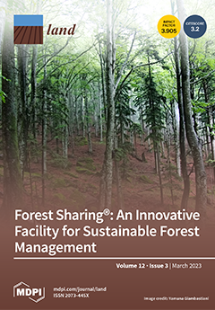
Cover Story (view full-size image): Innovations concerning the adoption of sharing and the circular economy in sustainable forest management are mandatory in order to support sustainable development, especially in small forest holdings. The Forest Sharing® platform, which was launched in Italy, offers an opportunity to restart managing uncontrollable and abandoned small forest properties through a sustainable, multifunctional, collaborative, and sharing approach. This study aims to assess the location of forests and forest owners who are registered on the platform to better understand the fragmentation of forest ownership, comparing the current situations in Italy and Europe more generally. Moreover, in this work, we present the different GIS analyses implemented on the platform to better understand the state of 9585 cadaster forest parcels registered by 644 users. View this paper
  • Issues are regarded as officially published after their release is announced to the table of contents alert mailing list.
  • You may sign up for e-mail alerts to receive table of contents of newly released issues.
  • PDF is the official format for papers published in both, html and pdf forms. To view the papers in pdf format, click on the "PDF Full-text" link, and use the free Adobe Reader to open them.
Order results
Result details
Section
Select all
Export citation of selected articles as:
15 pages, 1081 KiB  
Correction
Correction: Mackay-Smith et al. A Framework for Reviewing Silvopastoralism: A New Zealand Hill Country Case Study. Land 2021, 10, 1386
by Thomas H. Mackay-Smith, Lucy Burkitt, Janet Reid, Ignacio F. López and Chris Phillips
Land 2023, 12(3), 725; https://doi.org/10.3390/land12030725 - 22 Mar 2023
Viewed by 800
Abstract
The authors would like to make the following correction to the published article [...] Full article
(This article belongs to the Special Issue Mountains under Pressure)
18 pages, 4682 KiB  
Article
Side-Deep Fertilization Stabilizes Double-Cropping Rice Yield, Increases N and P Utilization, and Reduces N and P Losses
by Kun Hou, Lian Zhang, Ping Liu, Shifu He, Xiangmin Rong, Jianwei Peng, Yuping Zhang, Chang Tian and Yongliang Han
Land 2023, 12(3), 724; https://doi.org/10.3390/land12030724 - 22 Mar 2023
Cited by 1 | Viewed by 1225
Abstract
(1) Background: the broadcast is an outdated fertilization method with a low fertilizer-utilization rate and environmental problems, which seriously restricts the development of agriculture. (2) Methods: Under a machine-transplanted rice with side-deep fertilization (MRSF) mode, five treatments were applied: 0 cm (D0), 5 [...] Read more.
(1) Background: the broadcast is an outdated fertilization method with a low fertilizer-utilization rate and environmental problems, which seriously restricts the development of agriculture. (2) Methods: Under a machine-transplanted rice with side-deep fertilization (MRSF) mode, five treatments were applied: 0 cm (D0), 5 cm (D5), 7.5 cm (D7.5), and 10 cm (D10), comprising four different depths of fertilization, and no fertilization (CK). The yield, the accumulation of N and P in the straw and in grains of rice, concentrations of N and P in the surface water, ammonia (NH3) volatilization, and soil nutrients were measured in rice fields. (3) Results: In rice yields, compared with the D0 treatment, only the D7.5 treatment significantly increased by 7.84% in late rice, while the other treatments showed no significant difference between early and late rice. The N- and P-use efficiency of D10 increased by 5.30–24.73% and 0.84–17.75%, respectively, compared with the D0-D7.5 treatments. In surface water, compared with the D0 treatment, D5, D7.5, and D10, the total N (TN), total P (TP) concentration, and NH3 volatilization decreased by 10.24–60.76%, 16.30–31.01%, and 34.78–86.08%, respectively; the D10 treatment had the best inhibition effect on the TN, TP concentration, and NH3 volatilization, which were 58.48–60.76%, 22.04–31.01%, and 77.21–86.08%, respectively. (4) Conclusions: The optimized depth for side-deep fertilization was 10 cm. We would like to emphasize the impact of the paddy on various deep fertilizations and provide an important reference for developing precise fertilization in rice fields in this area. Full article
(This article belongs to the Special Issue Status in Agricultural Soil Pollution and Its Controls)
Show Figures

Figure 1

24 pages, 1326 KiB  
Article
Exploring the Determinants of the Relationships between the Land-Based Sectors with the Wider Rural Business Base in Scotland: An Empirical Analysis
by Pattanapong Tiwasing, Lorna Pate, Jenny McMillan, Jane Atterton and Steven G. Thomson
Land 2023, 12(3), 723; https://doi.org/10.3390/land12030723 - 22 Mar 2023
Viewed by 1772
Abstract
Over the past two decades, the relative socio-economic importance of land-based sectors has declined in comparison to non-land-based businesses such as tourism, food and beverage activities. However, policy implementation and research have primarily focused on the economic contributions of land-based businesses, leaving businesses [...] Read more.
Over the past two decades, the relative socio-economic importance of land-based sectors has declined in comparison to non-land-based businesses such as tourism, food and beverage activities. However, policy implementation and research have primarily focused on the economic contributions of land-based businesses, leaving businesses outside these sectors and in rural areas, referred to as non-land-based businesses, largely overlooked. Therefore, this study aims to examine the importance of non-land-based businesses and the key determinants of the relationships between non-land-based businesses and land-based (farming, forestry and landed estate) sectors in rural Scotland. Through a survey of 1500 businesses whose primary focus is not agriculture, forestry or landed rural estates in four Scottish regions, the key findings of the logit model reveal that businesses located in rural areas are more likely to have relationships, both direct (supplying or purchasing goods/services) and indirect, with farming, forestry and landed estate sectors than their urban counterparts. Focusing on rural businesses, the results show that business size, sectors, business age, exporting, importing and business constraints related to cash flow, digital connectivity and government financial support significantly influence their relationships with land-based sectors. The results of crosstab analysis also reveal differences in business performance, business challenges related to Brexit and future plans between non-land-based rural businesses having relationships with land-based sectors in different rural classifications: accessible/remote small towns, accessible rural areas and remote rural areas. The paper concludes with policy recommendations to support rural businesses and future land-based and non-land-based sectors in rural Scotland. Full article
(This article belongs to the Section Urban Contexts and Urban-Rural Interactions)
Show Figures

Figure 1

22 pages, 5466 KiB  
Article
Agricultural Intensification Reduces the Portfolio of Wetland Ecosystem Services: European Danube River Lowlands as a Global Biodiversity Hotspot
by Tudor Racoviceanu, Constantin Cazacu, Mihai Adamescu, Relu Giucă, Magdalena Bucur, Mariia Fedoriak and Per Angelstam
Land 2023, 12(3), 722; https://doi.org/10.3390/land12030722 - 21 Mar 2023
Cited by 1 | Viewed by 1708
Abstract
Anthropogenic landscape transformations have promoted the provision of ecosystem services (ES) at the expense of other ES, biodiversity, and human well-being. We analysed the transformation portfolios of ES provisions, the costs of transformation, and the rivalry between ES categories and biodiversity conservation during [...] Read more.
Anthropogenic landscape transformations have promoted the provision of ecosystem services (ES) at the expense of other ES, biodiversity, and human well-being. We analysed the transformation portfolios of ES provisions, the costs of transformation, and the rivalry between ES categories and biodiversity conservation during the pre-communist and communist eras. We also examined EU influences in Romania’s Danube River lowlands. The environmental history of social-ecological systems was used to: (1) map transformations of natural environments; (2) analyse the outputs of human modes of production, including crops, fish, timber, and livestock, using economic valuation methods and by appropriating the primary means of production; and (3) describe ideologies and values as drivers of ES transformations. During the communist era, the surface area of the agricultural land increased at the expense of natural ecosystems. This resulted in increased provisions being made for crops and timber at the expense of the fish supply; it also caused a reduction in livestock. The costs of land reclamation, hydrotechnical works, and the use of fertilizers and pesticides, resulted in a net annual loss of EUR 36 million for the entire case study area, disregarding the losses of other ES. Achieving a balanced portfolio of ES requires a discussion about the need for nature restoration, transdisciplinary social-ecological research, and the identification of key leverage points. Full article
(This article belongs to the Special Issue Diversifying Forest Landscape Management Approaches)
Show Figures

Figure 1

16 pages, 4853 KiB  
Article
The Spatiotemporal Pattern and Driving Mechanism of Urban Sprawl in China’s Counties
by Xu Yang, Xuan Zou, Xueqi Liu, Qixuan Li, Siqian Zou and Ming Li
Land 2023, 12(3), 721; https://doi.org/10.3390/land12030721 - 21 Mar 2023
Viewed by 1352
Abstract
Cities in China do not constitute a few global metropolises, but are characterized by heterogeneity. Studying counties can give us a comprehensive picture of urban sprawl in China. This study measured the sprawl index of 1880 counties in China from 2005 to 2020 [...] Read more.
Cities in China do not constitute a few global metropolises, but are characterized by heterogeneity. Studying counties can give us a comprehensive picture of urban sprawl in China. This study measured the sprawl index of 1880 counties in China from 2005 to 2020 for the first time and then revealed the evolution of their spatiotemporal characteristics and driving mechanisms. The results revealed the following. (1) China’s counties had a noticeable sprawling trend from 2005 to 2020, and their evolutionary process was characterized by spatiotemporal heterogeneity. (2) From 2005 to 2020, the counties’ sprawl gradually evolved into a spatial distribution pattern of high in the east and low in the west. The spatial distribution of sprawl in county and municipal districts had the characteristics of an interlocking distribution. (3) High–high cluster areas of CSI are mainly distributed in plains, and hilly, basin, and plateau areas tend to be low–low cluster areas. High–low outliers were distributed in a “point–line” pattern along the railroad lines and a cluster pattern near railroad intersections and central cities. Low–high outliers had the trend of encircling the high–high cluster areas. (4) The coefficient of the natural drivers was higher but tended to decrease, while the coefficient of economic and spatial drivers was lower but gradually increased. This study is the first to refine the study of urban sprawl to the county scale, which provides a reference for decision making to optimize the spatial structure of counties and thus promote high-quality development. Full article
Show Figures

Figure 1

18 pages, 3729 KiB  
Article
The Association between Carbon Emission and Urban Spatial Form—A Study of Zhuhai, China
by Yiheng Zhang, Shengyong Zhang and Yabo Gong
Land 2023, 12(3), 720; https://doi.org/10.3390/land12030720 - 21 Mar 2023
Cited by 3 | Viewed by 1607
Abstract
Research on carbon emission is an important basis for solving global climate problems, and it is also one of the ways to quantitatively assess the impact of human activities. Cities are one of the main bearing spaces of human activities, and reasonable urban [...] Read more.
Research on carbon emission is an important basis for solving global climate problems, and it is also one of the ways to quantitatively assess the impact of human activities. Cities are one of the main bearing spaces of human activities, and reasonable urban form is conducive to reducing energy consumption in human activities. This paper takes 50 clusters within Zhuhai, China, as the research object, quantifies the landscape spatial form index and social spatial form index of each cluster and establishes the index set of urban spatial form, so as to analyze the influence of different urban spatial form index on carbon emission. The main conclusions are as follows: (1) From the spatial distribution of each index, the urban cluster size and residential building area of each cluster in Zhuhai are generally large, and the distribution is basically consistent with that of densely populated areas. The urban clusters with high dominance are mainly located in the main urban area of Xiangzhou District, and the urban compactness, dispersion and industrial building area are generally high in the west and low in the east. (2) The size of urban clusters, industrial building area and residential building area have a strong promoting effect on carbon emission, while the compactness, dispersion and dominance of urban clusters have a strong inhibiting effect on carbon emission. (3) Based on the above conclusions, the low-carbon urban spatial form optimization strategy should be proposed from three aspects: urban development boundary control, promoting industrial structure transformation and compact urban development. Full article
Show Figures

Figure 1

15 pages, 2601 KiB  
Article
Heterogeneous Effects of the Talent Competition on Urban Innovation in China: Evidence from Prefecture-Level Cities
by Runyuan Wang, Weiguang Cai, Hong Ren and Xianrui Ma
Land 2023, 12(3), 719; https://doi.org/10.3390/land12030719 - 21 Mar 2023
Cited by 3 | Viewed by 1596
Abstract
With in-depth efforts in the national strategy of innovation-driven development, the demand for talent in cities is burgeoning. Cities in China have released a large number of preferential policies to attract talent as these cities look to gain an edge in increasing talent [...] Read more.
With in-depth efforts in the national strategy of innovation-driven development, the demand for talent in cities is burgeoning. Cities in China have released a large number of preferential policies to attract talent as these cities look to gain an edge in increasing talent competition. This study empirically studied the effect of talent competition on urban innovation using a panel data set of 298 prefectural-level cities in China from 2010 to 2019 based on the difference-in-difference model and an event study method. The results show that there are heterogeneous effects of talent competitions on urban innovation, which may widen the gap between urban innovation in different cities. The effect of talent competition in different cities showed a significant positive correlation with the level of urban development, and there is a “head effect” of talent competition on urban innovation. Moreover, the results of the mechanism analysis indicate that the effect of talent competition on urban innovation is mainly through talent flow. These findings can help policymakers formulate scientific and reasonable talent policies to promote the strategy of innovation-driven development. Full article
(This article belongs to the Special Issue Urbanization and City Development in China's Transition)
Show Figures

Figure 1

17 pages, 2240 KiB  
Article
The Threat of COVID-19 on Food Security: A Modelling Perspective of Scenarios in the Informal Settlements in Windhoek
by Ndeyapo M. Nickanor, Godfrey Tawodzera and Lawrence N. Kazembe
Land 2023, 12(3), 718; https://doi.org/10.3390/land12030718 - 21 Mar 2023
Viewed by 1923
Abstract
Due to the heterogeneity among households across locations, predicting the impacts of stay-at-home mitigation and lockdown strategies for COVID-19 control is crucial. In this study, we quantitatively assessed the effects of the Namibia government’s lockdown control measures on food insecurity in urban informal [...] Read more.
Due to the heterogeneity among households across locations, predicting the impacts of stay-at-home mitigation and lockdown strategies for COVID-19 control is crucial. In this study, we quantitatively assessed the effects of the Namibia government’s lockdown control measures on food insecurity in urban informal settlements with a focus on Windhoek, Namibia. We developed three types of conditional regression models to predict food insecurity prevalence (FIP) scenarios incorporating household frequency of food purchase (FFP) as the impacting factor, based on the Hungry Cities Food Matrix. Empirical data were derived from the 2017 African Food Security Urban Network (AFSUN) Windhoek study and applied univariate probit and bivariate partial observability models to postulate the relation between food insecurity and FFP within the context of stay-at-home disease mitigation strategy. The findings showed that FFP was positively correlated with the prevalence of food insecurity (r = 0.057, 95% CI: 0.0394, 0.085). Daily purchases portrayed a survivalist behaviour and were associated with increased food insecurity (coeff = 0.076, p = 0.05). Only those who were purchasing food twice monthly were significantly associated with reduced food insecurity (coeff = −0.201, p = 0.001). Those households in informal settlements were severely impacted by food insecurity (coeff = 0.909, p-value = 0.007). We conclude that public health compliance should precede with cash or food support to poor households in balance with the need for long-term placement of control measures to fully contain COVID-19 or related infectious diseases. Full article
(This article belongs to the Special Issue Impacts of COVID-19 on Urban Food Security)
Show Figures

Figure 1

22 pages, 8403 KiB  
Article
Identifying Park Spatial Characteristics That Encourage Moderate-to-Vigorous Physical Activity among Park Visitors
by Mingxin Liu, Chenxi Chen and Jiaqi Yan
Land 2023, 12(3), 717; https://doi.org/10.3390/land12030717 - 21 Mar 2023
Cited by 1 | Viewed by 2230
Abstract
The general consensus is that physical activity can prevent and manage lifestyle-induced chronic diseases, and moderate-to-vigorous physical activity (MVPA) has been included in several guidelines of WHO as an indicative intensity standard. Numerous studies have confirmed that improving the spatial quality of urban [...] Read more.
The general consensus is that physical activity can prevent and manage lifestyle-induced chronic diseases, and moderate-to-vigorous physical activity (MVPA) has been included in several guidelines of WHO as an indicative intensity standard. Numerous studies have confirmed that improving the spatial quality of urban parks can be very helpful in supporting physical activities, and that the quality of parks is significantly related to the intensity of physical activities. However, few studies have explored the spatial characteristics of activating physical activities. Using a modified System for Observing Play and Recreation in Communities (SOPARC), this study examines the relationship between spatial characteristics and MVPA through a binary logistic regression model. The results reveal that: firstly, inconsistent with other similar studies, the most observed group in the park is the adults rather than the seniors, and the proportion of the females (51%) is higher; secondly, the distribution of MVPA in different groups shows that the seniors have less interaction with other groups, and they have a significant spatial attachment. Thirdly, in functionality, large lawn and jogging trails have been proved to be the most effective features to promote the occurrence of MVPA; among the activity, except for the significant correlation between equipped and MVPA, other attributes can be proved to encourage MVPA as well as those in comfort. In conclusion, our results can contribute to the planning and design of the urban park as well as the further management and allocation of the space and facilities under the vision of promoting public health. Full article
(This article belongs to the Special Issue Urban Green Space Use Behaviours and Equity)
Show Figures

Figure 1

19 pages, 2892 KiB  
Review
Dating Agricultural Terraces in the Mediterranean Using Luminescence: Recent Progress and Challenges
by Aayush Srivastava, Tim Kinnaird, Christopher Sevara, Justin Allen Holcomb and Sam Turner
Land 2023, 12(3), 716; https://doi.org/10.3390/land12030716 - 21 Mar 2023
Cited by 4 | Viewed by 2532
Abstract
Agricultural terraces provide farmers in hilly landscapes with effective ways to increase the area available for crops. They mitigate the risks of soil erosion and promote crop productivity by slowing surface water runoff and retaining moisture. As in other parts of the world, [...] Read more.
Agricultural terraces provide farmers in hilly landscapes with effective ways to increase the area available for crops. They mitigate the risks of soil erosion and promote crop productivity by slowing surface water runoff and retaining moisture. As in other parts of the world, terraces have been constructed and used in the Mediterranean for millennia. The availability of terraced agriculture had important socio-economic, ecological, and environmental implications for past societies. However, the chronology of construction, use, and abandonment of terraces in different regions remains uncertain. A more robust set of chronological data will allow better assessment of whether terrace agriculture was a resilient strategy in the face of past economic or ecological instability and, in turn, inform how terraces could be used to address future agricultural and environmental challenges. In this paper, we review the application of luminescence dating to terrace sediments, the key challenges involved, and the currently published data which include over 250 luminescence ages. We also discuss the use of a multidisciplinary approach involving other geoarchaeological tools (e.g., use of GIS analyses, field-based luminescence readers, and micromorphology) to enhance the ways that past terrace systems can be understood. Terrace systems are inextricably linked to sustainable land use across the Mediterranean. Luminescence dating methods, therefore, have a crucial role to play in understanding the complexities of past and future landscape change. Full article
(This article belongs to the Section Landscape Archaeology)
Show Figures

Figure 1

20 pages, 2717 KiB  
Article
Soil-to-Atmosphere GHG Fluxes in Hemiboreal Deciduous Tree and Willow Coppice Based Agroforestry Systems with Mineral Soil
by Andis Bārdulis, Dana Purviņa, Kristaps Makovskis, Arta Bārdule and Dagnija Lazdiņa
Land 2023, 12(3), 715; https://doi.org/10.3390/land12030715 - 21 Mar 2023
Cited by 1 | Viewed by 1606
Abstract
In this study, we estimated the magnitude of soil-to-atmosphere carbon dioxide (CO2), methane (CH4), and nitrous oxide (N2O) fluxes in deciduous tree and willow coppice based agroforestry systems in hemiboreal Latvia. We studied systems combining hybrid alder, [...] Read more.
In this study, we estimated the magnitude of soil-to-atmosphere carbon dioxide (CO2), methane (CH4), and nitrous oxide (N2O) fluxes in deciduous tree and willow coppice based agroforestry systems in hemiboreal Latvia. We studied systems combining hybrid alder, hybrid aspen, silver birch, black alder, and willow clones with perennial reed canary grass (RCG), which were established in the spring of 2011 in former cropland with mineral soil. Three different soil fertilisation practices were initially applied (control without fertilisation, fertilisation with wood ash, and sewage sludge). Measurements of fluxes of greenhouse gases were taken in both deciduous tree, willow coppice and RCG plots using a closed opaque manual chamber method, from June 2020 to October 2021. Soil CO2 fluxes (the sum of autotrophic and heterotrophic respiration) were increased in RCG plots compared to plots under willow and deciduous tree canopies, while the highest mean CH4 fluxes were found in willow coppice plots. No impact of dominant vegetation type on instantaneous soil N2O fluxes was found. Temperature was the key determinant of the magnitude of CO2 and N2O fluxes. The highest soil CO2 and N2O fluxes were detected during the summer and decreased in the following order: summer, autumn, spring, winter. There were no pronounced relationships between soil CH4 fluxes and temperature. Full article
(This article belongs to the Special Issue Climate Change and Sustainable Land Production)
Show Figures

Figure 1

23 pages, 1144 KiB  
Article
Using Risk System Theory to Explore Farmers’ Intentions towards Rural Homestead Transfer: Empirical Evidence from Anhui, China
by Gexin Guan and Wei Zhao
Land 2023, 12(3), 714; https://doi.org/10.3390/land12030714 - 21 Mar 2023
Cited by 4 | Viewed by 1827
Abstract
In China, rural homesteads are strategic elements for coordinating the people and land resources relationship between urban and rural regions and are powerful means for increasing the property income of farmers. The rural homestead transfer issue has always concerned policymakers. In this paper, [...] Read more.
In China, rural homesteads are strategic elements for coordinating the people and land resources relationship between urban and rural regions and are powerful means for increasing the property income of farmers. The rural homestead transfer issue has always concerned policymakers. In this paper, the risk system theory framework is employed to identify risk source (risk perception), risk control (the control measures and institutions), and risk receptor (farmers’ characteristics) to explore farmers’ intentions towards rural homestead transfer from the perspective of first- and second-order observation. The results demonstrate that farmers’ intentions are significantly affected by risk source from first-order observation, and risk control and risk receptor from second-order observation. The heterogeneity of outcomes is examined by grouping of ages and regions of sampled farmers. It is suggested that the risk perception needs of farmers should be respected, land tenure of rural homesteads should be tightly protected, and farmers’ characteristics should be of great concern. Moreover, more attention should be paid to idle homesteads, and full advantage taken of rural resources to develop featured rural industries. Full article
Show Figures

Figure 1

21 pages, 5742 KiB  
Article
NDVI Characteristics and Influencing Factors of Typical Ecosystems in the Semi-Arid Region of Northern China: A Case Study of the Hulunbuir Grassland
by Yating Zhao, Chunming Hu, Xi Dong and Jun Li
Land 2023, 12(3), 713; https://doi.org/10.3390/land12030713 - 20 Mar 2023
Cited by 3 | Viewed by 1334
Abstract
The semi-arid region of northern China is highly sensitive to environmental changes, especially the Hulunbuir Grassland, which has an essential ecological status and a fragile environment. This study focused on the NDVI characteristics of three different ecosystems and their dominant influencing factors. It [...] Read more.
The semi-arid region of northern China is highly sensitive to environmental changes, especially the Hulunbuir Grassland, which has an essential ecological status and a fragile environment. This study focused on the NDVI characteristics of three different ecosystems and their dominant influencing factors. It proposed a method to show the immediate effects of factors influencing NDVI on a statistical level. The results showed that: (1) NDVI of floodplain wetland > NDVI of meadow > NDVI of sand ribbon. There were obvious differences among the three ecosystems, and the spatial distribution of NDVI was consistent with altitude. (2) The main explanatory factors were the phenological period, humidity, temperature, accumulated precipitation, runoff, and evaporation, which accounted for 68.8% of the total explanation. (3) Phenological period, humidity, and precipitation were positively correlated with NDVI. Temperature and evaporation had a positive effect on NDVI within a certain range. This study revealed the differences in environmental factors in different ecosystems, enriched the theory of NDVI influencing factors, and provided a scientific basis for future NDVI research and regional ecological conservation. Full article
(This article belongs to the Section Land Systems and Global Change)
Show Figures

Figure 1

20 pages, 2291 KiB  
Article
“Do I See What You See?”—Differentiation of Stakeholders in Assessing Heritage Significance of Neighbourhood Attributes
by Lidwine Spoormans, Darinka Czischke, Ana Pereira Roders and Wessel de Jonge
Land 2023, 12(3), 712; https://doi.org/10.3390/land12030712 - 20 Mar 2023
Cited by 4 | Viewed by 2349
Abstract
Although attention for citizen involvement in urban development and heritage management processes is growing, both in practice and in research, the specifics of stakeholders’ interests have been less researched. This paper reveals and discusses the assessment by individuals and groups, to differentiate stakeholders, [...] Read more.
Although attention for citizen involvement in urban development and heritage management processes is growing, both in practice and in research, the specifics of stakeholders’ interests have been less researched. This paper reveals and discusses the assessment by individuals and groups, to differentiate stakeholders, based on the heritage significance they convey on neighbourhood attributes. Fifty-nine interviews on a Dutch neighbourhood in Amsterdam Zuidoost were analysed integrating quantitative and qualitative methods. Results confirm important differences between and within stakeholder groups regarding their interest in particular attribute categories and scales, indicating the need to further specify stakeholders beyond the commonly used ‘community’ and ‘experts’. The identification of stakeholder interests is important to involve relevant groups in the identification and designation of significant attributes, buildings, and areas and to anticipate potential conflicts or shared interests in neighbourhood renovation processes. Full article
Show Figures

Figure 1

19 pages, 1160 KiB  
Article
Development of a Methodology and Model for Land Administration Data Dissemination Processes
by Josip Križanović and Miodrag Roić
Land 2023, 12(3), 711; https://doi.org/10.3390/land12030711 - 20 Mar 2023
Cited by 2 | Viewed by 1702
Abstract
Land administration (LA) is concerned with processes. Simply put, LA cannot be understood, built, or improved unless the processes associated with it are understood. When it comes to the processes involved in LA, two general processes can be identified, namely registration and dissemination. [...] Read more.
Land administration (LA) is concerned with processes. Simply put, LA cannot be understood, built, or improved unless the processes associated with it are understood. When it comes to the processes involved in LA, two general processes can be identified, namely registration and dissemination. Nowadays, processes are implemented electronically; however, paper-based thinking is still present, and the performance of processes is impeded by siloed data management. These issues could be addressed through the employment of standards such as the Land Administration Domain Model. Processes are not yet part of the standard, but their inclusion in future extensions is planned. Moreover, a literature analysis indicated that there is no standardized methodology or model available for describing LA processes. Consequently, we modeled one part of land administration processes, namely data dissemination, by developing a methodology and model to describe it. The methodology was developed with the goal of providing guidelines for other researchers when modeling use cases of data dissemination processes by enabling comparisons of models, searching for best practices, and developing standardized process models. Additionally, the methodology was tested on a conceptual use case to prove its viability. Furthermore, a model based on conceptual modeling and an activity-centric process modeling approach was developed and linked to existing classes of the Land Administration Domain Model. The organizational and technological challenges which might arise when improving data dissemination processes are discussed, and possible outcomes of the developed methodology and model are provided. Full article
Show Figures

Figure 1

16 pages, 9478 KiB  
Article
Classification and Evaluation Methods for Optimization of Land Use Efficiency at Village Level
by Xiaoyu Chen, Qingming Zhan and Yuli Fan
Land 2023, 12(3), 710; https://doi.org/10.3390/land12030710 - 19 Mar 2023
Viewed by 1549
Abstract
Land fragmentation hinders sustainable development in rural areas by reducing the efficiency of land use, and it could be mitigated by optimum allocation of land resources. However, most land use allocation models address micro-scale interaction, which is not conducive to the arrangement of [...] Read more.
Land fragmentation hinders sustainable development in rural areas by reducing the efficiency of land use, and it could be mitigated by optimum allocation of land resources. However, most land use allocation models address micro-scale interaction, which is not conducive to the arrangement of the specific implementation plan. Facing such issues, this study proposed a village classification method (LUEOVC) that can provide specific optimization strategies for each village according to different optimization objectives. Specifically, we used a multi-objective particle swarm optimization algorithm to find the best land use adjustment strategies under different land use optimization objectives, and the pros and cons of these strategies are based on land use efficiency evaluation. The proposed village classification method can reflect the impact of the optimal allocation of different types of land resources on the land use efficiency of each village. The results of experiments conducted in Xinxing County, Guangdong Province showed that the village-based land use optimization strategy provided in this method can improve the land use efficiency of the cultivated land with the most serious fragmentation in the study area by 0.9%. The method also enables planners to compare the costs and gains under different objections, so as to better help decision-makers in formulating land use optimization strategies for different villages. Full article
Show Figures

Figure 1

20 pages, 2670 KiB  
Article
Disaster Risk Regionalization and Prediction of Corn Thrips Combined with Cloud Model: A Case Study of Shandong Province, China
by Yanan Zuo, Fengxiang Jin, Min Ji, Zhenjin Li and Jiutao Yang
Land 2023, 12(3), 709; https://doi.org/10.3390/land12030709 - 19 Mar 2023
Viewed by 2922
Abstract
Corn thrips do serious harm to the yield and quality of corn. In this paper, the Shandong Province of China was taken as the study area. Based on the data of the occurrence of corn thrips in Shandong Province, a risk regionalization model [...] Read more.
Corn thrips do serious harm to the yield and quality of corn. In this paper, the Shandong Province of China was taken as the study area. Based on the data of the occurrence of corn thrips in Shandong Province, a risk regionalization model was established by using eight indicators under four categories of hazard, sensitivity, vulnerability and the disaster prevention and mitigation capacity of diseases and pests on a monthly time scale. Firstly, the cloud model was introduced to determine the weight of each indicator, and then the risk regionalization of the corn thrips disaster in Shandong Province was carried out using the weighted percentage method, the weighted comprehensive evaluation method and the natural disaster risk index method. Finally, combined with the collected data, the disaster prediction of corn thrip occurrence degree was realized based on multiple linear regression, genetic algorithm optimized back-propagation neural network and genetic algorithm optimized support vector machine methods. The results show that: (1) the risk of Corn thrips disaster is mainly concentrated in the central and western parts of Shandong Province. Heze City is a high-risk area. Liaocheng City, Dezhou City, Jinan City and Weifang City are relatively high-risk areas. (2) By comparing the prediction accuracy of the three models, it was determined that the genetic algorithm optimized support vector machine model has the best effect, with an average accuracy of 79.984%, which is 7.013% and 22.745% higher than that of the multiple linear regression and genetic algorithm optimized back-propagation neural network methods, respectively. The results of this study can provide a scientific basis for fine prevention of corn thrips in Shandong Province. Full article
Show Figures

Figure 1

16 pages, 816 KiB  
Article
The Impact of Rural Land on the Life Satisfaction of Farming Women: Evidence from China
by Philip Arestis, Mianshan Lai, Songpei Zhang and Yunxiang Liu
Land 2023, 12(3), 708; https://doi.org/10.3390/land12030708 - 19 Mar 2023
Viewed by 1162
Abstract
This study investigates the impact of rural land on the life satisfaction of rural-farming women with a modified institutional analysis and development (IAD) framework as the theoretical framework. The research sample is composed of data acquired from surveys of thirty-six randomly selected villages [...] Read more.
This study investigates the impact of rural land on the life satisfaction of rural-farming women with a modified institutional analysis and development (IAD) framework as the theoretical framework. The research sample is composed of data acquired from surveys of thirty-six randomly selected villages in three provinces in China. The main findings include that the quality of the cultivated land, embodied in the cultivated land location and the land cultivation facilities, has an impact on the life satisfaction of rural-farming women; agreeable living conditions can improve the life satisfaction of rural-farming women; and the well-being status of rural-farming women also has an impact on their life satisfaction, but there are differences in this impact. The objective factors, such as household cash and savings, farming income, and farming time, also have inconsistent effects on the life satisfaction of rural-farming women. This study bridges the gap and explains the land-related factors, which have an impact on rural women farmers, and brings attention to this group of people who are easily overlooked. Full article
(This article belongs to the Special Issue Land Use and Rural Sustainability)
Show Figures

Figure 1

16 pages, 14300 KiB  
Article
Research on Changsha Gardens in Ming Dynasty, China
by Weiwen Li and Chi Gao
Land 2023, 12(3), 707; https://doi.org/10.3390/land12030707 - 18 Mar 2023
Cited by 1 | Viewed by 2344
Abstract
Despite the growing interest in Chinese gardens, there is a lack of research on Changsha Gardens. Through document retrieval, review, and map analysis, we reconstructed the Changsha Gardens during the Ming Dynasty. Our findings reveal that gardening flourished in Changsha during this period. [...] Read more.
Despite the growing interest in Chinese gardens, there is a lack of research on Changsha Gardens. Through document retrieval, review, and map analysis, we reconstructed the Changsha Gardens during the Ming Dynasty. Our findings reveal that gardening flourished in Changsha during this period. The royal gardens, dominated by literati aesthetics, set the trend for development, while the landscaping techniques were influenced by Jiangnan Gardens. Private gardens placed more emphasis on artistic mood and cultural implications. Landscape architects incorporated towers, terraces, and suburban mountain gardening to borrow scenery. The use of spring water to create landscapes and the rectangular shapes of the water bodies reflected Neo-Confucianism and practical functions. Planting design focused on meaning over form, with landscapes used to commemorate sages and promote the farming and reading culture and other Confucian values. However, it relied too much on borrowing natural scenery and the pragmatism of the Hunan culture, which might have affected the progress of landscaping techniques and the development of Changsha Gardens. Changsha Gardens were not as skilled as Jiangnan Gardens, and the style was not as prominent as other regional schools of gardens. This might be the reason why Changsha Gardens have not become one of the regional schools of gardens in China. Full article
(This article belongs to the Special Issue Historical Landscape Evolution)
Show Figures

Figure 1

45 pages, 49737 KiB  
Article
Phenological Flowering Patterns of Woody Plants in the Function of Landscape Design: Case Study Belgrade
by Mirjana Ocokoljić, Djurdja Petrov, Nevenka Galečić, Dejan Skočajić, Olivera Košanin and Isidora Simović
Land 2023, 12(3), 706; https://doi.org/10.3390/land12030706 - 18 Mar 2023
Cited by 3 | Viewed by 2005
Abstract
The study focuses on describing key events in the flowering phenophases of woody taxa that promote practical landscape sustainability and design planning. Apart from the beginning of flowering, the full development and the duration of phenophases are important for landscape architecture, consumers, and [...] Read more.
The study focuses on describing key events in the flowering phenophases of woody taxa that promote practical landscape sustainability and design planning. Apart from the beginning of flowering, the full development and the duration of phenophases are important for landscape architecture, consumers, and pollination. The phenological patterns of 13 woody taxa were monitored for 16 years through 90,860 phenological observations from the BBCH scale for the period 2007–2022. Growing degree days were determined by combining phenological and climatic data and a linear trend was used to assess phenophase tendencies. Mann–Kendall and Sen’s slope tests and Spearman’s correlation coefficient were used to assess statistical significance. Shifts in flowering indicated warming trends, reflecting various changes in phenology. Early flowering taxa were affected the most, but plants shifted phenophases in both directions (earlier and later in the year). Repeated flowering (and occasionally fruiting) and even third flowering, as seen in 2022, can significantly affect biodiversity and lead to plant–pollinator asynchrony and changes in ecosystem functioning, ecological interaction, and landscape design. A list of native and introduced taxa and their adaptation mechanisms to climate change are provided and can be used for sustainable landscape design and nature-based solutions in landscape architecture. Full article
Show Figures

Graphical abstract

29 pages, 30220 KiB  
Article
Lava Flow Hazard and Its Implication in Geopark Development for the Active Harrat Khaybar Intracontinental Monogenetic Volcanic Field, Saudi Arabia
by Károly Németh and Mohammed Rashad Moufti
Land 2023, 12(3), 705; https://doi.org/10.3390/land12030705 - 18 Mar 2023
Viewed by 3106
Abstract
Harrat Khaybar is an active monogenetic volcanic field in western Saudi Arabia that hosts spectacular monogenetic volcanoes and a Holocene volcanic cone with extensive lava fields. The volcanic region is a subject of intensive land use development, especially along tourism ventures, where the [...] Read more.
Harrat Khaybar is an active monogenetic volcanic field in western Saudi Arabia that hosts spectacular monogenetic volcanoes and a Holocene volcanic cone with extensive lava fields. The volcanic region is a subject of intensive land use development, especially along tourism ventures, where the volcanic features are the key elements to utilize for increasing visitation rates to the region. The youngest eruption is suspected to be Holocene and occurred fewer than 5000 years ago based on the cross-cutting relationship between the youngest lava flows and archaeological sites. Lava flows are typical, from pāhoehoe to ‘a‘ā types with great diversity of transitional textural forms. Here, we recorded typical transitional lava flow surface textures from the youngest flows identified by digital-elevation-model-based terrain analysis, satellite imagery, and direct field observations. We performed lava flow simulations using the Q-LavHA plug-in within the QGIS environment. Lava flow simulations yielded satisfactory results if we applied eruptions along fissures, long simulation distances, and ~5 m lava flow thickness. In these simulations, the upper flow regimes were reconstructed well, but long individual lava flows were not possible to simulate, suggesting that morphological steps likely promoted lava ponding, inflation, and sudden deflation by releasing melts further along shallow syneruptive valley networks. Full article
Show Figures

Figure 1

10 pages, 980 KiB  
Communication
Diametric Growth of a Forest under Reduced-Impact Logging in the Eastern Region of the Brazilian Amazon
by William Montero Flores, Isadora França, Graciliano Galdino Alves dos Santos, Izildinha de Souza Miranda, Eric Fabricio Santos Moraes, Gustavo Hernández Sánchez, Sandra Dezuite Balieiro Da Silva and Emil José Hernández-Ruz
Land 2023, 12(3), 704; https://doi.org/10.3390/land12030704 - 18 Mar 2023
Viewed by 1283
Abstract
Growth is a component of forest dynamics that encompasses changes in species composition, interactions between species, and stand structure. We evaluated the effect of the presence of lianas, crown shape, and light exposure on the periodic annual increment of trees (PAI) in two [...] Read more.
Growth is a component of forest dynamics that encompasses changes in species composition, interactions between species, and stand structure. We evaluated the effect of the presence of lianas, crown shape, and light exposure on the periodic annual increment of trees (PAI) in two phytophysiognomies: the ombrophilous dense forest and the ombrophilous open forest with lianas. This study was conducted in the eastern Brazilian Amazon in 13 permanent monitoring plots of 50 m × 50 m (2500 m2) in the same annual production unit. The area has been subjected to reduced-impact logging from 2014 to 2016. The increment in tree diameter varied significantly between both forests (opens forests: 1.28 cm yr−1; dense forests: 0.82 cm yr−1). Light exposure influenced the increment in tree diameter in the ombrophilous open forest with lianas, while the crown shape and light exposure significantly affected the ombrophilous dense forest. Our study emphasizes the usefulness of the periodic annual increment in exploring the differences between contrasting phytophysiognomies in a single annual production unit in the Brazilian Amazon that is subject to reduced-impact logging. Full article
(This article belongs to the Section Land Planning and Landscape Architecture)
Show Figures

Figure 1

26 pages, 37954 KiB  
Article
Shifting Sands: Assessing Bankline Shift Using an Automated Approach in the Jia Bharali River, India
by Jatan Debnath, Dhrubajyoti Sahariah, Anup Saikia, Gowhar Meraj, Nityaranjan Nath, Durlov Lahon, Wajahat Annayat, Pankaj Kumar, Kesar Chand, Suraj Kumar Singh and Shruti Kanga
Land 2023, 12(3), 703; https://doi.org/10.3390/land12030703 - 17 Mar 2023
Cited by 10 | Viewed by 2053
Abstract
Bank erosion hazard is a frequent occurrence that poses threats to floodplain ecosystems. This analysis examined changes to the Jia Bharali River channel in India using the GIS-based Digital Shoreline Analysis System [DSAS]. The Jia Bharali’s future channel was predicted so as to [...] Read more.
Bank erosion hazard is a frequent occurrence that poses threats to floodplain ecosystems. This analysis examined changes to the Jia Bharali River channel in India using the GIS-based Digital Shoreline Analysis System [DSAS]. The Jia Bharali’s future channel was predicted so as to identify the most erosion-susceptible zones. The rate of bankline movement was calculated using remotely sensed data collected over a period of 45 years (1976–2021). The results show that the river’s erosion and deposition rates were higher in the early years than towards the later part of the period under analysis. On the right and left banks of the river, the average shift rate was −9.22 and 5.8 m/y, respectively, which is comparatively high. The chosen portion of the river was evenly divided into three zones, A, B, and C. The most positively affected zone was zone A. The left bank of zone B exhibited a higher rate of erosion than the right bank, indicating that the river was moving to the left [eastward] in this zone. At the same time, the right bank was being eroded faster than the left, indicating a westward thrust at zone C. The predicted result demonstrates that the left bank of zone B and the right bank of zone C would have a higher average migration rate. Therefore, these banks were identified as being the most susceptible to bank erosion. The study evaluates the spatio-temporal change of the river in sensitive regions where neighboring settlements and infrastructure were at risk of changing channel dynamics. Using the actual and forecasted bankline, the degree of accuracy was confirmed. The results of the automated prediction approach could be useful for river hazard management in the Jia Bharali and in similar environmental settings with tropical high precipitation zones. Full article
(This article belongs to the Special Issue The Impact of Extreme Weather on Land Degradation and Conservation)
Show Figures

Figure 1

22 pages, 15999 KiB  
Article
Filling the Gaps in Biophysical Knowledge of Urban Ecosystems: Flooding Mitigation and Stormwater Retention
by Stefano Salata
Land 2023, 12(3), 702; https://doi.org/10.3390/land12030702 - 17 Mar 2023
Viewed by 1828
Abstract
Urban flooding is one of the most recognized problems cities must tackle in the coming decades due to climate change conditions. Nevertheless, the empirical knowledge of the biophysical capacity of cities to absorb, store or retain and release water after rainfall events is [...] Read more.
Urban flooding is one of the most recognized problems cities must tackle in the coming decades due to climate change conditions. Nevertheless, the empirical knowledge of the biophysical capacity of cities to absorb, store or retain and release water after rainfall events is limited, partly due to the gaps that modeling has in terms of representing the complexity of urban systems. This limit, in turn, affects the decision-making process related to the system’s adaptation. This work aims to integrate two types of alternative spatial ecosystem modeling and see how results can be combined, evaluated and used in view of a more holistic comprehension of flooding phenomena while reaching a deeper understanding of the vulnerability to multiple types of rain events: flash floods versus annual precipitation. The results of the two modeling sessions will be analyzed and compared. They will be further used to gather a greater understanding of the biophysical complexity of Izmir’s Metropolitan City in Turkey: one of the most dynamic but climatically threatened urban areas in the Mediterranean basin. The findings confirm the extent to which empirical knowledge of the urban system is partial and uncertain, thus requiring continuous progress through ecosystem modeling to support an evolutive interpretation of biophysical performances based on trial and error. Full article
(This article belongs to the Special Issue Supporting Assessment and Planning Processes for a Good Anthropocene)
Show Figures

Figure 1

19 pages, 3099 KiB  
Article
The Effect of Place-Based Policy on Urban Land Green Use Efficiency: Evidence from the Pilot Free-Trade Zone Establishment in China
by Yuan Feng, Ying Li and Changfei Nie
Land 2023, 12(3), 701; https://doi.org/10.3390/land12030701 - 17 Mar 2023
Cited by 8 | Viewed by 1803
Abstract
The improvement of urban land green use efficiency is significant in promoting sustainable development. As an important place-based policy in China, the pilot free-trade zone establishment has exerted a profound impact on urban economy and society. Meanwhile, the issue of whether the pilot [...] Read more.
The improvement of urban land green use efficiency is significant in promoting sustainable development. As an important place-based policy in China, the pilot free-trade zone establishment has exerted a profound impact on urban economy and society. Meanwhile, the issue of whether the pilot free-trade zone can improve urban land green use efficiency or not is missing from prior literature, which is the concern of this study. Specifically, based on the super-efficiency slacks-based measure model, we first measure urban land green use efficiency of 279 cities in China from 2011 to 2019 and then use the multi-period difference-in-differences method to investigate the causal effect of the pilot free-trade zone establishment on urban land green use efficiency. The results show that the pilot free-trade zone significantly improved urban land green use efficiency, especially in the eastern cities, the coastal cities, and the cities with a high economic development level. Further, there exists a spatial spillover effect of the pilot free-trade zone on urban land green use efficiency. This study has implications for optimal allocation of urban land in the deployment of place-based policies, serving economic structural upgrading and a carbon neutrality vision. Full article
Show Figures

Figure 1

31 pages, 3767 KiB  
Review
Exploring Associations between Subjective Well-Being and Non-Market Values When Used in the Evaluation of Urban Green Spaces: A Scoping Review
by Elli Papastergiou, Dionysis Latinopoulos, Myrto Evdou and Athanasios Kalogeresis
Land 2023, 12(3), 700; https://doi.org/10.3390/land12030700 - 17 Mar 2023
Cited by 2 | Viewed by 3133
Abstract
Proximity and access to urban green spaces (UGSs) provide city dwellers with multiple benefits related to health and well-being. Understanding what (and how) characteristics of these spaces affect individuals’ perceived preferences and sense of well-being (subjective well-being) could be critical for relevant future [...] Read more.
Proximity and access to urban green spaces (UGSs) provide city dwellers with multiple benefits related to health and well-being. Understanding what (and how) characteristics of these spaces affect individuals’ perceived preferences and sense of well-being (subjective well-being) could be critical for relevant future planning interventions, policy design, and investments in green spaces. This scoping review aims to summarize, synthesize, and compare previous research findings about the application of (stated) preference-based methods, using non-market valuation techniques (e.g., willingness-to-pay methods), and non-preference-based measures of well-being (e.g., subjective well-being) to evaluate UGSs. By comparing these two methodologies, we aim to explore the differences and similarities among the determinants of benefits associated with UGS design and planning. We also seek to identify the most commonly used research approaches for measuring and/or projecting the impact of (new or rejuvenated) UGSs on people’s welfare and well-being. The review focuses on peer-reviewed empirical scientific work published during the period from 2010 to 2022. Full article
Show Figures

Figure 1

19 pages, 12765 KiB  
Article
Spatial Differentiation and Influencing Mechanisms of Farmland Transfer Rents in Mountainous Areas: Evidence from Chongqing and Its Surrounding Areas
by Ting Du, Chao Li and Zhaolin Wang
Land 2023, 12(3), 699; https://doi.org/10.3390/land12030699 - 16 Mar 2023
Cited by 1 | Viewed by 1464
Abstract
This study used Chongqing, a municipality in mountainous southwest China, and its surrounding areas as a case study to explore the spatial differentiation of farmland transfer rents in mountainous areas, with the aim of serving as a theoretical and practical reference to realize [...] Read more.
This study used Chongqing, a municipality in mountainous southwest China, and its surrounding areas as a case study to explore the spatial differentiation of farmland transfer rents in mountainous areas, with the aim of serving as a theoretical and practical reference to realize the value of farmland, ensure regional food security, and promote stable and sound development of the farmland transfer market. In doing so, we applied the GIS spatial analysis method to explore the spatial differentiation and influencing mechanisms of farmland transfer rents in mountainous areas. Our results indicate that farmland transfer rents in mountainous areas have a significant high and low clustering tendency. The high-value areas of farmland transfer rents are mainly located in the downtown area and the west of Chongqing, while the low-value areas are mainly distributed in the Daba Mountains and Wuling Mountains, which are two national contiguous areas of dire poverty. Location and terrain factors are the main driving forces for the spatial differentiation of farmland transfer rents in mountainous areas. Specifically, a 1% increase in farmland mean slope and farmland supply-demand ratio in the study area will lead to a 0.13 and 0.15% decrease in farmland transfer rents, respectively, while a 1% increase in GDP will drive up farmland transfer rents by 0.09%. The policy factor is not significant. The influence of terrain and farmland supply and demand on transfer rents increased from west to east, whereas the influence of traffic location on transfer rents decreased in an outward direction from the southwest of the study area. It is concluded that local governments should objectively view the spatial differentiation of farmland transfer rents in mountainous areas and avoid the blind comparison of transfer rents between regions. Mountainous areas with low transfer rents should focus on increasing the intrinsic value of farmland assets by stimulating effective demand for farmland and improving farming conditions, while mountainous areas with high transfer rents in major grain-producing counties should be wary of their impact on grain production to ensure regional food security. Full article
Show Figures

Figure 1

9 pages, 590 KiB  
Communication
Synergistic Effect of Multiple Metals Present at Slightly Lower Concentration than the Australian Investigation Level Can Induce Phytotoxicity
by Naser Khan, Nanthi Bolan, Ian Clark, Sebastian Meier, David Lewis and Miguel A. Sánchez-Monedero
Land 2023, 12(3), 698; https://doi.org/10.3390/land12030698 - 16 Mar 2023
Cited by 2 | Viewed by 1344
Abstract
An individual trace metal present in a soil at its ecological screening value or investigation level (trigger/threshold) is expected to cause phytotoxicity. However, phytotoxicity may be induced by a mixture of multiple metals, each present at a concentration lower than the corresponding investigation [...] Read more.
An individual trace metal present in a soil at its ecological screening value or investigation level (trigger/threshold) is expected to cause phytotoxicity. However, phytotoxicity may be induced by a mixture of multiple metals, each present at a concentration lower than the corresponding investigation level. To investigate the accumulative impact of metals present below their individual investigation levels, three successive phytotoxicity trials were conducted in a greenhouse using the triticale plant CrackerJack (Triticosecale rimpaui), a cereal crop, in a sandy acidic soil treated jointly with Cd, Cu, and Zn at various rates. Seed germination and seedling growth were monitored. The metal rates in the first two trials were either too toxic or nontoxic. In the third trial, it was found that the mixture of Cd, Cu, and Zn at rates of 2.5, 97.5, and 188 mg kg−1, respectively, did not affect seed germination, but caused a slight reduction in plant growth. Although metal concentrations used were lower than the Australian Ecological Investigation Level (Urban) for Cd, Cu, and Zn, which are 3.0, 100, and 200 mg kg−1, respectively, the reduction occurred due to synergy. It was concluded that, to enhance the usefulness of environmental investigation limits, the synergistic effects of multiple metals present at levels slightly below the established limits must be considered. Full article
(This article belongs to the Section Soil-Sediment-Water Systems)
Show Figures

Figure 1

23 pages, 5799 KiB  
Article
Assessing Integrated Hydrologic Model: From Benchmarking to Case Study in a Typical Arid and Semi-Arid Basin
by Zheng Lu, Yuan He and Shuyan Peng
Land 2023, 12(3), 697; https://doi.org/10.3390/land12030697 - 16 Mar 2023
Viewed by 1518
Abstract
Groundwater-surface water interactions play a crucial role in hydrologic cycles, especially in arid and semi-arid basins. There is a growing interest in developing integrated hydrologic models to describe groundwater-surface water interactions and the associated processes. In this study, an integrated process-based hydrologic model, [...] Read more.
Groundwater-surface water interactions play a crucial role in hydrologic cycles, especially in arid and semi-arid basins. There is a growing interest in developing integrated hydrologic models to describe groundwater-surface water interactions and the associated processes. In this study, an integrated process-based hydrologic model, ParFlow, was tested and utilized to quantify the hydrologic responses, such as changes in surface runoff and surface/subsurface storage. We progressively conducted a complexity-increasing series of benchmarking cases to assess the performance of ParFlow in simulating overland flow and integrated groundwater-surface water exchange. Meanwhile, the overall performance and the computational efficiency were quantitatively assessed using modified Taylor diagrams. Based on the benchmarking cases, two case studies in the Heihe River Basin were performed for further validation and to diagnose the hydrologic responses under disturbance, named the Bajajihu (BJH) and Dayekou (DYK) cases, respectively. Both cases were 2D transects configured with in-situ measurements in the mid- and downstream of the Heihe River Basin. In the BJH case, simulated soil moisture by ParFlow was shown to be comparable with in-situ observations in general, with Pearson’s correlation coefficient (R) > 0.93 and root mean square difference (RMSD) < 0.007. In the DYK case, seven scenarios driven by remote sensing and reanalysis data were utilized to study hydrological responses influenced by natural physical processes (i.e., precipitation) and groundwater exploitations (i.e., pumping) that are critical to surface and subsurface storage. Results show that subsurface storage is sensitive to groundwater exploitation before an obvious stationary point. Moreover, a correlation analysis was additionally provided demonstrating the impacts of different factors on subsurface storage timeseries. It was found that pumping influences subsurface storage remarkably, especially under short-term but large-volume pumping rates. The study is expected to provide a powerful tool and insightful guidance in understanding hydrological processes’ effects in arid and semi-arid basins. Full article
(This article belongs to the Section Soil-Sediment-Water Systems)
Show Figures

Figure 1

20 pages, 5511 KiB  
Article
Risk Assessment of Earthquake–Landslide Hazard Chain Based on CF-SVM and Newmark Model—Using Changbai Mountain as an Example
by Kai Ke, Yichen Zhang, Jiquan Zhang, Yanan Chen, Chenyang Wu, Zuoquan Nie and Junnan Wu
Land 2023, 12(3), 696; https://doi.org/10.3390/land12030696 - 16 Mar 2023
Cited by 3 | Viewed by 1679
Abstract
Changbai Mountain is an important part of the development and opening pilot area of Changjitu. It is the birthplace of Songhua River, Yalu River, and Tumen River, and is known as the source of the three rivers. Millions of people live in the [...] Read more.
Changbai Mountain is an important part of the development and opening pilot area of Changjitu. It is the birthplace of Songhua River, Yalu River, and Tumen River, and is known as the source of the three rivers. Millions of people live in the basin. A volcanic eruption accompanied by earthquakes would lead to a large number of landslides, debris flows, and show a chain effect, the formation of a secondary geological disaster chain, which is a serious threat to people’s lives and property safety. This paper selected indexes from three aspects: the hazard of earthquake-induced geological disaster chain, the exposure and vulnerability of disaster-bearing bodies, and the risk assessment of earthquake-induced geological disaster chain. The sensitivity values of each influence factor were calculated by the certainty factor (CF) using the support vector machine, and then, the susceptibility assessment was obtained. The cumulative displacement calculated by the Newmark model represented the potential risk intensity. We considered the Changbai Mountain volcanic earthquake–landslide disaster chain as an example. The results of risk assessment showed that the extremely high and high risk areas were mainly located within the 12 km radius of Tianchi Lake, and the other areas in the study area were mainly associated with very low to low risk values. The verification results showed that the receiver operating characteristic (ROC) curve area was 0.8373, indicating that the method was very effective in the identification and assessment of seismic hazard chain risk. In these high-risk areas, relevant countermeasures should be formulated to prevent the risk of geological disasters, strengthen the implementation of regional disaster prevention and reduction work, and ensure the safety of residents’ lives and property. Full article
Show Figures

Figure 1

Previous Issue
Next Issue
Back to TopTop