Next Issue
Volume 12, March
Previous Issue
Volume 12, January


Land, Volume 12, Issue 2 (February 2023) – 256 articles

Cover Story (view full-size image): 
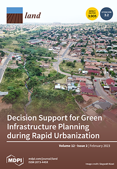
Multifunctional green infrastructure is a key component of compact sustainable cities. GIS modeling and stakeholder engagement can assess and communicate the need for green infrastructure benefits in a Global South city facing rapid urbanization. In this study, green infrastructure benefits were mapped to provide oversight of multiple objectives for climate change adaptation, biodiversity, and spatial distribution of urban green space, and to guide decision making. Low-scoring benefit areas occur in dense urban areas needing small-scale nature-based solutions or rehabilitation. Moderate scores occur in parts of the city that are vulnerable to urban expansion and densification, and high-scoring areas can be protected as conservation areas. The role of decision support tools in urban planning is discussed. View this paper
  • Issues are regarded as officially published after their release is announced to the table of contents alert mailing list.
  • You may sign up for e-mail alerts to receive table of contents of newly released issues.
  • PDF is the official format for papers published in both, html and pdf forms. To view the papers in pdf format, click on the "PDF Full-text" link, and use the free Adobe Reader to open them.
Order results
Result details
Section
Select all
Export citation of selected articles as:
21 pages, 2025 KiB  
Article
Impact of Bottom-Sediment Removal on 137Cs Contamination in an Urban Pond
by Honoka Kurosawa, Yoshifumi Wakiyama, Toshihiro Wada and Kenji Nanba
Land 2023, 12(2), 519; https://doi.org/10.3390/land12020519 - 20 Feb 2023
Viewed by 1292
Abstract
Many irrigation ponds in Fukushima Prefecture were decontaminated due to the contamination of radiocesium released from Fukushima Daiichi Nuclear Power Plant. To evaluate the impact of decontamination on 137Cs dynamics in an urban pond in Koriyama City, Fukushima Prefecture, Japan, temporal changes [...] Read more.
Many irrigation ponds in Fukushima Prefecture were decontaminated due to the contamination of radiocesium released from Fukushima Daiichi Nuclear Power Plant. To evaluate the impact of decontamination on 137Cs dynamics in an urban pond in Koriyama City, Fukushima Prefecture, Japan, temporal changes in 137Cs concentrations in bottom sediments and pond water were investigated before and after bottom-sediment removal. Post-decontamination, 137Cs inventories in bottom sediments decreased by 46–89%. 137Cs inventories in bottom sediments were relatively high in fine sediments before decontamination, and were also high at points near the water inlet after decontamination. Following decontamination, the mean 137Cs concentration in suspended solids (SS) and the mean dissolved 137Cs concentration in pond water decreased by 52% and 5%, respectively. Even after decontamination, the normalized 137Cs concentrations in SS and in water, which were calculated by dividing the 137Cs concentrations by the mean 137Cs inventories in each area, were higher than those in rivers, dam reservoirs, and ponds elsewhere in Fukushima. The positive correlations between δ15N values, an indicator of the source contribution to bottom sediments, and 137Cs concentrations in the upper 5 cm of bottom sediments after decontamination implied that SS from urban areas gradually increased the 137Cs inventories in the pond. The results underline the importance of secondary inputs of 137Cs from highly urbanized catchments. Full article
(This article belongs to the Topic Fate and Transport of Artificial Radionuclides in Soil-Water Environment)
(This article belongs to the Section Soil-Sediment-Water Systems)
Show Figures

Figure 1

15 pages, 1403 KiB  
Article
How a Short-Lived Rumor of Residential Redevelopment Disturbs a Local Housing Market: Evidence from Hangzhou, China
by Yanjiang Zhang, Hongyi Fan, Qingling Liu, Xiaofen Yu and Shangming Yang
Land 2023, 12(2), 518; https://doi.org/10.3390/land12020518 - 20 Feb 2023
Cited by 2 | Viewed by 1398
Abstract
This paper investigates how a short-lived rumor of residential redevelopment triggered herding trading and housing price overreactions in a local housing market in Hangzhou. Through event studies, we find that herding purchasing caused a short-term housing price overreaction. Simultaneously, existing homeowners became reluctant [...] Read more.
This paper investigates how a short-lived rumor of residential redevelopment triggered herding trading and housing price overreactions in a local housing market in Hangzhou. Through event studies, we find that herding purchasing caused a short-term housing price overreaction. Simultaneously, existing homeowners became reluctant to sell, and the number of new listings for sale decreased temporarily. However, we find no evidence of a decrease in market efficiency. A herding investor who purchased an average home may have suffered a loss of CNY 593,907 after the rumor weakened, equivalent to 8.7 years of income for an average resident in Hangzhou in 2021. This study reveals the importance of government policy communication, and the detrimental impact of ambiguous urban renewal policies on housing market stability and wealth redistribution. Full article
Show Figures

Figure 1

12 pages, 495 KiB  
Article
Venezuelan Migration, COVID-19 and Food (in)Security in Urban Areas of Ecuador
by Taymi Milán and Cheryl Martens
Land 2023, 12(2), 517; https://doi.org/10.3390/land12020517 - 20 Feb 2023
Cited by 2 | Viewed by 1690
Abstract
The forced migration of nearly 6 million Venezuelans is a global issue that is transforming urban contexts, particularly in Latin America. Ecuador is the third main recipient country of displaced Venezuelans. The lack of State migration policies and the deteriorating economic situation throughout [...] Read more.
The forced migration of nearly 6 million Venezuelans is a global issue that is transforming urban contexts, particularly in Latin America. Ecuador is the third main recipient country of displaced Venezuelans. The lack of State migration policies and the deteriorating economic situation throughout the region have had significant impacts on migrants. While food security and migration have been studied extensively in Latin America, their intersection remains under-explored. Through a systematic review and focus group research, this exploratory study analyzes the food security conditions of Venezuelans in Ecuador and the impacts of the COVID-19 pandemic on the levels of food insecurity using an intersectional approach. Quantitative, systematic review results demonstrate that demands for food assistance outweighed the planning and provisions supplied by both state and non-state actors. Focus groups results support the findings from the systematic review and demonstrate that in the medium-sized port cities of Manta and Machala, food demands during the pandemic lockdown measures were met through the direct food supply and resilience strategies, including the securing of personal loans and bartering. In contrast, in the cities of Quito and Huaquillas, strict enforcement of COVID-19 lockdown measures, reduced access to work and systematic food access and increased reliance on food assistance from non-governmental actors. This study also found that the impacts of food (in)security in the context of COVID-19 disproportionately affected women in all cities, as they offered their food rations to meet the needs of their children, grandchildren, or other dependents. Full article
(This article belongs to the Special Issue Impacts of COVID-19 on Urban Food Security)
Show Figures

Figure 1

20 pages, 2858 KiB  
Article
Quantitatively Evaluating the Ecological Product Value of Nine Provinces in the Yellow River Basin from the Perspective of the Dual-Carbon Strategy
by Yang Zhang, Zijun Ma, Meng Sun, Jianing Song, Yang Yang, Qiang Li and Ying Jing
Land 2023, 12(2), 516; https://doi.org/10.3390/land12020516 - 20 Feb 2023
Cited by 4 | Viewed by 1460
Abstract
At the 75th session of the United Nations General Assembly, China formally proposed the goal of achieving carbon peak by 2030 and carbon neutrality by 2060, which is called the dual-carbon strategy. In this study, we incorporated the dual-carbon strategy perspective into ecological [...] Read more.
At the 75th session of the United Nations General Assembly, China formally proposed the goal of achieving carbon peak by 2030 and carbon neutrality by 2060, which is called the dual-carbon strategy. In this study, we incorporated the dual-carbon strategy perspective into ecological product value (EPV) evaluation. The EPV is the sum of the final product and service value provided by regional ecosystems for human production and life. A significant uncertainty exists in evaluating the EPV. To bridge this gap, we explored the quantitative evaluation index system of EPV based on the dual-carbon perspective and conducted an empirical analysis relating to four subindexes (ecological protection, ecological products carbon neutral capacity transformation, ecological value, and ecological product value realization safeguard mechanism). The EPV in nine provinces of the Yellow River basin in 2020 was measured. The results showed that the total evaluation score of EPV realization in the Yellow River basin was relatively low, and the average scores of ecological product protection level, carbon neutrality capacity, value transformation level, and value realization guarantee mechanism were all at a low level. Overall, the protection level of ecological products and the guarantee mechanism to realize the EPV were relatively good. However, the carbon neutrality capacity and the value transformation level were relatively poor. From the spatial perspective, the value realization level of ecological products was roughly upstream region > downstream region > midstream region in the Yellow River basin. Finally, corresponding countermeasures and suggestions are put forward according to the comprehensive evaluation index of EPV realization and analysis of the four subindexes. Full article
Show Figures

Figure 1

22 pages, 13096 KiB  
Article
Spatio-Temporal Analysis of Cultivated Land from 2010 to 2020 in Long’an County, Karst Region, China
by Jianhui Dong, Wenju Yun, Kening Wu, Shaoshuai Li, Bingrui Liu and Qiaoyuan Lu
Land 2023, 12(2), 515; https://doi.org/10.3390/land12020515 - 20 Feb 2023
Cited by 1 | Viewed by 1319
Abstract
Spatio-temporal changes in cultivated land have a profound impact on food security and sustainable development. However, existing studies on spatio-temporal changes in cultivated land mostly focus on single factors, for instance quantity, quality and ecology, that cannot comprehensively reflect the changes in total [...] Read more.
Spatio-temporal changes in cultivated land have a profound impact on food security and sustainable development. However, existing studies on spatio-temporal changes in cultivated land mostly focus on single factors, for instance quantity, quality and ecology, that cannot comprehensively reflect the changes in total production capacity and the sustainability of cultivated land. This study aims to construct a comprehensive analysis approach and to provide a reference basis for a comprehensive analysis of the extent of changes in overall cultivated land food-production capacity and the formulation of cultivated land conservation-related policies. This comprehensive analysis method constructed from three dimensions: quantity, production capacity and ecology, fully reflects the changes in the total amount, structure, rate of change, spatial distribution, quality, total production capacity and sustainability of cultivated land. The results from the application of this approach to Long’an County, Guangxi Province, China demonstrate that: (a) from 2010 to 2020, the total amount of cultivated land in Long’an County decreased sharply by 30.83%, accounted for mainly by the conversion into orchards, forest land and other garden land; (b) the quality of cultivated land improved by 2.71% on average, mostly in relation to natural factors; (c) the total food-production capacity of cultivated land decreased by 28.96% on average, mainly due to the decrease in the area of cultivated land; (d) both the ecological grade and the sustainability of cultivated land decreased slightly; (e) the barycenter of cultivated land migrated 3.3 km to the ecologically sensitive areas in the west, and the patch size of cultivated land decreased from an average of 2.60 hectares/pc in 2010 to that of 1.34 hectares/pc in 2020, suggesting increased fragmentation of cultivated land; and (f) the patch regularity of cultivated land decreased from 2.08 in 2010 to 1.76 in 2020, showing improved patch regularity and slightly better adaptability to mechanization. There were two main reasons for the lower, total food production capacity in Long’an County: first, the low comparative income of grain cultivation, because of which farmers spontaneously adjusted the agricultural cultivation structure to pursue high returns; and second, the lack of targeted government policies to protect cultivated land. In general, this comprehensive analysis method is applicable to other provinces in China or other regions abroad to provide a reference basis for a comprehensive understanding of changes in the food production capacity of cultivated land and the formulation of policies on cultivated land protection. Full article
Show Figures

Figure 1

22 pages, 3225 KiB  
Article
Environmental Design for Urban Cooling, Access, and Safety: A Novel Approach to Auditing Outdoor Areas in Residential Aged Care Facilities
by Chris Boulton, Claudia Baldwin, Tony Matthews and Silvia Tavares
Land 2023, 12(2), 514; https://doi.org/10.3390/land12020514 - 20 Feb 2023
Viewed by 2004
Abstract
Strategies and guidelines for best practice environmental design typically have a singular focus and intended outcome, for example, green infrastructure management for urban cooling in a hotter climate. However, when applied to specific situations such as aged care, matters such as accessibility, wayfinding, [...] Read more.
Strategies and guidelines for best practice environmental design typically have a singular focus and intended outcome, for example, green infrastructure management for urban cooling in a hotter climate. However, when applied to specific situations such as aged care, matters such as accessibility, wayfinding, and safety are also critical. Combining various audit tools offer multiple benefits to meet a variety of needs for thermal comfort, health, and well-being, as well as cost-effectiveness. In the absence of such a tool, using a place-based analysis, we developed a novel audit tool for external settings of residential aged care facilities (ACFs) incorporating urban cooling, Crime Prevention Through Environmental Design (CPTED), and universal design criteria. To determine how ACFs perform in the face of increased levels of urban heat required evaluation of additional urban cooling measures. The Audit Tool was developed and tested in collaboration with ACFs across sub-tropical and tropical areas of Australia, varying in climate, scale, and urban density. Quality of life for residents, visitors, and staff of ACFs can be supported by the provision of green infrastructure to improve the thermal comfort of outdoor settings and, if located appropriately, reduce the need for an increase in internal air-conditioning. The aim of this article is to propose a user-friendly Hybrid Environmental Design Audit Tool (HEDAT) to support facility managers, planners, and design consultants to inform the prioritization and targeting of interventions and monitoring of implementation and outcomes. Full article
Show Figures

Figure 1

15 pages, 1142 KiB  
Article
Role of Traditional Agroforestry Systems in Climate Change Mitigation through Carbon Sequestration: An Investigation from the Semi-Arid Region of Pakistan
by Ghulam Yasin, Muhammad Farrakh Nawaz, Muhammad Zubair, Muhammad Farooq Azhar, Matoor Mohsin Gilani, Muhammad Nadeem Ashraf, Anzhen Qin and Shafeeq Ur Rahman
Land 2023, 12(2), 513; https://doi.org/10.3390/land12020513 - 20 Feb 2023
Cited by 7 | Viewed by 2698
Abstract
Several agroforestry systems prevail in different agro-ecological zones of Pakistan, and cover a remarkable area of 19.3 million hectares. They not only play an important role in slowing down CO2 emissions, but also contribute to mitigating climate change. However, in many regions, [...] Read more.
Several agroforestry systems prevail in different agro-ecological zones of Pakistan, and cover a remarkable area of 19.3 million hectares. They not only play an important role in slowing down CO2 emissions, but also contribute to mitigating climate change. However, in many regions, the relevant effect of agroforestry systems on overall carbon (C) stock and their reliance on various factors are quite unidentified. This study was planned to assess the biomass accumulation and C stocks of different commonly practiced agroforestry systems (boundary, bund, scattered, agri-horticulture) and their constituent land use types (tree + cropland) through a non-destructive approach (allometric equations) in a semi-arid region of Punjab, Pakistan. The results showed that the highest plant biomass (87.12 t ha−1) increased by 46%, 17%, 78%, and 339%, and C stock (42.77 t ha−1) increased by 49.51%, 20%, 82%, and 361% in the boundary planting system compared to the bund, scattered, agri-horti and sole cropland, respectively. The soil organic carbon (SOC) stock at all three depths, 0–15 cm, 15–30 cm & 30–45 cm, was found in the following order: boundary planting system > bund planting system > agri-horti system > scattered planting system > agricultural system, with a maximum in the boundary planting system and minimum in the sole cropping system at all three depths. Overall, the total C stock of the ecosystem’s vegetation + soil C (0–30 cm) in the forested area was 275 t ha−1, equating to 37 t ha−1 in the agricultural system alone. Our results highlighted that agroforestry systems have the highest potential for C sequestration. We suggest that research and investment in agroforestry systems can be a successful way for Pakistan to achieve some of its climate change mitigation goals. Full article
(This article belongs to the Special Issue The Impact of Soil Carbon Sequestration on Ecosystem Services)
Show Figures

Figure 1

15 pages, 1156 KiB  
Review
From Garden City to 15-Minute City: A Historical Perspective and Critical Assessment
by Amir Reza Khavarian-Garmsir, Ayyoob Sharifi, Mohammad Hajian Hossein Abadi and Zahra Moradi
Land 2023, 12(2), 512; https://doi.org/10.3390/land12020512 - 20 Feb 2023
Cited by 12 | Viewed by 7146
Abstract
The 15-minute city concept was introduced as a post-COVID strategy to support more sustainable recovery from the pandemic and develop complete, climate-sensitive, and resilient neighborhoods. This review examines key neighborhood planning movements to identify the origins of the 15-minute city concept. These include [...] Read more.
The 15-minute city concept was introduced as a post-COVID strategy to support more sustainable recovery from the pandemic and develop complete, climate-sensitive, and resilient neighborhoods. This review examines key neighborhood planning movements to identify the origins of the 15-minute city concept. These include the garden city, neighborhood unit plan, modernist urbanism, post-modern urbanism, and eco-urbanism, which have emerged since the late 19th century. The results of the study show that the concept of the 15-minute city has ten basic characteristics: proximity, density, diversity, mixed-use, modularity, adaptability, flexibility, human-scale design, connectivity, and digitalization. The concept has been successful in advancing theoretical debates on sustainable urbanism. However, some criticisms of past planning movements also apply to the 15-minute city. Similar to the neighborhood unit and modernist urbanism, the concept follows a philosophy of physical determinism, setting goals without specifying how or by what means they will be achieved. At this point, one can only speculate about the future of the concept. A more detailed study of the real-world applications of the concept is needed before one can thoroughly discuss its strengths and weaknesses. Full article
(This article belongs to the Special Issue Urban Resilience and Urban Sustainability under Climate Change)
Show Figures

Figure 1

16 pages, 571 KiB  
Article
The Effects of Urbanisation on Green Growth within Sustainable Development Goals
by Aleksy Kwilinski, Oleksii Lyulyov and Tetyana Pimonenko
Land 2023, 12(2), 511; https://doi.org/10.3390/land12020511 - 20 Feb 2023
Cited by 52 | Viewed by 2625
Abstract
The Green Deal policy and Sustainable Development Goals require that the economic development of a country should be reoriented towards ‘green‘ economic development. Currently, the globalisation and intensification of production boosts urbanisation in many countries, which may stimulate economic growth and improve citizen [...] Read more.
The Green Deal policy and Sustainable Development Goals require that the economic development of a country should be reoriented towards ‘green‘ economic development. Currently, the globalisation and intensification of production boosts urbanisation in many countries, which may stimulate economic growth and improve citizen well-being, but may also lead to excessive consumption of resources and negative environmental impacts. Against the backdrop of these challenges, it is expedient to estimate the effects of urbanisation on the green growth of a country and define the relevant changes and instruments for achieving green growth in a country in view of urbanisation. The research covers the EU countries and Ukraine (as an official candidate for European Union membership) in the period of 2005–2020. Applying the Global Malmquist–Luenberger productivity index (to estimate green economic growth); a fixed and random effects model, GMM modelling (to evaluate the impact of urbanisation on green economic growth), this study aimed to contribute to the theoretical framework of green economic growth by extending input and undesirable output parameters of a country’s productivity. The findings revealed that, in 2020, as compared to 2005, green economic growth went into a decline in all countries analysed, this decline stemmed from accelerated urbanisation. However, industrial structure and research and development appeared to be conducive to green economic growth, which justifies the idea that countries should focus on implementing structural reforms for the technological modernisation of infrastructure and industrial complexes to dispose of the shortcomings caused by urbanisation. To compensate for this negative impact, the findings of this research prompt a set of policy implications concerning dissemination of the green knowledge and technologies, green project implementation, reinforcement of incentive instruments and achievement of a synergistic balance of economic and ecological targets underlying the SDGs. Full article
(This article belongs to the Section Urban Contexts and Urban-Rural Interactions)
Show Figures

Figure 1

37 pages, 12567 KiB  
Article
Are Local Residents Benefiting from the Latest Urbanization Dynamic in China? China’s Characteristic Town Strategy from a Resident Perspective: Evidence from Two Cases in Hangzhou
by Yi Yang, Tetsuo Kidokoro, Fumihiko Seta and Ziyi Wang
Land 2023, 12(2), 510; https://doi.org/10.3390/land12020510 - 19 Feb 2023
Cited by 1 | Viewed by 3224
Abstract
The Characteristic Town (CT) program is one of the most notable strategies in China’s urbanization process in recent years, responding to the drawbacks of the past decades of crude urbanization development model and maintaining and promoting capital accumulation and economic growth with innovative [...] Read more.
The Characteristic Town (CT) program is one of the most notable strategies in China’s urbanization process in recent years, responding to the drawbacks of the past decades of crude urbanization development model and maintaining and promoting capital accumulation and economic growth with innovative approach to space production. However, no studies have been conducted to examine whether residents actually benefit from it. Therefore, we combined desk research, participatory observation, in-depth interviews, and questionnaires to evaluate its influence on residents in two representative cases in Hangzhou, Zhejiang Province, where the program originated. The results show limited improvement in public benefits: a general but insignificant improvement in the living standard of the residents; residents’ public participation is generally lacking; residents’ cognition of self-identity has begun to appear deviation, and barriers between them and foreign workers have begun to emerge; residents’ assessment of the new development strategy varies from case to case. Compared to other urban and rural redevelopment, renewal, and construction practices around the world, the CT program does not seem to appear to be overly special or advanced in terms of securing and enhancing public benefits. To this end, this study concluded that it is necessary to consider the need to adopt an official evaluation system that attaches equal importance to economic, environmental, and social factors, further strengthen the supervision of local financial expenditure, effectively strengthen the role of the public, improve infrastructure and public service facilities, and enhance the comprehensive training of indigenous people. Full article
Show Figures

Figure 1

16 pages, 2037 KiB  
Review
Transforming Research on Recreational Ecosystem Services into Applications and Governance
by Zhifang Wang, Yuqing Jian, Zhibin Huang, Salman Qureshi, Kexin Cheng, Zhuhui Bai and Qingwen Zhang
Land 2023, 12(2), 509; https://doi.org/10.3390/land12020509 - 19 Feb 2023
Cited by 1 | Viewed by 1945
Abstract
The science-practice gap has recently been discussed as a critical challenge restricting sustainable growth and development in all facets of our society, including explorations of Recreation Ecosystem Services (RES). To better explore how well the scientific study of RES and its application are [...] Read more.
The science-practice gap has recently been discussed as a critical challenge restricting sustainable growth and development in all facets of our society, including explorations of Recreation Ecosystem Services (RES). To better explore how well the scientific study of RES and its application are connected, this paper aims to synthesize empirical evidence based on an in-depth and systematic literature review. We found that studies of RES have not effectively transformed into the decision-making and long-term planning of our cities. From 2005 to 2020, only 13% of studies referred to specific applications, and about 40% of papers mentioned no applications or practical implications for their research. However, RES research has many potential applications, which can be categorised into six main aspects. In terms of non-spatial improvement: Improved monetary benefits (40%), non-monetary benefits (30%); in terms of spatial improvement: space with high recreational potential or degradation (7%), the relation between supply and demand (7%); and Cross-service governance (16%). After combining the results of various studies, we developed a framework starting from applicable problems and their solutions, which can incorporate the outcomes of RES research while systematically narrowing down the research questions and methods. The framework offers a starting point for further research that can modify and improve in bridging science-practice gaps in RES studies. Full article
Show Figures

Figure 1

29 pages, 10220 KiB  
Article
Sustainable Development of Rural Areas in Poland since 2004 in the Light of Sustainability Indicators
by Marcin K. Widomski and Anna Musz-Pomorska
Land 2023, 12(2), 508; https://doi.org/10.3390/land12020508 - 18 Feb 2023
Cited by 3 | Viewed by 1333
Abstract
Sustainable development of a region requires sustainability of its rural parts, as a source of supplies and resources for the urbanized regions. The current climate changes, loss of biodiversity, limited resources, depopulation, deterioration of economic conditions or even poverty may limit the sustainable [...] Read more.
Sustainable development of a region requires sustainability of its rural parts, as a source of supplies and resources for the urbanized regions. The current climate changes, loss of biodiversity, limited resources, depopulation, deterioration of economic conditions or even poverty may limit the sustainable development of rural populations. This paper presents the study concerning assessment of sustainable development of rural areas in Poland since 2004, the date of Poland entrance to the European Union, in light of the selected Sustainable Development Indicators. The assessment was based on the set of 38 indicators covering environmental, social and economic pillars of sustainability. The results of this study indicate the significant progress in some aspects of rural development in Poland since 2004. However, several serious limits for rural sustainability were identified, including limited access to basic services including sanitation, anthropopressure on the natural environment, limited access to clear and renewable energy, depopulation, ageing, unfavorable economic conditions and relatively low productivity of agriculture. Full article
(This article belongs to the Special Issue Future Evolution of the Land Use Structure of Rural Settlements)
Show Figures

Figure 1

17 pages, 4300 KiB  
Article
The Effect of Land Consolidation Projects on Carbon Footprint
by Ela Ertunç
Land 2023, 12(2), 507; https://doi.org/10.3390/land12020507 - 18 Feb 2023
Cited by 2 | Viewed by 1483
Abstract
In this study, transportation-induced carbon footprint values before and after the consolidation projects in two areas with similar agricultural characteristics were calculated. The IPCC Tier 1 method recommended by the IPCC (Intergovernmental Panel on Climate Change) was used to calculate the carbon footprint. [...] Read more.
In this study, transportation-induced carbon footprint values before and after the consolidation projects in two areas with similar agricultural characteristics were calculated. The IPCC Tier 1 method recommended by the IPCC (Intergovernmental Panel on Climate Change) was used to calculate the carbon footprint. Furthermore, the effects of changes in road lengths and routes in these areas after Land Consolidation (LC) on the fuel consumption of tractors and, accordingly, the carbon dioxide (CO2) emission values were also determined. As a result of the study, the carbon footprint value (GgCO2) decreased by 10% in the Fatih neighborhood and 33% in the Selimiye neighborhood after the land consolidation project. Carbon equivalent (CE) is used to measure the effects on greenhouse gas emissions and global warming and corresponds to the amount of carbon dioxide (CO2) emissions. In total, 490.21 kg CO2·ha−1 of greenhouse gas (GHG) emissions were mitigated. In light of these results, it can be concluded that LC can be considered a useful process in greenhouse gas mitigation strategy. Based on the values obtained from the study results, it was concluded that land consolidation contributed to reducing carbon footprint and increasing agricultural production and productivity in rural areas. The reduction in fuel consumption and carbon emissions in rural areas will contribute to reducing the adverse effects of air pollution and climate change. Full article
(This article belongs to the Special Issue New Insights in Integrated Land Management)
Show Figures

Figure 1

12 pages, 3079 KiB  
Technical Note
Soil Moisture Change Detection with Sentinel-1 SAR Image for Slow Onsetting Disasters: An Investigative Study Using Index Based Method
by Arnob Bormudoi, Masahiko Nagai, Vaibhav Katiyar, Dorj Ichikawa and Tsuyoshi Eguchi
Land 2023, 12(2), 506; https://doi.org/10.3390/land12020506 - 17 Feb 2023
Viewed by 1736
Abstract
Understanding physical processes in nature, including the occurrence of slow-onset natural disasters such as droughts and landslides, requires knowledge of the change in soil moisture between two points in time. The study was conducted on a relatively bare soil, and the change in [...] Read more.
Understanding physical processes in nature, including the occurrence of slow-onset natural disasters such as droughts and landslides, requires knowledge of the change in soil moisture between two points in time. The study was conducted on a relatively bare soil, and the change in soil moisture was examined with an index called Normalized radar Backscatter soil Moisture Index (NBMI) using Sentinel-1 satellite data. Along with soil moisture measured with a probe on the ground, a study of correlation with satellite imagery was conducted using a Multiple Linear Regression (MLR) model. Furthermore, the Dubois model was used to predict soil moisture. Results have shown that NBMI on a logarithmic scale provides a good representation of soil moisture change with R2~86%. The MLR model showed a positive correlation of soil moisture with the co-polarized backscatter coefficient, but an opposite correlation with the surface roughness and angle of incidence. The results of the Dubois model showed poor correlation of 44.37% and higher RMSE error of 17.1, demonstrating the need for detailed and accurate measurement of surface roughness as a prerequisite for simulating the model. Of the three approaches, index-based measurement has been shown to be the most rapid for understanding soil moisture change and has the potential to be used for understanding some mechanisms of natural disasters under similar soil conditions. Full article
Show Figures

Figure 1

20 pages, 3965 KiB  
Article
Green Space Ecosystem Services and Value Evaluation of Three-Dimensional Roads for Sustainable Cities
by Eunjoung Lee and Gunwoo Kim
Land 2023, 12(2), 505; https://doi.org/10.3390/land12020505 - 17 Feb 2023
Cited by 1 | Viewed by 1910
Abstract
The provision of green space as a result of three-dimensional roads plays a crucial role in maintaining the sustainability of the urban ecosystem. It does so by solving environmental problems and offering various ecosystem services to city residents. This study focuses on the [...] Read more.
The provision of green space as a result of three-dimensional roads plays a crucial role in maintaining the sustainability of the urban ecosystem. It does so by solving environmental problems and offering various ecosystem services to city residents. This study focuses on the park section of an expressway located between Bundang and Suseo in Seongnam city, South Korea, and quantifies the improvement in air quality and ecological value following the transformation of the road into green infrastructure. The goal is to determine the feasibility of sustainable green infrastructure for roads. The new park area on the road is approximately 83,000 sq. meters and there are approximately 3349 trees planted in the park. These trees can store 77.68 metric tons of carbon annually, isolate 13.21 metric tons of total carbon, remove 70.446 kg of air pollutants, avoid 112.8 cubic meters of emissions, and mitigate 31,983.90 cubic feet of emissions. The resulting economic value is approximately 874,494 dollars. Road green infrastructure conversion can be a useful solution to respond to environmental problems. To promote decision-making when developing policies, a process of pre-verification with quantified data of ecosystem services (example: air quality benefits, etc.) of trees using the i-Tree Eco program is required. In the execution stage, it is possible to understand the structure, function, and value of green spaces and prepare guidelines for tree selection, design alternatives, and evaluation as one of the management strategies for green spaces to improve the value of ecosystem services. Full article
Show Figures

Figure 1

24 pages, 630 KiB  
Article
COVID-19 and Urban Food Security in Ghana during the Third Wave
by Elizabeth Opiyo Onyango, Bernard Owusu and Jonathan S. Crush
Land 2023, 12(2), 504; https://doi.org/10.3390/land12020504 - 17 Feb 2023
Cited by 3 | Viewed by 2111
Abstract
While the effects of the COVID-19 pandemic on household food security have been documented, the intensity and forms of food insecurity in urban households in the Global South have not been adequately explored. This is despite the emerging consensus that impacts of the [...] Read more.
While the effects of the COVID-19 pandemic on household food security have been documented, the intensity and forms of food insecurity in urban households in the Global South have not been adequately explored. This is despite the emerging consensus that impacts of the pandemic were more severe in urban than rural Africa. This paper addresses this knowledge gap by examining the relationship between pandemic precarity and food insecurity in Ghana’s urban areas during the COVID-19 pandemic in 2020. This study is based on the World Bank (WB) and Ghana Statistical Service (GSS) COVID-19 High-Frequency Phone Survey. Using a sub-sample of 1423 urban households, the paper evaluates household experiences of the pandemic. Our findings show that household demographic characteristics are not a major predictor of food insecurity. Economic factors, especially the impact of the pandemic on wage income and total household income, were far more important, with those most affected being most food insecure. Additionally, food-insecure households were most aware of and were affected by food-price increases during the pandemic. These findings are important in planning the post-pandemic recovery initiatives and in addressing current and future emergencies and shocks to urban food systems. Full article
(This article belongs to the Special Issue Impacts of COVID-19 on Urban Food Security)
Show Figures

Figure 1

23 pages, 1793 KiB  
Article
Impact of Land Tenure Security Perception on Tree Planting Investment in Vietnam
by Hoang Huu Dinh, Shyam Basnet and Justus Wesseler
Land 2023, 12(2), 503; https://doi.org/10.3390/land12020503 - 17 Feb 2023
Cited by 1 | Viewed by 1700
Abstract
With over 14 million hectares allocated, Vietnam’s forest and forestland allocation has been one of the largest natural resource decentralization programs in the developing world over the last three decades. Given this remarkable achievement, critics are concerned about the low rates of household [...] Read more.
With over 14 million hectares allocated, Vietnam’s forest and forestland allocation has been one of the largest natural resource decentralization programs in the developing world over the last three decades. Given this remarkable achievement, critics are concerned about the low rates of household tree planting investment and question the roles and effects of land institutions on investment. Using nested logit and ordered probit models, this study examined the effects of household perceptions of forestland tenure security on tree investment and the causal effects among 239 households in 11 communes in the Central Highlands. The findings suggested that, given the land titling in hand, household perceptions of potential land expropriation in the next five years did not thwart investments in both short-term acacia and long-term cashew horizons. The number of laborers, cost of plantations, off-farm and agricultural incomes, migrant status, soil condition, plot location, government subsidies, and a positive market outlook all played a significant role in this investment. Interestingly, we found that short-term tree planting had the reverse impact on decreasing land users’ perceptions of land tenure security, possibly because each tree rotation shortens the 50-year land use period recorded in the Land Use Right Certificate. However, market prospects and government subsidies may significantly counteract the negative perception of LTS and encourage households to plant trees. The policy implication is that, in addition to strengthening LTS to ensure households’ current and future land use rights, tree investment-incentivized policies should be implemented. Full article
Show Figures

Figure 1

14 pages, 1274 KiB  
Article
A Life Cycle Assessment of Rice–Rice and Rice–Cowpea Cropping Systems in the West Coast of India
by Venkatesh Paramesh, Parveen Kumar, Ranjan Parajuli, Rosa Francaviglia, Kallakeri Kannappa Manohara, Vadivel Arunachalam, Trivesh Mayekar and Sulekha Toraskar
Land 2023, 12(2), 502; https://doi.org/10.3390/land12020502 - 17 Feb 2023
Cited by 2 | Viewed by 1876
Abstract
Crop diversification is essential in lowland rice cropping systems to achieve sustainability, improve soil health, and as a climate-resilient practice to reduce greenhouse gas (GHG) emissions. A life cycle assessment (LCA) was conducted for the farms in the west-coast region of India to [...] Read more.
Crop diversification is essential in lowland rice cropping systems to achieve sustainability, improve soil health, and as a climate-resilient practice to reduce greenhouse gas (GHG) emissions. A life cycle assessment (LCA) was conducted for the farms in the west-coast region of India to assess the environmental impact of the rice–rice and rice–cowpea cropping systems. The life cycle impact assessment (LCIA) was evaluated in a “cradle-to-gate” perspective. A higher energy consumption was found in the rice–rice system (32,673 vs. 18,197 MJ/ha), while the net energy output was higher in the rice–cowpea system (211,071 vs. 157,409 MJ/ha). Energy consumption was 44% lower in the rice–cowpea system, which was coupled with a higher energy efficiency (11.6 vs. 4.8), attributed to the lower energy consumption and the higher energy output. Further, the results indicated an energy saving potentialin the rice–cowpea system due to the higher use of renewable resources such as farmyard manure. Field emissions, fertilizer production, and fuel consumption were the major contributors to the greenhouse gas (GHG) emissions in both cropping systems. The total GHG emissions were 81% higher in the rice–rice system (13,894 ± 1329 kg CO2 eq./ha) than in the rice–cowpea system (7679 ± 719 kg CO2 eq./ha). The higher GHG emissions in the rice–rice system were largely due to the higher use of fertilizers, diesel fuel, and machinery. Hence, diversifying the winter rice with a cowpea crop and its large-scale adoption on the west coast of India would provide multiple benefits in decreasing the environmental impact and improving the energy efficiency to achieve sustainability and climate resilience in rice-based cropping systems. Full article
Show Figures

Figure 1

14 pages, 1365 KiB  
Article
Carbon Nitrogen Isotope Coupling of Soils and Seasonal Variation Characteristics in a Small Karst Watershed in Southern China
by Ya Liu, Ziqi Liu, Kangning Xiong, Yuan Li, Xiaoxi Lyu and Lulu Cai
Land 2023, 12(2), 501; https://doi.org/10.3390/land12020501 - 17 Feb 2023
Cited by 3 | Viewed by 1317
Abstract
Carbon and nitrogen are among the most important biogenic elements in terrestrial ecosystems, and carbon and nitrogen stable isotopes (δ13C and δ15N) are often used to indicate the sources of carbon and nitrogen elements and turnover processes, and the [...] Read more.
Carbon and nitrogen are among the most important biogenic elements in terrestrial ecosystems, and carbon and nitrogen stable isotopes (δ13C and δ15N) are often used to indicate the sources of carbon and nitrogen elements and turnover processes, and the study of C and N isotopes coupling can provide more precise indications. To this end, this study was conducted to investigate the effects of different land use types on soil organic carbon (SOC), soil organic nitrogen (SON) and the coupling relationship of C-N isotopes, as well as to reveal the seasonal variation characteristics of soil C and N. The results showed that SOC and SON contents of forest land were significantly higher than those of agricultural land and grassland. The soil C/N was significantly higher in the dry season than in the rainy season (p < 0.01), indicating that the decomposition rate of soil organic matter (SOM) was faster in the rainy season, which was not conducive to the accumulation of soil C. Soil δ13C and δ15N coupling showed seasonal characteristics: soil δ13C and δ15N did not have a good linear relationship in the rainy season, but showed a significant positive correlation in the dry season (r2 = 0.75, p < 0.05), indicating that there are differences in the soil C-N isotope fractionation coupling under the influence of climatic factors. This study provides a reference for regional land resource management as well as carbon and nitrogen cycle studies in karst areas. Full article
Show Figures

Figure 1

21 pages, 3086 KiB  
Article
Multitemporal Incidence of Landscape Fragmentation in a Protected Area of Central Andean Ecuador
by Carlos Rosero, Xosé Otero, Cinthya Bravo and Catherine Frey
Land 2023, 12(2), 500; https://doi.org/10.3390/land12020500 - 17 Feb 2023
Cited by 2 | Viewed by 1177
Abstract
Monitoring land cover changes in protected areas is crucial to control the conservation efficiency of biodiversity and natural ecosystem conditions, especially in Ecuador, one of the most megadiverse countries in the world. Therefore, the purpose of the present study has been to estimate [...] Read more.
Monitoring land cover changes in protected areas is crucial to control the conservation efficiency of biodiversity and natural ecosystem conditions, especially in Ecuador, one of the most megadiverse countries in the world. Therefore, the purpose of the present study has been to estimate spatiotemporal changes in the landscape and the level of fragmentation using remote sensing in Llanganates National Park (PNL), a protected area in central Andean Ecuador. To obtain land cover, satellite images were processed using the Maximum Likelihood Classification (MLC) algorithm. After statistical analysis, it was encountered that there is no significant difference in land cover change between the years 1991 to 2016 nor among the three watersheds, while the level of fragmentation in the PNL is low. Land cover changes in the study area are not evident, as it is a protected area where ecosystems are usually expected to maintain their initial conditions over time. Therefore, with these results it has been concluded that the biodiversity and landscape conservation processes in the PNL are effective. Full article
Show Figures

Figure 1

23 pages, 1850 KiB  
Article
Mineralogy, Geochemistry and Environmental Hazards of Different Types of Mining Waste from a Former Mediterranean Metal Mining Area
by Roberto Rodríguez-Pacheco, Gregorio García, Ana Vanessa Caparrós-Ríos, Virginia Robles-Arenas, Cristóbal García-García, Rocío Millán, Araceli Pérez-Sanz and Luis Alberto Alcolea-Rubio
Land 2023, 12(2), 499; https://doi.org/10.3390/land12020499 - 17 Feb 2023
Cited by 2 | Viewed by 1752
Abstract
Mine waste constitutes one of the biggest environmental and management problems, both due to its quantity and its danger when they are rich in toxic elements. There is a wide variety of waste from the oxidation of ores in metal mining areas, both [...] Read more.
Mine waste constitutes one of the biggest environmental and management problems, both due to its quantity and its danger when they are rich in toxic elements. There is a wide variety of waste from the oxidation of ores in metal mining areas, both metal sulphide and other minerals. These residues may be enriched in potentially toxic elements that can spread and contaminate ecosystems, farmland and villages. This study has focused on the characterization and evaluation of residues derived from metal-bearing mining waste in abandoned mining areas. Mineralogy and geochemical characteristics were determined by XRD, WDXRF and TG-MS techniques. In addition, DIN 38414-S4 leaching tests were carried out to assess the risk and mobility of potentially toxic elements. Silicates and oxides were found as the main mineral groups, followed by sulphates. These tailings were particularly enriched in Zn, Pb, As, Sb and Cd, while their leachates had high or extreme metal content. Consequently, these mining wastes are considered toxic and hazardous, even for landfills. Sulphides, as the primary source, and sulphates from their oxidation, were the main sources of these pollutants. Sulphates, As, Zn, Cd and Cu determined the specific environmental impact of the different tailing types, which were grouped into different clusters according to their mineralogy and geochemistry. These results provided a better understanding of the environmental hazards associated with the different types of metal mining waste in the area studied. Full article
(This article belongs to the Special Issue Contamination of Soils and Environmental Risks)
Show Figures

Figure 1

14 pages, 520 KiB  
Article
Creative Tourism in Islands and Regional Sustainable Development: What Can We Learn from the Pilot Projects Implemented in the Azores Territory?
by Rui Alexandre Castanho, Carlos Santos and Gualter Couto
Land 2023, 12(2), 498; https://doi.org/10.3390/land12020498 - 16 Feb 2023
Cited by 6 | Viewed by 2142
Abstract
The current need for territories and societies to grow is based on the Sustainable Development Models as well as the United Nations (UN) Agenda for 2030 Sustainable Development Goals (SDGs). In that case, such new forms of tourism development imply creating and upgrading [...] Read more.
The current need for territories and societies to grow is based on the Sustainable Development Models as well as the United Nations (UN) Agenda for 2030 Sustainable Development Goals (SDGs). In that case, such new forms of tourism development imply creating and upgrading critical infrastructures, facilities, equipment, or differentiated activities to bring clients who align with the desired Sustainable Development Models and SDGs. In this regard, the thematic literature provides evidence that some tourism typologies (nature-based, rural, culturally-based creative tourism) play a critical role in attaining sustainable regional development. Therefore, this paper aims to unfold what can be learned from the pilot projects implemented in the Azores region aimed toward the so-desired regional sustainability. Contextually, the obtained results ask for the regional leaders to consider encouraging entrepreneurship associated with small and medium-sized firms; fostering the diversity of touristic offerings; designing guidelines that follow sustainable development models and the SDGs; or creating meaningful investments in the conservation and protection of cultural heritage, as well as the Azorean endogenous resources. Full article
Show Figures

Figure 1

20 pages, 1206 KiB  
Article
Sustainable Collaborative Strategies of Territorial Regeneration for the Cultural Enhancement of Unresolved Landscapes
by Lucia Della Spina, Sebastiano Carbonara, Davide Stefano and Angela Viglianisi
Land 2023, 12(2), 497; https://doi.org/10.3390/land12020497 - 16 Feb 2023
Cited by 4 | Viewed by 1548
Abstract
The experience of adaptation and instability to a plurality of threats that question the life of human beings on the planet, from the post-pandemic to political conflicts, up to the danger looming in the background—the upheavals expected from climate change—impose a reflection that [...] Read more.
The experience of adaptation and instability to a plurality of threats that question the life of human beings on the planet, from the post-pandemic to political conflicts, up to the danger looming in the background—the upheavals expected from climate change—impose a reflection that recognizes that landscape/cultural heritage plays a key role in preservation/enhancement as a specific resource for its “human-centered development”, based on values included. These threats are challenges in which phenomena that require solidarity and common actions are faced, which should lead humans to cooperate to face them. The European Landscape Convention of 2000 attributed an important role to the landscape, as an “essential component of the life context of peoples”. The phase of listening to the territory and participatory and co-design processes are necessary tools for understanding the expectations and perceptions of the communities, co-exploring possible new uses of the landscape, being capable of generating added value for all stakeholders, and adopting a “win-win” approach. From this perspective, this contribution poses the following research question: how to build collaborative processes capable of putting local institutions, businesses, and local communities in synergy, to identify enhancement strategies for the cultural landscape? This study explores the potential of an integrated, incremental, and adaptive decision-making approach, oriented toward the elaboration of shared choices aimed at the elaboration of territorial enhancement strategies attentive to the specificity of the multiple values and complex resources that characterize the cultural terraced landscapes of the Costa Viola (Italy). In particular, the interactions between different knowledge, approaches, and tools makes it possible to formulate scenarios, strategies, and actions, contributing to the creation of a richer and more complex context of knowledge of the territory and to the construction of bottom-up and situated transformation strategies, supported from a decision-making process attentive to the identification of values and an understanding of the needs of the local ‘landscape community’ who live and animate it. Full article
(This article belongs to the Special Issue Landscapes at Risk. Social Capital Asset in the COVID-Scape Climate)
Show Figures

Figure 1

17 pages, 1438 KiB  
Article
Housing Prices and the Characteristics of Nearby Green Space: Does Landscape Pattern Index Matter? Evidence from Metropolitan Area
by Yiyi Chen, Colin A. Jones, Neil A. Dunse, Enquan Li and Ye Liu
Land 2023, 12(2), 496; https://doi.org/10.3390/land12020496 - 16 Feb 2023
Cited by 2 | Viewed by 3250
Abstract
This study aimed to examine the association between housing prices and green space characteristics with a special focus on exploring the effects of the shape pattern index. The research was based on a hedonic price model across two main distance buffers from residential [...] Read more.
This study aimed to examine the association between housing prices and green space characteristics with a special focus on exploring the effects of the shape pattern index. The research was based on a hedonic price model across two main distance buffers from residential properties to urban green spaces. Green spaces were characterized by size and shape measured by a landscape shape index (LSI). This study was based on 16,222 housing transaction data obtained from the website of real estate agencies during December 2019 in the Metropolitan Area of Beijing. Linear regression and semi-log regression analysis were used to examine the associations between independent housing and neighborhood characteristic variables and housing prices. The results suggested that a one-unit increase in the natural logarithm of the landscape shape index (LSI) can increase housing prices by 4% (5543 CNY 826 USD). Such marginal effects were more pronounced for residences located close to urban green spaces and tended to decay as the distance from residences to green spaces increased. Additional analysis captured the marginal effects of the natural logarithm of the landscape shape index (LSI > 1.3) on achieving the maximum monetary evaluation of the property. The findings of this study suggest that the effects of specific green space characteristics on housing prices should be taken into account in landscape and urban design. Full article
(This article belongs to the Special Issue Impacts of Land Use Pattern in Metropolitan Area)
Show Figures

Figure 1

18 pages, 3797 KiB  
Article
Extraction of Urban Built-Up Areas Using Nighttime Light (NTL) and Multi-Source Data: A Case Study in Dalian City, China
by Xueming Li, Yishan Song, He Liu and Xinyu Hou
Land 2023, 12(2), 495; https://doi.org/10.3390/land12020495 - 16 Feb 2023
Cited by 4 | Viewed by 2716
Abstract
The rapid urban development associated with China’s reform and opening up has been the source of many urban problems. To understand these issues, it is necessary to have a deep understanding of the distribution of urban spatial structure. Taking the six districts of [...] Read more.
The rapid urban development associated with China’s reform and opening up has been the source of many urban problems. To understand these issues, it is necessary to have a deep understanding of the distribution of urban spatial structure. Taking the six districts of Dalian as an example, in this study, we integrated the enhanced vegetation index, points of interest, and surface temperature data into night light data. Furthermore, herein, we analyze the kernel density of the points of interest and construct three indices using image geometric mean: a human settlement index (HSI), a HSI-POI (HP) index, and a HSI-POI-LST (HPL) index. Using a support vector machine to identify the land type in Dalian’s built-up area, 1000 sampling points were created for verification. Then, the threshold boundary corresponding to the highest overall accuracy of each index and kappa coefficient was selected. The relevant conclusions are as follows: As compared with the other three types of data, the HPL index constructed in this study exhibited natural and social attributes, and the built-up area extracted using this method had the highest accuracy, a high image spatial resolution, and was able to overcome the omission issues observed when using one or two data sources. In addition, this method produces richer spatial details of the actual built-up area and provides more choices for assessing small-scale urban built-up areas in future research. Full article
Show Figures

Figure 1

17 pages, 6124 KiB  
Article
Digital Mapping of Soil Properties Using Ensemble Machine Learning Approaches in an Agricultural Lowland Area of Lombardy, Italy
by Odunayo David Adeniyi, Alexander Brenning, Alice Bernini, Stefano Brenna and Michael Maerker
Land 2023, 12(2), 494; https://doi.org/10.3390/land12020494 - 16 Feb 2023
Cited by 4 | Viewed by 2288
Abstract
Sustainable agricultural landscape management needs reliable and accurate soil maps and updated geospatial soil information. Recently, machine learning (ML) models have commonly been used in digital soil mapping, together with limited data, for various types of landscapes. In this study, we tested linear [...] Read more.
Sustainable agricultural landscape management needs reliable and accurate soil maps and updated geospatial soil information. Recently, machine learning (ML) models have commonly been used in digital soil mapping, together with limited data, for various types of landscapes. In this study, we tested linear and nonlinear ML models in predicting and mapping soil properties in an agricultural lowland landscape of Lombardy region, Italy. We further evaluated the ability of an ensemble learning model, based on a stacking approach, to predict the spatial variation of soil properties, such as sand, silt, and clay contents, soil organic carbon content, pH, and topsoil depth. Therefore, we combined the predictions of the base learners (ML models) with two meta-learners. Prediction accuracies were assessed using a nested cross-validation procedure. Nonetheless, the nonlinear single models generally performed well, with RF having the best results; the stacking models did not outperform all the individual base learners. The most important topographic predictors of the soil properties were vertical distance to channel network and channel network base level. The results yield valuable information for sustainable land use in an area with a particular soil water cycle, as well as for future climate and socioeconomic changes influencing water content, soil pollution dynamics, and food security. Full article
Show Figures

Figure 1

23 pages, 352 KiB  
Article
Forest Governance in Nepal concerning Sustainable Community Forest Management and Red Panda Conservation
by Timothy Cadman, Tek Maraseni, Upama Ashish Koju, Anita Shrestha and Sikha Karki
Land 2023, 12(2), 493; https://doi.org/10.3390/land12020493 - 16 Feb 2023
Cited by 4 | Viewed by 3477
Abstract
This paper investigates issues confronting forest management and sustainability, focusing on the governance of the community forest user group (CFUG) initiative in Nepal. The paper begins with a literature review to give a general overview of the historical and current situation of forest [...] Read more.
This paper investigates issues confronting forest management and sustainability, focusing on the governance of the community forest user group (CFUG) initiative in Nepal. The paper begins with a literature review to give a general overview of the historical and current situation of forest governance in Nepal. It explores the historical impacts of unsustainable logging in Nepal and the World Bank Report, which both investigated and explored avenues for improving the forest situation, including community forestry. The paper outlines the development of community forestry, the legislative, regulatory, and governance frameworks underpinning this unique system of community-driven forest management, and its relationship to sustainable forest management (SFM). SFM in turn has engendered a market for sustainably derived timber and labeling systems for ‘good’ wood. The paper continues by providing an analysis of stakeholder attitudes regarding the current forest governance situation in Nepal. Furthermore, it provides another small case study on how such standards might be applied in the local community context of protecting Nepal’s Red Panda while simultaneously delivering sustainable forest management and community development. It concludes with a discussion on the need for governance standards for forest management and community forestry in Nepal. Full article
(This article belongs to the Special Issue Forests in the Landscape: Threats and Opportunities)
23 pages, 3098 KiB  
Article
Landscape Values in a Marina in Granada (Spain): Enhancing Landscape Management through Public Participation
by Ricardo Martín and Víctor Yepes
Land 2023, 12(2), 492; https://doi.org/10.3390/land12020492 - 16 Feb 2023
Cited by 1 | Viewed by 1390
Abstract
Landscape values are related to the attributes that people assign to a perceived landscape. They reflect marina user perceptions, thus representing a feedback tool for marina managers to use to verify the degree of user satisfaction. This study focused on identifying and assessing [...] Read more.
Landscape values are related to the attributes that people assign to a perceived landscape. They reflect marina user perceptions, thus representing a feedback tool for marina managers to use to verify the degree of user satisfaction. This study focused on identifying and assessing a marina’s landscape values. We took Marina del Este (Granada, Spain) as a case study. We considered interviews and a questionnaire to devise methods to enhance the participation of stakeholders and users. First, the SWOT analysis from stakeholder interviews enabled us to collect management’s perceptions. Second, the survey gathered the marina’s landscape values, comprising 104 respondents from visitors and users. ANOVA and PCA methods were applied to check the suitability of the values. The results showed that the marina should be in keeping with an atmosphere of tranquility and well-being. Nevertheless, there was a need to improve values related to nautical tourism, such as hospitality and maintenance, dealing with the lack of space and an excess of urbanization in the surroundings. Marina managers should consider these outcomes and analyze the points of improvement to establish the causes of these disagreements and propose solutions for the established management model. The perception of stakeholders and users can enable more consensual policies with greater levels of acceptance and involvement. Full article
(This article belongs to the Special Issue Contemporary Cityscape—Structure, Aesthetics, Perception)
Show Figures

Figure 1

15 pages, 1836 KiB  
Article
Land Consolidation in Rural China: Historical Stages, Typical Modes, and Improvement Paths
by Yuanzhi Guo and Jieyong Wang
Land 2023, 12(2), 491; https://doi.org/10.3390/land12020491 - 16 Feb 2023
Cited by 6 | Viewed by 2254
Abstract
Land consolidation is an important means to optimize land-use structure and improve the level of intensive and economical use of land, and it is also a critical measure to coordinate economic and social development and promote cultivated-land protection. Therefore, the scientific advancement of [...] Read more.
Land consolidation is an important means to optimize land-use structure and improve the level of intensive and economical use of land, and it is also a critical measure to coordinate economic and social development and promote cultivated-land protection. Therefore, the scientific advancement of land consolidation is of great significance to comprehensively promote rural revitalization and build a modern agricultural power. In this study, we explore the history of rural China’s land consolidation since 1949 and divide it into five stages: start-up stage (1949–1977), exploration stage (1978–1997), rapid development stage (1998–2007), quality improvement stage (2008–2018) and comprehensive consolidation stage (2019 to present). In different stages, there are obvious differences in national policy orientation on land consolidation. The differences in organization and implementation entities determine that government-led land consolidation, enterprise-driven land consolidation and villager-initiated land consolidation are the three main modes of rural land consolidation in China. To overcome the problems existing in current rural development and boost rural and agricultural modernization, it is urgent to adhere to planning-led and ecological priorities, build a diversified input pattern, innovate the public participation mechanism and strengthen full-process supervision, scientifically promoting the whole-region comprehensive land consolidation in rural China. Full article
(This article belongs to the Special Issue Land Consolidation and Rural Revitalization)
Show Figures

Figure 1

16 pages, 8982 KiB  
Article
Thematic Comparison between ESA WorldCover 2020 Land Cover Product and a National Land Use Land Cover Map
by Diogo Duarte, Cidália Fonte, Hugo Costa and Mário Caetano
Land 2023, 12(2), 490; https://doi.org/10.3390/land12020490 - 16 Feb 2023
Cited by 4 | Viewed by 1871
Abstract
This work presents a comparison between a global and a national land cover map, namely the ESA WorldCover 2020 (WC20) and the Portuguese use/land cover map (Carta de Uso e Ocupação do Solo 2018) (COS18). Such a comparison is relevant given the current [...] Read more.
This work presents a comparison between a global and a national land cover map, namely the ESA WorldCover 2020 (WC20) and the Portuguese use/land cover map (Carta de Uso e Ocupação do Solo 2018) (COS18). Such a comparison is relevant given the current amount of publicly available LULC products (either national or global) where such comparative studies enable a better understanding regarding different sets of LULC information and their production, focus and characteristics, especially when comparing authoritative maps built by national mapping agencies and global land cover focused products. Moreover, this comparison is also aimed at complementing the global validation report released with the WC20 product, which focused on global and continental level accuracy assessments, with no additional information for specific countries. The maps were compared by following a framework composed by four steps: (1) class nomenclature harmonization, (2) computing cross-tabulation matrices between WC20 and the Portuguese map, (3) determining the area occupied by each harmonized class in each data source, and (4) visual comparison between the maps to illustrate their differences focusing on Portuguese landscape details. Some of the differences were due to the different minimum mapping unit ofCOS18 and WC20, different nomenclatures and focuses on either land use or land cover. Overall, the results show that while WC20 detail is able to distinguish small occurrences of artificial surfaces and grasslands within an urban environment, WC20 is often not able to distinguish sparse/individual trees from the neighboring cover, which is a common occurrence in the Portuguese landscape. While selecting a map, users should be aware that differences between maps can have a range of causes, such as scale, temporal reference, nomenclature and errors. Full article
(This article belongs to the Special Issue Geomatics for Resource Monitoring and Management)
Show Figures

Figure 1

Previous Issue
Next Issue
Back to TopTop