Next Issue
Volume 13, December
Previous Issue
Volume 13, October


Atmosphere, Volume 13, Issue 11 (November 2022) – 198 articles

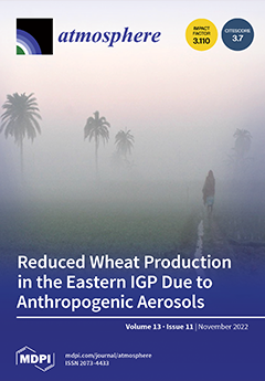
Cover Story (view full-size image): The effect of persistently high levels of anthropogenic aerosols during winter on wheat production, an important winter crop in the eastern Indo-Gangetic Plain (IGP), was studied using the Agricultural Production System Simulator (APSIM) model. The model was applied at several nodes within the eastern IGP (Nepal, India, and Bangladesh) using wheat field trial data from 2015 to 2017. The model revealed anthropogenic aerosols reduced wheat grain yield, biomass yield, and crop evapotranspiration by on average 11.2–13.5%, 21.2–22%, and 13.5–15%, respectively, during the 2015–2017 seasons at the eastern IGP sites. The modeled reduction in wheat yield represents an average reduction of more than 3.2 kg per capita per annum due to anthropogenic aerosols, which is a substantial impact on food security in the eastern IGP. View this paper
  • Issues are regarded as officially published after their release is announced to the table of contents alert mailing list.
  • You may sign up for e-mail alerts to receive table of contents of newly released issues.
  • PDF is the official format for papers published in both, html and pdf forms. To view the papers in pdf format, click on the "PDF Full-text" link, and use the free Adobe Reader to open them.
Order results
Result details
Section
Select all
Export citation of selected articles as:
15 pages, 6031 KiB  
Article
Ionospheric TEC Prediction in China Based on the Multiple-Attention LSTM Model
by Haijun Liu, Dongxing Lei, Jing Yuan, Guoming Yuan, Chunjie Cui, Yali Wang and Wei Xue
Atmosphere 2022, 13(11), 1939; https://doi.org/10.3390/atmos13111939 - 21 Nov 2022
Cited by 2 | Viewed by 1479
Abstract
The prediction of the total electron content (TEC) in the ionosphere is of great significance for satellite communication, navigation and positioning. This paper presents a multiple-attention mechanism-based LSTM (multiple-attention Long Short-Term Memory, MA-LSTM) TEC prediction model. The main achievements of this paper are [...] Read more.
The prediction of the total electron content (TEC) in the ionosphere is of great significance for satellite communication, navigation and positioning. This paper presents a multiple-attention mechanism-based LSTM (multiple-attention Long Short-Term Memory, MA-LSTM) TEC prediction model. The main achievements of this paper are as follows: (1) adding an L1 constraint to the LSTM-based TEC prediction model—an L1 constraint prevents excessive attention to the input sequence during modelling and prevents overfitting; (2) adding multiple-attention mechanism modules to the TEC prediction model. By adding three parallel attention modules, respectively, we calculated the attention value of the output vector from the LSTM layer, and calculated its attention distribution through the softmax function. Then, the vector output by each LSTM layer was weighted and summed with the corresponding attention distribution so as to highlight and focus on important features. To verify our model’s performance, eight regions located in China were selected in the European Orbit Determination Center (CODE) TEC grid dataset. In these selected areas, comparative experiments were carried out with LSTM, GRU and Att-BiGRU. The results show that our proposed MA-LSTM model is obviously superior to the comparison models. This paper also discusses the prediction effect of the model in different months. The results show that the prediction effect of the model is best in July, August and September, with the R-square reaching above 0.99. In March, April and May, the R-square is slightly low, but even at the worst time, the fitting degree between the predicted value and the real value still reaches 0.965. We also discussed the influence of a magnetic quiet period and a magnetic storm period on the prediction performance. The results show that in the magnetic quiet period, our model fit very well. In the magnetic storm period, the R-square is lower than that of the magnetic quiet period, but it can also reach 0.989. The research in this paper provides a reliable method for the short-term prediction of ionospheric TEC. Full article
(This article belongs to the Section Upper Atmosphere)
Show Figures

Figure 1

23 pages, 1538 KiB  
Article
Usage of Needle and Branches in the Applications of Bioindicator, Source Apportionment and Risk Assessment of PAHs
by Sevil Caliskan Eleren and Yücel Tasdemir
Atmosphere 2022, 13(11), 1938; https://doi.org/10.3390/atmos13111938 - 21 Nov 2022
Cited by 1 | Viewed by 1508
Abstract
Biomonitoring studies have enormous benefits providing a fruitful and cost-efficient means of measuring environmental exposure to toxic chemicals. This study collected ambient air and pine tree components, including needles and 1-year-old and 2-year-old branches, for one year. Concentrations, potential sources and temporal variations [...] Read more.
Biomonitoring studies have enormous benefits providing a fruitful and cost-efficient means of measuring environmental exposure to toxic chemicals. This study collected ambient air and pine tree components, including needles and 1-year-old and 2-year-old branches, for one year. Concentrations, potential sources and temporal variations of atmospheric polycyclic aromatic hydrocarbons (PAHs) were investigated. In general, lower concentration levels were observed in the warmer months. Ambient PAHs pose a serious public health threat and impose a need for calculating cancer risks. It was also intended to define the best tree component reflecting the ambient air PAHs. The consideration of the representative tree component minimizes the unnecessary laboratory processes and expenses in biomonitoring studies. The coefficient of divergence (COD), diagnostic ratio (DR) and principal component analysis (PCA) were employed to specify the PAH sources. As a result of the DR and PCA evaluations, the effect of the industrial area has emerged, besides the dominance of the pollutants originating from traffic and combustion. The results have shown that pine needles and branches were mainly affected by similar sources, which also influenced air concentrations. Inhalation cancer risk values were also calculated and they varied between 1.64 × 10⁻⁶ and 3.02 × 10⁻⁵. A potential risk increases in the colder season depending on the ambient air PAH concentrations. Full article
(This article belongs to the Special Issue Biomonitoring - an Effective Tool for Air Pollution Assessment)
Show Figures

Graphical abstract

15 pages, 3931 KiB  
Article
Seasonal Variations in Concentrations and Chemical Compositions of TSP near a Bulk Material Storage Site for a Steel Plant
by Yen-Yi Lee, Sheng-Lun Lin, Bo-Wun Huang, Justus Kavita Mutuku and Guo-Ping Chang-Chien
Atmosphere 2022, 13(11), 1937; https://doi.org/10.3390/atmos13111937 - 21 Nov 2022
Cited by 2 | Viewed by 1443
Abstract
The concentrations of total suspended particles (TSPs) on four buildings near a steel plant’s bulk material storage site for iron ore, coal, limestone, and sinter were evaluated for summer and winter, where the concentrations were 58 (17–55) μg m−3 and 125 (108–155) [...] Read more.
The concentrations of total suspended particles (TSPs) on four buildings near a steel plant’s bulk material storage site for iron ore, coal, limestone, and sinter were evaluated for summer and winter, where the concentrations were 58 (17–55) μg m−3 and 125 (108–155) μg m−3, respectively. A multivariate regression analysis of meteorological parameters with TSP concentrations indicates that temperature, wind speed, and frequency of rainfall are potential predictors of TSP concentrations, where the respective p values for the model are p = 0.005, p = 0.049, and p = 0.046. The strong correlation between usual co-pollutants, CO, NO2, and NOX with TSP concentrations, as indicated by the Pearson correlation values of 0.87, 0.86, and 0.77, respectively, implies substantial pollution from mobile sources. The weak correlation of SO2 with TSP concentrations rules out a significant pollution contribution from power plants. The speciation of TSPs in winter showed the percentage proportions of water-soluble ions, metal elements, and carbon content in winter as 60%, 15%, and 25%, while in summer, they were 68%, 14%, and 18%, respectively. Water-soluble ions were the most significant composition for both seasons, where the predominant species in summer and winter are SO42− and NO3, respectively. In the TSP metal elements profile, the proportion of natural origin ones exceeded those from anthropogenic sources. The health risk assessment indicates a significant cancer risk posed by chromium, while that posed by other metal elements including Co, Ni, As, and Pb are insignificant. Additionally, all metal elements’ chronic daily occupational exposure levels were below the reference doses except for Cu and Zn. Insights from this investigation can inform decisions on the design of the TSP-capturing mechanism. Specifically, water sprays to capture the water-soluble portion would substantially reduce the amplified concentrations of TSPs, especially in winter. Full article
(This article belongs to the Special Issue Air Pollution in Industrial Regions)
Show Figures

Figure 1

18 pages, 5326 KiB  
Article
Error Decomposition of CRA40-Land and ERA5-Land Reanalysis Precipitation Products over the Yongding River Basin in North China
by Ye Zhang, Yintang Wang, Lingjie Li, Leizhi Wang, Qin Wang, Yong Huang and Liping Li
Atmosphere 2022, 13(11), 1936; https://doi.org/10.3390/atmos13111936 - 21 Nov 2022
Viewed by 1193
Abstract
Long-term and high-resolution reanalysis precipitation datasets provide important support for research on climate change, hydrological forecasting, etc. The comprehensive evaluation of the error performances of the newly released ERA5-Land and CRA40-Land reanalysis precipitation datasets over the Yongding River Basin in North China was [...] Read more.
Long-term and high-resolution reanalysis precipitation datasets provide important support for research on climate change, hydrological forecasting, etc. The comprehensive evaluation of the error performances of the newly released ERA5-Land and CRA40-Land reanalysis precipitation datasets over the Yongding River Basin in North China was based on the two error decomposition schemes, namely, decomposition of the total mean square error into systematic and random errors and decomposition of the total precipitation bias into hit bias, missed precipitation, and false precipitation. Then, the error features of the two datasets and precipitation intensity and terrain effects against error features were analyzed in this study. The results indicated the following: (1) Based on the decomposition approach of systematic and random errors, the total error of ERA5-Land is generally greater than that of CRA40-Land. Additionally, the proportion of random errors was higher in summer and over mountainous areas, specifically, the ERA5-Land accounts for more than 75%, while the other was less than 70%; (2) Considering the decomposition method of hit, missed, and false bias, the total precipitation bias of ERA5-Land and CRA40-Land was consistent with the hit bias. The magnitude of missed precipitation and false precipitation was less than the hit bias. (3) When the precipitation intensity is less than 38 mm/d, the random errors of ERA5-Land and CRA40-Land are larger than the systematic error. The relationship between precipitation intensity and hit, missed, and false precipitation is complicated, for the hit bias of ERA5-L is always smaller than that of CRA40-L, and the missed precipitation and false precipitation are larger than those ofCRA40-L when the precipitation is small. The error of ERA5-Land and CRA40-Land was significantly correlated with elevation. A comprehensive understanding of the error features of the two reanalysis precipitation datasets is valuable for error correction and the construction of a multi-source fusion model with gauge-based and satellite-based precipitation datasets. Full article
(This article belongs to the Topic Advanced Research in Precipitation Measurements)
Show Figures

Figure 1

13 pages, 1124 KiB  
Article
The Relationship between Elemental Carbon and Volatile Organic Compounds in the Air of an Underground Metal Mine
by Andrzej Szczurek, Marcin Przybyła and Monika Maciejewska
Atmosphere 2022, 13(11), 1935; https://doi.org/10.3390/atmos13111935 - 21 Nov 2022
Cited by 1 | Viewed by 1469
Abstract
Elemental carbon (EC) content in air is considered a proxy for the diesel exhaust impact at workplaces. This paper examines the possibility of estimating EC content in mine air on the basis of measurements of volatile organic compounds (VOC). The measurement study was [...] Read more.
Elemental carbon (EC) content in air is considered a proxy for the diesel exhaust impact at workplaces. This paper examines the possibility of estimating EC content in mine air on the basis of measurements of volatile organic compounds (VOC). The measurement study was carried out in an underground metal mine. Gas chromatography with mass spectrometry (GC/MS) was applied for VOC determination, and thermal-optical analysis (TOA) with an FID detector was utilized for EC measurements. A correlation was found between the measurements of EC and total VOC (TVOC) as well as the content of individual hydrocarbons C12–C14 in the air of an extraction zone in the mine. A regression model was developed which predicts EC based on C12, C13, and C14, considered individually, and the remaining VOCs detected with GC/MS taken in total. The model was statistically significant (p = 0.053), and it offered an EC prediction error of RMSE = 4.60 µg/sample. The obtained result confirms the possibility of using VOC measurements for the preliminary estimation of EC concentrations in mine air. This approach is feasible given the availability of portable GC/MS and offers easy and fast measurements providing qualitative and quantitative information. Full article
(This article belongs to the Special Issue Feature Papers in Air Quality)
Show Figures

Figure 1

16 pages, 2455 KiB  
Article
Imputation of Missing PM2.5 Observations in a Network of Air Quality Monitoring Stations by a New kNN Method
by Idit Belachsen and David M. Broday
Atmosphere 2022, 13(11), 1934; https://doi.org/10.3390/atmos13111934 - 21 Nov 2022
Cited by 4 | Viewed by 2042
Abstract
Statistical analyses often require unbiased and reliable data completion. In this work, we imputed missing fine particulate matter (PM2.5) observations from eight years (2012–2019) of records in 59 air quality monitoring (AQM) stations in Israel, using no auxiliary data but the [...] Read more.
Statistical analyses often require unbiased and reliable data completion. In this work, we imputed missing fine particulate matter (PM2.5) observations from eight years (2012–2019) of records in 59 air quality monitoring (AQM) stations in Israel, using no auxiliary data but the available PM2.5 observations. This was achieved by a new k-Nearest Neighbors multivariate imputation method (wkNNr) that uses the correlations between the AQM stations’ data to weigh the distance between the observations. The model was evaluated against an iterative imputation with an Ensemble of Extremely randomized decision Trees (iiET) on artificially and randomly removed data intervals of various lengths: very short (0.5–3 h, corresponding to 1–6 missing values), short (6–24 h), medium-length (36–72 h), long (10–30 d), and very long (30 d–2 y). The new wkNNr model outperformed the iiET in imputing very short missing-data intervals when the adjacent lagging and leading observations were added as model inputs. For longer missing-data intervals, despite its simplicity and the smaller number of hyperparameters required for tuning, the new model showed an almost comparable performance to the iiET. A parallel Python implementation of the new kNN-based multivariate imputation method is available on github. Full article
(This article belongs to the Collection Measurement of Exposure to Air Pollution)
Show Figures

Figure 1

19 pages, 13159 KiB  
Article
Using Mobile Monitoring and Atmospheric Dispersion Modeling for Capturing High Spatial Air Pollutant Variability in Cities
by Grazia Fattoruso, Domenico Toscano, Antonella Cornelio, Saverio De Vito, Fabio Murena, Massimiliano Fabbricino and Girolamo Di Francia
Atmosphere 2022, 13(11), 1933; https://doi.org/10.3390/atmos13111933 - 20 Nov 2022
Cited by 2 | Viewed by 1687
Abstract
Air pollution is still one of the biggest environmental threats to human health on a global scale. In urban environments, exposure to air pollution is largely influenced by the activity patterns of the population as well as by the high spatial and temporal [...] Read more.
Air pollution is still one of the biggest environmental threats to human health on a global scale. In urban environments, exposure to air pollution is largely influenced by the activity patterns of the population as well as by the high spatial and temporal variability in air pollutant concentrations. Over the last years, several studies have attempted to better characterize the spatial variations in air pollutant concentrations within a city by deploying dense, fixed as well as mobile, low-cost sensor networks and more recently opportunistic sampling and by improving the spatial resolution of air quality models up to a few meters. The purpose of this work has been to investigate the use of properly designed mobile monitoring campaigns along the streets of an urban neighborhood to assess the capability of an operational air dispersion model as SIRANE at the district scale to capture the local variability of pollutant concentrations. To this end, an IoT ecosystem—MONICA (an Italian acronym for Cooperative Air Quality Monitoring), developed by ENEA, has been used for mobile measurements of CO and NO2 concentration in the urban area of the City of Portici (Naples, Southern Italy). By comparing the mean concentrations of CO and NO2 pollutants measured by MONICA devices and those simulated by SIRANE along the urban streets, the former appeared to exceed the simulated ones by a factor of 3 and 2 for CO and NO2, respectively. Furthermore, for each pollutant, this factor is higher within the street canyons than in open roads. However, the mobile and simulated mean concentration profiles largely adapt, although the simulated profiles appear smoother than the mobile ones. These results can be explained by the uncertainty in the estimation of vehicle emissions in SIRANE as well as the different temporal resolution of measurements of MONICA able to capture local high concentrations. Full article
(This article belongs to the Special Issue Feature Papers in Air Quality)
Show Figures

Figure 1

19 pages, 7391 KiB  
Article
The Impact of Stochastic Perturbations in Physics Variables for Predicting Surface Solar Irradiance
by Ju-Hye Kim, Pedro A. Jiménez, Manajit Sengupta, Jimy Dudhia, Jaemo Yang and Stefano Alessandrini
Atmosphere 2022, 13(11), 1932; https://doi.org/10.3390/atmos13111932 - 20 Nov 2022
Cited by 3 | Viewed by 1343
Abstract
We present a probabilistic framework tailored for solar energy applications referred to as the Weather Research and Forecasting-Solar ensemble prediction system (WRF-Solar EPS). WRF-Solar EPS has been developed by introducing stochastic perturbations into the most relevant physical variables for solar irradiance predictions. In [...] Read more.
We present a probabilistic framework tailored for solar energy applications referred to as the Weather Research and Forecasting-Solar ensemble prediction system (WRF-Solar EPS). WRF-Solar EPS has been developed by introducing stochastic perturbations into the most relevant physical variables for solar irradiance predictions. In this study, we comprehensively discuss the impact of the stochastic perturbations of WRF-Solar EPS on solar irradiance forecasting compared to a deterministic WRF-Solar prediction (WRF-Solar DET), a stochastic ensemble using the stochastic kinetic energy backscatter scheme (SKEBS), and a WRF-Solar multi-physics ensemble (WRF-Solar PHYS). The performances of the four forecasts are evaluated using irradiance retrievals from the National Solar Radiation Database (NSRDB) over the contiguous United States. We focus on the predictability of the day-ahead solar irradiance forecasts during the year of 2018. The results show that the ensemble forecasts improve the quality of the forecasts, compared to the deterministic prediction system, by accounting for the uncertainty derived by the ensemble members. However, the three ensemble systems are under-dispersive, producing unreliable and overconfident forecasts due to a lack of calibration. In particular, WRF-Solar EPS produces less optically thick clouds than the other forecasts, which explains the larger positive bias in WRF-Solar EPS (31.7 W/m2) than in the other models (22.7–23.6 W/m2). This study confirms that the WRF-Solar EPS reduced the forecast error by 7.5% in terms of the mean absolute error (MAE) compared to WRF-Solar DET, and provides in-depth comparisons of forecast abilities with the conventional scientific probabilistic approaches (i.e., SKEBS and a multi-physics ensemble). Guidelines for improving the performance of WRF-Solar EPS in the future are provided. Full article
(This article belongs to the Section Atmospheric Techniques, Instruments, and Modeling)
Show Figures

Figure 1

18 pages, 5780 KiB  
Article
Effective Moisture Evolution since the Last Glacial Maximum Revealed by a Loess Record from the Westerlies-Dominated Ili Basin, NW China
by Yudong Li, Yue Li, Yougui Song, Haoru Wei, Yanping Wang and Nosir Shukurov
Atmosphere 2022, 13(11), 1931; https://doi.org/10.3390/atmos13111931 - 19 Nov 2022
Cited by 2 | Viewed by 1841
Abstract
Moisture variation is extremely relevant for the stability of ecosystems in Central Asia (CA). Therefore, moisture evolution and its potential driving mechanism over the region are always a hot research topic. Although much effort has been devoted to understanding the processes of moisture [...] Read more.
Moisture variation is extremely relevant for the stability of ecosystems in Central Asia (CA). Therefore, moisture evolution and its potential driving mechanism over the region are always a hot research topic. Although much effort has been devoted to understanding the processes of moisture evolutions in CA during the Quaternary, particularly the Holocene, the associated underlying mechanisms remain in a state of persistent debate. In this study, the granulometry, clay mineral and chroma properties of a loess section (named ZSP section) in the westerlies-dominated Ili Basin, NW China are investigated. With the accelerator mass spectrometry radiocarbon dating (AMS 14C)-based Bayesian age–depth model, we provide a sensitive record of effective moisture evolution since the last glacial maximum (LGM) in the basin, and the results help enhance understanding of the possible driving mechanisms for westerly climate change. Comparisons of clay mineralogy indices shows that the study area is involved in the Northern Hemisphere dust cycle processes as a dust source, and the content of <2 μm grain size fraction in the ZSP section can thereby be used to reflect the westerlies’ intensity. After deducting the complicated influencing factors for lightness changes throughout the section, the calibrated lightness is adopted to indicate the regional effective moisture. Our findings show that effective moisture is relatively abundant during the LGM and the middle–late Holocene, with dry climate conditions during the last deglaciation and early Holocene. We argue that westerlies’ intensity was the main factor for driving the effective moisture evolution in the Ili Basin since the LGM. Local and source evaporation intensity and effective intra-annual control time of the westerlies over the study area exerted a minor influence on the moisture changes. Full article
(This article belongs to the Special Issue Quaternary Westerlies and Monsoon Interaction in Asia)
Show Figures

Figure 1

17 pages, 6789 KiB  
Article
Black Carbon Personal Exposure during Commuting in the Metropolis of Karachi
by Javeria Javed, Erum Zahir, Haider Abbas Khwaja, Muhammad Kamran Khan and Saiyada Shadiah Masood
Atmosphere 2022, 13(11), 1930; https://doi.org/10.3390/atmos13111930 - 19 Nov 2022
Viewed by 1641
Abstract
Black carbon (BC) exposure and inhalation dose of a commuter using four traffic modes (car, bus, auto-rickshaw, and motorbike) were monitored in Karachi, Pakistan. The real-time exposure concentrations in office-peak and off-peak hours were recorded during the winter season using microAeth® AE51 [...] Read more.
Black carbon (BC) exposure and inhalation dose of a commuter using four traffic modes (car, bus, auto-rickshaw, and motorbike) were monitored in Karachi, Pakistan. The real-time exposure concentrations in office-peak and off-peak hours were recorded during the winter season using microAeth® AE51 BC monitors. Exposure concentrations were higher in peak hours and were reduced to half in the off-peak time. The inclination levels of the inhaled dose were similar, and this trend was observed with all four modes of commute. The motorbike was found to be the most exposed mode of transportation, followed by auto-rickshaws, cars, and buses, respectively. However, the order was reversed when accounting for inhaled doses, e.g., the inhalation dose for auto rickshaws was highest, followed by the bus, motorbike, and car, respectively. Spatiotemporal analysis reveals that driving roads with lower traffic intensity and fewer intersections resulted in lower exposures. Therefore, traffic intensity, road topology, the timing of the trip, and the degree of urbanization were found to be the major influences for in-vehicle BC exposure. Full article
(This article belongs to the Section Air Quality and Human Health)
Show Figures

Figure 1

17 pages, 4664 KiB  
Article
Using Neural Network NO2-Predictions to Understand Air Quality Changes in Urban Areas—A Case Study in Hamburg
by Anne-Sophie Jesemann, Volker Matthias, Jürgen Böhner and Benjamin Bechtel
Atmosphere 2022, 13(11), 1929; https://doi.org/10.3390/atmos13111929 - 19 Nov 2022
Cited by 2 | Viewed by 1808
Abstract
Due to the link between air pollutants and human health, reliable model estimates of hourly pollutant concentrations are of particular interest. Artificial neural networks (ANNs) are powerful modeling tools capable of reproducing the observed variations in pollutants with high accuracy. We present a [...] Read more.
Due to the link between air pollutants and human health, reliable model estimates of hourly pollutant concentrations are of particular interest. Artificial neural networks (ANNs) are powerful modeling tools capable of reproducing the observed variations in pollutants with high accuracy. We present a simple ANN for the city of Hamburg that estimated the hourly NO2 concentration. The model was trained with a ten-year dataset (2007–2016), tested for the year 2017, and then applied to assess the efficiency of countermeasures against air pollution implemented since 2018. Using both meteorological data and describing the weekday dependent traffic variabilities as predictors, the model performed accurately and showed high consistency over the test data. This proved to be very efficient in detecting anomalies in the time series. The further the prediction was from the time of the training data, the more the modeled data deviated from the measured data. Using the model, we could detect changes in the time series that did not follow previous trends in the training data. The largest deviation occurred during the COVID-19 lockdown in 2020, when traffic volumes decreased significantly. Concluding our case study, the ANN based approach proved suitable for modeling the NO2 concentrations and allowed for the assessment of the efficiency of policy measures addressing air pollution. Full article
(This article belongs to the Special Issue Air Quality Impacts of Vehicle Emissions)
Show Figures

Figure 1

25 pages, 4036 KiB  
Article
Footprints of COVID-19 on Pollution in Southern Spain
by Eszter Wirth, Manuel Alejandro Betancourt-Odio, Macarena Cabeza-García and Ana Zapatero-González
Atmosphere 2022, 13(11), 1928; https://doi.org/10.3390/atmos13111928 - 19 Nov 2022
Cited by 2 | Viewed by 1982
Abstract
Background: Many annual deaths in Spain could be avoided if pollution levels were reduced. Every year, several municipalities in the Community of Andalusia, located in southern Spain, exceed the acceptable levels of atmospheric pollution. In this sense, the evolution of primary air pollutants [...] Read more.
Background: Many annual deaths in Spain could be avoided if pollution levels were reduced. Every year, several municipalities in the Community of Andalusia, located in southern Spain, exceed the acceptable levels of atmospheric pollution. In this sense, the evolution of primary air pollutants during the March–June 2020 lockdown can be taken as reliable evidence to analyze the effectiveness of potential air quality regulations. Data and Method: Using a multivariate linear regression model, this paper assesses the levels of NO2, O3, and PM10 in Andalusia within the 2017–2020 period, relating these representative indices of air quality with lockdown stages during the pandemic and considering control variables such as climatology, weekends, or the intrusion of Saharan dust. To reveal patterns at a local level between geographic zones, a spatial analysis was performed. Results: The results show that the COVID-19 lockdown had a heterogeneous effect on the analyzed pollutants within Andalusia’s geographical regions. In general terms, NO2 and PM10 concentrations decreased in the main metropolitan areas and the industrial districts of Huelva and the Strait of Gibraltar. At the same time, O3 levels rose in high-temperature regions of Cordoba and Malaga. Full article
(This article belongs to the Special Issue Air Quality in Spain and the Iberian Peninsula)
Show Figures

Figure 1

19 pages, 3637 KiB  
Article
Actual Evapotranspiration Estimation Using Sentinel-1 SAR and Sentinel-3 SLSTR Data Combined with a Gradient Boosting Machine Model in Busia County, Western Kenya
by Peter K. Musyimi, Ghada Sahbeni, Gábor Timár, Tamás Weidinger and Balázs Székely
Atmosphere 2022, 13(11), 1927; https://doi.org/10.3390/atmos13111927 - 18 Nov 2022
Cited by 2 | Viewed by 2374
Abstract
Kenya is dominated by a rainfed agricultural economy. Recurrent droughts influence food security. Remotely sensed data can provide high-resolution results when coupled with a suitable machine learning algorithm. Sentinel-1 SAR and Sentinel-3 SLSTR sensors can provide the fundamental characteristics for actual evapotranspiration (AET) [...] Read more.
Kenya is dominated by a rainfed agricultural economy. Recurrent droughts influence food security. Remotely sensed data can provide high-resolution results when coupled with a suitable machine learning algorithm. Sentinel-1 SAR and Sentinel-3 SLSTR sensors can provide the fundamental characteristics for actual evapotranspiration (AET) estimation. This study aimed to estimate the actual monthly evapotranspiration in Busia County in Western Kenya using Sentinel-1 SAR and Sentinel-3 SLSTR data with the application of the gradient boosting machine (GBM) model. The descriptive analysis provided by the model showed that the estimated mean, minimum, and maximum AET values were 116, 70, and 151 mm/month, respectively. The model performance was assessed using the correlation coefficient (r) and root mean square error (RMSE). The results revealed a correlation coefficient of 0.81 and an RMSE of 10.7 mm for the training dataset (80%), and a correlation coefficient of 0.47 and an RMSE of 14.1 mm for the testing data (20%). The results are of great importance scientifically, as they are a conduit for exploring alternative methodologies in areas with scarce meteorological data. The study proves the efficiency of high-resolution data retrieved from Sentinel sensors coupled with machine learning algorithms, focusing on GBM as an alternative to accurately estimate AET. However, the optimal solution would be to obtain direct evapotranspiration measurements. Full article
Show Figures

Figure 1

13 pages, 4101 KiB  
Article
Towards a Healthy Car: UVC LEDs in an Automobile’s HVAC Demonstrates Effective Disinfection of Cabin Air
by Richard M. Mariita, James H. Davis, Michelle M. Lottridge, Rajul V. Randive, Hauke Witting and Johannes Yu
Atmosphere 2022, 13(11), 1926; https://doi.org/10.3390/atmos13111926 - 18 Nov 2022
Cited by 2 | Viewed by 1644
Abstract
Vehicle Heating, ventilation, and air conditioning (HVAC) systems can accumulate and recirculate highly infectious respiratory diseases via aerosols. Integrating Ultraviolet Subtype C (UVC) light-emitting diodes (LEDs) to complement automobile HVAC systems can protect occupants from developing allergies, experiencing inflammatory problems, or acquiring respiratory [...] Read more.
Vehicle Heating, ventilation, and air conditioning (HVAC) systems can accumulate and recirculate highly infectious respiratory diseases via aerosols. Integrating Ultraviolet Subtype C (UVC) light-emitting diodes (LEDs) to complement automobile HVAC systems can protect occupants from developing allergies, experiencing inflammatory problems, or acquiring respiratory infectious diseases by inactivating pathogenic organisms. UVC can add little to no static pressure with minimal space, unlike mercury lamps which are larger and heavier. Additionally, UVC LEDs are effective at low voltage and have no mercury or glass. While previous experiments have shown UVC LED technology can reduce bacteriophage Phi6 concentrations by 1 log in 5 min (selected as the average time to clean the cabin air), those studies had not positioned LED within the HVAC itself or studied the susceptibility of the surrogate at the specific wavelength. This study aimed to assess the disinfection performance of UVC LEDs in automotive HVAC systems and determine the dose–response curve for bacteriophage Phi6, a SARS-CoV-2 surrogate. To achieve this, UVC LEDs were installed in a car HVAC system. To determine inactivation efficacy, a model chamber of 3.5 m3, replicating the typical volume of a car, containing the modified automobile HVAC system was filled with bacteriophage Phi6, and the HVAC was turned on with and without the UVC LEDs being turned on. The results revealed that HVAC complemented with UVC reduced bacteriophage Phi6 levels significantly more than the HVAC alone and reduced the viral concentration in the cabin by more than 90% viral reduction in less than 5 min. The performance after 5 min is expected to be significantly better against SARS-CoV-2 because of its higher sensitivity to UVC, especially at lower wavelengths (below 270 nm). HVAC alone could not achieve a 90% viral reduction of bacteriophage Phi6 in 15 min. Applying UVC LEDs inside an HVAC system is an effective means of quickly reducing the number of aerosolized viral particles in the chamber, by inactivating microorganisms leading to improved cabin air quality. Full article
(This article belongs to the Special Issue Science and Technology of Indoor and Outdoor Environment)
Show Figures

Figure 1

16 pages, 1586 KiB  
Communication
Thoughts about the Thermal Environment and the Development of Human Civilisation
by Ioannis Charalampopoulos and Andreas Matzarakis
Atmosphere 2022, 13(11), 1925; https://doi.org/10.3390/atmos13111925 - 18 Nov 2022
Cited by 3 | Viewed by 2025
Abstract
Thermal conditions are the most challenging factors in studying human biometeorology, indoor and outdoor design, and adaptation to climate change. The thermal environment is always present and shapes everyday life, behaviours, and the natural and artificial environment. In this paper, we analyse some [...] Read more.
Thermal conditions are the most challenging factors in studying human biometeorology, indoor and outdoor design, and adaptation to climate change. The thermal environment is always present and shapes everyday life, behaviours, and the natural and artificial environment. In this paper, we analyse some thoughts that link thermal perception to the roots of human civilisation. Following the narrative thread of mythology and the history of religions, there are direct and indirect references to the thermal environment everywhere. The thermal environment may be a part of the core of human culture. Full article
(This article belongs to the Section Biometeorology)
Show Figures

Figure 1

14 pages, 5319 KiB  
Article
Methodology for Virtual Prediction of Vehicle-Related Particle Emissions and Their Influence on Ambient PM10 in an Urban Environment
by Toni Feißel, Florian Büchner, Miles Kunze, Jonas Rost, Valentin Ivanov, Klaus Augsburg, David Hesse and Sebastian Gramstat
Atmosphere 2022, 13(11), 1924; https://doi.org/10.3390/atmos13111924 - 18 Nov 2022
Cited by 3 | Viewed by 2191
Abstract
As a result of rising environmental awareness, vehicle-related emissions such as particulate matter are subject to increasing criticism. The air pollution in urban areas is especially linked to health risks. The connection between vehicle-related particle emissions and ambient air quality is highly complex. [...] Read more.
As a result of rising environmental awareness, vehicle-related emissions such as particulate matter are subject to increasing criticism. The air pollution in urban areas is especially linked to health risks. The connection between vehicle-related particle emissions and ambient air quality is highly complex. Therefore, a methodology is presented to evaluate the influence of different vehicle-related sources such as exhaust particles, brake wear and tire and road wear particles (TRWP) on ambient particulate matter (PM). In a first step, particle measurements were conducted based on field trials with an instrumented vehicle to determine the main influence parameters for each emission source. Afterwards, a simplified approach for a qualitative prediction of vehicle-related particle emissions is derived. In a next step, a virtual inner-city scenario is set up. This includes a vehicle simulation environment for predicting the local emission hot spots as well as a computational fluid dynamics model (CFD) to account for particle dispersion in the environment. This methodology allows for the investigation of emissions pathways from the point of generation up to the point of their emission potential. Full article
(This article belongs to the Special Issue Non-exhaust particle emissions from vehicles)
Show Figures

Figure 1

17 pages, 7001 KiB  
Article
Analysis of the Spatial–Temporal Distribution Characteristics of NO2 and Their Influencing Factors in the Yangtze River Delta Based on Sentinel-5P Satellite Data
by Xiaohui Guo, Zhen Zhang, Zongcai Cai, Leilei Wang, Zhengnan Gu, Yangyang Xu and Jinbiao Zhao
Atmosphere 2022, 13(11), 1923; https://doi.org/10.3390/atmos13111923 - 18 Nov 2022
Cited by 1 | Viewed by 1638
Abstract
The recent rapid economic development in the Yangtze River Delta (YRD) has led to atmospheric destruction; therefore, it is imperative to solve the issue of atmospheric environmental pollution to ensure stable long-term development. Based on the NO2 column concentration observed by the [...] Read more.
The recent rapid economic development in the Yangtze River Delta (YRD) has led to atmospheric destruction; therefore, it is imperative to solve the issue of atmospheric environmental pollution to ensure stable long-term development. Based on the NO2 column concentration observed by the TROPOMI (a tropospheric monitoring instrument) on the Sentinel-5P, the spatial–temporal distribution characteristics of the NO2 column concentration in the YRD from 2019 to 2020 were analyzed using the Google Earth Engine (GEE) platform, and the Geographical Detector (Geodetector) model was used to determine the driving factors of the NO2 column concentration. The results show that the correlation between the NO2 column concentration and the ground-monitored NO2 concentrations reached 70%. The annual variation trend of the NO2 column concentration exhibited a ‘U’-shaped curve, with the characteristics of ‘high in winter and low in summer, with a transition between spring and autumn’. It exhibited obvious agglomeration characteristics in terms of the spatial distribution, with a high-value agglomeration in the central region of the YRD, followed by the northern region, and a low-value agglomeration in the southern region, with higher altitudes. The change in the NO2 column concentration in the YRD was affected by both physical geographical factors and socio-economic factors; it is clear that the influence of socio-economic factors has increased. Full article
(This article belongs to the Special Issue Feature Papers in Air Quality)
Show Figures

Figure 1

19 pages, 5369 KiB  
Article
Spatial-Temporal Variations of Extreme Precipitation Characteristics and Its Correlation with El Niño-Southern Oscillation during 1960–2019 in Hubei Province, China
by Weizheng Wang, Huiya Tang, Jinping Li and Yukun Hou
Atmosphere 2022, 13(11), 1922; https://doi.org/10.3390/atmos13111922 - 18 Nov 2022
Cited by 2 | Viewed by 1460
Abstract
Extreme precipitation could result in many disasters, such as floods, drought, and soil erosion, further bringing severe economic loss. Based on the daily precipitation records during 1960–2019 of 26 stations obtained from the National Meteorological Science Data Center of China, 10 extreme precipitation [...] Read more.
Extreme precipitation could result in many disasters, such as floods, drought, and soil erosion, further bringing severe economic loss. Based on the daily precipitation records during 1960–2019 of 26 stations obtained from the National Meteorological Science Data Center of China, 10 extreme precipitation indices (EPIs: annual total precipitation (PRCPTOT), max-1-day precipitation amount (RX1day), max-5-day precipitation amount (RX5day), number of heavy rain days (R10), number of very heavy rain days (R10), simple daily intensity index (SDII), consecutive dry days (CDD), continued wet days (CWD), very wet days (R95p) and extremely wet days (R99p)) were chosen and used to analyze the spatial-temporal variation of extreme precipitation within Hubei province, China, which is an important industrial and agricultural base in China. Finally, the correlation between El Niño-Southern Oscillation and EPIs was analyzed by cross-wavelet analysis. Results showed that the annual EPIs varied obviously during 1960–2019, and CWD decreased significantly (p < 0.05). The chosen EPIs were higher in eastern and southwestern Hubei compared to other regions, and RX1day, RX5day, R95p, and R99p were increased in most regions. The spatial-temporal variations of spring and summer EPIs were more obvious than those on an annual scale. In summer, all EPIs except CDD should increase in the near future. More attention should be paid to Wuhan, Enshi, and Macheng, where the RX1day, RX5day, R95p, and R99p will increase in these regions. Finally, the RX1day and R10 were positively correlated with MEI (p < 0.05), while the RX5day, CDD, CWD, and R99p were negatively correlated with MEI (p < 0.05). The extreme precipitation events within Hubei were affected by the El Niño-Southern Oscillation. The results could provide a possible driving factor for precipitation prediction and natural hazard prevention within Hubei province, China. Full article
(This article belongs to the Section Meteorology)
Show Figures

Figure 1

19 pages, 10475 KiB  
Article
Extreme Value Analysis of NOx Air Pollution in the Winter Seaport of Varna
by Yordan Garbatov, Petar Georgiev and Ivet Fuchedzhieva
Atmosphere 2022, 13(11), 1921; https://doi.org/10.3390/atmos13111921 - 18 Nov 2022
Cited by 3 | Viewed by 1460
Abstract
The work studies extreme pollution events and their return period in the winter seaport of Varna, providing information for decision-makers, government agencies and civil society on how the intensity of shipping traffic may impact the air pollution in the vicinity of the port. [...] Read more.
The work studies extreme pollution events and their return period in the winter seaport of Varna, providing information for decision-makers, government agencies and civil society on how the intensity of shipping traffic may impact the air pollution in the vicinity of the port. Extreme value analysis employing the Weibull distribution is applied to investigate air pollution and the probability of higher concentrations of oxides of nitrogen (NOx) generated by ships while queuing in the winter seaport. Potential cleaning of the air pollution generated by the anchored ships is introduced to meet the acceptable level of air pollution concentrations in coastal zones. The employed ship pollution cleaning and overall ship service costs are minimised to satisfy cleaner environmental conditions. The developed approach is adopted to analyse the air pollution of a port without a monitoring system to control and prevent pollution and with limited information on ship traffic and air pollution. Full article
Show Figures

Figure 1

15 pages, 16099 KiB  
Article
Atmosphere Critical Processes Sensing with ACP
by Sergey Pulinets and Pavel Budnikov
Atmosphere 2022, 13(11), 1920; https://doi.org/10.3390/atmos13111920 - 18 Nov 2022
Cited by 3 | Viewed by 1375
Abstract
This manuscript intends to demonstrate the diagnostic value of the previously discussed integrated parameter called atmospheric chemical potential (ACP) for tracking the atmospheric anomalies before strong earthquakes generated by the chain of processes initiated by air ionization due to radon emanation from the [...] Read more.
This manuscript intends to demonstrate the diagnostic value of the previously discussed integrated parameter called atmospheric chemical potential (ACP) for tracking the atmospheric anomalies before strong earthquakes generated by the chain of processes initiated by air ionization due to radon emanation from the Earth’s crust. For this purpose, we considered several kinds of critical processes in the atmosphere using the ACP as an indicator and diagnostic tool: hurricane dynamics, the effects of radioactive pollution (the Chernobyl NPP accident), volcano eruptions and pre-earthquake atmospheric anomalies. We established that in all cases, some unusual features of the studied critical processes were revealed to be invisible when using certain methods of monitoring. This means that the application of ACP may improve the operative monitoring of the critical processes in atmosphere. In the cases of volcano eruptions and earthquakes, ACP can be used for short-term forecast. Full article
(This article belongs to the Section Meteorology)
Show Figures

Figure 1

18 pages, 3964 KiB  
Article
Ultra-Fine Particle Emissions Characterization and Reduction Technologies in a NG Heavy Duty Engine
by Pierpaolo Napolitano, Davide Di Domenico, Dario Di Maio, Chiara Guido and Stefano Golini
Atmosphere 2022, 13(11), 1919; https://doi.org/10.3390/atmos13111919 - 18 Nov 2022
Cited by 4 | Viewed by 2053
Abstract
This paper describes some strategies to deal with the arduous challenge of reducing emissions from the transport sector. Two different approaches in particle emissions reduction from natural gas (NG) heavy duty (HD) engines were evaluated. The focus was on reducing the ultra-fine sub [...] Read more.
This paper describes some strategies to deal with the arduous challenge of reducing emissions from the transport sector. Two different approaches in particle emissions reduction from natural gas (NG) heavy duty (HD) engines were evaluated. The focus was on reducing the ultra-fine sub 23 nm particles, a key aspect in the vehicles’ impact on human health and environment. To this end, an experimental research activity was carried out on a NG HD engine that was EURO VI regulation compliant. Lubricant oils characterized by different base compositions and ash contents were compared to provide a preferred path to develop formulations. The performed activity on world harmonized transient cycles (WHTCs) have demonstrated a high reduction potential (≈70%) that is reachable by acting on the lube formulation. A CNG particle filter (CPF), derived from the diesel and gasoline engines technology, was fully characterized in terms of its filtration efficiency. Three different types of tests were carried out: steady state, WHTCs, and several idle-to-load step maneuvers. The CPF was highly efficient in reducing solid particles over 10 nm diameter in all the different tests. During WHTCs, the mean abatement efficiency was about 85%. Both technologies provide interesting insights to make NG HD engines compliant with the upcoming Euro VII regulation. Full article
(This article belongs to the Special Issue Vehicle Emissions: New Challenges and Potential Solutions)
Show Figures

Figure 1

11 pages, 32671 KiB  
Article
Evaluation of Outdoor Environment PM10 Concentration in an Organized Industrial Zone Using Geographical Information System
by Fatma Kunt and Şükran Erdoğan
Atmosphere 2022, 13(11), 1918; https://doi.org/10.3390/atmos13111918 - 17 Nov 2022
Viewed by 1180
Abstract
Air pollution adversely affects human health, visibility distance, materials, plants and animal health. Air pollution’s impact on human health arises from inhaling high amounts of harmful substances in the atmosphere. Notably, our understanding of the damage caused by PM10 pollutants is improving [...] Read more.
Air pollution adversely affects human health, visibility distance, materials, plants and animal health. Air pollution’s impact on human health arises from inhaling high amounts of harmful substances in the atmosphere. Notably, our understanding of the damage caused by PM10 pollutants is improving daily. This study aims to measure and analyze PM10 pollution in the Konya Organized Industrial Zone at certain times and places. Measurements were taken at twenty-four locations in the morning, noon and evening hours. The results were compared with the Turkish Air Quality Assessment and Management Regulation, and pollution maps of the regions were created with Surfer Software and ArcGIS 10.1 programs. With the measurements, it was observed that the times at which the limit was exceeded were mainly the evening hours. While no limit exceedance was recorded in the morning hours, the average concentration value was observed once in those hours, and around noon the maximum value was observed five times. In this study, we correlated the measurement results, the values of the measurement points located in the city center and the average number of vehicles passing through the region. It was observed that the PM10 -induced air pollution in the Konya Organized Industrial Zone was caused by dense traffic during evening hours. To prevent traffic-related pollution in the region, it is recommended to increase the number of entrance and exit gates in the industrial zone and to plant trees in appropriate sections. Full article
(This article belongs to the Special Issue Industrial Air Pollution: Emission, Management and Policy)
Show Figures

Figure 1

12 pages, 2688 KiB  
Article
Effects of Outdoor Air Pollutants on Indoor Environment Due to Natural Ventilation
by Ayame Tamuro, Ryoichi Kuwahara and Hyuntae Kim
Atmosphere 2022, 13(11), 1917; https://doi.org/10.3390/atmos13111917 - 17 Nov 2022
Cited by 3 | Viewed by 1270
Abstract
This study measured ventilation volumes and particle concentrations in indoor environments with open windows and doors. In addition, the effect of the airflow mode of the air conditioner on the ventilation volume and indoor particle concentration variations was also measured. The ventilation fan [...] Read more.
This study measured ventilation volumes and particle concentrations in indoor environments with open windows and doors. In addition, the effect of the airflow mode of the air conditioner on the ventilation volume and indoor particle concentration variations was also measured. The ventilation fan could only provide approximately 43% of the ventilation volume during the design phase. The amount of ventilation differed depending on the opening area in windows and doors. The ventilation volume was increased by opening multiple windows or doors, even when the area of the opening was the same. No significant change in the ventilation rate was observed, although the air conditioner was expected to promote the ventilation rate in the room when set on blow mode. It was confirmed that both 0.3 and 1 μm particles could enter through the gaps around the windows and doors. Although most of the 5 μm particles were from the outdoor air, when the air conditioner was operated in airflow mode, the removal of 5 μm particles was performed by the air conditioner filter. The use of medium-performance or HEPA filters is expected to remove smaller particulates. Full article
(This article belongs to the Special Issue Science and Technology of Indoor and Outdoor Environment)
Show Figures

Figure 1

25 pages, 9547 KiB  
Article
Quantifying a Reliable Framework to Estimate Hydro-Climatic Conditions via a Three-Way Interaction between Land Surface Temperature, Evapotranspiration, Soil Moisture
by Mercedeh Taheri, Milad Shamsi Anboohi, Mohsen Nasseri, Mostafa Bigdeli and Abdolmajid Mohammadian
Atmosphere 2022, 13(11), 1916; https://doi.org/10.3390/atmos13111916 - 17 Nov 2022
Cited by 3 | Viewed by 1124
Abstract
Distributed hydrological models can be suitable choices for predicting the spatial distribution of water and energy fluxes if the conceptual relationships between the components are defined appropriately. Therefore, an innovative approach has been developed using a simultaneous formulation of bulk heat transfer theory, [...] Read more.
Distributed hydrological models can be suitable choices for predicting the spatial distribution of water and energy fluxes if the conceptual relationships between the components are defined appropriately. Therefore, an innovative approach has been developed using a simultaneous formulation of bulk heat transfer theory, energy budgeting, and water balance as an integrated hydrological model, i.e., the Monthly Continuous Semi-Distributed Energy Water Balance (MCSD-EWB) model, to estimate land surface hydrological components. The connection between water and energy balances is established by evapotranspiration (ET), which is a function of soil moisture and land surface temperature (LST). Thus, the developed structure is based on a three-way coupling between ET, soil moisture, and LST. The LST is obtained via the direct solution of the energy balance equation, and the spatiotemporal distribution of ET is presented using the computed LST and soil moisture through the bulk transfer method and water balance. In addition to the LST computed using the MCSD-EWB model, the LST products of ERA5-Land and MODIS are also utilized as inputs. The results indicate the adequate performance of the model in simulating LST, ET, streamflow, and groundwater level. Furthermore, the developed model performs better by employing the ERA5-Land LST than by using the MODIS LST in estimating the components. Full article
(This article belongs to the Special Issue Land Surface Temperature Retrieval Using Satellite Remote Sensing)
Show Figures

Figure 1

14 pages, 5226 KiB  
Article
On the Successiveness of the Two Extreme Cold Events in China during the 2020/21 Winter According to Cold Air Trajectories
by Leying Zhang, Shuxiu Hou and Zuowei Xie
Atmosphere 2022, 13(11), 1915; https://doi.org/10.3390/atmos13111915 - 17 Nov 2022
Cited by 1 | Viewed by 1278
Abstract
Two extreme cold air events successively hit China during 28–31 December 2020 (the late 2020 event) and during 6–8 January 2021 (the early 2021 event), which caused great losses. These two events have received extensive attention in relation to synoptic weather systems and [...] Read more.
Two extreme cold air events successively hit China during 28–31 December 2020 (the late 2020 event) and during 6–8 January 2021 (the early 2021 event), which caused great losses. These two events have received extensive attention in relation to synoptic weather systems and remote forcing. Although it has been noted that a near-surface cool condition can greatly impact tropospheric circulation, its role in the successiveness of two such extreme cold waves remains unclear. This study focused on cold air pathways from the Lagrangian perspective, and explored the potential influence of cold air over the key region in terms of connecting the two cold events using a piecewise potential vorticity inversion. With the obtained results, three cold air sources with three corresponding air routes were identified in the two cold events. The northern pathway dominated the late 2020 event, in which the cold air intruded from the eastern Laptev Sea and moved southward to China. In contrast, the early 2021 event was mainly associated with the northwestern pathway in which the cold air came from the Ural Mountains and moved clockwise. Notably, cold air traveling along the western route from western Lake Balkhash arrived at the north of the Tianshan Mountains earlier and amplified the positive height anomaly in situ. Moreover, such an enhanced positive height anomaly moved the direction of the cold air from the northern and northwestern routes southward and thus played a key role in the successiveness of the two extreme cold events. Full article
(This article belongs to the Special Issue Characteristics and Attribution of Air Temperature Variability)
Show Figures

Figure 1

17 pages, 4087 KiB  
Article
Investigation of Waves Generated by Tropical Cyclone Kyarr in the Arabian Sea: An Application of ERA5 Reanalysis Wind Data
by Aliasghar Golshani, Masoud Banan-Dallalian, Mehrdad Shokatian-Beiragh, Majid Samiee-Zenoozian and Shahab Sadeghi-Esfahlani
Atmosphere 2022, 13(11), 1914; https://doi.org/10.3390/atmos13111914 - 17 Nov 2022
Cited by 7 | Viewed by 2944
Abstract
In this study, the wave conditions in the Arabian Sea induced by tropical cyclone Kyarr (2019) have been simulated by employing the 3rd generation wave model MIKE 21 SW. The model was run from 24 October to 1 November 2019, a total of [...] Read more.
In this study, the wave conditions in the Arabian Sea induced by tropical cyclone Kyarr (2019) have been simulated by employing the 3rd generation wave model MIKE 21 SW. The model was run from 24 October to 1 November 2019, a total of 8 days. The MIKE 21 SW model was forced by reanalyzed ERA5 wind data from the European Centre for Medium-Range Weather Forecasts (ECMWF). The results are compared with buoy data from the Indian National Centre for Ocean Information Services (INCOIS), which is located at 67.44° E, 18.50° N. In addition, the satellite altimeter data (CryoSat-2, SARAL and Jason-3 satellite altimeter data) was utilized for validation. Three wave parameters are considered for the validation: the significant wave height; the peak wave period; and the mean wave direction. The validation results showed that the significant wave height, the peak wave period, and the mean wave direction could be reasonably predicted by the model with reanalysis wind data as input. The maximum significant wave height reached to 10.7 m (with an associated peak wave period of 12.5 s) on 28 October 2019 at 23:00:00 in the middle of the Arabian Sea. For coastal areas, the significant wave height along the Iran and Pakistan (north Arabian Sea) coasts increased to a range of 1.4–2.8 m when tropical cyclone Kyarr moved northward. This wave height along with elevated sea level may cause severe coastal erosion and nearshore inland flooding. Impacts of cyclones on coastal zones critical facilities and infrastructure can be reduced by timely and suitable action before the event, so coastal managers should understand the effect of cyclones and their destructive consequences. The validated model developed in this study may be utilized as input data of evaluating the risk to life and infrastructure in this area. Full article
Show Figures

Figure 1

17 pages, 3917 KiB  
Article
Direct Detection of Severe Biomass Burning Aerosols from Satellite Data
by Makiko Nakata, Sonoyo Mukai and Toshiyuki Fujito
Atmosphere 2022, 13(11), 1913; https://doi.org/10.3390/atmos13111913 - 17 Nov 2022
Cited by 4 | Viewed by 1367
Abstract
The boundary between high-concentration aerosols (haze) and clouds is ambiguous and the mixing of aerosols and clouds is complex in terms of composition and structure. In particular, the contribution of biomass burning aerosols (BBAs) to global warming is a source of uncertainty in [...] Read more.
The boundary between high-concentration aerosols (haze) and clouds is ambiguous and the mixing of aerosols and clouds is complex in terms of composition and structure. In particular, the contribution of biomass burning aerosols (BBAs) to global warming is a source of uncertainty in the global radiation budget. In a previous study, we proposed a method to detect absorption aerosols such as BBAs and dust using a simple indicator based on the ratio of violet to near-ultraviolet wavelengths from the Global Change Observation Mission-Climate/Second-Generation Global Imager (GCOM-C/SGLI) satellite data. This study adds newly obtained SGLI data and proposes a method for the direct detection of severe biomass burning aerosols (SBBAs). Moreover, polarization data derived from polarization remote sensing was incorporated to improve the detection accuracy. This is possible because the SGLI is a multi-wavelength sensor consisting of 19 channels from 380 nm in the near-ultraviolet to thermal infrared, including red (674 nm) and near-infrared (869 nm) polarization channels. This method demonstrated fast SBBA detection directly from satellite data by using two types of wavelength ratio indices that take advantage of the characteristics of the SGLI data. The SBBA detection algorithm derived from the SGLI observation data was validated by using the polarized reflectance calculated by radiative transfer simulations and a regional numerical model—scalable computing for advanced library and environment (SCALE). Our algorithm can be applied to the detection of dust storms and high-concentration air pollution particles, and identifying the type of high-concentration aerosol facilitates the subsequent detailed characterization of the aerosol. This work demonstrates the usefulness of polarization remote sensing beyond the SGLI data. Full article
(This article belongs to the Special Issue Satellite Remote Sensing Applied in Atmosphere)
Show Figures

Figure 1

4 pages, 188 KiB  
Editorial
Atmospheric and Ocean Optics: Atmospheric Physics III
by Oleg A. Romanovskii and Olga V. Kharchenko
Atmosphere 2022, 13(11), 1912; https://doi.org/10.3390/atmos13111912 - 17 Nov 2022
Cited by 3 | Viewed by 998
Abstract
This Special Issue aimed to collect novel papers presented at the 27th International Conference on “Atmospheric and Ocean Optics: Atmospheric Physics” (AOO—21) held from 5 to 9 July 2021 in Moscow, Russia [...] Full article
(This article belongs to the Special Issue Atmospheric and Ocean Optics: Atmospheric Physics III)
19 pages, 3602 KiB  
Article
Seasonal Characteristics of Atmospheric PM2.5 in an Urban Area of Vietnam and the Influence of Regional Fire Activities
by Quang Trung Bui, Duc Luong Nguyen and Thi Hieu Bui
Atmosphere 2022, 13(11), 1911; https://doi.org/10.3390/atmos13111911 - 16 Nov 2022
Cited by 1 | Viewed by 2169
Abstract
This study investigated the seasonal variation and chemical characteristics of atmospheric PM2.5 at an urban site in Hanoi City of Vietnam in summer (July 2020) and winter (January 2021) periods. The study results showed that the average value of daily PM2.5 [...] Read more.
This study investigated the seasonal variation and chemical characteristics of atmospheric PM2.5 at an urban site in Hanoi City of Vietnam in summer (July 2020) and winter (January 2021) periods. The study results showed that the average value of daily PM2.5 concentrations observed for the winter period was about 3 times higher than the counterpart for the summer period. The concentrations of major species in atmospheric PM2.5 (SO42−, NH4+, K+, OC and EC) measured during the winter period were also significantly higher than those during the summer period. The contribution of secondary sources to the measured OC (the largest contributor to PM2.5) was larger than that of primary sources during the winter period, compared to those in the summer period. The correlation analysis among anions and cations in PM2.5 suggested that different sources and atmospheric processes could influence the seasonal variations of PM2.5 species. The unfavorable meteorological conditions (lower wind speed and lower boundary layer height) in the winter period were identified as one of the key factors contributing to the high PM2.5 pollution in this period. With the predominance of north and northeast winds during the winter period, the long-range transport of air pollutants which emitted from the highly industrialized areas and the intensive fire regions in the southern part of China and Southeast Asia region were likely other important sources for the highly elevated concentrations of PM2.5 and its chemical species in the study area. Full article
(This article belongs to the Special Issue Wildland Fire under Changing Climate)
Show Figures

Figure 1

12 pages, 2281 KiB  
Article
Network Analysis Measuring the Impact of Volcanic Eruptions
by Yu Sun, Yuelong Zhang, Jun Meng and Jingfang Fan
Atmosphere 2022, 13(11), 1910; https://doi.org/10.3390/atmos13111910 - 16 Nov 2022
Viewed by 1535
Abstract
Volcanoes can be extremely damaging to the environment, human society, and also impact climate change. During volcanic eruption, massive amounts of gases and dust particles are thrown into the atmosphere and propagated instantaneously by the stratospheric circulation, resulting in a huge impact on [...] Read more.
Volcanoes can be extremely damaging to the environment, human society, and also impact climate change. During volcanic eruption, massive amounts of gases and dust particles are thrown into the atmosphere and propagated instantaneously by the stratospheric circulation, resulting in a huge impact on the interactive pattern of the atmosphere. Here, we develop a climate network-based framework to study the temporal evolution of lower stratospheric atmosphere conditions in relation to a volcanic eruption, the Hunga Tonga-Hunga Ha’apai (HTHH) volcano, which erupted on 20 December 2021. Various spatial-temporal topological features of the climate network are introduced to analyze the nature of the HTHH. We show that our framework has the potential to identify the dominant eruption events of the HTHH and reveal the impact of the HTHH eruption. We find that during the eruption periods of the HTHH, the correlation behaviors in the lower stratosphere became much stronger than during normal periods. Both the degree and clustering coefficients increased significantly during the dominant eruption periods, and could be used as indications for the eruption of HTHH. The underlying mechanism for the observed cooperative mode is related to the impact of a volcanic eruption on global mass circulations. The study on the network topology of the atmospheric structure during a volcanic eruption provides a fresh perspective to investigate the impact of volcanic eruptions. It can also reveal how the interactive patterns of the atmosphere respond to volcanic eruptions and improve our understanding regarding the global impacts of volcanic eruptions. Full article
(This article belongs to the Special Issue New Approaches to Complex Climate Systems)
Show Figures

Figure 1

Previous Issue
Next Issue
Back to TopTop