Next Issue
Volume 14, January
Previous Issue
Volume 13, November


Atmosphere, Volume 13, Issue 12 (December 2022) – 194 articles

Cover Story (view full-size image): 
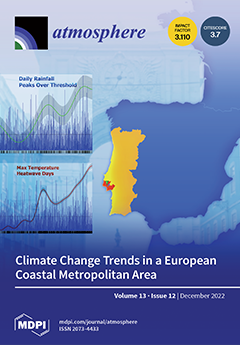
This investigation is an updated climate change trends analysis (from 1864 to 2021)—developed within the scope of the SCORE project, a Horizon-2020-funded research project to increase climate resilience in European coastal cities—for a representative site of the Lisbon Metropolitan Area (Portugal). By using long ground-based daily records of rainfall and surface temperature, the analysis aimed to identify long-term and recent climate trends in rainfall and temperature, changes in extreme rainfalls, heatwaves, and droughts, and the possible effects of coupled changes in minimum and maximum daily temperatures on drought development based on the diurnal temperature range (DTR) indicator. The results are based on robust statistical models that, in some cases, serve as abstractions of the climate change phenomenon. View this paper
  • Issues are regarded as officially published after their release is announced to the table of contents alert mailing list.
  • You may sign up for e-mail alerts to receive table of contents of newly released issues.
  • PDF is the official format for papers published in both, html and pdf forms. To view the papers in pdf format, click on the "PDF Full-text" link, and use the free Adobe Reader to open them.
Order results
Result details
Section
Select all
Export citation of selected articles as:
16 pages, 6503 KiB  
Article
Evaluation of Air–Sea Flux Parameterization for Typhoon Mangkhut Simulation during Intensification Period
by Lei Ye, Yubin Li and Zhiqiu Gao
Atmosphere 2022, 13(12), 2133; https://doi.org/10.3390/atmos13122133 - 19 Dec 2022
Cited by 2 | Viewed by 1199
Abstract
Using the Advanced Research Weather Research and Forecasting (WRF) model, a series of numerical experiments are conducted to examine the sensitivity of the Typhoon Mangkhut intensification simulation to different air–sea flux parameterization schemes (isftcflx option), including option 0 (OPT0), option 1 (OPT1), [...] Read more.
Using the Advanced Research Weather Research and Forecasting (WRF) model, a series of numerical experiments are conducted to examine the sensitivity of the Typhoon Mangkhut intensification simulation to different air–sea flux parameterization schemes (isftcflx option), including option 0 (OPT0), option 1 (OPT1), and option 2 (OPT2). The results show that three schemes basically reproduce tropical cyclone (TC) track and intensity of observation, and the simulated exchange coefficient of three schemes is consistent with theoretical results. Using the same upper limit of Cd as OPT0 and OPT2, OPT1 has much larger Ck than the other two options, which leads to larger latent heat (and sensible heat) flux and produces stronger inflow (within boundary layer) and updrafts (around eyewall), and thus stronger TC intensity. Meanwhile, the results that larger Ck/Cd corresponds with stronger TC in the mature stage are consistent with Emanuel’s potential intensity theory. The fact that Ck in OPT1 is evidently larger than the Ck from previous studies leads to produce a better TC intensity simulation. Generally, we should use more reasonable air–sea flux parameterization based on observation to improve TC intensity simulation. Full article
Show Figures

Figure 1

17 pages, 11136 KiB  
Article
Spatiotemporal Distribution of Precipitation over the Mongolian Plateau during 1976–2017
by Yingying Xia, Dan Dan, Hongyu Liu, Haijun Zhou and Zhiqiang Wan
Atmosphere 2022, 13(12), 2132; https://doi.org/10.3390/atmos13122132 - 19 Dec 2022
Cited by 2 | Viewed by 1323
Abstract
Located in the interior of Eurasia, the Mongolian Plateau (MP) is extremely sensitive to global warming and become a critical area for studying precipitation patterns. Based on the monthly data of 135 meteorological stations during 1976–2017, we analyze the spatiotemporal change in precipitation [...] Read more.
Located in the interior of Eurasia, the Mongolian Plateau (MP) is extremely sensitive to global warming and become a critical area for studying precipitation patterns. Based on the monthly data of 135 meteorological stations during 1976–2017, we analyze the spatiotemporal change in precipitation and discuss its response to atmospheric circulation. The results show that: (1) Precipitation shows increasing trends in spring, autumn, and winter, but a decreasing trend at a rate of 5.3 mm/decade in summer. The annual precipitation also shows an overall slight decreasing trend. (2) The spatial distribution is uneven, the annual precipitation in the northern Great Khingan Mountains is more, but it gradually decreases at the rate of 10–30 mm/decade, showing a trend of “wet gets dry”; while there is less in the southwest Gobi Desert region, but it gradually increases with the rate of 10–20 mm/decade, showing a trend of “dry gets wet”. (3) Over decades, the East Asian summer monsoon (EASM) and westerly circulation show a seesaw change in MP. Affected by the weakening of the EASM, the area of arid regions has gradually expanded. The results also demonstrate that the EASM has a higher impact on the annual precipitation change pattern, particularly in the southeastern MP. The conclusion indicated that the variation in the position and orientation between EASM and the westerly circulation may be an explanation for the spatiotemporal precipitation pattern, providing a new viewpoint to the question of circulation mechanisms behind climate change in MP in recent 40 years. Full article
(This article belongs to the Topic Advanced Research in Precipitation Measurements)
Show Figures

Figure 1

17 pages, 2687 KiB  
Review
Estimation of Atmospheric Fossil Fuel CO2 Traced by Δ14C: Current Status and Outlook
by Ming-Yuan Yu, Yu-Chi Lin and Yan-Lin Zhang
Atmosphere 2022, 13(12), 2131; https://doi.org/10.3390/atmos13122131 - 19 Dec 2022
Cited by 3 | Viewed by 2635
Abstract
Fossil fuel carbon dioxide (FFCO2) is a major source of atmospheric greenhouse gases that result in global climate change. Quantification of the atmospheric concentrations and emissions of FFCO2 is of vital importance to understand its environmental process and to formulate [...] Read more.
Fossil fuel carbon dioxide (FFCO2) is a major source of atmospheric greenhouse gases that result in global climate change. Quantification of the atmospheric concentrations and emissions of FFCO2 is of vital importance to understand its environmental process and to formulate and evaluate the efficiency of carbon emission reduction strategies. Focusing on this topic, we summarized the state-of-the-art method to trace FFCO2 using radiocarbon (14C), and reviewed the 14CO2 measurements and the calculated FFCO2 concentrations conducted in the last two decades. With the mapped-out spatial distribution of 14CO2 values, the typical regional distribution patterns and their driving factors are discussed. The global distribution of FFCO2 concentrations is also presented, and the datasets are far fewer than 14CO2 measurements. With the combination of 14C measurements and atmospheric transport models, the FFCO2 concentration and its cross-regional transport can be well interpreted. Recent progress in inverse methods can further constrain emission inventories well, providing an independent verification method for emission control strategies. This article reviewed the latest developments in the estimation of FFCO2 and discussed the urgent requirements for the control of FFCO2 according to the current situation of climate change. Full article
(This article belongs to the Section Atmospheric Techniques, Instruments, and Modeling)
Show Figures

Figure 1

28 pages, 5504 KiB  
Article
Effects of Sea-Surface Temperature, Cloud Vertical Structure and Wind Speed on Temperature Change between Hiatus and Post-Hiatus Periods in Tropical Western Pacific
by Chien-Han Su and Jean-Fu Kiang
Atmosphere 2022, 13(12), 2130; https://doi.org/10.3390/atmos13122130 - 19 Dec 2022
Cited by 1 | Viewed by 1513
Abstract
A region in the tropical western Pacific is selected to study the notable change in temperature between the recent warming hiatus period and the post-hiatus period. In total, three probable factors, namely sea-surface temperature (SST), cloud vertical structure (CVS) and wind speed, which [...] Read more.
A region in the tropical western Pacific is selected to study the notable change in temperature between the recent warming hiatus period and the post-hiatus period. In total, three probable factors, namely sea-surface temperature (SST), cloud vertical structure (CVS) and wind speed, which may account for the temperature change are found to exhibit noticeable differences between these two periods. A one-dimensional atmospheric radiative transfer model, incorporating convective adjustment and energy exchange with the ocean, is developed to simulate the diurnal pattern of temperature profile under the influence of the three probable factors in the two concerned periods. Virtual profiles of sea-surface temperature, cloud vertical structure and wind speed in both periods are developed from data available in the literature. Diurnal patterns of temperatures near the air–sea interface are computed with the proposed model over a sufficient number of days. The simulated temperatures under different combinations of factors, in either the hiatus or post-hiatus period, are statistically analyzed to gain insights about the separate and combined effects of these three factors on causing climate change. Full article
(This article belongs to the Section Biosphere/Hydrosphere/Land–Atmosphere Interactions)
Show Figures

Figure 1

13 pages, 2924 KiB  
Article
A Parallel Computing Algorithm for the Emergency-Oriented Atmospheric Dispersion Model CALPUFF
by Dongou Yang, Mei Li and Hui Liu
Atmosphere 2022, 13(12), 2129; https://doi.org/10.3390/atmos13122129 - 19 Dec 2022
Cited by 1 | Viewed by 1276
Abstract
The calculation of the three-dimensional atmospheric dispersion model is often time-consuming, which makes the model difficult to apply to the emergency field. With the aim of addressing this problem, we propose a parallel computing algorithm for the CALPUFF atmospheric dispersion model. Existing methods [...] Read more.
The calculation of the three-dimensional atmospheric dispersion model is often time-consuming, which makes the model difficult to apply to the emergency field. With the aim of addressing this problem, we propose a parallel computing algorithm for the CALPUFF atmospheric dispersion model. Existing methods for parallelizing the atmospheric dispersion model can be divided into two categories, with one using the parallel computing interface to rewrite the source code and the other directly dividing the repetitive elements in the computation task. This paper proposes an improved method based on the latter approach. Specifically, the method of spatial division with buffers is adopted to parallelize the wind field module of the CALPUFF model system, and the method for receptor layering is adopted to parallelize the dispersion module. In addition, the message queue software RabbitMQ is used as the communication middleware. A performance test is conducted on nine computing nodes on the Alibaba Cloud Computing Platform for a single-source continuous emergency leak case. The results show that the division method with a buffer of ten cells is most suitable for the case above in order to maintain the balance between computation speed and accuracy. This reduces the computation time of the model to about one-sixth, which is of great significance for extending the atmospheric dispersion model to the emergency field. Full article
Show Figures

Figure 1

19 pages, 6447 KiB  
Article
Quantify the Spatial Association between the Distribution of Catering Business and Urban Spaces in London Using Catering POI Data and Image Segmentation
by Yang Zhang, Xiaowei Li, Qingrui Jiang, Mingze Chen and Lunyuan Liu
Atmosphere 2022, 13(12), 2128; https://doi.org/10.3390/atmos13122128 - 19 Dec 2022
Cited by 2 | Viewed by 1784
Abstract
The impacts of global climate change on food systems will be broad, complex, and profoundly affected by urban context. Food-related urbanism has been investigated for decades to explore how food access influences placemaking and urban forms. With global climate change, foodscapes within urban [...] Read more.
The impacts of global climate change on food systems will be broad, complex, and profoundly affected by urban context. Food-related urbanism has been investigated for decades to explore how food access influences placemaking and urban forms. With global climate change, foodscapes within urban spaces are an important consideration in urban design and planning for food security and community health. The distribution of catering businesses (restaurants and cafés), one critical method of access to food, is highly associated with urban spaces because of their high impact on diet patterns, human physical activities, travel behaviors, and the use of public spaces. This research explores the spatial associations that exist between the distribution of catering businesses and the design and planning of urban spaces in London. This quantitative research includes three parts: (1) uses Open Street Map data and the GIS spatial analysis method to study the distribution of catering businesses; (2) uses the imagery segmentation method in machine learning to categorize urban spaces into open, landscape, and conflict spaces; and (3) establishes the association between the distribution of catering businesses and the categories of urban spaces through Spearman’s correlation and a linear regression model. The results indicate that the spatial distributions of catering businesses are highly correlated with urban spaces. Conflict and landscape spaces have a significant positive influence on the distribution of catering businesses, while open space has a significant negative influence. Based on the context of global climate change, this research contributes a quantitative urban design and planning approach to promote access to food increase food options and advocate active lifestyles. Full article
Show Figures

Figure 1

20 pages, 15513 KiB  
Article
Impact of the Microphysics in HARMONIE-AROME on Fog
by Sebastián Contreras Osorio, Daniel Martín Pérez, Karl-Ivar Ivarsson, Kristian Pagh Nielsen, Wim C. de Rooy, Emily Gleeson and Ewa McAufield
Atmosphere 2022, 13(12), 2127; https://doi.org/10.3390/atmos13122127 - 19 Dec 2022
Cited by 1 | Viewed by 1528
Abstract
This study concerns the impact of microphysics on the HARMONIE-AROME NWP model. In particular, the representation of cloud droplets in the single-moment bulk microphysics scheme is examined in relation to fog forecasting. We focus on the shape parameters of the cloud droplet size [...] Read more.
This study concerns the impact of microphysics on the HARMONIE-AROME NWP model. In particular, the representation of cloud droplets in the single-moment bulk microphysics scheme is examined in relation to fog forecasting. We focus on the shape parameters of the cloud droplet size distribution and recent changes to the representation of the cloud droplet number concentration (CDNC). Two configurations of CDNC are considered: a profile that varies with height and a constant one. These aspects are examined together since few studies have considered their combined impact during fog situations. We present a set of six experiments performed for two non-idealised three-dimensional case studies over the Iberian Peninsula and the North Sea. One case displays both low clouds and fog, and the other shows a persistent fog field above sea. The experiments highlight the importance of the considered parameters that affect droplet sedimentation, which plays a key role in modelled fog. We show that none of the considered configurations can simultaneously represent all aspects of both cases. Hence, continued efforts are needed to introduce relationships between the governing parameters and the relevant atmospheric conditions. Full article
(This article belongs to the Special Issue Decision Support System for Fog)
Show Figures

Figure 1

13 pages, 1933 KiB  
Article
A Step to Develop Heat-Health Action Plan: Assessing Heat Waves’ Impacts on Mortality
by Hazal Cansu Çulpan, Ümit Şahin and Günay Can
Atmosphere 2022, 13(12), 2126; https://doi.org/10.3390/atmos13122126 - 18 Dec 2022
Cited by 6 | Viewed by 2971
Abstract
Climate change is one of the biggest health threats facing humanity and can directly affect human health through heat waves. This study aims to evaluate excess deaths during heat waves between the summer months of 2004 and 2017 in Istanbul and to determine [...] Read more.
Climate change is one of the biggest health threats facing humanity and can directly affect human health through heat waves. This study aims to evaluate excess deaths during heat waves between the summer months of 2004 and 2017 in Istanbul and to determine a definition of heat waves that can be used in the development of an early warning system, a part of prospective urban heat-health action plans. In this study, heat waves were determined using the Excess Heat Factor, an index based on a three-day-averaged daily mean temperature. The death rates during heat waves and non-heat wave days of the summer months were compared with a Z test of the difference of natural logarithms. Thirty heat waves were recorded in Istanbul during the summer months of 2004–2017. In 67% of the heat waves, the death rate was significantly higher than the reference period and 4281 excess deaths were recorded. The mortality risk was especially higher during heat waves of higher intensity. The study showed an excess risk of mortality during heat waves in Istanbul, and the findings suggest that the Excess Heat Factor could be an appropriate tool for an early warning system in Istanbul. Full article
Show Figures

Figure 1

10 pages, 2278 KiB  
Article
Research on Prospecting Prediction Based on Evidence Weight
by Zhen Chen and Mingde Lang
Atmosphere 2022, 13(12), 2125; https://doi.org/10.3390/atmos13122125 - 17 Dec 2022
Cited by 1 | Viewed by 1081
Abstract
There are many small and medium-sized orogenic copper deposits in the Jinman–Lanping area of Yunnan. In order to standardize mining, long-term planning, and unified management, it is necessary to further delineate prospecting areas. In order to improve the efficiency of prospecting, a data-driven [...] Read more.
There are many small and medium-sized orogenic copper deposits in the Jinman–Lanping area of Yunnan. In order to standardize mining, long-term planning, and unified management, it is necessary to further delineate prospecting areas. In order to improve the efficiency of prospecting, a data-driven approach is established. This paper uses the weight of evidence model to make prospecting predictions, and it then delineates the prospective prospecting area. The relevant evidence layers in the weight of evidence model are geochemical anomalies and remote sensing iron staining anomalies. Among them, the geochemical anomaly layer mainly uses the concentration-area (C-A) fractal model to separate the geochemical background and anomaly acquisition. The remote sensing iron-stained anomaly layer mainly uses bands (1, 4, 5, 7), and bands (1, 3, 4, 5) were combined for principal component analysis to extract abnormal iron staining. Finally, using the weight of evidence model, the spatial element layers (evidence layers) from different sources were combined, and the interaction between them was analyzed. It is pointed out that the area has good prospects for prospecting, and the prospective prospecting area was thus delineated. Full article
(This article belongs to the Special Issue Anthropogenic Pollutants in Environmental Geochemistry)
Show Figures

Figure 1

14 pages, 2209 KiB  
Article
Development of a CNN+LSTM Hybrid Neural Network for Daily PM2.5 Prediction
by Hyun S. Kim, Kyung M. Han, Jinhyeok Yu, Jeeho Kim, Kiyeon Kim and Hyomin Kim
Atmosphere 2022, 13(12), 2124; https://doi.org/10.3390/atmos13122124 - 17 Dec 2022
Cited by 8 | Viewed by 2691
Abstract
A CNN+LSTM (Convolutional Neural Network + Long Short-Term Memory) based deep hybrid neural network was established for the citywide daily PM2.5 prediction in South Korea. The structural hyperparameters of the CNN+LSTM model were determined through comprehensive sensitivity tests. The input features were [...] Read more.
A CNN+LSTM (Convolutional Neural Network + Long Short-Term Memory) based deep hybrid neural network was established for the citywide daily PM2.5 prediction in South Korea. The structural hyperparameters of the CNN+LSTM model were determined through comprehensive sensitivity tests. The input features were obtained from the ground observations and GFS forecast. The performance of CNN+LSTM was evaluated by comparison with PM2.5 observations and with the 3-D CTM (three-dimensional chemistry transport model)-predicted PM2.5. The newly developed hybrid model estimated more accurate ambient levels of PM2.5 compared to the 3-D CTM. For example, the error and bias of the CNN+LSTM prediction were 1.51 and 6.46 times smaller than those by 3D-CTM simulation. In addition, based on IOA (Index of Agreement), the accuracy of CNN+LSTM prediction was 1.10–1.18 times higher than the 3-D CTM-based prediction. The importance of input features was indirectly investigated by sequential perturbing input variables. The most important meteorological and atmospheric environmental features were geopotential height and previous day PM2.5. The obstacles of the current CNN+LSTM-based PM2.5 prediction were also discussed. The promising result of this study indicates that DNN-based models can be utilized as an effective tool for air quality prediction. Full article
(This article belongs to the Special Issue Machine Learning in Air Pollution)
Show Figures

Figure 1

15 pages, 5238 KiB  
Article
Influence of ENSO on Droughts and Vegetation in a High Mountain Equatorial Climate Basin
by Jheimy Pacheco, Abel Solera, Alex Avilés and María Dolores Tonón
Atmosphere 2022, 13(12), 2123; https://doi.org/10.3390/atmos13122123 - 17 Dec 2022
Cited by 2 | Viewed by 1447
Abstract
Several studies have assessed droughts and vegetation considering climatic factors, particularly El Niño-Southern Oscillation (ENSO) at different latitudes. However, there are knowledge gaps in the tropical Andes, a region with high spatiotemporal climatic variability. This research analyzed the relationships between droughts, vegetation, and [...] Read more.
Several studies have assessed droughts and vegetation considering climatic factors, particularly El Niño-Southern Oscillation (ENSO) at different latitudes. However, there are knowledge gaps in the tropical Andes, a region with high spatiotemporal climatic variability. This research analyzed the relationships between droughts, vegetation, and ENSO from 2001–2015. Meteorological drought was analyzed using the Standardized Precipitation Evapotranspiration Index (SPEI) for 1, 3 and 6 months. Normalized Difference Vegetation Index (NDVI) was used to evaluate vegetation, and ENSO indexes were used as climate drivers. The Wavelet coherence method was used to establish time-frequency relationships. This approach was applied in the Machángara river sub-basin in the Southern Ecuadorian Andes. The results showed significant negative correlations during 2009–2013 between the SPEI and NDVI, with the SPEI6 lagging by nine months and a return period of 1.5 years. ENSO–SPEI presented the highest negative correlations during 2009–2014 and a return period of three years, with ENSO leading the relationship for around fourteen months. ENSO-NDVI showed the highest positive correlations during 2004–2008 and a return period of one year, with the ENSO indexes continually delayed by approximately one month. These results could be a benchmark for developing advanced studies for climate hazards. Full article
(This article belongs to the Special Issue El Niño-Southern Oscillation Related Extreme Events)
Show Figures

Figure 1

18 pages, 7166 KiB  
Article
Evaluating Agronomic Onset Definitions in Senegal through Crop Simulation Modeling
by Eunjin Han, Adama Faye, Mbaye Diop, Bohar Singh, Komla Kyky Ganyo and Walter Baethgen
Atmosphere 2022, 13(12), 2122; https://doi.org/10.3390/atmos13122122 - 17 Dec 2022
Viewed by 1440
Abstract
Rainfed agriculture in Senegal is heavily affected by weather-related risks, particularly timing of start/end of the rainy season. For climate services in agriculture, the National Meteorological Agency (ANACIM) of Senegal has defined an onset of rainy season based on the rainfall. In the [...] Read more.
Rainfed agriculture in Senegal is heavily affected by weather-related risks, particularly timing of start/end of the rainy season. For climate services in agriculture, the National Meteorological Agency (ANACIM) of Senegal has defined an onset of rainy season based on the rainfall. In the field, however, farmers do not necessarily follow the ANACIM’s onset definition. To close the gap between the parallel efforts by a climate information producer (i.e., ANACIM) and its actual users in agriculture (e.g., farmers), it is desirable to understand how the currently available onset definitions are linked to the yield of specific crops. In this study, we evaluated multiple onset definitions, including rainfall-based and soil-moisture-based ones, in terms of their utility in sorghum production using the DSSAT–Sorghum model. The results show that rainfall-based definitions are highly variable year to year, and their delayed onset estimation could cause missed opportunities for higher yields with earlier planting. Overall, soil-moisture-based onset dates determined by a crop simulation model produced yield distributions closer to the ones by semi-optimal planting dates than the other definitions, except in a relatively wet southern location. The simulated yields, particularly based on the ANACIM’s onset definition, showed statistically significant differences from the semi-optimal yields for a range of percentiles (25th, 50th, 75th, and 90th) and the means of the yield distributions in three locations. The results emphasize that having a good definition and skillful forecasts of onset is critical to improving the management of risks of crop production in Senegal. Full article
Show Figures

Figure 1

21 pages, 34635 KiB  
Article
Climate Adaptability Analysis on the Shape of Outpatient Buildings for Different Climate Zones in China Based on Low-Energy Target
by Youman Wei, Siyan Wang, Hongwei Dang and Peng Liu
Atmosphere 2022, 13(12), 2121; https://doi.org/10.3390/atmos13122121 - 16 Dec 2022
Cited by 2 | Viewed by 1638 | Retraction
Abstract
Under the impact of COVID-19 and the needs for urban expansion, a large number of outpatient buildings have been rapidly constructed, but the problem of high energy consumption has always been ignored. There is a lack of research on the adaptability of building [...] Read more.
Under the impact of COVID-19 and the needs for urban expansion, a large number of outpatient buildings have been rapidly constructed, but the problem of high energy consumption has always been ignored. There is a lack of research on the adaptability of building shape in different climate zones. Many studies have shown that a reasonable shape in the early stage of design can significantly reduce the energy consumption of buildings. Therefore, it helps if architects quickly select a reasonable shape that can effectively reduce energy consumption. This study summarized a number of outpatient building cases in China and proposed three typical building shapes: centralized-type (Shape-1), corridor-type (Shape-2), and courtyard-type (Shape-3). The Design Builder tool was used to simulate and analyze the typical building energy consumption in different climate zones. The simulation results show that Shape-2 (angle: 0°) should be chosen in severe cold zone; Shape-1 (angle: 90°) should be chosen in cold zone; Shape-1 (angle: 0°) should be chosen in hot summer and cold winter zone; Shape-1 (angle: 60°) should be chosen in hot summer and warm winter zone; and Shape-1 or Shape-2 can be chosen in warm zone. The results of this study can provide suggestions for the energy saving design of outpatient buildings in China and other areas with similar conditions. The result can help architects make rapid shape selection in the early stage of design. Full article
(This article belongs to the Special Issue Science and Technology of Indoor and Outdoor Environment)
Show Figures

Figure 1

13 pages, 3130 KiB  
Article
High Indoor Radon Case Study: Influence of Meteorological Parameters and Indication of Radon Prone Area
by Dušica Spasić and Ljiljana Gulan
Atmosphere 2022, 13(12), 2120; https://doi.org/10.3390/atmos13122120 - 16 Dec 2022
Cited by 5 | Viewed by 1508
Abstract
Indoor radon and meteorological parameters (temperature, humidity, pressure, precipitation, indoor dew point, wind direction, wind speed and heat index) were simultaneously monitored in an old residential house in a radon suspected area. Measurements were performed during the period from winter to summer (13 [...] Read more.
Indoor radon and meteorological parameters (temperature, humidity, pressure, precipitation, indoor dew point, wind direction, wind speed and heat index) were simultaneously monitored in an old residential house in a radon suspected area. Measurements were performed during the period from winter to summer (13 February 2021–15 August 2021). Indoor radon concentrations were measured with detectors, Airthings Corentium Home (alpha spectrometry method), and meteorological parameters were continuously monitored by the meteorological station WTH600–E (wireless weather station). The influence of geological characteristics in the study area was analyzed, as well as some observed variations and correlations with indoor/outdoor meteorological parameters. The results indicated that indoor radon levels are higher in the spring/summer season than in the winter season. Diurnal radon concentrations varied during measuring period from 303–1708 Bq/m3 (average 949 Bq/m3) and 427–1852 Bq/m3 (average 1116 Bq/m3) for the living room and bedroom, respectively. Indoor radon concentrations correlated with: outdoor/indoor temperature, indoor humidity (r = 0.45, r = 0.40, r = 0.32, r = 0.56, respectively); indoor dew point (r = 0.53); outdoor barometric pressure (r = −0.26); there were no clear correlation with precipitation and outdoor humidity. The health risk due to long-term, high radon exposure was assessed through the calculated inhalation dose. Full article
Show Figures

Figure 1

20 pages, 8515 KiB  
Article
Arctic Atmospheric Ducting Characteristics and Their Connections with Arctic Oscillation and Sea Ice
by Ting Qin, Bo Su, Li Chen, Junfeng Yang, Hulin Sun, Jing Ma and Wenhao Yu
Atmosphere 2022, 13(12), 2119; https://doi.org/10.3390/atmos13122119 - 16 Dec 2022
Viewed by 1545
Abstract
Atmospheric ducting is an anomalous atmospheric structure that affects electromagnetic wave propagation. In the context of global warming, the navigation capacity of the Arctic is increased, and the atmospheric duct can affect communication and navigation in the Arctic. In this study, based on [...] Read more.
Atmospheric ducting is an anomalous atmospheric structure that affects electromagnetic wave propagation. In the context of global warming, the navigation capacity of the Arctic is increased, and the atmospheric duct can affect communication and navigation in the Arctic. In this study, based on the European Centre for Medium-Range Weather Forecasts reanalysis data (ERA-interim), the climate characteristics and their variations of atmospheric ducts over the Arctic polar region (north of 60° N) from 1989 to 2018 were analyzed, including the occurrence frequency, spatial distribution, thickness and intensity of the atmospheric ducts. The results show that the overall frequency of atmospheric ducts in the Arctic is low, with the average frequency of all types of ducts being less than 10% throughout the year. The frequency of surface ducts is 2~3 times that of elevated ducts. More than 90% of the atmospheric ducts in the Arctic have a trapped layer with a thickness of less than 100 m, and the average thickness of surface ducts is higher than that of the elevated ducts. The intensity of the Arctic surface ducts is stronger than that of the elevated ducts, with an average intensity of 2.1 M (±2.3 M) to 4.5 M (±4.5 M) for the surface ducts and 1.7 M (±2 M) to 2.5 M (±2.9 M) for the elevated ducts. There is a positive correlation between the ducts’ trapped layer thickness and duct intensity. The variation in atmospheric ducts is responsive to the changes in atmospheric circulation and the sea ice extent. This anomalous circulation changes surface wind in the Arctic, which affects the formation and maintenance of the ducts. The trends of ducts in the Arctic Ocean are consistent with those of the Arctic Sea ice extent, while the Arctic continental and coastal ducts show the opposite trend. Full article
(This article belongs to the Section Atmospheric Techniques, Instruments, and Modeling)
Show Figures

Figure 1

23 pages, 11095 KiB  
Article
Indoor Thermal Environment in Different Generations of Naturally Ventilated Public Residential Buildings in Singapore
by Ji-Yu Deng, Nyuk Hien Wong, Daniel Jun Chung Hii, Zhongqi Yu, Erna Tan, Meng Zhen and Shanshan Tong
Atmosphere 2022, 13(12), 2118; https://doi.org/10.3390/atmos13122118 - 16 Dec 2022
Cited by 2 | Viewed by 2242
Abstract
This study aims to evaluate and compare the indoor air velocities and thermal environment inside different generations of public residential buildings developed by the Housing and Development Board (HDB) of Singapore and analyze the impact of façade design on the indoor thermal environment. [...] Read more.
This study aims to evaluate and compare the indoor air velocities and thermal environment inside different generations of public residential buildings developed by the Housing and Development Board (HDB) of Singapore and analyze the impact of façade design on the indoor thermal environment. To achieve this goal, several case studies were carried out, namely, five typical HDB blocks built in different generations from the 1970s to recent years. Firstly, these five blocks with different façade design features were simulated to obtain the indoor air temperatures for both window-closed and window-open scenarios by using the EnergyPlus V22.2.0 (U.S. Department of Energy) and Design-Builder v6 software(DesignBuilder Software Ltd, Stroud, Gloucs, UK). Meanwhile, the computational fluid dynamics (CFD) simulations were conducted to obtain the area-weighted wind velocities in the corresponding zones to evaluate the indoor thermal comfort. Accordingly, the effects of façade design on indoor air temperatures under both the window-closed and window-open conditions were compared and analyzed. Positive correlations between the facades’ window-to-wall ratio (WWR) and the residential envelope transmittance value (RETV) and Ta were confirmed with statistical significance at a 0.05 level. Furthermore, the indoor thermal comfort based on the wind open scenarios was also investigated. The results indicate that the thermal environment can be greatly improved by implementing proper façade design strategies as well as opening the windows, which could result in an average 3.2 °C reduction in Ta. Finally, some principles were proposed for the façade design of residential buildings in tropical regions with similar climate conditions. Full article
(This article belongs to the Special Issue Materials, Technologies, and Methods for the Building Indoor Comfort)
Show Figures

Figure 1

22 pages, 4563 KiB  
Article
Spatial and Temporal Variations of Polychlorinated Biphenyls and Organochlorine Pesticides in Snow in Eastern Siberia
by Elena A. Mamontova and Alexander A. Mamontov
Atmosphere 2022, 13(12), 2117; https://doi.org/10.3390/atmos13122117 - 16 Dec 2022
Cited by 2 | Viewed by 1141
Abstract
This study evaluated the spatial and long-term variations of polychlorinated biphenyls (PCBs) and organochlorine pesticides (OCPs) in the snow at 55 industrial, urban, rural, and remote stations in Eastern Siberia, Russia, in 2021 in comparison to data obtained from the 1990s to the [...] Read more.
This study evaluated the spatial and long-term variations of polychlorinated biphenyls (PCBs) and organochlorine pesticides (OCPs) in the snow at 55 industrial, urban, rural, and remote stations in Eastern Siberia, Russia, in 2021 in comparison to data obtained from the 1990s to the 2010s. In 2021, the mean levels of the organochlorine compounds in snow amounted to 76 ng/L ∑PCB36, 5.8 ng/L hexachlorobenzene (HCB), 0.02 ng/L α-hexachlorocyclohexane (HCH), and 1.01 ng/L dichlorodiphenyltrichloroethane (DDT) and its metabolites. The spatial distribution of organochlorines was shown to result from the presence of industrial and urban sources, as well as atmospheric transport. The PCB and HCB temporal distributions from the 1990s to the 2020s were represented as V-shaped curves. The PCB homological patterns show that, in some of the samples, the abundance of lower chlorinated homologues in 2021 is greater than in previous years. Over the last three decades, the HCH and DDT levels have significantly decreased. The relationship between PCBs and suspended particulate matter became stronger with the increase in PCB chlorination levels from lighter to heavier chlorinated congeners. Deposition with wet precipitation in the wintertime provided 3–8% of the annual deposition flux. Massive POP deposition with wet precipitation occurred in May (about 12–18%) and from July to September (60–65%). Full article
Show Figures

Figure 1

13 pages, 16024 KiB  
Article
Heteroscedastic Characteristics of Precipitation with Climate Changes in China
by Zhonghua Qian, Luyao Wang, Xin Chen, Hui Zhang and Zimeng Li
Atmosphere 2022, 13(12), 2116; https://doi.org/10.3390/atmos13122116 - 16 Dec 2022
Cited by 1 | Viewed by 1532
Abstract
With global warming, previous studies have found nonuniformity responses of precipitation because of regional differences. However, climate change affects the mean, extreme, and data structure of precipitation. Quantile regression, which can reflect every part of the trends of data, was used to detect [...] Read more.
With global warming, previous studies have found nonuniformity responses of precipitation because of regional differences. However, climate change affects the mean, extreme, and data structure of precipitation. Quantile regression, which can reflect every part of the trends of data, was used to detect responses of each part of precipitation in China. The V2.0 dataset of daily precipitation grid data (0.5° × 0.5°) from 1961 to 2020 in China was used as practical observation data. Daily precipitation in 2015–2100 from the China Model BCC-CSM2-MR of scenarios SSP2-4.5 and SSP5-8.5 were chosen as future climate changes with moderate and high radiative forcing, respectively. On the basis of the sign consistency of the slope coefficients with quantile regression, the results of quantiles q = 0.3, 0.5, 0.7 and 0.9 were selected to represent low, median, high and flood precipitation, respectively. Precipitation in four seasons was separately analyzed to observe seasonal characteristics in China. For the observation data, precipitation had obviously different responses in the low and high percentiles and was present in mainly spring and summer. In spring, in the middle and lower Yangtze Plains, the low and median precipitation increased, whereas the high and flood precipitation significantly decreased. In summer, Heilongjiang Province and northern Inner Mongolia showed decreasing trends in the low quantile and increasing trends in the high quantile, indicating a completely opposite trend adjustment. These regions deserve more attention. However, obviously different responses in low and high percentiles were not so evident in future climate changes. Self-consistency in model data may weaken the heteroscedastic characteristics of precipitation. Full article
(This article belongs to the Special Issue The Water Cycle and Climate Change)
Show Figures

Figure 1

10 pages, 1792 KiB  
Article
A Descriptive Assessment of Household Air Pollution in Rural Kitchens in Kenya
by Dennis Musyoka and Kanyiva Muindi
Atmosphere 2022, 13(12), 2115; https://doi.org/10.3390/atmos13122115 - 16 Dec 2022
Cited by 5 | Viewed by 1525
Abstract
Efforts to ensure households transition to modern fuels are expected to reduce household air pollution. However, exposure to toxic particles and gases in fuel stacking households remains under-researched. We implemented a household survey to identify household energy sources and assess exposure to particulate [...] Read more.
Efforts to ensure households transition to modern fuels are expected to reduce household air pollution. However, exposure to toxic particles and gases in fuel stacking households remains under-researched. We implemented a household survey to identify household energy sources and assess exposure to particulate matter with diameter of ≤5 microns (PM2.5), ≤10 microns (PM10) and select polluting gases (Sulfur Dioxide (SO2), Total Volatile Organic Compounds (TVOCs), Carbon Dioxide (CO2), Nitrogen Dioxide (NO2), Carbon Monoxide (CO)) in a rural community. Wood was the main cooking fuel in 94.2% (1615/1703) households with fuel stacking reported in 86.1% (1462/1703) of total households. Daily time-weighted average concentrations of PM2.5 and PM10 were beyond World Health Organization (WHO) limits in wood-using households (189.53 (Standard deviation (SD) = 268.80) µg/m3 and 592.38 (SD = 623) µg/m3, respectively) and Liquid Petroleum Gas (LPG) -using households (57.2 (SD = 53.6) µg/m3 and 189.86 (SD = 168) µg/m3, respectively). Only daily average CO and TVOC concentration in wood-using households exceeded recommended levels. Household socio-economic status, education level of the head of household, use of a separate kitchen and household size influenced household energy choices. Rural households using wood as the main cooking fuel are exposed to high levels of particulate matter, carbon monoxide and total volatile organic compounds. LPG-using households may not realize health benefits if stacking with polluting fuels is practiced. Full article
(This article belongs to the Special Issue Ambient and Indoor Air Pollution Status in Africa)
Show Figures

Figure 1

13 pages, 3098 KiB  
Article
Comparison and Clarification of China and US CCUS Technology Development
by Xiao-Yu Li, Xu Gao and Jing-Jing Xie
Atmosphere 2022, 13(12), 2114; https://doi.org/10.3390/atmos13122114 - 16 Dec 2022
Cited by 1 | Viewed by 2174
Abstract
The content of the China-US CCUS technology development roadmap is summarized based on the roadmap update in 2019. Qualitative analysis and evaluation were conducted from the perspectives of running CCUS demonstrations or industrial projects, CO2 pipeline infrastructure, established regulatory frameworks, policy support, [...] Read more.
The content of the China-US CCUS technology development roadmap is summarized based on the roadmap update in 2019. Qualitative analysis and evaluation were conducted from the perspectives of running CCUS demonstrations or industrial projects, CO2 pipeline infrastructure, established regulatory frameworks, policy support, research and development capabilities, and geological storage resources. A simple analysis of the development status of carbon capture, storage, and utilization technology through relevant patent data is provided. Future planning by China and the United States in terms of planning volume, investment funds, related industries, transportation methods, geological storage, geological utilization, other utilization methods, and incentive policies is compared. Overall, US CCUS technology development is in the leading position in the world; it has entered the stage of small-scale commercial promotion, while the overall development level of China’s CCUS technology is still behind the international advanced level in a small-scale experimental demonstration period, and is still in the catch-up stage. However, as the Chinese government has put forward the strategy of “carbon peaking and carbon neutralization”, CCUS has ushered in a golden opportunity for development in China, and some large-scale industrial demonstration projects have been carried out. This study analyzes China’s advantages and challenges in developing CCUS and gives some suggestions on the direction that China’s CCUS development should take in the future. Full article
(This article belongs to the Section Air Pollution Control)
Show Figures

Figure 1

11 pages, 2538 KiB  
Article
Numerical Simulation of a CAM-Measured Spectra Influenced by Coarse Aerosol
by Grégoire Dougniaux, William Soerjady, Kelvin Ankrah and Diane Mauclère
Atmosphere 2022, 13(12), 2113; https://doi.org/10.3390/atmos13122113 - 16 Dec 2022
Viewed by 1287
Abstract
In nuclear facilities, the mandatory atmosphere surveillance is operated by Continuous Air Monitors. This standalone instrument is designed to measure the airborne aerosol activity concentration and to trig an alarm signal when a predetermined activity concentration is exceeded. However, a rapid resuspension event [...] Read more.
In nuclear facilities, the mandatory atmosphere surveillance is operated by Continuous Air Monitors. This standalone instrument is designed to measure the airborne aerosol activity concentration and to trig an alarm signal when a predetermined activity concentration is exceeded. However, a rapid resuspension event of coarse aerosol leads to a measurement error: the airborne aerosol activity concentration is over-evaluated. Prior results have shown that the coarse aerosol deposit disturbs the background evaluation for the radioactivity measurement. The interactions between radioactive aerosols (with radon daughters) and coarse non-radioactive aerosols have to be investigated by running together aerosol models and nuclear simulations. Therefore, this paper investigates different ways to represent an aerosol deposit in numerical simulations. We developed two numerical aerosol deposit models that we integrated into Geant4, a tool for the simulation of the passage of radiations through matter, and then compared these to experimental results. The simplest model was discarded, and by using the second model, we managed to correctly frame our simulation results as an experimental measurement: an aerosol has been correctly considered in a nuclear simulation. By combining theory, simulations, and experimentations on both aerosol science and nuclear physics, this research will be able to improve the comprehension of monitors’ behaviour in delicate situations and, more broadly, the filtration of aerosols using radioactivity. Full article
(This article belongs to the Special Issue Advances in Understanding Aerosols Filtration)
Show Figures

Figure 1

18 pages, 3411 KiB  
Article
Lightning Identification Method Based on Deep Learning
by Zheng Qian, Dongdong Wang, Xiangbo Shi, Jinliang Yao, Lijun Hu, Hao Yang and Yongsen Ni
Atmosphere 2022, 13(12), 2112; https://doi.org/10.3390/atmos13122112 - 16 Dec 2022
Cited by 1 | Viewed by 1378
Abstract
In this study, a deep learning method called Lightning-SN was developed and used for cloud-to-ground (CG) lightning identification. Based on artificial scenarios, this network model selects radar products that exhibit characteristic factors closely related to lightning. Advanced time of arrival and direction lightning [...] Read more.
In this study, a deep learning method called Lightning-SN was developed and used for cloud-to-ground (CG) lightning identification. Based on artificial scenarios, this network model selects radar products that exhibit characteristic factors closely related to lightning. Advanced time of arrival and direction lightning positioning data were used as the labeling factors. The Lightning-SN model was constructed based on an encoder–decoder structure with 25 convolutional layers, five pooling layers, five upsampling layers, and a sigmoid activation function layer. Additionally, the maximum pooling index method was adopted in Lightning-SN to avoid characteristic boundary information loss in the pooling process. The gradient harmonizing mechanism was used as the loss function to improve the model performance. The evaluation results showed that the Lightning-SN improved the segmentation accuracy of the CG lightning location compared with the traditional threshold method, according to the 6-minute operating period of the current S-band Doppler radar, exhibiting a better performance in terms of lightning location identification based on high-resolution radar data. The model was applied to the Ningbo area of Zhejiang Province, China. It was applied to the lightning hazard prevention in the hazardous chemical park in Ningbo. The composite reflectivity and radial velocity were the two dominant factors, with a greater influence on the model performance than other factors. Full article
Show Figures

Figure 1

17 pages, 3408 KiB  
Article
Manifestations of Different El Niño Types in the Dynamics of the Extratropical Stratosphere
by Tatiana S. Ermakova, Andrey V. Koval, Sergei P. Smyshlyaev, Ksenia A. Didenko, Olga G. Aniskina, Elena N. Savenkova and Ekaterina V. Vinokurova
Atmosphere 2022, 13(12), 2111; https://doi.org/10.3390/atmos13122111 - 16 Dec 2022
Cited by 4 | Viewed by 1065
Abstract
The behavior of planetary waves and their influence on the global circulation of the Northern Hemisphere during different El Niño types is studied. Three sets of five boreal winters were chosen for each El Niño type: Modoki I and II and canonical El [...] Read more.
The behavior of planetary waves and their influence on the global circulation of the Northern Hemisphere during different El Niño types is studied. Three sets of five boreal winters were chosen for each El Niño type: Modoki I and II and canonical El Niño. Based on data of the Japanese 55-year Reanalysis and the Modern-Era Retrospective Analysis for Research and Applications, the spatio-temporal structure of planetary waves and the residual mean circulation were analyzed. The results show that the canonical El Niño type is characterized by the weakest wave activity in March. It is also demonstrated that warming of the polar stratosphere, accompanied by maximizing wave activity and weakening of the zonal wind, may lead to earlier stratospheric polar vortex collapse and the early spring transition under Modoki I conditions. This study is the next step in understanding of the so-called long-range teleconnections, consisting of the propagation of a signal from the tropical El Niño Southern Oscillation source into the polar stratosphere. Full article
Show Figures

Figure 1

13 pages, 1613 KiB  
Article
Research Progress of Forest Fires Spread Trend Forecasting in Heilongjiang Province
by Xiaoxue Wang, Chengwei Wang, Guangna Zhao, Hairu Ding and Min Yu
Atmosphere 2022, 13(12), 2110; https://doi.org/10.3390/atmos13122110 - 16 Dec 2022
Cited by 3 | Viewed by 1116
Abstract
In order to further grasp the scientific method of forecasting the spreading trend of forest fires in Heilongjiang Province, which is located in Northeast China, the basic concepts of forest fires, a geographical overview of Heilongjiang Province, and an overview of forest fire [...] Read more.
In order to further grasp the scientific method of forecasting the spreading trend of forest fires in Heilongjiang Province, which is located in Northeast China, the basic concepts of forest fires, a geographical overview of Heilongjiang Province, and an overview of forest fire forecasting are mainly introduced. The calculation and computer simulation of various forest fire spread models are reviewed, and the selected model for forest fires spread in Heilongjiang Province is mainly summarized. The research shows that the Wang Zhengfei–Mao Xianmin model has higher accuracy and is more suitable for the actual situation of Heilongjiang Province. However, few studies over the past three decades have updated the formula. Therefore, this empirical model is mainly analyzed in this paper. The nonlinear least squares method is used to re-fit the wind speed correction coefficient, which gets closer results to the actual values, and the Wang Zhengfei–Mao Xianmin model is rewritten and evaluated for a more precise formula. In addition, a brief overview of the commonly used Rothermel mathematical–physical model and the improved ellipse mathematical model is given, which provides a basis for the improvement of the forest fires spread model in Heilongjiang Province. Full article
Show Figures

Figure 1

16 pages, 3272 KiB  
Article
Analysis of the Concentration of Emissions from the Spanish Fleet of Tugboats
by Andrés Ortega-Piris, Emma Diaz-Ruiz-Navamuel, Alvaro Herrero Martinez, Miguel A. Gutierrez and Alfonso-Isidro Lopez-Diaz
Atmosphere 2022, 13(12), 2109; https://doi.org/10.3390/atmos13122109 - 16 Dec 2022
Viewed by 1293
Abstract
At present, the sensitivity of society towards emissions in commercial maritime ports is increasing, which is reflected in the large number of studies on the control of emissions in them, perhaps because the most important commercial ports are located in cities with high [...] Read more.
At present, the sensitivity of society towards emissions in commercial maritime ports is increasing, which is reflected in the large number of studies on the control of emissions in them, perhaps because the most important commercial ports are located in cities with high population density. The objective of this work was to determine the greenhouse gas emissions caused by the activity of the Spanish tugboat fleet, studying the tugboat fleet of the eleven autonomous coastal Spanish communities from 2004 to 2017 and their impact on the carbon footprint of the country’s shipping sector. To do this, the methodology used by the International Maritime Organization for merchant ships to estimate the emissions of a tugboat fleet is formalized, and Gini concentration index methodology was applied to the concentration of emissions from this fleet. This has made it possible to obtain results on the distribution of the concentration of emissions from Spanish ports by region, age, and size, as well as to establish the profile of the tugboat port that pollutes the most and its carbon footprint. One of the results is that in the period analyzed, the concentration of emissions from the Spanish tugboat fleet increased if we looked at its distribution by region, and decreased if we look at its distribution by age and size. This is because tugboat activity was very different by region; however, their characteristics related to age and size evolved in a more homogeneous way. Full article
(This article belongs to the Special Issue Impacts of Air Pollutants Emitted from Ships on Environment)
Show Figures

Figure 1

13 pages, 4630 KiB  
Article
Wind Characteristics in the Surface Layer on Different Underlying Surfaces in High Altitude Areas of Central and Western China
by Dan Zheng, Zhangsong Ni, Yiyu Qing, Zhuang Sun, Jun Zhang and Shumin Li
Atmosphere 2022, 13(12), 2108; https://doi.org/10.3390/atmos13122108 - 16 Dec 2022
Viewed by 1298
Abstract
To explore the influence of complex terrain on wind characteristics of the surface layer and to better develop and utilize wind energy resources of high-altitude regions in central and western China, two typical topographies: the Qiaodi Village in Sichuan (in western China, site [...] Read more.
To explore the influence of complex terrain on wind characteristics of the surface layer and to better develop and utilize wind energy resources of high-altitude regions in central and western China, two typical topographies: the Qiaodi Village in Sichuan (in western China, site 1) and the Nanhua Mountain in Shanxi (in central China, site 2), were selected for this study. The diurnal and monthly variations of the atmospheric stability were contrasted at the two sites, according to the Obukhov length calculated by the eddy covariance data. The energy exchange process between complex underlying surfaces and the atmospheric boundary layer can be reflected to a certain extent by investigating the diurnal variation differences of the turbulent fluxes at the two sites. The results show that: (1) the dominant boundary layer at site 1 during nighttime is the neutral boundary layer, while at site 2 it is the stable; (2) the horizontal wind speed at 10 m above the ground is the highest (lowest) in the neutral (unstable) boundary layer at site 1, while it is the highest (lowest) in the neutral and weak-unstable (stable) boundary layer at site 2, and (3) the momentum flux, sensible heat flux, and latent heat flux all show unimodal diurnal characteristics. There is a 1 h lag in the flux peak at site 1 compared to site 2. Full article
(This article belongs to the Section Climatology)
Show Figures

Figure 1

21 pages, 4332 KiB  
Article
Climate Patterns and Their Influence in the Cordillera Blanca, Peru, Deduced from Spectral Analysis Techniques
by Adrián Fernández-Sánchez, José Úbeda, Luis Miguel Tanarro, Nuria Naranjo-Fernández, José Antonio Álvarez-Aldegunde and Joshua Iparraguirre
Atmosphere 2022, 13(12), 2107; https://doi.org/10.3390/atmos13122107 - 16 Dec 2022
Viewed by 1650
Abstract
Climate patterns are natural processes that drive climate variability in the short, medium, and long term. Characterizing the patterns behind climate variability is essential to understand the functioning of the regional atmospheric system. Since investigations typically reveal only the link and extent of [...] Read more.
Climate patterns are natural processes that drive climate variability in the short, medium, and long term. Characterizing the patterns behind climate variability is essential to understand the functioning of the regional atmospheric system. Since investigations typically reveal only the link and extent of the influence of climate patterns in specific regions, the magnitude of that influence in meteorological records usually remains unclear. The central Peruvian Andes are affected by most of the common climate patterns of tropical areas, such as Intertropical Convergence Zone (ITCZ), Sea Surface Temperature (SST), solar irradiance, Madden Julian Oscillation (MJO), Pacific Decadal Oscillation (PDO), and El Niño Southern Oscillation (ENSO). They are also affected by regional processes that are exclusive from South America, such as the South American Low-Level Jet (SALLJ), South American Monsoon System (SAMS), Bolivian High (BH), and Humboldt Current. The aim of this research is to study the climate variability of precipitation, maximum and minimum temperature records over Cordillera Blanca (Peru), and its relationship with the intensity and periodicity of the common climate patterns that affect this region. To achieve this aim, a spectral analysis based on Lomb’s Periodogram was performed over meteorological records (1986–2019) and over different climate pattern indexes. Results show a coincidence in periodicity between MJO and SALLJ, with monthly cycles for precipitation and temperature (27-day, 56-day, and 90-day cycles). Moreover, the most intense periodicities, such as annual (365 days) and biannual (182 and 122 days) cycles in meteorological variables, possibly would be led by ITCZ and ENSO together, as well as a combination of the Humboldt Current and SALLJ. Additionally, interannual periodicities (3-year, 4.5-year, 5.6–7-year and 11-year cycles) would have coincidence with the ENSO–solar combination, while the longest cycles (16 years) could match PDO variability. Full article
(This article belongs to the Special Issue Advances in Atmospheric Sciences ‖)
Show Figures

Graphical abstract

11 pages, 2524 KiB  
Article
Compact, Fast Cavity Ring-Down Spectroscopy Monitor for Simultaneous Measurement of Ozone and Nitrogen Dioxide in the Atmosphere
by Xiaoyan Liu, Zhijing Hu, Hehe Tang, Huijie Xue, Yang Chen and Renzhi Hu
Atmosphere 2022, 13(12), 2106; https://doi.org/10.3390/atmos13122106 - 15 Dec 2022
Cited by 2 | Viewed by 1152
Abstract
A sensitive, compact detector for the simultaneous measurement of O3 and NO2 is presented in this work. There are two channels in the detector, namely the Ox channel and the NO2 channel. In the presence of excess NO, ambient [...] Read more.
A sensitive, compact detector for the simultaneous measurement of O3 and NO2 is presented in this work. There are two channels in the detector, namely the Ox channel and the NO2 channel. In the presence of excess NO, ambient O3 is converted to NO2 in the Ox measurement channel. In both channels, NO2 is directly detected via cavity ring-down spectroscopy (CRDS) at 409 nm. At a 10 s integration time, the Ox and NO2 channels have a 1σ precision of 14.5 and 13.5 pptv, respectively. The Allan deviation plot shows that the optimal sensitivity of O3 and NO2 occurs at an integration time of ~60 s, with values of 10.2 and 8.5 pptv, respectively. The accuracy is 6% for the O3 channel and 5% for the NO2 channel, and the largest uncertainty comes from the effective NO2 absorption cross-section. Intercomparison of the NO2 detection between the NO2 and Ox channels shows good agreement within their uncertainties, with an absolute shift of 0.31 ppbv, a correlation coefficient of R2 = 0.99 and a slope of 0.98. Further intercomparison for ambient O3 measurement between the O3/NO2-CRDS developed in this work and a commercial UV O3 monitor also shows excellent agreement, with linear regression slopes close to unity and an R2 value of 0.99 for 1 min averaged data. The system was deployed to measure O3 and NO2 concentrations in Hefei, China, and the observation results show obvious diurnal variation characteristics. The successful deployment of the system has demonstrated that the instrument can provide a new method for retrieving fast variations in ambient O3 and NO2. Full article
(This article belongs to the Section Air Quality and Human Health)
Show Figures

Figure 1

27 pages, 42147 KiB  
Article
Optimal Solar Farm Site Selection in the George Town Conurbation Using GIS-Based Multi-Criteria Decision Making (MCDM) and NASA POWER Data
by Puteri Nur Atiqah Bandira, Mou Leong Tan, Su Yean Teh, Narimah Samat, Shazlyn Milleana Shaharudin, Mohd Amirul Mahamud, Fredolin Tangang, Liew Juneng, Jing Xiang Chung and Mohd Saiful Samsudin
Atmosphere 2022, 13(12), 2105; https://doi.org/10.3390/atmos13122105 - 15 Dec 2022
Cited by 7 | Viewed by 3506
Abstract
Many countries are committed to boosting renewable energy in their national energy mix by 2030 through the support and incentives for solar energy harnessing. However, the observed solar data limitation may result in ineffective decision making, regarding solar farm locations. Therefore, the aim [...] Read more.
Many countries are committed to boosting renewable energy in their national energy mix by 2030 through the support and incentives for solar energy harnessing. However, the observed solar data limitation may result in ineffective decision making, regarding solar farm locations. Therefore, the aim of this study is to utilise GIS-based multi criteria decision making (MCDM) and NASA POWER data to identify the optimal locations for solar farm installations, with the George Town Conurbation as a case study. Although NASA POWER is tailored for the application, at least, on the regional level, the information it provided on the solar radiation and the maximum and minimum temperatures are deemed useful for the initial solar mapping attempt at the local level, especially in the absence or lack of local data. The performance of the GIS-based MCDM model is categorized as good in identifying solar farms. There are no significant differences in the area under the curve (AUC) values between the map of the NASA POWER data and ground-measured data. This indicates the potential of using the NASA POWER data for generating the much-needed initial insights for the local optimal solar farm site selection. The stakeholders can benefit from the suitability map generated to effectively target the locations that have the highest potential to generate solar energy efficiently and sustainably. Full article
Show Figures

Figure 1

18 pages, 2660 KiB  
Article
Prediction of Aircraft Go-Around during Wind Shear Using the Dynamic Ensemble Selection Framework and Pilot Reports
by Afaq Khattak, Pak-Wai Chan, Feng Chen and Haorong Peng
Atmosphere 2022, 13(12), 2104; https://doi.org/10.3390/atmos13122104 - 15 Dec 2022
Cited by 4 | Viewed by 1698
Abstract
Pilots typically implement the go-around protocol to avoid landings that are hazardous due to wind shear, runway excursions, or unstable approaches. Despite its rarity, it is essential for safety. First, in this study, we present three Dynamic Ensemble Selection (DES) frameworks: Meta-Learning for [...] Read more.
Pilots typically implement the go-around protocol to avoid landings that are hazardous due to wind shear, runway excursions, or unstable approaches. Despite its rarity, it is essential for safety. First, in this study, we present three Dynamic Ensemble Selection (DES) frameworks: Meta-Learning for Dynamic Ensemble Selection (META-DES), Dynamic Ensemble Selection Performance (DES-P), and K-Nearest Oracle Elimination (KNORAE), with homogeneous and heterogeneous pools of machine learning classifiers as base estimators for the prediction of aircraft go-around in wind shear (WS) events. When generating a prediction, the DES approach automatically selects the subset of machine learning classifiers which is most probable to perform well for each new test instance to be classified, thereby making it more effective and adaptable. In terms of Precision (86%), Recall (83%), and F1-Score (84%), the META-DES model employing a pool of Random Forest (RF) classifiers outperforms other models. Environmental and situational factors are subsequently assessed using SHapley Additive exPlanations (SHAP). The wind shear magnitude, corridor, time of day, and WS altitude had the greatest effect on SHAP estimation. When a strong tailwind was present at low altitude, runways 07R and 07C were highly susceptible to go-arounds. The proposed META-DES with a pool of RF classifiers and SHAP for predicting aircraft go-around in WS events may be of interest to researchers in the field of air traffic safety. Full article
(This article belongs to the Special Issue Advances in Transportation Meteorology)
Show Figures

Figure 1

Previous Issue
Next Issue
Back to TopTop