Next Issue
Volume 4, September
Previous Issue
Volume 4, March


Earth, Volume 4, Issue 2 (June 2023) – 14 articles

Cover Story (view full-size image): 
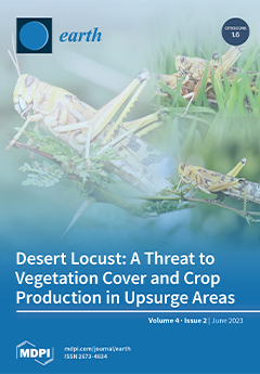
Recognizing the environmental impacts of desert locusts is of utmost importance due to the far-reaching consequences they have on ecosystems and human livelihoods. These insects have gained notoriety for forming large swarms and consuming vast amounts of vegetation. This voracious feeding leads to severe ecological imbalances, thus impeding agricultural production, food security and causing huge economic losses globally. Consequently, comprehending the environmental impacts of these swarms is crucial for devising early warning systems, control measures, and sustainable agricultural practices that safeguard earth systems. Through this research, we contributed to the knowledge on ecological and socio-economic disruptions caused by these insect pests to protect the fragile balance of our ecosystems. View this paper
  • Issues are regarded as officially published after their release is announced to the table of contents alert mailing list.
  • You may sign up for e-mail alerts to receive table of contents of newly released issues.
  • PDF is the official format for papers published in both, html and pdf forms. To view the papers in pdf format, click on the "PDF Full-text" link, and use the free Adobe Reader to open them.
Order results
Result details
Select all
Export citation of selected articles as:
3 pages, 186 KiB  
Book Review
Book Review: Sanz et al. Elements and Mineral Resources; Springer: Cham, Switzerland, 2022; ISBN 978-3-030-85888-9
by Dmitry A. Ruban
Earth 2023, 4(2), 442-444; https://doi.org/10.3390/earth4020023 - 08 Jun 2023
Viewed by 773
Abstract
Mineral resources remain essential to contemporary society and determine the important patterns of its sustainable development [...] Full article
44 pages, 7405 KiB  
Article
Impact of Climate Variability on Rainfall Characteristics in the Semi-Arid Shashe Catchment (Botswana) from 1981–2050
by Ronny G. Matenge, Bhagabat P. Parida, Moatlhodi W. Letshwenyo and Gofetamang Ditalelo
Earth 2023, 4(2), 398-441; https://doi.org/10.3390/earth4020022 - 06 Jun 2023
Cited by 2 | Viewed by 1029
Abstract
Futuristic rainfall projections are used in scale and various climate impact assessments. However, the influence of climate variability on spatial distribution patterns and characteristics of rainfall at the local level, especially in semi-arid catchments that are highly variable and are not well explored. [...] Read more.
Futuristic rainfall projections are used in scale and various climate impact assessments. However, the influence of climate variability on spatial distribution patterns and characteristics of rainfall at the local level, especially in semi-arid catchments that are highly variable and are not well explored. In this study, we explore the influence of climate variability on the spatial distribution and rainfall characteristics at a local scale in the semi-arid Shashe catchment, Northeastern Botswana. The LARS-WG, Long Ashton Research Station Weather Generator downscaling method, three representative scenarios (RCP 2.6, RCP 4.5, and RCP 4.5), three trend detection methods (Mann-Kendall, Sen’s slope, and innovative trend analysis) and L-moment method were used to assess climate change impacts on rainfall. Two data sets were used; one with 40 years of observed data from 1981–2020 and the other with 70 years from 1981–2050 (40 years of observed and 30 years of projected data from 2021–2050). Generally, the study found trend inconsistencies for all the trend detection methods. In most cases, Sen’s Slope has a high estimate of observed and RCP 2.6, while ITA overestimates rainfall totals under RCP 4.5 and RCP 8.5. The trend is increasing for annual total rainfall in most gauging stations while decreasing for annual maximum rainfall. The catchment is homogeneous, and Generalized Logistic distribution is the dataset’s best-fit distribution. Spatial coverage of a 100-year rainfall between 151–180 mm will be 81% based on observed data and 87% based on projected data under RCP 2.6 scenario when it happens. A 200-year rainfall between 196–240 mm under RCP 4.5 and 8.5 has high spatial areal coverage, at least 90% of the total catchment. The outcomes of this study will provide insightful information for water resource management and flood risk assessment under climate change. There is a need, however, to assess the transferability of this approach to other catchments in the country and assess the performance of other advanced modelling systems, such as machine learning, in this region. Full article
Show Figures

Graphical abstract

14 pages, 3353 KiB  
Article
The Influence of Eurasian Beaver (Castor fiber L.) Activity on the Transformation and Functioning of Riparian Phytocoenoses in the Southern Boreal Zone (European Russia)
by Nail G. Nazarov, Vadim E. Prokhorov, Aidar G. Sharifullin, Artyom V. Gusarov and Fedor N. Lisetskii
Earth 2023, 4(2), 384-397; https://doi.org/10.3390/earth4020021 - 09 May 2023
Cited by 2 | Viewed by 1533
Abstract
The reintroduction of Eurasian beaver (Castor fiber L.) results in significant changes in ecosystems. The purpose of this study is to assess the impact of the environment-forming activity of C. fiber on the riparian phytocoenoses of the Raifa forest sector of the [...] Read more.
The reintroduction of Eurasian beaver (Castor fiber L.) results in significant changes in ecosystems. The purpose of this study is to assess the impact of the environment-forming activity of C. fiber on the riparian phytocoenoses of the Raifa forest sector of the Volga-Kama State Nature Biosphere Reserve (Middle Volga region, European Russia) after the reintroduction. Phytoindication methods of ecological–coenotic groups and indicator values were used to assess changes in environmental conditions under the influence of beaver activity. The influence of the beaver reintroduction factor on the increase in the moisture regime (by three points according to the Tsyganov indicator values) and the illumination of habitats, the richness of soils in nitrogen, and the acidity and salt regime of soils (by one point) was revealed. Under the conditions of fodder and construction activities of the beaver, an increase in the proportion of aquatic and wetland groups from 10.2% to 28.2% and boreal plant species from 15.0% to 27.6% was detected. An expansive nature of the change in the degree of landscape occupancy with wetland plants was noted. A decrease in the degree of landscape occupancy (3 to 2 points) of the distribution of ruderal species in the riparian zones of the waterbodies of the reserve due to the activity of the beaver was revealed. Based on phytoindication and ecological–coenotic analyses, it was shown that the reintroduction of C. fiber into the waterbodies of the Raifa forest sector of the reserve is responsible for maintaining the necessary microclimatic conditions for the preservation of natural southern boreal communities. The results obtained can be used for predictive assessment of the influence of the beaver on riparian (small rivers and lakes) plant communities of forest ecosystems in the Middle Volga region of European Russia and other regions of the planet with similar environmental conditions. Full article
Show Figures

Figure 1

19 pages, 3114 KiB  
Article
Assessing the Impacts of Land Use and Climate Changes on River Discharge towards Lake Victoria
by Renatus James Shinhu, Aloyce I. Amasi, Maarten Wynants, Joel Nobert, Kelvin M. Mtei and Karoli N. Njau
Earth 2023, 4(2), 365-383; https://doi.org/10.3390/earth4020020 - 08 May 2023
Cited by 2 | Viewed by 2029
Abstract
The Lake Victoria basin’s expanding population is heavily reliant on rainfall and river flow to meet their water needs, making them extremely vulnerable to changes in climate and land use. To develop adaptation and mitigation strategies to climate changes it is urgently necessary [...] Read more.
The Lake Victoria basin’s expanding population is heavily reliant on rainfall and river flow to meet their water needs, making them extremely vulnerable to changes in climate and land use. To develop adaptation and mitigation strategies to climate changes it is urgently necessary to evaluate the impacts of climate change on the quantity of water in the rivers that drain into Lake Victoria. In this study, the semi-distributed hydrological SWAT model was used to evaluate the impact of current land use and climate changes for the period of 1990–2019 and assess the probable future impacts of climate changes in the near future (2030–2060) on the Simiyu river discharge draining into Lake Victoria, Northern Tanzania. The General Circulation Model under RCPs 4.5, 6.0 and 8.5 predicted an increase in the annual average temperature of 1.4 °C in 2030 to 2 °C in 2060 and an average of 7.8% reduction in rainfall in the catchment. The simulated river discharge from the hydrological model under RCPs 4.5, 6.0 and 8.5 revealed a decreasing trend in annual average discharge by 1.6 m3/s from 5.66 m3/s in 2019 to 4.0 m3/s in 2060. The increase in evapotranspiration caused by the temperature increase is primarily responsible for the decrease in river discharge. The model also forecasts an increase in extreme discharge events, from a range between 32.1 and 232.8 m3/s in 1990–2019 to a range between 10.9 and 451.3 m3/s in the 2030–2060 period. The present combined impacts of climate and land use changes showed higher effects on peak discharge at different return periods (Q5 to Q100) with values of 213.7 m3/s (Q5), 310.2 m3/s (Q25) and 400.4 m3/s (Q100) compared to the contributions of climate-change-only scenario with peak discharges of 212.1 m3/s (Q5), 300.2 m3/s (Q25) and 390.2 m3/s (Q100), and land use change only with peak discharges of 295.5 m3/s (Q5), 207.1 m3/s Q25) and 367.3 m3/s (Q100). However, the contribution ratio of climate change was larger than for land use change. The SWAT model proved to be a useful tool for forecasting river discharge in complex semi-arid catchments draining towards Lake Victoria. These findings highlight the need for catchment-wide water management plans in the Lake Victoria Basin. Full article
Show Figures

Figure 1

20 pages, 4964 KiB  
Article
The Effect of Surface Oil on Ocean Wind Stress
by Daneisha Blair, Yangxing Zheng and Mark A. Bourassa
Earth 2023, 4(2), 345-364; https://doi.org/10.3390/earth4020019 - 06 May 2023
Cited by 1 | Viewed by 1762
Abstract
This study provides, to the best of our knowledge, the first detailed analysis of how surface oil modifies air–sea interactions in a two-way coupled model, i.e., the coupled–ocean–atmosphere–wave–sediment–transport (COAWST) model, modified to account for oil-related changes in air–sea fluxes. This study investigates the [...] Read more.
This study provides, to the best of our knowledge, the first detailed analysis of how surface oil modifies air–sea interactions in a two-way coupled model, i.e., the coupled–ocean–atmosphere–wave–sediment–transport (COAWST) model, modified to account for oil-related changes in air–sea fluxes. This study investigates the effects of oil on surface roughness, surface wind, surface and near-surface temperature differences, and boundary-layer stability and how those conditions ultimately affect surface stress. We first conducted twin-coupled modeling simulations with and without the influence of oil over the Deepwater Horizon (DWH) oil spill period (20 April to 5 May 2010) in the Gulf of Mexico. Then, we compared the results by using a modularized flux model with parameterizations selected to match those selected in the coupled model adapted to either ignore or account for different atmospheric/oceanic processes in calculating surface stress. When non-oil inputs to the bulk formula were treated as being unchanged by oil, the surface stress changes were always negative because of oil-related dampening of the surface roughness alone. However, the oil-related changes to 10 m wind speeds and boundary-layer stability were found to play a dominant role in surface stress changes relative to those due to the oil-related surface roughness changes, highlighting that most of the changes in surface stress were due to oil-related changes in wind speed and boundary-layer stability. Finally, the oil-related changes in surface stress due to the combined oil-related changes in surface roughness, surface wind, and boundary-layer stability were not large enough to have a major impact on the surface current and surface oil transport, indicating that the feedback from the surface oil to the surface oil movement itself is insignificant in forecasting surface oil transport unless the fractional oil coverage is much larger than the value found in this study. Full article
Show Figures

Figure 1

14 pages, 2564 KiB  
Review
Fields of Application of SWAT Hydrological Model—A Review
by Josip Janjić and Lidija Tadić
Earth 2023, 4(2), 331-344; https://doi.org/10.3390/earth4020018 - 02 May 2023
Cited by 9 | Viewed by 5509
Abstract
Soil and Water Assessment Tool (SWAT) is a widely used model for runoff, non-point source pollution, and other complex hydrological processes under changing environments (groundwater flow, evapotranspiration, snow melting, etc.). This paper reviews the key characteristics and applications of SWAT. Since its inception [...] Read more.
Soil and Water Assessment Tool (SWAT) is a widely used model for runoff, non-point source pollution, and other complex hydrological processes under changing environments (groundwater flow, evapotranspiration, snow melting, etc.). This paper reviews the key characteristics and applications of SWAT. Since its inception in the 1990s, there has been a significant increase in the number of articles related to the SWAT model. In the last 10 years, the number of articles almost reached 4000. The range of applications varies between small and large scales; however, large watershed modelling dominates in North America and Asia. Moreover, the prevailing modelling is related to hydrological impacts in a changing environment, which is a global problem. The significant shortcoming of the SWAT model is the vast quantity of data necessary to run the model to generate accurate and reliable results, which is not accessible in some regions of the world. Apart from its accessibility, it has several advantages, including continuous development, which results in a slew of new interfaces and tools supporting the model. Additionally, it can simulate human activity and agricultural measures and adapt to new circumstances and situations. This article emphasizes weaknesses and strengths of SWAT model application on modelling of hydrological processes in changing climate and environment. Full article
Show Figures

Figure 1

16 pages, 4450 KiB  
Article
Sustainable Use of Soil and Water Conservation Technologies and Its Determinants: The Case of the Handosha Watershed, Omo-Gibe River Basin, Ethiopia
by Habtamu Dagne, Engdawork Assefa and Ermias Teferi
Earth 2023, 4(2), 315-330; https://doi.org/10.3390/earth4020017 - 01 May 2023
Cited by 1 | Viewed by 1695
Abstract
For the past forty years, Ethiopia has been promoting sustainable land management activities to enhance agricultural productivity. This study was intended to identify the factors determining farmers’ adoption and continued use of soil bund measures in the Handosha watershed, Omo-Gibe river basin. A [...] Read more.
For the past forty years, Ethiopia has been promoting sustainable land management activities to enhance agricultural productivity. This study was intended to identify the factors determining farmers’ adoption and continued use of soil bund measures in the Handosha watershed, Omo-Gibe river basin. A multistage sampling technique was used to select 340 households using the Heckman sample selection model. A total of 235 (69.12%) households adopted soil bunds, but only 89 (37.87%) of them were sustainably practicing soil bunds on their farm plots. Most adopters widely practiced soil bunds (49.42%), followed by stone bund (15.9%), and Fanyajuu (10%). The empirical results of the Heckman sample selection model showed that the farming experience, land tenure security, and perception of profitability of conservation measures were significantly positively affected the adoption of soil bund. Whereas, farm plot size and participation in off farm activities significantly negatively influenced the adoption of soil bund. Sustainable use of soil bund measures were significantly positively influenced by land tenure security, family size, and frequency of extension contact, whereas the distance between farm plots and home, and farm plot size were negatively affected. As a result, a design of agro-ecological-based soil and water conservation (SWC) measures was essential in reducing farmland vulnerability to soil erosion and food insecurity. It has been concluded that conservation practices should not only focus on the implementation and biophysical factors but also consider the socioeconomic interests of the farmers to improve the sustainable use of conservation technologies. Full article
Show Figures

Figure 1

19 pages, 5590 KiB  
Article
Simulating Urban Growth Using the Cellular Automata Markov Chain Model in the Context of Spatiotemporal Influences for Salem and Its Peripherals, India
by Linda Theres, Selvakumar Radhakrishnan and Abdul Rahman
Earth 2023, 4(2), 296-314; https://doi.org/10.3390/earth4020016 - 23 Apr 2023
Viewed by 2441
Abstract
Urbanization is one of the biggest challenges for developing countries, and predicting urban growth can help planners and policymakers understand how spatial growth patterns interact. A study was conducted to investigate the spatiotemporal dynamics of land use/land cover changes in Salem and its [...] Read more.
Urbanization is one of the biggest challenges for developing countries, and predicting urban growth can help planners and policymakers understand how spatial growth patterns interact. A study was conducted to investigate the spatiotemporal dynamics of land use/land cover changes in Salem and its surrounding communities from 2001 to 2020 and to simulate urban expansion in 2030 using cellular automata (CA)–Markov and geospatial techniques. The findings showed a decrease in aerial vegetation cover and an increase in barren and built-up land, with a rapid transition from vegetation cover to bare land. The transformed barren land is expected to be converted into built-up land in the near future. Urban growth in the area is estimated to be 179.6 sq km in 2030, up from 59.6 sq km in 2001, 76 sq km in 2011, and 133.3 sq km in 2020. Urban sprawl is steadily increasing in Salem and the surrounding towns of Omalur, Rasipuram, Sankari, and Vazhapadi, with sprawl in the neighboring towns surpassing that in directions aligned toward Salem. The city is being developed as a smart city, which will result in significant expansion and intensification of the built-up area in the coming years. The study’s outcomes can serve as spatial guidelines for growth regulation and monitoring. Full article
Show Figures

Figure 1

18 pages, 3470 KiB  
Article
Impact of Lockdown on Column and Surface Aerosol Content over Ahmedabad and a Comparison with the Indo-Gangetic Plain
by Nisha Vaghmaria, James ME, Alok Sagar Gautam and Sneha Gautam
Earth 2023, 4(2), 278-295; https://doi.org/10.3390/earth4020015 - 12 Apr 2023
Cited by 1 | Viewed by 1235
Abstract
Changes in vertical column concentration, size distribution, and surface concentration of aerosol associated with the lockdown imposed by the COVID-19 pandemic in 2020 over the Ahmedabad region in Gujarat State, India, were analyzed. The results are compared with changes over selected Indo-Gangetic Plain [...] Read more.
Changes in vertical column concentration, size distribution, and surface concentration of aerosol associated with the lockdown imposed by the COVID-19 pandemic in 2020 over the Ahmedabad region in Gujarat State, India, were analyzed. The results are compared with changes over selected Indo-Gangetic Plain (IGP) regions. On 25 March 2020, the prime minister of India declared a complete lockdown throughout the country and later lifted restrictions in a phased manner. Aerosol optical depth (AOD) over the Ahmedabad region on 29 March dropped to as low as 0.11, and in the first two weeks of lockdown, the weekly average AOD was only 0.18. On almost all days of the lockdown period, AOD over the Ahmedabad region was lower than the decadal mean. It was found that the Ahmedabad region responded differently to lockdown conditions compared to the IGP regions. During the first lockdown phase, AOD decreased by about 29% compared to the pre-lockdown period over the Ahmedabad region. However, the average reduction over the IGP was much more, about 50%. The average Angstrom exponent (AE) of 0.96 during the pre-lockdown period over the Ahmedabad region increased phase-wise to 1.36 during the L3 lockdown phase, indicating dominance of fine-mode particles during the lockdown period. It suggests a reduction in anthropogenically produced coarse-mode particles, typically dust produced by vehicular movement, construction, and industrial activities. However, on the other hand, over the IGP region, the high dominance of fine-mode particles during the pre-lockdown period had changed to a high dominance of coarse-mode particles, especially over the Delhi region. This indicates a reduction in anthropogenically produced fine-mode particles, which are mainly generated by fossil and biofuels/biomass combustion, over the IGP region by lockdown conditions. Within a few days of lockdown, PM2.5 was reduced by 64% and 76% over the Ahmedabad and Delhi regions, respectively. The lockdown imposed by the pandemic provided an excellent opportunity to ascertain background aerosol conditions in the atmosphere. Full article
Show Figures

Figure 1

12 pages, 6132 KiB  
Technical Note
Application of the RAPS Method for Determining the Dependence of Nitrate Concentration in Groundwater on the Amount of Precipitation
by Marko Šrajbek, Bojan Đurin, Petra Sušilović and Suraj Kumar Singh
Earth 2023, 4(2), 266-277; https://doi.org/10.3390/earth4020014 - 06 Apr 2023
Cited by 1 | Viewed by 2194
Abstract
Protecting groundwater from contamination is today’s most current environmental protection topic. What can man do in his environment to reduce the harmful impact of contamination on the environment, and thus the immediate effect on groundwater? Agricultural production is an ongoing source of groundwater [...] Read more.
Protecting groundwater from contamination is today’s most current environmental protection topic. What can man do in his environment to reduce the harmful impact of contamination on the environment, and thus the immediate effect on groundwater? Agricultural production is an ongoing source of groundwater contamination due to the increasingly frequent use of nitrates in fertilizers, which are washed out from the soil into groundwater due to precipitation. This paper investigates three wellfields in the north of the Republic of Croatia near the town of Varaždin. With the application of the RAPS method, the dependence of nitrate concentration in groundwater on the amount of precipitation was established. The analysis results show the connection of the observed parameters, especially in the upper aquifer layer. In this layer, the coefficients of correlation are greater than 0.80 at all locations, which shows a strong positive connection between the parameters. In the lower aquifer, the values of the coefficients of correlation are lower, and the results mostly indicate a weak correlation. The obtained results will serve as a starting point for future studies, which will aim to precisely determine the factors that influence groundwater quality in the observed area. Full article
Show Figures

Figure 1

25 pages, 7856 KiB  
Article
Integrated Geospatial and Geophysical Approaches for Mapping Groundwater Potential in the Semi-Arid Bukombe District, Tanzania
by Juma N. Kubingwa, Edikafubeni E. Makoba and Kassim Ramadhani Mussa
Earth 2023, 4(2), 241-265; https://doi.org/10.3390/earth4020013 - 05 Apr 2023
Cited by 2 | Viewed by 1923
Abstract
The rapid growth of civil societies coupled with population influx due to the artisanal mining industry in the Bukombe district (BD) has triggered a high demand for water resources. The daily consumption of water resources in the district surpasses the supply from available [...] Read more.
The rapid growth of civil societies coupled with population influx due to the artisanal mining industry in the Bukombe district (BD) has triggered a high demand for water resources. The daily consumption of water resources in the district surpasses the supply from available surface water sources. Thus, the situation has raised the demand for groundwater resources as an alternative. Despite the importance of groundwater resources, no current studies have spatially assessed groundwater potential to locate optimal points for borehole development. This study intended to investigate and map the groundwater potential areas (GWPAs) in the semi-arid BD using remote sensing (RS), the geographic information system (GIS), and the analytic hierarchy process (AHP) to help local communities access clean and safe water. Rainfall, geology, slope, drainage density, land use/land cover and lineament density were prepared to delineate the map of GWPAs. The map was categorized into poor (0.21%), moderate good (51.39%), good (45.70%) and very good (2.70%). Finally, the GWPA map was validated using Vertical Electrical Sounding (VES), 2-D sections and a drilled borehole. The validation results confirmed that the applied approach provides significant results that can help in planning the sustainable utilization of groundwater resources. Full article
Show Figures

Figure 1

18 pages, 1612 KiB  
Review
Freshwater Shortage, Salinity Increase, and Global Food Production: A Need for Sustainable Irrigation Water Desalination—A Scoping Review
by Marufa Khondoker, Sujata Mandal, Ranjit Gurav and Sangchul Hwang
Earth 2023, 4(2), 223-240; https://doi.org/10.3390/earth4020012 - 04 Apr 2023
Cited by 8 | Viewed by 4951
Abstract
Climate-change-induced freshwater shortage and saline intrusion have been posing significant risks to agricultural sectors in arid and semi-arid regions, negatively impacting irrigation, crop yield, and food production. Climate-smart sustainable solutions are the requirement to combat these major concerns. To overcome freshwater scarcity, pressure-driven [...] Read more.
Climate-change-induced freshwater shortage and saline intrusion have been posing significant risks to agricultural sectors in arid and semi-arid regions, negatively impacting irrigation, crop yield, and food production. Climate-smart sustainable solutions are the requirement to combat these major concerns. To overcome freshwater scarcity, pressure-driven desalination techniques are used that require advanced operational systems and electricity, which creates an additional economic burden when applied in the agriculture sector. Therefore, more sustainable methods for soil and water desalination using plant-, microbial-, algal-, biomass-, and carbon-based systems are needed. This scoping review addresses the effects of climate change on freshwater shortage and global food production, the influence of salinity and sodicity on agriculture, and sustainable desalination technologies. Full article
Show Figures

Figure 1

14 pages, 1969 KiB  
Article
Ecotonic Communities of Diatoms in the Southeastern Part of the Kamchatka Peninsula
by Alfiya I. Fazlutdinova, Rezeda Z. Allaguvatova and Lira A. Gaysina
Earth 2023, 4(2), 209-222; https://doi.org/10.3390/earth4020011 - 30 Mar 2023
Cited by 1 | Viewed by 1386
Abstract
Data about the ecotonic diatom communities of the Kamchatka Peninsula, a unique territory with strong volcanic activity, are very limited. We aimed to investigate diatom algae of the ecotones in the southeastern part of Kamchatka, including the Paratunka river valley, at the foot [...] Read more.
Data about the ecotonic diatom communities of the Kamchatka Peninsula, a unique territory with strong volcanic activity, are very limited. We aimed to investigate diatom algae of the ecotones in the southeastern part of Kamchatka, including the Paratunka river valley, at the foot of the Vachkazhets volcano, and the bank of the Bystraya river. In total, 55 taxa were identified. The most diverse were the flora of the Paratunka river, with 31 taxa. Near the Bystraya river, 26 taxa were identified. Near the Vachkazhets volcano, 18 taxa were identified. Fragilariforma virescens, Planothidium lanceolatum, Pinnularia cf. subcapitata, Halamphora normanii, Nitzschia palea, and Eunotia exigua were the dominant species in the studied ecosystems, with the maximum abundance score. Pinnularia cf. subcapitata and Planothidium lanceolatum were found in all ecotones. In the studied habitats, small indifferent alkaliphilic cosmopolitan species prevailed. Our study revealed that the diatom species composition of the Kamchatka ecotones reflects their adaptability to survive in the extreme conditions of volcanic substrates. The results contribute to our knowledge of the ecology and biogeography of a number of diatom taxa. Full article
Show Figures

Figure 1

22 pages, 7778 KiB  
Article
Desert Locust (Schistocerca gregaria) Invasion Risk and Vegetation Damage in a Key Upsurge Area
by Raphael Mongare, Elfatih M. Abdel-Rahman, Bester Tawona Mudereri, Emily Kimathi, Simon Onywere and Henri E. Z. Tonnang
Earth 2023, 4(2), 187-208; https://doi.org/10.3390/earth4020010 - 28 Mar 2023
Cited by 1 | Viewed by 2421
Abstract
In the recent past, the Horn of Africa witnessed an upsurge in the desert locust (Schistocerca gregaria) invasion. This has raised major concerns over the massive food insecurity, socioeconomic impacts, and livelihood losses caused by these recurring invasions. This study determined [...] Read more.
In the recent past, the Horn of Africa witnessed an upsurge in the desert locust (Schistocerca gregaria) invasion. This has raised major concerns over the massive food insecurity, socioeconomic impacts, and livelihood losses caused by these recurring invasions. This study determined the potential vegetation damage due to desert locusts (DLs) and predicted the suitable habitat at high risk of invasion by the DLs using current and future climate change scenarios in Kenya. The normalized difference vegetation index (NDVI) for the period 2018–2020 was computed using multi-date Sentinel-2 imagery in the Google Earth Engine platform. This was performed to assess the vegetation changes that occurred between May and July of the year 2020 when northern Kenya was the hotspot of the DL upsurge. The maximum entropy (MaxEnt) algorithm was used together with 646 DL occurrence records and six bioclimatic variables to predict DL habitat suitability. The current (2020) and two future climatic scenarios for the shared socioeconomic pathways SSP2-4.5 and SSP5-8.5 from the model for interdisciplinary research on climate (MIROC6) were utilized to predict the future potential distribution of DLs for the year 2030 (average for 2021–2040). Using Turkana County as a case, the NDVI analysis indicated the highest vegetation damage between May and July 2020. The MaxEnt model produced an area under the curve (AUC) value of 0.87 and a true skill statistic (TSS) of 0.61, while temperature seasonality (Bio4), mean diurnal range (Bio2), and precipitation of the warmest quarter (Bio18) were the most important bioclimatic variables in predicting the DL invasion suitability. Further analysis demonstrated that currently 27% of the total area in Turkana County is highly suitable for DL invasion, and the habitat coverage is predicted to potentially decrease to 20% in the future using the worst-case climate change scenario (SSP5-8.5). These results have demonstrated the potential of remotely sensed data to pinpoint the magnitude and location of vegetation damage caused by the DLs and the potential future risk of invasion in the region due to the available favorable vegetational and climatic conditions. This study provides a scalable approach as well as baseline information useful for surveillance, development of control programs, and monitoring of DL invasions at local and regional scales. Full article
Show Figures

Figure 1

Previous Issue
Next Issue
Back to TopTop