Next Issue
Volume 4, June
Previous Issue
Volume 3, December


Earth, Volume 4, Issue 1 (March 2023) – 9 articles

Cover Story (view full-size image): 
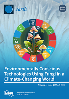
The perspective entitled “Environmentally Conscious Technologies Using Fungi in a Climate-Changing World” shows that fungi are a diverse and fascinating group of organisms that can help to achieve the United Nations Sustainable Development Goals. Their properties make them useful organisms in addressing the urgent challenges facing humanity. Fungi can be used biotechnologically to produce biodegradable products with minimal waste and energy consumption. Recent research in the field of white biotechnology has made significant progress, and further advances can be expected in the near future, especially in agricultural and environmental biotechnology. Against this backdrop, it is crucial to explore the use of fungi in novel and environmentally conscious technologies and to mitigate the effects of climate change. View this paper
  • Issues are regarded as officially published after their release is announced to the table of contents alert mailing list.
  • You may sign up for e-mail alerts to receive table of contents of newly released issues.
  • PDF is the official format for papers published in both, html and pdf forms. To view the papers in pdf format, click on the "PDF Full-text" link, and use the free Adobe Reader to open them.
Order results
Result details
Select all
Export citation of selected articles as:
19 pages, 527 KiB  
Review
A Review of Literature on the Usage of Low-Cost Sensors to Measure Particulate Matter
by Amit U. Raysoni, Sai Deepak Pinakana, Esmeralda Mendez, Dawid Wladyka, Katarzyna Sepielak and Owen Temby
Earth 2023, 4(1), 168-186; https://doi.org/10.3390/earth4010009 - 14 Mar 2023
Cited by 3 | Viewed by 3292
Abstract
With advances in technological sciences, individuals can utilize low-cost air monitoring sensors to record air quality at homes, schools, and businesses. Air quality data collected from LCSs are publicly accessible, informing the community of the air quality around them. It is important to [...] Read more.
With advances in technological sciences, individuals can utilize low-cost air monitoring sensors to record air quality at homes, schools, and businesses. Air quality data collected from LCSs are publicly accessible, informing the community of the air quality around them. It is important to measure local and regional particulate matter (PM) concentrations to keep the public involved, especially those with specific health concerns, such as asthma, wheezing, and seasonal allergies. The number of studies involving the use of LCSs to evaluate PM levels is increasing with more manufacturers producing ‘easy to use’ LCSs targeting the public. The goal of this review is to understand and incorporate the findings from studies using LCSs to analyze PM of various sizes, i.e., PM1, PM2.5, PM4, and PM10. This review integrates analyses from 51 different studies in 14 countries, including the U.S. The findings indicate spatial heterogeneity in the PM concentrations across a region. Some of the low-cost sensor manufacturers mentioned in these studies include Plantower, AQMesh, Alpha-sense, PurpleAir, E-MOTEs, and Shinyei. This review emphasizes the importance of LCSs in the field of PM monitoring and its potential to inform the public about their exposure burden, and to aid state and federal decision makers in formulating policies for mitigating the effects of PM pollution in any urban or rural setting. Full article
Show Figures

Figure 1

17 pages, 5225 KiB  
Article
Multiscale Correlation Analysis between Wind Direction and Meteorological Parameters in Guadeloupe Archipelago
by Thomas Plocoste and Adarsh Sankaran
Earth 2023, 4(1), 151-167; https://doi.org/10.3390/earth4010008 - 10 Mar 2023
Cited by 1 | Viewed by 1929
Abstract
In this paper, the wind direction (WD) behaviour with respect to the variability of other meteorological parameters (i.e., rainfall (R), temperature (T), relative humidity (Rh), solar radiation (SR) and wind [...] Read more.
In this paper, the wind direction (WD) behaviour with respect to the variability of other meteorological parameters (i.e., rainfall (R), temperature (T), relative humidity (Rh), solar radiation (SR) and wind speed (U)) was studied in a multi-scale way. To carry out this study, the Hilbert–Huang transform (HHT) framework was applied to a Guadeloupe archipelago dataset from 2016 to 2021. Thus, the time-dependent intrinsic correlation (TDIC) analysis based on multivariate empirical mode decomposition (MEMD) was performed. For time scales between ∼3 days and ∼7 months, the localized positive and negative correlations between WD and the meteorological parameters have been identified. The alternation between these correlations was more significant for T and Rh. With regard to SR and U, there was a dominance of a negative correlation with WD. We assumed that the micro-climate previously identified in the literature for the study area plays a key role in these behaviours. A strong positive correlation between WD and R was found from ∼7 months to ∼2.5 years. At the annual scale, the relationships between WD and all meteorological parameters were long range and no significant transition in correlation was observed showing the impact of the Earth’s annual cycle on climatic variables. All these results clearly show the influence of R-T-Rh-SR-U on WD over different time scales. Full article
Show Figures

Figure 1

58 pages, 29606 KiB  
Article
Surface Urban Heat Island and Thermal Profiles Using Digital Image Analysis of Cities in the El Bajío Industrial Corridor, Mexico, in 2020
by Sandra Lizbeth Medina-Fernández, Juan Manuel Núñez, Itzia Barrera-Alarcón and Daniel. A. Perez-DeLaMora
Earth 2023, 4(1), 93-150; https://doi.org/10.3390/earth4010007 - 08 Mar 2023
Cited by 1 | Viewed by 2474
Abstract
The Surface Urban Heat Island (SUHI) effect refers to the difference in Land Surface Temperature (LST) between an urban area and its surrounding non-urban area. LST can provide detailed information on the variations in different types of land cover. This study, therefore, analyzes [...] Read more.
The Surface Urban Heat Island (SUHI) effect refers to the difference in Land Surface Temperature (LST) between an urban area and its surrounding non-urban area. LST can provide detailed information on the variations in different types of land cover. This study, therefore, analyzes the behavior of LST and SUHIs in fourteen cities in the El Bajío Industrial Corridor, Mexico, using Landsat satellite images from 2020, with QGIS software. It utilizes thermal profiles to identify the land uses that intensify LST, which are essentially those that are anthropologically altered. The results show that the increases in LST and SUHI are more pronounced in cities with greater urban conglomeration, as well as those where there are few green areas and a sizeable industrial or mixed area, with few or no bodies of water. In addition, the increase in temperature in the SUHI is due to certain crops such as vegetables, red fruits, and basic grains such as corn, wheat, and sorghum that use fallow as part of agricultural practices, located around urban areas, which minimizes natural areas with arboreal vegetation. Full article
Show Figures

Figure 1

15 pages, 1366 KiB  
Review
Ecosystem Services Valuation of Constructed Wetland as a Nature-Based Solution to Wastewater Treatment
by Casper Boongaling Agaton and Patricia Marie Caparas Guila
Earth 2023, 4(1), 78-92; https://doi.org/10.3390/earth4010006 - 11 Feb 2023
Cited by 7 | Viewed by 4123
Abstract
Constructed wetlands (CWs) are nature-based solutions that utilize natural vegetation, soils, and microbes to treat domestic wastewater and industrial effluents. They are engineered treatment systems that mimic the functions of natural wetlands to capture stormwater, reduce nutrient loads, and create diverse wildlife habitats. [...] Read more.
Constructed wetlands (CWs) are nature-based solutions that utilize natural vegetation, soils, and microbes to treat domestic wastewater and industrial effluents. They are engineered treatment systems that mimic the functions of natural wetlands to capture stormwater, reduce nutrient loads, and create diverse wildlife habitats. Providing these monetary and non-monetary benefits, its implementation has grown in several applications and geographical spread. Recent studies integrate the ecosystem services of CWs in project valuation, and the critical analysis of research hotspots has not been made yet. This study employs a systematic review to analyze the literature on ecosystem services provided by CWs and how they are incorporated into the valuation of CW projects. Among the ecosystem services that have been identified are provisioning (biomass and water supply), regulating (wastewater treatment and purification, climate regulation, flood prevention, and erosion control), cultural (recreation and aesthetic, biodiversity, education, and research), and supporting (habitat formation, nutrient cycling, and hydrological cycle). In terms of valuation methods and techniques, the results identified contingent valuation, shadow pricing, cost–benefit analysis, benefits transfer, habitat evaluation procedures, replacement cost, and travel cost. The analysis results provide researchers with a concrete basis for future studies and directions for further development. This also provides policymakers and CW project planners with valuable insights on various aspects of policy support for CW adoption and project valuation. Full article
Show Figures

Figure 1

9 pages, 718 KiB  
Perspective
Environmentally Conscious Technologies Using Fungi in a Climate-Changing World
by Davor Kržišnik and José Gonçalves
Earth 2023, 4(1), 69-77; https://doi.org/10.3390/earth4010005 - 08 Feb 2023
Cited by 6 | Viewed by 4001
Abstract
Fungi are a diverse and fascinating group of organisms that play an important role in various ecosystems, e.g., in the decomposition of organic matter and nutrient cycling. However, climate change poses a significant threat to these ecosystems and the organisms that inhabit them. [...] Read more.
Fungi are a diverse and fascinating group of organisms that play an important role in various ecosystems, e.g., in the decomposition of organic matter and nutrient cycling. However, climate change poses a significant threat to these ecosystems and the organisms that inhabit them. Fluctuations in temperature and humidity can cause shifts in the distribution of fungi and negatively impact the ecosystems they inhabit. Yet fungi have the potential to play a role in mitigating the effects of climate change. With the use of biotechnology, fungi can help meet the United Nations Sustainable Development Goals, and their properties make them useful organisms in addressing the urgent challenges that humanity faces. For example, industrial biotechnology using fungi can lead to the production of goods that are more biodegradable, use less energy and produce less waste. Fungi have long been used in the production of enzymes, alkaloids, detergents, acids, and biosurfactants on an industrial scale. Recent research in the field of white biotechnology has made significant progress, and further advances are expected in the near future, especially in agricultural and environmental biotechnology. With this in mind, it is crucial to explore the use of fungi in novel and environmentally conscious technologies, as well as in mitigating the effects of climate change. Full article
Show Figures

Figure 1

3 pages, 188 KiB  
Editorial
Acknowledgment to the Reviewers of Earth in 2022
by Earth Editorial Office
Earth 2023, 4(1), 66-68; https://doi.org/10.3390/earth4010004 - 16 Jan 2023
Viewed by 856
Abstract
High-quality academic publishing is built on rigorous peer review [...] Full article
26 pages, 1927 KiB  
Article
The Cost of Alternative Water Supply and Efficiency Options under Uncertainty: An Application of Modern Portfolio Theory and Chebyshev’s Inequality
by Dat Tran, Tatiana Borisova and Kate Beggs
Earth 2023, 4(1), 40-65; https://doi.org/10.3390/earth4010003 - 09 Jan 2023
Viewed by 2194
Abstract
Sea-level rise, population growth, and changing land-use patterns will further constrain Florida’s already scarce groundwater and surface water supplies in the coming decades. Significant investments in water supply and water demand management are needed to ensure sufficient water availability for human and natural [...] Read more.
Sea-level rise, population growth, and changing land-use patterns will further constrain Florida’s already scarce groundwater and surface water supplies in the coming decades. Significant investments in water supply and water demand management are needed to ensure sufficient water availability for human and natural systems. Section 403.928 (1) (b) of the Florida Statutes requires estimating the expenditures needed to meet the future water demand and avoid the adverse effects of competition for water supplies to 2040. This study considers the 2020–2040 planning period and projects (1) future water demand and supplies; and (2) the total expenditures (capital costs) necessary to meet the future water demand in Florida, USA. The uniqueness of this study compared with the previous studies is the introduction of a probabilistic-based approach to quantify the uncertainty of the investment costs to meet future water demand. We compile data from the U.S. Geological Survey, Florida’s Department of Agriculture & Consumer Services, Florida’s Water Management Districts, and the Florida Department of Environmental Protection to project the future water demand and supplies, and the expenditures needed to meet the demand considering uncertainty in the costs of alternative water supply options. The results show that the total annual water demand is projected to increase by 1405 million cubic meters (+15.9%) by 2040, driven primarily by urbanization. Using the median capital costs of alternative water supply projects, cumulative expenditures for the additional water supplies are estimated between USD 1.11–1.87 billion. However, when uncertainty in the project costs is accounted for, the projected expenditure range shifts to USD 1.65 and USD 3.21 billion. In addition, we illustrate how using Modern Portfolio Theory (MPT) can increase the efficacy of investment planning to develop alternative water supply options. The results indicate that using MPT in selecting the share of each project type in developing water supply options can reduce the standard deviation of capital costs per one unit of capacity by 74% compared to the equal share allocation. This study highlights the need for developing more flexible funding strategies on local, regional, and state levels to finance additional water supply infrastructure, and more cost-effective combinations of demand management strategies and alternative water supply options to meet the water needed for the state in the future. Full article
Show Figures

Figure 1

17 pages, 2933 KiB  
Article
Influence of Infiltrations on the Recharge of the Nkoabang Aquifer Located in the Center Region, Cameroon
by Monique Makuate Tagne, Merlin Simo-Tagne, Nnaemeka R. Nwakuba, Estelle Ndome Effoudou-Priso, Jules Rémy Ndam Ngoupayou, Michel Mbessa, Ablain Tagne Tagne and Razika Kharchi
Earth 2023, 4(1), 23-39; https://doi.org/10.3390/earth4010002 - 01 Jan 2023
Viewed by 1308
Abstract
Due to the limited reach of the drinking-water delivery network, Yaoundé’s surrounding communities (such as Nkoabang) rely on well water, boreholes, and springs. This study conducted a Thornthwaite water-balance analysis in the watershed in order to understand its hydrology capability and investigated the [...] Read more.
Due to the limited reach of the drinking-water delivery network, Yaoundé’s surrounding communities (such as Nkoabang) rely on well water, boreholes, and springs. This study conducted a Thornthwaite water-balance analysis in the watershed in order to understand its hydrology capability and investigated the influence of the flows and infiltrations on the recharge of the aquifer of Nkoabang (Centre Region, Cameroon). The methodology of this work consisted of updating the rainfall and temperature data of the Mvan meteorological station in Yaoundé to carry out the hydrological and water balances of the Nkoabang aquifer and performing the piezometric monitoring of seven wells and one spring in the dry season and the rainy season. The average rainfall height for the period between 1951–2017 was 1577 ± 222 mm, while the monthly temperatures ranged from 22.8 (July) to 25.4 °C (February) for an average of 24.1 °C ± 0.8 °C. The average interannual infiltration was 137 mm, corresponding to an infiltration coefficient of 8.68%. The value of the piezometric levering varies between 706 and 718 m for an average of 711.76 m during the dry season. It fluctuates between 706 and 719 m during the rainy season for an average of 712.95 ± 4.09 m. Irrespective of the season, the highest and lowest values are those of P6 and P3, respectively. Piezometric level values vary little from one season to another but are higher in the rainy season than in the dry season. Wells in the study area generally show small variations in piezometric level amplitude, ranging from 0.4 to 3.3 m with an average of 1.19 ± 1 m. The analysis of the piezometric map of the Nkoabang aquifer shows a flow in the NE-SW direction; storage areas south of the study areas and the water supply area in the peaks and NE of Nkoabang. The daily indicative flow rates of the spring (S) are 0.15 m3 (dry season), which can supply in the dry and rainy seasons 36 to 46 people, respectively, based on a ratio of 0.1 m3 per day per habitant. Full article
Show Figures

Figure 1

22 pages, 7877 KiB  
Article
Development of Global Snow Cover—Trends from 23 Years of Global SnowPack
by Sebastian Roessler and Andreas Jürgen Dietz
Earth 2023, 4(1), 1-22; https://doi.org/10.3390/earth4010001 - 20 Dec 2022
Cited by 4 | Viewed by 4183
Abstract
Globally, the seasonal snow cover is the areal largest, the most short-lived and the most variable part of the cryosphere. Remote sensing proved to be a reliable tool to investigate their short-term variations worldwide. The medium-resolution sensor MODIS sensor has been delivering daily [...] Read more.
Globally, the seasonal snow cover is the areal largest, the most short-lived and the most variable part of the cryosphere. Remote sensing proved to be a reliable tool to investigate their short-term variations worldwide. The medium-resolution sensor MODIS sensor has been delivering daily snow products since the year 2000. Remaining data gaps due to cloud coverage or polar night are interpolated using the DLR’s Global SnowPack (GSP) processor which produces daily global cloud-free snow cover. With the conclusion of the hydrological year 2022 in the northern hemisphere, the snow cover dynamics of the last 23 hydrological years can now be examined. Trends in snow cover development over different time periods (months, seasons, snow seasons) were examined using the Mann–Kendall test and the Theil–Sen slope. This took place as both pixel based and being averaged over selected hydrological catchment areas. The 23-year time series proved to be sufficient to identify significant developments for large areas. Globally, an average decrease in snow cover duration of −0.44 days/year was recorded for the full hydrological year, even if slight increases in individual months such as November were also found. Likewise, a large proportion of significant trends could also be determined globally at the catchment area level for individual periods. Most drastic developments occurred in March, with an average decrease in snow cover duration by −0.16 days/year. In the catchment area of the river Neman, which drains into the Baltic Sea, there is even a decrease of −0.82 days/year. Full article
Show Figures

Graphical abstract

Previous Issue
Next Issue
Back to TopTop