Next Issue
Volume 6, May
Previous Issue
Volume 6, March


Fire, Volume 6, Issue 4 (April 2023) – 45 articles

Cover Story (view full-size image): 
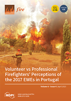
2017 wildfires in Portugal presented complex scenarios, clearly beyond the capacity of control, where command orders were inadequate considering the fire behavior, namely in terms of metrics (ROS, intensity, and spotting) and the collapse of communication systems. This paper gives voice to the professional and volunteer firefighters that faced these complex events, with both recognizing that they were not coping with “normal fires”.
Firefighters express their opinions concerning operational experience facing fire, difficulties and weaknesses, emotions, lessons learned, and new strategies of management. Although with some differences in perceptions, Extreme Wildfire Events’ complexity and challenges are not yet well understood by firefighters still using techniques and approaches no longer adequate to cope with EWEs characteristics, but asking for more resources to reinforce suppression. View this paper
  • Issues are regarded as officially published after their release is announced to the table of contents alert mailing list.
  • You may sign up for e-mail alerts to receive table of contents of newly released issues.
  • PDF is the official format for papers published in both, html and pdf forms. To view the papers in pdf format, click on the "PDF Full-text" link, and use the free Adobe Reader to open them.
Order results
Result details
Section
Select all
Export citation of selected articles as:
22 pages, 5423 KiB  
Article
Assessment Method Integrating Visibility and Toxic Gas for Road Tunnel Fires Using 2D Maps for Identifying Risks in the Smoke Environment
by Huei-Ru Hsieh, Hung-Chieh Chung, Nobuyoshi Kawabata, Miho Seike, Masato Hasegawa, Shen-Wen Chien and Tzu-Sheng Shen
Fire 2023, 6(4), 173; https://doi.org/10.3390/fire6040173 - 21 Apr 2023
Cited by 1 | Viewed by 1518
Abstract
This study proposes an assessment method to quantify the risks of the smoke environment for road tunnel fire safety based on previous studies. The assessment method integrates visibility and toxic gases to address the hazards of smoke distribution more comprehensively. Considering that the [...] Read more.
This study proposes an assessment method to quantify the risks of the smoke environment for road tunnel fire safety based on previous studies. The assessment method integrates visibility and toxic gases to address the hazards of smoke distribution more comprehensively. Considering that the hazards of visibility reduction and toxic gases for tunnel users vary with exposure time and location in a fire event, the smoke environment (SE) levels are defined as a function of longitudinal location and time. The SE levels simplify smoke distribution as calculated from 3D computational fluid dynamics (CFDs). For easily identifying SE risks, SE levels are illustrated on a 2D map to analyze the potential hazard by quantifying specific areas and times of smoke exposure. To demonstrate the applicability of the assessment method of this study, cases are carried out using CFD simulation to investigate the risks associated with tunnel fires with various tunnel cross-section types, longitudinal velocities, and gradients. In the analysis of the SE level in different cross-section types and longitudinal velocities under the condition of no vehicle, a velocity of 0.9–1.1 m/s can maintain a less serious SE level both upstream and downstream in a horizontal rectangular tunnel, and 0.3–0.5 m/s in a horizontal horseshoe-shaped tunnel. Both rectangular and horseshoe-shaped tunnels reveal an obvious rise within 10–15 min. In the case of inclined tunnels, for both rectangular and horseshoe-shaped tunnels, the SE level near the fire source obviously deteriorates. Thus, the longitudinal velocity range for the purpose of maintaining a relatively less serious SE level should be slightly reduced for inclined tunnels compared with horizontal tunnels. Full article
(This article belongs to the Special Issue Advance in Tunnel Fire Research)
Show Figures

Figure 1

12 pages, 5910 KiB  
Article
Effects of Nano-Nickel Oxide on Thermokinetics, Thermal Safety, and Gas-Generating Characteristics of 5-Aminotetrazole Thermal Degradation
by Dan Zhang, Lifeng Xie and Bin Li
Fire 2023, 6(4), 172; https://doi.org/10.3390/fire6040172 - 21 Apr 2023
Cited by 1 | Viewed by 1290
Abstract
5-aminotetrazole (5AT) has been widely used as a fuel in SPGGs for its high nitrogen content, heat resistance, and environmentally friendly product. However, 5AT-based propellants still have disadvantages, such as a high exhaust temperature and unstable combustion rate, which somewhat limit their application. [...] Read more.
5-aminotetrazole (5AT) has been widely used as a fuel in SPGGs for its high nitrogen content, heat resistance, and environmentally friendly product. However, 5AT-based propellants still have disadvantages, such as a high exhaust temperature and unstable combustion rate, which somewhat limit their application. Given that transition metal oxides are typically employed in small quantities to enhance the performance of solid propellants, this study selected nickel oxide (NiO) nanoparticles as a catalyst and employed them in conjunction with 5AT via mechanical ball milling to investigate their impact on the pyrolysis behavior of 5AT. It was found that the nanoscale NiO particles can significantly reduce the thermal degradation temperature of 5AT according to TG-DSC tests. The calculation of the energy required to initiate the pyrolysis of 5AT using three kinetic methods, namely Friedman (FR), Flynn–Wall–Ozawa (FWO), and Kissinger–Akahira–Sunose (KAS), indicated that the use of NiO nanoparticles can reduce the energy required by more than 46 kJ mol−1, thereby increasing the likelihood of 5AT pyrolysis. Meanwhile, the reduced thermal safety parameters indicated that NiO makes 5AT more susceptible to thermal decomposition due to thermal explosion transition, so more care is needed for the storage of 5AT. Moreover, the TG-FTIR test was conducted to study the pyrolysis mechanism with or without NiO; the results showed that NiO exerts different catalytic effects on the gas products. The results from this study can offer direction and recommendations for future research on solid propellants. Full article
(This article belongs to the Special Issue Turbulent Combustion Modelling, Experiment and Simulation)
Show Figures

Figure 1

17 pages, 3884 KiB  
Article
A Fire Evacuation and Control System in Smart Buildings Based on the Internet of Things and a Hybrid Intelligent Algorithm
by Ali Mohammadiounotikandi, Hassan Falah Fakhruldeen, Maytham N. Meqdad, Banar Fareed Ibrahim, Nima Jafari Navimipour and Mehmet Unal
Fire 2023, 6(4), 171; https://doi.org/10.3390/fire6040171 - 20 Apr 2023
Cited by 6 | Viewed by 2899
Abstract
Concerns about fire risk reduction and rescue tactics have been raised in light of recent incidents involving flammable cladding systems and fast fire spread in high-rise buildings worldwide. Thus, governments, engineers, and building designers should prioritize fire safety. During a fire event, an [...] Read more.
Concerns about fire risk reduction and rescue tactics have been raised in light of recent incidents involving flammable cladding systems and fast fire spread in high-rise buildings worldwide. Thus, governments, engineers, and building designers should prioritize fire safety. During a fire event, an emergency evacuation system is indispensable in large buildings, which guides evacuees to exit gates as fast as possible by dynamic and safe routes. Evacuation plans should evaluate whether paths inside the structures are appropriate for evacuations, considering the building’s electric power, electric controls, energy usage, and fire/smoke protection. On the other hand, the Internet of Things (IoT) is emerging as a catalyst for creating and optimizing the supply and consumption of intelligent services to achieve an efficient system. Smart buildings use IoT sensors for monitoring indoor environmental parameters, such as temperature, humidity, luminosity, and air quality. This research proposes a new way for a smart building fire evacuation and control system based on the IoT to direct individuals along an evacuation route during fire incidents efficiently. This research utilizes a hybrid nature-inspired optimization approach, Emperor Penguin Colony, and Particle Swarm Optimization (EPC-PSO). The EPC algorithm is regulated by the penguins’ body heat radiation and spiral-like movement inside their colony. The behavior of emperor penguins improves the PSO algorithm for sooner convergences. The method also uses a particle idea of PSO to update the penguins’ positions. Experimental results showed that the proposed method was executed accurately and effectively by cost, energy consumption, and execution time-related challenges to ensure minimum life and resource causalities. The method has decreased the execution time and cost by 10.41% and 25% compared to other algorithms. Moreover, to achieve a sustainable system, the proposed method has decreased energy consumption by 11.90% compared to other algorithms. Full article
Show Figures

Figure 1

17 pages, 4428 KiB  
Article
Spatial Modeling of Forest and Land Fire Susceptibility Using the Information Value Method in Kotawaringin Barat Regency, Indonesia
by Arman Nur Ikhsan, Danang Sri Hadmoko and Prima Widayani
Fire 2023, 6(4), 170; https://doi.org/10.3390/fire6040170 - 20 Apr 2023
Cited by 3 | Viewed by 1601
Abstract
Kotawaringin Barat is a high-risk area for forest and land fires; a total of 564.13 km2 of forest land was burned from 2015 to 2022, the majority of which spread to peatlands. The goal of this contribution is to use the information [...] Read more.
Kotawaringin Barat is a high-risk area for forest and land fires; a total of 564.13 km2 of forest land was burned from 2015 to 2022, the majority of which spread to peatlands. The goal of this contribution is to use the information value method (IVM) to construct forest and land fire spatial susceptibility maps for the Kotawaringin Barat regency. MODIS hotspots from 2016 to 2020 were used as the dependent variable, with six independent variables included in the modeling. According to the data, there were 925 hotspots detected in Kotawaringin Barat between 2016 and 2020. The areas closest to rivers and roads are more susceptible to forest and land fires, while the areas closest to settlements are safer. Flat slopes have an IVM of 0.697, while peatlands have an IVM of 0.667, making them the most susceptible to forest and land fires. Furthermore, the most susceptive land covers are swamps (IVM = 1.071) and shrublands (IVM = 0.024). According to the IVM model of susceptibility mapping, Kotawaringin Barat is categorized as very high (18.32%) and high (27.97%) risk. About 33.57% of the study area is classified as moderately susceptible, while the remaining 20.14% is classified as low risk. The accuracy of the IVM for forest and land fires is 66.87% (AUC), indicating that the model can be used for susceptibility assessments particularly for very high to high susceptibility areas. Full article
(This article belongs to the Section Fire Science Models, Remote Sensing, and Data)
Show Figures

Figure 1

13 pages, 2537 KiB  
Article
An Efficient Wildfire Detection System for AI-Embedded Applications Using Satellite Imagery
by George L. James, Ryeim B. Ansaf, Sanaa S. Al Samahi, Rebecca D. Parker, Joshua M. Cutler, Rhode V. Gachette and Bahaa I. Ansaf
Fire 2023, 6(4), 169; https://doi.org/10.3390/fire6040169 - 20 Apr 2023
Cited by 4 | Viewed by 3879
Abstract
Wildfire risk has globally increased during the past few years due to several factors. An efficient and fast response to wildfires is extremely important to reduce the damaging effect on humans and wildlife. This work introduces a methodology for designing an efficient machine [...] Read more.
Wildfire risk has globally increased during the past few years due to several factors. An efficient and fast response to wildfires is extremely important to reduce the damaging effect on humans and wildlife. This work introduces a methodology for designing an efficient machine learning system to detect wildfires using satellite imagery. A convolutional neural network (CNN) model is optimized to reduce the required computational resources. Due to the limitations of images containing fire and seasonal variations, an image augmentation process is used to develop adequate training samples for the change in the forest’s visual features and the seasonal wind direction at the study area during the fire season. The selected CNN model (MobileNet) was trained to identify key features of various satellite images that contained fire or without fire. Then, the trained system is used to classify new satellite imagery and sort them into fire or no fire classes. A cloud-based development studio from Edge Impulse Inc. is used to create a NN model based on the transferred learning algorithm. The effects of four hyperparameters are assessed: input image resolution, depth multiplier, number of neurons in the dense layer, and dropout rate. The computational cost is evaluated based on the simulation of deploying the neural network model on an Arduino Nano 33 BLE device, including Flash usage, peak random access memory (RAM) usage, and network inference time. Results supported that the dropout rate only affects network prediction performance; however, the number of neurons in the dense layer had limited effects on performance and computational cost. Additionally, hyperparameters such as image size and network depth significantly impact the network model performance and the computational cost. According to the developed benchmark network analysis, the network model MobileNetV2, with 160 × 160 pixels image size and 50% depth reduction, shows a good classification accuracy and is about 70% computationally lighter than a full-depth network. Therefore, the proposed methodology can effectively design an ML application that instantly and efficiently analyses imagery from a spacecraft/weather balloon for the detection of wildfires without the need of an earth control centre. Full article
(This article belongs to the Topic Application of Remote Sensing in Forest Fire)
Show Figures

Figure 1

15 pages, 3041 KiB  
Article
Development of a Decision Matrix for National Weather Service Red Flag Warnings
by Sarah Jakober, Timothy Brown and Tamara Wall
Fire 2023, 6(4), 168; https://doi.org/10.3390/fire6040168 - 19 Apr 2023
Cited by 2 | Viewed by 1527
Abstract
The National Weather Service is responsible for alerting wildland fire management of meteorological conditions that create an environment conducive for extreme fire behavior. This is communicated via Red Flag Warnings (RFWs), which presently lack a national standardized methodology and rarely are explicitly linked [...] Read more.
The National Weather Service is responsible for alerting wildland fire management of meteorological conditions that create an environment conducive for extreme fire behavior. This is communicated via Red Flag Warnings (RFWs), which presently lack a national standardized methodology and rarely are explicitly linked to fuel conditions such those as provided by National Fire-Danger Rating System (NFDRS) indicators. The need for a revamped RFW has been expressed recently by both fire management and fire weather meteorologists. A decision matrix approach was developed to determine criteria that consistently and explicitly associates meteorological and fuels information to extreme fire behavior. Extreme fire behavior is defined here as maximum rates of spread (area per day) observed on documented large fires from 1999–2014 utilizing the ICS209 all-hazard dataset. Meteorological conditions occurring with these rates of spread were compared to historical percentiles of relative humidity, wind speed, and the NFDRS Energy Release Component. These percentiles were assigned a numerical score from one through five based on percentile rank. The additive result of all three scores was plotted against rates of spread yielding a two-step decision matrix of RFW categories where, for example, the highest score is the most extreme RFW case. Actual RFW issuances were compared to this matrix method. Full article
Show Figures

Figure 1

15 pages, 4361 KiB  
Article
Obstacle Impacts on Methane-Air Flame Propagation Properties in Straight Pipes
by Mohammadreza Shirzaei, Jafar Zanganeh and Behdad Moghtaderi
Fire 2023, 6(4), 167; https://doi.org/10.3390/fire6040167 - 19 Apr 2023
Cited by 1 | Viewed by 1115
Abstract
Accidental flame initiation to propagation in pipes carrying flammable gases is a significant safety concern that can potentially result in loss of life and substantial damage to property. The understanding of flame propagation characteristics caused by methane–air mixtures within various extractive and associated [...] Read more.
Accidental flame initiation to propagation in pipes carrying flammable gases is a significant safety concern that can potentially result in loss of life and substantial damage to property. The understanding of flame propagation characteristics caused by methane–air mixtures within various extractive and associated process industries such as coal mining is critical in developing effective and safe fire prevention and mitigation countermeasures. The aim of this study is to investigate and visualise the fire and explosion properties of a methane–air mixture in a straight pipe with and without obstacles. The experimental setup included modular starting pipes, an array of sensors (flame, temperature, and pressure), a gas injection system, a gas analyser, data acquisition and a control system. The resulting observations indicated that the presence of obstacles within a straight pipe eventuated an increase in flame propagation speed and deflagration overpressure as well as a reduction in the elapsed time of flame propagation. The maximum flame propagation speed in the presence of an orifice with a 70% blockage ratio at multiple spots was increased around 1.7 times when compared to the pipe without obstacles for 10% methane concentration. The findings of this study will augment the body of scientific knowledge and assist extractive and associated process industries, including stakeholders in coal mining to develop better strategies for preventing or reducing the incidence of methane–air flame propagation caused by accidental fires. Full article
Show Figures

Figure 1

14 pages, 9540 KiB  
Article
Forest Fire Patterns and Lightning-Caused Forest Fire Detection in Heilongjiang Province of China Using Satellite Data
by Qiangying Jiao, Meng Fan, Jinhua Tao, Weiye Wang, Di Liu and Ping Wang
Fire 2023, 6(4), 166; https://doi.org/10.3390/fire6040166 - 19 Apr 2023
Cited by 8 | Viewed by 3176
Abstract
Large forest fires can cause significant damage to forest ecosystems and threaten human life and property. Heilongjiang Province is a major forested area in China with the highest number and concentration of lightning-caused forest fires in the country. This study examined the spatial [...] Read more.
Large forest fires can cause significant damage to forest ecosystems and threaten human life and property. Heilongjiang Province is a major forested area in China with the highest number and concentration of lightning-caused forest fires in the country. This study examined the spatial and temporal distribution patterns of forest fires in Heilongjiang Province, as well as the ability of satellite remote sensing to detect these fires using VIIRS 375 m fire point data, ground history forest fire point data, and land cover dataset. The study also investigated the occurrence patterns of lightning-caused forest fires and the factors affecting satellite identification of these fires through case studies. Results show that April has the highest annual number of forest fires, with 77.6% of forest fires being caused by lightning. However, less than 30% of forest fires can be effectively detected by satellites, and lightning-caused forest fires account for less than 15% of all fires. There is a significant negative correlation between the two. Lightning-caused forest fires are concentrated in the Daxing’an Mountains between May and July, and are difficult to monitor by satellites due to cloud cover and lack of satellite transit. Overall, the trend observed in the number of forest fire pixels that are monitored by satellite remote sensing systems is generally indicative of the trends in the actual number of forest fires. However, lightning-caused forest fires are the primary cause of forest fires in Heilongjiang Province, and satellite remote sensing is relatively weak in monitoring these fires due to weather conditions and the timing of satellite transit. Full article
(This article belongs to the Topic Application of Remote Sensing in Forest Fire)
Show Figures

Figure 1

21 pages, 6632 KiB  
Article
Spatial Dependencies and Neighbour Interactions of Wildfire Patterns in Galician Mountain Areas (NW Spain)
by Jesús Barreal and Gil Jannes
Fire 2023, 6(4), 165; https://doi.org/10.3390/fire6040165 - 18 Apr 2023
Viewed by 1558
Abstract
Galicia is the Spanish region most affected by wildfires, and these wildfire patterns are the object of intense research. However, within Galicia, the mountain areas have certain socioeconomic and ecological characteristics that differentiate them from the rest of the region and have thus [...] Read more.
Galicia is the Spanish region most affected by wildfires, and these wildfire patterns are the object of intense research. However, within Galicia, the mountain areas have certain socioeconomic and ecological characteristics that differentiate them from the rest of the region and have thus far not received any specific research attention. This paper proposes an analysis of the spatial wildfire patterns in the core Galician mountain systems in terms of the frequency, ratio of affected area, suppression time, and extension. The contiguity relations of these variables were examined in order to establish neighbour interactions and identify local concentrations of wildfire incidences. Furthermore, a spatial econometric model is proposed for these dependent variables in terms of a set of land cover (coniferous, transitional woodland–shrub) and land use (agricultural, industrial), complemented by population density, ecological protection, and common lands. The relevance of these parameters was studied, and it was found amongst other results, that economic value (agricultural and/or industrial) mitigates wildfire risk and impact, whereas ecological protection does not. In terms of land cover, conifers reduce the frequency and affected area of wildfires, whereas transitional land has a mixed effect, mitigating suppression time and extension but increasing the wildfire frequency. Suggestions for policy improvements are given based on these results, with a particular emphasis on the need for coordination of local policies in order to take into account the neighbour dependencies of wildfire risk and impact. Full article
(This article belongs to the Special Issue Spatial Statistics and Operational Research for Wildfires Management)
Show Figures

Figure 1

15 pages, 4892 KiB  
Article
Protected Areas Conserved Forests from Fire and Deforestation in Vietnam’s Central Highlands from 2001 to 2020
by Samuel J. Ebright, Amanda B. Stan, Hoàng Văn Sâm and Peter Z. Fulé
Fire 2023, 6(4), 164; https://doi.org/10.3390/fire6040164 - 18 Apr 2023
Cited by 3 | Viewed by 1532
Abstract
As a tropical nation with ~40% forested land area and 290 protected areas in the Indo-Burma Biodiversity Hotspot, Vietnam holds an important part of global forests. Despite a complex history of multiple colonial rules, war, rapid economic development and societal growth, Vietnam was [...] Read more.
As a tropical nation with ~40% forested land area and 290 protected areas in the Indo-Burma Biodiversity Hotspot, Vietnam holds an important part of global forests. Despite a complex history of multiple colonial rules, war, rapid economic development and societal growth, Vietnam was one of a few Southeast Asian countries to reverse deforestation trends and sustain net forest cover gain since the 1990s. However, a considerable amount of Vietnam’s forest gain has been from plantation forestry, as Vietnam’s policies have promoted economic development. In the Central Highlands region of Vietnam, widespread forest degradation and deforestation has occurred recently in some areas due to plantation forestry and other factors, including fire-linked deforestation, but protected areas here have been largely effective in their conservation goals. We studied deforestation, wildfires, and the contribution of fire-linked deforestation from 2001 to 2020 in an area near the Da Lat Plateau of the Central Highlands of Vietnam. We stratified our study area to distinguish legally protected areas and those in the surrounding landscape matrix without formal protection. Using satellite-derived data, we investigated four questions: (1) Have regional deforestation trends continued in parts of the Central Highlands from 2001 to 2020? (2) Based on remotely sensed fire detections, how has fire affected the Central Highlands and what proportion of deforestation is spatiotemporally linked to fire? (3) Were annual deforestation and burned area lower in protected areas relative to the surrounding land matrix? (4) Was the proportion of fire-linked deforestation lower in protected areas than in the matrix? To answer these questions, we integrated the Global Forest Change and FIRED VIETNAM datasets. We found that 3794 fires burned 8.7% of the total study area and 13.6% of the area became deforested between 2001 and 2020. While nearly half of fires were linked to deforestation, fire-linked deforestation accounted for only a small part of forest loss. Across the entire study area, 54% of fire-linked deforestation occurred in natural forests and 46% was in plantation forests. Fire ignitions in the study area were strongly linked to the regional dry season, November to March, and instrumental climate data from 1971 to 2020 showed statistically significant increasing trends in minimum, mean, and maximum temperatures. However, the total area burned did not have a significant increasing trend. Regional trends in deforestation continued in Vietnam’s Central Highlands from 2001 to 2020, and nearly half of all detected fires can be spatially and temporally linked to forest loss. However, protected areas in the region effectively conserved forests relative to the surrounding landscape. Full article
(This article belongs to the Topic Application of Remote Sensing in Forest Fire)
Show Figures

Figure 1

18 pages, 4604 KiB  
Article
Flaming Ignition of PMMA, Pine Wood and Pine Needle by External Radiation: Autoignition and Radiant Distance Effect
by Jiayun Song
Fire 2023, 6(4), 163; https://doi.org/10.3390/fire6040163 - 18 Apr 2023
Viewed by 1530
Abstract
Flame radiation is one of the important causes of wildland–urban interface (WUI) fires. PMMA, pine needle and pine wood are the most common fuels in WUI fires, but the radiant distance effect on the flaming ignitions as well as the subsequent burning behavior [...] Read more.
Flame radiation is one of the important causes of wildland–urban interface (WUI) fires. PMMA, pine needle and pine wood are the most common fuels in WUI fires, but the radiant distance effect on the flaming ignitions as well as the subsequent burning behavior is still poorly understood. This work represents an experiment to investigate the flaming autoignition of PMMA, pine-needle and pine-wood fuel beds with different radiant distances (25 mm–100 mm) under a uniform incident radiant heat flux, 25 kW/m2 The experiment results show that for PMMA and pine wood, they all transition from gas-phase ignition near the cone heater to solid-phase ignition. For pine needle, it has smoldering ignition and smoldering-to-flaming ignition. The relationship between radiant distance and ignition delay time is an approximately inverted u-shape curve, and there exists a critical radiant distance (D = 60 mm) for the minimum ignition delay time. For pine wood and PMMA, when D < 60 mm, there exists a linear relationship between radiant distance, D, and tig1/2. Full article
(This article belongs to the Special Issue Turbulent Combustion Modelling, Experiment and Simulation)
Show Figures

Figure 1

26 pages, 4202 KiB  
Article
Emission Factors for the Burning of Decking Slabs Made of Wood and Thermoplastic with a Cone Calorimeter
by Bruno Martinent, Karina Meerpoel-Pietri, Svetlana Petlitckaia, Toussaint Barboni, Virginie Tihay-Felicelli and Paul-Antoine Santoni
Fire 2023, 6(4), 162; https://doi.org/10.3390/fire6040162 - 17 Apr 2023
Cited by 2 | Viewed by 1232
Abstract
Smoke is an important component of wildfires. Specifying the combustion process of different materials allows scientists to better prevent and adopt public health measures. This experimental study contributes to a better characterisation of the smoke emitted by two types of decking, wood and [...] Read more.
Smoke is an important component of wildfires. Specifying the combustion process of different materials allows scientists to better prevent and adopt public health measures. This experimental study contributes to a better characterisation of the smoke emitted by two types of decking, wood and thermoplastic, commonly used in terraces. Emission factors were characterised using a cone calorimeter for different incident fluxes ranging from 10 to 50 kW/m2. The study showed that compared to wooden (pine) decking, thermoplastic (polypropylene) decking produces more gases and aerosols, less VOCs, but with a chemical composition that is more carcinogenic. Full article
(This article belongs to the Special Issue Atmosphere Fire Interactions)
Show Figures

Figure 1

13 pages, 2785 KiB  
Article
Wildfires Improve Forest Growth Resilience to Drought
by Jesús Julio Camarero, Mercedes Guijarro, Rafael Calama, Cristina Valeriano, Manuel Pizarro and Javier Madrigal
Fire 2023, 6(4), 161; https://doi.org/10.3390/fire6040161 - 17 Apr 2023
Viewed by 1759
Abstract
In seasonally dry forests, wildfires can reduce competition for soil water among trees and improve forest resilience to drought. We tested this idea by comparing tree-ring growth patterns of Pinus pinea stands subjected to two prescribed burning intensities (H, high; L, low) and [...] Read more.
In seasonally dry forests, wildfires can reduce competition for soil water among trees and improve forest resilience to drought. We tested this idea by comparing tree-ring growth patterns of Pinus pinea stands subjected to two prescribed burning intensities (H, high; L, low) and compared them with unburned (U) control stands in southwestern Spain. Then, we assessed post-growth resilience to two droughts that occurred before (2005) and after (2012) the prescribed burning (2007). Resilience was quantified as changes in radial growth using resilience indices and as changes in cover and greenness using the NDVI. The NDVI sharply dropped after the fire, and minor drops were also observed after the 2005 and 2012 droughts. We found that post-drought growth and resilience were improved in the H stands, where growth also showed the lowest coherence among individual trees and the lowest correlation with water year precipitation. In contrast, trees from the L site showed the highest correlations with precipitation and the drought index. These findings suggest that tree growth recovered better after drought and responded less to water shortage in the H trees. Therefore, high-intensity fires are linked to reduced drought stress in Mediterranean pine forests. Full article
Show Figures

Figure 1

5 pages, 1029 KiB  
Perspective
Detecting, Monitoring and Foreseeing Wildland Fire Requires Similar Multiscale Viewpoints as Meteorology and Climatology
by David M. J. S. Bowman
Fire 2023, 6(4), 160; https://doi.org/10.3390/fire6040160 - 17 Apr 2023
Viewed by 1734
Abstract
Achieving sustainable coexistence with wildfires in the Anthropocene requires skilful integrated fire observations, fire behaviour predictions, forecasts of fire risk, and projections of change to fire climates. The diverse and multiscale approaches used by the atmospheric sciences, to understand geographic patterns, temporal trends [...] Read more.
Achieving sustainable coexistence with wildfires in the Anthropocene requires skilful integrated fire observations, fire behaviour predictions, forecasts of fire risk, and projections of change to fire climates. The diverse and multiscale approaches used by the atmospheric sciences, to understand geographic patterns, temporal trends and likely trajectories of weather and climate, provide a role model for how multiscale assessments of fire danger can be formulated and delivered to fire managers, emergency responders and at-risk communities. Adaptation to escalating risk of fire disasters requires specialised national agencies, like weather services, that provide to provide a diverse range of products to enable detection and near and longer-range prediction of landscape fire activity. Full article
Show Figures

Figure 1

10 pages, 1299 KiB  
Article
Using a Statistical Model to Estimate the Effect of Wildland Fire Smoke on Ground Level PM2.5 and Asthma in California, USA
by Donald Schweizer, Haiganoush Preisler, Marcela Entwistle, Hamed Gharibi and Ricardo Cisneros
Fire 2023, 6(4), 159; https://doi.org/10.3390/fire6040159 - 16 Apr 2023
Cited by 1 | Viewed by 1278
Abstract
Forest fire activity has been increasing in California. Satellite imagery data along with ground level measurements of PM2.5 have been previously used to determine the presence and level of smoke. In this study, emergency room visits for asthma are explored for the [...] Read more.
Forest fire activity has been increasing in California. Satellite imagery data along with ground level measurements of PM2.5 have been previously used to determine the presence and level of smoke. In this study, emergency room visits for asthma are explored for the impacts of wildland smoke over the entire state of California for the years 2008–2015. Smoke events included extreme high-intensity fire and smoke along with low and moderate smoke events. The presence of wildland fire smoke detected by remote sensing significantly increased fine particulate matter (PM2.5) and significantly increased the odds of exceeding expected concentrations of PM2.5 at ground level. Smoke observed above a monitoring site increases the chance of PM2.5 exceeding 35 µg m−3 (odds ratio 114 (87–150) when high levels of smoke are detected). The strength of association of an asthma emergency room visit is increased with higher PM2.5 concentrations. The odds ratios (OR) are highest for asthma hospital visits when daily mean PM2.5 concentrations experienced exceed 35 µg m−3 for multiple days (OR 1.38 (1.21–1.57) with 3 days). Nonetheless, on days with wildland fire smoke, the association of an emergency room visit for asthma due to PM2.5 is not observed. Further study is needed to confirm these findings and determine if this is a product of smoke avoidance and reduction of personal exposure during smoke episodes. Full article
(This article belongs to the Section Fire Social Science)
Show Figures

Figure 1

21 pages, 3213 KiB  
Article
Probabilistic Wildfire Risk Assessment and Modernization Transitions: The Case of Greece
by Andreas Y. Troumbis, Cleo Maria Gaganis and Haralambos Sideropoulos
Fire 2023, 6(4), 158; https://doi.org/10.3390/fire6040158 - 14 Apr 2023
Cited by 2 | Viewed by 2562
Abstract
Wildfire is the primary cause of deforestation in fire-prone environments, disrupting the forest transition process generated by multiple social-ecological drivers of modernization. Given the positive feedback between climate change and wildfire-driven deforestation, it seems necessary to abstract the primary- or micro-characteristics of wildfire [...] Read more.
Wildfire is the primary cause of deforestation in fire-prone environments, disrupting the forest transition process generated by multiple social-ecological drivers of modernization. Given the positive feedback between climate change and wildfire-driven deforestation, it seems necessary to abstract the primary- or micro-characteristics of wildfire event(s) and focus on the general behavior of the phenomenon across time and space. This paper intends to couple wildfire self-organizing criticality theory (SOC) and modernization statistics to propose a verisimilar explanation of the phenomenon’s evolution in the past decades and a prediction of its trends in Greece. We use power law distributions of the fire frequency–magnitude relationship to estimate the basic SOC parameters and the Weibull reliability method to calculate large-size wildfires’ conditional probability as a time function. We use automatic linear modeling to search for the most accurate relationship between wildfire metrics and the best subset of modernization predictors. The discussion concentrates on reframing the political debate on fire prevention vs. suppression, its flaws and limitations, and the core challenges for adopting more efficient wildfire management policies in Greece. Full article
(This article belongs to the Special Issue Advances in Incorporating Fire in Social-Ecological Models)
Show Figures

Figure 1

2 pages, 973 KiB  
Correction
Correction: Haddad, R.K.; Harun, Z. Development of a Novel Quantitative Risk Assessment Tool for UK Road Tunnels. Fire 2023, 6, 65
by Razieh Khaksari Haddad and Zambri Harun
Fire 2023, 6(4), 157; https://doi.org/10.3390/fire6040157 - 14 Apr 2023
Viewed by 557
Abstract
In the original publication [...] Full article
Show Figures

Figure 1

10 pages, 2018 KiB  
Article
An Experimental Study on the Transportation Characteristics of Perfluoro(2-methyl-3-pentanone) in a Straight Pipe
by Xiaomin Ni, Ye Chen, Qiurui Huang, Chenxi Zhao, Songyang Li, Jiahui Huang and Jian Wang
Fire 2023, 6(4), 156; https://doi.org/10.3390/fire6040156 - 14 Apr 2023
Cited by 2 | Viewed by 1045
Abstract
Gaseous fire suppressants are usually stored in a vessel via pressurization, and then discharged out through pipelines. The flow behaviors of the agents in pipes greatly affect its dispersion in space, as well as the fire extinguishing results. Here, an experimental study was [...] Read more.
Gaseous fire suppressants are usually stored in a vessel via pressurization, and then discharged out through pipelines. The flow behaviors of the agents in pipes greatly affect its dispersion in space, as well as the fire extinguishing results. Here, an experimental study was carried out on the transportation characteristics of perfluoro(2-methyl-3-pentanone) (C6F12O) in a horizontal straight pipe with the temperature and pressure recorded synchronously. At a filling pressure of 1800 kPa and a filling density of 517 kg·m−3, the agent release was completed in 2.0 s with the pipeline pressure peak of 1145 kPa and the pipeline temperature nadir of −10.6 °C. In comparison to that of bromotrifluoromethane (CF3Br) under the same conditions, the temperature and pressure curves of C6F12O exhibited similar varying trajectories but a much smaller amplitude, which could be ascribed to their different thermophysical properties. When keeping the other conditions unchanged, raising the filling pressure C6F12O reduces the discharge duration and the pipeline temperatures. Increasing the filling density extends the discharge duration, but shows little influence on the pipeline temperatures. The results were expected to provide useful information for the model validation and engineering design of a C6F12O fire-suppressing system with a predictable performance. Full article
(This article belongs to the Special Issue Advances in Fire Suppression)
Show Figures

Figure 1

18 pages, 2909 KiB  
Article
Short-Term Effects of Experimental Fire on Physicochemical and Microbial Properties of a Mediterranean Cambisol
by Jasna Hrenović, Ivica Kisić, Domina Delač, Goran Durn, Igor Bogunović, Mateja Mikulec and Paulo Pereira
Fire 2023, 6(4), 155; https://doi.org/10.3390/fire6040155 - 13 Apr 2023
Cited by 2 | Viewed by 1317
Abstract
Little is known about the bonfire impact on microbial properties in soil. This work aimed to study moderate- to high-severity experimental burning (250 °C) compared to unburned Cambisol in a natural Mediterranean environment (Croatia) on selected soil properties. The soil was sampled immediately [...] Read more.
Little is known about the bonfire impact on microbial properties in soil. This work aimed to study moderate- to high-severity experimental burning (250 °C) compared to unburned Cambisol in a natural Mediterranean environment (Croatia) on selected soil properties. The soil was sampled immediately and 1, 2, 4, and 6 months after the fire. The fire increased the mean weight diameter, water stable aggregates, and water repellence in different soil fractions, and the observed effect was the strongest immediately after the fire. It also altered soil pH, electrical conductivity, total nitrogen carbon, and sulphur content, and completely destroyed carbapenem-resistant bacteria, but did not significantly affect the soil’s mineralogical properties. Six months after the fire, most microbial properties (save for pH) returned to near control values. Heterotrophic, sporogenic, and phosphate-solubilising bacteria started to recover after a month, whereas the population of carbapenem-resistant bacteria was destroyed initially, but recovered by the fourth month after the fire. Dehydrogenase activity was not significantly affected, but proper recovery started four months after the fire. Even though Cambisol showed some resilience to fire and its properties mostly returned to normal by the sixth month, and a full recovery is expected to occur later, as vegetation returns. Full article
(This article belongs to the Special Issue Mediterranean Fires)
Show Figures

Figure 1

21 pages, 12197 KiB  
Article
Influence of Gradually Inflated Obstructions on Flame Propagation in a Tube Closed at One End
by Zhengbiao Peng, Jafar Zanganeh and Behdad Moghtaderi
Fire 2023, 6(4), 154; https://doi.org/10.3390/fire6040154 - 13 Apr 2023
Cited by 1 | Viewed by 1096
Abstract
Rapid suppression is a must in the mitigation of ventilation air methane (VAM) explosions. Flame suppression proves to be much more challenging than prevention of flame initiation due to the small physics timescale (~1 s). This study numerically investigates the effect of spherical [...] Read more.
Rapid suppression is a must in the mitigation of ventilation air methane (VAM) explosions. Flame suppression proves to be much more challenging than prevention of flame initiation due to the small physics timescale (~1 s). This study numerically investigates the effect of spherical obstructions on flame propagation dynamics in a tube closed at one end. Obstructions with an inflating geometry, installed at different locations, were examined. Noticeably, in the presence of a single or multiple obstructions that partially block the tube, flame and pressure waves propagate faster upstream than in an empty tube; this phenomenon is more pronounced when the obstruction is located further away from the ignition point. In scenarios of a full blockage of the tube, the high pressure builds up inside the blocked region, e.g., surging up to 7.5 bar in less than 0.1 s at a location 10 m away from the ignition point (tube diameter: 0.456 m). Obstructions located closer to the ignition point experience more tearing in terms of duration and strength. Full article
Show Figures

Figure 1

14 pages, 5058 KiB  
Article
A Study on the Spontaneous Ignition of Some Ligneous Pellets
by Tânia Ferreira, Edmundo Marques, João Monney Paiva and Carlos Pinho
Fire 2023, 6(4), 153; https://doi.org/10.3390/fire6040153 - 12 Apr 2023
Cited by 4 | Viewed by 1428
Abstract
A preliminary non-exhaustive study was conducted on the ignition of some ligneous biomass pellets inside a laboratory scale traveling bed furnace. The experiments consisted in the measurement of the ignition time of volatiles released by six different types of pellets, obtained from wood [...] Read more.
A preliminary non-exhaustive study was conducted on the ignition of some ligneous biomass pellets inside a laboratory scale traveling bed furnace. The experiments consisted in the measurement of the ignition time of volatiles released by six different types of pellets, obtained from wood species found in the Portuguese forest, namely Pinus pinaster, Acacia dealbata, Cytisus scoparius, Cistus ladanifer, Paulownia cotevisa and Eucalyptus globulus. The experiments were carried out at corrected furnace temperatures of 359, 381, 403, 424 and 443 °C, using two different pellet sizes and with batches of 6 and 8 g of pellets. The ignition time was determined measuring the time elapsed between placing the batch of pellets on the traveling grate and the volatiles’ ignition moment. Its dependency was linear, and an increase in ignition time with the furnace temperature was verified. Pinus pinaster was the species that presented a higher ignition time and Cytisus scoparius the shortest. For the same pellets size, an increase in the mass of batches led to shorter ignition times. Full article
(This article belongs to the Special Issue Upgrading of Biomass Resources for Subsequent Combustion Use)
Show Figures

Figure 1

10 pages, 1511 KiB  
Article
Exploration of the Burning Question: A Long History of Fire in Eastern Australia with and without People
by Mark Constantine IV, Alan N. Williams, Alexander Francke, Haidee Cadd, Matt Forbes, Tim J. Cohen, Xiaohong Zhu and Scott D. Mooney
Fire 2023, 6(4), 152; https://doi.org/10.3390/fire6040152 - 11 Apr 2023
Cited by 3 | Viewed by 3634
Abstract
Ethnographic observations suggest that Indigenous peoples employed a distinct regime of frequent, low-intensity fires in the Australian landscape in the past. However, the timing of this behaviour and its ecological impact remain uncertain. Here, we present detailed analysis of charcoal, including a novel [...] Read more.
Ethnographic observations suggest that Indigenous peoples employed a distinct regime of frequent, low-intensity fires in the Australian landscape in the past. However, the timing of this behaviour and its ecological impact remain uncertain. Here, we present detailed analysis of charcoal, including a novel measure of fire severity using Fourier transform infrared (FTIR) spectroscopy, at a site in eastern Australia that spans the last two glacial/interglacial transitions between 135–104 ka and 18–0.5 ka BP (broadly equivalent to Marine Isotope Stage (MIS) 6-5 and 2-1, respectively). The accumulation of charcoal and vegetation composition was similar across both periods, correlating closely with Antarctic ice core records, and suggesting that climate is the main driver of fire regimes. Fire severity was lower over the past 18,000 years compared to the penultimate glacial/interglacial period and suggests increasing anthropogenic influence over the landscape during this time. Together with local archaeological records, our data therefore imply that Indigenous peoples have been undertaking cultural burning since the beginning of the Holocene, and potentially the end of the Last Glacial Maximum. We highlight the fact that this signal is not easily discernible in the other proxies examined, including widely used charcoal techniques, and propose that any anthropogenic signal will be subtle in the palaeo-environmental record. While early Indigenous people’s reasons for landscape burning were different from those today, our findings nonetheless suggest that the current land management directions are based on a substantive history and could result in a reduction in extreme fire events. Full article
Show Figures

Figure 1

24 pages, 1622 KiB  
Article
Terrestrial Laser Scan Metrics Predict Surface Vegetation Biomass and Consumption in a Frequently Burned Southeastern U.S. Ecosystem
by Eva Louise Loudermilk, Scott Pokswinski, Christie M. Hawley, Aaron Maxwell, Michael R. Gallagher, Nicholas S. Skowronski, Andrew T. Hudak, Chad Hoffman and John Kevin Hiers
Fire 2023, 6(4), 151; https://doi.org/10.3390/fire6040151 - 08 Apr 2023
Cited by 3 | Viewed by 2027
Abstract
Fire-prone landscapes found throughout the world are increasingly managed with prescribed fire for a variety of objectives. These frequent low-intensity fires directly impact lower forest strata, and thus estimating surface fuels or understory vegetation is essential for planning, evaluating, and monitoring management strategies [...] Read more.
Fire-prone landscapes found throughout the world are increasingly managed with prescribed fire for a variety of objectives. These frequent low-intensity fires directly impact lower forest strata, and thus estimating surface fuels or understory vegetation is essential for planning, evaluating, and monitoring management strategies and studying fire behavior and effects. Traditional fuel estimation methods can be applied to stand-level and canopy fuel loading; however, local-scale understory biomass remains challenging because of complex within-stand heterogeneity and fast recovery post-fire. Previous studies have demonstrated how single location terrestrial laser scanning (TLS) can be used to estimate plot-level vegetation characteristics and the impacts of prescribed fire. To build upon this methodology, co-located single TLS scans and physical biomass measurements were used to generate linear models for predicting understory vegetation and fuel biomass, as well as consumption by fire in a southeastern U.S. pineland. A variable selection method was used to select the six most important TLS-derived structural metrics for each linear model, where the model fit ranged in R2 from 0.61 to 0.74. This study highlights prospects for efficiently estimating vegetation and fuel characteristics that are relevant to prescribed burning via the integration of a single-scan TLS method that is adaptable by managers and relevant for coupled fire–atmosphere models. Full article
(This article belongs to the Special Issue Understanding Heterogeneity in Wildland Fuels)
Show Figures

Figure 1

9 pages, 1012 KiB  
Technical Note
Prescribed Burning Effect on the Richness, Diversity and Forest Structure of an Endemic Reforested Pinus canariensis Stand (Canary Islands)
by José Ramón Arévalo, María Bernardos, Cristina González-Montelongo and Federico Grillo
Fire 2023, 6(4), 150; https://doi.org/10.3390/fire6040150 - 07 Apr 2023
Cited by 2 | Viewed by 1199
Abstract
Forest fires are considered to play a fundamental role in structuring many forest plant communities. Prescribed burning is a useful tool to reduce fire risk by reducing the amount of fuel. Our main objective was to analyse the effects of prescribed burning on [...] Read more.
Forest fires are considered to play a fundamental role in structuring many forest plant communities. Prescribed burning is a useful tool to reduce fire risk by reducing the amount of fuel. Our main objective was to analyse the effects of prescribed burning on undergrowth species richness and diversity as well as on other characteristic variables in a reforested Pinus canariensis stand. In areas where prescribed burning had been performed in the last 10 years, we established 8 plots of 900 m2. Their respective control plots were in nearby unburned and environmentally similar areas. We systematically selected 10 points in each plot and sampled the presence, richness and diversity of species in 1 m2 grids. For each plot, the basal area, mean canopy height and average height of individuals were measured. In centred 10 × 10 m plots, shrub species were counted as well as the litter depth, litter cover and herb cover. There was no significant change in the number of species richness found when comparing burned vs. control plots. Additionally, we did not find any differences in diversity or shrub composition, nor were we able to determine the species associated with any of the treatments. The basal area and litter depth were the only parameters that revealed significant differences. Ecologically, prescribed fire is a good practice to reduce biomass accumulation in P. canariensis plantations, with little effect on species richness and forest structure but with positive effects for stand management, insofar as biomass reduction can help control summer wildfires. Full article
Show Figures

Figure 1

22 pages, 1999 KiB  
Article
Tissue-Level Flammability Testing: A Review of Existing Methods and a Comparison of a Novel Hot Plate Design to an Epiradiator Design
by Joe V. Celebrezze, Indra Boving and Max A. Moritz
Fire 2023, 6(4), 149; https://doi.org/10.3390/fire6040149 - 06 Apr 2023
Cited by 1 | Viewed by 2013
Abstract
Increased wildfire frequency and size has led to a surge in flammability research, most of which investigates landscape-level patterns and wildfire dynamics. There has been a recent shift towards organism-scale mechanisms that may drive these patterns, as more studies focus on flammability of [...] Read more.
Increased wildfire frequency and size has led to a surge in flammability research, most of which investigates landscape-level patterns and wildfire dynamics. There has been a recent shift towards organism-scale mechanisms that may drive these patterns, as more studies focus on flammability of plants themselves. Here, we examine methods developed to study tissue-level flammability, comparing a novel hot-plate-based method to existing methods identified in a literature review. Based on a survey of the literature, we find that the hot plate method has advantages over alternatives when looking at the specific niche of small-to-intermediate live fuel samples—a size range not addressed in most studies. In addition, we directly compare the hot plate method to the commonly used epiradiator design by simultaneously conducting flammability tests along a moisture gradient, established with a laboratory benchtop drydown. Our design comparison addresses two basic issues: (1) the relationship between hydration and flammability and (2) relationships between flammability metrics. We conclude that the hot plate method compares well to the epiradiator method, while allowing for testing of bigger samples. Full article
(This article belongs to the Section Fire Science Models, Remote Sensing, and Data)
Show Figures

Figure 1

26 pages, 3437 KiB  
Article
Simulation of the Impact of Firebrands on the Process of the Wood Layer Ignition
by Oleg Matvienko, Denis Kasymov, Egor Loboda, Anastasia Lutsenko and Olga Daneyko
Fire 2023, 6(4), 148; https://doi.org/10.3390/fire6040148 - 06 Apr 2023
Viewed by 1216
Abstract
In this study, a theoretical formulation of the ignition and combustion of the wood layer by burning and smoldering firebrands has been considered. The effect of the firebrands’ length, distances between firebrands and their geometrical parameters on the heat exchange with the wood [...] Read more.
In this study, a theoretical formulation of the ignition and combustion of the wood layer by burning and smoldering firebrands has been considered. The effect of the firebrands’ length, distances between firebrands and their geometrical parameters on the heat exchange with the wood layer and the ignition process were analyzed. With a decrease in firebrand size, ignition of wood is possible with a decrease in the distance between the firebrands. With an increase in firebrand size at the same distance between them, the ignition regime becomes possible albeit with a longer delay time Δt. With a decrease in the distance between the firebrands, the ignition of wood is possible with an increase in Δt. As a result of mathematical modeling of the process, the following processes are noted: the heat stored in firebrands of small sizes is insufficient to initiate the ignition process; the temperature in the wood layer, due to conductive heat exchange, slightly increases at first, before beginning to decrease as a result of heat exchange with the surrounding air and the wood layer; intensive heat exchange with the environment of small size firebrands leads to the end of firebrand smoldering and its cooling; and, if the firebrand size reaches a critical value, then the pyrolysis process begins in the area adjacent to it. Full article
Show Figures

Figure 1

14 pages, 3227 KiB  
Technical Note
A Probabilistic Model for Fire Temperature Rise in High-Rise Residential Buildings under the Action of Uncertain Factors
by Jiyao Yin, Tianyao Tang, Guowei Zhang, Lin Zhou and Peng Deng
Fire 2023, 6(4), 147; https://doi.org/10.3390/fire6040147 - 03 Apr 2023
Viewed by 1361
Abstract
Due to the randomness of interior combustibles, wall thermal inertia, and opening factor, the fire temperature rise in high-rise residential buildings is uncertain. This study investigated 38 urban high-rise residential buildings, created the probability density functions of fire load density, opening factor, and [...] Read more.
Due to the randomness of interior combustibles, wall thermal inertia, and opening factor, the fire temperature rise in high-rise residential buildings is uncertain. This study investigated 38 urban high-rise residential buildings, created the probability density functions of fire load density, opening factor, and wall thermal inertia, and constructed random fire scenarios for urban high-rise residential buildings. On this basis, relying on the Latin Hypercube Sampling method, this study further explored the probabilistic model for fire temperature rise in urban high-rise residential buildings under the action of uncertain factors, generated the possible temperature rise curves of fires in urban high-rise residential buildings and their probability distribution, and established the most representative temperature rise curve. Full article
(This article belongs to the Special Issue Compartment Fire and Safety)
Show Figures

Figure 1

48 pages, 10726 KiB  
Review
Countering Omitted Evidence of Variable Historical Forests and Fire Regime in Western USA Dry Forests: The Low-Severity-Fire Model Rejected
by William L. Baker, Chad T. Hanson, Mark A. Williams and Dominick A. DellaSala
Fire 2023, 6(4), 146; https://doi.org/10.3390/fire6040146 - 03 Apr 2023
Cited by 5 | Viewed by 9585
Abstract
The structure and fire regime of pre-industrial (historical) dry forests over ~26 million ha of the western USA is of growing importance because wildfires are increasing and spilling over into communities. Management is guided by current conditions relative to the historical range of [...] Read more.
The structure and fire regime of pre-industrial (historical) dry forests over ~26 million ha of the western USA is of growing importance because wildfires are increasing and spilling over into communities. Management is guided by current conditions relative to the historical range of variability (HRV). Two models of HRV, with different implications, have been debated since the 1990s in a complex series of papers, replies, and rebuttals. The “low-severity” model is that dry forests were relatively uniform, low in tree density, and dominated by low- to moderate-severity fires; the “mixed-severity” model is that dry forests were heterogeneous, with both low and high tree densities and a mixture of fire severities. Here, we simply rebut evidence in the low-severity model’s latest review, including its 37 critiques of the mixed-severity model. A central finding of high-severity fire recently exceeding its historical rates was not supported by evidence in the review itself. A large body of published evidence supporting the mixed-severity model was omitted. These included numerous direct observations by early scientists, early forest atlases, early newspaper accounts, early oblique and aerial photographs, seven paleo-charcoal reconstructions, ≥18 tree-ring reconstructions, 15 land survey reconstructions, and analysis of forest inventory data. Our rebuttal shows that evidence omitted in the review left a falsification of the scientific record, with significant land management implications. The low-severity model is rejected and mixed-severity model is supported by the corrected body of scientific evidence. Full article
(This article belongs to the Special Issue Fire Regimes and Ecosystem Resilience)
Show Figures

Figure 1

23 pages, 4750 KiB  
Article
Short-Term Response of Soil Bacterial Communities after Prescribed Fires in Semi-Arid Mediterranean Forests
by Rocío Soria, Antonio Tortosa, Natalia Rodríguez-Berbel, Manuel Esteban Lucas-Borja, Raúl Ortega and Isabel Miralles
Fire 2023, 6(4), 145; https://doi.org/10.3390/fire6040145 - 03 Apr 2023
Cited by 1 | Viewed by 1566
Abstract
Low-intensity burnings could be an effective silvicultural tool to prevent the occurrence and severity of wildfires. Nevertheless, their use as a forest fuel reduction tool may have a negative impact on soil properties. The aim of this investigation was to study the impact [...] Read more.
Low-intensity burnings could be an effective silvicultural tool to prevent the occurrence and severity of wildfires. Nevertheless, their use as a forest fuel reduction tool may have a negative impact on soil properties. The aim of this investigation was to study the impact of a low-intensity prescribed fire on the main chemical properties of the soil (pH, electrical conductivity, and total organic carbon), and the diversity and composition of the soil bacterial communities in a semi-arid forest in SE Spain. Two similar stands were treated with a low-intensity prescribed burn in spring and autumn 2018 and were compared to an unburned stand. All soil samples were collected at the same time (autumn 2018). The chemical properties of the soil showed no significant differences between the prescribed burns and the control forest. Shannon and Pielou’s diversity indices presented values significantly lower in the burned soils compared to the control. Prescribed burning did not modify soil bacterial community structure at the phylum level, but NMDS analysis did reveal a difference between soil bacterial communities at the genus level. Both prescribed burnings favoured some bacterial taxa over others, suggesting different thermal and bacterial resistance. The presence of Massilia, Pseudomonas and Arthrobacter could suggest a short-term ecosystem recovery. Therefore, prescribed burning in semi-arid forests could be suitable as a preventive tool against wildfires. Full article
(This article belongs to the Special Issue Fire Regimes and Ecosystem Resilience)
Show Figures

Figure 1

29 pages, 77135 KiB  
Article
CFD-Based Validation Study on the Fire Prevention Wisdom of Ancient Village Houses in Western Hunan
by Fupeng Zhang, Lei Shi, Simian Liu, Chi Zhang and Zhezheng Liu
Fire 2023, 6(4), 144; https://doi.org/10.3390/fire6040144 - 03 Apr 2023
Cited by 2 | Viewed by 1725
Abstract
Ancient villages are precious architectural treasures that have been protected from fire hazards for centuries through traditional fire prevention strategies. However, research on traditional fire response strategies is limited, with existing studies mainly focusing on climate response strategies, conservation, and renewal. No prior [...] Read more.
Ancient villages are precious architectural treasures that have been protected from fire hazards for centuries through traditional fire prevention strategies. However, research on traditional fire response strategies is limited, with existing studies mainly focusing on climate response strategies, conservation, and renewal. No prior research has revealed the quantitative fire response strategies used for ancient buildings. This paper takes the first ancient village in western Hunan, High-Chair village, as an example, and it (1) assesses the fire risk of High-Chair village; (2) determines the traditional fire response strategies of the ancient village, including fire prevention culture, residential layout, wall forms, and fire resistant materials; and (3) uses CFD simulation to reveal and verify the science and rationale of the traditional patio layout and hill wall forms. The study suggests utilizing CFD simulation to quantitatively assess and validate fire response strategies. Such knowledge of fire prevention can provide fire mitigation solutions for rural construction. Full article
(This article belongs to the Collection Heritage and Fire)
Show Figures

Figure 1

Previous Issue
Next Issue
Back to TopTop