Next Issue
Volume 15, October-2
Previous Issue
Volume 15, September-2


Water, Volume 15, Issue 19 (October-1 2023) – 201 articles

Cover Story (view full-size image): 
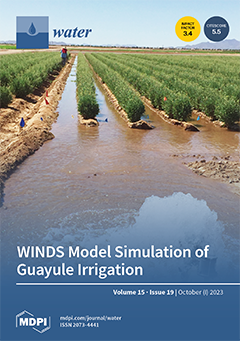
The “WINDS Model Simulation of Guayule Irrigation” focused on this furrow irrigation treatment in a guayule irrigation experiment on sandy loam soil at the University of Arizona’s Maricopa Agricultural Center. The experiment also included deficit irrigation and drip irrigation treatments. Guayule is a desert plant that produces rubber. This experiment was part of the USDA-NIFA Sustainable Bioeconomy for Arid Regions (SBAR) project, which was under the leadership of Kimberly L. Ogden at the University of Arizona. The SBAR irrigation experiments also included treatments on a clay soil at Bridgestone’s 281-acre guayule research farm in Eloy, Arizona. Guayule acreage is expanding because it is a low water-use alternative for agriculture under water shortages in the southwestern United States. View this paper
  • Issues are regarded as officially published after their release is announced to the table of contents alert mailing list.
  • You may sign up for e-mail alerts to receive table of contents of newly released issues.
  • PDF is the official format for papers published in both, html and pdf forms. To view the papers in pdf format, click on the "PDF Full-text" link, and use the free Adobe Reader to open them.
Order results
Result details
Section
Select all
Export citation of selected articles as:
30 pages, 6346 KiB  
Article
Application of Machine Learning Coupled with Stochastic Numerical Analyses for Sizing Hybrid Surge Vessels on Low-Head Pumping Mains
by Ahmed M. A. Sattar, Abedalkareem Nedal Ghazal, Mohamed Elhakeem, Amgad S. Elansary and Bahram Gharabaghi
Water 2023, 15(19), 3525; https://doi.org/10.3390/w15193525 - 09 Oct 2023
Viewed by 1837
Abstract
In surge protection, low-head profiles are deemed a challenge in pump failure events since they are prone to severe negative pressure surges that require an uneconomical surge vessel volume. A hybrid surge vessel with a dipping tube can provide required protection with reasonable [...] Read more.
In surge protection, low-head profiles are deemed a challenge in pump failure events since they are prone to severe negative pressure surges that require an uneconomical surge vessel volume. A hybrid surge vessel with a dipping tube can provide required protection with reasonable economic volume. This work presents novel analyses for the hybrid surge vessel and develops a simple model for its optimum sizing using a stochastic numerical approach coupled with machine learning. Practical ranges for correct sizing of vessel components, such as ventilation tube, inlet/outlet air valves, and compression chamber, are presented for optimal protection and performance. The water hammer equations are iteratively solved using the hybrid surge vessel’s revised boundary conditions within the method of characteristics numerical framework to generate 2000 cases representing real pump failures on low-head pipelines. Genetic programming is utilized to develop simple relations for prediction of the hybrid vessel initial and expanded air volumes in addition to the compression chamber volume. Moreover, the developed model presented a classification index for low-head pipelines on which the hybrid vessel would be most economical. The developed model yielded good prediction error statistics. The developed model proves to be more accurate and easier to use than the classical design charts for the low-head pumping mains. The model clearly showed the relation between various hydraulic and pipe parameters, with pipe diameter and static head as the most influencing parameters on compression chamber volume and expanded air volume. The developed model, together with the classification indices, can be used for preliminary surge protection sizing for low-head pipelines. Full article
Show Figures

Figure 1

19 pages, 2516 KiB  
Article
The Synergy of Water Resource Agglomeration and Innovative Conservation Technologies on Provincial and Regional Water Usage Efficiency in China: A Super SBM-DEA Approach
by Rizwana Yasmeen, Gang Hao, Yusen Ye, Wasi Ul Hassan Shah and Caihong Tang
Water 2023, 15(19), 3524; https://doi.org/10.3390/w15193524 - 09 Oct 2023
Cited by 6 | Viewed by 1318 | Correction
Abstract
China is currently facing the significant task of effectively managing its water resources to satisfy the rising needs while grappling with the growing worries of water shortage. In this context, it becomes crucial to comprehend the importance of resource agglomeration and technological adoption. [...] Read more.
China is currently facing the significant task of effectively managing its water resources to satisfy the rising needs while grappling with the growing worries of water shortage. In this context, it becomes crucial to comprehend the importance of resource agglomeration and technological adoption. Thus, this research examines the relationship between water resource agglomeration and the adoption of innovative conservation technologies in enhancing water usage efficiency at provincial and regional levels in China (2006–2020). In the first stage, the study utilizes a super SBM-Data Envelopment Analysis (DEA) methodology to evaluate the water usage efficiency of China’s provinces and regions. In the second stage, we find the dynamic nexuses between water resources, water technologies (recycling, sprinkler irrigation) and water usage efficiency by applying a systematic econometric approach. SBM-DEA analysis revealed that Beijing (1.08), Shaanxi (1.01), Shanghai (1.23) and Tianjin (1.01) remained the higher efficient over the years. Six provinces (Guangdong, Shandong, Jiangsu, Inner Mongolia, Hebei, and Zhejiang) are in the middle ranges (0.55–0.83). In contrast, nineteen provinces have the lowest water usage efficiency (0.21–049). Qinghai and Ningxia are on the lowest rank (0.21) and (0.22), respectively. The findings recommended that the water resources impact is negative. In comparison, the impact of water-saving mechanisms on the efficiency of water usage seems to be positive, as recycling technology significantly enhances the water usage efficiency in China’s province. The study found that GDP growth has a negative impact on water usage efficiency in the early stages of economic development. Still, as economies mature, this negative impact diminishes, indicating a tendency to allocate more resources to water conservation and efficiency. Water recycling technology, the modernization of irrigation methods, and water resource management can enhance water efficiency. Full article
(This article belongs to the Section Water Resources Management, Policy and Governance)
Show Figures

Figure 1

20 pages, 1595 KiB  
Article
Multi-Dimensional Collaborative Operation Model and Evaluation of Cascade Reservoirs in the Middle Reaches of the Yellow River
by Xinjie Li, Qiang Wang, Yuanjian Wang, Hongtao Zhang, Jieyu Li and Donglin Li
Water 2023, 15(19), 3523; https://doi.org/10.3390/w15193523 - 09 Oct 2023
Viewed by 955
Abstract
Reservoir operation optimization is a technical measure for flood control and is beneficial owing to its reasonable and reliable control and application of existing water conservancy and hydropower hubs, while ensuring dam safety and flood control, as well as the normal operation of [...] Read more.
Reservoir operation optimization is a technical measure for flood control and is beneficial owing to its reasonable and reliable control and application of existing water conservancy and hydropower hubs, while ensuring dam safety and flood control, as well as the normal operation of power supply and water supply. Considering the beneficial functions of reservoirs, namely flood control and ecological protection, this paper firstly established a two-objective optimal operation model for the reservoir group in the middle reaches of the Yellow River. We aim to maximize the average output of the cascade reservoir group and minimize the average change in ecological flow during the operation period under efficient sediment transport conditions, with the coordination degree of water and sediment as the constraints of reservoir discharge flows. The paper aims to construct an evaluation index system for reservoir operation schemes, apply a combined approach of objective and subjective evaluations, and introduce the gray target and cumulative prospect theories. By uniformly quantifying the established scheme evaluation index system, screening the reservoir operation schemes with the fuzzy evaluation method, and selecting the recommended scheme for each typical year, this paper provides a new scientific formulation of the operation schemes of reservoirs in the middle reaches of the Yellow River. The selected schemes are compared with actual data, demonstrating the effectiveness of joint reservoir operation and for multidimensional benefits in terms of power generation, ecology, and flood control. Full article
(This article belongs to the Special Issue China Water Forum 2023)
Show Figures

Figure 1

16 pages, 8988 KiB  
Article
Monitoring Suspended Sediment Concentration in the Yellow River Estuary and Its Vicinity Waters on the Basis of SDGSAT-1 Multispectral Imager
by Yingzhuo Hou, Qianguo Xing, Xiangyang Zheng, Dezhi Sheng and Futao Wang
Water 2023, 15(19), 3522; https://doi.org/10.3390/w15193522 - 09 Oct 2023
Viewed by 1179
Abstract
Suspended sediments have profound impacts on marine primary productivity and the ecological environment. The Yellow River estuary and its vicinity waters, with a high dynamic range of suspended sediment concentration (SSC), have important eco-environmental functions for the sustainable development in this region. The [...] Read more.
Suspended sediments have profound impacts on marine primary productivity and the ecological environment. The Yellow River estuary and its vicinity waters, with a high dynamic range of suspended sediment concentration (SSC), have important eco-environmental functions for the sustainable development in this region. The multispectral imager (MI) on board China’s first Sustainable Development Goals Science Satellite 1 (SDGSAT-1) features seven high-resolution bands (10 m). This study employs multispectral imagery obtained from SDGSAT-1 with single-band and band-ratio models to monitor the SSC in the Yellow River estuary and its vicinity waters. The results show that SDGSAT-1 images can be used to estimate the SSC in the Yellow River estuary and its vicinity waters. The overall pattern of the SSC exhibits a notable pattern of higher concentrations in nearshore areas and lower concentrations in offshore areas, and the retrieved SSC can attain values surpassing 1000 mg/L in nearshore areas. The R2 values of both the single-band and the band-ratio models for SSC inversion exceed 0.7. The single-band model R(854) demonstrates superior performance, achieving the highest R2 value of 0.93 and the lowest mean absolute percentage error (MAPE) of 44.04%. The single-band model based on SDGSAT-1 R(854) tends to outperform the band-ratio models for waters with algal blooms, which may be used for inversions of SSC and/or suspended particulate matter (SPM) in the waters full of algal blooms and suspended sediments. The monitoring results by SDGSAT-1 suggest that the complex SSC distributions in the Yellow River estuary and its vicinity waters were highly impacted by the river sediments discharge, tide, currents and wind-induced waves. Full article
Show Figures

Figure 1

15 pages, 2468 KiB  
Article
Spatiotemporal Analysis of Long-Term Rainfall in Semi-Arid Area Using Artificial Intelligence Models (Case Study: Ilam Province, Iran)
by Navid Moradpoor, Mohsen Najarchi and Seyed Mohammad Mirhoseini Hezave
Water 2023, 15(19), 3521; https://doi.org/10.3390/w15193521 - 09 Oct 2023
Cited by 1 | Viewed by 792
Abstract
Ilam province is located in the southwest of Iran, and the primary motivation for this research is to study different dimensions of rainfall fluctuations in the Ilam province. This study is of great importance for the management of the environment in terms of [...] Read more.
Ilam province is located in the southwest of Iran, and the primary motivation for this research is to study different dimensions of rainfall fluctuations in the Ilam province. This study is of great importance for the management of the environment in terms of the application of rainfall distribution in different areas. After collecting the data, first, the average number of rainfall months for each of the studied stations for a period was obtained. Then the data were arranged numerically in the order of Gregorian months. Ultra-innovative artificial intelligence methods were used to perform spatial–temporal analysis. The results show that in autumn and winter all three factors were influential on rainfall in the region. The equation method of regression line trend was used to express the changes in rainfall in the study period, and it was concluded that during this period the rainfall trend in March, June, and December in all stations was decreasing. In May, all stations had an upward trend except for Harsin station. In other months, there are decreasing and increasing trends among the stations. The general trend for rainfall during the study period is also one of decreasing. Regarding the results, the standard deviation for the simulation is equal to 10.22 for autumn and 12.35% for winter. This value is about 17.97% and 7.19%, respectively, for the observed rainfall. The results show there are no significant differences between the model and measured data, so the artificial network is applicable for the simulated monthly precipitation. Full article
(This article belongs to the Special Issue Renewable Energy System Flexibility for Water Desalination: Volume II)
Show Figures

Figure 1

14 pages, 4448 KiB  
Article
Efficacy of Nitrogen and Phosphorus Removal and Microbial Characterization of Combined A2O-MBBR Constructed Wetlands
by Jiawei Li, Kun Dong, Shaoyuan Bai, Yubing Fan, Yishan Feng, Meina Liang and Dunqiu Wang
Water 2023, 15(19), 3520; https://doi.org/10.3390/w15193520 - 09 Oct 2023
Viewed by 1036
Abstract
A combined anaerobic–anoxic–oxic moving bed biofilm reactor (A2O-MBBR) constructed wetlands process was used to treat low carbon-to-nitrogen (C/N) simulated sewage. The results showed that the removal rates of chemical oxygen demand (COD), ammonia nitrogen (NH4+-N), total nitrogen (TN), [...] Read more.
A combined anaerobic–anoxic–oxic moving bed biofilm reactor (A2O-MBBR) constructed wetlands process was used to treat low carbon-to-nitrogen (C/N) simulated sewage. The results showed that the removal rates of chemical oxygen demand (COD), ammonia nitrogen (NH4+-N), total nitrogen (TN), and total phosphorus (TP) by this process were 94.06%, 94.40%, 67.11%, and 84.57%, respectively, and the concentrations of COD, NH4+-N, TN, and TP in the effluent were lower than the Class I-A standard of GB18918-2002. In the anoxic zone, NH4+-N had an inhibitory effect on phosphorus uptake via phosphorus-accumulating organisms (PAOs). The highest community diversity was observed in the anoxic zone sludge at 24 d. During the water-quality-shock loads stage, microbial community diversity decreased in a combined A2O-MBBR constructed wetlands reactor. At the phylum level, bacteria within the mature activated sludge were dominated by Proteobacteria, while Planctomycetes bacteria were the dominant species in the constructed wetlands. At the genus level, Tolumonas spp. were the dominant species in the 12 d and 24 d constructed wetlands and the anaerobic zone, with relative abundance percentages ranging from 20.24 to 33.91%. In the water-quality-shock loads stage, they were replaced by denitrifying bacteria such as Herbaspirillum spp. Unclassified_Burkholderiales was the dominant species in the constructed wetlands, with a relative abundance of 33.09%. Full article
Show Figures

Figure 1

35 pages, 28427 KiB  
Article
Combining Transcriptomic and Metabolomic Analyses to Investigate the Acute Effects of Microcystin-LR and Nanoplastics of Asian Clams
by Jiahua Zhang, Jie Wang, Shikun Liu, Yin Zhou and Xingguo Liu
Water 2023, 15(19), 3519; https://doi.org/10.3390/w15193519 - 09 Oct 2023
Viewed by 1006
Abstract
In agricultural and fishery production, the occurrence of cyanobacterial blooms and the contamination of freshwater systems with microplastics have become increasingly important research focuses. However, the individual and combined toxic mechanisms of these two pollutants are not yet fully understood. Therefore, in this [...] Read more.
In agricultural and fishery production, the occurrence of cyanobacterial blooms and the contamination of freshwater systems with microplastics have become increasingly important research focuses. However, the individual and combined toxic mechanisms of these two pollutants are not yet fully understood. Therefore, in this study, we analyzed the effects of these two stressors, microcystins (MC) and nanoplastics (NP), on the transcriptome and metabolome of the hepatopancreas of river clams. RNA and metabolites extracted from river clams treated with MC, NP, and a combination of MC and NP were used to construct standardized cDNA libraries, which were then subjected to integrated analysis. Significant enrichment of 49 pathways, 34 pathways, and 44 pathways was observed in the MC group compared to the control group, NP group compared to the control group, and NP-MC group compared to the control group, respectively. In these three experimental groups, we found that the lysosome pathway, which affects immune function and cell apoptosis, was enriched with numerous differentially expressed genes and metabolites. Changes in ATP6N and ADP may impair lysosomal acidification and disrupt normal lysosomal degradation processes, indicating interference with the hepatopancreatic metabolism of pollutants. Interestingly, we observed significant alterations in the cathepsin family, and the downregulation of cathepsin genes, along with the downregulation of ATP6N, implies a potential disruption in lysosomal proteolysis. In the NP-MC group, the downregulation of purine expression levels suggests an impact on the immune system of river clams by NP-MC. In conclusion, while there is some overlap in the damage caused to the hepatopancreas of river clams by MCs, MPs, and the combination of NP-MC, further research is necessary to fully understand their effects. Full article
(This article belongs to the Special Issue Aquaculture Water Safety)
Show Figures

Figure 1

14 pages, 5763 KiB  
Article
Enrichment Mechanism of Lithium in Geothermal Waters from a Bedrock Reservoir in Xiong’an New Area, China
by Jun Li, Hanxiong Zhang, Yinmei Zhang, Laibin Wang and Zhigang Zhang
Water 2023, 15(19), 3518; https://doi.org/10.3390/w15193518 - 09 Oct 2023
Cited by 1 | Viewed by 856
Abstract
The lithium concentrations in the geothermal waters of the Wumishan Formation carbonate reservoir in China Xiong’an New Area are over 1 mg/L and are even higher than those in the geothermal waters of granite reservoirs in some areas of China. It is still [...] Read more.
The lithium concentrations in the geothermal waters of the Wumishan Formation carbonate reservoir in China Xiong’an New Area are over 1 mg/L and are even higher than those in the geothermal waters of granite reservoirs in some areas of China. It is still unknown which are the most important factors controlling the lithium concentrations in the geothermal waters in the study area. This article selected the analysis and test data of 32 geothermal water samples obtained in recent years from the study area and combined them with hydrochemical analysis and test data from granite reservoirs in other regions of China to study the enrichment mechanism of lithium in the geothermal waters in the study area. The results of the hydrochemical data analysis indicate that the lithology, pH, and water–rock interaction between geothermal water and carbonate rocks are not the main factors affecting the lithium concentrations in the study area. The mixing of paleo-seawater and the leaching of the evaporated rocks formed by it are the most important factors controlling the lithium concentrations in the study area, and temperature is also an important factor affecting the lithium concentrations. The research results are of great significance to the study of the enrichment mechanism of lithium in geothermal waters and the formation mechanism of geothermal waters in similar areas around the world. Full article
Show Figures

Figure 1

22 pages, 5849 KiB  
Article
Micrometeorological Analysis and Glacier Ablation Simulation in East Kunlun
by Weisheng Wang, Meiping Sun, Yanjun Che, Xiaojun Yao, Mingjun Zhang and Shuting Niu
Water 2023, 15(19), 3517; https://doi.org/10.3390/w15193517 - 09 Oct 2023
Cited by 1 | Viewed by 765
Abstract
Worldwide, there are great challenges for meteorological monitoring and glacier ablation monitoring in high-altitude mountain areas. It is often difficult to capture fine-scale climate and glacial changes in high-altitude mountainous areas due to the harsh natural environment and the extreme lack of observational [...] Read more.
Worldwide, there are great challenges for meteorological monitoring and glacier ablation monitoring in high-altitude mountain areas. It is often difficult to capture fine-scale climate and glacial changes in high-altitude mountainous areas due to the harsh natural environment and the extreme lack of observational sites. Based on high-altitude meteorological stations erected on the eastern shore of Aqikkule Lake (AQK) and at the terminus of Shenshechuan Glacier (SSG), as well as on mass balance data from SSG, the characteristics and correlation of temperature, solar radiation, relative humidity, precipitation, wind speed and direction of the two regions, and the mass balance in the ablation area of SSG from 30 May 2022 to 18 May 2023 were analyzed, and the average melting depth of SSG was simulated. The results indicate the following: (1) The average annual temperature of AQK and the terminus of SSG is −3.7 °C and −7.7 °C, respectively, and the vertical lapse rate of temperature in the summer half of the year is greater than that in the winter half of the year. Precipitation timing has a great influence on daily temperature differences. (2) Precipitation in both places is concentrated in summer; the glaciers in this area are of the summer recharge type, and precipitation has a significant reducing effect on the solar incident radiation and increases the relative humidity in this region. (3) AQK and SSG both have local circulation development, in the area of AQK all year round due to the lake effect, while the terminus of SSG only has the development of valley winds in the summer, being controlled in the winter by the westerly wind belt. (4) The average mass balance value of the ablation area of SSG was −1786 mm as measured by the range poles method. The average annual ablation depth of SSG simulated by using the empirical formula was 587–597 mm, which is not large compared with other glacier areas in the Tibetan Plateau, and it has the characteristics of typical continental-type glaciers. Full article
(This article belongs to the Special Issue Assessment of Glacier Changes)
Show Figures

Figure 1

16 pages, 1908 KiB  
Article
Harnessing ICT Resources to Enhance Community Disaster Resilience: A Case Study of Employing Social Media to Zhengzhou 7.20 Rainstorm, China
by Linpei Zhai and Jae Eun Lee
Water 2023, 15(19), 3516; https://doi.org/10.3390/w15193516 - 09 Oct 2023
Viewed by 1135
Abstract
This study aimed to explore how community disaster resilience can be enhanced via the utilization of ICT resources. Three social media applications were selected. Taking the 2021 Zhengzhou 7.20 rainstorm as an example, questionnaire responses were collected and analyzed, and a linear regression [...] Read more.
This study aimed to explore how community disaster resilience can be enhanced via the utilization of ICT resources. Three social media applications were selected. Taking the 2021 Zhengzhou 7.20 rainstorm as an example, questionnaire responses were collected and analyzed, and a linear regression model was constructed to explore the impact of the relationships between responses. The findings showed that the use of WeChat, TikTok, and Weibo had positive effects on community disaster resilience. Specifically, the use of social media (WeChat, TikTok, and Weibo) by the general public during this rainstorm disaster was positively related to convenience and trust, creation and dissemination, emotion and communication, cooperation and collective action, and relief and release. We also analyzed the differences in the use of the three social media platforms during the rainstorm disaster and found that the number of people who used TikTok was the highest, but the variable scores for TikTok were not the highest. WeChat had the highest variable scores, and both the number of users and variable scores for Weibo were in the middle. Full article
Show Figures

Figure 1

17 pages, 2990 KiB  
Article
Integrated Modeling of Hybrid Nanofiltration/Reverse Osmosis Desalination Plant Using Deep Learning-Based Crow Search Optimization Algorithm
by Sani. I. Abba, Jamilu Usman, Ismail Abdulazeez, Dahiru U. Lawal, Nadeem Baig, A. G. Usman and Isam H. Aljundi
Water 2023, 15(19), 3515; https://doi.org/10.3390/w15193515 - 09 Oct 2023
Cited by 1 | Viewed by 1678
Abstract
The need for reliable, state-of-the-art environmental investigations and pioneering approaches to address pressing ecological dilemmas and to nurture the sustainable development goals (SDGs) cannot be overstated. With the power to revolutionize desalination processes, artificial intelligence (AI) models hold the potential to address global [...] Read more.
The need for reliable, state-of-the-art environmental investigations and pioneering approaches to address pressing ecological dilemmas and to nurture the sustainable development goals (SDGs) cannot be overstated. With the power to revolutionize desalination processes, artificial intelligence (AI) models hold the potential to address global water scarcity challenges and contribute to a more sustainable and resilient future. The realm of desalination has exhibited a mounting inclination toward modeling the efficacy of the hybrid nanofiltration/reverse osmosis (NF–RO) process. In this research, the performance of NF–RO based on permeate conductivity was developed using deep learning long short-term memory (LSTM) integrated with an optimized metaheuristic crow search algorithm (CSA) (LSTM-CSA). Before model development, an uncertainty Monte Carlo simulation was adopted to evaluate the uncertainty attributed to the prediction. The results based on several performance statistical criteria (root mean square error (RMSE) and mean absolute error (MAE)) demonstrated the reliability of both LSTM (RMSE = 0.1971, MAE = 0.2022) and the LSTM-CSA (RMSE = 0.1890, MAE = 0.1420), with the latter achieving the highest accuracy. The accuracy was also evaluated using new 2D graphical visualization, including a cumulative distribution function (CDF) and fan plot to justify the other evaluation indicators such as standard deviation and determination coefficients. The outcomes proved that AI could optimize energy usage, identify energy-saving opportunities, and suggest more sustainable operating strategies. Additionally, AI can aid in developing advanced brine treatment techniques, facilitating the extraction of valuable resources from the brine, thus minimizing waste and maximizing resource utilization. Full article
(This article belongs to the Special Issue Membrane Technologies for Wastewater Treatment and Resource Recovery)
Show Figures

Figure 1

21 pages, 4470 KiB  
Article
A Method for Calculating Water Demand for Sediment Transport Based on the Principles of River Dynamics
by Lin Hou, Hongwu Zhang, Linqi Li, Junchi Zhao and Xiji Li
Water 2023, 15(19), 3514; https://doi.org/10.3390/w15193514 - 08 Oct 2023
Viewed by 1105
Abstract
Sufficient water is pivotal in maintaining the stability of boundaries in sandy river systems. However the current methodologies employed for computing the water demand for sediment transport in rivers frequently neglect this component. This research utilizes data spanning 1960 to 2020 from seven [...] Read more.
Sufficient water is pivotal in maintaining the stability of boundaries in sandy river systems. However the current methodologies employed for computing the water demand for sediment transport in rivers frequently neglect this component. This research utilizes data spanning 1960 to 2020 from seven principal hydrological stations located in the lower Yellow River to establish the correlation between key factors pertaining to the sediment transport capacity of flow. A closed equation system was established based on the principles of river dynamics to solve unknown hydraulic parameters. Finding a suitable hydraulic geometric relationship equation as a supplementary equation is a key step in constructing a closed equation system. The findings indicate that sediment transport water demands are 71.79, 133.24, 226.89, 286.12, and 313.6 × 10⁸ m3, respectively, when sediment inflow is at 1, 2, 4, 6, and 8 × 10⁸ t, with a bankfull discharge of 4000 m3/s. As the sediment inflow diminishes and the unit water demand for sediment transport increases, the sediment transport efficiency of the lower Yellow River reduces. The outcomes of this research can serve as a foundation for the joint operation of the Yellow River’s main and branch reservoirs, as well as for designing water resource allocation schemes within the basin. Full article
(This article belongs to the Special Issue Fluvial Sediment and Geomorphology)
Show Figures

Figure 1

14 pages, 4566 KiB  
Article
Spatiotemporal Differentiation and Influencing Factors of Frost Key Date in Harbin Municipality from 1961 to 2022
by Tian-Tai Zhang, Chang-Lei Dai, Shu-Ling Li, Chen-Yao Zhang, Yi-Ding Zhang and Miao Yu
Water 2023, 15(19), 3513; https://doi.org/10.3390/w15193513 - 08 Oct 2023
Viewed by 850
Abstract
This study analyzed frost formation data provided by the Harbin Meteorological Bureau and considered geographic factors, temperature, and population density. Various analytical methods, including linear fitting, the Mann–Kendall mutation test, the Pettitt method, and the sliding t-test, were employed to identify the [...] Read more.
This study analyzed frost formation data provided by the Harbin Meteorological Bureau and considered geographic factors, temperature, and population density. Various analytical methods, including linear fitting, the Mann–Kendall mutation test, the Pettitt method, and the sliding t-test, were employed to identify the temporal and spatial changes as well as the effects of these factors on frost dates in Harbin. The study shows that the first FSD occurred on 18 August, in both 1966 and 1967, which was the 255th day. The latest FSD was observed on 10 October 2006, which was the 283rd day. The earliest occurrence of an FED was on 24 April 2015, which was the 114th day, and the latest was on 21 April 1974, which was the 141st day. The highest number of frost days occurred in 2012, with 161 days, whereas the shortest year was 1966, with only 123 frost days. Throughout the study period, the FSD increased by 7.8 days at a rate of −1.27d/10a, the FED increased by 10.9 days at a rate of 1.77d/10a, and the FFS increased by 18.9 days at a rate of 3.05d/10a. The propensity rates of the FSD and FFS at each location in Harbin indicate an upward trend, while for the FED, certain locations display an upward trend. In general, the FSD has exhibited a delayed trend, the FED has shown an earlier trend, and the FFS has experienced an extended trend. With one-way linear regression, the FSD exhibited an increasing trend at each site, while the FFS also indicated a similar trend, and the FED showed an overall decreasing trend. Throughout the study period, a change was observed in the FSD in 2000, resulting in an average arrival time of the 265th day, or 22 September, of that year. Subsequently, post mutation, the average arrival time of the FSD in the study area was the 272nd day, or 29 September, of that year. In 2006, the FED also underwent a change, with the average arrival time in the study area being the 128th day, or 4 April, of that year. After the change, the average arrival time of the FED in the study area was the 121st day, i.e., 8 April. In 1 April 2004 of that year saw a change in the FFS. Prior to the change, the FFS in the study area averaged the 137th day, whilst following the change, the FFS in the study area averaged the 150th day. The FSD and FFS within Harbin exhibit a negative correlation with latitude and a positive correlation with temperature. Additionally, the FED displays a positive correlation with latitude and a negative correlation with temperature. As the FSD, FED, and FFS in central Harbin are the earliest, latest, and longest, the Pearson correlation coefficient method and multiple regression cannot adequately reflect the effect of longitude. Full article
Show Figures

Figure 1

10 pages, 575 KiB  
Article
Application of the Weighted Arithmetic Water Quality Index in Assessing Groundwater Quality: A Case Study of the South Gujarat Region
by Divya D. Patel, Darshan J. Mehta, Hazi M. Azamathulla, Mohdzuned Mohmedraffi Shaikh, Shivendra Jha and Upaka Rathnayake
Water 2023, 15(19), 3512; https://doi.org/10.3390/w15193512 - 08 Oct 2023
Cited by 5 | Viewed by 2746
Abstract
Groundwater is a natural resource used for drinking, agriculture, and industry, apart from surface water. Its quality should be assessed regularly, and the condition of water resources should be maintained accordingly. The most common analytical method for describing and assessing the general water [...] Read more.
Groundwater is a natural resource used for drinking, agriculture, and industry, apart from surface water. Its quality should be assessed regularly, and the condition of water resources should be maintained accordingly. The most common analytical method for describing and assessing the general water quality is the Water Quality Index (WQI). This study aims to assess the South Gujarat Region’s groundwater quality using the WQI. Various physicochemical parameters like pH, turbidity, total dissolved solids, total hardness, calcium, magnesium, chloride, sulphate, nitrate, fluorides, and total alkalinity are considered for the present study. The data period from 2018 to 2022 is considered for the same. The Weighted Arithmetic Water Quality Index Technique is used to evaluate these data. For checking the potability of the parameters within the acceptable limit, the Indian Standard Drinking Water Specification code (IS: 10050-2012) is adopted. According to the study mentioned above, a few wells’ groundwater quality has been found to be higher than the WQI value. It is also observed that four wells were found unsuitable for drinking purposes in 2018. It is noted that if the WQI value of groundwater is above 51, it is considered harmful to human health; therefore, it requires some kind of processing before use. This study will be beneficial to the policymakers for identifying and providing details about groundwater quality in the form of a specific value, i.e., WQI. Full article
(This article belongs to the Special Issue Advanced Technologies for Wastewater Treatment and Water Reuse)
Show Figures

Figure 1

25 pages, 7261 KiB  
Article
Seepage Prediction Model for Roller-Compacted Concrete Dam Using Support Vector Regression and Hybrid Parameter Optimization
by Mei-Yan Zhuo, Jinn-Chyi Chen, Ren-Ling Zhang, Yan-Kun Zhan and Wen-Sun Huang
Water 2023, 15(19), 3511; https://doi.org/10.3390/w15193511 - 08 Oct 2023
Viewed by 759
Abstract
In this study, a seepage prediction model was established for roller-compacted concrete dams using support vector regression (SVR) with hybrid parameter optimization (HPO). The model includes data processing via HPO and machine learning through SVR. HPO benefits from the correlation extraction capability of [...] Read more.
In this study, a seepage prediction model was established for roller-compacted concrete dams using support vector regression (SVR) with hybrid parameter optimization (HPO). The model includes data processing via HPO and machine learning through SVR. HPO benefits from the correlation extraction capability of grey relational analysis and the dimensionality reduction technique of principal component analysis. The proposed model was trained, validated, and tested using 22 years of monitoring data regarding the Shuidong Dam in China. We compared the performance of HPO with other popular methods, while the SVR method was compared with the traditional time-series prediction method of long short-term memory (LSTM). Our findings reveal that the HPO method proves valuable real-time dam safety monitoring during data processing. Meanwhile, the SVR method demonstrates superior robustness in predicting seepage flowrate post-dam reinforcement, compared with LSTM. Thus, the developed model effectively identifies the factors related to seepage and exhibits high accuracy in predicting fluctuation trends regarding the Shuidong Dam, achieving a determination coefficient R2 > 0.9. Further, the model can provide valuable guidance for dam safety monitoring, including diagnosing the efficacy of monitoring parameters or equipment, evaluating equipment monitoring frequency, identifying locations sensitive to dam seepage, and predicting seepage. Full article
Show Figures

Figure 1

24 pages, 3851 KiB  
Article
Assessing Flood Risk: LH-Moments Method and Univariate Probability Distributions in Flood Frequency Analysis
by Cornel Ilinca, Stefan Ciprian Stanca and Cristian Gabriel Anghel
Water 2023, 15(19), 3510; https://doi.org/10.3390/w15193510 - 08 Oct 2023
Cited by 1 | Viewed by 1065
Abstract
This study examines all of the equations necessary to derive the parameters for seven probability distributions of three parameters typically used in flood frequency research, namely the Pearson III (PE3), the generalized extreme value (GEV), the Weibull (W3), the log-normal (LN3), the generalized [...] Read more.
This study examines all of the equations necessary to derive the parameters for seven probability distributions of three parameters typically used in flood frequency research, namely the Pearson III (PE3), the generalized extreme value (GEV), the Weibull (W3), the log-normal (LN3), the generalized Pareto Type II (PG), the Rayleigh (RY) and the log-logistic (LL3) distributions, using the higher-order linear moments method (LH-moments). The analysis represents the expansion of previous research whose results were presented in previous materials, and is part of hydrological research aimed at developing a standard for calculating maximum flows based on L-moments and LH-moments. The given methods for calculating the parameters of the examined distributions are used to calculate the maximum flows on Romania’s Prigor River. For both methods, the criterion for selecting the most suitable distribution is represented by the diagram of the L-skewness–L-kurtosis and LH-skewness–LH-kurtosis. The results for Prigor River show that the PG distribution is the best model for the L-moments method, the theoretical values of the statistical indicators being 0.399 and 0.221. The RY distribution is the best model for the LH-moments technique, with values of 0.398 and 0.192 for the two statistical indicators. Full article
(This article belongs to the Section Hydrology)
Show Figures

Figure 1

16 pages, 3841 KiB  
Article
Compound Extremes of Droughts and Pluvials: A Review and Exploration of Spatio-Temporal Characteristics and Associated Risks in the Canadian Prairies
by Elaine Wheaton, Barrie Bonsal and David Sauchyn
Water 2023, 15(19), 3509; https://doi.org/10.3390/w15193509 - 08 Oct 2023
Viewed by 851
Abstract
The Canadian Prairies are associated with high natural hydroclimatic variability including the frequent periodic occurrence of droughts and pluvials. These extremes carry various risks including significant damage to the economy, environment and society. The well-documented level of damage necessitates further risk assessment and [...] Read more.
The Canadian Prairies are associated with high natural hydroclimatic variability including the frequent periodic occurrence of droughts and pluvials. These extremes carry various risks including significant damage to the economy, environment and society. The well-documented level of damage necessitates further risk assessment and planned reductions to vulnerability, particularly in light of a warming climate. A logical starting point involves awareness and information about the changing characteristics of such climate extremes. We focus on the compound occurrence of droughts and pluvials as the risks from this type of event are magnified compared to the hydroclimatic extremes in isolation. Compound droughts and pluvials (CDP) are drought and pluvial events that occur in close succession in time or in close proximity in area. Also, research on CDP is limited even for the worldwide literature. Therefore, the purposes of this paper are to synthesize recent literature concerning the risks of CDP, and to provide examples of past occurrences, with a focus on the Canadian Prairies. Since literature from the Prairies is limited, global work is also reviewed. That literature indicates increasing concern and interest in CDP. Relationships between drought and pluvials are also characterized using the SPEI Global Monitor for the Prairies, emphasizing the recent past. Research mostly considers drought and pluvials as separate events in the Prairies, but is integrated here to characterize the relationships of these extremes. The spatiotemporal patterns showed that several of the extreme to record pluvials were found to be closely associated with extreme droughts in the Prairies. The intensities of the extremes and their dry to wet boundaries were described. This is the first research to explore the concept of and to provide examples of CDP for the Prairies and for Canada. Examples of CDP provide insights into the regional hydroclimatic variability. Furthermore, most literature on future projections strongly suggests that this variability is likely to increase, mainly driven by anthropogenic climate change. Therefore, improved methods to characterize and to quantify CDP are required. These findings suggest means of decreasing vulnerability and associated damages. Although the study area is the Canadian Prairies, the work is relevant to other regions that are becoming more vulnerable to increasing risks of and vulnerabilities to such compound extremes. Full article
(This article belongs to the Special Issue Drought Risk Assessment and Human Vulnerability in the 21st Century)
Show Figures

Figure 1

13 pages, 3241 KiB  
Article
Chemical Characteristics and Controlling Factors of Shallow Groundwater in the Lower Reaches of Changhua River Basin, Hainan Island, China
by Dun Wang, Lizhong Zhang, Lixin Pei, Xiwen Li, Yamin Yang, Zeheng Chen and Linde Liang
Water 2023, 15(19), 3508; https://doi.org/10.3390/w15193508 - 08 Oct 2023
Cited by 2 | Viewed by 771
Abstract
In order to ensure a sustainable water resource for residents of the lower reaches of the Changhua River on Hainan Island, it is crucial to understand the chemical characteristics and formation mechanisms of their shallow groundwater. To achieve this, we collected and analyzed [...] Read more.
In order to ensure a sustainable water resource for residents of the lower reaches of the Changhua River on Hainan Island, it is crucial to understand the chemical characteristics and formation mechanisms of their shallow groundwater. To achieve this, we collected and analyzed 100 groundwater samples using various methods. Our findings indicate that the groundwater is generally near-neutral to weakly alkaline, suggesting an oxidized environment. We identified 56 chemical types, with Ca•Na-HCO3 and Ca-HCO3 being the most common. Water–rock interactions—particularly with silicate rocks—are the primary factor influencing the water’s chemical characteristics, with Na+ and K+ coming from the leaching of silicate rocks, and Ca2+ and Mg2+ originating from the dissolution of carbonate rocks. Unfortunately, human activities such as agricultural practices and domestic sewage have had a significant impact on the groundwater, with NO3 levels surpassing SO42− in most samples. These findings provide valuable insights into the development and protection of the shallow groundwater in this area. Full article
(This article belongs to the Section Hydrogeology)
Show Figures

Figure 1

21 pages, 5207 KiB  
Article
An Effective Method for Underwater Biological Multi-Target Detection Using Mask Region-Based Convolutional Neural Network
by Zhaoxin Yue, Bing Yan, Huaizhi Liu and Zhe Chen
Water 2023, 15(19), 3507; https://doi.org/10.3390/w15193507 - 08 Oct 2023
Cited by 1 | Viewed by 852
Abstract
Underwater creatures play a vital role in maintaining the delicate balance of the ocean ecosystem. In recent years, machine learning methods have been developed to identify underwater biologicals in the complex underwater environment. However, the scarcity and poor quality of underwater biological images [...] Read more.
Underwater creatures play a vital role in maintaining the delicate balance of the ocean ecosystem. In recent years, machine learning methods have been developed to identify underwater biologicals in the complex underwater environment. However, the scarcity and poor quality of underwater biological images present significant challenges to the recognition of underwater biological targets, especially multi-target recognition. To solve these problems, this paper proposed an ensemble method for underwater biological multi-target recognition. First, the CutMix method was improved for underwater biological image augmentation. Second, the white balance, multiscale retinal, and dark channel prior algorithms were combined to enhance the underwater biological image quality, which could largely improve the performance of underwater biological target recognition. Finally, an improved model was proposed for underwater biological multi-target recognition by using a mask region-based convolutional neural network (Mask-RCNN), which was optimized by the soft non-maximum suppression and attention-guided context feature pyramid network algorithms. We achieved 4.97 FPS, the mAP was 0.828, and the proposed methods could adapt well to underwater biological multi-target recognition. The recognition effectiveness of the proposed method was verified on the URPC2018 dataset by comparing it with current state-of-the-art recognition methods including you-only-look-once version 5 (YOLOv5) and the original Mask-RCNN model, where the mAP of the YOLOv5 model was lower. Compared with the original Mask-RCNN model, the mAP of the improved model increased by 3.2% to 82.8% when the FPS was reduced by only 0.38. Full article
Show Figures

Figure 1

12 pages, 3343 KiB  
Article
Ground Penetrating Radar Image Recognition for Earth Dam Disease Based on You Only Look Once v5s Algorithm
by Binghan Xue, Jianglin Gao, Songtao Hu, Yan Li, Jianguo Chen and Rui Pang
Water 2023, 15(19), 3506; https://doi.org/10.3390/w15193506 - 08 Oct 2023
Cited by 1 | Viewed by 792
Abstract
The Ground Penetrating Radar (GPR) method is a commonly used method for earth dam disease detection. However, the major challenge is that the obtained GPR image data of earth dam disease mainly relies on human judgment, especially in long-distance earth dam disease detection, [...] Read more.
The Ground Penetrating Radar (GPR) method is a commonly used method for earth dam disease detection. However, the major challenge is that the obtained GPR image data of earth dam disease mainly relies on human judgment, especially in long-distance earth dam disease detection, which may lead to misjudgments and omissions. The You Only Look Once v5s (YOLOv5s) algorithm is innovatively employed for GPR image recognition to address the current challenge. The YOLOv5s neural network model has advantages over the traditional convolutional neural network in terms of object detection speed and accuracy. In this study, an earth dam disease detection model was established based on YOLOv5s. Raw images from actual earth dam disease detection and GPR forward simulation images were used as the initial dataset. Data augmentation techniques were applied to expand the original dataset. The LabelImg annotation tool was employed to classify and label earth dam disease, thereby creating an object detection dataset that includes earth dam disease features. The model was trained within this dataset. The results indicate that the total loss function of the model trained on the custom dataset initially decreases and then stabilizes, showing no signs of overfitting and demonstrating good generalizability. The earth dam disease detection model based on YOLOv5s achieved average precision rates of 96.0%, 95.5%, and 93.9% for voids, seepage, and loosening disease, respectively. It can be concluded that the earth dam disease detection model based on YOLOv5s may be an effective tool for intelligent GPR image recognition in identifying earth dam disease. Full article
(This article belongs to the Section Hydraulics and Hydrodynamics)
Show Figures

Figure 1

13 pages, 2922 KiB  
Article
Changes in Stormwater Quality and Heavy Metals Content along the Rainfall–Runoff Process in an Urban Catchment
by Ewelina Pochodyła-Ducka, Katarzyna Glińska-Lewczuk and Agnieszka Jaszczak
Water 2023, 15(19), 3505; https://doi.org/10.3390/w15193505 - 08 Oct 2023
Cited by 1 | Viewed by 1372
Abstract
Stormwater quality in an urban watershed can be influenced by several factors, including land use patterns, atmospheric deposition, and human activities. The objective of this study was to investigate spatial and temporal changes in stormwater quality and heavy metal content during the rainfall–runoff [...] Read more.
Stormwater quality in an urban watershed can be influenced by several factors, including land use patterns, atmospheric deposition, and human activities. The objective of this study was to investigate spatial and temporal changes in stormwater quality and heavy metal content during the rainfall–runoff in an urban sub-catchment (30 ha) in the town of Olsztyn (NE Poland). Samples were collected from six locations along the rainfall–runoff pathway, including the following direct rainfall and runoff locations: roof runoff, surface runoff, storm collector, and the river. Parameters such as pH, specific conductivity, fluorescent dissolved organic matter (fDOM), total dissolved solids (TDS), and turbidity were measured in situ, while samples were analyzed for heavy metal content (Cu, Cr, Fe, Ni, Zn, and Pb) in the lab (ICP-OES). The results showed significant changes in water quality along the runoff. The highest concentrations of heavy metals were found in samples from a stormwater collector and surface runoff, particularly in winter and spring, due to the increased deposition of air pollutants and salt washout from roads. This study highlights the importance of monitoring stormwater quality and heavy metals in urban watersheds in terms of impacts on the river ecosystem as a recipient of stormwater. Solutions such as green infrastructure and stormwater management are proposed to mitigate the impacts of urbanization on water quality and protect the aquatic environment. Full article
Show Figures

Figure 1

13 pages, 3116 KiB  
Article
Evaluation of the Groundwater Ecological Water Requirement in the Southeast Margin of Otindag Sandy Land Based on Allowable Groundwater Depth Drawdown
by Gaoqiang Zhang, Yutong Cheng, Haodong Liu, Chunlei Xiao, Hongfeng Nie, Zhenzhou Zhu, Dan Zhao and Yourang Zan
Water 2023, 15(19), 3504; https://doi.org/10.3390/w15193504 - 07 Oct 2023
Viewed by 766
Abstract
Water resources in arid and semi-arid areas are limiting factors for ecosystem health and economic development. Therefore, an accurate and reasonable assessment of ecological water demand is crucial for efficient water resource utilization. In this study, we used vegetation coverage and groundwater depth [...] Read more.
Water resources in arid and semi-arid areas are limiting factors for ecosystem health and economic development. Therefore, an accurate and reasonable assessment of ecological water demand is crucial for efficient water resource utilization. In this study, we used vegetation coverage and groundwater depth to assess the state of vegetation growth in the Zhenglanqi, located at the southeastern edge of Otindag Sandy Land. Our results indicate the existence of a statistical power index function between vegetation coverage and groundwater depth scatter plots, where even minor changes in groundwater depth can have a significant impact on vegetation growth. In order to quantitatively assess the impact of subsidence on vegetation ecology, we propose a maximum allowable subsidence level under conditions that maintain normal ecological conditions, based on the initial subsidence depth and ecological guarantee rate. Our findings suggest that regions with shallower initial groundwater depths are more sensitive to changes in their environment than regions with deeper groundwater depths. The total groundwater consumption in the study area was 83 million cubic meters while maintaining an ecological guarantee rate of 80%; thus, while ensuring normal environmental conditions, human exploitation of shallow groundwater accounts for only 16 percent. Full article
(This article belongs to the Special Issue China Water Forum 2023)
Show Figures

Figure 1

18 pages, 4053 KiB  
Article
Nitrogen and Phosphorus Loading Characteristics of Agricultural Non-Point Sources in the Tuojiang River Basin
by Dong Fu, Yanchuan Gong, Chuntan Chen, Xiao Gui, Hepei Liu, Shu Chen, Juntao Ren and Bingjie Hou
Water 2023, 15(19), 3503; https://doi.org/10.3390/w15193503 - 07 Oct 2023
Cited by 1 | Viewed by 845
Abstract
Agricultural non-point source (ANPS) pollution has emerged as a significant factor influencing water quality within watersheds. Understanding the spatial distribution and composition of ANPS is crucial for effective river water quality management. Based on the statistical data of 28 districts and counties in [...] Read more.
Agricultural non-point source (ANPS) pollution has emerged as a significant factor influencing water quality within watersheds. Understanding the spatial distribution and composition of ANPS is crucial for effective river water quality management. Based on the statistical data of 28 districts and counties in the Tuojiang River Basin (TJRB), the load distribution characteristics of total nitrogen (TN) and total phosphorus (TP) from ANPS were studied in this work by using the pollutant discharge coefficient method. In 2018, ANPS contributed 60,888.92 tons of TN and 20,085.98 tons of TP to the TJRB. By 2019, the TN load had decreased to 57,155.44 tons, while the TP load increased to 21,659.91 tons. Spatially, TN and TP loads follow a pattern of being lowest in the upstream, intermediate in the downstream, and highest in the middle reaches. Planting sources emerged as the primary contributors to TN and TP loads from ANPS in the TJRB, accounting for 61.43% and 77.39%, respectively. Rural living sources made a lesser contribution, at 20.23% for TN and 9.15% for TP, while poultry and livestock farming sources accounted for 18.34% of TN and 13.46% of TP loads. The analysis of grey water footprint (GWF) and water pollution level (WPL) revealed that TN and TP loads continued to exert significant pressure on the TJRB’s water environment throughout the study period. These findings offer valuable insights for enhancing water quality management in the TJRB. Full article
(This article belongs to the Special Issue Agricultural Water-Saving Effects of Soil Mulching)
Show Figures

Figure 1

11 pages, 2064 KiB  
Technical Note
The Effect of Salinity on N2O Emissions during Domestic Wastewater Partial Nitrification Treatment in a Sequencing Batch Reactor
by Pengzhang Li, Yun Wang, Yue Liu, Shuying Wang and Yongzhen Peng
Water 2023, 15(19), 3502; https://doi.org/10.3390/w15193502 - 07 Oct 2023
Cited by 1 | Viewed by 759
Abstract
Previous studies have highlighted the salinization caused by the use of seawater to flush toilets and industrial wastewater entering the urban wastewater systems in coastal areas. Thus, in this study, the effect of salinity on N2O emissions during the partial nitrification [...] Read more.
Previous studies have highlighted the salinization caused by the use of seawater to flush toilets and industrial wastewater entering the urban wastewater systems in coastal areas. Thus, in this study, the effect of salinity on N2O emissions during the partial nitrification process, as well as the emission mechanism, was investigated using a partial nitrification system of wastewater as the research object. The results showed that (1) the increase in salinity decreased the oxidation rate of NH4+ and the formation rate of NO2 during partial nitrification; (2) the increase in salinity increased the N2O emissions during NH4+ oxidation and NH2OH oxidation and decreased the formation rate of NO2-N during hydroxylamine oxidation; (3) the total N2O emissions during hydroxylamine oxidation were less than those during ammonia nitrogen oxidation, and a greater amount of NO2 was reduced to N2 instead of N2O during hydroxylamine oxidation; and (4) a novel finding was that, during partial nitrification with the available organic matter, the N2O emissions via heterotrophic denitrification by heterotrophic bacteria should not be ignored, and the increase in salinity can increase the N2O emissions generated via heterotrophic denitrification. These results would provide a theoretical basis for reducing the N2O emissions in the wastewater treatment process. Full article
(This article belongs to the Section Wastewater Treatment and Reuse)
Show Figures

Figure 1

21 pages, 971 KiB  
Article
Biofilm-Enhanced Natural Zeolite Material in Purification Performance for Slaughterhouse Wastewater
by Timoth Mkilima, Kulyash Meiramkulova, Aliya Kydyrbekova, Tursynkul Bazarbayeva, Daldabayeva Gulnur, Zholdasbek Aknur, Abzal Shegenbayev, Dzhexenbayev Nurbolat, Gulaina Oshanova and Kaisagaliyeva Gulzhakhan
Water 2023, 15(19), 3501; https://doi.org/10.3390/w15193501 - 07 Oct 2023
Cited by 1 | Viewed by 796
Abstract
This study focuses on evaluating the efficacy of biofilm-enhanced natural zeolite for the purification of slaughterhouse wastewater. The investigation encompasses four distinct treatment methods: employing natural zeolite without biofilm, integrating biofilm into 1–2 mm particle size natural zeolite, enhancing biofilm in less than [...] Read more.
This study focuses on evaluating the efficacy of biofilm-enhanced natural zeolite for the purification of slaughterhouse wastewater. The investigation encompasses four distinct treatment methods: employing natural zeolite without biofilm, integrating biofilm into 1–2 mm particle size natural zeolite, enhancing biofilm in less than 4 mm particle size natural zeolite, and introducing biofilm in less than 8 mm particle size natural zeolite. The outcomes underscore the substantial improvement brought about by biofilm incorporation. For instance, within the natural zeolite treatment system without biofilm, the final effluent retained 28 NTU of turbidity. In contrast, utilizing the <8 mm particle size with biofilm resulted in 3.2 NTU of turbidity in the treated effluent, 2.45 NTU for the <4 mm particle size with biofilm, and 1.02 NTU for the 1–2 mm particle size zeolite system with biofilm. Notably, the achieved removal rates were significant, reaching 79.88% for natural zeolite without biofilm, 97.69% for the <8 mm particle size with biofilm, 99.27% for the <4 mm particle size with biofilm, and 98.24% for the 1–2 mm particle size zeolite system with biofilm. It is noteworthy that the removal efficiencies varied from 50 to 100% for wastewater samples subjected to the treatment system without biofilm, 65.7–100% with the <8 mm particle size biofilm, 71.4–100% with the <4 mm particle size biofilm, and 71.7–100% with the 1–2 mm particle size zeolite system biofilm. These findings collectively emphasize the pivotal role of biofilm in enhancing treatment outcomes, presenting a promising avenue for optimizing wastewater treatment efficiency. Full article
Show Figures

Figure 1

22 pages, 9706 KiB  
Article
WINDS Model Simulation of Guayule Irrigation
by Matthew E. Katterman, Peter M. Waller, Diaa Eldin M. Elshikha, Gerard W. Wall, Douglas J. Hunsaker, Reid S. Loeffler and Kimberly L. Ogden
Water 2023, 15(19), 3500; https://doi.org/10.3390/w15193500 - 07 Oct 2023
Cited by 1 | Viewed by 1015
Abstract
The WINDS (Water-Use, Irrigation, Nitrogen, Drainage, and Salinity) model uses the FAO56 dual crop coefficient and a daily time-step soil–water balance to simulate evapotranspiration and water content in the soil profile. This research calibrated the WINDS model for simulation of guayule under full [...] Read more.
The WINDS (Water-Use, Irrigation, Nitrogen, Drainage, and Salinity) model uses the FAO56 dual crop coefficient and a daily time-step soil–water balance to simulate evapotranspiration and water content in the soil profile. This research calibrated the WINDS model for simulation of guayule under full irrigation. Using data from a furrow irrigated two-season guayule experiment in Arizona, this research developed segmented curves for guayule basal crop coefficient, canopy cover, crop height and root growth. The two-season guayule basal crop coefficient (Kcb) curve included first and second season development, midseason, late-season and end-season growth stages. For a fully irrigated guayule crop, the year one midseason Kcb was 1.14. The second year Kcb development phase began after the crop was semi-dormant during the first winter. The second year Kcb value was 1.23. The two-season root growth curve included a growth phase during the first season, no growth during winter, and a second growth phase during the second winter. A table allocated fractions of total transpiration to soil layers as a function of root depth. With the calibrated tables and curves, the WINDS model simulated soil moisture content with a root mean squared error (RMSE) of 1- to 3-% volumetric water content in seven soil layers compared with neutron probe water contents during the two-year growth cycle. Thus, this research developed growth curves and accurately simulated evapotranspiration and water content for a two-season guayule crop. Full article
(This article belongs to the Special Issue Model-Based Irrigation Management)
Show Figures

Figure 1

14 pages, 4598 KiB  
Article
Sorption of Selenium(IV) and Selenium(VI) onto Iron Oxide/Hydroxide-Based Carbon Materials: Activated Carbon and Carbon Foam
by Lucia López-Toyos, Elena Rodríguez, Roberto García, Maria Rosa Martínez-Tarazona and Maria Antonia López-Antón
Water 2023, 15(19), 3499; https://doi.org/10.3390/w15193499 - 07 Oct 2023
Viewed by 902
Abstract
Selenium pollution in water is a worldwide issue. Se(IV) and Se(VI) are mainly found in contaminated water due to their high solubility and mobility; their presence poses a serious risk as they can severely harm human health. Although iron oxide and hydroxide nanoparticles [...] Read more.
Selenium pollution in water is a worldwide issue. Se(IV) and Se(VI) are mainly found in contaminated water due to their high solubility and mobility; their presence poses a serious risk as they can severely harm human health. Although iron oxide and hydroxide nanoparticles can be efficient candidates for the removal of selenium oxyanions due to their high adsorption capacity, the role of each iron species has not been fully elucidated. Furthermore, iron species are often found to be less effective for Se(VI) than Se(IV). The challenge and novelty of this study was to develop a carbon material impregnated with different iron phases, including oxides (magnetite/hematite) and hydroxides (goethite/lepidocrocite) capable of removing both Se(IV) and Se(VI). Since the phase and morphology of the iron nanoparticles play a significant role in Se adsorption, the study evaluated both characteristics by modifying the impregnation method, which is based on an oxidative hydrolysis with FeSO4 7H2O and CH3COONa, and the type of carbonaceous support (activated carbon or sucrose-based carbon foam). Impregnated activated carbons provide better removal efficiencies (70–80%) than carbon foams (<40%), due to their high surface areas and point zero charges. These results show that the adsorption of Se(VI) is more favorable on magnetic oxides (78%) and hydroxides (71%) than in hematite (<40%). In addition, the activated carbon decorated with magnetite showed a high adsorption capacity for both selenium species, even in alkaline conditions, when the sorbent surface is negatively charged. A mechanism based on the adsorption of inner-sphere complexes was suggested for Se(IV) immobilization, whereas Se(VI) removal occurred through the formation of outer-sphere complexes and redox processes. Full article
Show Figures

Figure 1

21 pages, 8240 KiB  
Article
Assessment of Precipitation and Evapotranspiration in an Urban Area Using Remote Sensing Products (CHIRP, CMORPH, and SSEBop): The Case of the Metropolitan Region of Belem, Amazon
by Victor Hugo da Motta Paca, Everaldo Barreiros de Souza, Joaquim Carlos Barbosa Queiroz and Gonzalo E. Espinoza-Dávalos
Water 2023, 15(19), 3498; https://doi.org/10.3390/w15193498 - 07 Oct 2023
Viewed by 1052
Abstract
The aim of this study was to assess precipitation (P) and actual evapotranspiration (ET) by analyzing data from in situ stations compared with remote sensing products. Climate Hazards Center InfraRed Precipitation (CHIRP) and Climate Prediction Center morphing technique (CMORPH) were used for P [...] Read more.
The aim of this study was to assess precipitation (P) and actual evapotranspiration (ET) by analyzing data from in situ stations compared with remote sensing products. Climate Hazards Center InfraRed Precipitation (CHIRP) and Climate Prediction Center morphing technique (CMORPH) were used for P and Operational Simplified Surface Energy Balance (SSEBop) was used for ET. The P in situ data for six stations were also compared to a reference station in the city. ET was analyzed for a single in situ station. The region chosen for this study was the Metropolitan Area of Belem (MAB), close to the estuary of the Amazon River and the mouth of the Tocantins River. Belem is the rainiest state capital in Brazil, which causes a myriad of challenges for the local population. The assessment was performed using the statistical metrics root-mean-square error (RMSE), normalized root-mean-square error (NRMSE), mean bias error (MBE), coefficient of determination (R2), regression slope, and Nash–Sutcliffe coefficient (NS). For the reference station, the automatic and conventional CHIRP and CMORPH results, in mm/month, were as follows: automatic CHIRP: RMSE = 93.3, NRMSE = 0.32, MBE = −33.54, R2 = 0.7048, Slope = 0.945, NS = 0.5668; CMORPH: RMSE = 195.93, NRMSE = 0.37, MBE = −52.86, R2 = 0.6731, Slope = 0.93, NS = 0.4344; conventional station CHIRP: RMSE = 94.87, NRMSE = 0.32, MBE = −33.54, R2 = 0.7048, Slope = 0.945, NS = 0.5668; CMORPH: RMSE = 105.58, NRMSE = 0.38, MBE = −59.46 R2 = 0.7728, Slope = 1.007, NS = 0.4308. In the MAB region, ET ranges on average between 83 mm/month in the Amazonian summer and 112 mm/month in the Amazonian winter. This work concludes that, although CMORPH has a coarser resolution than CHIRP for the MAB at a monthly resolution, both remote sensing products were reliable. SSEBop also showed acceptable performance. For analyses of the consistency of precipitation time series, these products could provide more accurate information. The present study validates P and ET from remote sensing products with station data in the rain-dominated urban MAB. Full article
(This article belongs to the Section Hydrology)
Show Figures

Figure 1

14 pages, 4981 KiB  
Article
Discovery of Environmental Nanoparticles in a Mineral Water Spring from Yiyuan County, Shandong Province, Eastern China: A New Form of Elements in Mineral Water
by Rui Liu, Zhiqiang Zhao, Minghui Lv, Hongwei Wang, Lixia Li, Shenting Gang, Lei Zuo, Peng Zhang, Yaqin Wang, Changsuo Li and Qianqian Lu
Water 2023, 15(19), 3497; https://doi.org/10.3390/w15193497 - 07 Oct 2023
Viewed by 832
Abstract
Environmental nanoparticles are known to be present in various aquatic environments, exerting significant influences on water quality, particularly in water distribution systems. However, there has been a notable dearth of research on the presence and impact of environmental nanoparticles in mineral water, a [...] Read more.
Environmental nanoparticles are known to be present in various aquatic environments, exerting significant influences on water quality, particularly in water distribution systems. However, there has been a notable dearth of research on the presence and impact of environmental nanoparticles in mineral water, a unique water resource. In this study, we employed Nanoparticle Tracking Analysis (NTA) and conducted High-Resolution Transmission Electron Microscopy (HRTEM) to address this research gap. This groundbreaking study represents the first comprehensive exploration of environmental nanoparticles within natural mineral water from Zibo City, Shandong Province, China. The results of the NTA showed that the concentration of the particles was 5.5 × 10⁵ particles/mL and the peak diameter of the size distribution was 180 nm. The HRTEM showed that the nanoparticles were granular, pinniform, rodlike, and flakey in shape, and some of the nanoparticles existed in aggregation. The energy-dispersive spectrometry results showed that most of the nanoparticles contained O, Mg, Ca, Si, Fe, Ti, and P, and some of them also contained F, V, S, and Mn. When combined with the characteristics of the selected area electron diffraction pattern, the nanoparticles were confirmed to be Ca-bearing nanoparticles, attapulgite nanorods, MnO2 nanosheets, and TiO2 nanoparticles. These findings shed light on a novel manifestation of elemental compositions in mineral water. Furthermore, considering the chemical and physical attributes of both the nanoparticles and mineral water, it is highly plausible that these environmental nanoparticles result from the weathering of minerals. The presence of these nanoparticles within mineral water offers a unique opportunity to advance our comprehension of nanoparticle behavior across diverse systems. Significantly, the realm of environmental nanoparticle science holds paramount importance for ongoing endeavors in ensuring water safety, enhancing treatment processes, and facilitating effective remediation procedures. Full article
(This article belongs to the Special Issue Origin, Characterization, and Protection of Spring Water)
Show Figures

Figure 1

12 pages, 967 KiB  
Article
Minimally Active Neutralization of Acid Mine Drainage through the Monte Carlo Method
by Kevinstiv Castro Huaman, Yaneth Vasquez Olivera, Vidal Aramburu Rojas, Luis Arauzo, Carlos Raymundo Ibañez and Francisco Dominguez
Water 2023, 15(19), 3496; https://doi.org/10.3390/w15193496 - 07 Oct 2023
Viewed by 1182
Abstract
The necessity of mining valuable metals must be balanced with the safe and effective disposal or remediation of the resulting waste. Water, one of our most valuable resources, is a major component of the mining process, and its post-operation storage often results in [...] Read more.
The necessity of mining valuable metals must be balanced with the safe and effective disposal or remediation of the resulting waste. Water, one of our most valuable resources, is a major component of the mining process, and its post-operation storage often results in acid mine drainage. While many remediation methods have been studied, they have low economic feasibility, as minimally active methods alone were inadequate, and thus required additional, costly active methods for effective neutralization. This study looks to neutralize acid mine drainage with only minimally passive methods, through an optimized dosage of lime, fly ash, and aluminum hydroxide. Wastewater samples of pH 3.62 and 5.03, containing 1.36 and 2.21 percent sulfides, respectively, were experimentally treated, with the utilized dosage parameters generated using the Monte Carlo method for neutralizing acidity. The remediated water samples presented 0.01% and 0.16% sulfur content values, which corresponds to 99.3% and 92.8% reductions, respectively. These results present, for the first time, that minimally active methods could achieve a pH of 8.5 without active methods. While future studies should validate these results and provide a more complete characterization of the water samples, the major challenge of neutralization was addressed, and, thus, these results contribute process incentives for mining companies to economically remediate their waste water in order to safeguard their surrounding communities and return valuable water back to the water cycle. Full article
(This article belongs to the Section Wastewater Treatment and Reuse)
Show Figures

Figure 1

Previous Issue
Back to TopTop