Next Issue
Volume 12, June
Previous Issue
Volume 12, April


Land, Volume 12, Issue 5 (May 2023) – 178 articles

Cover Story (view full-size image): 
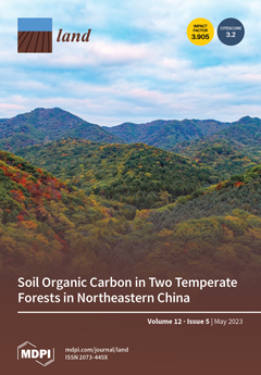
Forests store large quantities of soil organic C (SOC). We studied two dominant forest types in northeastern China: secondary mixed forest (MF) and larch plantation forest (LF). Samples from the surface organic layer to 0-40 cm mineral soils were collected and separated into (1) aggregate and non-aggregated fractions and (2) particulate and mineral-associated organic matter (POM and MAOM). SOC was 13.6% lower in LF than MF (8609 ± 1180 vs. 9969 ± 2084 g C m-2) and in both forests, mainly stored in mineral soils, aggregates, and MAOM. The proportion of C in microaggregates and MAOM increased from Oa+e to 40 cm layer, with C/N ratios smaller and δ13C heavier in MAOM than POM. Our study demonstrated the significance of aggregate formation, mineral association, and deep soil distribution on SOC storage and stability. View this paper
  • Issues are regarded as officially published after their release is announced to the table of contents alert mailing list.
  • You may sign up for e-mail alerts to receive table of contents of newly released issues.
  • PDF is the official format for papers published in both, html and pdf forms. To view the papers in pdf format, click on the "PDF Full-text" link, and use the free Adobe Reader to open them.
Order results
Result details
Section
Select all
Export citation of selected articles as:
31 pages, 6791 KiB  
Article
Historical Political Ecology in the Former Lake Texcoco: Hydrological Regulation
by Carolina Montero-Rosado, Enrique Ojeda-Trejo, Vicente Espinosa-Hernández, Demetrio Fernández-Reynoso, Miguel Caballero Deloya and Gerardo Sergio Benedicto Valdés
Land 2023, 12(5), 1113; https://doi.org/10.3390/land12051113 - 22 May 2023
Cited by 2 | Viewed by 1722
Abstract
Lake Texcoco in Mexico is a remarkable place for observing how human and natural relationships evolve through time in a landscape. Since the opening of the watershed and the draining of the lake, there have been various attempts to exploit the area, although [...] Read more.
Lake Texcoco in Mexico is a remarkable place for observing how human and natural relationships evolve through time in a landscape. Since the opening of the watershed and the draining of the lake, there have been various attempts to exploit the area, although few have succeeded. This study highlights the importance of historical analysis in identifying socio-natural processes that have historically influenced lake use, degradation, management, and conservation. The novelty of this study lies in its application of a historical political ecology approach to understand the evolving dynamics between power relations and the ecology of the former Lake Texcoco in Mexico Valley. By examining both the ecological and political-economic history of the lake, this study reveals how conflicts related to natural resource management in the past have influenced the ecological dynamics of the present. Overall, this study presents a unique perspective on the socio-natural history of Lake Texcoco, demonstrating the potential of using historical political ecology to understand the long-term effects of environmental change. Full article
Show Figures

Figure 1

32 pages, 19690 KiB  
Article
Evaluating the Applicability of Global LULC Products and an Author-Generated Phenology-Based Map for Regional Analysis: A Case Study in Ecuador’s Ecoregions
by Gladys Maria Villegas Rugel, Daniel Ochoa, Jose Miguel Menendez and Frieke Van Coillie
Land 2023, 12(5), 1112; https://doi.org/10.3390/land12051112 - 22 May 2023
Viewed by 1507
Abstract
An accurate and detailed understanding of land-use change affected by anthropogenic actions is key to environmental policy decision-making and implementation. Although global land cover products have been widely used to monitor and analyse land use/land cover (LULC) change, the feasibility of using these [...] Read more.
An accurate and detailed understanding of land-use change affected by anthropogenic actions is key to environmental policy decision-making and implementation. Although global land cover products have been widely used to monitor and analyse land use/land cover (LULC) change, the feasibility of using these products at the regional level needs to be assessed due to the limitation and biases of generalised models from around the world. The main objective of the present study was to generate regional LULC maps of three target areas located in the main ecoregions of Ecuador at a resolution of 10 m using Google Earth Engine (GEE) cloud-based computing. Our approach is based on (1) Single Date Classification (SDC) that processes Sentinel-2 data into fuzzy rule-driven thematic classes, (2) rule refinement using Visible Infrared Imaging Radiometer Suite (VIIRS) data, and (3) phenology-based synthesis (PBS) classification that combines SDC into LULC based on the occurrence rule. Our results show that the three target areas were classified with an overall accuracy of over 80%. In addition, cross-comparison between the global land cover products and our LULC product was performed and we found discrepancies and inaccuracies in the global products due to the characteristics of the target areas that included a dynamic landscape. Our LULC product supplements existing official statistics and showcases the effectiveness of phenology-based mapping in managing land use by providing precise and timely data to support agricultural policies and ensure food security. Full article
(This article belongs to the Special Issue Land Cover and Land Use Mapping Using Satellite Image)
Show Figures

Figure 1

15 pages, 305 KiB  
Article
Effects of the Implementation of the Broadband China Policy (BCP) on House Prices: Evidence from a Quasi-Natural Experiment in China
by Peng Wang, Yihui He and Kengcheng Zheng
Land 2023, 12(5), 1111; https://doi.org/10.3390/land12051111 - 22 May 2023
Cited by 5 | Viewed by 1102
Abstract
With the rapid development of digital finance, the implementation of digital infrastructure is becoming increasingly significant. Broadband construction is an important part of the communication network, and can promote urban infrastructure in cities. However, whether the development of broadband can affect housing prices [...] Read more.
With the rapid development of digital finance, the implementation of digital infrastructure is becoming increasingly significant. Broadband construction is an important part of the communication network, and can promote urban infrastructure in cities. However, whether the development of broadband can affect housing prices by affecting the urban infrastructure and the convenience of residents is a question worth addressing. In this study, using panel data regarding cities in China, we used the spatial multi-period difference-in-differences (SDID) model to investigate the utility of the Broadband China Policy (BCP) on urban house prices and the mechanism of impact. We found that the BCP can increase house prices, and that this impact has a positive spatial spillover effect. This conclusion still held after a series of tests such as parallel trend tests, placebo tests, and the exclusion of other policy effects. The BCP can increase house prices by improving urban infrastructure, promoting urbanization, and optimizing urban industrial structure. In addition, we conducted a heterogeneity analysis by taking into consideration the administrative level, economic development level, and location of cities. The findings of this paper not only enrich the research on the BCP and housing prices, they also provide policy recommendations in terms of urban land use and sustainable development. Full article
20 pages, 11068 KiB  
Article
Coastal Wetland Restoration Strategies Based on Ecosystem Service Changes: A Case Study of the South Bank of Hangzhou Bay
by Xin Jing, Yuefei Zhuo, Zhongguo Xu, Yang Chen, Guan Li and Xueqi Wang
Land 2023, 12(5), 1110; https://doi.org/10.3390/land12051110 - 22 May 2023
Cited by 1 | Viewed by 1638
Abstract
A unique variety of wetlands known as coastal wetlands that connect terrestrial and marine ecosystems is crucial to reducing and adapting to climate change as well as the advancement of human culture. However, the coastal wetland ecosystem is currently in danger as a [...] Read more.
A unique variety of wetlands known as coastal wetlands that connect terrestrial and marine ecosystems is crucial to reducing and adapting to climate change as well as the advancement of human culture. However, the coastal wetland ecosystem is currently in danger as a result of the increasing intensity of human activity, and wetland restoration and reconstruction have garnered a lot of interest. The differentiated ecological restoration strategies based on ecosystem service change analysis can provide a reference for the effective management and sustainability of coastal wetland ecosystems. The InVEST model and ArcGIS were used to analyze the spatiotemporal changes in ecosystem services before and after the implementation of coastal wetland restoration policies based on remote sensing image data, meteorological and soil data, etc. The ecological restoration pattern of coastal wetlands was divided, and the corresponding ecological restoration strategies were proposed in this study. The following are the results: (1) there are still many wetlands that have been converted to non-wetlands following the implementation of the wetland restoration policy, and the ecosystem services as a whole exhibit a rising and then falling trend, with a rise from 2005 to 2015, a fall in 2015 due to the creation of Hangzhou Bay New District, and a slight improvement to 2020. Among them, the water yield increased continuously, the carbon storage fluctuated, and the habitat quality did not improve significantly. (2) The hot spots of ecosystem services were concentrated in the south and southeast of the study area, with no obvious cold spots. (3) By comprehensively analyzing the changes and spatial patterns of ecosystem services, the coastal wetlands on the south bank of Hangzhou Bay were divided into an ecological conservation zone, a green development zone, and an ecological restoration zone at the township level, and corresponding optimization strategies were proposed. The results can provide a reference for the fine-grained and differentiated management of regional ecosystem services. Full article
Show Figures

Figure 1

35 pages, 20713 KiB  
Article
Water as a Problem and a Solution in Arid Landscapes: Resilient Practices and Adapted Land Use in the Eastern Marmarica (NW-Egypt) between the 2nd Millennium BCE and the 1st Millennium CE
by Anna-Katharina Rieger
Land 2023, 12(5), 1109; https://doi.org/10.3390/land12051109 - 22 May 2023
Cited by 2 | Viewed by 3020
Abstract
Arid environments are suitable for researching the resilience of landscapes, since their ecological conditions pose continuous water stress to plants, animals, and humans living there. It is not only water, but also soil that is a limited resource. The arid landscape of the [...] Read more.
Arid environments are suitable for researching the resilience of landscapes, since their ecological conditions pose continuous water stress to plants, animals, and humans living there. It is not only water, but also soil that is a limited resource. The arid landscape of the Eastern Marmarica (NW-Egypt) serves as an example for studying the resilience in and of a past landscape and its inhabitants from the 2nd millennium BCE to the 1st millennium CE, which is conceptualised as a ‘social arid landscape’. The adapted life strategies and resilient practices to make a living in the arid environment are reconstructed from (geo-) archaeological evidence, discussing the applicability of the concept of resilience for ancient (landscape) studies. Resilience is an etic concept, depending on the perspective on and scale of a system. With the categories of ‘event’, ‘practice’ and ‘knowledge’, however, various scales can be bridged; life strategies can be defined as communities of practice and dichotomies be solved. Niche dwellings in the ancient Marmarica, where exposure to stress was normal, functioned because of an elaborate water management and the mobility of the people living there. The resilience of the arid social landscape is based on mixed life strategies, where only a multi-factored crisis (economic and climatic) or a series of smaller shocks (many dry years) could have destructive impacts. Full article
(This article belongs to the Special Issue Resilience in Historical Landscapes)
Show Figures

Figure 1

18 pages, 9611 KiB  
Article
Responses of Vegetation Phenology to Urbanisation and Natural Factors along an Urban-Rural Gradient: A Case Study of an Urban Agglomeration on the Northern Slope of the Tianshan Mountains
by Gulbakram Ahmed, Mei Zan, Pariha Helili and Alimujiang Kasimu
Land 2023, 12(5), 1108; https://doi.org/10.3390/land12051108 - 22 May 2023
Cited by 2 | Viewed by 1046
Abstract
Understanding the responses of vegetation phenology to natural and human disturbances is essential for better understanding ecosystems. In this study, Moderate Resolution Imaging Spectroradiometer data and products were used together with other relevant data to analyse vegetation phenological responses to urbanisation and natural [...] Read more.
Understanding the responses of vegetation phenology to natural and human disturbances is essential for better understanding ecosystems. In this study, Moderate Resolution Imaging Spectroradiometer data and products were used together with other relevant data to analyse vegetation phenological responses to urbanisation and natural factors in the major urban agglomerations of the Urumqi-Changji, Shihezi-Manasi, and Wusu-Kuidun-Dushanzi regions on the Urban Agglomeration on the Northern Slope of the Tianshan Mountains (UANSTM). Vegetation phenology distributed along an urban-rural gradient showed distinct variability, with start of growing season (SOS), end of growing season (EOS), and growing season length (GSL) occurring earlier, later, and longer, respectively, in urban areas than those in suburban and rural areas. In the Urumqi-Changji region, the earliest SOS, the later EOS, and the longest GSL occurred. Surface urban heat island intensity (SUHII) was most pronounced in the Urumqi-Changji region, with a heat island intensity of 1.77–3.34 °C. Vegetation phenology was influenced by both urbanisation and natural factors, whose contributions were 44.2% to EOS and 61.8% to SOS, respectively. The results of this study emphasise the importance of quantifying the vegetation phenological responses to human disturbances, including climate change, along the urban-rural gradient on the UANSTM. Full article
Show Figures

Figure 1

17 pages, 6127 KiB  
Article
Post-Tin-Mining Agricultural Soil Regeneration Using Local Organic Amendments Improve Nitrogen Fixation and Uptake in a Legume–Cassava Intercropping System
by Rizki Maftukhah, Katharina M. Keiblinger, Ngadisih Ngadisih, Murtiningrum Murtiningrum, Rosana M. Kral, Axel Mentler and Rebecca Hood-Nowotny
Land 2023, 12(5), 1107; https://doi.org/10.3390/land12051107 - 22 May 2023
Cited by 1 | Viewed by 1121
Abstract
The low nitrogen content of Bangka Island’s post-tin-mining soil may limit its suitability for agricultural production. In this study, we investigated the effect of locally available organic soil amendments on nitrogen fixation (N2–fixation) and crop nitrogen (N) uptake in a cassava–legume [...] Read more.
The low nitrogen content of Bangka Island’s post-tin-mining soil may limit its suitability for agricultural production. In this study, we investigated the effect of locally available organic soil amendments on nitrogen fixation (N2–fixation) and crop nitrogen (N) uptake in a cassava–legume intercrop system. Cassava was intercropped with centrosema in post-tin-mining soils with six treatments, including a control and different soil amendments, such as dolomite, compost, charcoal, a combined treatment of charcoal and compost, and a combined treatment of compost and sawdust. The percentages of N derived from N2-fixation (%Ndfa) with the different seasons and treatments were comparable. Nonetheless, due to the higher shoot biomass accumulation, the mass of N2–fixation in soil amended with compost and when combined with charcoal was significantly higher than the control (50 to 73 kg ha−1). Treatments with compost and its combination with charcoal exhibited higher N uptake from the cassava–centrosema intercropped system (82 and 137 kg ha−1) and higher inorganic ammonium (NH4+) concentrations in the soil at harvest time (5.5 and 6.7 µg g−1). When combined with organic soil amendments, N2–fixation from centrosema produces not only higher biomass, but also higher N contribution to the system. Overall, locally available organic amendments, particularly the combined application of charcoal and compost, showed promise for improving N2–fixation of intercrop centrosema as well as for increasing N availability in the soil, which is of critical importance for crop growth in post-mining soils that have lost fertility. Full article
(This article belongs to the Special Issue Sustainable Land Management, Climate Change and Food Security)
Show Figures

Figure 1

21 pages, 5461 KiB  
Article
Scale-Dependent Field Partition Based on Water Retention Functional Data
by Annamaria Castrignanò, Ladan Heydari and Hossein Bayat
Land 2023, 12(5), 1106; https://doi.org/10.3390/land12051106 - 22 May 2023
Cited by 1 | Viewed by 809
Abstract
Functional data are being used increasingly in recent years and in many environmental sciences, such as hydrology applied to agriculture. This means that the output, instead of a scalar variable represented by a spatial map, is given by a function. Furthermore, in site-specific [...] Read more.
Functional data are being used increasingly in recent years and in many environmental sciences, such as hydrology applied to agriculture. This means that the output, instead of a scalar variable represented by a spatial map, is given by a function. Furthermore, in site-specific management, there is a need to delineate the field into management areas depending on the agricultural procedure and on the scale of application. In this paper, an approach based on multivariate geostatistics is illustrated that uses the parameters of Dexter’s water retention model and some soil properties to arrive at a multiscale delineation of an agricultural field in Iran. One hundred geo-referenced soil samples were taken and subjected to various measurements. The volumetric water contents at the different suctions were fitted to Dexter’s model. The estimated curve parameters plus the measurements of the soil variables were transformed into standardized Gaussian variables and the values transformed were subjected to geostatistical cokriging and factorial cokriging procedures. These results show that soil properties (organic carbon, bulk density, saturated hydraulic conductivity and tensile strength of soil aggregates) influence the parameters of Dexter’s model, although to different extents. The thematic maps of both soil properties and water retention curve parameters displayed a varying degree of spatial association that allowed the identification of homogeneous areas within the field. The first regionalized factors (F1) at the scales of 508 m and 3000 m made it possible to provide different delineations of the field into homogeneous areas as a function of scale, characterized by specific physical and hydraulic properties. F1 at a short and long distance could be interpreted as “porosity indicator” and “hydraulic indicator”, respectively. Such type of field delineation proves particularly useful in sustainable irrigation management. This paper emphasizes the importance of taking the spatial scale into account in precision agriculture. Full article
Show Figures

Figure 1

14 pages, 2344 KiB  
Article
Assessing the Livelihood Vulnerability of Nomads to Changing Climate in the Third Pole Region of Nepal
by Rijan Bhakta Kayastha, Woo-Kyun Lee, Nischal Shrestha and Sonam Wangyel Wang
Land 2023, 12(5), 1105; https://doi.org/10.3390/land12051105 - 22 May 2023
Cited by 3 | Viewed by 1448
Abstract
This study was performed in Nepal’s Langtang and Shey Phoksundo National Parks (NPs) to find out how vulnerable the nomads’ ways of making a living are to climate change. We interviewed 68 household heads between March and May 2022 to obtain information on [...] Read more.
This study was performed in Nepal’s Langtang and Shey Phoksundo National Parks (NPs) to find out how vulnerable the nomads’ ways of making a living are to climate change. We interviewed 68 household heads between March and May 2022 to obtain information on 13 components and 46 indicators. The original data were backed up by an analysis of the published and unpublished literature that was available. A composite index was used to combine the data, and different vulnerabilities were compared. As nomads in both NPs rely mostly on natural resources for energy, water, and food, the findings revealed that land, energy, water, sanitation, and natural resources are the most important factors influencing nomads’ livelihood vulnerability in both NPs. Although herders in Shey Phoksundo NP suffered less loss as a result of climate change-related natural disasters, human–wildlife conflict was a major issue in both parks. Both the livelihood vulnerability index (LVI) and LVI–IPCC suggested that both national parks were moderately vulnerable to climate change indicators. The results are likely to serve as empirical evidence for future strategies, such as implementing policy measures aimed at reducing the sensitivity of habitat conditions, increasing societal resilience, introducing sustainable livelihood alternatives, and improving individual stability. Full article
Show Figures

Figure 1

16 pages, 2300 KiB  
Article
Land Use Transition and Its Driving Mechanism of “Human–Elephant” Conflicts Zone in Yunnan, China
by Yuan Wang, Zhiyu Liu, Yanfang Wen and Yahui Wang
Land 2023, 12(5), 1104; https://doi.org/10.3390/land12051104 - 22 May 2023
Viewed by 1336
Abstract
In recent years, the issue of “human–elephant” conflict in the south of the Yunnan Province, China has been escalating and poses a severe threat to the livelihoods of local residents. To address this problem, this study utilized survey data from farmers in Pu’er [...] Read more.
In recent years, the issue of “human–elephant” conflict in the south of the Yunnan Province, China has been escalating and poses a severe threat to the livelihoods of local residents. To address this problem, this study utilized survey data from farmers in Pu’er City and villages in Xishuangbanna Prefecture, Yunnan Province. By employing land input–output analysis and spatial analysis methods, this study aims to uncover the land use transition in the research area over the past three decades and identify the driving mechanism behind this transition. The findings of this research can provide valuable guidance for reducing regional conflicts between humans and wild animals, as well as improving the livelihoods of farmers. Research indicates that farmers in the study area have significantly transformed their land use practices. The per capita arable land area has increased, and traditional grain crops are being replaced with economically profitable crops such as rubber. Rubber is the predominant crop in the conflict-prone “human–elephant” core region, while other economic crops dominate the peripheral region. The overall land use index has risen, with a greater diversity and stability in land use structure. However, the input–output efficiency of cultivated land in the “human–elephant” core region remains low, leading to a lower comprehensive land use index than that of the peripheral region. The land use transition is influenced by several factors, including socio-economic development, changes in crop comparative benefits, and the activities of wild Asian elephants. Frequent crop destruction by elephants, which results in damage to farmers’ livelihoods, is the primary cause of land use changes in “human–elephant” conflict areas. Ultimately, this conflict stems from the competition for regional land resources between humans and elephants, as humans dominate production space while elephants dominate ecological space. Local governments should optimize the layout of regional production and ecological spaces to alleviate these conflicts while also regulating circulation markets and improving farmers’ land output levels. Full article
(This article belongs to the Special Issue Feature Papers for Land, Biodiversity, and Human Wellbeing Section)
Show Figures

Figure 1

16 pages, 10425 KiB  
Article
Multi-Perspective Analysis of Land Changes in the Transitional Zone between the Mu Us Desert and the Loess Plateau in China from 2000 to 2020
by Yunzhi Zhang, Tongyan Zheng, Chen Yu, Jing Ren, Xuegang Gong, Hao Wang and Yihao Duan
Land 2023, 12(5), 1103; https://doi.org/10.3390/land12051103 - 21 May 2023
Cited by 1 | Viewed by 1044
Abstract
The transition zone between the Mu Us Sandy Land and the Loess Plateau is considered an ecologically fragile area. However, significant changes in land use have occurred in the past few decades due to changes in land policies and the implementation of major [...] Read more.
The transition zone between the Mu Us Sandy Land and the Loess Plateau is considered an ecologically fragile area. However, significant changes in land use have occurred in the past few decades due to changes in land policies and the implementation of major national ecological projects. Despite this, there is still a lack of clear investigation into the impact of these changes on the landscape structure and ecological health of the area. This study utilizes high-resolution annual land use data from China, along with multi-index models and algorithms, to comprehensively analyze regional land use changes, landscape patterns, and the ecological environment’s quality. Through a comprehensive analysis of various factors, including changes in quantity, transformation in land types, spatial dynamics, landscape structure, and ecological quality, we aim to provide a better understanding of the complex interactions between land use and ecological systems in this area. The research results indicate that: (1) Since 2000, 9057.4 km2 of land in the study area has undergone changes. The grassland area has the largest increase, the forest area has the fastest growth rate, while cropland and barren land have decreased to varying degrees, and impervious surface has slightly expanded. (2) The movement trajectory of the center of gravity for different land types is closely related to human activities such as land development and utilization, as well as ecological restoration. Land changes have resulted in an escalation of landscape fragmentation, a reduction in landscape diversity, and a decline in the uniform distribution of different types. (3) Ecological land is the key to improving the ecological environment. The increase in ecological land area in the study area has led to an improvement in the quality of the ecological environment. The net contribution rate of land change to ecological improvement reaches 1.99%. The analysis methods and perspectives used in this study can be applied to other similar studies. The study’s findings enhance the understanding of how land and vegetation changes affect the ecological environment in this crucial area. They are of great significance in guiding the development and utilization of land resources and the implementation of ecological environment projects. Full article
(This article belongs to the Section Land – Observation and Monitoring)
Show Figures

Figure 1

16 pages, 2619 KiB  
Review
Review of Valuation of Forest Ecosystem Services and Realization Approaches in China
by Shiliang Liu, Yuhong Dong, Hua Liu, Fangfang Wang and Lu Yu
Land 2023, 12(5), 1102; https://doi.org/10.3390/land12051102 - 21 May 2023
Cited by 3 | Viewed by 2785
Abstract
Forests are essential for the provision of water, financial resources, food, and carbon, and offer immense ecosystem service values. The accurate, quantitative, and objective evaluation of forest ecosystem service (FES) values can help uncover methods for realizing ecological product value, which in turn [...] Read more.
Forests are essential for the provision of water, financial resources, food, and carbon, and offer immense ecosystem service values. The accurate, quantitative, and objective evaluation of forest ecosystem service (FES) values can help uncover methods for realizing ecological product value, which in turn supports forest conservation and ecological benefit enhancement. In China, FES valuation methods are diverse and tailored to specific objectives, encompassing matter quantity assessment, value quantity assessment, energy value analysis, and landscape ecological modeling methods. The “Forest Ecosystem Service Function Assessment Specification” guideline plays a crucial role in fostering standardized valuation. Carbon-related ecosystem services have been increasingly studied in China; however, valuation challenges remain, including data accuracy, the double counting of ecosystem services, methodological limitations, and the incomplete assessment of non-use values. Regarding value realization, the development of payment for ecosystem services (PES), ecological product benefit trading (EPBT), ecological premiums, and ecological industries has seen gradual progresses in recent years. However, realization approaches still depend on government support, and the establishment of market-oriented strategies requires further reinforcement. Enhancing FES valuation necessitates the integration of interdisciplinary and multi-method approaches, as well as the creation of an accounting and assessment mechanism. Realization approaches must not only be continuously expanded but also consistently innovated over time. It is essential to consider the impact of market development on FES valuation; establish robust realization approaches; reinforce promotional and guarantee mechanisms; and increase the efficacy of policy management. Full article
(This article belongs to the Special Issue Feature Papers for Landscape Ecology Section)
Show Figures

Figure 1

14 pages, 3122 KiB  
Article
Land Use/Land Cover Change Analysis Using Multi-Temporal Remote Sensing Data: A Case Study of Tigris and Euphrates Rivers Basin
by Azher Ibrahim Al-Taei, Ali Asghar Alesheikh and Ali Darvishi Boloorani
Land 2023, 12(5), 1101; https://doi.org/10.3390/land12051101 - 21 May 2023
Viewed by 3052
Abstract
Multi-temporal land use/land cover (LULC) change analysis is essential for environmental planning and recourses management. Various global LULC datasets are available now. However, they do not show strong consistency on a regional scale and are mainly time limited. Therefore, high-quality multi-temporal LULC mapping [...] Read more.
Multi-temporal land use/land cover (LULC) change analysis is essential for environmental planning and recourses management. Various global LULC datasets are available now. However, they do not show strong consistency on a regional scale and are mainly time limited. Therefore, high-quality multi-temporal LULC mapping with reasonable consistency on a regional scale is still demanding. In this study, using the Landsat 7, Landsat 8, and the NASA digital elevation model (DEM), LULC mapping of the Tigris and Euphrates rivers basin (TEB) was performed by random forest (RF) classifier in the Google Earth Engine platform during 2000–2022. The spectral bands, spectral indices, morphological, and textural features were applied in the developed procedure. The results indicated that the proposed approach had accurate performance (accuracy = 0.893 and an F score = 0.820) with a good consistency with previous studies. The feature importance evaluation was carried out using Gini index, and spectral indices were identified as the most important features in LULC mapping. Overall, severe LULC change has happened in the TEB during the last two decades. Our results revealed the expansion of water and built-up classes while trees class has experienced a decreasing trend. From a regional perspective, three main areas in the east and south-east of Iraq, north-west of Iraq, and east of Syria were identified where LULC change was intense. These areas are prone to land degradation and dust storms emission problems, and it is necessary to take steps to prevent severe LULC changes in them. Full article
Show Figures

Figure 1

21 pages, 2598 KiB  
Article
How Does New Energy Demonstration City Policy Promote Urban Land Use Efficiency in China? The Mediating Effect of Industrial Structure
by Mengcheng Wang, Nana Lin, Youming Dong and Yifeng Tang
Land 2023, 12(5), 1100; https://doi.org/10.3390/land12051100 - 20 May 2023
Cited by 3 | Viewed by 1266
Abstract
As an effective measure to solve the dilemma of urban energy consumption and economic development, the new energy demonstration city (NEDC) policy in China could greatly promote the development of the new energy industry and urban economy. This study aims to [...] Read more.
As an effective measure to solve the dilemma of urban energy consumption and economic development, the new energy demonstration city (NEDC) policy in China could greatly promote the development of the new energy industry and urban economy. This study aims to explore how the NEDC policy effectively promotes the growth of urban land use efficiency (ULUE), an essential indicator of economic development, through the urban industrial structure. Based on the panel data of 285 Chinese cities during 2003–2019, this study took the NEDC policy as a quasi-natural experiment and employed the PSM-DID method and the mediating effect model to objectively evaluate its policy effects. We found that the NEDC policy could significantly promote the growth of the ULUE. Specifically, the ULUE has been significantly improved by 17.0%. The NEDC policy could also promote the ULUE indirectly through the mediating effect of industrial structure advancement (ISA), but the mediating effect of industrial structure rationalization (ISR) was not significant. Furthermore, the promotional effect of the NEDC policy on the ULUE has regional heterogeneity. Compared with eastern cities and high-innovation cities, central and western cities and medium-innovation and low-innovation cities can obtain much higher promotion effects. This study may provide some policy inspiration for policymakers to support low-corban and sustainable economic development and urban land use. Full article
(This article belongs to the Topic Urban Land Use and Spatial Analysis)
Show Figures

Figure 1

21 pages, 4959 KiB  
Article
Optimal Modeling of Sustainable Land Use Planning under Uncertain at a Watershed Level: Interval Stochastic Fuzzy Linear Programming with Chance Constraints
by Bingkui Qiu, Yan Tu, Guoliang Ou, Min Zhou, Yifan Zhu, Shuhan Liu and Haoyang Ma
Land 2023, 12(5), 1099; https://doi.org/10.3390/land12051099 - 20 May 2023
Viewed by 1246
Abstract
In this paper, an uncertain interval stochastic fuzzy chance constraint land use optimal allocation method is proposed and applied to solve the problem of land use planning in river basins. The UISFCL-LUP method is an aggregation of interval parametric programming, fuzzy linear programming [...] Read more.
In this paper, an uncertain interval stochastic fuzzy chance constraint land use optimal allocation method is proposed and applied to solve the problem of land use planning in river basins. The UISFCL-LUP method is an aggregation of interval parametric programming, fuzzy linear programming and chance constraint programming which can cope with uncertain problems such as interval value, fuzzy set and probability. In this paper, the uncertain mathematical method is explored and studied in the optimal allocation of land use in the next two planning periods of Nansihu Lake Basin in China. Moreover, it was proved that ISFCL-LUP can deal with the uncertainty of interval, membership function and probability representation and can also be used to solve the land use planning and land use strategy analysis under uncertain conditions. On the basis of model calculations, we obtained the optimal allocation results for six types of land use in four regions over two planning periods based on different environmental constraints. The results show that the optimized λ value (that is, the degree of satisfaction with all the model conditions) is in the range of [0.54, 0.79] and the corresponding system benefits are between [18.4, 20.4] × 1012 RMB and [96.7, 109.3] × 1012 RMB. The results indicate that land managers can make judgments based on the different socio-economic development needs of different regions and determine strategic land use allocation plans under uncertain conditions. At the same time, the model obtained interval solutions under different system satisfaction and constraint violation probabilities, which helps land managers to analyze the importance of land system optimization and sustainable development more deeply. Full article
(This article belongs to the Special Issue Celebrating the 130th Anniversary of Wuhan University on Land Science)
Show Figures

Figure 1

58 pages, 2840 KiB  
Article
Challenges and Solutions for Forest Biodiversity Conservation in Sweden: Assessment of Policy, Implementation Outputs, and Consequences
by Per Angelstam, Terrence Bush and Michael Manton
Land 2023, 12(5), 1098; https://doi.org/10.3390/land12051098 - 20 May 2023
Cited by 2 | Viewed by 5724
Abstract
Swedish policies aim at conserving biological production, biodiversity, cultural heritage and recreational assets. This requires compositionally and structurally functional networks of representative habitats, the processes that maintain them, and resilient ecosystems. The term green infrastructure (GI) captures this. We review (1) policy concerning [...] Read more.
Swedish policies aim at conserving biological production, biodiversity, cultural heritage and recreational assets. This requires compositionally and structurally functional networks of representative habitats, the processes that maintain them, and resilient ecosystems. The term green infrastructure (GI) captures this. We review (1) policy concerning forest biodiversity conservation from the 1990s; (2) the implementation outputs, including the formulation of short-term and evidence-based long-term goals for protected areas, education, and the development of hierarchical spatial planning; (3) the consequences in terms of formally protected and voluntarily set-aside forest stands, as well as conservation management and habitat restoration. We assess the successes and failures regarding policy, outputs and consequences, discuss challenges to be addressed, and suggest solutions. Policies capture evidence-based knowledge about biodiversity, and evidence-based conservation planning as an output. However, the desired consequences are not met on the ground. Thus, the amount of formally protected and voluntary set-aside forests are presently too low, and have limited quality and poor functional connectivity. GI functionality is even declining because of forestry intensification, and insufficient conservation. Challenges include limited collaborative learning among forest and conservation planners, poor funding to conserve forest habitats with sufficient size, quality and connectivity, and national politics that ignores evidence-based knowledge. As solutions, we highlight the need for diversification of forest management systems with a landscape perspective that matches forest owner objectives and regional social-ecological contexts. This requires integrative approaches to knowledge production, learning and spatial planning. Full article
(This article belongs to the Special Issue Diversifying Forest Landscape Management Approaches)
Show Figures

Figure 1

20 pages, 3171 KiB  
Article
Bibliometrics on Public Utilities Registration Research
by Grgo Dželalija and Miodrag Roić
Land 2023, 12(5), 1097; https://doi.org/10.3390/land12051097 - 20 May 2023
Cited by 2 | Viewed by 1020
Abstract
Public utilities, such as electricity, water, heat, oil, gas, and electronic communication, are a vital component of every modern society. With rising urbanisation, more complex buildings and infrastructure, underground and overground construction, as well as a limited amount of space in such areas, [...] Read more.
Public utilities, such as electricity, water, heat, oil, gas, and electronic communication, are a vital component of every modern society. With rising urbanisation, more complex buildings and infrastructure, underground and overground construction, as well as a limited amount of space in such areas, the proper registration of utilities has become more important than ever. A bibliometric analysis was conducted on the research topic of public utilities’ registration. On publications retrieved from the Scopus database concerned with the topic of public utilities in land administration a bibliometric performance analysis and a scientific mapping analysis were conducted. A total of 241 publications containing the keyword ‘utilities’ or ‘infrastructure’, together with the keyword ‘cadastre’ or ‘land administration’, in their titles, abstracts, or keywords were selected for this research. The outcomes of the performed analysis were also compared with the outcomes of analysis of publications concerned with land administration research in general. Our results revealed that research conducted on the topic of public utilities registration has increased but is still rare compared to the research conducted on land administration in general. Our results also showed the importance of the development of three-dimensional cadastres, as well as standard models, such as the ISO standard Land Administration Domain Model, for including utilities in land administration. Full article
(This article belongs to the Special Issue Developing 3D Cadastre for Urban Land Use)
Show Figures

Figure 1

16 pages, 591 KiB  
Article
Aboriginal Community Views about a Native Plant-Based Enterprise Development in Northern Australia
by Julian Gorman, Gretchen Ennis, Penelope Wurm, Melissa Bentivoglio and Chris Brady
Land 2023, 12(5), 1096; https://doi.org/10.3390/land12051096 - 19 May 2023
Cited by 2 | Viewed by 1557
Abstract
As global populations rapidly increase, there is a need to maintain sustainable landscapes through innovative agricultural systems and practices that continue to work towards addressing Sustainable Development Goal 2, Zero Hunger. Indigenous people around the world seek culturally appropriate and sustainable livelihood opportunities [...] Read more.
As global populations rapidly increase, there is a need to maintain sustainable landscapes through innovative agricultural systems and practices that continue to work towards addressing Sustainable Development Goal 2, Zero Hunger. Indigenous people around the world seek culturally appropriate and sustainable livelihood opportunities to improve their socioeconomic status, and there is a rich diversity of existing globally important agricultural heritage systems that have been developed by Indigenous cultures over millennia. Wild harvest of plant products is an innovative agricultural practice which has been conducted by Aboriginal Australians for thousands of years and is a more acceptable form of agriculture on Aboriginal land than more intensive forms, such as horticulture. Wild harvest is typically more culturally appropriate, less intensive, and involves less impact. However, enterprise development programs in Aboriginal communities across Northern Australia have historically had very limited economic success. Such communities often experience high welfare dependency and few economic development opportunities. This research takes a case study approach to explore community views about the development of an Aboriginal plant-based enterprise in the Northern Territory, Australia. We used qualitative methods to engage with community members about their experiences, current attitudes, and future aspirations towards the Enterprise. We found that there was broad support from across all sectors of the community for the Enterprise and clear understanding of its monetary and non-monetary benefits. However, there was limited knowledge of, and involvement in, the business beyond the role of provider and producer, and of the governance aspects of the Enterprise. Using this case study as our focus, we advocate for deeper understanding and stronger inclusion of community aspirations, realities, and perspectives on Aboriginal economic development. Cultural values and knowledge need to inform business development. Additionally, there is a need to invest in basic infrastructure to account for the low base of private asset ownership in this context. A holistic, multifunctional landscape approach is required to support sustainable agricultural practices on Aboriginal lands across Northern Australia. Full article
(This article belongs to the Special Issue Landscapes and Sustainable Farming)
Show Figures

Figure 1

18 pages, 6460 KiB  
Article
Investigating Near-Surface Hydrologic Connectivity in a Grass-Covered Inter-Row Area of a Hillslope Vineyard Using Field Monitoring and Numerical Simulations
by Vedran Krevh, Lana Filipović, Jasmina Defterdarović, Igor Bogunović, Yonggen Zhang, Zoran Kovač, Andrew Barton and Vilim Filipović
Land 2023, 12(5), 1095; https://doi.org/10.3390/land12051095 - 19 May 2023
Viewed by 910
Abstract
The interplay of surface and shallow subsurface fluxes plays a critical role in controlling water movement in hillslope agroecosystems and impacting soil and plant health during prolonged dry periods, demonstrating a need for in-field monitoring. This study was conducted for two years (2021–2022) [...] Read more.
The interplay of surface and shallow subsurface fluxes plays a critical role in controlling water movement in hillslope agroecosystems and impacting soil and plant health during prolonged dry periods, demonstrating a need for in-field monitoring. This study was conducted for two years (2021–2022) by combining field monitoring of the grass-covered inter-row area (passive wick lysimeter, surface runoff, and meteorological data), laboratory determination of soil hydraulic properties (SHPs), and numerical modeling with the aim to explore near-surface fluxes at the SUPREHILL Critical Zone Observatory (CZO) located on a hillslope vineyard. Additionally, sensitivity analysis for basic root water uptake (RWU) parameters was conducted. The model was evaluated (R2, RMSE, and NSE) with lysimeter (hillslope) and runoff (footslope) data, producing good agreement, but only after the inverse optimization of laboratory estimated hydraulic conductivity was conducted, demonstrating that adequate parameterization is required to capture the hydropedological response of erosion-affected soil systems. Results exhibit the dependence of runoff generation on hydraulic conductivity, rainfall, and soil moisture conditions. The data suggest different soil-rewetting scenarios based on temporal rainfall variability. Sensitivity analysis demonstrated that Leaf Area Index (LAI) was the most responsive parameter determining the RWU. The study offers an approach for the investigation of fluxes in the topsoil for similar sites and/or crops (and covers), presenting the methodology of self-constructed soil–water collection instruments. Full article
(This article belongs to the Special Issue Soil Moisture and Drought Monitoring)
Show Figures

Graphical abstract

15 pages, 1991 KiB  
Article
Economic Valuation of Mangroves and a Linear Mixed Model-Assisted Framework for Identifying Its Main Drivers: A Case Study in Benin
by Corine Bitossessi Laurenda Sinsin, Alice Bonou, Kolawolé Valère Salako, Rodrigue Castro Gbedomon and Romain Lucas Glèlè Kakaï
Land 2023, 12(5), 1094; https://doi.org/10.3390/land12051094 - 19 May 2023
Viewed by 1333
Abstract
Mangroves are brackish wetland ecosystems found in tropical areas. They are highly productive ecosystems that contribute to the economic empowerment of local communities. Proper estimation of their monetary value and the extent of their contribution to rural households’ income, although challenging, is paramount [...] Read more.
Mangroves are brackish wetland ecosystems found in tropical areas. They are highly productive ecosystems that contribute to the economic empowerment of local communities. Proper estimation of their monetary value and the extent of their contribution to rural households’ income, although challenging, is paramount for sustainable management decisions. This study aimed to estimate the total economic wealth earned from mangrove ecosystems in Benin. Specifically, the study assessed the diversity of ecosystem services (ESs) provided by mangroves and the contribution of ESs to the total annual economic value of mangroves, and it identified socio-demographic drivers of the total economic value at the individual informant level. In total, 298 informants from 15 villages were interviewed to determine the diversity of mangrove ESs. The ESs were then gathered per category. Household-level economic values of mangroves, economic values of mangroves per ES category, and total economic value were estimated by combining diverse approaches. The contribution of each category of ES to the total economic value (TEV) was determined. A Principal Component Analysis (PCA) was applied to describe the relationships between the economic value of categories of ESs. A Linear Mixed Effect Model (LMEM) was used to determine valid socio-demographic drivers of the TEV. Twenty-nine ESs were identified, with regulation and recreation services being the best contributors to annual TEV, which was estimated at USD 1.29 billion (USD 195,223.69/hectare). Stakeholdership followed by household size are the main socio-demographic drivers of TEV. The identified ESs and their estimated economic value can be incorporated into policy briefs and technical sheets to (i) promote ESs for the optimisation of TEV and (ii) raise awareness and funding for the conservation and sustainable management of mangrove ecosystems. Full article
Show Figures

Figure 1

17 pages, 4146 KiB  
Article
Predictions of Land Use/Land Cover Change and Landscape Pattern Analysis in the Lower Reaches of the Tarim River, China
by Shanshan Wang, Qiting Zuo, Kefa Zhou, Jinlin Wang and Wei Wang
Land 2023, 12(5), 1093; https://doi.org/10.3390/land12051093 - 19 May 2023
Cited by 3 | Viewed by 1210
Abstract
Natural vegetation on both sides of the Tarim River Basin (TRB) is the only barrier—a critical ecological niche—between the economic belt in the artificial oasis and the Taklimakan Desert. To understand the impact of human activities on the TRB, we explored the spatial [...] Read more.
Natural vegetation on both sides of the Tarim River Basin (TRB) is the only barrier—a critical ecological niche—between the economic belt in the artificial oasis and the Taklimakan Desert. To understand the impact of human activities on the TRB, we explored the spatial and temporal variations in land use/land cover change (LUCC) and landscape pattern evolution from 2000 to 2020. These variations were simulated for 2030 with the 20 years of data using the cellular automata–Markov model and geographical information system analyses. The results predicted substantial LUCCs in the lower reaches of the Tarim River (TRlr), with 3400 km2 (20.29%) of the total area (16,760.94 km2) undergoing changes. Wetland, artificial land, grassland, farmland, and forestland areas increased by 578.59, 43.90, 339.90, 201.62, and 536.11 km2, respectively, during the period from 2020 to 2030. The only decreases were in the Gobi/other deserts and bare soils (1700.13 km2). We also determined current and future changes in TRlr landscape pattern indices at the class and landscape levels. Combined with a field survey and hydrological data, theoretical support for effective land use management strategies is provided. The findings offer a scientific basis for future ecological civilization construction and sustainable development in the TRB. Full article
Show Figures

Figure 1

18 pages, 4866 KiB  
Article
Study on Spatiotemporal Evolution and Driving Forces of Habitat Quality in the Basin along the Yangtze River in Anhui Province Based on InVEST Model
by Yong Cao, Cheng Wang, Yue Su, Houlang Duan, Xumei Wu, Rui Lu, Qiang Su, Yutong Wu and Zhaojun Chu
Land 2023, 12(5), 1092; https://doi.org/10.3390/land12051092 - 19 May 2023
Cited by 1 | Viewed by 1139
Abstract
The basin along the Yangtze River in Anhui Province is an important ecological protective screen in the Yangtze River Delta Economic Belt, with a large number of wetlands, lakes, and nature reserves in the basin. The effect of the rapid development of regional [...] Read more.
The basin along the Yangtze River in Anhui Province is an important ecological protective screen in the Yangtze River Delta Economic Belt, with a large number of wetlands, lakes, and nature reserves in the basin. The effect of the rapid development of regional urbanization on the ecological environment quality has become an important threat source that restricts ecosystem function and biodiversity protection in the basin. Therefore, this study used InVEST model to analyze the spatial and temporal evolution of habitat quality based on remote sensing image data from 1990, 2000, 2010, and 2020 in the basin along the Yangtze River in Anhui Province and revealed the spatial evolution trend of habitat quality degradation by using hot and cold spot analysis methods. The geographical detector model was used to discuss the main driving factors of habitat quality change. The study results showed that a trend of increase and decrease of construction land and paddy land in the basin from 1990 to 2020 was the opposite, that is, the area of construction land increased, and the area of paddy land decreased. Especially, the area of construction land increased from 390.18 km2 in 1990 to 1616.34 km2 in 2020. The area of increase and decrease of other land types remained around 1% to 2%. During the period from 2000 to 2020, Construction land was mainly transferred in from paddy land, accounting for over 60% of the area transferred in, which indicated the continuous increase of human activity intensity in the study area. From 1990 to 2020, the areas with a significant decline in habitat quality in the basin were mainly concentrated along the Yangtze River and in the northern part of the Chaohu Lake. The area proportion with the lowest grade of habitat quality showed a trend of increasing year by year, that is, the area proportion increased from 4.85% in 1990 to 8.47% in 2020. The hot spots of habitat quality degradation were concentrated in Hefei and its surrounding areas, while the cold spots of the degradation were mainly concentrated in the southern and western mountainous areas. Land use type was the main driving factor affecting habitat quality, and the interaction between land use and per capita GDP was the main driving factor for changes in habitat quality. The study results had important theoretical and practical value for the ecological environment protection and harmonious development of the relationship between humans and nature in the basin along the Yangtze River in Anhui Province. Full article
(This article belongs to the Section Land, Biodiversity, and Human Wellbeing)
Show Figures

Figure 1

19 pages, 32819 KiB  
Article
Analysis of the China’s Interprovincial Innovation Connection Network Based on Modified Gravity Model
by Kai Zhu, Zhiling Gu and Jingang Li
Land 2023, 12(5), 1091; https://doi.org/10.3390/land12051091 - 18 May 2023
Cited by 4 | Viewed by 998
Abstract
With the arrival of the era of innovative economy, innovation is of great significance for the development of China, and even the world. Based on statistical data and taking 2009, 2014, and 2019 as node years, this study uses the entropy weight method [...] Read more.
With the arrival of the era of innovative economy, innovation is of great significance for the development of China, and even the world. Based on statistical data and taking 2009, 2014, and 2019 as node years, this study uses the entropy weight method and a modified gravity model to study the pattern and evolution characteristics of China’s interprovincial innovation network. The results showed that: 1. The weights of innovation output, innovation input, and innovation environment were 0.253, 0.340, and 0.407, respectively. Currently, innovation output is the most representative of the interprovincial innovation connections, but the weight of innovation environment has been increasing year by year, and its importance is constantly highlighted. 2. The overall spatial structure of China’s interprovincial innovation network shows a “core periphery” feature, radiating from coastal provinces such as Jiangsu, Beijing, and Zhejiang to inland provinces, and exhibiting an overall pattern of “strong in the east and weak in the west”. 3. In terms of evolutionary characteristics, Guangdong and Jiangsu ranked in the top two in terms of outward innovation scale from 2009 to 2019. The combined total innovation connections of the top five provinces in 2009, 2014, and 2019 accounted for 70.79%, 64.29%, and 64.24%, respectively. Although the phenomenon of uneven innovation connections exists, it has slowed down. In addition, China’s interprovincial innovation network is gradually becoming enriched, with the most significant change being the number of innovation links, with a gravity level increasing from four in 2009 to twenty-six in 2019. The interprovincial innovation links continue to strengthen, but the focus has not changed significantly; it is still concentrated in the Bohai Rim region and the Yangtze River Delta region. 4. In terms of maximum gravitational lines, Guangdong Province had the highest number of maximum gravitational lines in 2009, 2014, and 2019, with a total of six. The maximum gravitational line change from 2009 to 2019 took place from 2014 to 2019, transitioning from “Jilin-Liaoning” to “Jilin-Heilongjiang”. Full article
Show Figures

Figure 1

26 pages, 3935 KiB  
Article
Effect of Canal Bank Engineering Disturbance on Plant Communities: Analysis of Taxonomic and Functional Beta Diversity
by Brittany E. Pugh and Richard Field
Land 2023, 12(5), 1090; https://doi.org/10.3390/land12051090 - 18 May 2023
Viewed by 1375
Abstract
We aimed to determine how patterns of functional and taxonomic dissimilarities and their components differ between disturbed and undisturbed plant communities. Taxonomic (species) and functional (trait) diversity are key aspects of biodiversity, and their respective dissimilarities are important in diversity scaling and for [...] Read more.
We aimed to determine how patterns of functional and taxonomic dissimilarities and their components differ between disturbed and undisturbed plant communities. Taxonomic (species) and functional (trait) diversity are key aspects of biodiversity, and their respective dissimilarities are important in diversity scaling and for informing conservation. We utilized a pseudo-experimental setting, the Basingstoke Canal, UK, where sections of canal bank have been repaired over a four-year period and are interspersed with sections left undisturbed. We collected plant community data, computed functional beta diversity and taxonomic beta diversity and partitioned them into species loss and replacement components. We compared disturbed and undisturbed plots with respect to these dissimilarity measures, the time since disturbance, invasive species, plant life-forms and environmental dissimilarity. We found high levels of taxonomic (85–90%) and functional (70–76%) dissimilarities between disturbed and undisturbed sites, primarily driven by turnover. The total dissimilarity was lower for functional dissimilarity than taxonomic dissimilarity. Disturbed sites had greater between-site taxonomic and functional dissimilarities and lower plant abundances than undisturbed sites, driven by both turnover and nestedness components. The disturbed site functional diversity diverged strongly from null expectations. We found no significant effects of time since disturbance, environmental variables or invasive species, possibly indicating the dominance of stochastic, local-scale processes. However, disturbed sites had lower levels of phanerophyte richness and higher levels of therophyte richness. Our results indicate that small-scale disturbances may increase taxonomic and functional between-community dissimilarities in anthropogenic habitats without increasing invasive species, lending support to local-scale conservation that enhances habitat heterogeneity to promote taxonomic diversity and its corresponding biotic functions. Full article
(This article belongs to the Special Issue Species Vulnerability and Habitat Loss)
Show Figures

Graphical abstract

13 pages, 2741 KiB  
Article
Assessment of Urban Ecological Resilience Based on PSR Framework in the Pearl River Delta Urban Agglomeration, China
by Qiongrui Zhang, Tao Huang and Songjun Xu
Land 2023, 12(5), 1089; https://doi.org/10.3390/land12051089 - 18 May 2023
Cited by 2 | Viewed by 1403
Abstract
Studying resilience provides an opportunity to address a range of urban environmental problems. However, existing studies pay little attention to urban ecological resilience (UER), and the system of assessing urban resilience pays little attention to the process attribute of resilience. This study focuses [...] Read more.
Studying resilience provides an opportunity to address a range of urban environmental problems. However, existing studies pay little attention to urban ecological resilience (UER), and the system of assessing urban resilience pays little attention to the process attribute of resilience. This study focuses on UER and constructs an evaluation framework based on the pressure _state _response (PSR) framework. The ‘pressure’ indicator morphological resilience (MR) is evaluated using source _sink landscape theory. The ‘state’ indicator density resilience (DR) is evaluated using the ratio of ecological carrying capacity to ecological footprint. The ‘response’ indicator uses indicators of economic structure, vitality, and innovation for evaluation. We found that the MR and DR of the study area in 2020 showed a spatial layout of low in the central area and high in the peripheral areas, while the high-value ER area was in the central part. The average district and county MR was 1.44, DR was between 0.003 and 1.975, and ER was 0.32; overall, ER and MR are better in the study area, but DR is worse. The spatial layout of comprehensive UER was found to be low in the middle and high in the periphery of the study area. Some areas with low MR and DR have high UER, which verifies the compensation effect of ER on urban ecology. This study provides a new method for assessing UER, and the findings can provide useful information for urban planning. Full article
Show Figures

Figure 1

16 pages, 16658 KiB  
Article
Assessing Relativeness in the Provision of Urban Ecosystem Services: Better Comparison Methods for Improved Well-Being
by Goran Krsnik, Sonia Reyes-Paecke, Keith M. Reynolds, Jordi Garcia-Gonzalo and José Ramón González Olabarria
Land 2023, 12(5), 1088; https://doi.org/10.3390/land12051088 - 18 May 2023
Viewed by 1200
Abstract
In this study, we evaluated alternative methods for comparing the provision of ecosystem services among urban areas, stressing how the choice of comparison method affects the ability to compare the ecosystem service outcomes, in order to improve the management actions in urban green [...] Read more.
In this study, we evaluated alternative methods for comparing the provision of ecosystem services among urban areas, stressing how the choice of comparison method affects the ability to compare the ecosystem service outcomes, in order to improve the management actions in urban green areas, reduce environmental inequality, and ensure satisfactory levels of human well-being. For the analysis, ten spatial indicators were quantified to assess the provision of urban ecosystem services in Barcelona, Spain, and Santiago, Chile. Two comparison methods were applied in both cities to evaluate the differences in their provision scores. The analysis was performed using the Ecosystem Management Decision Support (EMDS) system, a spatially enabled decision support framework for environmental management. The results depicted changes in the values of the provision of ecosystem services depending on the methodological approach applied. When the data were analysed separately for each city, both cities registered a wide range of provision values across the city districts, varying from very low to very high values. However, when the analysis was based on the data for both cities, the provision scores in Santiago decreased, while they increased in Barcelona, showing relativeness and a discrepancy in their provisions, hindering an appropriate planning definition. Our results emphasise the importance of the choice of comparison approach in the analyses of urban ecosystem services and the need for further studies on these comparison methods. Full article
(This article belongs to the Special Issue Urban Ecosystem Services IV)
Show Figures

Figure 1

18 pages, 9708 KiB  
Article
Object- Versus Pixel-Based Unsupervised Fire Burn Scar Mapping under Different Biogeographical Conditions in Europe
by Marta Milczarek, Sebastian Aleksandrowicz, Afroditi Kita, Rizos-Theodoros Chadoulis, Ioannis Manakos and Edyta Woźniak
Land 2023, 12(5), 1087; https://doi.org/10.3390/land12051087 - 18 May 2023
Cited by 1 | Viewed by 1607
Abstract
Wildfire detection and mapping is crucial for managing natural resources and preventing further environmental damage. In this study, we compared two methods of mapping burn scars using Sentinel-2 satellite imagery, a pixel-based approach and an object-based approach, at test sites located in various [...] Read more.
Wildfire detection and mapping is crucial for managing natural resources and preventing further environmental damage. In this study, we compared two methods of mapping burn scars using Sentinel-2 satellite imagery, a pixel-based approach and an object-based approach, at test sites located in various climatic zones with diverse land cover synthesis. The study aimed to determine the advantages and limitations of each method in terms of accuracy and precision in detecting burn scars. The results showed that both methods could detect burn scars with high accuracy, but with some limitations. The F1 score was in the range of 0.64–0.89 for the object-based approach, and 0.58–0.90 for the pixel-based approach. The pixel-based method produced a more precise delineation of the burnt area, but it was only suitable for detecting burn scars in a limited area of interest. The object-based method, on the other hand, was able to detect burn scars over a larger area accurately but with some commission errors. The results of both methods were also compared to the Copernicus Emergency Management Service (CEMS) rapid mapping product. Full article
Show Figures

Figure 1

17 pages, 4850 KiB  
Article
Social Perception of the Ecosystem Services of Prunus serotina subsp. capuli in the Andes of Ecuador
by Juan Carlos Carrasco Baquero, Luis Felipe Lema Palaquibay, Carlos Renato Chávez Velásquez, Verónica Caballero-Serrano, Rachel Itle and Dario J. Chavez
Land 2023, 12(5), 1086; https://doi.org/10.3390/land12051086 - 18 May 2023
Viewed by 1210
Abstract
Ecosystem services (ES) refer to the benefits that people obtain from the ecosystem. In this sense, Prunus serotina is associated with the provision of ES; however, these services have been scarcely studied. The objective of this research was to determine the knowledge and [...] Read more.
Ecosystem services (ES) refer to the benefits that people obtain from the ecosystem. In this sense, Prunus serotina is associated with the provision of ES; however, these services have been scarcely studied. The objective of this research was to determine the knowledge and perceptions of individuals in rural areas regarding the importance of ES, as well as the factors that influence them. Surveys were applied in three study areas (Chimborazo, Tungurahua, and Cotopaxi) of the central Andes of Ecuador that detailed the sociodemographic and perception characteristics of ES based on the predefined ES of the Millennium Ecosystem Assessment (MEA). In the assessment, the interview data were analyzed to obtain the relationships between the variables using Spearman’s correlation in the R-studio software. The results showed that individuals’ level of education, age, and gender play an important role in variations in peoples’ knowledge of ES. A total of 21 ES were identified; the most representative services, according to their ecosystem category, were support (shelter for birds and insects and soil formation), provisioning (food, insecticide, wood, and firewood), regulation (improvement in the quality of air and climate regulation), and culture (scenic beauty and the maintenance of traditions). This analysis of the social perception of ES works as a strategy for the maintenance of Prunus serotina in the orchards and plots of families in the central Andes of Ecuador. The identification of ES through the social perception of their existence facilitates an understanding of the importance of ES in rural localities, which lays the foundation for strategies to be developed in the future for their conservation. Full article
(This article belongs to the Section Landscape Ecology)
Show Figures

Figure 1

20 pages, 15975 KiB  
Article
Coupling and Coordination Relationship between Urbanization Quality and Ecosystem Services in the Upper Yellow River: A Case Study of the Lanzhou–Xining Urban Agglomeration, China
by Wusheng Zhao, Peiji Shi, Ya Wan and Yan Yao
Land 2023, 12(5), 1085; https://doi.org/10.3390/land12051085 - 18 May 2023
Cited by 1 | Viewed by 1112
Abstract
The study of the man–land relationship in the urbanization process is the current frontier and focus of international research. How to balance urban development and ecosystem conservation in the Upper Yellow River is a key issue for sustainable development in China. In this [...] Read more.
The study of the man–land relationship in the urbanization process is the current frontier and focus of international research. How to balance urban development and ecosystem conservation in the Upper Yellow River is a key issue for sustainable development in China. In this study, we evaluated the Lanzhou–Xining urban agglomeration (LXUA) by constructing a multi-dimensional assessment system for urbanization quality and ecosystem services. The efficacy function model, entropy weight method, and Integrated Valuation of Ecosystem Services and Tradeoffs (InVEST) model were used to quantitatively assess the subsystems’ state of development. Then, the coupling model (CD) and the coordination degree (CCD) model were used to explore the coupling coordination relationship and spatial-temporal change characteristics of the composite system. The findings indicate that: (1) In 2020, the quality of urbanization in the LXUA showed the pattern of “double core”. The development of urban centers in each city is insufficient, and the proportion of counties with a low level is too high. (2) Integrated ecosystem services showed an increasing distribution pattern from the northeast to the southwest. Water provision services, soil conservation services and carbon fixation services all showed growth trends. (3) Each county’s composite system was in the run-in stage or highly coupled stage. The subsystems were closely related to each other. (4) The CCD was decreased by 6% between two decades. The number of counties on the verge of disorder was the highest. About 80% of the counties were relatively lagging behind in ecosystem services. Full article
(This article belongs to the Special Issue Rethinking the Man-Land Relations in China)
Show Figures

Figure 1

16 pages, 849 KiB  
Article
Precision Farming: Barriers of Variable Rate Technology Adoption in Italy
by Margherita Masi, Jorgelina Di Pasquale, Yari Vecchio and Fabian Capitanio
Land 2023, 12(5), 1084; https://doi.org/10.3390/land12051084 - 17 May 2023
Cited by 6 | Viewed by 1813
Abstract
Research dealing with the adoption of various precision agriculture technologies has shown that guidance and recording tools are more widespread than reactive ones (such as variable rate technology), with much lower utilization rates in European case studies. This study aims to analyze the [...] Read more.
Research dealing with the adoption of various precision agriculture technologies has shown that guidance and recording tools are more widespread than reactive ones (such as variable rate technology), with much lower utilization rates in European case studies. This study aims to analyze the propensity to innovate variable rate technologies among young Italian farmers. A cluster analysis was carried out revealing four groups. The first two groups represent non-adopters who think technological innovation is very complex from a technical point of view, as well as not very accessible as capital-intensive technology. The third and fourth groups represent adopters. The third reports an early level of adoption, still considering the cost of access a major barrier to technology implementation. The fourth, on the other hand, shows a more intensive level and considers the lack of institutional support a major limitation. The cluster with the most intensive adoption is characterized by the youngest age group, the farms with the largest size, and a prevalence of female entrepreneurs. The need for management training in day-to-day business operations upon adoption is detected for all groups. This paper identified relevant drivers and barriers in characterizing the adopting farm of variable rate technologies. Results may offer insights to the policy maker to better calibrate support interventions. Full article
Show Figures

Figure 1

Previous Issue
Next Issue
Back to TopTop