Next Issue
Volume 12, October-2
Previous Issue
Volume 12, September-2
 
 
remotesensing-logo

Journal Browser

Journal Browser

Remote Sens., Volume 12, Issue 19 (October-1 2020) – 162 articles

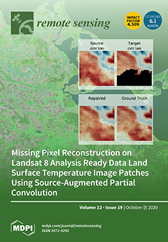
Cover Story (view full-size image): This study presents missing pixel reconstruction on Landsat land surface temperature image patches using source-augmented partial convolution. View this paper
  • Issues are regarded as officially published after their release is announced to the table of contents alert mailing list.
  • You may sign up for e-mail alerts to receive table of contents of newly released issues.
  • PDF is the official format for papers published in both, html and pdf forms. To view the papers in pdf format, click on the "PDF Full-text" link, and use the free Adobe Reader to open them.
Order results
Result details
Section
Select all
Export citation of selected articles as:
28 pages, 7028 KiB  
Article
Thermophysical Features of the Rümker Region in Northern Oceanus Procellarum: Insights from CE-2 CELMS Data
by Zhiguo Meng, Jietao Lei, Yuqi Qian, Long Xiao, James W. Head, Shengbo Chen, Weiming Cheng, Jiancheng Shi, Jinsong Ping and Zhizhong Kang
Remote Sens. 2020, 12(19), 3272; https://doi.org/10.3390/rs12193272 - 08 Oct 2020
Cited by 11 | Viewed by 3122
Abstract
The Rümker region is located in the northern Oceanus Procellarum, which has been selected as the landing and sampling region for China’s Chang’e-5 (CE-5) mission. The thermophysical features of the mare units are studied in detail using the brightness temperature (TB) maps (TB, [...] Read more.
The Rümker region is located in the northern Oceanus Procellarum, which has been selected as the landing and sampling region for China’s Chang’e-5 (CE-5) mission. The thermophysical features of the mare units are studied in detail using the brightness temperature (TB) maps (TB, normalized TB, TB difference) derived from the CE-2 microwave radiometer data. The previously interpreted geological boundaries of the Rümker region are revisited in this study according to their TB behaviors: IR1, IR2, and IR3 Rümker plateau units are combined into one single unit (IR); and a hidden unit is found on the Mons Rümker; Mare basaltic units Im1 and Em1 are combined into Em1; and Em2 is more likely the extending of Im2. Each of the previous proposed landing sites and their scientific value are summarized and reevaluated. Based on this, four landing sites are recommended in order to maximize the scientific outcome of the CE-5 mission. We suggest that the Eratosthenian-aged Em4 and Em1 units as the top priority landing site for the CE-5 mission; the age-dating results will provide important clues concerning the thermal evolution of the Moon. Full article
(This article belongs to the Special Issue Lunar Remote Sensing and Applications)
Show Figures

Graphical abstract

21 pages, 2691 KiB  
Article
Indoor and Outdoor Low-Cost Seamless Integrated Navigation System Based on the Integration of INS/GNSS/LIDAR System
by Ningbo Li, Lianwu Guan, Yanbin Gao, Shitong Du, Menghao Wu, Xingxing Guang and Xiaodan Cong
Remote Sens. 2020, 12(19), 3271; https://doi.org/10.3390/rs12193271 - 08 Oct 2020
Cited by 31 | Viewed by 4274
Abstract
Global Navigation Satellite System (GNSS) provides accurate positioning data for vehicular navigation in open outdoor environment. In an indoor environment, Light Detection and Ranging (LIDAR) Simultaneous Localization and Mapping (SLAM) establishes a two-dimensional map and provides positioning data. However, LIDAR can only provide [...] Read more.
Global Navigation Satellite System (GNSS) provides accurate positioning data for vehicular navigation in open outdoor environment. In an indoor environment, Light Detection and Ranging (LIDAR) Simultaneous Localization and Mapping (SLAM) establishes a two-dimensional map and provides positioning data. However, LIDAR can only provide relative positioning data and it cannot directly provide the latitude and longitude of the current position. As a consequence, GNSS/Inertial Navigation System (INS) integrated navigation could be employed in outdoors, while the indoors part makes use of INS/LIDAR integrated navigation and the corresponding switching navigation will make the indoor and outdoor positioning consistent. In addition, when the vehicle enters the garage, the GNSS signal will be blurred for a while and then disappeared. Ambiguous GNSS satellite signals will lead to the continuous distortion or overall drift of the positioning trajectory in the indoor condition. Therefore, an INS/LIDAR seamless integrated navigation algorithm and a switching algorithm based on vehicle navigation system are designed. According to the experimental data, the positioning accuracy of the INS/LIDAR navigation algorithm in the simulated environmental experiment is 50% higher than that of the Dead Reckoning (DR) algorithm. Besides, the switching algorithm developed based on the INS/LIDAR integrated navigation algorithm can achieve 80% success rate in navigation mode switching. Full article
(This article belongs to the Section AI Remote Sensing)
Show Figures

Graphical abstract

26 pages, 14189 KiB  
Article
Coastal Wetland Classification with Deep U-Net Convolutional Networks and Sentinel-2 Imagery: A Case Study at the Tien Yen Estuary of Vietnam
by Kinh Bac Dang, Manh Ha Nguyen, Duc Anh Nguyen, Thi Thanh Hai Phan, Tuan Linh Giang, Hoang Hai Pham, Thu Nhung Nguyen, Thi Thuy Van Tran and Dieu Tien Bui
Remote Sens. 2020, 12(19), 3270; https://doi.org/10.3390/rs12193270 - 08 Oct 2020
Cited by 34 | Viewed by 5257
Abstract
The natural wetland areas in Vietnam, which are transition areas from inland and ocean, play a crucial role in minimizing coastal hazards; however, during the last two decades, about 64% of these areas have been converted from the natural wetland to the human-made [...] Read more.
The natural wetland areas in Vietnam, which are transition areas from inland and ocean, play a crucial role in minimizing coastal hazards; however, during the last two decades, about 64% of these areas have been converted from the natural wetland to the human-made wetland. It is anticipated that the conversion rate continues to increase due to economic development and urbanization. Therefore, monitoring and assessment of the wetland are essential for the coastal vulnerability assessment and geo-ecosystem management. The aim of this study is to propose and verify a new deep learning approach to interpret 9 of 19 coastal wetland types classified in the RAMSAR and MONRE systems for the Tien Yen estuary of Vietnam. Herein, a Resnet framework was integrated into the U-Net to optimize the performance of the proposed deep learning model. The Sentinel-2, ALOS-DEM, and NOAA-DEM satellite images were used as the input data, whereas the output is the predefined nine wetland types. As a result, two ResU-Net models using Adam and RMSprop optimizer functions show the accuracy higher than 85%, especially in forested intertidal wetlands, aquaculture ponds, and farm ponds. The better performance of these models was proved, compared to Random Forest and Support Vector Machine methods. After optimizing the ResU-Net models, they were also used to map the coastal wetland areas correctly in the northeastern part of Vietnam. The final model can potentially update new wetland types in the southern parts and islands in Vietnam towards wetland change monitoring in real time. Full article
Show Figures

Graphical abstract

18 pages, 2483 KiB  
Article
Impacts of Urbanization on the Ecosystem Services in the Guangdong-Hong Kong-Macao Greater Bay Area, China
by Xuege Wang, Fengqin Yan and Fenzhen Su
Remote Sens. 2020, 12(19), 3269; https://doi.org/10.3390/rs12193269 - 08 Oct 2020
Cited by 37 | Viewed by 4952
Abstract
Unprecedented urbanization has occurred globally, which has converted substantial natural landscapes into impervious surfaces and further impacted ecosystem services and functioning. In this study, we quantified the spatiotemporal patterns of urbanization and investigated the impacts of urbanization on the ecosystem service value (ESV) [...] Read more.
Unprecedented urbanization has occurred globally, which has converted substantial natural landscapes into impervious surfaces and further impacted ecosystem services and functioning. In this study, we quantified the spatiotemporal patterns of urbanization and investigated the impacts of urbanization on the ecosystem service value (ESV) in the Guangdong-Hong Kong-Macao Greater Bay Area (GBA) of China from 1980 to 2018. The results show that the GBA has experienced extensive urbanization, with the urban area increasing from 2607.4 to 8243.5 km2 from 1980 to 2018. Zhongshan, Zhuhai, Dongguan, Shenzhen, and Foshan exhibited the top five highest urban expansion rates. Throughout the study period, edge expansion was the most dominant growth mode, with a decreasing trend, while infilling increased in the GBA. The total ESV loss induced by urban expansion in the GBA reached 40.5 billion yuan over the past four decades. The ESV loss due to the water body decrease caused by urbanization was the largest. Our study suggests that decision-makers should control new urban areas and protect water bodies, wetlands, and forests with high ESVs to promote the sustainable development of urban agglomerations. Full article
Show Figures

Graphical abstract

10 pages, 3230 KiB  
Letter
Comparison of TEC Calculations Based on Trimble, Javad, Leica, and Septentrio GNSS Receiver Data
by Vladislav Demyanov, Maria Sergeeva, Mark Fedorov, Tatiana Ishina, Victor Jose Gatica-Acevedo and Enrique Cabral-Cano
Remote Sens. 2020, 12(19), 3268; https://doi.org/10.3390/rs12193268 - 08 Oct 2020
Cited by 10 | Viewed by 3672
Abstract
A Global Navigation Satellite System (GNSS) receiver is, to some extent, a “black box” when its data is used for ionospheric studies. Our results based on Javad, Septentrio, Trimble, and Leica GNSS receivers have proven that the accuracy of the slant Total Electron [...] Read more.
A Global Navigation Satellite System (GNSS) receiver is, to some extent, a “black box” when its data is used for ionospheric studies. Our results based on Javad, Septentrio, Trimble, and Leica GNSS receivers have proven that the accuracy of the slant Total Electron Content (TEC) calculation can differ significantly depending on the GNSS receiver type/model, because TEC measurements depend on the carrier phase tracking technique applied in a receiver. The correlation coefficient between carrier phase noise in L1 and L2 channels is considered as a possible indicator that shows if the L1-aided tracking technique or independent tracking is applied inside a receiver. An empirical model of the TEC noise component was provided to determine the TEC noise value in different types/models of GNSS receivers. Full article
(This article belongs to the Special Issue GNSS High Rate Data for Research of the Ionosphere)
Show Figures

Graphical abstract

23 pages, 4677 KiB  
Article
Evaluating the Magnitude of VIIRS Out-of-Band Response for Varying Earth Spectra
by Benjamin Scarino, David R. Doelling, Rajendra Bhatt, Arun Gopalan and Conor Haney
Remote Sens. 2020, 12(19), 3267; https://doi.org/10.3390/rs12193267 - 08 Oct 2020
Viewed by 2532
Abstract
Prior evaluations of Visible Infrared Imaging Radiometer Suite (VIIRS) out-of-band (OOB) contribution to total signal revealed specification exceedance for multiple key solar reflective and infrared bands that are of interest to the passive remote-sensing community. These assessments are based on laboratory measurements, and [...] Read more.
Prior evaluations of Visible Infrared Imaging Radiometer Suite (VIIRS) out-of-band (OOB) contribution to total signal revealed specification exceedance for multiple key solar reflective and infrared bands that are of interest to the passive remote-sensing community. These assessments are based on laboratory measurements, and although highly useful, do not necessarily translate to OOB contribution with consideration of true Earth-reflected or Earth-emitted spectra, especially given the significant spectral variation of Earth targets. That is, although the OOB contribution of VIIRS is well known, it is not a uniform quantity applicable across all scene types. As such, this article quantifies OOB contribution for multiple relative spectral response characterization versions across the S-NPP, NOAA-20, and JPSS-2 VIIRS sensors as a function of varied SCIAMACHY- and IASI-measured hyperspectral Earth-reflected and Earth-emitted scenes. For instance, this paper reveals measured radiance variations of nearly 2% for the S-NPP VIIRS M5 (~0.67 μm) band, and up to 5.7% for certain VIIRS M9 (~1.38 μm) and M13 (~4.06 μm) bands that are owed solely to the truncation of OOB response for a set of spectrally distinct Earth scenes. If unmitigated, e.g., by only considering the published extended bandpass, such variations may directly translate to scene-dependent scaling discrepancies or subtle errors in vegetative index determinations. Therefore, knowledge of OOB effects is especially important for inter-calibration or environmental retrieval efforts that rely on specific or multiple categories of Earth scene spectra, and also to researchers whose products rely on the impacted channels. Additionally, instrument teams may find this evaluation method useful for pre-launch characterization of OOB contribution with specific Earth targets in mind rather than relying on general models. Full article
Show Figures

Graphical abstract

18 pages, 1179 KiB  
Article
Potential Lidar Height, Intensity, and Ratio Parameters for Plot Dominant Species Discrimination and Volume Estimation
by Taejin Park
Remote Sens. 2020, 12(19), 3266; https://doi.org/10.3390/rs12193266 - 08 Oct 2020
Cited by 2 | Viewed by 2705
Abstract
Precise stand species classification and volume estimation are key research topics for automated forest inventory. This study aims to explore the feasibility of light detection and ranging (lidar) height, intensity, and ratio parameters for discriminating dominant species (Pinus densiflora, Larix kaempferi [...] Read more.
Precise stand species classification and volume estimation are key research topics for automated forest inventory. This study aims to explore the feasibility of light detection and ranging (lidar) height, intensity, and ratio parameters for discriminating dominant species (Pinus densiflora, Larix kaempferi, and Quercus spp.) and estimating volume at plot scale. To achieve these objectives, multiple linear discriminant and regression analyses were utilized after a separate selection of explanatory variables from extracted 38 lidar height, intensity, and ratio parameters. A kappa accuracy of 0.75 was achieved in discriminating the plot-dominant species from three different species by adopting a combination of nine selected explanatory variables. Further investigation found that dispersion and mean of lidar intensity within a plot are key classifiers of identifying three species. Species-specific optimal plot volume models for Pinus densiflora, Larix kaempferi, and Quercus spp. were evaluated by coefficients of determination of 0.71, 0.74, and 0.56, respectively. Compared to species classification, height-related lidar variables play a key role in modeling forest plot volume. Several explanatory variables for each modeling practice were correlated to canopy vertical and horizontal structures and were enough to represent species-specific characteristics in both approaches for species classification and plot volume estimation. Additionally, observed different variable combinations for two important applications imply that future studies should use proper variable combinations for each purpose. Full article
Show Figures

Graphical abstract

19 pages, 3392 KiB  
Article
Estimation of Leaf Chlorophyll a, b and Carotenoid Contents and Their Ratios Using Hyperspectral Reflectance
by Rei Sonobe, Hiroto Yamashita, Harumi Mihara, Akio Morita and Takashi Ikka
Remote Sens. 2020, 12(19), 3265; https://doi.org/10.3390/rs12193265 - 08 Oct 2020
Cited by 47 | Viewed by 5277
Abstract
Japanese horseradish (wasabi) grows in very specific conditions, and recent environmental climate changes have damaged wasabi production. In addition, the optimal culture methods are not well known, and it is becoming increasingly difficult for incipient farmers to cultivate it. Chlorophyll a, b [...] Read more.
Japanese horseradish (wasabi) grows in very specific conditions, and recent environmental climate changes have damaged wasabi production. In addition, the optimal culture methods are not well known, and it is becoming increasingly difficult for incipient farmers to cultivate it. Chlorophyll a, b and carotenoid contents, as well as their allocation, could be an adequate indicator in evaluating its production and environmental stress; thus, developing an in situ method to monitor photosynthetic pigments based on reflectance could be useful for agricultural management. Besides original reflectance (OR), five pre-processing techniques, namely, first derivative reflectance (FDR), continuum-removed (CR), de-trending (DT), multiplicative scatter correction (MSC), and standard normal variate transformation (SNV), were compared to assess the accuracy of the estimation. Furthermore, five machine learning algorithms—random forest (RF), support vector machine (SVM), kernel-based extreme learning machine (KELM), Cubist, and Stochastic Gradient Boosting (SGB)—were considered. To classify the samples under different pH or sulphur ion concentration conditions, the end of the red edge bands was effective for OR, FDR, DT, MSC, and SNV, while a green-peak band was effective for CR. Overall, KELM and Cubist showed high performance and incorporating pre-processing techniques was effective for obtaining estimated values with high accuracy. The best combinations were found to be DT–KELM for chl a (RPD = 1.511–5.17, RMSE = 1.23–3.62 μg cm−2) and chl a:b (RPD = 0.73–3.17, RMSE = 0.13–0.60); CR–KELM for chl b (RPD = 1.92–5.06, RMSE = 0.41–1.03 μg cm−2) and chl a:car (RPD = 1.31–3.23, RMSE = 0.26–0.50); SNV–Cubist for car (RPD = 1.63–3.32, RMSE = 0.31–1.89 μg cm−2); and DT–Cubist for chl:car (RPD = 1.53–3.96, RMSE = 0.27–0.74). Full article
(This article belongs to the Special Issue Remote Sensing for Estimating Leaf Chlorophyll Content in Plants)
Show Figures

Figure 1

29 pages, 15947 KiB  
Article
Adjustments to SIF Aid the Interpretation of Drought Responses at the Caatinga of Northeast Brazil
by Edgard Bontempo, Ricardo Dalagnol, Flavio Ponzoni and Dalton Valeriano
Remote Sens. 2020, 12(19), 3264; https://doi.org/10.3390/rs12193264 - 08 Oct 2020
Cited by 6 | Viewed by 3004
Abstract
Sun-Induced chlorophyll Fluorescence (SIF) relates directly to photosynthesis yield and stress but there are still uncertainties in its interpretation. Most of these uncertainties concern the influences of the emitting vegetation’s structure (e.g., leaf angles, leaf clumping) and biochemistry (e.g., chlorophyll content, other pigments) [...] Read more.
Sun-Induced chlorophyll Fluorescence (SIF) relates directly to photosynthesis yield and stress but there are still uncertainties in its interpretation. Most of these uncertainties concern the influences of the emitting vegetation’s structure (e.g., leaf angles, leaf clumping) and biochemistry (e.g., chlorophyll content, other pigments) on the radiative transfer of fluorescent photons. The Caatinga is a large region in northeast Brazil of semiarid climate and heterogeneous vegetation, where such biochemical and structural characteristics can vary greatly even within a single hectare. With this study we aimed to characterize eleven years of SIF seasonal variation from Caatinga vegetation (2007 to 2017) and to study its responses to a major drought in 2012. Orbital SIF data from the instrument GOME-2 was used along with MODIS MAIAC EVI and NDVI. Environmental data included precipitation rate (TRMM), surface temperature (MODIS) and soil moisture (ESA CCI). To support the interpretation of SIF responses we used red and far-red SIF adjusted by the Sun’s zenith angle (SIF-SZA) and by daily Photosynthetically Active Radiation (dSIF). Furthermore, we also adjusted SIF through two contrasting formulations using NDVI data as proxy for structure and biochemistry, based on previous leaf-level and landscape level studies: SIF-Yield and SIF-Prod. Data was tested with time-series decomposition, rank correlation, spatial correlation and Linear Mixed Models (LMM). Results show that GOME-2 SIF and adjusted SIF formulations responded consistently to the observed environmental variation and showed a marked decrease in SIF emissions in response to a 2012 drought that was generally larger than the corresponding NDVI and EVI decreases. Drought sensitivity of SIF, as inferred from LMM slopes, was correlated to land cover at different regions of the Caatinga. This is the first study to show correlation between landscape-level SIF and an emergent property of ecosystems (i.e., resilience), showcasing the value of remotely sensed fluorescence for ecological studies. Full article
Show Figures

Graphical abstract

32 pages, 11808 KiB  
Article
Wide-Area Near-Real-Time Monitoring of Tropical Forest Degradation and Deforestation Using Sentinel-1
by Dirk Hoekman, Boris Kooij, Marcela Quiñones, Sam Vellekoop, Ita Carolita, Syarif Budhiman, Rahmat Arief and Orbita Roswintiarti
Remote Sens. 2020, 12(19), 3263; https://doi.org/10.3390/rs12193263 - 08 Oct 2020
Cited by 30 | Viewed by 7603
Abstract
The use of Sentinel-1 (S1) radar for wide-area, near-real-time (NRT) tropical-forest-change monitoring is discussed, with particular attention to forest degradation and deforestation. Since forest change can relate to processes ranging from high-impact, large-scale conversion to low-impact, selective logging, and can occur in sites [...] Read more.
The use of Sentinel-1 (S1) radar for wide-area, near-real-time (NRT) tropical-forest-change monitoring is discussed, with particular attention to forest degradation and deforestation. Since forest change can relate to processes ranging from high-impact, large-scale conversion to low-impact, selective logging, and can occur in sites having variable topographic and environmental properties such as mountain slopes and wetlands, a single approach is insufficient. The system introduced here combines time-series analysis of small objects identified in S1 data, i.e., segments containing linear features and apparent small-scale disturbances. A physical model is introduced for quantifying the size of small (upper-) canopy gaps. Deforestation detection was evaluated for several forest landscapes in the Amazon and Borneo. Using the default system settings, the false alarm rate (FAR) is very low (less than 1%), and the missed detection rate (MDR) varies between 1.9% ± 1.1% and 18.6% ± 1.0% (90% confidence level). For peatland landscapes, short radar detection delays up to several weeks due to high levels of soil moisture may occur, while, in comparison, for optical systems, detection delays up to 10 months were found due to cloud cover. In peat swamp forests, narrow linear canopy gaps (road and canal systems) could be detected with an overall accuracy of 85.5%, including many gaps barely visible on hi-res SPOT-6/7 images, which were used for validation. Compared to optical data, subtle degradation signals are easier to detect and are not quickly lost over time due to fast re-vegetation. Although it is possible to estimate an effective forest-cover loss, for example, due to selective logging, and results are spatiotemporally consistent with Sentinel-2 and TerraSAR-X reference data, quantitative validation without extensive field data and/or large hi-res radar datasets, such as TerraSAR-X, remains a challenge. Full article
(This article belongs to the Special Issue Advances in Remote Sensing for Global Forest Monitoring)
Show Figures

Graphical abstract

13 pages, 2605 KiB  
Letter
Single-Stage Rotation-Decoupled Detector for Oriented Object
by Bo Zhong and Kai Ao
Remote Sens. 2020, 12(19), 3262; https://doi.org/10.3390/rs12193262 - 08 Oct 2020
Cited by 23 | Viewed by 4709
Abstract
Oriented object detection has received extensive attention in recent years, especially for the task of detecting targets in aerial imagery. Traditional detectors locate objects by horizontal bounding boxes (HBBs), which may cause inaccuracies when detecting objects with arbitrary oriented angles, dense distribution and [...] Read more.
Oriented object detection has received extensive attention in recent years, especially for the task of detecting targets in aerial imagery. Traditional detectors locate objects by horizontal bounding boxes (HBBs), which may cause inaccuracies when detecting objects with arbitrary oriented angles, dense distribution and a large aspect ratio. Oriented bounding boxes (OBBs), which add different rotation angles to the horizontal bounding boxes, can better deal with the above problems. New problems arise with the introduction of oriented bounding boxes for rotation detectors, such as an increase in the number of anchors and the sensitivity of the intersection over union (IoU) to changes of angle. To overcome these shortcomings while taking advantage of the oriented bounding boxes, we propose a novel rotation detector which redesigns the matching strategy between oriented anchors and ground truth boxes. The main idea of the new strategy is to decouple the rotating bounding box into a horizontal bounding box during matching, thereby reducing the instability of the angle to the matching process. Extensive experiments on public remote sensing datasets including DOTA, HRSC2016 and UCAS-AOD demonstrate that the proposed approach achieves state-of-the-art detection accuracy with higher efficiency. Full article
Show Figures

Graphical abstract

19 pages, 2815 KiB  
Article
A Cloud Detection Method Using Convolutional Neural Network Based on Gabor Transform and Attention Mechanism with Dark Channel Subnet for Remote Sensing Image
by Jing Zhang, Qin Zhou, Jun Wu, Yuchen Wang, Hui Wang, Yunsong Li, Yuzhou Chai and Yang Liu
Remote Sens. 2020, 12(19), 3261; https://doi.org/10.3390/rs12193261 - 07 Oct 2020
Cited by 19 | Viewed by 3824
Abstract
Cloud detection, as a crucial step, has always been a hot topic in the field of optical remote sensing image processing. In this paper, we propose a deep learning cloud detection Network that is based on the Gabor transform and Attention modules with [...] Read more.
Cloud detection, as a crucial step, has always been a hot topic in the field of optical remote sensing image processing. In this paper, we propose a deep learning cloud detection Network that is based on the Gabor transform and Attention modules with Dark channel subnet (NGAD). This network is based on the encoder-decoder framework. The information on texture is an important feature that is often used in traditional cloud detection methods. The NGAD enhances the attention of the network towards important texture features in the remote sensing images through the proposed Gabor feature extraction module. The channel attention module that is based on the larger scale features and spatial attention module that is based on the dark channel subnet have been introduced in NGAD. The channel attention module highlights the important information in a feature map from the channel dimensions, weakens the useless information, and helps the network to filter this information. A dark channel subnet with spatial attention module has been designed in order to further reduce the influence of the redundant information in the extracted features. By introducing a “dark channel”, the information in the feature map is reconstructed from the spatial dimension. The NGAD is validated while using the Gaofen-1 WFV imagery in four spectral bands. The experimental results show that the overall accuracy of NGAD reaches 97.42% and the false alarm rate reaches 2.22%. The efficiency of cloud detection using NGAD exceeds the state-of-art image segmentation network model and remote sensing image cloud detection model. Full article
Show Figures

Graphical abstract

16 pages, 7299 KiB  
Article
Supervised Segmentation of Ultra-High-Density Drone Lidar for Large-Area Mapping of Individual Trees
by Martin Krůček, Kamil Král, KC Cushman, Azim Missarov and James R. Kellner
Remote Sens. 2020, 12(19), 3260; https://doi.org/10.3390/rs12193260 - 07 Oct 2020
Cited by 29 | Viewed by 5832
Abstract
We applied a supervised individual-tree segmentation algorithm to ultra-high-density drone lidar in a temperate mountain forest in the southern Czech Republic. We compared the number of trees correctly segmented, stem diameter at breast height (DBH), and tree height from drone-lidar segmentations to field-inventory [...] Read more.
We applied a supervised individual-tree segmentation algorithm to ultra-high-density drone lidar in a temperate mountain forest in the southern Czech Republic. We compared the number of trees correctly segmented, stem diameter at breast height (DBH), and tree height from drone-lidar segmentations to field-inventory measurements and segmentations from terrestrial laser scanning (TLS) data acquired within two days of the drone-lidar acquisition. Our analysis detected 51% of the stems >15 cm DBH, and 87% of stems >50 cm DBH. Errors of omission were much more common for smaller trees than for larger ones, and were caused by removal of points prior to segmentation using a low-intensity and morphological filter. Analysis of segmented trees indicates a strong linear relationship between DBH from drone-lidar segmentations and TLS data. The slope of this relationship is 0.93, the intercept is 4.28 cm, and the r2 is 0.98. However, drone lidar and TLS segmentations overestimated DBH for the smallest trees and underestimated DBH for the largest trees in comparison to field data. We evaluate the impact of random error in point locations and variation in footprint size, and demonstrate that random error in point locations is likely to cause an overestimation bias for small-DBH trees. A Random Forest classifier correctly identified broadleaf and needleleaf trees using stem and crown geometric properties with overall accuracy of 85.9%. We used these classifications and DBH estimates from drone-lidar segmentations to apply allometric scaling equations to segmented individual trees. The stand-level aboveground biomass (AGB) estimate using these data is 76% of the value obtained using a traditional field inventory. We demonstrate that 71% of the omitted AGB is due to segmentation errors of omission, and the remaining 29% is due to DBH estimation errors. Our analysis indicates that high-density measurements from low-altitude drone flight can produce DBH estimates for individual trees that are comparable to TLS. These data can be collected rapidly throughout areas large enough to produce landscape-scale estimates. With additional refinement, these estimates could augment or replace manual field inventories, and could support the calibration and validation of current and forthcoming space missions. Full article
(This article belongs to the Special Issue 3D Forest Structure Observation)
Show Figures

Figure 1

23 pages, 4012 KiB  
Article
Tailored Algorithms for the Detection of the Atmospheric Boundary Layer Height from Common Automatic Lidars and Ceilometers (ALC)
by Simone Kotthaus, Martial Haeffelin, Marc-Antoine Drouin, Jean-Charles Dupont, Sue Grimmond, Alexander Haefele, Maxime Hervo, Yann Poltera and Matthias Wiegner
Remote Sens. 2020, 12(19), 3259; https://doi.org/10.3390/rs12193259 - 07 Oct 2020
Cited by 21 | Viewed by 3577
Abstract
A detailed understanding of atmospheric boundary layer (ABL) processes is key to improve forecasting of pollution dispersion and cloud dynamics in the context of future climate scenarios. International networks of automatic lidars and ceilometers (ALC) are gathering valuable data that allow for the [...] Read more.
A detailed understanding of atmospheric boundary layer (ABL) processes is key to improve forecasting of pollution dispersion and cloud dynamics in the context of future climate scenarios. International networks of automatic lidars and ceilometers (ALC) are gathering valuable data that allow for the height of the ABL and its sublayers to be derived in near real time. A new generation of advanced methods to automatically detect the ABL heights now exist. However, diversity in ALC models means these algorithms need to be tailored to instrument-specific capabilities. Here, the advanced algorithm STRATfinder is presented for application to high signal-to-noise ratio (SNR) ALC observations, and results are compared to an automatic algorithm designed for low-SNR measurements (CABAM). The two algorithms are evaluated for application in an operational network setting. Results indicate that the ABL heights derived from low-SNR ALC have increased uncertainty during daytime deep convection, while high-SNR observations can have slightly reduced capabilities in detecting shallow nocturnal layers. Agreement between the ALC-based methods is similar when either is compared to the ABL heights derived from temperature profile data. The two independent methods describe very similar average diurnal and seasonal variations. Hence, high-quality products of ABL heights may soon become possible at national and continental scales. Full article
(This article belongs to the Special Issue Remote Sensing of the Atmospheric Boundary Layer)
Show Figures

Graphical abstract

14 pages, 2164 KiB  
Article
Deep Learning in Hyperspectral Image Reconstruction from Single RGB images—A Case Study on Tomato Quality Parameters
by Jiangsan Zhao, Dmitry Kechasov, Boris Rewald, Gernot Bodner, Michel Verheul, Nicholas Clarke and Jihong Liu Clarke
Remote Sens. 2020, 12(19), 3258; https://doi.org/10.3390/rs12193258 - 07 Oct 2020
Cited by 20 | Viewed by 5753
Abstract
Hyperspectral imaging has many applications. However, the high device costs and low hyperspectral image resolution are major obstacles limiting its wider application in agriculture and other fields. Hyperspectral image reconstruction from a single RGB image fully addresses these two problems. The robust HSCNN-R [...] Read more.
Hyperspectral imaging has many applications. However, the high device costs and low hyperspectral image resolution are major obstacles limiting its wider application in agriculture and other fields. Hyperspectral image reconstruction from a single RGB image fully addresses these two problems. The robust HSCNN-R model with mean relative absolute error loss function and evaluated by the Mean Relative Absolute Error metric was selected through permutation tests from models with combinations of loss functions and evaluation metrics, using tomato as a case study. Hyperspectral images were subsequently reconstructed from single tomato RGB images taken by a smartphone camera. The reconstructed images were used to predict tomato quality properties such as the ratio of soluble solid content to total titratable acidity and normalized anthocyanin index. Both predicted parameters showed very good agreement with corresponding “ground truth” values and high significance in an F test. This study showed the suitability of hyperspectral image reconstruction from single RGB images for fruit quality control purposes, underpinning the potential of the technology—recovering hyperspectral properties in high resolution—for real-world, real time monitoring applications in agriculture any beyond. Full article
Show Figures

Graphical abstract

15 pages, 6973 KiB  
Article
Improving Water Leaving Reflectance Retrievals from ABI and AHI Data Acquired Over Case 2 Waters from Present Geostationary Weather Satellite Platforms
by Bo-Cai Gao and Rong-Rong Li
Remote Sens. 2020, 12(19), 3257; https://doi.org/10.3390/rs12193257 - 07 Oct 2020
Cited by 4 | Viewed by 2423
Abstract
The current generation of geostationary weather satellite instruments, such as the Advanced Baseline Imagers (ABIs) on board the US NOAA GOES 16 and 17 satellites and the Advanced Himawari Imagers (AHIs) on board the Japanese Himawari-8/9 satellites, have six channels located in the [...] Read more.
The current generation of geostationary weather satellite instruments, such as the Advanced Baseline Imagers (ABIs) on board the US NOAA GOES 16 and 17 satellites and the Advanced Himawari Imagers (AHIs) on board the Japanese Himawari-8/9 satellites, have six channels located in the visible to shortwave IR (SWIR) spectral range. These instruments can acquire images over both land and water surfaces at spatial resolutions between 0.5 and 2 km and with a repeating cycle between 5 and 30 min depending on the mode of operation. The imaging data from these instruments have clearly demonstrated the capability in detecting sediment movements over coastal waters and major chlorophyll blooms over deeper oceans. At present, no operational ocean color data products have been produced from ABI data. Ocean color data products have been operationally generated from AHI data at the Japan Space Agency, but the spatial coverage of the products over very turbid coastal waters are sometimes lacking. In this article, we describe atmospheric correction algorithms for retrieving water leaving reflectances from ABI and AHI data using spectrum-matching techniques. In order to estimate aerosol models and optical depths, we match simultaneously the satellite-measured top of atmosphere (TOA) reflectances on the pixel by pixel basis for three channels centered near 0.86, 1.61, and 2.25 μm (or any combinations of two channels among the three channels) with theoretically simulated TOA reflectances. We demonstrate that water leaving reflectance retrievals can be made from ABI and AHI data with our algorithms over turbid case two waters. Our spectrum-matching algorithms, if implemented onto operational computing facilities, can be complimentary to present operational ocean versions of atmospheric correction algorithms that are mostly developed based on the SeaWiFS type of two-band ratio algorithm. Full article
(This article belongs to the Special Issue Remote Sensing of the Aquatic Environments)
Show Figures

Graphical abstract

19 pages, 2541 KiB  
Article
Comparison of Spectral Reflectance-Based Smart Farming Tools and a Conventional Approach to Determine Herbage Mass and Grass Quality on Farm
by Leonie Hart, Olivier Huguenin-Elie, Roy Latsch, Michael Simmler, Sébastien Dubois and Christina Umstatter
Remote Sens. 2020, 12(19), 3256; https://doi.org/10.3390/rs12193256 - 07 Oct 2020
Cited by 8 | Viewed by 3228
Abstract
The analysis of multispectral imagery (MSI) acquired by unmanned aerial vehicles (UAVs) and mobile near-infrared reflectance spectroscopy (NIRS) used on-site has become increasingly promising for timely assessments of grassland to support farm management. However, a major challenge of these methods is their calibration, [...] Read more.
The analysis of multispectral imagery (MSI) acquired by unmanned aerial vehicles (UAVs) and mobile near-infrared reflectance spectroscopy (NIRS) used on-site has become increasingly promising for timely assessments of grassland to support farm management. However, a major challenge of these methods is their calibration, given the large spatiotemporal variability of grassland. This study evaluated the performance of two smart farming tools in determining fresh herbage mass and grass quality (dry matter, crude protein, and structural carbohydrates): an analysis model for MSI (GrassQ) and a portable on-site NIRS (HarvestLabTM 3000). We compared them to conventional look-up tables used by farmers. Surveys were undertaken on 18 multi-species grasslands located on six farms in Switzerland throughout the vegetation period in 2018. The sampled plots represented two phenological growth stages, corresponding to an age of two weeks and four to six weeks, respectively. We found that neither the performance of the smart farming tools nor the performance of the conventional approach were satisfactory for use on multi-species grasslands. The MSI-model performed poorly, with relative errors of 99.7% and 33.2% of the laboratory analyses for herbage mass and crude protein, respectively. The errors of the MSI-model were indicated to be mainly caused by grassland and environmental characteristics that differ from the relatively narrow Irish calibration dataset. The On-site NIRS showed comparable performance to the conventional Look-up Tables in determining crude protein and structural carbohydrates (error ≤ 22.2%). However, we identified that the On-site NIRS determined undried herbage quality with a systematic and correctable error. After corrections, its performance was better than the conventional approach, indicating a great potential of the On-site NIRS for decision support on grazing and harvest scheduling. Full article
(This article belongs to the Special Issue Remote Sensing of Grassland Ecosystem)
Show Figures

Graphical abstract

16 pages, 4224 KiB  
Technical Note
A Priority Data Association Policy for Multitarget Tracking on Intelligent Vehicle Risk Assessment
by Dequan Zeng, Lu Xiong, Zhuoping Yu, Qiping Chen, Zhiqiang Fu, Zhuoren Li, Peizhi Zhang, Puhang Xu, Zixuan Qian, Hongyu Xiao, Peiyuan Fang, Zhiqiang Li and Bo Leng
Remote Sens. 2020, 12(19), 3255; https://doi.org/10.3390/rs12193255 - 07 Oct 2020
Cited by 1 | Viewed by 2224
Abstract
In order to conduct risk assessment for collision-free decision making of intelligent vehicles in a complex road traffic environment, it is essential to conduct stable tracking and state estimation of multiple vehicle targets. Therefore, this paper proposes a multitarget tracking method in line [...] Read more.
In order to conduct risk assessment for collision-free decision making of intelligent vehicles in a complex road traffic environment, it is essential to conduct stable tracking and state estimation of multiple vehicle targets. Therefore, this paper proposes a multitarget tracking method in line with the priority data association rule. Firstly, a standard coordinate turn process model is deduced as the existence of translation and rotation of the vehicle on the two-dimensional ground plane. Secondly, an unscented Kalman filter algorithm is developed due to the nonlinear radar measurement model. Thirdly, a priority data association rule, which puts the targets in a priority queue according to the number of times they are associated, is designed to filter out noise, given that it is unlikely for a vehicle target as an inertial system to appear or disappear instantly in practice. In addition, the data association rule specifies that the closer the target is to the front of the queue, the more prioritized the association with the newly observed target would be. Finally, the track management algorithm is constructed. On this basis, a series of real vehicle tests were conducted on real roads with four typical scenarios. According to the test results, the proposed algorithm is effective in filtering out noise and is suboptimal as the nearest neighbor data association. Full article
Show Figures

Graphical abstract

18 pages, 7496 KiB  
Article
An Ensemble Learning Approach for Urban Land Use Mapping Based on Remote Sensing Imagery and Social Sensing Data
by Zhou Huang, Houji Qi, Chaogui Kang, Yuelong Su and Yu Liu
Remote Sens. 2020, 12(19), 3254; https://doi.org/10.3390/rs12193254 - 07 Oct 2020
Cited by 42 | Viewed by 4654
Abstract
Urban land use mapping is crucial for effective urban management and planning due to the rapid change of urban processes. State-of-the-art approaches rely heavily on the socioeconomic, topographical, infrastructural and land cover information of urban environments via feeding them into ad hoc classifiers [...] Read more.
Urban land use mapping is crucial for effective urban management and planning due to the rapid change of urban processes. State-of-the-art approaches rely heavily on the socioeconomic, topographical, infrastructural and land cover information of urban environments via feeding them into ad hoc classifiers for land use classification. Yet, the major challenge lies in the lack of a universal and reliable approach for the extraction and combination of physical and socioeconomic features derived from remote sensing imagery and social sensing data. This article proposes an ensemble-learning-approach-based solution of integrating a rich body of features derived from high resolution satellite images, street-view images, building footprints, points-of-interest (POIs) and social media check-ins for the urban land use mapping task. The proposed approach can statistically differentiate the importance of input feature variables and provides a good explanation for the relationships between land cover, socioeconomic activities and land use categories. We apply the proposed method to infer the land use distribution in fine-grained spatial granularity within the Fifth Ring Road of Beijing and achieve an average classification accuracy of 74.2% over nine typical land use types. The results also indicate that our model outperforms several alternative models that have been widely utilized as baselines for land use classification. Full article
(This article belongs to the Section Urban Remote Sensing)
Show Figures

Graphical abstract

31 pages, 11409 KiB  
Article
Evaluation of Remote Sensing and Reanalysis Snow Depth Datasets over the Northern Hemisphere during 1980–2016
by Lin Xiao, Tao Che and Liyun Dai
Remote Sens. 2020, 12(19), 3253; https://doi.org/10.3390/rs12193253 - 07 Oct 2020
Cited by 18 | Viewed by 3416
Abstract
Snow cover is a key parameter of the climate system and its significant seasonal and annual variability have significant impacts on the surface energy balance and global water circulation. However, current snow depth datasets show large inconsistencies and uncertainties, which limit their applications [...] Read more.
Snow cover is a key parameter of the climate system and its significant seasonal and annual variability have significant impacts on the surface energy balance and global water circulation. However, current snow depth datasets show large inconsistencies and uncertainties, which limit their applications in climate change projections and hydrological processes simulations. In this study, a comprehensive assessment of five hemispheric snow depth datasets was carried out against ground observations from 43,391 stations. The five snow depth datasets included three remote sensing datasets, i.e., Advanced Microwave Scanning Radiometer for the Earth Observing System (AMSR-E), Advanced Microwave Scanning Radiometer-2 (AMSR2), Global Snow Monitoring for Climate Research (GlobSnow), and two reanalysis datasets, i.e., ERA-Interim and the Modern-Era Retrospective Analysis for Research and Applications, version 2 (MERRA-2). Assessment results imply that the spatial distribution of GlobSnow and ERA-Interim exhibit overall better agreements with ground observations than other datasets. GlobSnow and ERA-Interim exhibit less uncertainty during the snow accumulation and ablation periods, respectively. In plain and forested regions, GlobSnow, ERA-Interim and MERRA-2 show better performances, while in mountain and forested mountain areas, GlobSnow exhibits the best performance. AMSR-E and AMSR2 agree better with ground observations in shallow snow condition (0–10 cm), while MERRA-2 shows more satisfying performance when snow depth exceeds 50 cm. These systematic and integrated understanding of the five representative snow depth datasets provides information on data selection and data refinement, as well as data fusion, which is our next work of interest. Full article
(This article belongs to the Special Issue Fusion of High-Level Remote Sensing Products)
Show Figures

Graphical abstract

13 pages, 4810 KiB  
Letter
Determination of Epicenters before Earthquakes Utilizing Far Seismic and GNSS Data: Insights from Ground Vibrations
by Chieh-Hung Chen, Li-Ching Lin, Ta-Kang Yeh, Strong Wen, Huaizhong Yu, Chen Yu, Yongxin Gao, Peng Han, Yang-Yi Sun, Jann-Yenq Liu, Cheng-Horng Lin, Chi-Chia Tang, Che-Min Lin, Hung-Hao Hsieh and Pin-Ji Lu
Remote Sens. 2020, 12(19), 3252; https://doi.org/10.3390/rs12193252 - 07 Oct 2020
Cited by 18 | Viewed by 3620
Abstract
Broadband seismometers, ground-based Global Navigation Satellite Systems (GNSS), and magnetometers that were located within an epicentral distance of approximately 150 km consistently observed the novel anomalous behaviors of the common-mode ground vibrations approximately 5–10 days before the M6.6 Meinong earthquake in Taiwan. The [...] Read more.
Broadband seismometers, ground-based Global Navigation Satellite Systems (GNSS), and magnetometers that were located within an epicentral distance of approximately 150 km consistently observed the novel anomalous behaviors of the common-mode ground vibrations approximately 5–10 days before the M6.6 Meinong earthquake in Taiwan. The common-mode ground vibrations with amplitudes near 0.1 m at frequencies ranging from 8 × 10⁻⁵ to 2 × 10⁻⁴ Hz were generated near the region close to the epicenter of the impending earthquake. The common-mode vibrations were consistently observed in seismic and GNSS data associated with five other earthquakes in four distinct areas. The results reveal that the common-mode vibrations could be a typical behavior before earthquakes. The causal mechanism of common-mode vibrations can be attributed to crustal resonance excitations before fault dislocations occur. Potential relationships with other pre-earthquake anomalies suggest that the common-mode vibrations could be ground motion before earthquakes, which was investigated for a significant length of time. Full article
Show Figures

Graphical abstract

17 pages, 9449 KiB  
Article
sUAS Remote Sensing of Vineyard Evapotranspiration Quantifies Spatiotemporal Uncertainty in Satellite-Borne ET Estimates
by Michael Kalua, Anna M. Rallings, Lorenzo Booth, Josué Medellín-Azuara, Stefano Carpin and Joshua H. Viers
Remote Sens. 2020, 12(19), 3251; https://doi.org/10.3390/rs12193251 - 07 Oct 2020
Cited by 6 | Viewed by 3493
Abstract
Small Unmanned Aerial Systems (sUAS) show promise in being able to collect high resolution spatiotemporal data over small extents. Use of such remote sensing platforms also show promise for quantifying uncertainty in more ubiquitous Earth Observation System (EOS) data, such as evapotranspiration and [...] Read more.
Small Unmanned Aerial Systems (sUAS) show promise in being able to collect high resolution spatiotemporal data over small extents. Use of such remote sensing platforms also show promise for quantifying uncertainty in more ubiquitous Earth Observation System (EOS) data, such as evapotranspiration and consumptive use of water in agricultural systems. This study compares measurements of evapotranspiration (ET) from a commercial vineyard in California using data collected from sUAS and EOS sources for 10 events over a growing season using multiple ET estimation methods. Results indicate that sUAS ET estimates that include non-canopy pixels are generally lower on average than EOS methods by >0.5 mm day1. sUAS ET estimates that mask out non-canopy pixels are generally higher than EOS methods by <0.5 mm day1. Masked sUAS ET estimates are less variable than unmasked sUAS and EOS ET estimates. This study indicates that limited deployment of sUAS can provide important estimates of uncertainty in EOS ET estimations for larger areas and to also improve irrigation management at a local scale. Full article
(This article belongs to the Special Issue Remote Sensing in Hydrology and Water Resources Management)
Show Figures

Graphical abstract

28 pages, 13267 KiB  
Article
Identification of Polycentric Cities in China Based on NPP-VIIRS Nighttime Light Data
by Mingguo Ma, Qin Lang, Hong Yang, Kaifang Shi and Wei Ge
Remote Sens. 2020, 12(19), 3248; https://doi.org/10.3390/rs12193248 - 07 Oct 2020
Cited by 19 | Viewed by 3191
Abstract
Nighttime light data play an important role in the research on cities, while the urban centers over a large spatial scale are still far from clearly understood. Aiming at the current challenges in monitoring the spatial structure of cities using nighttime light data, [...] Read more.
Nighttime light data play an important role in the research on cities, while the urban centers over a large spatial scale are still far from clearly understood. Aiming at the current challenges in monitoring the spatial structure of cities using nighttime light data, this paper proposes a new method for identifying urban centers for massive cities at the large spatial scale based on the brightness information captured by the Suomi National Polar-Orbiting Partnership’s Visible Infrared Imaging Radiometer Suite (NPP-VIIRS) sensor. Based on the method for extracting the peak point based on digital elevation model (DEM) data in terrain analysis, the maximum neighborhood and difference algorithms were applied to the NPP-VIIRS data to extract the pixels with the peak nighttime light intensity to identify the potential locations of urban centers. The results show 7239 urban centers in 2200 cities in China in 2017, with an average of 3.3 urban centers per city. Approximately 68% of the cities had significant polycentric structures. The developed method in this paper is useful for identifying the urban centers and can provide the reference to the city planning and construction. Full article
(This article belongs to the Section Urban Remote Sensing)
Show Figures

Graphical abstract

24 pages, 8991 KiB  
Article
Recent Climate Change Feedbacks to Greenland Ice Sheet Mass Changes from GRACE
by Fang Zou, Robert Tenzer, Hok Sum Fok and Janet E. Nichol
Remote Sens. 2020, 12(19), 3250; https://doi.org/10.3390/rs12193250 - 06 Oct 2020
Cited by 7 | Viewed by 2702
Abstract
Although a significant effort has been dedicated to studying changes in the mass budget of the Greenland Ice Sheet (GrIS), mechanisms behind these changes are not yet fully understood. In this study, we address this issue by investigating the link between climate controls [...] Read more.
Although a significant effort has been dedicated to studying changes in the mass budget of the Greenland Ice Sheet (GrIS), mechanisms behind these changes are not yet fully understood. In this study, we address this issue by investigating the link between climate controls and mass changes of the GrIS between August 2002 and June 2017. We estimate the GrIS mass changes based on averaging the Gravity Recovery and Climate Experiment (GRACE) monthly gravity field solutions from four processing data centers. We then investigate the possible impact of different climate variables on the GrIS mass changes using the North Atlantic Oscillation (NAO), temperature, precipitation, and the 700 hPa wind retrieved from the ERA-5 reanalysis. Results indicate a decrease of −267.77 ± 32.67 Gt/yr in the total mass of the GrIS over the 16-year period. By quantifying the relationship between climate controls and mass changes, we observe that mass changes in different parts of Greenland have varying sensitivity to climate controls. The NAO mainly controls mass changes in west Greenland, where the summertime NAO modulations have a greater impact on the summer mass loss than the wintertime NAO modulations have on the winter mass gain. The GrIS mass changes are correlated spatially with summer temperature, especially in southwest Greenland. Mass balance changes in northwest Greenland are mostly affected by wind anomalies. These new findings based on wind anomalies indicate that the summer atmospheric circulation anomalies control surface temperature and snow precipitation and consequently affect mass changes in different parts of Greenland. Full article
Show Figures

Graphical abstract

20 pages, 4426 KiB  
Article
Capturing the Impact of the 2018 European Drought and Heat across Different Vegetation Types Using OCO-2 Solar-Induced Fluorescence
by Ankit Shekhar, Jia Chen, Shrutilipi Bhattacharjee, Allan Buras, Antony Oswaldo Castro, Christian S. Zang and Anja Rammig
Remote Sens. 2020, 12(19), 3249; https://doi.org/10.3390/rs12193249 - 06 Oct 2020
Cited by 27 | Viewed by 4212
Abstract
The European heatwave of 2018 led to record-breaking temperatures and extremely dry conditions in many parts of the continent, resulting in widespread decrease in agricultural yield, early tree-leaf senescence, and increase in forest fires in Northern Europe. Our study aims to capture the [...] Read more.
The European heatwave of 2018 led to record-breaking temperatures and extremely dry conditions in many parts of the continent, resulting in widespread decrease in agricultural yield, early tree-leaf senescence, and increase in forest fires in Northern Europe. Our study aims to capture the impact of the 2018 European heatwave on the terrestrial ecosystem through the lens of a high-resolution solar-induced fluorescence (SIF) data acquired from the Orbiting Carbon Observatory-2 (OCO-2) satellite. SIF is proposed to be a direct proxy for gross primary productivity (GPP) and thus can be used to draw inferences about changes in photosynthetic activity in vegetation due to extreme events. We explore spatial and temporal SIF variation and anomaly in the spring and summer months across different vegetation types (agriculture, broadleaved forest, coniferous forest, and mixed forest) during the European heatwave of 2018 and compare it to non-drought conditions (most of Southern Europe). About one-third of Europe’s land area experienced a consecutive spring and summer drought in 2018. Comparing 2018 to mean conditions (i.e., those in 2015–2017), we found a change in the intra-spring season SIF dynamics for all vegetation types, with lower SIF during the start of spring, followed by an increase in fluorescence from mid-April. Summer, however, showed a significant decrease in SIF. Our results show that particularly agricultural areas were severely affected by the hotter drought of 2018. Furthermore, the intense heat wave in Central Europe showed about a 31% decrease in SIF values during July and August as compared to the mean over the previous three years. Furthermore, our MODIS (Moderate Resolution Imaging Spectroradiometer) and OCO-2 comparative results indicate that especially for coniferous and mixed forests, OCO-2 SIF has a quicker response and a possible higher sensitivity to drought in comparison to MODIS’s fPAR (fraction of absorbed photosynthetically active radiation) and the Normalized Difference Vegetation Index (NDVI) when considering shorter reference periods, which highlights the added value of remotely sensed solar-induced fluorescence for studying the impact of drought on vegetation. Full article
(This article belongs to the Special Issue Drought Monitoring Using Satellite Remote Sensing)
Show Figures

Graphical abstract

19 pages, 7052 KiB  
Article
Spatial Heterogeneity of Vegetation Response to Mining Activities in Resource Regions of Northwestern China
by Hanting Li, Miaomiao Xie, Huihui Wang, Shaoling Li and Meng Xu
Remote Sens. 2020, 12(19), 3247; https://doi.org/10.3390/rs12193247 - 06 Oct 2020
Cited by 30 | Viewed by 3190
Abstract
Aggregated mining development has direct and indirect impacts on vegetation changes. This impact shows spatial differences due to the complex influence of multiple mines, which is a common issue in resource regions. To estimate the spatial heterogeneity of vegetation response to mining activities, [...] Read more.
Aggregated mining development has direct and indirect impacts on vegetation changes. This impact shows spatial differences due to the complex influence of multiple mines, which is a common issue in resource regions. To estimate the spatial heterogeneity of vegetation response to mining activities, we coupled vegetation changes and mining development through a geographically weighted regression (GWR) model for three cumulative periods between 1999 and 2018 in integrated resource regions of northwestern China. Vegetation changes were monitored by Sen’s slope and the Mann–Kendall test according to a total of 72 Landsat images. Spatial distribution of mining development was quantified, due to four land-use maps in 2000, 2005, 2010, and 2017. The results showed that 80% of vegetation in the study area experienced different degrees of degradation, more serious in the overlapping areas of multiple mines and mining areas. The scope of influence for single mines on vegetation shrunk by about 48%, and the mean coefficients increased by 20%, closer to mining areas. The scope of influence for multiple mines on vegetation gradually expanded to 86% from the outer edge to the inner overlapping areas of mining areas, where the mean coefficients increased by 92%. The correlation between elevation and vegetation changes varied according to the average elevation of the total mining areas. Ultimately, the available ecological remediation should be systematically considered for local conditions and mining consequences. Full article
(This article belongs to the Special Issue Land Degradation Assessment with Earth Observation)
Show Figures

Graphical abstract

26 pages, 14017 KiB  
Article
CORONA High-Resolution Satellite and Aerial Imagery for Change Detection Assessment of Natural Hazard Risk and Urban Growth in El Alto/La Paz in Bolivia, Santiago de Chile, Yungay in Peru, Qazvin in Iran, and Mount St. Helens in the USA
by Alexander Fekete
Remote Sens. 2020, 12(19), 3246; https://doi.org/10.3390/rs12193246 - 06 Oct 2020
Cited by 21 | Viewed by 7556
Abstract
Urban growth and natural hazard events are continuous trends and reliable monitoring is demanded by organisations such as the Intergovernmental Panel on Climate Change, the United Nations Office for Disaster Risk Reduction, or the United Nations Human Settlements Programme. CORONA is the program [...] Read more.
Urban growth and natural hazard events are continuous trends and reliable monitoring is demanded by organisations such as the Intergovernmental Panel on Climate Change, the United Nations Office for Disaster Risk Reduction, or the United Nations Human Settlements Programme. CORONA is the program name of photoreconnaissance satellite imagery available from 1960 to 1984 provides an extension of monitoring ranges in comparison to later satellite data such as Landsat that are more widely used. Providing visual comparisons with aerial or high-resolution OrbView satellite imagery, this article demonstrates applications of CORONA images for change detection of urban growth and sprawl and natural hazard exposure. Cases from El Alto/ La Paz in Bolivia, Santiago de Chile, Yungay in Peru, Qazvin in Iran, and Mount St. Helens in the USA are analysed. After a preassessment of over 20 disaster events, the 1970 Yungay earthquake-triggered debris avalanche and the natural hazard processes of the 1980 Mt St. Helens volcanic eruption are further analysed. Usability and limitations of CORONA data are analysed, including the availability of data depending on flight missions, cloud cover, spatial and temporal resolution, but also rather scarce documentation of natural hazards in the 1960s and 70s. Results include the identification of urban borders expanding into hazard-prone areas such as mountains, riverbeds or erosion channels. These are important areas for future research, making more usage of this valuable but little-used data source. The article addresses geographers, spatial planners, political decision makers and other scientific areas dealing with remote sensing. Full article
Show Figures

Graphical abstract

29 pages, 10996 KiB  
Article
Validation of Carbon Trace Gas Profile Retrievals from the NOAA-Unique Combined Atmospheric Processing System for the Cross-Track Infrared Sounder
by Nicholas R. Nalli, Changyi Tan, Juying Warner, Murty Divakarla, Antonia Gambacorta, Michael Wilson, Tong Zhu, Tianyuan Wang, Zigang Wei, Ken Pryor, Satya Kalluri, Lihang Zhou, Colm Sweeney, Bianca C. Baier, Kathryn McKain, Debra Wunch, Nicholas M. Deutscher, Frank Hase, Laura T. Iraci, Rigel Kivi, Isamu Morino, Justus Notholt, Hirofumi Ohyama, David F. Pollard, Yao Té, Voltaire A. Velazco, Thorsten Warneke, Ralf Sussmann and Markus Rettingeradd Show full author list remove Hide full author list
Remote Sens. 2020, 12(19), 3245; https://doi.org/10.3390/rs12193245 - 06 Oct 2020
Cited by 23 | Viewed by 4752
Abstract
This paper provides an overview of the validation of National Oceanic and Atmospheric Administration (NOAA) operational retrievals of atmospheric carbon trace gas profiles, specifically carbon monoxide (CO), methane (CH4) and carbon dioxide (CO2), from the NOAA-Unique Combined Atmospheric Processing [...] Read more.
This paper provides an overview of the validation of National Oceanic and Atmospheric Administration (NOAA) operational retrievals of atmospheric carbon trace gas profiles, specifically carbon monoxide (CO), methane (CH4) and carbon dioxide (CO2), from the NOAA-Unique Combined Atmospheric Processing System (NUCAPS), a NOAA enterprise algorithm that retrieves atmospheric profile environmental data records (EDRs) under global non-precipitating (clear to partly cloudy) conditions. Vertical information about atmospheric trace gases is obtained from the Cross-track Infrared Sounder (CrIS), an infrared Fourier transform spectrometer that measures high resolution Earth radiance spectra from NOAA operational low earth orbit (LEO) satellites, including the Suomi National Polar-orbiting Partnership (SNPP) and follow-on Joint Polar Satellite System (JPSS) series beginning with NOAA-20. The NUCAPS CO, CH4, and CO2 profile EDRs are rigorously validated in this paper using well-established independent truth datasets, namely total column data from ground-based Total Carbon Column Observing Network (TCCON) sites, and in situ vertical profile data obtained from aircraft and balloon platforms via the NASA Atmospheric Tomography (ATom) mission and NOAA AirCore sampler, respectively. Statistical analyses using these datasets demonstrate that the NUCAPS carbon gas profile EDRs generally meet JPSS Level 1 global performance requirements, with the absolute accuracy and precision of CO 5% and 15%, respectively, in layers where CrIS has vertical sensitivity; CH4 and CO2 product accuracies are both found to be within ±1%, with precisions of ≈1.5% and ⪅0.5%, respectively, throughout the tropospheric column. Full article
Show Figures

Graphical abstract

21 pages, 30799 KiB  
Article
Testing Side-Scan Sonar and Multibeam Echosounder to Study Black Coral Gardens: A Case Study from Macaronesia
by Karolina Czechowska, Peter Feldens, Fernando Tuya, Marcial Cosme de Esteban, Fernando Espino, Ricardo Haroun, Mischa Schönke and Francisco Otero-Ferrer
Remote Sens. 2020, 12(19), 3244; https://doi.org/10.3390/rs12193244 - 06 Oct 2020
Cited by 20 | Viewed by 5522
Abstract
Black corals (order Antipatharia) are important components of mesophotic and deep-water marine communities, but due to their inaccessibility, there is limited knowledge about the basic aspects of their distribution and ecology. The aim of this study was to test methodologies to map and [...] Read more.
Black corals (order Antipatharia) are important components of mesophotic and deep-water marine communities, but due to their inaccessibility, there is limited knowledge about the basic aspects of their distribution and ecology. The aim of this study was to test methodologies to map and study colonies of a branched antipatharian species, Antipathella wollastoni, in the Canary Islands (Spain). Acoustic tools, side-scan sonar (SSS), and a multibeam echosounder (MBES), coupled with ground-truthing video surveys, were used to determine the habitat characteristics of Antipathella wollastoni. Below 40 m depth, colonies of increasing height (up to 1.3 m) and abundance (up to 10 colonies/m2) were observed, particularly on steep and current-facing slopes on rocky substrates. However, coral presence was not directly imaged on backscatter mosaics and bathymetric data. To improve this situation, promising initial attempts of detecting Antipathella wollastoni by utilizing the MBES water column scatter in an interval for 0.75 m to 1 m above the seafloor are reported. Full article
(This article belongs to the Special Issue Remote Sensing of Islands)
Show Figures

Figure 1

19 pages, 10221 KiB  
Article
Monitoring Littoral Platform Downwearing Using Differential SAR Interferometry
by Gosia Mider, James Lawrence, Philippa Mason and Richard Ghail
Remote Sens. 2020, 12(19), 3243; https://doi.org/10.3390/rs12193243 - 06 Oct 2020
Cited by 3 | Viewed by 3747
Abstract
A methodology for the remotely sensed monitoring, measurement and quantification of littoral zone platform downwearing has been developed and is demonstrated, using Persistent Scatterer Interferometric Synthetic Aperture Radar data and analysis. The research area is a 30 km section of coast in East [...] Read more.
A methodology for the remotely sensed monitoring, measurement and quantification of littoral zone platform downwearing has been developed and is demonstrated, using Persistent Scatterer Interferometric Synthetic Aperture Radar data and analysis. The research area is a 30 km section of coast in East Sussex, UK. This area combines a range of coastal environments and is characterised by the exposure of chalk along the cliffs and coastal platform. Persistent Scatterer Interferometry (PSI) has been employed, using 3.5 years of Sentinel-1 SAR data. The results demonstrate an average ground level change of −0.36 mm a−1 across the research area, caused by platform downwearing. Protected sections of coast are downwearing at an average of −0.33 mm a−1 compared to unprotected sections, which are downwearing more rapidly at an average rate of −1.10 mm a−1. The material properties of the chalk formations in the platform were considered, and in unprotected areas the weakest chalk types eroded at higher rates (−0.66 mm a−1) than the more resistant formations (−0.53 mm a−1). At a local scale, results were achieved in three studies to demonstrate variations between urban and rural environments. Individual persistent scatterer point values provided a near-continuous sequence of measurements, which allowed the effects of processes to be evaluated. The results of this investigation show an effective way of retrospective and ongoing monitoring of platform downwearing, erosion and other littoral zone processes, at regional, local and point-specific scales. Full article
(This article belongs to the Special Issue InSAR in Remote Sensing)
Show Figures

Graphical abstract

Previous Issue
Back to TopTop