Next Issue
Volume 11, January
Previous Issue
Volume 10, November


Hydrology, Volume 10, Issue 12 (December 2023) – 24 articles

Cover Story (view full-size image): 
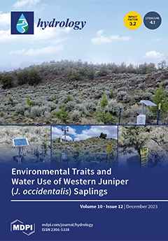
Limited information regarding young-stage tree water uptake and environmental relationships in water-limited ecosystems exists. This study in a semiarid rangeland ecosystem in central Oregon, USA, measured the transpiration of western juniper (Juniperus occidentalis) saplings using the stem heat balance method. The results showed higher transpiration rates in wet vs. dry years. Vapor pressure deficit, solar radiation, and air temperature positively correlated with transpiration in all years. Soil moisture and soil temperature positively correlated with transpiration for most years. Precipitation and relative humidity negatively correlated with transpiration. This study adds information on the interannual variability of environmental factors driving water use by young juniper trees, and it can help improve the management of restored semiarid ecosystems. View this paper
  • Issues are regarded as officially published after their release is announced to the table of contents alert mailing list.
  • You may sign up for e-mail alerts to receive table of contents of newly released issues.
  • PDF is the official format for papers published in both, html and pdf forms. To view the papers in pdf format, click on the "PDF Full-text" link, and use the free Adobe Reader to open them.
Order results
Result details
Section
Select all
Export citation of selected articles as:
32 pages, 6394 KiB  
Article
Evaluating the Benefits of Flood Warnings in the Management of an Urban Flood-Prone Polder Area
by Felipe Duque, Greg O’Donnell, Yanli Liu, Mingming Song and Enda O’Connell
Hydrology 2023, 10(12), 238; https://doi.org/10.3390/hydrology10120238 - 13 Dec 2023
Viewed by 2190
Abstract
Polders are low-lying areas located in deltas, surrounded by embankments to prevent flooding (river or tidal floods). They rely on pumping systems to remove water from the inner rivers (artificial rivers inside the polder area) to the outer rivers, especially during storms. Urbanized [...] Read more.
Polders are low-lying areas located in deltas, surrounded by embankments to prevent flooding (river or tidal floods). They rely on pumping systems to remove water from the inner rivers (artificial rivers inside the polder area) to the outer rivers, especially during storms. Urbanized polders are especially vulnerable to pluvial flooding if the drainage, storage, and pumping capacity of the polder is inadequate. In this paper, a Monte Carlo (MC) framework is proposed to evaluate the benefits of rainfall threshold-based flood warnings when mitigating pluvial flooding in an urban flood-prone polder area based on 24 h forecasts. The framework computes metrics that give the potential waterlogging duration, maximum inundated area, and pump operation costs by considering the full range of potential storms. The benefits of flood warnings are evaluated by comparing the values of these metrics across different scenarios: the no-warning, perfect, deterministic, and probabilistic forecast scenarios. Probabilistic forecasts are represented using the concept of “predictive uncertainty” (PU). A polder area located in Nanjing was chosen for the case study. The results show a trade-off between the metrics that represent the waterlogging and the pumping costs, and that probabilistic forecasts of rainfall can considerably enhance these metrics. The results can be used to design a rainfall threshold-based flood early warning system (FEWS) for a polder area and/or evaluate its benefits. Full article
(This article belongs to the Section Hydrological and Hydrodynamic Processes and Modelling)
Show Figures

Figure 1

23 pages, 18071 KiB  
Article
Groundwater Recharge Potentiality Mapping in Wadi Qena, Eastern Desert Basins of Egypt for Sustainable Agriculture Base Using Geomatics Approaches
by Hanaa A. Megahed, Abd El-Hay A. Farrag, Amira A. Mohamed, Paola D’Antonio, Antonio Scopa and Mohamed A. E. AbdelRahman
Hydrology 2023, 10(12), 237; https://doi.org/10.3390/hydrology10120237 - 12 Dec 2023
Cited by 1 | Viewed by 1867
Abstract
In arid and hyper-arid areas, groundwater is a precious and rare resource. The need for water supply has grown over the past few decades as a result of population growth, urbanization, and agricultural endeavors. This research aims to locate groundwater recharge potential zones [...] Read more.
In arid and hyper-arid areas, groundwater is a precious and rare resource. The need for water supply has grown over the past few decades as a result of population growth, urbanization, and agricultural endeavors. This research aims to locate groundwater recharge potential zones (GWPZs) using multi-criteria evaluation (MCE) in the Wadi Qena Basin, Eastern Desert of Egypt, which represents one of the most promising valleys on which the government depends for land reclamations and developments. These approaches have been used to integrate and delineate the locations of high groundwater recharge and the potential of the Quaternary aquifer in the Wadi Qena basin. After allocating weight factors to identify features in each case based on infiltration, land use/land cover, slope, geology, topology, soil, drainage density, lineament density, rainfall, flow accumulation, and flow direction, these thematic maps were combined. The results of the GIS modeling led to the division of the area’s groundwater recharge potential into five groups, ranging from very high (in the western part) to very low (in the eastern part of the basin). The zones with the best prospects for groundwater exploration turned out to be the alluvial and flood plains, with their thick strata of sand and gravel. The groundwater recharge potential map was validated using data from the field and earlier investigations. The promising recharging areas show high suitability for soil cultivation. The results overall reveal that RS and GIS methodologies offer insightful instruments for more precise assessment, planning, and monitoring of water resources in arid regions and anywhere with similar setups for groundwater prospecting and management. Full article
Show Figures

Figure 1

13 pages, 3539 KiB  
Article
Modeling and Simulating Rainfall and Temperature Using Rotated Bivariate Copulas
by Giovanni De Luca and Giorgia Rivieccio
Hydrology 2023, 10(12), 236; https://doi.org/10.3390/hydrology10120236 - 12 Dec 2023
Viewed by 1710
Abstract
Climate change is a significant environmental challenge that affects water resources, agriculture, health, and other aspects of human life. Bivariate modeling is a statistical method used to analyze the relationship between variables such as rainfall and temperature. The Pearson correlation coefficient, Kendall’s tau, [...] Read more.
Climate change is a significant environmental challenge that affects water resources, agriculture, health, and other aspects of human life. Bivariate modeling is a statistical method used to analyze the relationship between variables such as rainfall and temperature. The Pearson correlation coefficient, Kendall’s tau, or Spearman’s rank correlation are some measures used for bivariate modeling. However, copula functions can describe the dependence structure between two or more variables and can be effectively used to describe the relationship between rainfall and temperature. Despite the literature on bivariate modeling of rainfalls and temperature being extensive, finding flexible and sophisticated bivariate models is sometimes difficult. In this paper, we use rotated copula functions that can arrange any type of dependence that is empirically detected, especially negative dependence. The methodology is applied to an Italian municipality’s bivariate daily time series of rainfall and temperature. The estimated rotated copula is significant and, therefore, can be used for simulating the effects of extreme events. Full article
(This article belongs to the Special Issue New Perspectives in Rainfall-Runoff Modelling and Flood Forecasting)
Show Figures

Figure 1

20 pages, 3812 KiB  
Article
Achieving Real-World Saturated Hydraulic Conductivity: Practical and Theoretical Findings from Using an Exponential One-Phase Decay Model
by Amadou Keïta, Malicki Zorom, Moussa Diagne Faye, Djim Doumbe Damba, Yacouba Konaté, László G. Hayde and Bruno Lidon
Hydrology 2023, 10(12), 235; https://doi.org/10.3390/hydrology10120235 - 09 Dec 2023
Viewed by 1697
Abstract
Obtaining accurate values of saturated hydraulic conductivity (Ksat) is very important for managing all natural or artificial processes involving water flow into soils. Double-ring infiltration (DRI) is one of the easiest-to-work-with techniques commonly used for Ksat determination. Unfortunately, when [...] Read more.
Obtaining accurate values of saturated hydraulic conductivity (Ksat) is very important for managing all natural or artificial processes involving water flow into soils. Double-ring infiltration (DRI) is one of the easiest-to-work-with techniques commonly used for Ksat determination. Unfortunately, when improperly used, it leads to important variations and inaccurate results. This study was designed to investigate the necessary conditions to reach the true-value or real-world saturated hydraulic conductivity (Ksat-real-world) in the field. For this purpose, the effects of two factors—namely, the measured infiltration data type (cumulative, instant rate, and average rate) and the related non-linear regression equation type—were analyzed. Measurements with DRI were performed with samples from 106 locations in three West African countries, namely, Burkina Faso, Mali, and Cote d’Ivoire. The soils were composed of loam, sandy loam, and sandy clay loam. The results show that when infiltration rates are used rather than cumulative infiltration non-linear regression curves, the variability between the measured Ksat and the real-world saturated hydraulic conductivity (Ksat-real-world) could reach from 2.2% to 58.8%. This variability was caused by the approximate amplification—according to the procedure used—of time-increment measurement errors. Extending the test duration to more than 4 h, especially when clay soils were involved, and using the exponential one-phase decay non-linear regression of the cumulative infiltration data based on a clear measurement protocol provided the Ksat values that were closest to Ksat-real-world. Full article
(This article belongs to the Section Hydrological and Hydrodynamic Processes and Modelling)
Show Figures

Figure 1

24 pages, 29622 KiB  
Article
Spatial and Temporal Variations of the Hydrochemical Parameters in the Gravelly Aquifer of the Lower Course of Vjosa River, Albania
by Elsa Dindi and Ardian Shehu
Hydrology 2023, 10(12), 234; https://doi.org/10.3390/hydrology10120234 - 07 Dec 2023
Viewed by 1914
Abstract
Vjosa is the main river of South Albania. Currently, the confined Quaternary gravelly aquifer in its lower course supplies drinking water for roughly 300,000 local residents. In the past years, extracted groundwater quantity has increased, whereas the groundwater quality has been affected by [...] Read more.
Vjosa is the main river of South Albania. Currently, the confined Quaternary gravelly aquifer in its lower course supplies drinking water for roughly 300,000 local residents. In the past years, extracted groundwater quantity has increased, whereas the groundwater quality has been affected by seawater intrusion. This paper aims to assess the groundwater quality and to discuss the dominant hydrochemical processes in the aquifer. To fulfil this goal, the study discusses the groundwater quality’s spatial and temporal variations on the basis of the hydrochemical parameters and ratios for 2010–2021 period, during which data are collected from three monitoring wells, located 6, 14 and 17 km, from the sea. While for 1961–2009 period, hydro-chemical water types and TDS maps are prepared using roughly 100 chemical analyses. The hydro-chemical parameters are discussed related to the factors controlling the groundwater’s chemical constituents and the groundwater extraction. Heavy metals and nitrates’ contents indicate that the aquifer is not affected by anthropogenic pollution. The main conclusion is that the groundwater quality is affected by seawater intrusion due to overexploitation. The study reveals its gaps, mentions its possible usefulness, and underlines the discrepancy between the policy makers and the hydrogeologists approaches concerning groundwater extraction. Full article
(This article belongs to the Section Surface Waters and Groundwaters)
Show Figures

Figure 1

15 pages, 7320 KiB  
Article
An Extended Flood Characteristic Simulation Considering Natural Dependency Structures
by Marco Albert Öttl, Felix Simon, Jens Bender, Christoph Mudersbach and Jürgen Stamm
Hydrology 2023, 10(12), 233; https://doi.org/10.3390/hydrology10120233 - 06 Dec 2023
Viewed by 1713
Abstract
The design of a river-basin-specific flood hydrograph generator based on gauge records enables the generation of synthetic flood hydrographs for the dimensioning of hydraulic structures. Based on selected flow time series, flood waves can be described using four parameters based on flood characteristic [...] Read more.
The design of a river-basin-specific flood hydrograph generator based on gauge records enables the generation of synthetic flood hydrographs for the dimensioning of hydraulic structures. Based on selected flow time series, flood waves can be described using four parameters based on flood characteristic simulations, as described by Leichtfuss and Lohr (1999). After successfully adapting suitable distribution functions, dependencies in the load structure are quantified in the next step using copula functions. This newly developed approach builds on the procedure proposed by Bender and Jensen (2012), which assumes hydrological independence. Using copula functions results in increased accuracy in the extended flood characteristic simulation. Moreover, considerable enhancements are achieved through the utilization of genetic algorithms, wherein the descending branch of the flood hydrograph is adjusted by employing an additional variable factor. Subsequently, any number of synthetic flood hydrographs can be generated by combining these parameters. In keeping with the principle of Monte Carlo simulation, a sufficiently high number of synthetic events results in extreme conditions with a low probability of occurrence being reliably represented. Hence, this endeavor has the potential to enhance result reproducibility and prediction quality. As a result, this expanded approach can be employed to provide dependable assessments regarding inflows aimed at optimizing reservoir capacity, for instance. Full article
Show Figures

Figure 1

14 pages, 18374 KiB  
Article
The Seasonal Variability and Environmental Factors Influencing the Transpiration of Western Juniper (Juniperus occidentalis) Saplings
by Carlos G. Ochoa and Mohamed A. B. Abdallah
Hydrology 2023, 10(12), 232; https://doi.org/10.3390/hydrology10120232 - 06 Dec 2023
Cited by 1 | Viewed by 1953
Abstract
There is scarce information regarding the interactions between young tree water uptake and the environment in water-limited ecosystems. This study was conducted in a semiarid rangeland ecosystem in central Oregon, Pacific Northwest Region, USA. We measured the tree transpiration of western juniper ( [...] Read more.
There is scarce information regarding the interactions between young tree water uptake and the environment in water-limited ecosystems. This study was conducted in a semiarid rangeland ecosystem in central Oregon, Pacific Northwest Region, USA. We measured the tree transpiration of western juniper (Juniperus occidentalis) saplings using the stem heat balance (SHB) method. We analyzed the correlation between transpiration and environmental factors affecting the saplings’ water use from May to October for 2017, 2018, 2019, 2021, and 2022. The study results showed that total annual precipitation for all but one year was below the long-term (2005 to 2022) mean precipitation value of 307 mm for the study site. Significantly higher transpiration rates were observed in the wet vs. dry years. The highest monthly averaged transpiration rates (2.95 L d−1) were obtained in August during the above-average precipitation year (2017). Peak transpiration rates for the below-average precipitation years were generally reached in June or July, ranging from 0.91 to 1.65 L d−1. The seasonal response of transpiration to different environmental factors varied. For all years, vapor pressure deficit (VPD), solar radiation (SR), and air temperature (AT) showed a positive correlation with transpiration, whereas precipitation (Pr) and relative humidity (RH) indicated a negative correlation with transpiration. Soil moisture (SM) and soil temperature (ST) positively correlated with transpiration for most years. A strong association between VPD and transpiration was observed during the wettest (2017; 327 mm) and driest (2021; 198 mm) years. Results from this study add to the limited literature on sapling transpiration and can contribute to the improved management of cool-climate rangeland ecosystems through an enhanced understanding of water use by young-stage trees and its potential impacts on the water balance of restored juniper landscapes. Full article
Show Figures

Figure 1

25 pages, 6627 KiB  
Article
Integrated Multi-Model Approach for Assessing Groundwater Vulnerability in Rajasthan’s Semi-Arid Zone: Incorporating DRASTIC and SINTACS Variants
by Nadha Gowrish Narisetty, Gaurav Tripathi, Shruti Kanga, Suraj Kumar Singh, Gowhar Meraj, Pankaj Kumar, Bojan Đurin and Hrvoje Matijević
Hydrology 2023, 10(12), 231; https://doi.org/10.3390/hydrology10120231 - 04 Dec 2023
Viewed by 1991
Abstract
Groundwater pollution in Rajasthan, India, poses significant challenges due to the region’s heavy reliance on this resource for drinking and irrigation. Given the increasing water scarcity and overexploitation, this study assesses the susceptibility of groundwater pollution in this semi-arid area. We applied and [...] Read more.
Groundwater pollution in Rajasthan, India, poses significant challenges due to the region’s heavy reliance on this resource for drinking and irrigation. Given the increasing water scarcity and overexploitation, this study assesses the susceptibility of groundwater pollution in this semi-arid area. We applied and compared vulnerability mapping methods, DRASTIC and SINTACS, and their modified versions. These methodologies considered various geological and environmental factors such as depth-to-water table, recharge, aquifer conductivity, soil, and topography. The modified versions also integrated land use and temperature data for enhanced sensitivity. Validation was achieved by comparing contaminant data from the Central Ground Water Board (CGWB), India, focusing on primary contaminants such as fluoride, nitrate, chloride, and total dissolved solids (TDS). The results strongly align with the modified methodologies and observed groundwater ion values. Specifically, more than half of the 300 sample points analyzed indicated TDS values exceeding the permissible 300 ppm limit, with over 80 points surpassing 500 ppm. The vulnerability was classified into the following five categories: very low; low; medium; high; and very high. Notably, 30.53% of the area displayed “very high” vulnerability under the modified DRASTIC model. Districts like Jalore, Pali, Sirohi, and Jodhpur emerged as highly vulnerable zones, while areas within Udaipur, Kota, and Jaipur, among others, showed very high vulnerability. This research highlights the importance of conducting groundwater vulnerability assessments, especially for regions grappling with water scarcity like Rajasthan. The findings from this research are pivotal in guiding sustainable ground water resource management, as well as advocating continual monitoring and effective groundwater conservation strategies in the region. Full article
(This article belongs to the Special Issue Recent Advances in Water and Water Resources Engineering)
Show Figures

Figure 1

19 pages, 7219 KiB  
Article
Differentiation of Multi-Parametric Groups of Groundwater Bodies through Discriminant Analysis and Machine Learning
by Ismail Mohsine, Ilias Kacimi, Vincent Valles, Marc Leblanc, Badr El Mahrad, Fabrice Dassonville, Nadia Kassou, Tarik Bouramtane, Shiny Abraham, Abdessamad Touiouine, Meryem Jabrane, Meryem Touzani, Abdoul Azize Barry, Suzanne Yameogo and Laurent Barbiero
Hydrology 2023, 10(12), 230; https://doi.org/10.3390/hydrology10120230 - 04 Dec 2023
Cited by 2 | Viewed by 1707
Abstract
In order to facilitate the monitoring of groundwater quality in France, the groundwater bodies (GWB) in the Provence-Alpes-Côte d’Azur region have been grouped into 11 homogeneous clusters on the basis of their physico-chemical and bacteriological characteristics. This study aims to test the legitimacy [...] Read more.
In order to facilitate the monitoring of groundwater quality in France, the groundwater bodies (GWB) in the Provence-Alpes-Côte d’Azur region have been grouped into 11 homogeneous clusters on the basis of their physico-chemical and bacteriological characteristics. This study aims to test the legitimacy of this grouping by predicting whether water samples belong to a given sampling point, GWB or group of GWBs. To this end, 8673 observations and 18 parameters were extracted from the Size-Eaux database, and this dataset was processed using discriminant analysis and various machine learning algorithms. The results indicate an accuracy of 67% using linear discriminant analysis and 69 to 83% using ML algorithms, while quadratic discriminant analysis underperforms in comparison, yielding a less accurate prediction of 59%. The importance of each parameter in the prediction was assessed using an approach combining recursive feature elimination (RFE) techniques and random forest feature importance (RFFI). Major ions show high spatial range and play the main role in discrimination, while trace elements and bacteriological parameters of high local and/or temporal variability only play a minor role. The disparity of the results according to the characteristics of the GWB groups (geography, altitude, lithology, etc.) is discussed. Validating the grouping of GWBs will enable monitoring and surveillance strategies to be redirected on the basis of fewer, homogeneous hydrogeological units, in order to optimize sustainable management of the resource by the health agencies. Full article
Show Figures

Figure 1

15 pages, 1852 KiB  
Article
Evaluating Non-Stationarity in Precipitation Intensity-Duration-Frequency Curves for the Dallas–Fort Worth Metroplex, Texas, USA
by Binita Ghimire, Gehendra Kharel, Esayas Gebremichael and Linyin Cheng
Hydrology 2023, 10(12), 229; https://doi.org/10.3390/hydrology10120229 - 02 Dec 2023
Viewed by 1936
Abstract
Extreme precipitation has become more frequent and intense with time and space. Infrastructure design tools such as Intensity-Duration-Frequency (IDF) curves still rely on historical precipitation and stationary assumptions, risking current and future urban infrastructure. This study developed IDF curves by incorporating non-stationarity trends [...] Read more.
Extreme precipitation has become more frequent and intense with time and space. Infrastructure design tools such as Intensity-Duration-Frequency (IDF) curves still rely on historical precipitation and stationary assumptions, risking current and future urban infrastructure. This study developed IDF curves by incorporating non-stationarity trends in precipitation annual maximum series (AMS) for Dallas–Fort Worth, the fourth-largest metropolitan region in the United States. A Pro-NEVA tool was used to develop non-stationary IDF curves, taking historical precipitation AMS for seven stations that showed a non-stationary trend with time as a covariate. Four statistical indices—the Akaike Information Criterion (AIC), Bayesian Information Criterion (BIC), Root Mean Square Error (RMSE), and Nash–Sutcliffe Efficiency (NSE)—were used as the model goodness of fit evaluation. The lower AIC, BIC, and RMSE values and higher NSE values for non-stationary models indicated a better performance compared to the stationary models. Compared to the traditional stationary assumption, the non-stationary IDF curves showed an increase (up to 75%) in the 24 h precipitation intensity for the 100-year return period. Using the climate change adaptive non-stationary IDF tool for the DFW metroplex and similar urban regions could enable decision makers to make climate-informed choices about infrastructure investments, emergency preparedness measures, and long-term urban development and water resource management planning. Full article
(This article belongs to the Special Issue Trends and Variations in Hydroclimatic Variables)
Show Figures

Figure 1

24 pages, 5400 KiB  
Article
Coastal Inundation Hazard Assessment in Australian Tropical Cyclone Prone Regions
by Jane Nguyen and Yuriy Kuleshov
Hydrology 2023, 10(12), 228; https://doi.org/10.3390/hydrology10120228 - 01 Dec 2023
Viewed by 1650
Abstract
One of the hazards associated with tropical cyclones (TCs) is a storm surge, which leads to coastal inundation and often results in loss of life and damage to infrastructure. In this study, we used GIS-based bathtub models and tide-gauge-derived water levels to assess [...] Read more.
One of the hazards associated with tropical cyclones (TCs) is a storm surge, which leads to coastal inundation and often results in loss of life and damage to infrastructure. In this study, we used GIS-based bathtub models and tide-gauge-derived water levels to assess coastal inundation scenarios for the landfall region of TC Debbie. The three scenarios modelled what could have happened if the TC’s maximum storm surge had coincided with the maximum storm tide for that day, month, or TC season, where the water levels were determined through analysis of tide gauge data, using a new method called the variable enhanced Bathtub Model. Additionally, this study analysed the impact of excluding the correction of water levels with the Australian Height Datum. Our study found that between the least and most severe scenarios, with the input water-level difference for the model along the coastline being 0.43 m, the observed inundation depth of the analysed populated region increased from 0.25 m to 1 m. Ultimately, it was found that in the worst-case scenario, the study region could have experienced coastal inundation 0.63 m higher than it did, inundating 72.53 km2 of the coast. The results of this study support the consensus that coastal inundation is highly dependent on the characteristics of the terrain, and that coastal inundation modelling, such as that completed in this study, needs to be performed to better inform decision makers and communities of the potential impacts of TC-induced storm surges. Full article
Show Figures

Figure 1

15 pages, 6386 KiB  
Article
Assessing Groundwater Quality and Diagnosing Nitrate Pollution in the Sidi Allal Region: A GIS-Based Approach Utilizing the Groundwater Pollution Index
by Hefdhallah S. Al-Aizari, Ayman A. Ghfar, Ali R. Al-Aizari, Abdul-Jaleel M. Al-Aizari, Mohamed Sheikh Moshab and Mika Sillanpää
Hydrology 2023, 10(12), 227; https://doi.org/10.3390/hydrology10120227 - 01 Dec 2023
Viewed by 1692
Abstract
Groundwater is a critical resource for various human activities, yet it faces contamination risks from agricultural, industrial, and domestic sources. This study aimed to evaluate groundwater in Morocco’s Sidi Allal region using the groundwater pollution index (GPI) and diagnose nitrate pollution. The study [...] Read more.
Groundwater is a critical resource for various human activities, yet it faces contamination risks from agricultural, industrial, and domestic sources. This study aimed to evaluate groundwater in Morocco’s Sidi Allal region using the groundwater pollution index (GPI) and diagnose nitrate pollution. The study included 45 groundwater wells from the study area, and physicochemical parameters such as pH, electrical conductivity, cations, and anions were examined in the laboratory. The geographic information system (GIS) was used to determine the spatial distribution of groundwater quality parameters. The groundwater pollution index and nitrate pollution index (NPI) were determined. The inverse distance weighting method (IDW) was used to create a spatial distribution map. The results indicated that the calculated GPI values ranged from 0.856 to 7.416, with an average of 2.06. About 40% of groundwater samples were highly polluted and unsuitable for drinking. The NPI values ranged between −0.74 and 10.5, with an average of 5.1. About 64% of the total groundwater samples were considered highly polluted according to the NPI classification, suggesting that the groundwater was unsuitable for drinking purposes. The spatial distribution map revealed the availability of appropriate groundwater in the central area of the study area and inappropriate groundwater near the Esbou River and Nassour Canal. The findings of this study revealed high concentrations of nitrates in groundwater samples in the central part of the study area, indicating that this increase in nitrates may be due to intensive use of nitrogen fertilizers in agricultural activities and sewage waste. Full article
Show Figures

Figure 1

15 pages, 4376 KiB  
Article
Analysis of Changes in Water Flow after Passing through the Planned Dam Reservoir Using a Mixture Distribution in the Face of Climate Change: A Case Study of the Nysa Kłodzka River, Poland
by Łukasz Gruss, Mirosław Wiatkowski, Maksymilian Połomski, Łukasz Szewczyk and Paweł Tomczyk
Hydrology 2023, 10(12), 226; https://doi.org/10.3390/hydrology10120226 - 01 Dec 2023
Cited by 1 | Viewed by 1544
Abstract
Climate change and extreme weather events have the potential to increase the occurrences of flooding and hydrological droughts. Dam reservoir operation can mitigate or aggravate this impact. This study aims to evaluate the influence of the planned Kamieniec Ząbkowicki dam reservoir on the [...] Read more.
Climate change and extreme weather events have the potential to increase the occurrences of flooding and hydrological droughts. Dam reservoir operation can mitigate or aggravate this impact. This study aims to evaluate the influence of the planned Kamieniec Ząbkowicki dam reservoir on the flow patterns of the Nysa Kłodzka river in the context of changing hydrological conditions and climate change. In the study, a 40-year observational series of hydrological data was used to simulate changes in water flow through the river valley in a numerical model. This simulation was conducted both for the natural river valley and for the same river valley but with the added reservoir dam. Flow simulations revealed that dam operation increased downstream flow values, reducing variability in extreme high-flow events. Addition, the mixture log-normal distribution shows that the operation of the dam resulted in a reduction in the variability of both low flows and extreme high-flow events. Furthermore, the model illustrates that moderate-flow conditions remain relatively stable and similar before and after dam construction. The Mann–Kendall trend test, Sen slope trend test and Innovative Trend Analysis indicated that the dam had a significant impact on flow trends, reducing the negative trend. This hydrotechnical structure stabilizes and regulates flows, especially in response to climate-induced changes. These findings highlight the effectiveness of the dam in mitigating flood risk and supporting water resource management. It is essential to consider the role of the dam in adapting to changing hydrological conditions influenced by climate change. For practical application, efficient flow regulation by reservoir administration is crucial. Full article
(This article belongs to the Special Issue Recent Advances in Hydrological Modeling)
Show Figures

Figure 1

13 pages, 2769 KiB  
Article
Estimating Thermal Impact on Groundwater Systems from Heat Pump Technologies: A Simplified Method for High Flow Rates
by David Krcmar, Tibor Kovacs, Matej Molnar, Kamila Hodasova and Martin Zatlakovic
Hydrology 2023, 10(12), 225; https://doi.org/10.3390/hydrology10120225 - 29 Nov 2023
Viewed by 1428
Abstract
This research delves into the potential thermal effects on underground water systems caused by the use of thermal technologies involving extraction and injection wells. We developed a unique approach that combines straightforward calculations with computer-based modeling to evaluate thermal impacts when water flow [...] Read more.
This research delves into the potential thermal effects on underground water systems caused by the use of thermal technologies involving extraction and injection wells. We developed a unique approach that combines straightforward calculations with computer-based modeling to evaluate thermal impacts when water flow rates exceed 2 L/s. Our model, based on a system with two wells and a steady water flow, was used to pinpoint the area around the thermal technology where the temperature varied by more than 1 °C. Our findings suggest that the data-based relationships we derived from our model calculations provide a cautious estimate of the size of the affected area, or ‘thermal cloud’. However, it is important to note that our model’s assumptions might not fully account for the complex variables present in real-world underground water systems. This highlights a need for more research and testing. A key contribution of our study is the development of a new method to assess the thermal impact of operations involving heat pumps. In conclusion, while our proposed method needs more fine-tuning, it shows promise in estimating temperature changes within water-bearing rock layers, or aquifers. This is crucial in the effective use of thermal technologies while also ensuring the protection and sustainable management of our underground water resources. Full article
(This article belongs to the Topic Human Impact on Groundwater Environment)
Show Figures

Figure 1

11 pages, 752 KiB  
Review
Stream-Aquifer Systems in Semi-Arid Regions: Hydrologic, Legal, and Management Issues
by Neil S. Grigg, Ryan T. Bailey and Ryan G. Smith
Hydrology 2023, 10(12), 224; https://doi.org/10.3390/hydrology10120224 - 29 Nov 2023
Viewed by 1465
Abstract
Integrated solutions to groundwater management problems require effective analysis of stream-aquifer connections, especially in irrigated semi-arid regions where groundwater pumping affects return flows and causes streamflow depletion. Scientific research can explain technical issues, but legal and management solutions are difficult due to the [...] Read more.
Integrated solutions to groundwater management problems require effective analysis of stream-aquifer connections, especially in irrigated semi-arid regions where groundwater pumping affects return flows and causes streamflow depletion. Scientific research can explain technical issues, but legal and management solutions are difficult due to the complexities of hydrogeology, the expense of data collection and model studies, and the inclination of water users not to trust experts, regulatory authorities, and in some cases, their management organizations. The technical, legal, and management issues are reviewed, and experiences with integrated management of stream-aquifer systems are used to illustrate how governance authorities can approach engineering, legal, regulatory, and management challenges incrementally. The situations in three basins of the State of Colorado with over-appropriated water resources are explained to identify modeling and control issues confronting regulators and managers of water rights. Water rights administration in the state follows the strict appropriation method and a workable technical-legal approach to establishing regulatory and management strategies has been developed. The explanations show how models and data management are improving, but the complexities of hydrogeology and institutional systems must be confronted on a case-by-case basis. Stream-aquifer systems will require more attention in the future, better data will be needed, model developers must prove superiority over simpler methods, and organizational arrangements will be needed to facilitate successful collective action amidst inevitable legal challenges. Continued joint research between technical, legal, and management communities will also be needed. Full article
Show Figures

Figure 1

25 pages, 10427 KiB  
Article
Performance Evaluation of Different Stilling Basins Downstream of Barrage Using FLOW-3D Scour Models
by Muhammad Waqas Zaffar, Ishtiaq Haasan and Abdul Razzaq Ghumman
Hydrology 2023, 10(12), 223; https://doi.org/10.3390/hydrology10120223 - 27 Nov 2023
Viewed by 1559
Abstract
The present study investigated the performance of three different stilling basins, i.e., modified United State Bureau of Reclamation (USBR) Type III, USBR Type II, and wedge-shaped baffle blocks (WSBB), using FLOW-3D scour models. Field data of the riverbed profile [...] Read more.
The present study investigated the performance of three different stilling basins, i.e., modified United State Bureau of Reclamation (USBR) Type III, USBR Type II, and wedge-shaped baffle blocks (WSBB), using FLOW-3D scour models. Field data of the riverbed profile are employed to validate the present models. After comparison, the results of statistical indices, i.e., coefficient of determination (R2) and Nash–Sutcliffe model efficiency coefficient (NSE), indicated that the Renormalization Group (RNG-K-ϵ) showed good agreement with the field data, with R2 and NSE values of 0.9094 and 0.896, respectively. Validated models are used to simulate velocity field and local bed shear stress (BSS) and scour for design and flood discharges of 28.30 m3/s/m and 17.5 m3/s/m, respectively. At 28.30 m3/s/m, the results indicated that the riverbed downstream of the remodeled basin was completely exposed, while, at 17.5 m3/s/m, the net change in bed reached 85%. At 28.30 m3/s/m, the net change at the centerline of models reached 51% and 67% in USBR Type III and WSBB basins, respectively. At 17.5 m3/s/m, compared to Type II and III basins, the WSBB basin indicated less BSS, which significantly reduced the scour. Conclusively, the Type II basin showed less energy dissipation for the studied flows, while the WSBB basin improved flow fields downstream of the barrage. Full article
Show Figures

Figure 1

28 pages, 12892 KiB  
Article
Evaluation of Baseflow Modeling with BlueM.Sim for Long-Term Hydrological Studies in the German Low Mountain Range of Hesse, Germany
by Michael Kissel, Michael Bach and Britta Schmalz
Hydrology 2023, 10(12), 222; https://doi.org/10.3390/hydrology10120222 - 24 Nov 2023
Viewed by 1688
Abstract
So far, research with the hydrological model BlueM.Sim has been focused on reservoir management and integrated river basin modeling. BlueM.Sim is part of the official toolset for estimating immissions into rivers in Hesse (Germany) via long-term continuous modeling. Dynamic runoff modeling from rural [...] Read more.
So far, research with the hydrological model BlueM.Sim has been focused on reservoir management and integrated river basin modeling. BlueM.Sim is part of the official toolset for estimating immissions into rivers in Hesse (Germany) via long-term continuous modeling. Dynamic runoff modeling from rural catchments is permitted within the Hessian guidelines, but in practice, a constant flow or low flow is used. However, due to increasing water stress in the region caused by climate change, the dynamic modeling of runoff from rural catchments will become necessary. Therefore, dynamic baseflow modeling with BlueM.Sim is of the greatest importance. This study evaluated baseflow modeling with BlueM.Sim in a representative hard-rock aquifer in the German Low Mountain range. Two model setups (Factor Approach (FA): CN method + monthly baseflow; Soil Moisture Approach (SMA): physical soil moisture simulation) were calibrated (validated) for a 9-year (5-year) period. The FA achieved an NSE of 0.62 (0.44) and an LnNSE of 0.64 (0.60) for the calibration and validation periods. The selection of a solution for the successful validation of the FA was challenging and required a selection that overestimated baseflow in the calibration period. This is due to the major disadvantage of the FA, namely, that baseflow can only vary according to an estimated yearly pattern of monthly baseflow factors. However, the data requirements are low, and the estimation of monthly baseflow factors is simple and could potentially be regionalized for Hesse, leading to a better representation of baseflow than in current practice. The SMA achieved better results with an NSE of 0.78 (0.75) and an LnNSE of 0.72 (0.78). The data requirements and model setup are extensive and require the estimation of many parameters, which are limitations to its application in practice. Furthermore, a literature review has shown that a single linear reservoir, as in BlueM.Sim, is not optimal for modeling baseflow in hard-rock aquifers. However, for detailed climate change impact studies in the region with BlueM.Sim, the SMA should be preferred over the FA. It is expected that BlueM.Sim would benefit from implementing a more suitable model structure for baseflow in hard-rock aquifers, resulting in improved water balance and water quality outcomes. Full article
(This article belongs to the Section Surface Waters and Groundwaters)
Show Figures

Figure 1

15 pages, 6366 KiB  
Article
Investigating the Coupling Relationship between Soil Moisture and Evaporative Fraction over China’s Transitional Climate Zone
by Liang Zhang, Sha Sha, Qiang Zhang, Funian Zhao, Jianhua Zhao, Hongyu Li, Sheng Wang, Jianshun Wang, Yanbin Hu and Hui Han
Hydrology 2023, 10(12), 221; https://doi.org/10.3390/hydrology10120221 - 24 Nov 2023
Viewed by 1547
Abstract
The interaction between soil moisture (SM) and evaporative fraction (EF), which reflects the degree of exchange of water and energy between the land and the atmosphere, is an important component of the theory of land–atmosphere coupling. Exploring the relationship between SM and EF [...] Read more.
The interaction between soil moisture (SM) and evaporative fraction (EF), which reflects the degree of exchange of water and energy between the land and the atmosphere, is an important component of the theory of land–atmosphere coupling. Exploring the relationship between SM and EF in the transitional climate zone of China can help deepen our understanding of the characteristics of water and energy exchange in this region of strong land–atmosphere coupling. Data on observations in fluxes in the transitional climate zone revealed that fluxes in the energy on the surface of the land in this region exhibited significant inter-annual variations. The sensible heat flux (SH) exhibited the largest fluctuations in July and August, while the latent heat flux (LE) varied the most from June to August. The EF was found to exhibit weak correlations with indicators of vegetation growth such as the leaf area index, Normalized Difference Vegetation Index, and gross primary productivity in the transitional zone of the East Asian summer monsoon. By contrast, the relationship of land–atmosphere coupling between EF and SM in the transitional climate zone was stronger. Based on an analysis of the consistency of the relationship of SM-EF coupling, when the SMP reached 35%, there was a significant transition in the linear relationship between the SMP and EF that was consistent between the shallower and deeper layers of soil (0–40 and 40–80 cm). However, neither level had SM that reached saturation during the six-year observational period (2007–2012), and the mean values of its probability density function showed that the deep soil was drier than the shallow soil. This characteristic shows that SM plays a dominant role in variations in the EF in the transitional climate zone, which in turn indicates that constraints on the moisture govern the SM–EF relationship. The results of this study provide a better understanding of the mechanisms of land–atmosphere coupling in the transitional climate zone of China. Full article
(This article belongs to the Section Hydrology–Climate Interactions)
Show Figures

Figure 1

30 pages, 2317 KiB  
Review
Priority Research Topics to Improve Streamflow Data Availability in Data-Scarce Countries: The Case for Ethiopia
by Meron Teferi Taye, Fasikaw Atanaw Zimale, Tekalegn Ayele Woldesenbet, Mulugeta Genanu Kebede, Selamawit Damtew Amare, Getachew Tegegne, Kirubel Mekonnen and Alemseged Tamiru Haile
Hydrology 2023, 10(12), 220; https://doi.org/10.3390/hydrology10120220 - 23 Nov 2023
Cited by 1 | Viewed by 2333
Abstract
Lack of consistent streamflow data has been an increasing challenge reported by many studies in developing countries. This study aims to understand the current challenges in streamflow monitoring in Ethiopia to prioritize research topics that can support sustained streamflow monitoring in the country [...] Read more.
Lack of consistent streamflow data has been an increasing challenge reported by many studies in developing countries. This study aims to understand the current challenges in streamflow monitoring in Ethiopia to prioritize research topics that can support sustained streamflow monitoring in the country and elsewhere. A workshop-based expert consultation, followed by a systematic literature review, was conducted to build a collective understanding of the challenges and opportunities of streamflow monitoring in Ethiopia. The experts’ consultation identified the top ten research priorities to improve streamflow monitoring through research, education, remote sensing applications, and institutions. The experts’ views were supported by a systematic review of more than 300 published articles. The review indicated scientific investigation in Ethiopian basins was constrained by streamflow data gaps to provide recent and relevant hydrological insights. However, there is inadequate research that seeks solutions, while some researchers use experimental methods to generate recent streamflow data, which is an expensive approach. Articles that attempted to fill data gaps make up less than 20% of the reviewed articles. This study identified research priorities that can benefit streamflow data providers and the research community in alleviating many of the challenges associated with streamflow monitoring in countries such as Ethiopia. Full article
Show Figures

Figure 1

27 pages, 30319 KiB  
Article
Incorporating Weather Attribution to Future Water Budget Projections
by Nick Martin
Hydrology 2023, 10(12), 219; https://doi.org/10.3390/hydrology10120219 - 22 Nov 2023
Viewed by 1501
Abstract
Weather attribution is a scientific study that estimates the relative likelihood of an observed weather event occurring under different climate regimes. Water budget models are widely used tools that can estimate future water resource management and conservation conditions using daily weather forcing. A [...] Read more.
Weather attribution is a scientific study that estimates the relative likelihood of an observed weather event occurring under different climate regimes. Water budget models are widely used tools that can estimate future water resource management and conservation conditions using daily weather forcing. A stochastic weather generator (WG) is a statistical model of daily weather sequences designed to simulate or represent a climate description. A WG provides a means to generate stochastic, future weather forcing to drive a water budget model to produce future water resource projections. Observed drought magnitude and human-induced climate change likelihood from a weather attribution study provide targets for WG calibration. The attribution-constrained WG approximately reproduces the five-fold increase in probability attributed to observed drought magnitude under climate change. A future (2031–2060) climate description produced by the calibrated WG is significantly hotter, with lower expected soil moisture than the future description obtained from global climate model (GCM) simulation results. The attribution-constrained WG describes future conditions where historical extreme and severe droughts are significantly more likely to occur. Full article
Show Figures

Figure 1

13 pages, 8562 KiB  
Article
Sustainable Water Resources Management under Climate Change: A Case Study with Potato Irrigation in an Insular Mediterranean Environment
by Vassilis Litskas, Paraskevi Vourlioti, Theano Mamouka, Stylianos Kotsopoulos and Charalampos Paraskevas
Hydrology 2023, 10(12), 218; https://doi.org/10.3390/hydrology10120218 - 21 Nov 2023
Viewed by 1492
Abstract
Potato cultivation is a significant agricultural activity worldwide. As a staple food in many countries, potatoes provide essential nutrients and are a significant source of income for farmers. This paper investigates current and future net irrigation requirements for potatoes in combination with LCA [...] Read more.
Potato cultivation is a significant agricultural activity worldwide. As a staple food in many countries, potatoes provide essential nutrients and are a significant source of income for farmers. This paper investigates current and future net irrigation requirements for potatoes in combination with LCA (life cycle assessment) to assess the GHG emissions due to irrigation. Potato cultivation in Cyprus is used as a model for insular environments, which are often neglected from such studies. The models suggest that an increase in net irrigation requirements is expected but there is a large variability among locations and between years. The increase in rainfall that some of the models predict does not mean that this water will be effectively stored in the soil (and reduce irrigation requirements). The GHG emissions due to potato irrigation in Cyprus are estimated to be 1369.41 tons CO2eq and expected to decrease after 2030 by 35%, mainly due to changes in the electricity mix (from heavy fuel to renewable energy). Further research including other important (irrigated) crops in the island will support the development of strategies towards sustainable resources management under climate change. Full article
(This article belongs to the Special Issue Hydrology and Water Management in Agricultural Landscapes)
Show Figures

Figure 1

25 pages, 8135 KiB  
Article
Assessment of Potential Potable Water Reserves in Islamabad, Pakistan Using Vertical Electrical Sounding Technique
by Mehboob ur Rashid, Muhammad Kamran, Muhammad Jawad Zeb, Ihtisham Islam, Hammad Tariq Janjuhah and George Kontakiotis
Hydrology 2023, 10(12), 217; https://doi.org/10.3390/hydrology10120217 - 21 Nov 2023
Viewed by 2319
Abstract
This study aimed to investigate the potential reserves of potable water in Islamabad, Pakistan, considering the alarming depletion of water resources. A detailed vertical electrical sounding (VES) survey was conducted in two main localities: Bara Kahu (Area 1) and Aabpara to G-13 (Area [...] Read more.
This study aimed to investigate the potential reserves of potable water in Islamabad, Pakistan, considering the alarming depletion of water resources. A detailed vertical electrical sounding (VES) survey was conducted in two main localities: Bara Kahu (Area 1) and Aabpara to G-13 (Area 2), based on accessibility, time, and budget constraints. A total of 23 VES measurements were performed, with 13 in Area 1 and 10 in Area 2, reaching a maximum depth of 500 m. Geologs and pseudosections were generated to assess lithological variations, aquifer conditions, and resistivity trends with depth. Statistical distribution of resistivity (SDR), hydraulic parameters, true resistivity, macroanisotropy, aquifer depth and thickness, and linear regression (R2) curves were calculated for both areas, providing insights into the aquifer conditions. The results revealed that the study areas predominantly consisted of sandy lithology as the aquifer horizon, encompassing sandstone, sandy clay, and clayey sand formations. Area 2 exhibited a higher presence of clayey horizons, and aquifers were generally deeper compared to Area 1. The aquifer thickness ranged from 10 m to 200 m, with shallow depths ranging from 10 m to 60 m and deeper aquifers exceeding 200 m. Aquifers in Area 1 were mostly semi-confined, while those in Area 2 were predominantly unconfined and susceptible to recharge and potential contamination. The northwest–southeast side of Area 1 exhibited the highest probability for ground resource estimation, while in Area 2, the northeast–southwest side displayed a dominant probability. The study identified a probable shear zone in Area 2, indicating lithological differences between the northeast and southwest sides with a reverse sequence. Based on the findings, it is recommended that the shallow aquifers in Area 1 be considered the best potential reservoir for water supply. In contrast, deeper drilling is advised in Area 2 to ensure a long-lasting, high-quality water supply. These results provide valuable information for water resource management and facilitate sustainable water supply planning and decision making in Islamabad, Pakistan. Full article
Show Figures

Figure 1

23 pages, 3457 KiB  
Article
Calibration of Land-Use-Dependent Evaporation Parameters in Distributed Hydrological Models Using MODIS Evaporation Time Series Data
by Markus C. Casper, Zoé Salm, Oliver Gronz, Christopher Hutengs, Hadis Mohajerani and Michael Vohland
Hydrology 2023, 10(12), 216; https://doi.org/10.3390/hydrology10120216 - 21 Nov 2023
Viewed by 1451
Abstract
The land-use-specific calibration of evapotranspiration parameters in hydrologic modeling is challenging due to the lack of appropriate reference data. We present a MODIS-based calibration approach of vegetation-related evaporation parameters for two mesoscale catchments in western Germany with the physically based distributed hydrological model [...] Read more.
The land-use-specific calibration of evapotranspiration parameters in hydrologic modeling is challenging due to the lack of appropriate reference data. We present a MODIS-based calibration approach of vegetation-related evaporation parameters for two mesoscale catchments in western Germany with the physically based distributed hydrological model WaSiM-ETH. Time series of land-use-specific actual evapotranspiration (ETa) patterns were generated from MOD16A2 evapotranspiration and CORINE land-cover data from homogeneous image pixels for the major land-cover types in the region. Manual calibration was then carried out for 1D single-cell models, each representing a specific land-use type based on aggregated 11-year mean ETa values using SKout and PBIAS as objective functions (SKout > 0.8, |PBIAS| < 5%). The spatio-temporal evaluation on the catchment scale was conducted by comparing the simulated ETa pattern to six daily ETa grids derived from LANDSAT data. The results show a clear overall improvement in the SPAEF (spatial efficiency metric) for most land-use types, with some deficiencies for two scenes in spring and late summer due to phenological variation and a particularly dry hydrological system state, respectively. The presented method demonstrates a significant improvement in the simulation of ETa regarding both time and spatial scale. Full article
(This article belongs to the Special Issue Water Resources Management under Uncertainty and Climate Change)
Show Figures

Figure 1

19 pages, 2069 KiB  
Article
Drought in the Breadbasket of America and the Influence of Oceanic Teleconnections
by Olivia G. Campbell and Gregory B. Goodrich
Hydrology 2023, 10(12), 215; https://doi.org/10.3390/hydrology10120215 - 21 Nov 2023
Viewed by 1448
Abstract
From 1980 to 2020, drought events accounted for only 11.4% of the billion-dollar disasters in the United States (U.S.), yet caused the second-highest total amount in damages, at USD 236.6 billion. With the average cost of a drought being upwards of USD 9.5 [...] Read more.
From 1980 to 2020, drought events accounted for only 11.4% of the billion-dollar disasters in the United States (U.S.), yet caused the second-highest total amount in damages, at USD 236.6 billion. With the average cost of a drought being upwards of USD 9.5 billion, these natural disasters can create serious problems in agriculture. Drought is defined as a period of below-average precipitation that causes damage to agriculture and water supplies. Previous research has linked drought events in the U.S. Great Plains to oceanic teleconnections in the Pacific and Atlantic basins, indicating the influence of El Niño—Southern Oscillation (ENSO), the Pacific Decadal Oscillation (PDO), and the Atlantic Multidecadal Oscillation (AMO). This study looks to identify areas of the Great Plains where drought, as measured by PDSI, has the strongest relationship to ENSO, PDO, and AMO from 1950 to 2019. The states studied are Iowa, Illinois, Minnesota, Texas, Nebraska, and Kansas because these rank as the second through seventh most agriculturally productive states in terms of crop and livestock production. Results show that most of this region displays a relationship between drought and the ENSO and PDO, with less of the region displaying a relationship with the AMO. Full article
Show Figures

Figure 1

Previous Issue
Next Issue
Back to TopTop