

Climate, Volume 11, Issue 7 (July 2023) – 24 articles
Cover Story (view full-size image):
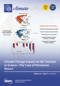
The sustainability of ski tourism is directly related to the prevailing climatic conditions. This study investigates the impact of climate change on ski tourism in Greece. Changes in climatic parameters and specific snow indicators are assessed for climate projections for selected scenarios. The results show a clear increase in temperature and a considerable decrease in snow cover and snowfall in Greece. Decreasing trends are identified for snow indicators such as the duration of the snow season from climate projections for the RCP 4.5 and the RCP 8.5 scenarios for the 1971–2099 period. In light of these findings, necessary adaptation measures against climate change are proposed in order to maintain the viability of ski tourism in Greece and for the special case of Parnassos Ski Resort. View this paper
- Issues are regarded as officially published after their release is announced to the table of contents alert mailing list.
- You may sign up for e-mail alerts to receive table of contents of newly released issues.
- PDF is the official format for papers published in both, html and pdf forms. To view the papers in pdf format, click on the "PDF Full-text" link, and use the free Adobe Reader to open them.
Previous Issue
Next Issue