Next Issue
Volume 13, April-1
Previous Issue
Volume 13, March-1
 
 
remotesensing-logo

Journal Browser

Journal Browser

Remote Sens., Volume 13, Issue 6 (March-2 2021) – 183 articles

Cover Story (view full-size image): 
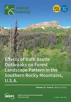
Bark beetles are some of the most important drivers of change in forests throughout the Earth’s Northern Hemisphere. These native insects typically persist at low populations in conifer forests, yet irruptive outbreaks can also occur rapidly across large areas. Over the last 20 years, outbreaks of three bark beetle species (Dendroctonus rufipennis, Dendroctonus ponderosae, and Dryocoetes confusus), triggered by above-average drought conditions, have led to broad-scale forest mortality in the Southern Rocky Mountains, USA. Using Landsat time series with field validation, the effects of these outbreaks was quantified across this complex region. Over 10,000 km2 of subalpine forest area was affected by bark beetles; while effects of the outbreaks were severe in many places, they were highly variable across the region. View this paper
  • Issues are regarded as officially published after their release is announced to the table of contents alert mailing list.
  • You may sign up for e-mail alerts to receive table of contents of newly released issues.
  • PDF is the official format for papers published in both, html and pdf forms. To view the papers in pdf format, click on the "PDF Full-text" link, and use the free Adobe Reader to open them.
Order results
Result details
Section
Select all
Export citation of selected articles as:
20 pages, 10156 KiB  
Article
GPR-Based Automatic Identification of Root Zones of Influence Using HDBSCAN
by Xihong Cui, Zhenxian Quan, Xuehong Chen, Zheng Zhang, Junxiong Zhou, Xinbo Liu, Jin Chen, Xin Cao and Li Guo
Remote Sens. 2021, 13(6), 1227; https://doi.org/10.3390/rs13061227 - 23 Mar 2021
Cited by 10 | Viewed by 2957
Abstract
The belowground root zone of influence (ZOI) is fundamental to the study of the root–root and root–soil interaction mechanisms of plants and is vital for understanding changes in plant community compositions and ecosystem processes. However, traditional root research methods have a limited capacity [...] Read more.
The belowground root zone of influence (ZOI) is fundamental to the study of the root–root and root–soil interaction mechanisms of plants and is vital for understanding changes in plant community compositions and ecosystem processes. However, traditional root research methods have a limited capacity to measure the actual ZOIs within plant communities without destroying them in the process. This study has developed a new approach to determining the ZOIs within natural plant communities. First, ground-penetrating radar (GPR), a non-invasive near-surface geophysical tool, was used to obtain a dataset of the actual spatial distribution of the coarse root system in a shrub quadrat. Second, the root dataset was automatically clustered and analyzed using the hierarchical density-based spatial clustering of applications with noise (HDBSCAN) algorithm to determine the ZOIs of different plants. Finally, the shape, size, and other characteristics of each ZOI were extracted based on the clustering results. The proposed method was validated using GPR-obtained root data collected in two field shrub plots and one simulation on a dataset from existing literature. The results show that the shrubs within the studied community exhibited either segregated and aggregated ZOIs, and the two types of ZOIs were distinctly in terms of shape and size, demonstrating the complexity of root growth in response to changes in the surrounding environment. The ZOIs extracted based on GPR survey data were highly consistent with the actual growth pattern of shrub roots and can thus be used to reveal the spatial competition strategies of plant roots responding to changes in the soil environment and the influence of neighboring plants. Full article
(This article belongs to the Special Issue Advanced Ground Penetrating Radar Theory and Applications)
Show Figures

Figure 1

19 pages, 15286 KiB  
Article
GPU-Based Parallel Implementation of VLBI Correlator for Deep Space Exploration System
by Fan Zhang, Chenxi Zhao, Songtao Han, Fei Ma and Deliang Xiang
Remote Sens. 2021, 13(6), 1226; https://doi.org/10.3390/rs13061226 - 23 Mar 2021
Cited by 5 | Viewed by 2595
Abstract
Very Long Baseline Interferometry (VLBI) solution can yield accurate information of angular position, and has been successfully used in the field of deep space exploration, such as astrophysics, imaging, detector positioning, and so on. The increase in VLBI data volume puts higher demands [...] Read more.
Very Long Baseline Interferometry (VLBI) solution can yield accurate information of angular position, and has been successfully used in the field of deep space exploration, such as astrophysics, imaging, detector positioning, and so on. The increase in VLBI data volume puts higher demands on efficient processing. Essentially, the main step of VLBI is the correlation processing, through which the angular position can be calculated. Since the VLBI correlation processing is both computation-intensive and data-intensive, the CPU cluster is usually employed in practical application to perform complex distributed computation. In this paper, we propose a parallel implementation of VLBI correlator based on graphics processing unit (GPU) to realize a more efficient and economical angular position calculation of deep space target. On the basis of massively GPU parallel computing, the coalesced access strategy and the parallel pipeline strategy are introduced to further accelerate the VLBI correlator. Experimental results show that the optimized GPU-based VLBI method can meet the real-time processing requirements of the received data stream. Compared with the sequential method, the proposed approach can reach a 224.1 × calculation speedup, and a 36.8 × application speedup. Compared with the multi-CPUs method, it can achieve 28.6 × calculation speedup and 4.7 × application speedup. Full article
(This article belongs to the Special Issue High Performance Computing of Remotely-Sensed Data)
Show Figures

Figure 1

17 pages, 14761 KiB  
Article
Land Use and Land Cover Mapping Using RapidEye Imagery Based on a Novel Band Attention Deep Learning Method in the Three Gorges Reservoir Area
by Xin Zhang, Ling Du, Shen Tan, Fangming Wu, Liang Zhu, Yuan Zeng and Bingfang Wu
Remote Sens. 2021, 13(6), 1225; https://doi.org/10.3390/rs13061225 - 23 Mar 2021
Cited by 11 | Viewed by 3252
Abstract
Land use/land cover (LULC) change has been recognized as one of the most important indicators to study ecological and environmental changes. Remote sensing provides an effective way to map and monitor LULC change in real time and for large areas. However, with the [...] Read more.
Land use/land cover (LULC) change has been recognized as one of the most important indicators to study ecological and environmental changes. Remote sensing provides an effective way to map and monitor LULC change in real time and for large areas. However, with the increasing spatial resolution of remote sensing imagery, traditional classification approaches cannot fully represent the spectral and spatial information from objects and thus have limitations in classification results, such as the “salt and pepper” effect. Nowadays, the deep semantic segmentation methods have shown great potential to solve this challenge. In this study, we developed an adaptive band attention (BA) deep learning model based on U-Net to classify the LULC in the Three Gorges Reservoir Area (TGRA) combining RapidEye imagery and topographic information. The BA module adaptively weighted input bands in convolution layers to address the different importance of the bands. By comparing the performance of our model with two typical traditional pixel-based methods including classification and regression tree (CART) and random forest (RF), we found a higher overall accuracy (OA) and a higher Intersection over Union (IoU) for all classification categories using our model. The OA and mean IoU of our model were 0.77 and 0.60, respectively, with the BA module and were 0.75 and 0.58, respectively, without the BA module. The OA and mean IoU of CART and RF were both below 0.51 and 0.30, respectively, although RF slightly outperformed CART. Our model also showed a reasonable classification accuracy in independent areas well outside the training area, which indicates the strong model generalizability in the spatial domain. This study demonstrates the novelty of our proposed model for large-scale LULC mapping using high-resolution remote sensing data, which well overcomes the limitations of traditional classification approaches and suggests the consideration of band weighting in convolution layers. Full article
Show Figures

Graphical abstract

16 pages, 525 KiB  
Article
Comparison of Climate Reanalysis and Remote-Sensing Data for Predicting Olive Phenology through Machine-Learning Methods
by Izar Azpiroz, Noelia Oses, Marco Quartulli, Igor G. Olaizola, Diego Guidotti and Susanna Marchi
Remote Sens. 2021, 13(6), 1224; https://doi.org/10.3390/rs13061224 - 23 Mar 2021
Cited by 10 | Viewed by 2938
Abstract
Machine-learning algorithms used for modelling olive-tree phenology generally and largely rely on temperature data. In this study, we developed a prediction model on the basis of climate data and geophysical information. Remote measurements of weather conditions, terrain slope, and surface spectral reflectance were [...] Read more.
Machine-learning algorithms used for modelling olive-tree phenology generally and largely rely on temperature data. In this study, we developed a prediction model on the basis of climate data and geophysical information. Remote measurements of weather conditions, terrain slope, and surface spectral reflectance were considered for this purpose. The accuracy of the temperature data worsened when replacing weather-station measurements with remote-sensing records, though the addition of more complete environmental data resulted in an efficient prediction model of olive-tree phenology. Filtering and embedded feature-selection techniques were employed to analyze the impact of variables on olive-tree phenology prediction, facilitating the inclusion of measurable information in decision support frameworks for the sustainable management of olive-tree systems. Full article
Show Figures

Figure 1

17 pages, 17462 KiB  
Article
Data Assimilation of Terrestrial Water Storage Observations to Estimate Precipitation Fluxes: A Synthetic Experiment
by Manuela Girotto, Rolf Reichle, Matthew Rodell and Viviana Maggioni
Remote Sens. 2021, 13(6), 1223; https://doi.org/10.3390/rs13061223 - 23 Mar 2021
Cited by 10 | Viewed by 3233
Abstract
The Gravity Recovery and Climate Experiment (GRACE) mission and its Follow-On (GRACE-FO) mission provide unprecedented observations of terrestrial water storage (TWS) dynamics at basin to continental scales. Established GRACE data assimilation techniques directly adjust the simulated water storage components to improve the estimation [...] Read more.
The Gravity Recovery and Climate Experiment (GRACE) mission and its Follow-On (GRACE-FO) mission provide unprecedented observations of terrestrial water storage (TWS) dynamics at basin to continental scales. Established GRACE data assimilation techniques directly adjust the simulated water storage components to improve the estimation of groundwater, streamflow, and snow water equivalent. Such techniques artificially add/subtract water to/from prognostic variables, thus upsetting the simulated water balance. To overcome this limitation, we propose and test an alternative assimilation scheme in which precipitation fluxes are adjusted to achieve the desired changes in simulated TWS. Using a synthetic data assimilation experiment, we show that the scheme improves performance skill in precipitation estimates in general, but that it is more robust for snowfall than for rainfall, and it fails in certain regions with strong horizontal gradients in precipitation. The results demonstrate that assimilation of TWS observations can help correct (adjust) the model’s precipitation forcing and, in turn, enhance model estimates of TWS, snow mass, soil moisture, runoff, and evaporation. A key limitation of the approach is the assumption that all errors in TWS originate from errors in precipitation. Nevertheless, the proposed approach produces more consistent improvements in simulated runoff than the established GRACE data assimilation techniques. Full article
Show Figures

Graphical abstract

22 pages, 51861 KiB  
Article
3D Reconstruction of Coastal Cliffs from Fixed-Wing and Multi-Rotor UAS: Impact of SfM-MVS Processing Parameters, Image Redundancy and Acquisition Geometry
by Gil Gonçalves, Diogo Gonçalves, Álvaro Gómez-Gutiérrez, Umberto Andriolo and Juan Antonio Pérez-Alvárez
Remote Sens. 2021, 13(6), 1222; https://doi.org/10.3390/rs13061222 - 23 Mar 2021
Cited by 36 | Viewed by 4080
Abstract
Monitoring the dynamics of coastal cliffs is fundamental for the safety of communities, buildings, utilities, and infrastructures located near the coastline. Structure-from-Motion and Multi View Stereo (SfM-MVS) photogrammetry based on Unmanned Aerial Systems (UAS) is a flexible and cost-effective surveying technique for generating [...] Read more.
Monitoring the dynamics of coastal cliffs is fundamental for the safety of communities, buildings, utilities, and infrastructures located near the coastline. Structure-from-Motion and Multi View Stereo (SfM-MVS) photogrammetry based on Unmanned Aerial Systems (UAS) is a flexible and cost-effective surveying technique for generating a dense 3D point cloud of the whole cliff face (from bottom to top), with high spatial and temporal resolution. In this paper, in order to generate a reproducible, reliable, precise, accurate, and dense point cloud of the cliff face, a comprehensive analysis of the SfM-MVS processing parameters, image redundancy and acquisition geometry was performed. Using two different UAS, a fixed-wing and a multi-rotor, two flight missions were executed with the aim of reconstructing the geometry of an almost vertical cliff located at the central Portuguese coast. The results indicated that optimizing the processing parameters of Agisoft Metashape can improve the 3D accuracy of the point cloud up to 2 cm. Regarding the image acquisition geometry, the high off-nadir (90°) dataset taken by the multi-rotor generated a denser and more accurate point cloud, with lesser data gaps, than that generated by the low off-nadir dataset (3°) taken by the fixed wing. Yet, it was found that reducing properly the high overlap of the image dataset acquired by the multi-rotor drone permits to get an optimal image dataset, allowing to speed up the processing time without compromising the accuracy and density of the generated point cloud. The analysis and results presented in this paper improve the knowledge required for the 3D reconstruction of coastal cliffs by UAS, providing new insights into the technical aspects needed for optimizing the monitoring surveys. Full article
(This article belongs to the Special Issue Advances in Remote Sensing in Coastal Geomorphology)
Show Figures

Graphical abstract

17 pages, 904 KiB  
Technical Note
A Review of Unmanned Aerial Vehicle Low-Altitude Remote Sensing (UAV-LARS) Use in Agricultural Monitoring in China
by Haidong Zhang, Lingqing Wang, Ting Tian and Jianghai Yin
Remote Sens. 2021, 13(6), 1221; https://doi.org/10.3390/rs13061221 - 23 Mar 2021
Cited by 79 | Viewed by 9035
Abstract
Precision agriculture relies on the rapid acquisition and analysis of agricultural information. An emerging method of agricultural monitoring is unmanned aerial vehicle low-altitude remote sensing (UAV-LARS), which possesses significant advantages of simple construction, strong mobility, and high spatial-temporal resolution with synchronously obtained image [...] Read more.
Precision agriculture relies on the rapid acquisition and analysis of agricultural information. An emerging method of agricultural monitoring is unmanned aerial vehicle low-altitude remote sensing (UAV-LARS), which possesses significant advantages of simple construction, strong mobility, and high spatial-temporal resolution with synchronously obtained image and spatial information. UAV-LARS could provide a high degree of overlap between X and Y during key crop growth periods that is currently lacking in satellite and remote sensing data. Simultaneously, UAV-LARS overcomes the limitations such as small scope of ground platform monitoring. Overall, UAV-LARS has demonstrated great potential as a tool for monitoring agriculture at fine- and regional-scales. Here, we systematically summarize the history and current application of UAV-LARS in Chinese agriculture. Specifically, we outline the technical characteristics and sensor payload of the available types of unmanned aerial vehicles and discuss their advantages and limitations. Finally, we provide suggestions for overcoming current limitations of UAV-LARS and directions for future work. Full article
(This article belongs to the Special Issue Digital Agriculture with Remote Sensing)
Show Figures

Graphical abstract

24 pages, 15491 KiB  
Article
A Surging Glacier Recognized by Remote Sensing on the Zangser Kangri Ice Field, Central Tibetan Plateau
by Bowen Jia, Shugui Hou and Yetang Wang
Remote Sens. 2021, 13(6), 1220; https://doi.org/10.3390/rs13061220 - 23 Mar 2021
Cited by 6 | Viewed by 2468
Abstract
A glacier surge, which is quasi-periodic and involves rapid flow, is an abnormal glacier motion. Although some glaciers have been found to be surging, little is known about surging glaciers on the Tibetan Plateau (TP), especially the Central and Northern TP. Here, we [...] Read more.
A glacier surge, which is quasi-periodic and involves rapid flow, is an abnormal glacier motion. Although some glaciers have been found to be surging, little is known about surging glaciers on the Tibetan Plateau (TP), especially the Central and Northern TP. Here, we found a surging glacier (GLIMS ID: G085885E34389N) on the Zangser Kangri ice field (ZK), Central TP, by means of the digital elevation models (DEMs) from the Shuttle Radar Topography Mission (SRTM), TanDEM-X 90 m, Advanced Spaceborne Thermal Emission and Reflection Radiometer (ASTER) DEMs, and High Mountain Asia 8-m DEM (HMA), combined with Landsat images and the Global Land Ice Velocity Extraction from Landsat 8 (GoLIVE) dataset. This surge event was confirmed by the crevasses, shear margin, and visible advancing snout shown in the Landsat images produced since 2014 and the HMA. The inter-comparison of these DEMs and the surface velocity changes showed that the surge event started between October 2012 and January 2014. The glacier may have also surged in the 1970s, based on a comparison between the topographical map and Landsat images. The glacier mass balance here has been slightly positive from 1999 onward (+0.03 ± 0.06 m w.e.a−1 from 1999 to 2015, +0.02 ± 0.07 m w.e.a−1 from 1999 to December 2011), which may indicate that the ZK is located on the southern edge of the mass balance anomaly on the TP. Combining with other surging glaciers on the Central and Northern TP, the relatively balanced mass condition, large size, and shallow slope can be associated with glacier surges on the Central and Northern TP. Full article
Show Figures

Graphical abstract

11 pages, 1494 KiB  
Communication
AgroShadow: A New Sentinel-2 Cloud Shadow Detection Tool for Precision Agriculture
by Ramona Magno, Leandro Rocchi, Riccardo Dainelli, Alessandro Matese, Salvatore Filippo Di Gennaro, Chi-Farn Chen, Nguyen-Thanh Son and Piero Toscano
Remote Sens. 2021, 13(6), 1219; https://doi.org/10.3390/rs13061219 - 23 Mar 2021
Cited by 14 | Viewed by 3901
Abstract
Remote sensing for precision agriculture has been strongly fostered by the launches of the European Space Agency Sentinel-2 optical imaging constellation, enabling both academic and private services for redirecting farmers towards a more productive and sustainable management of the agroecosystems. As well as [...] Read more.
Remote sensing for precision agriculture has been strongly fostered by the launches of the European Space Agency Sentinel-2 optical imaging constellation, enabling both academic and private services for redirecting farmers towards a more productive and sustainable management of the agroecosystems. As well as the freely and open access policy adopted by the European Space Agency (ESA), software and tools are also available for data processing and deeper analysis. Nowadays, a bottleneck in this valuable chain is represented by the difficulty in shadow identification of Sentinel-2 data that, for precision agriculture applications, results in a tedious problem. To overcome the issue, we present a simplified tool, AgroShadow, to gain full advantage from Sentinel-2 products and solve the trade-off between omission errors of Sen2Cor (the algorithm used by the ESA) and commission errors of MAJA (the algorithm used by Centre National d’Etudes Spatiales/Deutsches Zentrum für Luft- und Raumfahrt, CNES/DLR). AgroShadow was tested and compared against Sen2Cor and MAJA in 33 Sentinel 2A-B scenes, covering the whole of 2020 and in 18 different scenarios of the whole Italian country at farming scale. AgroShadow returned the lowest error and the highest accuracy and F-score, while precision, recall, specificity, and false positive rates were always similar to the best scores which alternately were returned by Sen2Cor or MAJA. Full article
(This article belongs to the Special Issue Image Enhancement Techniques to Guarantee Sensors Interoperability)
Show Figures

Graphical abstract

21 pages, 2691 KiB  
Article
Geometry-Aware Discriminative Dictionary Learning for PolSAR Image Classification
by Yachao Zhang, Xuan Lai, Yuan Xie, Yanyun Qu and Cuihua Li
Remote Sens. 2021, 13(6), 1218; https://doi.org/10.3390/rs13061218 - 23 Mar 2021
Cited by 4 | Viewed by 2198
Abstract
In this paper, we propose a new discriminative dictionary learning method based on Riemann geometric perception for polarimetric synthetic aperture radar (PolSAR) image classification. We made an optimization model for geometry-aware discrimination dictionary learning in which the dictionary learning (GADDL) is generalized from [...] Read more.
In this paper, we propose a new discriminative dictionary learning method based on Riemann geometric perception for polarimetric synthetic aperture radar (PolSAR) image classification. We made an optimization model for geometry-aware discrimination dictionary learning in which the dictionary learning (GADDL) is generalized from Euclidian space to Riemannian manifolds, and dictionary atoms are composed of manifold data. An efficient optimization algorithm based on an alternating direction multiplier method was developed to solve the model. Experiments were implemented on three public datasets: Flevoland-1989, San Francisco and Flevoland-1991. The experimental results show that the proposed method learned a discriminative dictionary with accuracies better those of comparative methods. The convergence of the model and the robustness of the initial dictionary were also verified through experiments. Full article
Show Figures

Figure 1

57 pages, 12701 KiB  
Review
Trends in Satellite Earth Observation for Permafrost Related Analyses—A Review
by Marius Philipp, Andreas Dietz, Sebastian Buchelt and Claudia Kuenzer
Remote Sens. 2021, 13(6), 1217; https://doi.org/10.3390/rs13061217 - 23 Mar 2021
Cited by 26 | Viewed by 10358
Abstract
Climate change and associated Arctic amplification cause a degradation of permafrost which in turn has major implications for the environment. The potential turnover of frozen ground from a carbon sink to a carbon source, eroding coastlines, landslides, amplified surface deformation and endangerment of [...] Read more.
Climate change and associated Arctic amplification cause a degradation of permafrost which in turn has major implications for the environment. The potential turnover of frozen ground from a carbon sink to a carbon source, eroding coastlines, landslides, amplified surface deformation and endangerment of human infrastructure are some of the consequences connected with thawing permafrost. Satellite remote sensing is hereby a powerful tool to identify and monitor these features and processes on a spatially explicit, cheap, operational, long-term basis and up to circum-Arctic scale. By filtering after a selection of relevant keywords, a total of 325 articles from 30 international journals published during the last two decades were analyzed based on study location, spatio-temporal resolution of applied remote sensing data, platform, sensor combination and studied environmental focus for a comprehensive overview of past achievements, current efforts, together with future challenges and opportunities. The temporal development of publication frequency, utilized platforms/sensors and the addressed environmental topic is thereby highlighted. The total number of publications more than doubled since 2015. Distinct geographical study hot spots were revealed, while at the same time large portions of the continuous permafrost zone are still only sparsely covered by satellite remote sensing investigations. Moreover, studies related to Arctic greenhouse gas emissions in the context of permafrost degradation appear heavily underrepresented. New tools (e.g., Google Earth Engine (GEE)), methodologies (e.g., deep learning or data fusion etc.) and satellite data (e.g., the Methane Remote Sensing LiDAR Mission (Merlin) and the Sentinel-fleet) will thereby enable future studies to further investigate the distribution of permafrost, its thermal state and its implications on the environment such as thermokarst features and greenhouse gas emission rates on increasingly larger spatial and temporal scales. Full article
Show Figures

Figure 1

19 pages, 5293 KiB  
Article
The Estimation of Magnetite Prospective Resources Based on Aeromagnetic Data: A Case Study of Qihe Area, Shandong Province, China
by Xiuhe Gao, Shengqing Xiong, Changchun Yu, Dishuo Zhang and Chengping Wu
Remote Sens. 2021, 13(6), 1216; https://doi.org/10.3390/rs13061216 - 23 Mar 2021
Cited by 12 | Viewed by 2406
Abstract
In the Qihe area, the magnetic anomalies caused by deep and concealed magnetite are weak and compared with ground surveys, airborne surveys further weaken the signals. Moreover, the magnetite in the Qihe area belongs to a contact-metasomatic deposit, and the magnetic anomalies caused [...] Read more.
In the Qihe area, the magnetic anomalies caused by deep and concealed magnetite are weak and compared with ground surveys, airborne surveys further weaken the signals. Moreover, the magnetite in the Qihe area belongs to a contact-metasomatic deposit, and the magnetic anomalies caused by the magnetite and its mother rock overlap and interweave. Therefore, it is difficult to directly delineate the target areas of magnetite according to the measured aeromagnetic maps in Qihe or similar areas, let alone estimate prospective magnetite resources. This study tried to extract magnetite-caused anomalies from aeromagnetic data by using high-pass filtering. Then, a preliminary estimation of magnetite prospective resources was realized by the 3D inversion of the extracted anomalies. In order to improve the resolution and accuracy of the inversion results, a combined model-weighting function was proposed for the inversion. Meanwhile, the upper and lower bounds and positive and negative constraints were imposed on the model parameters to further improve the rationality of the inversion results. A theoretical model with deep and concealed magnetite was established. It demonstrated the feasibility of magnetite-caused anomaly extraction and magnetite prospective resource estimation. Finally, the magnetite-caused anomalies were extracted from the measured aeromagnetic data and were consistent with known drilling information. The distribution of underground magnetic bodies was obtained by the 3D inversion of extracted anomalies, and the existing drilling data were used to delineate the volume of magnetite. In this way, the prospective resources of magnetite in Qihe area were estimated. Full article
(This article belongs to the Section Remote Sensing in Geology, Geomorphology and Hydrology)
Show Figures

Figure 1

22 pages, 2626 KiB  
Article
Spatio-Temporal Distribution of Deep Convection Observed along the Trans-Mexican Volcanic Belt
by José Francisco León-Cruz, Cintia Carbajal Henken, Noel Carbajal and Jürgen Fischer
Remote Sens. 2021, 13(6), 1215; https://doi.org/10.3390/rs13061215 - 23 Mar 2021
Cited by 6 | Viewed by 2988
Abstract
Complex terrain features—in particular, environmental conditions, high population density and potential socio-economic damage—make the Trans-Mexican Volcanic Belt (TMVB) of particular interest regarding the study of deep convection and related severe weather. In this research, 10 years of Moderate-Resolution Imaging Spectroradiometer (MODIS) cloud observations [...] Read more.
Complex terrain features—in particular, environmental conditions, high population density and potential socio-economic damage—make the Trans-Mexican Volcanic Belt (TMVB) of particular interest regarding the study of deep convection and related severe weather. In this research, 10 years of Moderate-Resolution Imaging Spectroradiometer (MODIS) cloud observations are combined with Climate Hazards Group Infrared Precipitation with Station (CHIRPS) rainfall data to characterize the spatio-temporal distribution of deep convective clouds (DCCs) and their relationship to extreme precipitation. From monthly distributions, wet and dry phases are identified for cloud fraction, deep convective cloud frequency and convective precipitation. For both DCC and extreme precipitation events, the highest frequencies align just over the higher elevations of the TMVB. A clear relationship between DCCs and terrain features, indicating the important role of orography in the development of convective systems, is noticed. For three sub-regions, the observed distributions of deep convective cloud and extreme precipitation events are assessed in more detail. Each sub-region exhibits different local conditions, including terrain features, and are known to be influenced differently by emerging moisture fluxes from the Gulf of Mexico and the Pacific Ocean. The observed distinct spatio-temporal variabilities provide the first insights into the physical processes that control the convective development in the study area. A signal of the midsummer drought in Mexico (i.e., “canícula”) is recognized using MODIS monthly mean cloud observations. Full article
(This article belongs to the Special Issue Use of Remote Sensing for High Impact Weather)
Show Figures

Graphical abstract

20 pages, 15745 KiB  
Article
Interannual and Seasonal Variations of Hydrological Connectivity in a Large Shallow Wetland of North China Estimated from Landsat 8 Images
by Ziqi Li, Wenchao Sun, Haiyang Chen, Baolin Xue, Jingshan Yu and Zaifeng Tian
Remote Sens. 2021, 13(6), 1214; https://doi.org/10.3390/rs13061214 - 23 Mar 2021
Cited by 19 | Viewed by 3102
Abstract
Hydrological connectivity is an important characteristic of wetlands that maintains the stability and functions of an ecosystem. This study investigates the temporal variations of hydrological connectivity and their driving mechanism in Baiyangdian Lake, a large shallow wetland in North China, using a time [...] Read more.
Hydrological connectivity is an important characteristic of wetlands that maintains the stability and functions of an ecosystem. This study investigates the temporal variations of hydrological connectivity and their driving mechanism in Baiyangdian Lake, a large shallow wetland in North China, using a time series of open water surface area data derived from 36 Landsat 8 multispectral images from 2013–2019 and in situ measured water level data. Water area classification was implemented using the Google Earth Engine. Six commonly used indexes for extracting water surface data from satellite images were compared and the best performing index was selected for the water classification. A composite hydrological connectivity index computed from open water area data derived from Landsat 8 images was developed based on several landscape pattern indices and applied to Baiyangdian Lake. The results show that, reflectance in the near-infrared band is the most accurate index for water classification with >98% overall accuracy because of its sensitivity to different land cover types. The slopes of the best-fit linear relationships between the computed hydrological connectivity and observed water level show high variability between years. In most years, hydrological connectivity generally increases when water levels increase, with an average R2 of 0.88. The spatial distribution of emergent plants also varies year to year owing to interannual variations of the climate and hydrological regime. This presents a possible explanation for the variations in the annual relationship between hydrological connectivity and water level. For a given water level, the hydrological connectivity is generally higher in spring than summer and autumn. This can be explained by the fact that the drag force exerted by emergent plants, which reduces water flow, is smaller than that for summer and autumn owing to seasonal variations in the phenological characteristics of emergent plants. Our study reveals that both interannual and seasonal variations in the hydrological connectivity of Baiyangdian Lake are related to the growth of emergent plants, which occupy a large portion of the lake area. Proper vegetation management may therefore improve hydrological connectivity in this wetland. Full article
Show Figures

Graphical abstract

19 pages, 3123 KiB  
Article
A Novel Hierarchical Model in Ensemble Environment for Road Detection Application
by Yang Gu, Bingfeng Si and Bushi Liu
Remote Sens. 2021, 13(6), 1213; https://doi.org/10.3390/rs13061213 - 23 Mar 2021
Cited by 5 | Viewed by 1771
Abstract
As a popular research direction in the field of intelligent transportation, road detection has been extensively concerned by many researchers. However, there are still some key issues in specific applications that need to be further improved, such as the feature processing of road [...] Read more.
As a popular research direction in the field of intelligent transportation, road detection has been extensively concerned by many researchers. However, there are still some key issues in specific applications that need to be further improved, such as the feature processing of road images, the optimal choice of information extraction and detection methods, and the inevitable limitations of detection schemes. In the existing research work, most of the image segmentation algorithms applied to road detection are sensitive to noise data and are prone to generate redundant information or over-segmentation, which makes the computation of segmentation process more complicated. In addition, the algorithm needs to overcome objective factors such as different road conditions and natural environments to ensure certain execution efficiency and segmentation accuracy. In order to improve these issues, we integrate the idea of shallow machine-learning model that clusters first and then classifies in this paper, and a hierarchical multifeature road image segmentation integration framework is proposed. The proposed model has been tested and evaluated on two sets of road datasets based on real scenes and compared with common detection methods, and its effectiveness and accuracy have been verified. Moreover, it demonstrates that the method opens up a new way to enhance the learning and detection capabilities of the model. Most importantly, it has certain potential for application in various practical fields such as intelligent transportation or assisted driving. Full article
Show Figures

Graphical abstract

18 pages, 4615 KiB  
Article
A New Method for Extracting Individual Plant Bio-Characteristics from High-Resolution Digital Images
by Saba Rabab, Edmond Breen, Alem Gebremedhin, Fan Shi, Pieter Badenhorst, Yi-Ping Phoebe Chen and Hans D. Daetwyler
Remote Sens. 2021, 13(6), 1212; https://doi.org/10.3390/rs13061212 - 23 Mar 2021
Cited by 5 | Viewed by 2192
Abstract
The extraction of automated plant phenomics from digital images has advanced in recent years. However, the accuracy of extracted phenomics, especially for individual plants in a field environment, requires improvement. In this paper, a new and efficient method of extracting individual plant areas [...] Read more.
The extraction of automated plant phenomics from digital images has advanced in recent years. However, the accuracy of extracted phenomics, especially for individual plants in a field environment, requires improvement. In this paper, a new and efficient method of extracting individual plant areas and their mean normalized difference vegetation index from high-resolution digital images is proposed. The algorithm was applied on perennial ryegrass row field data multispectral images taken from the top view. First, the center points of individual plants from digital images were located to exclude plant positions without plants. Second, the accurate area of each plant was extracted using its center point and radius. Third, the accurate mean normalized difference vegetation index of each plant was extracted and adjusted for overlapping plants. The correlation between the extracted individual plant phenomics and fresh weight ranged between 0.63 and 0.75 across four time points. The methods proposed are applicable to other crops where individual plant phenotypes are of interest. Full article
Show Figures

Graphical abstract

17 pages, 6078 KiB  
Article
A Method of Segmenting Apples Based on Gray-Centered RGB Color Space
by Pan Fan, Guodong Lang, Bin Yan, Xiaoyan Lei, Pengju Guo, Zhijie Liu and Fuzeng Yang
Remote Sens. 2021, 13(6), 1211; https://doi.org/10.3390/rs13061211 - 23 Mar 2021
Cited by 29 | Viewed by 3089
Abstract
In recent years, many agriculture-related problems have been evaluated with the integration of artificial intelligence techniques and remote sensing systems. The rapid and accurate identification of apple targets in an illuminated and unstructured natural orchard is still a key challenge for the picking [...] Read more.
In recent years, many agriculture-related problems have been evaluated with the integration of artificial intelligence techniques and remote sensing systems. The rapid and accurate identification of apple targets in an illuminated and unstructured natural orchard is still a key challenge for the picking robot’s vision system. In this paper, by combining local image features and color information, we propose a pixel patch segmentation method based on gray-centered red–green–blue (RGB) color space to address this issue. Different from the existing methods, this method presents a novel color feature selection method that accounts for the influence of illumination and shadow in apple images. By exploring both color features and local variation in apple images, the proposed method could effectively distinguish the apple fruit pixels from other pixels. Compared with the classical segmentation methods and conventional clustering algorithms as well as the popular deep-learning segmentation algorithms, the proposed method can segment apple images more accurately and effectively. The proposed method was tested on 180 apple images. It offered an average accuracy rate of 99.26%, recall rate of 98.69%, false positive rate of 0.06%, and false negative rate of 1.44%. Experimental results demonstrate the outstanding performance of the proposed method. Full article
Show Figures

Graphical abstract

17 pages, 4196 KiB  
Article
Exploring VIIRS Continuity with MODIS in an Expedited Capability for Monitoring Drought-Related Vegetation Conditions
by Trenton D. Benedict, Jesslyn F. Brown, Stephen P. Boyte, Daniel M. Howard, Brian A. Fuchs, Brian D. Wardlow, Tsegaye Tadesse and Kirk A. Evenson
Remote Sens. 2021, 13(6), 1210; https://doi.org/10.3390/rs13061210 - 23 Mar 2021
Cited by 10 | Viewed by 4650
Abstract
Vegetation has been effectively monitored using remote sensing time-series vegetation index (VI) data for several decades. Drought monitoring has been a common application with algorithms tuned to capturing anomalous temporal and spatial vegetation patterns. Drought stress models, such as the Vegetation Drought Response [...] Read more.
Vegetation has been effectively monitored using remote sensing time-series vegetation index (VI) data for several decades. Drought monitoring has been a common application with algorithms tuned to capturing anomalous temporal and spatial vegetation patterns. Drought stress models, such as the Vegetation Drought Response Index (VegDRI), often use VIs like the Normalized Difference Vegetation Index (NDVI). The EROS expedited Moderate Resolution Imaging Spectroradiometer (eMODIS)-based, 7-day NDVI composites are integral to the VegDRI. As MODIS satellite platforms (Terra and Aqua) approach mission end, the Visible Infrared Imaging Radiometer Suite (VIIRS) presents an alternate NDVI source, with daily collection, similar band passes, and moderate spatial resolution. This study provides a statistical comparison between EROS expedited VIIRS (eVIIRS) 375-m and eMODIS 250-m and tests the suitability of replacing MODIS NDVI with VIIRS NDVI for drought monitoring and vegetation anomaly detection. For continuity with MODIS NDVI, we calculated a geometric mean regression adjustment algorithm using 375-m resolution for an eMODIS-like NDVI (eVIIRS’) eVIIRS’ = 0.9887 × eVIIRS − 0.0398. The resulting statistical comparisons (eVIIRS’ vs. eMODIS NDVI) showed correlations consistently greater than 0.84 throughout the three years studied. The eVIIRS’ VegDRI results characterized similar drought patterns and hotspots to the eMODIS-based VegDRI, with near zero bias. Full article
Show Figures

Figure 1

16 pages, 3730 KiB  
Article
Spatiotemporal Patterns of Ecosystem Restoration Activities and Their Effects on Changes in Terrestrial Gross Primary Production in Southwest China
by Zhi Ding, Hui Zheng, Ying Liu, Sidong Zeng, Pujia Yu, Wei Shi and Xuguang Tang
Remote Sens. 2021, 13(6), 1209; https://doi.org/10.3390/rs13061209 - 23 Mar 2021
Cited by 5 | Viewed by 2244
Abstract
Large-scale ecosystem restoration projects (ERPs) have been implemented since the beginning of the new millennium to restore vegetation and improve the ecosystem in Southwest China. However, quantifying the effects of specific restoration activities, such as afforestation and grass planting, on vegetation recovery is [...] Read more.
Large-scale ecosystem restoration projects (ERPs) have been implemented since the beginning of the new millennium to restore vegetation and improve the ecosystem in Southwest China. However, quantifying the effects of specific restoration activities, such as afforestation and grass planting, on vegetation recovery is difficult due to their incommensurable spatiotemporal distribution. Long-term and successive ERP-driven land use/cover changes (LUCCs) were used to recognise the spatiotemporal patterns of major restoration activities, and a contribution index was defined to assess the effects of these activities on gross primary production (GPP) dynamics in Southwest China during the period of 2001–2015. The results were as follows. (1) Afforestation and grass planting were major restoration activities that accounted for more than 54% of all LUCCs in Southwest China. Approximately 96% of restoration activities involved afforestation, and these activities were mostly distributed around Yunnan Province. (2) The Breathing Earth System Simulator (BESS) GPP performed better than the Moderate Resolution Imaging Spectroradiometer (MODIS) GPP validated by field observation data. Nevertheless, their annual GPP trends were similar and increased by 12,581 g C m−2 d−1 and 13,406 g C m−2 d−1 for MODIS and BESS GPPs, respectively. (3) Although the afforestation and grass planting areas accounted for less than 1% of the total area of Southwest China, they contributed to more than 1% of the annual GPP increase in the entire study area. Afforestation directly contributed 14.94% (BESS GPP) or 24.64% (MODIS GPP) to the annual GPP increase. Meanwhile, grass planting directly contributed only 0.41% (BESS GPP) or 0.03% (MODIS GPP) to the annual GPP increase. Full article
Show Figures

Graphical abstract

22 pages, 5171 KiB  
Article
A Comprehensive Evaluation of Latest GPM IMERG V06 Early, Late and Final Precipitation Products across China
by Linfei Yu, Guoyong Leng, Andre Python and Jian Peng
Remote Sens. 2021, 13(6), 1208; https://doi.org/10.3390/rs13061208 - 22 Mar 2021
Cited by 29 | Viewed by 3130
Abstract
This study evaluated the performance of the early, late and final runs of IMERG version 06 precipitation products at various spatial and temporal scales in China from 2008 to 2017, against observations from 696 rain gauges. The results suggest that the three IMERG [...] Read more.
This study evaluated the performance of the early, late and final runs of IMERG version 06 precipitation products at various spatial and temporal scales in China from 2008 to 2017, against observations from 696 rain gauges. The results suggest that the three IMERG products can well reproduce the spatial patterns of precipitation, but exhibit a gradual decrease in the accuracy from the southeast to the northwest of China. Overall, the three runs show better performances in the eastern humid basins than the western arid basins. Compared to the early and late runs, the final run shows an improvement in the performance of precipitation estimation in terms of correlation coefficient, Kling–Gupta Efficiency and root mean square error at both daily and monthly scales. The three runs show similar daily precipitation detection capability over China. The biases of the three runs show a significantly positive (p < 0.01) correlation with elevation, with higher accuracy observed with an increase in elevation. However, the categorical metrics exhibit low levels of dependency on elevation, except for the probability of detection. Over China and major river basins, the three products underestimate the frequency of no/tiny rain events (P < 0.1 mm/day) but overestimate the frequency of light rain events (0.1 ≤ P < 10 mm/day). The three products converge with ground-based observation with regard to the frequency of rainstorm (P ≥ 50 mm/day) in the southern part of China. The revealed uncertainties associated with the IMERG products suggests that sustaining efforts are needed to improve their retrieval algorithms in the future. Full article
Show Figures

Graphical abstract

27 pages, 56295 KiB  
Article
Multiple RFI Sources Location Method Combining Two-Dimensional ESPRIT DOA Estimation and Particle Swarm Optimization for Spaceborne SAR
by Junfei Yu, Jingwen Li, Bing Sun, Yuming Jiang and Liying Xu
Remote Sens. 2021, 13(6), 1207; https://doi.org/10.3390/rs13061207 - 22 Mar 2021
Cited by 6 | Viewed by 2151
Abstract
Synthetic aperture radar (SAR) systems are susceptible to radio frequency interference (RFI). The existence of RFI will cause serious degradation of SAR image quality and a huge risk of target misjudgment, which makes the research on RFI suppression methods receive widespread attention. Since [...] Read more.
Synthetic aperture radar (SAR) systems are susceptible to radio frequency interference (RFI). The existence of RFI will cause serious degradation of SAR image quality and a huge risk of target misjudgment, which makes the research on RFI suppression methods receive widespread attention. Since the location of the RFI source is one of the most vital information for achieving RFI spatial filtering, this paper presents a novel location method of multiple independent RFI sources based on direction-of-arrival (DOA) estimation and the non-convex optimization algorithm. It deploys an L-shaped multi-channel array on the SAR system to receive echo signals, and utilizes the two-dimensional estimating signal parameter via rotational invariance techniques (2D-ESPRIT) algorithm to estimate the positional relationship between the RFI source and the SAR system, ultimately combines the DOA estimation results of multiple azimuth time to calculate the geographic location of RFI sources through the particle swarm optimization (PSO) algorithm. Results on simulation experiments prove the effectiveness of the proposed method. Full article
Show Figures

Graphical abstract

18 pages, 6539 KiB  
Article
Analysis and Validation of a Hybrid Forward-Looking Down-Looking Ground Penetrating Radar Architecture
by María García-Fernández, Guillermo Álvarez-Narciandi, Yuri Álvarez López and Fernando Las-Heras Andrés
Remote Sens. 2021, 13(6), 1206; https://doi.org/10.3390/rs13061206 - 22 Mar 2021
Cited by 6 | Viewed by 2514
Abstract
Ground Penetrating Radar (GPR) has proved to be a successful technique for the detection of landmines and Improvised Explosive Devices (IEDs) buried in the ground. In the last years, novel architectures for safe and fast detection, such as those based on GPR systems [...] Read more.
Ground Penetrating Radar (GPR) has proved to be a successful technique for the detection of landmines and Improvised Explosive Devices (IEDs) buried in the ground. In the last years, novel architectures for safe and fast detection, such as those based on GPR systems onboard Unmanned Aerial Vehicles (UAVs), have been proposed. Furthermore, improvements in GPR hardware and signal processing techniques have resulted in a more efficient detection. This contribution presents an experimental validation of a hybrid Forward-Looking–Down-Looking GPR architecture. The main goal of this architecture is to combine advantages of both GPR architectures: reduction of clutter coming from the ground surface in the case of Forward-Looking GPR (FLGPR), and greater dynamic range in the case of Down-Looking GPR (DLGPR). Compact radar modules working in the lower SHF frequency band have been used for the validation of the hybrid architecture, which involved realistic targets. Full article
(This article belongs to the Special Issue Advanced Techniques for Ground Penetrating Radar Imaging)
Show Figures

Figure 1

17 pages, 1467 KiB  
Article
UAV Recognition Based on Micro-Doppler Dynamic Attribute-Guided Augmentation Algorithm
by Caidan Zhao, Gege Luo, Yilin Wang, Caiyun Chen and Zhiqiang Wu
Remote Sens. 2021, 13(6), 1205; https://doi.org/10.3390/rs13061205 - 22 Mar 2021
Cited by 15 | Viewed by 3130
Abstract
A micro-Doppler signature (m-DS) based on the rotation of drone blades is an effective way to detect and identify small drones. Deep-learning-based recognition algorithms can achieve higher recognition performance, but they needs a large amount of sample data to train models. In addition [...] Read more.
A micro-Doppler signature (m-DS) based on the rotation of drone blades is an effective way to detect and identify small drones. Deep-learning-based recognition algorithms can achieve higher recognition performance, but they needs a large amount of sample data to train models. In addition to the hovering state, the signal samples of small unmanned aerial vehicles (UAVs) should also include flight dynamics, such as vertical, pitch, forward and backward, roll, lateral, and yaw. However, it is difficult to collect all dynamic UAV signal samples under actual flight conditions, and these dynamic flight characteristics will lead to the deviation of the original features, thus affecting the performance of the recognizer. In this paper, we propose a small UAV m-DS recognition algorithm based on dynamic feature enhancement. We extract the combined principal component analysis and discrete wavelet transform (PCA-DWT) time–frequency characteristics and texture features of the UAV’s micro-Doppler signal and use a dynamic attribute-guided augmentation (DAGA) algorithm to expand the feature domain for model training to achieve an adaptive, accurate, and efficient multiclass recognition model in complex environments. After the training model is stable, the average recognition accuracy rate can reach 98% during dynamic flight. Full article
(This article belongs to the Special Issue Remote Sensing Data and Classification Algorithms)
Show Figures

Graphical abstract

25 pages, 1465 KiB  
Review
A Technical Study on UAV Characteristics for Precision Agriculture Applications and Associated Practical Challenges
by Nadia Delavarpour, Cengiz Koparan, John Nowatzki, Sreekala Bajwa and Xin Sun
Remote Sens. 2021, 13(6), 1204; https://doi.org/10.3390/rs13061204 - 22 Mar 2021
Cited by 138 | Viewed by 16819
Abstract
The incorporation of advanced technologies into Unmanned Aerial Vehicles (UAVs) platforms have enabled many practical applications in Precision Agriculture (PA) over the past decade. These PA tools offer capabilities that increase agricultural productivity and inputs’ efficiency and minimize operational costs simultaneously. However, these [...] Read more.
The incorporation of advanced technologies into Unmanned Aerial Vehicles (UAVs) platforms have enabled many practical applications in Precision Agriculture (PA) over the past decade. These PA tools offer capabilities that increase agricultural productivity and inputs’ efficiency and minimize operational costs simultaneously. However, these platforms also have some constraints that limit the application of UAVs in agricultural operations. The constraints include limitations in providing imagery of adequate spatial and temporal resolutions, dependency on weather conditions, and geometric and radiometric correction requirements. In this paper, a practical guide on technical characterizations of common types of UAVs used in PA is presented. This paper helps select the most suitable UAVs and on-board sensors for different agricultural operations by considering all the possible constraints. Over a hundred research studies were reviewed on UAVs applications in PA and practical challenges in monitoring and mapping field crops. We concluded by providing suggestions and future directions to overcome challenges in optimizing operational proficiency. Full article
(This article belongs to the Section Remote Sensing in Agriculture and Vegetation)
Show Figures

Graphical abstract

23 pages, 7737 KiB  
Article
Evaluating the Vertical Accuracy of DEM Generated from ZiYuan-3 Stereo Images in Understanding the Tectonic Morphology of the Qianhe Basin, China
by Zhiheng Liu, Ling Han, Zhaohui Yang, Hongye Cao, Fengcheng Guo, Jianhua Guo and Yiqi Ji
Remote Sens. 2021, 13(6), 1203; https://doi.org/10.3390/rs13061203 - 22 Mar 2021
Cited by 10 | Viewed by 3060
Abstract
Currently available high-resolution digital elevation model (DEM) is not particularly useful to geologists for understanding the long-term changes in fluvial landforms induced by tectonic uplift, although DEMs that are generated from satellite stereo images such as the ZiYuan-3 (ZY3) satellite include characteristics with [...] Read more.
Currently available high-resolution digital elevation model (DEM) is not particularly useful to geologists for understanding the long-term changes in fluvial landforms induced by tectonic uplift, although DEMs that are generated from satellite stereo images such as the ZiYuan-3 (ZY3) satellite include characteristics with significant coverage and rapid acquisition. Since an ongoing analysis of fluvial systems is lacking, the ZY3 DEM was generated from block adjustment to describe the mountainous area of the Qianhe Basin that have been induced by tectonic uplift. Moreover, we evaluated the overall elevation difference in ZY3 DEM, Shuttle Radar Topography Mission (1″ × 1″) (SRTM1), and Reflection Radiometer Global Digital Elevation Model (ASTER GDEM) by using the Ice Cloud and Land Elevation Satellite/Geoscience Laser Altimeter (ICESat/GLAH14) point cloud and a DEM of 1:50,000 scale. The values of the root mean square error (RMSE) of the elevation difference for ZY3 DEM were 9.31 and 9.71 m, respectively, and are in good agreement with SRTM1. The river long profiles and terrace heights were also extracted to compare the differences in channel steepness and the incision rates with SRTM1 and ASTER GDEM. Our results prove that ZY3 DEM would be a good alternative to SRTM1 in achieving the 1:50,000 scale for DEM products in China, while ASTER GDEM is unsuitable for extracting river longitudinal profiles. In addition, the northern and southern river incision rates were estimated using the ages and heights of river terraces, demonstrating a range from 0.12–0.45 to 0.10–0.33 m/kyr, respectively. Collectively, these findings suggest that ZY3 DEM is capable of estimating tectonic geomorphological features and has the potential for analyzing the continuous evolutionary response of a landscape to changes in climate and tectonics. Full article
(This article belongs to the Special Issue Advances in Global Digital Elevation Model Processing)
Show Figures

Figure 1

18 pages, 4637 KiB  
Article
Global Assessment of the GNSS Single Point Positioning Biases Produced by the Residual Tropospheric Delay
by Ling Yang, Jinfang Wang, Haojun Li and Timo Balz
Remote Sens. 2021, 13(6), 1202; https://doi.org/10.3390/rs13061202 - 22 Mar 2021
Cited by 6 | Viewed by 2769
Abstract
The tropospheric delay is one of the main error sources that degrades the accuracy of Global Navigation Satellite Systems (GNSS) Single Point Positioning (SPP). Although an empirical model is usually applied for correction and thereby to improve the positioning accuracy, the residual tropospheric [...] Read more.
The tropospheric delay is one of the main error sources that degrades the accuracy of Global Navigation Satellite Systems (GNSS) Single Point Positioning (SPP). Although an empirical model is usually applied for correction and thereby to improve the positioning accuracy, the residual tropospheric delay is still drowned in measurement noise, and cannot be further compensated by parameter estimation. How much this type of residual error would sway the SPP positioning solutions on a global scale are still unclear. In this paper, the biases on SPP solutions introduced by the residual tropospheric delay when using nine conventionally Zenith Tropospheric Delay (ZTD) models are analyzed and discussed, including Saastamoinen+norm/Global Pressure and Temperature (GPT)/GPT2/GPT2w/GPT3, University of New Brunswick (UNB)3/UNB3m, European Geostationary Navigation Overlay System (EGNOS) and Vienna Mapping Functions (VMF)3 models. The accuracies of the nine ZTD models, as well as the SPP biases caused by the residual ZTD (dZTD) after model correction are evaluated using International GNSS Service (IGS)-ZTD products from around 400 globally distributed monitoring stations. The seasonal, latitudinal, and altitudinal discrepancies are analyzed respectively. The results show that the SPP solution biases caused by the dZTD mainly occur on the vertical direction, nearly to decimeter level, and significant discrepancies are observed among different models at different geographical locations. This study provides references for the refinement and applications of the nine ZTD models for SPP users. Full article
(This article belongs to the Special Issue Advances in GNSS Data Processing and Navigation)
Show Figures

Graphical abstract

19 pages, 6115 KiB  
Article
Similarity Index Based Approach for Identifying Similar Grotto Statues to Support Virtual Restoration
by Wei Hua, Miaole Hou, Yunfei Qiao, Xuesheng Zhao, Shishuo Xu and Songnian Li
Remote Sens. 2021, 13(6), 1201; https://doi.org/10.3390/rs13061201 - 21 Mar 2021
Cited by 4 | Viewed by 2656
Abstract
Grottoes, with caves and statues, are an important part of immovable heritage. Statues in a particular grotto setting are often similar in geometric form and artistic style, and identifying the similarity between these statues can help provide important references for value recognition, condition [...] Read more.
Grottoes, with caves and statues, are an important part of immovable heritage. Statues in a particular grotto setting are often similar in geometric form and artistic style, and identifying the similarity between these statues can help provide important references for value recognition, condition assessment, repair, and the virtual restoration of statues. Traditionally, such reference information mainly depended on expert empirical judgment, which is highly subjective, lacks quantitative analysis, and cannot provide effective scientific support for the virtual restoration of grotto statues. This paper presents a similarity index based approach for identifying similarities between grotto statues by studying 11 small Buddhist statues carved on the 18th cave in the Yungang Grottoes, located in Datong, China. The similarity index is determined according to the hash values calculated based on the pHash method using the orthophoto images of Buddhist statues to identify similar statues. Similar feature points between the identified statues are then matched using the Scale Invariant Feature Transform (SIFT) operator to support the repair and reconstruction of damaged statues. The experimental results show that the variation of similarity index values confirms the visual inspection of the statues’ appearance in the orthophotos. The additional analysis of three-dimensional (3D) point clouds also confirms that the similarity index based approach is accurate in the initial screening of similar grotto statues. Full article
(This article belongs to the Special Issue Sensors & Methods in Cultural Heritage)
Show Figures

Figure 1

26 pages, 6129 KiB  
Article
MSDRN: Pansharpening of Multispectral Images via Multi-Scale Deep Residual Network
by Wenqing Wang, Zhiqiang Zhou, Han Liu and Guo Xie
Remote Sens. 2021, 13(6), 1200; https://doi.org/10.3390/rs13061200 - 21 Mar 2021
Cited by 21 | Viewed by 2734
Abstract
In order to acquire a high resolution multispectral (HRMS) image with the same spectral resolution as multispectral (MS) image and the same spatial resolution as panchromatic (PAN) image, pansharpening, a typical and hot image fusion topic, has been well researched. Various pansharpening methods [...] Read more.
In order to acquire a high resolution multispectral (HRMS) image with the same spectral resolution as multispectral (MS) image and the same spatial resolution as panchromatic (PAN) image, pansharpening, a typical and hot image fusion topic, has been well researched. Various pansharpening methods that are based on convolutional neural networks (CNN) with different architectures have been introduced by prior works. However, different scale information of the source images is not considered by these methods, which may lead to the loss of high-frequency details in the fused image. This paper proposes a pansharpening method of MS images via multi-scale deep residual network (MSDRN). The proposed method constructs a multi-level network to make better use of the scale information of the source images. Moreover, residual learning is introduced into the network to further improve the ability of feature extraction and simplify the learning process. A series of experiments are conducted on the QuickBird and GeoEye-1 datasets. Experimental results demonstrate that the MSDRN achieves a superior or competitive fusion performance to the state-of-the-art methods in both visual evaluation and quantitative evaluation. Full article
(This article belongs to the Special Issue Multi-Task Deep Learning for Image Fusion and Segmentation)
Show Figures

Figure 1

25 pages, 23764 KiB  
Article
The Annual Cycling of Nighttime Lights in India
by Fengchi Hsu, Mikhail Zhizhin, Tilottama Ghosh, Christopher Elvidge and Jay Taneja
Remote Sens. 2021, 13(6), 1199; https://doi.org/10.3390/rs13061199 - 21 Mar 2021
Cited by 10 | Viewed by 3736
Abstract
India is known to have unstable power supply, and many locations show an annual cycle in VIIRS Nighttime Light (VNL). In this study, autocorrelation function (ACF) analysis is used to identify the annual cycling in VNL. Two fundamentally different classification techniques are proposed [...] Read more.
India is known to have unstable power supply, and many locations show an annual cycle in VIIRS Nighttime Light (VNL). In this study, autocorrelation function (ACF) analysis is used to identify the annual cycling in VNL. Two fundamentally different classification techniques are proposed to classify the ACF profile into one of the three arch types, i.e., acyclic, single peak, and dual peak. The results from the two classification techniques are closely compared to verify their output. This analysis is carried out for the entire territory of India in 15 arc second grid cells. The power stability data acquired from the India Human Development Survey (IHDS) and the Electricity Supply Monitoring Initiative (ESMI) are used to verify their relationship to the annual cycling of VNL. To further aide the analysis, land use/land class are accounted for by data from the India National Remote Sensing Center (NRSC). As a result, the contribution of power stability to VNL annual cycling in India is inconclusive due to the limitation of power stability data. Furthermore, other potential factors should be further examined. Full article
(This article belongs to the Special Issue Advances in VIIRS Data)
Show Figures

Graphical abstract

21 pages, 3377 KiB  
Article
ZoomInNet: A Novel Small Object Detector in Drone Images with Cross-Scale Knowledge Distillation
by Bi-Yuan Liu, Huai-Xin Chen, Zhou Huang, Xing Liu and Yun-Zhi Yang
Remote Sens. 2021, 13(6), 1198; https://doi.org/10.3390/rs13061198 - 21 Mar 2021
Cited by 18 | Viewed by 3368
Abstract
Drone-based object detection has been widely applied in ground object surveillance, urban patrol, and some other fields. However, the dramatic scale changes and complex backgrounds of drone images usually result in weak feature representation of small objects, which makes it challenging to achieve [...] Read more.
Drone-based object detection has been widely applied in ground object surveillance, urban patrol, and some other fields. However, the dramatic scale changes and complex backgrounds of drone images usually result in weak feature representation of small objects, which makes it challenging to achieve high-precision object detection. Aiming to improve small objects detection, this paper proposes a novel cross-scale knowledge distillation (CSKD) method, which enhances the features of small objects in a manner similar to image enlargement, so it is termed as ZoomInNet. First, based on an efficient feature pyramid network structure, the teacher and student network are trained with images in different scales to introduce the cross-scale feature. Then, the proposed layer adaption (LA) and feature level alignment (FA) mechanisms are applied to align the feature size of the two models. After that, the adaptive key distillation point (AKDP) algorithm is used to get the crucial positions in feature maps that need knowledge distillation. Finally, the position-aware L2 loss is used to measure the difference between feature maps from cross-scale models, realizing the cross-scale information compression in a single model. Experiments on the challenging Visdrone2018 dataset show that the proposed method draws on the advantages of the image pyramid methods, while avoids the large calculation of them and significantly improves the detection accuracy of small objects. Simultaneously, the comparison with mainstream methods proves that our method has the best performance in small object detection. Full article
Show Figures

Graphical abstract

Previous Issue
Next Issue
Back to TopTop