Next Issue
Volume 13, April-2
Previous Issue
Volume 13, March-2
 
 
remotesensing-logo

Journal Browser

Journal Browser

Remote Sens., Volume 13, Issue 7 (April-1 2021) – 179 articles

Cover Story (view full-size image): 
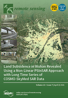
Wuhan is an important city in Central China, whose rapid development has led to increasingly serious land subsidence over the last few decades. In this study, we used nearly 300 high-resolution COSMO-SkyMed StripMap HIMAGE scenes acquired in 2012–2019 to monitor the long-term subsidence process and reveal its spatiotemporal variations. By combining the sequence of settlement curves in the subsiding area, the relationship between natural factors (soft soil consolidation, rainfall), human factors (subway construction, new urbanization, groundwater pumping), and ground deformation was discussed in detail. Our work unveils previously unknown characters of land subsidence in Wuhan and its causative factors, and also shows the benefits of non-linear PSInSAR to study the temporal evolution of such processes in dynamic and expanding cities. View this paper.
  • Issues are regarded as officially published after their release is announced to the table of contents alert mailing list.
  • You may sign up for e-mail alerts to receive table of contents of newly released issues.
  • PDF is the official format for papers published in both, html and pdf forms. To view the papers in pdf format, click on the "PDF Full-text" link, and use the free Adobe Reader to open them.
Order results
Result details
Section
Select all
Export citation of selected articles as:
19 pages, 2735 KiB  
Article
NRTK, PPP or Static, That Is the Question. Testing Different Positioning Solutions for GNSS Survey
by Gino Dardanelli, Antonino Maltese, Claudia Pipitone, Alessandro Pisciotta and Mauro Lo Brutto
Remote Sens. 2021, 13(7), 1406; https://doi.org/10.3390/rs13071406 - 06 Apr 2021
Cited by 22 | Viewed by 4721
Abstract
Worldwide, the determination of the coordinates from a Global Navigation Satellite System (GNSS) survey (in Network Real Time Kinematic, Precise Point Positioning, or static mode) has been analysed in several scientific and technical applications. Many of those have been carried out to compare [...] Read more.
Worldwide, the determination of the coordinates from a Global Navigation Satellite System (GNSS) survey (in Network Real Time Kinematic, Precise Point Positioning, or static mode) has been analysed in several scientific and technical applications. Many of those have been carried out to compare Precise Point Positioning (PPP), Network Real Time Kinematic (NRTK), and static modes’ solutions, usually, using the latter as the true or the most plausible solution. This approach is not always possible as the static mode solution depends on several parameters (baseline length, acquisition time, ionospheric, and tropospheric models, etc.) that must be considered to evaluate the accuracy of the method. This work aims to show the comparison among the GNSS survey methods mentioned above, using some benchmark points. The tests were carried out by comparing the survey methods in pairs to check their solutions congruence. The NRTK and the static solutions refer to a local GNSS CORS network’s analysis. The NRTK positioning has been obtained with different methods (VRS, FKP, NEA) and the PPP solution has been calculated with two different software (RTKLIB and CSRS-PPP). A statistical approach has been performed to check if the distribution frequencies of the coordinate’s residual belong to the normal distribution, for all pairs analysed. The results show that the hypothesis of a normal distribution is confirmed in most of the pairs and, specifically, the Static vs. NRTK pair seems to achieve the best congruence, while involving the PPP approach, pairs obtained with CSRS software achieve better congruence than those involving RTKLIB software. Full article
(This article belongs to the Special Issue BDS/GNSS for Earth Observation)
Show Figures

Graphical abstract

19 pages, 22455 KiB  
Article
Error Analysis of LAI Measurements with LAI-2000 Due to Discrete View Angular Range Angles for Continuous Canopies
by Jun Geng, Gang Yuan, J. M. Chen, Chunguang Lyu, Lili Tu, Weiliang Fan, Qingjiu Tian, Zhaofu Wu, Tingye Tao, Min Yu, Yongchao Zhu, Jianwei Huang, Kaijian Xu, Jinchao Li and Shaoteng Wang
Remote Sens. 2021, 13(7), 1405; https://doi.org/10.3390/rs13071405 - 06 Apr 2021
Cited by 5 | Viewed by 2702
Abstract
As a widely used ground-based optical instrument, the LAI-2000 or LAI-2200 plant canopy analyzer (PCA) (Li-Cor, Inc., Lincoln, NE) is designed to measure the plant effective leaf area index (Le) by measuring the canopy gap fraction at several limited or [...] Read more.
As a widely used ground-based optical instrument, the LAI-2000 or LAI-2200 plant canopy analyzer (PCA) (Li-Cor, Inc., Lincoln, NE) is designed to measure the plant effective leaf area index (Le) by measuring the canopy gap fraction at several limited or discrete view zenith angles (VZAs) (usually five VZAs: 7, 23, 38, 53, and 68°) based on Miller’s equation. Miller’s equation requires the probability of radiative transmission through the canopy to be measured over the hemisphere, i.e., VZAs in the range from 0 to 90°. However, the PCA view angle ranges are confined to several limited ranges or discrete sectors. The magnitude of the error produced by the discretization of VZAs in the leaf area index measurements remains difficult to determine. In this study, a theoretical deduction was first presented to definitely prove why the limited or discrete VZAs or ranges can affect the Le measured with the PCA, and the specific error caused by the limited or discrete VZAs was described quantitatively. The results show that: (1) the weight coefficient of the last PCA ring is the main cause of the error; (2) the error is closely related to the leaf inclination angles (IAs)—the Le measured with the PCA can be significantly overestimated for canopies with planophile IAs, whereas it can be underestimated for erectophile IAs; and (3) the error can be enhanced with the increment of the discrete degree of PCA rings or VZAs, such as using four or three PCA rings. Two corrections for the error are presented and validated in three crop canopies. Interestingly, although the leaf IA type cannot influence the Le calculated by Miller’s equation in the hemispheric space, it affects the Le measured with the PCA using the discrete form of Miller’s equation for several discrete VZAs. Full article
(This article belongs to the Special Issue Leaf and Canopy Biochemical and Biophysical Variables Retrieval)
Show Figures

Figure 1

17 pages, 4536 KiB  
Article
Graph Convolutional Networks by Architecture Search for PolSAR Image Classification
by Hongying Liu, Derong Xu, Tianwen Zhu, Fanhua Shang, Yuanyuan Liu, Jianhua Lu and Ri Yang
Remote Sens. 2021, 13(7), 1404; https://doi.org/10.3390/rs13071404 - 06 Apr 2021
Cited by 6 | Viewed by 2657
Abstract
Classification of polarimetric synthetic aperture radar (PolSAR) images has achieved good results due to the excellent fitting ability of neural networks with a large number of training samples. However, the performance of most convolutional neural networks (CNNs) degrades dramatically when only a few [...] Read more.
Classification of polarimetric synthetic aperture radar (PolSAR) images has achieved good results due to the excellent fitting ability of neural networks with a large number of training samples. However, the performance of most convolutional neural networks (CNNs) degrades dramatically when only a few labeled training samples are available. As one well-known class of semi-supervised learning methods, graph convolutional networks (GCNs) have gained much attention recently to address the classification problem with only a few labeled samples. As the number of layers grows in the network, the parameters dramatically increase. It is challenging to determine an optimal architecture manually. In this paper, we propose a neural architecture search method based GCN (ASGCN) for the classification of PolSAR images. We construct a novel graph whose nodes combines both the physical features and spatial relations between pixels or samples to represent the image. Then we build a new searching space whose components are empirically selected from some graph neural networks for architecture search and develop the differentiable architecture search method to construction our ASGCN. Moreover, to address the training of large-scale images, we present a new weighted mini-batch algorithm to reduce the computing memory consumption and ensure the balance of sample distribution, and also analyze and compare with other similar training strategies. Experiments on several real-world PolSAR datasets show that our method has improved the overall accuracy as much as 3.76% than state-of-the-art methods. Full article
(This article belongs to the Section AI Remote Sensing)
Show Figures

Graphical abstract

23 pages, 7399 KiB  
Article
Double-Branch Network with Pyramidal Convolution and Iterative Attention for Hyperspectral Image Classification
by Hao Shi, Guo Cao, Zixian Ge, Youqiang Zhang and Peng Fu
Remote Sens. 2021, 13(7), 1403; https://doi.org/10.3390/rs13071403 - 06 Apr 2021
Cited by 18 | Viewed by 2540
Abstract
Deep-learning methods, especially convolutional neural networks (CNN), have become the first choice for hyperspectral image (HSI) classification to date. It is a common procedure that small cubes are cropped from hyperspectral images and then fed into CNNs. However, standard CNNs find it difficult [...] Read more.
Deep-learning methods, especially convolutional neural networks (CNN), have become the first choice for hyperspectral image (HSI) classification to date. It is a common procedure that small cubes are cropped from hyperspectral images and then fed into CNNs. However, standard CNNs find it difficult to extract discriminative spectral–spatial features. How to obtain finer spectral–spatial features to improve the classification performance is now a hot topic of research. In this regard, the attention mechanism, which has achieved excellent performance in other computer vision, holds the exciting prospect. In this paper, we propose a double-branch network consisting of a novel convolution named pyramidal convolution (PyConv) and an iterative attention mechanism. Each branch concentrates on exploiting spectral or spatial features with different PyConvs, supplemented by the attention module for refining the feature map. Experimental results demonstrate that our model can yield competitive performance compared to other state-of-the-art models. Full article
Show Figures

Figure 1

20 pages, 7670 KiB  
Article
Retrieving Photometric Properties and Soil Moisture Content of Tidal Flats Using Bidirectional Spectral Reflectance
by Chen Gao, Min Xu, Hanzeyu Xu and Wei Zhou
Remote Sens. 2021, 13(7), 1402; https://doi.org/10.3390/rs13071402 - 06 Apr 2021
Cited by 4 | Viewed by 2215
Abstract
Moisture content in tidal flats changes frequently and spatially on account of tidal fluctuations, which greatly influence the reflectance of the tidal flat surface. Precise prediction of the spatial-temporal variation of tidal flats’ moisture content is an important foundation of surface bio-geophysical information [...] Read more.
Moisture content in tidal flats changes frequently and spatially on account of tidal fluctuations, which greatly influence the reflectance of the tidal flat surface. Precise prediction of the spatial-temporal variation of tidal flats’ moisture content is an important foundation of surface bio-geophysical information research by remote sensing. In this paper, we first measured the multi-angle reflectance of soil samples obtained from tidal flats in the northeastern Dongtai, Jiangsu Province, China, in the laboratory. Then, based on the particle swarm optimization (PSO) algorithm, we retrieved the photometric characteristics of the soil surface by employing the SOILSPECT bidirectional reflectance model. Finally, the soil moisture content was retrieved by introducing the equivalent water thickness of the soil. The results showed that: (i) A significant correlation existed between the retrieved equivalent water thickness and the measured soil moisture content. The SOILSPECT model is capable of estimating soil moisture with high precision by using multi-angle reflectance. (ii) Retrieved values of single scattering albedo (ω) were consistent with the variation of soil moisture content. The roughness parameter (h) and the asymmetry factor (Θ) were consistent with the structure and particle composition of the soil surface in dry soil samples. (iii) When the soil samples were soaked with water, the roughness parameter (h) and the type of scattering on the soil surface both showed irregular changes. These results support the importance of using the measured soil particle size as one of the parameters for the retrieval of soil moisture content, which is a method that should be used cautiously, especially in tidal flats. Full article
Show Figures

Graphical abstract

15 pages, 10271 KiB  
Article
The Potential Role of News Media to Construct a Machine Learning Based Damage Mapping Framework
by Genki Okada, Luis Moya, Erick Mas and Shunichi Koshimura
Remote Sens. 2021, 13(7), 1401; https://doi.org/10.3390/rs13071401 - 05 Apr 2021
Cited by 9 | Viewed by 5138
Abstract
When flooding occurs, Synthetic Aperture Radar (SAR) imagery is often used to identify flood extent and the affected buildings for two reasons: (i) for early disaster response, such as rescue operations, and (ii) for flood risk analysis. Furthermore, the application of machine learning [...] Read more.
When flooding occurs, Synthetic Aperture Radar (SAR) imagery is often used to identify flood extent and the affected buildings for two reasons: (i) for early disaster response, such as rescue operations, and (ii) for flood risk analysis. Furthermore, the application of machine learning has been valuable for the identification of damaged buildings. However, the performance of machine learning depends on the number and quality of training data, which is scarce in the aftermath of a large scale disaster. To address this issue, we propose the use of fragmentary but reliable news media photographs at the time of a disaster and use them to detect the whole extent of the flooded buildings. As an experimental test, the flood occurred in the town of Mabi, Japan, in 2018 is used. Five hand-engineered features were extracted from SAR images acquired before and after the disaster. The training data were collected based on news photos. The date release of the photographs were considered to assess the potential role of news information as a source of training data. Then, a discriminant function was calibrated using the training data and the support vector machine method. We found that news information taken within 24 h of a disaster can classify flooded and nonflooded buildings with about 80% accuracy. The results were also compared with a standard unsupervised learning method and confirmed that training data generated from news media photographs improves the accuracy obtained from unsupervised classification methods. We also provide a discussion on the potential role of news media as a source of reliable information to be used as training data and other activities associated to early disaster response. Full article
Show Figures

Figure 1

18 pages, 11342 KiB  
Article
Satellite-Based Observations Reveal the Altitude-Dependent Patterns of SIFyield and Its Sensitivity to Ambient Temperature in Tibetan Meadows
by Ruonan Chen, Liangyun Liu and Xinjie Liu
Remote Sens. 2021, 13(7), 1400; https://doi.org/10.3390/rs13071400 - 05 Apr 2021
Cited by 3 | Viewed by 2388
Abstract
Photosynthesis and its sensitivity to the changing environment in alpine regions are of great significance to the understanding of vegetation–environment interactions and other global ecological processes in the context of global change, while their variations along the elevation gradient remain unclear. Using solar-induced [...] Read more.
Photosynthesis and its sensitivity to the changing environment in alpine regions are of great significance to the understanding of vegetation–environment interactions and other global ecological processes in the context of global change, while their variations along the elevation gradient remain unclear. Using solar-induced chlorophyll fluorescence (SIF) derived from satellite observations, we discovered an increase in solar-induced fluorescence yield (SIFyield) with rising elevation in Tibetan meadows in the summer, related to the altitudinal variation in temperature sensitivity at both seasonal and interannual scales. Results of the altitudinal patterns of SIFyield demonstrated higher temperature sensitivity at high altitudes, and the sensitivity at the interannual scale even exceeds that at seasonal scale when the elevation reaches above 4700 m. This high-temperature sensitivity of SIFyield at high altitudes implies potential adaptation of alpine plants and also indicates that changes in photosynthesis-related physiological functions at high altitudes should receive more attention in climate change research. The altitudinal SIFyield patterns revealed in this study also highlight that variations in temperature sensitivity should be considered in models, otherwise the increasing trend of SIFyield observations can never be discovered in empirical simulations. Full article
(This article belongs to the Special Issue Remote Sensing of Fluorescence, Photosynthesis and Vegetation Status)
Show Figures

Graphical abstract

17 pages, 31346 KiB  
Article
Shoreline Changes along Northern Ibaraki Coast after the Great East Japan Earthquake of 2011
by Quang Nguyen Hao and Satoshi Takewaka
Remote Sens. 2021, 13(7), 1399; https://doi.org/10.3390/rs13071399 - 05 Apr 2021
Cited by 6 | Viewed by 3021
Abstract
In this study, we analyze the influence of the Great East Japan Earthquake, which occurred on 11 March 2011, on the shoreline of the northern Ibaraki Coast. After the earthquake, the area experienced subsidence of approximately 0.4 m. Shoreline changes at eight sandy [...] Read more.
In this study, we analyze the influence of the Great East Japan Earthquake, which occurred on 11 March 2011, on the shoreline of the northern Ibaraki Coast. After the earthquake, the area experienced subsidence of approximately 0.4 m. Shoreline changes at eight sandy beaches along the coast are estimated using various satellite images, including the ASTER (Advanced Spaceborne Thermal Emission and Reflection Radiometer), ALOS AVNIR-2 (Advanced Land Observing Satellite, Advanced Visible and Near-infrared Radiometer type 2), and Sentinel-2 (a multispectral sensor). Before the earthquake (for the period March 2001–January 2011), even though fluctuations in the shoreline position were observed, shorelines were quite stable, with the averaged change rates in the range of ±1.5 m/year. The shoreline suddenly retreated due to the earthquake by 20–40 m. Generally, the amount of retreat shows a strong correlation with the amount of land subsidence caused by the earthquake, and a moderate correlation with tsunami run-up height. The ground started to uplift gradually after the sudden subsidence, and shoreline positions advanced accordingly. The recovery speed of the beaches varied from +2.6 m/year to +6.6 m/year, depending on the beach conditions. Full article
Show Figures

Figure 1

18 pages, 10262 KiB  
Article
Crustal Strain and Stress Fields in Egypt from Geodetic and Seismological Data
by Mohamed Rashwan, Rashad Sawires, Ali M. Radwan, Federica Sparacino, José Antonio Peláez and Mimmo Palano
Remote Sens. 2021, 13(7), 1398; https://doi.org/10.3390/rs13071398 - 05 Apr 2021
Cited by 5 | Viewed by 3367
Abstract
The comparison between crustal stress and surface strain azimuthal patterns has provided new insights into several complex tectonic settings worldwide. Here, we performed such a comparison for Egypt taking into account updated datasets of seismological and geodetic observations. In north-eastern Egypt, the stress [...] Read more.
The comparison between crustal stress and surface strain azimuthal patterns has provided new insights into several complex tectonic settings worldwide. Here, we performed such a comparison for Egypt taking into account updated datasets of seismological and geodetic observations. In north-eastern Egypt, the stress field shows a fan-shaped azimuthal pattern with a WNW–ESE orientation on the Cairo region, which progressively rotated to NW–SE along the Gulf of Aqaba. The stress field shows a prevailing normal faulting regime, however, along the Sinai/Arabia plate boundary it coexists with a strike–slip faulting one (σ1 ≅ σ2 > σ3), while on the Gulf of Suez, it is characterized by crustal extension occurring on near-orthogonal directions (σ1 > σ2 ≅ σ3). On the Nile Delta, the maximum horizontal stress (SHmax) pattern shows scattered orientations, while on the Aswan region, it has a WNW–ESE strike with pure strike–slip features. The strain-rate field shows the largest values along the Red Sea and the Sinai/Arabia plate boundary. Crustal stretching (up to 40 nanostrain/yr) occurs on these areas with WSW–ENE and NE–SW orientations, while crustal contraction occurs on northern Nile Delta (10 nanostrain/yr) and offshore (~35 nanostrain/yr) with E–W and N–S orientations, respectively. The comparison between stress and strain orientations over the investigated area reveals that both patterns are near-parallel and driven by the same large-scale tectonic processes. Full article
(This article belongs to the Special Issue Geodetic Observations for Earth System)
Show Figures

Graphical abstract

22 pages, 7328 KiB  
Article
A Novel Strategy to Reconstruct NDVI Time-Series with High Temporal Resolution from MODIS Multi-Temporal Composite Products
by Linglin Zeng, Brian D. Wardlow, Shun Hu, Xiang Zhang, Guoqing Zhou, Guozhang Peng, Daxiang Xiang, Rui Wang, Ran Meng and Weixiong Wu
Remote Sens. 2021, 13(7), 1397; https://doi.org/10.3390/rs13071397 - 05 Apr 2021
Cited by 13 | Viewed by 4645
Abstract
Vegetation indices (VIs) data derived from satellite imageries play a vital role in land surface vegetation and dynamic monitoring. Due to the excessive noises (e.g., cloud cover, atmospheric contamination) in daily VI data, temporal compositing methods are commonly used to produce composite data [...] Read more.
Vegetation indices (VIs) data derived from satellite imageries play a vital role in land surface vegetation and dynamic monitoring. Due to the excessive noises (e.g., cloud cover, atmospheric contamination) in daily VI data, temporal compositing methods are commonly used to produce composite data to minimize the negative influence of noise over a given compositing time interval. However, VI time series with high temporal resolution were preferred by many applications such as vegetation phenology and land change detections. This study presents a novel strategy named DAVIR-MUTCOP (DAily Vegetation Index Reconstruction based on MUlti-Temporal COmposite Products) method for normalized difference vegetation index (NDVI) time-series reconstruction with high temporal resolution. The core of the DAVIR-MUTCOP method is a combination of the advantages of both original daily and temporally composite products, and selecting more daily observations with high quality through the temporal variation of temporally corrected composite data. The DAVIR-MUTCOP method was applied to reconstruct high-quality NDVI time-series using MODIS multi-temporal products in two study areas in the continental United States (CONUS), i.e., three field experimental sites near Mead, Nebraska from 2001 to 2012 and forty-six AmeriFlux sites evenly distributed across CONUS from 2006 to 2010. In these two study areas, the DAVIR-MUTCOP method was also compared to several commonly used methods, i.e., the Harmonic Analysis of Time-Series (HANTS) method using original daily observations, Savitzky–Golay (SG) filtering using daily observations with cloud mask products as auxiliary data, and SG filtering using temporally corrected composite data. The results showed that the DAVIR-MUTCOP method significantly improved the temporal resolution of the reconstructed NDVI time series. It performed the best in reconstructing NDVI time-series across time and space (coefficient of determination (R2 = 0.93 ~ 0.94) between reconstructed NDVI and ground-observed LAI). DAVIR-MUTCOP method presented the highest robustness and accuracy with the change of the filtering parameter (R2 = 0.99 ~ 1.00, bias = 0.001, root mean square error (RMSE) = 0.020). Only MODIS data were used in this study; nevertheless, the DAVIR-MUTCOP method proposed a universal and potential way to reconstruct daily time series of other VIs or from other operational sensors, e.g., AVHRR and VIIRS. Full article
(This article belongs to the Section Remote Sensing in Agriculture and Vegetation)
Show Figures

Figure 1

27 pages, 5758 KiB  
Article
Urban Heat Island Formation in Greater Cairo: Spatio-Temporal Analysis of Daytime and Nighttime Land Surface Temperatures along the Urban–Rural Gradient
by Darshana Athukorala and Yuji Murayama
Remote Sens. 2021, 13(7), 1396; https://doi.org/10.3390/rs13071396 - 05 Apr 2021
Cited by 29 | Viewed by 6222
Abstract
An urban heat island (UHI) is a significant anthropogenic modification of urban land surfaces, and its geospatial pattern can increase the intensity of the heatwave effects. The complex mechanisms and interactivity of the land surface temperature in urban areas are still being examined. [...] Read more.
An urban heat island (UHI) is a significant anthropogenic modification of urban land surfaces, and its geospatial pattern can increase the intensity of the heatwave effects. The complex mechanisms and interactivity of the land surface temperature in urban areas are still being examined. The urban–rural gradient analysis serves as a unique natural opportunity to identify and mitigate ecological worsening. Using Landsat Thematic Mapper (TM), Operational Land Imager/Thermal Infrared Sensor (OLI/TIRS) and Moderate Resolution Imaging Spectroradiometer (MODIS), Land Surface Temperature (LST) data in 2000, 2010, and 2019, we examined the spatial difference in daytime and nighttime LST trends along the urban–rural gradient in Greater Cairo, Egypt. Google Earth Engine (GEE) and machine learning techniques were employed to conduct the spatio-temporal analysis. The analysis results revealed that impervious surfaces (ISs) increased significantly from 564.14 km2 in 2000 to 869.35 km2 in 2019 in Greater Cairo. The size, aggregation, and complexity of patches of ISs, green space (GS), and bare land (BL) showed a strong correlation with the mean LST. The average urban–rural difference in mean LST was −3.59 °C in the daytime and 2.33 °C in the nighttime. In the daytime, Greater Cairo displayed the cool island effect, but in the nighttime, it showed the urban heat island effect. We estimated that dynamic human activities based on the urban structure are causing the spatial difference in the LST distribution between the day and night. The urban–rural gradient analysis indicated that this phenomenon became stronger from 2000 to 2019. Considering the drastic changes in the spatial patterns and the density of IS, GS, and BL, urban planners are urged to take immediate steps to mitigate increasing surface UHI; otherwise, urban dwellers might suffer from the severe effects of heatwaves. Full article
(This article belongs to the Special Issue Remote Sensing of the Urban Climate)
Show Figures

Graphical abstract

17 pages, 30967 KiB  
Article
Presence of the Past: Digital Narrative of the Dennys Lascelles Concrete Wool Store; Geelong, Australia
by Md Mizanur Rashid, Chin Koi Khoo, Sofija Kaljevic and Surabhi Pancholi
Remote Sens. 2021, 13(7), 1395; https://doi.org/10.3390/rs13071395 - 05 Apr 2021
Cited by 2 | Viewed by 2712
Abstract
Recreation of the past—of historical buildings—sits at the intersection of the spatio-temporal manifestation of cultural memories, socio-cultural meanings, values, and identity remolds, and refines the existing understanding and sense of place. Digital technologies have become a popular tool in recreation of the past [...] Read more.
Recreation of the past—of historical buildings—sits at the intersection of the spatio-temporal manifestation of cultural memories, socio-cultural meanings, values, and identity remolds, and refines the existing understanding and sense of place. Digital technologies have become a popular tool in recreation of the past by creating a new body of knowledge and historical discourse based on identifying the gaps within our written histories. Designers and policymakers around the world have been exploring various tools and technologies, such as diachronic modeling, yet there is a gap in evidence-based understanding regarding the actual functioning and success of applications for placemaking. This paper, therefore, sets out to scrutinize the role of digital technologies in facilitating digital placemaking. To do so, it investigates the potential of a new “digital heritage” narrative in the revival of the lost architectural narrative of the Dennys Lascelles wool store, Geelong. The proposed paper aims to investigate the potential of a new “digital heritage” narrative and storytelling as a means towards a digital placemaking framework. While exploring the new and unique capabilities provided by the digital narrative in capturing, simulating, and disseminating lost heritage, it will further imbue a sense of place by connecting the everyday city dweller. Full article
(This article belongs to the Special Issue 3D Virtual Reconstruction for Cultural Heritage)
Show Figures

Graphical abstract

27 pages, 11263 KiB  
Article
Crop Monitoring and Classification Using Polarimetric RADARSAT-2 Time-Series Data Across Growing Season: A Case Study in Southwestern Ontario, Canada
by Qinghua Xie, Kunyu Lai, Jinfei Wang, Juan M. Lopez-Sanchez, Jiali Shang, Chunhua Liao, Jianjun Zhu, Haiqiang Fu and Xing Peng
Remote Sens. 2021, 13(7), 1394; https://doi.org/10.3390/rs13071394 - 05 Apr 2021
Cited by 23 | Viewed by 4005
Abstract
Multitemporal polarimetric synthetic aperture radar (PolSAR) has proven as a very effective technique in agricultural monitoring and crop classification. This study presents a comprehensive evaluation of crop monitoring and classification over an agricultural area in southwestern Ontario, Canada. The time-series RADARSAT-2 C-Band PolSAR [...] Read more.
Multitemporal polarimetric synthetic aperture radar (PolSAR) has proven as a very effective technique in agricultural monitoring and crop classification. This study presents a comprehensive evaluation of crop monitoring and classification over an agricultural area in southwestern Ontario, Canada. The time-series RADARSAT-2 C-Band PolSAR images throughout the entire growing season were exploited. A set of 27 representative polarimetric observables categorized into ten groups was selected and analyzed in this research. First, responses and temporal evolutions of each of the polarimetric observables over different crop types were quantitatively analyzed. The results reveal that the backscattering coefficients in cross-pol and Pauli second channel, the backscattering ratio between HV and VV channels (HV/VV), the polarimetric decomposition outputs, the correlation coefficient between HH and VV channelρ ρHHVV, and the radar vegetation index (RVI) show the highest sensitivity to crop growth. Then, the capability of PolSAR time-series data of the same beam mode was also explored for crop classification using the Random Forest (RF) algorithm. The results using single groups of polarimetric observables show that polarimetric decompositions, backscattering coefficients in Pauli and linear polarimetric channels, and correlation coefficients produced the best classification accuracies, with overall accuracies (OAs) higher than 87%. A forward selection procedure to pursue optimal classification accuracy was expanded to different perspectives, enabling an optimal combination of polarimetric observables and/or multitemporal SAR images. The results of optimal classifications show that a few polarimetric observables or a few images on certain critical dates may produce better accuracies than the whole dataset. The best result was achieved using an optimal combination of eight groups of polarimetric observables and six SAR images, with an OA of 94.04%. This suggests that an optimal combination considering both perspectives may be valuable for crop classification, which could serve as a guideline and is transferable for future research. Full article
(This article belongs to the Special Issue Environmental Mapping Using Remote Sensing)
Show Figures

Graphical abstract

25 pages, 2487 KiB  
Article
Cereal Crops Soil Parameters Retrieval Using L-Band ALOS-2 and C-Band Sentinel-1 Sensors
by Emna Ayari, Zeineb Kassouk, Zohra Lili-Chabaane, Nicolas Baghdadi, Safa Bousbih and Mehrez Zribi
Remote Sens. 2021, 13(7), 1393; https://doi.org/10.3390/rs13071393 - 04 Apr 2021
Cited by 16 | Viewed by 3431
Abstract
This paper discusses the potential of L-band Advanced Land Observing Satellite-2 (ALOS-2) and C-band Sentinel-1 radar data for retrieving soil parameters over cereal fields. For this purpose, multi-incidence, multi-polarization and dual-frequency satellite data were acquired simultaneously with in situ measurements collected over a [...] Read more.
This paper discusses the potential of L-band Advanced Land Observing Satellite-2 (ALOS-2) and C-band Sentinel-1 radar data for retrieving soil parameters over cereal fields. For this purpose, multi-incidence, multi-polarization and dual-frequency satellite data were acquired simultaneously with in situ measurements collected over a semiarid area, the Merguellil Plain (central Tunisia). The L- and C-band signal sensitivity to soil roughness, moisture and vegetation was investigated. High correlation coefficients were observed between the radar signals and soil roughness values for all processed multi-configurations of ALOS-2 and Sentinel-1 data. The sensitivity of SAR (Synthetic Aperture Radar) data to soil moisture was investigated for three classes of the normalized difference vegetation index (NDVI) (low vegetation cover, medium cover and dense cover), illustrating a decreasing sensitivity with increasing NDVI values. The highest sensitivity to soil moisture under the dense cover class is observed in L-band data. For various vegetation properties (leaf area index (LAI), height of vegetation cover (H) and vegetation water content (VWC)), a strong correlation is observed with the ALOS-2 radar signals (in HH(Horizontal-Horizontal) and HV(Horizontal-Vertical) polarizations). Different empirical models that link radar signals (in the L- and C-bands) to soil moisture and roughness parameters, as well as the semi-empirical Dubois modified model (Dubois-B) and the modified integral equation model (IEM-B), over bare soils are proposed for all polarizations. The results reveal that IEM-B performed a better accuracy comparing to Dubois-B. This analysis is also proposed for covered surfaces using different options provided by the water cloud model (WCM) (with and without the soil–vegetation interaction scattering term) coupled with the best accuracy bare soil backscattering models: IEM-B for co-polarization and empirical models for the entire dataset. Based on the validated backscattering models, different options of coupled models are tested for soil moisture inversion. The integration of a soil–vegetation interaction component in the WCM illustrates a considerable contribution to soil moisture precision in the HV polarization mode in the L-band frequency and a neglected effect on C-band data inversion. Full article
(This article belongs to the Special Issue Satellite Soil Moisture Validation and Applications)
Show Figures

Figure 1

22 pages, 5528 KiB  
Article
Mapping Surficial Soil Particle Size Fractions in Alpine Permafrost Regions of the Qinghai–Tibet Plateau
by Chong Wang, Lin Zhao, Hongbing Fang, Lingxiao Wang, Zanpin Xing, Defu Zou, Guojie Hu, Xiaodong Wu, Yonghua Zhao, Yu Sheng, Qiangqiang Pang, Erji Du, Guangyue Liu and Hanbo Yun
Remote Sens. 2021, 13(7), 1392; https://doi.org/10.3390/rs13071392 - 04 Apr 2021
Cited by 6 | Viewed by 2604
Abstract
Spatial information of particle size fractions (PSFs) is primary for understanding the thermal state of permafrost in the Qinghai-Tibet Plateau (QTP) in response to climate change. However, the limitation of field observations and the tremendous spatial heterogeneity hamper the digital mapping of PSF. [...] Read more.
Spatial information of particle size fractions (PSFs) is primary for understanding the thermal state of permafrost in the Qinghai-Tibet Plateau (QTP) in response to climate change. However, the limitation of field observations and the tremendous spatial heterogeneity hamper the digital mapping of PSF. This study integrated log-ratio transformation approaches, variable searching methods, and machine learning techniques to map the surficial soil PSF distribution of two typical permafrost regions. Results showed that the Boruta technique identified different covariates but retained those covariates of vegetation and land surface temperature in both regions. Variable selection techniques effectively decreased the data redundancy and improved model performance. In addition, the spatial distribution of soil PSFs generated by four log-ratio models presented similar patterns. Isometric log-ratio random forest (ILR-RF) outperformed the other models in both regions (i.e., R2 ranged between 0.36 to 0.56, RMSE ranged between 0.02 and 0.10). Compared with three legacy datasets, our prediction better captured the spatial pattern of PSFs with higher accuracy. Although this study largely improved the accuracy of spatial distribution of soil PSFs, further endeavors should also be made to improve model accuracy and interpretability for a better understanding of the interaction and processes between environmental predictors and soil PSFs at permafrost regions. Full article
Show Figures

Graphical abstract

25 pages, 2625 KiB  
Article
Rice-Yield Prediction with Multi-Temporal Sentinel-2 Data and 3D CNN: A Case Study in Nepal
by Ruben Fernandez-Beltran, Tina Baidar, Jian Kang and Filiberto Pla
Remote Sens. 2021, 13(7), 1391; https://doi.org/10.3390/rs13071391 - 04 Apr 2021
Cited by 43 | Viewed by 8604
Abstract
Crop yield estimation is a major issue of crop monitoring which remains particularly challenging in developing countries due to the problem of timely and adequate data availability. Whereas traditional agricultural systems mainly rely on scarce ground-survey data, freely available multi-temporal and multi-spectral remote [...] Read more.
Crop yield estimation is a major issue of crop monitoring which remains particularly challenging in developing countries due to the problem of timely and adequate data availability. Whereas traditional agricultural systems mainly rely on scarce ground-survey data, freely available multi-temporal and multi-spectral remote sensing images are excellent tools to support these vulnerable systems by accurately monitoring and estimating crop yields before harvest. In this context, we introduce the use of Sentinel-2 (S2) imagery, with a medium spatial, spectral and temporal resolutions, to estimate rice crop yields in Nepal as a case study. Firstly, we build a new large-scale rice crop database (RicePAL) composed by multi-temporal S2 and climate/soil data from the Terai districts of Nepal. Secondly, we propose a novel 3D Convolutional Neural Network (CNN) adapted to these intrinsic data constraints for the accurate rice crop yield estimation. Thirdly, we study the effect of considering different temporal, climate and soil data configurations in terms of the performance achieved by the proposed approach and several state-of-the-art regression and CNN-based yield estimation methods. The extensive experiments conducted in this work demonstrate the suitability of the proposed CNN-based framework for rice crop yield estimation in the developing country of Nepal using S2 data. Full article
(This article belongs to the Special Issue Machine Learning for Remote Sensing Image/Signal Processing)
Show Figures

Graphical abstract

15 pages, 2953 KiB  
Article
A New Method for Determining an Optimal Diurnal Threshold of GNSS Precipitable Water Vapor for Precipitation Forecasting
by Haobo Li, Xiaoming Wang, Suqin Wu, Kefei Zhang, Erjiang Fu, Ying Xu, Cong Qiu, Jinglei Zhang and Li Li
Remote Sens. 2021, 13(7), 1390; https://doi.org/10.3390/rs13071390 - 04 Apr 2021
Cited by 10 | Viewed by 2469
Abstract
Nowadays, precipitable water vapor (PWV) retrieved from ground-based Global Navigation Satellite Systems (GNSS) tracking stations has heralded a new era of GNSS meteorological applications, especially for severe weather prediction. Among the existing models that use PWV timeseries to predict heavy precipitation, the “threshold-based” [...] Read more.
Nowadays, precipitable water vapor (PWV) retrieved from ground-based Global Navigation Satellite Systems (GNSS) tracking stations has heralded a new era of GNSS meteorological applications, especially for severe weather prediction. Among the existing models that use PWV timeseries to predict heavy precipitation, the “threshold-based” models, which are based on a set of predefined thresholds for the predictors used in the model for predictions, are effective in heavy precipitation nowcasting. In previous studies, monthly thresholds have been widely accepted due to the monthly patterns of different predictors being fully considered. However, the primary weakness of this type of thresholds lies in their poor prediction results in the transitional periods between two consecutive months. Therefore, in this study, a new method for the determination of an optimal set of diurnal thresholds by adopting a 31-day sliding window was first proposed. Both the monthly and diurnal variation characteristics of the predictors were taken into consideration in the new method. Then, on the strength of the new method, an improved PWV-based model for heavy precipitation prediction was developed using the optimal set of diurnal thresholds determined based on the hourly PWV and precipitation records for the summer over the period 2010–2017 at the co-located HKSC–KP (King’s Park) stations in Hong Kong. The new model was evaluated by comparing its prediction results against the hourly precipitation records for the summer in 2018 and 2019. It is shown that 96.9% of heavy precipitation events were correctly predicted with a lead time of 4.86 h, and the false alarms resulting from the new model were reduced to 25.3%. These results suggest that the inclusion of the diurnal thresholds can significantly improve the prediction performance of the model. Full article
(This article belongs to the Special Issue Climate Modelling and Monitoring Using GNSS)
Show Figures

Graphical abstract

30 pages, 21631 KiB  
Article
Variation in Ice Phenology of Large Lakes over the Northern Hemisphere Based on Passive Microwave Remote Sensing Data
by Lei Su, Tao Che and Liyun Dai
Remote Sens. 2021, 13(7), 1389; https://doi.org/10.3390/rs13071389 - 04 Apr 2021
Cited by 7 | Viewed by 2608
Abstract
Ice phenology data of 22 large lakes of the Northern Hemisphere for 40 years (1979–2018) have been retrieved from passive microwave remote sensing brightness temperature (Tb). The results were compared with site-observation data and visual interpretation from Moderate Resolution Imaging Spectroradiometer (MODIS) surface [...] Read more.
Ice phenology data of 22 large lakes of the Northern Hemisphere for 40 years (1979–2018) have been retrieved from passive microwave remote sensing brightness temperature (Tb). The results were compared with site-observation data and visual interpretation from Moderate Resolution Imaging Spectroradiometer (MODIS) surface reflectivity products images (MOD09GA). The mean absolute errors of four lake ice phenology parameters, including freeze-up start date (FUS), freeze-up end date (FUE), break-up start date (BUS), and break-up end date (BUE) against MODIS-derived ice phenology were 2.50, 2.33, 1.98, and 3.27 days, respectively. The long-term variation in lake ice phenology indicates that FUS and FUE are delayed; BUS and BUE are earlier; ice duration (ID) and complete ice duration (CID) have a general decreasing trend. The average change rates of FUS, FUE, BUS, BUE, ID, and CID of lakes in this study from 1979 to 2018 were 0.23, 0.23, −0.17, −0.33, −0.67, and −0.48 days/year, respectively. Air temperature and latitude are two dominant driving factors of lake ice phenology. Lake ice phenology for the period 2021–2100 was predicted by the relationship between ice phenology and air temperature for each lake. Compared with lake ice phenology changes from 1990 to 2010, FUS is projected to be delayed by 3.1 days and 11.8 days under Representative Concentration Pathways (RCPs) 2.6 and 8.5 scenarios, respectively; BUS is projected to be earlier by 3.3 days and 10.7 days, respectively; and ice duration from 2080 to 2100 will decrease by 6.5 days and 21.9 days, respectively. Full article
(This article belongs to the Special Issue The Cryosphere Observations Based on Using Remote Sensing Techniques)
Show Figures

Graphical abstract

18 pages, 7558 KiB  
Article
Ghost Elimination via Multi-Component Collaboration for Unmanned Aerial Vehicle Remote Sensing Image Stitching
by Wanli Xue, Zhe Zhang and Shengyong Chen
Remote Sens. 2021, 13(7), 1388; https://doi.org/10.3390/rs13071388 - 04 Apr 2021
Cited by 14 | Viewed by 2809
Abstract
Ghosts are a common phenomenon widely present in unmanned aerial vehicle (UAV) remote sensing image stitching that seriously affect the naturalness of stitching results. In order to effectively remove ghosts and produce visually natural stitching results, we propose a novel image stitching method [...] Read more.
Ghosts are a common phenomenon widely present in unmanned aerial vehicle (UAV) remote sensing image stitching that seriously affect the naturalness of stitching results. In order to effectively remove ghosts and produce visually natural stitching results, we propose a novel image stitching method that can identify and eliminate ghosts through multi-component collaboration without object distortion, segmentation or repetition. Specifically, our main contributions are as follows: first, we propose a ghost identification component to locate a potential ghost in the stitching area; and detect significantly moving objects in the two stitched images. In particular, due to the characteristics of UAV shooting, the objects in UAV remote sensing images are small and the image quality is poor. We propose a mesh-based image difference comparison method to identify ghosts; and use an object tracking algorithm to accurately correspond to each ghost pair. Second, we design an image information source selection strategy to generate the ghost replacement region, which can replace the located ghost and avoid object distortion, segmentation and repetition. Third, we find that the process of ghost elimination can produce natural mosaic images by eliminating the ghost caused by initial blending with selected image information source. We validate the proposed method on VIVID data set and compare our method with Homo, ELA, SPW and APAP using the peak signal to noise ratio (PSNR) evaluation indicator. Full article
(This article belongs to the Special Issue Semantic Segmentation of High-Resolution Images with Deep Learning)
Show Figures

Figure 1

11 pages, 8827 KiB  
Technical Note
Velocity Analysis Using Separated Diffractions for Lunar Penetrating Radar Obtained by Yutu-2 Rover
by Chao Li and Jinhai Zhang
Remote Sens. 2021, 13(7), 1387; https://doi.org/10.3390/rs13071387 - 04 Apr 2021
Cited by 15 | Viewed by 2751
Abstract
The high-frequency channel of lunar penetrating radar (LPR) onboard Yutu-2 rover successfully collected high quality data on the far side of the Moon, which provide a chance for us to detect the shallow subsurface structures and thickness of lunar regolith. However, traditional methods [...] Read more.
The high-frequency channel of lunar penetrating radar (LPR) onboard Yutu-2 rover successfully collected high quality data on the far side of the Moon, which provide a chance for us to detect the shallow subsurface structures and thickness of lunar regolith. However, traditional methods cannot obtain reliable dielectric permittivity model, especially in the presence of high mix between diffractions and reflections, which is essential for understanding and interpreting the composition of lunar subsurface materials. In this paper, we introduce an effective method to construct a reliable velocity model by separating diffractions from reflections and perform focusing analysis using separated diffractions. We first used the plane-wave destruction method to extract weak-energy diffractions interfered by strong reflections, and the LPR data are separated into two parts: diffractions and reflections. Then, we construct a macro-velocity model of lunar subsurface by focusing analysis on separated diffractions. Both the synthetic ground penetrating radar (GPR) and LPR data shows that the migration results of separated reflections have much clearer subsurface structures, compared with the migration results of un-separated data. Our results produce accurate velocity estimation, which is vital for high-precision migration; additionally, the accurate velocity estimation directly provides solid constraints on the dielectric permittivity at different depth. Full article
Show Figures

Figure 1

16 pages, 2564 KiB  
Article
Responses of Summer Upwelling to Recent Climate Changes in the Taiwan Strait
by Caiyun Zhang
Remote Sens. 2021, 13(7), 1386; https://doi.org/10.3390/rs13071386 - 03 Apr 2021
Cited by 4 | Viewed by 2672
Abstract
The response of a summer upwelling system to recent climate change in the Taiwan Strait has been investigated using a time series of sea surface temperature and wind data over the period 1982–2019. Our results revealed that summer upwelling intensities of the Taiwan [...] Read more.
The response of a summer upwelling system to recent climate change in the Taiwan Strait has been investigated using a time series of sea surface temperature and wind data over the period 1982–2019. Our results revealed that summer upwelling intensities of the Taiwan Strait decreased with a nonlinear fluctuation over the past four decades. The average upwelling intensity after 2000 was 35% lower than that before 2000. The long-term changes in upwelling intensities show strong correlations with offshore Ekman transport, which experienced a decreasing trend after 2000. Unlike the delay effect of canonical ENSO events on changes in summer upwelling, ENSO Modoki events had a significant negative influence on upwelling intensity. Strong El Niño Modoki events were not favorable for the development of upwelling. This study also suggested that decreased upwelling could not slow down the warming rate of the sea surface temperature and would probably cause the decline of chlorophyll a in the coastal upwelling system of the Taiwan Strait. These results will contribute to a better understanding of the dynamic process of summer upwelling in the Taiwan Strait, and provide a sound scientific basis for evaluating future trends in coastal upwelling and their potential ecological effects. Full article
Show Figures

Graphical abstract

26 pages, 14994 KiB  
Article
Seamless 3D Image Mapping and Mosaicing of Valles Marineris on Mars Using Orbital HRSC Stereo and Panchromatic Images
by Yu Tao, Greg Michael, Jan-Peter Muller, Susan J. Conway and Alfiah R. D. Putri
Remote Sens. 2021, 13(7), 1385; https://doi.org/10.3390/rs13071385 - 03 Apr 2021
Cited by 9 | Viewed by 3434
Abstract
A seamless mosaic has been constructed including a 3D terrain model at 50 m grid-spacing and a corresponding terrain-corrected orthoimage at 12.5 m using a novel approach applied to ESA Mars Express High Resolution Stereo Camera orbital (HRSC) images of Mars. This method [...] Read more.
A seamless mosaic has been constructed including a 3D terrain model at 50 m grid-spacing and a corresponding terrain-corrected orthoimage at 12.5 m using a novel approach applied to ESA Mars Express High Resolution Stereo Camera orbital (HRSC) images of Mars. This method consists of blending and harmonising 3D models and normalising reflectance to a global albedo map. Eleven HRSC image sets were processed to Digital Terrain Models (DTM) based on an opensource stereo photogrammetric package called CASP-GO and merged with 71 published DTMs from the HRSC team. In order to achieve high quality and complete DTM coverage, a new method was developed to combine data derived from different stereo matching approaches to achieve a uniform outcome. This new approach was developed for high-accuracy data fusion of different DTMs at dissimilar grid-spacing and provenance which employs joint 3D and image co-registration, and B-spline fitting against the global Mars Orbiter Laser Altimeter (MOLA) standard reference. Each HRSC strip is normalised against a global albedo map to ensure that the very different lighting conditions could be corrected and resulting in a tiled set of seamless mosaics. The final 3D terrain model is compared against the MOLA height reference and the results shown of this intercomparison both in altitude and planum. Visualisation and access mechanisms to the final open access products are described. Full article
(This article belongs to the Special Issue Cartography of the Solar System: Remote Sensing beyond Earth)
Show Figures

Figure 1

20 pages, 8658 KiB  
Article
Flood Monitoring in Rural Areas of the Pearl River Basin (China) Using Sentinel-1 SAR
by Junliang Qiu, Bowen Cao, Edward Park, Xiankun Yang, Wenxin Zhang and Paolo Tarolli
Remote Sens. 2021, 13(7), 1384; https://doi.org/10.3390/rs13071384 - 03 Apr 2021
Cited by 36 | Viewed by 7742
Abstract
Flood hazards result in enormous casualties and huge economic losses every year in the Pearl River Basin (PRB), China. It is, therefore, crucial to monitor floods in PRB for a better understanding of the flooding patterns and characteristics of the PRB. Previous studies, [...] Read more.
Flood hazards result in enormous casualties and huge economic losses every year in the Pearl River Basin (PRB), China. It is, therefore, crucial to monitor floods in PRB for a better understanding of the flooding patterns and characteristics of the PRB. Previous studies, which utilized hydrological data were not successful in identifying flooding patterns in the rural and remote regions in PRB. Such regions are the key supplier of agricultural products and water resources for the entire PRB. Thus, an analysis of the impacts of floods could provide a useful tool to support mitigation strategies. Using 66 Sentinel-1 images, this study employed Otsu’s method to investigate floods and explore flood patterns across the PRB from 2017 to 2020. The results indicated that floods are mainly located in the central West River Basin (WRB), middle reaches of the North River (NR) and middle reaches of the East River (ER). WRB is more prone to flood hazards. In 2017, 94.0% flood-impacted croplands were located in WRB; 95.0% of inundated croplands (~9480 hectares) were also in WRB. The most vulnerable areas to flooding are sections of the Yijiang, Luoqingjiang, Qianjiang, and Xunjiang tributaries and the lower reaches of Liujiang. Our results highlight the severity of flood hazards in a rural region of the PRB and emphasize the need for policy overhaul to enhance flood control in rural regions in the PRB to ensure food safety. Full article
Show Figures

Graphical abstract

25 pages, 5217 KiB  
Article
Inconsistency among Landsat Sensors in Land Surface Mapping: A Comprehensive Investigation Based on Simulation
by Feng Chen, Chenxing Wang, Yuansheng Zhang, Zhenshi Yi, Qiancong Fan, Lin Liu and Yuejun Song
Remote Sens. 2021, 13(7), 1383; https://doi.org/10.3390/rs13071383 - 03 Apr 2021
Cited by 5 | Viewed by 2063
Abstract
Comprehensive investigations on the between-sensor comparability among Landsat sensors have been relatively limited compared with the increasing use of multi-temporal Landsat records in time series analyses. More seriously, the sensor-related difference has not always been considered in applications. Accordingly, comparisons were conducted among [...] Read more.
Comprehensive investigations on the between-sensor comparability among Landsat sensors have been relatively limited compared with the increasing use of multi-temporal Landsat records in time series analyses. More seriously, the sensor-related difference has not always been considered in applications. Accordingly, comparisons were conducted among all Landsat sensors available currently, including Multispectral Scanner (MSS), Thematic Mappers (TM), Enhanced Thematic Mappers (ETM+), and Operational Land Imager (OLI)) in land cover mapping, based on a collection of synthesized, multispectral data. Compared to TM, OLI showed obvious between-sensor differences in channel reflectance, especially over the near infrared (NIR) and shortwave infrared (SWIR) channels, and presented positive bias in vegetation spectral indices. OLI did not always outperform TM and ETM+ in classification, which related to the methods used. Furthermore, the channels over SWIR of TM and its successors contributed largely to enhancement of inter-class separability and to improvement of classification. Currently, the inclusion of MSS data is confronted with significant challenges regarding the consistency of surface mapping. Considering the inconsistency among the Landsat sensors, it is applicable to generate a consistent time series of spectral indices through proper transformation models. Meanwhile, it suggests the generation of specific class(es) based on interest instead of including all classes simultaneously. Full article
(This article belongs to the Special Issue Optical Remote Sensing Applications in Urban Areas)
Show Figures

Figure 1

23 pages, 3162 KiB  
Article
Impending Hydrological Regime of Lhasa River as Subjected to Hydraulic Interventions—A SWAT Model Manifestation
by Muhammad Yasir, Tiesong Hu and Samreen Abdul Hakeem
Remote Sens. 2021, 13(7), 1382; https://doi.org/10.3390/rs13071382 - 03 Apr 2021
Cited by 7 | Viewed by 2494
Abstract
The damming of rivers has altered their hydrological regimes. The current study evaluated the impacts of major hydrological interventions of the Zhikong and Pangduo hydropower dams on the Lhasa River, which was exposed in the form of break and change points during the [...] Read more.
The damming of rivers has altered their hydrological regimes. The current study evaluated the impacts of major hydrological interventions of the Zhikong and Pangduo hydropower dams on the Lhasa River, which was exposed in the form of break and change points during the double-mass curve analysis. The coefficient of variability (CV) for the hydro-meteorological variables revealed an enhanced climate change phenomena in the Lhasa River Basin (LRB), where the Lhasa River (LR) discharge varied at a stupendous magnitude from 2000 to 2016. The Mann–Kendall trend and Sen’s slope estimator supported aggravated hydro-meteorological changes in LRB, as the rainfall and LR discharge were found to have been significantly decreasing while temperature was increasing from 2000 to 2016. The Sen’s slope had a largest decrease for LR discharge in relation to the rainfall and temperature, revealing that along with climatic phenomena, additional phenomena are controlling the hydrological regime of the LR. Reservoir functioning in the LR is altering the LR discharge. The Soil and Water Assessment Tool (SWAT) modeling of LR discharge under the reservoir’s influence performed well in terms of coefficient of determination (R2), Nash–Sutcliffe coefficient (NSE), and percent bias (PBIAS). Thus, simulation-based LR discharge could substitute observed LR discharge to help with hydrological data scarcity stress in the LRB. The simulated–observed approach was used to predict future LR discharge for the time span of 2017–2025 using a seasonal AutoRegressive Integrated Moving Average (ARIMA) model. The predicted simulation-based and observation-based discharge were closely correlated and found to decrease from 2017 to 2025. This calls for an efficient water resource planning and management policy for the area. The findings of this study can be applied in similar catchments. Full article
Show Figures

Figure 1

20 pages, 9798 KiB  
Article
Land Cover Mapping and Ecological Risk Assessment in the Context of Recent Ecological Migration
by Tingting Zhang, Zhenrong Du, Jianyu Yang, Xiaochuang Yao, Cong Ou, Bowen Niu and Shuai Yan
Remote Sens. 2021, 13(7), 1381; https://doi.org/10.3390/rs13071381 - 03 Apr 2021
Cited by 18 | Viewed by 2917
Abstract
In order to protect the ecological environment and solve the poverty problem in the western region, China has established an ecological migration (EM) policy. This policy aims to relocate populations from poverty-stricken areas with fragile ecological environments, which inevitably leads to changes in [...] Read more.
In order to protect the ecological environment and solve the poverty problem in the western region, China has established an ecological migration (EM) policy. This policy aims to relocate populations from poverty-stricken areas with fragile ecological environments, which inevitably leads to changes in land cover and the ecological environment. The objective of this study was to identify the effects of EM in a typical region (Wuwei), including changes in the land cover and ecological risk (ER). A land cover change monitoring method was implemented for the 2010–2019 period for six land cover classes using random forest, which is an effective supervised machine learning method. The land cover change patterns were analyzed by determining the area changes of the six classes and applying a land use transition matrix, and a landscape ecological risk model based on landscape disturbance and fragility was used. Our results demonstrate that the increase and decrease in the area of cultivated land, unused land, and construction land can be divided into two stages (2010–2015 and 2015–2019). The area of water and perennial snow doubled during the study periods. The major land cover transitions were between unused land and construction land and between unused land and crop land. In addition, the ER value for the Qilian Mountain National Nature Reserve decreased because of the implementation of EM in the study area, indicating that the ecological environment was effectively improved. The results demonstrate the advantage of the proposed approach in understanding the impact of EM on regional land cover changes and the ecological environment so as to provide guidance for follow-up planning and development. Full article
Show Figures

Graphical abstract

24 pages, 8432 KiB  
Article
Registration and Fusion of Close-Range Multimodal Wheat Images in Field Conditions
by Sébastien Dandrifosse, Alexis Carlier, Benjamin Dumont and Benoît Mercatoris
Remote Sens. 2021, 13(7), 1380; https://doi.org/10.3390/rs13071380 - 03 Apr 2021
Cited by 15 | Viewed by 3449
Abstract
Multimodal images fusion has the potential to enrich the information gathered by multi-sensor plant phenotyping platforms. Fusion of images from multiple sources is, however, hampered by the technical lock of image registration. The aim of this paper is to provide a solution to [...] Read more.
Multimodal images fusion has the potential to enrich the information gathered by multi-sensor plant phenotyping platforms. Fusion of images from multiple sources is, however, hampered by the technical lock of image registration. The aim of this paper is to provide a solution to the registration and fusion of multimodal wheat images in field conditions and at close range. Eight registration methods were tested on nadir wheat images acquired by a pair of red, green and blue (RGB) cameras, a thermal camera and a multispectral camera array. The most accurate method, relying on a local transformation, aligned the images with an average error of 2 mm but was not reliable for thermal images. More generally, the suggested registration method and the preprocesses necessary before fusion (plant mask erosion, pixel intensity averaging) would depend on the application. As a consequence, the main output of this study was to identify four registration-fusion strategies: (i) the REAL-TIME strategy solely based on the cameras’ positions, (ii) the FAST strategy suitable for all types of images tested, (iii) and (iv) the ACCURATE and HIGHLY ACCURATE strategies handling local distortion but unable to deal with images of very different natures. These suggestions are, however, limited to the methods compared in this study. Further research should investigate how recent cutting-edge registration methods would perform on the specific case of wheat canopy. Full article
(This article belongs to the Special Issue Imaging for Plant Phenotyping)
Show Figures

Graphical abstract

19 pages, 4426 KiB  
Article
Assessing Stream Thermal Heterogeneity and Cold-Water Patches from UAV-Based Imagery: A Matter of Classification Methods and Metrics
by Johannes Kuhn, Roser Casas-Mulet, Joachim Pander and Juergen Geist
Remote Sens. 2021, 13(7), 1379; https://doi.org/10.3390/rs13071379 - 03 Apr 2021
Cited by 21 | Viewed by 3536
Abstract
Understanding stream thermal heterogeneity patterns is crucial to assess and manage river resilience in light of climate change. The dual acquisition of high-resolution thermal infrared (TIR) and red–green–blue-band (RGB) imagery from unmanned aerial vehicles (UAVs) allows for the identification and characterization of thermally [...] Read more.
Understanding stream thermal heterogeneity patterns is crucial to assess and manage river resilience in light of climate change. The dual acquisition of high-resolution thermal infrared (TIR) and red–green–blue-band (RGB) imagery from unmanned aerial vehicles (UAVs) allows for the identification and characterization of thermally differentiated patches (e.g., cold-water patches—CWPs). However, a lack of harmonized CWP classification metrics (patch size and temperature thresholds) makes comparisons across studies almost impossible. Based on an existing dual UAV imagery dataset (River Ovens, Australia), we present a semi-automatic supervised approach to classify key riverscape habitats and associated thermal properties at a pixel-scale accuracy, based on spectral properties. We selected five morphologically representative reaches to (i) illustrate and test our combined classification and thermal heterogeneity assessment method, (ii) assess the changes in CWP numbers and distribution with different metric definitions, and (iii) model how climatic predictions will affect thermal habitat suitability and connectivity of a cold-adapted fish species. Our method was successfully tested, showing mean thermal differences between shaded and sun-exposed fluvial mesohabitats of up to 0.62 °C. CWP metric definitions substantially changed the number and distance between identified CWPs, and they were strongly dependent on reach morphology. Warmer scenarios illustrated a decrease in suitable fish habitats, but reach-scale morphological complexity helped sustain such habitats. Overall, this study demonstrates the importance of method and metric definitions to enable spatio-temporal comparisons between stream thermal heterogeneity studies. Full article
(This article belongs to the Special Issue Application of Hyperspectral Data in Ecological Environment)
Show Figures

Graphical abstract

11 pages, 32927 KiB  
Communication
A Coastal Experiment for GNSS-R Code-Level Altimetry Using BDS-3 New Civil Signals
by Fan Gao, Tianhe Xu, Xinyue Meng, Nazi Wang, Yunqiao He and Baojiao Ning
Remote Sens. 2021, 13(7), 1378; https://doi.org/10.3390/rs13071378 - 03 Apr 2021
Cited by 18 | Viewed by 2778
Abstract
High temporal and spatial resolutions are the key advantages of the global navigation satellites system-reflectometry (GNSS-R) technique, while low precision and instabilities constrain its development. Compared with conventional Ku/C band nadir-looking radar altimetry, the precision of GNSS-R code-level altimetry is restricted by the [...] Read more.
High temporal and spatial resolutions are the key advantages of the global navigation satellites system-reflectometry (GNSS-R) technique, while low precision and instabilities constrain its development. Compared with conventional Ku/C band nadir-looking radar altimetry, the precision of GNSS-R code-level altimetry is restricted by the smaller bandwidth and the lower transmitted power of the signals. Fortunately, modernized GNSS broadcast new open-available ranging codes with wider bandwidth. The Chinese BDS-3 system was built on 31 July 2020; its inclined geostationary orbit and medium circular orbit satellites provide B1C and B2a public navigation service signals in the two frequency bands of B1 and B2. In order to investigate their performance on GNSS-R code-level altimetry, a coastal experiment was conducted on 5 November 2020 at a trestle of Weihai in the Shandong province of China. The raw intermediate frequency data with a 62 MHz sampling rate were collected and post-processed to solve the sea surface height every second continuously for over eight hours. The precisions were evaluated using the measurements from a 26 GHz radar altimeter mounted on the same trestle near our GNSS-R setup. The results show that a centimeter-level accuracy of GNSS-R altimetry—based on B1C code after the application of the moving average—can be achieved, while for B2a code, the accuracy is about 10 to 20 cm. Full article
(This article belongs to the Special Issue GNSS-R Earth Remote Sensing from SmallSats)
Show Figures

Graphical abstract

20 pages, 6225 KiB  
Article
Quality of Orbit Predictions for Satellites Tracked by SLR Stations
by Joanna Najder and Krzysztof Sośnica
Remote Sens. 2021, 13(7), 1377; https://doi.org/10.3390/rs13071377 - 03 Apr 2021
Cited by 9 | Viewed by 4759
Abstract
This study aims to evaluate and analyze the orbit predictions of selected satellites: geodetic, Global Navigational Satellite Systems (GNSS), and scientific low-orbiting, which are tracked by laser stations. The possibility of conducting satellite laser ranging (SLR) to artificial satellites depends on the access [...] Read more.
This study aims to evaluate and analyze the orbit predictions of selected satellites: geodetic, Global Navigational Satellite Systems (GNSS), and scientific low-orbiting, which are tracked by laser stations. The possibility of conducting satellite laser ranging (SLR) to artificial satellites depends on the access to high-quality predictions of satellite orbits. The predictions provide information to laser stations where to aim the telescope in search of a satellite to get the returns from the retroreflectors installed onboard. If the orbit predictions are very imprecise, SLR stations must spend more time to correct the telescope pointing, and thus the number of collected observations is small or, in an extreme case, there are none of them at all. Currently, there are about 120 satellites equipped with laser retroreflectors orbiting the Earth. Therefore, the necessity to determine the quality of predictions provided by various analysis centers is important in the context of the increasing number of satellites tracked by SLR stations. We compare the orbit predictions to final GNSS orbits, precise orbits of geodetic satellites based on SLR measurements determined in postprocessing, and kinematic orbits of low-orbiting satellites based on GPS data. We assess the quality degradation of the orbit predictions over time depending on the type of orbit and the satellite being analyzed. We estimate the time of usefulness of prediction files, and indicate those centers which publish most accurate predictions of the satellites’ trajectories. The best-quality predictions for geodetic satellites and Galileo reach the mean error of 0.5–1 m for the whole 5-day prediction file (for all three components), while the worst ones can reach values of up to several thousand meters during the first day of the prediction. Full article
Show Figures

Graphical abstract

Previous Issue
Next Issue
Back to TopTop