Next Issue
Volume 5, December
Previous Issue
Volume 5, August


Fire, Volume 5, Issue 5 (October 2022) – 49 articles

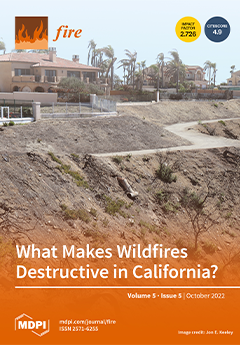
Cover Story (view full-size image): As human impacts mount, there is a pressing need to understand structure loss in wildfires. Compared to research on destroyed structures, fewer studies focus on the nature of destructive wildfires. We analyzed factors differentiating fires that resulted in at least one building loss (“destructive fires”) from those that did not (“non-destructive wildfires”) in California. Destructive fires were larger and more severe than non-destructive ones, and the top-ranking factors associated with large destructive fires were proximity to the wildland-urban interface and wind velocity on the day of ignition. These and other factors varied in importance across geographical regions, reflecting the complexity inherent in decision making to reduce fire risk. Homeowner mitigation, land use planning to reduce wildfire exposure, and ignition prevention emerge as approaches with potential everywhere. View this paper
  • Issues are regarded as officially published after their release is announced to the table of contents alert mailing list.
  • You may sign up for e-mail alerts to receive table of contents of newly released issues.
  • PDF is the official format for papers published in both, html and pdf forms. To view the papers in pdf format, click on the "PDF Full-text" link, and use the free Adobe Reader to open them.
Order results
Result details
Section
Select all
Export citation of selected articles as:
14 pages, 2109 KiB  
Article
Assessment and Mitigation of the Fire Vulnerability and Risk in the Historic City Centre of Aveiro, Portugal
by Dener Silva, Hugo Rodrigues and Tiago Miguel Ferreira
Fire 2022, 5(5), 173; https://doi.org/10.3390/fire5050173 - 21 Oct 2022
Cited by 6 | Viewed by 2618
Abstract
Identifying fire risk in urban centres is instrumental for supporting informed decision-making and outlining efficient vulnerability mitigation strategies. Historic centres are particularly complex in this regard due to the high density of combustible materials in these areas, the favourable fire propagation conditions between [...] Read more.
Identifying fire risk in urban centres is instrumental for supporting informed decision-making and outlining efficient vulnerability mitigation strategies. Historic centres are particularly complex in this regard due to the high density of combustible materials in these areas, the favourable fire propagation conditions between buildings, and the complex urban morphology, which makes the evacuation of inhabitants difficult in case of a fire emergency. Recent safety regulations tend not to be fully applicable to historic city centres, where the specificities of the buildings, together with the need to safeguard their heritage value, make the rules for new buildings incompatible. For that reason, an adaptation of current evaluation methods is required to assure the safety of these places. The present paper aims to contribute to this topic by presenting and discussing the results obtained from the application of a simplified fire risk assessment methodology to a representative part of the historic city centre of Aveiro, Portugal. Data were collected through fieldwork building inspections and the results were mapped using a Geographic Information System tool. The study reveals that around 63% of the assessed buildings have a level of fire risk greater than the level of risk which is acceptable for buildings with this type of use and value. Based on the work developed, different mitigation strategies are suggested and compared. Finally, the results obtained in this work are compared with results published for historic urban areas with similar characteristics. Full article
Show Figures

Figure 1

18 pages, 36662 KiB  
Article
A Thermal Imaging Flame-Detection Model for Firefighting Robot Based on YOLOv4-F Model
by Sen Li, Yeheng Wang, Chunyong Feng, Dan Zhang, Huaizhou Li, Wei Huang and Long Shi
Fire 2022, 5(5), 172; https://doi.org/10.3390/fire5050172 - 21 Oct 2022
Cited by 7 | Viewed by 5162
Abstract
Fire robots are an effective way to save lives from fire, but their limited detection accuracy has greatly hampered their practical applications in complicated fire conditions. This study therefore proposes an advanced thermal imaging flame detection model of YOLOv4-F based on YOLOv4-tiny. We [...] Read more.
Fire robots are an effective way to save lives from fire, but their limited detection accuracy has greatly hampered their practical applications in complicated fire conditions. This study therefore proposes an advanced thermal imaging flame detection model of YOLOv4-F based on YOLOv4-tiny. We replaced the Leaky ReLU activation function with the Mish activation function in the YOLOV4-tiny feature extraction network. A Spatial Pyramid Pooling (SPP) was also added to increase the receiving range of the feature extraction network. To improve the feature fusion efficiency between multi-scale feature layers, a Path Aggregation Network (PANet) was adopted to replace the YOLOv4-tiny Feature Pyramid Network (FPN) with full use of feature information; a high-quality dataset containing 14,757 thermal imaging flame images was built according to the PASCAL VOC 2007 dataset standard. The results show that, when compared to the YOLOv4-tiny, YOLOv5-s, and YOLOv7-tiny models, the average detection accuracy of the proposed YOLOv4-F model is 5.75% higher, the average mAP of the five IOU cases rises by 7.02%, and the average detection confidence of three scaled flames shows a 18.09% gain. The proposed YOLOV4-F meets the requirements of fire robots on real-time responses and accurate flame detection, offering an important tool to improve the performance of the current fire robots. Full article
Show Figures

Figure 1

15 pages, 2215 KiB  
Article
Topographic Factors Drive Short-Term Understory Revegetation in Burned Areas
by Zhixue He, Lei Wang, Jun Luo, Bin Zhang, Qingchun Deng and Hui Liu
Fire 2022, 5(5), 171; https://doi.org/10.3390/fire5050171 - 20 Oct 2022
Cited by 1 | Viewed by 1354
Abstract
Fire is a disturbance factor in forest ecosystems which has an important influence on vegetation succession. In order to reveal the natural recovery characteristics of the understory vegetation and its response to topographic factors (elevation, slope position, aspect and slope) after fire in [...] Read more.
Fire is a disturbance factor in forest ecosystems which has an important influence on vegetation succession. In order to reveal the natural recovery characteristics of the understory vegetation and its response to topographic factors (elevation, slope position, aspect and slope) after fire in subtropical forests, a typical subtropical forest (Xide County, China) was selected as the study area. Based on quadrat surveys and correlation analyses, the main results of this study were as follows. (1) Within four months after a fire, a total of 71 species, 52 genera and 20 families of understory vegetation species were increased, representing a rapid recovery after a fire. The total number of genera and species of understory vegetation increased by 157% and 209%, respectively. (2) Different burning intensities had different effects on the recovery of vegetation species diversity. The change in Margalef richness index was the most significant, increasing by 5.44 and 5.16 in lightly and severely burned areas, respectively. (3) The vegetation community could be divided into six types after restoration. (4) Elevation and slope were significantly correlated with the diversity and distribution characteristics of understory vegetation in the burned area. This study is useful to understand the characteristics of the short-term natural recovery of understory vegetation in subtropical forests after fire, to identify the relationship between vegetation and topographic factors in burned areas, and to provide a scientific basis for vegetation recovery. Full article
(This article belongs to the Special Issue Effects of Wildfire on Biodiversity)
Show Figures

Figure 1

16 pages, 3041 KiB  
Article
Effects of Carbon Chain Length on N-Alkane Counterflow Cool Flames: A Kinetic Analysis
by Dan Tian, Lei Xu and Dong Liu
Fire 2022, 5(5), 170; https://doi.org/10.3390/fire5050170 - 18 Oct 2022
Cited by 1 | Viewed by 1810
Abstract
An in-depth understanding of the low-temperature reactivity of hydrocarbon fuels is of practical relevance to developing advanced low-temperature combustion techniques. The present study aims to study the low-temperature chemistry of several large n-alkanes with different carbon chain lengths in counterflow cool diffusion [...] Read more.
An in-depth understanding of the low-temperature reactivity of hydrocarbon fuels is of practical relevance to developing advanced low-temperature combustion techniques. The present study aims to study the low-temperature chemistry of several large n-alkanes with different carbon chain lengths in counterflow cool diffusion flames by kinetic analysis. The large n-alkanes that were chosen are n-heptane (NC7H16), n-decane (NC10H22) and n-dodecane (NC12H26), which are important components of practical fuels. Firstly, the thermochemical structure of a typical cool diffusion flame is understood through its comparison with that of a hot diffusion flame. The boundary conditions, including the ozone concentration, fuel concentration and flow velocity—where cool flames can be established—are identified with a detailed chemical mechanism that evaluates the low-temperature reactivity of the investigated n-alkanes. The results show that the n-alkane with a longer carbon chain length is more reactive than the smaller one, thereby indicating the order of NC12H26 > NC10H22 > NC7H16. This trend is qualitatively similar to the findings from non-flame reactors. The reaction pathway and sensitivity analysis are performed to understand the effects of carbon chain length on the low-temperature reactivity. The contribution of an n-alkane with a longer carbon chain to the dehydrogenation reaction, oxidation reaction and isomerization reaction is greater than that of a smaller n-alkane, and abundant O and OH radicals are generated to promote the fuel low-temperature oxidation process, thereby resulting in an enhanced low-temperature reactivity. The effects of ozone addition on the low-temperature reactivity of n-alkanes are also highlighted. It is found that the addition of ozone could provide a large number of active O radicals, which dehydrogenate with the fuels to generate OH radicals and then promote fuel low-temperature oxidation. The present results are expected to enrich the understanding of the low-temperature characteristics of large n-alkanes. Full article
Show Figures

Figure 1

12 pages, 2107 KiB  
Article
Fire and Herbivory Interactively Suppress the Survival and Growth of Trees in an African Semiarid Savanna
by Mary W. Ngugi, Duncan M. Kimuyu, Ryan L. Sensenig, Wilfred O. Odadi, Samuel K. Kiboi, Joyce K. Omari and Truman P. Young
Fire 2022, 5(5), 169; https://doi.org/10.3390/fire5050169 - 18 Oct 2022
Cited by 2 | Viewed by 2024
Abstract
There has been a long-standing interest in understanding how interactions between fire and herbivory influence woody vegetation dynamics in savanna ecosystems. However, controlled, replicated experiments examining how different fire regimes interact with different herbivore groups are rare. We tested the effects of single [...] Read more.
There has been a long-standing interest in understanding how interactions between fire and herbivory influence woody vegetation dynamics in savanna ecosystems. However, controlled, replicated experiments examining how different fire regimes interact with different herbivore groups are rare. We tested the effects of single and repeated burns, crossed with six replicated herbivore treatments, on the mortality and growth of woody vegetation in the Kenya Long-term Exclosure Experiment plots located in a semi-arid savanna system in central Kenya. Burned plots experienced higher tree mortality overall, but differences between burns and non-burns were only significant in plots excluding all wild herbivores and in plots accessible to megaherbivores. Cattle ameliorated the negative effects of repeat burns on tree mortality, perhaps by suppressing fuel load accumulation. Across all herbivore treatments, trees experienced a significant reduction in height within the first two years after fire (top-kill), which was followed by a gradual recovery. Saplings and coppices subjected to repeated burns regrew faster than those that were burned once, except in the presence of megaherbivores. This study highlights strong context-dependent interactions between fire and different herbivore groups, and extends previous approaches to understanding fire–herbivory interactions, which have tended to lump the effects of different herbivore groups, or study them separately. Full article
(This article belongs to the Special Issue Fire in Savanna Landscapes)
Show Figures

Figure 1

11 pages, 2506 KiB  
Brief Report
Fire Severity Causes Temporal Changes in Ground-Dwelling Arthropod Assemblages of Patagonian Araucaria–Nothofagus Forests
by Alfredo H. Zúñiga, Jaime R. Rau, Andrés Fierro, Pablo M. Vergara, Francisco Encina-Montoya, Andrés Fuentes-Ramírez and Fabian M. Jaksic
Fire 2022, 5(5), 168; https://doi.org/10.3390/fire5050168 - 18 Oct 2022
Cited by 3 | Viewed by 1420
Abstract
Fire is one of the main drivers of anthropogenic disturbances in temperate forest ecosystems worldwide, with multiple effects spread across ecological networks. Nevertheless, the biodiversity effects of fire are poorly known for species-diverse groups such as arthropods. In this research, we used a [...] Read more.
Fire is one of the main drivers of anthropogenic disturbances in temperate forest ecosystems worldwide, with multiple effects spread across ecological networks. Nevertheless, the biodiversity effects of fire are poorly known for species-diverse groups such as arthropods. In this research, we used a burn gradient generated two and three years after a large fire event to assess how different levels of fire severity affect arthropod diversity in the forest with the main forest forming long-living tree species Araucaria araucana, in southern Chile. The species richness and abundance of arthropods among trophic guilds was estimated annually in four fire-severity levels. We found that arthropods responded differently to fire severity levels, depending on their trophic guilds and years after fire (two and three years after fire). During the second year after fire, zoophages, phytophages, and parasitoids were more diverse in areas with high fire severity within the second year after fire, as compared to those in areas with low severity or unburned stands. In the third year after fire, a change in this trend was observed, where the abundance of all groups dropped significantly, with positive changes in the diversity in zoophages, phytophages, polyphages and saprophages, which is more noticeable in sites with high severity. These results indicate that annual variation in environmental conditions triggers bottom-up cascading effects for arthropods. Forests stands severely impacted by fires support highly fluctuating and possibly unstable arthropod assemblages. Hence, restoration efforts should be focused on recovering microhabitat conditions in these stands to allow the persistence of arthropods. Full article
Show Figures

Figure 1

14 pages, 6259 KiB  
Article
Study of the Heat Exhaust Coefficient of Lateral Smoke Exhaust in Tunnel Fires: The Effect of Tunnel Width and Transverse Position of the Fire Source
by Qiulin Liu, Zhisheng Xu, Weikun Xu, Sylvain Marcial Sakepa Tagne, Haowen Tao, Jiaming Zhao and Houlin Ying
Fire 2022, 5(5), 167; https://doi.org/10.3390/fire5050167 - 15 Oct 2022
Cited by 4 | Viewed by 1757
Abstract
The tunnel width and the transverse fire’s position both impact the heat exhaust coefficient, which is a critical component of the lateral smoke exhaust in tunnel fires. In this research, the tunnel width and the transverse location of the fire source are varied [...] Read more.
The tunnel width and the transverse fire’s position both impact the heat exhaust coefficient, which is a critical component of the lateral smoke exhaust in tunnel fires. In this research, the tunnel width and the transverse location of the fire source are varied to analyze the heat exhaust coefficient of lateral smoke exhaust. When tunnel width increases, there is a noticeable decrease in the longitudinal temperature of the entrained air and smoke layer in the fire plume. Furthermore, the heat exhaust coefficients are reduced. An increase in the distance between the exhaust vent and the fire source causes an increase in the proportion of hot smoke in the smoke exhaust mass flow, which increases the heat exhaust coefficient. A calculated heat exhaust coefficient was developed using the fire source’s location and the tunnel’s width as inputs, which agrees well with the simulation results. This method can predict the heat exhaust coefficient of the lateral smoke exhaust in tunnel fires. The findings of this study provide insight into how the tunnel width and the location of a transverse fire influence the heat exhaust coefficient. Full article
(This article belongs to the Special Issue Fire-Induced Smoke Movement and Control)
Show Figures

Figure 1

24 pages, 5785 KiB  
Article
Wildfire Risk Levels at the Local Scale: Assessing the Relative Influence of Hazard, Exposure, and Social Vulnerability
by Rafaello Bergonse, Sandra Oliveira, Pedro Santos and José Luís Zêzere
Fire 2022, 5(5), 166; https://doi.org/10.3390/fire5050166 - 14 Oct 2022
Cited by 6 | Viewed by 2031
Abstract
Wildfire risk assessment provides important tools to fire management, by analysing and aggregating information regarding multiple, interactive dimensions. The three main risk dimensions hazard, exposure and vulnerability, the latter considered in its social dimension, were quantified separately at the local scale for 972 [...] Read more.
Wildfire risk assessment provides important tools to fire management, by analysing and aggregating information regarding multiple, interactive dimensions. The three main risk dimensions hazard, exposure and vulnerability, the latter considered in its social dimension, were quantified separately at the local scale for 972 civil parishes in central mainland Portugal and integrated into a wildfire risk index. The importance of each component in the level of risk varied, as assessed by a cluster analysis that established five different groups of parishes, each with a specific profile regarding the relative importance of each dimension. The highest values of wildfire risk are concentrated in the centre-south sector of the study area, with high-risk parishes also dispersed in the northeast. Wildfire risk level is dominated by the hazard component in 52% of the parishes, although with contrasting levels of magnitude. Exposure and social vulnerability dominate together in 32% of the parishes, with the latter being the main risk driver in only 17%. The proposed methodology allows for an integrated, multilevel assessment of wildfire risk, facilitating the effective allocation of resources and the adjustment of risk reduction policies to the specific reality in each parish that results from distinct combinations of the wildfire risk dimensions. Full article
(This article belongs to the Section Fire Social Science)
Show Figures

Figure 1

18 pages, 79750 KiB  
Article
On the Large Eddy Simulation Modelling of Water Suppression Systems Droplet Impact and Coverage Area
by Ivan Miguel De Cachinho Cordeiro, Hengrui Liu, Anthony Chun Yin Yuen, Timothy Bo Yuan Chen, Ao Li, Cheng Wang, Ruifeng Cao and Guan Heng Yeoh
Fire 2022, 5(5), 165; https://doi.org/10.3390/fire5050165 - 13 Oct 2022
Cited by 4 | Viewed by 1774
Abstract
In this article, a collective database from validated numerical simulation has been established to study the suppression effects of water-based suppression systems under a single-compartment fire scenario at various suppression configurations and fire locations. Five fuel locations along the axis between the centre [...] Read more.
In this article, a collective database from validated numerical simulation has been established to study the suppression effects of water-based suppression systems under a single-compartment fire scenario at various suppression configurations and fire locations. Five fuel locations along the axis between the centre and corner of the room were configurated to dynamically analyse how the horizontal distance between the nozzle and fuel pan affects the heat release rate (HRR), temperature cooling phenomena at different heights and also the velocity profile. Throughout the fuel pan relocations, the water-mist system has achieved an average suppression time of 25 s for all the locations, it was found that the water mist system can effectively control the fire under 200 °C that is distanced over 2 m spanwise displacement from the nozzle against the fire, while the sprinkler has exhibited an excellent fuel surface cooling effect due to large momentum and heat capacity within the coverage area with an average suppression time of 50 s. The results of this study have further explored the spray coverage and droplet penetrability of different suppression systems at different locations corresponding to the fire source, and the quantitative assessment of fuel locations could also contribute to the future development of performance-based fire safety designs. Full article
(This article belongs to the Special Issue Compartment Fire and Safety)
Show Figures

Figure 1

25 pages, 3403 KiB  
Article
Research on the Influence of Narrow and Long Obstacles with Regular Configuration on Crowd Evacuation Efficiency Based on Tri-14 Model with an Example of Supermarket
by Ligang Lu, Jingwei Ji, Cheng Zhai, Shengcheng Wang, Zhen Zhang and Tiantian Yang
Fire 2022, 5(5), 164; https://doi.org/10.3390/fire5050164 - 11 Oct 2022
Cited by 2 | Viewed by 1449
Abstract
Regular shelves configuration forms unique characteristics of internal obstacles in a supermarket. It is crucial to study the crowd evacuation affected by obstacles during accidents or disasters in supermarkets as assembly occupancies. Based on the Tri-14 model, this paper studied the influence of [...] Read more.
Regular shelves configuration forms unique characteristics of internal obstacles in a supermarket. It is crucial to study the crowd evacuation affected by obstacles during accidents or disasters in supermarkets as assembly occupancies. Based on the Tri-14 model, this paper studied the influence of safety exit designs and shelves’ configuration on the crowd evacuation efficiency with different densities in a supermarket through parameters and images. The results mainly indicate that: (1) The evacuation distance of farthest grid (Dfg) is the key factor to determine the total evacuation time of a low-density crowd. (2) For a high-density crowd, the closer the proportion ratio of the number of evacuees choosing each exit is to that of designed strand numbers of crowd flow at each exit, the higher the evacuation efficiency and average utilization efficiency of exits get; the scattered arrangement of exits will not necessarily lead to improving evacuation efficiency. Shelves’ configuration could lead to the extension of Dfg, but the change may reduce evacuation time instead, especially when forming effective advanced-gathering zones. (3) Under appropriate conditions, the impact of shelves’ configuration on evacuation efficiency can be negligible. This study has certain guiding significance for obstacle configuration and architectural design in large public gathering places. Full article
(This article belongs to the Special Issue Building Fire Dynamics and Fire Evacuation)
Show Figures

Figure 1

23 pages, 3020 KiB  
Article
Deep Learning Based Burnt Area Mapping Using Sentinel 1 for the Santa Cruz Mountains Lightning Complex (CZU) and Creek Fires 2020
by Harrison Luft, Calogero Schillaci, Guido Ceccherini, Diana Vieira and Aldo Lipani
Fire 2022, 5(5), 163; https://doi.org/10.3390/fire5050163 - 10 Oct 2022
Cited by 1 | Viewed by 2015
Abstract
The study presented here builds on previous synthetic aperture radar (SAR) burnt area estimation models and presents the first U-Net (a convolutional network architecture for fast and precise segmentation of images) combined with ResNet50 (Residual Networks used as a backbone for many computer [...] Read more.
The study presented here builds on previous synthetic aperture radar (SAR) burnt area estimation models and presents the first U-Net (a convolutional network architecture for fast and precise segmentation of images) combined with ResNet50 (Residual Networks used as a backbone for many computer vision tasks) encoder architecture used with SAR, Digital Elevation Model, and land cover data for burnt area mapping in near-real time. The Santa Cruz Mountains Lightning Complex (CZU) was one of the most destructive fires in state history. The results showed a maximum burnt area segmentation F1-Score of 0.671 in the CZU, which outperforms current models estimating burnt area with SAR data for the specific event studied models in the literature, with an F1-Score of 0.667. The framework presented here has the potential to be applied on a near real-time basis, which could allow land monitoring as the frequency of data capture improves. Full article
(This article belongs to the Special Issue Advances in Forest Fire Behaviour Modelling Using Remote Sensing)
Show Figures

Figure 1

20 pages, 5657 KiB  
Article
Study on Membrane Damage and Collapse of Air-Supported Structures under Fire Conditions
by Fei Yan, Guojun Sun and Suduo Xue
Fire 2022, 5(5), 162; https://doi.org/10.3390/fire5050162 - 8 Oct 2022
Cited by 3 | Viewed by 1657
Abstract
Air-supported structures are widely used as public buildings. Air-supported structures are soft and most traditional fire-fighting installations cannot be used in them. Existing design specifications only specify the fire resistance of the materials to be used for air-supported structures and there is no [...] Read more.
Air-supported structures are widely used as public buildings. Air-supported structures are soft and most traditional fire-fighting installations cannot be used in them. Existing design specifications only specify the fire resistance of the materials to be used for air-supported structures and there is no fire resistance design method for air-supported structures. The destruction process of air-supported structures can be divided into three stages: pre-fracture, leakage, and collapse. Theorical and numerical models were used to research the time span of all those stages. A framework to estimate the collapse and evacuation time was proposed in this paper. Air-supported structures with different spans were researched in this paper, and we found that the height of a structure has a significant influence on its fire resistance. The evacuation time increased by more than 52 times when the structure’s span increased from 20 m to 80 m. The pre-fracture stage contributed to more than 90% of the evacuation time when the span of structure was larger than 80 m. Full article
Show Figures

Figure 1

13 pages, 3614 KiB  
Article
Study on Pyrolysis Characteristics of Chinese Fir under Different Natural Aging Times
by Huailin Yan, Guoqing Zhu and Yongchang Zhao
Fire 2022, 5(5), 161; https://doi.org/10.3390/fire5050161 - 6 Oct 2022
Cited by 1 | Viewed by 1325
Abstract
The thermal degradation behavior of naturally aging Chinese fir was investigated using a STA 449 thermal analyzer. The Chinese fir with different natural aging times showed different pyrolysis behaviors. The longer the natural aging time, the lower the initial pyrolysis temperature of Chinese [...] Read more.
The thermal degradation behavior of naturally aging Chinese fir was investigated using a STA 449 thermal analyzer. The Chinese fir with different natural aging times showed different pyrolysis behaviors. The longer the natural aging time, the lower the initial pyrolysis temperature of Chinese fir. The results of activation energy estimated by Kissinger–Akahira–Sunose (KAS) method and Flynn–Wall–Ozawa (FWO) method are almost the same. However, with the increase in natural aging time, the activation energy of fir is increasing. The suitable pyrolysis reaction model of nature aging—10 Chinese fir was attributed to the ‘‘diffusion-Jander’’ (D3) model. Furthermore, a nth order reaction model serves for nature aging—70 and nature aging—100 Chinese fir reaction mechanism. Full article
(This article belongs to the Special Issue Unusual Fire in Open and Confined Space)
Show Figures

Figure 1

11 pages, 2870 KiB  
Technical Note
Double-Differenced dNBR: Combining MODIS and Landsat Imagery to Map Fine-Grained Fire MOSAICS in Lowland Eucalyptus Savanna in Kakadu National Park, Northern Australia
by Grant J. Williamson, Todd M. Ellis and David M. J. S. Bowman
Fire 2022, 5(5), 160; https://doi.org/10.3390/fire5050160 - 3 Oct 2022
Cited by 7 | Viewed by 2115
Abstract
A neglected dimension of the fire regime concept is fire patchiness. Habitat mosaics that emerge from the grain of burned and unburned patches (pyrodiversity) are critical for the persistence of a diverse range of plant and animal species. This issue is of particular [...] Read more.
A neglected dimension of the fire regime concept is fire patchiness. Habitat mosaics that emerge from the grain of burned and unburned patches (pyrodiversity) are critical for the persistence of a diverse range of plant and animal species. This issue is of particular importance in frequently burned tropical Eucalyptus savannas, where coarse fire mosaics have been hypothesized to have caused the recent drastic population declines of small mammals. Satellites routinely used for fire mapping in these systems are unable to accurately map fine-grained fire mosaics, frustrating our ability to determine whether declines in biodiversity are associated with local pyrodiversity. To advance this problem, we have developed a novel method (we call ‘double-differenced dNBR’) that combines the infrequent (c. 16 days) detailed spatial resolution Landsat with daily coarse scale coverage of MODIS and VIIRS to map pyrodiversity in the savannas of Kakadu National Park. We used seasonal Landsat mosaics and differenced normalized burn ratio (dNBR) to define burned areas, with a modification to dNBR that subtracts long-term average dNBR to increase contrast. Our results show this approach is effective in mapping fine-scale fire mosaics in the homogenous lowland savannas, although inappropriate for nearby heterogenous landscapes. Comparison of this methods to other fire metrics (e.g., area burned, seasonality) based on Landsat and MODIS imagery suggest this method is likely accurate and better at quantifying fine-scale patchiness of fire, albeit it demands detailed field validation. Full article
(This article belongs to the Special Issue Fire in Savanna Landscapes)
Show Figures

Figure 1

16 pages, 8208 KiB  
Article
Small-Scale Analysis of Characteristics of the Wildland–Urban Interface Area of Thessaloniki, Northern Greece
by Petros Ganatsas, Nikolaos Oikonomakis and Marianthi Tsakaldimi
Fire 2022, 5(5), 159; https://doi.org/10.3390/fire5050159 - 1 Oct 2022
Cited by 5 | Viewed by 2394
Abstract
In the past few years, the continuous expansion of urban development has created mixed forested, agricultural, and urban areas. These areas are called the wildland–urban interface (WUI), and they are characterized by increased human activities and land-use conversion, and they usually contribute to [...] Read more.
In the past few years, the continuous expansion of urban development has created mixed forested, agricultural, and urban areas. These areas are called the wildland–urban interface (WUI), and they are characterized by increased human activities and land-use conversion, and they usually contribute to a high risk of wildfire occurrence. In the case of the peri-urban areas of Thessaloniki city, an effort was made to map, classify, and describe this wildland–urban interface, using Sentinel-2 satellite images of the area and very large scale orthophotos (VLSO) for the human settlements. Object-based image analysis (OBIA) was applied to classify landcover, combined with analysis of field data. The results showed that the WUI area in the city of Thessaloniki appears to the north and east of the city and covers an area of 2203.98 ha. The main characteristics affected by the ecological conditions of this area are the building (or human infrastructure) density, type, and the structure of forest vegetation. Human population pressure was found to be greatly differentiated between WUI areas belonging to different municipalities, the most affected was the municipality of Thessaloniki. A set of fire prevention silvicultural treatments are suggested for mitigating the fire danger in the area, accompanied by appropriate human awareness actions and the involvement of the local society. These measures include the reduction in crown bulk density and increase in crown base height through pruning (at least to 1/3 of total tree height), and low thinning, aiming to ensure that tree crowns of mature Pinus brutia trees are not in contact with one another. Both in the young P. brutia forest and the evergreen vegetation areas, thinning, pruning, and vegetation clearing is recommended adjusted according to each ecosystem. Full article
(This article belongs to the Special Issue Advances in Incorporating Fire in Social-Ecological Models)
Show Figures

Figure 1

15 pages, 1582 KiB  
Article
Mid-Term Changes in Soil Properties after Wildfire, Straw Mulching and Salvage Logging in Pinus halepensis Mill. Forests
by Mehdi Navidi, Manuel Esteban Lucas-Borja, Pedro Antonio Plaza-Álvarez, Bruno Gianmarco Carra, Misagh Parhizkar and Demetrio Antonio Zema
Fire 2022, 5(5), 158; https://doi.org/10.3390/fire5050158 - 1 Oct 2022
Cited by 5 | Viewed by 2000
Abstract
The hydrological effects of straw mulching and salvage logging have been widely experimented in the Mediterranean forests affected by wildfires. In contrast, knowledge about the impacts of these post-fire management techniques on the physico-chemical properties of burned soils is poor, especially many years [...] Read more.
The hydrological effects of straw mulching and salvage logging have been widely experimented in the Mediterranean forests affected by wildfires. In contrast, knowledge about the impacts of these post-fire management techniques on the physico-chemical properties of burned soils is poor, especially many years after the fire. In particular, no studies have evaluated the soil changes after the combinations of soil mulching and salvage logging after wildfires in Mediterranean forests. To fill this gap, this study explores the effects of straw mulching and salvage logging, applied individually or in combination to a burnt forest of Pinus halepensis Mill. of central-eastern Spain, on the physico-chemical properties of soil six years after a wildfire. Both the post-fire techniques significantly altered the organic matter, phosphorous, and carbonate contents of the burned soils as well as their C/N (carbon/nitrogen) ratio, while the texture and other chemical properties (pH, electrical conductivity, total nitrogen, potassium, cations/anions, and active limestone) of the soils were not significantly affected by these post-fire treatments. Organic matter (OM) and phosphorous (P) contents increased by 57% and 69%, respectively, in mulched soils in comparison to the burned but untreated plots. In logged soils, the OM increased by 27%, while P decreased by 17%. Salvage logging after straw mulching increased OM, albeit less than under the individual soil treatments (+13%), but noticeably reduced P (−39%). The C/N ratio practically underwent the same variation (+15–20%) after the combination of the two treatments. The principal component analysis and the agglomerative hierarchical cluster analysis applied to the soil properties measured in the plots under the individual and combined management show that the effects of salvage logging on soil properties appear to be more impactful compared to straw mulching. Full article
(This article belongs to the Special Issue Mediterranean Fires)
Show Figures

Figure 1

3 pages, 195 KiB  
Editorial
Introducing the “Fire Social Science” Section of the Journal Fire
by Christine Eriksen
Fire 2022, 5(5), 157; https://doi.org/10.3390/fire5050157 - 30 Sep 2022
Cited by 1 | Viewed by 1644
Abstract
Climate change is often espoused in public debates as being the main culprit of the increasing frequency, scale, and intensity of wildfires around the world [...] Full article
(This article belongs to the Section Fire Social Science)
14 pages, 2165 KiB  
Article
Numerical Study of the Effectiveness of a Firebreak in a Savanna Area and the Sizing Rules by an Optimised Fire Propagation Model
by Akahoua D. V. Brou
Fire 2022, 5(5), 156; https://doi.org/10.3390/fire5050156 - 30 Sep 2022
Cited by 2 | Viewed by 1779
Abstract
Firebreaks are one of the techniques used to fight bushfires in Côte d’Ivoire. Their objective is to prevent the progression of fire and to protect sensitive sites. In this paper, a parametric study on the effectiveness of a firebreak in a savanna area [...] Read more.
Firebreaks are one of the techniques used to fight bushfires in Côte d’Ivoire. Their objective is to prevent the progression of fire and to protect sensitive sites. In this paper, a parametric study on the effectiveness of a firebreak in a savanna area is conducted using a fire spread model. The ability of the model to conduct this study was tested by an empirical model based on fire experiments in the Australian savanna. An agreement was found between the results predicted by our model and those of the empirical model. The parametric study conducted on the effectiveness of firebreaks indicated that a firebreak thickness equal to twice the flame length was effective. For bushfire control in Côte d’Ivoire, a firebreak with a minimum thickness of 8 m could stop the fire despite the slope of the land and the wind speed. Full article
(This article belongs to the Special Issue Fire in Savanna Landscapes)
Show Figures

Figure 1

32 pages, 8084 KiB  
Article
Compartment Fire Behavior at the Stages of Detection, Containment and Suppression Using Water Mist
by Geniy Kuznetsov, Roman Volkov, Aleksandr Sviridenko and Alena Zhdanova
Fire 2022, 5(5), 155; https://doi.org/10.3390/fire5050155 - 30 Sep 2022
Cited by 1 | Viewed by 2013
Abstract
This paper presents experimental research findings regarding the characteristics of fire safety equipment activation before and after a water-based fire suppression system is triggered. A group of typical indoor combustible materials (wood, linoleum, cardboard, paper) were used to construct Class A model fires [...] Read more.
This paper presents experimental research findings regarding the characteristics of fire safety equipment activation before and after a water-based fire suppression system is triggered. A group of typical indoor combustible materials (wood, linoleum, cardboard, paper) were used to construct Class A model fires in the experiments. The three most frequent fire causes were reproduced: the careless handling of fire (open flame), the unsafe operation of heating equipment and electrical short circuits. To identify the fire behavior, an automated system including fire (heat, smoke, flame) detectors, contact and non-contact temperature measurement instruments, a gas analysis system and video recording equipment was employed. Following the experiments, the most efficient (in terms of detection speed and reliability) combinations of technical equipment that are necessary and sufficient to identify all the combustion stages of substances and materials were determined. The efficient consumption of a fire-extinguishing agent was found to be possible when fire development stages were controlled. Guidelines on creating automated fire prevention systems in buildings were provided. These have the potential to significantly speed up compartment fire suppression. Full article
(This article belongs to the Special Issue Compartment Fire and Safety)
Show Figures

Figure 1

12 pages, 5415 KiB  
Article
Effects of n-Butanol Addition on the Combustion Characteristics of n-Heptane Counterflow Diffusion Flame at Elevated Pressure
by Yaoyao Ying and Dong Liu
Fire 2022, 5(5), 154; https://doi.org/10.3390/fire5050154 - 30 Sep 2022
Cited by 2 | Viewed by 1629
Abstract
This study focused on the effects of n-butanol addition on the combustion characteristics of n-heptane counterflow diffusion flame under pressures of 1, 3, and 5 atm by a detailed kinetic simulation. The added n-butanol volume fraction ranged from 0 to [...] Read more.
This study focused on the effects of n-butanol addition on the combustion characteristics of n-heptane counterflow diffusion flame under pressures of 1, 3, and 5 atm by a detailed kinetic simulation. The added n-butanol volume fraction ranged from 0 to 50%. The mass averaged velocity of fuel streams was selected to ensure momentum flux balance and was approximately constant for the investigated flames. Flame structures and mole fraction profiles impacted by n-butanol addition for major species, free radicals, and intermediate species were analyzed by concentrating on the formations of soot precursors and oxygenated air pollutants. The results showed that with the addition of n-butanol, the flame temperature decreased and the formation of the main soot precursors such as C2H2 and C6H6 was inhibited. This can be attributed to the reduced rate of production of these species. The flame temperature increased significantly, and the profile moved towards the fuel side with the increasing pressure. Moreover, the production of C2H2 and C6H6 was observably promoted as the pressure increased. The concentrations of free radical H, O, and OH decreased significantly as the pressure increased but slightly decreased with the increasing n-butanol addition, which might have been caused by the chemical effect of n-butanol. Full article
(This article belongs to the Special Issue Premixed and Non-premixed Flame Propagation and Suppression)
Show Figures

Figure 1

19 pages, 1935 KiB  
Data Descriptor
A Protocol for Collecting Burned Area Time Series Cross-Check Data
by Harry R. Podschwit, Brian Potter and Narasimhan K. Larkin
Fire 2022, 5(5), 153; https://doi.org/10.3390/fire5050153 - 29 Sep 2022
Cited by 2 | Viewed by 1477
Abstract
Data on wildfire growth are useful for multiple research purposes but are frequently unavailable and often have data quality problems. For these reasons, we developed a protocol for collecting daily burned area time series from the InciWeb website, Incident Management Situation Reports (IMSRs), [...] Read more.
Data on wildfire growth are useful for multiple research purposes but are frequently unavailable and often have data quality problems. For these reasons, we developed a protocol for collecting daily burned area time series from the InciWeb website, Incident Management Situation Reports (IMSRs), and other sources. We apply this protocol to create the Warehouse of Multiple Burned Area Time Series (WoMBATS) data, which are a collection of burned area time series with cross-check data for 514 wildfires in the United States for the years 2018–2020. We compare WoMBATS-derived distributions of wildfire occurrence and size to those derived from MTBS data to identify potential biases. We also use WoMBATS data to cross tabulate the frequency of missing data in InciWeb and IMSRs and calculate differences in size estimates. We identify multiple instances where WoMBATS data fails to reproduce wildfire occurrence and size statistics derived from MTBS data. We show that WoMBATS data are typically much more complete than either of the two constituent data sources, and that the data collection protocol allows for the identification of otherwise undetectable errors. We find that although disagreements between InciWeb and IMSRs are common, the magnitude of these differences are usually small. We illustrate how WoMBATS data can be used in practice by validating two simple wildfire growth forecasting models. Full article
(This article belongs to the Section Fire Science Models, Remote Sensing, and Data)
Show Figures

Figure 1

18 pages, 3000 KiB  
Article
A New Fire Danger Index Developed by Random Forest Analysis of Remote Sensing Derived Fire Sizes
by Sami Ullah Shah, Marta Yebra, Albert I. J. M. Van Dijk and Geoffrey J. Cary
Fire 2022, 5(5), 152; https://doi.org/10.3390/fire5050152 - 29 Sep 2022
Cited by 2 | Viewed by 2675
Abstract
Studies using remote sensing data for fire danger prediction have primarily relied on fire ignitions data to develop fire danger indices (FDIs). However, these data may only represent conditions suitable for ignition but may not represent fire danger conditions causing escalating fire size. [...] Read more.
Studies using remote sensing data for fire danger prediction have primarily relied on fire ignitions data to develop fire danger indices (FDIs). However, these data may only represent conditions suitable for ignition but may not represent fire danger conditions causing escalating fire size. The fire-related response variable’s scalability is a key factor that forms a basis for an FDI to include a broader range of fire danger conditions. Remote sensing derived fire size is a scalable fire characteristic encapsulating all possible fire sizes that previously occurred in the landscape, including extreme fire events. Consequently, we propose a new FDI that uses remote sensing derived fire size as a response variable. We computed fire sizes from the Moderate Resolution Imaging Spectroradiometer (MODIS) satellite instrument burned area. We applied random forest (RF) and logistic regression (LR) to develop the FDI for Australia. RF models performed better than LR, and the higher predicted probabilities demonstrated higher chances for ignited fires to be escalated to larger fire sizes at a regional scale across Australia. However, the predicted probabilities cannot be related to the specific range of fire sizes due to data limitations. Further research with higher temporal and spatial resolution data of both the response and predictor variables can help establish a better relationship between a specific range of fire sizes and the predicted probabilities. Full article
(This article belongs to the Section Fire Science Models, Remote Sensing, and Data)
Show Figures

Figure 1

18 pages, 6816 KiB  
Article
Using Geographic Information to Analyze Wildland Firefighter Situational Awareness: Impacts of Spatial Resolution on Visibility Assessment
by Katherine A. Mistick, Philip E. Dennison, Michael J. Campbell and Matthew P. Thompson
Fire 2022, 5(5), 151; https://doi.org/10.3390/fire5050151 - 29 Sep 2022
Cited by 2 | Viewed by 2015
Abstract
Wildland firefighters must be able to maintain situational awareness to ensure their safety. Crew members, including lookouts and crew building handlines, rely on visibility to assess risk and communicate changing conditions. Geographic information systems and remote sensing offer potential solutions for characterizing visibility [...] Read more.
Wildland firefighters must be able to maintain situational awareness to ensure their safety. Crew members, including lookouts and crew building handlines, rely on visibility to assess risk and communicate changing conditions. Geographic information systems and remote sensing offer potential solutions for characterizing visibility using models incorporating terrain and vegetation height. Visibility can be assessed using viewshed algorithms, and while previous research has demonstrated the utility of these algorithms across multiple fields, their use in wildland firefighter safety has yet to be explored. The goals of this study were to develop an approach for assessing visibility at the handline level, quantify the effects of spatial resolution on a lidar-driven visibility analysis, and demonstrate a set of spatial metrics that can be used to inform handline safety. Comparisons were made between elevation models derived from airborne lidar at varying spatial resolutions and those derived from LANDFIRE, a US-wide 30 m product. Coarser resolution inputs overestimated visibility by as much as 223%, while the finest-scale resolution input was not practical due to extreme processing times. Canopy cover and slope had strong linear relationships with visibility, with R2 values of 0.806 and 0.718, respectively. Visibility analyses, when conducted at an appropriate spatial resolution, can provide useful information to inform situational awareness in a wildland fire context. Evaluating situational awareness at the handline level prior to engaging a fire may help firefighters evaluate potential safety risks and more effectively plan handlines. Full article
Show Figures

Figure 1

17 pages, 6311 KiB  
Article
Quantifying the Effectiveness of a Mesh in Mitigating Burning Capabilities of Firebrand Shower
by Ahmad Sharifian Barforoush and Matthew du Preez
Fire 2022, 5(5), 150; https://doi.org/10.3390/fire5050150 - 28 Sep 2022
Cited by 3 | Viewed by 1641
Abstract
The broad aim of this research is to quantify the effectiveness of fences made of metal mesh around buildings in mitigating risks associated with firebrand showers created in wildland fires. This paper aims to (1) quantify the effectiveness of a mesh complying with [...] Read more.
The broad aim of this research is to quantify the effectiveness of fences made of metal mesh around buildings in mitigating risks associated with firebrand showers created in wildland fires. This paper aims to (1) quantify the effectiveness of a mesh complying with Australian Standard 3959:2018 against firebrand showers and (2) identify behaviors of firebrands interacting with the mesh. The study was conducted using Red Gum and Cypress Pinewood firebrands inside a wind tunnel at 40 km/h with and without a mesh present for a total of 50 experiments. Two types of effectiveness were defined using the number of holes and their area burnt by the firebrand. The results show the mesh was highly effective against both large and small firebrands except for some long needle shape firebrands. The results are aligned with AS 3959:2018 and show an effectiveness ratio of the mesh in the range 93.2–98.8% for Red Gum and Cypress Pine firebrands at a wind speed of 40 km/h. It was documented that firebrands in interaction with the mesh show one or a combination of eight different mechanisms: passing, stopping, splitting, shattering, pausing, bouncing, slipping and wandering. Full article
Show Figures

Figure 1

18 pages, 9002 KiB  
Article
Numerical Investigations on the Influencing Factors of Rapid Fire Spread of Flammable Cladding in a High-Rise Building
by Md Kamrul Hassan, Md Delwar Hossain, Michael Gilvonio, Payam Rahnamayiezekavat, Grahame Douglas, Sameera Pathirana and Swapan Saha
Fire 2022, 5(5), 149; https://doi.org/10.3390/fire5050149 - 26 Sep 2022
Cited by 7 | Viewed by 2620
Abstract
This paper investigates aluminium composite panels (ACPs) to understand the fire behaviour of combustible cladding systems under different fire scenarios. A fire dynamics simulator (FDS) is used to develop the numerical model of full-scale fire tests of combustible cladding systems using the procedures [...] Read more.
This paper investigates aluminium composite panels (ACPs) to understand the fire behaviour of combustible cladding systems under different fire scenarios. A fire dynamics simulator (FDS) is used to develop the numerical model of full-scale fire tests of combustible cladding systems using the procedures of the British BS 8414.1 standards. The results obtained from the FDS models are verified with test data. Seven test scenarios are investigated with four distinct parameters, i.e., cavity barrier, air-cavity gap, panel mounting (with and without joining gaps between the panels), and material combustibility qualities. A critical air-cavity gap (50–100 mm) is established at which maximum fire spread is noticed. Furthermore, variations in the cavity barrier, panel mounting, and material combustibility significantly impact the rapid fire spread of ACP cladding systems and the internal failure criterion. The results from the present study can serve as a basis for future research on the full-scale fire-test development of combustible ACPs. Full article
Show Figures

Figure 1

20 pages, 939 KiB  
Article
Measuring Cross-Correlations, Contagion and Long-Range Behavior between Fires in Brazil and Some Time Series Related to Its Economic Growth
by Claudio Marcio Cassela Inacio, Jr., Vinicius V. Nogueira, António M. Lopes and Sergio Adriani David
Fire 2022, 5(5), 148; https://doi.org/10.3390/fire5050148 - 24 Sep 2022
Cited by 1 | Viewed by 1377
Abstract
Fires bring up the debate about their impact on Brazil’s economic growth. Some processing tools such as cointegration and, especially, the correlation have been applied for identifying possible transmission or contagion mechanisms between distinct time series. This paper adopts the detrended cross-correlation analysis [...] Read more.
Fires bring up the debate about their impact on Brazil’s economic growth. Some processing tools such as cointegration and, especially, the correlation have been applied for identifying possible transmission or contagion mechanisms between distinct time series. This paper adopts the detrended cross-correlation analysis (DCCA) and rolling window approach to investigate the dynamic coupling between fires and the evolution of some key variables related to Brazil’s economic growth (e.g., agricultural planted area, ethanol production, rainfall in the midwest region and gross domestic product) covering two periods, namely from January 2012 to August 2016 (before the Brazilian presidential impeachment occurred in 2016) and from September 2016 to April 2021, covering the post-impeachment scenario, with the new government policies in the environmental sector. The results show a positive cross-correlation between the level of fires versus planted area of all cereals, leguminous and oleaginous in Brazil (mostly Soybean and Corn) and versus ethanol production (a renewable energy generation). It is also possible to verify some impact level on the Brazilian gross domestic product. Furthermore, we observed quantitatively, by means of the adopted methods that fires in Brazil have the potential to damage economic growth and some activities addressed in this study can also harm the environment in both mid and long-term. Full article
(This article belongs to the Special Issue Vegetation Fires in South America)
Show Figures

Figure 1

20 pages, 3566 KiB  
Article
Evaluating Satellite Fire Detection Products and an Ensemble Approach for Estimating Burned Area in the United States
by Amy L. Marsha and Narasimhan K. Larkin
Fire 2022, 5(5), 147; https://doi.org/10.3390/fire5050147 - 22 Sep 2022
Cited by 4 | Viewed by 2211
Abstract
Fire location and burning area are essential parameters for estimating fire emissions. However, ground-based fire data (such as fire perimeters from incident reports) are often not available with the timeliness required for real-time forecasting. Fire detection products derived from satellite instruments such as [...] Read more.
Fire location and burning area are essential parameters for estimating fire emissions. However, ground-based fire data (such as fire perimeters from incident reports) are often not available with the timeliness required for real-time forecasting. Fire detection products derived from satellite instruments such as the GOES-16 Advanced Baseline Imager or MODIS, on the other hand, are available in near real-time. Using a ground fire dataset of 2699 fires during 2017–2019, we fit a series of linear models that use multiple satellite fire detection products (HMS aggregate fire product, GOES-16, MODIS, and VIIRS) to assess the ability of satellite data to detect and estimate total burned area. It was found that on average models fit with fire detections from GOES-16 products performed better than those developed from other satellites in the study (modelled R2 = 0.84 and predictive R2 = 0.88). However, no single satellite product was found to best estimate incident burned area, highlighting the need for an ensemble approach. With our proposed modelling ensemble, we demonstrate its ability to estimate burned area and suggest its further use in daily fire tracking and emissions-modeling frameworks. Full article
Show Figures

Figure 1

15 pages, 3691 KiB  
Article
Using Participatory Mapping to Foster Community-Based Disaster Risk Reduction in Forest Fire-Prone Areas: The Case of Monchique in Portugal
by Maria Partidário, Guilherme Saad, Margarida B. Monteiro, Joana Dias, Rute Martins, Isabel Loupa Ramos, Henrique Ribeiro, Miguel Teixeira, Maria de Belém Costa Freitas and Carla Antunes
Fire 2022, 5(5), 146; https://doi.org/10.3390/fire5050146 - 22 Sep 2022
Cited by 3 | Viewed by 4198
Abstract
Local knowledge and communities’ active role in disaster risk areas are recognized in the literature as key conditions to better understand risks, enhance adaptive capacities and foster local resilience. A participatory action research project in forest fire-prone areas in Monchique, Portugal, is aligned [...] Read more.
Local knowledge and communities’ active role in disaster risk areas are recognized in the literature as key conditions to better understand risks, enhance adaptive capacities and foster local resilience. A participatory action research project in forest fire-prone areas in Monchique, Portugal, is aligned with the literature and adopts participatory mapping as a method that can bring evidence to the importance of local knowledge and communities’ agency. In the BRIDGE Project, different types of knowledge are integrated, triggering local/collective agency and fostering a forest fire community-based disaster risk reduction (CBDRR) approach. An innovation laboratory (InnoLab) provides the space for dialogue and knowledge sharing for different actors that manage forest territories. In the InnoLab, participatory mapping is used as a method to engage landowners where risk factors and local vulnerabilities were identified. Their active engagement enabled a collective perception in the assessment of vulnerability and led to the identification of strategic measures for risk reduction. This paper shares the process and outcomes of this participatory mapping, highlighting the benefits of a community approach and the importance of local knowledge and practices as recognized in the literature. It also reveals how the active role of local stakeholders can help drive a CBDRR process. Full article
(This article belongs to the Topic Recent Breakthroughs in Forest Fire Research)
Show Figures

Figure 1

15 pages, 10683 KiB  
Article
Rigid Protection System of Infrastructures against Forest Fires
by Gilberto Vaz, Jorge Raposo, Luís Reis, Pedro Monteiro and Domingos Viegas
Fire 2022, 5(5), 145; https://doi.org/10.3390/fire5050145 - 22 Sep 2022
Cited by 2 | Viewed by 2130
Abstract
The destruction caused by forest fires generates social impacts, environmental impacts, and extremely important economic impacts caused by the destruction of a wide range of infrastructures and essential goods. Therefore, as it is impossible to remove all the infrastructures from the forest and [...] Read more.
The destruction caused by forest fires generates social impacts, environmental impacts, and extremely important economic impacts caused by the destruction of a wide range of infrastructures and essential goods. Therefore, as it is impossible to remove all the infrastructures from the forest and wildland–urban interface, the design of protection systems is essential. The main objective of this work is the development of a low-cost protection system, with rigid panels, requiring a simple installation, in order to protect outdoor infrastructures such as telecommunications stations, shelters, roadside enclosures, power cabinets, and other structures. A study was carried out on panels that could be used for protection in order to determine whether the protective material would be more appropriate. Taking into account the fire resistance behavior, thermal and structural properties and cost, the panels selected were the magnesium oxide fiberglass reinforced. The protection was constructed, installed on a telecommunication cabinet, and experimentally laboratory tested in a wind combustion tunnel. To collect the data InfraRed and video cameras, heat flux sensors, and thermocouples were used to determine the fire propagation, heat flux, and temperatures, respectively. The experimental data show that the low-cost protection is effective for protecting telecommunication cabinets and similar infrastructures against forest fires. Full article
(This article belongs to the Topic Recent Breakthroughs in Forest Fire Research)
Show Figures

Figure 1

19 pages, 5358 KiB  
Article
Estimating the Suppression Performance of an Electronically Controlled Residential Water Mist System from BS 8458:2015 Fire Test Data
by Charlie Hopkin, Michael Spearpoint, Yusuf Muhammad and William Makant
Fire 2022, 5(5), 144; https://doi.org/10.3390/fire5050144 - 21 Sep 2022
Cited by 4 | Viewed by 2807
Abstract
It is commonly assumed in fire modelling that suppression systems can control the heat release rate of a fire. However, many performance-based assumptions are derived from experimental data for sprinklers, and uncertainty remains for their application to water mist systems. In the UK, [...] Read more.
It is commonly assumed in fire modelling that suppression systems can control the heat release rate of a fire. However, many performance-based assumptions are derived from experimental data for sprinklers, and uncertainty remains for their application to water mist systems. In the UK, residential water mist systems are usually tested to the BS 8458:2015 standard, but the heat release rate in these tests is not quantified and focus is instead placed on thermocouple temperatures. This paper details a series of fire tests to the BS 8458:2015 standard for an electronically controlled water mist system. The paper also includes B-RISK zone modelling of these tests to estimate the suppression performance of the system, comparing model outputs to thermocouple test data. Three traditional suppression assumptions, historically derived from experimental data for sprinklers, have been adopted in the zone modelling to examine whether their application following system activation can be extended to the tested water mist system. The work indicates that applying these suppression assumptions remains reasonable in the context of the performance of the tested water mist system, noting the constraints of the test methods in representing a limited number of fire scenarios. Full article
Show Figures

Figure 1

Previous Issue
Next Issue
Back to TopTop