Coasts 2024, 4(2), 306-322; https://doi.org/10.3390/coasts4020016 - 05 Apr 2024
Abstract
►
Show Figures
Estuary sedimentary sequences have been the focus of several papers in the last decades; however, the majority these papers were centered in mesotidal and macrotidal estuaries of the middle latitudes. This present paper studies, from a sedimentological point of view, the infilling of
[...] Read more.
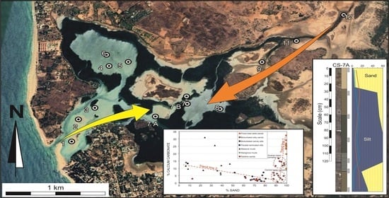
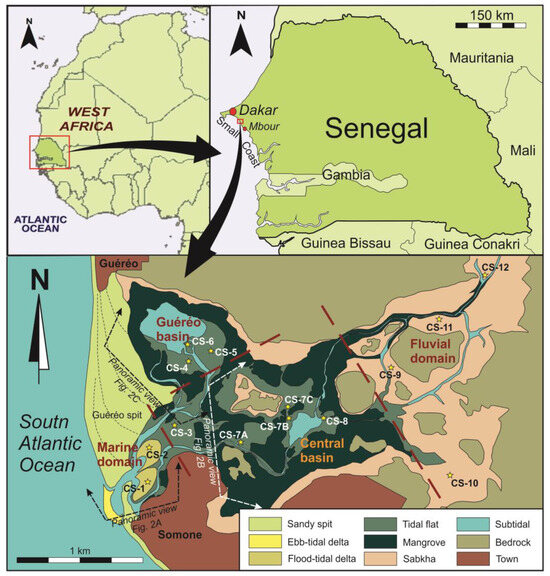
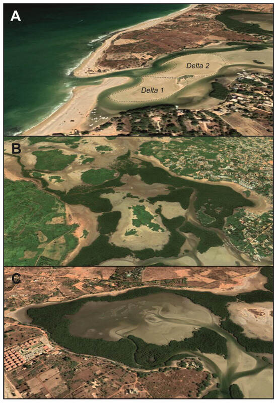
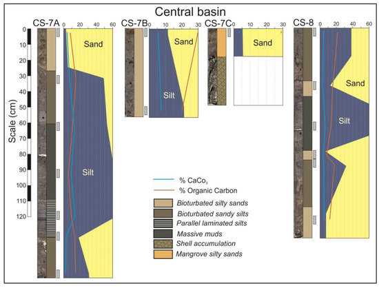
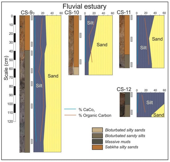
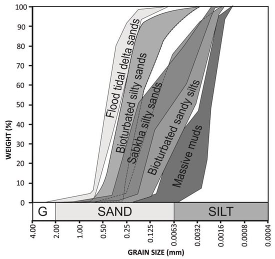
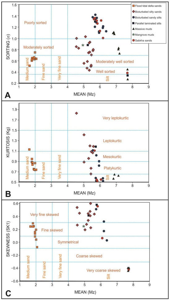
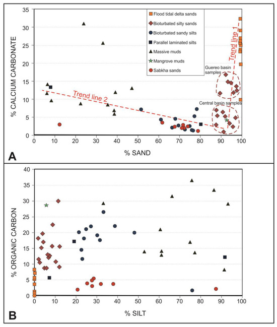
Estuary sedimentary sequences have been the focus of several papers in the last decades; however, the majority these papers were centered in mesotidal and macrotidal estuaries of the middle latitudes. This present paper studies, from a sedimentological point of view, the infilling of a microtidal, wave-dominated tropical estuary, where wide tidal flats, mangroves and sabkhas are developed. Somone Lagoon is a Senegalese protected environment, very rich from an ecological point of view and with a definitive touristic vocation. For this work, 14 piston cores were studied. Additionally, the grain size, calcium carbonate and organic matter contents of 61 sediment samples vertically distributed in these cores were analyzed. The distribution of facies and the vertical sequences of sediments show the influence of the tropical seasonal fluctuations of fluvial sediment supply and evaporation processes. A high degree of bioturbation and an elevated organic content can be interpreted as the result of a high capacity of retention of the organic material into the estuary influenced by the weak tidal currents typical of a microtidal regime. These processes, acting since the last Holocene invasion of sea level, caused an advanced state of infilling of this estuarine system where both flood tidal deltas and bay head deltas prograde above the fine facies of the central domain of the estuary.
Full article
Graphical abstract


