Next Issue
Volume 10, October
Previous Issue
Volume 10, August


Land, Volume 10, Issue 9 (September 2021) – 110 articles

Cover Story (view full-size image): 
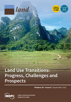
Land is the spatial carrier of major anthropogenic activities. Land use transition refers to any variation in land use systems from one state to another. The picture depicts a typical farmland landscape in China, which is the epitome of human–land interactions. Land use transitions are pervasive at a variety of spatial and temporal scales, not only in rapidly urbanizing economies, but also in highly developed nations. This implies land use transition research is of vital importance for global sustainability. Thus, this paper systematically analyzes the overall picture, historical trajectories, key fields, and hot topics of land use transition research in the past two decades from a comprehensive perspective, to provide scientific support for sustainable land use and environmental management. View this paper.
  • Issues are regarded as officially published after their release is announced to the table of contents alert mailing list.
  • You may sign up for e-mail alerts to receive table of contents of newly released issues.
  • PDF is the official format for papers published in both, html and pdf forms. To view the papers in pdf format, click on the "PDF Full-text" link, and use the free Adobe Reader to open them.
Order results
Result details
Section
Select all
Export citation of selected articles as:
30 pages, 4332 KiB  
Review
A Synthesis of Land Use/Land Cover Studies: Definitions, Classification Systems, Meta-Studies, Challenges and Knowledge Gaps on a Global Landscape
by Ryan Nedd, Katie Light, Marcia Owens, Neil James, Elijah Johnson and Aavudai Anandhi
Land 2021, 10(9), 994; https://doi.org/10.3390/land10090994 - 21 Sep 2021
Cited by 55 | Viewed by 13979
Abstract
Land is a natural resource that humans have utilized for life and various activities. Land use/land cover change (LULCC) has been of great concern to many countries over the years. Some of the main reasons behind LULCC are rapid population growth, migration, and [...] Read more.
Land is a natural resource that humans have utilized for life and various activities. Land use/land cover change (LULCC) has been of great concern to many countries over the years. Some of the main reasons behind LULCC are rapid population growth, migration, and the conversion of rural to urban areas. LULC has a considerable impact on the land-atmosphere/climate interactions. Over the past two decades, numerous studies conducted in LULC have investigated various areas of the field of LULC. However, the assemblage of information is missing for some aspects. Therefore, to provide coherent guidance, a literature review to scrutinize and evaluate many studies in particular topical areas is employed. This research study collected approximately four hundred research articles and investigated five (5) areas of interest, including (1) LULC definitions; (2) classification systems used to classify LULC globally; (3) direct and indirect changes of meta-studies associated with LULC; (4) challenges associated with LULC; and (5) LULC knowledge gaps. The synthesis revealed that LULC definitions carried vital terms, and classification systems for LULC are at the national, regional, and global scales. Most meta-studies for LULC were in the categories of direct and indirect land changes. Additionally, the analysis showed significant areas of LULC challenges were data consistency and quality. The knowledge gaps highlighted a fall in the categories of ecosystem services, forestry, and data/image modeling in LULC. Core findings exhibit common patterns, discrepancies, and relationships from the multiple studies. While literature review as a tool showed similarities among various research studies, our results recommend researchers endeavor to perform further synthesis in the field of LULC to promote our overall understanding, since research investigations will continue in LULC. Full article
(This article belongs to the Special Issue Land Use and Land Cover Mapping in a Changing World)
Show Figures

Figure 1

30 pages, 9288 KiB  
Article
Spatiotemporal Evolution and Driving Forces of Sustainable Development of Urban Human Settlements in China for SDGs
by Xueping Cong, Xueming Li and Yilu Gong
Land 2021, 10(9), 993; https://doi.org/10.3390/land10090993 - 21 Sep 2021
Cited by 13 | Viewed by 2767
Abstract
As the world’s largest developing country, China has actively implemented the UN Sustainable Development Goals (SDGs). Sustainable development of urban human settlements is the result of localization and the deepening of sustainable development theory in China. This study combines SDGs to construct an [...] Read more.
As the world’s largest developing country, China has actively implemented the UN Sustainable Development Goals (SDGs). Sustainable development of urban human settlements is the result of localization and the deepening of sustainable development theory in China. This study combines SDGs to construct an evaluation index system for the sustainable development of urban human settlements in China, using optimization methods, such as natural breaks (Jenks), exploratory spatial data analysis, and GeoDetector, to conduct systematic research on the spatiotemporal evolution of the current sustainable development level and analyze the core driving forces of urban human settlements in 285 prefecture-level cities in China from 2000 to 2019. Our study revealed that: (1) The overall sustainable development level of urban human settlements and their subsystems in China has improved steadily, but the levels of subsystems are quite different; (2) the sustainable development level of the urban human settlements in China can be expressed as a spatial pattern of “high in the east and low in the west, high in the south and low in the north” and has relatively significant spatial correlation characteristics; notably, the development level of each subsystem has different spatial characteristics; (3) the sustainable development level of urban human settlements is mainly based on medium sustainability, and the main development model is to progress from a medium-low development level to a medium-high development level; (4) the sustainable development level of urban human settlements is mainly driven by the per capita gross domestic product (GDP), housing price-to-income ratio, investment in education and scientific research, Internet penetration, and PM2.5. Full article
(This article belongs to the Topic Climate Change and Environmental Sustainability)
Show Figures

Figure 1

25 pages, 2973 KiB  
Article
Territories of Faith: 1000 Years of Landscape Multifunctionality in Santa Mariña de Augas Santas (NW Spain)
by Cruz Ferro-Vázquez, Rebeca Blanco-Rotea, Jorge Sanjurjo-Sánchez, Sonia García-Rodríguez and Marco V. García Quintela
Land 2021, 10(9), 992; https://doi.org/10.3390/land10090992 - 21 Sep 2021
Cited by 1 | Viewed by 2527
Abstract
Landscape multifunctionality is increasingly recognized as an important aspect in sustainability and developmental debates. Yet, how and why a multifunctional landscape configuration develops over time has not been sufficiently studied. Here we present the geoarchaeological investigation of the Santa Mariña de Augas Santas [...] Read more.
Landscape multifunctionality is increasingly recognized as an important aspect in sustainability and developmental debates. Yet, how and why a multifunctional landscape configuration develops over time has not been sufficiently studied. Here we present the geoarchaeological investigation of the Santa Mariña de Augas Santas site, in northwestern Spain. We focus on the role of religious practice, and of its interplay with productive strategies, in landscape transformation. A geochemical, mineralogical, and geochronological characterization of the pedo-sedimentary record (including XRF, EA-IRMS, XRD, OSL and 14C measurements) allowed to characterize catchment scale sedimentation processes in relation to agricultural activities. The geographical and chronological coincidence of production functions with documented religious activities demonstrate that both aspects shared geographical spaces during the last millennium. Current landscape multifunctionality at Santa Mariña is thus not the final outcome of a specific evolution, but an essential aspect of traditional land use strategies through history and a driver of change. This work highlights the need of a long-term study of the processes of landscape configuration when assessing the sustainability of traditional productive systems. Full article
(This article belongs to the Section Landscape Archaeology)
Show Figures

Figure 1

12 pages, 2736 KiB  
Article
Impact of the Kunming–Bangkok Highway on Land Use Changes along the Route between Laos and Thailand
by Fangyu Zheng, Jiuming Huang, Zhiming Feng and Chiwei Xiao
Land 2021, 10(9), 991; https://doi.org/10.3390/land10090991 - 19 Sep 2021
Cited by 11 | Viewed by 3077
Abstract
Road construction fragments the landscape, reduces connectivity, and drives land use changes. To our knowledge, little is known about the scope and intensity of the effects of cross-border roads on changes in land use. Here, with the land use data products provided by [...] Read more.
Road construction fragments the landscape, reduces connectivity, and drives land use changes. To our knowledge, little is known about the scope and intensity of the effects of cross-border roads on changes in land use. Here, with the land use data products provided by the US Agency for International Development’s SERVIR Mekong project, using the GIS-based spatial analysis to quantitatively analyze and compare the effects of the cross-border road on land use changes within a 30 km buffer area along the Kunming–Bangkok Highway between Laos and Thailand. The results show the following: The greater the distance was from the highway, the smaller were the overall changes in land use within the buffer zone. A comparison of the situation before and after the road was opened in 2013 revealed significant differences in the most influential land use types of agricultural expansion, i.e., from 47.07% to 52.07% (the buffer zone was 1 km). In particular, 57.32% (1381.93 ha) and 40.08% (966.46 ha) of the land occupied by forests had been converted into land for plantation and agriculture, respectively, from 2013 to 2018. The scope of the impact of the operational route on the dynamics of land use was inconsistent. The largest impact before the road became operational was within 4 km of the buffer zone (0.26 to 0.24). Once the road had been opened, the range of its impact was beyond 10 km (0.63 to 0.57). The work here can provide a scientific basis for regional transportation planning and the sustainable use of land resources. Full article
(This article belongs to the Section Land Systems and Global Change)
Show Figures

Figure 1

18 pages, 2298 KiB  
Article
A New Indicator to Better Represent the Impact of Landscape Pattern Change on Basin Soil Erosion and Sediment Yield in the Upper Reach of Ganjiang, China
by Yongfen Zhang, Nong Wang, Chongjun Tang, Shiqiang Zhang, Yuejun Song, Kaitao Liao and Xiaofei Nie
Land 2021, 10(9), 990; https://doi.org/10.3390/land10090990 - 19 Sep 2021
Cited by 4 | Viewed by 1717
Abstract
Landscape patterns are a result of the combined action of natural and social factors. Quantifying the relationships between landscape pattern changes, soil erosion, and sediment yield in river basins can provide regulators with a foundation for decision-making. Many studies have investigated how land-use [...] Read more.
Landscape patterns are a result of the combined action of natural and social factors. Quantifying the relationships between landscape pattern changes, soil erosion, and sediment yield in river basins can provide regulators with a foundation for decision-making. Many studies have investigated how land-use changes and the resulting landscape patterns affect soil erosion in river basins. However, studies examining the effects of terrain, rainfall, soil erodibility, and vegetation cover factors on soil erosion and sediment yield from a landscape pattern perspective remain limited. In this paper, the upper Ganjiang Basin was used as the study area, and the amount of soil erosion and the amount of sediment yield in this basin were first simulated using a hydrological model. The simulated values were then validated. On this basis, new landscape metrics were established through the addition of factors from the revised universal soil loss equation to the land-use pattern. Five combinations of landscape metrics were chosen, and the interactions between the landscape metrics in each combination and their effects on soil erosion and sediment yield in the river basin were examined. The results showed that there were highly similar correlations between the area metrics, between the fragmentation metrics, between the spatial structure metrics, and between the evenness metrics across all the combinations, while the correlations between the shape metrics in Combination 1 (only land use in each year) differed notably from those in the other combinations. The new landscape indicator established based on Combination 4, which integrated the land-use pattern and the terrain, soil erodibility, and rainfall erosivity factors, were the most significantly correlated with the soil erosion and sediment yield of the river basin. Finally, partial least-squares regression models for the soil erosion and sediment yield of the river basin were established based on the five landscape metrics with the highest variable importance in projection scores selected from Combination 4. The results of this study provide a simple approach for quantitatively assessing soil erosion in other river basins for which detailed observation data are lacking. Full article
(This article belongs to the Section Soil-Sediment-Water Systems)
Show Figures

Figure 1

24 pages, 10729 KiB  
Article
Factors Affecting Landslide Susceptibility Mapping: Assessing the Influence of Different Machine Learning Approaches, Sampling Strategies and Data Splitting
by Minu Treesa Abraham, Neelima Satyam, Revuri Lokesh, Biswajeet Pradhan and Abdullah Alamri
Land 2021, 10(9), 989; https://doi.org/10.3390/land10090989 - 19 Sep 2021
Cited by 31 | Viewed by 4437
Abstract
Data driven methods are widely used for the development of Landslide Susceptibility Mapping (LSM). The results of these methods are sensitive to different factors, such as the quality of input data, choice of algorithm, sampling strategies, and data splitting ratios. In this study, [...] Read more.
Data driven methods are widely used for the development of Landslide Susceptibility Mapping (LSM). The results of these methods are sensitive to different factors, such as the quality of input data, choice of algorithm, sampling strategies, and data splitting ratios. In this study, five different Machine Learning (ML) algorithms are used for LSM for the Wayanad district in Kerala, India, using two different sampling strategies and nine different train to test ratios in cross validation. The results show that Random Forest (RF), K Nearest Neighbors (KNN), and Support Vector Machine (SVM) algorithms provide better results than Naïve Bayes (NB) and Logistic Regression (LR) for the study area. NB and LR algorithms are less sensitive to the sampling strategy and data splitting, while the performance of the other three algorithms is considerably influenced by the sampling strategy. From the results, both the choice of algorithm and sampling strategy are critical in obtaining the best suited landslide susceptibility map for a region. The accuracies of KNN, RF, and SVM algorithms have increased by 10.51%, 10.02%, and 4.98% with the use of polygon landslide inventory data, while for NB and LR algorithms, the performance was slightly reduced with the use of polygon data. Thus, the sampling strategy and data splitting ratio are less consequential with NB and algorithms, while more data points provide better results for KNN, RF, and SVM algorithms. Full article
(This article belongs to the Special Issue Landslide Hazard and Environment Risk Assessment)
Show Figures

Graphical abstract

22 pages, 482 KiB  
Article
New Round of Collective Forest Rights Reform, Forestland Transfer and Household Production Efficiency
by Jinna Yu, Yiming Wei, Wei Fang, Zhen Liu, Yujie Zhang and Jing Lan
Land 2021, 10(9), 988; https://doi.org/10.3390/land10090988 - 18 Sep 2021
Cited by 10 | Viewed by 1651
Abstract
The purpose of this paper was to analyze the influence mechanism of the new round of Collective Forest Rights Reform (CFRR) on farmers’ production efficiency from the perspective of forestland transfer. Based on the panel data of field investigation in Jiangxi Province, a [...] Read more.
The purpose of this paper was to analyze the influence mechanism of the new round of Collective Forest Rights Reform (CFRR) on farmers’ production efficiency from the perspective of forestland transfer. Based on the panel data of field investigation in Jiangxi Province, a panel logit model was used to verify whether the new round of CFRR has affected farmers’ forestland circulation behavior. The results showed that the new round of CFRR has played a significant role in promoting forestland circulation. Secondly, the non-parametric DEA method was used to estimate the technical, scale, and comprehensive efficiency of households. DID and panel quantile models were constructed to analyze the impact of forestland inflow policy and forestland outflow policy effects on rural household productivity. The regression results showed that the effect of forestland inflow has had a significantly positive impact on scale and comprehensive efficiency, but it only had a significant effect on technical efficiency in the 0.1 quartile. The effect of forestland outflow was not found to be significant for technical, scale, and comprehensive efficiency, but it was found to be negative for technical efficiency in the 0.75 quartile and negative for scale efficiency in the 0.5 and 0.75 quantiles. Full article
Show Figures

Figure 1

28 pages, 4536 KiB  
Article
Singapore vs. the ‘Singapore of Africa’—Different Approaches to Managing Urban Agriculture
by Ada Górna and Krzysztof Górny
Land 2021, 10(9), 987; https://doi.org/10.3390/land10090987 - 18 Sep 2021
Cited by 6 | Viewed by 7583
Abstract
Through structured comparison, this article seeks to present the different approaches to urban agriculture in the cities of Singapore and Kigali. The former is seen as a model ‘smart city’ worth following worldwide, while the latter is frequently referred to as the ‘Singapore [...] Read more.
Through structured comparison, this article seeks to present the different approaches to urban agriculture in the cities of Singapore and Kigali. The former is seen as a model ‘smart city’ worth following worldwide, while the latter is frequently referred to as the ‘Singapore of Africa’. The research conducted was divided into two stages. The first one was desk-based and included the analysis of satellite and aerial images along with the analysis of legal documents regarding land ownership and urban agriculture management. The second one was based on field work carried out in 2019 in both cities and comprised the mapping of areas encompassed by urban agriculture, the collection of photographic documentation, field observations, as well as semi-structured interviews. The research was summarized in line with a comparative analysis of institutional and legal framework of urban agriculture and policy towards its development; spatial features of urban agriculture, including distribution, location, and area; as well as inherent features of urban agriculture, including systems of production, main crops, production methods, and functions. The process makes it clear that despite the fact that urban agriculture is considered in planning documents of both cities, the scale of the activity and the approach towards it differ markedly. In Singapore, the authorities support mainly the high-technology and land-efficient solutions, with other, low-profit forms of agricultural activity being pushed out from the urban space. In turn, in Kigali, where the scale of agricultural activity is incomparably greater, the inhabitants enjoy a certain freedom to make use of unused land in cultivation, which increases their food security and enhances their ability to cope with external stresses. Full article
Show Figures

Figure 1

24 pages, 50764 KiB  
Article
Exploring the Impact of Urban Built Environment on Public Emotions Based on Social Media Data: A Case Study of Wuhan
by Yuanyuan Ma, Yunzi Yang and Hongzan Jiao
Land 2021, 10(9), 986; https://doi.org/10.3390/land10090986 - 17 Sep 2021
Cited by 17 | Viewed by 4405
Abstract
In the era of public participation in government, public emotions and expectations are important considerations influencing urban construction, planning, and management. A desirable urban environment can make people feel at ease and comfortable and contribute to promoting positive public emotions. However, in the [...] Read more.
In the era of public participation in government, public emotions and expectations are important considerations influencing urban construction, planning, and management. A desirable urban environment can make people feel at ease and comfortable and contribute to promoting positive public emotions. However, in the process of rapid urban development, the high-density and overloaded urban built environment has triggered people’s mental tension and anxiety and has contributed to negative emotions. Thus, this study aimed to explore the spatial distribution of public emotions and urban built environments in cities and to thoroughly investigate the correlation between urban built environments and public emotions. Considering the lack of dynamic elements analysis and emotions spatial analysis in previous studies, this study takes Wuhan City as an example, uses social media big data as the basis for text emotion analysis, introduces dynamic traffic elements, and establishes a multidimensional urban built environment measurement index system from five aspects: land use, spatial form, road and traffic, green space and open space, and daily life service facilities. Subsequently, the spatial distribution characteristics of public sentiment and urban built environment elements in Wuhan were analyzed. Finally, a geographically weighted regression method was used to analyze the degree of influence of different urban built environment elements on public emotions. The results showed that public emotions in Wuhan are not homogeneously distributed in terms of score and space and that there are significant differences. The urban built environment has a significant influence on public emotions. Higher land use mix, higher road network density, higher number of public transportation facilities, higher number of public open spaces, lower traffic congestion, and impact of freight transportation play important roles in promoting positive emotions. Therefore, in the process of urban construction, planners and decision makers should purposefully improve the quality of the built environment. Measures can include improving the mix of land functions, alleviating traffic congestion, avoiding the negative effects of freight traffic, rationally constructing green and open spaces, and improving various living facilities. This can help contribute toward improving urban functions and urban environments, and promote the construction of a people-oriented healthy city. Full article
(This article belongs to the Special Issue Reflecting on the Future of the Built Environment)
Show Figures

Figure 1

18 pages, 1826 KiB  
Article
Sustainable Development and Rural Tourism in Depopulated Areas
by José María López-Sanz, Azucena Penelas-Leguía, Pablo Gutiérrez-Rodríguez and Pedro Cuesta-Valiño
Land 2021, 10(9), 985; https://doi.org/10.3390/land10090985 - 17 Sep 2021
Cited by 29 | Viewed by 4463
Abstract
The high degree of depopulation in certain areas of Spain is a serious threat to the country, and is aggravated by the ongoing loss of population from those areas. Rural tourism is one of the activities that can help prevent this depopulation. However, [...] Read more.
The high degree of depopulation in certain areas of Spain is a serious threat to the country, and is aggravated by the ongoing loss of population from those areas. Rural tourism is one of the activities that can help prevent this depopulation. However, to successfully promote such tourism, we must consider the elements that have the greatest influence on tourists when they choose one location over another, or one accommodation over another. Extensive data have been collected from 1658 valid surveys of tourists in one of the most depopulated areas of Spain. Several multivariate techniques were then applied to the data, including Principal Component Analysis (PCA) and Multiple Classification Analysis (MCA). Factors were obtained that identified both the different motivations that influence tourists, and the variables that identify the province based on its image. An analysis was then made of how both the variables thus identified the influence of the formation of the image that tourists take away from the visit. Tourists are most strongly motivated by natural landscapes, monuments, or events of cultural interest, i.e., natural and cultural attractions rather than social ones, and the cognitive image has the greatest influence on the formation of the new image. The principal findings of this research are that the future of many of these depopulated areas depends on successfully promoting both their beautiful landscapes and their cultural heritage, as well as developing and improving the areas themselves so that the depopulation is slowed down or even reversed, to the benefit of the local population. This would also benefit the local and regional authorities and the establishments linked to rural tourism in the area, increasing their profits and raising the level of employment in the province. Full article
Show Figures

Figure 1

23 pages, 36876 KiB  
Article
Exploring the Correlation between Block Vitality and Block Environment Based on Multisource Big Data: Taking Wuhan City as an Example
by Yunzi Yang, Yuanyuan Ma and Hongzan Jiao
Land 2021, 10(9), 984; https://doi.org/10.3390/land10090984 - 17 Sep 2021
Cited by 15 | Viewed by 2816
Abstract
Block is the basic unit for studying the urban activities of residents, and block vitality is the concrete expression of urban dynamics at the block level. The quality of the block’s residential environment is a crucial medium to satisfy the residents’ pursuit of [...] Read more.
Block is the basic unit for studying the urban activities of residents, and block vitality is the concrete expression of urban dynamics at the block level. The quality of the block’s residential environment is a crucial medium to satisfy the residents’ pursuit of high-quality life; good block quality is essential for fostering the block vitality and further enhancing the overall vitality of the city. This study used the distribution density of cellular signaling data to quantify block vitality and constructed a block environment index system covering four dimensions—block accessibility, block function, block development degree, and human perception of block environment—innovatively introducing the elements of block environment from the human perspective. Considering the variability of block vitality between workdays and weekends, and between downtown and suburban blocks, this study used a geographically weighted regression model to show the mechanism of the spatial and temporal influence of indicators on block vitality, as well as to suggest how to enhance block vitality at different times of the day based on the influence mechanism. This study was conducted in Wuhan, China. The findings suggest that block vitality exhibited significant spatial and temporal heterogeneity. A high-vitality block can be created by enhancing the block’s accessibility, increasing the degree of block construction, and enriching the functional density and mix of functions in the block. A pleasantly green environment with a moderate degree of openness exerted a significant impact on promoting human activity and enhancing block vitality. The creation of high-vitality blocks should also consider the differences in the impact of various elements on block vitality between weekend and workday. For example, amid the surge in travel demand for education venues on weekends, enhancing the accessibility of blocks can significantly increase the vitality of blocks on weekends. We can truly realize the people-oriented approach to build a livable and high-vitality city by adapting to local conditions and time. Full article
(This article belongs to the Section Urban Contexts and Urban-Rural Interactions)
Show Figures

Figure 1

21 pages, 1789 KiB  
Article
The Heightened ‘Security Zone’ Function of Gated Communities during the COVID-19 Pandemic and the Changing Housing Market Dynamic: Evidence from Beijing, China
by Ling Li, Wayne Xinwei Wan and Shenjing He
Land 2021, 10(9), 983; https://doi.org/10.3390/land10090983 - 17 Sep 2021
Cited by 16 | Viewed by 5283
Abstract
The ongoing COVID-19 pandemic has left a strong imprint on many aspects of urban life. Gated communities (GCs) in China are less commonly perceived as a negative and segregated urban form of community compared to other contexts, owing to their wide variety and [...] Read more.
The ongoing COVID-19 pandemic has left a strong imprint on many aspects of urban life. Gated communities (GCs) in China are less commonly perceived as a negative and segregated urban form of community compared to other contexts, owing to their wide variety and relative openness. Yet, the enhanced security zone function and the popularity of GCs, along with the heightened segregation and exclusion effects, mean they are most likely to emerge in post-pandemic urban China because of the perceived effectiveness of GCs in preventing health risks by excluding outsiders during the pandemic. Drawing on empirical data from Beijing, this research presents strong evidence for a strengthened perceived ‘security zone’ effect of GCs during the pandemic. Given that rigid pandemic control measures were organized at the community level, a large-scale household survey in Beijing suggests that residents commonly recognise the effectiveness of GCs in security control and show a strong preference for GCs over open communities after the pandemic, even though there is a lack of direct evidence of reduced COVID-19 risk in GCs. The heightened perceived ‘security zone’ function of GCs has shown a significant impact on the housing market, evidenced by an increase of 2% in the housing prices for GCs, compared with those of open communities. The rising popularity of GCs is also evidenced by a significant increase in property viewings by potential homebuyers and smaller price discounts in actual transactions in gated communities vis-à-vis open communities. We argue that the rising risk-averse sentiment in the post-pandemic era has given rise to the popularity of GCs. This study provides timely and fresh insights into the changing meaning of GCs in post-pandemic China. Full article
Show Figures

Figure 1

17 pages, 6460 KiB  
Article
Spatio-Temporal Variation and Driving Forces of Land-Use Change from 1980 to 2020 in Loess Plateau of Northern Shaanxi, China
by Xue Zhou and Yang Zhou
Land 2021, 10(9), 982; https://doi.org/10.3390/land10090982 - 17 Sep 2021
Cited by 14 | Viewed by 2801
Abstract
Land-use cover is undergoing intense change under global climate change and rapid urbanization, especially in the Loess Plateau, where ecological restoration policies like Green for Grain Project (GFGP) have been vigorously implemented since the 1980s. The main objective of this study was to [...] Read more.
Land-use cover is undergoing intense change under global climate change and rapid urbanization, especially in the Loess Plateau, where ecological restoration policies like Green for Grain Project (GFGP) have been vigorously implemented since the 1980s. The main objective of this study was to distinguish the difference of spatio-temporal variation of land-use change in the two study periods of 1980–2000 and 2000–2020 at the county scales. Geographically and temporally weighted regression (GTWR) was employed to handle both the spatial and temporal heterogeneity of the driving forces for land use change. The results showed that the quantity of construction land, woodland and grassland experienced continuous growth, but arable land declined substantially. The results of GTWR model showed that the dominant influencing factors of land-use change had temporal and spatial differences in the Loess Plateau. Specifically, the implementation of GFGP and precipitation accelerated the changes in arable land, grassland and woodland. For construction land, its growth was mainly promoted by gross domestic product (GDP) and population, both of which had more obvious positive effects in the last 20 years. The findings provide a scientific basis to put forward countermeasures emphasizing sustainable land use in the Loess Plateau. Full article
Show Figures

Figure 1

18 pages, 951 KiB  
Article
How Does Low-Density Urbanization Reduce the Financial Sustainability of Chinese Cities? A Debt Perspective
by Yan Yan, Hui Liu, Ningcheng Wang and Shenjun Yao
Land 2021, 10(9), 981; https://doi.org/10.3390/land10090981 - 17 Sep 2021
Cited by 6 | Viewed by 2631
Abstract
Low-density urbanization threatens urban social and ecological sustainability not only directly by excessively encroaching on suburban farmland and ecological space, but may also indirectly do so by undermining the financial basis of sustainable urban development. To address this relationship, this study empirically examines [...] Read more.
Low-density urbanization threatens urban social and ecological sustainability not only directly by excessively encroaching on suburban farmland and ecological space, but may also indirectly do so by undermining the financial basis of sustainable urban development. To address this relationship, this study empirically examines the effect of low-density urbanization on local government debt by using panel data of prefecture-level cities in China from 2006 to 2015. Results show that the scale of local government debt increases significantly with a rise in urban expansion. Furthermore, this study found that low-density urbanization affects local government debt in two ways. First, low-density urban expansion reduces the land output efficiency, which decreases potential fiscal revenue and thus increases local government debt. Second, low-density urban expansion raises the construction and maintenance expenditure of urban infrastructure, which increases the demand for urban construction financing and thus pushes up the scale of debt. The results of the heterogeneous study indicate that low-density urbanization significantly affects local government debt mainly in Central/Western regions, small and medium-sized cities, cities with high fiscal stress and development pressure, and residentially expanding cities. On the contrary, low-density urbanization has no significant effect on the Eastern regions, large cities, cities with low fiscal stress and development pressure, and spatially expanding cities. This study theoretically explored and empirically verified a critical indirect effect of low-density urbanization on urban sustainability by increasing fiscal risks, which is, and will continue to be, a common and vital challenge faced by cities in China and other rapidly urbanizing developing countries. Full article
(This article belongs to the Special Issue Cities' Spatial Structure and Drivers of its Transformation)
Show Figures

Figure 1

14 pages, 1124 KiB  
Article
Application of the Adaptive Cycle and Panarchy in La Marjaleria Social-Ecological System: Reflections for Operability
by Marc Escamilla Nacher, Carla Sofia Santos Ferreira, Michael Jones and Zahra Kalantari
Land 2021, 10(9), 980; https://doi.org/10.3390/land10090980 - 17 Sep 2021
Cited by 2 | Viewed by 3106
Abstract
The adaptive cycle and panarchy are recognised tools for resilience assessment prior to establishing new management approaches aligned with Anthropocene needs. This study used the adaptive cycle and panarchy to assess the dynamics of the social-ecological system (SES) of La Marjaleria, Spain, which [...] Read more.
The adaptive cycle and panarchy are recognised tools for resilience assessment prior to establishing new management approaches aligned with Anthropocene needs. This study used the adaptive cycle and panarchy to assess the dynamics of the social-ecological system (SES) of La Marjaleria, Spain, which experienced increasing human pressure and environmental degradation in recent decades, and developed the ‘adaptive curve’ as a novel graphical representation of system change in the presentation of the results. Based on a literature review of historical changes in La Marjaleria, a SES analysis was performed using the adaptive cycle and panarchy, following the Resilience Alliance’s Practitioners Guide. The assessment offered new insights into the social and ecological dynamics of La Marjaleria through identification of causes and consequences from a complex systems perspective. Previous land-use management in the area has generated tensions between different stakeholders and reduced environmental resilience. The systems thinking approach highlighted the complexity of change processes, offering the possibility of new routes for dialogue and understanding. The ‘adaptive curve’ developed as a method of illustrating interactions across scales in this study could be useful for synthesising the results of a panarchy analysis and supporting their interpretation, offering relevant departure points for future planning and decision-making. Full article
(This article belongs to the Special Issue Feature Papers for Soil-Sediment-Water Systems Section)
Show Figures

Figure 1

21 pages, 2448 KiB  
Article
Short Value Chains in Food Production: The Role of Spatial Proximity for Economic and Land Use Dynamics
by Dominik Bertram, Tobias Chilla and Carola Wilhelm
Land 2021, 10(9), 979; https://doi.org/10.3390/land10090979 - 16 Sep 2021
Cited by 3 | Viewed by 4166
Abstract
Agricultural land demand tends to be in weak condition vis-à-vis settlement development, transport infrastructure and industry expansion. At the same time, the awareness and demand of consumers for regional food is constantly rising, in particular in urban regions. The resulting challenge is that [...] Read more.
Agricultural land demand tends to be in weak condition vis-à-vis settlement development, transport infrastructure and industry expansion. At the same time, the awareness and demand of consumers for regional food is constantly rising, in particular in urban regions. The resulting challenge is that high demand for regional food is concentrated at places where land for food production tends to be particularly under pressure. Against this background, our article reflects on the extent to which regional food supply chains support the status of agricultural demand in the competition for land. The main aim of our paper is to understand the role of proximity between the different stages of value creation, including cultivation, production (manual or industrial) and trade (retail, direct marketing). Our empirical study on the example of three products in Bavaria (Germany) shows that short distances within food value chains support the agricultural condition in land use dynamics (beer, sweet cherry, asparagus). The analyses are based on official and internal statistics as well as expert interviewing. This mixed-methods approach results in value-creation mappings and provides spatial differentiation of the economic process. Proximity between at least two stages of value creation plays an important role to explain the economic trends and land use dynamic. These findings are rooted in arguments of efficiency, tacit knowledge, networks, as well as product reputation. However, the role of proximity does not automatically play a role but has to be stabilized by strategic measures such as product innovation and marketing measures. Full article
Show Figures

Figure 1

26 pages, 18084 KiB  
Article
How Did Sheep Save the Day? The Role of Dry Stone Wall Heritage and Agropastorality in Historical Landscape Preservation. A Case-Study of the Town of Cres Olive Grove
by Tanja Kremenić, Goran Andlar and Mauro Varotto
Land 2021, 10(9), 978; https://doi.org/10.3390/land10090978 - 16 Sep 2021
Cited by 6 | Viewed by 3363
Abstract
The dry stone wall landscape surrounding the town of Cres is a unique cultural landscape; it is one of the largest well-preserved historical olive groves in the Croatian Adriatic, while simultaneously serving as pasture for sheep. Still, there are currently no studies that [...] Read more.
The dry stone wall landscape surrounding the town of Cres is a unique cultural landscape; it is one of the largest well-preserved historical olive groves in the Croatian Adriatic, while simultaneously serving as pasture for sheep. Still, there are currently no studies that capture this landscape as a multifunctional whole or which acknowledge its relevance within the current multidisciplinary discussions. The aim of this paper is to clarify past and current circumstances surrounding and affecting it. The study focuses on two main pillars of landscape preservation: (1) dry stone wall structures and (2) agro-pastoral practices; giving an overview of its historical formation and current management and trends. The goal is to establish knowledge that can be used as a foundation for the management of this area and present a good practice example for the preservation of historical landscapes in the Mediterranean region. The research involved combined desk and fieldwork: cartographic data analysis, literature analysis, GIS elaboration, terrestrial and aerial photographs and observations, followed by interviews with local informants. Continuous investing in the production of quality olive oil and the evolution of the landscape into a multifunctional agro-pastoral-touristic space is what enabled its preservation. This multifunctionality can only be matched by a diversity of scientific studies and this study aimed at providing the first step—a foundation for the identification of the values of the Cres landscape, with the scope of better precising further planning and management. Full article
(This article belongs to the Special Issue Rural–Urban Gradients: Landscape and Nature Conservation)
Show Figures

Figure 1

22 pages, 2583 KiB  
Article
Watershed Response to Legacy Phosphorus and Best Management Practices in an Impacted Agricultural Watershed in Florida, U.S.A.
by Yogesh P. Khare, Rajendra Paudel, Ruscena Wiederholt, Anteneh Z. Abiy, Thomas Van Lent, Stephen E. Davis and Younggu Her
Land 2021, 10(9), 977; https://doi.org/10.3390/land10090977 - 16 Sep 2021
Cited by 10 | Viewed by 3051
Abstract
Soil phosphorus (P) built up due to past management practices, legacy P, in the Lake Okeechobee Watershed (LOW) in south-central Florida, U.S.A., is often discussed as the root cause of lake eutrophication. Improvement of the lake’s water quality requires the identification of critical [...] Read more.
Soil phosphorus (P) built up due to past management practices, legacy P, in the Lake Okeechobee Watershed (LOW) in south-central Florida, U.S.A., is often discussed as the root cause of lake eutrophication. Improvement of the lake’s water quality requires the identification of critical P sources and quantifying their contributions. We performed a global sensitivity analysis of the Watershed Assessment Model (WAM), a common evaluation tool in LOW environmental planning, using the Morris method. A pre-calibrated WAM setup (Baseline) of the LOW sub-watershed, Taylor Creek Nubbin Slough (TCNS), was used as a test case. Eight scenarios were formulated to estimate the contributions of various P sources. The Morris analysis indicated that total phosphorus (TP) loads were highly sensitive to legacy P in improved pastures, the major land use covering 46.2% of TCNS. The scenario modeling revealed that legacy P, inorganic fertilizers, and other sources contribute 63%, 10%, and 32%, respectively, to the Baseline TP load of 111.3 metric tons/y to the lake. Improved pastures, dairies, citrus, and field crops are the top TP load contributors. Our results have important implications for water quality improvement plans in the LOW and highlighted the need for accurate spatial mapping of legacy P and incorporation of such information in modeling efforts for watersheds demonstrating legacy P problems. Full article
(This article belongs to the Special Issue Advances in Hydrologic and Water Quality Modeling of Water Systems)
Show Figures

Figure 1

26 pages, 5930 KiB  
Article
Exploring Spatio-Temporal Patterns of Urban Village Redevelopment: The Case of Shenzhen, China
by Yani Lai, Lin Jiang and Xiaoxiao Xu
Land 2021, 10(9), 976; https://doi.org/10.3390/land10090976 - 16 Sep 2021
Cited by 15 | Viewed by 5300
Abstract
The redevelopment of urban villages is a prominent part of urban renewal in China, which has attracted much attention from the academic community. However, the understanding of when and where the redevelopment of urban villages occurs is still limited partly because of the [...] Read more.
The redevelopment of urban villages is a prominent part of urban renewal in China, which has attracted much attention from the academic community. However, the understanding of when and where the redevelopment of urban villages occurs is still limited partly because of the lack of empirical analysis. Through exploratory spatial data and overlay analyses, this study examines the spatio-temporal distribution characteristics based on data from 277 urban village redevelopment projects in Shenzhen, China, between 2010 and 2018. Results demonstrate that the redevelopment of urban villages occurs in central and suburban areas but rarely occurs in the periphery of the city. The overall spatial distribution is spatially clustered, having become increasingly significant from 2010 to 2018. In the beginning, the redevelopment of urban villages was dispersed in diverse areas and partly expanded into adjacent neighbourhoods. A majority of redevelopment took place in areas near the planning urban centres and the planning subway stations, which are almost in Density Zones I–III. The findings of this study contribute to new spatio-temporal perspectives in the global process mechanism of urban village redevelopment and call for special attention to the significant influences of state intervention, which is an informative reference for future sustainable urban development. Full article
(This article belongs to the Section Land Planning and Landscape Architecture)
Show Figures

Figure 1

16 pages, 2888 KiB  
Article
Observed Methane Uptake and Emissions at the Ecosystem Scale and Environmental Controls in a Subtropical Forest
by Hui Wang, Hong Li, Zhihao Liu, Jianhua Lv, Xinzhang Song, Quan Li, Hong Jiang and Changhui Peng
Land 2021, 10(9), 975; https://doi.org/10.3390/land10090975 - 16 Sep 2021
Cited by 4 | Viewed by 2406
Abstract
Methane (CH4) is one of the three most important greenhouse gases. To date, observations of ecosystem-scale methane (CH4) fluxes in forests are currently lacking in the global CH4 budget. The environmental factors controlling CH4 flux dynamics remain [...] Read more.
Methane (CH4) is one of the three most important greenhouse gases. To date, observations of ecosystem-scale methane (CH4) fluxes in forests are currently lacking in the global CH4 budget. The environmental factors controlling CH4 flux dynamics remain poorly understood at the ecosystem scale. In this study, we used a state-of-the-art eddy covariance technique to continuously measure the CH4 flux from 2016 to 2018 in a subtropical forest of Zhejiang Province in China, quantify the annual CH4 budget and investigate its control factors. We found that the total annual CH4 budget was 1.15 ± 0.28~4.79 ± 0.49 g CH4 m−2 year−1 for 2017–2018. The daily CH4 flux reached an emission peak of 0.145 g m−2 d−1 during winter and an uptake peak of −0.142 g m−2 d−1 in summer. During the whole study period, the studied forest region acted as a CH4 source (78.65%) during winter and a sink (21.35%) in summer. Soil temperature had a negative relationship (p < 0.01; R2 = 0.344) with CH4 flux but had a positive relationship with soil moisture (p < 0.01; R2 = 0.348). Our results showed that soil temperature and moisture were the most important factors controlling the ecosystem-scale CH4 flux dynamics of subtropical forests in the Tianmu Mountain Nature Reserve in Zhejiang Province, China. Subtropical forest ecosystems in China acted as a net source of methane emissions from 2016 to 2018, providing positive feedback to global climate warming. Full article
(This article belongs to the Special Issue Feature Papers for Land–Climate Interactions Section)
Show Figures

Figure 1

24 pages, 6000 KiB  
Article
Comparison of the Spatial Wind Erosion Patterns of Erosion Risk Mapping and Quantitative Modeling in Eastern Austria
by Simon Scheper, Thomas Weninger, Barbara Kitzler, Lenka Lackóová, Wim Cornelis, Peter Strauss and Kerstin Michel
Land 2021, 10(9), 974; https://doi.org/10.3390/land10090974 - 16 Sep 2021
Cited by 8 | Viewed by 3126
Abstract
Various large-scale risk maps show that the eastern part of Austria, in particular the Pannonian Basin, is one of the regions in Europe most vulnerable to wind erosion. However, comprehensive assessments of the severity and the extent of wind erosion risk are still [...] Read more.
Various large-scale risk maps show that the eastern part of Austria, in particular the Pannonian Basin, is one of the regions in Europe most vulnerable to wind erosion. However, comprehensive assessments of the severity and the extent of wind erosion risk are still lacking for this region. This study aimed to prove the results of large-scale maps by developing high-resolution maps of wind erosion risk for the target area. For this, we applied a qualitative soil erosion assessment (DIN 19706) with lower data requirements and a more data-demanding revised wind erosion equation (RWEQ) within a GIS application to evaluate the process of assessing wind erosion risk. Both models defined similar risk areas, although the assignment of severity classes differed. Most agricultural fields in the study area were classified as not at risk to wind erosion (DIN 19706), whereas the mean annual soil loss rate modeled by RWEQ was 3.7 t ha−1 yr−1. August was the month with the highest modeled soil loss (average of 0.49 t ha−1 month−1), due to a low percentage of vegetation cover and a relatively high weather factor combining wind speed and soil moisture effects. Based on the results, DIN 19706 is suitable for a general classification of wind erosion-prone areas, while RWEQ can derive additional information such as seasonal distribution and soil loss rates besides the spatial extents of wind erosion. Full article
(This article belongs to the Section Soil-Sediment-Water Systems)
Show Figures

Graphical abstract

23 pages, 9530 KiB  
Article
Integrating Multivariate (GeoDetector) and Bivariate (IV) Statistics for Hybrid Landslide Susceptibility Modeling: A Case of the Vicinity of Pinios Artificial Lake, Ilia, Greece
by Christos Polykretis, Manolis G. Grillakis, Athanasios V. Argyriou, Nikos Papadopoulos and Dimitrios D. Alexakis
Land 2021, 10(9), 973; https://doi.org/10.3390/land10090973 - 15 Sep 2021
Cited by 16 | Viewed by 3765
Abstract
Over the last few years, landslides have occurred more and more frequently worldwide, causing severe effects on both natural and human environments. Given that landslide susceptibility (LS) assessments and mapping can spatially determine the potential for landslides in a region, it constitutes a [...] Read more.
Over the last few years, landslides have occurred more and more frequently worldwide, causing severe effects on both natural and human environments. Given that landslide susceptibility (LS) assessments and mapping can spatially determine the potential for landslides in a region, it constitutes a basic step in effective risk management and disaster response. Nowadays, several LS models are available, with each one having its advantages and disadvantages. In order to enhance the benefits and overcome the weaknesses of individual modeling, the present study proposes a hybrid LS model based on the integration of two different statistical analysis models, the multivariate Geographical Detector (GeoDetector) and the bivariate information value (IV). In a GIS-based framework, the hybrid model named GeoDIV was tested to generate a reliable LS map for the vicinity of the Pinios artificial lake (Ilia, Greece), a Greek wetland. A landslide inventory of 60 past landslides and 14 conditioning (morphological, hydro-lithological and anthropogenic) factors was prepared to compose the spatial database. An LS map was derived from the GeoDIV model, presenting the different zones of potential landslides (probability) for the study area. This map was then validated by success and prediction rates—which translate to the accuracy and prediction ability of the model, respectively. The findings confirmed that hybrid modeling can outperform individual modeling, as the proposed GeoDIV model presented better validation results than the IV model. Full article
(This article belongs to the Special Issue Landslide Hazard and Environment Risk Assessment)
Show Figures

Figure 1

12 pages, 754 KiB  
Editorial
Fit-for-Purpose Land Administration—Providing Secure Land Rights at Scale
by Stig Enemark, Robin McLaren and Christiaan Lemmen
Land 2021, 10(9), 972; https://doi.org/10.3390/land10090972 - 15 Sep 2021
Cited by 8 | Viewed by 3867
Abstract
This Special Issue provides an insight, collated from 26 articles, focusing on various aspects of the Fit-for-Purpose Land Administration (FFPLA) concept and its application [...] Full article
Show Figures

Figure 1

18 pages, 1807 KiB  
Article
Perennial Crop Dynamics May Affect Long-Run Groundwater Levels
by Bradley Franklin, Kurt Schwabe and Lucia Levers
Land 2021, 10(9), 971; https://doi.org/10.3390/land10090971 - 15 Sep 2021
Cited by 1 | Viewed by 2022
Abstract
During California’s severe drought from 2011 to 2017, a significant shift in irrigated area from annual to perennial crops occurred. Due to the time requirements associated with bringing perennial crops to maturity, more perennial acreage likely increases the opportunity costs of fallowing, a [...] Read more.
During California’s severe drought from 2011 to 2017, a significant shift in irrigated area from annual to perennial crops occurred. Due to the time requirements associated with bringing perennial crops to maturity, more perennial acreage likely increases the opportunity costs of fallowing, a common drought mitigation strategy. Increases in the costs of fallowing may put additional pressure on another common “go-to” drought mitigation strategy—groundwater pumping. Yet, overdrafted groundwater systems worldwide are increasingly becoming the norm. In response to depleting aquifers, as evidenced in California, sustainable groundwater management policies are being implemented. There has been little modeling of the potential effect of increased perennial crop production on groundwater use and the implications for public policy. A dynamic, integrated deterministic model of agricultural production in Kern County, CA, is developed here with both groundwater and perennial area by vintage treated as stock variables. Model scenarios investigate the impacts of surface water reductions and perennial prices on land and groundwater use. The results generally indicate that perennial production may lead to slower aquifer draw-down compared with deterministic models lacking perennial crop dynamics, highlighting the importance of accounting for the dynamic nature of perennial crops in understanding the co-evolution of agricultural and groundwater systems under climate change. Full article
(This article belongs to the Special Issue Agricultural Land Use, Economics and Climate Change)
Show Figures

Figure 1

13 pages, 1071 KiB  
Article
Counterbalancing the Development Territorial Disparities in the Implementation of the Community-Led Local Development EU Approach in Romania
by Alexandru Olar and Mugurel I. Jitea
Land 2021, 10(9), 970; https://doi.org/10.3390/land10090970 - 15 Sep 2021
Cited by 7 | Viewed by 1826
Abstract
LEADER is a rural development method based on a participative approach, which was tailored in 1991 as a complement to the traditional common agricultural policy (CAP) measures. One of its most important objectives is to reduce the differences between rural and urban areas [...] Read more.
LEADER is a rural development method based on a participative approach, which was tailored in 1991 as a complement to the traditional common agricultural policy (CAP) measures. One of its most important objectives is to reduce the differences between rural and urban areas by building on local knowledge and potential. The aim of the present paper is to identify what are the most important characteristics of the LAGs that can counterbalance the existing economic disparities in the rural regions. The research was conducted in the northwest development region of Romania (2014–2020 programming period), using the principal component analysis and the hierarchical cluster analysis. Two types of data were collected: indicators of performance, such as the number of projects contracted and jobs created, were used to assess the success of the method, while the territorial and LAG characteristics were used to explain these results. The findings confirm the presence of an unequal distribution of LEADER support in favor of the most urbanized and developed areas. However, the results also show that the experience and economic and administrative capacity of LAGs could help counterbalance the influence of the territorial features previously mentioned, and therefore to reduce the gap between them and the more developed groups. Full article
Show Figures

Figure 1

14 pages, 3537 KiB  
Article
Beijing’s First Green Belt—A 50-Year Long Chinese Planning Story
by Lu Sun, Christian Fertner and Gertrud Jørgensen
Land 2021, 10(9), 969; https://doi.org/10.3390/land10090969 - 15 Sep 2021
Cited by 8 | Viewed by 3684
Abstract
This article traces the development process of Beijing’s First Green Belt from its origins in the 1950s, to its reinterpretation in the 1980s/1990s and its implementation in the 1990s/2000s. We identify three-time phases and important milestones, which kept the green belt idea alive, [...] Read more.
This article traces the development process of Beijing’s First Green Belt from its origins in the 1950s, to its reinterpretation in the 1980s/1990s and its implementation in the 1990s/2000s. We identify three-time phases and important milestones, which kept the green belt idea alive, developed it and contextualized it in relation to the historical background. This article shows that the first green belt project in Beijing was a continuing process of changing functions and ranges. Its adaptability to variations followed the political changes and reflected the socio-economic dynamics, which secured its longevity. Different ideas shaped the plan and its link to mega events like the Olympic Games and environmental problems accelerated the implementation, but the shortage of funding and absence of legislation led to a compromised result. The case is an interesting example of how a long-term project transforms over and with time, but also for the gap between planning ambitions and actual urban development, illustrating past and contemporary urban planning in the context of a fast-developing country. Full article
Show Figures

Figure 1

23 pages, 3187 KiB  
Article
Evaluation of the Terrestrial Ecosystem Model Biome-BGCMuSo for Modelling Soil Organic Carbon under Different Land Uses
by Maša Zorana Ostrogović Sever, Zoltán Barcza, Dóra Hidy, Anikó Kern, Doroteja Dimoski, Slobodan Miko, Ozren Hasan, Branka Grahovac and Hrvoje Marjanović
Land 2021, 10(9), 968; https://doi.org/10.3390/land10090968 - 14 Sep 2021
Cited by 4 | Viewed by 2529
Abstract
Soil organic carbon (SOC) is a mandatory pool in national inventory reports on greenhouse gas (GHG) emissions and removals to the UNFCCC. Hence, its accurate assessment is important. Modelling SOC changes for national GHG reports is encouraged, but the uncertainty related to this [...] Read more.
Soil organic carbon (SOC) is a mandatory pool in national inventory reports on greenhouse gas (GHG) emissions and removals to the UNFCCC. Hence, its accurate assessment is important. Modelling SOC changes for national GHG reports is encouraged, but the uncertainty related to this pool still presents a significant challenge; thus, verifying modelling results with field observations is essential. We used the process-based model Biome-BGCMuSo and assessed its suitability for use in Croatia’s GHG reporting. We modelled SOC stocks in the top 30 cm of the mineral soil layer (SOC30) for four different land-use (LU) categories (Deciduous/Coniferous Forest, Grassland and Annual Cropland) distributed in three biogeographical regions (Alpine, Continental and Mediterranean) and compared them with results of a national soil survey. A total of 573 plot level simulations were undertaken and results were evaluated at three stratification levels (LU, LU × biogeographical region, and plot). The model reproduced the overall country mean of SOC30 with no overall bias, and showed good performance at the LU level with no significant (p < 0.05) difference for all LUs except Deciduous Forest (11% overestimation). At finer stratifications, the model performance considerably worsened. Further model calibration, improvement and testing, as well as repeated soil survey are needed in order to assess the changes in SOC30 and to evaluate the potential of the Biome-BGCMuSo model for use in GHG reporting. Full article
(This article belongs to the Section Soil-Sediment-Water Systems)
Show Figures

Figure 1

19 pages, 2580 KiB  
Article
Topsoil Seed Bank as Feeding Ground for Farmland Birds: A Comparative Assessment in Agricultural Habitats
by Aikaterini Voudouri, Evgenia Chaideftou and Athanassios Sfougaris
Land 2021, 10(9), 967; https://doi.org/10.3390/land10090967 - 14 Sep 2021
Viewed by 2116
Abstract
The topsoil seed bank was studied in four types of agricultural bird habitats: fields with cereals, maize, clover and tilled fields of a Mediterranean plain to determine the potentially richest habitat based on food supply for the wintering farmland birds. The diversity and [...] Read more.
The topsoil seed bank was studied in four types of agricultural bird habitats: fields with cereals, maize, clover and tilled fields of a Mediterranean plain to determine the potentially richest habitat based on food supply for the wintering farmland birds. The diversity and abundance of topsoil seeds differed between seasons but did not differ significantly between habitats. The cereal habitat was the richest in food supply for the overwintering of farmland birds. The topsoil seed bank was dominated by Chenopodium album, Polygonum aviculare and Amaranthus retroflexus. The findings of this study provide insight for low-intensity management of higher-elevation mount agricultural areas of southern Mediterranean by preserving seed-rich habitats for farmland avifauna. Full article
(This article belongs to the Special Issue Soil Management for Sustainable Agriculture and Ecosystem Services)
Show Figures

Figure 1

24 pages, 6508 KiB  
Article
Response of NDVI of Natural Vegetation to Climate Changes and Drought in China
by Huaijun Wang, Zhi Li, Lei Cao, Ru Feng and Yingping Pan
Land 2021, 10(9), 966; https://doi.org/10.3390/land10090966 - 13 Sep 2021
Cited by 22 | Viewed by 3662
Abstract
Temporal and spatial changes in vegetation and their influencing factors are of great significance for the assessment of climate change and sustainable development of ecosystems. This study applied the Asymmetric Gaussians (AG) fitting method, Mann-Kendall test, and correlation analysis to the Global Inventory [...] Read more.
Temporal and spatial changes in vegetation and their influencing factors are of great significance for the assessment of climate change and sustainable development of ecosystems. This study applied the Asymmetric Gaussians (AG) fitting method, Mann-Kendall test, and correlation analysis to the Global Inventory Monitoring and Modeling System (GIMMS) third-generation Normalized Difference Vegetation Index and gridded climate and drought data for 1982–2015. The temporal and spatial changes to NDVI for natural grassland and forest during the growing season were analyzed. Relationships among NDVI, climate change, and droughts were also analyzed to reveal the influence of vegetation change. The results showed that: (1) Land use/cover change (LUCC) in China was mainly represented by increases in agricultural land (Agrl) and urban and rural land (Uril), and decreases in unutilized land (Bald), grassland, forest, and permanent glacier and snow (Snga). The increase in agricultural land was mainly distributed in the western northwest arid area (WNW) and northern North China (NNC), whereas regions with severe human activities such as southern South China (SNC), western South China (WSC), and eastern South China (ESC) showed significant decreases in agricultural land due to conversion to urban and rural land. (2) The start of the growing season (SOS) was advanced in WNW, SNC, WSC, and ESC, and the end of growing season (EOS) was delayed in WNW, NNC, and SNC. The growing season length (GSL) of natural vegetation in China has been extended by eight days over the last 34 years. However, the phenology of the Qinghai-Tibet Plateau (TP) was opposite to that of the other regions and the GSL showed an insignificant decreasing trend. (3) The NDVI increased significantly, particularly in the SNC, WSC, ESC, and the grassland of the WNW. Precipitation was found to mainly control the growth of vegetation in the arid and semi-arid regions of northwest China (WNW and ENW), and precipitation had a much greater impact on grassland than on forests. Temperature had an impact on the growth of vegetation throughout China, particularly in SNC, ESC, and WSC. (4) The Standardized Precipitation Evapotranspiration Index (SPEI) showed a downward trend, indicating an aridification trend in China, particularly in ENW, NNC, and WNW. Similar to precipitation, the main areas affected by drought were WNW and ENW and grassland was found to be more sensitive to drought than forest. The results of this study are of great significance for predicting the response of ecosystem productivity to climate change under future climate change scenarios. Full article
(This article belongs to the Topic Climate Change and Environmental Sustainability)
Show Figures

Figure 1

16 pages, 324 KiB  
Article
Segmentation of Foreign Tourists Based on Emotional Perception—The Case of Granada, Spain
by José Valverde-Roda, Miguel Ángel Solano-Sánchez, Minerva Aguilar-Rivero and Gema Gomez-Casero
Land 2021, 10(9), 965; https://doi.org/10.3390/land10090965 - 12 Sep 2021
Cited by 2 | Viewed by 1838
Abstract
The aim of the present research was to present the typologies of foreign tourists in the city of Granada, Spain, based on their emotional perception and interest in culture using different fieldwork methods. The main obtained results determine four segments of tourists: cultural, [...] Read more.
The aim of the present research was to present the typologies of foreign tourists in the city of Granada, Spain, based on their emotional perception and interest in culture using different fieldwork methods. The main obtained results determine four segments of tourists: cultural, alternative, heritage, and emotional. The results also show that, in addition to cultural reasons, tourists presented other types of attractions that encouraged them to visit the city. Regarding the satisfaction variable, the obtained results show that satisfaction increased when cultural reasons had a strong influence on the tourists’ choice of destination. This research contributes to identifying the characteristics of the different visitor segments, with the aim of designing tourist and cultural products that can more efficiently satisfy their needs. This will have a positive impact on the economic development of the city of Granada with an increase in tourist spending, which will lead to an increase in employment and urban development. Full article
(This article belongs to the Special Issue Tourism and Employment in Urban Development)
Previous Issue
Next Issue
Back to TopTop