Next Issue
Volume 10, November
Previous Issue
Volume 10, September


Land, Volume 10, Issue 10 (October 2021) – 111 articles

Cover Story (view full-size image): 
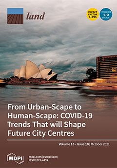
The COVID-19 pandemic reinforced the importance of the humanscape, and livability considerations will progressively lead to urban development discussions. This research reflected on COVID-19 trends that will shape future city centres based on the Sydney experience. The photo was taken in 2021 during the pandemic, capturing a famous part of the Sydney CBD (the Opera House), and illustrated the fast-changing societal needs within the built environment. This research contributes to the notion that future city centres will embrace and prioritise the humanscape in a response to ‘build back better’ and accordingly identifies how the humanscape can be articulated in broader spatial planning approaches to create attractive future city centres. View this paper
  • Issues are regarded as officially published after their release is announced to the table of contents alert mailing list.
  • You may sign up for e-mail alerts to receive table of contents of newly released issues.
  • PDF is the official format for papers published in both, html and pdf forms. To view the papers in pdf format, click on the "PDF Full-text" link, and use the free Adobe Reader to open them.
Order results
Result details
Section
Select all
Export citation of selected articles as:
26 pages, 2133 KiB  
Article
Spatio-Temporal Evolution Characteristics and Spatial Interaction Spillover Effects of New-Urbanization and Green Land Utilization Efficiency
by Shuai Wang, Cunyi Yang and Zhenghui Li
Land 2021, 10(10), 1105; https://doi.org/10.3390/land10101105 - 19 Oct 2021
Cited by 25 | Viewed by 3258
Abstract
In the context of vigorously promoting new-urbanization, effectively improving the green use efficiency of urban land is an inevitable requirement to achieve high-quality economic and social development. Based on the panel data from 2011 to 2018 of 297 prefecture-level and above cities in [...] Read more.
In the context of vigorously promoting new-urbanization, effectively improving the green use efficiency of urban land is an inevitable requirement to achieve high-quality economic and social development. Based on the panel data from 2011 to 2018 of 297 prefecture-level and above cities in China, this paper uses the entropy weight method and the super-efficient SBM-GML model to estimate the spatio-temporal evolution characteristics of new-urbanization and urban green land utilization efficiency. Then, the spatial simultaneous-equation and the generalized spatial three-stage least square method (GS3SLS) are employed to empirically investigate the spatial interaction spillover effects between the new-urbanization and the green land utilization efficiency. The results indicate that: (1) The level of new-urbanization and the green land utilization efficiency in Chinese cities have common and complex temporal and spatial dynamic evolution characteristics. (2) There are mutual inhibition effects between new-urbanization and green land utilization efficiency, and the level of new-urbanization is in a comparatively leading role. (3) Both the level of new-urbanization and green land utilization efficiency have obvious spatial spillover effects. (4) The level of new-urbanization of surrounding regions promotes the green land utilization efficiency of local regions, and the improvement of the green land utilization efficiency of surrounding regions also promotes the level of new-urbanization of local regions. As environmental pressure increasingly becomes a constraint on urban development, these findings are helpful to clarify the regional relationship between urban construction and green development and promote the harmonious development of new-urbanization and green land utilization efficiency. Full article
(This article belongs to the Special Issue Efficient Land Use and Sustainable Urban Development)
Show Figures

Figure 1

23 pages, 5531 KiB  
Article
Fostering Carbon Credits to Finance Wildfire Risk Reduction Forest Management in Mediterranean Landscapes
by Fermín Alcasena, Marcos Rodrigues, Pere Gelabert, Alan Ager, Michele Salis, Aitor Ameztegui, Teresa Cervera and Cristina Vega-García
Land 2021, 10(10), 1104; https://doi.org/10.3390/land10101104 - 19 Oct 2021
Cited by 7 | Viewed by 5111
Abstract
Despite the need for preserving the carbon pools in fire-prone southern European landscapes, emission reductions from wildfire risk mitigation are still poorly understood. In this study, we estimated expected carbon emissions and carbon credits from fuel management projects ongoing in Catalonia (Spain). The [...] Read more.
Despite the need for preserving the carbon pools in fire-prone southern European landscapes, emission reductions from wildfire risk mitigation are still poorly understood. In this study, we estimated expected carbon emissions and carbon credits from fuel management projects ongoing in Catalonia (Spain). The planning areas encompass about 1000 km2 and represent diverse fire regimes and Mediterranean forest ecosystems. We first modeled the burn probability assuming extreme weather conditions and historical fire ignition patterns. Stand-level wildfire exposure was then coupled with fuel consumption estimates to assess expected carbon emissions. Finally, we estimated treatment cost-efficiency and carbon credits for each fuel management plan. Landscape-scale average emissions ranged between 0.003 and 0.070 T CO2 year−1 ha−1. Fuel treatments in high emission hotspots attained reductions beyond 0.06 T CO2 year−1 per treated ha. Thus, implementing carbon credits could potentially finance up to 14% of the treatment implementation costs in high emission areas. We discuss how stand conditions, fire regimes, and treatment costs determine the treatment cost-efficiency and long-term carbon-sink capacity. Our work may serve as a preliminary step for developing a carbon-credit market and subsidizing wildfire risk management programs in low-revenue Mediterranean forest systems prone to extreme wildfires. Full article
Show Figures

Figure 1

21 pages, 5231 KiB  
Article
Mixed Land Use Evaluation and Its Impact on Housing Prices in Beijing Based on Multi-Source Big Data
by Hanbing Yang, Meichen Fu, Li Wang and Feng Tang
Land 2021, 10(10), 1103; https://doi.org/10.3390/land10101103 - 18 Oct 2021
Cited by 16 | Viewed by 3274
Abstract
The tense relationship between the supply and demand of land resources and the past spatial expansion of urban development in Beijing have brought many urban problems. Mixed land use is considered to be able to solve these urban problems as well as promote [...] Read more.
The tense relationship between the supply and demand of land resources and the past spatial expansion of urban development in Beijing have brought many urban problems. Mixed land use is considered to be able to solve these urban problems as well as promote sustainable urban development. In this context, this study uses multi-source big data such as POI, OpenStreetMap and web crawler data to construct current land-use data of the area within the sixth ring road of Beijing, and then uses the entropy index and type number index to analyze the spatial distribution and aggregation characteristics of the mixed land-use level. Finally, a multi-scale geographically weighted regression is applied to explore the impact of the block and life circle scale mixed land use on housing prices. The results show that: (1) the accuracy of land use data obtained by using multi-source big data is high, and the consistency with the real land use situation is as high as 82.67%. (2) the mixed land use level in the study area is higher in the urban center and lower in the periphery of the city. However, it does not show the spatial distribution characteristics gradually decreasing with the increase of the distance from the urban center but shows that the area from the third to the fifth ring road is the highest. (3) the impact of block scale and life circle scale mixed land use on housing price is different. The type number index has a negative effect on the housing price in block scale mixed land use, while the entropy index has a positive effect on the housing price in life circle scale mixed land use. Based on the existing “bottom-up” individual-dominant development mode, the government of Beijing should issue relevant policies and documents to give “top-down” control and guidance in the future, so as to promote the maximization of the benefits of mixed land use. Furthermore, in the practice of mixed land use in Beijing, land use types should be reduced at the block scale and the area of different land use types should be balanced at the life circle scale. Full article
(This article belongs to the Section Urban Contexts and Urban-Rural Interactions)
Show Figures

Figure 1

18 pages, 18379 KiB  
Article
Impact of Artificial Elements on Mountain Landscape Perception: An Eye-Tracking Study
by Suling Guo, Wei Sun, Wen Chen, Jianxin Zhang and Peixue Liu
Land 2021, 10(10), 1102; https://doi.org/10.3390/land10101102 - 17 Oct 2021
Cited by 16 | Viewed by 3735
Abstract
The landscape is an essential resource for attracting tourists to a destination, but this resource has long been overused by tourism development. Tourists and scholars have begun noticing the interference of human structures in the natural environment and how this can change the [...] Read more.
The landscape is an essential resource for attracting tourists to a destination, but this resource has long been overused by tourism development. Tourists and scholars have begun noticing the interference of human structures in the natural environment and how this can change the meaning of a landscape. In this study, the impact of artificial elements on mountain landscapes was investigated by measuring the characteristics of visual perception and a landscape value assessment using eye-tracking analysis. Furthermore, this study includes socio-demographic features for testing whether they have an impact on landscape perception. The results show that human structures impact both visual perception and the perceived value of landscapes. Hotels and temples attract more visual attention than a purely natural landscape. Modern hotels appear to have a negative influence on mountain landscape valuation, while temples with unique culture have positive impacts. Socio-demographic groups differ significantly in how they observe landscape images and, to a degree, how they value the landscape therein. Our study should be of value to landscape planning and tourism policy making. Full article
(This article belongs to the Topic Climate Change and Environmental Sustainability)
Show Figures

Figure 1

19 pages, 9174 KiB  
Article
Underground Land Administration from 2D to 3D: Critical Challenges and Future Research Directions
by Bahram Saeidian, Abbas Rajabifard, Behnam Atazadeh and Mohsen Kalantari
Land 2021, 10(10), 1101; https://doi.org/10.3390/land10101101 - 17 Oct 2021
Cited by 14 | Viewed by 4329
Abstract
The development and use of underground space is a necessity for most cities in response to rapid urbanisation. Effective underground land administration is critical for sustainable urban development. From a land administration perspective, the ownership extent of underground assets is essential for planning [...] Read more.
The development and use of underground space is a necessity for most cities in response to rapid urbanisation. Effective underground land administration is critical for sustainable urban development. From a land administration perspective, the ownership extent of underground assets is essential for planning and managing underground areas. In some jurisdictions, physical structures (e.g., walls, ceilings, and utilities) are also necessary to delineate the ownership extent of underground assets. The current practice of underground land administration focuses on the ownership of underground space and mostly relies on 2D survey plans. This inefficient and fragmented 2D-based underground data management and communication results in several issues including boundary disputes, underground strikes, delays and disruptions in projects, economic losses, and urban planning issues. This study provides a review of underground land administration from three common aspects: legal, institutional, and technical. A range of important challenges have been identified based on the current research and practice. To address these challenges, the authors of this study propose a new framework for 3D underground land administration. The proposed framework outlines the future research directions to upgrade underground land administration using integrated 3D digital approaches. Full article
Show Figures

Figure 1

20 pages, 3868 KiB  
Article
Research on the Spatial Differences and Convergence Mechanism of Urban Land Use Efficiency under the Background of Regional Integration: A Case Study of the Yangtze River Economic Zone, China
by Kun Ge, Shan Zou, Danling Chen, Xinhai Lu and Shangan Ke
Land 2021, 10(10), 1100; https://doi.org/10.3390/land10101100 - 17 Oct 2021
Cited by 19 | Viewed by 2021
Abstract
Revealing the spatial differences and convergence mechanism of urban land use efficiency (ULUE) under the background of regional integration is of great significance for exploring the coordinated promotion path of ULUE. We attempted to build a theoretical framework to interpret ULUE spatial convergence [...] Read more.
Revealing the spatial differences and convergence mechanism of urban land use efficiency (ULUE) under the background of regional integration is of great significance for exploring the coordinated promotion path of ULUE. We attempted to build a theoretical framework to interpret ULUE spatial convergence under the background of regional integration and build a ULUE “green” evaluation system under multi-objective constraints. Based on this, we employed the super efficiency slack-based model (SBM), exploratory spatial data analysis, and spatial convergence model incorporated into the spatial weight matrix to re-examine the true level, spatial differences, and convergence mechanism of ULUE in the Yangtze River Economic Zone from 2003 to 2019 on a city scale. The results show that: (1) during the investigation period, ULUE in the Yangtze River Economic Zone has obvious spatial disequilibrium and spatial correlation characteristics; (2) there are absolute β-space convergence and conditional β-space convergence of ULUE in the whole Yangtze River Economic Zone and its upstream, midstream, and downstream areas; (3) driven by government management, industrial development, and spatial error effects, the convergence time of ULUE in the whole Yangtze River Economic Zone and its upstream, midstream, and downstream areas is obviously shortened. Full article
Show Figures

Figure 1

17 pages, 294 KiB  
Article
Recognition Changes of the Concept of Urban Resilience: Moderating Effects of COVID-19 Pandemic
by Soyoung Han, Jisoo Sim and Yoonku Kwon
Land 2021, 10(10), 1099; https://doi.org/10.3390/land10101099 - 16 Oct 2021
Cited by 7 | Viewed by 2442
Abstract
Urban resilience, which has emerged as an important concept in cities since sustainability became a 21st-century urban paradigm, reflects the needs of the times to change and bring about a shift in existing national landscape architecture and social policies. To explore the characteristics [...] Read more.
Urban resilience, which has emerged as an important concept in cities since sustainability became a 21st-century urban paradigm, reflects the needs of the times to change and bring about a shift in existing national landscape architecture and social policies. To explore the characteristics of recognition of college students majoring in landscape architecture towards the concept of urban resilience before and after the beginning of COVID-19, this study aims to answer three research questions: to analyzes recognitions of landscape architecture majoring students on urban resilience (research question 1); to compare the differences that emerge from before and after the beginning of the COVID-19 pandemic (research question 2); and to explore latent classes according to the education pattern (research question 3). The results of this study are as follows: First, before the beginning of COVID-19, four latent classes were drawn up in relation to awareness of the concept of urban resilience, while three latent classes were examined after the start of the pandemic. Before the beginning of COVID-19, students of landscape architecture accepted the concept of urban resilience as a physical and environmental approach to overcome risk factors by creating landscape architecture and infrastructure or applying the concept of resilience in urban development and redevelopment. However, after the beginning of COVID-19, they mostly have been recognized urban resilience as a concept related to technological ability. Thirdly, the grades and educational experiences of the students were found to have a significant effect on the probability of their belonging to a specific latent class. Full article
(This article belongs to the Section Land Planning and Landscape Architecture)
12 pages, 1761 KiB  
Article
The Role of High-Volume Ranches as Cattle Suppliers: Supply Chain Connections and Cattle Production in Mato Grosso
by Raquel Carvalho, Lisa Rausch, Jacob Munger and Holly K. Gibbs
Land 2021, 10(10), 1098; https://doi.org/10.3390/land10101098 - 16 Oct 2021
Cited by 3 | Viewed by 2033
Abstract
Brazil’s zero-deforestation Cattle Agreements (CAs) have influenced the supply chain but their impact on deforestation has been limited in part because slaughterhouses monitor deforestation only on the properties they buy from directly. Consequently, deforestation continues to enter the supply chain indirectly from properties [...] Read more.
Brazil’s zero-deforestation Cattle Agreements (CAs) have influenced the supply chain but their impact on deforestation has been limited in part because slaughterhouses monitor deforestation only on the properties they buy from directly. Consequently, deforestation continues to enter the supply chain indirectly from properties that are not monitored. Knowledge gaps and data limitations have made it challenging to close this loophole and achieve meaningful reductions in deforestation. Here we leverage our large property-level supply chain database that links together six years of records from the Animal Transport Guide (GTA), high-resolution satellite data, property boundaries, and land cover data to quantify different types of supply chain connections and characterize cattle production in Mato Grosso. We find that a relatively small number of high-volume suppliers—defined as the top 5% of cattle suppliers in terms of the volume of cattle sold–supplied 50–60% of the total volume purchased by major slaughterhouses. One-fourth of high-volume direct suppliers cleared forest between 2009–2018, and 90% of them also bought from indirect suppliers with deforestation, leading these high-volume direct suppliers to act as funnels for deforestation into the supply chain. Because they serve as important hubs in the supply chain, high-volume suppliers may represent a key starting point to expand the CAs to cover large numbers of indirect suppliers. Full article
Show Figures

Figure 1

16 pages, 1423 KiB  
Article
Land Use Demands for the CLUE-S Spatiotemporal Model in an Agroforestry Perspective
by Georgios Mamanis, Michael Vrahnakis, Dimitrios Chouvardas, Stamatia Nasiakou and Vassiliki Kleftoyanni
Land 2021, 10(10), 1097; https://doi.org/10.3390/land10101097 - 16 Oct 2021
Cited by 19 | Viewed by 2737
Abstract
Rural landscape evolution models are used as tools for the analysis of the causes and impact of land use changes on landscapes. The CLUE-S (the Conversion of Land Use and its Effects at Small regional extent) model was developed to simulate the changes [...] Read more.
Rural landscape evolution models are used as tools for the analysis of the causes and impact of land use changes on landscapes. The CLUE-S (the Conversion of Land Use and its Effects at Small regional extent) model was developed to simulate the changes in current land use, by using quantitative relationships between land uses and driving factors combined with a dynamic modeling of land use competition. One of the modules that build the “CLUE-S” is the non-spatial subset of the model that calculates the temporal evolution of the land use/cover under several socio-economic scenarios. The purpose of this research was to estimate the demands of land use in the area of Mouzaki, Thessaly plain, Greece with the ultimate goal of using them in the non-spatial module of the CLUE-S to predict the evolution of land uses in year 2040. These estimations are the quantitative prediction of the spatial change for all land use types at the aggregate level. Three models of forecasting the future land cover in the area were simulated, in order to obtain a clear view of the different land uses in the future. We distinguished three model-scenarios for calculating the demand-forecasts: (a) business as usual (BAU) scenario, that deals with a linear projection of the current land use demands, (b) rapid economic development (RED) scenario, and (c) ecological land protection (ELP) scenario. In the BAU scenario the land use demands for the year 2040 were calculated using linear interpolation utilizing historical data from 1960 to 2020. In the RED scenario, the demands were calculated by maximizing the economic benefit of land uses, and in the ELP scenario the demands were calculated by maximizing the environmental benefit of land uses. Furthermore, a multi-criteria analysis was performed to find the trade-offs between economic benefit maximization and environmental benefit optimization. It was found that the agricultural lands reach their maximum area under the RED scenario, while reaching their lower bound for the ELP scenario. The same goes for agroforestry systems. The grasslands reach their lower bound under the ELP scenario, while they achieve a higher value under the RED scenario. Concerning the silvopastoral woodlands, although an increase is foreseen under the BAU scenario, it appears that they reach their lower bound in the other two scenarios, RED and ELP. Forests receive intermediate values and cover a larger area under the ELP scenario compared with the RED scenario. The expected forest cover under the BAU scenario is higher. Moreover, sparse and dense shrublands receive their lower bound for both optimization scenarios, while the settlements reach the upper bound for the RED scenario and the lower one under the ELP scenario. Full article
Show Figures

Figure 1

19 pages, 696 KiB  
Article
Community Perceptions of Tree Risk and Management
by Abbie Judice, Jason Gordon, Jesse Abrams and Kris Irwin
Land 2021, 10(10), 1096; https://doi.org/10.3390/land10101096 - 16 Oct 2021
Cited by 6 | Viewed by 3106
Abstract
Urban forests (trees growing in urban and peri-urban areas, including villages and large cities) are vital to mitigating the effects of climate change and urbanization but require special considerations such as risk mitigation in developed landscapes. Despite abundant research on risk perceptions of [...] Read more.
Urban forests (trees growing in urban and peri-urban areas, including villages and large cities) are vital to mitigating the effects of climate change and urbanization but require special considerations such as risk mitigation in developed landscapes. Despite abundant research on risk perceptions of natural hazards, there is limited knowledge about risk perceptions associated with urban trees. As such, this research examines community perceptions of urban tree risk mitigation with a focus on four cities in the U.S. south. To better understand risk perceptions and mitigation, this study employs key informant interviews with community members. Guided by a socio-ecological resilience framework, the findings identify factors affecting resident attitudes towards tree management on the individual parcel and the community levels. The findings benefit tree risk governance in the face of climate variability, which increases societal and environmental vulnerability in urban settings. Full article
Show Figures

Figure 1

20 pages, 463 KiB  
Article
How Do Network Embeddedness and Environmental Awareness Affect Farmers’ Participation in Improving Rural Human Settlements?
by Jinhua Xie, Gangqiao Yang, Ge Wang and Wei Xia
Land 2021, 10(10), 1095; https://doi.org/10.3390/land10101095 - 16 Oct 2021
Cited by 12 | Viewed by 2082
Abstract
Based on social embeddedness theory, this paper aims to explore the influence mechanism of network embeddedness and environmental awareness on farmers’ participation in improving rural human settlements (IRHS). This research applies the Logit model and the Bootstrap method, using survey data from 495 [...] Read more.
Based on social embeddedness theory, this paper aims to explore the influence mechanism of network embeddedness and environmental awareness on farmers’ participation in improving rural human settlements (IRHS). This research applies the Logit model and the Bootstrap method, using survey data from 495 farmers in Hubei Province, China. The results show that: (1) relational embeddedness has a significant negative impact on the centralized treatment of farmers’ domestic sewage, implying that strengthening the relationship between farmers and households helps to provide them with centralized treatment for domestic sewage; (2) environmental awareness has a significant positive impact on the centralized treatment of farmers’ domestic sewage, implying that the enhancement of farmers’ environmental awareness increases the promotion centralized treatment for domestic sewage; and (3) structural embeddedness can further affects farmers’ environmental awareness and then affects their participation in the centralized treatment of domestic sewage, implying that environmental awareness has a mediating effect between structural embeddedness and the centralized treatment of farmers’ domestic sewage. Overall, it is necessary not only to encourage the establishment of extension and discussion networks for farmers (relational embeddedness) to participate in IRHS but also to improve environmental education for farmers, especially by increasing their access to environmental knowledge and information (environmental awareness in mountainous areas, and, finally to support farmers. The relationship between the members and the village cadres (structural embeddedness) can further improve farmers’ awareness of participation in IRHS to better guide them in the centralized treatment of domestic waste and domestic sewage. Full article
Show Figures

Figure 1

15 pages, 2584 KiB  
Article
Evaluation of Economic Linkage between Urban Built-Up Areas in a Mid-Sized City of Uyo (Nigeria)
by Etido Essien and Cyrus Samimi
Land 2021, 10(10), 1094; https://doi.org/10.3390/land10101094 - 15 Oct 2021
Cited by 3 | Viewed by 1772
Abstract
Urban growth has transformed many mid-sized cities into metropolitan areas. One of the effects of this growth is a change in urban growth patterns, which are directly linked with household income. Hence, this paper aims to assess the effect of different economic variables [...] Read more.
Urban growth has transformed many mid-sized cities into metropolitan areas. One of the effects of this growth is a change in urban growth patterns, which are directly linked with household income. Hence, this paper aims to assess the effect of different economic variables that trigger urban built-up patterns, using economic indicators such as city administrative taxes, a socio-economic survey of living standards, household income and satellite data. The regression model was used and adapted, and a case study is presented for the mid-sized city of Uyo in southeastern Nigeria. The result shows sparse built-up growth patterns with numerous adverse effects. Although, there is awareness of the impact of unregulated sparse built-up growth patterns in the literature, little attention has been given to this growth pattern in Africa. The results also show that increases in federal allocation (27%), investment tax (22%), direct tax (52%) and indirect tax (26%) have led to urban expansion into vegetative land and have a causal correlation with different built-up areas. Hence, medium and high-income earners migrate to suburban areas for bigger living space and a lack of basic social amenities affects the land value in suburban areas. They also assist in the provision of social amenities in the neighborhood. Full article
Show Figures

Figure 1

20 pages, 11056 KiB  
Article
Royal Land Use and Management in Beijing in the Qing Dynasty
by Yao Xiao and Lian Liu
Land 2021, 10(10), 1093; https://doi.org/10.3390/land10101093 - 15 Oct 2021
Cited by 2 | Viewed by 1841
Abstract
Management is an important factor affecting the formation and development of a landscape. This study concludes that royal land use is planned by specifying the land type, while the economic benefits and landscape value are also taken into account. The royal land has [...] Read more.
Management is an important factor affecting the formation and development of a landscape. This study concludes that royal land use is planned by specifying the land type, while the economic benefits and landscape value are also taken into account. The royal land has landscape value, with the core being the royal garden, the background being farmland, and the connecting line being water. Meanwhile, the royal garden management organization has a high level of authority. Based on the rules of the Imperial Household Department (Neiwufu) of the Qing Dynasty, the present paper extracts the royal land use and management records. This paper discusses the characteristics of royal land management from the spatial distribution and utilization of types of land. It analyzes the specific revenue, expenditure, and fund flow of land in detail and summarizes the land management model. Land management is based mainly on directional revenue and expenditure as well as quota revenue and the expenditure system. The management system is established to support the gardens’ construction. Full article
(This article belongs to the Special Issue Integrated Approach to Land Use Change Assessment)
Show Figures

Figure 1

19 pages, 6141 KiB  
Article
A Spatial Typography of Environmentally Friendly Common Agricultural Policy Support Relevant to European Green Deal Objectives
by Roman Rudnicki, Łukasz Wiśniewski and Mirosław Biczkowski
Land 2021, 10(10), 1092; https://doi.org/10.3390/land10101092 - 15 Oct 2021
Cited by 10 | Viewed by 1734
Abstract
The European Union (EU), through its implementation of the Common Agricultural Policy (CAP), is increasingly emphasising the development of environmentally friendly forms of agriculture. This is confirmed by, for example, the new European Green Deal (EGD). In Poland, the most important forms of [...] Read more.
The European Union (EU), through its implementation of the Common Agricultural Policy (CAP), is increasingly emphasising the development of environmentally friendly forms of agriculture. This is confirmed by, for example, the new European Green Deal (EGD). In Poland, the most important forms of CAP support for the environmentally friendly management of agricultural land were the following measures: agri-environment-climate measures (AECM) and organic farming (OF). These aid instruments facilitated the use of a range of packages and variants, which resulted in the pro-environmental forms of support offered by the CAP support having a very diverse internal structure. This study therefore attempts to synthesise the diversity of CAP financial support using spatial typology methods. The researched support measures were divided into three basic directions for developing agriculture: ecology, environment and habitat. The research procedure involved the D’Hondt method, the normalisation method, standardisation and correlation. The study was conducted on the example of Poland, and the basic territorial unit of analysis was the commune. It was shown that support for environmentally friendly activities in Poland related to almost 10% of the total farm area. The utilised agricultural area (UAA) covered by subsidies can be broken down as follows: organic farming—32.7%, environmental farming—31.8%, habitat farming—35.5%. The detailed results of the typology indicate the complexity of the spatial distribution of environmentally friendly CAP funds, which is defined by environmental determinants and the characteristics of the farms themselves. Farm-specific, non-environmental determinants were found to be the most significant, including farm size and managerial expertise. Full article
(This article belongs to the Special Issue Rural Space Modeling)
Show Figures

Figure 1

20 pages, 2762 KiB  
Article
Diversity Is Not Everything
by Drew A. Scott, Kathryn D. Eckhoff, Nicola Lorenz, Richard Dick and Rebecca M. Swab
Land 2021, 10(10), 1091; https://doi.org/10.3390/land10101091 - 15 Oct 2021
Cited by 1 | Viewed by 1344
Abstract
Since the passage of legislation in 1977, Appalachian mineland reclamation is typically completed using non-native C3 grasses and forbs. Alternatively, reclamation with native prairie (C4) grasses and forbs offers a more ecologically friendly alternative that can contribute to native plant [...] Read more.
Since the passage of legislation in 1977, Appalachian mineland reclamation is typically completed using non-native C3 grasses and forbs. Alternatively, reclamation with native prairie (C4) grasses and forbs offers a more ecologically friendly alternative that can contribute to native plant conservation and potentially improve soil properties more quickly than shallower rooted C3 cool-season grasses. We assessed the establishment of native prairie after reclamation, evaluating three treatments for six years after planting—traditional cool season planting, native prairie planted at light density, and native prairie planted at heavy density. All treatments reached the objectives of reclamation—percentage of ground covered by vegetation—within 2 years after planting. All treatments at all sites, except for one site by treatment combination near a forest, showed an increase in plant species richness and Shannon–Wiener diversity in the first four years of reclamation, a peak around 5 years, and subsequent decrease. Little difference in plant richness and Shannon–Wiener diversity among treatments was observed. However, the two native seed mixes quickly diverged from the traditional mix in terms of community structure and diverged further over time, with both native treatments heading towards a more desirable native prairie grassland state, while the traditional mix remained dominated by non-native cool season grasses. The native treatments also exhibited greater increase in microbial biomass and fungi:bacteria ratio over time compared to the traditional mix. Soil organic carbon increased over time regardless of seed mix treatment. Exchangeable base cations and phosphorus generally decreased over time, as expected, regardless of seed mix treatment, likely due to uptake from established plants. Native grassland species were able to establish despite inclusion of some traditional species in the native mix. Native plant establishment likely resulted in benefits including pollinator resources, bird and wildlife habitat, and increased soil health, and we recommend that native prairie mixes be used directly in reclamation moving forward, as they are able to meet reclamation goals while establishing a successful native prairie plant community. Full article
(This article belongs to the Special Issue Grassland Restoration)
Show Figures

Figure 1

17 pages, 3316 KiB  
Article
Comprehensive Food System Planning for Urban Food Security in Nanjing, China
by Taiyang Zhong, Zhenzhong Si, Steffanie Scott, Jonathan Crush, Kui Yang and Xianjin Huang
Land 2021, 10(10), 1090; https://doi.org/10.3390/land10101090 - 15 Oct 2021
Cited by 9 | Viewed by 3086
Abstract
Food system planning is important to achieve the goal of “zero hunger” in the UN’s 2030 Agenda for Sustainable Development (UN, 2016). However, discussion about comprehensive planning for food security is scarce and little is known about the situation in Chinese cities. To [...] Read more.
Food system planning is important to achieve the goal of “zero hunger” in the UN’s 2030 Agenda for Sustainable Development (UN, 2016). However, discussion about comprehensive planning for food security is scarce and little is known about the situation in Chinese cities. To narrow this gap, this study collected and analyzed four medium-term plans and two annual plans for the “vegetable basket project” in Nanjing, China. This study examines the strategies for urban food security in Nanjing to shed light on how the city developed a comprehensive approach to food system planning over the past three decades. The evolution of incremental food system planning in Nanjing provides valuable lessons for other cities facing food security challenges and shortages of financial resources. Reducing food insecurity is an ongoing challenge for the city governments in the Global South and comprehensive planning is a useful tool for addressing the challenge of urban food insecurity. Full article
Show Figures

Figure 1

12 pages, 1780 KiB  
Article
Analysis of the Discriminatory Perceptions of Victims on Damage from Environmental Pollution: A Case Study of the Hebei Spirit Oil Spill in South Korea
by Jae-Hyuck Lee and Do-Kyun Kim
Land 2021, 10(10), 1089; https://doi.org/10.3390/land10101089 - 15 Oct 2021
Cited by 1 | Viewed by 2379
Abstract
Environmental pollution causes severe damage to local communities, which is perceived differently by different victims, that is, the damage is discriminatory. However, previous studies have not focused on this aspect. Here, we explored the perceptions of different victims of the Hebei Spirit oil [...] Read more.
Environmental pollution causes severe damage to local communities, which is perceived differently by different victims, that is, the damage is discriminatory. However, previous studies have not focused on this aspect. Here, we explored the perceptions of different victims of the Hebei Spirit oil spill incident of Korea. Additionally, we explored the importance of considering discriminatory aspects of damage when planning recovery governance. The damages from the oil spill were analyzed using a text mining technique for each subject based on factor analyses. Women and residents older than 60 years were interested in the social relations of the village community; residents in their 40s, who were raising children and teenagers, were interested in the economic aspects; boat fishermen, who had discontinued fishing to participate in the pollution response activity in the early stages of the incident, were interested in disaster prevention; and women divers were interested in health issues. Hence, restoring the economy and environment and reversing indirect social damages are essential for recovery from pollution damage. Furthermore, governance for recovery must not exclude specific victims based on the discriminatory aspects of damages. A political process is necessary to secure the validity of governance and alternatives by involving different victim groups. Full article
Show Figures

Figure 1

2 pages, 138 KiB  
Editorial
A New Editor-in-Chief for Land
by Andrew Millington
Land 2021, 10(10), 1088; https://doi.org/10.3390/land10101088 - 14 Oct 2021
Viewed by 989
Abstract
In writing this editorial, I am signing off as the founding Editor-in-Chief of Land, and it is with great pleasure that I am handing over these duties to Professor Christine Fürst, who has been Section Editor-in-Chief of the Section “Landscape Ecology” since 2020 [...] Read more.
In writing this editorial, I am signing off as the founding Editor-in-Chief of Land, and it is with great pleasure that I am handing over these duties to Professor Christine Fürst, who has been Section Editor-in-Chief of the Section “Landscape Ecology” since 2020 [...] Full article
18 pages, 2311 KiB  
Article
Four Years Continuous Monitoring Reveals Different Effects of Urban Constructed Wetlands on Bats
by Han Li, Radmila Petric, Zinah Alazzawi, Jake Kauzlarich, Rania H. Mahmoud, Rasheed McFadden, Niklas Perslow, Andrea Rodriguez Flores, Hadi Soufi, Kristina Morales, Matina C. Kalcounis-Rueppell, Malcolm D. Schug and Lindsey A. Zarecky
Land 2021, 10(10), 1087; https://doi.org/10.3390/land10101087 - 14 Oct 2021
Cited by 6 | Viewed by 3454
Abstract
Proactive artificial wetland constructions have been implemented to mitigate the loss of wetlands and their ecosystem services. As wetlands are habitats for bats, short-term (one or two years) studies find that constructed wetlands can immediately increase local bat activity and diversity. However, it [...] Read more.
Proactive artificial wetland constructions have been implemented to mitigate the loss of wetlands and their ecosystem services. As wetlands are habitats for bats, short-term (one or two years) studies find that constructed wetlands can immediately increase local bat activity and diversity. However, it is not clear how constructed wetlands affect bats through time while the wetlands are aging. We collected four years of continuous bat acoustic monitoring data at two constructed wetlands in an urban park in Greensboro, NC, USA. We examined bat activity and community composition patterns at these wetlands and compared them with reference sites in the city. With four years of data, we found that the effects of constructed wetlands were both habitat- and species-specific. The wetland in forests significantly increased bat activity, while the wetland in the open grass altered bat community composition. Specifically, in terms of species, we found that over time, constructed wetlands no longer attracted more big brown, silver-haired, or evening bats than control sites while the wetlands aged, highlighting the need to study broadly how each bat species uses natural and artificial wetlands. We emphasize the importance of long-term monitoring and the periodical evaluation of wildlife conservation actions. Full article
(This article belongs to the Special Issue Wildlife Protection and Habitat Management: Practice and Perspectives)
Show Figures

Figure 1

17 pages, 5298 KiB  
Article
Multi-Dimensional Feature Recognition and Policy Implications of Rural Human–Land Relationships in China
by Guanglong Dong, Wenxin Zhang, Xinliang Xu and Kun Jia
Land 2021, 10(10), 1086; https://doi.org/10.3390/land10101086 - 14 Oct 2021
Cited by 22 | Viewed by 1809
Abstract
Rural decline has become an indisputable fact and a global issue. As a developing country, China is simultaneously facing unprecedented rapid urbanization and severe rural decline. The coordinated development of its rural human–land relationship is therefore of great significance for ensuring the country’s [...] Read more.
Rural decline has become an indisputable fact and a global issue. As a developing country, China is simultaneously facing unprecedented rapid urbanization and severe rural decline. The coordinated development of its rural human–land relationship is therefore of great significance for ensuring the country’s food security and achieving both rural revitalization and sustainable development. Yet, the related research on this complex subject has mostly focused on a single element: rural settlements. Since studies of the rural human–land relationship tend to only discuss the coordinated change in rural populations vis-à-vis rural settlement area, their degree of spatial matching and intensive utilization level of rural settlements has been largely overlooked. To rectify this imbalance, using data on rural populations and rural settlement area in counties of Shandong Province in 2009 and 2018, this paper applied the methods of per capita rural settlement area, the Theil index, and Tapio’s decoupling model to quantitatively identify the rural human–land relationship along three dimensions: intensive utilization level, spatial matching degree, and change coordination degree. The results revealed that the per capita rural settlement area in Shandong Province was as high as 212.18 m2/person in 2018, which exceeded the standard to varying degrees in all cities, having an overall geographical pattern of being high in the north and low in the south. The Theil index for all cities was small, which indicates that the spatial matching between rural population and rural settlements is high. To sum up, there are small differences in the utilization of rural settlements among cities, and their extensive utilization of rural settlements is a common phenomenon. In addition, the relationship between the changes in the rural population size and rural settlement area corresponded to a discordant state, in the form of strong negative decoupling, expansive negative decoupling, and expansive coupling; however, among them, the strong negative decoupling type was the dominant type. It is worth noting that all of these three types will exacerbate the extensive utilization of rural settlements. Accordingly, this paper proposes policies and measures, such as the paid withdrawal of rural homesteads, an expanded scope of homestead transfer, cross-regional “increasing versus decreasing balance”, classified promotion of rural revitalization, and improved village planning. Full article
(This article belongs to the Special Issue Efficient Land Use and Sustainable Urban Development)
Show Figures

Figure 1

22 pages, 1984 KiB  
Article
Attitudes and Behaviors toward the Use of Public and Private Green Space during the COVID-19 Pandemic in Iran
by Mohammad Reza Khalilnezhad, Francesca Ugolini and Luciano Massetti
Land 2021, 10(10), 1085; https://doi.org/10.3390/land10101085 - 14 Oct 2021
Cited by 31 | Viewed by 3443
Abstract
This paper reports the results of an exploratory study carried out in Birjand, Iran, during the first year of the COVID-19 pandemic. The aim of the study was to explore the behavioral change in the use and the motivation to visit a green [...] Read more.
This paper reports the results of an exploratory study carried out in Birjand, Iran, during the first year of the COVID-19 pandemic. The aim of the study was to explore the behavioral change in the use and the motivation to visit a green space (public or private) during the pandemic as compared to the pre-pandemic period, the effect of green spaces (private and public) on users’ feelings, the relations between the extent to which the access to green spaces was missed, and characteristics of respondents and the place they live. A survey was carried out through an online questionnaire in winter 2020 and about 400 responses were collected. The results showed a decrease in visitation of public green spaces during the pandemic, and higher visitation of private green spaces such as gardens or courtyards by those with access. In addition, both public and private green spaces enhance positive feelings and decrease the negative ones. Respondents missed access to green spaces, especially when their visitation before the pandemic was high, and women missed them more than men. Therefore, private green spaces might represent an opportunity for psychological respite in time of a pandemic, but also for socialization. The study reports respondents’ useful suggestions for urban landscape planning for the city of Birjand that might also be useful for other cities in dry lands; improving the quality of green spaces beyond the quantity may play a role in enhancing the connection to nature in the time of a pandemic, with positive effects on mental health, and this can also can improve recreation opportunities and reduce inequalities. Full article
Show Figures

Figure 1

25 pages, 4429 KiB  
Article
Is Expansion or Regulation more Critical for Existing Protected Areas? A Case Study on China’s Eco-Redline Policy in Chongqing Capital
by Benhui Zhu and Shizuka Hashimoto
Land 2021, 10(10), 1084; https://doi.org/10.3390/land10101084 - 14 Oct 2021
Cited by 3 | Viewed by 2390
Abstract
Protecting areas of important ecological value is one of the main approaches to safeguarding the Earth’s ecosystems. However, the long-term effectiveness of protected areas is often uncertain. Focusing on China’s ecological conservation redline policy (Eco-redline policy) introduced in recent years, this study attempted [...] Read more.
Protecting areas of important ecological value is one of the main approaches to safeguarding the Earth’s ecosystems. However, the long-term effectiveness of protected areas is often uncertain. Focusing on China’s ecological conservation redline policy (Eco-redline policy) introduced in recent years, this study attempted to examine the effectiveness of alternative policy interventions and their implications on future land-use and land-cover (LULC) patterns. A scenario analysis was employed to elucidate the implications of different policy interventions for Chongqing capital, one of the most representative cities in China. These interventions considered the spatial extent of Eco-redline areas (ERAs) and the management intensity within these areas. LULC data for two different periods from 2000 (first year) to 2010 (end year) were derived from satellite images and then used for future (2050) LULC projections, incorporating the various policy interventions. Furthermore, several landscape indices, including the shape complexity, contrast, and aggregation of forest patches were calculated for each scenario. After comparing the scenarios, our analysis suggests that the current extent of ERAs may not be sufficient, although their management intensity is. Therefore, we suggest that during the optimization of the Eco-redline policy, ERAs are gradually increased while maintaining their current management intensity. Full article
(This article belongs to the Section Land Planning and Landscape Architecture)
Show Figures

Figure 1

23 pages, 6659 KiB  
Article
Urban Environment during Post-War Reconstruction: Architectural Dominants and Nodal Points as Measures of Changes in an Urban Landscape
by Bartosz Czarnecki and Michał Pawel Chodorowski
Land 2021, 10(10), 1083; https://doi.org/10.3390/land10101083 - 14 Oct 2021
Cited by 4 | Viewed by 4013
Abstract
Modernist planners were given the opportunity to apply the idea of the Modern Movement in the implementation of cities transforming after the World War II blitz, which was not possible before in long-term evolving structures. However, they could not alter everything: some urban [...] Read more.
Modernist planners were given the opportunity to apply the idea of the Modern Movement in the implementation of cities transforming after the World War II blitz, which was not possible before in long-term evolving structures. However, they could not alter everything: some urban and even architectural elements were necessary to be preserved. As a result, the elements of the ancient landscapes of these cities—historical objects and spaces—necessary for the continuity of evidence of history and identity were preserved, often being completely reconstructed. Finally, in some of these cities, both old and new elements contribute to the contemporary urban landscape. The aim of the research is to examine two key categories of urban structure in this perspective: (1) architectural dominants (landmarks) and (2) urban network nodes. For this purpose, (1) the changes in the number and rank of the spaces through which the landmarks expositions were carried out are compared, and (2) the changes in the rank of nodes in the urban structure, both these in the pre-war and in the present structures, as well as changes in their distribution and concentration areas are analyzed. The number of individual elements is compared and the changes in the structure of their arrangement are analyzed with the use of a polygon grid. A medium-scale European city (Bialystok) is used as the case study. Results of our analysis indicate that the post-war reconstruction led to a decrease in the number of elements of the urban grid (streets, nodal points), especially those of low rank. The rank of many others also decreased: 57% of all nodal points within the historical grid of the selected area does not exist in the post-war structure. The number of main rank directions of exposition decreased by 18% and in the subordinate group by 38%. The research is an attempt to construct a new criteria of evaluating changes in the quality of the cityscape, which is described in the article. Full article
(This article belongs to the Special Issue Quality of Urban Space versus Quality of Urban Life)
Show Figures

Figure 1

15 pages, 17675 KiB  
Article
Farmland Changes and Their Ecological Impact in the Huangshui River Basin
by Hui Wei, Changhe Lu and Yaqun Liu
Land 2021, 10(10), 1082; https://doi.org/10.3390/land10101082 - 14 Oct 2021
Cited by 10 | Viewed by 1711
Abstract
The Huangshui River Basin (HRB) is the main grain production and key implementation region of the “Grain for Green Program” (GGP) of Qinghai Province, and has experienced a quick urbanization during the last 20 years. Therefore, identifying the farmland change and its ecological [...] Read more.
The Huangshui River Basin (HRB) is the main grain production and key implementation region of the “Grain for Green Program” (GGP) of Qinghai Province, and has experienced a quick urbanization during the last 20 years. Therefore, identifying the farmland change and its ecological effects is significant for farmland and ecological protection in the HRB. To this end, this study analyzed the farmland change between 2000 and 2018, based on 1 m spatial resolution farmland data visually interpreted from Google Earth high-resolution images, and then estimated its ecological impact based on the Normalized Difference Vegetation Index (NDVI) data of MODIS, using an ecological impact index of farmland change. The study found that: (1) The farmland area in the HRB decreased from 320.15 k ha in 2000 to 245.01 k ha in 2018, reduced by 23.47% or 1.48% per year, as mainly caused by ecological restoration and built-up land occupation; (2) from 2000 to 2018, the natural environment showed a greening trend in the HRB, with the mean NDVI increasing by 0.74% per year; (3) the farmland changes had a positive ecological effect, contributing 6.67% to the regional increase in the NDVI, but had a negative impact on grain production; (4) it is suggested to strengthen farmland protection by strictly controlling the urban land occupation and over-conversion of farmland in the HRB. Full article
Show Figures

Figure 1

19 pages, 20922 KiB  
Article
The Evolution of the Urban Residential Space Structure and Driving Forces in the Megacity—A Case Study of Shenyang City
by He Sun, Xueming Li, Yingying Guan, Shenzhen Tian and He Liu
Land 2021, 10(10), 1081; https://doi.org/10.3390/land10101081 - 13 Oct 2021
Cited by 5 | Viewed by 2137
Abstract
For megacities, they are in a period of transformation from extensive development to smart growth. Recognizing new characteristics and new changes of the residential space in megacities under the backdrop of new development has great practical significance for realizing the sustainable development of [...] Read more.
For megacities, they are in a period of transformation from extensive development to smart growth. Recognizing new characteristics and new changes of the residential space in megacities under the backdrop of new development has great practical significance for realizing the sustainable development of the city. As the only megacity in Northeast China, Shenyang was selected to be the research object, with 1989–2018 as the research period. The research comprehensively used multiple spatial representation methods and statistical methods to study the residential space pattern and driving factors in Shenyang City. The results showed that: (1) Residential space expansion can be divided into four stages: slow development, rapid expansion, speedy expansion, and stable extension. (2) The residential space structure presented a spatial evolution characteristic of overall expansion, forming multiple secondary core density centers. The east-west direction had a larger extension range than the northeast-southwest direction. There was an axisymmetric zonal distribution on both sides of the Hun River. (3) The agglomeration of different residential forms was obvious, and the spatial heterogeneity was increasingly stronger. (4) Urban planning measures and economic strength were the main driving forces of residential space expansion. Full article
(This article belongs to the Topic Climate Change and Environmental Sustainability)
Show Figures

Figure 1

23 pages, 7157 KiB  
Article
Land Use and Land Cover Change in the Yellow River Basin from 1980 to 2015 and Its Impact on the Ecosystem Services
by Bo Liu, Libo Pan, Yue Qi, Xiao Guan and Junsheng Li
Land 2021, 10(10), 1080; https://doi.org/10.3390/land10101080 - 13 Oct 2021
Cited by 45 | Viewed by 3095
Abstract
Land use and land cover change is an important driving force for changes in ecosystem services. We defined several important human-induced land cover change processes such as Ecological Restoration Project, Cropland Expansion, Land Degradation, and Urbanization by the land use/land cover transition matrix [...] Read more.
Land use and land cover change is an important driving force for changes in ecosystem services. We defined several important human-induced land cover change processes such as Ecological Restoration Project, Cropland Expansion, Land Degradation, and Urbanization by the land use/land cover transition matrix method. We studied human-induced land cover changes in the Yellow River Basin from 1980 to 2015 and evaluated its impact on ecosystem service values by the benefit transfer method and elasticity coefficient. The results show that the cumulative area of human-induced land cover change reaches 65.71 million ha from 1980 to 2015, which is close to the total area of the Yellow River Basin. Before 2000, Ecological Restoration Project was the most important human-induced land cover change process. However, due to the large amount of cropland expansion and land degradation, the area of natural vegetation was reduced and the ecosystem value declined. Since 2000, due to the implementation of the “Grain for Green” program, the natural vegetation of upstream area and midstream area of Yellow River Basin has been significantly improved. This implies that under an appropriate policy framework, a small amount of human-induced land cover change can also improve ecosystem services significantly. Full article
Show Figures

Figure 1

18 pages, 686 KiB  
Article
Moving the 2030 Agenda Ahead: Exploring the Role of Multiple Mediators toward Perceived Environment and Social Sustainability in Residential Neighbourhoods
by Massoomeh Hedayati Marzbali, Aldrin Abdullah, Mohammad Javad Maghsoodi Tilaki and Mina Safizadeh
Land 2021, 10(10), 1079; https://doi.org/10.3390/land10101079 - 13 Oct 2021
Cited by 5 | Viewed by 1665
Abstract
Neighbourhood safety represents an important topic of study to illustrate the reasons behind the increases in crime and mitigate its effects in neighbourhoods. This study examines how the social and environmental features of neighbourhoods may influence the social sustainability of residents based on [...] Read more.
Neighbourhood safety represents an important topic of study to illustrate the reasons behind the increases in crime and mitigate its effects in neighbourhoods. This study examines how the social and environmental features of neighbourhoods may influence the social sustainability of residents based on the assumption that the perception of safety and social cohesion mediates the effects of neighbourhood environment on social sustainability. A quantitative method was employed to collect data from residents in a low-rise residential area in Penang, Malaysia. The results of structural equation modelling (SEM) indicated the positive and significant effect of neighbourhood accessibility on perceived disorder, whilst the effect of accessibility on social cohesion was negative. Disorders may comprise social and physical disorders, and may have a negative effect on perception of safety, but not on social cohesion. The relationship between disorders and social sustainability is serially mediated by the perception of safety and social cohesion. This implies that those who perceived high disorderliness in a neighbourhood environment reported a lower level of perception of safety, social cohesion and lower levels of social sustainability. Attempts need to be made to reduce neighbourhood disorderliness to pave the way for 2030 Agenda goals implementation. Full article
Show Figures

Figure 1

14 pages, 1396 KiB  
Opinion
Overcoming Key Barriers for Secondary Cloud Forest Management in Mexico
by Tarin Toledo-Aceves, Manuel R. Guariguata, Sven Günter, Luciana Porter-Bolland and Leticia Merino
Land 2021, 10(10), 1078; https://doi.org/10.3390/land10101078 - 13 Oct 2021
Cited by 4 | Viewed by 2755
Abstract
Secondary cloud forests (SCFs), those that regenerate naturally following abandonment of human activities in previously deforested land, are of great value as refuges of high species diversity and for their critical role in hydrological regulation. This opinion paper analyzes the main environmental, socio-economic, [...] Read more.
Secondary cloud forests (SCFs), those that regenerate naturally following abandonment of human activities in previously deforested land, are of great value as refuges of high species diversity and for their critical role in hydrological regulation. This opinion paper analyzes the main environmental, socio-economic, and regulatory aspects that currently hamper the sustainable use and conservation of SCFs in Mexico for the provision of timber and ecosystem services. The main constraints identified include contradictory norms and policies and the marginalization of smallholders in timber production activities. Developing economic incentives for forest product harvesting and provision of ecosystem services derived from SCFs, while also addressing legal and normative aspects related to their sustainable use, is paramount. Given the high heterogeneity in floristic composition and stand structure of SCFs among localities, technical and social norms for sustainable use should be sufficiently flexible to allow adaptive management approaches. Future research areas should be focused on monitoring the response of SCFs to silvicultural interventions, documenting existing traditional practices as well as conducting socio-economic analyses of timber production and associated ecosystem services. This is essential for developing sound policies and approaches for the sustainable use and long-term management of SCFs in Mexico. Full article
(This article belongs to the Special Issue The Governance of Natural Forest Regrowth as a Restoration Option)
Show Figures

Figure 1

34 pages, 16015 KiB  
Article
Reconstruction of Residential Land Cover and Spatial Analysis of Population in Bursa Region (Turkey) in the Mid-Nineteenth Century
by Eda Ustaoglu and Mustafa Erdem Kabadayı
Land 2021, 10(10), 1077; https://doi.org/10.3390/land10101077 - 13 Oct 2021
Cited by 1 | Viewed by 2057
Abstract
The historic reconstruction of residential land cover is of significance to uncover the human-environment relationship and its changing dynamics. Taking into account the historical census data and cadastral maps of seven villages, this study generated residential land cover maps for the Bursa Region [...] Read more.
The historic reconstruction of residential land cover is of significance to uncover the human-environment relationship and its changing dynamics. Taking into account the historical census data and cadastral maps of seven villages, this study generated residential land cover maps for the Bursa Region in the 1850s using a model based on natural constraints, land zoning, socio-economic factors and residential suitability. Two different historical reconstructions were generated; one based on a high density residential model and another based on a low density model. The simulated landcover information was used as an ancillary data to redistribute aggregated census counts to fine scale raster cells. Two different statistical models were developed; one based on probability maps and the other applying regression models including Ordinary Least Squares (OLS) and Geographically Weighted Regression (GWR) models. The regression models were validated with historical census data of the 1840s. From regression models, socio-economic and physical characteristics, accessibility and natural amenities showed significant impacts on the distribution of population. Model validation analysis revealed that GWR is more accurate than OLS models. The generated residential land cover and gridded population datasets can provide a basis for the historical study of population and land use. Full article
(This article belongs to the Section Land Systems and Global Change)
Show Figures

Figure 1

12 pages, 255 KiB  
Review
Optimizing Beef Cow-Calf Grazing across Missouri with an Emphasis on Protecting Ecosystem Services
by Michael Aide, Indi Braden, Susan Murray, Collin Schabbing, Sophia Scott, Samantha Siemers, Sven Svenson and Julie Weathers
Land 2021, 10(10), 1076; https://doi.org/10.3390/land10101076 - 13 Oct 2021
Cited by 2 | Viewed by 1660
Abstract
Soil health is an emerging paradigm for which much research in row crop agriculture has been undertaken. Research involving grazing lands and soil health has not been as active, a feature partially attributed to (i) greater erosional rates in cropland, (ii) loss of [...] Read more.
Soil health is an emerging paradigm for which much research in row crop agriculture has been undertaken. Research involving grazing lands and soil health has not been as active, a feature partially attributed to (i) greater erosional rates in cropland, (ii) loss of soil organic matter and reduced soil structure attributed to annual tillage practices, (iii) cash flow from cropland is easier to visualize than the value-added nature of grazing lands, and (iv) there exists more competitive grant funding sources for croplands. Grazing lands do require soil quality augmentation and investment in soil health to optimize their ecosystem services potential. This manuscript, with an emphasis on beef cattle grazing in the central USA, attempts to survey the literature to (i) identify the influence of grazing on important ecosystem services provided by Mollisols and Alfisols, (ii) develop a listing of soil indicators that may be selected to quantify and credential soil quality, and (iii) develop guidelines that align soil indicators and changes in grazing management to support the restoration of ecosystem services. Full article
Previous Issue
Next Issue
Back to TopTop