Next Issue
Volume 13, January-1
Previous Issue
Volume 12, November


Water, Volume 12, Issue 12 (December 2020) – 297 articles

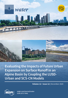
Cover Story (view full-size image): Effectively evaluating future urban expansion impacts (UEI) on surface runoff in alpine basins is full of challenges due to the lack of reliable methods. This study develops a new method by coupling the land use scenario dynamics-urban (LUSD-urban) model and soil conservation service–curve number (SCS-CN) model to estimate future UEI on surface runoff. Taking the Qinghaihu–Huangshui basin (QHB) in the Tibetan Plateau, China as an example, we find that our method could effectually evaluate future UEI on surface runoff. Therefore, we believe that the coupled model developed by this manuscript can be applied to evaluate future UEI on surface runoff and aids with sustainable urban development in alpine basins. View this paper
  • Issues are regarded as officially published after their release is announced to the table of contents alert mailing list.
  • You may sign up for e-mail alerts to receive table of contents of newly released issues.
  • PDF is the official format for papers published in both, html and pdf forms. To view the papers in pdf format, click on the "PDF Full-text" link, and use the free Adobe Reader to open them.
Order results
Result details
Section
Select all
Export citation of selected articles as:
15 pages, 1036 KiB  
Article
Revisiting Soil Aquifer Treatment: Improving Biodegradation and Filtration Efficiency Using a Highly Porous Material
by Joshua Brooks, Noam Weisbrod and Edo Bar-Zeev
Water 2020, 12(12), 3593; https://doi.org/10.3390/w12123593 - 21 Dec 2020
Cited by 7 | Viewed by 3518
Abstract
Soil aquifer treatment (SAT) is an established and sustainable wastewater treatment approach for water reuse that has been gaining increased attention in various countries around the world. Increasing volumes of domestic wastewater and escalating real estate prices around urban areas emphasize the urgent [...] Read more.
Soil aquifer treatment (SAT) is an established and sustainable wastewater treatment approach for water reuse that has been gaining increased attention in various countries around the world. Increasing volumes of domestic wastewater and escalating real estate prices around urban areas emphasize the urgent need to maximize the treatment efficiency by revisiting the SAT setup. In this study, a novel approach was examined to increase biodegradation rates and improve the quality of SAT topsoil effluent. Experiments with midscale, custom-made columns were carried out with sand collected from an operational SAT and a highly permeable natural material with high internal porosity, tuff, which was maturated (i.e., buried in the SAT infiltration basin) for 3 months. The filtration efficiency, biodegradation rates of organic material, microbial diversity, and outflow quality were compared between the operational SAT sand and the tuff using state-of-the-art approaches. The results of this study indicate that biodegradation rates (9.2 µg C g−1d−1) and filtration efficiency were up to 2.5-fold higher within the tuff than the SAT sand. Furthermore, the biofilm community was markedly different between the two media, giving additional insights into the bacterial phyla responsible for biodegradation. The results highlight the advantage of using highly porous material to enhance the SAT filtration efficiency without extending the topsoil volume. Hence, infusing a permeable medium, comprising highly porous material, into the SAT topsoil could offer a simple approach to upgrade an already advantageous SAT in both developed and developing countries. Full article
Show Figures

Figure 1

15 pages, 4449 KiB  
Article
Biological Reduction of Organic Matter in Buji River Sediment (Shenzhen, China) with Artificial Oxygenation
by Lin Che, Wenbiao Jin, Xu Zhou, Chenbo Cao, Wei Han, Changlei Qin, Renjie Tu, Yidi Chen, Xiaochi Feng and Qilin Wang
Water 2020, 12(12), 3592; https://doi.org/10.3390/w12123592 - 21 Dec 2020
Cited by 7 | Viewed by 2704
Abstract
In this work, artificial oxygenation treatment (pure oxygen aeration or oxygen enriched water injection) combined with the introduction of exogenous microorganisms was employed to purify urban river sediment for the first time. Results showed that the developed in situ remediation strategy could increase [...] Read more.
In this work, artificial oxygenation treatment (pure oxygen aeration or oxygen enriched water injection) combined with the introduction of exogenous microorganisms was employed to purify urban river sediment for the first time. Results showed that the developed in situ remediation strategy could increase the dissolved oxygen (DO) concentration and oxidation-reduction potential (ORP) value of the sediments. Benefiting from the increase of DO concentration, the bacterial diversity was enhanced. The highest removal efficiencies of organic matter were 18.4% and 22.3% through pure oxygen aeration and oxygen enriched water injection, respectively. More importantly, overlying water quality was not affected. By comparison, oxygen enriched water injection treatment could achieve better performance on sediment purification. Introducing exogenous microorganisms further reduced the organic matter content of the sediment. In short, the current work not only proposed a promising strategy for controlling urban river sediment pollution, but also provided novel insight for the understanding of river sediment containing highly concentrated organic matter. Full article
(This article belongs to the Section Biodiversity and Functionality of Aquatic Ecosystems)
Show Figures

Figure 1

24 pages, 4671 KiB  
Article
Assessment of Landscape Retention Water Capacity and Hydrological Balance in Traditional Agricultural Landscape (Model Area Liptovská Teplička Settlements, Slovakia)
by Zdena Krnáčová, Pavol Kenderessy, Juraj Hreško, Daniel Kubínsky and Marta Dobrovodská
Water 2020, 12(12), 3591; https://doi.org/10.3390/w12123591 - 21 Dec 2020
Cited by 1 | Viewed by 2428
Abstract
The hydration potential of a landscape is an increasingly important attribute in a time of advancing climate change, making its assessment also a matter of some urgency. This study used the landscape ecological approach involving the hydrological balance, in which the soil water [...] Read more.
The hydration potential of a landscape is an increasingly important attribute in a time of advancing climate change, making its assessment also a matter of some urgency. This study used the landscape ecological approach involving the hydrological balance, in which the soil water retention capacity (SWRC) and landscape water retention capacity (LWRC) are evaluated. To support our assessment of the water retention capacity in the landscape (LWRC), we used a synthetic interconnection of analytical vector layers of selected physical parameters of soil subtypes and secondary landscape structure (SLS) to create homogeneous polygons in the GIS Arc/Map10 computing environment. Selected abiotic and biotic attributes were assigned coefficients using a simple algorithm according to the authors, which were projected into landscape ecological complexes (LEC) in the GIS computer program in the Arc/Map10 program. We used hydrological balance calculations to specify the volumes of water retained in the landscape. The aim is to spatially estimate the retention capacity of the landscape, taking into account the current land use, including historical anti-erosion measures to reduce unwanted water runoff and soil erosion. Using zonal statistics, we achieved the following results. The part of the model area with very low or low LWCR represents 39.91% of the agricultural land used. We recorded a high LWCR on 17.69% of the area, with a predominance of meadows and cultizol cambis and cultizol fluvials. The calculation of the hydrological balance, which represents only 22.9% of atmospheric precipitation, also made a significant contribution to our knowledge of the LWRC. Full article
(This article belongs to the Special Issue Hydrological Impacts of Climate Change and Land Use)
Show Figures

Figure 1

28 pages, 1097 KiB  
Review
An Overview of Per- and Polyfluoroalkyl Substances (PFAS) in the Environment: Source, Fate, Risk and Regulations
by Ziyad Abunada, Motasem Y. D. Alazaiza and Mohammed J. K. Bashir
Water 2020, 12(12), 3590; https://doi.org/10.3390/w12123590 - 21 Dec 2020
Cited by 97 | Viewed by 17691
Abstract
The current article reviews the state of art of the perfluoroalkyl and polyfluoroalkyl substances (PFASs) compounds and provides an overview of PFASs occurrence in the environment, wildlife, and humans. This study reviews the issues concerning PFASs exposure and potential risks generated with a [...] Read more.
The current article reviews the state of art of the perfluoroalkyl and polyfluoroalkyl substances (PFASs) compounds and provides an overview of PFASs occurrence in the environment, wildlife, and humans. This study reviews the issues concerning PFASs exposure and potential risks generated with a focus on PFAS occurrence and transformation in various media, discusses their physicochemical characterization and treatment technologies, before discussing the potential human exposure routes. The various toxicological impacts to human health are also discussed. The article pays particular attention to the complexity and challenging issue of regulating PFAS compounds due to the arising uncertainty and lack of epidemiological evidence encountered. The variation in PFAS regulatory values across the globe can be easily addressed due to the influence of multiple scientific, technical, and social factors. The varied toxicology and the insufficient definition of PFAS exposure rate are among the main factors contributing to this discrepancy. The lack of proven standard approaches for examining PFAS in surface water, groundwater, wastewater, or solids adds more technical complexity. Although it is agreed that PFASs pose potential health risks in various media, the link between the extent of PFAS exposure and the significance of PFAS risk remain among the evolving research areas. There is a growing need to address the correlation between the frequency and the likelihood of human exposure to PFAS and the possible health risks encountered. Although USEPA (United States Environmental Protection Agency) recommends the 70 ng/L lifetime health advisory in drinking water for both perfluorooctane sulfonate (PFO) perfluorooctanoic acid (PFOA), which is similar to the Australian regulations, the German Ministry of Health proposed a health-based guidance of maximum of 300 ng/L for the combination of PFOA and PFOS. Moreover, there are significant discrepancies among the US states where the water guideline levels for the different states ranged from 13 to 1000 ng L−1 for PFOA and/or PFOS. The current review highlighted the significance of the future research required to fill in the knowledge gap in PFAS toxicology and to better understand this through real field data and long-term monitoring programs. Full article
(This article belongs to the Special Issue Wastewater Treatment: Current and Future Techniques)
Show Figures

Figure 1

5 pages, 1137 KiB  
Editorial
Urban Water Management: A Pragmatic Approach
by Bruno Brunone and Marco Franchini
Water 2020, 12(12), 3589; https://doi.org/10.3390/w12123589 - 21 Dec 2020
Cited by 1 | Viewed by 1987
Abstract
When the 4th edition of the International Electronic Conference on Water Sciences (ECWS-4), sponsored by Water and MDPI, was launched, the COVID-19 pandemic did not exist at all [...] Full article
(This article belongs to the Special Issue Urban Water Management: A Pragmatic Approach)
Show Figures

Figure 1

19 pages, 6424 KiB  
Article
A Review of Tank Model and Its Applicability to Various Korean Catchment Conditions
by Jong Wook Lee, Sun Dong Chegal and Seung Oh Lee
Water 2020, 12(12), 3588; https://doi.org/10.3390/w12123588 - 21 Dec 2020
Cited by 5 | Viewed by 4628
Abstract
This paper reviews a conceptual rainfall-runoff model called Tank which has been widely used over the last 20 years in Korea as a part of a water resource modelling framework for assessing and developing long-term water resource polices. In order to examine the [...] Read more.
This paper reviews a conceptual rainfall-runoff model called Tank which has been widely used over the last 20 years in Korea as a part of a water resource modelling framework for assessing and developing long-term water resource polices. In order to examine the uncertainty of model predictions and the sensitivity of model’s parameters, Monte Carlos and Markov chain-based approaches are applied to five catchments of various Korean geographical and climatic conditions where the catchment sizes are ranged from 83 to 4786 km2. In addition, three optimization algorithms—dynamically dimensioned search (DDS), robust parameter estimation (ROPE), and shuffled complex evolution (SCE)—are selected to test whether the model parameters can be optimized consistently within a narrower range than the uncertainty bounds. From the uncertainty analysis, it is found that there is limited success in refining the priori distributions of the model parameters, indicating there is a high degree of equifinality for some parameters or at least there are large numbers of parameter combinations leading to good solutions within model’s uncertainty bounds. Out of the three optimization algorithms, SCE meets the criteria of the consistency best. It is also found that there are still some parameters that even the SCE method struggles to refine the priori distributions. It means that their contribution to model results is minimal and can take a value within a reasonable range. It suggests that the model may be reconceptualized to be parsimonious and to rationalize some parameters without affecting model’s capacity to replicate historical flow characteristics. Cross-validation indicates that sensitive parameters to catchment characteristics can be transferred when geophysical similarity exists between two catchments. Regionalization can be further improved by using a regression or geophysical similarity-based approach to transfer model parameters to ungauged catchments. It may be beneficial to categorize the model parameters depending on the level of their sensitivities, and a different approach to each category may be applied to regionalize the calibrated parameters. Full article
(This article belongs to the Section Hydrology)
Show Figures

Figure 1

16 pages, 2865 KiB  
Article
Performance of Satellite-Based Evapotranspiration Models in Temperate Pastures of Southern Chile
by Italo Moletto-Lobos, Cristian Mattar and Jonathan Barichivich
Water 2020, 12(12), 3587; https://doi.org/10.3390/w12123587 - 21 Dec 2020
Cited by 9 | Viewed by 3181
Abstract
Farmers in the temperate zone of southern Chile have started to irrigate historically rainfed pastures during recent years to reduce dairy productivity losses against increasingly severe summer droughts. The lack of information on pasture water requirements (i.e., evapotranspiration), however, hampers the implementation of [...] Read more.
Farmers in the temperate zone of southern Chile have started to irrigate historically rainfed pastures during recent years to reduce dairy productivity losses against increasingly severe summer droughts. The lack of information on pasture water requirements (i.e., evapotranspiration), however, hampers the implementation of efficient irrigation programs. Here, we use in-situ observations to evaluate the skill of four remote sensing Surface Energy Balance (SEB) models and two satellite-based global evapotranspiration products (PML_V2 and GLEAM) to estimate actual evapotranspiration (ETa) of pastures in southern Chile during 2014–2017. Daily ETa measured at an evaluation site over the period ranges between 1.2 mm and 6.2 mm day−1 during the growing season (October–March), with an annual maximum of about 4.8 mm day−1 in January and a minimum 0.6 mm day−1 in June. Only the Simplified SEB (SEBS) model and its operational variant (SSEBop) and the PML_V2 global evapotranspiration product perform well, capturing 63–79% of the variance of in-situ evapotranspiration with an error between 0.75 mm day−1 and 1.1 mm day−1. The readily available PML_V2 product can be used as a convenient way to determine average water footprint of pastures and the two SEBs models can be implemented to monitor irrigation requirements in near-real time from field to regional scales. These results demonstrated a high potential of satellite observations for monitoring evapotranspiration and quantify the water footprint of pastures in southern Chile for a sustainable irrigation practice. Full article
(This article belongs to the Section Water, Agriculture and Aquaculture)
Show Figures

Figure 1

16 pages, 3861 KiB  
Article
Spatiotemporal Dissolved Silicate Variation, Sources, and Behavior in the Eutrophic Zhanjiang Bay, China
by Peng Zhang, Jia-Lei Xu, Ji-Biao Zhang, Jian-Xu Li, Yan-Chan Zhang, Yi Li and Xin-Qi Luo
Water 2020, 12(12), 3586; https://doi.org/10.3390/w12123586 - 21 Dec 2020
Cited by 21 | Viewed by 3003
Abstract
Dissolved silicate (DSi) is an important nutrient in coastal water, which is used by planktonic diatoms for cell division and growth. In this study, surface water samples were collected in the eutrophic Zhanjiang Bay (ZJB) in 2019, covering a seasonal variation of coastal [...] Read more.
Dissolved silicate (DSi) is an important nutrient in coastal water, which is used by planktonic diatoms for cell division and growth. In this study, surface water samples were collected in the eutrophic Zhanjiang Bay (ZJB) in 2019, covering a seasonal variation of coastal water and land-based source water discharge. The spatiotemporal DSi distribution, land-based sources flux input and behaviors in ZJB were studied and discussed. The results show that the DSi concentration had significant differences in spatiotemporal scale. The average concentration of DSi in ZJB was 38.00 ± 9.48 μmol·L−1 in spring, 20.23 ± 11.27 μmol·L−1 in summer, 12.48 ± 1.42 μmol·L−1 in autumn and 11.96 ± 4.85 μmol·L−1 in winter. The spatiotemporal DSi distribution showed a decreasing gradient from the top to the mouth of ZJB, which was affected by land source inputs and hydrodynamics. The land-based sources’ input concentration of DSi in ZJB ranged from 0.021 to 0.46 mol·L−1, with an average of 0.14 mol·L−1, and the total annual flux of DSi was 1.06 × 10⁹ mol, comprising up to 8.28%, 41.55% and 50.17% in dry, normal, and wet seasons, respectively. The Suixi River contributed the highest DSi flux proportion in all seasons. The DSi in land-based source water was mainly affected by water flow discharge, diatom uptake and impacts from anthropogenic activities. Compared with dissolved inorganic nitrogen (DIN) and dissolved inorganic phosphorus (DIP), the DSi was the limitation nutrient in ZJB. Additionally, the DSi concentration in the coastal water was negatively correlated with salinity. The seasonal DSi/DIN and DSi/DIP ratios in land-based sources discharge water was significantly higher than that in coastal water (p < 0.05). Land-based sources of DSi input played an important role in nutrients composition that sustained diatoms as the dominant species in ZJB. Full article
(This article belongs to the Section Oceans and Coastal Zones)
Show Figures

Figure 1

26 pages, 4006 KiB  
Article
Integrated Water Management at the Peri-Urban Interface: A Case Study of Monterey, California
by Bridget C. Gile, Paul A. Sciuto, Negin Ashoori and Richard G. Luthy
Water 2020, 12(12), 3585; https://doi.org/10.3390/w12123585 - 21 Dec 2020
Cited by 3 | Viewed by 4655
Abstract
Climate change, drought, and chronic overdraft represent growing threats to the sustainability of water supplies in dry environments. The Monterey/Salinas region in California exemplifies a new era of integrated or “one water” management that is using all of the water it can get [...] Read more.
Climate change, drought, and chronic overdraft represent growing threats to the sustainability of water supplies in dry environments. The Monterey/Salinas region in California exemplifies a new era of integrated or “one water” management that is using all of the water it can get to achieve more sustainable supplies to benefit cities, agriculture, and the environment. This program is the first of its kind to reuse a variety of waters including wastewater, stormwater, food industry processing water, and agricultural drainage water. This study investigates the partnerships, projects, and innovations that shape Monterey’s integrated water network in order to better understand the challenges and opportunities facing California communities as they seek to sustainably manage peri-urban water supplies. Water reuse in the Monterey region produces substantial economic and environmental benefits, from tourism and irrigation of high-value crops to protection of groundwater and increases in environmental flows and water quality. Water resource managers in other communities can learn from Monterey’s success leveraging local needs and regional partnerships to develop effective integrated water solutions. However, key challenges remain in resolving mismatched timing between water availability and demand, funding alternative water supplies, and planning effectively under uncertainty. Opportunities exist to increase Monterey’s recycled water supply by up to 50%, but this requires investment in seasonal storage and depends on whether desalination or additional recycling forms the next chapter in the region’s water supply story. Regulatory guidance is needed on seasonal subsurface storage of tertiary-treated recycled water as distinct from potable recharge. By increasing the supply of recycled water to Monterey’s indirect potable use system, the region’s potential need for seawater desalination may be delayed as much as 30 years, resulting in cost and energy savings, and giving the opportunity to resolve present planning concerns. Full article
Show Figures

Figure 1

19 pages, 1865 KiB  
Article
Under-Sink Activated Carbon Water Filters Effectively Remove Lead from Private Well Water for over Six Months
by Riley Mulhern and Jacqueline MacDonald Gibson
Water 2020, 12(12), 3584; https://doi.org/10.3390/w12123584 - 21 Dec 2020
Cited by 16 | Viewed by 8328
Abstract
Children who rely on private well water in the United States have been shown to be at greater risk of having elevated blood lead levels. Evidence-based solutions are needed to prevent drinking water lead exposure among private well users, but minimal data are [...] Read more.
Children who rely on private well water in the United States have been shown to be at greater risk of having elevated blood lead levels. Evidence-based solutions are needed to prevent drinking water lead exposure among private well users, but minimal data are available regarding the real-world effectiveness of available interventions like point-of-use water treatment for well water. In this study, under-sink activated carbon block water filters were tested for lead and other heavy metals removal in an eight-month longitudinal study in 17 homes relying on private wells. The device removed 98% of all influent lead for the entirety of the study, with all effluent lead levels less than 1 µg/L. Profile sampling in a subset of homes showed that the faucet fixture is a significant source of lead leaching where well water is corrosive. Flushing alone was not capable of reducing first-draw lead to levels below 1 µg/L, but the under-sink filter was found to increase the safety and effectiveness of faucet flushing. The results of this study can be used by individual well users and policymakers alike to improve decision-making around the use of under-sink point-of-use devices to prevent disproportionate lead exposures among private well users. Full article
(This article belongs to the Special Issue Challenges in Supplying Safe Drinking Water in Rural Communities)
Show Figures

Graphical abstract

15 pages, 5393 KiB  
Article
Efficient Removal of Levofloxacin by Activated Persulfate with Magnetic CuFe2O4/MMT-k10 Nanocomposite: Characterization, Response Surface Methodology, and Degradation Mechanism
by Junying Yang, Minye Huang, Shengsen Wang, Xiaoyun Mao, Yueming Hu and Xian Chen
Water 2020, 12(12), 3583; https://doi.org/10.3390/w12123583 - 21 Dec 2020
Cited by 17 | Viewed by 3167
Abstract
In this study, a magnetic copper ferrite/montmorillonite-k10 nanocomposite (CuFe2O4/MMT-k10) was successfully fabricated by a simple sol-gel combustion method and was characterised by X-ray diffraction (XRD), scanning electron microscopy (SEM), transmission electron microscopy (TEM), the Brunner–Emmett–Teller (BET) method, vibrating sample [...] Read more.
In this study, a magnetic copper ferrite/montmorillonite-k10 nanocomposite (CuFe2O4/MMT-k10) was successfully fabricated by a simple sol-gel combustion method and was characterised by X-ray diffraction (XRD), scanning electron microscopy (SEM), transmission electron microscopy (TEM), the Brunner–Emmett–Teller (BET) method, vibrating sample magnetometer (VSM), and X-ray photoelectron spectroscopy (XPS). For levofloxacin (LVF) degradation, CuFe2O4/MMT-k10 was utilized to activate persulfate (PS). Due to the relative high adsorption capacity of CuFe2O4/MMT-k10, the adsorption feature was considered an enhancement of LVF degradation. In addition, the response surface methodology (RSM) model was established with the parameters of pH, temperature, PS dosage, and CuFe2O4/MMT-k10 dosage as the independent variables to obtain the optimal response for LVF degradation. In cycle experiments, we identified the good stability and reusability of CuFe2O4/MMT-k10. We proposed a potential mechanism of CuFe2O4/MMT-k10 activating PS through free radical quenching tests and XPS analysis. These results reveal that CuFe2O4/MMT-k10 nanocomposite could activate the persulfate, which is an efficient technique for LVF degradation in water. Full article
(This article belongs to the Special Issue Remediation of Contaminated or Degraded Soil and Water Resources)
Show Figures

Figure 1

15 pages, 5157 KiB  
Article
Elevation Dependence of the Impact of Global Warming on Rainfall Variations in a Tropical Island
by Mirindra Finaritra Rabezanahary Tanteliniaina, Jia Chen, Tanveer M. Adyel and Jun Zhai
Water 2020, 12(12), 3582; https://doi.org/10.3390/w12123582 - 21 Dec 2020
Cited by 8 | Viewed by 3273
Abstract
Due to their vulnerability, understanding the impacts of global warming on rainfall is important for a tropical country and islands. This research aimed to assess the impact of global warming on rainfall in Madagascar, using the Mann-Kendall test, continuous wavelet transform, and polynomial [...] Read more.
Due to their vulnerability, understanding the impacts of global warming on rainfall is important for a tropical country and islands. This research aimed to assess the impact of global warming on rainfall in Madagascar, using the Mann-Kendall test, continuous wavelet transform, and polynomial regression. The result showed that the annual, seasonal maximum, and minimum temperature increased, while elevation amplified the increase of maximum temperature. Different trends in rainfall were found in the 22 regions of Madagascar but in general, the increasing trend in rainfall was prominent at a higher elevation than lower elevation. The annual rainfall decreased up to −5 mm per year for the regions located below 450 m of altitude while increased up to +5 mm per year above 500 m. We found that the wet becomes wetter with an important increase in rainfall in summer and the increase in temperature influenced the rainfall. The annual rainfall increased with temperature and elevation. However, if the increase in temperature was more than 0.03 °C per year, the annual rainfall increased regardless of elevation. The knowledge of the elevation dependence of the impact of warming on rainfall is important for water resources management and climate change adaptation strategies, especially for island nations and African countries. Full article
(This article belongs to the Special Issue Advanced Optimization of Wastewater Treatment Processes)
Show Figures

Figure 1

20 pages, 6455 KiB  
Article
Unravelling Climate and Anthropogenic Forcings on the Evolution of Surface Water Resources in Southern France
by Camille Labrousse, Wolfgang Ludwig, Sébastien Pinel, Mahrez Sadaoui and Guillaume Lacquement
Water 2020, 12(12), 3581; https://doi.org/10.3390/w12123581 - 20 Dec 2020
Cited by 6 | Viewed by 3450
Abstract
In the Mediterranean, climate change and human pressures are expected to significantly impact the availability of surface water resources. In order to quantify these impacts during the last 60 years (1959–2018), we examined the hydro-climatic and land use change evolution in six coastal [...] Read more.
In the Mediterranean, climate change and human pressures are expected to significantly impact the availability of surface water resources. In order to quantify these impacts during the last 60 years (1959–2018), we examined the hydro-climatic and land use change evolution in six coastal river basins of the Gulf of Lion in southern France. By combining observed water discharge, gridded climate, mapped land use and agricultural censuses data, we propose a statistical regression model which successfully reproduces the variability of annual water discharge in all basins. Our results clearly demonstrate that, despite important anthropogenic water withdrawals for irrigation, climate change is the major driver for the detected reduction of water discharge. The model can explain 78–88% of the variability of annual water discharge in the study catchments. It requires only two climatic indices that are solely computed from monthly temperature (T) and precipitation (P) data, thus allowing the estimation of the respective contributions of both parameters in the detected changes. According to our results, the study region experienced on average a warming trend of 1.6 °C during the last 60 years which alone was responsible for a reduction of almost 25% of surface water resources. Full article
Show Figures

Figure 1

18 pages, 3908 KiB  
Article
Solving Transient Groundwater Inverse Problems Using Space–Time Collocation Trefftz Method
by Cheng-Yu Ku, Li-Dan Hong and Chih-Yu Liu
Water 2020, 12(12), 3580; https://doi.org/10.3390/w12123580 - 20 Dec 2020
Cited by 6 | Viewed by 2064
Abstract
This paper presents a space–time meshfree method for solving transient inverse problems in subsurface flow. Based on the transient groundwater equation, we derived the Trefftz basis functions utilizing the method of separation of variables. Due to the basis functions completely satisfying the equation [...] Read more.
This paper presents a space–time meshfree method for solving transient inverse problems in subsurface flow. Based on the transient groundwater equation, we derived the Trefftz basis functions utilizing the method of separation of variables. Due to the basis functions completely satisfying the equation to be solved, collocation points are placed on the space–time boundaries. Numerical solutions are approximated based on the superposition theorem. Accordingly, the initial and boundary conditions are both regarded as space–time boundary conditions. Forward and inverse examples are conducted to validate the proposed approach. Emphasis is placed on the two-dimensional boundary detection problem in which the nonlinearity is solved using the fictitious time integration method. Results demonstrate that approximations with high accuracy are acquired in which the boundary data on the absent boundary may be efficiently recovered even when inaccessible partial data are provided. Full article
(This article belongs to the Special Issue Meshless Methods for Water Dynamics and Complex Flows)
Show Figures

Figure 1

23 pages, 6364 KiB  
Review
Urban Flooding Mitigation Techniques: A Systematic Review and Future Studies
by Yinghong Qin
Water 2020, 12(12), 3579; https://doi.org/10.3390/w12123579 - 20 Dec 2020
Cited by 45 | Viewed by 13993
Abstract
Urbanization has replaced natural permeable surfaces with roofs, roads, and other sealed surfaces, which convert rainfall into runoff that finally is carried away by the local sewage system. High intensity rainfall can cause flooding when the city sewer system fails to carry the [...] Read more.
Urbanization has replaced natural permeable surfaces with roofs, roads, and other sealed surfaces, which convert rainfall into runoff that finally is carried away by the local sewage system. High intensity rainfall can cause flooding when the city sewer system fails to carry the amounts of runoff offsite. Although projects, such as low-impact development and water-sensitive urban design, have been proposed to retain, detain, infiltrate, harvest, evaporate, transpire, or re-use rainwater on-site, urban flooding is still a serious, unresolved problem. This review sequentially discusses runoff reduction facilities installed above the ground, at the ground surface, and underground. Mainstream techniques include green roofs, non-vegetated roofs, permeable pavements, water-retaining pavements, infiltration trenches, trees, rainwater harvest, rain garden, vegetated filter strip, swale, and soakaways. While these techniques function differently, they share a common characteristic; that is, they can effectively reduce runoff for small rainfalls but lead to overflow in the case of heavy rainfalls. In addition, most of these techniques require sizable land areas for construction. The end of this review highlights the necessity of developing novel, discharge-controllable facilities that can attenuate the peak flow of urban runoff by extending the duration of the runoff discharge. Full article
(This article belongs to the Special Issue Rainwater Management in Urban Areas)
Show Figures

Figure 1

25 pages, 9837 KiB  
Article
Natural vs. Anthropic Influence on the Multidecadal Shoreline Changes of Mediterranean Urban Beaches: Lessons from the Gulf of Cagliari (Sardinia)
by Manuela Biondo, Carla Buosi, Daniele Trogu, Hannah Mansfield, Matteo Vacchi, Angelo Ibba, Marco Porta, Andrea Ruju and Sandro De Muro
Water 2020, 12(12), 3578; https://doi.org/10.3390/w12123578 - 20 Dec 2020
Cited by 10 | Viewed by 3850
Abstract
Urban Mediterranean beaches are often characterized by a fragile and unstable equilibrium that can be easily altered by ongoing climate change and by the increase in human pressure. This may pose serious threats to the survival of beach systems that cannot accommodate these [...] Read more.
Urban Mediterranean beaches are often characterized by a fragile and unstable equilibrium that can be easily altered by ongoing climate change and by the increase in human pressure. This may pose serious threats to the survival of beach systems that cannot accommodate these modifications. In this paper, the spatio-temporal shift of the shoreline was investigated along two urban beaches in the Gulf of Cagliari (Poetto and Giorgino; southern Sardinia, western Mediterranean Sea) across a time frame of 62 years (1954–2016). The Digital Shoreline Analysis System (DSAS) ArcGIS™ extension was used to extract different statistical parameters which allowed us to quantify the erosion and accretion rates. These data were further examined in relation to a number of anthropic and natural forcings in order to disentangle the factors controlling shoreline evolution. Eight sectors with interchanging net erosive and accretion trends were identified along the Poetto and Giorgino beaches. In six decades, some sectors of the two study sites appeared to have undergone great shoreline modification as a result of the intense anthropogenic activities impacting these coastal areas. The westernmost portions of both beaches were found to be the most vulnerable to erosion processes; such conditions were likely controlled by the interplaying of local hydrodynamics and by the intense coastal development which affected these sectors. The highest retreat rates (mean end point rate (EPR) = −0.51/year) were recorded in the western limit of Giorgino beach. Along the western limit of Poetto beach, EPR erosion rates (mean EPR = −2.92/year) considerably increased in the years after the artificial beach nourishment carried out in 2002, suggesting that the majority of the nourished material was lost offshore or partly redistributed along the beach. Coastal structures, urban development, river catchment modification, industrial and port activities, beach cleaning and touristic and recreational activities have been identified as the ongoing causes of coastal alteration. If these factors remain constant, under projected climate change scenarios, these beaches are at risk of further increased flooding and erosion. In this context, the application of DSAS appeared as an essential tool, supporting a monitoring system able to provide understanding and, potentially, predictions of the short- to long-term evolution of these beach systems. Full article
Show Figures

Figure 1

22 pages, 1624 KiB  
Review
Green Infrastructure as an Urban Heat Island Mitigation Strategy—A Review
by Fatma Balany, Anne WM Ng, Nitin Muttil, Shobha Muthukumaran and Man Sing Wong
Water 2020, 12(12), 3577; https://doi.org/10.3390/w12123577 - 20 Dec 2020
Cited by 73 | Viewed by 12732
Abstract
Research on urban heat mitigation has been growing in recent years with many of the studies focusing on green infrastructure (GI) as a strategy to mitigate the adverse effects of an urban heat island (UHI). This paper aims at presenting a review of [...] Read more.
Research on urban heat mitigation has been growing in recent years with many of the studies focusing on green infrastructure (GI) as a strategy to mitigate the adverse effects of an urban heat island (UHI). This paper aims at presenting a review of the range of findings from GI research for urban heat mitigation through a review of scientific articles published during the years 2009–2020. This research includes a review of the different types of GI and its contribution for urban heat mitigation and human thermal comfort. In addition to analysing different mitigation strategies, numerical simulation tools that are commonly used are also reviewed. It is seen that ENVI-met is one of the modelling tools that is considered as a reliable to simulate different mitigation strategies and hence has been widely used in the recent past. Considering its popularity in urban microclimate studies, this article also provides a review of ENVI-met simulation results that were reported in the reviewed papers. It was observed that the majority of the research was conducted on a limited spatial scale and focused on temperature and human thermal comfort. Full article
Show Figures

Figure 1

17 pages, 3040 KiB  
Article
Spatiotemporal Variation in Relative Humidity in Guangdong, China, from 1959 to 2017
by Zhanming Liu, Hong Yang and Xinghu Wei
Water 2020, 12(12), 3576; https://doi.org/10.3390/w12123576 - 20 Dec 2020
Cited by 8 | Viewed by 3055
Abstract
Despite the marked influence of relative humidity (RH) on ecosystems and human society, the spatiotemporal pattern of RH is far from clearly understood. This study analyzed the spatiotemporal variation in RH in Guangdong Province, South China, in the period of 1959–2017. The RH [...] Read more.
Despite the marked influence of relative humidity (RH) on ecosystems and human society, the spatiotemporal pattern of RH is far from clearly understood. This study analyzed the spatiotemporal variation in RH in Guangdong Province, South China, in the period of 1959–2017. The RH data were collected from 74 national standard meteorological stations. The spatiotemporal variation in RH was evaluated using rotate empirical orthogonal function (REOF) zoning, Mann–Kendall test, and wavelet transform methods. Based on the REOF decomposition situation of monthly RH field, Guangdong was divided into six subareas. The annual mean of RH in the whole province was 78.90%. In terms of spatial variation, overall annual mean RH decreased from southwest to northeast in the province. Temporally, annual mean RH showed a declining trend in the last six decades. Particularly, the RH in the Pearl River Delta area declined at the rate of 1.349%/10a. Mann–Kendall tests showed that mutation points of annual mean RH mostly appeared in the 1990s, especially in the early 1990s. Continuous wavelet transforms of annual mean RH displayed that inland subareas have similar cycle characteristics, and the east coast and Pearl River Delta have no significant period in most time domains. The results provide new understanding of RH variation in the last six decades in South China, which is valuable for detecting climate change, monitoring hazardous weather, and predicting future environmental change. Full article
Show Figures

Figure 1

20 pages, 7416 KiB  
Article
Changing Low Flow and Streamflow Drought Seasonality in Central European Headwaters
by Vojtech Vlach, Ondrej Ledvinka and Milada Matouskova
Water 2020, 12(12), 3575; https://doi.org/10.3390/w12123575 - 20 Dec 2020
Cited by 17 | Viewed by 3615
Abstract
In the context of the ongoing climate warming in Europe, the seasonality and magnitudes of low flows and streamflow droughts are expected to change in the future. Increasing temperature and evaporation rates, stagnating precipitation amounts and decreasing snow cover will probably further intensify [...] Read more.
In the context of the ongoing climate warming in Europe, the seasonality and magnitudes of low flows and streamflow droughts are expected to change in the future. Increasing temperature and evaporation rates, stagnating precipitation amounts and decreasing snow cover will probably further intensify the summer streamflow deficits. This study analyzed the long-term variability and seasonality of low flows and streamflow droughts in fifteen headwater catchments of three regions within Central Europe. To quantify the changes in the low flow regime of selected catchments during the 1968–2019 period, we applied the R package lfstat for computing the seasonality ratio (SR), the seasonality index (SI), mean annual minima, as well as for the detection of streamflow drought events along with deficit volumes. Trend analysis of summer minimum discharges was performed using the Mann–Kendall test. Our results showed a substantial increase in the proportion of summer low flows during the analyzed period, accompanied with an apparent shift in the average date of low flow occurrence towards the start of the year. The most pronounced seasonality shifts were found predominantly in catchments with the mean altitude 800–1000 m.a.s.l. in all study regions. In contrast, the regime of low flows in catchments with terrain above 1000 m.a.s.l. remained nearly stable throughout the 1968–2019 period. Moreover, the analysis of mean summer minimum discharges indicated a much-diversified pattern in behavior of long-term trends than it might have been expected. The findings of this study may help identify the potentially most vulnerable near-natural headwater catchments facing worsening summer water scarcity. Full article
(This article belongs to the Special Issue Statistical Approach to Hydrological Analysis)
Show Figures

Figure 1

21 pages, 4228 KiB  
Review
Baseline Water Temperature: Estimation of the Annual Cycle of Surface Water Temperature in Lakes in North-Central Poland over the 1951–1968 Period
by Andrzej Hutorowicz
Water 2020, 12(12), 3574; https://doi.org/10.3390/w12123574 - 19 Dec 2020
Cited by 1 | Viewed by 2333
Abstract
Water temperature is an important ecological variable that affects the functioning of lakes. Unfortunately, for many lakes there are no long-term observations enabling the assessment of changes in water temperatures. This makes it difficult to include this aspect in research into the biology, [...] Read more.
Water temperature is an important ecological variable that affects the functioning of lakes. Unfortunately, for many lakes there are no long-term observations enabling the assessment of changes in water temperatures. This makes it difficult to include this aspect in research into the biology, ecology and chemistry of such lakes. This paper presents a literature review related to changes of surface water temperatures in lakes and in particular describing the response of water temperatures and stratification to changing climate in Polish lakes. On this basis, a model based on the available data on water temperature in 931 Polish lakes in the years 1951–1968 was proposed, which allows to estimate the baseline water temperature on any day of the year. This model is calculated using the complementary error peak function on the 0–3 m water temperature dataset, which provides the best reduction of diurnal temperature fluctuations. It can be an alternative to the average temperature of surface waters, which are calculated on the basis of systematically collected data. Based on the average water temperature data obtained from 56 thermal profiles in 10 lakes in 2010–2019, the equation was analogically calculated. The average monthly water temperatures in June, July, August and September and the change in water temperature (0.24–0.30 °C decade−1) in the period 1951–1968/2010–2019 were estimated then. Similar regional or single lake trends have been found in studies by other authors covering a similar or longer period of time. The proposed method, which is suitable for simulating temperatures, especially in summer, enables the determination of the value of changes in surface water temperature in Polish lakes when only thermal profiles data from different dates are available, which can be especially helpful when analyzing hydrobiological results. Full article
(This article belongs to the Section Water Quality and Contamination)
Show Figures

Figure 1

29 pages, 3815 KiB  
Article
Stable Carbon Isotopes of Phytoplankton as a Tool to Monitor Anthropogenic CO2 Submarine Leakages
by Federica Relitti, Nives Ogrinc, Michele Giani, Federica Cerino, Mirta Smodlaka Tankovic, Ana Baricevic, Lidia Urbini, Bor Krajnc, Paola Del Negro and Cinzia De Vittor
Water 2020, 12(12), 3573; https://doi.org/10.3390/w12123573 - 19 Dec 2020
Viewed by 3986
Abstract
This study aims to validate the stable carbon isotopic composition (δ13C) of phytoplankton as a tool for detecting submarine leakages of anthropogenic CO2(g), since it is characterised by δ13C values significantly lower than the natural CO [...] Read more.
This study aims to validate the stable carbon isotopic composition (δ13C) of phytoplankton as a tool for detecting submarine leakages of anthropogenic CO2(g), since it is characterised by δ13C values significantly lower than the natural CO2 dissolved in oceans. Three culture experiments were carried out to investigate the changes in δ13C of the diatom Thalassiosira rotula during growth in an artificially modified medium (ASW). Three different dissolved inorganic carbon (DIC) concentrations were tested to verify if carbon availability affects phytoplankton δ13C. Simultaneously, at each experiment, T. rotula was cultured under natural DIC isotopic composition (δ13CDIC) and carbonate system conditions. The available DIC pool for diatoms grown in ASW was characterised by δ13CDIC values (−44.2 ± 0.9‰) significantly lower than the typical marine range. Through photosynthetic DIC uptake, microalgae δ13C rapidly changed, reaching significantly low values (until −43.4‰). Moreover, the different DIC concentrations did not affect the diatom δ13C, exhibiting the same trend in δ13C values in the three ASW experiments. The experiments prove that phytoplankton isotopic composition quickly responds to changes in the δ13C of the medium, making this approach a promising and low-impact tool for detecting CO2(g) submarine leakages from CO2(g) deposits. Full article
(This article belongs to the Section Hydrology)
Show Figures

Figure 1

17 pages, 3992 KiB  
Article
Temperature and Consolidation Sensing Near Drinking Water Wells Using Fiber Bragg Grating Sensors
by Sandra Drusová, R. Martijn Wagterveld, Karel J. Keesman and Herman L. Offerhaus
Water 2020, 12(12), 3572; https://doi.org/10.3390/w12123572 - 19 Dec 2020
Cited by 1 | Viewed by 2772
Abstract
Drinking water wells require continuous monitoring to prevent groundwater-related issues such as pollution, clogging and overdrafting. In this research, optical fibers with fiber Bragg grating sensors were placed in an aquifer to explore their potential use in long-term well monitoring. Fiber Bragg grating [...] Read more.
Drinking water wells require continuous monitoring to prevent groundwater-related issues such as pollution, clogging and overdrafting. In this research, optical fibers with fiber Bragg grating sensors were placed in an aquifer to explore their potential use in long-term well monitoring. Fiber Bragg grating sensors were simultaneously sensitive to consolidation strain and temperature, and these two responses were separated by creating autoregressive consolidation models. Consolidation responses from these multiple sensors were rescaled to obtain pressure distribution along the depth. Pressure and temperature data showed impermeable soil layers and locations where groundwater accumulated. Time development of temperature along the fiber revealed oxidation of minerals and soil layers with varying permeability. Fiber Bragg grating sensors are useful tools to examine subsurface processes near wells and they can show the first signs of clogging. Full article
(This article belongs to the Section Water Resources Management, Policy and Governance)
Show Figures

Graphical abstract

20 pages, 5062 KiB  
Article
The Response of Lateral Flow to Peak River Discharge in a Macrotidal Estuary
by Yuhan Yan, Dehai Song, Xianwen Bao and Yang Ding
Water 2020, 12(12), 3571; https://doi.org/10.3390/w12123571 - 19 Dec 2020
Cited by 4 | Viewed by 2839
Abstract
The Ou River, a medium-sized river in southeastern China, is selected to study the lateral flow response to rapidly varied river discharge, i.e., peak river discharge (PRD). A three-dimensional model based on the Finite-Volume Community Ocean Model is validated by in situ measurements [...] Read more.
The Ou River, a medium-sized river in southeastern China, is selected to study the lateral flow response to rapidly varied river discharge, i.e., peak river discharge (PRD). A three-dimensional model based on the Finite-Volume Community Ocean Model is validated by in situ measurements from 15 June to 16 July 2005. PRD, which considers the extra buoyancy and longitudinal momentum in a short time, rebuilds the stratification and lateral flow. PRD, compared with low-discharge, generally makes stratification stronger and lateral flow weaker. PRD mainly rebuilds lateral flow by changing lateral advection, lateral Coriolis, and lateral-barotropic pressure gradient terms. After PRD, the salinity recovery time is longer than that of the flow because the impact on buoyancy lasts longer than that on longitudinal flow. Longitudinal flow is mostly affected by the momentum transferred during PRD; therefore, the recovery time is close to the flooding duration. However, the lateral flow is affected by the buoyancy, and its recovery time is generally longer than the flooding duration. The lateral flow recovery time depends on transect width, flow velocity and the variation caused by PRD. PRD occurs widely in global small-/medium-sized river estuaries, and the result of this work can be extended to other estuaries. Full article
(This article belongs to the Special Issue Hydrodynamics in Estuaries and Coast: Analysis and Modeling)
Show Figures

Figure 1

19 pages, 3439 KiB  
Article
An Application of Correlation and Spectral Analysis in Hydrological Study of Neighboring Karst Springs
by Vesna Denić-Jukić, Ana Lozić and Damir Jukić
Water 2020, 12(12), 3570; https://doi.org/10.3390/w12123570 - 19 Dec 2020
Cited by 16 | Viewed by 3525
Abstract
Various methods of time series analysis have been used in studies of karst hydrological systems. Among these methods, correlation and spectral analysis have had an important role. The correlation analysis most often has been based on determination of correlation coefficients and correlation functions. [...] Read more.
Various methods of time series analysis have been used in studies of karst hydrological systems. Among these methods, correlation and spectral analysis have had an important role. The correlation analysis most often has been based on determination of correlation coefficients and correlation functions. Partial correlation functions (PCF) are a mathematical tool of the correlation analysis which practical applicability in karst hydrology is insufficiently explored. In this study, the correlation and spectral analysis are applied on the catchment of Rumin Springs located in the Dinaric karst area between Croatia and Bosnia and Herzegovina. The available daily data are the rainfall, air temperature and relative humidity from three locations, as well as the discharge from two springs. The periods before and after the construction of HPP Orlovac in 1973 are analyzed. The basic hypothesis is that a difference between PCF obtained for two neighboring karst springs describe a difference in their functioning. The results of application show that PCF can resolve some ambiguities concerning the effects included in correlation functions and can provide the additional information that cannot be obtained by other methods of time series analysis. The obtained results are mostly in accordance with the present knowledge, and they support the existing hypotheses about the functioning of Rumin Springs. Full article
(This article belongs to the Special Issue Recent Advances in Karstic Hydrogeology)
Show Figures

Figure 1

22 pages, 10942 KiB  
Article
Risk Assessment of Irrigation-Related Soil Salinization and Sodification in Mediterranean Areas
by Alexandra Tomaz, Patrícia Palma, Sofia Fialho, Ana Lima, Paula Alvarenga, Miguel Potes, Maria João Costa and Rui Salgado
Water 2020, 12(12), 3569; https://doi.org/10.3390/w12123569 - 19 Dec 2020
Cited by 23 | Viewed by 6280
Abstract
Salinization and sodification are important processes of soil degradation affecting irrigated lands. A large proportion of the global irrigated area is affected by some degree of soil salinity or sodicity caused by the intensification of irrigation. The increase of the frequency of adverse [...] Read more.
Salinization and sodification are important processes of soil degradation affecting irrigated lands. A large proportion of the global irrigated area is affected by some degree of soil salinity or sodicity caused by the intensification of irrigation. The increase of the frequency of adverse climatic conditions, like high temperatures and variations in precipitation patterns caused by climate change, will potentially amplify these processes in arid, semi-arid, and Mediterranean areas. The use of integrated approaches for the spatial and temporal prediction of the risk of salinization and sodification in irrigated areas is of great value, helping in the decision-making regarding land uses and choice of more suitable agricultural practices. In this study, based on key criteria for the assessment of irrigation-related salinization processes (e.g., climate, topography, soil drainage, water quality for irrigation, and crop irrigation method), we developed a methodology for the prediction of soil salinity and sodicity risk in irrigated lands, using two composite indices, the Salinization Risk (RSA) index and the Sodification Risk (RSO) index. The application of these indices to a real scenario (a Mediterranean area in Southern Portugal) showed that 67% of the potentially irrigated area presented a low risk of salinity development, 68% had a moderate risk of sodification, and 16% was of high risk of sodicity development. Areas under moderate risk of salinization (26%) were mostly characterized by low slopes and fine-textured soils, like Luvisols and Vertisols, with limited drainage conditions. Areas with high risk of soil sodification presented a large incidence of low slope terrain, moderate-to-restricted soil drainage, in high clay content Luvisols, Vertisols and Cambisols, and land use dominated by annual crops irrigated with surface or sprinkler systems. These risk prediction tools have the potential to be used for resource use planning by policymakers and on-farm management decision by farmers, contributing to the sustainability of irrigated agriculture in Mediterranean regions. Full article
Show Figures

Graphical abstract

20 pages, 4030 KiB  
Article
Multistep Flood Inundation Forecasts with Resilient Backpropagation Neural Networks: Kulmbach Case Study
by Qing Lin, Jorge Leandro, Stefan Gerber and Markus Disse
Water 2020, 12(12), 3568; https://doi.org/10.3390/w12123568 - 19 Dec 2020
Cited by 11 | Viewed by 2964
Abstract
Flooding, a significant natural disaster, attracts worldwide attention because of its high impact on communities and individuals and increasing trend due to climate change. A flood forecast system can minimize the impacts by predicting the flood hazard before it occurs. Artificial neural networks [...] Read more.
Flooding, a significant natural disaster, attracts worldwide attention because of its high impact on communities and individuals and increasing trend due to climate change. A flood forecast system can minimize the impacts by predicting the flood hazard before it occurs. Artificial neural networks (ANN) could efficiently process large amounts of data and find relations that enable faster flood predictions. The aim of this study is to perform multistep forecasts for 1–5 h after the flooding event has been triggered by a forecast threshold value. In this work, an ANN developed for the real-time forecast of flood inundation with a high spatial resolution (4 m × 4 m) is extended to allow for multiple forecasts. After trained with 120 synthetic flood events, the ANN was first tested with 60 synthetic events for verifying the forecast performance for 3 h, 6 h, 9 h and 12 h lead time. The model produces good results, as shown by more than 81% of all grids having an RMSE below 0.3 m. The ANN is then applied to the three historical flood events to test the multistep inundation forecast. For the historical flood events, the results show that the ANN outputs have a good forecast accuracy of the water depths for (at least) the 3 h forecast with over 70% accuracy (RMSE within 0.3 m), and a moderate accuracy for the subsequent forecasts with (at least) 60% accuracy. Full article
(This article belongs to the Special Issue Modelling of Floods in Urban Areas)
Show Figures

Figure 1

12 pages, 2381 KiB  
Article
Removal of Diclofenac in Wastewater Using Biosorption and Advanced Oxidation Techniques: Comparative Results
by José M. Angosto, María J. Roca and José A. Fernández-López
Water 2020, 12(12), 3567; https://doi.org/10.3390/w12123567 - 19 Dec 2020
Cited by 25 | Viewed by 4427
Abstract
Wastewater treatment is a topic of primary interest with regard to the environment. Diclofenac is a common analgesic drug often detected in wastewater and surface water. In this paper, three commonly available agrifood waste types (artichoke agrowaste, olive-mill residues, and citrus waste) were [...] Read more.
Wastewater treatment is a topic of primary interest with regard to the environment. Diclofenac is a common analgesic drug often detected in wastewater and surface water. In this paper, three commonly available agrifood waste types (artichoke agrowaste, olive-mill residues, and citrus waste) were reused as sorbents of diclofenac present in aqueous effluents. Citrus-waste biomass for a dose of 2 g·L−1 allowed for removing 99.7% of diclofenac present in the initial sample, with a sorption capacity of 9 mg of adsorbed diclofenac for each gram of used biomass. The respective values obtained for olive-mill residues and artichoke agrowaste were around 4.15 mg·g−1. Advanced oxidation processes with UV/H2O2 and UV/HOCl were shown to be effective treatments for the elimination of diclofenac. A significant reduction in chemical oxygen demand (COD; 40–48%) was also achieved with these oxidation treatments. Despite the lesser effectiveness of the sorption process, it should be considered that the reuse and valorization of these lignocellulosic agrifood residues would facilitate the fostering of a circular economy. Full article
(This article belongs to the Special Issue Adsorbents for Water and Wastewater Treatment and Resource Recovery)
Show Figures

Figure 1

16 pages, 5750 KiB  
Article
Modelling of Flood Inundation due to Levee Breaches: Sensitivity of Flood Inundation against Breach Process Parameters
by Yohannis Birhanu Tadesse and Peter Fröhle
Water 2020, 12(12), 3566; https://doi.org/10.3390/w12123566 - 18 Dec 2020
Cited by 7 | Viewed by 2828
Abstract
This paper analyses the sensitivity of flood inundation due to river levee breach against breach process parameters using the 1996 Awash River levee breach case at Wonji, Ethiopia. A parametric levee breach model integrated into the 2D hydrodynamic numerical model Telemac-2D is used [...] Read more.
This paper analyses the sensitivity of flood inundation due to river levee breach against breach process parameters using the 1996 Awash River levee breach case at Wonji, Ethiopia. A parametric levee breach model integrated into the 2D hydrodynamic numerical model Telemac-2D is used to simulate a levee breach flood event at Wonji, Ethiopia. Levee breach process parameters are systemically varied to find out their effect on the flood inundation. The analysis of the model results shows that the flood inundation is sensitive to the final breach dimensions and breach location. However, the parameters describing the levee breach development have negligible influence on the flood inundation. This implies that final breach dimension and breach location in an event of levee breach are the most important and decisive parameters affecting the resulting inundation of the flood plain, and as such should be given due consideration when creating flood inundation maps due to levee breach. Full article
(This article belongs to the Section Hydraulics and Hydrodynamics)
Show Figures

Figure 1

20 pages, 6782 KiB  
Article
Modified Convergent Flow Tracing Method for Evaluating Advective Velocity and Effective Porosity in Fractured Rock Aquifers
by Byung-Woo Kim and Hangbok Lee
Water 2020, 12(12), 3565; https://doi.org/10.3390/w12123565 - 18 Dec 2020
Cited by 1 | Viewed by 2668
Abstract
This study presented the analysis of the modified convergent flow tracing method, which is a modified virtual solute transport approach to retrieve tracer masses from a pulse image (virtual) well to an extraction well. In the convergent flow tracer test, approximate analytical solutions [...] Read more.
This study presented the analysis of the modified convergent flow tracing method, which is a modified virtual solute transport approach to retrieve tracer masses from a pulse image (virtual) well to an extraction well. In the convergent flow tracer test, approximate analytical solutions were extended for the pulse image well using a single-well tracing method. This method transformed the drift-and-pumpback conditions of the single-well tracing method. The method requires a prior information of the effective porosity. Using sodium chloride as a tracer mass, the tracer data sampled through field-scale tests were used to obtain breakthrough curves. This modified method was different from the pre-existing single method because it considers both the ambient groundwater movement (the two classes of drifts) and the constant volumetric flow rate during the pumping phase. The method was applied to the tracer test at underground research tunnel for verifying the theory inductively derived from the single tracing method. Through field tests, the values of velocity and porosity were compared to the results of the drift-and-pumpback equations of the single-well test, and the several different equations related to breakthrough curves of the two-well tests conducted on a field scale. Full article
Show Figures

Figure 1

20 pages, 2401 KiB  
Article
How to Sustainably Use Water Resources—A Case Study for Decision Support on the Water Utilization of Xinjiang, China
by Mengtian Fan, Jianhua Xu, Yaning Chen, Dahui Li and Shasha Tian
Water 2020, 12(12), 3564; https://doi.org/10.3390/w12123564 - 18 Dec 2020
Cited by 21 | Viewed by 4955
Abstract
Global warming has led to a serious crisis on regional water resources. Establishing a decision support system (DSS) on the sustainable utilization of water resources for arid areas is an increasingly critical problem. Selecting Xinjiang as a case study, this paper developed a [...] Read more.
Global warming has led to a serious crisis on regional water resources. Establishing a decision support system (DSS) on the sustainable utilization of water resources for arid areas is an increasingly critical problem. Selecting Xinjiang as a case study, this paper developed a system dynamics (SD) model. Through the simulation operation of the model, we achieved the decision on sustainable utilization of water resources. The extensive economic development is the main factor restricting the sustainable utilization of water resources in Xinjiang. We propose to adjust the planting structure and implement water-saving irrigation in Xinjiang, especially the Tarim Basin and Turpan-Hami Basin. This research provides the sustainable utilization plan of water resources for Xinjiang and its sub-regions in the next 30 years. By 2050, we recommend that the reuse rate of urban domestic water consumption and industrial sewage should reach 75%; the rural domestic water quota should be 70 L/(person·day); water consumption per industrial output value of ten thousand Yuan should be 28 m3; the irrigation water quota should be 5000 m3/hectare in Xinjiang. This research can provide references for the decision on sustainable utilization of water resources in arid regions around the world. Full article
(This article belongs to the Section Water Resources Management, Policy and Governance)
Show Figures

Figure 1

Previous Issue
Back to TopTop