Next Issue
Volume 13, January-2
Previous Issue
Volume 12, December


Water, Volume 13, Issue 1 (January-1 2021) – 109 articles

Cover Story (view full-size image): 
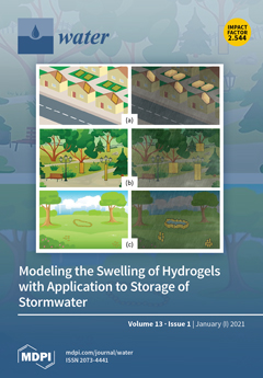
In the search for new stormwater storage in urban catchments, Lundström et al. (2020) examined the feasibility of creating dynamic storage of stormwater in sponge-like porous bodies (SPB) made of hydrogels. They proposed two types of such storage structures: (a) down-flow SPB storage (Figure 1a) and (b) up-flow SPB storage (Figure 1b,c). They demonstrated in numerical experiments that such bodies could fully absorb, in real time, Swedish design rainfalls of 1 h duration and a return period of 10 years. In the paper by Lundström et al., it was assumed that during the filling process, driven by diffusion only, SPBs would maintain the original shape. This assumption imposes a limit on the volume of water stored, setting it equal to the volumetric capacity of the original body. In the present paper, this “no swelling” assumption was removed. View this paper
  • Issues are regarded as officially published after their release is announced to the table of contents alert mailing list.
  • You may sign up for e-mail alerts to receive table of contents of newly released issues.
  • PDF is the official format for papers published in both, html and pdf forms. To view the papers in pdf format, click on the "PDF Full-text" link, and use the free Adobe Reader to open them.
Order results
Result details
Section
Select all
Export citation of selected articles as:
18 pages, 1948 KiB  
Article
Dynamic Hydraulics in a Drinking Water Distribution System Influence Suspended Particles and Turbidity, But Not Microbiology
by Emmanuelle I. Prest, Peter G. Schaap, Michael D. Besmer and Frederik Hammes
Water 2021, 13(1), 109; https://doi.org/10.3390/w13010109 - 05 Jan 2021
Cited by 19 | Viewed by 5060
Abstract
Spatial and short-term temporal changes in water quality as a result of water age and fluctuating hydraulic conditions were investigated in a drinking water distribution system. Online measurements of total and intracellular adenosine tri-phosphate (ATP), total and intact cell concentrations measured with flow [...] Read more.
Spatial and short-term temporal changes in water quality as a result of water age and fluctuating hydraulic conditions were investigated in a drinking water distribution system. Online measurements of total and intracellular adenosine tri-phosphate (ATP), total and intact cell concentrations measured with flow cytometry (FCM), turbidity, and particle counts were performed over five weeks at five subsequent locations of the distribution system. The high number of parallel FCM and ATP measurements revealed the combined effect of water age and final disinfection on spatial changes in microbiology in the system. The results underlined that regular daily dynamics in flow velocities are normal and inevitable in drinking water distribution systems, and significantly impact particle counts and turbidity. However, hydraulic conditions had no detectable impact on the concentration of suspended microbial cells. A weak correlation between flow velocity and ATP concentrations suggests incidental resuspension of particle-bound bacteria, presumably caused by either biofilm detachment or resuspension from sediment when flow velocities increase. The highly dynamic hydraulic conditions highlight the value of online monitoring tools for the meaningful description of short-term dynamics (day-scale) in drinking water distribution systems. Full article
(This article belongs to the Section Hydraulics and Hydrodynamics)
Show Figures

Figure 1

25 pages, 5349 KiB  
Article
Investigating the Effects of Agricultural Water Management in a Mediterranean Coastal Aquifer under Current and Projected Climate Conditions
by Vassilios Pisinaras, Charalampos Paraskevas and Andreas Panagopoulos
Water 2021, 13(1), 108; https://doi.org/10.3390/w13010108 - 05 Jan 2021
Cited by 9 | Viewed by 4237
Abstract
Coastal delta plains are areas with high agricultural potential for the Mediterranean region because of their high soil fertility, but they also constitute fragile systems in terms of water resources management because of the interaction of underlying aquifers with the sea. Such a [...] Read more.
Coastal delta plains are areas with high agricultural potential for the Mediterranean region because of their high soil fertility, but they also constitute fragile systems in terms of water resources management because of the interaction of underlying aquifers with the sea. Such a case is the Pinios River delta plain located in central Greece, which also constitutes a significant ecosystem. Soil and Water Assessment Tool (SWAT) and SEAWAT models were combined in order to simulate the impact of current water resources management practices in main groundwater budget components and groundwater salinization of the shallow aquifer developed in the area. Moreover, potential climate change impact was investigated using climate data from Regional Climate Model for two projected periods (2021–2050 and 2071–2100) and two sea level rise scenarios (increase by 0.5 and 1 m). Modeling results are providing significant insight: although the contribution of the river to groundwater inflows is significant, direct groundwater recharge from precipitation was found to be higher, while capillary rise constitutes a major part of groundwater outflows from the aquifer. Moreover, during the simulation period, groundwater flow from the aquifer to the sea were found to be higher than the inflows of seawater to the aquifer. Regarding climate change impact assessment, the results indicate that the variability in groundwater recharge posed by the high variability of precipitation during the projected periods is increasing the aquifer’s deterioration potential of both its quantity and quality status, the latter expressed by the increased groundwater Cl concentration. This evidence becomes more significant because of the limited groundwater storage capacity of the aquifer. Concerning sea level rise, it was found to be less significant in terms of groundwater salinization impact compared to the decrease in groundwater recharge and increase in crop water needs. Full article
Show Figures

Figure 1

25 pages, 4989 KiB  
Article
A Data-Driven Surrogate Approach for the Temporal Stability Forecasting of Vegetation Covered Dikes
by Elahe Jamalinia, Faraz S. Tehrani, Susan C. Steele-Dunne and Philip J. Vardon
Water 2021, 13(1), 107; https://doi.org/10.3390/w13010107 - 05 Jan 2021
Cited by 4 | Viewed by 2604
Abstract
Climatic conditions and vegetation cover influence water flux in a dike, and potentially the dike stability. A comprehensive numerical simulation is computationally too expensive to be used for the near real-time analysis of a dike network. Therefore, this study investigates a random forest [...] Read more.
Climatic conditions and vegetation cover influence water flux in a dike, and potentially the dike stability. A comprehensive numerical simulation is computationally too expensive to be used for the near real-time analysis of a dike network. Therefore, this study investigates a random forest (RF) regressor to build a data-driven surrogate for a numerical model to forecast the temporal macro-stability of dikes. To that end, daily inputs and outputs of a ten-year coupled numerical simulation of an idealised dike (2009–2019) are used to create a synthetic data set, comprising features that can be observed from a dike surface, with the calculated factor of safety (FoS) as the target variable. The data set before 2018 is split into training and testing sets to build and train the RF. The predicted FoS is strongly correlated with the numerical FoS for data that belong to the test set (before 2018). However, the trained model shows lower performance for data in the evaluation set (after 2018) if further surface cracking occurs. This proof-of-concept shows that a data-driven surrogate can be used to determine dike stability for conditions similar to the training data, which could be used to identify vulnerable locations in a dike network for further examination. Full article
(This article belongs to the Special Issue Water-Induced Landslides: Prediction and Control)
Show Figures

Figure 1

23 pages, 8580 KiB  
Article
The Response of Turbidity Maximum to Peak River Discharge in a Macrotidal Estuary
by Yuhan Yan, Dehai Song, Xianwen Bao and Nan Wang
Water 2021, 13(1), 106; https://doi.org/10.3390/w13010106 - 05 Jan 2021
Cited by 5 | Viewed by 2461
Abstract
The Ou River, a medium-sized river in the southeastern China, is examined to study the estuarine turbidity maximum (ETM) response to rapidly varied river discharge, i.e., peak river discharge (PRD). This study analyzes the difference in ETM and sediment transport mechanisms between low-discharge [...] Read more.
The Ou River, a medium-sized river in the southeastern China, is examined to study the estuarine turbidity maximum (ETM) response to rapidly varied river discharge, i.e., peak river discharge (PRD). This study analyzes the difference in ETM and sediment transport mechanisms between low-discharge and PRD during neap and spring tides by using the Finite-Volume Community Ocean Model. The three-dimensional model is validated by in-situ measurements from 23 April to 22 May 2007. In the Ou River Estuary (ORE), ETM is generally induced by the convergence between river runoff and density-driven flow. The position of ETM for neap and spring tides is similar, but the suspended sediment concentration during spring tide is stronger than that during neap tide. The sediment source of ETM is mainly derived from the resuspension of the seabed. PRD, compared with low-discharge, can dilute the ETM, but cause more sediment to be resuspended from the seabed. The ETM is more seaward during PRD. After PRD, the larger the peak discharge, the longer the recovery time will be. Moreover, the river sediment supply helps shorten ETM recovery time. Mechanisms for this ETM during a PRD can contribute to studies of morphological evolution and pollutant flushing. Full article
(This article belongs to the Special Issue Hydrodynamics in Estuaries and Coast: Analysis and Modeling)
Show Figures

Figure 1

17 pages, 39591 KiB  
Article
Soil Moisture Dynamics in Response to Precipitation and Thinning in a Semi-Dry Forest in Northern Mexico
by Argelia E. Rascón-Ramos, Martín Martínez-Salvador, Gabriel Sosa-Pérez, Federico Villarreal-Guerrero, Alfredo Pinedo-Alvarez, Eduardo Santellano-Estrada and Raúl Corrales-Lerma
Water 2021, 13(1), 105; https://doi.org/10.3390/w13010105 - 05 Jan 2021
Cited by 5 | Viewed by 3275
Abstract
Understanding soil moisture behavior in semi-dry forests is essential for evaluating the impact of forest management on water availability. The objective of the study was to analyze soil moisture based in storm observations in three micro-catchments (0.19, 0.20, and 0.27 ha) with similar [...] Read more.
Understanding soil moisture behavior in semi-dry forests is essential for evaluating the impact of forest management on water availability. The objective of the study was to analyze soil moisture based in storm observations in three micro-catchments (0.19, 0.20, and 0.27 ha) with similar tree densities, and subject to different thinning intensities in a semi-dry forest in Chihuahua, Mexico. Vegetation, soil characteristics, precipitation, and volumetric water content were measured before thinning (2018), and after 0%, 40%, and 80% thinning for each micro-catchment (2019). Soil moisture was low and relatively similar among the three micro-catchments in 2018 (mean = 8.5%), and only large rainfall events (>30 mm) increased soil moisture significantly (29–52%). After thinning, soil moisture was higher and significantly different among the micro-catchments only during small rainfall events (<10 mm), while a difference was not noted during large events. The difference before–after during small rainfall events was not significant for the control (0% thinning); whereas 40% and 80% thinning increased soil moisture significantly by 40% and 53%, respectively. Knowledge of the response of soil moisture as a result of thinning and rainfall characteristics has important implications, especially for evaluating the impact of forest management on water availability. Full article
(This article belongs to the Section Hydrology)
Show Figures

Figure 1

13 pages, 1275 KiB  
Article
Are Microplastics Impairing Marine Fish Larviculture?—Preliminary Results with Argyrosomus regius
by Diana Campos, Andreia C. M. Rodrigues, Rui J. M. Rocha, Roberto Martins, Ana Candeias-Mendes, Sara Castanho, Florbela Soares, Pedro Pousão-Ferreira, Amadeu M. V. M. Soares, Carlos Gravato and Ana L. Patrício Silva
Water 2021, 13(1), 104; https://doi.org/10.3390/w13010104 - 05 Jan 2021
Cited by 19 | Viewed by 4180
Abstract
The presence of small-sized (<300 µm) microplastics (MPs) in aquaculture facilities may threaten finfish hatchery, as their (in)voluntary ingestion by fish larvae may compromise nutritional requirements during early ontogeny, and consequently larval health and performance. Thus, we addressed the short-term effects (7 h) [...] Read more.
The presence of small-sized (<300 µm) microplastics (MPs) in aquaculture facilities may threaten finfish hatchery, as their (in)voluntary ingestion by fish larvae may compromise nutritional requirements during early ontogeny, and consequently larval health and performance. Thus, we addressed the short-term effects (7 h) of polyethylene microplastics (0.1, 1.0, 10 mg/L, PE-MPs) in meagre larvae Argyrosomus regius (15 dph) in the presence/absence of food. Larval feeding behavior, oxidative stress status, neurotoxicity, and metabolic requirements were evaluated. Results showed that meagre larvae ingested PE-MPs regardless of their concentration, decreasing in the presence of food (Artemia metanauplii). The presence of PE-MPs compromised larval feeding activity at the highest concentration. Under starvation, exposed larvae activated the antioxidant defenses by increasing the total glutathione levels and inhibiting catalase activity, which seemed efficient to prevent oxidative damage. Such larvae also presented increased energy consumption potentially related to oxidative damage prevention and decreased neurotransmission. Biochemical responses of fed larvae showed a similar trend, except for LPO, which remained unaffected, except at 0.1 mg/PE-MPs/L. Our results suggest that small-sized MPs in finfish hatcheries may compromise larvae nutritional requirements, but at considerably higher levels than those reported in marine environments. Nevertheless, cumulative adverse effects due to lower MPs concentrations may occur. Full article
(This article belongs to the Special Issue Microplastics in Aquatic Environments and Wastewater Treatment )
Show Figures

Figure 1

16 pages, 1011 KiB  
Review
Land Application of Biosolids in Europe: Possibilities, Con-Straints and Future Perspectives
by Andrea Gianico, Camilla Maria Braguglia, Agata Gallipoli, Daniele Montecchio and Giuseppe Mininni
Water 2021, 13(1), 103; https://doi.org/10.3390/w13010103 - 05 Jan 2021
Cited by 62 | Viewed by 6069
Abstract
The agricultural use of good quality sludge represents a value-added route to ensure growth sustainability in Europe, where raw material availability, for example, for phosphorus, is insufficient to meet demand. However, the possible presence of pathogens, pharmaceuticals and heavy metals requires specific regulations [...] Read more.
The agricultural use of good quality sludge represents a value-added route to ensure growth sustainability in Europe, where raw material availability, for example, for phosphorus, is insufficient to meet demand. However, the possible presence of pathogens, pharmaceuticals and heavy metals requires specific regulations to minimize sludge-related health issues and environmental risks. The current regulation on sludge agricultural use applied by many EU countries is here presented and compared, highlighting scarce harmonization of the legislative framework among Member States. Actual issues, such as the fate of emerging micropollutants and microplastics in sludge-amended soils, and public health concerns regarding sludge spreading during the COVID-19 epidemic, are considered, too. Full article
(This article belongs to the Special Issue Sewage Sludge Treatment and Reuse)
Show Figures

Figure 1

15 pages, 5139 KiB  
Article
Prediction and Evaluation of Waterjet Pump Performance under Nonuniform Inflow Using Parallel Compressor Theory
by Puyu Cao and Rui Zhu
Water 2021, 13(1), 99; https://doi.org/10.3390/w13010099 - 04 Jan 2021
Cited by 1 | Viewed by 1718
Abstract
Parallel compressor theory (PCT) is commonly used to estimate effects of inlet distortion on compressor performance. As well as compressor, the actual inflow to pump is also nonuniform and unfavorable for performances. Nowadays, insufficient understanding of nonuniform inflow effects on pump performance restricts [...] Read more.
Parallel compressor theory (PCT) is commonly used to estimate effects of inlet distortion on compressor performance. As well as compressor, the actual inflow to pump is also nonuniform and unfavorable for performances. Nowadays, insufficient understanding of nonuniform inflow effects on pump performance restricts its development. Therefore, this paper applies PCT to predict external characteristics and evaluate internal flow instability of waterjet pump under nonuniform inflow. According to features of nonuniform inflow, the traditional PCT is modified and makes waterjet pump sub-divided into two circumferential tubes owning same performances but with different inlet velocity (representing nonuniform inflow). Above all, numerical simulation has been conducted to validated the applicability and accuracy of PCT in head prediction of waterjet pump under nonuniform inflow, since area-weighted sum of each tube head (i.e., theoretical pump head) is highly consistent with simulated result. Moreover, based on identifications of when and which tube occurs stall, PCT evaluates four stall behaviors of waterjet pump: partial deep stall, partial stall, pre-stall and full stall. Furthermore, different stall behavior generates different interactions between head variation of each tube, resulting in a multi-segment head curve under nonuniform inflow. The modified PCT with associated physical interpretations are expected to provide a sufficient understanding of nonuniform inflow effects on pump performances. Full article
(This article belongs to the Section Hydraulics and Hydrodynamics)
Show Figures

Figure 1

16 pages, 4688 KiB  
Article
Effects of Different Normalization, Aggregation, and Classification Methods on the Construction of Flood Vulnerability Indexes
by Luana Lavagnoli Moreira, Mariana Madruga de Brito and Masato Kobiyama
Water 2021, 13(1), 98; https://doi.org/10.3390/w13010098 - 04 Jan 2021
Cited by 33 | Viewed by 3878
Abstract
Index-based approaches are widely employed for measuring flood vulnerability. Nevertheless, the uncertainties in the index construction are rarely considered. Here, we conducted a sensitivity analysis of a flood vulnerability index in the Maquiné Basin, Southern Brazil, considering distinct normalization, aggregation, classification methods, and [...] Read more.
Index-based approaches are widely employed for measuring flood vulnerability. Nevertheless, the uncertainties in the index construction are rarely considered. Here, we conducted a sensitivity analysis of a flood vulnerability index in the Maquiné Basin, Southern Brazil, considering distinct normalization, aggregation, classification methods, and their effects on the model outputs. The robustness of the results was investigated by considering Spearman’s correlations, the shift in the vulnerability rank, and spatial analysis of different normalization techniques (min-max, z-scores, distance to target, and raking) and aggregation methods (linear and geometric). The final outputs were classified into vulnerability classes using natural breaks, equal interval, quantiles, and standard deviation methods. The performance of each classification method was evaluated by spatial analysis and the Akaike’s information criterion (AIC). The results presented low sensitivity regarding the normalization step. Conversely, the geometric aggregation method produced substantial differences on the spatial vulnerability and tended to underestimate the vulnerability where indicators with low values compensated for high values. Additionally, the classification of the vulnerability into different classes led to overly sensitive outputs. Thus, given the AIC performance, the natural breaks method was most suitable. The obtained results can support decision-makers in reducing uncertainty and increasing the quality of flood vulnerability assessments. Full article
(This article belongs to the Section Water Resources Management, Policy and Governance)
Show Figures

Figure 1

17 pages, 2676 KiB  
Article
Real-Time Control of the Middle Route of South-to-North Water Diversion Project
by Yongyan Wu, Liqun Li, Zihui Liu, Xiaonan Chen and Huiyong Huang
Water 2021, 13(1), 97; https://doi.org/10.3390/w13010097 - 04 Jan 2021
Cited by 6 | Viewed by 2096
Abstract
Scientific and effective operation control of the Middle Route of South-to-North Water Diversion Project (MRP) is crucial to ensure water conveyance safety. As the longest water transfer project in China, its operation is confronted with unprecedented difficulties since it is controlled by a [...] Read more.
Scientific and effective operation control of the Middle Route of South-to-North Water Diversion Project (MRP) is crucial to ensure water conveyance safety. As the longest water transfer project in China, its operation is confronted with unprecedented difficulties since it is controlled by a large number of check gates and diversion gates, subject to multiple constraints, and has no online regulation reservoirs. No automatic control models have been successfully put into use yet. This paper firstly introduced an expanded downstream depth operation method, and then scheduled the delivery using the volume balance principle and chartography according to the possible combination of flow change of the check gate, water volume change of the pool and flow change of diversions. Next, an improved real-time control model was established on the basis of PI controller, and the models were integrated into an automatic system for daily operation. Finally, a case study was carried out. Results showed that water level variations could be controlled within the target interval (0.25 m), and users’ demands could be met five times more rapidly. In addition, the total times of check gate operation could be reduced almost two times. The findings could promote the intelligent operation of the MRP. Full article
(This article belongs to the Special Issue Failure Risk Assessment in Water Supply System)
Show Figures

Figure 1

18 pages, 5414 KiB  
Article
Numerical Simulations of Non-Point Source Pollution in a Small Urban Catchment: Identification of Pollution Risk Areas and Effectiveness of Source-Control Measures
by Ye Pan, Jiaxun Guo, Long Yang, Qiqi Yuan, Zhihui Ren and Lachun Wang
Water 2021, 13(1), 96; https://doi.org/10.3390/w13010096 - 04 Jan 2021
Cited by 7 | Viewed by 3047
Abstract
Urban non-point source pollution is becoming a serious issue under the context of rapid urbanization and its impacts on surface hydrologic processes. The identification of non-point source risk areas and the effectiveness of source-control measures provides important first steps to improve the degrading [...] Read more.
Urban non-point source pollution is becoming a serious issue under the context of rapid urbanization and its impacts on surface hydrologic processes. The identification of non-point source risk areas and the effectiveness of source-control measures provides important first steps to improve the degrading aquatic environment but is challenged by the complex dynamics and variabilities of surface pollutants in urban environments. In this study, we investigate the spatial and temporal variabilities of non-point source pollution in a small urban catchment based on numerical simulations and in-situ samplings. Our results show that residential, industrial, and commercial land contribute to the most pollutant loadings and are the main constituents of the pollution risk area. Rainfall duration and intensity are the main factors in determining the temporal variations of urban non-point source pollution. There is no correlation between early drought days and pollution load. Numerical simulations show that it is more effective to increase urban vegetation coverage than to enhance road cleaning for effective non-surface pollution control. For enhanced road cleaning, it is more effective to improve the frequency of road cleaning than its efficiency. Our results provide important guidance for effective controls of non-point source pollution as well as the establishment of long-term surface pollutant monitoring network in complex urban environments. Full article
(This article belongs to the Section Urban Water Management)
Show Figures

Figure 1

19 pages, 6615 KiB  
Article
Trend Analysis of Annual and Seasonal River Runoff by Using Innovative Trend Analysis with Significant Test
by Yilinuer Alifujiang, Jilili Abuduwaili and Yongxiao Ge
Water 2021, 13(1), 95; https://doi.org/10.3390/w13010095 - 04 Jan 2021
Cited by 21 | Viewed by 3871
Abstract
This study investigated the temporal patterns of annual and seasonal river runoff data at 13 hydrological stations in the Lake Issyk-Kul basin, Central Asia. The temporal trends were analyzed using the innovative trend analysis (ITA) method with significance testing. The ITA method results [...] Read more.
This study investigated the temporal patterns of annual and seasonal river runoff data at 13 hydrological stations in the Lake Issyk-Kul basin, Central Asia. The temporal trends were analyzed using the innovative trend analysis (ITA) method with significance testing. The ITA method results were compared with the Mann-Kendall (MK) trend test at a 95% confidence level. The comparison results revealed that the ITA method could effectively identify the trends detected by the MK trend test. Specifically, the MK test found that the time series percentage decreased from 46.15% in the north to 25.64% in the south, while the ITA method revealed a similar rate of decrease, from 39.2% to 29.4%. According to the temporal distribution of the MK test, significantly increasing (decreasing) trends were observed in 5 (0), 6 (2), 4 (3), 8 (0), and 8 (1) time series in annual, spring, summer, autumn, and winter river runoff data. At the same time, the ITA method detected significant trends in 7 (1), 9 (3), 6(3), 9 (3), and 8 (2) time series in the study area. As for the ITA method, the “peak” values of 24 time series (26.97%) exhibited increasing patterns, 25 time series (28.09%) displayed increasing patterns for “low” values, and 40 time series (44.94%) showed increasing patterns for “medium” values. According to the “low”, “medium”, and “peak” values, five time series (33.33%), seven time series (46.67%), and three time series (20%) manifested decreasing trends, respectively. These results detailed the patterns of annual and seasonal river runoff data series by evaluating “low”, “medium”, and “peak” values. Full article
(This article belongs to the Section Hydrology)
Show Figures

Figure 1

19 pages, 3929 KiB  
Article
Are Biocrusts and Xerophytic Vegetation a Viable Green Roof Typology in a Mediterranean Climate? A Comparison between Differently Vegetated Green Roofs in Water Runoff and Water Quality
by Bernardo Rocha, Teresa A. Paço, Ana Catarina Luz, Paulo Palha, Sarah Milliken, Benzion Kotzen, Cristina Branquinho, Pedro Pinho and Ricardo Cruz de Carvalho
Water 2021, 13(1), 94; https://doi.org/10.3390/w13010094 - 04 Jan 2021
Cited by 12 | Viewed by 3259
Abstract
Green roofs can be an innovative and effective way of mitigating the environmental impact of urbanization by providing several important ecosystem services. However, it is known that the performance of green roofs varies depending on the type of vegetation and, in drier climates, [...] Read more.
Green roofs can be an innovative and effective way of mitigating the environmental impact of urbanization by providing several important ecosystem services. However, it is known that the performance of green roofs varies depending on the type of vegetation and, in drier climates, without resorting to irrigation, these are limited to xerophytic plant species and biocrusts. The aim of this research was therefore to compare differently vegetated green roofs planted with this type of vegetation. A particular focus was their ability to hold water during intense stormwater events and also the quality of the harvested rainwater. Six test beds with different vegetation compositions were used on the roof of a building in Lisbon. Regarding stormwater retention, the results varied depending on the composition of the vegetation and the season. As for water quality, almost all the parameters tested were higher than the Drinking Water Directive from the European Union (EU) and Word Health Organization (WHO) guidelines for drinking-water quality standards for potable water. Based on our results, biocrusts and xerophytic vegetation are a viable green roof typology for slowing runoff during stormwater events. Full article
Show Figures

Figure 1

15 pages, 3252 KiB  
Article
Magnesium as Environmental Tracer for Karst Spring Baseflow/Overflow Assessment—A Case Study of the Pertuso Karst Spring (Latium Region, Italy)
by Francesco Maria De Filippi, Silvia Iacurto, Gerardo Grelle and Giuseppe Sappa
Water 2021, 13(1), 93; https://doi.org/10.3390/w13010093 - 04 Jan 2021
Cited by 10 | Viewed by 3192
Abstract
Following a previous research carried out on the same site, this paper presents the update of the Mg2+ based method for the estimation of Pertuso Spring discharge, located in Central Italy. New collected data confirmed the validity of the proposed model and [...] Read more.
Following a previous research carried out on the same site, this paper presents the update of the Mg2+ based method for the estimation of Pertuso Spring discharge, located in Central Italy. New collected data confirmed the validity of the proposed model and the conservative behaviour of Mg2+ for groundwater related to the Pertuso Spring aquifer. Further analysis allowed to obtain a local linear relationship between magnesium concentration and total spring discharge (including exploitation rate), regardless of the mixing model proposed with the Aniene River. As regards two samples which fall out of the linear relationship and could have been detected as “outliers”, more in-depth data processing and sensitivity analyses revealed that the lowering in magnesium, at equal discharges, is determined by the appearance of the quick-flow component, less mineralized and related to storm events. Results showed that under specific conditions, related to the absence or presence of previous intense rainfall events, Mg2+ could be effectively a useful tracer for separating spring conduit flow (overflow) from diffuse flow (baseflow) within the karst aquifer. Full article
(This article belongs to the Special Issue Recent Advances in Karstic Hydrogeology)
Show Figures

Figure 1

28 pages, 4389 KiB  
Article
User Needs Analysis for the Definition of Operational Coastal Services
by Serena Geraldini, Antonello Bruschi, Giorgio Bellotti and Andrea Taramelli
Water 2021, 13(1), 92; https://doi.org/10.3390/w13010092 - 04 Jan 2021
Cited by 10 | Viewed by 3490
Abstract
According to the global growth of the “Blue economy”, coastal zones are under pressure from both land and marine side economic activities. The fragmentation of sectorial interests and legislation along the coasts has led to the need for bridging knowledge (data/information and methods/tools) [...] Read more.
According to the global growth of the “Blue economy”, coastal zones are under pressure from both land and marine side economic activities. The fragmentation of sectorial interests and legislation along the coasts has led to the need for bridging knowledge (data/information and methods/tools) and governance (decision-makers at every level) in order to ensure sustainable economic development and social and ecosystem resilience. This poses the need for an interaction process that associates user needs to the European and national legislative framework to create a policy-oriented demand of Copernicus Earth Observation services in coastal areas. Such goals need a strong and effective system to monitor compliance and to assess the progress of the legislation. This study aims at identifying potential gaps in the current Copernicus product offer for the monitoring of the coastal sector through the elicitation of stakeholder requirements. The methodology is applied to the Italian landscape of users, but it is scalable at European level. The results provide a clear overview of the coastal user requirements, highlighting the common need of integrated information for the management, and represents the basis for defining the coastal services. Full article
(This article belongs to the Special Issue Coastal Sediment Management: From Theory to Practice)
Show Figures

Figure 1

17 pages, 26279 KiB  
Article
Streamflow Forecasting via Two Types of Predictive Structure-Based Gated Recurrent Unit Models
by Xuehua Zhao, Hanfang Lv, Yizhao Wei, Shujin Lv and Xueping Zhu
Water 2021, 13(1), 91; https://doi.org/10.3390/w13010091 - 04 Jan 2021
Cited by 21 | Viewed by 2306
Abstract
Data-intelligent methods designed for forecasting the streamflow of the Fenhe River are crucial for enhancing water resource management. Herein, the gated recurrent unit (GRU) is coupled with the optimization algorithm improved grey wolf optimizer (IGWO) to design a hybrid model (IGWO-GRU) to carry [...] Read more.
Data-intelligent methods designed for forecasting the streamflow of the Fenhe River are crucial for enhancing water resource management. Herein, the gated recurrent unit (GRU) is coupled with the optimization algorithm improved grey wolf optimizer (IGWO) to design a hybrid model (IGWO-GRU) to carry out streamflow forecasting. Two types of predictive structure-based models (sequential IGWO-GRU and monthly IGWO-GRU) are compared with other models, such as the single least-squares support vector machine (LSSVM) and single extreme learning machine (ELM) models. These models incorporate the historical streamflow series as inputs of the model to forecast the future streamflow with data from January 1956 to December 2016 at the Shangjingyou station and from January 1958 to December 2016 at the Fenhe reservoir station. The IGWO-GRU model exhibited a strong ability for mapping in streamflow series when the parameters were carefully tuned. The monthly predictive structure can effectively extract the instinctive hydrological information that is more easily learned by the predictive model than the traditional sequential predictive structure. The monthly IGWO-GRU model was found to be a better forecasting tool, with an average qualification rate of 91.66% in two stations. It also showed good performance in absolute error and peak flow forecasting. Full article
(This article belongs to the Section Hydrology)
Show Figures

Figure 1

20 pages, 2139 KiB  
Review
The Issue of Groundwater Salinization in Coastal Areas of the Mediterranean Region: A Review
by Micòl Mastrocicco and Nicolò Colombani
Water 2021, 13(1), 90; https://doi.org/10.3390/w13010090 - 04 Jan 2021
Cited by 57 | Viewed by 5453
Abstract
The Mediterranean area is undergoing intensive demographic, social, cultural, economic, and environmental changes. This generates multiple environmental pressures such as increased demand for water resources, generation of pollution related to wastewater discharge, and land consumption. In the Mediterranean area, recent climate change studies [...] Read more.
The Mediterranean area is undergoing intensive demographic, social, cultural, economic, and environmental changes. This generates multiple environmental pressures such as increased demand for water resources, generation of pollution related to wastewater discharge, and land consumption. In the Mediterranean area, recent climate change studies forecast large impacts on the hydrologic cycle. Thus, in the next years, surface and ground-water resources will be gradually more stressed, especially in coastal areas. In this review paper, the historical and geographical distribution of peer-review studies and the main mechanisms that promote aquifer salinization in the Mediterranean area are critically discussed, providing the state of the art on topics such as actual saltwater wedge characterization, paleo-salinities in coastal areas, water-rock interactions, geophysical techniques aimed at delineating the areal and vertical extent of saltwater intrusion, management of groundwater overexploitation using numerical models and GIS mapping techniques for aquifer vulnerability to salinization. Each of the above-mentioned approaches has potential advantages and drawbacks; thus, the best tactic to tackle coastal aquifer management is to employ a combination of approaches. Finally, the number of studies focusing on predictions of climate change effects on coastal aquifers are growing but are still very limited and surely need further research. Full article
(This article belongs to the Special Issue Focus on the Salinization Issue in the Mediterranean Area)
Show Figures

Figure 1

19 pages, 10720 KiB  
Article
Flood Mapping Proposal in Small Watersheds: A Case Study of the Rebollos and Miranda Ephemeral Streams (Cartagena, Spain)
by Valentina Betancourt-Suárez, Estela García-Botella and Alfredo Ramon-Morte
Water 2021, 13(1), 102; https://doi.org/10.3390/w13010102 - 04 Jan 2021
Cited by 10 | Viewed by 2966
Abstract
Anthropogenic landscape changes cause significant disturbances to fluvial system dynamics and such is the case of the watersheds studied near the Spanish Mediterranean coast (Cartagena). Economic growth resulted in the addition of external water resources from the Tajo River (1979) as part of [...] Read more.
Anthropogenic landscape changes cause significant disturbances to fluvial system dynamics and such is the case of the watersheds studied near the Spanish Mediterranean coast (Cartagena). Economic growth resulted in the addition of external water resources from the Tajo River (1979) as part of the National Water Plan (1933). Irrigation water has caused the water table to rise since 1979. Furthermore, water resources have boosted urban touristic expansion, industrial estates, and road infrastructures. This study presents a diagnosis of the official flood hazard maps by applying remote sensing techniques that enable the identification of (i) areas flooded during recent events; and (ii) the possible effects of anthropogenic actions on fluvial processes affecting flooding (land use and land cover change—LULCC). The flooded areas were identified from a multispectral satellite image taken by a sensor on Sentinel-2. A multi-temporal analysis of aerial photographs (1929, 1956, 1981, 2009, and 2017) showing the fluvial and anthropic environment at a detailed scale (1:25,000) was used to define the fluvial geomorphology and the main anthropic alterations on the Rebollos ephemeral stream. Official inputs from geographical information repositories about land use were also gathered (LULC). The result was compared to the official flood hazard maps (SNCZI) and this revealed floodable areas that had not been previously mapped because official maps rely only on the hydraulic method. Finally, all the recent changes that will have increased the disastrous consequences of flooding have been detected, analyzed, and mapped for the study area. Full article
(This article belongs to the Special Issue Water Economics and Water Distribution Management)
Show Figures

Figure 1

28 pages, 11445 KiB  
Review
Modeling Surface Processes on Debris-Covered Glaciers: A Review with Reference to the High Mountain Asia
by Da Huo, Zhaohui Chi and Andong Ma
Water 2021, 13(1), 101; https://doi.org/10.3390/w13010101 - 04 Jan 2021
Cited by 9 | Viewed by 3567
Abstract
Surface processes on debris-covered glaciers are governed by a variety of controlling factors including climate, debris load, water bodies, and topography. Currently, we have not achieved a general consensus on the role of supraglacial processes in regulating climate–glacier sensitivity in High Mountain Asia, [...] Read more.
Surface processes on debris-covered glaciers are governed by a variety of controlling factors including climate, debris load, water bodies, and topography. Currently, we have not achieved a general consensus on the role of supraglacial processes in regulating climate–glacier sensitivity in High Mountain Asia, which is mainly due to a lack of an integrated understanding of glacier surface dynamics as a function of debris properties, mass movement, and ponding. Therefore, further investigations on supraglacial processes is needed in order to provide more accurate assessments of the hydrological cycle, water resources, and natural hazards in the region. Given the scarcity of long-term in situ data and the difficulty of conducting fieldwork on these glaciers, many numerical models have been developed by recent studies. This review summarizes our current knowledge of surface processes on debris-covered glaciers with an emphasis on the related modeling efforts. We present an integrated view on how numerical modeling provide insights into glacier surface ablation, supraglacial debris transport, morphological variation, pond dynamics, and ice-cliff evolution. We also highlight the remote sensing approaches that facilitate modeling, and discuss the limitations of existing models regarding their capabilities to address coupled processes on debris-covered glaciers and suggest research directions. Full article
(This article belongs to the Section Hydrology)
Show Figures

Figure 1

7 pages, 218 KiB  
Opinion
The Suspected Contradictory Role of Parental Care in the Adaption of Planktonic Calanoida to Temporary Freshwater
by Genuario Belmonte
Water 2021, 13(1), 100; https://doi.org/10.3390/w13010100 - 04 Jan 2021
Cited by 7 | Viewed by 1955
Abstract
Calanoida have the highest number of species among Copepoda in marine plankton, but not in fresh water, where the greatest number are Cyclopoida. Freshwater Cyclopoida also live in more freshwater sites than Calanoida. This could be a consequence of an invasion of freshwater [...] Read more.
Calanoida have the highest number of species among Copepoda in marine plankton, but not in fresh water, where the greatest number are Cyclopoida. Freshwater Cyclopoida also live in more freshwater sites than Calanoida. This could be a consequence of an invasion of freshwater by marine Cyclopoida before Calanoida. Similar to Cyclopoida, but different from marine Calanoida, freshwater Calanoida females produce egg sacs and care for eggs. This strategy is common among all freshwater plankton, suggesting that the evolution of parental care is an obliged adaption to conquer fresh water. Calanoida, different from Cyclopoida, survive adverse conditions as resting eggs. This life-cycle constraint obliges eggs to survive their mother’s death and wait in the benthos for a certain period. The necessity of completing embryonic development and the hatching of eggs far from the mother’s protection may be responsible for the relatively lower evolutionary success of Calanoida in fresh water compared to Cyclopoida (which rest as juveniles, thus protecting eggs in any moment of their development). Therefore, the brooding of eggs appears to be the obliged solution for Calanoida’s final establishment in fresh water, but the dispersion of eggs on the bottom after the mother’s death and during the rest period is probably the weak point in Calanoida’s competition with Cyclopoida. Full article
28 pages, 10561 KiB  
Article
Cd(II) and Pb(II) Adsorption Using a Composite Obtained from Moringa oleifera Lam. Cellulose Nanofibrils Impregnated with Iron Nanoparticles
by Adriana Vázquez-Guerrero, Raúl Cortés-Martínez, Ruth Alfaro-Cuevas-Villanueva, Eric M. Rivera-Muñoz and Rafael Huirache-Acuña
Water 2021, 13(1), 89; https://doi.org/10.3390/w13010089 - 03 Jan 2021
Cited by 32 | Viewed by 4080
Abstract
This work informs on the green synthesis of a novel adsorbent and its adsorption capacity. The adsorbent was synthesized by the combination of iron nanoparticles and cellulose nanofibers (FeNPs/NFCs). Cellulose nanofibers (NFCs) were obtained from Moringa (Moringa oleifera Lam.) by a pulping [...] Read more.
This work informs on the green synthesis of a novel adsorbent and its adsorption capacity. The adsorbent was synthesized by the combination of iron nanoparticles and cellulose nanofibers (FeNPs/NFCs). Cellulose nanofibers (NFCs) were obtained from Moringa (Moringa oleifera Lam.) by a pulping Kraft process, acid hydrolysis, and ultrasonic methods. The adsorption method has advantages such as high heavy metal removal in water treatment. Therefore, cadmium (Cd) and lead (Pb) adsorption with FeNP/NFC from aqueous solutions in batch systems was investigated. The kinetic, isotherm, and thermodynamic parameters, as well as the adsorption capacities of FeNP/NFC in each system at different temperatures, were evaluated. The adsorption kinetic data were fitted to mathematical models, so the pseudo-second-order kinetic model described both Cd and Pb. The kinetic rate constant (K2), was higher for Cd than for Pb, indicating that the metal adsorption was very fast. The adsorption isotherm data were best described by the Langmuir–Freundlich model for Pb multilayer adsorption. The Langmuir model described Cd monolayer sorption. However, experimental maximum adsorption capacities (qe exp) for Cd (>12 mg/g) were lower than those for Pb (>80 mg/g). In conclusion, iron nanoparticles on the FeNP/NFC composite improved Cd and Pb selectivity during adsorption processes, indicating the process’ spontaneous and exothermic nature. Full article
(This article belongs to the Special Issue Adsorbents for Water and Wastewater Treatment and Resource Recovery)
Show Figures

Figure 1

16 pages, 2576 KiB  
Article
Relative Performance of 1-D Versus 3-D Hydrodynamic, Water-Quality Models for Predicting Water Temperature and Oxygen in a Shallow, Eutrophic, Managed Reservoir
by Xiamei Man, Chengwang Lei, Cayelan C. Carey and John C. Little
Water 2021, 13(1), 88; https://doi.org/10.3390/w13010088 - 03 Jan 2021
Cited by 9 | Viewed by 2621
Abstract
Many researchers use one-dimensional (1-D) and three-dimensional (3-D) coupled hydrodynamic and water-quality models to simulate water quality dynamics, but direct comparison of their relative performance is rare. Such comparisons may quantify their relative advantages, which can inform best practices. In this study, we [...] Read more.
Many researchers use one-dimensional (1-D) and three-dimensional (3-D) coupled hydrodynamic and water-quality models to simulate water quality dynamics, but direct comparison of their relative performance is rare. Such comparisons may quantify their relative advantages, which can inform best practices. In this study, we compare two 1-year simulations in a shallow, eutrophic, managed reservoir using a community-developed 1-D model and a 3-D model coupled with the same water-quality model library based on multiple evaluation criteria. In addition, a verified bubble plume model is coupled with the 1-D and 3-D models to simulate the water temperature in four epilimnion mixing periods to further quantify the relative performance of the 1-D and 3-D models. Based on the present investigation, adopting a 1-D water-quality model to calibrate a 3-D model is time-efficient and can produce reasonable results; 3-D models are recommended for simulating thermal stratification and management interventions, whereas 1-D models may be more appropriate for simpler model setups, especially if field data needed for 3-D modeling are lacking. Full article
(This article belongs to the Special Issue Physical Processes in Lakes)
Show Figures

Figure 1

12 pages, 3362 KiB  
Article
Updated Kriging-Assisted Shape Optimization of a Gravity Dam
by Yongqiang Wang, Ye Liu and Xiaoyi Ma
Water 2021, 13(1), 87; https://doi.org/10.3390/w13010087 - 02 Jan 2021
Cited by 8 | Viewed by 2894
Abstract
The numerical simulation of the optimal design of gravity dams is computationally expensive. Therefore, a new optimization procedure is presented in this study to reduce the computational cost for determining the optimal shape of a gravity dam. Optimization was performed using a combination [...] Read more.
The numerical simulation of the optimal design of gravity dams is computationally expensive. Therefore, a new optimization procedure is presented in this study to reduce the computational cost for determining the optimal shape of a gravity dam. Optimization was performed using a combination of the genetic algorithm (GA) and an updated Kriging surrogate model (UKSM). First, a Kriging surrogate model (KSM) was constructed with a small sample set. Second, the minimizing the predictor strategy was used to add samples in the region of interest to update the KSM in each updating cycle until the optimization process converged. Third, an existing gravity dam was used to demonstrate the effectiveness of the GA–UKSM. The solution obtained with the GA–UKSM was compared with that obtained using the GA–KSM. The results revealed that the GA–UKSM required only 7.53% of the total number of numerical simulations required by the GA–KSM to achieve similar optimization results. Thus, the GA–UKSM can significantly improve the computational efficiency. The method adopted in this study can be used as a reference for the optimization of the design of gravity dams. Full article
(This article belongs to the Section Hydraulics and Hydrodynamics)
Show Figures

Figure 1

21 pages, 6874 KiB  
Article
Forecasting of Significant Wave Height Based on Gated Recurrent Unit Network in the Taiwan Strait and Its Adjacent Waters
by Jichao Wang, Yue Wang and Jungang Yang
Water 2021, 13(1), 86; https://doi.org/10.3390/w13010086 - 02 Jan 2021
Cited by 27 | Viewed by 3397
Abstract
Significant wave height (SWH) forecasting is a key process for offshore and costal engineering. However, accurate prediction of the SWH is quite challenging due to the randomness and fluctuation features of waves. This paper employs a novel deep learning method, the gated recurrent [...] Read more.
Significant wave height (SWH) forecasting is a key process for offshore and costal engineering. However, accurate prediction of the SWH is quite challenging due to the randomness and fluctuation features of waves. This paper employs a novel deep learning method, the gated recurrent unit network (GRU), to forecast SWH with lead times of 3, 6, 12 and 24 h. The data sets used in this study include the wind speed of the past 3 h and the current SWH as inputs, which were obtained from six buoy stations in the Taiwan Strait and its adjacent waters. The GRU results are compared with those of back propagation neural network (BP), extreme learning machine (ELM), support vector machine (SVM), and random forest (RF). Although the error indices of the six stations are different, the general performance of GRU is satisfactory, with a faster forecasting speed, smaller volatility and better adaptability. Using buoy station 46714D as an example, the root mean square error (RMSE) predicted by GRU reaches 0.234, 0.299, 0.371, and 0.479 with lead times of 3, 6, 12, and 24 h, respectively. Full article
(This article belongs to the Section Oceans and Coastal Zones)
Show Figures

Figure 1

22 pages, 4543 KiB  
Article
Exploring the Role of Reservoir Storage in Enhancing Resilience to Climate Change in Southern Europe
by Alfredo Granados, Alvaro Sordo-Ward, Bolívar Paredes-Beltrán and Luis Garrote
Water 2021, 13(1), 85; https://doi.org/10.3390/w13010085 - 01 Jan 2021
Cited by 11 | Viewed by 2595
Abstract
Recent trends suggest that streamflow discharge is diminishing in many rivers of Southern Europe and that interannual variability is increasing. This threatens to aggravate water scarcity problems that periodically arise in this region, because both effects will deteriorate the performance of reservoirs, decreasing [...] Read more.
Recent trends suggest that streamflow discharge is diminishing in many rivers of Southern Europe and that interannual variability is increasing. This threatens to aggravate water scarcity problems that periodically arise in this region, because both effects will deteriorate the performance of reservoirs, decreasing their reliable yield. Reservoir storage is the key infrastructure to overcome variability and to enhance water availability in semiarid climates. This paper presents an analysis of the role of reservoir storage in preserving water availability under climate change scenarios. The study is focused on 16 major Southern European basins. Potential water availability was calculated in these basins under current condition and for 35 different climatic projections for the period 2070–2100. The results show that the expected reduction of water availability is comparable to the decrease of the mean annual flow in basins with large storage capacity. For basins with small storage, the expected reduction of water availability is larger than the reduction of mean annual flow. Additionally, a sensitivity analysis was carried out by replicating the analysis assuming variable reservoir volumes from 25% to 175% of current storage. The results show that increasing storage capacity attenuates the reduction of water availability and reduces its uncertainty under climate change projections. This feature would allow water managers to develop suitable policies to mitigate the impacts of climate change, thus enhancing the resilience of the system. Full article
(This article belongs to the Special Issue Water Resources Management Models for Policy Assessment)
Show Figures

Figure 1

14 pages, 3484 KiB  
Article
Determination of Evaporative Fluxes Using a Bench-Scale Atmosphere Simulator
by Jared Suchan and Shahid Azam
Water 2021, 13(1), 84; https://doi.org/10.3390/w13010084 - 01 Jan 2021
Cited by 6 | Viewed by 2130
Abstract
An accurate determination of evaporative fluxes is critical for efficient water management in semi-arid climates such as in the Canadian Prairies. The main achievements of this research are the design and operation of a bench-scale atmosphere simulator, performance evaluation using selected weather scenarios [...] Read more.
An accurate determination of evaporative fluxes is critical for efficient water management in semi-arid climates such as in the Canadian Prairies. The main achievements of this research are the design and operation of a bench-scale atmosphere simulator, performance evaluation using selected weather scenarios pertaining to regional atmospheric conditions, validation using established empirical correlations, and estimation of evaporation rates and the amount for a typical local water body. Results indicate that the measured data achieved the target values for the various parameters and the data were found to be stable during the 3-h test duration. The vapour flux was found to have large variation during summer (0.120 g∙s−1∙m−2 during the day and 0.047 g∙s−1∙m−2 at night), low variation during spring (0.116 g∙s−1∙m−2 during the day and 0.062 g∙s−1∙m−2 at night), and negligible change during fall (0.100 g∙s−1∙m−2 during the day and 0.076 g∙s−1∙m−2 at night). The measured vapour flux was generally within one standard deviation of the equality line when compared with that predicted by both the mass-transfer equations and the combination equations. The average evaporation ranged from 4 mm∙d−1 to 8 mm∙d−1 during the day and decreased to 1 mm∙d−1 to 3 mm∙d−1 at night. The 24-h evaporation was found to be 8 ± 1 mm∙d−1 from late April through late October. Likewise, the cumulative annual evaporation was found to be 1781 mm, of which 82% occurs during the day and 18% at night. Full article
(This article belongs to the Section Hydrology)
Show Figures

Figure 1

19 pages, 3198 KiB  
Article
Identification of Nitrate Sources in Rivers in a Complex Catchment Using a Dual Isotopic Approach
by Yunyun Xu, Qiqi Yuan, Chunfa Zhao, Lachun Wang, Yuhua Li, Xiaoxue Ma, Jiaxun Guo and Hong Yang
Water 2021, 13(1), 83; https://doi.org/10.3390/w13010083 - 01 Jan 2021
Cited by 9 | Viewed by 4099
Abstract
Excessive nutrient input to surface water, including nitrate, exacerbates water eutrophication. Clarifying the proportions of different nitrate sources in the aquatic environment is critical for improving the polluted water. However, nitrate sources in river basins are very complex and not clearly understood. In [...] Read more.
Excessive nutrient input to surface water, including nitrate, exacerbates water eutrophication. Clarifying the proportions of different nitrate sources in the aquatic environment is critical for improving the polluted water. However, nitrate sources in river basins are very complex and not clearly understood. In this study, nitrogen concentrations and nitrate isotopic compositions were determined to estimate the spatiotemporal variation in nitrate sources in the Yuntaishan River basin, Nanjing, East China, from March 2019 to January 2020. The results showed that the concentrations of total nitrogen (TN), ammonium (NH4+-N), and nitrate (NO3-N) changed in the ranges of 0.53–18.0 mg/L, 0.01–15.4 mg/L, and 0.06–9.3 mg/L, respectively, wherein NO3-N was the main nitrogen form. Higher nitrogen concentrations appeared in winter and in the downstream parts of the river. In the entire river basin, the NO3-N mainly originated from sewage (67%) and soil (26%), with clear spatial variations. NO3-N in the Yunba sub-watershed was mainly derived from sewage (78%), which was higher than that in other tributaries, i.e., Shengli River (44%) and Yangshan River (49%). This was due to the fact that that Shengli and Yangshan sub-watersheds were covered by urban areas and were equipped with a complete sewage treatment system. In addition, the contributions of sewage to NO3-N rose from 60% upstream to 86% downstream, suggesting the increasing influence of the point source of sewage. The results showed that 53% of NO3-N in the basin outlet originated from the point source of sewage near the M4 site. Sewage contributed 75% of NO3-N in the rainy season and 67% of NO3-N in the dry season, suggesting the weakly temporal variation. Our results highlight the spatiotemporal variations in sources of NO3-N. These results will aid in the development of measures needed to control nitrogen pollution in river basins. Full article
Show Figures

Figure 1

17 pages, 7309 KiB  
Article
Assessment of the Dissimilarities of EDI and SPI Measures for Drought Determination in South Africa
by Omolola M. Adisa, Muthoni Masinde and Joel O. Botai
Water 2021, 13(1), 82; https://doi.org/10.3390/w13010082 - 01 Jan 2021
Cited by 11 | Viewed by 3633
Abstract
This study examines the (dis)similarity of two commonly used indices Standardized Precipitation Index (SPI) computed over accumulation periods 1-month, 3-month, 6-month, and 12-month (hereafter SPI-1, SPI-3, SPI-6, and SPI-12, respectively) and Effective Drought Index (EDI). The analysis is based on two drought monitoring [...] Read more.
This study examines the (dis)similarity of two commonly used indices Standardized Precipitation Index (SPI) computed over accumulation periods 1-month, 3-month, 6-month, and 12-month (hereafter SPI-1, SPI-3, SPI-6, and SPI-12, respectively) and Effective Drought Index (EDI). The analysis is based on two drought monitoring indicators (derived from SPI and EDI), namely, the Drought Duration (DD) and Drought Severity (DS) across the 93 South African Weather Service’s delineated rainfall districts over South Africa from 1980 to 2019. In the study, the Pearson correlation coefficient dissimilarity and periodogram dissimilarity estimates were used. The results indicate a positive correlation for the Pearson correlation coefficient dissimilarity and a positive value for periodogram of dissimilarity in both the DD and DS. With the Pearson correlation coefficient dissimilarity, the study demonstrates that the values of the SPI-1/EDI pair and the SPI-3/EDI pair exhibit the highest similar values for DD, while the SPI-6/EDI pair shows the highest similar values for DS. Moreover, dissimilarities are more obvious in SPI-12/EDI pair for DD and DS. When a periodogram of dissimilarity is used, the values of the SPI-1/EDI pair and SPI-6/EDI pair exhibit the highest similar values for DD, while SPI-1/EDI displayed the highest similar values for DS. Overall, the two measures show that the highest similarity is obtained in the SPI-1/EDI pair for DS. The results obtainable in this study contribute towards an in-depth knowledge of deviation between the EDI and SPI values for South Africa, depicting that these two drought indices values are replaceable in some rainfall districts of South Africa for drought monitoring and prediction, and this is a step towards the selection of the appropriate drought indices. Full article
(This article belongs to the Section Hydrology)
Show Figures

Figure 1

29 pages, 1105 KiB  
Review
A Systematic Review of the State of Cyber-Security in Water Systems
by Nilufer Tuptuk, Peter Hazell, Jeremy Watson and Stephen Hailes
Water 2021, 13(1), 81; https://doi.org/10.3390/w13010081 - 01 Jan 2021
Cited by 62 | Viewed by 11771
Abstract
Critical infrastructure systems are evolving from isolated bespoke systems to those that use general-purpose computing hosts, IoT sensors, edge computing, wireless networks and artificial intelligence. Although this move improves sensing and control capacity and gives better integration with business requirements, it also increases [...] Read more.
Critical infrastructure systems are evolving from isolated bespoke systems to those that use general-purpose computing hosts, IoT sensors, edge computing, wireless networks and artificial intelligence. Although this move improves sensing and control capacity and gives better integration with business requirements, it also increases the scope for attack from malicious entities that intend to conduct industrial espionage and sabotage against these systems. In this paper, we review the state of the cyber-security research that is focused on improving the security of the water supply and wastewater collection and treatment systems that form part of the critical national infrastructure. We cover the publication statistics of the research in this area, the aspects of security being addressed, and future work required to achieve better cyber-security for water systems. Full article
(This article belongs to the Special Issue Smart Urban Water Networks)
Show Figures

Figure 1

12 pages, 936 KiB  
Article
Ecosystem Organic Carbon Stock Estimations in the Sile River, North Eastern Italy
by Alessandro Buosi, Yari Tomio, Abdul-Salam Juhmani and Adriano Sfriso
Water 2021, 13(1), 80; https://doi.org/10.3390/w13010080 - 31 Dec 2020
Cited by 2 | Viewed by 2504
Abstract
River ecosystems are one of the dynamic components of the terrestrial carbon cycle that provide a crucial function in ecosystem processes and high value to ecosystem services. A large amount of carbon is transported from terrestrial to the ocean through river flows. In [...] Read more.
River ecosystems are one of the dynamic components of the terrestrial carbon cycle that provide a crucial function in ecosystem processes and high value to ecosystem services. A large amount of carbon is transported from terrestrial to the ocean through river flows. In order to evaluate the contribution of Sile River ecosystem to the global carbon stock, the river ecosystem Organic Carbon (OC) stock was quantified for sediments and dominant submerged aquatic macrophytes (SAMs) during the two sampling periods at three different stations along the Sile River (North Eastern Italy). The total mean ecosystem OC stock was 95.2 ± 13.8 Mg C ha−1 while those of SAMs ranged from 7.0 to 10.9 Mg C ha−1 which accounted for approx. 10% of the total OC stock. The total aboveground biomass retains approx. 90% of the SAM carbon stock, with a mean of 8.9 ± 1.6 Mg C ha−1. The mean sediment OC stock was 86.6 ± 14.5 Mg C ha−1 with low seasonal variations among the sites. Indeed, various environmental parameters and hydrodynamics appear to affect the accumulation of OC within the river ecosystem. The results highlight the role that freshwater river ecosystems play in the global carbon cycle, which consequently provide a baseline for future river ecosystem monitoring programs. Furthermore, future studies with additional sites and seasonal surveys of the river will enhance our understanding of the effects of global climate change on the river ecosystem and improve the ecosystem services. Full article
Show Figures

Figure 1

Previous Issue
Back to TopTop