Next Issue
Volume 5, March
Previous Issue
Volume 4, September


GeoHazards, Volume 4, Issue 4 (December 2023) – 11 articles

Cover Story (view full-size image): 
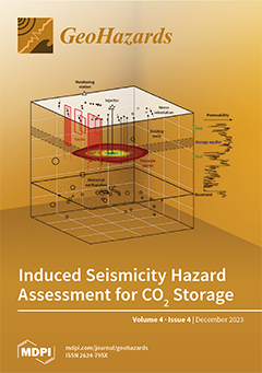
California’s San Joaquin Basin offers vast opportunities for CO2 storage in deep saline aquifers. Although the parts of the basin suited for storage are not tectonically active, there are large faults that present seismic hazards. Increasing pore pressure at depth through CO2 injection pushes faults closer to failure by decreasing effective normal stress. We compiled data on stress, faults, and seismicity at a proposed site to determine the conditions for fault slip during CO2 injection. Our results show that the probability of fault slip can be minimized by controlling the size, migration, and magnitude of pressure perturbation in the storage reservoir. We also characterized historical seismicity around the site and established criteria to distinguish induced events. This study represents a first-order procedure to assess site-scale seismic hazards related to CO2 storage. View this paper
  • Issues are regarded as officially published after their release is announced to the table of contents alert mailing list.
  • You may sign up for e-mail alerts to receive table of contents of newly released issues.
  • PDF is the official format for papers published in both, html and pdf forms. To view the papers in pdf format, click on the "PDF Full-text" link, and use the free Adobe Reader to open them.
Order results
Result details
Select all
Export citation of selected articles as:
28 pages, 9662 KiB  
Article
Marginal Distribution Fitting Method for Modelling Flood Extremes on a River Network
by Brian Skahill, Cole Haden Smith and Brook T. Russell
GeoHazards 2023, 4(4), 526-553; https://doi.org/10.3390/geohazards4040030 - 16 Dec 2023
Viewed by 1337
Abstract
This study utilized a max-stable process (MSP) model with a dependence structure defined via a non-Euclidean distance metric, with the goal of modelling extreme flood data on a river network. The dataset was composed of mean daily discharge observations from 22 United States [...] Read more.
This study utilized a max-stable process (MSP) model with a dependence structure defined via a non-Euclidean distance metric, with the goal of modelling extreme flood data on a river network. The dataset was composed of mean daily discharge observations from 22 United States Geological Survey streamflow gaging stations for river basins in Missouri and Arkansas. The analysis included the application of the elastic-net penalty to automatically build spatially varying trend surfaces to model the marginal distributions. The dependence model accounted for the river distance between hydrologically connected gaging sites and the hydrologic distance, defined as the Euclidean distance between the centers of site’s associated drainage areas, for all stations. Modelling the marginal distributions and spatial dependence among the extremes are two key components for spatially modelling extremes. Among the 16 covariates evaluated for marginal fitting, 7 were selected to spatially model the generalized extreme value (GEV) location parameter (for each gaging station’s contributing drainage basin, its outlet elevation, centroid x coordinate, centroid elevation, area, average basin width, elevation range, and median land surface slope). The three covariates selected for the GEV scale parameter included the area, average basin width, and median land surface slope. The GEV shape parameter was assumed to be constant throughout the entire study area. Comparisons of estimates obtained from the spatial covariate model with their corresponding “at-site” estimates resulted in computed values of 0.95, 0.95, 0.94 and 0.85, 0.84, 0.90 for the coefficient of determination, Nash–Sutcliffe efficiency, and Kling–Gupta efficiency for the GEV location and scale parameters, respectively. Brown–Resnick MSP models were fit to independent multivariate events extracted from a set of common discharge data, transformed to unit Fréchet margins while considering different permutations of the non-Euclidean dependence model. Each of the fitted model’s log-likelihood values indicated improved fits when using hydrologic distance rather than Euclidean distance. They also demonstrated that accounting for flow-connected dependence and anisotropy further improved model fit. In this study, the results from both parts were illustrative; however, further research with larger datasets and more heterogeneous systems is recommended. Full article
Show Figures

Figure 1

11 pages, 3620 KiB  
Article
Near Real-Time Detection and Moment Tensor Inversion of the 11 May 2022, Dharchula Earthquake
by Pankaj Kumar, Vipul Silwal, Rinku Mahanta, Vipin Kumar Maurya, Kamal, Mukat Lal Sharma and Ambikapathy Ammani
GeoHazards 2023, 4(4), 515-525; https://doi.org/10.3390/geohazards4040029 - 14 Dec 2023
Viewed by 1225
Abstract
On 11 May 2022, an earthquake of Mw 5.2 occurred in the Dharchula region of Uttarakhand Himalayas, India. The Uttarakhand State Earthquake Early Warning System (UEEWS) detected and transmitted the warning within 11.61 s from the origin time, taking only 4.26 s [...] Read more.
On 11 May 2022, an earthquake of Mw 5.2 occurred in the Dharchula region of Uttarakhand Himalayas, India. The Uttarakhand State Earthquake Early Warning System (UEEWS) detected and transmitted the warning within 11.61 s from the origin time, taking only 4.26 s for processing, location, and magnitude estimation and warning dissemination. The complete analysis was performed using three seconds of waveforms. Using the initial earthquake parameters provided by the UEEWS, moment tensor inversion was performed using the broadband seismometers network installed in northern India. The moment tensor (MT) inversion was performed for the event using both the body waves and the surface waves. The first motion polarity was used along with waveform data to enhance the solution’s stability. This paper discusses the importance of real-time event detection and efforts towards real-time MT source inversion of earthquakes in the Uttarakhand Himalayas. Relocation of two past earthquakes near Dharchula is also undertaken in this study. The outcome of this study provides insights into mitigating seismic hazards, understanding earthquake source mechanisms, and enhancing knowledge of local fault structures. Full article
(This article belongs to the Special Issue Active Faulting and Seismicity)
Show Figures

Figure 1

18 pages, 4932 KiB  
Article
Extreme Value Analysis of Tide Gauge Record at the Port of Busan, South Korea
by Phil J. Watson and Hak-Soo Lim
GeoHazards 2023, 4(4), 497-514; https://doi.org/10.3390/geohazards4040028 - 04 Dec 2023
Viewed by 1272
Abstract
This article conducts an extreme value analysis (EVA) of hourly tide gauge measurements at Busan, South Korea, from 1960 onwards to understand the influence of typhoon-driven surges and predicted tides that super-elevate ocean still water levels (SWLs) at Busan. The impact of the [...] Read more.
This article conducts an extreme value analysis (EVA) of hourly tide gauge measurements at Busan, South Korea, from 1960 onwards to understand the influence of typhoon-driven surges and predicted tides that super-elevate ocean still water levels (SWLs) at Busan. The impact of the 2003 super-typhoon “Maemi” dominates the records, super-elevating the SWL above mean sea level (MSL) by 1403 mm, equating to a recurrence interval of 98 years, eclipsing the second highest measured extreme in August 1960, with a return level of around 16 years. The sensitivity testing of the random timing of high tides and typhoon storm surges reveals several near misses in recent history, where water levels attained at the Busan tide gauge could have surpassed the records set during the “Maemi” event. This paper explores the omnipresent increasing risk of continuously increasing sea level coupled with oceanic inundation associated with extreme phenomena. By integrating sea level projections (IPCC AR6), the result of the EVA provides important resources for coastal planning and engineering design purposes at Busan. Full article
Show Figures

Figure 1

0 pages, 4751 KiB  
Article
Climate Change Impacts on Shallow Landslide Events and on the Performance of the Regional Shallow Landslide Early Warning System of Piemonte (Northwestern Italy)
by Davide Tiranti and Christian Ronchi
GeoHazards 2023, 4(4), 475-496; https://doi.org/10.3390/geohazards4040027 - 04 Dec 2023
Viewed by 1574
Abstract
Shallow landslides are one of the most dangerous gravitational phenomena. They are responsible for more than 50% of causalities due to landslides in northwestern Italy in the last century. The aim of the research study presented here is focused on understanding if and [...] Read more.
Shallow landslides are one of the most dangerous gravitational phenomena. They are responsible for more than 50% of causalities due to landslides in northwestern Italy in the last century. The aim of the research study presented here is focused on understanding if and how climate change influences the occurrence and behavior of this landslide type. A total of 120 widespread shallow landslide events have been analyzed from 1960 to 2019, taking into account the spatial and time distribution in association with related rainfall historical data elaborated by the Optimal Interpolation (OI) model. Results underline that shallow landslide events’ number (aggregated per five-year intervals) is characterized by a weak trend consisting of a slight increase in the Alps and a more pronounced decrease in the hilly and Apennines environments. In addition, the trend of the annual accumulated rainfall average shows a weak drop in the winter season of about 9 mm in ten years. Moreover, the rainy days have generally decreased over the hills and Apennines, while in the Alps, only in the summer season, with a decreasing rate of about 1.5 days every ten years. The rainfall trends are in accordance with those of shallow landslide events, pointing out the close and direct dependence of the shallow landslide events on the rainfall regime variations. The results obtained were also used to validate the robustness of the performance of the Regional Shallow Landslide Early Warning System adopted in Piemonte over the investigated period, confirming the effectiveness of the trigger thresholds used for the entire historical series and for different geographical areas. Full article
(This article belongs to the Special Issue Geomorphological Mapping Research for Landslide)
Show Figures

Figure 1

22 pages, 8214 KiB  
Article
Evaluating the Impact of Engineering Works in Megatidal Areas Using Satellite Images—Case of the Mont-Saint-Michel Bay, France
by Jean-Paul Deroin
GeoHazards 2023, 4(4), 453-474; https://doi.org/10.3390/geohazards4040026 - 10 Nov 2023
Viewed by 1156
Abstract
The Mont-Saint-Michel is known worldwide for its unique combination of the natural site and the Medieval abbey at the top of the rocky islet. But the Mont is also located within an estuarine complex, which is considerably silting up. For two decades, large-scale [...] Read more.
The Mont-Saint-Michel is known worldwide for its unique combination of the natural site and the Medieval abbey at the top of the rocky islet. But the Mont is also located within an estuarine complex, which is considerably silting up. For two decades, large-scale works were planned to prevent the Mont from being surrounded by the expanding salt meadows. The construction of a new dam over the Couesnon River, the digging of two new channels, and the destruction of the causeway were the main operations carried out between 2007 and 2015. The remote sensing approach is fully suitable for evaluating the real impact of the engineering project, particularly the expected large-scale hydrosedimentary effects of reestablishing the maritime landscape around the Mont. The migration of the different channels and the erosion-progradation balance of the vegetation through space and time are the main features to study. Between 2007 and 2023, the erosion of the salt meadows was significant to the south-west of the Mont but more limited to the south-east. During the same period, the sedimentation considerably increased to the north-east of the Bay, which seems to be facing the same silting-up problem. At this stage, the remote-sensing survey indicates mixed results for the engineering project. Full article
Show Figures

Figure 1

16 pages, 7349 KiB  
Article
Assessment of a Machine Learning Algorithm Using Web Images for Flood Detection and Water Level Estimates
by Marco Tedesco and Jacek Radzikowski
GeoHazards 2023, 4(4), 437-452; https://doi.org/10.3390/geohazards4040025 - 06 Nov 2023
Cited by 1 | Viewed by 1648
Abstract
Improving our skills to monitor flooding events is crucial for protecting populations and infrastructures and for planning mitigation and adaptation strategies. Despite recent advancements, hydrological models and remote sensing tools are not always useful for mapping flooding at the required spatial and temporal [...] Read more.
Improving our skills to monitor flooding events is crucial for protecting populations and infrastructures and for planning mitigation and adaptation strategies. Despite recent advancements, hydrological models and remote sensing tools are not always useful for mapping flooding at the required spatial and temporal resolutions because of intrinsic model limitations and remote sensing data. In this regard, images collected by web cameras can be used to provide estimates of water levels during flooding or the presence/absence of water within a scene. Here, we report the results of an assessment of an algorithm which uses web camera images to estimate water levels and detect the presence of water during flooding events. The core of the algorithm is based on a combination of deep convolutional neural networks (D-CNNs) and image segmentation. We assessed the outputs of the algorithm in two ways: first, we compared estimates of time series of water levels obtained from the algorithm with those measured by collocated tide gauges and second, we performed a qualitative assessment of the algorithm to detect the presence of flooding from images obtained from the web under different illumination and weather conditions and with low spatial or spectral resolutions. The comparison between measured and camera-estimated water levels pointed to a coefficient of determination R2 of 0.84–0.87, a maximum absolute bias of 2.44–3.04 cm and a slope ranging between 1.089 and 1.103 in the two cases here considered. Our analysis of the histogram of the differences between gauge-measured and camera-estimated water levels indicated mean differences of −1.18 cm and 5.35 cm for the two gauges, respectively, with standard deviations ranging between 4.94 and 12.03 cm. Our analysis of the performances of the algorithm to detect water from images obtained from the web and containing scenes of areas before and after a flooding event shows that the accuracy of the algorithm exceeded ~90%, with the Intersection over Union (IoU) and the boundary F1 score (both used to assess the output of segmentation analysis) exceeding ~80% (IoU) and 70% (BF1). Full article
(This article belongs to the Topic Natural Hazards and Disaster Risks Reduction)
Show Figures

Figure 1

16 pages, 5085 KiB  
Article
Induced Seismicity Hazard Assessment for a Potential CO2 Storage Site in the Southern San Joaquin Basin, CA
by Arjun Kohli, Yunan Li, Tae Wook Kim and Anthony R. Kovscek
GeoHazards 2023, 4(4), 421-436; https://doi.org/10.3390/geohazards4040024 - 01 Nov 2023
Cited by 2 | Viewed by 1425
Abstract
California’s Central Valley offers vast opportunities for CO2 storage in deep saline aquifers. We conducted an induced seismicity hazard assessment for a potential injection site in the southern San Joaquin Basin for 18 years of injection at 0.68 MtCO2/yr and [...] Read more.
California’s Central Valley offers vast opportunities for CO2 storage in deep saline aquifers. We conducted an induced seismicity hazard assessment for a potential injection site in the southern San Joaquin Basin for 18 years of injection at 0.68 MtCO2/yr and 100 years of monitoring. We mapped stress, faults, and seismicity in a 30 km radius around the site to build a geomechanical model and resolve the stresses on major faults. From a 3D hydromechanical simulation of the CO2 plume, we calculated the change in pressure over time on these faults and determined the conditions for safe injection. Lacking any subsurface imaging, we also conducted a probabilistic fault slip analysis using numerous random distributions of faults and a range of geomechanical parameters. Our results show that the change in probability of fault slip can be minimized by controlling the size, migration, and magnitude of the pressure plume. We also constructed a seismic catalog for the last 20 years around the site and characterized the natural patterns of seismicity. We use these results to establish criteria for evaluating potential-induced events during the storage period and to develop a traffic light response system. This study represents a first-order procedure to evaluate the seismic hazards presented by CO2 storage and incorporate uncertainties in hydrological and geomechanical parameters. Full article
(This article belongs to the Special Issue Active Faulting and Seismicity)
Show Figures

Figure 1

15 pages, 70096 KiB  
Article
Influence of the 2020 Seismic Hazard Update on Residential Losses in Greater Montreal, Canada
by Philippe Rosset, Xuejiao Long and Luc Chouinard
GeoHazards 2023, 4(4), 406-420; https://doi.org/10.3390/geohazards4040023 - 22 Oct 2023
Viewed by 1300
Abstract
Greater Montreal is situated in a region with moderate seismic activity and rests on soft ground deposits from the ancient Champlain Sea, as well as more recent alluvial deposits from the Saint Lawrence River. These deposits have the potential to amplify seismic waves, [...] Read more.
Greater Montreal is situated in a region with moderate seismic activity and rests on soft ground deposits from the ancient Champlain Sea, as well as more recent alluvial deposits from the Saint Lawrence River. These deposits have the potential to amplify seismic waves, as demonstrated by past strong, and recent weak, earthquakes. Studies based on the 2015 National Seismic Hazard Model (SHM5) had estimated losses to residential buildings at 2% of their value for an event with a return period of 2475 years. In 2020, the seismic hazard model was updated (SHM6), resulting in more severe hazards for eastern Canada. This paper aims to quantify the impact of these changes on losses to residential buildings in Greater Montreal. Our exposure database includes population and buildings at the scale of dissemination areas (500–1000 inhabitants). Buildings are classified by occupancy and construction type and grouped into three building code levels based on year of construction. The value of buildings is obtained from property-valuation rolls and the content value is derived from insurance data. Damage and losses are calculated using Hazus software developed for FEMA. Losses are shown to be 53% higher than the SHM5 estimates. Full article
(This article belongs to the Collection Geohazard Characterization, Modeling, and Risk Assessment)
Show Figures

Figure 1

26 pages, 2081 KiB  
Review
Evaluating Post-Fire Erosion and Flood Protection Techniques: A Narrative Review of Applications
by George Papaioannou, Angelos Alamanos and Fotios Maris
GeoHazards 2023, 4(4), 380-405; https://doi.org/10.3390/geohazards4040022 - 10 Oct 2023
Cited by 2 | Viewed by 2116
Abstract
Wildfires affect and change the burned sites’ condition, functionality, and ecosystem services. Altered hydrologic processes, such as runoff, increased streamflows, and sediment transport, are only a few examples resulting from burned soils, vegetation, and land cover. Such areas are flood-prone and face risks [...] Read more.
Wildfires affect and change the burned sites’ condition, functionality, and ecosystem services. Altered hydrologic processes, such as runoff, increased streamflows, and sediment transport, are only a few examples resulting from burned soils, vegetation, and land cover. Such areas are flood-prone and face risks of extreme peak flows, reduced infiltration, water pollution affecting habitats, and hydromorphological changes. In this study, we present the different post-fire erosion and flood protection treatments that have been developed to avoid and mitigate the consequences and risks mentioned above. We categorize them into Land, Channel, Barrier, and Road treatments and analyze their types, such as cover-based methods, barriers, mulching, in-channel treatments, such as check dams, seeding, or even chemical treatments. Examples of how such treatments were used in real cases are provided, commenting on their results in flood and erosion protection. We found that cover changes were more effective than barriers, as they provided an immediate ground-cover increase in both Mediterranean and US sites. We explore the factors that play a role in their effectiveness, including storm duration and intensity, topography and slopes, land cover and uses, treatment implementation-installation, as well as fire-related factors such as burn severity. These factors have different effects on different treatments, so we further discuss the suitability of each one depending on the site’s and treatment’s characteristics. The outcomes of this work are expected to improve the understanding of the practical aspects of these treatments, providing for the first time a synthesis of the available knowledge on the multiple complex factors that can determine their efficiency. Full article
Show Figures

Figure 1

13 pages, 1890 KiB  
Article
Is Sea Level Rise a Known Threat? A Discussion Based on an Online Survey
by Stefano Solarino, Elena Eva, Marco Anzidei, Gemma Musacchio and Maddalena De Lucia
GeoHazards 2023, 4(4), 367-379; https://doi.org/10.3390/geohazards4040021 - 03 Oct 2023
Cited by 1 | Viewed by 1621
Abstract
Since the last century, global warming has been triggering sea level rise at an unprecedented rate. In the worst case climate scenario, sea level could rise by up to 1.1 m above the current level, causing coastal inundation and cascading effects, thus affecting [...] Read more.
Since the last century, global warming has been triggering sea level rise at an unprecedented rate. In the worst case climate scenario, sea level could rise by up to 1.1 m above the current level, causing coastal inundation and cascading effects, thus affecting about one billion people around the world. Though widespread and threatening, the phenomenon is not well known to citizens as it is often overshadowed by other effects of global warming. Here, we show the results of an online survey carried out in 2020–2021 to understand the level of citizens’ knowledge on sea level rise including causes, effects, exacerbation in response to land subsidence and best practice towards mitigation and adaptation. The most important result of the survey is that citizens believe that it is up to governments to take action to cope with the effects of rising sea levels or mitigate the rise itself. This occurs despite the survey showing that they actually know what individuals can do and that a failure to act poses a threat to society. Gaps and preconceptions need to be eradicated by strengthening the collaboration between scientists and schools to improve knowledge, empowering our society. Full article
(This article belongs to the Topic Natural Hazards and Disaster Risks Reduction)
Show Figures

Figure 1

17 pages, 3076 KiB  
Article
Flooding and Waste Disposal Practices of Urban Residents in Nigeria
by Adaku Jane Echendu
GeoHazards 2023, 4(4), 350-366; https://doi.org/10.3390/geohazards4040020 - 26 Sep 2023
Viewed by 2702
Abstract
The rising incidence of flooding is a cause for global concern. Flooding is caused by both natural and human factors. In Nigeria, flooding has been attributed chiefly to human factors, such as poor waste disposal practices and management. Despite this known link, no [...] Read more.
The rising incidence of flooding is a cause for global concern. Flooding is caused by both natural and human factors. In Nigeria, flooding has been attributed chiefly to human factors, such as poor waste disposal practices and management. Despite this known link, no empirical study is known to have engaged with urban residents to understand their actual waste disposal practices and ascertain their knowledge of the connection of their waste disposal practices to the flooding they are increasingly experiencing. This work fills this gap via an in-depth engagement with residents and experts on their waste disposal practices in the flood-prone city of Port Harcourt via a mixed-methods case study. Questionnaire surveys and qualitative interviews served as the primary data collection tools. The study confirms the poor waste practices of residents and provides empirical data on the prevalence of various forms of waste disposal practices. This provides key information that can guide the needed change in waste practices to eliminate this known flood driver in the pursuit of sustainable flood risk management. This is pertinent as waste management is one of the areas where citizens have agency to act. A behavioural shift is needed in this regard and must be encouraged via targeted public sensitization. Having local vanguards champion waste management behavioural turn is also recommended. The relevant authorities are encouraged to adopt a more sustainable approach to waste management by ensuring there are waste services and putting in place adequate disincentives to deter offenders. Full article
Show Figures

Figure 1

Previous Issue
Next Issue
Back to TopTop