Next Issue
Volume 4, December
Previous Issue
Volume 4, June


GeoHazards, Volume 4, Issue 3 (September 2023) – 7 articles

Cover Story (view full-size image): 
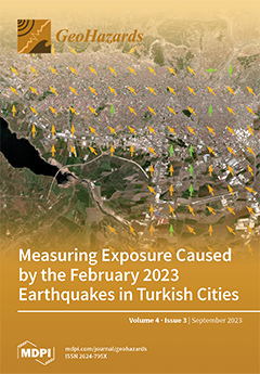
The devastating M 7.8 and M 7.5 earthquakes that occurred on 6 Feb. 2023 in Turkey's East Anatolian fault system caused widespread damage and collapse of structures in densely populated areas throughout the southern Turkey and northern Syria region, as well as a very large number of human losses. Utilizing Copernicus Sentinel-2 products and the Normalized Cross Correlation algorithm (NCC) of image matching, this study examines the correlation of the ground deformation induced by the earthquakes, with the critical exposure of the infrastructures (education, museums, libraries, hospitals, monuments, airports, roads and railways) of Gaziantep and Kahramanmaraş cities. View this paper
  • Issues are regarded as officially published after their release is announced to the table of contents alert mailing list.
  • You may sign up for e-mail alerts to receive table of contents of newly released issues.
  • PDF is the official format for papers published in both, html and pdf forms. To view the papers in pdf format, click on the "PDF Full-text" link, and use the free Adobe Reader to open them.
Order results
Result details
Select all
Export citation of selected articles as:
22 pages, 4693 KiB  
Article
Traditional Nomadism Offers Adaptive Capacity to Northern Mongolian Geohazards
by Gabrielle L. Moreau, Kelsey E. Nyland and Vera V. Kuklina
GeoHazards 2023, 4(3), 328-349; https://doi.org/10.3390/geohazards4030019 - 11 Aug 2023
Cited by 1 | Viewed by 1610
Abstract
Mongolia’s northernmost province, Khövsgöl Aimag, famous for its massive Lake Khövsgöl set among the mountainous steppe, taiga, and tundra forests, increasingly attracts both domestic and international tourists. Before the COVID-19 pandemic, Mongolia received over 500,000 tourists annually. The aimag is also home to [...] Read more.
Mongolia’s northernmost province, Khövsgöl Aimag, famous for its massive Lake Khövsgöl set among the mountainous steppe, taiga, and tundra forests, increasingly attracts both domestic and international tourists. Before the COVID-19 pandemic, Mongolia received over 500,000 tourists annually. The aimag is also home to Indigenous, nomadic Dukha reindeer herders and semi-nomadic Darkhad cattle herders. Using a multidisciplinary approach, this study uses an analytical hierarchy process to map areas in Khövsgöl Aimag, where the infrastructure, including buildings, dwellings, formal and informal roads, and pastureland, is subject to geohazards. The hazards of interest to this mapping analysis include mass wasting, flooding, and permafrost thawing, which threaten roads, pastures, houses, and other community infrastructure in Khövsgöl Aimag. Based on the integrated infrastructure risk map, an estimated 23% of the aimag is at high to very high risk for localized geohazards. After a discussion of the results informed by the interviews, mobile ethnographies, and local and national land use policies, we postulate that communities exercising more traditional nomadic lifestyles with higher mobility are more resilient to these primarily localized geohazards. Full article
Show Figures

Figure 1

12 pages, 1654 KiB  
Article
Non-Stationary Flood Discharge Frequency Analysis in West Africa
by Aymar Yaovi Bossa, Jean de Dieu Akpaca, Jean Hounkpè, Yacouba Yira and Djigbo Félicien Badou
GeoHazards 2023, 4(3), 316-327; https://doi.org/10.3390/geohazards4030018 - 11 Aug 2023
Cited by 1 | Viewed by 1069
Abstract
With climate change and intensification of the hydrological cycle, the stationarity of hydrological variables is becoming questionable, requiring appropriate flood assessment models. Frequency analysis is widely used for flood forecasting. This study aims to determine the most suitable models (stationary and non-stationary) for [...] Read more.
With climate change and intensification of the hydrological cycle, the stationarity of hydrological variables is becoming questionable, requiring appropriate flood assessment models. Frequency analysis is widely used for flood forecasting. This study aims to determine the most suitable models (stationary and non-stationary) for estimating the maximum flows observed at some stations spread across West Africa. A statistical analysis of the annual maximum flows in terms of homogeneity, stationarity, and independence was carried out through the Pettitt, modified Mann–Kendall, and Wald–Wolfowitz tests, respectively, to identify the stations whose flows are non-stationary. After that, the best-correlated climate covariates with the annual maximum flows of the non-stationary stations were determined. The covariates explored are the climatic indices of sea surface temperatures (SST). Finally, different non-stationary GEV models were derived by varying the scale and position parameters of the best-correlated index for each station. The results indicate that 56% of the annual maximum flow series are non-stationary. As per the Bayes information criterion (BIC) values, the performance of the non-stationary models (GEV, generalized extreme values) is largely greater than that of the stationary models. These good performances of non-stationary models using climatic indices open perspectives for the prediction of extreme flows in the study area. Full article
Show Figures

Figure 1

14 pages, 11921 KiB  
Article
Slope Failure and Landslide Detection in Huangdao District of Qingdao City Based on an Improved Faster R-CNN Model
by Yong Guan, Lili Yu, Shengyou Hao, Linsen Li, Xiaotong Zhang and Ming Hao
GeoHazards 2023, 4(3), 302-315; https://doi.org/10.3390/geohazards4030017 - 01 Aug 2023
Cited by 1 | Viewed by 1016
Abstract
To reduce the significant losses caused by slope failures and landslides, it is of great significance to detect and predict these disasters scientifically. This study focused on Huangdao District of Qingdao City in Shandong Province, using the improved Faster R-CNN network to detect [...] Read more.
To reduce the significant losses caused by slope failures and landslides, it is of great significance to detect and predict these disasters scientifically. This study focused on Huangdao District of Qingdao City in Shandong Province, using the improved Faster R-CNN network to detect slope failures and landslides. This study introduced a multi-scale feature enhancement module into the Faster R-CNN model. The module enhances the network’s perception of different scales of slope failures and landslides by deeply fusing high-resolution weak semantic features with low-resolution strong semantic features. Our experiments show that the improved Faster R-CNN model outperformed the traditional version, and that ResNet50 performed better than VGG16 with an AP value of 90.68%, F1 value of 0.94, recall value of 90.68%, and precision value of 98.17%. While the targets predicted by VGG16 were more dispersed and the false detection rate was higher than that of ResNet50, VGG16 was shown to have an advantage in predicting small-scale slope failures and landslides. The trained Faster R-CNN network model detected geological hazards of slope failure and landslide in Huangdao District, missing only two landslides, thereby demonstrating high detection accuracy. This method can provide an effective technical means for slope failures and landslides target detection and has practical implications. Full article
Show Figures

Figure 1

16 pages, 9980 KiB  
Article
Experimental Investigation of Levee Erosion during Overflow and Infiltration with Varied Hydraulic Conductivities of Levee and Foundation Properties in Saturated Conditions
by Liaqat Ali and Norio Tanaka
GeoHazards 2023, 4(3), 286-301; https://doi.org/10.3390/geohazards4030016 - 25 Jul 2023
Viewed by 1253
Abstract
This study investigated erosion during infiltration and overflow events and considered different grain sizes and hydraulic conductivity properties; four experimental cases were conducted under saturated conditions. The importance of understanding flow regimes during overflow experiments including their distinct flow characteristics, shear stresses, and [...] Read more.
This study investigated erosion during infiltration and overflow events and considered different grain sizes and hydraulic conductivity properties; four experimental cases were conducted under saturated conditions. The importance of understanding flow regimes during overflow experiments including their distinct flow characteristics, shear stresses, and erosion mechanisms in assessing the potential for levee failure are discussed. The failure mechanism of levee slopes during infiltration experiments involves progressive collapse due to piping followed by increased liquefaction and loss of shear stress, with the failure progression dependent on the permeability of the foundation material and shear strength. The infiltration experiments illustrate that the rate of failure varied based on the permeability of the foundation material. In the case of IO-E7-F5, where the levee had No. 7 sand in the embankment and No. 5 sand in the foundation (lower permeability), the failure was slower and limited. It took around 90 min for 65% of the downstream slope to fail, allowing more time for response measures. On the other hand, in the case of IO-E8-F4, with No. 8 sand in the embankment and No. 4 sand in the foundation (higher hydraulic conductivity), the failure was rapid and extensive. The whole downstream slope failed within just 18 min, and the collapse extended to 75% of the levee crest. These findings emphasize the need for proactive measures to strengthen vulnerable sections of levees and reduce the risk of extensive failure. Full article
(This article belongs to the Topic Natural Hazards and Disaster Risks Reduction)
Show Figures

Figure 1

19 pages, 8686 KiB  
Article
Correlation of Ground Deformation Induced by the 6 February 2023 M7.8 and M7.5 Earthquakes in Turkey Inferred by Sentinel-2 and Critical Exposure in Gaziantep and Kahramanmaraş Cities
by Ioannis Gkougkoustamos, Pavlos Krassakis, Georgia Kalogeropoulou and Issaak Parcharidis
GeoHazards 2023, 4(3), 267-285; https://doi.org/10.3390/geohazards4030015 - 06 Jul 2023
Cited by 3 | Viewed by 1730
Abstract
On 6 February 2023, an M7.8 devastating earthquake started rupturing the East Anatolian fault system in Turkey, resulting in intense shaking that lasted over a minute. A second earthquake of magnitude 7.5 struck near the city of Elbistan a few hours later. Both [...] Read more.
On 6 February 2023, an M7.8 devastating earthquake started rupturing the East Anatolian fault system in Turkey, resulting in intense shaking that lasted over a minute. A second earthquake of magnitude 7.5 struck near the city of Elbistan a few hours later. Both of these events are associated with the East Anatolian fault system. The earthquake sequence caused widespread damage and collapse of structures in densely populated areas throughout the Southern Turkey and Northern Syria regions and a very large number of human losses. This study focuses on the correlation of the ground deformation with the critical exposure of the infrastructures of Gaziantep and Kahramanmaraş cities. The estimation of the ground deformation of the affected area is achieved with the use of Copernicus Sentinel-2 products and the Normalized Cross Correlation algorithm (NCC) of image matching. The results of the East–West component show that specific sections of the region moved towards the East direction, reaching displacement measurements of 5.4 m, while other sections moved towards the West direction, reaching displacement measurements of 2.8 m. The results of the North–South component show that almost the whole affected area moved towards the North direction, with specific areas reaching displacements of 5.5 m, and a few exemptions, as some areas moved towards the South direction, with displacements reaching even 6.9 m. Regarding the cities of Kahramanmaraş and Gaziantep, their estimated movement direction is North-West and North-East, respectively, and is consistent with the movements of the Arabian and Anatolian Plates in which they are located. Important infrastructures of the study areas (education, museums, libraries, hospitals, monuments, airports, roads and railways) are superimposed on the findings, enabling us to detect the critical exposure rapidly. Full article
Show Figures

Figure 1

28 pages, 9930 KiB  
Article
Seismic Hazard in Greece: A Comparative Study for the Region of East Macedonia and Thrace
by Dimitris Sotiriadis, Basil Margaris, Nikolaos Klimis and Ioannis M. Dokas
GeoHazards 2023, 4(3), 239-266; https://doi.org/10.3390/geohazards4030014 - 30 Jun 2023
Cited by 4 | Viewed by 1535
Abstract
Greece is located in one of the most seismically active regions in Europe. Many seismic hazard studies have been performed for various sites around Greece, at a regional or local scale. However, the latest national seismic hazard map, currently used for the seismic [...] Read more.
Greece is located in one of the most seismically active regions in Europe. Many seismic hazard studies have been performed for various sites around Greece, at a regional or local scale. However, the latest national seismic hazard map, currently used for the seismic design of buildings and infrastructure, was published in 2000 and has not been updated since then. In light of recent advances in seismic source and ground motion modeling, the present study focuses on a comparative Probabilistic Seismic Hazard Assessment (PSHA) for the region of East Macedonia and Thrace (EMTH), located in Northern Greece. Various seismic source models are implemented and compared against an updated earthquake catalog to form the necessary source model logic tree. The ground motion logic tree is composed of Ground Motion Prediction Equations (GMPEs), which have been proven suitable for implementation in Greece. PSHA results are presented for the most important cities of East Macedonia and Thrace in a comparative way, which highlights the variability of the seismic hazard among the various seismic source models. An updated seismic hazard map of the study area is proposed, and a comparative disaggregation analysis is performed to estimate the earthquake scenarios with the largest contribution to the seismic hazard. Full article
Show Figures

Figure 1

22 pages, 11867 KiB  
Article
Probabilistic Tsunami Hazard Analysis for Vancouver Island Coast Using Stochastic Rupture Models for the Cascadia Subduction Earthquakes
by Katsuichiro Goda
GeoHazards 2023, 4(3), 217-238; https://doi.org/10.3390/geohazards4030013 - 21 Jun 2023
Cited by 2 | Viewed by 1456
Abstract
Tsunami hazard analysis is an essential step for designing buildings and infrastructure and for safeguarding people and assets in coastal areas. Coastal communities on Vancouver Island are under threat from the Cascadia megathrust earthquakes and tsunamis. Due to the deterministic nature of current [...] Read more.
Tsunami hazard analysis is an essential step for designing buildings and infrastructure and for safeguarding people and assets in coastal areas. Coastal communities on Vancouver Island are under threat from the Cascadia megathrust earthquakes and tsunamis. Due to the deterministic nature of current megathrust earthquake scenarios, probabilistic tsunami hazard analysis has not been conducted for the coast of Vancouver Island. To address this research gap, this study presents a new probabilistic tsunami hazard model for Vancouver Island from the Cascadia megathrust subduction events. To account for uncertainties of the possible rupture scenarios more comprehensively, time-dependent earthquake occurrence modeling and stochastic rupture modeling are integrated. The time-dependent earthquake model can capture a multi-modal distribution of inter-arrival time data on the Cascadia megathrust events. On the other hand, the stochastic rupture model can consider variable fault geometry, position, and earthquake slip distribution within the subduction zone. The results indicate that the consideration of different inter-arrival time distributions can result in noticeable differences in terms of site-specific tsunami hazard curves and uniform tsunami hazard curves at different return period levels. At present, the use of the one-component renewal model tends to overestimate the tsunami hazard values compared to the three-component Gaussian mixture model. With the increase in the elapsed time since the last event and the duration of tsunami hazard assessment, the differences tend to be smaller. Inspecting the regional variability of the tsunami hazards, specific segments of the Vancouver Island coast are likely to experience higher tsunami hazards due to the directed tsunami waves from the main subduction zone and due to the local underwater topography. Full article
Show Figures

Figure 1

Previous Issue
Next Issue
Back to TopTop