Next Issue
Volume 6, August
Previous Issue
Volume 6, June


Drones, Volume 6, Issue 7 (July 2022) – 31 articles

Cover Story (view full-size image): 
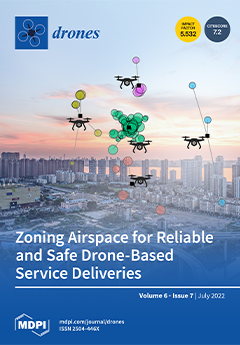
Since the concept of package delivery using drones was introduced, there have been dramatic advancements in drone technologies. However, it is still difficult to find such drone-based service delivery in our lives. One of the critical barriers to the implementation of drone-based service delivery at a full scale is the difficulties in the air traffic control and collision avoidance of drones. As a systematic solution to these difficulties, this study addresses a zoning approach that divides a service area into a set of zones and assigns a single drone to a zone. From the experiments of this study, where different demand distributions and different objective functions for demand clustering are considered, it is demonstrated that the safety of drones as well as the efficient use of the units can be achieved by the zoning approach. View this paper
  • Issues are regarded as officially published after their release is announced to the table of contents alert mailing list.
  • You may sign up for e-mail alerts to receive table of contents of newly released issues.
  • PDF is the official format for papers published in both, html and pdf forms. To view the papers in pdf format, click on the "PDF Full-text" link, and use the free Adobe Reader to open them.
Order results
Result details
Section
Select all
Export citation of selected articles as:
29 pages, 8073 KiB  
Article
A Unified Airspace Risk Management Framework for UAS Operations
by Suraj Bijjahalli, Alessandro Gardi, Nichakorn Pongsakornsathien, Roberto Sabatini and Trevor Kistan
Drones 2022, 6(7), 184; https://doi.org/10.3390/drones6070184 - 21 Jul 2022
Cited by 4 | Viewed by 3346
Abstract
Collision risk modelling has a long history in the aviation industry, with mature models currently utilised for the strategic planning of airspace sectors and air routes. However, the progressive introduction of Unmanned Aircraft Systems (UAS) and other forms of air mobility poses new [...] Read more.
Collision risk modelling has a long history in the aviation industry, with mature models currently utilised for the strategic planning of airspace sectors and air routes. However, the progressive introduction of Unmanned Aircraft Systems (UAS) and other forms of air mobility poses new challenges, compounded by a growing need to address both offline and online operational requirements. To address the associated gaps in the existing airspace risk assessment models, this article proposes a comprehensive risk management framework, which relies on a novel methodology to model UAS collision risk in all classes of airspace. This methodology inherently accounts for the performance of Communication, Navigation and Surveillance (CNS) systems, and, as such, it can be applied to both strategic and tactical operational timeframes. Additionally, the proposed approach can be applied inversely to determine CNS performance requirements given a target value of collision probability. This new risk assessment methodology is based on a rigorous analysis of the CNS error characteristics and transformation of the associated models into the spatial domain to generate a protection volume around each predicted air traffic conflict. Additionally, a methodology to quickly and conservatively evaluate the multi-integral formulation of collision probability is introduced. The validity of the proposed framework is tested using representative CNS performance parameters in two simulation case studies targeting, respectively, a terminal manoeuvring area and an enroute scenario. Full article
Show Figures

Figure 1

12 pages, 6251 KiB  
Article
Compact and Efficient Topological Mapping for Large-Scale Environment with Pruned Voronoi Diagram
by Yao Qi, Rendong Wang, Binbing He, Feng Lu and Youchun Xu
Drones 2022, 6(7), 183; https://doi.org/10.3390/drones6070183 - 21 Jul 2022
Cited by 5 | Viewed by 2024
Abstract
Topological maps generated in complex and irregular unknown environments are meaningful for autonomous robots’ navigation. To obtain the skeleton of the environment without obstacle polygon extraction and clustering, we propose a method to obtain high-quality topological maps using only pure Voronoi diagrams in [...] Read more.
Topological maps generated in complex and irregular unknown environments are meaningful for autonomous robots’ navigation. To obtain the skeleton of the environment without obstacle polygon extraction and clustering, we propose a method to obtain high-quality topological maps using only pure Voronoi diagrams in three steps. Supported by Voronoi vertex’s property of the largest empty circle, the method updates the global topological map incrementally in both dynamic and static environments online. The incremental method can be adapted to any fundamental Voronoi diagram generator. We maintain the entire space by two graphs, the pruned Voronoi graph for incremental updates and the reduced approximated generalized Voronoi graph for routing planning requests. We present an extensive benchmark and real-world experiment, and our method completes the environment representation in both indoor and outdoor areas. The proposed method generates a compact topological map in both small- and large-scale scenarios, which is defined as the total length and vertices of topological maps. Additionally, our method has been shortened by several orders of magnitude in terms of the total length and consumes less than 30% of the average time cost compared to state-of-the-art methods. Full article
(This article belongs to the Special Issue Application of UAS in Construction)
Show Figures

Figure 1

17 pages, 5257 KiB  
Article
Aircraft Carrier Pose Tracking Based on Adaptive Region in Visual Landing
by Jiexin Zhou, Qiufu Wang, Zhuo Zhang and Xiaoliang Sun
Drones 2022, 6(7), 182; https://doi.org/10.3390/drones6070182 - 21 Jul 2022
Cited by 1 | Viewed by 1620
Abstract
Due to its structural simplicity and its strong anti-electromagnetic ability, landing guidance based on airborne monocular vision has gained more and more attention. Monocular 6D pose tracking of the aircraft carrier is one of the key technologies in visual landing guidance. However, owing [...] Read more.
Due to its structural simplicity and its strong anti-electromagnetic ability, landing guidance based on airborne monocular vision has gained more and more attention. Monocular 6D pose tracking of the aircraft carrier is one of the key technologies in visual landing guidance. However, owing to the large range span in the process of carrier landing, the scale of the carrier target in the image variates greatly. There is still a lack of robust monocular pose tracking methods suitable for this scenario. To tackle this problem, a new aircraft carrier pose tracking algorithm based on scale-adaptive local region is proposed in this paper. Firstly, the projected contour of the carrier target is uniformly sampled to establish local circular regions. Then, the local area radius is adjusted according to the pixel scale of the projected contour to build the optimal segmentation energy function. Finally, the 6D pose tracking of the carrier target is realized by iterative optimization. Experimental results on both synthetic and real image sequences show that the proposed method achieves robust and efficient 6D pose tracking of the carrier target under the condition of large distance span, which meets the application requirements of carrier landing guidance. Full article
(This article belongs to the Special Issue Intelligent Coordination of UAV Swarm Systems)
Show Figures

Figure 1

32 pages, 12554 KiB  
Article
MCO Plan: Efficient Coverage Mission for Multiple Micro Aerial Vehicles Modeled as Agents
by Liseth Viviana Campo, Agapito Ledezma and Juan Carlos Corrales
Drones 2022, 6(7), 181; https://doi.org/10.3390/drones6070181 - 21 Jul 2022
Cited by 3 | Viewed by 2039
Abstract
Micro aerial vehicle (MAV) fleets have gained essential recognition in the decision schemes for precision agriculture, disaster management, and other coverage missions. However, they have some challenges in becoming massively deployed. One of them is resource management in restricted workspaces. This paper proposes [...] Read more.
Micro aerial vehicle (MAV) fleets have gained essential recognition in the decision schemes for precision agriculture, disaster management, and other coverage missions. However, they have some challenges in becoming massively deployed. One of them is resource management in restricted workspaces. This paper proposes a plan to balance resources when considering the practical use of MAVs and workspace in daily chores. The coverage mission plan is based on five stages: world abstraction, area partitioning, role allocation, task generation, and task allocation. The tasks are allocated according to agent roles, Master, Coordinator, or Operator (MCO), which describe their flight autonomy, connectivity, and decision skill. These roles are engaged with the partitioning based on the Voronoi-tessellation but extended to heterogeneous polygons. The advantages of the MCO Plan were evident compared with conventional Boustrophedon decomposition and clustering by K-means. The MCO plan achieved a balanced magnitude and trend of heterogeneity between both methods, involving MAVs with few or intermediate resources. The resulting efficiency was tested in the GAMA platform, with gained energy between 2% and 10% in the mission end. In addition, the MCO plan improved mission times while the connectivity was effectively held, even more, if the Firefly algorithm generated coverage paths. Full article
(This article belongs to the Special Issue Intelligent Coordination of UAV Swarm Systems)
Show Figures

Figure 1

12 pages, 1960 KiB  
Communication
Drones for Area-Wide Larval Source Management of Malaria Mosquitoes
by Wolfgang R. Mukabana, Guido Welter, Pius Ohr, Leka Tingitana, Makame H. Makame, Abdullah S. Ali and Bart G. J. Knols
Drones 2022, 6(7), 180; https://doi.org/10.3390/drones6070180 - 20 Jul 2022
Cited by 9 | Viewed by 4564
Abstract
Given the stagnating progress in the fight against malaria, there is an urgent need for area-wide integrated vector management strategies to complement existing intra-domiciliary tools, i.e., insecticide-treated bednets and indoor residual spraying. In this study, we describe a pilot trial using drones for [...] Read more.
Given the stagnating progress in the fight against malaria, there is an urgent need for area-wide integrated vector management strategies to complement existing intra-domiciliary tools, i.e., insecticide-treated bednets and indoor residual spraying. In this study, we describe a pilot trial using drones for aerial application of Aquatain Mosquito Formulation (AMF), a monomolecular surface film with larvicidal activity, against the African malaria mosquito Anopheles arabiensis in an irrigated rice agro-ecosystem in Unguja island, Zanzibar, Tanzania. Nine rice paddies were randomly assigned to three treatments: (a) control (drone spraying with water only), (b) drone spraying with 1 mL/m2, or (c) drone spraying with 5 mL/m2 of AMF. Compared to control paddies, AMF treatments resulted in highly significant (p < 0.001) reductions in the number of larvae and pupae and >90% fewer emerging adults. The residual effect of AMF treatment lasted for a minimum of 5 weeks post-treatment, with reductions in larval densities reaching 94.7% in week 5 and 99.4% in week 4 for the 1 and 5 mL/m2 AMF treatments, respectively. These results merit a review of the WHO policy regarding larval source management (LSM), which primarily recommends its use in urban environments with ‘few, fixed, and findable’ breeding sites. Unmanned aerial vehicles (UAVs) can rapidly treat many permanent, temporary, or transient mosquito breeding sites over large areas at low cost, thereby significantly enhancing the role of LSM in contemporary malaria control and elimination efforts. Full article
(This article belongs to the Section Drones in Ecology)
Show Figures

Figure 1

55 pages, 14829 KiB  
Article
Urban Air Mobility: Systematic Review of Scientific Publications and Regulations for Vertiport Design and Operations
by Karolin Schweiger and Lukas Preis
Drones 2022, 6(7), 179; https://doi.org/10.3390/drones6070179 - 19 Jul 2022
Cited by 34 | Viewed by 13666
Abstract
Novel electric aircraft designs coupled with intense efforts from academia, government and industry led to a paradigm shift in urban transportation by introducing UAM. While UAM promises to introduce a new mode of transport, it depends on ground infrastructure to operate safely and [...] Read more.
Novel electric aircraft designs coupled with intense efforts from academia, government and industry led to a paradigm shift in urban transportation by introducing UAM. While UAM promises to introduce a new mode of transport, it depends on ground infrastructure to operate safely and efficiently in a highly constrained urban environment. Due to its novelty, the research of UAM ground infrastructure is widely scattered. Therefore, this paper selects, categorizes and summarizes existing literature in a systematic fashion and strives to support the harmonization process of contributions made by industry, research and regulatory authorities. Through a document term matrix approach, we identified 49 Scopus-listed scientific publications (2016–2021) addressing the topic of UAM ground infrastructure with respect to airspace operation followed by design, location and network, throughput and capacity, ground operations, cost, safety, regulation, weather and lastly noise and security. Last listed topics from cost onwards appear to be substantially under-represented, but will be influencing current developments and challenges. This manuscript further presents regulatory considerations (Europe, U.S., international) and introduces additional noteworthy scientific publications and industry contributions. Initial uncertainties in naming UAM ground infrastructure seem to be overcome; vertiport is now being predominantly used when speaking about vertical take-off and landing UAM operations. Full article
(This article belongs to the Special Issue Urban Air Mobility (UAM))
Show Figures

Figure 1

19 pages, 4999 KiB  
Article
An Error Prediction Model for Construction Bulk Measurements Using a Customized Low-Cost UAS-LIDAR System
by Shanyue Guan, Yilei Huang, George Wang, Hannah Sirianni and Zhen Zhu
Drones 2022, 6(7), 178; https://doi.org/10.3390/drones6070178 - 19 Jul 2022
Cited by 4 | Viewed by 2386
Abstract
Small unmanned aerial systems (UAS) have been increasingly popular in surveying and mapping tasks. While photogrammetry has been the primary UAS sensing technology in other industries, construction activities can also benefit from accurate surveying measurements from airborne LIDAR. This paper discusses a custom-designed [...] Read more.
Small unmanned aerial systems (UAS) have been increasingly popular in surveying and mapping tasks. While photogrammetry has been the primary UAS sensing technology in other industries, construction activities can also benefit from accurate surveying measurements from airborne LIDAR. This paper discusses a custom-designed low-cost UAS-based LIDAR system that can effectively measure construction excavation and bulk piles. The system is designed with open interfaces that can be easily upgraded and expanded. An error model was developed to predict the horizontal and vertical errors of single point geo-registration for a generic UAS-LIDAR. This model was validated for the proposed UAS-LIDAR system using calibration targets and real-world measurements from different scenarios. The results indicated random errors from LIDAR at approximately 0.1 m and systematic errors at or below centimeter level. Additional pre-processing of the raw point cloud can further reduce the random errors in LIDAR measurements of bulk piles. Full article
Show Figures

Figure 1

29 pages, 1222 KiB  
Article
Computing in the Sky: A Survey on Intelligent Ubiquitous Computing for UAV-Assisted 6G Networks and Industry 4.0/5.0
by Saeed Hamood Alsamhi, Alexey V. Shvetsov, Santosh Kumar, Jahan Hassan, Mohammed A. Alhartomi, Svetlana V. Shvetsova, Radhya Sahal and Ammar Hawbani
Drones 2022, 6(7), 177; https://doi.org/10.3390/drones6070177 - 18 Jul 2022
Cited by 57 | Viewed by 6996
Abstract
Unmanned Aerial Vehicles (UAVs) are increasingly being used in a high-computation paradigm enabled with smart applications in the Beyond Fifth Generation (B5G) wireless communication networks. These networks have an avenue for generating a considerable amount of heterogeneous data by the expanding number of [...] Read more.
Unmanned Aerial Vehicles (UAVs) are increasingly being used in a high-computation paradigm enabled with smart applications in the Beyond Fifth Generation (B5G) wireless communication networks. These networks have an avenue for generating a considerable amount of heterogeneous data by the expanding number of Internet of Things (IoT) devices in smart environments. However, storing and processing massive data with limited computational capability and energy availability at local nodes in the IoT network has been a significant difficulty, mainly when deploying Artificial Intelligence (AI) techniques to extract discriminatory information from the massive amount of data for different tasks.Therefore, Mobile Edge Computing (MEC) has evolved as a promising computing paradigm leveraged with efficient technology to improve the quality of services of edge devices and network performance better than cloud computing networks, addressing challenging problems of latency and computation-intensive offloading in a UAV-assisted framework. This paper provides a comprehensive review of intelligent UAV computing technology to enable 6G networks over smart environments. We highlight the utility of UAV computing and the critical role of Federated Learning (FL) in meeting the challenges related to energy, security, task offloading, and latency of IoT data in smart environments. We present the reader with an insight into UAV computing, advantages, applications, and challenges that can provide helpful guidance for future research. Full article
(This article belongs to the Special Issue Drone Computing Enabling IoE)
Show Figures

Figure 1

20 pages, 1657 KiB  
Article
Rotor Failure Compensation in a Biplane Quadrotor Based on Virtual Deflection
by Nihal Dalwadi, Dipankar Deb and Stepan Ozana
Drones 2022, 6(7), 176; https://doi.org/10.3390/drones6070176 - 17 Jul 2022
Cited by 5 | Viewed by 1937
Abstract
A biplane quadrotor is a hybrid type of UAV that has wide applications such as payload pickup and delivery, surveillance, etc. This simulation study mainly focuses on handling the total rotor failure, and for that, we propose a control architecture that does not [...] Read more.
A biplane quadrotor is a hybrid type of UAV that has wide applications such as payload pickup and delivery, surveillance, etc. This simulation study mainly focuses on handling the total rotor failure, and for that, we propose a control architecture that does not only handle rotor failure but is also able to navigate the biplane quadrotor to a safe place for landing. In this structure, after the detection of total rotor failure, the biplane quadrotor will imitate reallocating control signals and then perform the transition maneuver and switch to the fixed-wing mode; control signals are also reallocated. A synthetic jet actuator (SJA) is used as the redundancy that generates the desired virtual deflection to control the pitch angle, while other states are taken care of by the three rotors. The SJA has parametric nonlinearity, and to handle it, an inverse adaptive compensation scheme is applied and a closed-loop stability analysis is performed based on the Lyapunov method for the pitch subsystem. The effectiveness of the proposed control structure is validated using numerical simulation carried out in the MATLAB Simulink. Full article
Show Figures

Figure 1

24 pages, 82754 KiB  
Article
Oblique View Selection for Efficient and Accurate Building Reconstruction in Rural Areas Using Large-Scale UAV Images
by Yubin Liang, Xiaochang Fan, Yang Yang, Deqian Li and Tiejun Cui
Drones 2022, 6(7), 175; https://doi.org/10.3390/drones6070175 - 16 Jul 2022
Cited by 6 | Viewed by 2268
Abstract
3D building models are widely used in many applications. The traditional image-based 3D reconstruction pipeline without using semantic information is inefficient for building reconstruction in rural areas. An oblique view selection methodology for efficient and accurate building reconstruction in rural areas is proposed [...] Read more.
3D building models are widely used in many applications. The traditional image-based 3D reconstruction pipeline without using semantic information is inefficient for building reconstruction in rural areas. An oblique view selection methodology for efficient and accurate building reconstruction in rural areas is proposed in this paper. A Mask R-CNN model is trained using satellite datasets and used to detect building instances in nadir UAV images. Then, the detected building instances and UAV images are directly georeferenced. The georeferenced building instances are used to select oblique images that cover buildings by using nearest neighbours search. Finally, precise match pairs are generated from the selected oblique images and nadir images using their georeferenced principal points. The proposed methodology is tested on a dataset containing 9775 UAV images. A total of 4441 oblique images covering 99.4% of all the buildings in the survey area are automatically selected. Experimental results show that the average precision and recall of the oblique view selection are 0.90 and 0.88, respectively. The percentage of robustly matched oblique-oblique and oblique-nadir image pairs are above 94% and 84.0%, respectively. The proposed methodology is evaluated for sparse and dense reconstruction. Experimental results show that the sparse reconstruction based on the proposed methodology reduces 68.9% of the data processing time, and it is comparably accurate and complete. Experimental results also show high consistency between the dense point clouds of buildings reconstructed by the traditional pipeline and the pipeline based on the proposed methodology. Full article
(This article belongs to the Special Issue UAV Photogrammetry for 3D Modeling)
Show Figures

Figure 1

17 pages, 8523 KiB  
Article
Using Drones to Monitor Broad-Leaved Orchids (Dactylorhiza majalis) in High-Nature-Value Grassland
by Kim-Cedric Gröschler and Natascha Oppelt
Drones 2022, 6(7), 174; https://doi.org/10.3390/drones6070174 - 15 Jul 2022
Cited by 3 | Viewed by 2040
Abstract
Dactylorhiza majalis is a threatened indicator species for the habitat quality of nutrient-poor grassland sites. Environmentalists utilize the species to validate the success of conservation efforts. Conventionally, plant surveys are field campaigns where the plant numbers are estimated and their spatial distribution is [...] Read more.
Dactylorhiza majalis is a threatened indicator species for the habitat quality of nutrient-poor grassland sites. Environmentalists utilize the species to validate the success of conservation efforts. Conventionally, plant surveys are field campaigns where the plant numbers are estimated and their spatial distribution is either approximated by GPS or labor-intensively measured by differential GPS. In this study, we propose a monitoring approach using multispectral drone-based data with a very high spatial resolution (~3 cm). We developed the magenta vegetation index to enhance the spectral response of Dactylorhiza majalis in the drone data. We integrated the magenta vegetation index in a random forest classification routine among other vegetation indices and analyzed feature impact on model decision making using SHAP. We applied an image object-level median filter to the classification result to account for image artefacts. Finally, we aggregated the filtered result to individuals per square meter using an overlaying vector grid. The SHAP analysis showed that magenta vegetation index had the highest impact on model decision making. The random forest model could reliably classify Dactylorhiza majalis in the drone data (F1 score: 0.99). We validated the drone-derived plant count using field mappings and achieved good results with an RMSE of 12 individuals per square meter, which is within the error margin stated by experts for a conventional plant survey. In addition to abundance, we revealed the comprehensive spatial distribution of the plants. The results indicate that drone surveys are a suitable alternative to conventional monitoring because they can aid in evaluating conservation efforts and optimizing site-specific management. Full article
(This article belongs to the Special Issue Drones for Biodiversity Conservation)
Show Figures

Figure 1

24 pages, 6307 KiB  
Article
Optimization Schemes for UAV Data Collection with LoRa 2.4 GHz Technology in Remote Areas without Infrastructure
by Zheng Zhang, Chun Zhou, Liangcai Sheng and Shouqi Cao
Drones 2022, 6(7), 173; https://doi.org/10.3390/drones6070173 - 15 Jul 2022
Cited by 7 | Viewed by 1942
Abstract
Recently, the use of unmanned aerial vehicles (UAVs) and LPWANs (low-power wide-area networks) has been a good solution to the problem of data collection for environmental monitoring in remote areas without infrastructure, and there are many valuable research works in this field. UAV [...] Read more.
Recently, the use of unmanned aerial vehicles (UAVs) and LPWANs (low-power wide-area networks) has been a good solution to the problem of data collection for environmental monitoring in remote areas without infrastructure, and there are many valuable research works in this field. UAV data collection for sensor nodes is becoming a challenge, that is, the amount of data will affect the UAV’s communication time and flight status, especially in LPWAN systems. In this paper, the optimization schemes are proposed to improve the efficiency of UAV for collecting data in LoRa network monitoring systems. Firstly, an improved clustering algorithm for the LoRa network is proposed, which considers the influence of distance between the cluster heads and the UAV take-off point. Secondly, we present an improved Genetic Algorithm for path planning to reduce the UAV flight distance, which introduces the Teaching–Learning-based Optimization (TLBO) and local search optimization algorithms to improve convergence speed and the path solution. Then, a LoRa 2.4 GHz adaptive data rate strategy with a dual channel is designed based on distance and link quality, to reduce the data transmitting time between the UAV and the cluster head nodes. Finally, we carry out the simulations and experiments. The results show the performance of the proposed schemes, which means that these can improve the efficiency of UAV data collection with low cost LoRa networks in remote areas without infrastructure. Full article
(This article belongs to the Section Drone Communications)
Show Figures

Figure 1

16 pages, 6194 KiB  
Article
Quadrotor Formation Control via Terminal Sliding Mode Approach: Theory and Experiment Results
by Ngoc Phi Nguyen, Daewon Park, Dao N. Ngoc, Nguyen Xuan-Mung, Tuan Tu Huynh, Tan N. Nguyen and Sung Kyung Hong
Drones 2022, 6(7), 172; https://doi.org/10.3390/drones6070172 - 14 Jul 2022
Cited by 16 | Viewed by 2526
Abstract
This article presents a formation tracking control method for the operation of multi-agent systems under disturbances. This study aims to ensure that the followers of a quadcopter converge into the desired formation while the center formation of the follower quadcopters tracks the leader’s [...] Read more.
This article presents a formation tracking control method for the operation of multi-agent systems under disturbances. This study aims to ensure that the followers of a quadcopter converge into the desired formation while the center formation of the follower quadcopters tracks the leader’s trajectory within a finite time. The distributed finite-time formation control problem is first investigated using the fast terminal sliding mode control (FTSMC) theory. A disturbance observer is then integrated into the FTSMC to overcome the model uncertainties and bounded disturbances. Subsequently, the Lyapunov function is proposed to ensure the stability of the system. It is shown that formation tracking control can be achieved even in the presence of disturbances. Simulation and experimental results verify the effectiveness of the proposed formation tracking control method compared to existing ones. Full article
Show Figures

Figure 1

17 pages, 6985 KiB  
Article
Super-Resolution Images Methodology Applied to UAV Datasets to Road Pavement Monitoring
by Laura Inzerillo, Francesco Acuto, Gaetano Di Mino and Mohammed Zeeshan Uddin
Drones 2022, 6(7), 171; https://doi.org/10.3390/drones6070171 - 12 Jul 2022
Cited by 14 | Viewed by 2930
Abstract
The increasingly widespread use of smartphones as real cameras on drones has allowed an ever-greater development of several algorithms to improve the image’s refinement. Although the latest generations of drone cameras let the user achieve high resolution images, the large number of pixels [...] Read more.
The increasingly widespread use of smartphones as real cameras on drones has allowed an ever-greater development of several algorithms to improve the image’s refinement. Although the latest generations of drone cameras let the user achieve high resolution images, the large number of pixels to be processed and the acquisitions from multiple lengths for stereo-view often fail to guarantee satisfactory results. In particular, high flight altitudes strongly impact the accuracy, and result in images which are undefined or blurry. This is not acceptable in the field of road pavement monitoring. In that case, the conventional algorithms used for the image resolution conversion, such as the bilinear interpolation algorithm, do not allow high frequency information to be retrieved from an undefined capture. This aspect is felt more strongly when using the recorded images to build a 3D scenario, since its geometric accuracy is greater when the resolution of the photos is higher. Super-Resolution algorithms (SRa) are utilized when registering multiple low-resolution images to interpolate sub-pixel information The aim of this work is to assess, at high flight altitudes, the geometric precision of a 3D model by using the the Morpho Super-Resolution™ algorithm for a road pavement distress monitoring case study. Full article
(This article belongs to the Special Issue UAV Photogrammetry for 3D Modeling)
Show Figures

Figure 1

12 pages, 2323 KiB  
Article
Unoccupied Aerial Systems: A Review of Regulatory and Legislative Frameworks in the Caribbean
by Deanesh Ramsewak, Naimah Salimah Mohammed and Noel Sookram
Drones 2022, 6(7), 170; https://doi.org/10.3390/drones6070170 - 09 Jul 2022
Cited by 1 | Viewed by 2075
Abstract
Unoccupied aerial systems (UAS) have become pervasive for many small-scale and large-scale aerial operations around the world. Their implementation in small island states like those of the Caribbean is particularly useful because they are relatively cheap and versatile. Despite being used for more [...] Read more.
Unoccupied aerial systems (UAS) have become pervasive for many small-scale and large-scale aerial operations around the world. Their implementation in small island states like those of the Caribbean is particularly useful because they are relatively cheap and versatile. Despite being used for more than a decade in this part of the world, however, many territories in this tropical region still do not have adequate regulatory and/or legislative frameworks to support UAS operations. UAS applications are varied in the Caribbean, ranging from recreational use and coral reef monitoring to public utilities and national security support. In this paper, we present the first collective assessment of existing UAS regulatory and legislative frameworks in the Caribbean region. Data on four factors that are critical to UAS operations was collected and analyzed for the fifteen full-member Caribbean Community (CARICOM) countries. Across the duration of this study, some of the countries assessed had no existing frameworks in place, while one had completely banned UAS operations within its jurisdiction. Others, including Guyana, Trinidad and Tobago, and Jamaica, had comprehensive frameworks that were continuously being updated. The outcome of a more in-depth analysis revealed that the UAS legislative framework for Guyana appeared to be the most robust amongst all CARICOM territories. Finally, some of the challenges of proper UAS regulation observed in the region are presented. Full article
Show Figures

Figure 1

27 pages, 7622 KiB  
Article
Estimation of Maize Foliar Temperature and Stomatal Conductance as Indicators of Water Stress Based on Optical and Thermal Imagery Acquired Using an Unmanned Aerial Vehicle (UAV) Platform
by Kiara Brewer, Alistair Clulow, Mbulisi Sibanda, Shaeden Gokool, John Odindi, Onisimo Mutanga, Vivek Naiken, Vimbayi G. P. Chimonyo and Tafadzwanashe Mabhaudhi
Drones 2022, 6(7), 169; https://doi.org/10.3390/drones6070169 - 08 Jul 2022
Cited by 17 | Viewed by 4605
Abstract
Climatic variability and extreme weather events impact agricultural production, especially in sub-Saharan smallholder cropping systems, which are commonly rainfed. Hence, the development of early warning systems regarding moisture availability can facilitate planning, mitigate losses and optimise yields through moisture augmentation. Precision agricultural practices, [...] Read more.
Climatic variability and extreme weather events impact agricultural production, especially in sub-Saharan smallholder cropping systems, which are commonly rainfed. Hence, the development of early warning systems regarding moisture availability can facilitate planning, mitigate losses and optimise yields through moisture augmentation. Precision agricultural practices, facilitated by unmanned aerial vehicles (UAVs) with very high-resolution cameras, are useful for monitoring farm-scale dynamics at near-real-time and have become an important agricultural management tool. Considering these developments, we evaluated the utility of optical and thermal infrared UAV imagery, in combination with a random forest machine-learning algorithm, to estimate the maize foliar temperature and stomatal conductance as indicators of potential crop water stress and moisture content over the entire phenological cycle. The results illustrated that the thermal infrared waveband was the most influential variable during vegetative growth stages, whereas the red-edge and near-infrared derived vegetation indices were fundamental during the reproductive growth stages for both temperature and stomatal conductance. The results also suggested mild water stress during vegetative growth stages and after a hailstorm during the mid-reproductive stage. Furthermore, the random forest model optimally estimated the maize crop temperature and stomatal conductance over the various phenological stages. Specifically, maize foliar temperature was best predicted during the mid-vegetative growth stage and stomatal conductance was best predicted during the early reproductive growth stage. Resultant maps of the modelled maize growth stages captured the spatial heterogeneity of maize foliar temperature and stomatal conductance within the maize field. Overall, the findings of the study demonstrated that the use of UAV optical and thermal imagery, in concert with prediction-based machine learning, is a useful tool, available to smallholder farmers to help them make informed management decisions that include the optimal implementation of irrigation schedules. Full article
Show Figures

Figure 1

22 pages, 2235 KiB  
Article
Stability Derivatives of Various Lighter-than-Air Vehicles: A CFD-Based Comparative Study
by Anoop Sasidharan, Ratna Kishore Velamati, Sheeja Janardhanan, Venkata Ramana Murthy Oruganti and Akram Mohammad
Drones 2022, 6(7), 168; https://doi.org/10.3390/drones6070168 - 07 Jul 2022
Cited by 1 | Viewed by 2084
Abstract
An aerostat with a single tether is proposed for the application of wind measurements at low altitudes. In the current study, the aerodynamic model parameters (stability derivatives) of the aerostat are investigated based on a CFD-based approach. The static, as well as the [...] Read more.
An aerostat with a single tether is proposed for the application of wind measurements at low altitudes. In the current study, the aerodynamic model parameters (stability derivatives) of the aerostat are investigated based on a CFD-based approach. The static, as well as the dynamic stability derivatives of the aerostats are presented. The calculation of the dynamic stability derivatives involves the simulation of the oscillations of the aerostats in their axial direction (surge), the vertical direction (heave) and angular motions with respect to the lateral direction (pitch). A forced sinusoidal oscillation is used for the simulation of the aerostat, and one stable period of oscillation is taken for the derivatives’ extraction. Four different aerostats are considered for the current study with four different angles of attack. The Zhiyuan aerostat, HAA aerostat, NPL aerostat and GNVR aerostat are the aerostats considered for this study. The stability derivative results obtained for the four aerostats are analyzed and compared with respect to their geometrical features. From the static aerodynamic characteristics, the Zhiyuan aerostat shows better performance than the other aerostats in terms of the lift–drag ratio. The dynamic stability derivatives of the Zhiyuan aerostat suggest its application as the proposed low-altitude wind measurement system. Full article
(This article belongs to the Special Issue Honorary Special Issue for Prof. Max F. Platzer)
Show Figures

Figure 1

26 pages, 7493 KiB  
Review
BVLOS Unmanned Aircraft Operations in Forest Environments
by Robin John ap Lewis Hartley, Isaac Levi Henderson and Chris Lewis Jackson
Drones 2022, 6(7), 167; https://doi.org/10.3390/drones6070167 - 04 Jul 2022
Cited by 9 | Viewed by 5240 | Correction
Abstract
This article presents a review about Beyond Visual Line Of Sight (BVLOS) operations using unmanned aircraft in forest environments. Forest environments present unique challenges for unmanned aircraft operations due to the presence of trees as obstacles, hilly terrain, and remote areas. BVLOS operations [...] Read more.
This article presents a review about Beyond Visual Line Of Sight (BVLOS) operations using unmanned aircraft in forest environments. Forest environments present unique challenges for unmanned aircraft operations due to the presence of trees as obstacles, hilly terrain, and remote areas. BVLOS operations help overcome some of these unique challenges; however, these are not widespread due to a number of technical, operational, and regulatory considerations. To help progress the application of BVLOS unmanned aircraft operations in forest environments, this article reviews the latest literature, practices, and regulations, as well as incorporates the practical experience of the authors. The unique characteristics of the operating environment are addressed alongside a clear argument as to how BVLOS operations can help overcome key challenges. The international regulatory environment is appraised with regard to BVLOS operations, highlighting differences between countries, despite commonalities in the considerations that they take into account. After addressing these points, technological, operational, and other considerations are presented and may be taken into account when taking a risk-based approach to BVLOS operations, with gaps for future research to address clearly highlighted. In totality, this article provides a practical understanding of how BVLOS unmanned aircraft operations can be done in forest environments, as well as provides a basis for future research into the topic area. Full article
(This article belongs to the Special Issue Feature Papers for Drones in Agriculture and Forestry Section)
Show Figures

Graphical abstract

13 pages, 813 KiB  
Article
Multiple-UAV Reinforcement Learning Algorithm Based on Improved PPO in Ray Framework
by Guang Zhan, Xinmiao Zhang, Zhongchao Li, Lin Xu, Deyun Zhou and Zhen Yang
Drones 2022, 6(7), 166; https://doi.org/10.3390/drones6070166 - 04 Jul 2022
Cited by 14 | Viewed by 4423
Abstract
Distributed multi-agent collaborative decision-making technology is the key to general artificial intelligence. This paper takes the self-developed Unity3D collaborative combat environment as the test scenario, setting a task that requires heterogeneous unmanned aerial vehicles (UAVs) to perform a distributed decision-making and complete cooperation [...] Read more.
Distributed multi-agent collaborative decision-making technology is the key to general artificial intelligence. This paper takes the self-developed Unity3D collaborative combat environment as the test scenario, setting a task that requires heterogeneous unmanned aerial vehicles (UAVs) to perform a distributed decision-making and complete cooperation task. Aiming at the problem of the traditional proximal policy optimization (PPO) algorithm’s poor performance in the field of complex multi-agent collaboration scenarios based on the distributed training framework Ray, the Critic network in the PPO algorithm is improved to learn a centralized value function, and the muti-agent proximal policy optimization (MAPPO) algorithm is proposed. At the same time, the inheritance training method based on course learning is adopted to improve the generalization performance of the algorithm. In the experiment, MAPPO can obtain the highest average accumulate reward compared with other algorithms and can complete the task goal with the fewest steps after convergence, which fully demonstrates that the MAPPO algorithm outperforms the state-of-the-art. Full article
Show Figures

Figure 1

21 pages, 104609 KiB  
Article
In the Heat of the Night: Comparative Assessment of Drone Thermography at the Archaeological Sites of Acquarossa, Italy, and Siegerswoude, The Netherlands
by Jitte Waagen, Jesús García Sánchez, Menno van der Heiden, Aaricia Kuiters and Patricia Lulof
Drones 2022, 6(7), 165; https://doi.org/10.3390/drones6070165 - 01 Jul 2022
Cited by 1 | Viewed by 2324
Abstract
Although drone thermography is increasingly applied as an archaeological remote sensing tool in the last few years, the technique and methods are still relatively under investigated. No doubt there are successes in positive identification of buried archaeology, and the prospection technique has clear [...] Read more.
Although drone thermography is increasingly applied as an archaeological remote sensing tool in the last few years, the technique and methods are still relatively under investigated. No doubt there are successes in positive identification of buried archaeology, and the prospection technique has clear complementary value. Nevertheless, there are also instances where thermograms did not reveal present shallow buried architectural features which had been clearly identified by, for example, ground-penetrating radar. The other way around, there are cases where the technique was able to pick up a signals of buried archaeology at a time of day that is supposed to be very unfavorable for thermographic recording. The main issue here is that the exact factors determining the potential for tracing thermal signatures of anthropomorphic interventions in the soil are many, and their effect, context, and interaction under investigated. This paper deals with a systematic application of drone thermography on two archaeological sites in different soils and climates, one in The Netherlands, and one in Italy, to investigate important variables that can make the prospection technique effective. Full article
(This article belongs to the Special Issue (Re)Defining the Archaeological Use of UAVs)
Show Figures

Figure 1

19 pages, 10153 KiB  
Communication
Entropy-Based Distributed Behavior Modeling for Multi-Agent UAVs
by Luke Fina, Douglas Shane Smith, Jr., Jason Carnahan and Hakki Erhan Sevil
Drones 2022, 6(7), 164; https://doi.org/10.3390/drones6070164 - 29 Jun 2022
Cited by 3 | Viewed by 2061
Abstract
This study presents a novel distributed behavior model for multi-agent unmanned aerial vehicles (UAVs) based on the entropy of the system. In the developed distributed behavior model, when the entropy of the system is high, the UAVs get closer to reduce the overall [...] Read more.
This study presents a novel distributed behavior model for multi-agent unmanned aerial vehicles (UAVs) based on the entropy of the system. In the developed distributed behavior model, when the entropy of the system is high, the UAVs get closer to reduce the overall entropy; this is called the grouping phase. If the entropy is less than the predefined threshold, then the UAVs switch to the mission phase and proceed to a global goal. Computer simulations are performed in AirSim, an open-source, cross-platform simulator. Comprehensive parameter analysis is performed, and parameters with the best results are implemented in multiple-waypoint navigation experiments. The results show the feasibility of the concept and the effectiveness of the distributed behavior model for multi-agent UAVs. Full article
(This article belongs to the Special Issue Multi-UAVs Control)
Show Figures

Figure 1

23 pages, 4722 KiB  
Article
Sobel Potential Field: Addressing Responsive Demands for UAV Path Planning Techniques
by Raouf Fareh, Mohammed Baziyad, Tamer Rabie, Ibrahim Kamel and Maamar Bettayeb
Drones 2022, 6(7), 163; https://doi.org/10.3390/drones6070163 - 29 Jun 2022
Cited by 2 | Viewed by 1762
Abstract
Dealing with the trade-off challenge between computation speed and path quality has been a high-priority research area in the robotic path planning field during the last few years. Obtaining a shorter optimized path requires additional processing since iterative algorithms are adopted to keep [...] Read more.
Dealing with the trade-off challenge between computation speed and path quality has been a high-priority research area in the robotic path planning field during the last few years. Obtaining a shorter optimized path requires additional processing since iterative algorithms are adopted to keep enhancing the final optimized path. Therefore, it is a challenging problem to obtain an optimized path in a real-time manner. However, this trade-off problem becomes more challenging when planning a path for an Unmanned Aerial Vehicle (UAV) system since they operate in 3D environments. A 3D map will naturally have more data to be processed compared to a 2D map and thus, processing becomes more expensive and time-consuming. This paper proposes a new 3D path planning technique named the Sobel Potential Field (SPF) technique to deal effectively with the swiftness-quality trade-off. The rationale of the proposed SPF technique is to minimize the processing of potential field methods. Instead of applying the potential field analysis on the whole 3D map which could be a very expensive operation, the proposed SPF technique will tend to focus on obstacle areas. This is done by adopting the Sobel edge detection technique to detect the 3D edges of obstacles. These edges will be the sources of the repulsive forces while the goal point will be emitting an attractive force. Next, a proposed objective function models the strength of the attractive and repulsive forces differently to have various influences on each point on the map. This objective function is then optimized using Particle Swarm Optimization (PSO) to find an obstacle-free path to the destination. Finally, the PSO-based path is optimized further by finding linear shortcuts in the path. Testbed experimental results have proven the effectiveness of the proposed SPF technique and showed superior performance over other meta-heuristic optimization techniques, as well as popular path planning techniques such as A* and PRM. Full article
Show Figures

Figure 1

15 pages, 16814 KiB  
Article
SR-DeblurUGAN: An End-to-End Super-Resolution and Deblurring Model with High Performance
by Yuzhen Xiao, Jidong Zhang, Wei Chen, Yichen Wang, Jianing You and Qing Wang
Drones 2022, 6(7), 162; https://doi.org/10.3390/drones6070162 - 27 Jun 2022
Cited by 5 | Viewed by 1916
Abstract
In this paper, we consider the difference in the abstraction level of features extracted by different perceptual layers and use a weighted perceptual loss-based generative adversarial network to deblur the UAV images, which removes the blur and restores the texture details of the [...] Read more.
In this paper, we consider the difference in the abstraction level of features extracted by different perceptual layers and use a weighted perceptual loss-based generative adversarial network to deblur the UAV images, which removes the blur and restores the texture details of the images well. The perceptual loss is used as an objective evaluation index for training process monitoring and model selection, which eliminates the need for extensive manual comparison of the deblurring effect and facilitates model selection. The UNet jump connection structure facilitates the transfer of features across layers in the network, reduces the learning difficulty of the generator, and improves the stability of adversarial training. Full article
Show Figures

Figure 1

22 pages, 11040 KiB  
Article
VSAI: A Multi-View Dataset for Vehicle Detection in Complex Scenarios Using Aerial Images
by Jinghao Wang, Xichao Teng, Zhang Li, Qifeng Yu, Yijie Bian and Jiaqi Wei
Drones 2022, 6(7), 161; https://doi.org/10.3390/drones6070161 - 27 Jun 2022
Cited by 6 | Viewed by 4822
Abstract
Arbitrary-oriented vehicle detection via aerial imagery is essential in remote sensing and computer vision, with various applications in traffic management, disaster monitoring, smart cities, etc. In the last decade, we have seen notable progress in object detection in natural imagery; however, such development [...] Read more.
Arbitrary-oriented vehicle detection via aerial imagery is essential in remote sensing and computer vision, with various applications in traffic management, disaster monitoring, smart cities, etc. In the last decade, we have seen notable progress in object detection in natural imagery; however, such development has been sluggish for airborne imagery, not only due to large-scale variations and various spins/appearances of instances but also due to the scarcity of the high-quality aerial datasets, which could reflect the complexities and challenges of real-world scenarios. To address this and to improve object detection research in remote sensing, we collected high-resolution images using different drone platforms spanning a large geographic area and introduced a multi-view dataset for vehicle detection in complex scenarios using aerial images (VSAI), featuring arbitrary-oriented views in aerial imagery, consisting of different types of complex real-world scenes. The imagery in our dataset was captured with a wide variety of camera angles, flight heights, times, weather conditions, and illuminations. VSAI contained 49,712 vehicle instances annotated with oriented bounding boxes and arbitrary quadrilateral bounding boxes (47,519 small vehicles and 2193 large vehicles); we also annotated the occlusion rate of the objects to further increase the generalization abilities of object detection networks. We conducted experiments to verify several state-of-the-art algorithms in vehicle detection on VSAI to form a baseline. As per our results, the VSAI dataset largely shows the complexity of the real world and poses significant challenges to existing object detection algorithms. The dataset is publicly available. Full article
(This article belongs to the Special Issue Intelligent Coordination of UAV Swarm Systems)
Show Figures

Figure 1

21 pages, 6269 KiB  
Article
A Modified YOLOv4 Deep Learning Network for Vision-Based UAV Recognition
by Farzaneh Dadrass Javan, Farhad Samadzadegan, Mehrnaz Gholamshahi and Farnaz Ashatari Mahini
Drones 2022, 6(7), 160; https://doi.org/10.3390/drones6070160 - 27 Jun 2022
Cited by 19 | Viewed by 4216
Abstract
The use of drones in various applications has now increased, and their popularity among the general public has increased. As a result, the possibility of their misuse and their unauthorized intrusion into important places such as airports and power plants are increasing, threatening [...] Read more.
The use of drones in various applications has now increased, and their popularity among the general public has increased. As a result, the possibility of their misuse and their unauthorized intrusion into important places such as airports and power plants are increasing, threatening public safety. For this reason, accurate and rapid recognition of their types is very important to prevent their misuse and the security problems caused by unauthorized access to them. Performing this operation in visible images is always associated with challenges, such as the small size of the drone, confusion with birds, the presence of hidden areas, and crowded backgrounds. In this paper, a novel and accurate technique with a change in the YOLOv4 network is presented to recognize four types of drones (multirotors, fixed-wing, helicopters, and VTOLs) and to distinguish them from birds using a set of 26,000 visible images. In this network, more precise and detailed semantic features were extracted by changing the number of convolutional layers. The performance of the basic YOLOv4 network was also evaluated on the same dataset, and the proposed model performed better than the basic network in solving the challenges. Compared to the basic YOLOv4 network, the proposed model provides better performance in solving challenges. Additionally, it can perform automated vision-based recognition with a loss of 0.58 in the training phase and 83% F1-score, 83% accuracy, 83% mean Average Precision (mAP), and 84% Intersection over Union (IoU) in the testing phase. These results represent a slight improvement of 4% in these evaluation criteria over the YOLOv4 basic model. Full article
(This article belongs to the Special Issue Advances in UAV Detection, Classification and Tracking)
Show Figures

Figure 1

20 pages, 28275 KiB  
Article
Distance-Based Formation Control for Fixed-Wing UAVs with Input Constraints: A Low Gain Method
by Jiarun Yan, Yangguang Yu and Xiangke Wang
Drones 2022, 6(7), 159; https://doi.org/10.3390/drones6070159 - 27 Jun 2022
Cited by 14 | Viewed by 2205
Abstract
Due to the nonlinear and asymmetric input constraints of the fixed-wing UAVs, it is a challenging task to design controllers for the fixed-wing UAV formation control. Distance-based formation control does not require global positions as well as the alignment of coordinates, which brings [...] Read more.
Due to the nonlinear and asymmetric input constraints of the fixed-wing UAVs, it is a challenging task to design controllers for the fixed-wing UAV formation control. Distance-based formation control does not require global positions as well as the alignment of coordinates, which brings in great convenience for designing a distributed control law. Motivated by the facts mentioned above, in this paper, the problem of distance-based formation of fixed-wing UAVs with input constraints is studied. A low-gain formation controller, which is a generalized gradient controller of the potential function, is proposed. The desired formation can be achieved by the designed controller under the input constraints of the fixed-wing UAVs with proven stability. Finally, the effectiveness of the proposed method is verified by the numerical simulation and the semi-physical simulation. Full article
(This article belongs to the Special Issue Intelligent Coordination of UAV Swarm Systems)
Show Figures

Figure 1

18 pages, 6284 KiB  
Article
High-Temporal-Resolution Forest Growth Monitoring Based on Segmented 3D Canopy Surface from UAV Aerial Photogrammetry
by Wenbo Zhang, Feng Gao, Nan Jiang, Chu Zhang and Yanchao Zhang
Drones 2022, 6(7), 158; https://doi.org/10.3390/drones6070158 - 26 Jun 2022
Cited by 9 | Viewed by 2023
Abstract
Traditional forest monitoring has been mainly performed with images or orthoimages from aircraft or satellites. In recent years, the availability of high-resolution 3D data has made it possible to obtain accurate information on canopy size, which has made the topic of canopy 3D [...] Read more.
Traditional forest monitoring has been mainly performed with images or orthoimages from aircraft or satellites. In recent years, the availability of high-resolution 3D data has made it possible to obtain accurate information on canopy size, which has made the topic of canopy 3D growth monitoring timely. In this paper, forest growth pattern was studied based on a canopy point cloud (PC) reconstructed from UAV aerial photogrammetry at a daily interval for a year. Growth curves were acquired based on the canopy 3D area (3DA) calculated from a triangulated 3D mesh. Methods for canopy coverage area (CA), forest coverage rate, and leaf area index (LAI) were proposed and tested. Three spectral vegetation indices, excess green index (ExG), a combination of green indices (COM), and an excess red union excess green index (ExGUExR) were used for the segmentation of trees. The results showed that (1) vegetation areas extracted by ExGUExR were more complete than those extracted by the other two indices; (2) logistic fitting of 3DA and CA yielded S-shaped growth curves, all with correlation R2 > 0.92; (3) 3DA curves represented the growth pattern more accurately than CA curves. Measurement errors and applicability are discussed. In summary, the UAV aerial photogrammetry method was successfully used for daily monitoring and annual growth trend description. Full article
(This article belongs to the Section Drones in Agriculture and Forestry)
Show Figures

Figure 1

14 pages, 702 KiB  
Article
Systemic Performance Analysis on Zoning for Unmanned Aerial Vehicle-Based Service Delivery
by Casper Bak Pedersen, Kasper Rosenkrands, Inkyung Sung and Peter Nielsen
Drones 2022, 6(7), 157; https://doi.org/10.3390/drones6070157 - 26 Jun 2022
Cited by 2 | Viewed by 1951
Abstract
A zoning approach that divides an area of interest into multiple sub-areas can be a systemic and strategic solution to safely deploy a fleet of unmanned aerial vehicles (UAVs) for package delivery services. Following the zoning approach, a UAV can be assigned to [...] Read more.
A zoning approach that divides an area of interest into multiple sub-areas can be a systemic and strategic solution to safely deploy a fleet of unmanned aerial vehicles (UAVs) for package delivery services. Following the zoning approach, a UAV can be assigned to one of the sub-areas, taking sole ownership and responsibility of the sub-area. As a result, the need for collision avoidance between units and the complexity of relevant operational activities can be minimized, ensuring both safe and reliable execution of the tasks. Given that the zoning approach involves the demand-server allocation decision, the service quality to customers can also be improved by performing the zoning properly. To illuminate the benefits of the zoning approach to UAV operations from a systemic perspective, this study applies clustering techniques to derive zoning solutions under different scenarios and examines the performance of the solutions using a simulation model. The simulation results demonstrate that the zoning approach can improve the safety of UAV operations, as well as the quality of service to demands. Full article
(This article belongs to the Special Issue Urban Air Mobility (UAM))
Show Figures

Figure 1

19 pages, 2854 KiB  
Article
A Design Approach for Simultaneous Cooperative Interception Based on Area Coverage Optimization
by Long Wang, Kai Liu, Yu Yao and Fenghua He
Drones 2022, 6(7), 156; https://doi.org/10.3390/drones6070156 - 24 Jun 2022
Cited by 6 | Viewed by 1681
Abstract
In this paper, a design approach for simultaneous cooperative interception is presented for a scenario where the successful handover cannot be guaranteed by a single interceptor due to the target maneuver and movement information errors at the handover moment. Firstly, the concepts of [...] Read more.
In this paper, a design approach for simultaneous cooperative interception is presented for a scenario where the successful handover cannot be guaranteed by a single interceptor due to the target maneuver and movement information errors at the handover moment. Firstly, the concepts of the reachable interception area and predicted interception area are introduced, a performance index function is constructed, and the probability of a successful handover is described by considering the coverage of the predicted interception area. Taking the probability of successful handover as a constraint, the simultaneous cooperative interception design problem is formulated based on area coverage. Then, an area coverage optimization algorithm is presented to design the spatial distributions of the interceptors. In order to enhance the handover probability, a simultaneous cooperative interception design approach is proposed to obtain the number of interceptors and the corresponding spatial distributions. Finally, simulation experiments are carried out to validate the effectiveness of the proposed approach. Full article
(This article belongs to the Special Issue Cooperation of Drones and Other Manned/Unmanned Systems)
Show Figures

Figure 1

10 pages, 2723 KiB  
Article
Quality Analysis of Tuberculosis Specimens Transported by Drones versus Ground Transportation
by Diosdélio Malamule, Susana Moreira, Carla Madeira, Carla Lutucuta, Gabriella Ailstock, Luciana Maxim, Ruth Bechtel, Olivier Defawe and Sofia Viegas
Drones 2022, 6(7), 155; https://doi.org/10.3390/drones6070155 - 23 Jun 2022
Viewed by 2762
Abstract
There are many challenges that impact the current referral network for Tuberculosis (TB) sputum specimens in Mozambique. In some cases, health facilities are remote and the road infrastructure is poor and at times impassable, leading to delays in laboratory specimen transportation and long [...] Read more.
There are many challenges that impact the current referral network for Tuberculosis (TB) sputum specimens in Mozambique. In some cases, health facilities are remote and the road infrastructure is poor and at times impassable, leading to delays in laboratory specimen transportation and long turn-around times for results. Drone transportation is a promising solution to reduce transportation time and improve access to laboratory diagnostics if the sample quality is not compromised during transport. This study evaluated the impact of drone transportation on the quality of TB sputum specimens with suspected Mycobacterium tuberculosis. 156 specimens were collected at five (5) health centers and sent to the Instituto Nacional de Saúde (INS) National TB Reference Laboratory. Specimens were then equally divided into two aliquots; one to be transported on land and the other by air using a drone. Control and study group specimens were processed using the NALC-NaOH method. Agreement between sample and control specimens was acceptable, indicating that drone transportation did not affect the quality of TB specimens. The authors recommend additional studies to validate drone transportation of TB specimens over a longer period of time to give further confidence in the adoption of drone delivery in Mozambique. Full article
Show Figures

Figure 1

Previous Issue
Next Issue
Back to TopTop