Next Issue
Volume 9, October
Previous Issue
Volume 9, August


Land, Volume 9, Issue 9 (September 2020) – 61 articles

Cover Story (view full-size image): 
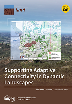
One challenge in protecting connectivity across ecological networks is addressing the ability of the network to adapt to changes over time. Many landscape-scale conservation plans and protected area networks are designed and implemented over years or even decades, but few networks consider the dynamics of ecological, conservation, and planning conditions that can occur over these time frames. This study presents an approach designed to inform adaptive planning for connectivity with a suite of analytical techniques in a long-established protected area network in San Diego, California. This approach can be used to evaluate whether protected area networks at any stage of planning or implementation are meeting connectivity goals over time as conditions change, allowing for adaptive management and planning to support and promote connectivity. View this paper
  • Issues are regarded as officially published after their release is announced to the table of contents alert mailing list.
  • You may sign up for e-mail alerts to receive table of contents of newly released issues.
  • PDF is the official format for papers published in both, html and pdf forms. To view the papers in pdf format, click on the "PDF Full-text" link, and use the free Adobe Reader to open them.
Order results
Result details
Section
Select all
Export citation of selected articles as:
18 pages, 5448 KiB  
Article
Highly Resolved Rainfall-Runoff Simulation of Retrofitted Green Stormwater Infrastructure at the Micro-Watershed Scale
by Sami Towsif Khan, Fernando Chapa and Jochen Hack
Land 2020, 9(9), 339; https://doi.org/10.3390/land9090339 - 22 Sep 2020
Cited by 20 | Viewed by 3160
Abstract
Green Stormwater Infrastructure (GSI), a sustainable engineering design approach for managing urban stormwater runoff, has long been recommended as an alternative to conventional conveyance-based stormwater management strategies to mitigate the adverse impact of sprawling urbanization. Hydrological and hydraulic simulations of small-scale GSI measures [...] Read more.
Green Stormwater Infrastructure (GSI), a sustainable engineering design approach for managing urban stormwater runoff, has long been recommended as an alternative to conventional conveyance-based stormwater management strategies to mitigate the adverse impact of sprawling urbanization. Hydrological and hydraulic simulations of small-scale GSI measures in densely urbanized micro watersheds require high-resolution spatial databases of urban land use, stormwater structures, and topography. This study presents a highly resolved Storm Water Management Model developed under considerable spatial data constraints. It evaluates the cumulative effect of the implementation of dispersed, retrofitted, small-scale GSI measures in a heavily urbanized micro watershed of Costa Rica. Our methodology includes a high-resolution digital elevation model based on Google Earth information, the accuracy of which was sufficient to determine flow patterns and slopes, as well as to approximate the underground stormwater structures. The model produced satisfactory results in event-based calibration and validation, which ensured the reliability of the data collection procedure. Simulating the implementation of GSI shows that dispersed, retrofitted, small-scale measures could significantly reduce impermeable surface runoff (peak runoff reduction up to 40%) during frequent, less intense storm events and delay peak surface runoff by 5–10 min. The presented approach can benefit stormwater practitioners and modelers conducting small scale hydrological simulation under spatial data constraint. Full article
(This article belongs to the Section Urban Contexts and Urban-Rural Interactions)
Show Figures

Figure 1

29 pages, 14259 KiB  
Article
Meta-Analysis of Geomorphodynamics in the Western Lower Bakırçay Plain (Aegean Region, Turkey)
by Fabian Becker, Daniel Knitter, Moritz Nykamp and Brigitta Schütt
Land 2020, 9(9), 338; https://doi.org/10.3390/land9090338 - 22 Sep 2020
Cited by 7 | Viewed by 3092
Abstract
The relation between human activities, climate variability, and geomorphodynamics in the Mediterranean region is widely discussed. For the western lower Bakırçay plain in the ancient Pergamon Micro-Region, geoarchaeological studies have shown changes in geomorphodynamics primarily on a site-basis. We reconstruct past geomorphodynamics in [...] Read more.
The relation between human activities, climate variability, and geomorphodynamics in the Mediterranean region is widely discussed. For the western lower Bakırçay plain in the ancient Pergamon Micro-Region, geoarchaeological studies have shown changes in geomorphodynamics primarily on a site-basis. We reconstruct past geomorphodynamics in the area based on a meta-analysis of 108 14C-ages obtained from 25 sediment sequences mainly from colluvial and alluvial deposits by analyzing cumulative probability functions of the 14C-ages. Accounting for biases in the database, we applied different approaches and compared the empirical probability functions with simulated functions. Reconstructed geomorphodynamics in the western lower Bakırçay plain during the Holocene principally coincide with a trend of climate-driven sensitivity to erosion and population dynamics in the eastern Mediterranean, but are also related to the local settlement history. Our data analysis shows that transformations of the Pergamon Micro-Region between the Hellenistic and Roman Imperial times is contemporary to increasing geomorphodynamics that peak in Roman Imperial times. However, a cause–effect relationship between geomorphodynamics and settlement dynamics should be further evaluated. A comparison with data from other settlement centers in Anatolia shows that a coincidence between the peak in geomorphodynamics and a peak in settlement activity are not obvious and may be influenced by soil conservation measures, preferred settlement location, and inherited soil exhaustion. Full article
Show Figures

Figure 1

16 pages, 1276 KiB  
Article
Effects of Land Urbanization on Smog Pollution in China: Estimation of Spatial Autoregressive Panel Data Models
by Xuan Yu, Manhong Shen, Weiteng Shen and Xiao Zhang
Land 2020, 9(9), 337; https://doi.org/10.3390/land9090337 - 22 Sep 2020
Cited by 20 | Viewed by 3480
Abstract
Studying the impact of land urbanization on smog pollution has important guiding significance for the sustainable development of cities. This study adds the spatial effect between regions into the research framework of smog pollution control in China. On the basis of a panel [...] Read more.
Studying the impact of land urbanization on smog pollution has important guiding significance for the sustainable development of cities. This study adds the spatial effect between regions into the research framework of smog pollution control in China. On the basis of a panel dataset of 31 province-level administrative regions in China from 2000 to 2017, we investigate the impact of land urbanization on smog pollution. We construct a spatial weight matrix and use Moran’s I statistic and the spatial autoregressive panel data model. The research results show that land urbanization and smog pollution have an inverted U-shaped relationship. With the advancement of land urbanization, the area’s smog pollution first increases and then decreases. However, in general, China has not passed the inflection point and is still at a stage where increasing land urbanization rate aggravates smog pollution. Moreover, the country’s smog pollution has a significant spatial positive correlation that shows agglomeration. In that context, multiple environmental governance entities, including the government, enterprises, and the public, need to collaborate on measures to reduce smog pollution. Future urban construction in China will need to integrate solutions that address the current nexus between urbanization and smog pollution to achieve green and sustainable development. Full article
Show Figures

Figure 1

21 pages, 1208 KiB  
Review
A Review of Changes in Mountain Land Use and Ecosystem Services: From Theory to Practice
by Ileana Pătru-Stupariu, Constantina Alina Hossu, Simona Raluca Grădinaru, Andreea Nita, Mihai-Sorin Stupariu, Alina Huzui-Stoiculescu and Athanasios-Alexandru Gavrilidis
Land 2020, 9(9), 336; https://doi.org/10.3390/land9090336 - 22 Sep 2020
Cited by 22 | Viewed by 4920
Abstract
Global changes impact the human-environment relationship, and, in particular, they affect the provision of ecosystem services. Mountain ecosystems provide a wide range of such services, but they are highly sensitive and vulnerable to change due to various human pressures and natural processes. We [...] Read more.
Global changes impact the human-environment relationship, and, in particular, they affect the provision of ecosystem services. Mountain ecosystems provide a wide range of such services, but they are highly sensitive and vulnerable to change due to various human pressures and natural processes. We conducted a literature survey that focused on two main issues. The first was the identification of quantitative methods aimed at assessing the impact of land use changes in mountain regions and the related ecosystem services. The second was the analysis of the extent to which the outcomes of these assessments are useful and transferable to stakeholders. We selected papers through a keyword-driven search of the ISI Web of Knowledge and other international databases. The keywords used for the search were mountain land use change and ecosystem service. Quantitative approaches to ecosystem service assessment rely on suitable indicators, therefore land use/land cover can be used as an appropriate proxy. Landscape metrics are a powerful analytical tool; their use can increase the accuracy of assessments and facilitate the mitigation of specific phenomena, such as fragmentation or the reduction of core habitat areas. Mapping is essential: it is the basis for spatial analyzes and eases the interactions between stakeholders. Land use/land cover change is a temporal process, so both past and future approaches are meaningful. It is necessary to enhance information transfer from theory to practice. Increasing stakeholder awareness can lead to suitable management solutions, and, reciprocally, stakeholder feedback can help improve current assessment methodologies and contribute to developing new tools that are suitable for specific problems. Full article
Show Figures

Figure 1

22 pages, 250 KiB  
Article
Reframing Native Knowledge, Co-Managing Native Landscapes: Ethnographic Data and Tribal Engagement at Yosemite National Park
by Rochelle Bloom and Douglas Deur
Land 2020, 9(9), 335; https://doi.org/10.3390/land9090335 - 22 Sep 2020
Cited by 4 | Viewed by 4289
Abstract
Several Native American communities assert traditional ties to Yosemite Valley, and special connections to the exceptional landmarks and natural resources of Yosemite National Park. However, tribal claims relating to this highly visible park with its many competing constituencies—such as tribal assertions of traditional [...] Read more.
Several Native American communities assert traditional ties to Yosemite Valley, and special connections to the exceptional landmarks and natural resources of Yosemite National Park. However, tribal claims relating to this highly visible park with its many competing constituencies—such as tribal assertions of traditional ties to particular landscapes or requests for access to certain plant gathering areas—often require supporting documentation from the written record. Addressing this need, academic researchers, the National Park Service and park-associated tribes collaborated in a multi-year effort to assemble a comprehensive ethnographic database containing most available written accounts of Native American land and resource use in Yosemite National Park. To date, the database includes over 13,000 searchable and georeferenced entries from historical accounts, archived ethnographic notebooks, tribal oral history transcripts and more. The Yosemite National Park Ethnographic Database represents a progressive tool for identifying culturally significant places and resources in Yosemite—a tool already being used by both cultural and natural resource managers within the National Park Service as well as tribal communities considering opportunities for future collaborative management of their traditional homelands within Yosemite National Park. We conclude that the organization of such data, including inherent ambiguities and contradictions, periodically updated with data provided by contemporary Tribal members, offers a rich, multivocal and dynamic representation of cultural traditions linked to specific park lands and resources. Indeed, some Yosemite tribal members celebrate the outcomes as revelatory, and as a partial antidote to their textual erasure from dispossessed lands. In practice however, as with any database, we find that this approach still risks ossifying data and reinforcing hegemonic discourses relating to cultural stasis, ethnographic objectivity and administrative power. By critically engaging these contradictions, we argue that one can still navigate pathways forward—bringing Native voices more meaningfully into the management of parks and other protected spaces, and providing a template useful at other parks for collaboration toward shared conservation goals. Full article
13 pages, 1615 KiB  
Article
Traditional Pollarding Practices for Dimorphic Ash Tree (Fraxinus dimorpha) Support Soil Fertility in the Moroccan High Atlas
by Abdessamad Fakhech, Didier Genin, Mohamed Ait-El-Mokhtar, El Mustapha Outamamat, Soufiane M’Sou, Mohamed Alifriqui, Abdelilah Meddich and Mohamed Hafidi
Land 2020, 9(9), 334; https://doi.org/10.3390/land9090334 - 21 Sep 2020
Cited by 2 | Viewed by 2704
Abstract
Shaping and pollarding of dimorphic ash tree (Fraxinus dimorpha) are two traditional practices used by the local inhabitants in agropastoral parklands of the Moroccan High Atlas to secure their production systems and increase tree production and strength. This study focused on [...] Read more.
Shaping and pollarding of dimorphic ash tree (Fraxinus dimorpha) are two traditional practices used by the local inhabitants in agropastoral parklands of the Moroccan High Atlas to secure their production systems and increase tree production and strength. This study focused on assessing the impact of these practices on soil quality. Abiotic parameters and mycorrhizal attributes of the samples of four soil types related to different ash tree morphotypes were assessed and compared. Rhizospheric soils (Rs) of three F. dimorpha morphotypes were sampled: trees regularly pollarded and shaped for stem anastomosis (An), regularly pollarded multistemmed trees (Na), and multistemmed trees belonging to a public forest under national forestry service management and sporadically illegally pollarded (Fo). The fourth soil was a non-Rs found in bare soils, which represented the control (Nr). Results showed a sizable difference between An soil properties and the other soil types ones, with significantly higher phosphorus (×6), nitrogen (×5), and carbon (×2) levels and higher mycorrhizal (×6) status than Nr soil, and showed 37% more mycorrhization intensity than Fo. Na showed intermediary levels between An and Fo. Fo had ×2 P, ×3 Total Kjeldahl Nitrogen (TKN), 58% more Total Organic Carbon (TOC) content, and twice the spore density compared with Nr. It is concluded that shaping and pollarding have a positive impact on the soil characteristics of the studied species and could make a useful contribution to sound agroforest management schemes. Full article
(This article belongs to the Special Issue Agroforestry-Based Ecosystem Services)
Show Figures

Figure 1

19 pages, 4329 KiB  
Article
Using SERVQUAL Method to Assess Tourist Service Quality by the Example of the Silesian Museum Established on the Post-Mining Area
by Natalia Kowalska and Anna Ostręga
Land 2020, 9(9), 333; https://doi.org/10.3390/land9090333 - 21 Sep 2020
Cited by 9 | Viewed by 5739
Abstract
The increasing role of the tourism industry in the global economy and the growing competition makes it necessary to ensure constant performance and continually improve quality. The paper draws attention to the necessity of conducting research on tourist attraction quality also in post-industrial [...] Read more.
The increasing role of the tourism industry in the global economy and the growing competition makes it necessary to ensure constant performance and continually improve quality. The paper draws attention to the necessity of conducting research on tourist attraction quality also in post-industrial areas which have become attractive tourist sites. It is emphasised that industrial tourism is a new yet quickly developing phenomenon in Poland, which compels managers to differentiate their service range and improve quality standards. The paper employs the SERVQUAL (SERvice QUALity) method to assess the quality of tourist services as a theoretical instrument to measure overall visitor satisfaction. The subject of the research was the Silesian Museum, which is result of reclamation and revitalisation of the inactive “Katowice” Hard Coal Mine. The article presents an empirical verification of the methodology which was modified for the purposes of the research subject. The Museum is considered to be one of the most important cultural centres and a crucial element of the social life of the Silesia region where mining activity has been carried out for centuries. Thirty young people from different continents participated in the survey. The results demonstrated that the expectations of the visitors were not met in three cases only which suggests a very high quality of the Silesian Museum. Moreover, the presented results show increasing capabilities and opportunities to maintain a high quality of services in the studied facility. The findings indicate that the appropriately modified SERVQUAL methodology is a valuable and simple tool to evaluate visitor satisfaction. The results of the evaluation of the Silesian Museum services will be presented to the facility managers. Further research will be carried out after the improvement and implementation of the next stage of the Museum’s development. Full article
(This article belongs to the Special Issue Landscape Planning as a Catalyst for Sustainable Development)
Show Figures

Figure 1

38 pages, 6848 KiB  
Article
Accessing Local Tacit Knowledge as a Means of Knowledge Co-Production for Effective Wildlife Corridor Planning in the Chignecto Isthmus, Canada
by Jessica L. Needham, Karen F. Beazley and Victoria P. Papuga
Land 2020, 9(9), 332; https://doi.org/10.3390/land9090332 - 20 Sep 2020
Cited by 10 | Viewed by 4412
Abstract
Inclusive knowledge systems that engage local perspectives and social and natural sciences are difficult to generate and infuse into decision-making processes but are critical for conservation planning. This paper explores local tacit knowledge application to identify wildlife locations, movement patterns and heightened opportunities [...] Read more.
Inclusive knowledge systems that engage local perspectives and social and natural sciences are difficult to generate and infuse into decision-making processes but are critical for conservation planning. This paper explores local tacit knowledge application to identify wildlife locations, movement patterns and heightened opportunities and barriers for connectivity conservation planning in a critical linkage area known as the Chignecto Isthmus in the eastern Canadian provinces of Nova Scotia and New Brunswick. Thirty-four local hunters, loggers, farmers and others with strong tacit knowledge of wildlife and the land participated in individual interviews and group workshops, both of which engaged participatory mapping. Individuals’ data were digitised, analysed and compiled into thematic series of maps, which were refined through participatory, consensus-based workshops. Locations of key populations and movement patterns for several species were delineated, predominantly for terrestrial mammals and migratory birds. When comparing local tacit-knowledge-based maps with those derived from formal-natural-science models, key differences and strong overlap were apparent. Local participants provided rich explanatory and complementary data. Their engagement in the process fostered knowledge transfer within the group and increased confidence in their experiential knowledge and its value for decision making. Benefits derived from our study for conservation planning in the region include enhanced spatial data on key locations of wildlife populations and movement pathways and local insights into wildlife changes over time. Identified contributing factors primarily relate to habitat degradation and fragmentation from human activities (i.e., land use and cover changes caused by roads and forestry practices), thereby supporting the need for conservation measures. The generated knowledge is important for consideration in local planning initiatives; it addresses gaps in existing formal-science data and validates or ground truths the outputs of existing computer-based models of wildlife habitat and movement pathways within the context of the complex social-ecological systems of the place and local people. Critically, awareness of the need for conservation and the value of the participants’ shared knowledge has been enhanced, with potential influence in fostering local engagement in wildlife conservation and other planning initiatives. Consistent with other studies, engagement of local people and their tacit knowledge was found to (i) provide important insights, knowledge translation, and dissemination to complement formal, natural science, (ii) help build a more inclusive knowledge system grounded in the people and place, and (iii) lend support to conservation action for connectivity planning and human-wildlife co-existence. More broadly, our methods demonstrate an effective approach for representing differences and consensus among participants’ spatial indications of wildlife and habitat as a means of co-producing knowledge in participatory mapping for conservation planning. Full article
Show Figures

Figure 1

17 pages, 609 KiB  
Review
Acknowledging Indigenous and Local Knowledge to Facilitate Collaboration in Landscape Approaches—Lessons from a Systematic Review
by Portia Adade Williams, Likho Sikutshwa and Sheona Shackleton
Land 2020, 9(9), 331; https://doi.org/10.3390/land9090331 - 18 Sep 2020
Cited by 49 | Viewed by 7739
Abstract
The need to recognize diverse actors, their knowledge and values is being widely promoted as critical for sustainability in contemporary land use, natural resource management and conservation initiatives. However, in much of the case study literature, the value of including indigenous and local [...] Read more.
The need to recognize diverse actors, their knowledge and values is being widely promoted as critical for sustainability in contemporary land use, natural resource management and conservation initiatives. However, in much of the case study literature, the value of including indigenous and local knowledge (ILK) in the management and governance of landscapes tends to be overlooked and undervalued. Understanding ILK as comprising indigenous, local and traditional knowledge, this systematic review synthesizes how ILK has been viewed and incorporated into landscape-based studies; what processes, mechanisms and areas of focus have been used to integrate it; and the challenges and opportunities that arise in doing so. Queries from bibliographic databases (Web of Science, JSTOR, Scopus and Africa Wide) were employed. Findings from the review underscore that the literature and case studies that link landscapes and ILK are dominated by a focus on agricultural systems, followed by social-ecological systems, indigenous governance, natural resource management, biodiversity conservation and climate change studies, especially those related to early warning systems for disaster risk reduction. The growing importance of multi-stakeholder collaborations in local landscape research and the promotion of inclusive consultations have helped to bring ILK to the fore in the knowledge development process. This, in turn, has helped to support improved landscape management, governance and planning for more resilient landscapes. However, more research is needed to explore ways to more effectively link ILK and scientific knowledge in landscape studies, particularly in the co-management of these social-ecological systems. More studies that confirm the usefulness of ILK, recognize multiple landscape values and their interaction with structures and policies dealing with landscape management and conservation are necessary for enhanced sustainability. Full article
Show Figures

Figure 1

20 pages, 2729 KiB  
Article
Local Perceptions of Ecosystem Services Across Multiple Ecosystem Types in Spain
by Marina García-Llorente, Antonio J. Castro, Cristina Quintas-Soriano, Elisa Oteros-Rozas, Irene Iniesta-Arandia, José A. González, David García del Amo, Marta Hernández-Arroyo, Izaskun Casado-Arzuaga, Ignacio Palomo, Erik Gómez-Baggethun, Miren Onaindia, Carlos Montes and Berta Martín-López
Land 2020, 9(9), 330; https://doi.org/10.3390/land9090330 - 18 Sep 2020
Cited by 21 | Viewed by 6126
Abstract
Combining socio-cultural valuations of ecosystem services with ecological and monetary assessments is critical to informing decision making with an integrative and multi-pronged approach. This study examined differences in the perceptions of ecosystem service supply and diversity across eight major ecosystem types in Spain [...] Read more.
Combining socio-cultural valuations of ecosystem services with ecological and monetary assessments is critical to informing decision making with an integrative and multi-pronged approach. This study examined differences in the perceptions of ecosystem service supply and diversity across eight major ecosystem types in Spain and scrutinized the social and ecological factors shaping these perceptions. First, we implemented 1932 face-to-face questionnaires among local inhabitants to assess perceptions of ecosystem service supply. Second, we created an ecosystem service diversity index to measure the perceived diversity of services considering agroecosystems, Mediterranean mountains, arid systems, two aquatic continental systems, coastal ecosystems and two urban ecosystems. Finally, we examined the influence of biophysical, socio-demographic and institutional factors in shaping ecosystem service perceptions. Overall, cultural services were the most widely perceived, followed by provisioning and regulating services. Provisioning services were most strongly associated with agroecosystems, mountains and coastal systems, whereas cultural services were associated with urban ecosystems and regulating services were specifically linked with agroecosystems, mountains and urban recreational areas. The highest service diversity index values corresponded to agroecosystems, mountains and wetlands. Our results also showed that socio-demographic factors, such as place of origin (urban vs. rural) and educational level, as well as institutional factors, such as management and access regimes, shaped the perception of ecosystem services. Full article
Show Figures

Figure 1

19 pages, 4947 KiB  
Article
Effects of Different Fertilizer Treatments on Rhizosphere Soil Microbiome Composition and Functions
by Yanan Li, Chengyu Wang, Tianye Wang, Yutao Liu, Shuxia Jia, Yunhang Gao and Shuxia Liu
Land 2020, 9(9), 329; https://doi.org/10.3390/land9090329 - 16 Sep 2020
Cited by 17 | Viewed by 4385
Abstract
Fertilization influences the soil microbiome. However, little is known about the effects of long-term fertilization on soil microbial metabolic pathways. In this study, we investigated the soil microbiome composition and function and microbial participation in the N cycle according to the Kyoto Encyclopedia [...] Read more.
Fertilization influences the soil microbiome. However, little is known about the effects of long-term fertilization on soil microbial metabolic pathways. In this study, we investigated the soil microbiome composition and function and microbial participation in the N cycle according to the Kyoto Encyclopedia of Genes and Genomes (KEGG) and gene ontology (GO) functional annotation of different genes in a metagenomic analysis after long-term fertilization. Fertilizer application significantly changed the soil C/N ratio. Chemical fertilizer (NPK) treatment decreased soil pH, and chemical fertilizer combined with straw (NPK+S0.5) treatment increased ammonium nitrogen (NH4+-N) but decreased nitrate nitrogen (NO3-N). NPK, NPK+S0.5 and S0.5 applications did not change the soil microbiome composition or dominant phylum but changed the relative abundances of microbiome components. Moreover, fertilizer significantly influenced metabolic processes, cellular processes and single-organism processes. Compared with a no-fertilizer treatment (CK), the NPK treatment resulted in more differentially expressed gene (DEG) pathways than the NPK+S0.5 and S0.5 treatments, and these pathways significantly correlated with soil nitrate nitrogen (NO3-N), available phosphorus (AP) and the moisture content of soil (MC). KEGG analysis found that fertilizer application mainly affected the ribosome, photosynthesis and oxidative phosphorylation pathways. S0.5 and NPK+S0.5 increased microbial nitrogen fixation, and NPK and NPK+S0.5 decreased amoA and amoB and accelerated denitrification. Thus, organic fertilizer increased N fixation and nitrification, and inorganic N fertilizer accelerated denitrification. We found that the function of the soil microbiome under different fertilizer applications could be important for the rational application of fertilizer and for environmental and sustainable development. Full article
Show Figures

Figure 1

21 pages, 891 KiB  
Article
Dairy Joint Ventures in South Africa’s Land and Agrarian Reform Programme: Who Benefits?
by Brittany Bunce
Land 2020, 9(9), 328; https://doi.org/10.3390/land9090328 - 16 Sep 2020
Cited by 8 | Viewed by 4059
Abstract
Joint Ventures (JVs) between ‘agribusiness’ investors and ‘small farmers’ or ‘customary landowners’ are being promoted in South Africa’s land and agrarian reform programme as a way to include land reform beneficiaries in the country’s competitive agricultural sector. This paper undertakes an in-depth comparative [...] Read more.
Joint Ventures (JVs) between ‘agribusiness’ investors and ‘small farmers’ or ‘customary landowners’ are being promoted in South Africa’s land and agrarian reform programme as a way to include land reform beneficiaries in the country’s competitive agricultural sector. This paper undertakes an in-depth comparative analysis of two JV dairy farms located on irrigation schemes in the former ‘homeland’ of the Ciskei, in South Africa’s Eastern Cape Province. The community, through government investment, brings the fixed assets to the business: land, irrigation infrastructure and milking parlours. The agribusiness partner or ‘sharemilker’ contributes the dairy cows and other movable assets. The paper explores what incentivizes agribusiness partners to enter into these types of ‘sharemilking’ JVs. The research reveals that investing in ‘moveable assets’ is more profitable for agribusiness and is also viewed as a more politically pragmatic way to arrange production in the context of land reform. These arrangements have led to further opportunities for investment in other parts of the dairy value chain. The social relations of production involved in sharemilking JVs also obscure class and race relations in ways that benefit agribusiness partners. Although beneficiaries are receiving benefits in the form of jobs and dividends, which in certain cases make notable contributions to household incomes, the structuring of sharemilking contracts is not a fair return on investment for the customary landowners. It is also argued that the JV model is at risk of equating ‘black emerging farmers’ with a group of ‘beneficiaries’ who are in reality workers and passive recipients of dividends and land rents. Full article
Show Figures

Figure 1

18 pages, 4115 KiB  
Article
Trees and Crops Arrangement in the Agroforestry System Based on Slope Units to Control Landslide Reactivation on Volcanic Foot Slopes in Java, Indonesia
by Rina Purwaningsih, Junun Sartohadi and Muhammad Anggri Setiawan
Land 2020, 9(9), 327; https://doi.org/10.3390/land9090327 - 15 Sep 2020
Cited by 7 | Viewed by 10011
Abstract
Agroforestry, as the dominant land use at the volcanic foot slope in Java Island, is prone to landslide due to a combination of rough relief and thick soil layer. However, evaluations of specific vegetation patterns against landslide reactivation due to soil erosion, which [...] Read more.
Agroforestry, as the dominant land use at the volcanic foot slope in Java Island, is prone to landslide due to a combination of rough relief and thick soil layer. However, evaluations of specific vegetation patterns against landslide reactivation due to soil erosion, which relays on the existing slope units and geomorphological processes, are still limited. The research data were collected through aerial photo interpretation by delineating morphological units of old landslides, slope units, and the existing land use. This was followed by field surveys for two consecutive purposes, i.e., (1) verification of aerial photo interpretation and (2) identification and intensity assessment of existing geomorphological processes. The data were tabulated according to slope units, as a basis for tree and crop arrangement in controlling erosion and landslide, by considering economic, social, and ecological functions. The agroforestry would control the landslides reactivation if the tree and crop arrangement was based on the morphological units formed by the previous landslide. The slope units are classified into residual zones at the highest elevations with flat slopes, erosion zones with the steepest slope, and sedimentation zones at the lowest elevations with gentle slopes. Trees and crops at those three units of the former landslide have different functions in controlling processes of rill erosion, gully erosion, and soil creep. Full article
Show Figures

Figure 1

18 pages, 5920 KiB  
Article
Remotely Sensed Changes in Vegetation Cover Distribution and Groundwater along the Lower Gila River
by Kyle Hartfield, Willem J.D. van Leeuwen and Jeffrey K. Gillan
Land 2020, 9(9), 326; https://doi.org/10.3390/land9090326 - 15 Sep 2020
Cited by 5 | Viewed by 2488
Abstract
Introduced as a soil erosion deterrent, salt cedar has become a menace along riverbeds in the desert southwest. Salt cedar replaces native species, permanently altering the structure, composition, function, and natural processes of the landscape. Remote sensing technologies have the potential to monitor [...] Read more.
Introduced as a soil erosion deterrent, salt cedar has become a menace along riverbeds in the desert southwest. Salt cedar replaces native species, permanently altering the structure, composition, function, and natural processes of the landscape. Remote sensing technologies have the potential to monitor the level of invasion and its impacts on ecosystem services. In this research, we developed a species map by segmenting and classifying various species along a stretch of the Lower Gila River. We calculated metrics from high-resolution multispectral imagery and light detection and ranging (LiDAR) data to identify salt cedar, mesquite, and creosote. Analysts derived training and validation information from drone-acquired orthophotos to achieve an overall accuracy of 94%. It is clear from the results that salt cedar completely dominates the study area with small numbers of mesquite and creosote present. We also show that vegetation has declined in the study area over the last 25 years. We discuss how water usage may be influencing the plant health and biodiversity in the region. An examination of ground well, stream gauge, and Gravity Recovery and Climate Experiment (GRACE) groundwater storage data indicates a decline in water levels near the study area over the last 25 years. Full article
(This article belongs to the Section Landscape Ecology)
Show Figures

Figure 1

19 pages, 5425 KiB  
Article
Exploring the Use of Sentinel-2 Data to Monitor Heterogeneous Effects of Contextual Drought and Heatwaves on Mediterranean Forests
by Rosa Coluzzi, Simonetta Fascetti, Vito Imbrenda, Santain Settimio Pino Italiano, Francesco Ripullone and Maria Lanfredi
Land 2020, 9(9), 325; https://doi.org/10.3390/land9090325 - 14 Sep 2020
Cited by 21 | Viewed by 3458
Abstract
The use of satellite data to detect forest areas impacted by extreme events, such as droughts, heatwaves, or fires is largely documented, however, the use of these data to identify the heterogeneity of the forests’ response to determine fine scale spatially irregular damage [...] Read more.
The use of satellite data to detect forest areas impacted by extreme events, such as droughts, heatwaves, or fires is largely documented, however, the use of these data to identify the heterogeneity of the forests’ response to determine fine scale spatially irregular damage is less explored. This paper evaluates the health status of forests in southern Italy affected by adverse climate conditions during the hot and dry summer of 2017, using Sentinel-2 images (10m) and in situ data. Our analysis shows that the post-event—NDVI (Normalized Difference Vegetation Index) decrease, observed in five experimental sites, well accounts for the heterogeneity of the local response to the climate event evaluated in situ through the Mannerucci and the Raunkiaer methods. As a result, Sentinel-2 data can be effectively integrated with biological information from field surveys to introduce continuity in the estimation of climate change impacts even in very heterogeneous areas whose details could not be captured by lower resolution observations. This integration appears to be a successful strategy in the study of the relationships between the climate and forests from a dynamical perspective. Full article
Show Figures

Figure 1

50 pages, 5617 KiB  
Article
Spatial Transformation of a New City in 2006–2020: Perspectives on the Spatial Dynamics, Environmental Quality Degradation, and Socio—Economic Sustainability of Local Communities in Makassar City, Indonesia
by Batara Surya, Hadijah Hadijah, Seri Suriani, Baharuddin Baharuddin, A. Tenri Fitriyah, Firman Menne and Emil Salim Rasyidi
Land 2020, 9(9), 324; https://doi.org/10.3390/land9090324 - 14 Sep 2020
Cited by 30 | Viewed by 6011
Abstract
The accelerated development of new urban areas has an impact on changes in the spatial use and complexity of ecosystems. The purpose of this study is to analyze (1) spatial transformation works as a determinant of changes in the social formation of local [...] Read more.
The accelerated development of new urban areas has an impact on changes in the spatial use and complexity of ecosystems. The purpose of this study is to analyze (1) spatial transformation works as a determinant of changes in the social formation of local communities in the new city area of Metro Tanjung Bunga; (2) process of social interaction and social adaptation between immigrants and local communities in new social formations in the new city area of Metro Tanjung Bunga; and (3) the effect of spatial use, changes in social formation, and work differentiation on the socio-economic sustainability of local communities. The research method used involves a combination of qualitative and quantitative approaches. Data were obtained by observation, in-depth interviews, surveys, and documentation. The results of the study show that spatial transformation has an impact on changing the single social formations of local communities into multiple social formations and transforming differences in modes of production between migrants and local communities into changes in the order of life of local communities. These changing interactions and social adaptations cause changes in the social structures and cultural patterns of local communities. Furthermore, changes in spatial use, social formation, and job differentiation have a significant effect on the socio-economic sustainability of local communities, with a coefficient of determination of 97.7%. This study recommends considering environmental, economic, and sociocultural factors followed by government decision-making for the future development of the new city area of Metro Tanjung Bunga, Makassar City. Full article
Show Figures

Figure 1

18 pages, 3448 KiB  
Article
Soil Organic Matter, Mitigation of and Adaptation to Climate Change in Cocoa–Based Agroforestry Systems
by Sikstus Gusli, Sri Sumeni, Riyami Sabodin, Ikram Hadi Muqfi, Mustakim Nur, Kurniatun Hairiah, Daniel Useng and Meine van Noordwijk
Land 2020, 9(9), 323; https://doi.org/10.3390/land9090323 - 14 Sep 2020
Cited by 31 | Viewed by 5993
Abstract
Belowground roles of agroforestry in climate change mitigation (C storage) and adaptation (reduced vulnerability to drought) are less obvious than easy-to-measure aspects aboveground. Documentation on these roles is lacking. We quantified the organic C concentration (Corg) and soil physical properties in [...] Read more.
Belowground roles of agroforestry in climate change mitigation (C storage) and adaptation (reduced vulnerability to drought) are less obvious than easy-to-measure aspects aboveground. Documentation on these roles is lacking. We quantified the organic C concentration (Corg) and soil physical properties in a mountainous landscape in Sulawesi (Indonesia) for five land cover types: secondary forest (SF), multistrata cocoa–based agroforestry (CAF) aged 4–5 years (CAF4), 10–12 years (CAF10), 17–34 years (CAF17), and multistrata (mixed fruit and timber) agroforest (MAF45) aged 45–68 years. With four replicate plots per cover type, we measured five pools of C-stock according to IPCC guidelines, soil bulk density (BD), macro porosity (MP), hydraulic conductivity (Ks), and available water capacity of the soil (AWC). The highest C-stock, in SF, was around 320 Mg ha−1, the lowest, 74 Mg ha−1, was in CAF4, with the older agroforestry systems being intermediate with 120 to 150 Mg ha−1. Soil compaction after forest conversion led to increased BD and reduced MP, Ks, and AWC. Older agroforestry partly recovered buffering: AWC per m of rooted soil profile increased by 5.7 mm per unit (g kg−1) increase of Corg. The restored AWC can support about a week’s worth of evapotranspiration without rain, assisting in climate change adaptation. Full article
(This article belongs to the Special Issue Agroforestry-Based Ecosystem Services)
Show Figures

Figure 1

21 pages, 3589 KiB  
Article
Land-Use Change and Future Water Demand in California’s Central Coast
by Tamara S. Wilson, Nathan D. Van Schmidt and Ruth Langridge
Land 2020, 9(9), 322; https://doi.org/10.3390/land9090322 - 14 Sep 2020
Cited by 7 | Viewed by 3890
Abstract
Understanding future land-use related water demand is important for planners and resource managers in identifying potential shortages and crafting mitigation strategies. This is especially the case for regions dependent on limited local groundwater supplies. For the groundwater dependent Central Coast of California, we [...] Read more.
Understanding future land-use related water demand is important for planners and resource managers in identifying potential shortages and crafting mitigation strategies. This is especially the case for regions dependent on limited local groundwater supplies. For the groundwater dependent Central Coast of California, we developed two scenarios of future land use and water demand based on sampling from a historical land change record: a business-as-usual scenario (BAU; 1992–2016) and a recent-modern scenario (RM; 2002–2016). We modeled the scenarios in the stochastic, empirically based, spatially explicit LUCAS state-and-transition simulation model at a high resolution (270-m) for the years 2001–2100 across 10 Monte Carlo simulations, applying current land zoning restrictions. Under the BAU scenario, regional water demand increased by an estimated ~222.7 Mm3 by 2100, driven by the continuation of perennial cropland expansion as well as higher than modern urbanization rates. Since 2000, mandates have been in place restricting new development unless adequate water resources could be identified. Despite these restrictions, water demand dramatically increased in the RM scenario by 310.6 Mm3 by century’s end, driven by the projected continuation of dramatic orchard and vineyard expansion trends. Overall, increased perennial cropland leads to a near doubling to tripling perennial water demand by 2100. Our scenario projections can provide water managers and policy makers with information on diverging land use and water use futures based on observed land change and water use trends, helping to better inform land and resource management decisions. Full article
(This article belongs to the Section Land Systems and Global Change)
Show Figures

Graphical abstract

17 pages, 845 KiB  
Article
Effects of Households’ Fertilization Knowledge and Technologies on Over-Fertilization: A Case Study of Grape Growers in Shaanxi, China
by Caixia Xue, Tingting Zhang, Shunbo Yao and Yajun Guo
Land 2020, 9(9), 321; https://doi.org/10.3390/land9090321 - 10 Sep 2020
Cited by 15 | Viewed by 2725
Abstract
Over-fertilization has caused serious environmental problems and high agricultural production costs at the household level in China. This study attempts to analyze the effects of grape growers’ fertilization knowledge and technologies on their over-fertilization behavior. Using survey data collected from 235 grape growers [...] Read more.
Over-fertilization has caused serious environmental problems and high agricultural production costs at the household level in China. This study attempts to analyze the effects of grape growers’ fertilization knowledge and technologies on their over-fertilization behavior. Using survey data collected from 235 grape growers planting a particular grape (the “Hutai No. 8” grape) in Shaanxi, the marginal productivity of the chemical fertilizer (CF) as well as the effect of fertilizing knowledge and technologies on households’ over-fertilization behavior were examined, using the loss control production function and examining a two-part model, respectively. The results show that the average marginal productivity of the CF is 0.46 and that more than 75% of the participants were overusing CFs, with the probability and intensity of over-fertilization being lower when households have richer knowledge on how to determine the accurate fertilization time and match fertilizers with nutrient needs. The identification of nutrient deficiency symptoms has no significant effect on the over-fertilization behavior of households. In addition, the adoption of water and fertilizer integration technology (WFIT) can reduce both the probability and intensity of over-fertilization, while the adoption of the soil testing and formulated fertilization technique (STFFT) helps to reduce only the intensity of over-fertilization by households, but does not have a significant impact on the probability of over-fertilization. Therefore, policies aimed at reducing over-fertilization may focus on increasing households’ fertilization knowledge and adopting advanced technologies on fertilizer management. Full article
Show Figures

Figure 1

24 pages, 6095 KiB  
Article
Network of Landscapes in the Sustainable Management of Transboundary Biosphere Reserves
by Joaquin Romano, Emilio Pérez-Chinarro and Byron V. Coral
Land 2020, 9(9), 320; https://doi.org/10.3390/land9090320 - 10 Sep 2020
Cited by 3 | Viewed by 2277
Abstract
The creation of Transboundary Biosphere Reserves (TBRs) is one of the most outstanding contributions of the United Nations Educational, Scientific, and Cultural Organization (UNESCO) Man and Biosphere Programme (MAB). Recent revisions have shown that there is a gap between its biodiversity conservation proposals [...] Read more.
The creation of Transboundary Biosphere Reserves (TBRs) is one of the most outstanding contributions of the United Nations Educational, Scientific, and Cultural Organization (UNESCO) Man and Biosphere Programme (MAB). Recent revisions have shown that there is a gap between its biodiversity conservation proposals and the theoretical convergence of nations towards sustainable development goals with the practices in action. By applying the landscape approach to the case study of the rural system of the Spanish–Portuguese border, declared Meseta Ibérica TBR (MITBR), it is verified that the spatial zoning of TBRs is a prominent factor in this gap, since they do not correspond to the landscape units and bioregions. This has led to the formulation and implementation of strategic proposals for the reorientation of TBRs towards the stimulation of landscape networks in the transboundary framework. Agroecological networks in this territory stand out, which brings together one of the highest concentrations of indigenous breeds in Europe. A breeder replacement experience was carried out based on the social networks of the MITBR that protect the landscape. The main conclusion of this article is that TBRs are effective in practice through the promotion of cross-border networks of governance and social participation, and mainly through agroecological ones due to their outstanding effect on biodiversity. Full article
(This article belongs to the Section Land Systems and Global Change)
Show Figures

Figure 1

26 pages, 4975 KiB  
Article
Classification of Landforms for Digital Soil Mapping in Urban Areas Using LiDAR Data Derived Terrain Attributes: A Case Study from Berlin, Germany
by Mohamed Ali Mohamed
Land 2020, 9(9), 319; https://doi.org/10.3390/land9090319 - 09 Sep 2020
Cited by 10 | Viewed by 6664
Abstract
In this study, a knowledge-based fuzzy classification method was used to classify possible soil-landforms in urban areas based on analysis of morphometric parameters (terrain attributes) derived from digital elevation models (DEMs). A case study in the city area of Berlin was used to [...] Read more.
In this study, a knowledge-based fuzzy classification method was used to classify possible soil-landforms in urban areas based on analysis of morphometric parameters (terrain attributes) derived from digital elevation models (DEMs). A case study in the city area of Berlin was used to compare two different resolution DEMs in terms of their potential to find a specific relationship between landforms, soil types and the suitability of these DEMs for soil mapping. Almost all the topographic parameters were obtained from high-resolution light detection and ranging (LiDAR)-DEM (1 m) and Advanced Spaceborne Thermal Emission and Reflection Radiometer (ASTER)-DEM (30 m), which were used as thresholds for the classification of landforms in the selected study area with a total area of about 39.40 km2. The accuracy of both classifications was evaluated by comparing ground point samples as ground truth data with the classification results. The LiDAR-DEM based classification has shown promising results for classification of landforms into geomorphological (sub)categories in urban areas. This is indicated by an acceptable overall accuracy of 93%. While the classification based on ASTER-DEM showed an accuracy of 70%. The coarser ASTER-DEM based classification requires additional and more detailed information directly related to soil-forming factors to extract geomorphological parameters. The importance of using LiDAR-DEM classification was particularly evident when classifying landforms that have narrow spatial extent such as embankments and channel banks or when determining the general accuracy of landform boundaries such as crests and flat lands. However, this LiDAR-DEM classification has shown that there are categories of landforms that received a large proportion of the misclassifications such as terraced land and steep embankments in other parts of the study area due to the increased distance from the major rivers and the complex nature of these landforms. In contrast, the results of the ASTER-DEM based classification have shown that the ASTER-DEM cannot deal with small-scale spatial variation of soil and landforms due to the increasing human impacts on landscapes in urban areas. The application of the approach used to extract terrain parameters from the LiDAR-DEM and their use in classification of landforms has shown that it can support soil surveys that require a lot of time and resources for traditional soil mapping. Full article
(This article belongs to the Section Land Planning and Landscape Architecture)
Show Figures

Figure 1

12 pages, 942 KiB  
Article
Liability and the Use of Prescribed Fire in the Southern Plains, USA: A Survey of District Court Judges
by Alissa Hinojosa, Urs P. Kreuter and Carissa L. Wonkka
Land 2020, 9(9), 318; https://doi.org/10.3390/land9090318 - 09 Sep 2020
Cited by 7 | Viewed by 2688
Abstract
Suppression of historical fire regimes has changed the composition and structure of many fire-dependent ecosystems, frequently resulting in decreased grazing productivity and biodiversity in grasslands and savannas. Land managers have attempted to reverse these trends through the application of prescribed fire, but regulations [...] Read more.
Suppression of historical fire regimes has changed the composition and structure of many fire-dependent ecosystems, frequently resulting in decreased grazing productivity and biodiversity in grasslands and savannas. Land managers have attempted to reverse these trends through the application of prescribed fire, but regulations and liability concerns often deter them. District court judges play a key role in defining the legal context of prescribed burning by interpreting applicable statutes in personal injury or property damage cases resulting from escaped prescribed fire. However, information about the way judges interpret open burning statutes and regulations is difficult to obtain. We conducted a mail survey of district court judges in Texas and Oklahoma, USA to shed light on decisions judges might make presiding over an escaped fire case. The survey included questions regarding their perception of prescribed fire, their understanding of the laws affecting prescribed burning, and hypothetical questions to determine how they would apply relevant law in an escaped fire case. We found that judges cited fewer factors as evidence of gross negligence than simple negligence. This suggests that a shift toward a gross negligence liability standard for escaped prescribed fire cases might result in fewer findings of prescribed burner liability. Full article
(This article belongs to the Section Land Socio-Economic and Political Issues)
Show Figures

Graphical abstract

20 pages, 2485 KiB  
Article
Public Food Procurement as a Driving Force for Building Local and Agroecological Food Systems: Farmers’ Skepticism in Vega Baja del Jarama, Madrid (Spain)
by Marian Simón-Rojo, Andrés Couceiro, Julia del Valle and José Fariña Tojo
Land 2020, 9(9), 317; https://doi.org/10.3390/land9090317 - 08 Sep 2020
Cited by 7 | Viewed by 4019
Abstract
In the last decade, efforts to re-localize the food system have been gaining ground in a way that is intended to induce changes in the primary sector, thereby improving its conditions and sustainability. The European Union has identified food as one of the [...] Read more.
In the last decade, efforts to re-localize the food system have been gaining ground in a way that is intended to induce changes in the primary sector, thereby improving its conditions and sustainability. The European Union has identified food as one of the ten key sectors with outstanding potential for an ecological transition, and public procurement of (organic) food as an appropriate policy to foster agricultural development and support small farmers. In this study, we analyze changes in land use and farming dynamics in three municipalities close to the metropolitan area of Madrid (Spain). We also explore how stakeholders and farmers perceive the driving forces of these changes and the potential for public procurement in providing stability for farmers and more specifically, boosting the articulation and consolidation of the emerging agroecological sector in an up-to-date hostile peri-urban environment. Some urban policies and food strategies in nearby cities, such as Madrid, have introduced measures to promote sustainable food in public procurement. The procurement could drive 10% of the total food grown in the Comunidad de Madrid, with large variations in the impact on different food subsectors. However, if public procurement is to be organic, local production has no capacity to meet increases in demand, except for honey and oil. Food procurement would not lead to improved stability and increases in farmers’ incomes if public policies to boost ecological transition are not adopted in parallel. For farmers, economic viability takes precedence over other problems, and although public procurement has been mainstreamed as a valuable tool to support local agriculture, stakeholders do not have high expectations for it. The research shows that farm size and specialization have a strong influence on market orientation, and the agroecological farmers and social movements that support them are primed for innovation adoption and may act as catalysts for the process. Full article
Show Figures

Figure 1

22 pages, 5346 KiB  
Article
Abandonment and Recultivation of Agricultural Lands in Slovakia—Patterns and Determinants from the Past to the Future
by Robert Pazúr, Juraj Lieskovský, Matthias Bürgi, Daniel Müller, Tibor Lieskovský, Zhen Zhang and Alexander V. Prishchepov
Land 2020, 9(9), 316; https://doi.org/10.3390/land9090316 - 07 Sep 2020
Cited by 36 | Viewed by 5541
Abstract
Central and Eastern Europe has experienced fundamental land use changes since the collapse of socialism around 1990. We analyzed the patterns and determinants of agricultural land abandonment and recultivation in Slovakia during the transition from a state-controlled economy to an open-market economy (1986 [...] Read more.
Central and Eastern Europe has experienced fundamental land use changes since the collapse of socialism around 1990. We analyzed the patterns and determinants of agricultural land abandonment and recultivation in Slovakia during the transition from a state-controlled economy to an open-market economy (1986 to 2000) and the subsequent accession to the European Union (2000 to 2010). We quantified agricultural land-use change based on available maps derived from 30-m multi-seasonal Landsat imagery and analyzed the socioeconomic and biophysical determinants of the observed agricultural land-use changes using boosted regression trees. We used a scenario-based approach to assess future agricultural land abandonment and recultivation until 2060. The maps of agricultural land use analysis reveal that cropland abandonment was the dominant land use process on 11% of agricultural land from 1986 to 2000, and on 6% of the agricultural land from 2000 to 2010. Recultivation occurred on approximately 2% of agricultural land in both periods. Although most abandoned land was located in the plains, the rate of abandonment was twice as high in the mountainous landscapes. The likelihood of abandonment increased with increased distance from the national capital (Bratislava), decreased with an increase of annual mean temperatures and was higher in proximity to forest edges and on steeper slopes. Recultivation was largely determined by the opposite effects. The scenario for 2060 suggests that future agricultural land abandonment and recultivation may largely be determined by climate and terrain conditions and, to a lesser extent, by proximity to economic centers. Our study underscores the value of synergetic use of satellite data and land-use modeling to provide the input for land planning, and to anticipate the potential effects of changing environmental and policy conditions. Full article
(This article belongs to the Special Issue Agricultural Land Abandonment: Patterns, Drivers and Consequences)
Show Figures

Figure 1

23 pages, 4947 KiB  
Article
Effects of Urbanization on Farmland Size and Diversified Farm Activities in Japan: An Analysis Based on the Land Parcel Database
by Shingo Yoshida
Land 2020, 9(9), 315; https://doi.org/10.3390/land9090315 - 04 Sep 2020
Cited by 11 | Viewed by 5659
Abstract
Peri-urban agriculture (PUA) has been widely regarded as a sub-field of multifunctional agriculture for improving the sustainability of urban environments. However, urban sprawl has both negative and positive effects on peri-urban farming, and the research on this issue in Japan is insufficient. This [...] Read more.
Peri-urban agriculture (PUA) has been widely regarded as a sub-field of multifunctional agriculture for improving the sustainability of urban environments. However, urban sprawl has both negative and positive effects on peri-urban farming, and the research on this issue in Japan is insufficient. This study aims to demonstrate the spatial distribution of farmland parcels in Tokyo and Osaka metropolitan areas and explore the synergistic effect of distance from cities and urban sprawl on the size of farmland parcels and farm-diversified activities such as direct marketing, farming experience, and environmentally friendly practices. Ordinary Least Squares (OLS) and Poisson regression analyses were used with a nationwide agricultural land parcel Geographic Information System (GIS) database (Tokyo metropolitan area = 1,939,162 and Osaka metropolitan area = 1,507,072 parcels), in Japan, to specify the farmland locations and calculate the extent of urban sprawl. The results revealed that more than 50% of farmlands in the targeted areas were located within 4 km from the boundaries of densely inhabited districts (DIDs). Furthermore, with a decreasing distance from a DID, the urban sprawl had more positive effects on farmland parcel sizes and farm-diversified activities. These findings imply that PUA has a wider presence in Japan, and the peri-urban farmers may be capable of utilizing the multifunctional nature of intensively sprawled urban environments. Full article
(This article belongs to the Special Issue Sustainability and Peri-Urban Agriculture)
Show Figures

Graphical abstract

24 pages, 11580 KiB  
Article
Transformations in the Agricultural and Scenic Landscapes in the Northwest of the Region of Murcia (Spain): Moving towards Long Awaited (Un)Sustainability
by Ramón García-Marín, Cayetano Espejo-Marín, Rubén Giménez-García and Víctor Ruiz-Álvarez
Land 2020, 9(9), 314; https://doi.org/10.3390/land9090314 - 04 Sep 2020
Cited by 8 | Viewed by 3152
Abstract
Since the middle of the 20th century, irrigation in the southeast of Spain has displayed significant productive growth based on the intensive use of the scarce water resources in the area and the contribution of river flows from the hydrographic basin of the [...] Read more.
Since the middle of the 20th century, irrigation in the southeast of Spain has displayed significant productive growth based on the intensive use of the scarce water resources in the area and the contribution of river flows from the hydrographic basin of the Tagus River to the hydrographic basin of the Segura River. Despite high levels of efficiency in the water use from the new irrigation systems, the water deficit has only intensified in recent years. The most dynamically irrigated areas (Campo de Cartagena, Valle del Guadalentín, Vega Alta del Segura and the southern coast of the Region of Murcia), were faced with a complex and trying future, resulting in numerous companies (agribusinesses) relocating to lease and acquire land in the northwest of Murcia to develop their intensive crops. The general objective of this article lies in the analysis of widespread landscape dynamics, and of agricultural dynamics in particular, in the rural environment of the northwest Region of Murcia (Spain). For this, an exhaustive analysis of the land cover and use transformations is carried out for the periods of time 1990–2000–2012–2018. The data studied come from the Corine Land Cover (CLC) project, carried out by the European Environment Agency (EEA). These spatial data are treated with geographical information systems (GISs) and represented by statistical and cartographic analyses and cross-tabulation matrices that indicate the dynamics of changes, loss and land gain. As the main result, we find that the areas occupied by new intensive irrigation on old rainfed farmland in the northwest Region of Murcia have increased in the last 30 years. Traditional irrigation is disappearing, and the environmental consequences (overexploitation of aquifers and decreased flows from natural sources), among others, are dire. Full article
Show Figures

Figure 1

38 pages, 9021 KiB  
Article
Identifying Potential Connectivity for an Urban Population of Rattlesnakes (Sistrurus catenatus) in a Canadian Park System
by Jonathan D. Choquette, Matthew R. Macpherson and Robert C. Corry
Land 2020, 9(9), 313; https://doi.org/10.3390/land9090313 - 03 Sep 2020
Cited by 2 | Viewed by 3553
Abstract
In the face of ongoing habitat loss and fragmentation, maintaining an adequate level of landscape connectivity is needed to both encourage dispersal between habitat patches and to reduce the extinction risk of fragmented wildlife populations. In a developing region of southwestern Ontario, Canada, [...] Read more.
In the face of ongoing habitat loss and fragmentation, maintaining an adequate level of landscape connectivity is needed to both encourage dispersal between habitat patches and to reduce the extinction risk of fragmented wildlife populations. In a developing region of southwestern Ontario, Canada, a declining population of Eastern Massasauga rattlesnakes (Sistrurus catenatus) persists in fragmented remnants of tallgrass prairie in an urban park system. The goal of this study was to identify potential connectivity pathways between habitat patches for this species by using a GIS least-cost permeability swath model, and to evaluate the outputs with snake road mortality data. Results identified seven pathways between five core habitat blocks, a subset of which were validated with aerial imagery and mortality data. Four high-ranking pathways intersected roads through or near road mortality hotspots. This research will guide conservation interventions aimed at recovering endangered reptiles in a globally rare ecosystem, and will inform the use of permeability swaths for the identification of locations most suitable for connectivity interventions in dynamic, urbanizing landscapes. Full article
Show Figures

Graphical abstract

19 pages, 9065 KiB  
Article
Effects of Hierarchical City Centers on the Intensity and Direction of Urban Land Expansion: A Case Study of Beijing
by Daquan Huang, Xin Tan, Tao Liu, Erxuan Chu and Fanhao Kong
Land 2020, 9(9), 312; https://doi.org/10.3390/land9090312 - 03 Sep 2020
Cited by 10 | Viewed by 2704
Abstract
Worldwide urban spatial expansion has become a hot topic in recent decades. To develop effective urban growth containment strategies, it is important to understand the spatial patterns and driving forces of urban sprawl. By employing a spatial analysis method and land use survey [...] Read more.
Worldwide urban spatial expansion has become a hot topic in recent decades. To develop effective urban growth containment strategies, it is important to understand the spatial patterns and driving forces of urban sprawl. By employing a spatial analysis method and land use survey data for the years 1996–2010, this study explores the effects of hierarchical administrative centers on the intensity and direction of urban land expansion in a Beijing municipality. The results are as follows: (1) land development intensity and expansion speeds are both affected significantly by the municipal and district and county centers where the governments hold a lot of administrative, public, and economic resources. (2) The distances to the administrative centers are determinant factors for the direction of urban land expansion. Except for several subregions adjacent to the municipal center, the closer the area is to an administrative center, the more likely it is that the expansion direction points toward the center. (3) The spatial patterns of urban land development are shaped jointly by governments at different levels, and transportation lines also play a role in remote areas. These findings are expected to have consulting value for future policymaking on urban land use and management in mega-cities, especially those with strong local government powers in other transition economies and developing countries. Full article
Show Figures

Figure 1

24 pages, 4879 KiB  
Article
The Impact of Urbanization on Farmland Productivity: Implications for China’s Requisition–Compensation Balance of Farmland Policy
by Zhongqi Deng, Qianyu Zhao and Helen X. H. Bao
Land 2020, 9(9), 311; https://doi.org/10.3390/land9090311 - 02 Sep 2020
Cited by 26 | Viewed by 4259
Abstract
The rapid growth of China’s economy since the reform in 1978 should be largely attributed to urbanization. Nonetheless, in terms of farmland productivity, urbanization may lead to perverse incentives and thus threaten food security. On the one hand, the requisition–compensation balance of farmland [...] Read more.
The rapid growth of China’s economy since the reform in 1978 should be largely attributed to urbanization. Nonetheless, in terms of farmland productivity, urbanization may lead to perverse incentives and thus threaten food security. On the one hand, the requisition–compensation balance of farmland (RCBF) policy could reduce farmland productivity because of a “superior occupation and inferior compensation”; on the other hand, urbanization promotes the transfer of the younger labor force and thus reduces the productivity of the agricultural labor force. To investigate the undesirable effects, based on some stylized facts, this study selects 29,415 county-level samples in a Chinese county from 2000–2014 to construct an empirical model. With a new stochastic frontier analysis method that eliminates the classical econometric issues of endogeneity and heterogeneity, the empirical results show that there is a U-shaped relationship between the farmland use efficiency (productivity) and urbanization rate, indicating that only when the urbanization rate is relatively low would urbanization decrease the farmland use efficiency; in contrast, when the urbanization rate is relatively high, technical progress would obviously be accompanied by urbanization, and thus, the undesirable effects are fully offset. Furthermore, the U-shaped relationship is robust after considering the endogeneity of the urbanization rate and total-factor farmland use efficiency. With these findings, recommendations to implement sustainable management and conservation policies regarding farmland resources are made. Full article
(This article belongs to the Section Land Socio-Economic and Political Issues)
Show Figures

Figure 1

20 pages, 1268 KiB  
Article
Protected Area Governance and Its Influence on Local Perceptions, Attitudes and Collaboration
by Jesse Sey Ayivor, Johnie Kodjo Nyametso and Sandra Ayivor
Land 2020, 9(9), 310; https://doi.org/10.3390/land9090310 - 02 Sep 2020
Cited by 26 | Viewed by 4778
Abstract
Globally, protected areas are faced with a myriad of threats emanating principally from anthropogenic drivers, which underpins the importance of the human element in protected area management. Delving into the “exclusive” and “inclusive” approaches to nature conservation discourse, this study explored the extent [...] Read more.
Globally, protected areas are faced with a myriad of threats emanating principally from anthropogenic drivers, which underpins the importance of the human element in protected area management. Delving into the “exclusive” and “inclusive” approaches to nature conservation discourse, this study explored the extent to which local communities collaborate in the management of protected areas and how the governance regime of these areas influences local perceptions and attitudes. Data for the study were collected through stakeholder interviews, focus group discussions as well as a probe into participating groups’ collective perceptions and opinions on certain key issues. A total of 51 focus group discussions were held in 45 communities involving 630 participants. The analysis was done using qualitative methods and simple case counts to explain levels of acceptance or dislike of issues. The results showed that the objectives of state-managed protected areas, by their nature, tend to exclude humans and negatively influence local perceptions and attitudes. This, in addition to human-wildlife conflicts and high handedness by officials on protected area offenders, affects community collaboration. The study concluded that for protected area management to be effective, effort must be made to positively influence local perceptions and attitudes by promoting “win-win-win” partnerships among all stakeholders. Full article
Show Figures

Figure 1

Previous Issue
Next Issue
Back to TopTop