sustainability-logo

Journal Browser

Journal Browser

The Sustainable Management of Geodiversity: Following Studies on Heritage for Conservation

A special issue of Sustainability (ISSN 2071-1050). This special issue belongs to the section "Sustainability in Geographic Science".

Deadline for manuscript submissions: closed (15 January 2023) | Viewed by 31381

Special Issue Editors


E-Mail Website
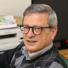
Guest Editor
Department of Sciences, University of Basilicata, via Ateneo Lucano, 10, 85100 Potenza, Italy
Interests: geomorphology; geological heritage; landslides; soil erosion; climate changes
Special Issues, Collections and Topics in MDPI journals

E-Mail Website
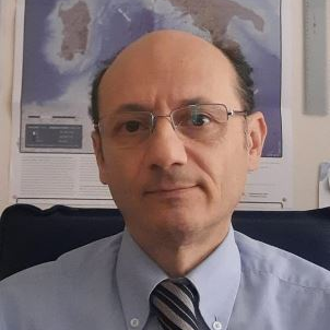
Guest Editor
Institute of Heritage Science, National Research Council (ISPC-CNR), Area Della Ricerca, C.da S. Loja, Tito, 85050 Potenza, Italy
Interests: natural hazards; historical seismicity; historical floods; historical landslides; disaster response; natural hazard insurance; natural hazards and cultural heritage; heritage science; bibliometrics
Special Issues, Collections and Topics in MDPI journals

E-Mail Website
Guest Editor
Department of Geology and Petroleum Geology, University of Aberdeen, Aberdeen AB24 3FX, UK
Interests: geomorphology; geological heritage; structural geology
Special Issues, Collections and Topics in MDPI journals

E-Mail Website
Guest Editor
Department of Sciences, University of Basilicata, Potenza 85100, Italy
Interests: Field Geology, Basin Analysis, Geomorphology, Geological heritage

Special Issue Information

Dear Colleagues,

The sustainable management of geodiversity is vital to ensure for future generations the possibility of experiencing the geological peculiarities of the Earth. The knowledge of geological history of the Earth is as important as the history of men. It is well-known worldwide that geodiversity, and particularly the geological heritage, is an irreplaceable natural resource and therefore any loss of sites with geological peculiarities must be avoided. This can be accomplished by utilizing all the available protection tools. To deal with all the problems concerning the sustainable management of geodiversity it is necessary to engage a multidisciplinary approach using economic, managerial, geological and geoconservation aspects of the administration of areas. It often happens that, after studying an area which has high geodiversity and the potential to become an important economic resource, the necessary skills to manage it are lacking. As such, references on the management problem together with all professionals involved are needed.

The Special Issue aims to collect papers that address issues related to the sustainable management of geodiversity. Therefore, we invite you to contribute to this Issue by submitting wide-ranging reviews, novel case studies, or research articles. Furthermore, it would be preferable submit papers addressed to specific and exemplary situation on the management of geodiversity, from an economic, social, and cultural points of view. Although, great progress has been made in recent years in the study of the geological heritage, which is preliminary to proper conservation, there still remains more work to be done. Examples of contents include but are not limited to:

  1. Geoheritage and geodiversity: protection, conservation, enhancement and touristic fruition;
  2. Geoheritage and geodiversity perception by people;
  3. Geoheritage and geodiversity education;
  4. New ICT technologies for geoheritage and geodiversity
  5. Geoheritage, geodiversity in relationship with urban areas;
  6. (New) Methods for assessing geodiversity;
  7. Cultural function of geodiversity;
  8. Geomatics and GIS for geodiversity inventory;
  9. Connecting geodiversity, biodiversity and society;
  10. Connecting biodiversity and geodiversity across scales using remote sensing

We would like to draw your attention to the preparation and presentation of original contributions on the following topics: Study and Sustainable management of geodiversity vs conservation of heritage.

This Special Issue will bring together scientific contributions dedicated to current studies on geodiversity and how to manage it in a sustainable way. In addition, original contributions are welcome that address the topic of conservation of the geological heritage.

The main objective of the Special Issue is to update the state of the art of the following topics: study of geodiversity, sustainable management of geodiversity, reduction of the environmental impact associated with geotourism and geoconservation.

The Special Issue will therefore consider updating the existing literature by integrating different investigative approaches, with particular attention to sustainable development and future generations. Do not hesitate to contact us for further information on this special volume. Many thanks in advance for your interest and best regards.

Dr. Mario Bentivenga
Dr. Fabrizio Terenzio Gizzi
Dr. Giuseppe Palladino
Dr. Eva Pescatore
Guest Editors

Manuscript Submission Information

Manuscripts should be submitted online at www.mdpi.com by registering and logging in to this website. Once you are registered, click here to go to the submission form. Manuscripts can be submitted until the deadline. All submissions that pass pre-check are peer-reviewed. Accepted papers will be published continuously in the journal (as soon as accepted) and will be listed together on the special issue website. Research articles, review articles as well as short communications are invited. For planned papers, a title and short abstract (about 100 words) can be sent to the Editorial Office for announcement on this website.

Submitted manuscripts should not have been published previously, nor be under consideration for publication elsewhere (except conference proceedings papers). All manuscripts are thoroughly refereed through a single-blind peer-review process. A guide for authors and other relevant information for submission of manuscripts is available on the Instructions for Authors page. Sustainability is an international peer-reviewed open access semimonthly journal published by MDPI.

Please visit the Instructions for Authors page before submitting a manuscript. The Article Processing Charge (APC) for publication in this open access journal is 2400 CHF (Swiss Francs). Submitted papers should be well formatted and use good English. Authors may use MDPI's English editing service prior to publication or during author revisions.

Keywords

  • Sustainable Management
  • Geodiversity, Heritage
  • Conservation

Published Papers (10 papers)

Order results
Result details
Select all
Export citation of selected articles as:

Research

22 pages, 3771 KiB  
Article
Geoheritage and Geoconservation: Some Remarks and Considerations
by Eva Pescatore, Mario Bentivenga and Salvatore Ivo Giano
Sustainability 2023, 15(7), 5823; https://doi.org/10.3390/su15075823 - 27 Mar 2023
Cited by 13 | Viewed by 1520
Abstract
Topics related to geoheritage research, protection, and conservation, as well as the enhancement and dissemination of geoheritage knowledge, have experienced an important increase in interest regarding the perspectives of both research and management policies. In geoheritage and geodiversity management, geoconservation is a term [...] Read more.
Topics related to geoheritage research, protection, and conservation, as well as the enhancement and dissemination of geoheritage knowledge, have experienced an important increase in interest regarding the perspectives of both research and management policies. In geoheritage and geodiversity management, geoconservation is a term that encompasses a series of actions dedicated to conservation, research on and the protection of geoheritage, and the enhancement as well as dissemination of knowledge in this area. Geoconservation is a kind of container, with several compartments dedicated to different aspects that identify geoheritage and geodiversity, including scientific, technical, administrative, didactical, and political aspects. These aspects are necessarily different according to (i) objects directly or indirectly involved in geoconservation actions; (ii) the area of application (protected and unprotected natural areas; emerged, submerged, or mixed areas; and urban, urbanized, and/or anthropized areas); (iii) final goals; and (iv) the final end users. This paper presents a schematization of geoconservation concepts and applications as expressed in the literature and as a result of personal experience in addressing issues related to geoheritage management. Full article
Show Figures

Figure 1

29 pages, 16708 KiB  
Article
Geoheritage Management in Areas with Multicultural Interest Contexts
by Eva Pescatore, Mario Bentivenga and Salvatore Ivo Giano
Sustainability 2022, 14(23), 15911; https://doi.org/10.3390/su142315911 - 29 Nov 2022
Cited by 5 | Viewed by 1137
Abstract
Sites of geo-cultural interest are often included in areas where multicultural contexts (geo and non geo) are present. Cultural heritage dissemination is sometimes mono-contextual, paying little attention to the possibility of inclusion in a wider multicultural context. When these different contexts are linkable [...] Read more.
Sites of geo-cultural interest are often included in areas where multicultural contexts (geo and non geo) are present. Cultural heritage dissemination is sometimes mono-contextual, paying little attention to the possibility of inclusion in a wider multicultural context. When these different contexts are linkable to each other following a specific theme, multicultural heritage dissemination will be possible, and often the geo context can represent a fulcrum, a resilient tool in doing that. A portion of the Sinni river’s catchment area (Basilicata region, Southern Italy) has been chosen to test and verify the multi-level/disciplinary approach applicability. The area is located on the southeastern edge of the Pliocene to Pleistocene Sant’Arcangelo basin in the Southern Apennines chain of Italy. Here, both basic observations on the physical geography landscape evolution and specialized observations on river dynamics and on the hydrographic network have been carried out. Educational routes will be proposed with different educational levels along a path that will include the San Giorgio Lucano hypogea. This paper represents the results of a qualitative study providing an overview of the possibility, in a multicultural context, about whether, when, and how the geo context may act as a link between the different disciplines and what is the best way to make it. A relational database, organized in contexts, areas, and themes, is planned at different levels of detail, and is currently being developed in order to make final products easily available. Each level will be provided with basic concepts, territorial contextualization, and of activities/itineraries. The goal is to provide a versatile tool that enhances the territorial multi-cultural heritage to reach a greater number of end users interested in both geo and non geo contexts. Full article
Show Figures

Figure 1

26 pages, 12958 KiB  
Article
Assessment of Geosites within a Natural Protected Area: A Case Study of Cajas National Park
by Edison Navarrete, Fernando Morante-Carballo, Jairo Dueñas-Tovar, Paúl Carrión-Mero, María Jaya-Montalvo and Edgar Berrezueta
Sustainability 2022, 14(5), 3120; https://doi.org/10.3390/su14053120 - 07 Mar 2022
Cited by 9 | Viewed by 3991
Abstract
Cajas National Park (CNP), located in southern Ecuador, comprises an area of high natural, scientific and cultural value with wide recognition worldwide. This national park has a large number of elements that, as a whole, constitute a relevant geological heritage. However, this geological [...] Read more.
Cajas National Park (CNP), located in southern Ecuador, comprises an area of high natural, scientific and cultural value with wide recognition worldwide. This national park has a large number of elements that, as a whole, constitute a relevant geological heritage. However, this geological heritage requires an enhancement that complements the important contribution made by the Natural Park in terms of conservation and protection of the natural heritage. This study aims to evaluate sites of geological relevance present in CNP through international geosite assessment methodologies and thus provide knowledge favouring these resources’ sustainable use and geoconservation. The study phases comprise four stages: (i) a base information analysis of the study area; (ii) identification and selection of sites of geological interest; (iii) a geosite and geomorphosite assessment using the Inventario Español de Lugares de Interés Geological (IELIG) method and Brilha method; (iv) a qualitative assessment using a strengths, weaknesses, opportunities and threats (SWOT) analysis for the contribution and influence of geomorphosites in the development of the study area. This work made it possible to determine that all the analysed geosites and geomorphological sites (14) have a high and very high interest. The Llaviucu valley site stands out for its relevant scientific, academic and tourist value. The IELIG method revealed that 50% of the evaluated sites have a high protection priority, while the rest are in the “medium” category. In addition, the investigation through the SWOT analysis revealed that the geomorphosites could provide significant added value to the development of geotourism and of the NP itself, complementing the already known natural attractions; moreover, the study presented strategies for the use of these in the sustainable development of the area. Full article
Show Figures

Figure 1

31 pages, 15713 KiB  
Article
Evaluation of the Visitor Understanding of Coastal Geotourism and Geoheritage Potential Based on Sustainable Regional Development in Western Black Sea Region, Turkey
by Canan Cengiz, Şükran Şahin, Bülent Cengiz, Mükerrem Bahar Başkır and Pelin Keçecioğlu Dağlı
Sustainability 2021, 13(21), 11812; https://doi.org/10.3390/su132111812 - 26 Oct 2021
Cited by 11 | Viewed by 2511
Abstract
The Black Sea coasts of Turkey have important examples of geological heritage with coastal cliffs in terms of geological formations and features. The Güzelcehisar Basalt Columns (GBCs) formation and its coast have been chosen as a research area in this article in terms [...] Read more.
The Black Sea coasts of Turkey have important examples of geological heritage with coastal cliffs in terms of geological formations and features. The Güzelcehisar Basalt Columns (GBCs) formation and its coast have been chosen as a research area in this article in terms of its basalt columns, rare coastal geological diversity and coastal geotourism potential. This paper presents the results of a visitor survey undertaken at the GBCs formation and its coast, located in the rural coastal part of Bartın province in the Western Black Sea Region of Turkey. This survey was conducted in 2020 to assess the tourism shoulder season visitors to the Güzelcehisar village. With the survey, its aim was to determine the awareness of the visitors on geoconservation and geodiversity and to evaluate the understanding of geological heritage and geotourism. In addition, it was desired to set visitor expectations to improve the geotourism experience. It was found that visitors had a high level of understanding and awareness of the terms “geodiversity”, “geoheritage”, “geotourism” and “geoconservation”. However, this survey also shows that there is less emphasis on the need to protect the geodiversity in Güzelcehisar. Guided walking is preferred in order to improve visitor understanding and improve experiences. These survey findings contain guiding explanations for studies that could provide a wider interpretation of the perceptions, experiences and expectations of visitors regarding the sustainable development of areas with similar coastal geotourism potential in Turkey. Full article
Show Figures

Figure 1

37 pages, 29846 KiB  
Article
Advances in Geoheritage Mapping: Application to Iconic Geomorphological Examples from the Italian Landscape
by Paola Coratza, Irene Maria Bollati, Valeria Panizza, Pierluigi Brandolini, Doriano Castaldini, Franco Cucchi, Giacomo Deiana, Maurizio Del Monte, Francesco Faccini, Furio Finocchiaro, Dario Gioia, Rita Melis, Carmine Minopoli, Olivia Nesci, Guido Paliaga, Micla Pennetta, Luigi Perotti, Alessia Pica, Federico Tognetto, Alfredo Trocciola, Laura Valentini, Marco Giardino and Manuela Pelfiniadd Show full author list remove Hide full author list
Sustainability 2021, 13(20), 11538; https://doi.org/10.3390/su132011538 - 19 Oct 2021
Cited by 25 | Viewed by 3098
Abstract
In the framework of geosite management, specific targeted symbols for geomorphological legends are still lacking. Concerning geosites of geomorphological interest, geomorphological mapping requires targeted symbols in relation to goals and applications, either concerning geomorphic hazards and risk detection or the enhancement of resources, [...] Read more.
In the framework of geosite management, specific targeted symbols for geomorphological legends are still lacking. Concerning geosites of geomorphological interest, geomorphological mapping requires targeted symbols in relation to goals and applications, either concerning geomorphic hazards and risk detection or the enhancement of resources, in particular those related to cultural heritage and, hence, geoheritage. A new methodology for mapping geo(morpho)heritage on geomorphological maps is presented in this paper. Nine iconic examples from the Italian landscape, selected in different morphogenetic and morphoclimatic contexts, are proposed to test the methodology in relation to point, polyline and polygon features. Moreover, guidelines for mapping are suggested according to the importance of the site and to the complexity of processes characterizing each case study. Full article
Show Figures

Figure 1

18 pages, 5526 KiB  
Article
A Quantitative GIS and AHP Based Analysis for Geodiversity Assessment and Mapping
by Andrea Ferrando, Francesco Faccini, Guido Paliaga and Paola Coratza
Sustainability 2021, 13(18), 10376; https://doi.org/10.3390/su131810376 - 17 Sep 2021
Cited by 21 | Viewed by 2700
Abstract
In recent times, the issues of geodiversity assessment and mapping have been subject of great attention, and many evaluation methodologies, either quantitative or qualitative, have been developed. In this research, a first assessment of geodiversity in the Liguria region has been carried out, [...] Read more.
In recent times, the issues of geodiversity assessment and mapping have been subject of great attention, and many evaluation methodologies, either quantitative or qualitative, have been developed. In this research, a first assessment of geodiversity in the Liguria region has been carried out, according to a quantitative method based on spatial analysis techniques implemented in a GIS environment. This method considers four diversity indices obtained by grid analysis, relevant to the four main aspects of geodiversity: geology, geomorphology, hydrogeology and pedology. The geodiversity index was calculated two times, first with a non-weighted sum, then with a weighted sum of the four diversity indices. In the second case, the weights have been assigned according to a semi-quantitative analytical hierarchy process method (AHP) based on experts’ judgment. The results show that the Liguria region is characterized by many areas with high geodiversity, most of them internationally known by geoscientists and tourists for their valuable geoheritage and for their stunning landscapes. The correspondence between these areas and the protected areas of the european Natura 2000 network suggests a link between geodiversity and biodiversity. Full article
Show Figures

Figure 1

29 pages, 7155 KiB  
Article
Preliminary Assessment of the Geological and Mining Heritage of the Golden Quadrilateral (Metaliferi Mountains, Romania) as a Potential Geotourism Destination
by Viorica Milu
Sustainability 2021, 13(18), 10114; https://doi.org/10.3390/su131810114 - 09 Sep 2021
Cited by 5 | Viewed by 2900
Abstract
The Metaliferi Mountains (Western Romania) are known worldwide as the richest gold region in Romania and hosts for numerous porphyry and epithermal deposits. In these mountains, mining for gold dates back to Roman and even pre-Roman times. The Golden Quadrilateral constitutes a remarkable [...] Read more.
The Metaliferi Mountains (Western Romania) are known worldwide as the richest gold region in Romania and hosts for numerous porphyry and epithermal deposits. In these mountains, mining for gold dates back to Roman and even pre-Roman times. The Golden Quadrilateral constitutes a remarkable example of an area having a significant geological and mining heritage. The main purposes of this work are to emphasize this heritage, to present, for the first time, an assessment of the geological and mining heritage of the Golden Quadrilateral as a possible geotourism destination, and to point out the important role that geotourism could have in the sustainable development of local communities. To achieve our goals, the features of thirteen sites are presented, and two geotourism itineraries are proposed. A quantitative assessment of the geosites’ capacity to support scientific, educational, and geotourism/recreational uses indicates that the Golden Quadrilateral presents a high potential not only for scientific studies but, also, for enhancement of the public understanding of science; geotourism could be part of the development strategy of rural areas. The two museums (Gold Museum and Gold Mining Museum) can have an important contribution both to the geo-education of visitors and in promoting the sustainable development of the region. Full article
Show Figures

Figure 1

23 pages, 6868 KiB  
Article
Geosites and Geotourism in the Local Development of Communities of the Andes Mountains. A Case Study
by Paúl Carrión-Mero, César Borja-Bernal, Gricelda Herrera-Franco, Fernando Morante-Carballo, María Jaya-Montalvo, Alfonso Maldonado-Zamora, Nataly Paz-Salas and Edgar Berrezueta
Sustainability 2021, 13(9), 4624; https://doi.org/10.3390/su13094624 - 21 Apr 2021
Cited by 29 | Viewed by 4184
Abstract
The inventory and assessment of a geosite in a territory provides a sound basis for the protection and use of its geological heritage. This article aims to evaluate the most relevant geosites in the province of Chimborazo (Ecuador), applying the Spanish Inventory of [...] Read more.
The inventory and assessment of a geosite in a territory provides a sound basis for the protection and use of its geological heritage. This article aims to evaluate the most relevant geosites in the province of Chimborazo (Ecuador), applying the Spanish Inventory of Sites of Geological Interest (IELIG, in Spanish) method, and proposing alternatives for geotourism development in the studied area. The methodological process was based on: (i) the inventory and preliminary selection of geosites; (ii) a semi-quantitative geosite assessment and proposal of travel itineraries for geotourism; and (iii) the application of the strengths, weaknesses, opportunities, and threats (SWOT) matrix to establish geotourism development strategies within a framework of sustainability. The global assessment of scientific, tourist, and academic interests demonstrates that 25% of the 20 evaluated geosites have very high interest and 75% have high interest. The top three geosites with the highest degrees of interest are the Chimborazo Volcano, known as ‘Earth’s Closest Point to the Sun’, the Pallatanga geological fault, and the geosite named Comunidad Cacha. The SWOT analysis reveals that travel itineraries that combine cultural heritage elements and geosites could offer a real alternative for the region’s sustainable development through geotourism. Full article
Show Figures

Figure 1

19 pages, 12774 KiB  
Article
Geosites Inventory in Liguria Region (Northern Italy): A Tool for Regional Geoconservation and Environmental Management
by Andrea Ferrando, Francesco Faccini, Flavio Poggi and Paola Coratza
Sustainability 2021, 13(4), 2346; https://doi.org/10.3390/su13042346 - 22 Feb 2021
Cited by 18 | Viewed by 3502
Abstract
The Liguria Region in Northern Italy is characterized by a wide geological and geomorphological variety, encompassing an important and valuable geoheritage. The Ligurian regional law (L.R. 39/2009) protects and enhances geodiversity and geosites, establishing the Regional Inventory of Geosites; however, an approved official [...] Read more.
The Liguria Region in Northern Italy is characterized by a wide geological and geomorphological variety, encompassing an important and valuable geoheritage. The Ligurian regional law (L.R. 39/2009) protects and enhances geodiversity and geosites, establishing the Regional Inventory of Geosites; however, an approved official inventory is still lacking. In this work, a first reasoned inventory of 120 geosites is proposed for the Liguria Region on the basis of field surveys and literature review. A quantitative assessment of the value and the degradation risk of geosites has been carried out: the value assessment takes into account scientific, additional and potential-for-use values; the degradation risk assessment considers geosites’ fragility and vulnerability. The results, providing knowledge on the Ligurian geoheritage, can serve as the basis for the Regional Inventory of Geosites and can be useful tools for the implementation of any regional geoconservation strategy or environmental management plan. Full article
Show Figures

Figure 1

13 pages, 1620 KiB  
Article
Geoheritage and Geodiversity Education in Romania: Formal and Non-Formal Analysis Based on Questionnaires
by Laura Comănescu and Alexandru Nedelea
Sustainability 2020, 12(21), 9180; https://doi.org/10.3390/su12219180 - 04 Nov 2020
Cited by 9 | Viewed by 2010
Abstract
This paper aims to present how education for geoheritage and geodiversity should take place both in the school curriculum and in extracurricular activities at all levels of Romanian education (middle school, high school and university). The research method consisted in applying two questionnaires [...] Read more.
This paper aims to present how education for geoheritage and geodiversity should take place both in the school curriculum and in extracurricular activities at all levels of Romanian education (middle school, high school and university). The research method consisted in applying two questionnaires (10 questions, most with answers to choose from) both to pre-university teachers (especially those in geography) and students/graduates (especially from geography faculties in the country). The obtained results demonstrate the existence of two different visions: for middle and high school education, education on geoheritage and geodiversity takes place sometimes formally (based on curriculum hours according to the school’s decision) but predominantly informally (based on practical field applications), with most schools educationally limited in terms of environment/sustainable development; in contrast, university education on these subjects has a formal character (based on dedicated courses or field practice modules). The results, although encouraging for the moment, show that there is a need to intensify awareness and education on geoheritage and geodiversity at all levels, especially in higher education, by introducing specific courses/content at all universities in the country. Full article
Show Figures

Figure 1

Back to TopTop