


Remote Sens. 2023, 15(23), 5480; https://doi.org/10.3390/rs15235480 - 23 Nov 2023
Viewed by 995
Abstract
►
Show Figures
Advances in visualisation techniques provide new ways for us to explore how we introduce complex topics like remote sensing to non-specialist audiences. Taking inspiration from the popularity of augmented reality (AR) apps, a free, mobile digital AR app titled SatelliteSkill5, has been
[...] Read more.
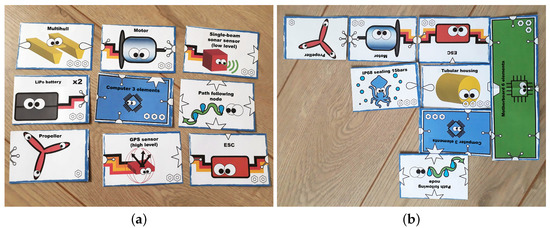
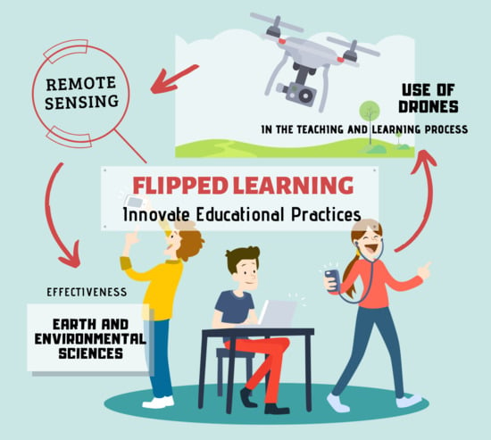
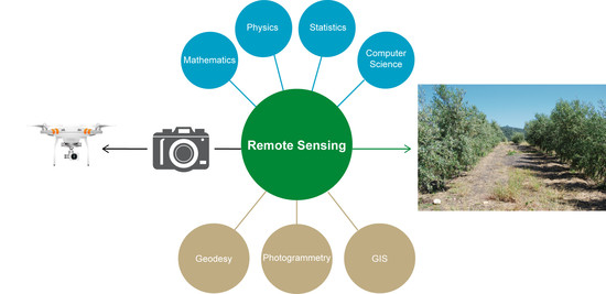
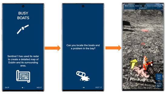
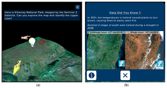
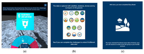
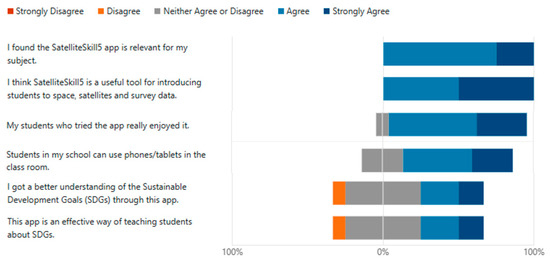
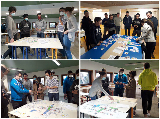
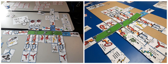
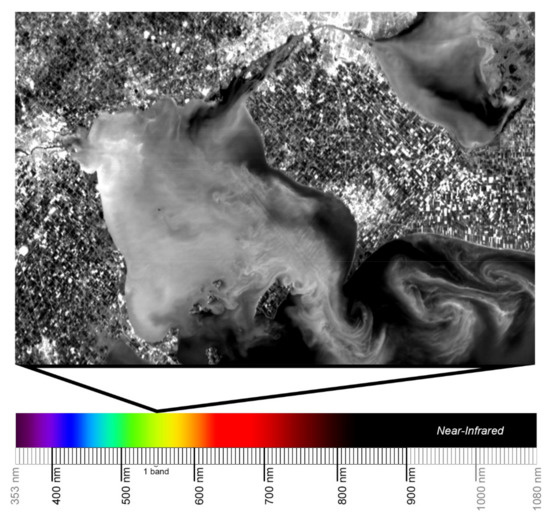
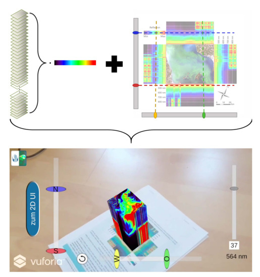
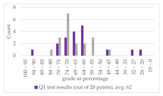
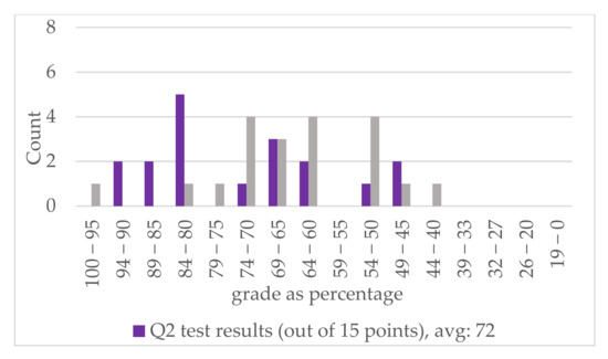
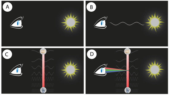
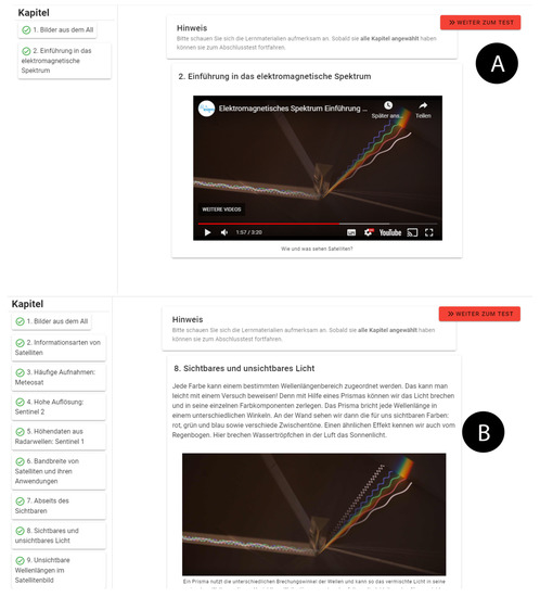
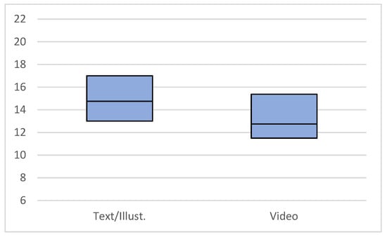
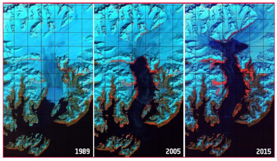
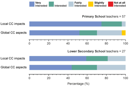
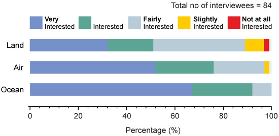
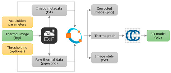
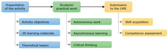
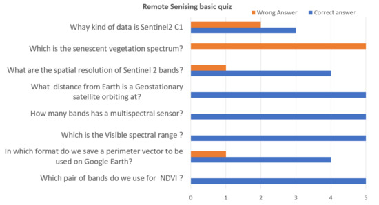
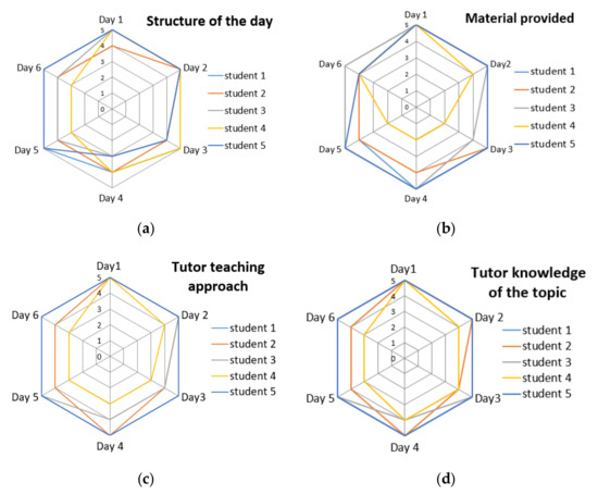
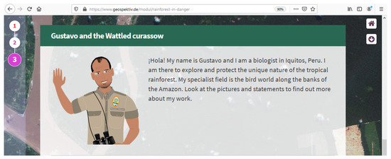
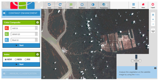
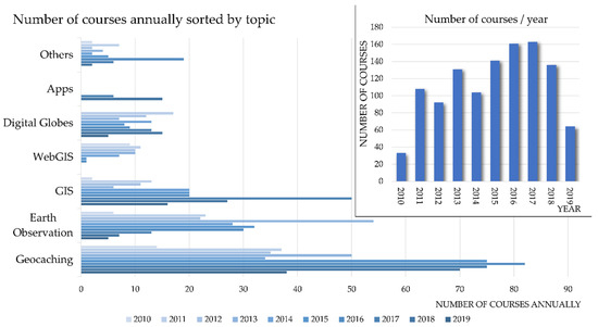
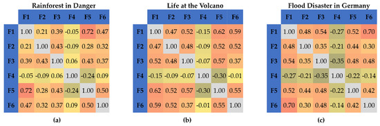
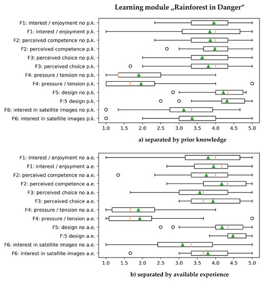
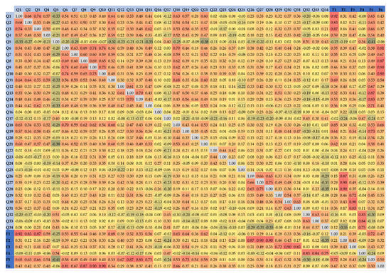
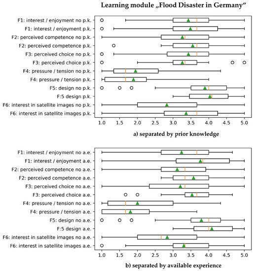
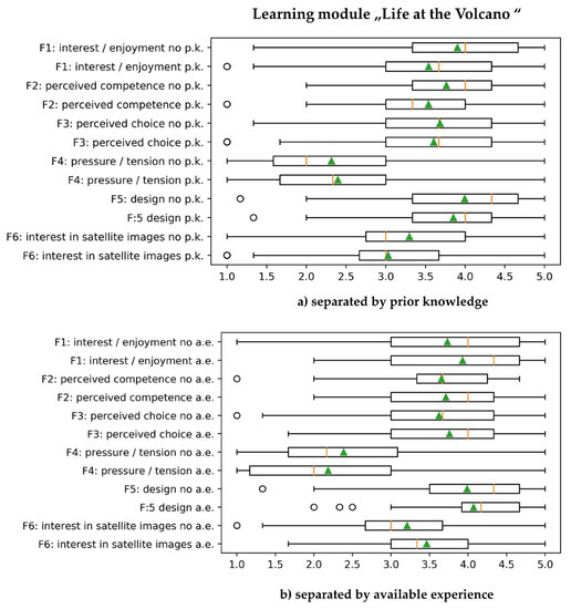
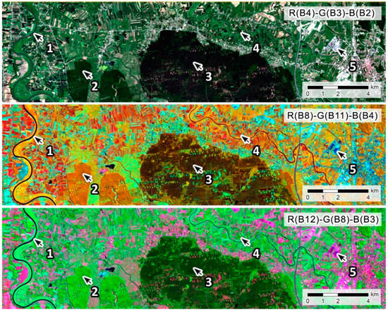
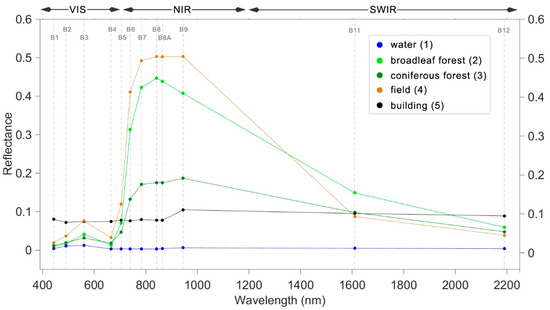
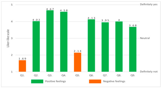
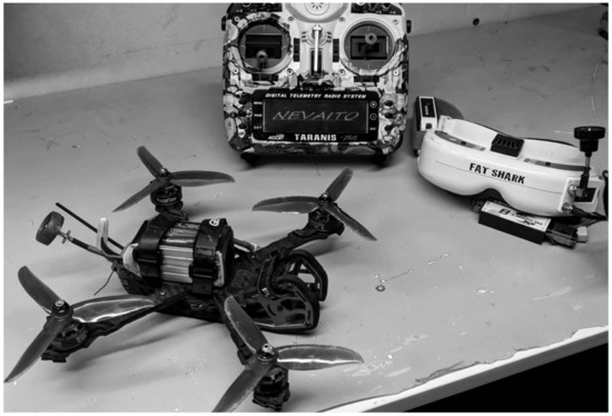
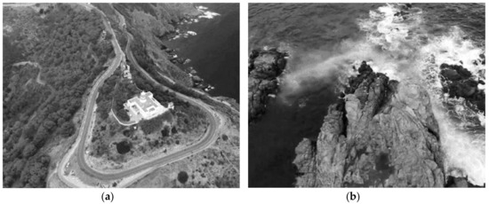
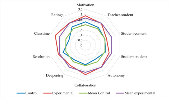
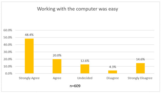
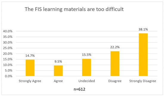
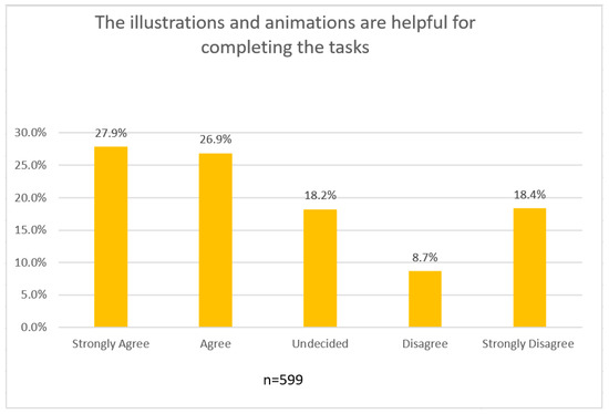
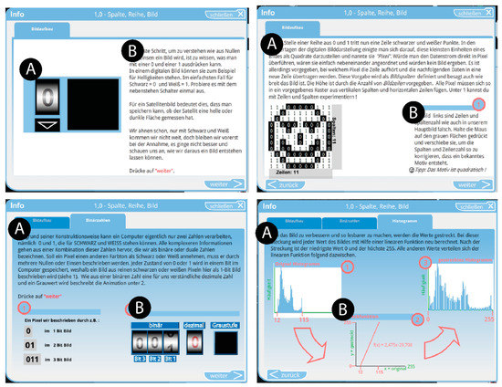
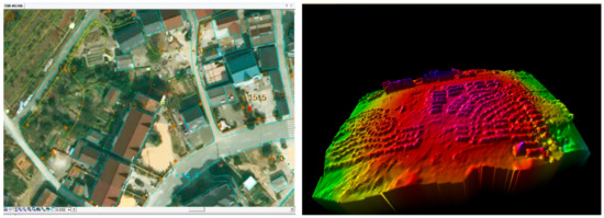
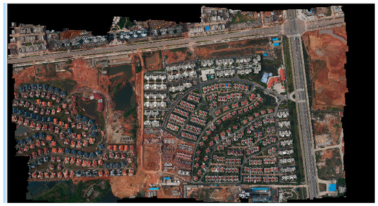
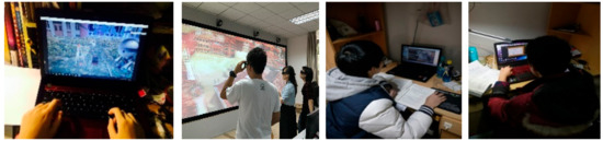
Advances in visualisation techniques provide new ways for us to explore how we introduce complex topics like remote sensing to non-specialist audiences. Taking inspiration from the popularity of augmented reality (AR) apps, a free, mobile digital AR app titled SatelliteSkill5, has been developed for both Androids and iPhones in Unity AR. SatelliteSkill5 helps users conceptualise remote sensing (RS) theory and technology by showcasing the potential of datasets such as multispectral images, SAR backscatter, drone orthophotography, and bathymetric LIDAR for tackling real-world challenges, with examples tackling many of the United Nations’ Sustainable Development Goals (SDGs) as the focus. Leveraging tried and tested pedagogic practices such as active learning, game-based learning, and targeting cross-curricular topics, SatelliteSkill5 introduces users to many of the fundamental geospatial data themes identified by the UN as essential for meeting the SDGs, imparting users with a familiarity of concepts such as land cover, elevation, land parcels, bathymetry, and soil. The SatelliteSkill5 app was piloted in 12 Irish schools during 2021 and 2022 and with 861 students ranging from 12 to 18 years old. This research shows that both students and teachers value learning in an easy-to-use AR environment and that SDGs help users to better understand complex remote sensing theory.
Full article

Figure 1


