Coastal Risk Prediction, Prevention and Management

A special issue of Journal of Marine Science and Engineering (ISSN 2077-1312). This special issue belongs to the section "Ocean Engineering".

Deadline for manuscript submissions: closed (20 February 2023) | Viewed by 7527

Special Issue Editor

Special Issue Information

Dear Colleagues,

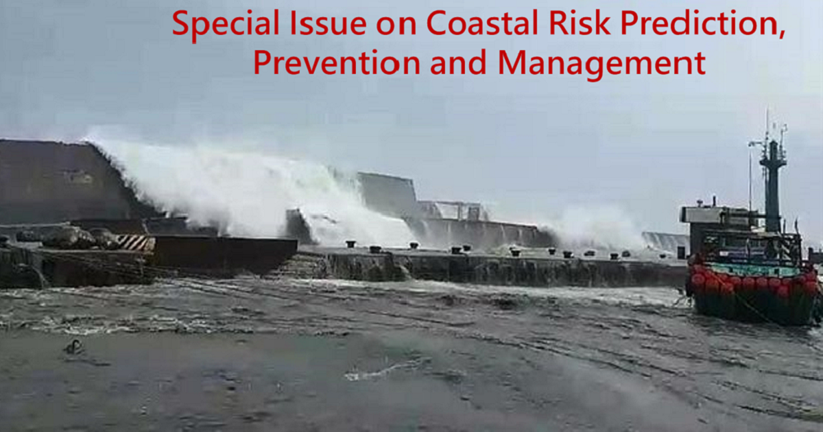
Coastal areas have been attractive settling grounds for the human population as they provided abundant marine resources, fertile agricultural land, and possibilities for trade and transport since early civilization. These advantages have led to high population densities and high levels of development in many coastal areas, and this trend is continuing into the 21st century. At present, about 1.2 billion people live in coastal areas globally, and this number is predicted to increase to 1.8–5.2 billion by the 2080s due to a combination of population growth and coastal migration. Along with this increase follows significant investments in infrastructure and the built environment. Coastal hazard management has become an increasingly important aspect of coastal planning to improve society's resilience to coastal hazards. Possible management options include complicated engineering structures, soft protection measures, various accommodation approaches, and a managed retreat from the coastline. It is also important to address coastal risks by early warning systems and emergency management plans to handle sudden and potential disastrous hazards, i.e., major flooding events.

Dr. Wei-Bo Chen
Guest Editor

Manuscript Submission Information

Manuscripts should be submitted online at www.mdpi.com by registering and logging in to this website. Once you are registered, click here to go to the submission form. Manuscripts can be submitted until the deadline. All submissions that pass pre-check are peer-reviewed. Accepted papers will be published continuously in the journal (as soon as accepted) and will be listed together on the special issue website. Research articles, review articles as well as short communications are invited. For planned papers, a title and short abstract (about 100 words) can be sent to the Editorial Office for announcement on this website.

Submitted manuscripts should not have been published previously, nor be under consideration for publication elsewhere (except conference proceedings papers). All manuscripts are thoroughly refereed through a single-blind peer-review process. A guide for authors and other relevant information for submission of manuscripts is available on the Instructions for Authors page. Journal of Marine Science and Engineering is an international peer-reviewed open access monthly journal published by MDPI.

Please visit the Instructions for Authors page before submitting a manuscript. The Article Processing Charge (APC) for publication in this open access journal is 2600 CHF (Swiss Francs). Submitted papers should be well formatted and use good English. Authors may use MDPI's English editing service prior to publication or during author revisions.

Keywords

  • coastal risk
  • numerical modelling
  • statistical analysis
  • artificial intelligence techniques
  • storm tide
  • storm surge
  • storm wave
  • coastal morphology

Published Papers (4 papers)

Order results
Result details
Select all
Export citation of selected articles as:

Research

21 pages, 5124 KiB  
Article
Determination of Current and Future Extreme Sea Levels at the Local Scale in Port-Bouët Bay (Côte d’Ivoire)
by Marcel Kouakou, Frédéric Bonou, Kissao Gnandi, Eric Djagoua, Mouhamed Idrissou and Asaa Abunkudugu
J. Mar. Sci. Eng. 2023, 11(4), 756; https://doi.org/10.3390/jmse11040756 - 31 Mar 2023
Cited by 1 | Viewed by 1992
Abstract
The Port-Bouët Bay shoreline is threatened by extreme sea level (ESL) events, which result from the combination of storm tide, wave run-up, and sea level rise (SLR). This study provides comprehensive scenarios of current and future ESLs at the local scale along the [...] Read more.
The Port-Bouët Bay shoreline is threatened by extreme sea level (ESL) events, which result from the combination of storm tide, wave run-up, and sea level rise (SLR). This study provides comprehensive scenarios of current and future ESLs at the local scale along the bay to understand the evolution of the phenomenon and promote local adaptation. The methodological steps involve first reconstructing historical storm tide and wave run-up data using a hydrodynamic model (D-flow FM) and the empirical model of Stockdon et al. Second, the Generalized Pareto Distribution (GPD) model fitted to the Peaks-Over-Thresholds (POT) method is applied to the data to calculate extreme return levels. Third, we combine the extreme storm tide and wave run-up using the joint probability method to obtain the current ESLs. Finally, the current ESLs are integrated with recent SLR projections to provide future ESL estimates. The results show that the current ESLs are relatively high, with 100-year return levels of 4.37 m ± 0.51, 4.97 m ± 0.57, and 4.48 m ± 0.5 at Vridi, Petit-Bassam, and Sogefiha respectively. By end-century, under the SSP1-2.6, SSP2-4.5, and SSP5-8.5 scenarios, the future SLR is expected to increase the current ESLs by 0.49 m, 0.62 m, and 0.84 m, respectively. This could lead to a more frequent occurrence of the current 100-year return period, happening once every 2 years by 2100, especially under SSP5-8.5. The developed SLR scenarios can be used to assess the potential coastal flood risk in the study area for sustainable and effective coastal management and planning. Full article
(This article belongs to the Special Issue Coastal Risk Prediction, Prevention and Management)
Show Figures

Figure 1

25 pages, 19644 KiB  
Article
Study of the Optimal Grid Resolution and Effect of Wave–Wave Interaction during Simulation of Extreme Waves Induced by Three Ensuing Typhoons
by Shih-Chun Hsiao, Han-Lun Wu and Wei-Bo Chen
J. Mar. Sci. Eng. 2023, 11(3), 653; https://doi.org/10.3390/jmse11030653 - 20 Mar 2023
Cited by 4 | Viewed by 1390
Abstract
Three typhoons, Meranti, Malakas, and Megi, occurred successively in eastern Taiwanese waters in September 2016, causing extreme waves (significant wave height > 10.0 m), and these events were selected to investigate the effect of model grid resolution and wave–wave interaction on simulating typhoon-driven [...] Read more.
Three typhoons, Meranti, Malakas, and Megi, occurred successively in eastern Taiwanese waters in September 2016, causing extreme waves (significant wave height > 10.0 m), and these events were selected to investigate the effect of model grid resolution and wave–wave interaction on simulating typhoon-driven waves. The WAVEWATCH III (WW3) model, with 0.50 deg, 0.25 deg, 0.20 deg, 0.10 deg, and 0.05 deg grid resolutions, and two reanalysis wind fields were adopted to simulate ocean waves during these three typhoons. The results indicated that the exertion of the Climate Forecast System version 2 (CFSv2) winds over the WW3 model with 0.10 deg grid resolution yielded optimum simulations of typhoon waves in a compromise between accuracy and elapsed time. In the present study, the WW3 model modeled nonlinear wave–wave interactions using discrete interaction approximation (DIA). The numerical experiments revealed that the underestimations of typhoon waves were significant when the WW3 model excluded nonlinear wave–wave interactions, especially when employing a higher grid resolution. This study also found that the WW3 model is superior to the Wind Wave Model III (WWM-III) using the CFSv2 winds because the WWM-III tended to overestimate the extreme waves in all three of these eastern Taiwan typhoon events that occurred in September 2016. Full article
(This article belongs to the Special Issue Coastal Risk Prediction, Prevention and Management)
Show Figures

Figure 1

17 pages, 8649 KiB  
Article
Validating Sea-Level Altimetry Data against Tide Gauge for Coastal Risk Analysis in Mozambique
by Fialho Paloge Juma Nehama, Zeinul Dufa Hassane Veriua, Clousa Maueua, Angela Hibbert, Francisco Calafat and Peter David Cotton
J. Mar. Sci. Eng. 2022, 10(11), 1597; https://doi.org/10.3390/jmse10111597 - 29 Oct 2022
Cited by 1 | Viewed by 1641
Abstract
Satellite altimetry data provide a solution to the lack of in situ tide gauge data, which are essential for comprehending various marine processes worldwide. In the present study, we seek to validate ALES-retrieved sea-level data against tide gauge observations from four ground stations [...] Read more.
Satellite altimetry data provide a solution to the lack of in situ tide gauge data, which are essential for comprehending various marine processes worldwide. In the present study, we seek to validate ALES-retrieved sea-level data against tide gauge observations from four ground stations on the coast of Mozambique. The approach consisted of extracting data from selected tracks of the Jason-1, Jason-2 and Jason-3 missions, and processing it to (i) remove outliers, (ii) collocate alongside tide gauge data, (iii) remove the tidal component and detrend, and (iv) perform a set of statistical analyses. Good agreement was found between the altimetry and tide gauge data in three of the four stations (Maputo, r = 0.59; Inhambane, r = 0.87; and Pemba, r = 0.75), with the exception of Beira. The annual and semi-annual cycles in the two datasets revealed that the altimetry signal is smaller in amplitude and ahead (with a few exceptions) of tide gauge by a varying number of days in each location. Both the annual and semi-annual cycles are far more comparable in Pemba, where the amplitude in particular has the same order of magnitude, followed by the Maputo station. The study concluded that the selected altimetry data for Pemba and Maputo stations are valid and can be used for coastal risk analysis and other applications. No altimetry data could be validated for Inhambane and Beira stations due to lack of consistent and sufficiently long tide gauge records. This difficulty urges the need for improved maintenance practices of ground stations located near human settlements that rely on sound information of the sea level and its variability to protect lives, infrastructure and livelihoods. Full article
(This article belongs to the Special Issue Coastal Risk Prediction, Prevention and Management)
Show Figures

Figure 1

26 pages, 11353 KiB  
Article
Typhoon Wave Simulation Responses to Various Reanalysis Wind Fields and Computational Domain Sizes
by Wei-Bo Chen
J. Mar. Sci. Eng. 2022, 10(10), 1360; https://doi.org/10.3390/jmse10101360 - 23 Sep 2022
Cited by 3 | Viewed by 1498
Abstract
A fully coupled tide-surge-wave model was developed to study the influence of different computational domains on typhoon wave characteristics in the waters surrounding Taiwan. Three typhoons were selected as study cases: Meranti, Malakas, and Megi, which successively impacted Taiwan in September 2016. Superposition [...] Read more.
A fully coupled tide-surge-wave model was developed to study the influence of different computational domains on typhoon wave characteristics in the waters surrounding Taiwan. Three typhoons were selected as study cases: Meranti, Malakas, and Megi, which successively impacted Taiwan in September 2016. Superposition of the CFSV2 winds blended with ERA5 winds onto the tide-surge-wave model yielded optimum simulations of typhoon waves. Storm wave responses along the eastern shelf of Taiwan resulting from three typhoons were examined in four model domains. The first domain (D01) was primarily situated in the region where giant waves were generated. The second domain (D02) covered an area extending from 114° E to 130° E and 19° N to 29° N. The third domain (D03) southwardly included the entire Bashi Channel, from longitudes of 111° E to 135° E and latitudes of 18° N to 30° N. The fourth domain (D04) was the largest among the four computational domains; it extended from longitudes of 105° E to 140° E and latitudes of 15° N to 31° N. The simulated sea state responses indicated that the smaller computational domains were inadequate for typhoon-driven storm wave computation purposes, although the areas of D01 and D02 reached approximately 0.75 and 1.38 million km2, respectively, encompassing all of Taiwan Island and adjacent waters. Our results suggest that utilizing at least D03 or a larger model domain (e.g., D04) is essential to account for the remote wind effect of typhoons on wave simulations in Taiwanese waters. Full article
(This article belongs to the Special Issue Coastal Risk Prediction, Prevention and Management)
Show Figures

Figure 1

Back to TopTop