Next Issue
Volume 10, October
Previous Issue
Volume 10, August


Hydrology, Volume 10, Issue 9 (September 2023) – 14 articles

Cover Story (view full-size image): 
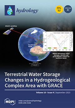
Information on groundwater depletion (caused by periods of low rainfall or droughts) and groundwater recovery is very important for the management of water resources in southern Spain in the current context of climate change. However, the spatial distribution of groundwater bodies in southern Spain is complex and current in situ groundwater monitoring methods are deficient, particularly in terms of obtaining representative samples and implementing as well as maintaining groundwater monitoring networks. The alternative approach investigated here is to consider the relationship between precipitation time series and changes in the terrestrial water storage estimated from GRACE observations. It is concluded that groundwater storage and terrestrial water storage show very similar trends but with a delay in the groundwater trend. View this paper
  • Issues are regarded as officially published after their release is announced to the table of contents alert mailing list.
  • You may sign up for e-mail alerts to receive table of contents of newly released issues.
  • PDF is the official format for papers published in both, html and pdf forms. To view the papers in pdf format, click on the "PDF Full-text" link, and use the free Adobe Reader to open them.
Order results
Result details
Section
Select all
Export citation of selected articles as:
34 pages, 16475 KiB  
Review
Evolution of Tunneling Hydro-Technology: From Ancient Times to Present and Future
by Andreas N. Angelakis, Cees W. Passchier, Mohammad Valipour, Jens A. Krasilnikoff, Vasileios A. Tzanakakis, Abdelkader T. Ahmed, Alper Baba, Rohitashw Kumar, Esra Bilgic, Andrea G. Capodaglio and Nicholas Dercas
Hydrology 2023, 10(9), 190; https://doi.org/10.3390/hydrology10090190 - 20 Sep 2023
Viewed by 1981
Abstract
Water tunnels are one of the oldest hydro-technologies for extracting water resources and/or transmitting them through water distribution systems. In the past, human societies have used tunneling for various purposes, including development, as a measure to enable underground resource extraction and the construction [...] Read more.
Water tunnels are one of the oldest hydro-technologies for extracting water resources and/or transmitting them through water distribution systems. In the past, human societies have used tunneling for various purposes, including development, as a measure to enable underground resource extraction and the construction of transportation networks in challenging landscapes and topographies. The development of hydro-technology potentially involves the construction of tunnels to feed aqueducts, irrigation and waste water systems. Thus, the ability to make and maintain tunnels became an important component in creating lasting and sustainable water systems, which increased water supply and security, minimized construction costs, and reduced environmental impact. Thus, this review asks how, when and why human societies of the past included tunneling for the development of lasting water supply systems. This review presents a comprehensive overview across time and space, covering the history of tunneling in hydro technology from antiquity to the present, and it ponders how past experiences could impact on future hydro-technological projects involving tunneling. A historical review of tunnel systems enhances our understanding of the potential, performance, challenges, and prospects associated with the use of hydro-techniques. In the past, as the different examples in time and space demonstrate, tunneling was often dedicated to solving local problems of supply and disposal. However, across the world, some features were repeated, including the need for carving through the living rock or digging to create tunnels covered with stone slabs. Also, the world-wide use of extensive and costly tunnel systems indicates the high level of investment which human societies are willing to make for securing control over and with its water resources. This study helps us to gather inspiration from proven technologies of the past and more recent knowledge of water tunnel design and construction. As we face global warming and its derivate problems, including problems of water scarcity and flooding, the ability to create and maintain tunnels remains an important technology for the future. Full article
(This article belongs to the Topic Hydrology and Water Resources in Agriculture and Ecology)
Show Figures

Figure 1

17 pages, 7398 KiB  
Article
Coastal Erosion Caused by River Mouth Migration on a Cuspate Delta: An Example from Thanh Hoa, Vietnam
by Dinh Van Duy, Tran Van Ty, Cao Tan Ngoc Than, Cu Ngoc Thang, Huynh Thi Cam Hong, Nguyen Trung Viet and Hitoshi Tanaka
Hydrology 2023, 10(9), 189; https://doi.org/10.3390/hydrology10090189 - 18 Sep 2023
Viewed by 1508
Abstract
Coastal erosion poses a significant threat to the infrastructure of the coastal community at the mouth of the Ma River in Thanh Hoa Province, Vietnam. In response, emergency solutions such as hard, protective structures are often implemented. However, this approach exacerbates the problem [...] Read more.
Coastal erosion poses a significant threat to the infrastructure of the coastal community at the mouth of the Ma River in Thanh Hoa Province, Vietnam. In response, emergency solutions such as hard, protective structures are often implemented. However, this approach exacerbates the problem as the underlying mechanisms of coastal erosion are not adequately investigated and understood. In this study, the long-term configuration of the mouth of the Ma River in Thanh Hoa Province, Central Vietnam, is investigated using Landsat imagery spanning from 1987 to 2023. An analytical solution of a one-line model for shoreline change was also used to examine the sand discharge from the Ma River and the diffusion coefficient for the sand transported along the shore by breaking waves. The results showed an asymmetric configuration of the mouth of the Ma River over the past 37 years. The supply of sand from the Ma River is around 350,000 m3/year. The majority of sand (ranging from 55% to 75%) is mainly transported to the northern beach of the Ma River delta. This uneven distribution of sand from the Ma River has led to the asymmetrical morphology of the delta apex in which the northern part of the Ma River delta is experiencing northward movement while the southern part of the Ma River Delta is moving southward and landward. The asymmetrical morphology of the delta at the mouth of the Ma River has recently been identified as the cause of severe coastal erosion. The diffusion coefficient value determined for the transportation of longshore sand along the deltaic lobes of the Ma River delta corresponds to 90 m2/day. This study offers a practical method for investigating morphological changes in cuspate deltas, especially when measured field data are limited. Full article
(This article belongs to the Section Marine Environment and Hydrology Interactions)
Show Figures

Figure 1

27 pages, 9190 KiB  
Article
Analysis of Groundwater Depletion in the Saskatchewan River Basin in Canada from Coupled SWAT-MODFLOW and Satellite Gravimetry
by Mohamed Hamdi and Kalifa Goïta
Hydrology 2023, 10(9), 188; https://doi.org/10.3390/hydrology10090188 - 15 Sep 2023
Cited by 2 | Viewed by 2903
Abstract
The Saskatchewan River Basin (SRB) of central Canada plays a crucial role in the Canadian Prairies. Yet, climate change and human action constitute a real threat to its hydrological processes. This study aims to evaluate and analyze groundwater spatial and temporal dynamics in [...] Read more.
The Saskatchewan River Basin (SRB) of central Canada plays a crucial role in the Canadian Prairies. Yet, climate change and human action constitute a real threat to its hydrological processes. This study aims to evaluate and analyze groundwater spatial and temporal dynamics in the SRB. Groundwater information was derived and compared using two different approaches: (1) a mathematical modeling framework coupling the Soil and Water Assessment Tool (SWAT) and the Modular hydrologic model (MODFLOW) and (2) gravimetric satellite observations from the Gravity Recovery and Climate Experiment (GRACE) mission and its follow-on (GRACE-FO). Both methods show generalized groundwater depletion in the SRB that can reach −1 m during the study period (2002–2019). Maximum depletion appeared especially after 2011. The water balance simulated by SWAT-MODFLOW showed that SRB could be compartmented roughly into three main zones. The mountainous area in the extreme west of the basin is the first zone, which is the most dynamic zone in terms of recharge, reaching +0.5 m. The second zone is the central area, where agricultural and industrial activities predominate, as well as potable water supplies. This zone is the least rechargeable and most intensively exploited area, with depletion ranging from +0.2 to −0.4 m during the 2002 to 2011 period and up to −1 m from 2011 to 2019. Finally, the third zone is the northern area that is dominated by boreal forest. Here, exploitation is average, but the soil does not demonstrate significant storage power. Briefly, the main contribution of this research is the quantification of groundwater depletion in the large basin of the SRB using two different methods: process-oriented and satellite-oriented methods. The next step of this research work will focus on the development of artificial intelligence approaches to estimate groundwater depletion from a combination of GRACE/GRACE-FO and a set of multisource remote sensing data. Full article
Show Figures

Figure 1

22 pages, 8605 KiB  
Article
Assessing Terrestrial Water Storage Variations in Southern Spain Using Rainfall Estimates and GRACE Data
by Eulogio Pardo-Igúzquiza, Jean-Philippe Montillet, José Sánchez-Morales, Peter A. Dowd, Juan Antonio Luque-Espinar, Neda Darbeheshti and Francisco Javier Rodríguez-Tovar
Hydrology 2023, 10(9), 187; https://doi.org/10.3390/hydrology10090187 - 15 Sep 2023
Viewed by 1510
Abstract
This paper investigates the relationship between rainfall, groundwater and Gravity Recovery and Climate Experiment (GRACE) data to generate regional-scale estimates of terrestrial water storage variations in the Andalucía region of southern Spain. These estimates can provide information on groundwater depletion (caused by periods [...] Read more.
This paper investigates the relationship between rainfall, groundwater and Gravity Recovery and Climate Experiment (GRACE) data to generate regional-scale estimates of terrestrial water storage variations in the Andalucía region of southern Spain. These estimates can provide information on groundwater depletion (caused by periods of low rainfall or droughts) and groundwater recovery. The spatial distribution of groundwater bodies in southern Spain is complex and current in situ groundwater monitoring methods are deficient, particularly in terms of obtaining representative samples and in implementing and maintaining groundwater monitoring networks. The alternative approach proposed here is to investigate the relationship between precipitation time series and changes in the terrestrial water storage estimated from GRACE observations. The results were validated against the estimated fluctuation in regional groundwater. The maximum correlation between the mean groundwater level and the GRACE observations is 0.69 and this occurs at a lag of one month because the variation in gravity is immediate, but rainfall water requires around one month to travel across the vadose zone before it reaches the groundwater table. Using graphical methods of accumulated deviations from the mean, we show that, in general, groundwater storage follows the smooth, multi-year trends of terrestrial water storage but with less short-term trends; the same is true of rainfall, for which the local trends are more pronounced. There is hysteresis-like behaviour in the variations in terrestrial water storage and in the variations of groundwater. In practical terms, this study shows that, despite the abnormal dryness of the Iberian Peninsula during the 2004–2010 drought, the depleted groundwater storage in Andalucía recovered almost to its pre-drought level by 2016. In addition, groundwater storage and terrestrial water storage show very similar trends but with a delay in the groundwater trend. Full article
(This article belongs to the Section Hydrology–Climate Interactions)
Show Figures

Figure 1

25 pages, 9095 KiB  
Article
Boron Isotopes in Fresh Surface Waters in a Temperate Coastal Setting
by Brooke N. Peritore, E. Troy Rasbury, Kathleen M. Wooton, Carrie C. Wright, Deanna M. Downs, Anastasia Iorga and Shannon L. Letscher
Hydrology 2023, 10(9), 186; https://doi.org/10.3390/hydrology10090186 - 14 Sep 2023
Viewed by 1291
Abstract
The results from a four-year study of a freshwater pond on Long Island, NY, USA, do not point to a single source of boron (and by proxy other elements including nutrients) in this system. However, boron data from samples associated with this pond [...] Read more.
The results from a four-year study of a freshwater pond on Long Island, NY, USA, do not point to a single source of boron (and by proxy other elements including nutrients) in this system. However, boron data from samples associated with this pond can be explained by mixing between average precipitation (weighted average δ11B = 22.7) in the area and the local sources of boron, both natural and anthropogenic. This multiyear study provided the opportunity to see both yearly and seasonal differences. One algae sample from the pond showed significant fractionation and enrichment in light boron relative to the water and suggests algae may act as a boron sink. This type of biological fractionation could explain an observed down-gradient trend to heavier boron isotope values in pond water, which corresponds to the slight reduction in boron concentration seen in 2021. However, the trend was subdued in the following year, likely due to differences in the water flow rates and/or rate of algal growth. An opposite trend was seen with depth in the water, where δ11B showed a positive correlation to boron concentration, which increased with depth from the surface of the pond. This gradient may be explained by the stratification of the pond with a heavy source concentrating in the bottom waters. The bottom water composition was consistent with goose feces (δ11B = 25.8) or the addition of chemicals from the application of rock salt to local roads in winter. Surprisingly, boron from seawater (average δ11B = 39.8) did not appear to have a direct impact on Setauket Pond, other than its influence on precipitation, providing heavy δ11B and very low boron concentrations. Full article
(This article belongs to the Special Issue Advances in Isotope Investigations of Groundwater Resources)
Show Figures

Figure 1

21 pages, 8283 KiB  
Article
Bloomin’ Ridiculous: Climate Change, Water Contamination and Algal Blooms in a Land Down Under
by Andrea Crampton and Angela T. Ragusa
Hydrology 2023, 10(9), 185; https://doi.org/10.3390/hydrology10090185 - 14 Sep 2023
Viewed by 1530
Abstract
Climate and anthropogenic change, particularly agricultural runoff, increase blue-green algae/cyanobacteria blooms. This article researches cyanobacteria alert-level identification, management, and risk communication in Lake Hume, Australia. Two methods, document and content analysis, evidence contamination events and risk communication, reflect water governance and data management [...] Read more.
Climate and anthropogenic change, particularly agricultural runoff, increase blue-green algae/cyanobacteria blooms. This article researches cyanobacteria alert-level identification, management, and risk communication in Lake Hume, Australia. Two methods, document and content analysis, evidence contamination events and risk communication, reflect water governance and data management limitations. Results found that Lake Hume had amber or red alerts for only one week, December 2021–December 2022. This failed to prevent government tourism promotion of recreational usage, contravening water authority red alert advice. Lake-use restrictions lacked compliance enforcement. Events during amber alerts lacked risk communication to vulnerable populations (children). Lake Hume’s governance by the Murray–Darling Basin Authority restricted risk communication to one authority that reproduced generic advice in minimal outlets/time points. Geophysical signage failed to address diversity needs (language, literacy, age, and disabilities). No risk communication was found for residents with diseases exacerbated by aerosolization. Despite WHO promoting cyanotoxin investigation, Australian research is absent in international literature. Further, Lake Hume cyanobacteria produce potentially carcinogenic microcystein. This coexists with census data revealing cancer rates higher than the national average in a waterside town. The results demonstrate the need to incorporate robust public health risk assessments, communication, and management into water management and advocate international legislation changes based on evidence-based research to reduce blooms and prevent agricultural runoff. Full article
(This article belongs to the Special Issue Climate Change Effects on Hydrology and Water Resources)
Show Figures

Figure 1

25 pages, 3668 KiB  
Article
Simulating Phosphorus Load Reductions in a Nested Catchment Using a Flow Pathway-Based Modeling Approach
by Russell Adams and Paul Quinn
Hydrology 2023, 10(9), 184; https://doi.org/10.3390/hydrology10090184 - 14 Sep 2023
Cited by 1 | Viewed by 1543
Abstract
Catchment models are essential tools to identify and predict water quality problems linked to excessive nutrient applications (in this case phosphorus (P)). The Catchment Runoff Attenuation Flux Tool (CRAFT) has been successfully used to model nutrient fluxes and concentrations in north-western European catchments. [...] Read more.
Catchment models are essential tools to identify and predict water quality problems linked to excessive nutrient applications (in this case phosphorus (P)). The Catchment Runoff Attenuation Flux Tool (CRAFT) has been successfully used to model nutrient fluxes and concentrations in north-western European catchments. The model is extremely parsimonious due to the relatively small number of parameters. However, an improvement to the representation of soluble P and particulate P fluxes in the fast-subsurface and surface runoff flow pathways was required. A case study in the north of Ireland applied the original and the new, enhanced (Dynamic) version of the CRAFT to the trans-border Blackwater catchment (UK and Republic of Ireland) covering nearly 1500 km2, with the land use predominantly livestock grazing. The larger size of the Blackwater also required a nested modeling approach to be implemented using a multiple sub-catchment variant (MultiCRAFT). P load reductions in the different sub-catchments were first identified using a simple approach based on the gap between the Water Framework Directive (WFD) limits for “Good” ecological status for soluble reactive P (SRP) concentrations and the recently observed concentrations. Modeling of different mitigation scenarios was then conducted using the MultiCRAFT framework with the best-performing variant of the CRAFT model embedded. The catchment was found to have flashy, episodic delivery of high concentrations of SRP and PP during runoff events which will require different sources (i.e., diffuse and point) of P to be targeted to achieve the WFD targets by the end of the decade. The modeling results thus showed that the required SRP load reductions could be best achieved using a combined scenario of mitigation measures that targeted diffuse sources contributing to both the surface runoff and fast-subsurface flow pathways, with point sources also identified as needing reduction in some sub-catchments. Full article
(This article belongs to the Special Issue Recent Advances in Hydrological Modeling)
Show Figures

Figure 1

14 pages, 2321 KiB  
Article
Potential Impacts of Climate Change on the Al Abila Dam in the Western Desert of Iraq
by Rasha Abed, Ammar Adham, Mohammed Falah Allawi and Coen Ritsema
Hydrology 2023, 10(9), 183; https://doi.org/10.3390/hydrology10090183 - 14 Sep 2023
Viewed by 1451
Abstract
The potential impacts resulting from climate change will cause significant global problems, particularly in underdeveloped nations where the effects are felt the most. Techniques for harvesting water such as small dams provide an alternative supply of water and are adaptive solutions to deal [...] Read more.
The potential impacts resulting from climate change will cause significant global problems, particularly in underdeveloped nations where the effects are felt the most. Techniques for harvesting water such as small dams provide an alternative supply of water and are adaptive solutions to deal with water scarcity in the context of future climate change. However, it is difficult to determine how rainwater harvesting (dams) may be impacted by climate change since general circulation models (GCMs), widely utilized for predicting potential future climate change scenarios, work on an extremely large scale. The primary aim of this research was to quantify the effect of climate change on water availability at the catchment scale by statistically downscaling temperature and rainfall from the GCMs. Then, using a water harvesting model, the performance of the Abila Dam in Iraq’s western desert was evaluated in both the current climate (1990–2020) and various future climate change scenarios (2020–2100). Precipitation generally decreases as the annual temperature increases. To simulate future water availability, these changes in meteorological factors were incorporated into the water harvesting model. In total, 15% or less of net storage might fulfil the whole storage capacity during the baseline period, whereas it is 10% in RCP 2.6 in 2011–2040 for future scenarios. In contrast, RCP 8.5 will be able to meet water needs at a pace of 6% in 2011–2040. The findings of this study proved that the Al Abila dam will be unable to supply the necessary water for the area surrounding the Al Abila dam in the future scenarios. Full article
Show Figures

Figure 1

33 pages, 3074 KiB  
Review
Dynamic Groundwater Contamination Vulnerability Assessment Techniques: A Systematic Review
by Arghadyuti Banerjee, Leo Creedon, Noelle Jones, Laurence Gill and Salem Gharbia
Hydrology 2023, 10(9), 182; https://doi.org/10.3390/hydrology10090182 - 04 Sep 2023
Cited by 2 | Viewed by 2589
Abstract
Assuring the quantity and quality of groundwater resources is essential for the well-being of human and ecological health, society, and the economy. For the last few decades, groundwater vulnerability modeling techniques have become essential for groundwater protection and management. Groundwater contamination is highly [...] Read more.
Assuring the quantity and quality of groundwater resources is essential for the well-being of human and ecological health, society, and the economy. For the last few decades, groundwater vulnerability modeling techniques have become essential for groundwater protection and management. Groundwater contamination is highly dynamic due to its dependency on recharge, which is a function of time-dependent parameters such as precipitation and evapotranspiration. Therefore, it is necessary to consider the time-series analysis in the “approximation” process to model the dynamic vulnerability of groundwater contamination. This systematic literature review (SLR) aims to critically review the methods used to evaluate the spatiotemporal assessment of groundwater vulnerability. The PRISMA method was employed to search web platforms and refine the collected research articles by applying certain inclusion and exclusion criteria. Despite the enormous growth in this field in recent years, spatiotemporal variations in precipitation and evapotranspiration were not considered considerably. Groundwater contamination vulnerability assessment needs to integrate the multicriteria decision support tools for better analysis of the subsurface flow, residence time, and groundwater recharge. Holistic approaches need to be formulated to evaluate the groundwater contamination in changing climatic scenarios and uncertainties, which can provide knowledge and tools with which to prepare sustainable groundwater management strategies. Full article
(This article belongs to the Section Hydrological and Hydrodynamic Processes and Modelling)
Show Figures

Figure 1

16 pages, 7498 KiB  
Article
Relating Lake Circulation Patterns to Sediment, Nutrient, and Water Hyacinth Distribution in a Shallow Tropical Highland Lake
by Mebrahtom G. Kebedew, Seifu A. Tilahun, Fasikaw A. Zimale, Mulugeta A. Belete, Mekete D. Wosenie and Tammo S. Steenhuis
Hydrology 2023, 10(9), 181; https://doi.org/10.3390/hydrology10090181 - 01 Sep 2023
Viewed by 1308
Abstract
Excess sediment and nutrient losses from intensifying agriculture degrade water quality and boost plant growth. The relationship between circulation patterns, spatial water quality degradation, and water hyacinth infestation is not adequately studied. The objective of this study is, therefore, to investigate the effect [...] Read more.
Excess sediment and nutrient losses from intensifying agriculture degrade water quality and boost plant growth. The relationship between circulation patterns, spatial water quality degradation, and water hyacinth infestation is not adequately studied. The objective of this study is, therefore, to investigate the effect of lake circulation patterns on sediment and nutrient distribution and its implication on the spread of water hyacinth in a tropical lake. This study was carried out in Lake Tana, the largest freshwater lake in Ethiopia, where sediment and nutrient concentrations are increasing, and water hyacinths have become a challenge since 2011. The lake circulation pattern was simulated by the Delft3D model based on a bathymetry survey, discharge, and meteorological forcings. To predict the transport path of sediments and dissolved nutrients, an inert tracer was released in the four main river inlets of the lake. Observed lake water level measurements were used to validate the model. Our results show that the lake circulation pattern could explain the transport path of sediment and nutrients and the location of the water hyacinths found in the northeast of the lake. Sediments and nutrients from the largest river, Gilgel Abay, in the southeast of Lake Tana, flow through the two outlets nearby with little sediment deposition due to the relatively short retention time. The phosphorus-rich sediments of the 24 h at 105 °C remaining three main rivers joining the lake at the north and east are transported to the northeast. Thus, the management and control of water hyacinths should focus on the northern and eastern catchment areas of Lake Tana. Full article
(This article belongs to the Special Issue Hydrodynamics and Water Quality of Rivers and Lakes)
Show Figures

Figure 1

27 pages, 7696 KiB  
Article
A Hydrogeological Conceptual Model Refines the Behavior of a Mediterranean Coastal Aquifer System: A Key to Sustainable Groundwater Management (Grombalia, NE Tunisia)
by Eya Ben Saad, Mohsen Ben Alaya, Jean-Denis Taupin, Nicolas Patris, Najet Chaabane and Radhia Souissi
Hydrology 2023, 10(9), 180; https://doi.org/10.3390/hydrology10090180 - 30 Aug 2023
Cited by 2 | Viewed by 1781
Abstract
The Mediterranean coastal aquifer system of the Grombalia basin (NE Tunisia) offers immense potential as a source of fresh water for agriculture, industry, and drinking water supply. Nonetheless, due to its intricate hydrogeological characteristics and the prevailing issue of groundwater salinity, comprehending its [...] Read more.
The Mediterranean coastal aquifer system of the Grombalia basin (NE Tunisia) offers immense potential as a source of fresh water for agriculture, industry, and drinking water supply. Nonetheless, due to its intricate hydrogeological characteristics and the prevailing issue of groundwater salinity, comprehending its groundwater system behavior becomes crucial for the effective and sustainable management of this aquifer system. Based on the hydrogeological characterization of the Grombalia basin, a novel 3D hydrogeological conceptual model was developed to enhance the understanding of its complex aquifer system. The integration of insights from geological, hydrogeological, hydrodynamic, and hydrochemical components facilitated the construction of the hydrogeological conceptual model. Although the model’s validity faced initial uncertainties due to spatial interpolation of lithological sequences, this study’s thorough and encompassing hydrogeological investigation overcame these limitations. As a result, a more informed comprehension of the aquifer system complexities was achieved. This study reveals that the basin is underlain by an extensive, cohesive Mio–Plio–Quaternary aquifer system. The model demonstrates vertical and lateral hydrogeological continuity between the Quaternary and underlying Mio–Pliocene deposits, enabling groundwater flow and exchange between these layers. Over-abstraction of the Mio–Plio–Quaternary aquifer system has led to a significant drop in piezometric levels and raised the risk of seawater intrusion. These findings emphasize the critical necessity of taking into account the interconnections among hydrogeological units to ensure sustainable groundwater management. The developed conceptual model offers a key tool for understanding the hydrodynamic functioning of the Grombalia aquifer system with a view toward guiding future groundwater management strategies. The application of this approach in the Grombalia basin suggests its potential applicability to other regional aquifers facing comparable challenges. Full article
(This article belongs to the Section Water Resources and Risk Management)
Show Figures

Figure 1

13 pages, 2036 KiB  
Article
Comparing Methods for the Regionalization of Intensity−Duration−Frequency (IDF) Curve Parameters in Sparsely-Gauged and Ungauged Areas of Central Chile
by Claudia Sangüesa, Roberto Pizarro, Ben Ingram, Alfredo Ibáñez, Diego Rivera, Pablo García-Chevesich, Juan Pino, Felipe Pérez, Francisco Balocchi and Francisco Peña
Hydrology 2023, 10(9), 179; https://doi.org/10.3390/hydrology10090179 - 28 Aug 2023
Cited by 2 | Viewed by 1898
Abstract
Estimating intensity−duration−frequency (IDF) curves requires local historical information of precipitation intensity. When such information is unavailable, as in areas without rain gauges, it is necessary to consider other methods to estimate curve parameters. In this study, three methods were explored to estimate IDF [...] Read more.
Estimating intensity−duration−frequency (IDF) curves requires local historical information of precipitation intensity. When such information is unavailable, as in areas without rain gauges, it is necessary to consider other methods to estimate curve parameters. In this study, three methods were explored to estimate IDF curves in ungauged areas: Kriging (KG), Inverse Distance Weighting (IDW), and Storm Index (SI). To test the viability of these methods, historical data collected from 31 rain gauges distributed in central Chile, 35° S to 38° S, are used. As a result of the reduced number of rain gauges to evaluate the performance of each method, we used LOOCV (Leaving One Out Cross Validation). The results indicate that KG was limited due to the sparse distribution of rain gauges in central Chile. SI (a linear scaling method) showed the smallest prediction error in all of the ungauged locations, and outperformed both KG and IDW. However, the SI method does not provide estimates of uncertainty, as is possible with KG. The simplicity of SI renders it a viable method for extrapolating IDF curves to locations without data in the central zone of Chile. Full article
(This article belongs to the Section Water Resources and Risk Management)
Show Figures

Figure 1

32 pages, 3142 KiB  
Review
Unlocking the Potential of Microbially Induced Calcium Carbonate Precipitation (MICP) for Hydrological Applications: A Review of Opportunities, Challenges, and Environmental Considerations
by Charalampos Konstantinou and Yuze Wang
Hydrology 2023, 10(9), 178; https://doi.org/10.3390/hydrology10090178 - 26 Aug 2023
Cited by 4 | Viewed by 2759
Abstract
Microbially induced calcium carbonate precipitation (MICP) is an innovative biocementation technique that facilitates the formation of calcium carbonate within a pore network. Initially gaining prominence in the field of geotechnical engineering, MICP has attracted significant attention since its inception (the last three decades) [...] Read more.
Microbially induced calcium carbonate precipitation (MICP) is an innovative biocementation technique that facilitates the formation of calcium carbonate within a pore network. Initially gaining prominence in the field of geotechnical engineering, MICP has attracted significant attention since its inception (the last three decades) and expanded its reach across various engineering disciplines. Examples include rock mechanics, geology and the oil and gas industry fields through the generation of rock-like specimens, and plugging of fractures, in civil and architectural engineering and material science for concrete repair, protection, and for self-healing of building materials, and in environmental engineering for the study of biomimetic materials. In response to this burgeoning interest, the current paper aims to present a comprehensive review of the main biochemical mechanisms underlying MICP (bacterial ureolytic activity, reactions duration and settling times, and chemical solution properties), their direct relevance to altering hydraulic and mechanical properties, both at the microscale and macroscale responses, and the precipitation mechanisms, particularly in relation to water resources and hydrology applications. Four main categories of relevant applications are identified, namely, the groundwater and soil remediation, the applications related to the generation of a low hydraulic conductivity barrier, those related to gaining cohesion, and the applications related to fluid flow studies in artificially generated porous media. Moreover, this comprehensive review not only aims to identify the existing applications of MICP within hydrological fields but also strives to propose novel and promising applications that can further expand its utility in this domain. Along with the investigation of the potential of MICP to revolutionize water resources and hydrology, it is imperative to delve deeper into its environmental implications to ensure sustainable and ecologically responsible implementation. Full article
Show Figures

Figure 1

32 pages, 34914 KiB  
Article
Modeling Hydrodynamic Behavior of the Ottawa River: Harnessing the Power of Numerical Simulation and Machine Learning for Enhanced Predictability
by Jean Cardi, Antony Dussel, Clara Letessier, Isa Ebtehaj, Silvio Jose Gumiere and Hossein Bonakdari
Hydrology 2023, 10(9), 177; https://doi.org/10.3390/hydrology10090177 - 24 Aug 2023
Viewed by 1543
Abstract
The Ottawa River Watershed is a vast area that stretches across Ontario and Quebec and holds great importance for Canada’s people, economy, and collective history, both in the present and the future. The river has faced numerous floods in recent years due to [...] Read more.
The Ottawa River Watershed is a vast area that stretches across Ontario and Quebec and holds great importance for Canada’s people, economy, and collective history, both in the present and the future. The river has faced numerous floods in recent years due to climate change. The most significant flood occurred in 2019, surpassing a 100-year flood event, and serves as a stark reminder of how climate change impacts our environment. Considering the limitations of machine learning (ML) models, which heavily rely on historical data used during training, they may struggle to accurately predict such “non-experienced” or “unseen” floods that were not encountered during the training process. To tackle this challenge, our study has utilized a combination of numerical modeling and ML to create an integrated methodology. Indeed, a comprehensive dataset of river flow discharge was generated using a numerical model, encompassing a wide range of potential future floods. This significantly improved the ML training process to generalize the accuracy of results. Utilizing this dataset, a novel ML model called the Expanded Framework of Group Method of Data Handling (EFGMDH) has been developed. Its purpose is to provide decision-makers with explicit equations for estimating three crucial hydrodynamic characteristics of the Ottawa River: floodplain width, flow velocity, and river flow depth. These predictions rely on various inputs, including the location of the desired cross-section, river slope, Manning roughness coefficient at different river sections (right, left, and middle), and river flow discharge. To establish practical models for each of the aforementioned hydrodynamic characteristics of the Ottawa River, different input combinations were tested to identify the most optimal ones. The EFGMDH model demonstrated high accuracy throughout the training and testing stages, achieving an R2 value exceeding 0.99. The proposed model’s exceptional performance demonstrates its reliability and practical applications for the study area. Full article
(This article belongs to the Special Issue Recent Advances in Hydrological Modeling)
Show Figures

Figure 1

Previous Issue
Next Issue
Back to TopTop