Next Issue
Volume 11, December
Previous Issue
Volume 11, October


Water, Volume 11, Issue 11 (November 2019) – 229 articles

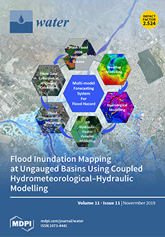
Cover Story (view full-size image): As extreme weather and flash floods increasingly threaten human health and economy, early warning systems are critical for timely preparedness and response. Effective flood warning systems imply multi-model forecasting products that can be exploited even in ungauged catchments, e.g. Xerias, Volos, Greece. Coupling advanced weather models (e.g., WRF-ARW) with hydrological models (e.g., WRF-Hydro) and 2D hydraulic modelling (e.g., HEC-RAS) is a key to simulate the complex hydrometeorological conditions causing flash flooding and to produce flood inundation maps for poorly gauged basins. Supplementing the integrated analysis with historical flood records enables for an empirical validation of the proposed physically-based multi-model system to provide reliable inputs into flood risk management. View this paper.
  • Issues are regarded as officially published after their release is announced to the table of contents alert mailing list.
  • You may sign up for e-mail alerts to receive table of contents of newly released issues.
  • PDF is the official format for papers published in both, html and pdf forms. To view the papers in pdf format, click on the "PDF Full-text" link, and use the free Adobe Reader to open them.
Order results
Result details
Section
Select all
Export citation of selected articles as:
16 pages, 2316 KiB  
Article
How do Interactive Flood Simulation Models Influence Decision-Making? An Observations-Based Evaluation Method
by Johannes G. Leskens, Marcela Brugnach and Arjen Hoekstra
Water 2019, 11(11), 2427; https://doi.org/10.3390/w11112427 - 19 Nov 2019
Cited by 4 | Viewed by 3315
Abstract
Interactive flood simulations models are computer models that are usable for practitioners during work sessions, allowing demand-driven flood simulations together with domain experts. It is assumed among developers of such models that these interactive models better serve decision-making processes, resulting in better informed [...] Read more.
Interactive flood simulations models are computer models that are usable for practitioners during work sessions, allowing demand-driven flood simulations together with domain experts. It is assumed among developers of such models that these interactive models better serve decision-making processes, resulting in better informed decisions about, for example, evacuation and rescue operations. In order to test this assumption, we present a method that uses observations to monitor and evaluate decision-making processes in work sessions where interactive models are applied. We present a theoretical framework as a basis for this method, based on theory of collaborative knowledge construction, and operationalize this into measurable metrics. We demonstrate our method in two cases of flood disaster management and illustrate and discuss the strengths and weaknesses. Full article
Show Figures

Figure 1

16 pages, 5481 KiB  
Article
Experimental Research on the Rotating Stall of a Pump Turbine in Pump Mode
by Peng Xue, Zhiping Liu, Li Lu, Zhongxin Gao and Xiaochao Meng
Water 2019, 11(11), 2426; https://doi.org/10.3390/w11112426 - 19 Nov 2019
Cited by 14 | Viewed by 3263
Abstract
The rotating stall is an unstable flow phenomenon of pump turbines in pump mode, which is of increasing concern to scientists and engineers working on pump turbines. However, at present, various studies are carried out based on CFD (computational fluid dynamics) simulation, while [...] Read more.
The rotating stall is an unstable flow phenomenon of pump turbines in pump mode, which is of increasing concern to scientists and engineers working on pump turbines. However, at present, various studies are carried out based on CFD (computational fluid dynamics) simulation, while directly measured data and experimental research on flow fields are seldom reported. By utilizing PIV (particle image velocimetry) measuring equipment, the flow field within the guide vane zone of a low specific speed pump turbine in pump mode was measured. By measuring and analyzing the transient flow field, the evolutionary process of the rotating stall within the guide vane passages was determined. We found that for all three tested guide vane openings, regardless of whether the positive slope appeared or not, a pre-stall operating point was found for each opening in the process of decreasing the flow rate. The analysis of the loss within the flow field indicated that the dissipation-induced loss increased greatly after the rotating stall appeared. The pump performance curves at the three guide vane openings showed an inflection at the pre-stall point. When the flow rate is larger than that of the pre-stall point, the head of the pump turbine dramatically increases as the flow rate decreases. However, when the flow rate is smaller than the pre-stall point, such increases noticeably slows down. The research results showed that whether the positive slope on the pump performance curve occurred or not, instability caused by the rotating stall should be of great concern. Full article
(This article belongs to the Section Hydraulics and Hydrodynamics)
Show Figures

Figure 1

22 pages, 1375 KiB  
Article
Mobilising Finance for WASH: Getting the Foundations Right
by Lesley Pories, Catarina Fonseca and Victoria Delmon
Water 2019, 11(11), 2425; https://doi.org/10.3390/w11112425 - 19 Nov 2019
Cited by 15 | Viewed by 7489
Abstract
Responding to the substantial finance gap for achieving Sustainable Development Goals 6.1 and 6.2, the water and sanitation sector has mobilized to launch new blended finance vehicles with increasing frequency. The sustainability and scale-up of financial solutions is intended to support increased access [...] Read more.
Responding to the substantial finance gap for achieving Sustainable Development Goals 6.1 and 6.2, the water and sanitation sector has mobilized to launch new blended finance vehicles with increasing frequency. The sustainability and scale-up of financial solutions is intended to support increased access to unserved, marginalized populations. However, without addressing foundational issues in the sector, any finance mechanism, whether public, private or blended, will be a short-term, band-aid solution and the sector will continue the cycle of dependency on external assistance. This paper presents the results of a collaborative effort of Water.org; the IRC water, sanitation and hygiene sector (WASH); and the World Bank Water Global Practice. Drawing from the latest research on effective public financial management and based on evidence from the countries where these organizations work, the paper demonstrates that sustainable success in mobilising finance on a large scale is dependent on a reasonable level of performance across 10 foundational areas. The paper presents evidence on the 10 foundational areas and discusses why other aspects of finance and governance, while necessary, are not sufficient. Better coordination amongst all development partners and governments, including a collective commitment to and prioritization of working on these foundational issues, is a necessary first step. Full article
(This article belongs to the Special Issue Selected Papers from 2019 World Water Week)
Show Figures

Figure 1

21 pages, 3846 KiB  
Article
Conceptual Models and Calibration Performance—Investigating Catchment Bias
by Alexander J. V. Buzacott, Bruce Tran, Floris F. van Ogtrop and R. Willem Vervoort
Water 2019, 11(11), 2424; https://doi.org/10.3390/w11112424 - 19 Nov 2019
Cited by 8 | Viewed by 3125
Abstract
Many lumped rainfall-runoff models are available but no single model can account for the uniqueness and variability of all catchments. While there has been progress in developing frameworks for optimal model selection, the process currently selects a range of model structures a priori [...] Read more.
Many lumped rainfall-runoff models are available but no single model can account for the uniqueness and variability of all catchments. While there has been progress in developing frameworks for optimal model selection, the process currently selects a range of model structures a priori rather than starting from the hydrological data and processes. In addition, studies on differential split sample tests (DSSTs) have focused on objective function definitions and calibration approaches. In this study, seven hydrological signatures and 12 catchment characteristics from 108 catchments around Australia were extracted for two 7-year time periods: (1) wet and (2) dry. The data was modelled using the GR4J, HBV and SIMHYD models using three objective functions to explore the relationship between model performance, catchment features and identified parameters. The hypothesis is that the hydrological signatures and catchment characteristics reflect catchment behaviour, and that certain signatures and characteristics are associated with better calibration performance. The results show that a greater percentage of catchments achieved a better calibration performance in the wet period compared to the dry period and that better calibration performance is associated with catchments that have greater cumulative flow and a steeper flow duration curve. The findings are consistent across the three models and three objective functions, suggesting that there is a bias in the studied models to wetter catchments. This study echoes the need to develop a conceptual model that can accommodate a wide variety of catchments and climates and provides a foundation to optimise and improve model selection in catchments based on their unique characteristics. Full article
(This article belongs to the Section Hydrology)
Show Figures

Figure 1

16 pages, 2060 KiB  
Article
Influence of Eichhornia crassipes (Mart) Solms on a Tropical Microcrustacean Community Based on Taxonomic and Functional Trait Diversity
by Lígia R. Stephan, Beatrix E. Beisner, Samuel G. M. Oliveira and Maria Stela M. Castilho-Noll
Water 2019, 11(11), 2423; https://doi.org/10.3390/w11112423 - 19 Nov 2019
Cited by 7 | Viewed by 2706
Abstract
Macrophytes are important structural attributes of freshwater ponds and wetlands, affecting zooplankton community composition. One of the best-known macrophytes in the world is Eichhornia crassipes, which, due to its high reproductive rate, can quickly occupy large areas of aquatic environments. However, there [...] Read more.
Macrophytes are important structural attributes of freshwater ponds and wetlands, affecting zooplankton community composition. One of the best-known macrophytes in the world is Eichhornia crassipes, which, due to its high reproductive rate, can quickly occupy large areas of aquatic environments. However, there have been few assessments of the direct effect of this macrophyte, in the absence of predators, for tropical zooplankton communities. The aim of this study was to evaluate the influence of E. crassipes on microcrustacean community structure using species and functional diversity, the latter providing an important tool to evaluate the response to changes in resource availability along an environment gradient. We also evaluated which functional traits were favored when the structural niche offered by submerged parts of the macrophytes was present. We conducted a 30 day mesocosm experiment (117 m3) with and without the presence of floating macrophytes (Eichhornia crassipes) inserted along one edge of the mesocosms. Treatment effects on microcrustacean density and community structure using taxonomic and functional classification approaches were assessed. There was a positive association between macrophyte presence and microcrustacean diversity for both diversity types, showing that the presence of macrophytes enhanced the niche availability for the microcrustacean community, likely through changes to resource diversity through habitat structure provision. In the presence of macrophytes, the abundance of species with the following feeding traits increased: burrowing, benthic habitat preference, and herbivore–detritivore and omnivore–carnivore trophic groups. Results showed that the species capable of using the niche offered by submerged macrophyte structures had benthic traits, enabling their co-existence with species possessing primarily pelagic traits. Using a functional approach, our study demonstrated that Eichhornia crassipes can structure microcrustacean communities and promote diversity, likely via increased habitat diversity, which enables the co-existence of species possessing different adaptations to acquiring resources available in the environment. Full article
(This article belongs to the Special Issue Trophic Interactions in Warm Freshwater Ecosystems)
Show Figures

Figure 1

22 pages, 5589 KiB  
Article
New Pond—Indicator Bacteria to Complement Routine Monitoring in a Wet/Dry Tropical Wastewater Stabilization System
by Alea Rose, Anna Padovan, Keith Christian, Mirjam Kaestli, Keith McGuinness, Skefos Tsoukalis and Karen Gibb
Water 2019, 11(11), 2422; https://doi.org/10.3390/w11112422 - 19 Nov 2019
Cited by 2 | Viewed by 3496
Abstract
Bacteria monitoring is a critical part of wastewater management. At tropical wastewater stabilization ponds (WSPs) in north Australia, sanitation is assessed using the standard fecal indicator bacteria (FIB) Escherichia coli and Enterococci. However, these bacteria are poor surrogates for enteric pathogens. A [...] Read more.
Bacteria monitoring is a critical part of wastewater management. At tropical wastewater stabilization ponds (WSPs) in north Australia, sanitation is assessed using the standard fecal indicator bacteria (FIB) Escherichia coli and Enterococci. However, these bacteria are poor surrogates for enteric pathogens. A focus on FIB misses the majority of pond-bacteria and how they respond to the tropical environment. Therefore, we aimed to identify the unknown pond bacteria and indicators that can complement E. coli to improve monitoring. Over two years, we measured the bacterial community in 288 wastewater samples during the wet and dry seasons. The WSP community was spatially and temporally dynamic. Standard pond-water physicochemical measures like conductivity poorly explained these community shifts. Cyanobacteria represented >6% of the WSP bacterial population, regardless of sample timing and location. Fecal bacteria were abundant in the first pond. However, in downstream ponds, these bacteria were less abundant, and instead, environmental taxa were common. For each pond, we identified a bacterial fingerprint that included new candidate bacterial indicators of fecal waste and processes like nitrogen removal. Combining the new indicators with standard FIB monitoring represents a locally relevant approach to wastewater monitoring that facilitates new tests for human fecal pollution within tropical climates. Full article
(This article belongs to the Special Issue Microbial Ecology of Full-Scale Wastewater Treatment Systems)
Show Figures

Figure 1

20 pages, 4613 KiB  
Article
Flood Simulations in Mid-Latitude Agricultural Land Using Regional Current and Future Extreme Weathers
by Nobuaki Kimura, Hirohide Kiri, Sachie Kanada, Iwao Kitagawa, Ikuo Yoshinaga and Hidenori Aiki
Water 2019, 11(11), 2421; https://doi.org/10.3390/w11112421 - 19 Nov 2019
Cited by 4 | Viewed by 3341
Abstract
Recent extreme weather events like the August 2016 flood disaster have significantly affected farmland in mid-latitude regions like the Tokachi River (TR) watershed, the most productive farmland in Japan. The August 2016 flood disaster was caused by multiple typhoons that occurred in the [...] Read more.
Recent extreme weather events like the August 2016 flood disaster have significantly affected farmland in mid-latitude regions like the Tokachi River (TR) watershed, the most productive farmland in Japan. The August 2016 flood disaster was caused by multiple typhoons that occurred in the span of two weeks and dealt catastrophic damage to agricultural land. This disaster was the focus of our flood model simulations. For the hydrological model input, the rainfall data with 0.04° grid space and an hourly interval were provided by a regional climate model (RCM) during the period of multiple typhoon occurrences. The high-resolution data can take account of the geographic effects, hardly reproduced by ordinary RCMs. The rainfall data drove a conceptual, distributed rainfall–runoff model, embedded in the integrated flood analysis system. The rainfall–runoff model provided discharges along rivers over the TR watershed. The RCM also provided future rainfall data with pseudo-global warming climate, assuming that the August 2016 disaster could reoccur again in the late 21st century. The future rainfall data were used to conduct a future flood simulation. With bias corrections, current and future flood simulations showed the potential inundated areas along riverbanks based on flood risk levels. The crop field-based agricultural losses in both simulations were estimated. The future cost may be two to three times higher as indicated by slightly higher simulated future discharge peaks in tributaries. Full article
(This article belongs to the Special Issue Influence of Climate Change on Floods)
Show Figures

Figure 1

12 pages, 2003 KiB  
Article
Untargeted Metabolite Profiling for Screening Bioactive Compounds in Digestate of Manure under Anaerobic Digestion
by Jiaxin Lu, Atif Muhmood, Wojciech Czekała, Jakub Mazurkiewicz, Jacek Dach and Renjie Dong
Water 2019, 11(11), 2420; https://doi.org/10.3390/w11112420 - 19 Nov 2019
Cited by 18 | Viewed by 4288
Abstract
Untargeted metabolite profiling was performed on chicken manure (CHM), swine manure (SM), cattle manure (CM), and their respective digestate by XCMS coupled with MetaboAnalyst programs. Through global chemical profiling, the chemical characteristics of different digestates and types of manure were displayed during the [...] Read more.
Untargeted metabolite profiling was performed on chicken manure (CHM), swine manure (SM), cattle manure (CM), and their respective digestate by XCMS coupled with MetaboAnalyst programs. Through global chemical profiling, the chemical characteristics of different digestates and types of manure were displayed during the anaerobic digestion (AD) process. As the feed for AD, CM had less easily-degradable organics, SM contained the least O-alkyls and anomerics of carbohydrates, and CHM exhibited relatively lower bio-stability. The derived metabolite pathways of different manure during the AD process were identified by MetaboAnalyst. Twelve, 8, and 5 metabolic pathways were affected by the AD process in CHM, SM, and CM, respectively. Furthermore, bioactive compounds of digestate were detected, such as amino acids (L-arginine, L-ornithine, L-cysteine, and L-aspartate), hormones (L-adrenaline, 19-hydroxy androstenedione, and estrone), alkaloids (tryptamine and N-methyltyramine), and vitamin B5, in different types of manure and their digestates. The combination of XCMS and MetaboAnalyst programs can be an effective strategy for metabolite profiling of manure and its anaerobic digestate under different situations. Full article
(This article belongs to the Section Wastewater Treatment and Reuse)
Show Figures

Graphical abstract

1 pages, 146 KiB  
Correction
Correction: Zhu, S., et al. A New Digital Lake Bathymetry Model Using the Step-Wise Water Recession Method to Generate 3D Lake Bathymetric Maps Based on DEMs. Water 2019, 11, 1151
by Siyu Zhu, Baojian Liu, Wei Wan, Hongjie Xie, Yu Fang, Xi Chen, Huan Li, Weizhen Fang, Guoqing Zhang, Mingwei Tao and Yang Hong
Water 2019, 11(11), 2419; https://doi.org/10.3390/w11112419 - 19 Nov 2019
Viewed by 1905
Abstract
In the published article [1], the authors realized some errors in the affiliation and email address of Yang Hong, and thus wish to make the following revisions: Add the Affiliation 5 “School of Civil Engineering and Environmental Science, University of Oklahoma, Norman, OK [...] Read more.
In the published article [1], the authors realized some errors in the affiliation and email address of Yang Hong, and thus wish to make the following revisions: Add the Affiliation 5 “School of Civil Engineering and Environmental Science, University of Oklahoma, Norman, OK 73019, USA” for Yang Hong Change the email address of Yang Hong to yanghong@ou [...] Full article
14 pages, 4744 KiB  
Article
Characteristics of Water Isotopes and Water Source Identification During the Wet Season in Naqu River Basin, Qinghai–Tibet Plateau
by Xi Chen, Guoli Wang, Fuqiang Wang, Denghua Yan and Heng Zhao
Water 2019, 11(11), 2418; https://doi.org/10.3390/w11112418 - 18 Nov 2019
Cited by 6 | Viewed by 3074
Abstract
Climate change is affecting the discharge of headstreams from mountainous areas on the Qinghai–Tibet Plateau. To constrain future changes in discharge, it is important to understand the present-day formation mechanism and components of runoff in the basin. Here we explore the sources of [...] Read more.
Climate change is affecting the discharge of headstreams from mountainous areas on the Qinghai–Tibet Plateau. To constrain future changes in discharge, it is important to understand the present-day formation mechanism and components of runoff in the basin. Here we explore the sources of runoff and spatial variations in discharge through measurements of δ2H and δ18O in the Naqu River, at the source of the Nu River, on the Qinghai–Tibet plateau, during the month of August from 2016 to 2018. We established thirteen sampling sites on the main stream and tributaries, and collected 39 samples from the river. We examined all the water samples and analyzed them for isotopes. We find a significant spatial variation trend based on one-way analysis of variance (ANOVA) (p < 0.05) between Main stream-2 and tributaries. The local meteoric water-line (LMWL) can be described as: δ2H = 7.9δ18O + 6.29. Isotopic evaporative fractionation in water and mixing of different water sources are responsible for the spatial difference in isotopic values between Main stream-2 and tributaries. Based on isotopic hydrograph separation, the proportion of snowmelt in runoff components ranges from 15% to 47%, and the proportion of rainwater ranges from 3% to 35%. Thus, the main components of runoff in the Naqu River are snowmelt and groundwater. Full article
(This article belongs to the Special Issue Use of Water Stable Isotopes in Hydrological Process)
Show Figures

Figure 1

22 pages, 7684 KiB  
Article
Parameter Uncertainty of a Snowmelt Runoff Model and Its Impact on Future Projections of Snowmelt Runoff in a Data-Scarce Deglaciating River Basin
by Yiheng Xiang, Lu Li, Jie Chen, Chong-Yu Xu, Jun Xia, Hua Chen and Jie Liu
Water 2019, 11(11), 2417; https://doi.org/10.3390/w11112417 - 18 Nov 2019
Cited by 11 | Viewed by 3685
Abstract
The impacts of climate change on water resources in snow- and glacier-dominated basins are of great importance for water resource management. The Snowmelt Runoff Model (SRM) was developed to simulate and predict daily streamflow for high mountain basins where snowmelt runoff is a [...] Read more.
The impacts of climate change on water resources in snow- and glacier-dominated basins are of great importance for water resource management. The Snowmelt Runoff Model (SRM) was developed to simulate and predict daily streamflow for high mountain basins where snowmelt runoff is a major contributor. However, there are many sources of uncertainty when using an SRM for hydrological simulations, such as low-quality input data, imperfect model structure and model parameters, and uncertainty from climate scenarios. Among these, the identification of model parameters is considered to be one of the major sources of uncertainty. This study evaluates the parameter uncertainty for SRM simulation based on different calibration strategies, as well as its impact on future hydrological projections in a data-scarce deglaciating river basin. The generalized likelihood uncertainty estimation (GLUE) method implemented by Monte Carlo sampling was used to estimate the model uncertainty arising from parameters calibrated by means of different strategies. Future snowmelt runoff projections under climate change impacts in the middle of the century and their uncertainty were assessed using average annual hydrographs, annual discharge and flow duration curves as the evaluation criteria. The results show that: (1) the strategy with a division of one or two sub-period(s) in a hydrological year is more appropriate for SRM calibration, and is also more rational for hydrological climate change impact assessment; (2) the multi-year calibration strategy is also more stable; and (3) the future runoff projection contains a large amount of uncertainty, among which parameter uncertainty plays a significant role. The projections also indicate that the onset of snowmelt runoff is likely to shift earlier in the year, and the discharge over the snowmelt season is projected to increase. Overall, this study emphasizes the importance of considering the parameter uncertainty of time-varying hydrological processes in hydrological modelling and climate change impact assessment. Full article
(This article belongs to the Special Issue Advances in Hydrologic Forecasts and Water Resources Management )
Show Figures

Graphical abstract

14 pages, 4675 KiB  
Article
Does Crop Rotation Enhance Groundwater Health? A Review of the Winter Wheat Fallow Policy in the North China Plain
by Ming Lei, Yuqian Zhang, Yuxuan Dang, Xiangbin Kong and Jingtao Yao
Water 2019, 11(11), 2416; https://doi.org/10.3390/w11112416 - 18 Nov 2019
Cited by 4 | Viewed by 2827
Abstract
Agricultural water management is a vital component of realizing the United Nation’s Sustainable Development Goals because of water shortages worldwide leading to a severe threat to ecological environments and global food security. As an agro-intensified irrigation area, the North China Plain (NCP) is [...] Read more.
Agricultural water management is a vital component of realizing the United Nation’s Sustainable Development Goals because of water shortages worldwide leading to a severe threat to ecological environments and global food security. As an agro-intensified irrigation area, the North China Plain (NCP) is the most important grain basket in China, which produces 30%–40% of the maize and 60%–80% of the wheat for China. However, this area has already been one of the largest groundwater funnels in the world due to long-term over-exploitation of groundwater. Due to the low precipitation during the growing period, winter wheat requires a large amount of groundwater to be pumped for irrigation, which consumes 70% of the groundwater irrigation. To alleviate the overexploitation of groundwater, the Chinese government implemented the Winter Wheat Fallow Policy (WWFP) in 2014. The evaluation and summarization of the WWFP will be beneficial for improving the groundwater overexploitation areas under high-intensity irrigation over all the world. So far, there have been few attempts at estimating the effectiveness of this policy. To fill this gap, we assessed the planting area of field crops and calculated the evapotranspiration of crops based on remote-sensed and meteorological data in the key area—Hengshui. We compared the agricultural water consumption before and after the implementation of this policy, and we analyzed the relationship between changes in crop planting structure and groundwater variations based on geographically weighted regression. Our results showed the overall classification accuracies for 2013 and 2015 were 85.56% and 82.22%, respectively. The planting area of winter wheat, as the most reduced crop, decreased from 35.71% (314,053 ha) in 2013 to 32.98% (289,986 ha) in 2015. The actual reduction in area of winter wheat reached 84% of the target (26 thousand ha) of the WWFP. The water consumption of major crops decreased from 2.98 billion m3 of water in 2013 to 2.83 billion m3 in 2015, a total reduction of 146 million m3, and 88.43% of reduced target of the WWFP (166 million m3). The planting changes of winter wheat did not directly affect the change of shallow groundwater level, but ET was positively related to shallow groundwater level and precipitation was negatively related to shallow groundwater levels. This study can provide a basis for the WWFP’s improvement and the development of sustainable agriculture in high-intensity irrigation areas. Full article
(This article belongs to the Section Hydrology)
Show Figures

Figure 1

18 pages, 7280 KiB  
Article
An Intermittent Karst River: The Case of the Čikola River (Dinaric Karst, Croatia)
by Ognjen Bonacci, Josip Terzić, Tanja Roje-Bonacci and Tihomir Frangen
Water 2019, 11(11), 2415; https://doi.org/10.3390/w11112415 - 17 Nov 2019
Cited by 12 | Viewed by 4403
Abstract
Intermittent and ephemeral streams (IRES) are responsible for transporting about half of the water on Earth’s surface. Their hydrological behavior is different in various landscapes. IRES are found more often in karst terrains than in any other regions, as a consequence of strong [...] Read more.
Intermittent and ephemeral streams (IRES) are responsible for transporting about half of the water on Earth’s surface. Their hydrological behavior is different in various landscapes. IRES are found more often in karst terrains than in any other regions, as a consequence of strong and direct interaction between groundwater and surface water. This paper presents a hydrogeological and hydrological analysis of the intermittent Čikola River and Spring catchment, which is located in deeply karstified and developed parts of the Dinaric karst in Croatia. Hydrological calculations determined that the catchment area covers approximately 300 km2 and very probably changes in accordance with rapid variations in groundwater level. The karst spring of the Čikola River is a cave, extracted for a public water supply with four drilled extraction wells. The results of the interrelated hydrological and hydrogeological analysis show interesting phenomena from an intermittent karst spring (cave) and its catchment, flowing downstream through a karst polje with several smaller confluences, then entering a karst canyon (where the river sinks during certain periods), and ending in an estuary before contributing to the larger Krka River. The research presented was based on water balance calculations, climatic and hydrological time series analyses, spring pumping tests, and thorough hydrogeological interpretation. Full article
(This article belongs to the Section Hydrology)
Show Figures

Figure 1

15 pages, 4341 KiB  
Article
The Analysis on Similarity of Spectrum Analysis of Landslide and Bareland through Hyper-Spectrum Image Bands
by Shiuan Wan, Tsu Chiang Lei, Hong Lin Ma and Ru Wen Cheng
Water 2019, 11(11), 2414; https://doi.org/10.3390/w11112414 - 17 Nov 2019
Cited by 5 | Viewed by 3088
Abstract
Landslides of Taiwan occur frequently in high mountain areas. Soil disturbance causes by the earthquake and heavy rainfall of the typhoon seasons often produced the earth and rock to landslide in the upper reaches of the catchment area. Therefore, the landslide near the [...] Read more.
Landslides of Taiwan occur frequently in high mountain areas. Soil disturbance causes by the earthquake and heavy rainfall of the typhoon seasons often produced the earth and rock to landslide in the upper reaches of the catchment area. Therefore, the landslide near the hillside has an influence on the catchment area. The hyperspectral images are effectively used to monitor the landslide area with the spectral analysis. However, it is rarely studied how to interpret it in the image of the landslide. If there are no elevation data on the slope disaster, it is quite difficult to identify the landslide zone and the bareland area. More specifically, this study used a series of spectrum analysis to identify the difference between them. Therefore, this study conducted a spectrum analysis for the classification of the landslide, bareland, and vegetation area in the mountain area of NanXi District, Tainan City. On the other hand, this study used the following parallel study on Support Vector Machine (SVM) for error matrix and thematic map for comparison. The study simultaneously compared the differences between them. The spectral similarity analysis reaches 85% for testing data, and the SVM approach has 98.3%. Full article
(This article belongs to the Special Issue Soil–Water Conservation, Erosion, and Landslide)
Show Figures

Figure 1

18 pages, 1277 KiB  
Article
Evaluating the Effect of Farmers’ Participation in Irrigation Management on Farm Productivity and Profitability in the Mubuku Irrigation Scheme, Uganda
by Éva Pék, Imre Fertő and Mohannad Alobid
Water 2019, 11(11), 2413; https://doi.org/10.3390/w11112413 - 17 Nov 2019
Cited by 3 | Viewed by 8631
Abstract
Irrigation remains a critical input into farming and, therefore, it remains a proxy for food security and poverty alleviation in developing countries. Despite their role in economic growth and the received investment, irrigation schemes are still underperforming. Among many irrigation schemes, transferring more [...] Read more.
Irrigation remains a critical input into farming and, therefore, it remains a proxy for food security and poverty alleviation in developing countries. Despite their role in economic growth and the received investment, irrigation schemes are still underperforming. Among many irrigation schemes, transferring more management responsibilities to farmers proved to be a viable path toward improving performance. However, the large diversity of implementation strategies makes evaluation difficult, while its well-demonstrated benefits have paramount importance to convince reluctant smallholders to take additional roles. In order to address this gap, we analyze the effects of participation on farming outcomes (yield, revenue, net profit) by estimating the treatment effect. We present the case study of a Mubuku small-scale irrigation scheme, Uganda. We provide a framework to construct the Farmers Participation Index while distinguishing farmers into participating and not participating groups. The effects of participation are investigated through econometric methods including nonparametric and semiparametric estimation methods such as a difference in means, a regression adjustment, propensity score matching, and entropy balancing. The analysis reveals a positive and significant treatment effect of participation on farming outcomes. The obtained results endorse the efforts of governmental programs to foster responsibility transfer and the farmers’ role in irrigation management. A strong causal relationship between management and profitability provides incentives for farmers to engage in participation. Full article
(This article belongs to the Section Water Resources Management, Policy and Governance)
Show Figures

Figure 1

12 pages, 3627 KiB  
Article
Response of Submerged Aquatic Vegetation to Water Depth in a Large Shallow Lake after an Extreme Rainfall Event
by Jinge Zhu, Jiancai Deng, Yihui Zhang, Zhaoliang Peng and Weiping Hu
Water 2019, 11(11), 2412; https://doi.org/10.3390/w11112412 - 17 Nov 2019
Cited by 7 | Viewed by 2999
Abstract
Submerged aquatic vegetation (SAV) is an important part of lake ecosystems, and a proper SAV community structure is the key factor in keeping a clear-water state. Although the response of SAV to water depth has been widely studied in different aquatic environments, little [...] Read more.
Submerged aquatic vegetation (SAV) is an important part of lake ecosystems, and a proper SAV community structure is the key factor in keeping a clear-water state. Although the response of SAV to water depth has been widely studied in different aquatic environments, little is known about the response of the SAV community to changes in water depth of a large lake after an extreme rainfall event. To examine this question, 780 samples were collected from Lake Taihu, China, between 2013 and 2017 to analyze the variations in SAV and water depth. The water level of the lake ranged from 2.75 to 4.87 m, and the water depth at sampling sites ranged from 1.07 to 3.31 m. The SAV biomass at the sampling sites ranged from 0 to 17.61 kg/m2. The influence of water depth on SAV biomass and frequency of occurrence differed by seasons and by species. The adaptation of SAV species to increasing water depth is a key element for community dynamics, which in turn contributes to water level regulation. A new method was proposed to identify the optimal water depth for SAV biomass accumulation based on calculation of the cumulative probability and probability density. Full article
(This article belongs to the Section Water Quality and Contamination)
Show Figures

Figure 1

26 pages, 8858 KiB  
Article
Long-Term Variation of Runoff Coefficient during Dry and Wet Seasons Due to Climate Change
by Doan Thi Thu Ha, Mona Ghafouri-Azar and Deg-Hyo Bae
Water 2019, 11(11), 2411; https://doi.org/10.3390/w11112411 - 17 Nov 2019
Cited by 5 | Viewed by 5206
Abstract
This study investigates the future long-term variation of the runoff coefficient during dry and wet seasons in five major basins in South Korea. The variation is estimated from the Soil and Water Assessment Tool (SWAT) model outputs based on an ensemble of 13 [...] Read more.
This study investigates the future long-term variation of the runoff coefficient during dry and wet seasons in five major basins in South Korea. The variation is estimated from the Soil and Water Assessment Tool (SWAT) model outputs based on an ensemble of 13 different Coupled Model Intercomparison Project Phase 5 (CMIP5) general circulation models (GCMs) in representative concentration pathway (RCP) 4.5 and RCP 8.5 scenarios. The estimates show a temporal non-considerable increase rate of the runoff coefficient during the 21st century in both RCPs, in which the trend and uncertainty of the runoff coefficient in the dry season is projected as higher than that in the wet season. A sharp contrast between the trends of the two components of the runoff coefficient is found during the dry and wet seasons. Over the five major basins, a higher increase rate of runoff coefficient is projected in the northeastern part of the Han River basin and most of the area of the Nakdong River basin. The spatial variation in the runoff coefficient change also represents a relationship with the change in the percentage of each land cover/land use type over 109 subbasins, where the correlation of the wet-season runoff coefficient is calculated as higher than that of the dry season. This relationship is expected to vary with changes in temperature and precipitation during both seasons in three future periods. Full article
(This article belongs to the Special Issue Evaluating Hydrological Responses to Climate Change)
Show Figures

Graphical abstract

31 pages, 879 KiB  
Article
Identifying and Overcoming Barriers to Collaborative Sustainable Water Governance in Remote Australian Indigenous Communities
by Melissa Jackson, Rodney A. Stewart and Cara D. Beal
Water 2019, 11(11), 2410; https://doi.org/10.3390/w11112410 - 17 Nov 2019
Cited by 18 | Viewed by 8518
Abstract
Collaboration between government agencies and communities for sustainable water governance in remote Indigenous communities is espoused as a means to contribute to more equitable, robust, and long-term decision-making and to ensure that water services contribute to broader considerations of physical, social, and economic [...] Read more.
Collaboration between government agencies and communities for sustainable water governance in remote Indigenous communities is espoused as a means to contribute to more equitable, robust, and long-term decision-making and to ensure that water services contribute to broader considerations of physical, social, and economic prosperity. In Australia, the uptake of collaborative water governance in remote Aboriginal and Torres Strait Island contexts has been slow and few examples exist from which to inform policy and practice. This study identifies barriers to uptake of collaborative sustainable water governance, drawing from qualitative interviews with water practitioners working in remote Indigenous Australia and analysis of key project documentation. Thematic analysis revealed discrete barriers across five key categories: (1) governance arrangements, (2) economic and financial, (3) capacity and skills, (4) data and information, and (5) cultural values and norms, with many barriers identified, unique to the remote Indigenous Australian context. The paper provides insights into how to address these barriers strategically to create transformative and sustainable change for Indigenous communities. The results contribute to the greater body of knowledge on sustainable and collaborative water governance, and they are of relevance for broader water management, policy, and research. Full article
Show Figures

Graphical abstract

14 pages, 6815 KiB  
Article
Geomorphological Signature of Late Pleistocene Sea Level Oscillations in Torre Guaceto Marine Protected Area (Adriatic Sea, SE Italy)
by Francesco De Giosa, Giovanni Scardino, Matteo Vacchi, Arcangelo Piscitelli, Maurilio Milella, Alessandro Ciccolella and Giuseppe Mastronuzzi
Water 2019, 11(11), 2409; https://doi.org/10.3390/w11112409 - 16 Nov 2019
Cited by 19 | Viewed by 3500
Abstract
Morphostratigraphy is a useful tool to reconstruct the sequence of processes responsible for shaping the landscape. In marine and coastal areas, where landforms are only seldom directly recognizable given the difficulty to have eyewitness of sea-floor features, it is possible to correlate geomorphological [...] Read more.
Morphostratigraphy is a useful tool to reconstruct the sequence of processes responsible for shaping the landscape. In marine and coastal areas, where landforms are only seldom directly recognizable given the difficulty to have eyewitness of sea-floor features, it is possible to correlate geomorphological data derived from indirect surveys (marine geophysics and remote sensing) with data obtained from direct ones performed on-land or by scuba divers. In this paper, remote sensing techniques and spectral images allowed high-resolution reconstruction of both morpho-topography and morpho-bathymetry of the Torre Guaceto Marine Protected Area (Italy). These data were used to infer the sequence of climatic phases and processes responsible for coastal and marine landscape shaping. Our data show a number of relict submerged surfaces corresponding to distinct phases of erosional/depositional processes triggered by the late-Quaternary interglacial–glacial cycles. In particular, we observed the presence of submerged marine terraces, likely formed during MIS 5–MIS 3 relative highstand phases. These geomorphic features, found at depths of ~26–30, ~34–38, and ~45–56 m, represent important evidence of past sea-level variations. Full article
(This article belongs to the Special Issue Landscapes and Landforms of Terrestrial and Marine Areas)
Show Figures

Figure 1

22 pages, 3176 KiB  
Article
Mainstreaming Gender into Irrigation: Experiences from Pakistan
by Junaid Alam Memon, Bethany Cooper and Sarah Wheeler
Water 2019, 11(11), 2408; https://doi.org/10.3390/w11112408 - 16 Nov 2019
Cited by 7 | Viewed by 7768
Abstract
The influence of gender in participatory irrigation management reforms has been the subject of significant research in the past. Whilst there is some understanding of what hinders women and marginalized groups from participating in irrigation management, there is limited understanding of how male [...] Read more.
The influence of gender in participatory irrigation management reforms has been the subject of significant research in the past. Whilst there is some understanding of what hinders women and marginalized groups from participating in irrigation management, there is limited understanding of how male and female farmers vary in their perceptions on the effectiveness of participation in irrigation affairs. There is also limited understanding around the interaction on gender and the overall success of participatory irrigation management programs. Based on the information obtained from 128 households surveyed through separate male and female questionnaires in Pakistan in 2018 (Sindh and Punjab provinces), we studied the country’s experience in engaging gender into its participatory irrigation management program. We found there was a significant difference in participatory irrigation management perceptions across both gender and locational jurisdiction. Overall, women generally perceive the performance and impact of farmer organizations to be significantly less effective than men. Our study emphasizes the importance of putting findings in a historical context to inform the theory, policy, and practice of mainstreaming gender into irrigation management. Full article
Show Figures

Figure 1

18 pages, 6313 KiB  
Article
Precipitation Trends and Alteration in Wei River Basin: Implication for Water Resources Management in the Transitional Zone between Plain and Loess Plateau, China
by Ci Li, Hongbo Zhang, Xinghui Gong, Xiaowei Wei and Jiantao Yang
Water 2019, 11(11), 2407; https://doi.org/10.3390/w11112407 - 16 Nov 2019
Cited by 8 | Viewed by 2651
Abstract
Precipitation plays a critical role in water resources management, and trend changes and alterations thereof are crucial to regional or basin water security, disaster prevention, and ecological restoration under a changing environment. In order to explore the implications of precipitation variation for water [...] Read more.
Precipitation plays a critical role in water resources management, and trend changes and alterations thereof are crucial to regional or basin water security, disaster prevention, and ecological restoration under a changing environment. In order to explore the implications of precipitation variation for water resources management, taking the Wei River Basin (a transitional zone between the Guanzhong Plain and Loess Plateau) as an example, this paper proposes an index system, namely the index of precipitation alteration (IPA), to evaluate changes in precipitation and investigate their potential influence on water resources management. The system includes 17 indicators gained from observed daily rainfall, involving some structural precipitation indicators describing the precipitation patterns and some functional precipitation indicators influencing utilization of watershed water resources. Non-parametric Mann-Kendall (MK) statistical test is employed to identify the IPA trend change, and range of variability approach is used to evaluate the variation of IPA. The analysis results in Wei River Basin show that IPA varies with different spatial and temporal distributions. Overall, although the annual total precipitation declined in the study area, the frequency of extreme events was increased during 1955–2012. In the face of severe climate change patterns, it is necessary to establish the precipitation index to evaluate the change of precipitation and to provide useful information for future precipitation assessments. Full article
(This article belongs to the Section Water Resources Management, Policy and Governance)
Show Figures

Figure 1

19 pages, 3207 KiB  
Article
Equivalent Discharge Coefficient of Side Weirs in Circular Channel—A Lazy Machine Learning Approach
by Francesco Granata, Fabio Di Nunno, Rudy Gargano and Giovanni de Marinis
Water 2019, 11(11), 2406; https://doi.org/10.3390/w11112406 - 16 Nov 2019
Cited by 18 | Viewed by 3187
Abstract
Side weirs have been widely used since ancient times in many hydraulic works. Their operation can be analyzed following different approaches. However, almost all possible analysis approaches require knowledge of the discharge coefficient, which depends on several geometric and hydraulic parameters. An effective [...] Read more.
Side weirs have been widely used since ancient times in many hydraulic works. Their operation can be analyzed following different approaches. However, almost all possible analysis approaches require knowledge of the discharge coefficient, which depends on several geometric and hydraulic parameters. An effective methodology for predicting discharge coefficient can be based on machine learning algorithms. In this research, experimental data obtained from tests carried out on a side weir in a circular channel and supercritical flow have been used to build predictive models of the equivalent discharge coefficient, by which the lateral outflow can be estimated by referring only to the flow depth upstream of the side weir. Four models, different in the input variables, have been developed. Each model has been proposed in 5 variants, depending on the applied algorithm. The focus is mainly on two lazy machine learning algorithms: k Nearest Neighbor and K-Star. The 5-input variables Model 1 and the 4-input variables Model 2 noticeably outperform the 3-input variables Model 3 and Model 4, showing that a suitable characterization of the side weir geometry is essential for a good accuracy of the prediction model. In addition, under models 1 and 2, k Nearest Neighbor and K-Star, despite the simpler structure, provide comparable or better performance than more complex algorithms such as Random Forest and Support Vector Regression. Full article
(This article belongs to the Section Hydraulics and Hydrodynamics)
Show Figures

Graphical abstract

21 pages, 6247 KiB  
Technical Note
Investigation of Sediment-Rich Glacial Meltwater Plumes Using a High-Resolution Multispectral Sensor Mounted on an Unmanned Aerial Vehicle
by Kornelia Anna Wójcik, Robert Józef Bialik, Maria Osińska and Marek Figielski
Water 2019, 11(11), 2405; https://doi.org/10.3390/w11112405 - 16 Nov 2019
Cited by 21 | Viewed by 4397
Abstract
A Parrot Sequoia+ multispectral camera on a Parrot Bluegrass drone registered in four spectral bands (green, red, red edge (RE), and near-infrared (NIR)) to identify glacial outflow zones and determined the meltwater turbidity values in waters in front of the following Antarctic glaciers: [...] Read more.
A Parrot Sequoia+ multispectral camera on a Parrot Bluegrass drone registered in four spectral bands (green, red, red edge (RE), and near-infrared (NIR)) to identify glacial outflow zones and determined the meltwater turbidity values in waters in front of the following Antarctic glaciers: Ecology, Dera Icefall, Zalewski, and Krak on King George Island, Southern Shetlands was used. This process was supported by a Red-Green-Blue (RGB) colour model from a Zenmuse X5 camera on an Inspire 2 quadcopter drone. Additional surface water turbidity measurements were carried out using a Yellow Springs Instruments (YSI) sonde EXO2. From this research, it was apparent that for mapping low-turbidity and medium-turbidity waters (<70 formazinenephelometricunits (FNU)), a red spectral band should be used, since it is insensitive to possible surface ice phenomena and registers the presence of both red and white sediments. High-turbidity plumes with elevated FNU values should be identified through the NIR band. Strong correlation coefficients between the reflectance at particular bands and FNU readings (RGreen = 0.85, RRed = 0.85, REdge = 0.84, and RNIR = 0.83) are shown that multispectral mapping using Unmanned Aerial Vehicles (UAVs) can be successfully usedeven in the unfavourable weather conditions and harsh climate of Antarctica. Lastly, the movement of water masses in Admiralty Bay is briefly discussed and supported by the results from EXO2 measurements. Full article
(This article belongs to the Special Issue Applications of Remote Sensing to Marine Fisheries and Oceanography)
Show Figures

Figure 1

12 pages, 1562 KiB  
Article
Testing an Analytical Model for Predicting Subsurface LNAPL Distributions from Current and Historic Fluid Levels in Monitoring Wells: A Preliminary Test Considering Hysteresis
by Robert James Lenhard, John L. Rayner and J. García-Rincón
Water 2019, 11(11), 2404; https://doi.org/10.3390/w11112404 - 15 Nov 2019
Cited by 5 | Viewed by 2329
Abstract
Knowledge of subsurface light nonaqueous phase liquid (LNAPL) saturation is important for developing a conceptual model and a plan for addressing LNAPL contaminated sites. Investigators commonly predict LNAPL mobility and potential recoverability using information such as LNAPL physical properties, subsurface characteristics, and LNAPL [...] Read more.
Knowledge of subsurface light nonaqueous phase liquid (LNAPL) saturation is important for developing a conceptual model and a plan for addressing LNAPL contaminated sites. Investigators commonly predict LNAPL mobility and potential recoverability using information such as LNAPL physical properties, subsurface characteristics, and LNAPL saturations. Several models exist that estimate the LNAPL specific volume and transmissivity from fluid levels in monitoring wells. Commonly, investigators use main drainage capillary pressure–saturation relations because they are more frequently measured and available in the literature. However, main drainage capillary pressure–saturation relations may not reflect field conditions due to capillary pressure–saturation hysteresis. In this paper, we conduct a preliminary test of a recent analytical model that predicts subsurface LNAPL saturations, specific volume, and transmissivity against data measured at a LNAPL contaminated site. We call our test preliminary because we compare only measured and predicted vertical LNAPL saturations at a single site. Our results show there is better agreement between measured and predicted LNAPL saturations when imbibition capillary pressure–saturation relations are employed versus main drainage capillary pressure–saturation relations. Although further testing of the model for different conditions and sites is warranted, the preliminary test of the model was positive when consideration was given to capillary pressure–saturation hysteresis, which suggests the model can yield reasonable predictions that can help develop and update conceptual site models for addressing subsurface LNAPL contamination. Parameters describing capillary pressure–saturation relations need to reflect conditions existing at the time when the fluid levels in a well are measured. Full article
(This article belongs to the Special Issue Subsurface Multiphase Flow and Contamination Remediation)
Show Figures

Figure 1

15 pages, 4346 KiB  
Article
Assessment of Water Supply Stability for Drought-Vulnerable Boryeong Multipurpose Dam in South Korea Using Future Dry Climate Change Scenarios
by Wonjin Kim, Jiwan Lee, Jinuk Kim and Seongjoon Kim
Water 2019, 11(11), 2403; https://doi.org/10.3390/w11112403 - 15 Nov 2019
Cited by 11 | Viewed by 3700
Abstract
This study assessed the water supply stability for Boryeong multipurpose dam by applying future dry climate change scenarios and Soil and Water Assessment Tool (SWAT). CMCC-CM, INM-CM4, and IPSL-CM5A-MR RCP 4.5 and 8.5 scenarios were selected as the future dry conditions using Runs [...] Read more.
This study assessed the water supply stability for Boryeong multipurpose dam by applying future dry climate change scenarios and Soil and Water Assessment Tool (SWAT). CMCC-CM, INM-CM4, and IPSL-CM5A-MR RCP 4.5 and 8.5 scenarios were selected as the future dry conditions using Runs theory and Standardized Precipitation Index (SPI). For historical (1980–1999), present (2000–2019), and future periods (2030s, 2050s, 2070s, and 2090s) of the 6 scenarios, SWAT model was used to simulate the future dam water supply stability. The stability was evaluated in terms of reliability (RT), resilience (RS), and vulnerability (V) based on the monthly target storage. The results showed that the future RT can be decreased to 0.803 in 2050s IPSL-CM5A-MR RCP 8.5 scenario from present 0.955. The future RS and V showed the minimum value of 0.003 and the biggest value of 3567.6 × 106 m3 in 2070s IPSL-CM5A-MR RCP 4.5 scenario. The future RT, RS, and V showed that the dam has low resilience and is vulnerable to future drought scenarios. Full article
Show Figures

Figure 1

20 pages, 3231 KiB  
Article
Hydraulic Responses and Flow Regulation in Multi-Demand Water Transfer Systems
by Xiaolian Liu, Yu Tian, Xiaohui Lei, Honggang Fan and Hao Wang
Water 2019, 11(11), 2402; https://doi.org/10.3390/w11112402 - 15 Nov 2019
Cited by 1 | Viewed by 2528
Abstract
It is of great significance for the practical operation scheduling to comprehensively analyze the influencing factors of the long-term steady-state operation state of different water demand scenarios and the coupled operation of hydraulic facilities when switching demand scenario as the demand changes. In [...] Read more.
It is of great significance for the practical operation scheduling to comprehensively analyze the influencing factors of the long-term steady-state operation state of different water demand scenarios and the coupled operation of hydraulic facilities when switching demand scenario as the demand changes. In the study, a case study is performed in the Daxing Branch project, the numerical model of which considered pipelines, pumps, valves, air valves, and regulating tanks is established using Method of Characteristics. The hydraulic responses and corresponding flow regulation of different demand scenarios and between changing demand scenarios are analyzed. The results show that steady-state working conditions can have important impacts on the transient process. Energy consumption and the amount of water transfer, as well as water hammer pressure and the allowable reaction time during the transient process should be taken into account in the selection of long-term steady-state working conditions of different demand scenarios. The sequence and maximum allowable time interval of the coupled operation of pumps and valves should be considered when switching demand scenario. Finally, the optimal steady-state working conditions of different demand scenarios, the coupled operation sequence of pumps and valves, the maximum allowable time interval of the Daxing Branch project are proposed, which can provide some insights into the safe operation of the project and other similar complex water transfer projects. Full article
(This article belongs to the Section Hydraulics and Hydrodynamics)
Show Figures

Figure 1

15 pages, 3789 KiB  
Article
Competitive Relationship between Flood Control and Power Generation with Flood Season Division: A Case Study in Downstream Jinsha River Cascade Reservoirs
by Hongyi Yao, Zengchuan Dong, Wenhao Jia, Xiaokuan Ni, Mufeng Chen, Cailin Zhu and Dayong Li
Water 2019, 11(11), 2401; https://doi.org/10.3390/w11112401 - 15 Nov 2019
Cited by 7 | Viewed by 2929
Abstract
The lower reaches of Jinsha River host the richest hydropower energy sources in China. With the construction of Wudongde and Baihetan, the multi-objective optimization for cascade reservoirs (along with Xiluodu and Xiangjia Dam) in the lower reaches of Jinsha River will create significant [...] Read more.
The lower reaches of Jinsha River host the richest hydropower energy sources in China. With the construction of Wudongde and Baihetan, the multi-objective optimization for cascade reservoirs (along with Xiluodu and Xiangjia Dam) in the lower reaches of Jinsha River will create significant benefits. This paper focuses on the competitive relationship between flood control and power generation, and attaches attention to the measurement of different objective functions and their competitive relationship. With observations of the flood in 1974, 1981, and 1985, a 100-year return period flood with peak-3d volume pair as different inputs for the optimal model is approached by NSGA-II. Different flood seasons divided by flood feature is applied to figure out specific competitive relationship. The results can be concluded as the following: (1) Strong competitive relationship mainly occurs in pre-flood season. (2) Whether it shows a strong competitive relationship depends on the amount of discharge. If the turbine is set to full capacity, power generation is fulfilled certainly, which means that there exists a weak competitive relationship between multi-objectives. (3) The different processes of floods have an effect on the duration of a competitive relationship. A flood with a late peak causes the extension of strong competition in the pre-flood season, which lends itself to a strong competition relationship in the post-flood season. (4) The intensity of competition in the pre-flood season is higher than that in the post-flood season because it has a larger range. Full article
Show Figures

Figure 1

27 pages, 339 KiB  
Review
The State of the Art of Clogging in Vertical Flow Wetlands
by Bernhard Pucher and Guenter Langergraber
Water 2019, 11(11), 2400; https://doi.org/10.3390/w11112400 - 15 Nov 2019
Cited by 22 | Viewed by 4188
Abstract
Clogging in vertical flow (VF) wetlands is an important process influencing water purification processes. The main contributing factors are the growth of microorganisms within the filter media, the accumulation of suspended solids on top of the wetland, as well as within the filter [...] Read more.
Clogging in vertical flow (VF) wetlands is an important process influencing water purification processes. The main contributing factors are the growth of microorganisms within the filter media, the accumulation of suspended solids on top of the wetland, as well as within the filter media. Both processes lead to a decrease of the available pore space, hence changing the soil’s hydraulic properties. This will alter the water flow and cause malfunctioning of the system. This paper summarizes the state of the art of the prevailing physical, biological and chemical processes influencing clogging in VF wetlands. Different design and operational parameters are discussed to give a better understanding on their influence to prevent malfunctioning. Based on a literature review, a detailed overview on experimental as well as modelling studies carried out is presented. The main conclusions are that on the one hand, important insights on clogging processes in VF wetlands have been gained but, on the other hand, design parameters such as intermittent loading operation and the grain size of the filter media are not well represented in those studies. Clogging models use different conceptual approaches ranging from black box models to process based models. Full article
(This article belongs to the Special Issue Recent Progress of Constructed Wetland for Wastewater Treatment)
16 pages, 8637 KiB  
Article
Analysis of Wet Soil Granular Flow down Inclined Chutes Using Discrete Element Method
by Chuan Zhao, Linlin Jiang, Xin Lu and Xiang Xiao
Water 2019, 11(11), 2399; https://doi.org/10.3390/w11112399 - 15 Nov 2019
Cited by 3 | Viewed by 2976
Abstract
This paper presents numerical simulation and analysis of two numerical experiments of wet soil granular flow down inclined chutes based on the JKR(Johnson-Kendall-Roberts)-cohesion model of the discrete element method. JKR is a cohesive contact model, which can reflect the influence of van der [...] Read more.
This paper presents numerical simulation and analysis of two numerical experiments of wet soil granular flow down inclined chutes based on the JKR(Johnson-Kendall-Roberts)-cohesion model of the discrete element method. JKR is a cohesive contact model, which can reflect the influence of van der Waals forces in the contact range to simulate cohesive granular matter. A surface energy coefficient kw was proposed to reflect the liquid surface tension between particles, and maximum surface energy (γmax) of wet soil composed of uniform particles was obtained at 0.2 J/m2. Computational results show that surface energy (γ) and granular size play significant roles in the simulation of wet soil granular flow. The larger surface energy is, and the stronger of adhesion between soil grains. Besides, surface energy also has a great effect on the average velocity and kinetic energy of the moist soil avalanches. With baffles on both sides of the inclined chute, the dry soil granular flow has the longest runout distance on the horizontal plane; with the increase of surface energy, the runout distance decreased gradually. However, without baffles on both sides of the geometric model, the runout distance of wet soil granular flow is farther, though expansion to the sides is more obvious. Wet soil with larger grains requires larger surface energy to maintain the soil structure intact during the sliding process. Furthermore, with the increase of granular size, the soil structure is not compact enough, and the cohesion between water and soil grains is extremely poor, which lead to the impact scope expanded of wet soil landslide disasters. Full article
(This article belongs to the Section Hydraulics and Hydrodynamics)
Show Figures

Figure 1

23 pages, 4437 KiB  
Article
A New Water Environmental Load and Allocation Modeling Framework at the Medium–Large Basin Scale
by Qiankun Liu, Jingang Jiang, Changwei Jing, Zhong Liu and Jiaguo Qi
Water 2019, 11(11), 2398; https://doi.org/10.3390/w11112398 - 15 Nov 2019
Cited by 3 | Viewed by 2882
Abstract
Waste load allocation (WLA), as a well-known total pollutant control strategy, is designed to distribute pollution responsibilities among polluters to alleviate environmental problems, but the current policy is unfair and limited to single scale or single pollution types. In this paper, a new, [...] Read more.
Waste load allocation (WLA), as a well-known total pollutant control strategy, is designed to distribute pollution responsibilities among polluters to alleviate environmental problems, but the current policy is unfair and limited to single scale or single pollution types. In this paper, a new, alternative, multi-scale, and multi-pollution WLA modeling framework was developed, with a goal of producing optimal and fair allocation quotas at multiple scales. The new WLA modeling framework integrates multi-constrained environmental Gini coefficients (EGCs) and Delphi-analytic hierarchy process (Delphi-AHP) optimization models to achieve the stated goal. The new WLA modeling framework was applied in a case study in the Xian-jiang watershed in Zhejiang Province, China, in order to test its validity and usefulness. The results, in comparison with existing practices by the local governments, suggest that the simulated pollutant load quota at the watershed scale is much fairer than the existing policies and even has some environmental economic benefits at the pollutant source scale. As the new WLA is a process-based modeling framework, it should be possible to adopt this approach in other similar geographic areas. Full article
(This article belongs to the Special Issue A Systems Approach for River and River Basin Restoration)
Show Figures

Graphical abstract

Previous Issue
Next Issue
Back to TopTop