Next Issue
Volume 12, January
Previous Issue
Volume 11, November


Water, Volume 11, Issue 12 (December 2019) – 237 articles

Cover Story (view full-size image): 
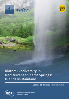
Mediterranean karst springs are freshwater environments of great ecological value and strategic water resources providing habitat for high biodiversity and drinking water supply. They are exposed to several pressures because of the variable rainfall regime, climate change and increasing water use. Integrated multidisciplinary approaches are necessary for their sustainable use and proper management. We compared epilithic diatom flora from karst springs in islands and mainland of two geographic areas (Spain and Italy). Our results confirm the role of springs as multiple ecotones and refuges for rare species. The geographic insularity may be an important factor in maintaining diatom biodiversity. View this paper.
  • Issues are regarded as officially published after their release is announced to the table of contents alert mailing list.
  • You may sign up for e-mail alerts to receive table of contents of newly released issues.
  • PDF is the official format for papers published in both, html and pdf forms. To view the papers in pdf format, click on the "PDF Full-text" link, and use the free Adobe Reader to open them.
Order results
Result details
Section
Select all
Export citation of selected articles as:
15 pages, 7844 KiB  
Article
Investigation of the Sloshing Behavior Due to Seismic Excitations Considering Two-Way Coupling of the Fluid and the Structure
by A. Ersin Dinçer
Water 2019, 11(12), 2664; https://doi.org/10.3390/w11122664 - 17 Dec 2019
Cited by 16 | Viewed by 4448
Abstract
Sloshing behavior due to near-fault type and earthquake excitations of a fluid in a tank having a highly deformable elastic structure in the middle was investigated experimentally and numerically in this paper. In the numerical model, fluid was simulated with smoothed particle hydrodynamics [...] Read more.
Sloshing behavior due to near-fault type and earthquake excitations of a fluid in a tank having a highly deformable elastic structure in the middle was investigated experimentally and numerically in this paper. In the numerical model, fluid was simulated with smoothed particle hydrodynamics (SPH) and structure was simulated with the finite element method (FEM). The coupling was satisfied with contact mechanics. The δ-SPH scheme was adapted to lower the numerical oscillations. The proposed fluid-structure interaction (FSI) method can simulate the violent fluid-structure interaction problem successfully. The effects of near-fault type and earthquake excitations on free-surfaces of fluid and the elastic structure are presented. Full article
(This article belongs to the Section Hydraulics and Hydrodynamics)
Show Figures

Figure 1

23 pages, 11879 KiB  
Article
Characterizing Consecutive Flooding Events after the 2017 Mt. Salto Wildfires (Southern Italy): Hazard and Emergency Management Implications
by Giuseppe Esposito, Antonio Parodi, Martina Lagasio, Rocco Masi, Giovanni Nanni, Filiberto Russo, Stefano Alfano and Gaetano Giannatiempo
Water 2019, 11(12), 2663; https://doi.org/10.3390/w11122663 - 17 Dec 2019
Cited by 12 | Viewed by 3771
Abstract
Every summer, wildfires affect thousands of steep watersheds in Italy, causing the partial or complete destruction of vegetation, and changes in soil hydraulic properties. Such effects alter the hydrologic response of watersheds, increasing post-fire debris and sediment-laden flow hazard. This study characterizes the [...] Read more.
Every summer, wildfires affect thousands of steep watersheds in Italy, causing the partial or complete destruction of vegetation, and changes in soil hydraulic properties. Such effects alter the hydrologic response of watersheds, increasing post-fire debris and sediment-laden flow hazard. This study characterizes the most relevant predisposing and triggering factors for a sequence of four post-fire flooding events, which, in the late summer-autumn of 2017, affected Montoro village in southern Italy. This research work consists of a fire severity assessment based on multispectral satellite images, characterization of meteorological systems and related flood-triggering rainfall, and provides an overview of the damage that occurred in the repeatedly affected urban area using crowdsourced data. The research findings demonstrate that the analyzed area burned with moderate-high (64.4%) and low severity (35.6%) levels. All the flooding events were triggered by rainfall evaluated as non-extreme, but with relevant peak intensities (I10 and I30), associated with the first convective storms impacting the burned watersheds. The crowdsourced data highlight the fact that roads and buildings on footslopes were inundated by mud and debris transported by rapid flows. The study identifies a clear relationship between wildfires and flooding processes and provides useful information for hazard assessment and emergency management operations. Full article
(This article belongs to the Special Issue Damaging Hydrogeological Events)
Show Figures

Figure 1

26 pages, 6324 KiB  
Article
Quantifying the Variability in Flow Competence and Streambed Mobility with Water Discharge in a Gravel-Bed Channel: River Esva, NW Spain
by Daniel Vázquez-Tarrío, Elena Fernández-Iglesias, María Fernández García and Jorge Marquínez
Water 2019, 11(12), 2662; https://doi.org/10.3390/w11122662 - 17 Dec 2019
Cited by 3 | Viewed by 3025
Abstract
Streambed mobility in gravel-bed rivers is largely controlled by the rate at which particles with different grain sizes are recruited from the riverbed into the bed load. In this paper, we present a study case in which we explored this question, based on [...] Read more.
Streambed mobility in gravel-bed rivers is largely controlled by the rate at which particles with different grain sizes are recruited from the riverbed into the bed load. In this paper, we present a study case in which we explored this question, based on combining field observations using painted plots and the grain size analysis of a large flood sediment deposit in the River Esva, northwest Spain, and the generalized threshold model (GTM) competence model developed by Recking. The main aim was to accomplish a complete characterization of streambed mobility in this river. The obtained results suggest the large potential of the GTM model compared to previous competence models when searching for the quantitative description of particle entrainment and streambed mobility in the River Esva. We observed how the grain size of the bed load in the River Esva tended to be closer to that of the sub-armour bed material during large floods, while moderate magnitude flows tended to carry a relatively fine bed load. Additionally, we compared our results with previously published field observations on flow competence. This comparison outlined the large degree of site specificity in the links between grain size of the bed load and that of the bed material. Full article
(This article belongs to the Section Hydraulics and Hydrodynamics)
Show Figures

Figure 1

25 pages, 4958 KiB  
Article
Urban Spatial Configuration and Functional Runoff Connectivity: Influence of Drainage Grid Density and Landscape Metrics
by Vincent Smets, Boud Verbeiren, Martin Hermy and Ben Somers
Water 2019, 11(12), 2661; https://doi.org/10.3390/w11122661 - 17 Dec 2019
Cited by 4 | Viewed by 3131
Abstract
Due to changing precipitation patterns induced by climate change, urban planners are confronted with new challenges to effectively mitigate rainfall runoff. An important knowledge gap that needs to be addressed before tackling these challenges is how and to which extent street/drainage grid density [...] Read more.
Due to changing precipitation patterns induced by climate change, urban planners are confronted with new challenges to effectively mitigate rainfall runoff. An important knowledge gap that needs to be addressed before tackling these challenges is how and to which extent street/drainage grid density and spatial land use configuration influence the amount of runoff. Therefore, a virtual experiment was conducted to assess the influence of grid density and spatial land use configuration on the functional runoff connectivity (Fc), which is a measure of the easiness by which water flows through the landscape. Through the use of a design of experiments approach in combination with the SCS—Curve Number runoff model, a wide variety of neutral landscape models with a fixed percentage of pervious- and impervious cover were generated that maximized the variance of Fc. Correlations between landscape metrics and neutral landscape models were calculated. Our results indicated that, out of the 17 landscape metrics tested, the average impervious cluster area, the number of impervious clusters, the standard deviation of the cluster size, two proximity indexes and the effective impervious area were strongly correlated with Fc throughout all grid scenarios. The relationship between Fc on the one hand and the average impervious cluster area and the effective impervious area on the other hand, was modelled. The average impervious cluster area models showed a relationship with Fc that closely approximated a logarithmic function (R2: 0.49–0.73), while the effective impervious area models were found to have a linear relationship with Fc (R2: 0.63–0.99). A dense grid was shown to cause a strong increase in Fc, demonstrating the effectiveness of an urban grid in channeling and removing runoff. Our results further indicate that fine-grained landscapes with a lot of small impervious clusters are preferred over course-grained landscapes when the goal is to reduce Fc. In highly urbanized landscapes, where the percentage of impervious area is high, small changes in landscape pattern could significantly reduce Fc. By using a downward hydrological modeling approach this research aims to bring more clarity to the underlying variables influencing Fc, rather than trying to generate realistic prediction values. Full article
Show Figures

Figure 1

14 pages, 1871 KiB  
Article
Solar Septic Tank: Next Generation Sequencing Reveals Effluent Microbial Community Composition as a Useful Index of System Performance
by Stephanie Connelly, Tatchai Pussayanavin, Richard J. Randle-Boggis, Araya Wicheansan, Suparat Jampathong, Ciara Keating, Umer Z. Ijaz, Willian T. Sloan and Thammarat Koottatep
Water 2019, 11(12), 2660; https://doi.org/10.3390/w11122660 - 17 Dec 2019
Cited by 12 | Viewed by 9518
Abstract
Septic tanks are widely deployed for off-grid sewage management but are typified by poor treatment performance, discharge of polluting effluents and the requirement for frequent de-sludging. The Solar Septic Tank (SST) is a novel septic tank design that uses passive heat from the [...] Read more.
Septic tanks are widely deployed for off-grid sewage management but are typified by poor treatment performance, discharge of polluting effluents and the requirement for frequent de-sludging. The Solar Septic Tank (SST) is a novel septic tank design that uses passive heat from the sun to raise in-tank temperatures and improves solids degradation, resulting in a cleaner effluent. Treatment has been shown to exceed conventional systems, however, the underlying biology driving treatment in the system is poorly understood. We used next generation sequencing (Illumina Miseq (San Diego, CA, USA), V4 region 16S DNA) to monitor the microbiology in the sludge and effluent of two mature systems, a conventional septic tank and an SST, during four months of routine operation in Bangkok, Thailand, and evaluated the ecology against a suite of operating and performance data collected during the same time period. Significant differences were observed between the microbiome of the sludge and effluent in each system and the dominant taxa in each appeared persistent over time. Furthermore, variation in the microbial community composition in the system effluents correlated with effluent water quality and treatment performance parameters, including the removal of chemical and biochemical oxygen demand and the concentration of fecal and total coliforms in the effluent. Thus, we propose that a wide-scale survey of the biology underlying decentralised biotechnologies for sewage treatment such as the SST could be conducted by sampling system effluent rather than sampling sludge. This is advantageous as accessing sludge during sampling is both hazardous and potentially disruptive to the anaerobic methanogenic consortia underlying treatment in the systems. Full article
(This article belongs to the Section Wastewater Treatment and Reuse)
Show Figures

Figure 1

13 pages, 1617 KiB  
Article
Evaluating the Influence of Rain Event Characteristics on Rainfall Interception by Urban Trees Using Multiple Correspondence Analysis
by Katarina Zabret and Mojca Šraj
Water 2019, 11(12), 2659; https://doi.org/10.3390/w11122659 - 17 Dec 2019
Cited by 17 | Viewed by 3876
Abstract
Urban trees play an important role in the built environment, reducing the rainfall reaching the ground by rainfall interception. The amount of intercepted rainfall depends on the meteorological and vegetation characteristics. By applying the multiple correspondence analysis (MCA), we analysed the influence of [...] Read more.
Urban trees play an important role in the built environment, reducing the rainfall reaching the ground by rainfall interception. The amount of intercepted rainfall depends on the meteorological and vegetation characteristics. By applying the multiple correspondence analysis (MCA), we analysed the influence of rainfall amount, intensity and duration, the number of raindrops, the mean volume diameter (MVD), wind speed and direction on rainfall interception. The analysis was based on data from 176 events collected over more than three years of observations. Measurements were taken under birch (Betula pendula Roth.) and pine (Pinus nigra Arnold) trees located in an urban park in the city of Ljubljana, Slovenia. The results indicate that rainfall interception is influenced the most by rainfall amount and the number of raindrops. In general, the ratio of rainfall interception to gross rainfall decreases with longer and more intense rainfall events. The influence of the raindrop number depends also on their size (MVD), which is evident especially for the pine tree. For example, pine tree interception increases with smaller raindrops regardless of their number. In addition, MCA gives a new insight into the influence of wind characteristics, which was not visible using previous methods of data analysis (regression analysis, correlation matrices, regression trees, boosted regression trees). According to the nearby buildings, a wind corridor is sometimes created, decreasing rainfall interception by both tree species. Full article
(This article belongs to the Special Issue Rainfall Interception Processes and Urban Hydrology)
Show Figures

Figure 1

18 pages, 18885 KiB  
Article
Socio-Economic Potential Impacts Due to Urban Pluvial Floods in Badalona (Spain) in a Context of Climate Change
by Eduardo Martínez-Gomariz, Luca Locatelli, María Guerrero, Beniamino Russo and Montse Martínez
Water 2019, 11(12), 2658; https://doi.org/10.3390/w11122658 - 17 Dec 2019
Cited by 22 | Viewed by 4788
Abstract
Pluvial flooding in Badalona (Spain) occurs during high rainfall intensity events, which in the future could be more frequent according to the latest report from the Intergovernmental Panel on Climate Change (IPCC). In this context, the present study aims at quantifying the potential [...] Read more.
Pluvial flooding in Badalona (Spain) occurs during high rainfall intensity events, which in the future could be more frequent according to the latest report from the Intergovernmental Panel on Climate Change (IPCC). In this context, the present study aims at quantifying the potential impacts of climate change for the city of Badalona. A comprehensive pluvial flood multi risk assessment has been carried out for the entire municipality. The assessment has a twofold target: People safety, based on both pedestrians’ and vehicles’ stability, and impacts on the economic sector in terms of direct damages on properties and vehicles, and indirect damages due to businesses interruption. Risks and damages have also been assessed for the projected future rainfall conditions which enabled the comparison with the current ones, thereby estimating their potential increment. Moreover, the obtained results should be the first step to assess the efficiency of adaptation measures. The novelty of this paper is the integration of a detailed 1D/2D urban drainage model with multiple risk criteria. Although, the proposed methodology was tested for the case study of Badalona (Spain), it can be considered generally applicable to other urban areas affected by pluvial flooding. Full article
(This article belongs to the Special Issue Flood Risk Assessments: Applications and Uncertainties)
Show Figures

Figure 1

14 pages, 2623 KiB  
Article
Sewer Life Span Prediction: Comparison of Methods and Assessment of the Sample Impact on the Results
by Tuija Laakso, Teemu Kokkonen, Ilkka Mellin and Riku Vahala
Water 2019, 11(12), 2657; https://doi.org/10.3390/w11122657 - 16 Dec 2019
Cited by 19 | Viewed by 3555
Abstract
Survival models can support the estimation of the resources needed for future renovations of sewer systems. They are particularly useful, when a large share of network will need renovation. This paper studies modelling sewer deterioration in a context, where data are available for [...] Read more.
Survival models can support the estimation of the resources needed for future renovations of sewer systems. They are particularly useful, when a large share of network will need renovation. This paper studies modelling sewer deterioration in a context, where data are available for pipes selected for inspections due to suspected or experienced poor condition. We compare the random survival forest and the Weibull regression for modelling survival and find that both methods yield similar results, but the random survival forest performs slightly better. We propose a method for estimating the range in which the actual network survival curve lies. We conclude that in order to reach reliable results, a life span model needs to be constructed based on a random sample of pipes, which are then consecutively inspected and in addition, censoring and left truncation need to be accounted for. The inspection data applied in this paper had been collected with the aim of finding pipes in poor condition in the network. As a result, the data were biased towards poor condition and unrepresentative in terms of pipe ages. Full article
(This article belongs to the Section Urban Water Management)
Show Figures

Figure 1

29 pages, 10651 KiB  
Article
Modeling Groundwater Potential Zone in a Semi-Arid Region of Aseer Using Fuzzy-AHP and Geoinformation Techniques
by Javed Mallick, Roohul Abad Khan, Mohd Ahmed, Saeed Dhafer Alqadhi, Majed Alsubih, Ibrahim Falqi and Mohd Abul Hasan
Water 2019, 11(12), 2656; https://doi.org/10.3390/w11122656 - 16 Dec 2019
Cited by 115 | Viewed by 8887
Abstract
Saudi Arabia’s arid and semi-arid regions suffer from water scarcity because of climatic constraints and rapid growth of domestic and industrial water uses. The growing demand for high-quality water supplies and to reduce the dependency on desalination creates an urgent need to explore [...] Read more.
Saudi Arabia’s arid and semi-arid regions suffer from water scarcity because of climatic constraints and rapid growth of domestic and industrial water uses. The growing demand for high-quality water supplies and to reduce the dependency on desalination creates an urgent need to explore groundwater resources as an alternative. The weighted overlay analysis method using the fuzzy-analytical hierarchy process (FAHP) multi-criteria decision making (MCDM) techniques combined with geoinformation technology was used in this study to explore the groundwater potential zones in the Itwad-Khamis watershed of Saudi Arabia. Twelve thematic layers were prepared and processed in a GIS setting to produce the groundwater potential zone map (GPZM). Subsequently, potential groundwater areas were delineated and drawn into five classes: very good potential, good potential, moderate potential, poor potential, and very poor potential. The estimated GWPZ (groundwater potential zones) was validated by analyzing the existing open wells distribution and the yield data of selected wells within the studied watershed. With this quality-based zoning, it was found that 82% of existing wells were located in a very good and good potential area. The statistical analysis showed that 14.6% and 28.8% of the total area were under very good and good, while 27.3% and 20.2% were accounted for the moderate and poor potential zone, respectively. To achieve sustainable groundwater management in the Aseer region, Saudi Arabia, this research provided a primary estimate and significant insights for local water managers and authorities by providing groundwater potential zone map. Full article
(This article belongs to the Section Hydrology)
Show Figures

Figure 1

14 pages, 7946 KiB  
Article
Oil-Water-Gas Three-Phase Separation in Multitube T-Junction Separators
by Lele Yang, Jing Wang, Yong Ma, Sen Liu, Jun Tang and Yongbing Zhu
Water 2019, 11(12), 2655; https://doi.org/10.3390/w11122655 - 16 Dec 2019
Cited by 8 | Viewed by 3468
Abstract
Multitube T-junctions can be used as an oil-water-gas pre-separator in the oil and gas industry. In this paper, the mixture model, coupled with the k-ε turbulent model, was applied for a simulation of the oil-water-gas three-phase flow characteristics in the multitube T-junction separator. [...] Read more.
Multitube T-junctions can be used as an oil-water-gas pre-separator in the oil and gas industry. In this paper, the mixture model, coupled with the k-ε turbulent model, was applied for a simulation of the oil-water-gas three-phase flow characteristics in the multitube T-junction separator. The oil droplet size ranged from 1 to 4 mm. The water content ranged from 5% to 20% and the gas content from 3% to 25%. According to the phase separation results for different droplet sizes, it was found that, as the oil droplet size increased, the water content at the water outlet initially increased and then tended to be stable. Therefore, it was necessary to increase the oil droplet size through corresponding measures before flowing into the T-junction for separation. For the separator with an inner diameter of 50 mm, the oil content at the inlet had a great influence on the water-oil separation performance, and the water-oil separation performance was obviously improved as the oil content decreased. Owing to increased residence time, the oil content had little influence on the water-oil separation performance when the separator with an inner diameter of 100 mm was applied. Moreover, for the separator with an inner diameter of 100 mm, the oil content had little influence on the degassing effect, and more than 90% of the gas could be discharged from the gas outlet. The separation performance of the multitube T-junction separator became worse as the inlet gas content increased. Full article
(This article belongs to the Section Wastewater Treatment and Reuse)
Show Figures

Figure 1

22 pages, 845 KiB  
Article
Discourse of Flood Management Approaches and Policies in Bangladesh: Mapping the Changes, Drivers, and Actors
by C. Emdad Haque, M. Abul Kalam Azad and Mahed-Ul-Islam Choudhury
Water 2019, 11(12), 2654; https://doi.org/10.3390/w11122654 - 16 Dec 2019
Cited by 15 | Viewed by 6265
Abstract
The fundamental processes of policy shifts emphasize how policy problems emerge and how policy decisions are made to overcome previous shortcomings. In Bangladesh, flood management policies may also have been driven by policy failures and flood-disaster events. In this context, we examined how [...] Read more.
The fundamental processes of policy shifts emphasize how policy problems emerge and how policy decisions are made to overcome previous shortcomings. In Bangladesh, flood management policies may also have been driven by policy failures and flood-disaster events. In this context, we examined how policy shifts occurred in the country from 1947 to 2019 in areas of water management and flood prevention, control, and risk mitigation. To understand the nature of these policy shifts, we examined the evolutionary processes of flood management policies, the associated drivers, and the roles of key actors. Our findings reveal that policy transitions were influenced primarily by the predominance of the structural intervention paradigm and by catastrophic flood events. Such transitions were nonlinear due to multiple interest groups who functioned as contributors to, as well as barriers against, flood prevention policies. Policy debates over environmental concerns helped bring about a shift from a primary focus on structural intervention to a mixed approach incorporating various nonstructural interventions. Furthermore, our results suggest that the shifts in flood management policies have resulted in some degree of reliance on a “people-centered” approach rather than solely an “engineering coalition”, which emphasizes the pivotal role of community members in decision making and the implementation of flood policies and programs. Full article
(This article belongs to the Special Issue Management of Hydrological Extremes: Floods and Droughts)
Show Figures

Figure 1

28 pages, 6586 KiB  
Article
Empirical and Physically Based Thresholds for the Occurrence of Shallow Landslides in a Prone Area of Northern Italian Apennines
by Massimiliano Bordoni, Beatrice Corradini, Luca Lucchelli, Roberto Valentino, Marco Bittelli, Valerio Vivaldi and Claudia Meisina
Water 2019, 11(12), 2653; https://doi.org/10.3390/w11122653 - 16 Dec 2019
Cited by 38 | Viewed by 3969
Abstract
Rainfall thresholds define the conditions leading to the triggering of shallow landslides over wide areas. They can be empirical, which exploit past rainfall data and landslide inventories, or physicallybased, which integrate slope physical–hydrological modeling and stability analyses. In this work, a comparison between [...] Read more.
Rainfall thresholds define the conditions leading to the triggering of shallow landslides over wide areas. They can be empirical, which exploit past rainfall data and landslide inventories, or physicallybased, which integrate slope physical–hydrological modeling and stability analyses. In this work, a comparison between these two types of thresholds was performed, using data acquired in Oltrepò Pavese (Northern Italian Apennines), to evaluate their reliability. Empirical thresholds were reconstructed based on rainfalls and landslides triggering events collected from 2000 to 2018. The same rainfall events were implemented in a physicallybased model of a representative testsite, considering different antecedent pore-water pressures, chosen according to the analysis of hydrological monitoring data. Thresholds validation was performed, using an external dataset (August 1992–August 1997). Soil hydrological conditions have a primary role on predisposing or preventing slope failures. In Oltrepò Pavese area, cold and wet months are the most susceptible periods, due to the permanence of saturated or close-to-saturation soil conditions. The lower the pore-water pressure is at the beginning of an event, the higher the amount of rain required to trigger shallow failures is. physicallybased thresholds provide a better reliability in discriminating the events which could or could not trigger slope failures than empirical thresholds. The latter provide a significant number of false positives, due to neglecting the antecedent soil hydrological conditions. These results represent a fundamental basis for the choice of the best thresholds to be implemented in a reliable earlywarning system. Full article
Show Figures

Graphical abstract

13 pages, 1696 KiB  
Article
Pattern of Water Use at the United Arab Emirates University
by M. M. Yagoub, Tareefa S. AlSumaiti, Latifa Ebrahim, Yaqein Ahmed and Rauda Abdulla
Water 2019, 11(12), 2652; https://doi.org/10.3390/w11122652 - 16 Dec 2019
Cited by 9 | Viewed by 5504
Abstract
In this study, indoor water use at the United Arab Emirates University (UAEU) was assessed for three years (2016, 2017, and 2018). A geographic information system (GIS) was employed to determine where water use is high within the university, when and why water [...] Read more.
In this study, indoor water use at the United Arab Emirates University (UAEU) was assessed for three years (2016, 2017, and 2018). A geographic information system (GIS) was employed to determine where water use is high within the university, when and why water is used, who uses it, and how to minimize its usage. Diverse data were employed to elucidate the broad patterns of university water use. It was assumed that water use is directly proportional to the number of students and is lower during winter. The relationship between water use and number of students in academic buildings was modeled using least squares regression. The results indicate a low correlation between water use and the number of students, possibly due to the centralized usage of academic buildings and movement of students between them. The hypothesis of activity-driven consumption indicated that most water use occurred in residential buildings (47.5%), averaging 81.7 L per person per day (LPD). This value is lower than the metrics for dormitories in the United States (121 LPD) and Europe (143 LPD). A survey of 412 students revealed that half the respondents were not aware of water issues. Most of them (87%) preferred to drink bottled water and were not willing to use gray water for flushing (56%) or urinals (60%). The findings of this study will improve the understanding of university water use which will facilitate the development of effective water conservation policies and the establishment of such practices among the next generation. Full article
(This article belongs to the Section Water Use and Scarcity)
Show Figures

Figure 1

19 pages, 6947 KiB  
Article
The Influence of Hydrometeorological Conditions on Changes in Littoral and Riparian Vegetation of a Meromictic Lake in the Last Half-Century
by Bogumił Nowak and Agnieszka E. Lawniczak-Malińska
Water 2019, 11(12), 2651; https://doi.org/10.3390/w11122651 - 16 Dec 2019
Cited by 8 | Viewed by 3013
Abstract
Changes in water levels in lakes play an important role in the development of their coastal zones and water trophy. The aim of this study was to assess the role of changes in hydrometeorological conditions in the development of littoral and riparian vegetation [...] Read more.
Changes in water levels in lakes play an important role in the development of their coastal zones and water trophy. The aim of this study was to assess the role of changes in hydrometeorological conditions in the development of littoral and riparian vegetation of a meromictic lake during the last half-century. The study was carried out in Lake Powidzkie, one of the largest water reservoirs located in central Poland. Water level and meteorological conditions were analyzed in the period 1961–2015. Modifications in the range of plant communities were analyzed on the basis of cartographic materials and field studies. Meteorological conditions, especially precipitation and evaporation, were found to strongly affect the lake's water retention, whilst they had less of an effect on water levels. A significant effect of the lowering of the water level in Lake Powidzkie on the development of the littoral zone, whose area more than doubled over the last half-century, from 41.5 to 118.8 ha, was noted. The most dynamic development of the littoral was observed in the last quarter of the century, in which three of several years of low-flow were recorded. The occurrence of periods with an increased amount of precipitation, after dry periods, did not contribute to the reduction of the size of the rush zone and limitation of the development of woody vegetation. Full article
(This article belongs to the Section Water Quality and Contamination)
Show Figures

Figure 1

14 pages, 1416 KiB  
Article
Maize Evapotranspiration Estimation Using Penman-Monteith Equation and Modeling the Bulk Canopy Resistance
by Nora Meraz-Maldonado and Héctor Flores-Magdaleno
Water 2019, 11(12), 2650; https://doi.org/10.3390/w11122650 - 15 Dec 2019
Cited by 2 | Viewed by 2904
Abstract
Some techniques, such as the Katerji and Perrier approach, estimate the bulk canopy resistance (rc) as a function of meteorological variables and then calculate the hourly evapotranspiration using the Penman–Monteith equation, so that traditional crop coefficients are not needed. As [...] Read more.
Some techniques, such as the Katerji and Perrier approach, estimate the bulk canopy resistance (rc) as a function of meteorological variables and then calculate the hourly evapotranspiration using the Penman–Monteith equation, so that traditional crop coefficients are not needed. As far as we know, there are no published studies regarding using this method for a maize crop. The objective of this study was to calibrate and validate the canopy resistance for an irrigated continuous maize crop in the Midwestern United States (US). In addition, we determined the effect of derivation year, bowen ratio, and the extent of canopy. In this study we derive empirical coefficients necessary to estimate rc for maize, five years (2001–2005) were considered. A split-sample approach was taken, in which each year’s data was taken as a potential calibration data set and validation was accomplished while using the other four years of data. We grouped the data by green leaf area index (GLAI) and the Bowen ratio (β) by parsing the data into a 3 × 3 grouping: LAI (≥2, ≥3, and ≥4) and |β| (≤0.1, ≤0.2, and ≤0.3). The best fit data indicated reasonably good results for all nine groupings, so that the calibration coefficients derived for the conditions LAI ≥ 2 and |β| ≤ 0.3 were taken in light of the longer span associated with LAI ≥ 2 and the larger number of hours. For the calibrations in this subgroup, the results indicate that the annual empirical coefficients for rc are nearly the same and equally effective, regardless of the year used for calibration. Our validation included all the daytime hours regardless of β. Thus, it was concluded that the calibration at our site was independent of the derivation year. Knowledge of the Bowen ratio was useful in calibration, but accurate ET estimates (validation) can be obtained without knowledge of the Bowen ratio. Validation resulted in hourly ET estimates for irrigated maize that explained 83% to 86% of the variation in measured ET with an accuracy of ± 0.2 mm. Full article
(This article belongs to the Special Issue Evapotranspiration and Plant Irrigation Strategies)
Show Figures

Figure 1

26 pages, 8990 KiB  
Article
An Assessment on Permeability and Grout Take of Limestone: A Case Study at Mut Dam, Karaman, Turkey
by Ali Kayabasi and Candan Gokceoglu
Water 2019, 11(12), 2649; https://doi.org/10.3390/w11122649 - 15 Dec 2019
Cited by 6 | Viewed by 5155
Abstract
The main purposes of the present study are to evaluate pilot grouting and to develop regression equations for prediction of grout intake. There are no permeability problems with the sandstone-siltstone-claystone alternations and basement clayey limestone at the dam site. Karstic limestone block is [...] Read more.
The main purposes of the present study are to evaluate pilot grouting and to develop regression equations for prediction of grout intake. There are no permeability problems with the sandstone-siltstone-claystone alternations and basement clayey limestone at the dam site. Karstic limestone block is permeable due to karstification and heavy discontinuities. For the purpose of the study, Q system, geological strength index (GSI), secondary permeability index (SPI), joint spacing (JSP), joint apertures (Ap), Lugeon (Lu), and the permeability coefficient (k) were determined. Karstic limestone block rock mass properties correlated with grouting material amount. A series of simple and multiple nonlinear regression analyses was performed between grout take material amount (Gt) and average values of these rock mass properties. Significant determination coefficients were determined. Prediction capacity of the empirical equations were also examined with root mean square error (RMSE), values account for (VAF), mean absolute percentage error (MAPE), and prediction error evaluations. Considering simple regression analyses, the equation derived with Gt-SPI gives the best performance. The best prediction is determined with the equation derived with rock quality designation values (RQD), SPI, and joint aperture as input parameters with the multiple nonlinear regression analysis, in addition to this, other empirical equations also provide acceptable results. Full article
(This article belongs to the Special Issue Planning and Management of Hydraulic Infrastructure)
Show Figures

Figure 1

22 pages, 18416 KiB  
Article
Documenting a Century of Coastline Change along Central California and Associated Challenges: From the Qualitative to the Quantitative
by Gary Griggs, Lida Davar and Borja G. Reguero
Water 2019, 11(12), 2648; https://doi.org/10.3390/w11122648 - 15 Dec 2019
Cited by 15 | Viewed by 8385
Abstract
Wave erosion has moved coastal cliffs and bluffs landward over the centuries. Now climate change-induced sea-level rise (SLR) and the changes in wave action are accelerating coastline retreat around the world. Documenting the erosion of cliffed coasts and projecting the rate of coastline [...] Read more.
Wave erosion has moved coastal cliffs and bluffs landward over the centuries. Now climate change-induced sea-level rise (SLR) and the changes in wave action are accelerating coastline retreat around the world. Documenting the erosion of cliffed coasts and projecting the rate of coastline retreat under future SLR scenarios are more challenging than historical and future shoreline change studies along low-lying sandy beaches. The objective of this research was to study coastal erosion of the West Cliff Drive area in Santa Cruz along the Central California Coast and identify the challenges in coastline change analysis. We investigated the geological history, geomorphic differences, and documented cliff retreat to assess coastal erosion qualitatively. We also conducted a quantitative assessment of cliff retreat through extracting and analyzing the coastline position at three different times (1953, 1975, and 2018). The results showed that the total retreat of the West Cliff Drive coastline over 65 years ranges from 0.3 to 32 m, and the maximum cliff retreat rate was 0.5 m/year. Geometric errors, the complex profiles of coastal cliffs, and irregularities in the processes of coastal erosion, including the undercutting of the base of the cliff and formation of caves, were some of the identified challenges in documenting historical coastline retreat. These can each increase the uncertainty of calculated retreat rates. Reducing the uncertainties in retreat rates is an essential initial step in projecting cliff and bluff retreat under future SLR more accurately and in developing a practical adaptive management plan to cope with the impacts of coastline change along this highly populated edge. Full article
(This article belongs to the Special Issue Coastal Dynamic and Evolution)
Show Figures

Figure 1

11 pages, 5310 KiB  
Article
Transmissibility Upscaling on Unstructured Grids for Highly Heterogeneous Reservoirs
by Dominique Guérillot and Jérémie Bruyelle
Water 2019, 11(12), 2647; https://doi.org/10.3390/w11122647 - 15 Dec 2019
Cited by 5 | Viewed by 3816
Abstract
One critical point of modeling of flow in porous media is the capacity to consider parameters that are highly variable in space. It is then very challenging to simulate numerically fluid flow on such heterogeneous porous media. The continuous increase in computing power [...] Read more.
One critical point of modeling of flow in porous media is the capacity to consider parameters that are highly variable in space. It is then very challenging to simulate numerically fluid flow on such heterogeneous porous media. The continuous increase in computing power makes it possible to integrate smaller and smaller heterogeneities into geological models of up to tens of millions of cells. On such meshes, despite computer performance, multi-phase flow equations cannot be solved in an acceptable time for hydrogeologists and reservoir engineers, especially when the modeling considers several components in each fluid and when taking into account rock-fluid interactions. Taking average reservoir properties is a common approach to reducing mesh size. During the last decades, many authors studied the upscaling topic. Two different ways have been investigated to upscale the absolute permeability: (1) an average of the permeability for each cell, which is then used for standard transmissibility calculation, or (2) computing directly the upscaled transmissibility values using the high-resolution permeability values. This paper is related to the second approach. The proposed method uses the half-block approach and combines the finite volume principles with algebraic methods to provide an upper and a lower bound of the upscaled transmissibility values. An application on an extracted map of the SPE10 model shows that this approach is more accurate and faster than the classical transmissibility upscaling method based on flow simulation. This approach keeps the contrast of transmissibility values observed at the high-resolution geological scale and improves the accuracy of field-scale flow simulation for highly heterogeneous reservoirs. Moreover, the upper and lower bounds delivered by the algebraic method allow checking the quality of the upscaling and the gridding. Full article
Show Figures

Figure 1

9 pages, 1036 KiB  
Article
Phosphorus Fractions in the Sediments of Yuecheng Reservoir, China
by Chenghua Dang, Ming Lu, Zheng Mu, Yu Li, Chenchen Chen, Fengxia Zhao, Lei Yan and Yao Cheng
Water 2019, 11(12), 2646; https://doi.org/10.3390/w11122646 - 15 Dec 2019
Cited by 2 | Viewed by 2823
Abstract
As a result of the inexorable development of the economy and the ever-increasing population, the demand for water in the urban and rural sectors has increased, and this in turn has caused the water quality and eutrophication of the reservoir to become a [...] Read more.
As a result of the inexorable development of the economy and the ever-increasing population, the demand for water in the urban and rural sectors has increased, and this in turn has caused the water quality and eutrophication of the reservoir to become a legitimate concern in the water environment management of river basins. Phosphorus (P) is one of the limiting nutrients in aquatic ecosystems; P in the sediment is a primary factor for eutrophication. Yuecheng Reservoir is located in one of the most productive and intensively cultivated agricultural regions in North China. Detailed knowledge of the sediment is lacking at this regional reservoir. The first study to look into the different P fractions and its diffusion fluxes at the water sediment interface of the Yuecheng Reservoir makes it possible to learn about the internal P loading. According to the results, the concentrations of total phosphorus (TP) ranged from 1576.3 to 2172.6 mg kg and the P fraction concentration sequence is as follows: P associated with calcium (Ca–Pi) > organic P (Po) > P bound to aluminum (Al), ferrum (Fe) and manganese (Mn) oxides and hydroxides (Fe/Al–Pi). The results demonstrated that, although the construction of a large number of water conservancy projects in the upper reaches of the river resulted in the decrease of inflow runoff, the pollutions from terrestrial plants or materials played a key role in the sediment phosphorus fraction, and they should be emphasized on the water environment management of river basin. Full article
(This article belongs to the Special Issue Lake and River Restoration: Method, Evaluation and Management)
Show Figures

Figure 1

16 pages, 1681 KiB  
Article
Regional and Seasonal Distributions of N-Nitrosodimethylamine (NDMA) Concentrations in Chlorinated Drinking Water Distribution Systems in Korea
by Sunyoung Park, Sungjin Jung and Hekap Kim
Water 2019, 11(12), 2645; https://doi.org/10.3390/w11122645 - 14 Dec 2019
Cited by 5 | Viewed by 3698
Abstract
Volatile N-Nitrosamines (NAs), including N-nitrosodimethylamine (NDMA), an emerging contaminant in drinking water, have been reported to induce cancer in animal studies. This study aims to investigate the regional and seasonal distributions of the concentrations of NDMA, one of the most commonly [...] Read more.
Volatile N-Nitrosamines (NAs), including N-nitrosodimethylamine (NDMA), an emerging contaminant in drinking water, have been reported to induce cancer in animal studies. This study aims to investigate the regional and seasonal distributions of the concentrations of NDMA, one of the most commonly found NAs with high carcinogenicity, in municipal tap water in Korea. NDMA in water samples was quantitatively determined using high-performance liquid chromatography-fluorescence detection (HPLC-FLD) as a 5-dimethylamino-1-naphthalenesulfonyl (dansyl) derivative after optimization to dry the SPE adsorbent and remove dimethylamine prior to derivatization. Tap water samples were collected from 41 sites in Korea, each of which was visited once in summer and once in winter. The average (±standard deviation) NDMA concentration among all the sites was 46.6 (±22.7) ng/L, ranging from <0.13 to 80.7 ng/L. Significant NDMA differences in the regions, excluding the Jeju region, were not found, whereas the average NDMA concentration was statistically higher in winter than in summer. A multiple regression analysis for the entire data set indicated a negative relationship between NDMA concentration and water temperature. High levels of NDMA in Korea may pose excessive cancer risks from the consumption of such drinking water. Full article
(This article belongs to the Special Issue Water Quality in Drinking Water Distribution Systems)
Show Figures

Graphical abstract

18 pages, 3226 KiB  
Article
Multi-Objective Optimal Operation of the Inter-Basin Water Transfer Project Considering the Unknown Shapes of Pareto Fronts
by Jianjian Xu and Dan Bai
Water 2019, 11(12), 2644; https://doi.org/10.3390/w11122644 - 14 Dec 2019
Cited by 6 | Viewed by 2796
Abstract
Studies have shown that the performance of multi-objective evolutionary algorithms depends to a large extent on the shape of the Pareto fronts of the problem. Although, most existing algorithms have poor applicability in dealing with this problem, especially in the multi-objective optimization operation [...] Read more.
Studies have shown that the performance of multi-objective evolutionary algorithms depends to a large extent on the shape of the Pareto fronts of the problem. Although, most existing algorithms have poor applicability in dealing with this problem, especially in the multi-objective optimization operation of reservoirs with unknown Pareto fronts. Therefore, this paper introduces an evolutionary algorithm with strong versatility and robustness named the Multi-Objective Evolutionary Algorithm with Reference Point Adaptation (AR-MOEA). In this paper, we take two water conservancy hubs (Huangjinxia and Sanhekou) of the Hanjiang to Wei River Water Diversion Project as example, and build a multi-objective operation model including water supply, ecology, and power generation. We use the AR-MOEA, the Non-dominated Sorting Genetic Algorithm II (NSGA-II), the Multi-Objective Evolutionary Algorithm based on Decomposition (MOEA/D) and the Indicator-Based Evolutionary Algorithm (IBEA) to search the optimal solutions, respectively. We analyze the performance of four algorithms and the operation rules in continuous dry years. The results indicate that (1) the AR-MOEA can overcome the difficulty of the shape and distribution of the unknown Pareto fronts in the multi-objective model. (2) AR-MOEA can improve the convergence and uniformity of the Pareto solution. (3) If we make full use of the regulation ability of the Sanhekou reservoir in the dry season, the water supply for coping with possible continuous dry years can be guaranteed. The study results contribute to the identification of the relationship among objectives, and is valued for water resources management of the Hanjiang to Wei River Water Diversion Project. Full article
(This article belongs to the Section Hydrology)
Show Figures

Figure 1

26 pages, 904 KiB  
Article
Adaptive Capacities for Diversified Flood Risk Management Strategies: Learning from Pilot Projects
by Flavia Simona Cosoveanu, Jean-Marie Buijs, Marloes Bakker and Teun Terpstra
Water 2019, 11(12), 2643; https://doi.org/10.3390/w11122643 - 14 Dec 2019
Cited by 5 | Viewed by 4638
Abstract
Diversification of flood risk management strategies (FRMS) in response to climate change relies on the adaptive capacities of institutions. Although adaptive capacities enable flexibility and adjustment, more empirical research is needed to better grasp the role of adaptive capacities to accommodate expected climate [...] Read more.
Diversification of flood risk management strategies (FRMS) in response to climate change relies on the adaptive capacities of institutions. Although adaptive capacities enable flexibility and adjustment, more empirical research is needed to better grasp the role of adaptive capacities to accommodate expected climate change effects. This paper presents an analytical framework based on the Adaptive Capacity Wheel (ACW) and Triple-loop Learning. The framework is applied to evaluate the adaptive capacities that were missing, employed, and developed throughout the ‘Alblasserwaard-Vijfheerenlanden’ (The Netherlands) and the ‘Wesermarsch’ (Germany) pilot projects. Evaluations were performed using questionnaires, interviews, and focus groups. From the 22 capacities of ACW, three capacities were identified important for diversifying the current FRMS; the capacity to develop a greater variety of solutions, continuous access to information about diversified FRMS, and collaborative leadership. Hardly any capacities related to ‘learning’ and ‘governance’ were mentioned by the stakeholders. From a further reflection on the data, we inferred that the pilot projects performed single-loop learning (incremental learning: ‘are we doing what we do right?’), rather than double-loop learning (reframing: ‘are we doing the right things?’). As the development of the framework is part of ongoing research, some directions for improvement are highlighted. Full article
(This article belongs to the Special Issue Flood Risk Governance for More Resilience)
Show Figures

Figure 1

21 pages, 1519 KiB  
Review
Applications of Bayesian Networks as Decision Support Tools for Water Resource Management under Climate Change and Socio-Economic Stressors: A Critical Appraisal
by Thuc D. Phan, James C. R. Smart, Ben Stewart-Koster, Oz. Sahin, Wade L. Hadwen, Lien T. Dinh, Iman Tahmasbian and Samantha J. Capon
Water 2019, 11(12), 2642; https://doi.org/10.3390/w11122642 - 14 Dec 2019
Cited by 27 | Viewed by 6890
Abstract
Bayesian networks (BNs) are widely implemented as graphical decision support tools which use probability inferences to generate “what if?” and “which is best?” analyses of potential management options for water resource management, under climate change and socio-economic stressors. This paper presents a systematic [...] Read more.
Bayesian networks (BNs) are widely implemented as graphical decision support tools which use probability inferences to generate “what if?” and “which is best?” analyses of potential management options for water resource management, under climate change and socio-economic stressors. This paper presents a systematic quantitative literature review of applications of BNs for decision support in water resource management. The review quantifies to what extent different types of data (quantitative and/or qualitative) are used, to what extent optimization-based and/or scenario-based approaches are adopted for decision support, and to what extent different categories of adaptation measures are evaluated. Most reviewed publications applied scenario-based approaches (68%) to evaluate the performance of management measures, whilst relatively few studies (18%) applied optimization-based approaches to optimize management measures. Institutional and social measures (62%) were mostly applied to the management of water-related concerns, followed by technological and engineered measures (47%), and ecosystem-based measures (37%). There was no significant difference in the use of quantitative and/or qualitative data across different decision support approaches (p = 0.54), or in the evaluation of different categories of management measures (p = 0.25). However, there was significant dependence (p = 0.076) between the types of management measure(s) evaluated, and the decision support approaches used for that evaluation. The potential and limitations of BN applications as decision support systems are discussed along with solutions and recommendations, thereby further facilitating the application of this promising decision support tool for future research priorities and challenges surrounding uncertain and complex water resource systems driven by multiple interactions amongst climatic and non-climatic changes. Full article
(This article belongs to the Section Water Resources Management, Policy and Governance)
Show Figures

Figure 1

19 pages, 3612 KiB  
Article
Hydro-Meteorological Characterization of Major Floods in Spanish Mountain Rivers
by Enrique Morán-Tejeda, Steven R. Fassnacht, Jorge Lorenzo-Lacruz, Juan Ignacio López-Moreno, Celso García, Esteban Alonso-González and Antonio-Juan Collados-Lara
Water 2019, 11(12), 2641; https://doi.org/10.3390/w11122641 - 14 Dec 2019
Cited by 21 | Viewed by 3657
Abstract
Spain, one of the most mountainous countries in Europe, suffers from frequent river flooding due to specific climatic and topographic features. Many headwaters of the largest rivers in Spain are located in mountainous areas of mid-to-high elevation. These include the Pyrenees, the Central [...] Read more.
Spain, one of the most mountainous countries in Europe, suffers from frequent river flooding due to specific climatic and topographic features. Many headwaters of the largest rivers in Spain are located in mountainous areas of mid-to-high elevation. These include the Pyrenees, the Central System, and the Cantabrian mountains, that have a sustained snowpack during the winter months. Most previous research on flood generation in Spain has focused on intense rainfall events, and the role of snowmelt has been ignored or considered marginal. In this paper we present a regional-scale study to quantify the relative importance of rainfall versus snowmelt in the largest floods recorded in mountain rivers in Spain during the last decades (1980–2014). We further analyzed whether catchments characteristics and weather types may favor the occurrence of rainfall or snowmelt induced floods. Results show that in 53% of the 250 analyzed floods the contribution of rainfall was larger than 90%, and in the rest of events snowmelt contribution was larger than 10%. Floods where snowmelt was the main contributor represented only 5% of the total events. The average contribution of snowmelt represents 18% of total runoff in floods that were analyzed. The role of snowmelt in floods, rather than triggering the event, was usually amplifying the duration of the event, especially after the peak flow was reached. In general, the importance of snowmelt in floods is greater in catchments with characteristics that favor snow accumulation. However, this does not apply to floods where contribution of snowmelt was larger than 90%, which tend to occur at catchments at mid-elevations that accumulate unusual amounts of snow that melt rapidly. Floods were more frequent under both cyclonic and anticyclonic synoptic situations over the Iberian Peninsula, as well as under advection of western and eastern flows. Our results contribute to the ongoing improvement of knowledge about the role of snow in the hydrology of Spanish rivers and on the importance of mountain processes on the hydrology of downstream areas. Full article
Show Figures

Graphical abstract

18 pages, 499 KiB  
Article
Factors Influencing the Adoption of Water Conservation Technologies by Smallholder Farmer Households in Tanzania
by Srijna Jha, Harald Kaechele and Stefan Sieber
Water 2019, 11(12), 2640; https://doi.org/10.3390/w11122640 - 13 Dec 2019
Cited by 23 | Viewed by 5699
Abstract
In Tanzania, the increasing population coupled with climate change amplifies issues of food insecurity and negatively impacts the livelihoods of smallholder farmer households. To address these issues a range of water conservation techniques (WCTs) have been useful. However, the adoption of these WCTs [...] Read more.
In Tanzania, the increasing population coupled with climate change amplifies issues of food insecurity and negatively impacts the livelihoods of smallholder farmer households. To address these issues a range of water conservation techniques (WCTs) have been useful. However, the adoption of these WCTs in Tanzania has been limited due to many reasons. With the objective to better understand and identify the factors that significantly influence the adoption of WCTs in Tanzania, the study uses survey data from 701 smallholder farmer households and a bivariate logistic regression, to provide, for the first time, a comprehensive model for the adoption of WCTs in Tanzania that includes a range of individual, household, socio-economic, and farmer perception related variables (factors). The evaluation shows that 120 farmers (17.12%) adopted WCTs and finds the farmer perceptions of rainfall instability, household wealth, and food security to be crucial. The results suggest that policy interventions should encourage conservation behavior (especially when the rainfall is perceived to be uncertain), emphasize the economic and food security-related benefits of adopting WCTs, include strategies that make adoption of WCTs attractive to female-led households, attempt to reach greater number of farmers via social networks and provide better access to public funds for farmers. Full article
Show Figures

Figure 1

11 pages, 1298 KiB  
Article
Degradation of Micropollutants by UV–Chlorine Treatment in Reclaimed Water: pH Effects, Formation of Disinfectant Byproducts, and Toxicity Assay
by Chi Wang, Zhian Ying, Ming Ma, Mingxin Huo and Wu Yang
Water 2019, 11(12), 2639; https://doi.org/10.3390/w11122639 - 13 Dec 2019
Cited by 17 | Viewed by 3560
Abstract
The utilization of reclaimed water is a reliable and sustainable approach to enhance water supply in water-deficient cities. However, the presence of micro-organic pollutants (MPs) in reclaimed water has potential adverse effects on aquatic ecosystems and human health. In this study, we investigated [...] Read more.
The utilization of reclaimed water is a reliable and sustainable approach to enhance water supply in water-deficient cities. However, the presence of micro-organic pollutants (MPs) in reclaimed water has potential adverse effects on aquatic ecosystems and human health. In this study, we investigated the occurrence of 12 target MPs in the influent and reclaimed water collected from a local wastewater treatment plant, and the ultraviolet (UV)–chlorine process was applied to analyze its ability to remove MPs. The results showed that all 12 MPs were detected in both the influent and the reclaimed water, with the concentrations ranging from 25.5 to 238 ng/L and 8.6 to 42.5 ng/L, respectively. Over 52% of all the target MPs were readily degraded by the UV–chlorine process, and the removal efficiency was 7.7% to 64.2% higher than the corresponding removal efficiency by chlorination or UV irradiation only. The degradation efficiency increased with the increasing initial chlorine concentration. The pH value had a slight influence on the MP degradation and exhibited different trends for different MPs. The formation of known disinfectant byproducts (DBPs) during the UV–chlorine process was 33.8% to 68.4% of that in the chlorination process, but the DBPs’ formation potentials were 1.3 to 2.2 times higher. The toxicity assay indicated that UV–chlorine can effectively reduce the toxicity of reclaimed water. Full article
Show Figures

Figure 1

12 pages, 3012 KiB  
Article
Impact of Filters to Reduce Phosphorus Losses: Field Observations and Modelling Tests in Tile-Drained Lowland Catchments
by Andreas Bauwe, Petra Kahle and Bernd Lennartz
Water 2019, 11(12), 2638; https://doi.org/10.3390/w11122638 - 13 Dec 2019
Cited by 4 | Viewed by 2780
Abstract
In this study, we analyzed Dissolved Reactive Phosphorus (DRP) and Total Phosphorus (TP) concentration dynamics over two years in surface waters of five nested catchments in northeastern Germany. Based on this, we constructed a filter box filled with iron-coated sand for Phosphorus (P) [...] Read more.
In this study, we analyzed Dissolved Reactive Phosphorus (DRP) and Total Phosphorus (TP) concentration dynamics over two years in surface waters of five nested catchments in northeastern Germany. Based on this, we constructed a filter box filled with iron-coated sand for Phosphorus (P) removal at the edge of a tile-drained field. Results of the filter box experiment were used for a model scenario analysis aiming at evaluating the P removal potential at catchment scale. DRP and TP concentrations were generally low but they exceeded occasionally target values. Results of the filter box experiment indicated that 28% of the TP load could be retained but the DRP load reduction was negligible. We assume that DRP could not be reduced due to short residence times and high flow dynamics. Instead, particulate P fractions were probably retained mechanically by the filter material. The scenario analysis revealed that the P removal potential of such filters are highest in areas, in which tile drainage water is the dominant P source. At a larger spatial scale, in which other P (point) sources are likewise important, edge-of-field P filters can only be one part of an integrated catchment strategy involving a variety of measures to reduce P losses. Full article
(This article belongs to the Section Water Quality and Contamination)
Show Figures

Figure 1

21 pages, 5431 KiB  
Article
Variability of Water Transit Time Distributions at the Strengbach Catchment (Vosges Mountains, France) Inferred Through Integrated Hydrological Modeling and Particle Tracking Algorithms
by Sylvain Weill, Nolwenn Lesparre, Benjamin Jeannot and Frederick Delay
Water 2019, 11(12), 2637; https://doi.org/10.3390/w11122637 - 13 Dec 2019
Cited by 12 | Viewed by 3137
Abstract
The temporal variability of transit-time distributions (TTDs) and residence-time distributions (RTDs) has received particular attention recently, but such variability has barely been studied using distributed hydrological modeling. In this study, a low-dimensional integrated hydrological model is run in combination with particle-tracking algorithms to [...] Read more.
The temporal variability of transit-time distributions (TTDs) and residence-time distributions (RTDs) has received particular attention recently, but such variability has barely been studied using distributed hydrological modeling. In this study, a low-dimensional integrated hydrological model is run in combination with particle-tracking algorithms to investigate the temporal variability of TTDs, RTDs, and StorAge Selection (SAS) functions in the small, mountainous Strengbach watershed belonging to the French network of critical-zone observatories. The particle-tracking algorithms employed rely upon both forward and backward formulations that are specifically developed to handle time-variable velocity fields and evaluate TTDs and RTDs under transient hydrological conditions. The model is calibrated using both traditional streamflow measurements and magnetic resonance sounding (MRS)—which is sensitive to the subsurface water content—and then verified over a ten-year period. The results show that the mean transit time is rather short, at 150–200 days, and that the TTDs and RTDs are not greatly influenced by water storage within the catchment. This specific behavior is mainly explained by the small size of the catchment and its small storage capacity, a rapid flow mainly controlled by gravity along steep slopes, and climatic features that keep the contributive zone around the stream wet all year long. Full article
Show Figures

Figure 1

23 pages, 6798 KiB  
Article
Role and Impact of Hydrograph Shape on Tidal Current-Induced Scour in Physical-Modelling Environments
by Alexander Schendel, Mario Welzel, Arndt Hildebrandt, Torsten Schlurmann and Tai-Wen Hsu
Water 2019, 11(12), 2636; https://doi.org/10.3390/w11122636 - 13 Dec 2019
Cited by 8 | Viewed by 2698
Abstract
For physical model tests, the time-varying characteristics of tidal currents are often simplified by a hydrograph following a shape of a unidirectional current or by resolving the tidal velocity signal into discrete steps of constant flow velocity. The influence of this generalization of [...] Read more.
For physical model tests, the time-varying characteristics of tidal currents are often simplified by a hydrograph following a shape of a unidirectional current or by resolving the tidal velocity signal into discrete steps of constant flow velocity. The influence of this generalization of the hydrograph’s shape on the scouring process in tidal currents has not yet been investigated systematically, further increasing the uncertainty in the prediction of scour depth and rate. Therefore, hydraulic model tests were carried out to investigate and quantify the influence of the hydrograph shape on the scouring processes under tidal currents. Several different hydrographs including those with continuously changing velocities, constant unidirectional currents, square-tide velocities and stepped velocity time series were analyzed. Results show that the scouring process in tidal currents is characterized by concurrent sediment backfilling and displacement which can only be reproduced by hydrographs that incorporate a varying flow direction. However, if only a correct representation of final scour depths is of interest, similar scour depths as in tidal currents might be achieved by a constant, unidirectional current, provided that a suitable flow velocity is selected. The effective flow work approach was found capable to identify such suitable hydraulic loads with reasonable practical accuracy. Full article
(This article belongs to the Section Hydraulics and Hydrodynamics)
Show Figures

Figure 1

15 pages, 7911 KiB  
Article
Field Testing of Porous Pavement Performance on Runoff and Temperature Control in Taipei City
by Yung-Yun Cheng, Shang-Lien Lo, Chia-Chun Ho, Jen-Yang Lin and Shaw L. Yu
Water 2019, 11(12), 2635; https://doi.org/10.3390/w11122635 - 13 Dec 2019
Cited by 33 | Viewed by 4673
Abstract
The Taipei University of Technology, under contract from the Taipei City Government, completed a study on porous asphalt (PA) and permeable interlocking concrete brick (PICB) pavement performance with respect to stormwater runoff reduction and surface temperature mitigation. Additionally, the variation of infiltration rates [...] Read more.
The Taipei University of Technology, under contract from the Taipei City Government, completed a study on porous asphalt (PA) and permeable interlocking concrete brick (PICB) pavement performance with respect to stormwater runoff reduction and surface temperature mitigation. Additionally, the variation of infiltration rates against time of these pavements was monitored. The results show the following: (a) Runoff peak reduction ranged from 16% for large, intense storms to 55% for small, long-duration storms. Rainfall volume reduction ranged from 16% to 77% with an average of 37.6%; (b) Infiltration rate: for PICB, it decreased by 25% to 50% over a 15-month monitoring period, but the rate at one location increased significantly after cleaning; for PA, the rate remained high at one location, but decreased by 70%–80% after 10 months at two other locations, due mainly to clogging problems; (c) Surface temperature: during storm events, porous concrete bricks had on average lower temperatures compared to regular concrete with a maximum difference of 6.6 °C; for porous asphalt the maximum drop was 3.9 °C. During dry days, both PA and PICB showed a tendency of faster temperature increase as the air temperature rose, but also faster temperature decreases as the air cooled when compared to regular pavements. On very hot days, much lower surface temperatures were observed for porous pavements (for PA: 17.0 °C and for PICB: 14.3 °C) than those for regular pavements. The results suggest that large-scale applications of porous pavements could help mitigate urban heat island impacts. Full article
(This article belongs to the Section Urban Water Management)
Show Figures

Figure 1

Previous Issue
Next Issue
Back to TopTop