Development of Oceanographic Sensors

A special issue of Journal of Marine Science and Engineering (ISSN 2077-1312). This special issue belongs to the section "Ocean Engineering".

Deadline for manuscript submissions: closed (10 January 2022) | Viewed by 9214

Special Issue Editor

Marine Chemistry, Leibniz Institute for Baltic Sea Research, Seestrasse 15, D-18119 Rostock, Germany
Interests: ocean sensors; profiling moorings; chemical sensors

Special Issue Information

Dear Colleagues,

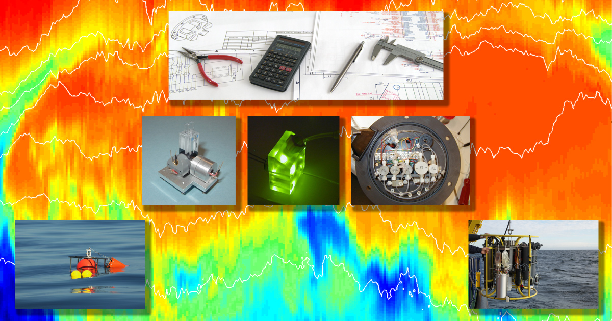
Ocean sciences crucially depend on our ability to make observations of relevant parameters on spatial and temporal scales appropriate for the processes we seek to understand. As temporal and spatial scales of ocean processes vary from sub-mm sub-second to decadal and ocean wide, the range of requirements for suitable sensors and platforms is equally wide. While sensors for basic physical properties like temperature, conductivity and pressure have been established and continually developed for decades, more and more chemical, biological and biogeochemical parameters become accessible by new or improved ocean sensors.

The special issue “Development of Oceanographic Sensors” of the Journal of Marine Science and Engineering seeks original contributions in the field of oceanographic sensors at various stages of the development (first demonstrations in the lab environment to fully qualifying demonstrations at sea). Articles on topics of interest to the sensors community, such as systematic uncertainty estimation of ocean sensors or calibration issues will be considered for publication.

Keywords

  • Oceanographic sensors
  • In-situ ocean sensors
  • Physical ocean sensors
  • Biological ocean sensors
  • Chemical ocean sensors
  • Biogeochemical ocean sensors
  • Sensor development

Published Papers (4 papers)

Order results
Result details
Select all
Export citation of selected articles as:

Research

Jump to: Other

11 pages, 496 KiB  
Article
Enhanced Near-Field Interference Suppression Scheme for the Non-Cooperative Underwater Acoustic Pulse Detection of the Towed Linear Array
by Kun Wei, Shiliang Fang and Jun Tao
J. Mar. Sci. Eng. 2022, 10(2), 250; https://doi.org/10.3390/jmse10020250 - 12 Feb 2022
Cited by 1 | Viewed by 1185
Abstract
Near-field interference suppression for a towed linear array (TLA) is investigated in this paper. The existing eigencomponent association (ECA) scheme and multiple signal classification interference suppression (MUSIC-IS) scheme require the prior information of a target bearing in order to achieve satisfactory performance. To [...] Read more.
Near-field interference suppression for a towed linear array (TLA) is investigated in this paper. The existing eigencomponent association (ECA) scheme and multiple signal classification interference suppression (MUSIC-IS) scheme require the prior information of a target bearing in order to achieve satisfactory performance. To improve this, we propose the use of an enhanced ECA (EECA) scheme that achieves interference suppression in a non-cooperative scenario. It identifies non-target eigenvectors by scanning the tail direction zone of the TLA. With the non-target-only eigenvectors subtracted, the beam power spectrum of the EECA manifests null troughs at the target bearings. Numerical simulations show the superiority of the EECA method. This method can effectively suppress strong interference without prior information, capture a target even at a low signal-to-interference (SIR) level of −25 dB, and obtain dozens of dB processing gains compared to the ECA and MUSIC-IS. Full article
(This article belongs to the Special Issue Development of Oceanographic Sensors)
Show Figures

Figure 1

12 pages, 1877 KiB  
Article
High-Frequency Radar Cross Section of Ocean Surface for an FMICW Source
by Hangyu Zhao, Yeping Lai, Yuhao Wang and Hao Zhou
J. Mar. Sci. Eng. 2021, 9(4), 427; https://doi.org/10.3390/jmse9040427 - 15 Apr 2021
Cited by 2 | Viewed by 2294
Abstract
The frequency-modulated interrupted continuous waveform (FMICW) has been widely used in remotely sensing sea surface states by high-frequency ground wave radar (HFGWR). However, the radar cross section model of the sea surface for this waveform has not yet been presented. Therefore, the first- [...] Read more.
The frequency-modulated interrupted continuous waveform (FMICW) has been widely used in remotely sensing sea surface states by high-frequency ground wave radar (HFGWR). However, the radar cross section model of the sea surface for this waveform has not yet been presented. Therefore, the first- and second-order cross section models of the sea surface about this waveform are derived in this study. The derivation begins with the general electric field equations. Subsequently, the FMICW source is introduced as the radar transmitted signal to obtain the FMICW-incorporated backscattered electric field equations. These equations are used to calculate range spectra by Fourier transforming. Therefore, Fourier transformation of the range spectra calculated from successive sweep intervals gives the Doppler spectra or the power spectral densities. The radar cross section model is obtained by directly comparing the Doppler spectra with the standard radar range equation. Moreover, the derived first- and second-order radar cross section models for an FMICW source are simulated and compared with those for a frequency-modulated continuous waveform (FMCW) source. Results show that the cross section models for the FMICW and FMCW cases have different analytical expressions but almost the same numerical results. Full article
(This article belongs to the Special Issue Development of Oceanographic Sensors)
Show Figures

Figure 1

15 pages, 12889 KiB  
Article
First-Order Peaks Determination for Direction-Finding High-Frequency Radar
by Yeping Lai, Yuhao Wang and Hao Zhou
J. Mar. Sci. Eng. 2021, 9(1), 8; https://doi.org/10.3390/jmse9010008 - 23 Dec 2020
Cited by 2 | Viewed by 1802
Abstract
Direction-finding (DF) high-frequency radar (HFR) is preferred among the HFR family and is widely used around the world due to its compact structure. The correct determination of first-order peaks (FOPs) from Doppler spectra recorded by radar is a critical step toward attaining accurate [...] Read more.
Direction-finding (DF) high-frequency radar (HFR) is preferred among the HFR family and is widely used around the world due to its compact structure. The correct determination of first-order peaks (FOPs) from Doppler spectra recorded by radar is a critical step toward attaining accurate mappings of surface currents. The commonly used FOPs determination method is generally sufficient for most situations. However, it needs six user-defined input parameters. These parameters result in complex procedures of optimizing the values of these six user-defined parameters. To simplify the FOPs determination for DF HFR, we propose an alternative method which only needs one user-defined parameter. To validate the reliability of the proposed method, we compare the FOPs determination results derived from the proposed method with those from the commonly used method on a data set covering a period of 256 days. The results indicate that the proposed method yields a similar FOPs determination result to the commonly used method. This proposed input-parameter-reduced method can greatly simplify the use of the HFR for users who are unprofessional in the HFR and promote the popularization and application of HFR. Full article
(This article belongs to the Special Issue Development of Oceanographic Sensors)
Show Figures

Figure 1

Other

Jump to: Research

13 pages, 548 KiB  
Technical Note
Validation of Drifting Buoy Data for Ocean Wave Observation
by Yukiharu Hisaki
J. Mar. Sci. Eng. 2021, 9(7), 729; https://doi.org/10.3390/jmse9070729 - 01 Jul 2021
Cited by 5 | Viewed by 2875
Abstract
Drifting buoys collect wave data in the open ocean far from land and in areas with strong currents. However, the validation of the drifting buoy wave data is limited. Here, we compared the drifting buoy wave data, ERA5 wave data, and moored GPS [...] Read more.
Drifting buoys collect wave data in the open ocean far from land and in areas with strong currents. However, the validation of the drifting buoy wave data is limited. Here, we compared the drifting buoy wave data, ERA5 wave data, and moored GPS buoy wave data. Data from 2009 to 2018 near the coast of Japan were used. The agreement of the drifting buoy-observed wave parameters with the moored GPS buoy-observed wave parameters is better than that of ERA5 wave parameters, which is statistically significant. In particular, the accuracy of the ERA5 wave heights tends to be lower where the ocean currents are fast. On the other hand, the agreement between the drifting buoy-observed wave heights and the moored GPS buoy-observed wave heights was good even in the areas with strong currents. It is confirmed that the drifting buoy wave data can be used as reference data for wave modeling study. Full article
(This article belongs to the Special Issue Development of Oceanographic Sensors)
Show Figures

Figure 1

Back to TopTop