


Buildings 2023, 13(12), 3123; https://doi.org/10.3390/buildings13123123 - 16 Dec 2023
Cited by 1 | Viewed by 990
Abstract
►
Show Figures
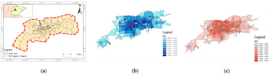
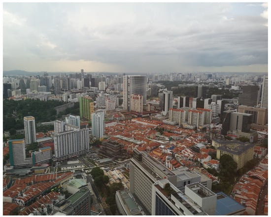
This paper addresses the deep renovation and enhancement of energy efficiency in existing urban areas, aiming to transform them into zero energy districts, utilizing renewable sources. This transformative process is essential to align with contemporary models for new buildings and to elevate existing
[...] Read more.
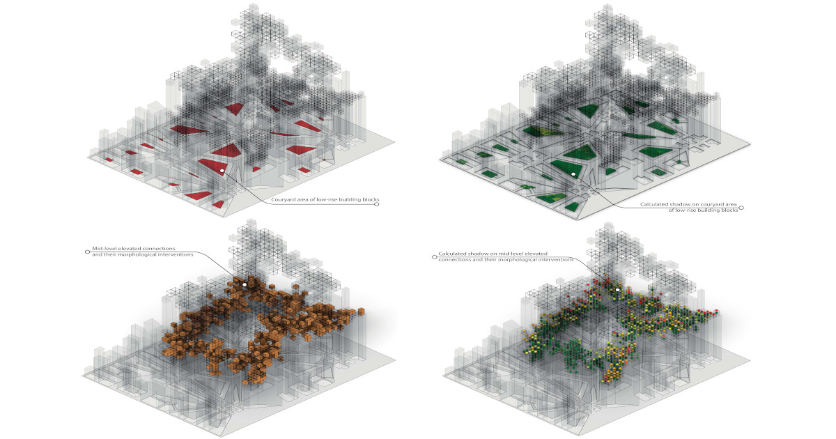
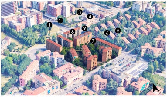
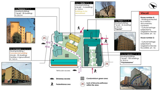
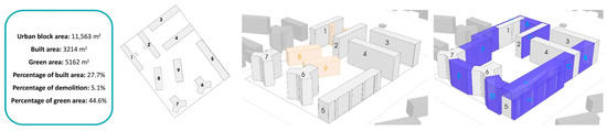
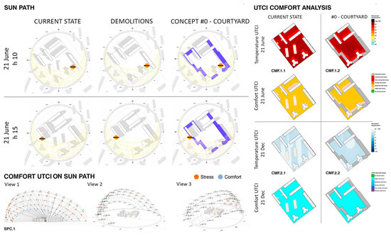
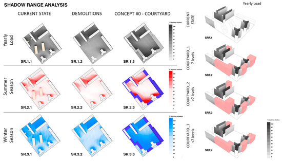
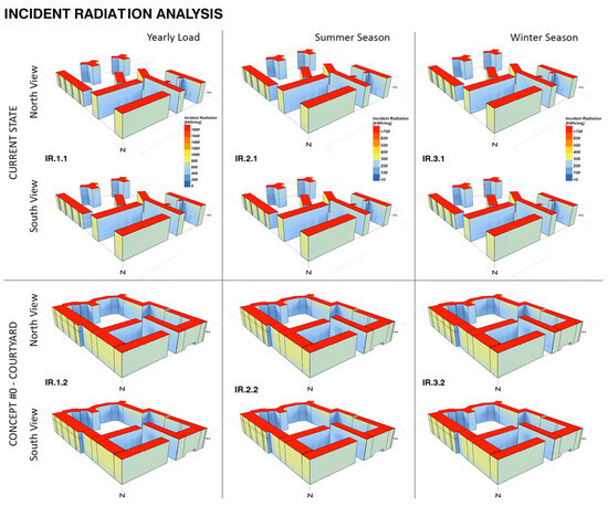
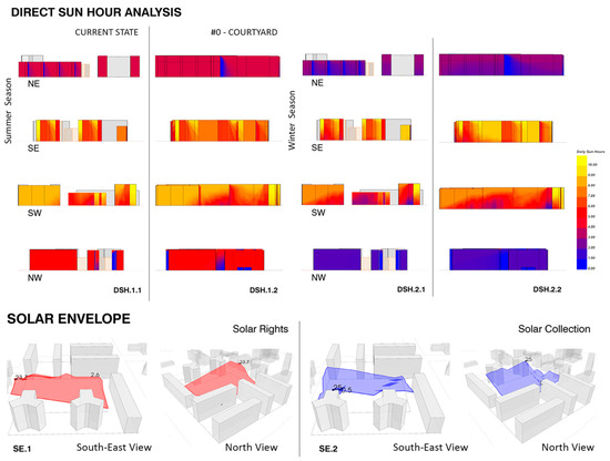
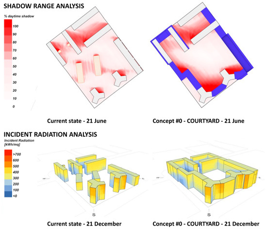
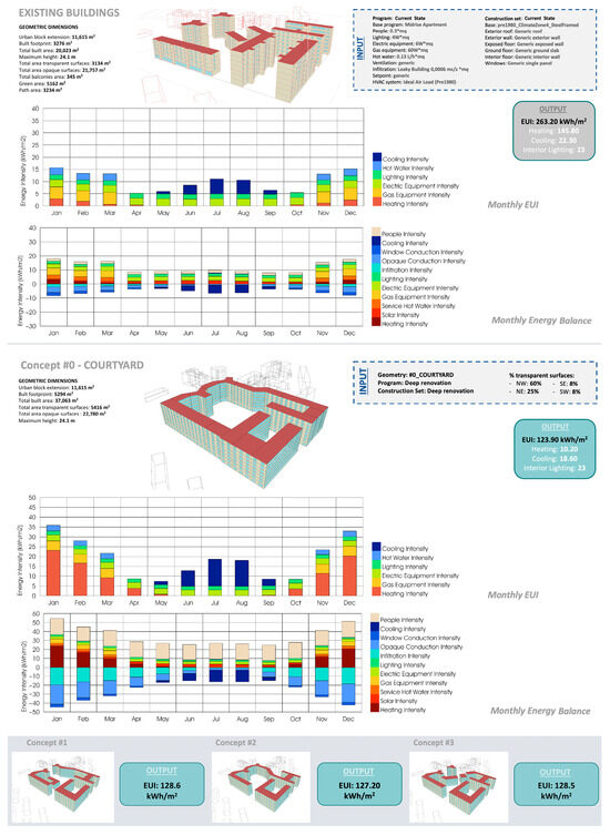
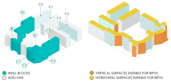
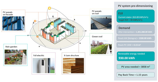
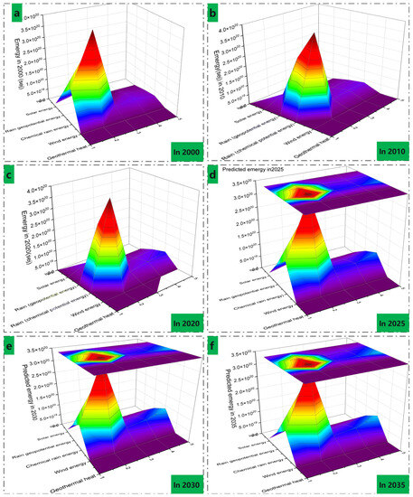
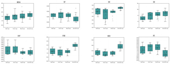
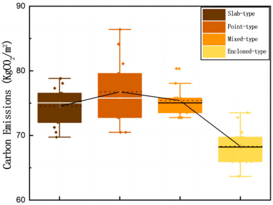
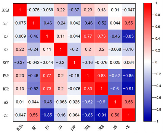
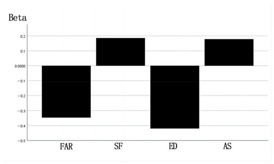
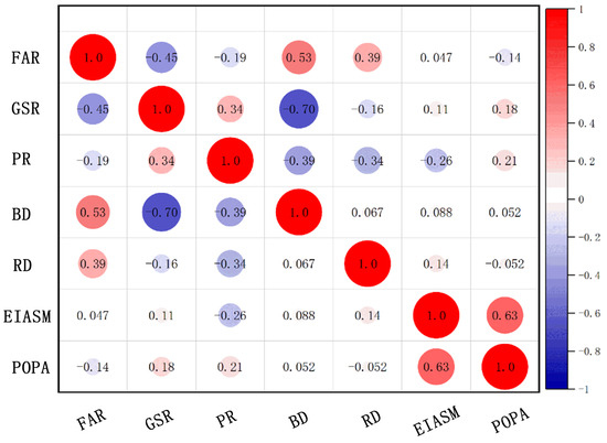
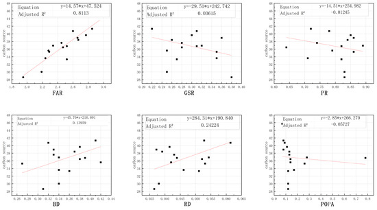
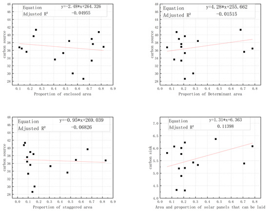
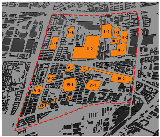
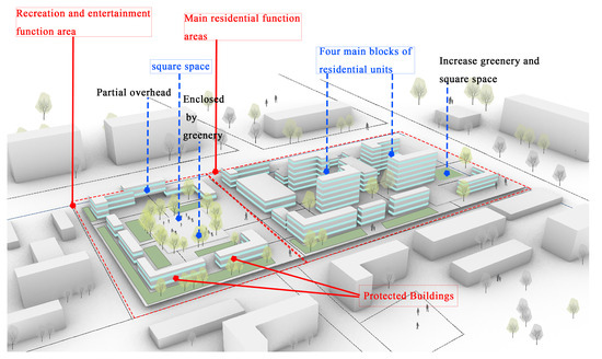
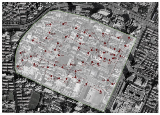
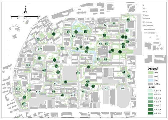
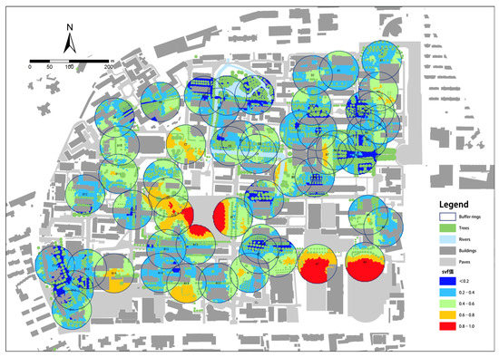
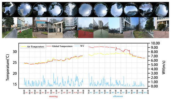
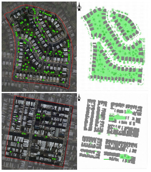
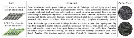
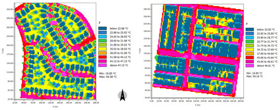
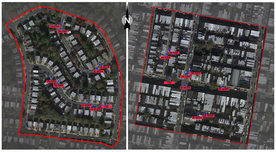
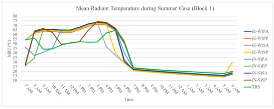
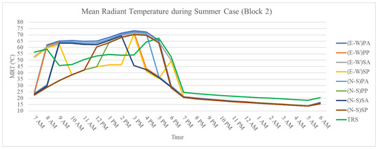
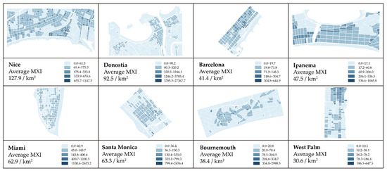
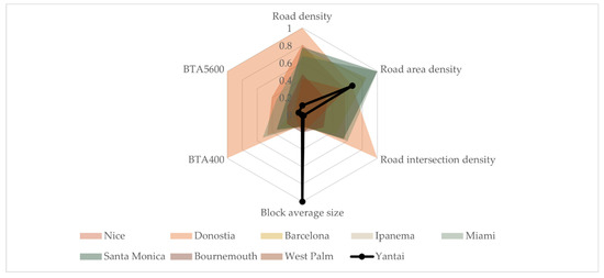
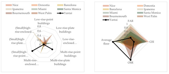
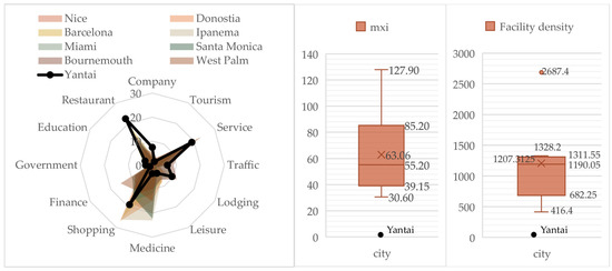
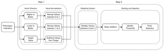
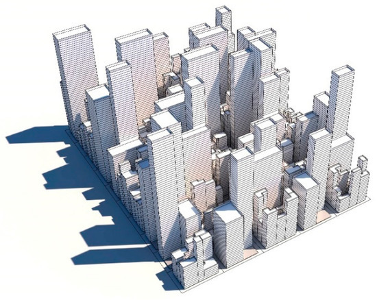
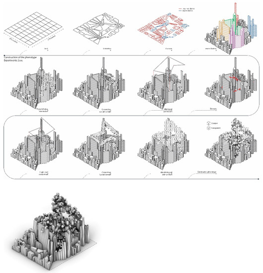
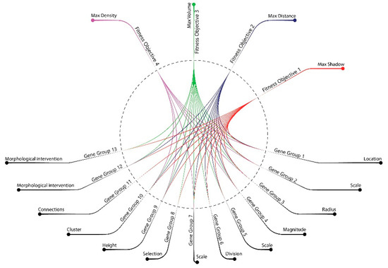
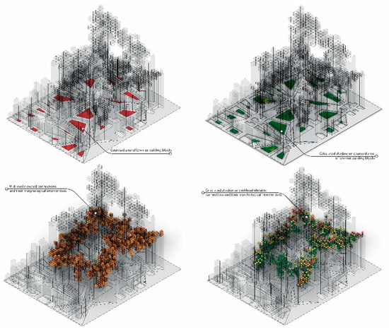
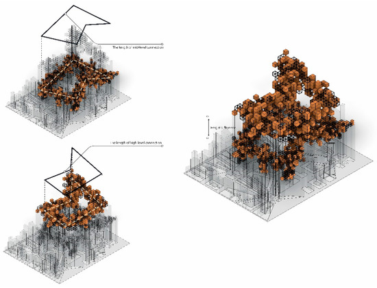
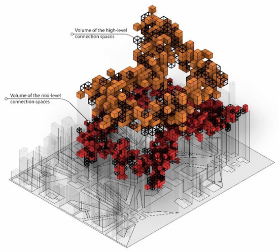
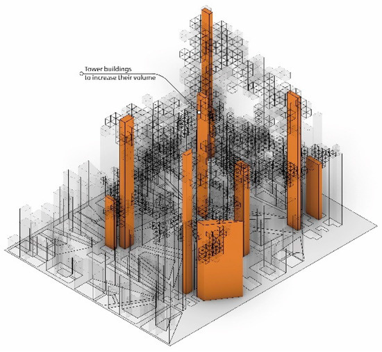
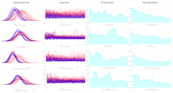
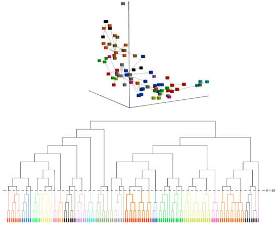
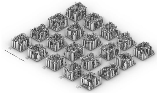
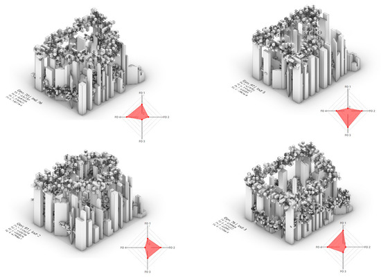
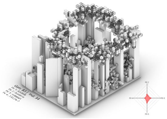
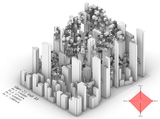
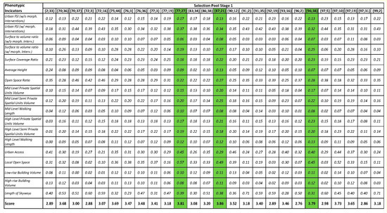
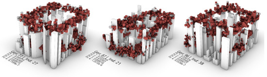
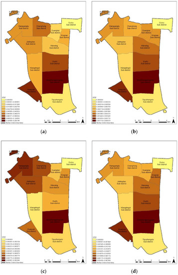
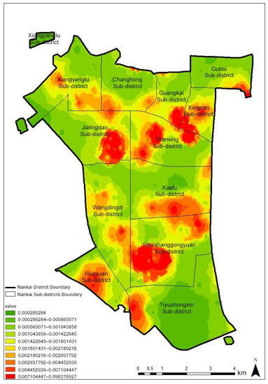
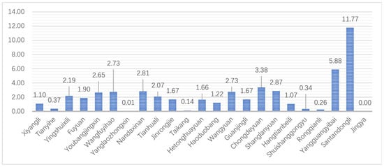
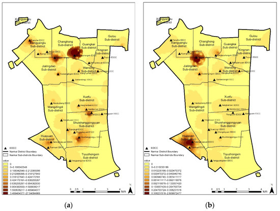
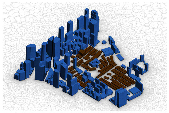
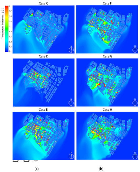
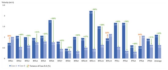
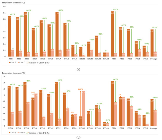
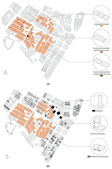
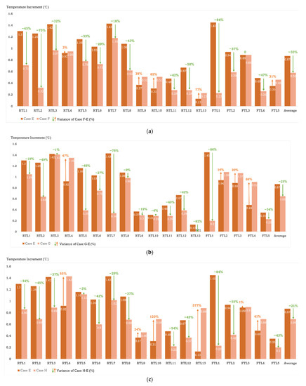
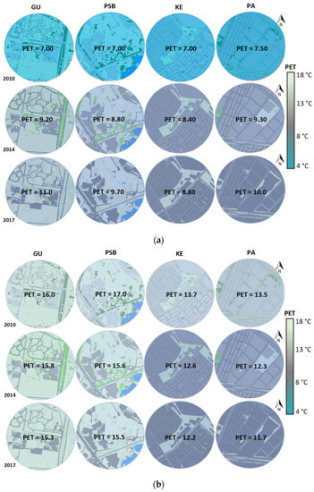
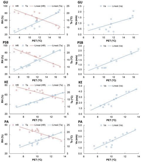
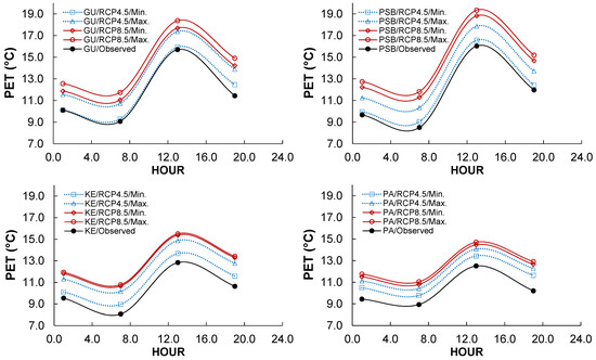
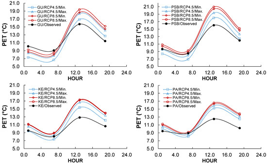
This paper addresses the deep renovation and enhancement of energy efficiency in existing urban areas, aiming to transform them into zero energy districts, utilizing renewable sources. This transformative process is essential to align with contemporary models for new buildings and to elevate existing structures to meet environmental housing standards mandated by current regulations. The proposed densification strategy is motivated by the necessity to augment the real estate value and enhance the architectural and performance quality of the existing building stock, all while minimizing additional land occupation. Its efficacy has been rigorously tested and demonstrated within the European Horizon 2020 project “ABRACADABRA”. The key actions advocated for in this approach revolve around the incorporation of renewable energies, volumetric expansion, and completion volumes (urban infill), within the Positive Energy District. The validation of this process occurs on a district scale in a social housing urban block located in Bologna (Italy), with currently poor environmental performance. A multi-criteria analysis was employed to examine the architectural, climatic, and energy context. The meta-design phase successfully attained the energy and economic targets set by the project and by local and European regulations settings, offering an optimized design solutions for reshaping the built environment.
Full article
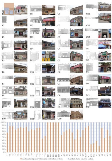
Figure 1


