Review

Optimistic Scenario of 0.50 m Mean Sea Level Rise and Possible Environmental Impacts, Resulting from Tidal Variations, in the City of Niterói, Rio de Janeiro—Brazil

by
Vilmar Leandro Dias Ferreira
1,*,
Elizabeth Santos Pereira
1,
Lucas Pluvie Souza de Mello
1,
Rodrigo Amado Garcia Silva
2 and
Fábio Ferreira Dias
1
1
Department of Geoenvironmental Analyses, Geosciences Institute, Fluminense Federal University, Av. Gal. Milton Tavares de Souza, s/nº, Praia Vermelha Campus, Boa Viagem, Niterói 24210-346, Brazil
2
Department of Agricultural and Environmental Engineering, Fluminense Federal University, Av. Gal. Milton Tavares de Souza, s/nº, Praia Vermelha Campus, Boa Viagem, Niterói 24210-346, Brazil
*
Author to whom correspondence should be addressed.
Coasts 2023, 3(3), 209-226; https://doi.org/10.3390/coasts3030013
Submission received: 1 April 2023 / Revised: 14 June 2023 / Accepted: 17 July 2023 / Published: 1 August 2023

Abstract

:
As several researches indicate, since the 1950s one observed unprecedented warming of the atmosphere and oceans, resulting from greenhouse gas emissions and changes in land use and occupation, leading to sea level rise and impacts on coastal areas. In the municipality of Niterói—Rio de Janeiro, Brazil, where a large urban concentration in coastal areas is observed, a Climate Change Adaptation System was developed, through which mitigation and adaptation strategies are combined, in order to: reduce vulnerabilities; avoid losses and damages; build instruments to allow adaptation of natural, human, productive and infrastructure systems. In this context, this paper aims to measure possible impacts, in the biophysical and socioeconomic spheres, resulting from an eventual 0.50 m rise in mean sea level, which represents an optimistic scenario according to the National Oceanic and Atmospheric Administration. In contrast to similar studies, this work also considered daily and occasional water level variations, represented by the highest astronomical tide and the highest storm surge observed in the studied region. The following data were applied: digital elevation model, 2010 population census data, and real estate information. With the altimetry data, by means of GIS, the census sectors inserted in the affected areas were selected, to obtain data regarding population, number of households, and income. Specialized websites were applied to collect average property values. The simulations revealed that approximately 2950 households and more than 9000 residents could be directly affected, with losses that could exceed R$ 3.60 billion. The Oceanic Region is configured as the most exposed region, susceptible to losses of several ecosystems, economic losses in residential areas and possible destruction of urban infrastructure.

1. Introduction

The warming of the global climate system is unequivocal. Since the 1950s, notable changes occurred in both the atmosphere and oceans: temperature shifts; increase in greenhouse gas concentrations (GHGs); decrease in amounts of snow and ice; increase in sea levels [1]. Several research works indicate that this warming occurred mainly due to carbon dioxide (CO2) emissions, and also due to changes in land use and occupation [1,2,3,4].
Between 1750 and 2011 the release of CO2 from industrial and agricultural activities generated global mean concentrations (GMC) ranging from 278.0 ppm to 390.5 ppm [1]. According to WMO, the GMC reached the mark of 407.8 ppm in 2018 [4].
This increase in GMC caused considerable variations in atmospheric circulation, as well as in the spatial distribution of water masses and interactions between them, culminating in ocean warming and significant deviations in the ocean water level [5]). These variations result from melting of the Greenland and Antarctic ice sheets, which has worsened since the early 1990s [6].
Historically, the rate of increase in the mean sea level (MSL) is also increasing: during the period 1901–2010, this increased rate was 1.7 mm/year [1.5 to 1.9]; between 1971 and 2010, the average rate was 2.0 mm/year [1.7 to 2.3]; and, between 1993 and 2010, 3.2 mm/year [2.8 to 3.6] [1]. Considering this trend, one projects an MSL increase rate of 4.0 mm/year for the period 2081–2100, compared to the period 1986–2005, in a more optimistic scenario of MSL elevation, according to the analyses carried out through Representative Concentration Pathway—RCP (projection IPCC 2.6) [6].
In view of these results and based on plausible scenarios prepared by Parris et al. [7] and Hall et al. [8], aimed at conditions for decision-making, taking into account specific assumptions about sea levels, the National Oceanic and Atmospheric Administration—NOAA—delimited six projections of sea level rise: low, with an increase of 0.30 m; low intermediate, with an increase of 0.50 m; intermediate, with an increase of 1.00 m; high intermediate, with an increase of 1.20 m; high, with projection of 2.00 m of increase; and extreme, with a level increase of 2.50 m [9].
This increase in MSL, induced by global warming, and its possible impacts on the coastal zone, has been a matter of great interest to the scientific community in the last few decades, as well as to the media and the general public, despite difficulties in its evaluations and mappings on a large scale [1,3]. The expected changes are phenomena associated with the biophysical and socioeconomic, as a consequence of the risks that can severely affect life on the coast [10]. By the end of the 21st century, almost the entire world’s coastline could be affected [3].
Coastal regions are characterized as poles of attraction for the most diverse populations, depending on the provision of resources and access to maritime trade, as well as recreational and cultural activities. However, in recent decades, these areas experienced enormous changes, driven by fast population growth and accelerated development [11]. In the possibility of MSL rise, several coastal areas will be subject to significant economic impacts caused by floods, erosion [12], submersion and saline intrusion into surface or groundwater [5,13].
Studying In this context, it is fundamental to study and understand the impacts and adaptation strategies to MSL rise [5,14]. This may be performed either through coastal processes modeling, in regard to hydrometeorological, biological and geodynamic factors, which interact nonlinearly at different spatial-time scales, or through the evaluation of the effects of human activities [1]. In recent decades, the application of geotechnologies became a method widely applied by several authors in research words regarding aspects related to the elevation of the MSL, as well as its possible impacts on the coastal zone [15,16,17,18], among others.
Considering the high levels of confidence regarding the occurrence of the CPR 2.6 projection [1], with a forecast increase in the MSL of 4.0 mm/year [2.6 to 5.4], for the period 2081–2100, this work aims to measure environmental impacts, in the biophysical and socioeconomic spheres, in the municipality of Niterói, state of Rio de Janeiro—southeastern Brazil—in virtue of possible increases in the level of marine waters of: (i) 1.20 m; (ii) 1.80 m. These two scenarios represent the NOAA’s sea level rise scenario of 0.50 m [9], also considering: (i) 0.70 m, which is the water level of the expected highest astronomical tide (HAT); (ii) 0.70 m, corresponding to the HAT occurring concomitantly with the highest storm surge—0.60 m—observed in the studied region.
This work also intends to provide the city of Niterói with data, to sustain decision-making processes regarding climate change.

2. Study Area

The Brazilian coastal zone comprises an area of approximately 251,000 km2, which corresponds to about 3% of the national territory [19], and extends for more than 8500 km, covering 280 municipalities, which belong to 17 federative states, according to the Ministry of the Environment [20]. More than 10.4% of the population lives in this area: around 22 million inhabitants [21].
The former capital of the state of Rio de Janeiro (RJ)—in the periods 1835–1893 and 1903–1975—the municipality of Niterói (Figure 1) presents one of the highest demographic densities in the metropolitan region of RJ and in the Brazilian coast: about 3800 inhabitants/km2 [21]. Niterói is currently composed of five Administrative Planning Regions, which comprise 52 neighborhoods. Three of these regions face ocean waters: North, Bay Beaches and Oceanic [22].
In terms of occupation and vulnerabilities to MSL rise, Niterói is composed of two distinct macroregions: Guanabara Bay, in which occupation is complex and disorderly distributed, characterized by sheltered and semi-sheltered coastlines; and Oceanic, which experienced a recent process of urban expansion and is characterized by an exposed coastline and areas around the Itaipu-Piratininga lagoon system [23].
In the coastal strip, the municipality is formed by a series of quaternary sedimentation environments, associated with depositional systems of continental and transitional marine origin, which led to the development of a plain, largely guided by the structural directions of the geological base, in addition to a sandy barrier formation, which confines the Itaipu–Piratininga Lagoon System [24].
The geomorphology of Niterói is characterized by the predominance of coastal plains (coastal and fluviomarine) and coastal massifs. According to the Mineral Resources Research Company—CPRM [25], the coastal plains and lowlands are subhorizontal surfaces, with soft and undulated relief. The lowlands are poorly drained terrains with meandering and rambling channel patterns, while the coastal plains are well-drained terrains with parallel drainage patterns, following the inter-coastal depressions. The coastal massifs, on the other hand, are located in the middle of the lowlands and coastal plains, and are mountainous, and extremely rugged, with the occurrence of colluvium and thallus deposits, shallow soils, and rock outcroppings.
The climate, according to the Köppen classification, is of type Aw: tropical, characterized by dry winter and rainy summer, with precipitation ranging between 750 mm and 1800 mm annually [26].
Regarding environmental issues, Niterói developed a System for Adaptation to Climate Change, which aims to implement mitigation/adaptation actions and efforts against MSL rise and to assess vulnerabilities and impacts in regard to climate change. This system provides standardization of a Municipal Resilience Plan, which should include the adoption of strategic planning for urban resilience, as well as preservation and qualification of ecosystems, green areas and initiatives of low greenhouse gas emissions, in order to avoid or minimize associated losses, including both extreme and slow-onset weather events [22].

3. Materials and Methods

The effects of climate change need to be considered worldwide, especially in urban planning. In coastal areas, in virtue of global warming, impacts from possible sea level rise must be considered. Several variables can be used in this analysis, not only in academia but also by decision-makers.
Several studies ([18,27,28], around the world, address topics regarding coastal flood scenarios as a result of increased MSL. However, such studies rarely consider daily and occasional variations in water level due to astronomical and meteorological effects. The approaches applied, in general, do not clearly show the reference water level, or leave this information implicit. Thus, this research presents simulations of flood areas in the city of Niterói considering astronomical tides and storm surges, phenomena that occur routinely in coastal areas around the world. The configurations of the performed simulations followed the steps described below, also represented in Figure 2:
(1)
Use of the Digital Elevation Model (MDE), obtained by LiDAR (Light Detection and Ranging) technology, available on the SIGeo/Niterói portal [29], for vectorization, through the ArcGIS application, version 10.5, of the 1.20 m and 1.80 m altimetric contour lines, using as reference level the level of the mean lowest low water tide in the region. These levels correspond to the projections of a 0.50 m MSL rise, added, respectively by:
(a)
The HAT water level, which is 0.71m according to records of the Brazilian Navy Tidal Board [30]—Fiscal Island station/ Rio de Janeiro—approximated to 0.70 m, due to adequacy of the GIS;
(b)
The water level of 1.35 m, which considers the 0.60 m highest storm surge (HSS) water level—according to the Gloss-Brazil database [31], in records for the period 1963–2017—occurring concomitantly with the HAT. One approximated this water level to be 1.30 m due to the adequacy of GIS.
(2)
Overlaying through the ArcGis program of shapefiles of 1.20 m and 1.80 m altimetric contour lines; shapefile of land use and occupation, available on the SIGeo/Niterói portal [29]; shapefile of census tracts, available on the IBGE [32] page, aiming to obtain the areas of intersection, representative of the possible flood areas.
Figure 2. Flowchart indicating the methodology applied in the simulations of 1.20 m and 1.80 m water level [30,31].
Coasts 03 00013 g002
Subsequently, one analyzed biophysical and socioeconomic impacts according to the following aspects:
(1)
Percentage of classes of land use and occupation, inserted in the intersection area.
(2)
Population and number of households, inserted in the intersection area.
However, regarding these items, one observed that several census tracts intersected by the vectorized altimetric contour lines, reducing the quantitative accuracy. In virtue of this, the performed calculation considered the proportion between the areas of the shapefile corresponding to each scenario and the total areas of the census tracts, including those fully contained in the altimetric range and those intercepted by each altimetric contour line;
(3)
Possible economic impacts, considering the households eventually affected. For this purpose, the parameter “market value”—the average value of real estate, per Administrative Region, related to the real estate market—was used. In this case, the websites of specialized companies such as OLX [33] and Free Market [34] were researched. Approximately 10,000 advertisements from each company, regarding the ten most representative neighborhoods, were analyzed, considering advertisements found concomitantly in both databases. A 5% sample criterion was adopted, which allowed the selection of the 20th, 40th, 60th, 80th, 100th... advertisements, etc., extracting the average market value per neighborhood. In situations of incoherent advertisements, the first subsequent advertisement was selected. The average value of the properties was calculated as the simple average of the neighborhoods analyzed in each Administrative Region, considering the altimetric range. Finally, the obtained values were multiplied by the number of households.
(4)
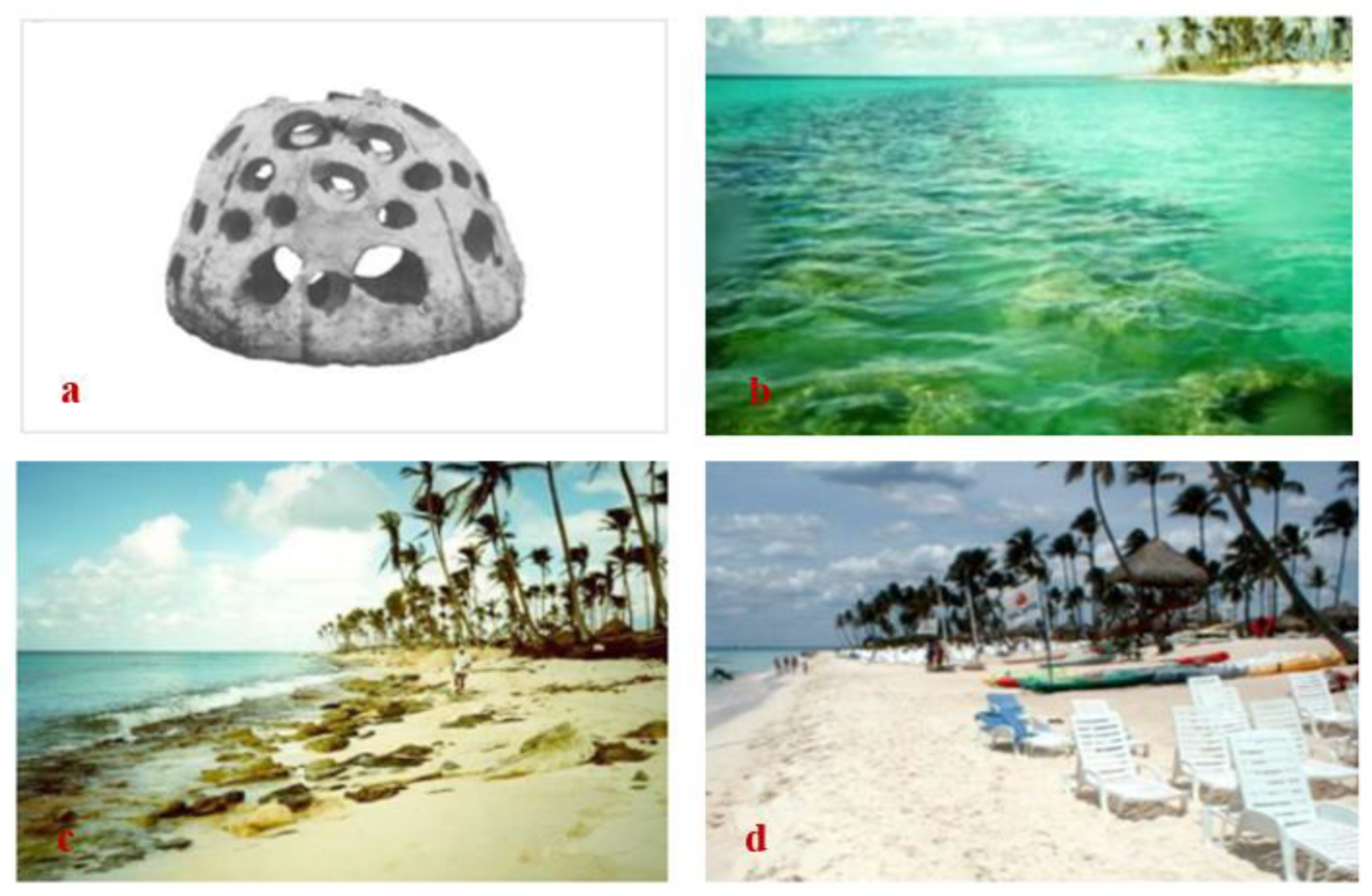
Survey of other significant environmental impacts of MSL rise, through primary bibliographic sources, such as the Orla Project [23], including mangroves, shell midden, fishermen’s colonies, shipping stations, ship repair and building companies, land reclamation areas, higher education institution, etc.
(5)
Finally, one presents proposals to adapt or mitigate the possible impacts caused by the increase in the average sea level for each segment analyzed, according to the results found.

4. Results

4.1. Sea Level in Conditions of HAT: Elevation of 1.20 m

In conditions of 1.20 m water level, due to the HAT in the scenario of 0.5 m MSL rise, the most significantly affected classes will be: “vegetation cover”, with 1,720,889 m2 of flooded areas, which correspond to about 71% of floods, 9.62% of the vegetated area of the administrative regions bathed by the sea and 2.88% of the vegetated areas of the municipality; “beach”, with 376,127 m2—approximately 15.44% of the flooded areas and 74.36% of the beaches of the municipality; and “urban”, with 181,242 m2—around 7.44% of the flooded areas, 1.08% of the urbanized areas of the administrative regions bathed by the sea and 0.41% of the urbanized areas of the municipality—according to the results illustrated in Figure 3 and Figure 4, graphically represented in Figure 5a and presented in Table 1.
In the Northern Region, the most affected class will be “industrial”, with a loss of 19,882 m2 of area, followed by “beach”, with 8656 m2, and “urban”, with 1216 m2. Regarding the Bay Beaches Region, the classes “vegetation cover”, “beach”, “industrial” and “urban”, will be the most affected, with losses of 189,672 m2, 145,222 m2, 88,766 m2 and 53,109 m2, respectively. As for the Oceanic Region, “vegetation cover”, “beach”, “urban” and “disorderly occupation”, appear as the most affected classes, with flooded areas of 1,531,217 m2, 222,248 m2, 126,916 m2 and 14,428 m2, respectively.
Regarding socioeconomic aspects, as Table 2 presents, the results revealed that about 1565 people, residents of approximately 500 households, may be directly affected by the rise in marine waters. This result already considers projections of population growth by 2041 and subsequent decline, according to IBGE [35]. The Oceanic Region is the most impacted, with about 1537 people and 491 households affected. Estimates for the North and Beaches of the Bay regions are not significant: only 5 households in each region can be reached by the waters, where approximately 28 people reside.
In terms of property damage, also shown in Table 2, one estimated losses of R$ 617 million, considering only residential properties possibly affected by floods, if no adaptation measure is adopted. The Oceanic Region should be considerably the most impacted, particularly the area immediately around the Itaipu–Piratininga Lagoon System, with about R$ 611 million of losses related to flooded homes. In the Bay Beaches Region, losses could reach approximately R$ 4.4 million and, in the Northern Region, around R$ 1.7 million.

4.2. Sea Level in Conditions of HSS Concomitant with HAT: Elevation of 1.80 m

In conditions of 1.80 m water level, which considers the maximum storm surge, concomitant with high water spring tide, the class most affected area is “vegetation cover”, with 2,449,966 m2 flooded, corresponding to approximately 52% of the flooded areas, 12.27% of the vegetated areas of the three administrative regions bathed by the sea and 4.10% of the municipality; “urban”, with 988,984 m2—about 21.01% of flooded areas, 5.89% of urbanized areas of the administrative regions bathed by the sea and 2.23% of the municipality; “industrial”, with 657,592 m2—around 13.97% of flooded areas, 51.02% of industrial areas of the administrative regions bathed by the sea and 43.77% of the municipality; and “beach”, with 396,025 m2, which correspond to about 8.40% of floods and 78.29% of the beach environments of the municipality—as illustrated in Figure 3 and Figure 4, graphically represented in Figure 5b and arranged in Table 1.
In the Northern Region, the “industrial” classes, with 483,012 m2, “urban”, with 138,866 m2, and “vegetation cover”, with 85,739 m2 of flooded areas, will be the most representative. In the Bay Beaches Region, “vegetation cover”, “industrial” and “urban” are the possibly most affected, with areas of 295,189 m2, 174,579 m2 and 164,119 m2, respectively. And, in the Oceanic Region, the classes “vegetation cover”, with 2,069,037 m2, “urban”, with 685,998 m2, and “beach”, with 232,065 m2, should be the most impacted.
With regard to socioeconomic aspects, Table 2 reveals that floods may reach approximately 4868 households in the municipality, where about 14,490 people live, considering projections of population growth until 2041 and subsequent decline, according to IBGE [35]. In the Northern Region, the water level may reach approximately 948 households and 2845 people. In the Bay Beaches Region, about 972 households and 2532 people. In regard to the Oceanic Region, one estimated 2948 households and 9113 people were possibly affected by the maximum elevations in water levels, considering the most severe storm surges combined with the maximum spring high water tide.
In terms of economic losses, considering the current market values of the households possibly affected, one estimated that the losses may reach an amount of approximately R$ 4.80 billion in the municipality if no adaptation measure is adopted. The Oceanic Region is expected to be the most impacted, with about R$ 3.67 billion in losses, mainly in the area surrounding the lagoon complex. In the Bay Beaches Region, damages are estimated at around R$ 848 million and, in the North Region, approximately R$ 286 million.

4.3. Other Environmental Aspects and Possible Impacts

Complementary analyses were performed, in regard to other environmental aspects, e.g., in the biophysical and socioeconomic spheres, existing in the coastal strip susceptible to flooding, considering the Waterfront Project of the Municipality of Niterói [23]. In general, on the coast of the Guanabara Bay macro-region, which is predominantly composed of sheltered shores, which are tide-dominated areas. In this case, lowlands are more susceptible to floods caused by variations in marine waters, and flooding caused by deficient rainwater drainage.
In the Northern Administrative Region, especially during the occurrence of maximum storm surges, in addition to possible impacts on industrial activity, fishing communities living near the shores will most likely need adaptation in their facilities. In biophysical terms, the remnants of mangroves and fragments of beaches will tend to be totally suppressed.
In the Administrative Region Beaches of the Bay, both fishing communities and waterway transport stations will demand adaptations, due to possible high levels of marine waters. Beach environments should be almost completely suppressed. In episodes of flooding, caused by heavy rains, one may expect intensified disturbances and damage to trade and road transportation.
In regard to the macro-region facing the Atlantic Ocean, on the edge of the Piratininga–Itaipu Lagoon Complex, the most significant impact refers to mangroves and urban installations developed very close to the lagoons’ shores, in landfills over wetlands. In the region facing the ocean, even at maximum storm surges, water levels should remain restricted to beach environments. However, the effects of waves, which tend to become increasingly frequent and intense, can cause severe damage to urban structures and to the restinga vegetation which occupies the upper beach environments, if no adaptation measure is taken. The fishing community, as well as the archaeological site, will most likely not be impacted, since they are located in a sheltered stretch of the Itaipu Beach, at higher levels than those addressed in this study.

5. Discussion

5.1. Rising Sea Levels and Its Impacts

Considering only a 0.50 m MSL rise, at first, the impacts in the municipality of Niterói are not very significant. However, when daily and occasional sea level variations—i.e., astronomical tides and storm surges—are considered, people, properties and ecosystems are directly impacted. Rising water levels will also tend to raise groundwater levels, intensifying flooding generated by storms [16]—which will tend to cause direct or indirect disruption to the resident populations of lowlands.
The simulations carried out in the municipality of Niterói revealed that, in optimistic conditions of 0.50 m MSL rise, concomitant with HAT and HSS, the area most impacted by the floods should be the Oceanic Region, where the class “vegetation cover” may present losses of 12.06% to 16.30%, especially related to the mangroves surrounding the Itaipu-Piratininga Lagoon System. In the Northern Region, the “industrial” class should be the most heavily affected: floods could reach 1.32% to 32.15% of the industrial areas of the municipality, reflecting a worse situation and giving rise to a demand for adaptation measures, to avoid further damage to the local economy. In addition, both in the Bay Beaches Region and in the Oceanic Region, the “beach” class is expected to experience a reduction from 72.74% to 76.67%—which tends to increase the degree of vulnerability of adjacent urban areas during adverse weather events, which also reflects on recreational and tourism activities.
It must be emphasized that, usually, the degree of vulnerability of human populations is positively evaluated according to the number of natural barriers, represented mainly by dunes, restingas and mangroves: the more expressive these formations are, the lower the vulnerabilities and risks for adjacent urban areas, as addressed by several studies [18,36,37,38,39,40]. In fact, from an immediate or short-term perspective, this role of natural barriers is undeniable [41]. However, in a medium/long-term perspective, with the reduction or suppression of these ecosystems, economically vulnerable human populations will tend to suffer more intensely the effects of adversities caused by rising levels of ocean waters [42,43,44,45,46].
As for residential sectors, including the classes “urban” and “disorderly occupation”, in occasions of HAT in association with HSS, one estimated, respectively, about 0.36% and 1.92% of flooded areas, which comprise 0.20 km2 and 1.03 km2. There are approximately between 500 and 4868 households in these areas, corresponding to about 1565 and 14,490 residents. In the Oceanic Region, particularly, floods are expected to cover between 0.14 km2 and 0.73 km2, reaching about 490 to 2950 households and 1500 to 9100 residents.
The northern sector around the Piratininga Lagoon is the most sensitive area: in this segment, there are disordered occupations comprising five census tracts, in land reclamation areas, in which the native vegetation was largely degraded, thus reducing natural protection. Economically, the situation is even more critical: per capita income in the community is approximately R$ 190.00/month—far below the municipal average, which is about R$ 909.00 monthly—a fact that may require interference from the government, due to adversities during possible flood episodes. If no other efficient measures are implemented, more than 1900 people may need relocation.
Thus, it is evident the importance of GIS techniques, which allow considerable precise calculation of possible future impacts resulting from the increase in the level of marine waters, in order to provide decision-makers with satisfactory parameters, which may allow the adoption of the most appropriate measures. Several authors used similar techniques in the quantification of these possible impacts—each with its particularities, considering the different territorial and geomorphological dimensions [14,15,16,17], among others.
Zhang et al. [15], in scenarios of MSL elevation of 1.20 m and 1.80 m, in the region of the Upper Florida Keys—USA, estimated that the total flood areas may be in the order of 119 km2 and 133 km2, where 15,933 and 21,768 people live, respectively, and, in the Lower Florida Keys region, there may be 176 km2 and 185 km2 of flooded areas, where 32,154 and 38,794 people live, respectively. Murali & Kumar [16], in simulations referring to the city of Cochin—Kerala State, southwestern India—estimated that the total areas reached, in scenarios of 1 m and 2 m elevation of sea level, would be 169.11 km2 and 598.83 km2, comprising urban areas of 43 km2 and 187 km2, respectively. And, in the analyses carried out by Al-Awadhi et al. [17], in Dhofar—Oman, in simulations of rising waters from 0.2 m to 5 m, there were floods in built areas in the order of 0.16 km2 to 1.20 km2.
In regard to possible economic losses at the global level, Hallegatte et al. [12] estimated that flood losses, considering the rise in sea level and subsidence, could reach approximately US$ 60–63 billion (around R$ 336–353 billion) in 2050. In Florida, where coastal areas are densely populated, the National Park Service report estimated, for a 1 m elevation scenario, about $40 billion (about $224.5 billion) in infrastructure exposed to possible impacts [13].
In Brazil, Marengo et al. [14], in studies conducted in the SE and NW regions of the municipality of Santos—state of São Paulo—in a possible scenario of an increase of 0.45 m in the NMM, estimated damages of approximately US$ 400 million (about R$ 2.24 billion) if no adaptation measure is adopted. In this case, the authors considered, more comprehensively, the economic damage related to all urban structures, differently from the present study, in which only the damage caused to residential properties was considered.

5.2. Coastal Zone in Niterói and Brazil—Legal Aspects

The rules of use and occupation of the Brazilian coastal zone are defined through the National Coastal Management Plan and its regulations. Among the instruments provided for this purpose, there are the “Macrodiagnosis of the Coastal and Marine Zone”—MDZCM and the “Coastal Ecological-Economic Zoning”—ZEEC. The first, which gathers information on a national scale, on the physical-natural and socioeconomic characteristics of the coastal zone, aims to guide actions for preservation, conservation, regulation and supervision of natural and cultural heritage, through the generation of flood risk indexes, social risk and technological risk, in addition to the identification of coastal and marine areas priority for biodiversity conservation. The second refers to the orientation of the territorial planning process, necessary to obtain the sustainable conditions for the development of the coastal zone, in line with the guidelines of the National Ecological-Economic Zoning, which acts as a mechanism to support monitoring, licensing, supervision and management actions [47].
However, in 2019, the Brazilian Federal Government authorized, through a specific law, the transfer to municipalities of the management of the sea, estuarine, lake and federal river beaches, including areas of common-use goods with economic exploitation, such as the boardwalk, squares and public parks (except bodies of water, considered essential areas for national defense, areas reserved for the use of organs and federal entities, areas for exploitation of public services of under competence of the Federal Government and areas of federal conservation units) [48]. In this sense, the Municipal Government, in medium and large cities, was responsible for elaborating and implementing an Intervention Plan of the Maritime Waterfront—Project Orla, articulated with the Municipal Master Plan, for the tracks adjacent to rivers and seas, as a way of detailing the ZEEC [49].
In Niterói, in addition to the Orla Project, launched in 2011, the Municipal Master Plan added an Environmental Policy in 2019, which included a System for Adaptation to Climate Change, combining mitigation and adaptation strategies, also considering the implementation of actions and efforts regarding raising sea levels and assessing the impacts of vulnerabilities with respect to climate change. This plan considers people, sites and ecosystems in vulnerable conditions [22], in line with the National Policy on Climate Change (PNMC), in which integration actions are advocated at the national, state and municipal levels, by public and private entities, in the context of climate change [50].
It should be emphasized, however, that public plans, despite containing political projections focused on mitigation and adaption to the effects of climate change, in practice, the short-term goal is usually the reduction of greenhouse gas emissions. Public policies focused on possible impacts are still incipient, due to uncertainties related to both the warming of the atmosphere and the consequent increase in the level of ocean waters.

6. Adaptation Proposals

In view of the possible impacts arising from the rise in sea levels, coastal protection methods should inevitably be implemented, from the most traditional ones, such as beach walls, spores, breakwaters, artificial beach nourishment, etc., to the less traditional ones, normally used in sheltered environments and which can be adopted sufficiently as forms of mitigation, including gabion walls, polypropylene bags, geotextiles, among others [36]. Table 3 presents a synthesis of the main expected natural and socioeconomic impacts and their respective mitigation/adaptation proposals, following the precepts of various bibliographic sources.
Adaptation measures should be integrated with coastal zone management and preventive planning could reduce future problems [16]. Among the various options, the interventions proposed must always be compared and evaluated, particularly with respect to costs, which may cover: planning and engineering, materials, labor, implementation, management and maintenance [38]. The choice should be technical and socio-political, addressing which options are desirable, accessible and sustainable in the long term, considering protection, accommodation and relocation initiatives [56].
With these questions raised, related to the impacts possibly caused by the increase in water level in the municipality of Niterói, with prospects for the year 2100, also considering the various control/protection options exposed in Table 3, we suggest the following adaptation measures, which may be feasible and essential, specifically proposed for each segment analyzed—objects of this study:
(1) In sheltered or semi-sheltered areas, basically represented by the edge of Guanabara Bay and the Itaipu–Piratininga Lagoon System, rigid structures may be necessary in stretches where no intervention exists, in addition to adaptation measures for the urban environment due to flooding, such as implementation of large-scale pumping systems for the removal of rainwater, such as those used in New Orleans—USA [38], mainly during intense rainfall events, which tend to reduce urban drainage gradients, due to the rise in the level of the water table [16].
These solutions are not simple, since they cover flood effects in virtue of rising water levels (containment works) and, additionally, flooding events due to rainwater, especially during HAT episodes. Thus, there is a need for combined and effective systems—which require specific studies and continuous monitoring, among other proposals.
(2) In the Oceanic Region, where vulnerability to wave action tends to increase with rising sea levels, a combination of methods, preceded by careful assessments, can be suggested as a form of mitigation or adaptation—for example construction of submerged breakwaters—aiming not extensive changes to the environmental dynamics—concomitantly with artificial sand feeding (beach nourishment) and maintenance of native vegetation—a proposal that resembles the one offered by Fortunato et al. [36], for the solution of erosive problems detected on the beach of Hac-Sá, on the island of Coloane, in Macau.
This type of solution, however, according to Fortunato et al. [36], tends to reduce the incident wave energy and, reduce erosion of the shoreline and, in the short and medium term, could cause major changes in the natural dynamics of the beaches. Analyses on morphodynamic behavior and natural adjustment of beach profiles showed that only artificial beach nourishment would be the most indicated measure because it presents no fluctuations in the shoreline and offers more favorable conditions for recreational use. In addition, it is configured as a non-structural solution of lower costs, which allows the maintenance of the natural dynamics of the beach.
However, this study provides more detailed evaluations regarding sediment dynamics in the beach environments of the non-sheltered segment of Niterói, continuous monitoring and planning/adoption of the most indicated engineering works, with the objective of reducing impacts on leisure, tourism, urban structures and, consequently, on the local economy. A “simple” beach nourishment may require greater efforts in terms of monitoring and control, considering that extreme weather episodes, whose effects occur in a short period of time, should become increasingly frequent and intense, in a much more pronounced dynamic.
An example of engineering work, similar to the proposals presented in this study, was developed in the 1970s, in Las Teresitas. The construction of an artificial beach in the municipality of Santa Cruz de Tenerife, Canary Islands—Illustrated in Figure 6—combined the following methods: a breakwater built 150 m far from the coast, with an extension of 1 km, and beach nourishment, expanding the beach to a width of 80 m [57].
Another example was developed on a beach near Bayahibe, east of Santo Domingo and LaRomano—Dominican Republic—through the installation of three submerged breakwater segments, built using Reef Ball (structures produced in molded concrete), according to illustrations presented in Figure 7, which provided considerable gain of sand in the beach strip, between 1999 and 2001 [58].
Figure 6. Artificial beach in the municipality of Santa Cruz de Tenerife, Canary Islands—Spain—built through the combination of two methods: detached breakwaters and beach nourishment. SOURCE: Wikipedia [59].
Coasts 03 00013 g006

7. Conclusions

This article aimed to identify the main environmental impacts, in the biophysical and socioeconomic spheres, expected to occur along the coastal region of the municipality of Niterói, in virtue of a 0.50 m increase in the mean sea level, which is an optimistic projection according to the National Oceanic and Atmospheric Administration, for the year 2100, due to climate changes, most likely caused by GHG emissions of anthropic origin. In addition, one indicated the best adaptation proposals, following the principles, objectives and guidelines of the Brazilian National Coastal Management Plan—NCMP (Law No. 7661/1988) and the National Policy on Climate Change—NPCC (Law No. 12,187/2009), which aim to preserve, improve and recover the environmental quality conducive to life.
One observed that on the coast of the Guanabara Bay macro-region, which comprises the Northern Administrative Regions and Bay Beaches, and on the shores of the Piratininga–Itaipu Lagoon System, at the Oceanic Region, both characterized as tide-dominated environments, the adjacent areas are more susceptible to flood scenarios in the future. In the Oceanic Region, specifically in the segment facing the Atlantic Ocean, where wave dynamics predominate, possible impacts would be more related to increased erosion, which could cause considerable damage, especially to public structures.
Specifically, both in the Northern Region and in the Bay Beaches Region, tidal variations would not cause such significant direct impacts. However, it would require continuous monitoring and adoption of measures, especially due to the intensification of possible flooding caused by rainfall, in virtue of increased groundwater level and consequent reduction in urban drainage.
In regard to the Oceanic Region, the islands located in the Piratininga–Itaipu Lagoon System may have the native mangrove vegetation suppressed, due to rising sea levels, because there is no migration area, as a result of the increased urbanization in the adjacent areas. On the Atlantic Ocean coast, configured as exposed, the remaining resting strips, which act as a natural protection for urban structures, are also susceptible to rising waters and also tend to be suppressed. The Piratininga neighborhood was the most possibly impacted, in both flood scenarios, due to urban concentration in low-lying lands.
The results observed around the Piratininga–Itaipu Lagoon System may be seen as a pessimistic scenario, once the tidal range inside lagoons tends to be smaller than what is observed in the ocean, in virtue of the energy loss which occurs in the hydraulic flow through tidal inlets, caused by bed shear stress. Detailed studies in this regard may be performed in the future, applying numerical modeling and field data collection.
Despite the range of information raised in this study, other issues, such as coastal erosion, possible damage to urban infrastructure, saline intrusion, migratory movements of the population and flooding in episodes of intense rainfall, due to the reduction in soil absorption capacity, may be subject of future studies, in order to provide other elements to help in the planning and management by the Municipal Government of Niterói.

Author Contributions

Conceptualization, V.L.D.F., E.S.P., L.P.S.d.M., R.A.G.S. and F.F.D.; Methodology, V.L.D.F., E.S.P., L.P.S.d.M., R.A.G.S. and F.F.D.; Validation, V.L.D.F., E.S.P., L.P.S.d.M., R.A.G.S. and F.F.D.; Formal analysis, V.L.D.F., E.S.P., L.P.S.d.M., R.A.G.S. and F.F.D.; Investigation, V.L.D.F. and F.F.D.; Resources, V.L.D.F. and F.F.D.; Data curation, V.L.D.F. and F.F.D.; Writing—original draft preparation, V.L.D.F. and F.F.D. Writing—review and editing, V.L.D.F., E.S.P., L.P.S.d.M., R.A.G.S. and F.F.D.; Visualization, V.L.D.F. and F.F.D.; Supervision, R.A.G.S. and F.F.D.; Project administration, F.F.D. All authors have read and agreed to the published version of the manuscript.

Funding

This research received no external funding.

Informed Consent Statement

Not applicable.

Data Availability Statement

No new data were created or analyzed in this study. Data sharing is not applicable to this article.

Conflicts of Interest

The authors declare no conflict of interest.

References

  1. IPCC—Intergovernmental Panel on Climate Change. 5th Assessment Report, Climate Change 2013: The Physical Science Basis, Contribution of Working Group I to the Fifth Assessment Report of the Intergovernmental Panel on Climate Change; Cambridge University Press: Cambridge, UK, 2013; Available online: https://www.ipcc.ch/site/assets/uploads/2018/03/WG1AR5_SummaryVolume_FINAL.pdf (accessed on 10 July 2019).
  2. IPCC—Intergovernmental Panel on Climate Change. 4th Assessment Report, Climate Change 2007: The Physical Science Basis, Contribution of Working Group I to the Fourth Assessment Report of the Intergovernmental Panel on Climate Change; Cambridge University Press: Cambridge, UK, 2007; Available online: https://www.ipcc.ch/site/assets/uploads/2018/03/ar4_wg3_full_report-1.pdf (accessed on 8 June 2019).
  3. Cazenave, A.; Cozannet, G.L. Sea level rise and its coastal impacts. Earth’s Future 2014, 2, 15–34. [Google Scholar] [CrossRef]
  4. WMO—World Meteorological Organization. The State of Greenhouse Gases in the Atmosphere Based on Global Observations through 2018; WMO Greenhouse Gas Bulletin: Geneve, Switzerland, 2019; Available online: http://ane4bf-datap1.s3-eu-west-1.amazonaws.com/wmocms/s3fs-public/ckeditor/files/GHG-Bulletin-15_en.pdf?mQP5SDxBr_pHsQNJsAPrF8E5XnqkfHo2 (accessed on 3 February 2021).
  5. Nicholls, R.J.; Hanson, S.E.; Lowe, J.A.; Warrick, R.A.; Lu, X.; Long, A.J. Sea-level scenarios for evaluating coastal impacts. WIREs Clim. Chang. 2014, 5, 129–150. [Google Scholar] [CrossRef]
  6. Church, J.A.; Clark, P.U.; Cazenave, A.; Gregory, J.M.; Jevrejeva, S.; Levermann, A.; Marrifield, M.A.; Milne, G.A.; Nerem, R.S.; Nunn, P.D.; et al. Sea level change. In Climate Change 2013: The Physical Scence Basis. Contribution of Working Group I to the Fifth Assessment Report of the Intergovernmental Panel on Climate Change; Stocker, T.F., Qin, D., Plattner, G.-K., Tignor, M., Allen, S.K., Boschung, J., Nauels, A., Xia, Y., Bex, V., Midgley, P.M., Eds.; Cambridge University Press: Cambridge, UK, 2013; Chapter 13; p. 121. Available online: https://www.researchgate.net/publication/284695835_Climate_Change_2013_The_Physical_Science_Basis_Contribution_of_Working_Group_I_to_the_Fifth_Assessment_Report_of_the_Intergovernmental_Panel_on_Climate_Change (accessed on 15 July 2019).
  7. Parris, A.; Brinursjum, P.; Burkett, V.; Cayan, D.; Culver, M.; Hall, J.; Horton, R.; Knuuti, K.; Moss, R.; Obeysekera, J.; et al. Global Sea Level Rise Scenarios for the US National Climate Assessment. NOAA Tech Memo OAR CPO-1; Climate Program Office (CPO): Silver Spring, MD, USA, 2012; p. 37. Available online: https://www.researchgate.net/publication/256497517_Global_Sea_Level_Rise_Scenarios_for_the_US_National_Climate_Assessment (accessed on 10 July 2019).
  8. Hall, J.A.; Gill, S.; Obeysekera, J.; Sweet, W.; Knuuti, K.; Marburger, J. Regional Sea Level Scenarios for Coastal Risk Management: Managing the Uncertainty of Future Sea Level Change and Extreme Water Levels for Department of Defense Coastal Sites Worldwide; U.S. Department of Defense, Strategic Environmental Research and Development Program: Alexandria, VA, USA, 2016; p. 224. Available online: https://www.usfsp.edu/icar/files/2015/08/CARSWG-SLR-FINAL-April-2016.pdf (accessed on 10 July 2019).
  9. NOAA—National Oceanic and Atmospheric Administration. Global and Regional Sea Level Rise Scenarios for the United States; NOAA/Technical Report NOS CO-OPS083; National Oceanic and Atmospheric Administration: Silver Spring, MD, USA, 2017. Available online: https://tidesandcurrents.noaa.gov/publications/techrpt83_Global_and_Regional_SLR_Scenarios_for_the_US_final.pdf (accessed on 10 July 2019).
  10. IPCC—Intergovernmental Panel on Climate Change. Managing the Risks of Extreme Events and Disasters to Advance Climate Change Adaptation. A Special Report of Working Groups I and II of the Intergovernmental Panel on Climate Change; Cambridge University Press: Cambridge, UK, 2012; Available online: https://www.ipcc.ch/site/assets/uploads/2018/03/SREX_Full_Report-1.pdf (accessed on 8 June 2019).
  11. Choudri, B.S.; Baawain, M.S.; Ahmed, M.; Al Sidairi, A.K.; Al Nadabi, H. Relative Vulnerability of costal Wilayats to development: A study of Al-Batinah North, Oman. J. Coast. Conserv. 2014, 19, 51–57. [Google Scholar] [CrossRef]
  12. Hallegatte, S.; Green, C.; Nicholls, R.J.; Corfee-Morlot, J. Future flood losses in major coastal cities. Nat. Clim. Chang. 2013, 3, 802–806. [Google Scholar] [CrossRef]
  13. NOAA—National Oceanic and Atmospheric Administration. Climate Change and Sea Level Rise: What Can Marine Protected Areas Do to Lessen Impacts? Climate Change Issue Profile: Sea Level Rise; National Marine Protected Areas Center: Silver Spring, MD, USA, 2015. Available online: https://www.nps.gov/subjects/climatechange/upload/sea-level-rise-brief-noaa-mpa.pdf (accessed on 9 January 2019).
  14. Marengo, J.A.; Nunes, L.H.; Souza, C.R.G.; Harari, J.; Muller-Karger, F.; Greco, R.K.; Hosokawa, E.K.; Tabuchi, E.B.; Merrill, S.J.; Reynolds, C. A globally deployable strategy for co-development of adaptation preferences to sea-level rise: The public participation case of Santos, Brazil. Am. J. Clim. Chang. 2017, 6, 403–424. [Google Scholar] [CrossRef] [Green Version]
  15. Zhang, K.; Dittmar, J.; Ross, M.; Bergh, C. Assesment of sea level rise impacts on human population and real property in the Florida Keys. Clim. Chang. 2011, 107, 129–146. [Google Scholar] [CrossRef]
  16. Murali, R.M.; Kumar, P.K.D. Scenarios on land use/land cover classes of the coastal zones of zones of Cochin, India. J. Environ. Manag. 2015, 148, 124–133. Available online: http://citeseerx.ist.psu.edu/viewdoc/download?doi=10.1.1.915.4408&rep=rep1&type=pdf (accessed on 14 June 2020).
  17. Al-Awadhi, T.; Ramadan, E.; Choudri, B.S.; Charabi, Y. Growth of Coastal Population: Likely Exposure to Sea Level Rise and Associated Storm Surge Flooding in the Sultanate of Oman. J. Environ. Manag. Tour. 2016, 7, 340–346. Available online: https://www.researchgate.net/publication/306215639_Growth_of_coastal_population_Likely_exposure_to_sea_level_rise_and_associated_storm_surge_flooding_in_the_sultanate_of_Oman/link/57f6bc2308ae886b8981c9aa/download (accessed on 20 September 2020).
  18. Passos, A.S.; Dias, F.F.; Barros, S.R.S.; Santos, P.R.A.; Souza, C.R.G.; Vargas, R. Sea level rise and its likely impacts: A case study in the coast of Mangaratiba-RJ. Pan-Am. J. Aquat. Sci. 2018, 13, 260–272. [Google Scholar]
  19. IBGE—Instituto Brasileiro de Geografia e Estatística. Organição do Território. Estrutura Territorial. Municípios Defrontantes com o mar/2018; IBGE: Rio de Janeiro, Brasil, 2018. Available online: https://www.ibge.gov.br/geociencias/organizacao-do-territorio/estrutura-territorial/24072-municipios-defrontantes-com-o-mar.html?=&t=downloads (accessed on 5 March 2020).
  20. MMA—Ministério do Meio Ambiente. MMA Divulga Municípios da zona Costeira; MMA: Brasília, Brasil, 2018. Available online: https://www.mma.gov.br/informma/item/15352-definidos-munic%C3%ADpios-da-zona-costeira.html (accessed on 4 March 2020).
  21. IBGE—Instituto Brasileiro de Geografia e Estatística. IBGE: Rio de Janeiro, Brasil. 2020. Available online: https://cidades.ibge.gov.br/brasil (accessed on 16 December 2018).
  22. Niterói. Lei Nº 3385, de 21 de Janeiro de 2019. Aprova a Política de Desenvolvimento Urbano do Município e Institui o Plano Diretor de Niterói; Procuradoria Geral do Município de Niterói: Niterói, Brasil, 2019. Available online: http://pgm.niteroi.rj.gov.br/legislacao_pmn/2019/Leis/Lei%203385%20Plano%20Diretor.pdf (accessed on 11 March 2020).
  23. PMN—Prefeitura Municipal de Niterói (Niterói City Hall). Projeto Orla Niterói; Secretaria Municipal de Urbanismo/Departamento de Urbanismo de Niterói: Niterói, Brasil, 2011. [Google Scholar]
  24. CPRM—Companhia de Pesquisa de Recursos Minerais—Serviço Geológico do Brasil. Programa Levantamentos Geológicos Básicos do Brasil. Geologia do Estado do Rio de Janeiro; Divisão de Editoral Geral—Diedig Departamento de Apoio Técnico—Depat: Brasília, Brasil, 2001. Available online: http://rigeo.cprm.gov.br/jspui/bitstream/doc/17229/4/rel_proj_rj_geologia.pdf (accessed on 19 March 2020).
  25. CPRM—Companhia de Pesquisa de Recursos Minerais—Serviço Geológico do Brasil. Diagnóstico Geoambiental do Estado do Rio de Janeiro; Divisão de Editoral Geral—Diedig Departamento de Apoio Técnico—Depat: Brasília, Brasil, 2000. Available online: https://rigeo.cprm.gov.br/jspui/bitstream/doc/17229/14/rel_proj_rj_geoambiental.pdf (accessed on 12 March 2020).
  26. AGEITEC—Agência Embrapa de Informação Tecnológica (Embrapa Technological Information Agency). Clima. 2020. Available online: https://www.cnpf.embrapa.br/pesquisa/efb/clima.htm (accessed on 23 May 2020).
  27. Dias, F.F.; Santos, C.A.; Santos, P.R.A.; Vargas, R.; Passos, A.S.; Nascimento, L.L.; Rodrigues, T.F.; Segueri, K.M.B.; Aguilera, S.O.; Jesus, P.B.; et al. Mudanças Climáticas: Efeitos do mar elevação de nível nos municípios de Rio das Ostras, Casimiro de Abreu, Cabo Frio e Armação dos Búzios, Rio de Janeiro, Brasil. Pan-Am. J. Aquat. Sci. 2020, 15, 1–15. [Google Scholar]
  28. Araújo, J.C.; Dias, F.F. Multicriterial method of AHP analysis for the identification of coastal vulnerability regarding the rise of sea level: Case study in Ilha Grande Bay, Rio de Janeiro, Brazil. Nat. Hazards 2021, 107, 53–72. [Google Scholar] [CrossRef]
  29. PMN—Prefeitura Municipal de Niterói (Niterói City Hall). Sistema de Gestão da Geoinformação da Prefeitua de Niterói—SIGeo; Plataforma de geoinformação da Prefeitura de Niterói: Niterói, Brasil, 2020. Available online: http://sigeo.niteroi.rj.gov.br/ (accessed on 9 April 2020).
  30. Marinha do Brasil. Tábuas de Marés. Centro de Hidrografia da Marinha. Porto de Angra dos Reis (Estado do Rio de Janeiro); Marinha do Brasil: Rio de Janeiro, Brazil, 2020; Available online: https://www.marinha.mil.br/chm/tabuas-de-mare (accessed on 15 April 2020).
  31. Gloss-Brasil. 13 Marégrafos no Brasil do Global Sea Level Observing System. 2017. Available online: http://www.goosbrasil.org/gloss/ (accessed on 12 October 2020).
  32. IBGE—Instituto Brasileiro de Geografia e Estatística. Censo 2010; IBGE: Rio de Janeiro, Brasil, 2018. Available online: https://censo2010.ibge.gov.br/noticias-censo.html?busca=1&id=1&idnoticia=2036&t=ibge-parceria-marinha-brasil-lanca-atlas-geografico-zonas-costeiras-oceanicas&view=noticia (accessed on 23 December 2018).
  33. OLX. Available online: https://rj.olx.com.br/rio-de-janeiro-e-regiao/niteroi (accessed on 13 August 2020).
  34. Mercado Livre. Available online: https://imoveis.mercadolivre.com.br/venda/rio-de-janeiro/niteroi (accessed on 15 August 2020).
  35. IBGE—Instituto Brasileiro de Geografia e Estatística. População. Projeção da população do Brasil e das Unidades da Federação; IBGE: Rio de Janeiro, Brasil, 2021. Available online: https://www.ibge.gov.br/apps/populacao/projecao/ (accessed on 9 January 2021).
  36. Fortunato, A.B.; Clímaco, M.; Oliveira, F.; Oliveira, A.; Sancho, F.; Freire, P. Dinâmica Fisiográfica da Orla Costeira: Estudos de Reabilitação e Protecção/Coastal Dynamics: Rehabilitation and Protection Studies. Rev. Gestão Costeira Integr./J. Integr. Coast. Zone Manag. 2008, 8, 45–65. [Google Scholar] [CrossRef]
  37. Arkema, K.K.; Guannel, G.; Verutes, G.; Wood, S.A.; Guerry, A.; Ruckelshaus, M.; Dareiva, P.; Lacayo, M.; Silver, J.M. Coastal habitats shield people and property from sea-level rise and storms. Nat. Clim. Chang. 2013, 3, 813–918. [Google Scholar] [CrossRef]
  38. Jonkman, S.N.; Hillen, M.M.; Nicholls, R.J.; Kanning, W.; Van Ledden, M. Costs of adapting coastal defences to sea-level rise—New estimates and their implication. J. Coast. Res. 2013, 29, 1212–1226. [Google Scholar] [CrossRef]
  39. Zhang, Y.; Li, W.; Sun, G.; Miao, G.; Noormets, A.; Emanuel, R.; King, J.S. Understanding coastal wetland hydrology with a new regional scale process-based hydrologic model. Hydrol. Process. 2018, 32, 3158–3173. [Google Scholar] [CrossRef]
  40. Osilieri, P.R.G.; Seoane, J.C.S.; Dias, F.F. Coastal Vulnerability Index revisited: A case study from Maricá, RJ, Brazil. Coastal Vulnerability Index revisto: Estudo de caso para Maricá, RJ, Brasil. Rev. Bras. De Cartogr. 2020, 72, 81–99. [Google Scholar] [CrossRef] [Green Version]
  41. Parkinson, R.W.; Harlim, P.W.; Meeder, J.F. Managing the Anthropocene marine trnsgression to the year 2100 and beyond in the State of Florida U.S.A. Clim. Chang. 2015, 128, 85–98. [Google Scholar] [CrossRef]
  42. Lins-de-Barros, F.M.; Muehe, D. The smartline approach to coastal vulnerability and social risk assessment applied to a segment of the east coast of Rio de Janeiro State, Brazil. J. Coast. Conserv. 2011, 17, 211–223. [Google Scholar] [CrossRef]
  43. Hauer, M.E. Migration induced by sea-level rise could reshape the US population landscape. Nat. Clim. Chang. 2017, 7, 321–325. [Google Scholar] [CrossRef] [Green Version]
  44. Herdy, R.D.; Hauer, M.E. Social Vulnerability projections improve sea-level rise risk assessments. Appl. Geogr. 2018, 91, 10–20. Available online: https://mathewhauer.github.io/papers/2018-AppliedGeographerHardyHauer.pdf (accessed on 3 March 2019). [CrossRef]
  45. Ribeiro, P.; Ferrão, J.; Seixas, J. Mainstreaming climate adaptation in spatial planning. The case of Baixa Pombalina in Lisbon. Rev. Finisterra 2018, 108, 15–38. [Google Scholar] [CrossRef]
  46. Tonmoy, F.N.; El-Zein, A. Vulnerability to sea level rise: A novel local-scale indicator-based assessment methodology and application to eight beaches in Shoalhaven, Austrália. Ecol. Indic. 2018, 85, 295–307. Available online: https://www.researchgate.net/publication/321111187_Vulnerability_to_sea_level_rise_A_novel_local-scale_indicator-based_assessment_methodology_and_application_to_eight_beaches_in_Shoalhaven_Australia (accessed on 23 May 2020). [CrossRef] [Green Version]
  47. Brasil. Decreto Nº 5.300, de 7 de dezembro de 2004. In Regulamento a Lei Nº 7.661, de 16 de Maio de 1988, que Instituiu o Plano Nacional de Gerenciamento Costeiro—PNGC, Dispõe Sobre as Regras de uso e Ocupação da zona Costeira e Estabelece Critérios de Gestão da orla Marítima, e dá Outras Providências; DOU: Brasília, Brasil, 2004. [Google Scholar]
  48. Brasil. Dispõe sobre a transferência de imóveis do Fundo do Regime Geral de Previdência Social para a União, sobre a administração, a alienação e a gestão dos imóveis da extinta Rede Ferroviária Federal S.A. (RFFSA) e sobre a gestão dos imóveis da União; extingue o Fundo Contingente da extinta RFFSA (FC); altera o Decreto-Lei Nº 1.876, de 15 de julho de 1981, e as Leis N° 9.497, DE 11 de setembro de 1997, 9.636, de 15 de maio de 1998, 11.481, de 31 de maio de 2007, 11.483, de 31 de maio de 2007, 13.240, de 30 de dezembro de 2025, 3 10.233, de 5 de junho de 2001; e revoga dispositivos das Leis Nº 8.742, de 7 de dezembro de 1993, 9.649, de 27 de maio de 1998, 11.481, de 31 de maio de 2007, e 11.483, de 31 de maio de 2007. In Lei Nº 13.813, de 9 de Abril de 2019; DOU: Brasília, Brasil, 2019. [Google Scholar]
  49. IBAMA—Instituto do Meio Ambiente e dos Recursos Naturais Renováveis. Projeto orla: Manual de Gestão; Ministério do Meio Ambiente, Ministério do Planejamento, Orçamento e Gestão, IBAMA, MMA: Brasília, Brazil, 2006. [Google Scholar]
  50. Lei Nº 12.187, de 29 de dezembro de 2009. In Institui a Política Nacional sobre Mudança do Clima—PNMC, e dá Outras Provid~Encias; DOU: Brasília, Brasil, 2009.
  51. U.S. Army Corps of Engineers. Shore Protection Manual, 4th ed.; Department of the Army, Waterways Experiment Station, Corps of Engineers, Coastal Engineering Research Center; Superintendent of Documents, U.S. Government Printing Office: Washington, DC, USA, 1984; Volume II. Available online: https://luk.staff.ugm.ac.id/USACE/USACE-ShoreProtectionManual1.pdf (accessed on 10 July 2020).
  52. Nordstron, K.F.; Jackson, N.L.; Rafferty, P. Mitigating the effects of bulkgeads on the Bay Shore of Fire Island National Seashore. In Puget Sound Shorelines and the Impacts of Armoring—Proceedings of a State of the Science Workshop; Shipman, H., Dethier, M.N., Gelfenbaum, G., Fresh, K.L., Dinicola, R.S., Eds.; US Geological Survey Scientific Investigations Report; US Department of the Interior: Washington, DC, USA, 2010; Volume 5354, pp. 57–64. Available online: https://www.researchgate.net/publication/265223946_Mitigating_the_Effects_of_Bulkheads_on_the_Bay_Shore_of_Fire_Island_National_Seashore/link/571f53d408aeaced788aa79a/download (accessed on 15 October 2020).
  53. Mangor, K.; Droken, N.K.; Kaergaard, K.H.; Kristensen, S.E. Shoreline Management Guidelines; DHI: Copenhagen, Denmark, 2017; p. 453. Available online: https://www.dhigroup.com/upload/campaigns/shoreline/assets/ShorelineManagementGuidelines_Feb2017-TOC.pdf (accessed on 11 June 2020).
  54. Klijn, F.; Kreibich, H.; De Moel, H.; Penning-Rowsell, E. Adaptative flood risk management planning based on a comprehensive folld risk conceptualisation. Mitig. Adapt. Strat. Glob. Chang. 2015, 20, 845–864. [Google Scholar] [CrossRef] [PubMed] [Green Version]
  55. Brown, J.M.; Morrissey, K.; Knight, P.; Prime, T.D.; Almeida, L.P.; Masselink, G.; Bird, C.O.; Dodds, D.; Plater, A.J. A coastal vulnerability assessment for planning climate resilient infrastructure. Ocean Coast. Manag. 2018, 163, 101–112. Available online: https://reader.elsevier.com/reader/sd/pii/S0964569118300693?token=82066A35C7ED2CFAEA0F0B41388AC29CE0E9E4B8551250377643838C8B59C818175E46FD7ED7D1DB3A8A41E2256971FA (accessed on 7 June 2020). [CrossRef]
  56. Nicholls, R.J.; Cazenave, A. Sea-Level Rise and Its Impact on Coastal Zones. Science 2010, 328, 1516–1520. Available online: https://www.researchgate.net/publication/44683423_Sea-Level_Rise_and_Its_Impact_on_Coastal_Zones (accessed on 12 September 2020). [CrossRef]
  57. Wikipédia. Wikimedia Foundation. Available online: https://pt.wikipedia.org/wiki/Playa_de_Las_Teresitas#/media/Ficheiro:Playa_de_Las_Teresitas_en_Santa_Cruz.jpg (accessed on 23 March 2021).
  58. Harris, L.E. Submerged Reef Structures for Habitat Enhancement and Shoreline Erosion Abatement. Coastal Engineering Technical Note. U.S. Army Corps of Engineers. 2001. Available online: https://reefinnovations.com/wp-content/uploads/2016/02/Lee-Harris-Research.pdf (accessed on 10 June 2020).
  59. Wikipédia. Wikimedia Foundation. Available online: https://en.wikipedia.org/wiki/Playa_de_Las_Teresitas (accessed on 5 March 2021).
Figure 1. Study area: municipality of Niterói, Rio de Janeiro—Brazil—2021. SOURCE: Cartographic reference system: SIRGAS 2000; UTM23S; unit: meter.
Coasts 03 00013 g001
Figure 3. Illustration of flooded areas for: (i) 1.20 m water level—highest astronomical tide; (ii) 1.80 m water level—highest astronomical tide associated with the highest storm surge observed in the studied region. Cartographic reference system: SIRGAS 2000; UTM23S; unit: meter. SOURCE: Based on data from the City Hall of Niterói [29].
Coasts 03 00013 g003
Figure 4. Illustration of flooded areas for: (i) 1.20 m water level—highest astronomical tide; (ii) 1.80 m water level—highest astronomical tide associated with the highest storm surge in the Oceanic, in the municipality of Niterói, state of Rio de Janeiro—Brazil, in a scenario of 0.50 m mean sea level rise. Cartographic reference system: SIRGAS 2000; UTM23S; unit: meter. SOURCE: Based on data from the City Hall of Niterói [29].
Coasts 03 00013 g004
Figure 5. Graphical representations of land use and occupation classes in the municipality of Niterói, state of Rio de Janeiro—Brazil: in “(a)”, in the altimetric range of 1.20 m above the current mean sea level; in “(b)”, in the altimetric range of 1.80 m above the current mean sea level. SOURCE: City Hall of Niterói [29].
Coasts 03 00013 g005
Figure 7. Project developed in 1998 on a beach located east of Santo Domingo and LaRomano—Dominican Republic, through the installation of submerged breakwaters, built using molded concrete structures. In (a), reef ball unit; in (b), submerged breakwater, built with reef ball units; in (c), beach strip, before the installation of the breakwater; and, in (d), beach strip, after the installation of the breakwater. Source: [58].
Coasts 03 00013 g007
Table 1. Land use and occupation, in the altimetric levels of 1.20 m and 1.80 m, in the Planning Administrative Regions: Northern, Bay Beaches and Oceanic, in the municipality of Niterói, state of Rio de Janeiro—Brazil.
ClassMunicipality of Niterói (m2)1.20 m Altitude Range (m2)Region/Range of 1.20 m Altitude (m2)1.80 m Altitude Range (m2)Region/Range of 1.80 m Altitude (m2)
NorthernBay BeachesOceanicNorthernBay BeachesOceanic
Rocky Outcrop2,750,84620,956019,435152152,742033,54119,201
Agricultural319,83700000000
Vegetal cover59,725,1711,720,8890189,6721,531,2172,449,96685,739295,1892,069,037
Industrial1,502,375108,64819,88288,7660657,592483,012174,5790
Military887,31414,345060778268118,183054,87163,311
Disorderly Occupation9,270,95614,4280014,42842,11637686440,875
Beach505,833376,1278656145,222222,248396,0258656155,303232,065
Urban44,307,123181,242121653,109126,916988,984138,866164,119685,998
Total continental areas119,269,4602,436,63929,755502,2821,904,6004,705,611716,652878,4683,110,490
Body of Water4,683,0834,451,861004,451,8614,514,652175030134,509,888
Totals123,952,5436,888,50029,755502,2826,356,4629,220,263718,402881,4827,620,378
SOURCE: City Hall of Niterói [29].
Table 2. Population, number of households and economic losses related to the possibly affected households, in the Planning Administrative Regions: Northern, Bay Beaches and Oceanic in the municipality of Niterói, state of Rio de Janeiro—Brazil, during the HAT in association with the HSS, which correspond to water levels of 1.20 m and 1.80 m, respectively, in a scenario of an increase in mean sea level of 0.50 m, as a result of climate changes.
Class1.20 m
Altitude Range
Region1.80 m
Altitude Range
Region
NorthernBay BeachesOceanicNorthernBay BeachesOceanic
Population (unit)15651414153714,490284525329113
Households (unit)5015549148689489722948
Total market value (R$)616,972,1781,734,9574,360,185610,877,0364,801,618,374286,247,652847,620,2073,667,750,515
SOURCE: Brazilian Institute of Geography and Statistics [32], OLX [33], Free Market [34].
Table 3. Possible impacts and adaptation proposals in virtue of mean sea level rise.
AspectsPossible ImpactsControl Measures/Possible SolutionsSources
Bibliographic
BiophysicalErosionMonitoring. Engineering works: installation of adherent and/or detached, soft and/or rigid protective structures, and/or maintenance of natural systems. e.g.: breakwaters; beache nourishment, etc.[18,36,37,38,39,51,52,53]
InundationMonitoring. Engineering works: installation of adherent, soft and/or rigid protective structures, and/or maintenance of natural systems. E.g. mangrove maintenance. Implementation of effective public policies.[18,36,37,38,39,51,52,53,54,55]
FloodingImprovement of urban drainage systems. Implementation of mechanisms to increase soil permeability. Installation of large-scale water pumping systems.[38,45]
Loss of natural coastal protection areasEnsure the maintenance of natural systems (wetlands, dunes and beaches). E.g. beach nourishment. Obs.: urbanization acts as a limiting factor for the migration of these systems.[18,36,37,38,39,40,52]
SocioeconomicDamage/loss of urban settlementsImplementation of effective coastal protection techniques. Monitoring. Elaboration of appropriate public policies regarding land use. In extreme cases, relocation of people.[16,46,55]
Damage/loss of urban structuresImplementation of effective coastal protection techniques. Monitoring. Elaboration of appropriate public policies regarding land use. Projects to adapt urban structures.[16,45,46,55]
Damage/loss of transport terminalsImplementation of effective coastal protections. Projects to adapt the structures of transport terminals (stations, ports, etc.).[45]
Damage to coastal protection structuresAdequate project planning of regarding dimensioning and materials applied. Monitoring and maintenance.[38,51,53]
Disclaimer/Publisher’s Note: The statements, opinions and data contained in all publications are solely those of the individual author(s) and contributor(s) and not of MDPI and/or the editor(s). MDPI and/or the editor(s) disclaim responsibility for any injury to people or property resulting from any ideas, methods, instructions or products referred to in the content.

