

Hydrology, Volume 6, Issue 3 (September 2019) – 26 articles
Cover Story (view full-size image):
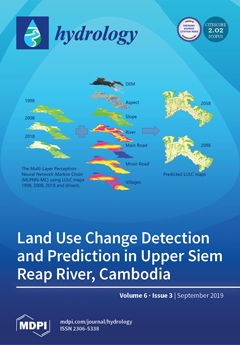
Siem Reap River has played a crucial role in maintaining the Angkor temple complex and livelihood of the people in the basin since the 12th century. Land use in this watershed has changed over the last few decades, which is thought to have had an influence on the river. The objective of this study was to reconstruct patterns of deforestation from 1988 to 2018 and to explore land use 40 and 80 years into the future. A supervised classification and a Markov chain multi-layer perception neural network were used in this study. Forest cover has decreased significantly for the past three decades, at the rate 1.22% per decade, and there will be a continuous upward trend of deforestation and downward trend of forest cover in the future. This study emphasizes the impacts of land use change on water supply for the Angkor temple complex (World Heritage Site) and population. View this paper
- Issues are regarded as officially published after their release is announced to the table of contents alert mailing list.
- You may sign up for e-mail alerts to receive table of contents of newly released issues.
- PDF is the official format for papers published in both, html and pdf forms. To view the papers in pdf format, click on the "PDF Full-text" link, and use the free Adobe Reader to open them.
Previous Issue
Next Issue