Next Issue
Volume 6, September
Previous Issue
Volume 6, March


Hydrology, Volume 6, Issue 2 (June 2019) – 28 articles

Cover Story (view full-size image): 
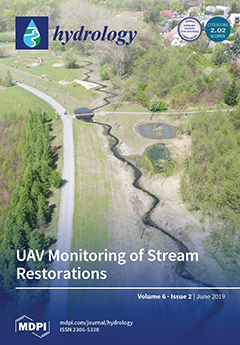
This study presents a novel set of techniques, employing unmanned aerial vehicles (UAVs) for the monitoring of stream restoration. Three years of UAV monitoring of an urban stream aimed to the assess the indicators of restoration success, such as the compliance of the restoration to the plan, stability and the evolution of the stream channel, or changes in riparian habitats. UAV monitoring revealed that the realized restoration is significantly less complex than the approved plan, i.e., with fewer meander bends, lower sinuosity, and results in heavy eutrophication in the new shallow ponds. Moreover, the new channel features stability and ability to mitigate the flooding. The study proved that high-resolution UAV monitoring provides a survey tool with unique features, valuable for the post-project assessment of stream restorations. View this paper.
  • Issues are regarded as officially published after their release is announced to the table of contents alert mailing list.
  • You may sign up for e-mail alerts to receive table of contents of newly released issues.
  • PDF is the official format for papers published in both, html and pdf forms. To view the papers in pdf format, click on the "PDF Full-text" link, and use the free Adobe Reader to open them.
Order results
Result details
Section
Select all
Export citation of selected articles as:
15 pages, 4628 KiB  
Article
An Urban Flash Flood Alert Tool for Megacities—Application for Manhattan, New York City, USA
by Rafea Al-Suhili, Cheila Cullen and Reza Khanbilvardi
Hydrology 2019, 6(2), 56; https://doi.org/10.3390/hydrology6020056 - 24 Jun 2019
Cited by 11 | Viewed by 4481
Abstract
Urban flooding is a frequent problem affecting cities all over the world. The problem is more significant now that the climate is changing and urbanization trends are increasing. Various, physical hydrological models such as the Environmental Protection Agency Storm Water Management Model (EPA [...] Read more.
Urban flooding is a frequent problem affecting cities all over the world. The problem is more significant now that the climate is changing and urbanization trends are increasing. Various, physical hydrological models such as the Environmental Protection Agency Storm Water Management Model (EPA SWMM), MIKE URBAN-II and others, have been developed to simulate flooding events in cities. However, they require high accuracy mapping and a simulation of the underground storm drainage system. Sadly, this capability is usually not available for older or larger so-called megacities. Other hydrological model types are classified in the semi-physical category, like Cellular Automata (CA), require the incorporation of very fine resolution data. These types of data, in turn, demand massive computer power and time for analysis. Furthermore, available forecasting systems provide a way to determine total rainfall during extreme events, but they do not tell us what areas will be flooded. This work introduces an urban flooding tool that couples a rainfall-runoff model with a flood map database to expedite the alert process and estimate flooded areas. A 0.30-m Lidar Digital Elevation Model (DEM) of the study area (in this case Manhattan, New York City) is divided into 140 sub-basins. Several flood maps for each sub-basin are generated and organized into a database. For any forecasted extreme rainfall event, the rainfall-runoff model predicts the expected runoff volume at different times during the storm interval. The system rapidly searches for the corresponding flood map that delineates the expected flood area. The sensitivity analysis of parameters in the model show that the effect of storm inlet flow head is approximately linear while the effects of the threshold infiltration rate, the number of storm inlets, and the storm inlet flow reduction factor are non-linear. The reduction factor variation is found to exhibit a high non-linearity variation, hence requiring further detailed investigation. Full article
Show Figures

Figure 1

21 pages, 7397 KiB  
Article
Critical Analysis of the Snow Survey Network According to the Spatial Variability of Snow Water Equivalent (SWE) on Eastern Mainland Canada
by Yawu Noumonvi Sena, Karem Chokmani, Erwan Gloaguen and Monique Bernier
Hydrology 2019, 6(2), 55; https://doi.org/10.3390/hydrology6020055 - 21 Jun 2019
Viewed by 3187
Abstract
In Eastern Canada, the snow survey network is highly optimized at the operational scale. However, it is commonly accepted that the network is limited when it comes to studying the spatial variability of the snow water equivalent (SWE), which forms different spatial structures [...] Read more.
In Eastern Canada, the snow survey network is highly optimized at the operational scale. However, it is commonly accepted that the network is limited when it comes to studying the spatial variability of the snow water equivalent (SWE), which forms different spatial structures that are active at multiple scales—from local to regional. The main objective of this study was to conduct a critical analysis of the existing snow survey network, based on the spatial variability of the existing SWE structures. To do so, we must (1) assess the snow survey network’s capacity to model spatial variability structures of SWE, and (2) study the spatial distribution based on the spatial variability structures of SWE. Initially, the snow survey network’s capacity to model the spatial variability structures of the SWE was evaluated by a variogram analysis. Second, the spatial distribution of the snow survey network’s data was analyzed through the Lorenz index curve and by measuring the spatial distribution using the Gini index. The results showed that, at a regional scale, the snow survey stations were evenly distributed within the spatial structures. However, at the local scale, the snow survey network was inadequate to model the spatial variability of SWE due to the reduced and uneven number of snow survey stations. Full article
Show Figures

Figure 1

15 pages, 3271 KiB  
Article
Evidence for Pathways of Concentrated Submarine Groundwater Discharge in East Antarctica from Helicopter-Borne Electrical Resistivity Measurements
by Neil Foley, Slawek M. Tulaczyk, Denys Grombacher, Peter T. Doran, Jill Mikucki, Krista F. Myers, Nikolaj Foged, Hilary Dugan, Esben Auken and Ross Virginia
Hydrology 2019, 6(2), 54; https://doi.org/10.3390/hydrology6020054 - 20 Jun 2019
Cited by 16 | Viewed by 6314
Abstract
The Southern Ocean receives limited liquid surface water input from the Antarctic continent. It has been speculated, however, that significant liquid water may flow from beneath the Antarctic Ice Sheet, and that this subglacial flow carries that water along with dissolved nutrients to [...] Read more.
The Southern Ocean receives limited liquid surface water input from the Antarctic continent. It has been speculated, however, that significant liquid water may flow from beneath the Antarctic Ice Sheet, and that this subglacial flow carries that water along with dissolved nutrients to the coast. The delivery of solutes, particularly limiting nutrients like bioavailable iron, to the Southern Ocean may contribute to ecosystem processes including primary productivity. Using a helicopter-borne time domain electromagnetic survey along the coastal margins of the McMurdo Dry Valleys region of Southern Victoria Land, Antarctica, we detected subsurface connections between inland lakes, aquifers, and subglacial waters. These waters, which appear as electrically conductive anomalies, are saline and may contain high concentrations of biologically important ions, including iron and silica. Local hydraulic gradients may drive these waters to the coast, where we postulate they emerge as submarine groundwater discharge. This high latitude groundwater system, imaged regionally in the McMurdo Dry Valleys, may be representative of a broader system of Antarctic submarine groundwater discharge that fertilizes the Southern Ocean. In total, it has the potential to deliver tens of gigagrams of bioavailable Fe and Si to the coastal zone. Full article
(This article belongs to the Special Issue Submarine Groundwater Discharge and Its Effects)
Show Figures

Figure 1

24 pages, 21539 KiB  
Article
Extent Changes in the Perennial Snowfields of Gates of the Arctic National Park and Preserve, Alaska
by Molly E. Tedesche, Erin D. Trochim, Steven R. Fassnacht and Gabriel J. Wolken
Hydrology 2019, 6(2), 53; https://doi.org/10.3390/hydrology6020053 - 17 Jun 2019
Cited by 3 | Viewed by 4625
Abstract
Perennial snowfields in Gates of the Arctic National Park and Preserve (GAAR) in the central Brooks Range of Alaska are a critical component of the cryosphere. They serve as habitat for an array of wildlife, including caribou, a species that is crucial as [...] Read more.
Perennial snowfields in Gates of the Arctic National Park and Preserve (GAAR) in the central Brooks Range of Alaska are a critical component of the cryosphere. They serve as habitat for an array of wildlife, including caribou, a species that is crucial as a food and cultural resource for rural subsistence hunters and Native Alaskans. Snowfields also influence hydrology, vegetation, permafrost, and have the potential to preserve valuable archaeological artifacts. By deriving time series maps using cloud computing and supervised classification of Landsat satellite imagery, we calculated areas and evaluated extent changes. We also derived changes in elevations of the perennial snowfields that remained stable for at least four years. For the study period of 1985 to 2017, we found that total areas of perennial snowfields in GAAR are decreasing, with most of the notable changes in the latter half of the study period. Equilibrium areas, or bright areas, of the snowfields are shrinking, while ablation, or dark areas, are growing. We also found that the snowfields occur at higher elevations over time. Climate change may be altering the distribution, elevation, and extent of perennial snowfields in GAAR, which could affect caribou populations and subsistence lifestyles in rural Alaska. Full article
(This article belongs to the Special Issue Snow Hydrology: Monitoring and Modelling)
Show Figures

Graphical abstract

11 pages, 4005 KiB  
Technical Note
Determination of the Probabilities of Landslide Events—A Case Study of Bhutan
by Raju Sarkar and Kelzang Dorji
Hydrology 2019, 6(2), 52; https://doi.org/10.3390/hydrology6020052 - 16 Jun 2019
Cited by 22 | Viewed by 4646
Abstract
Landslides have been and are prominent and devastating natural disasters in Bhutan due to its orography and intense monsoonal rainfall. The damage caused by landslides is huge, causing significant loss of lives, damage to infrastructure and loss of agricultural land. Several methods have [...] Read more.
Landslides have been and are prominent and devastating natural disasters in Bhutan due to its orography and intense monsoonal rainfall. The damage caused by landslides is huge, causing significant loss of lives, damage to infrastructure and loss of agricultural land. Several methods have been developed to understand the relationship between rainfall and landslide incidences. The most common method to understand the relationship is by defining thresholds using empirical methods which are expressed in either intensity-duration or event rainfall-duration terms. However, such thresholds determine the results in a binary form which may not be useful for landslide cases. Apart from defining thresholds, it is significant to validate the results. The article attempts to address both these issues by adopting a probabilistic approach and validating the results. The region of interest is the Chukha region located along the Phuentsholing-Thimphu Highway, which is a significant trade route between neighbouring countries and the national capital Thimphu. In the present study, probabilities are determined by Bayes’ theorem considering rainfall and landslide data from 2004 to 2014. Singular (rainfall intensity, rainfall duration and event rainfall) along with a combination (rainfall intensity and rainfall duration) of precipitation parameters were considered to determine the probabilities for landslide events. A sensitivity analysis was performed to verify the determined probabilities. The results depict that a combination of rainfall parameters is a better indicator to forecast landslides as compared to single rainfall parameter. Finally, the probabilities are validated using landslide records for 2015 using a threat score. The validation signifies that the probabilities can be used as the first line of action for an operational landslide warning system. Full article
(This article belongs to the Special Issue Rainfall-Induced Landslides Hazard)
Show Figures

Figure 1

15 pages, 6722 KiB  
Article
Researching the Variation of Typhoon Intensities Under Climate Change in Vietnam: A Case Study of Typhoon Lekima, 2007
by Tran Quoc Lap
Hydrology 2019, 6(2), 51; https://doi.org/10.3390/hydrology6020051 - 15 Jun 2019
Cited by 5 | Viewed by 3599
Abstract
Most of the typhoons that impact coastal regions of Vietnam occur from the north to the central part, between June and November. As a result of global warming, typhoon intensities are expected to increase. Therefore, an assessment of various typhoon strengths is essential. [...] Read more.
Most of the typhoons that impact coastal regions of Vietnam occur from the north to the central part, between June and November. As a result of global warming, typhoon intensities are expected to increase. Therefore, an assessment of various typhoon strengths is essential. In this study, Typhoon Lekima, which hit Vietnam in 2007, was simulated by weather research and forecast models, using ensemble simulation methodology. Reproductive results of the typhoon intensity are similar to actual estimated values from the Japan Meteorological Agency. Also, the variation of typhoon intensities and heavy rainfall in future climate scenarios was investigated using numerical simulations based on pseudo global warming conditions, constructed using fifth-phase results of the Coupled Model Intercomparison Project multi-model global warming experiments. Simulation results of five Pseudo Global Warming (PGW_FF) models indicate that intensities of the typhoon will be magnified in future climate. The minimum sea level pressure of typhoons similar to Typhoon Lekima in the future will increase from 8 hPa to 9 hPa, and the spatial distribution of maximum wind speed and tracked direction will move towards the southern regions. Total precipitation will significantly increase for a maximum of six hours, and the spatial distribution of heavy rain caused by typhoons will shift from the north to the southwest of Vietnam. In the future, simulated results showed that global warming correlates strongly with a significant increase in typhoon intensity and heavy rain. Full article
Show Figures

Figure 1

13 pages, 1072 KiB  
Article
Incorporating Antecedent Soil Moisture into Streamflow Forecasting
by Abdoul Oubeidillah, Glenn Tootle and Thomas Piechota
Hydrology 2019, 6(2), 50; https://doi.org/10.3390/hydrology6020050 - 11 Jun 2019
Cited by 5 | Viewed by 2802
Abstract
This study incorporates antecedent (preceding) soil moisture into forecasting streamflow volumes within the North Platte River Basin, Colorado/Wyoming (USA). The incorporation of antecedent soil moisture accounts for infiltration and can improve streamflow predictions. Current Natural Resource Conservation Service (NRCS) forecasting methods are replicated, [...] Read more.
This study incorporates antecedent (preceding) soil moisture into forecasting streamflow volumes within the North Platte River Basin, Colorado/Wyoming (USA). The incorporation of antecedent soil moisture accounts for infiltration and can improve streamflow predictions. Current Natural Resource Conservation Service (NRCS) forecasting methods are replicated, and a comparison is drawn between current NRCS forecasts and proposed forecasting methods using antecedent soil moisture. Current predictors used by the NRCS in regression-based streamflow forecasting include precipitation, streamflow persistence (previous season streamflow volume) and snow water equivalent (SWE) from SNOTEL (snow telemetry) sites. Proposed methods utilize antecedent soil moisture as a predictor variable in addition to the predictors noted above. A decision system was used to segregate data based on antecedent soil moisture conditions (e.g., dry, wet or normal). Principal Components Analysis and Stepwise Linear Regression were applied to generate streamflow forecasts, and numerous statistics were determined to measure forecast skill. The results show that when incorporating antecedent soil moisture, the “poor” forecasts (i.e., years in which the NRCS forecast differed greatly from the observed value) were improved, while the overall forecast skill remains unchanged. The research presented shows the need to increase the monitoring and collection of soil moisture data in mountainous western U.S. watersheds, as this parameter results in improved forecast skill. Full article
Show Figures

Figure 1

20 pages, 7215 KiB  
Article
Application of Meteorological and Hydrological Drought Indices to Establish Drought Classification Maps of the Ba River Basin in Vietnam
by Doan Quang Tri, Tran Tho Dat and Dinh Duc Truong
Hydrology 2019, 6(2), 49; https://doi.org/10.3390/hydrology6020049 - 08 Jun 2019
Cited by 14 | Viewed by 5571
Abstract
The objective of this study was to establish drought classification maps to simulate and calculate the lack of discharge in the Ba River basin in Vietnam. The maps were established using three meteorological drought indices (the Standardized Precipitation Index (SPI), the Drought Index [...] Read more.
The objective of this study was to establish drought classification maps to simulate and calculate the lack of discharge in the Ba River basin in Vietnam. The maps were established using three meteorological drought indices (the Standardized Precipitation Index (SPI), the Drought Index (J), and the Ped Index (Ped)), the Soil and Water Assessment Tool (SWAT) model, and the hydrological drought index (KDrought). The results from the calculation of the SPI, Aridity Index (AI), and Ped at three stations (An Khe, Ayunpa, and MDrak) showed that the J index was suitable for the study area. Based on the J index, an extreme drought was predicted to occur at the Ayunpa, An Khe, and MDrak stations. During the calibration process, the SWAT Calibration Uncertainties Program (SWAT-CUP) model, with automatic algorithms, was used to select the parameters to optimize the SWAT model. For the calibration and validation, the observed discharge at two hydrology stations, An Khe and Cung Son, from the periods 1981–1991 and 1992–2002, respectively, were used. The simulated discharge was found to be acceptable, with the Nash–Sutcliffe efficiency (NSE), Percent bias (PBIAS), and R2 reaching good levels in both calibration and validation. The results from the calculation of the drought index (KDrought), and the established drought classification maps in 2016, showed that the most affected areas were the communes of the Gia Lai and Dak Lak provinces. The results from the simulation and calculations were found to be consistent with the situation that occurred in practice. The application of meteorological and hydrological drought indices, as well as the hydrological model, to support impact assessments of drought classification in space and time, as well as the establishment of forecasting and warning maps, will help managers to effectively plan policy responses to drought. Full article
Show Figures

Figure 1

11 pages, 1355 KiB  
Article
Effectiveness Assessment of a New System of Sediment Trap in the Investigation of Matter Sedimentation in a Reservoir—A Case Study
by Maksymilian Cieśla, Lilianna Bartoszek and Renata Gruca-Rokosz
Hydrology 2019, 6(2), 48; https://doi.org/10.3390/hydrology6020048 - 07 Jun 2019
Cited by 5 | Viewed by 4040
Abstract
This paper presents results of the research on the effectiveness of entrapping sediment matter in newly designed sediment traps. Four traps, characterized by different geometrical and construction parameters, were analyzed. The assessment of the operation of the traps was made on the basis [...] Read more.
This paper presents results of the research on the effectiveness of entrapping sediment matter in newly designed sediment traps. Four traps, characterized by different geometrical and construction parameters, were analyzed. The assessment of the operation of the traps was made on the basis of research work conducted in situ in a small retention reservoir located in Blizne, south-east Poland during summer 2017 and 2018. Under environmental conditions present during the research, trap number 2 emerged as the most effective. It was characterized by a height to diameter ratio equal to 6.06, as well as innovative design thanks to the presence of a dual-chamber cylindrical vessel with a sedimentation funnel ending in a deflector. The proposed construction solution ensured optimal, stable operation of the trap. This trap is more effective in entrapping sediment matter than the simple tools described in the literature so far. In addition, it can be used not only in reservoirs, but also in seas and oceans. Such traps can be used to study the sedimentation rate in various water ecosystems, and also the entrapped sediment can be analysed in a qualitative manner to determine its role in the distribution of pollutants deposited in the sediments of aquatic ecosystems. Full article
Show Figures

Figure 1

11 pages, 9951 KiB  
Article
Characterization of Nutrient and Metal Leaching in Roadside Ditches Maintained with Cool and Warm Season Grasses
by Alex Boger and Laurent Ahiablame
Hydrology 2019, 6(2), 47; https://doi.org/10.3390/hydrology6020047 - 07 Jun 2019
Cited by 1 | Viewed by 2533
Abstract
Roadside ditches play an important role in the quantity and quality of receiving waters. Very little, however, is known about the fate and transport of nutrients and trace metals in roadside ditches, especially their leaching to shallow groundwater. This study sought to document [...] Read more.
Roadside ditches play an important role in the quantity and quality of receiving waters. Very little, however, is known about the fate and transport of nutrients and trace metals in roadside ditches, especially their leaching to shallow groundwater. This study sought to document selected water quality constituent levels in infiltrated water (i.e., leachate) in roadside ditches maintained with permanent vegetation. Leachate sampling wells were installed in four roadside ditches, and water samples were collected from the wells following major rainfall events during the years 2016 and 2017. The samples were analyzed for nutrient and metal concentrations. Results indicated that nutrient concentrations in the water samples range from 0.00600 to 0.0107 mg/L for orthophosphate (PO4–P), 0.00500 to 6.80 mg/L for nitrate (NO3–N), 0 to 0.007 mg/L for nitrite (NO2–N), and 0.0100 to 314 mg/L for chloride (Cl). Concentrations of the metals examined varied between 0.0100 and 104 mg/L in water samples. While there was no specific pattern in both nutrient and metal concentrations when roadside ditches maintained with cool season grass were compared to those of warm season grass ditches, results suggest that grass types will likely affect differently uptake of nutrients and metals in the ditches. Full article
Show Figures

Figure 1

17 pages, 2780 KiB  
Article
Effects of Bias-Correcting Climate Model Data on the Projection of Future Changes in High Flows
by Vanessa Wörner, Phillip Kreye and Günter Meon
Hydrology 2019, 6(2), 46; https://doi.org/10.3390/hydrology6020046 - 04 Jun 2019
Cited by 22 | Viewed by 3907
Abstract
Bias-correction methods are commonly applied to climate model data in hydrological climate impact studies. This is due to the often large deviations between simulated and observed climate variables. These biases may cause unrealistic simulation results when directly using the climate model data as [...] Read more.
Bias-correction methods are commonly applied to climate model data in hydrological climate impact studies. This is due to the often large deviations between simulated and observed climate variables. These biases may cause unrealistic simulation results when directly using the climate model data as input for hydrological models. Our analysis of the EURO-CORDEX (Coordinated Downscaling Experiment for Europe) data for the Northwestern part of Germany showed substantial biases for all climatological input variables needed by the hydrological model PANTA RHEI. The sensitivity for climatological input data demonstrated that changes in only one climate variable significantly affect the simulated average discharge and mean annual peak flow. The application of bias correction methods of different complexity on the climate model data improved the plausibility of hydrological modeling results for the historical period 1971–2000. The projections for the future period 2069–2099 for high flows indicate on average small changes for representative concentration pathway (RCP) 4.5 and an increase of approximately 10% for RCP8.5 when applying non-bias corrected climate model data. These values significantly differed when applying bias correction. The bias correction methods were evaluated in terms of their ability to (a) maintain the change signal for precipitation and (b) the goodness of fit for hydrological parameters for the historical period. Our results for this evaluation indicated that no bias correction method can explicitly be preferred over the others. Full article
Show Figures

Figure 1

17 pages, 1576 KiB  
Article
Freshening of a Coastal Karst Aquifer Revealed by the Temporal Changes in a Spring Water Composition (La Palme, Southern France)
by Christophe Monnin, Joseph Tamborski, Simon Bejannin, Marc Souhaut, Manon Roques, Philippe Olivier and Pieter van Beek
Hydrology 2019, 6(2), 45; https://doi.org/10.3390/hydrology6020045 - 03 Jun 2019
Cited by 6 | Viewed by 2879
Abstract
Coastal karst aquifers are vulnerable to sea level rise and seawater intrusion. Knowledge of aquifer hydrological characteristics is therefore essential to managing this water resource. Long-term aquifer monitoring may not always be possible, especially in areas that humans frequent for recreational purposes. However, [...] Read more.
Coastal karst aquifers are vulnerable to sea level rise and seawater intrusion. Knowledge of aquifer hydrological characteristics is therefore essential to managing this water resource. Long-term aquifer monitoring may not always be possible, especially in areas that humans frequent for recreational purposes. However, hydrological information can be deduced from the chemical composition of periodically sampled groundwaters. We characterized the complete chemical composition (temperature, pH, salinity, ORP, O2, Na-K-Ca-Mg-Ba-Sr-Si-Cl-SO4-DIC, and DOC) of a brackish karstic spring located along the French Mediterranean coast (La Palme). The salinity of the spring water varied between 4 and 9 during the 2.5 year period of observation. Chemical analyses revealed that the spring is modified from modern seawater, as shown by Na-normalized dissolved element concentrations. Thermodynamic calculations of mineral saturation states (PHREEQC) point to aragonite and barite saturation and elevated equilibrium CO2 partial pressure. The simultaneous salinity minima and oxygen maxima coincide with extreme values of dissolved element concentrations. This indicates that variation in salinity and water chemistry in La Palme coastal aquifer is primarily driven by infiltration of fresh rainwater. This study shows that geochemical investigations can provide an alternative approach to characterizing the hydrological properties of coastal karst aquifers when wells or boreholes are not readily available. Full article
(This article belongs to the Special Issue Submarine Groundwater Discharge and Its Effects)
Show Figures

Figure 1

13 pages, 7466 KiB  
Article
Soil Moisture Monitoring in Iran by Implementing Satellite Data into the Root-Zone SMAR Model
by Fatemeh Gheybi, Parivash Paridad, Farid Faridani, Ali Farid, Alonso Pizarro, Mauro Fiorentino and Salvatore Manfreda
Hydrology 2019, 6(2), 44; https://doi.org/10.3390/hydrology6020044 - 28 May 2019
Cited by 8 | Viewed by 4110
Abstract
Monitoring Surface Soil Moisture (SSM) and Root Zone Soil Moisture (RZSM) dynamics at the regional scale is of fundamental importance to many hydrological and ecological studies. This need becomes even more critical in arid and semi-arid regions, where there are a lack of [...] Read more.
Monitoring Surface Soil Moisture (SSM) and Root Zone Soil Moisture (RZSM) dynamics at the regional scale is of fundamental importance to many hydrological and ecological studies. This need becomes even more critical in arid and semi-arid regions, where there are a lack of in situ observations. In this regard, satellite-based Soil Moisture (SM) data is promising due to the temporal resolution of acquisitions and the spatial coverage of observations. Satellite-based SM products are only able to estimate moisture from the soil top layer; however, linking SSM with RZSM would provide valuable information on land surface-atmosphere interactions. In the present study, satellite-based SSM data from Soil Moisture and Ocean Salinity (SMOS), Advanced Microwave Scanning Radiometer 2 (AMSR2), and Soil Moisture Active Passive (SMAP) are first compared with the few available SM in situ observations, and are then coupled with the Soil Moisture Analytical Relationship (SMAR) model to estimate RZSM in Iran. The comparison between in situ SM observations and satellite data showed that the SMAP satellite products provide more accurate description of SSM with an average correlation coefficient (R) of 0.55, root-mean-square error (RMSE) of 0.078 m3 m−3 and a Bias of 0.033 m3 m−3. Thereafter, the SMAP satellite products were coupled with SMAR model, providing a description of the RZSM with performances that are strongly influenced by the misalignment between point and pixel processes measured in the preliminary comparison of SSM data. Full article
Show Figures

Graphical abstract

24 pages, 5276 KiB  
Article
Development of a Hydrogeological Conceptual Model for Shallow Aquifers in the Data Scarce Upper Blue Nile Basin
by David Walker, Geoff Parkin, John Gowing and Alemseged Tamiru Haile
Hydrology 2019, 6(2), 43; https://doi.org/10.3390/hydrology6020043 - 27 May 2019
Cited by 22 | Viewed by 4915
Abstract
Rural communities in sub-Saharan Africa commonly rely on shallow hand-dug wells and springs; consequently, shallow aquifers are an extremely important water source. Increased utilisation of shallow groundwater could help towards achieving multiple sustainable development goals (SDGs) by positively impacting poverty, hunger, and health. [...] Read more.
Rural communities in sub-Saharan Africa commonly rely on shallow hand-dug wells and springs; consequently, shallow aquifers are an extremely important water source. Increased utilisation of shallow groundwater could help towards achieving multiple sustainable development goals (SDGs) by positively impacting poverty, hunger, and health. However, these shallow aquifers are little studied and poorly understood, partly due to a paucity of existing hydrogeological information in many regions of sub-Saharan Africa. This study develops a hydrogeological conceptual model for Dangila woreda (district) in Northwest Ethiopia, based on extensive field investigations and implementation of a citizen science programme. Geological and water point surveys revealed a thin (3–18 m) weathered volcanic regolith aquifer overlying very low permeability basalt. Hydrochemistry suggested that deep groundwater within fractured and scoriaceous zones of the basalt is not (or is poorly) connected to shallow groundwater. Isotope analysis and well monitoring indicated shallow groundwater flow paths that are not necessarily coincident with surface water flow paths. Characteristics of the prevalent seasonal floodplains are akin to “dambos” that are well-described in literature for Southern Africa. Pumping tests, recharge assessments, and hydrometeorological analysis indicated the regolith aquifer shows potential for increased utilisation. This research is transferrable to the shallow volcanic regolith aquifers that overlie a substantial proportion of Ethiopia and are prevalent throughout the East African Rift and in several areas elsewhere on the continent. Full article
Show Figures

Figure 1

13 pages, 12509 KiB  
Article
Simulation of Marine Weather during an Extreme Rainfall Event: A Case Study of a Tropical Cyclone
by Zhiyuan Wu and Naire Mohamad Alshdaifat
Hydrology 2019, 6(2), 42; https://doi.org/10.3390/hydrology6020042 - 24 May 2019
Cited by 4 | Viewed by 6590
Abstract
The ocean is the largest source of water vapor on the planet, while precipitation is the greatest in tropical oceans and coastal areas. As a strong convective weather, typhoons bring not only strong winds but also strong precipitations. The accurate prediction of rainfall [...] Read more.
The ocean is the largest source of water vapor on the planet, while precipitation is the greatest in tropical oceans and coastal areas. As a strong convective weather, typhoons bring not only strong winds but also strong precipitations. The accurate prediction of rainfall and precipitation induced by typhoons is still difficult because of the nonlinear relationship between typhoon precipitation and physical processes such as typhoon dynamics, heat, cloud microphysics, and radiation. In order to fully describe the interaction between sea and air, we simulated rainfall distribution under the influence of a typhoon using a state-of-the-art, atmosphere–ocean-wave model considering a real typhoon over the South China Sea as a case study. The typhoon wind field, pressure field, and spatial and temporal distribution of rainfall were simulated on the basis of this coupled atmosphere–ocean-wave model. The spatial asymmetry distribution characteristics of typhoon wind field, pressure field, and rainfall were revealed by the simulation. The reasons for this asymmetric distribution were elaborated through a diagnostic analysis. Full article
Show Figures

Figure 1

13 pages, 2876 KiB  
Article
Radar Rainfall Estimation in Morocco: Quality Control and Gauge Adjustment
by Zahra Sahlaoui and Soumia Mordane
Hydrology 2019, 6(2), 41; https://doi.org/10.3390/hydrology6020041 - 23 May 2019
Cited by 12 | Viewed by 4294
Abstract
This study focused on investigating the impact of gauge adjustment on the rainfall estimate from a Moroccan C-band weather radar located in Khouribga City. The radar reflectivity underwent a quality check before deployment to retrieve the rainfall amount. The process consisted of clutter [...] Read more.
This study focused on investigating the impact of gauge adjustment on the rainfall estimate from a Moroccan C-band weather radar located in Khouribga City. The radar reflectivity underwent a quality check before deployment to retrieve the rainfall amount. The process consisted of clutter identification and the correction of signal attenuation. Thereafter, the radar reflectivity was converted into rainfall depth over a period of 24 h. An assessment of the accuracy of the radar rainfall estimate over the study area showed an overall underestimation when compared to the rain gauges (bias = −6.4 mm and root mean square error [RMSE] = 8.9 mm). The adjustment model was applied, and a validation of the adjusted rainfall versus the rain gauges showed a positive impact (bias = −0.96 mm and RMSE = 6.7 mm). The case study conducted on December 16, 2016 revealed substantial improvements in the precipitation structure and intensity with reference to African Rainfall Climatology version 2 (ARC2) precipitations. Full article
Show Figures

Figure 1

14 pages, 2486 KiB  
Review
An Assessment of Woody Plant Water Source Studies from across the Globe: What Do We Know after 30 Years of Research and Where Do We Go from Here?
by Md. Shawkat I. Sohel, Mohammed Abdus Salam and John Herbohn
Hydrology 2019, 6(2), 40; https://doi.org/10.3390/hydrology6020040 - 21 May 2019
Cited by 8 | Viewed by 3881
Abstract
In the face of global climate change, water availability and its impact on forest productivity is becoming an increasingly important issue. It is therefore necessary to evaluate the advancement of research in this field and to set new research priorities. A systematic literature [...] Read more.
In the face of global climate change, water availability and its impact on forest productivity is becoming an increasingly important issue. It is therefore necessary to evaluate the advancement of research in this field and to set new research priorities. A systematic literature review was performed to evaluate the spatiotemporal dynamics of global research on woody plant water sources and to determine a future research agenda. Most of the reviewed studies were from the United States, followed by China and Australia. The research indicates that there is a clear variation in woody plant water sources in forests due to season, climate, leaf phenology, and method of measurement. Much of the research focus has been on identifying plant water sources using a single isotope approach. Much less focus has been given to the nexus between water source and tree size, tree growth, drought, water use efficiency, agroforestry systems, groundwater interactions, and many other topics. Therefore, a new set of research priorities has been proposed that will address these gaps under different vegetation and climate conditions. Once these issues are resolved, the research can inform forest process studies in new ways. Full article
Show Figures

Figure 1

15 pages, 3592 KiB  
Article
Modeling the Potential of Submarine Groundwater Discharge to Facilitate Growth of Vibrio cholerae Bacteria
by Felix Vollberg, Marc Walther, Astrid Gärdes and Nils Moosdorf
Hydrology 2019, 6(2), 39; https://doi.org/10.3390/hydrology6020039 - 18 May 2019
Cited by 5 | Viewed by 3823
Abstract
Submarine groundwater discharge (SGD), the discharge of terrestrial groundwater to the ocean, can govern the coastal benthic environment. Bacteria such as Vibrio cholerae inhabit coastal waters and sediments, whose growth can be influenced by SGD. In particular, salinity changes introduced by SGD could [...] Read more.
Submarine groundwater discharge (SGD), the discharge of terrestrial groundwater to the ocean, can govern the coastal benthic environment. Bacteria such as Vibrio cholerae inhabit coastal waters and sediments, whose growth can be influenced by SGD. In particular, salinity changes introduced by SGD could have a positive effect on the abundance but also virulence of non-halophilic V. cholera bacteria dwelling in coastal waters and shallow marine sediments. Here we assess potential effects of SGD on the environmental properties that favor V. cholerae in a numerical modeling study representing multiple scenarios. Approaching natural systems, simulation results reveal a high sensitivity of non-halophilic Vibrio cholerae growth to SGD and its primary driving factors. This dependency leads to highest growth potential at high groundwater inflow and low hydraulic conductivity of the aquifer as well as for steep sea-side boundary slopes. Besides its minor impact on the extent of SGD in our model, dispersion is a crucial limiting factor for V. cholerae habitat. We conclude that there is a close connection between the driving factors of SGD and low salinity zones along a coastal slope, and recommend taking these into consideration for evaluating local V. cholerae outbreaks. Full article
(This article belongs to the Special Issue Submarine Groundwater Discharge and Its Effects)
Show Figures

Figure 1

24 pages, 8857 KiB  
Article
Spatio-Temporal Rainfall Variability and Flood Prognosis Analysis Using Satellite Data over North Bihar during the August 2017 Flood Event
by Gaurav Tripathi, Bikash Ranjan Parida and Arvind Chandra Pandey
Hydrology 2019, 6(2), 38; https://doi.org/10.3390/hydrology6020038 - 17 May 2019
Cited by 20 | Viewed by 5184
Abstract
Flooding is one of the most common natural disasters in India. Typically, the Kosi and Gandak river basins are well-known for lingering flood affected basins in North Bihar every year, which lies in the eastern part of India. There were no such comprehensive [...] Read more.
Flooding is one of the most common natural disasters in India. Typically, the Kosi and Gandak river basins are well-known for lingering flood affected basins in North Bihar every year, which lies in the eastern part of India. There were no such comprehensive studies available in North Bihar that discussed flood progression and regression at shorter time-scales like two day intervals. So in this study, we employed high temporal resolution data to capture inundation extent and further, the flood extent has been validated with high spatial resolution data. The specific objective of this study was to analyze the satellite-derived Near Real Time (NRT) MODIS flood product for spatiotemporal mapping of flood progression and regression over the North Bihar. The synthetic aperture RADAR (SAR) data were also used to validate the MODIS NRT Flood data. As a case study, we selected a recent flood event of August–September 2017 and captured the flood inundation spatial extent at two day intervals using the 2 day composite NRT flood data. The flood prognosis analysis has revealed that during the peak flooding period, 12% to 17% of the area was inundated and the most adversely affected districts were Darbhanga and Katihar in North Bihar. We estimated that in total nearly 6.5% area of the North Bihar was submerged. The method applied was simple, but it can still be suitable to be applied by the community involved in flood hazard management, not necessarily experts in hydrological modeling. It can be concluded that the NRT MODIS flood product was beneficial to monitor flood prognosis over a larger geographical area where observational data are limited. Nevertheless, it was noticed that the flood extent area derived from MODIS NRT data has overestimated areal extent, but preserved the spatial pattern of flood. Apparently, the present flood prognosis analysis can be improved by integrating microwave remote sensing data (SAR) and hydrological models. Full article
Show Figures

Figure 1

16 pages, 5290 KiB  
Article
Assessment of Wetland Restoration and Climate Change Impacts on Water Balance Components of the Heeia Coastal Wetland in Hawaii
by Kariem A. Ghazal, Olkeba Tolessa Leta, Aly I. El-Kadi and Henrietta Dulai
Hydrology 2019, 6(2), 37; https://doi.org/10.3390/hydrology6020037 - 14 May 2019
Cited by 6 | Viewed by 4661
Abstract
Hydrological modeling is an important tool that can be used to assess water resources’ availability and sustainability that are necessary for food security and ecological health of coastal regions. In this study, we assessed the impacts of land use and climate changes on [...] Read more.
Hydrological modeling is an important tool that can be used to assess water resources’ availability and sustainability that are necessary for food security and ecological health of coastal regions. In this study, we assessed the impacts of land use and climate changes on water balance components (WBCs) of the Heeia coastal wetland. We developed a Soil and Water Assessment Tool (SWAT) model to capture the unique characteristics of the Hawaiian Islands, including its volcanic soil’s nature and high initial infiltration rates. We used the sequential uncertainty fitting algorithm to assess the sensitivity and uncertainty of WBCs under different climate change scenarios. Results of the statistical analysis of daily streamflow simulations showed that the model performance was within the generally acceptable criteria. Under future climate scenarios, rainfall change was the determinant factor most negatively impacting WBCs. Recharge and baseflow components had the highest sensitivity to the combined effects of land use and climate changes, especially during dry season. The uncertainty analysis indicated that the streamflow is projected to slightly increase by the middle of 21st century, but expected to decline by 40% during the late 21st century of Representative Concentration Pathways (RCP) 8.5. Full article
Show Figures

Figure 1

15 pages, 5609 KiB  
Article
Seasonal Groundwater Recharge Characterization Using Time-Lapse Electrical Resistivity Tomography in the Thepkasattri Watershed on Phuket Island, Thailand
by Yacob T. Tesfaldet and Avirut Puttiwongrak
Hydrology 2019, 6(2), 36; https://doi.org/10.3390/hydrology6020036 - 05 May 2019
Cited by 13 | Viewed by 5420
Abstract
Understanding the recharge mechanisms in the vadose zone is crucial to groundwater management and artificial recharge development. In this study, a systematic characterization of seasonal groundwater recharge was done using time-lapse electrical resistivity tomography (time-lapse ERT). The objective of this study was to [...] Read more.
Understanding the recharge mechanisms in the vadose zone is crucial to groundwater management and artificial recharge development. In this study, a systematic characterization of seasonal groundwater recharge was done using time-lapse electrical resistivity tomography (time-lapse ERT). The objective of this study was to characterize the seasonal groundwater recharge through the vadose zone and streams. A total of six electrical resistivity surveys in two locations were taken during the dry and rainy seasons using an advanced geosciences incorporated (AGI) SuperSting R2 resistivity meter in 2018. Then, time-lapse inversion was calculated using the dry season ERT as the base model and the rainy season ERTs as the monitoring datasets. The results showed a significant decrease in inverted resistivity from the dry season to the rainy season, which suggests rainwater infiltration through the vadose zone. Similarly, significant water level rise was observed in wells monitored during the survey indicating groundwater recharge. The time-lapse ERT showed, in one case, the Nang Dak stream and the unsaturated zones are the preferential groundwater recharge zones throughout the year; in another case, the Rieng stream is the groundwater discharge zone and the vadose zone is the preferential recharge zone. Finally, a simplified conceptual hydrogeological model representing the study area is presented to visualize the recharge mechanisms in the study area. Full article
Show Figures

Figure 1

19 pages, 3813 KiB  
Article
Hydro-Climatic Variability: A Characterisation and Trend Study of the Awash River Basin, Ethiopia
by Mahtsente Tibebe Tadese, Lalit Kumar, Richard Koech and Birhanu Zemadim
Hydrology 2019, 6(2), 35; https://doi.org/10.3390/hydrology6020035 - 27 Apr 2019
Cited by 44 | Viewed by 5802
Abstract
The objective of this study was to characterize, quantify and validate the variability and trends of hydro-climatic variables in the Awash River Basin (ARB) in Ethiopia using graphical and statistical methods. The rainfall and streamflow trends and their relationships were evaluated using the [...] Read more.
The objective of this study was to characterize, quantify and validate the variability and trends of hydro-climatic variables in the Awash River Basin (ARB) in Ethiopia using graphical and statistical methods. The rainfall and streamflow trends and their relationships were evaluated using the regression method, Mann–Kendall (MK) test and correlation analysis. The analysis focused on rainfall and streamflow collected from 28 and 18 stations, respectively. About 85.7% and 75.3% of the rainfall stations exhibited normal to moderate variability in annual and June to September rainfall, respectively, whereas 96.43% of rainfall stations showed high variability in March to May. The MK test showed that most of the significant trends in annual rainfall were decreasing except in two stations. These research findings provide valuable information on the characteristics, variability, and trend of rainfall and streamflow necessary for the design of sustainable water management strategies and to reduce the impact of droughts and floods in the ARB. Full article
Show Figures

Figure 1

11 pages, 1462 KiB  
Article
Tree-Ring Reconstructions of Streamflow for the Tennessee Valley
by SallyRose Anderson, Ross Ogle, Glenn Tootle and Abdoul Oubeidillah
Hydrology 2019, 6(2), 34; https://doi.org/10.3390/hydrology6020034 - 26 Apr 2019
Cited by 16 | Viewed by 3311
Abstract
This study reports the preliminary results from a statistical screening of tree-ring width records from the International Tree-Ring Data Bank (ITRDB), to evaluate the strength of the hydrological signal, in dendrochronological records from the Tennessee Valley. We used United States Geological Survey (USGS) [...] Read more.
This study reports the preliminary results from a statistical screening of tree-ring width records from the International Tree-Ring Data Bank (ITRDB), to evaluate the strength of the hydrological signal, in dendrochronological records from the Tennessee Valley. We used United States Geological Survey (USGS) streamflow data from 11 gages, within the Tennessee Valley, and regional tree-ring chronologies, to analyze the dendroclimatic potential of the region, and create seasonal flow reconstructions. Prescreening methods included correlation, date, and temporal stability analysis of predictors to ensure practical and reliable reconstructions. Seasonal correlation analysis revealed that large numbers of regional tree-ring chronologies were significantly correlated (p ≤ 0.05) with the May–June–July streamflow. Stepwise linear regression was used to create the May–June–July streamflow reconstructions. Ten of the 12 streamflow stations were considered statistically skillful (R2 ≥ 0.40). Skillful reconstructions ranged from 208 to 301 years in length, and were statistically validated using leave-one-out cross validation, the sign test, and a comparison of the distribution of low flow years. The long-term streamflow variability was analyzed for the Nolichucky, Nantahala, Emory, and South Fork (SF) Holston stations. The reconstructions revealed that while most of the Western United States (U.S.). was experiencing some of its highest flow years during the early 1900s, the Tennessee Valley region was experiencing a very low flow. Results revealed the potential benefit of using tree-ring chronologies to reconstruct hydrological variables in the Southeastern U.S., by demonstrating the ability of proxy-based reconstructions to provide useful data beyond the instrumental record. Full article
Show Figures

Figure 1

19 pages, 1661 KiB  
Article
Bounding of Flow and Transport Analysis in Heterogeneous Saturated Porous Media: A Minimum Energy Dissipation Principle for the Bounding and Scale-Up
by R. William Nelson and Gustavious P. Williams
Hydrology 2019, 6(2), 33; https://doi.org/10.3390/hydrology6020033 - 25 Apr 2019
Cited by 1 | Viewed by 2422
Abstract
We apply minimum kinetic energy principles from classic mechanics to heterogeneous porous media flow equations to derive and evaluate rotational flow components to determine bounding homogenous representations. Kelvin characterized irrotational motions in terms of energy dissipation and showed that minimum dynamic energy dissipation [...] Read more.
We apply minimum kinetic energy principles from classic mechanics to heterogeneous porous media flow equations to derive and evaluate rotational flow components to determine bounding homogenous representations. Kelvin characterized irrotational motions in terms of energy dissipation and showed that minimum dynamic energy dissipation occurs if the motion is irrotational; i.e., a homogeneous flow system. For porous media flow, reductions in rotational flow represent heterogeneity reductions. At the limit, a homogeneous system, flow is irrotational. Using these principles, we can find a homogenous system that bounds a more complex heterogeneous system. We present mathematics for using the minimum energy principle to describe flow in heterogeneous porous media along with reduced special cases with the necessary bounding and associated scale-up equations. The first, simple derivation involves no boundary differences and gives results based on direct Kelvin-type minimum energy principles. It provides bounding criteria, but yields only a single ultimate scale-up. We present an extended derivation that considers differing boundaries, which may occur between scale-up elements. This approach enables a piecewise less heterogeneous representation to bound the more heterogeneous system. It provides scale-up flexibility for individual model elements with differing sizes, and shapes and supports a more accurate representation of material properties. We include a case study to illustrate bounding with a single direct scale-up. The case study demonstrates rigorous bounding and provides insight on using bounding flow to help understand heterogeneous systems. This work provides a theoretical basis for developing bounding models of flow systems. This provides a means to justify bounding conditions and results. Full article
Show Figures

Figure 1

17 pages, 4445 KiB  
Article
Can a Calibration-Free Dynamic Rainfall‒Runoff Model Predict FDCs in Data-Scarce Regions? Comparing the IDW Model with the Dynamic Budyko Model in South India
by Anita Nag and Basudev Biswal
Hydrology 2019, 6(2), 32; https://doi.org/10.3390/hydrology6020032 - 22 Apr 2019
Cited by 4 | Viewed by 3848
Abstract
Construction of flow duration curves (FDCs) is a challenge for hydrologists as most streams and rivers worldwide are ungauged. Regionalization methods are commonly followed to solve the problem of discharge data scarcity by transforming hydrological information from gauged basins to ungauged basins. As [...] Read more.
Construction of flow duration curves (FDCs) is a challenge for hydrologists as most streams and rivers worldwide are ungauged. Regionalization methods are commonly followed to solve the problem of discharge data scarcity by transforming hydrological information from gauged basins to ungauged basins. As a consequence, regionalization-based FDC predictions are not very reliable where discharge data are scarce quantitatively and/or qualitatively. In such a scenario, it is perhaps more meaningful to use a calibration-free rainfall‒runoff model that can exploit easily available meteorological information to predict FDCs in ungauged basins. This hypothesis is tested in this study by comparing a well-known regionalization-based model, the inverse distance weighting (IDW) model, with the recently proposed calibration-free dynamic Budyko model (DB) in a region where discharge observations are not only insufficient quantitatively but also show apparent signs of observational errors. The DB model markedly outperformed the IDW model in the study region. Furthermore, the IDW model’s performance sharply declined when we randomly removed discharge gauging stations to test the model in a variety of data availability scenarios. The analysis here also throws some light on how errors in observational datasets and drainage area influence model performance and thus provides a better picture of the relative strengths of the two models. Overall, the results of this study support the notion that a calibration-free rainfall‒runoff model can be chosen to predict FDCs in discharge data-scarce regions. On a philosophical note, our study highlights the importance of process understanding for the development of meaningful hydrological models. Full article
Show Figures

Figure 1

15 pages, 1476 KiB  
Article
Lithofacies Identification and Multivariate Analysis of Groundwater Chemistry in Coastal Aquifers in Koko Area of the Western Niger Delta
by Oghenero Ohwoghere-Asuma, Kizito Ejiro Aweto and Chukwuma Felix Ugbe
Hydrology 2019, 6(2), 31; https://doi.org/10.3390/hydrology6020031 - 20 Apr 2019
Cited by 5 | Viewed by 2788
Abstract
Understanding aquifer lithofacies and depth of occurrence, and what factors influence its quality and chemistry are of paramount importance to the management of groundwater resource. Subsurface lithofacies distribution was characterized by resistivity and validated with available subsurface geology. Resistivity values varied from less [...] Read more.
Understanding aquifer lithofacies and depth of occurrence, and what factors influence its quality and chemistry are of paramount importance to the management of groundwater resource. Subsurface lithofacies distribution was characterized by resistivity and validated with available subsurface geology. Resistivity values varied from less than 100 Ωm to above 1000 Ωm. Lithofacies identified includes clay, clayey sand, sand and peat. Shallow unconfined and confined aquifers occurred at depths ranging from 0 to 12 m and 18 to 63 m, respectively. Geochemistry and multivariate statistical analysis consisting of principal component analysis (PCA) and cluster analysis (CA) were used for the determination of quality and groundwater evolution. Groundwater types depicted by Piper plots were Ca3+, Cl and Na+, Cl, which was characterized by low dissolved ions, slightly acidic and Fe2+. The dominant variables influencing groundwater quality as returned by PCA were organic pollution resulting from swampy depositional environment, anthropogenic effects resulting from septic and leachates from haphazard dumpsites mixing with groundwater from diffuse sources. In addition, the weathering and dissolution of aquifer sediments rich in feldspar and clay minerals have considerable impact on groundwater quality. CA depicted two distinct types of groundwater that are significantly comparable to those obtained from Piper plots. Full article
Show Figures

Figure 1

19 pages, 3215 KiB  
Article
Geostatistical Distribution and Contamination Status of Heavy Metals in the Sediment of Perak River, Malaysia
by Mohammed Abdus Salam, Shujit Chandra Paul, Farrah Izzaty Shaari, Aweng Eh Rak, Rozita Binti Ahmad and Wan Rashidah Kadir
Hydrology 2019, 6(2), 30; https://doi.org/10.3390/hydrology6020030 - 10 Apr 2019
Cited by 38 | Viewed by 7620
Abstract
Heavy metal pollution is one of the major environmental issues in recent decades owing to the rapid increase in urbanisation and industrialisation. Sediments usually act as sinks for heavy metals due to their complex physical and chemical adsorption mechanisms. In this study, heavy [...] Read more.
Heavy metal pollution is one of the major environmental issues in recent decades owing to the rapid increase in urbanisation and industrialisation. Sediments usually act as sinks for heavy metals due to their complex physical and chemical adsorption mechanisms. In this study, heavy metals like lead (Pb), Zinc (Zn), Cadmium (Cd), Copper (Cu) and Iron (Fe) in the surface sediment from 15 location (upstream and downstream) on the Perak River, Malaysia were investigated by means of inductively coupled plasma optical emission spectroscopy (ICP-OES). The geostatistical prediction map showed the range of Pb, Zn, Cd, Cu and Fe concentration in upstream area was 14.56–27.0 µg/g, 20–51.27 µg/g, 1.51–3.0 µg/g, 6.6–19.12 µg/g and 20.24–56.58%, respectively, and in downstream areas was 27.6–60.76 µg/g, 49.04–160.5 µg/g, 2.77–4.02 µg/g, 9.82–59.99 µg/g and 31.34–39.5%, respectively. Based on the enrichment factor and geoaccumulation index, Cd was found to be the most dominant pollutant in the study area. Pollution load index, sediment quality guidelines and sediment environmental toxicity quotient data showed that the downstream sediment was more polluted than the upstream sediment in the Perak River. The multivariate analysis showed that Pb, Zn and Cu mainly originated from natural sources with minor contribution from human activities, whereas Fe and Cd originated from various industrial and agricultural activities along the studied area. Full article
Show Figures

Figure 1

22 pages, 22728 KiB  
Article
UAV Monitoring of Stream Restorations
by Jakub Langhammer
Hydrology 2019, 6(2), 29; https://doi.org/10.3390/hydrology6020029 - 28 Mar 2019
Cited by 20 | Viewed by 8226
Abstract
This study examines the potential and limits of the unmanned aerial vehicles (UAVs) applicability for the monitoring of stream restoration in an urban environment. UAV imaging was used for long-term post-restoration monitoring of an urban stream. The monitoring was aimed to track the [...] Read more.
This study examines the potential and limits of the unmanned aerial vehicles (UAVs) applicability for the monitoring of stream restoration in an urban environment. UAV imaging was used for long-term post-restoration monitoring of an urban stream. The monitoring was aimed to track the stream changes significant for the assessment of the restoration success, such as the compliance of the restoration to the plan, stability and evolution of the stream channel, or changes in stream and riparian habitats. The recurrent imaging campaigns in the restored segment of Hostavicky brook in Prague, The Czech Republic, were undertaken for three years since the restoration using the DJI Inspire 1 Pro platform. The UAV monitoring revealed that the new stream pattern substantially differs from the proposed restoration plan. Despite this, the new channel has proved stability, supported by intense grassing of the floodplain, resulting in only marginal evolution of the restored channel. The new channel proved the ability to mitigate the course of a significant flood event without significant flood spills outside the riparian zone. The UAV monitoring also revealed intense eutrophication in newly created shallow ponds with insufficient drainage. The research proved that UAV imaging is a unique source of spatial data, providing reliable information for quantitative and qualitative assessment of the stream restoration progress and success. Full article
Show Figures

Graphical abstract

Previous Issue
Next Issue
Back to TopTop