Next Issue
Volume 6, January
Previous Issue
Volume 5, September


Drones, Volume 5, Issue 4 (December 2021) – 50 articles

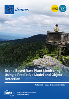
Cover Story (view full-size image): NC State University researchers launched a drone from an observation platform on Roan Mountain in North Carolina (1800 meters elevation) to collect imagery of the cliff face. Approximately 1000 meters of elevation change was visible in the photograph, which highlighted the difficulty of monitoring the rare plant, Geum radiatum, at this location. The researchers used a machine learning predictive model to plan a targeted flight area, allowing for efficient data collection without impacting the rare plant or endangering personnel. Visual analysis of UAS imagery verified the locations of thirty-three known plants and discovered four previously undocumented occurrences. View this paper.
  • Issues are regarded as officially published after their release is announced to the table of contents alert mailing list.
  • You may sign up for e-mail alerts to receive table of contents of newly released issues.
  • PDF is the official format for papers published in both, html and pdf forms. To view the papers in pdf format, click on the "PDF Full-text" link, and use the free Adobe Reader to open them.
Order results
Result details
Section
Select all
Export citation of selected articles as:
12 pages, 25333 KiB  
Article
Drone Magnetometry in Mining Research. An Application in the Study of Triassic Cu–Co–Ni Mineralizations in the Estancias Mountain Range, Almería (Spain)
by Daniel Porras, Javier Carrasco, Pedro Carrasco, Santiago Alfageme, Diego Gonzalez-Aguilera and Rafael Lopez Guijarro
Drones 2021, 5(4), 151; https://doi.org/10.3390/drones5040151 - 18 Dec 2021
Cited by 12 | Viewed by 4516
Abstract
The use of drones in mining and geological exploration is under rapid development, especially in the field of magnetic field prospection. In part, this is related to the advantages presented for over ground surveys, allowing for high-density data acquisition with low loss of [...] Read more.
The use of drones in mining and geological exploration is under rapid development, especially in the field of magnetic field prospection. In part, this is related to the advantages presented for over ground surveys, allowing for high-density data acquisition with low loss of resolution, while being particularly useful in scenarios where vegetation, topography, and access are limiting factors. This work analyzes results of a drone magnetic survey acquired across the old mines of Don Jacobo, where Copper-Cobalt-Nickel stratabound mineralizations were exploited in the Estancias mountain range of the Betic Cordillera, Spain. The survey carried out used a vapor magnetometer installed on a Matrice 600 Pro Hexacopter. Twenty-four parallel survey lines were flown with a speed of 5 m/s, orthogonal to the regional strike of the geological structure, and mineralization with 50 m line separation and 20 m flight height over the ground was studied. The interpretation of the magnetic data allows us to reveal and model two high magnetic susceptibility bodies with residual magnetization, close to the old mines and surface mineral shows. These bodies could be related to potential unexploited mineralized areas whose formation may be related to a normal fault placed to the south of the survey area. Our geophysical survey provides essential data to improve the geological and mining potential of the area, allowing to design future research activities. Full article
(This article belongs to the Special Issue Feature Papers of Drones)
Show Figures

Figure 1

16 pages, 2135 KiB  
Article
Pathways to Unsegregated Sharing of Airspace: Views of the Uncrewed Aerial Vehicle (UAV) Industry
by Matt Grote, Aliaksei Pilko, James Scanlan, Tom Cherrett, Janet Dickinson, Angela Smith, Andy Oakey and Greg Marsden
Drones 2021, 5(4), 150; https://doi.org/10.3390/drones5040150 - 15 Dec 2021
Cited by 7 | Viewed by 2892
Abstract
The uncrewed aerial vehicle (UAV or drone) industry is expanding, offering services such as video/photography, inspection, monitoring, surveying, and logistics. This is leading to competing demands for airspace with existing crewed aircraft activities, especially in uncontrolled airspace. As a result, there is an [...] Read more.
The uncrewed aerial vehicle (UAV or drone) industry is expanding, offering services such as video/photography, inspection, monitoring, surveying, and logistics. This is leading to competing demands for airspace with existing crewed aircraft activities, especially in uncontrolled airspace. As a result, there is an increasingly urgent need for a shared airspace solution that enables drones to be integrated with the wider aviation community in unsegregated operations. The purpose of this research was to engage with the drone industry to understand their issues regarding shared airspace as an important first step in the co-development of operating procedures that can provide equitable airspace access for all. An online, interactive workshop format was employed, with participants (n ~ 80) drawn from the UK drone industry and other attendant organisations. Verbal and written data were recorded, and then analysed using thematic analysis. The findings summarise the issues on a range of topics, grouped into three over-arching themes: (1) operational environment; (2) technical and regulatory environment; and (3) equity and wider society. Results suggested that important issues included the necessity for a dependable detect-and-avoid (DAA) system for in-flight de-confliction, based on onboard electronic conspicuity (EC) devices, and the need for support for shared airspace from the wider aviation community. This study contributes to the stakeholder engagement that will be essential if the co-development of a shared airspace solution is to be widely acceptable to all. Full article
Show Figures

Figure 1

17 pages, 826 KiB  
Article
Convolutional Neural Networks for Classification of Drones Using Radars
by Divy Raval, Emily Hunter, Sinclair Hudson, Anthony Damini and Bhashyam Balaji
Drones 2021, 5(4), 149; https://doi.org/10.3390/drones5040149 - 15 Dec 2021
Cited by 9 | Viewed by 3895
Abstract
The ability to classify drones using radar signals is a problem of great interest. In this paper, we apply convolutional neural networks (CNNs) to the Short-Time Fourier Transform (STFT) spectrograms of the simulated radar signals reflected from the drones. The drones vary in [...] Read more.
The ability to classify drones using radar signals is a problem of great interest. In this paper, we apply convolutional neural networks (CNNs) to the Short-Time Fourier Transform (STFT) spectrograms of the simulated radar signals reflected from the drones. The drones vary in many ways that impact the STFT spectrograms, including blade length and blade rotation rates. Some of these physical parameters are captured in the Martin and Mulgrew model which was used to produce the datasets. We examine the data under X-band and W-band radar simulation scenarios and show that a CNN approach leads to an F1 score of 0.816±0.011 when trained on data with a signal-to-noise ratio (SNR) of 10 dB. The neural network which was trained on data from an X-band radar with 2 kHz pulse repetition frequency was shown to perform better than the CNN trained on the aforementioned W-band radar. It remained robust to the drone blade pitch and its performance varied directly in a linear fashion with the SNR. Full article
(This article belongs to the Special Issue Feature Papers of Drones)
Show Figures

Figure 1

30 pages, 1632 KiB  
Review
UAV-Enabled Mobile Edge-Computing for IoT Based on AI: A Comprehensive Review
by Yassine Yazid, Imad Ez-Zazi, Antonio Guerrero-González, Ahmed El Oualkadi and Mounir Arioua
Drones 2021, 5(4), 148; https://doi.org/10.3390/drones5040148 - 13 Dec 2021
Cited by 59 | Viewed by 13223
Abstract
Unmanned aerial vehicles (UAVs) are becoming integrated into a wide range of modern IoT applications. The growing number of networked IoT devices generates a large amount of data. However, processing and memorizing this massive volume of data at local nodes have been deemed [...] Read more.
Unmanned aerial vehicles (UAVs) are becoming integrated into a wide range of modern IoT applications. The growing number of networked IoT devices generates a large amount of data. However, processing and memorizing this massive volume of data at local nodes have been deemed critical challenges, especially when using artificial intelligence (AI) systems to extract and exploit valuable information. In this context, mobile edge computing (MEC) has emerged as a way to bring cloud computing (CC) processes within reach of users, to address computation-intensive offloading and latency issues. This paper provides a comprehensive review of the most relevant research works related to UAV technology applications in terms of enabled or assisted MEC architectures. It details the utility of UAV-enabled MEC architecture regarding emerging IoT applications and the role of both deep learning (DL) and machine learning (ML) in meeting various limitations related to latency, task offloading, energy demand, and security. Furthermore, throughout this article, the reader gains an insight into the future of UAV-enabled MEC, the advantages and the critical challenges to be tackled when using AI. Full article
Show Figures

Figure 1

16 pages, 8367 KiB  
Article
Large-Scale Earthwork Progress Digitalization Practices Using Series of 3D Models Generated from UAS Images
by Jin-Woo Cho, Jae-Kang Lee and Jisoo Park
Drones 2021, 5(4), 147; https://doi.org/10.3390/drones5040147 - 12 Dec 2021
Cited by 13 | Viewed by 3747
Abstract
Since the Fourth Industrial Revolution, existing manpower-centric manufacture has been shifting towards technology and data-centric production in all areas of society. The construction sector is also facing a new paradigm called smart construction with a clear purpose of improving productivity and securing safety [...] Read more.
Since the Fourth Industrial Revolution, existing manpower-centric manufacture has been shifting towards technology and data-centric production in all areas of society. The construction sector is also facing a new paradigm called smart construction with a clear purpose of improving productivity and securing safety by applying site management using information and communications technology (ICT). This study aims to develop a framework for earthwork process digitalization based on images acquired by using the unmanned aerial system (UAS). The entire framework includes precise UAS data acquisition, cut-and-fill volume estimation, cross-section drawing, and geo-fencing generation. To this end, homogeneous time-series drone image data were obtained from active road construction sites under earthwork. The developed system was able to generate precise 3D topographical models and estimate cut-and-fill volume changes. In addition, the proposed framework generated cross-sectional views of each area of interest throughout the construction stages and finally created geo-fencing to assist the safe operation of heavy equipment. We expect that the proposed framework can contribute to smart construction areas by automating the process of digitizing earthwork progress. Full article
(This article belongs to the Special Issue Application of UAS in Construction)
Show Figures

Figure 1

14 pages, 4476 KiB  
Technical Note
Design and Implementation of Intelligent EOD System Based on Six-Rotor UAV
by Jiwei Fan, Ruitao Lu, Xiaogang Yang, Fan Gao, Qingge Li and Jun Zeng
Drones 2021, 5(4), 146; https://doi.org/10.3390/drones5040146 - 11 Dec 2021
Cited by 4 | Viewed by 3970
Abstract
Explosive ordnance disposal (EOD) robots can replace humans that work in hazardous environments to ensure worker safety. Thus, they have been widely developed and deployed. However, existing EOD robots have some limitations in environmental adaptation, such as a single function, slow action speed, [...] Read more.
Explosive ordnance disposal (EOD) robots can replace humans that work in hazardous environments to ensure worker safety. Thus, they have been widely developed and deployed. However, existing EOD robots have some limitations in environmental adaptation, such as a single function, slow action speed, and limited vision. To overcome these shortcomings and solve the uncertain problem of bomb disposal on the firing range, we have developed an intelligent bomb disposal system that integrates autonomous unmanned aerial vehicle (UAV) navigation, deep learning, and other technologies. For the hardware structure of the system, we design an actuator constructed by a winch device and a mechanical gripper to grasp the unexploded ordnance (UXO), which is equipped under the six-rotor UAV. The integrated dual-vision Pan-Tilt-Zoom (PTZ) pod is applied in the system to monitor and photograph the deployment site for dropping live munitions. For the software structure of the system, the ground station exploits the YOLOv5 algorithm to detect the grenade targets for real-time video and accurately locate the landing point of the grenade. The operator remotely controls the UAV to grasp, transfer, and destroy grenades. Experiments on explosives defusal are performed, and the results show that our system is feasible with high recognition accuracy and strong maneuverability. Compared with the traditional mode of explosives defusal, the system can provide decision-makers with accurate information on the location of the grenade and at the same time better mitigate the potential casualties in the explosive demolition process. Full article
Show Figures

Figure 1

20 pages, 10913 KiB  
Article
Accuracy Assessment of Cultural Heritage Models Extracting 3D Point Cloud Geometric Features with RPAS SfM-MVS and TLS Techniques
by Alessandra Capolupo
Drones 2021, 5(4), 145; https://doi.org/10.3390/drones5040145 - 11 Dec 2021
Cited by 11 | Viewed by 2911
Abstract
A proper classification of 3D point clouds allows fully exploiting data potentiality in assessing and preserving cultural heritage. Point cloud classification workflow is commonly based on the selection and extraction of respective geometric features. Although several research activities have investigated the impact of [...] Read more.
A proper classification of 3D point clouds allows fully exploiting data potentiality in assessing and preserving cultural heritage. Point cloud classification workflow is commonly based on the selection and extraction of respective geometric features. Although several research activities have investigated the impact of geometric features on classification outcomes accuracy, only a few works focused on their accuracy and reliability. This paper investigates the accuracy of 3D point cloud geometric features through a statistical analysis based on their corresponding eigenvalues and covariance with the aim of exploiting their effectiveness for cultural heritage classification. The proposed approach was separately applied on two high-quality 3D point clouds of the All Saints’ Monastery of Cuti (Bari, Southern Italy), generated using two competing survey techniques: Remotely Piloted Aircraft System (RPAS) Structure from Motion (SfM) and Multi View Stereo (MVS) techniques and Terrestrial Laser Scanner (TLS). Point cloud compatibility was guaranteed through re-alignment and co-registration of data. The geometric features accuracy obtained by adopting the RPAS digital photogrammetric and TLS models was consequently analyzed and presented. Lastly, a discussion on convergences and divergences of these results is also provided. Full article
(This article belongs to the Special Issue Drone Inspection in Cultural Heritage)
Show Figures

Figure 1

26 pages, 5127 KiB  
Article
UAV Path Planning Based on Multi-Stage Constraint Optimization
by Yong Shen, Yunlou Zhu, Hongwei Kang, Xingping Sun, Qingyi Chen and Da Wang
Drones 2021, 5(4), 144; https://doi.org/10.3390/drones5040144 - 06 Dec 2021
Cited by 12 | Viewed by 2875
Abstract
Evolutionary Algorithms (EAs) based Unmanned Aerial Vehicle (UAV) path planners have been extensively studied for their effectiveness and high concurrency. However, when there are many obstacles, the path can easily violate constraints during the evolutionary process. Even if a single waypoint causes a [...] Read more.
Evolutionary Algorithms (EAs) based Unmanned Aerial Vehicle (UAV) path planners have been extensively studied for their effectiveness and high concurrency. However, when there are many obstacles, the path can easily violate constraints during the evolutionary process. Even if a single waypoint causes a few constraint violations, the algorithm will discard these solutions. In this paper, path planning is constructed as a multi-objective optimization problem with constraints in a three-dimensional terrain scenario. To solve this problem in an effective way, this paper proposes an evolutionary algorithm based on multi-level constraint processing (ANSGA-III-PPS) to plan the shortest collision-free flight path of a gliding UAV. The proposed algorithm uses an adaptive constraint processing mechanism to improve different path constraints in a three-dimensional environment and uses an improved adaptive non-dominated sorting genetic algorithm (third edition—ANSGA-III) to enhance the algorithm’s path planning ability in a complex environment. The experimental results show that compared with the other four algorithms, ANSGA-III-PPS achieves the best solution performance. This not only validates the effect of the proposed algorithm, but also enriches and improves the research results of UAV path planning. Full article
Show Figures

Figure 1

18 pages, 29555 KiB  
Article
Acceleration-Aware Path Planning with Waypoints
by Rudolf Ortner, Indrajit Kurmi and Oliver Bimber
Drones 2021, 5(4), 143; https://doi.org/10.3390/drones5040143 - 27 Nov 2021
Cited by 2 | Viewed by 3675
Abstract
In this article we demonstrate that acceleration and deceleration of direction-turning drones at waypoints have a significant influence to path planning which is important to be considered for time-critical applications, such as drone-supported search and rescue. We present a new path planning approach [...] Read more.
In this article we demonstrate that acceleration and deceleration of direction-turning drones at waypoints have a significant influence to path planning which is important to be considered for time-critical applications, such as drone-supported search and rescue. We present a new path planning approach that takes acceleration and deceleration into account. It follows a local gradient ascend strategy which locally minimizes turns while maximizing search probability accumulation. Our approach outperforms classic coverage-based path planning algorithms, such as spiral- and grid-search, as well as potential field methods that consider search probability distributions. We apply this method in the context of autonomous search and rescue drones and in combination with a novel synthetic aperture imaging technique, called Airborne Optical Sectioning (AOS), which removes occlusion of vegetation and forest in real-time. Full article
(This article belongs to the Special Issue Feature Papers of Drones)
Show Figures

Figure 1

14 pages, 2865 KiB  
Article
Incorporating Geographical Scale and Multiple Environmental Factors to Delineate the Breeding Distribution of Sea Turtles
by Liam C. Dickson, Kostas A. Katselidis, Christophe Eizaguirre and Gail Schofield
Drones 2021, 5(4), 142; https://doi.org/10.3390/drones5040142 - 26 Nov 2021
Cited by 5 | Viewed by 3849
Abstract
Temperature is often used to infer how climate influences wildlife distributions; yet, other parameters also contribute, separately and combined, with effects varying across geographical scales. Here, we used an unoccupied aircraft system to explore how environmental parameters affect the regional distribution of the [...] Read more.
Temperature is often used to infer how climate influences wildlife distributions; yet, other parameters also contribute, separately and combined, with effects varying across geographical scales. Here, we used an unoccupied aircraft system to explore how environmental parameters affect the regional distribution of the terrestrial and marine breeding habitats of threatened loggerhead sea turtles (Caretta caretta). Surveys spanned four years and ~620 km coastline of western Greece, encompassing low (<10 nests/km) to high (100–500 nests/km) density nesting areas. We recorded 2395 tracks left by turtles on beaches and 1928 turtles occupying waters adjacent to these beaches. Variation in beach track and inwater turtle densities was explained by temperature, offshore prevailing wind, and physical marine and terrestrial factors combined. The highest beach-track densities (400 tracks/km) occurred on beaches with steep slopes and higher sand temperatures, sheltered from prevailing offshore winds. The highest inwater turtle densities (270 turtles/km) occurred over submerged sandbanks, with warmer sea temperatures associated with offshore wind. Most turtles (90%) occurred over nearshore submerged sandbanks within 10 km of beaches supporting the highest track densities, showing the strong linkage between optimal marine and terrestrial environments for breeding. Our findings demonstrate the utility of UASs in surveying marine megafauna and environmental data at large scales and the importance of integrating multiple factors in climate change models to predict species distributions. Full article
(This article belongs to the Special Issue Ecological Applications of Drone-Based Remote Sensing)
Show Figures

Figure 1

21 pages, 2843 KiB  
Article
SORA Methodology for Multi-UAS Airframe Inspections in an Airport
by Carol Martinez, Pedro J. Sanchez-Cuevas, Simos Gerasimou, Abhishek Bera and Miguel A. Olivares-Mendez
Drones 2021, 5(4), 141; https://doi.org/10.3390/drones5040141 - 24 Nov 2021
Cited by 6 | Viewed by 4771
Abstract
Deploying Unmanned Aircraft Systems (UAS) in safety- and business-critical operations requires demonstrating compliance with applicable regulations and a comprehensive understanding of the residual risk associated with the UAS operation. To support these activities and enable the safe deployment of UAS into civil airspace, [...] Read more.
Deploying Unmanned Aircraft Systems (UAS) in safety- and business-critical operations requires demonstrating compliance with applicable regulations and a comprehensive understanding of the residual risk associated with the UAS operation. To support these activities and enable the safe deployment of UAS into civil airspace, the European Union Aviation Safety Agency (EASA) has established a UAS regulatory framework that mandates the execution of safety risk assessment for UAS operations in order to gain authorization to carry out certain types of operations. Driven by this framework, the Joint Authorities for Rulemaking on Unmanned Systems (JARUS) released the Specific Operation Risk Assessment (SORA) methodology that guides the systematic risk assessment for UAS operations. However, existing work on SORA and its applications focuses mainly on single UAS operations, offering limited support for assuring operations conducted with multiple UAS and with autonomous features. Therefore, the work presented in this paper analyzes the application of SORA for a Multi-UAS airframe inspection (AFI) operation, that involves deploying multiple UAS with autonomous features inside an airport. We present the decision-making process of each SORA step and its application to a multiple UAS scenario. The results shows that the procedures and safety features included in the Multi-AFI operation such as workspace segmentation, the independent multi-UAS AFI crew proposed, and the mitigation actions provide confidence that the operation can be conducted safely and can receive a positive evaluation from the competent authorities. We also present our key findings from the application of SORA and discuss how it can be extended to better support multi-UAS operations. Full article
Show Figures

Figure 1

18 pages, 21150 KiB  
Article
UAV Approach for Detecting Plastic Marine Debris on the Beach: A Case Study in the Po River Delta (Italy)
by Yuri Taddia, Corinne Corbau, Joana Buoninsegni, Umberto Simeoni and Alberto Pellegrinelli
Drones 2021, 5(4), 140; https://doi.org/10.3390/drones5040140 - 24 Nov 2021
Cited by 23 | Viewed by 5560
Abstract
Anthropogenic marine debris (AMD) represent a global threat for aquatic environments. It is important to locate and monitor the distribution and presence of macroplastics along beaches to prevent degradation into microplastics (MP), which are potentially more harmful and more difficult to remove. UAV [...] Read more.
Anthropogenic marine debris (AMD) represent a global threat for aquatic environments. It is important to locate and monitor the distribution and presence of macroplastics along beaches to prevent degradation into microplastics (MP), which are potentially more harmful and more difficult to remove. UAV imaging represents a quick method for acquiring pictures with a ground spatial resolution of a few centimeters. In this work, we investigate strategies for AMD mapping on beaches with different ground resolutions and with elevation and multispectral data in support of RGB orthomosaics. Operators with varying levels of expertise and knowledge of the coastal environment map the AMD on four to five transects manually, using a range of photogrammetric tools. The initial survey was repeated after one year; in both surveys, beach litter was collected and further analyzed in the laboratory. Operators assign three levels of confidence when recognizing and describing AMD. Preliminary validation of results shows that items identified with high confidence were almost always classified properly. Approaching the detected items in terms of surface instead of a simple count increased the percentage of mapped litter significantly when compared to those collected. Multispectral data in near-infrared (NIR) wavelengths and digital surface models (DSMs) did not significantly improve the efficiency of manual mapping, even if vegetation features were removed using NDVI maps. In conclusion, this research shows that a good solution for performing beach AMD mapping can be represented by using RGB imagery with a spatial resolution of about 200 pix/m for detecting macroplastics and, in particular, focusing on the largest items. From the point of view of assessing and monitoring potential sources of MP, this approach is not only feasible but also quick, practical, and sustainable. Full article
(This article belongs to the Special Issue UAVs for Coastal Surveying)
Show Figures

Figure 1

11 pages, 4312 KiB  
Communication
Verification of the Detection Performance of Drone Radio Telemetry for Tracking the Movement of Frogs
by Hideyuki Niwa and Yuya Sawai
Drones 2021, 5(4), 139; https://doi.org/10.3390/drones5040139 - 23 Nov 2021
Cited by 1 | Viewed by 2781
Abstract
Elucidating the various behavioral and ecological uses of animal habitats is the basis for the conservation and management of animal species. Therefore, tracking the movement of animals is necessary. Biotelemetry is used for tracking the movement of animals. By mounting a radio telemetry [...] Read more.
Elucidating the various behavioral and ecological uses of animal habitats is the basis for the conservation and management of animal species. Therefore, tracking the movement of animals is necessary. Biotelemetry is used for tracking the movement of animals. By mounting a radio telemetry receiver and antenna on a drone, the time and labor required for surveying animals can be reduced. In addition, it is easy to track difficult-to-reach areas such as rice paddies and forests, and the environment is not invaded by the survey. We think that this drone radio telemetry will be the best method for tracking the movement of small amphibians, such as frogs. However, in order to put the method to practical use, the accuracy of the system needs to be verified. Approximately 26 ha of area in Sogabe, Kameoka City, Kyoto Prefecture, Japan was investigated in this study. We selected and validated the location where frogs are likely to enter farmlands. The location where the detection of movement is expected to be stable are 5 cm deep areas in the soil, gaps in masonry, and under plastic bags, whereas areas in which the detection is likely to be unstable are areas deeper than 5 cm in the soil, covered concrete channels, and grass. By calculating the geographic center, the location of the nanotag could be estimated with an accuracy of less than 16 m. We successfully showed that the drone radio telemetry system used in this study is capable of detecting and tracking the movement of animals with high spatial and temporal resolutions. However, we suggest that the detection of movement may be interrupted depending on the location of the target animal and more than three detections are needed to guarantee the accuracy of the estimation. Full article
Show Figures

Graphical abstract

17 pages, 3078 KiB  
Article
Optimum Sizing of Photovoltaic-Battery Power Supply for Drone-Based Cellular Networks
by Mahshid Javidsharifi, Hamoun Pourroshanfekr Arabani, Tamas Kerekes, Dezso Sera, Sergiu Viorel Spataru and Josep M. Guerrero
Drones 2021, 5(4), 138; https://doi.org/10.3390/drones5040138 - 22 Nov 2021
Cited by 9 | Viewed by 3334
Abstract
In order to provide Internet access to rural areas and places without a reliable economic electricity grid, self-sustainable drone-based cellular networks have recently been presented. However, the difficulties of power consumption and mission planning lead to the challenge of optimal sizing of the [...] Read more.
In order to provide Internet access to rural areas and places without a reliable economic electricity grid, self-sustainable drone-based cellular networks have recently been presented. However, the difficulties of power consumption and mission planning lead to the challenge of optimal sizing of the power supply for future cellular telecommunication networks. In order to deal with this challenge, this paper presents an optimal approach for sizing the photovoltaic (PV)-battery power supply for drone-based cellular networks in remote areas. The main objective of the suggested approach is to minimize the total cost, including the capital and operational expenditures. The suggested framework is applied to an off-grid cellular telecommunication network with drone-based base stations that are powered by PV-battery systems-based recharging sites in a rural location. The PV-battery system is optimally designed for three recharging sites with three different power consumption profiles with different peak and cumulative loads. Results show that the optimal design of the PV-battery system is dependent on geographical data, solar irradiation, and ambient temperature, which affect the output power of the PV system, as well as the power consumption profile, which affects the required number of PV panels and battery capacity. Full article
(This article belongs to the Special Issue Feature Papers of Drones)
Show Figures

Figure 1

16 pages, 1297 KiB  
Article
Using Ground-Based Passive Reflectors for Improving UAV Landing
by Dmitry Yasentsev, Timofey Shevgunov, Evgeny Efimov and Boris Tatarskiy
Drones 2021, 5(4), 137; https://doi.org/10.3390/drones5040137 - 19 Nov 2021
Cited by 13 | Viewed by 3327
Abstract
The article reviews the problem of landing on hard-to-reach and poorly developed territories, especially in the case of unmanned aerial vehicles. Various landing systems and approaches are analyzed, and their key advantages and disadvantages are summarized; afterwards, an approach with passive reflectors is [...] Read more.
The article reviews the problem of landing on hard-to-reach and poorly developed territories, especially in the case of unmanned aerial vehicles. Various landing systems and approaches are analyzed, and their key advantages and disadvantages are summarized; afterwards, an approach with passive reflectors is considered. A formal definition is provided for the main factors relative to the accuracy analysis, and a model is presented. The way to improve the landing procedure, while simultaneously meeting various practical constraints, is analyzed; the results of numerical simulation are presented, followed by the detailed conclusion describing still remaining challenges and subjects for further research. Full article
(This article belongs to the Special Issue Conceptual Design, Modeling, and Control Strategies of Drones)
Show Figures

Figure 1

42 pages, 132720 KiB  
Article
Large-Scale Reality Modeling of a University Campus Using Combined UAV and Terrestrial Photogrammetry for Historical Preservation and Practical Use
by Bryce E. Berrett, Cory A. Vernon, Haley Beckstrand, Madi Pollei, Kaleb Markert, Kevin W. Franke and John D. Hedengren
Drones 2021, 5(4), 136; https://doi.org/10.3390/drones5040136 - 17 Nov 2021
Cited by 11 | Viewed by 6523
Abstract
Unmanned aerial vehicles (UAV) enable detailed historical preservation of large-scale infrastructure and contribute to cultural heritage preservation, improved maintenance, public relations, and development planning. Aerial and terrestrial photo data coupled with high accuracy GPS create hyper-realistic mesh and texture models, high resolution point [...] Read more.
Unmanned aerial vehicles (UAV) enable detailed historical preservation of large-scale infrastructure and contribute to cultural heritage preservation, improved maintenance, public relations, and development planning. Aerial and terrestrial photo data coupled with high accuracy GPS create hyper-realistic mesh and texture models, high resolution point clouds, orthophotos, and digital elevation models (DEMs) that preserve a snapshot of history. A case study is presented of the development of a hyper-realistic 3D model that spans the complex 1.7 km2 area of the Brigham Young University campus in Provo, Utah, USA and includes over 75 significant structures. The model leverages photos obtained during the historic COVID-19 pandemic during a mandatory and rare campus closure and details a large scale modeling workflow and best practice data acquisition and processing techniques. The model utilizes 80,384 images and high accuracy GPS surveying points to create a 1.65 trillion-pixel textured structure-from-motion (SfM) model with an average ground sampling distance (GSD) near structures of 0.5 cm and maximum of 4 cm. Separate model segments (31) taken from data gathered between April and August 2020 are combined into one cohesive final model with an average absolute error of 3.3 cm and a full model absolute error of <1 cm (relative accuracies from 0.25 cm to 1.03 cm). Optimized and automated UAV techniques complement the data acquisition of the large-scale model, and opportunities are explored to archive as-is building and campus information to enable historical building preservation, facility maintenance, campus planning, public outreach, 3D-printed miniatures, and the possibility of education through virtual reality (VR) and augmented reality (AR) tours. Full article
Show Figures

Figure 1

22 pages, 4756 KiB  
Article
Self-Localization of Tethered Drones without a Cable Force Sensor in GPS-Denied Environments
by Amer Al-Radaideh and Liang Sun
Drones 2021, 5(4), 135; https://doi.org/10.3390/drones5040135 - 17 Nov 2021
Cited by 16 | Viewed by 4254
Abstract
This paper considers the self-localization of a tethered drone without using a cable-tension force sensor in GPS-denied environments. The original problem is converted to a state-estimation problem, where the cable-tension force and the three-dimensional position of the drone with respect to a ground [...] Read more.
This paper considers the self-localization of a tethered drone without using a cable-tension force sensor in GPS-denied environments. The original problem is converted to a state-estimation problem, where the cable-tension force and the three-dimensional position of the drone with respect to a ground platform are estimated using an extended Kalman filter (EKF). The proposed approach uses the data reported by the onboard electric motors (i.e., the pulse width modulation (PWM) signals), accelerometers, gyroscopes, and altimeter, embedded in the commercial-of-the-shelf (COTS) inertial measurement units (IMU). A system-identification experiment was conducted to determine the model that computes the drone thrust force using the PWM signals. The proposed approach was compared with an existing work that assumes known cable-tension force. Simulation results show that the proposed approach produces estimates with less than 0.3-m errors when the actual cable-tension force is greater than 1 N. Full article
(This article belongs to the Special Issue Advances in SLAM and Data Fusion for UAVs/Drones)
Show Figures

Figure 1

20 pages, 2510 KiB  
Article
A 3D Vision Cone Based Method for Collision Free Navigation of a Quadcopter UAV among Moving Obstacles
by Zhenxing Ming and Hailong Huang
Drones 2021, 5(4), 134; https://doi.org/10.3390/drones5040134 - 12 Nov 2021
Cited by 9 | Viewed by 4131
Abstract
In the near future, it’s expected that unmanned aerial vehicles (UAVs) will become ubiquitous surrogates for human-crewed vehicles in the field of border patrol, package delivery, etc. Therefore, many three-dimensional (3D) navigation algorithms based on different techniques, e.g., model predictive control (MPC)-based, navigation [...] Read more.
In the near future, it’s expected that unmanned aerial vehicles (UAVs) will become ubiquitous surrogates for human-crewed vehicles in the field of border patrol, package delivery, etc. Therefore, many three-dimensional (3D) navigation algorithms based on different techniques, e.g., model predictive control (MPC)-based, navigation potential field-based, sliding mode control-based, and reinforcement learning-based, have been extensively studied in recent years to help achieve collision-free navigation. The vast majority of the 3D navigation algorithms perform well when obstacles are sparsely spaced, but fail when facing crowd-spaced obstacles, which causes a potential threat to UAV operations. In this paper, a 3D vision cone-based reactive navigation algorithm is proposed to enable small quadcopter UAVs to seek a path through crowd-spaced 3D obstacles to the destination without collisions. The proposed algorithm is simulated in MATLAB with different 3D obstacles settings to demonstrate its feasibility and compared with the other two existing 3D navigation algorithms to exhibit its superiority. Furthermore, a modified version of the proposed algorithm is also introduced and compared with the initially proposed algorithm to lay the foundation for future work. Full article
(This article belongs to the Special Issue Conceptual Design, Modeling, and Control Strategies of Drones)
Show Figures

Figure 1

16 pages, 2947 KiB  
Article
An Intelligent Quadrotor Fault Diagnosis Method Based on Novel Deep Residual Shrinkage Network
by Pu Yang, Huilin Geng, Chenwan Wen and Peng Liu
Drones 2021, 5(4), 133; https://doi.org/10.3390/drones5040133 - 08 Nov 2021
Cited by 8 | Viewed by 2769
Abstract
In this paper, a fault diagnosis algorithm named improved one-dimensional deep residual shrinkage network with a wide convolutional layer (1D-WIDRSN) is proposed for quadrotor propellers with minor damage, which can effectively identify the fault classes of quadrotor under interference information, and without additional [...] Read more.
In this paper, a fault diagnosis algorithm named improved one-dimensional deep residual shrinkage network with a wide convolutional layer (1D-WIDRSN) is proposed for quadrotor propellers with minor damage, which can effectively identify the fault classes of quadrotor under interference information, and without additional denoising procedures. In a word, that fault diagnosis algorithm can locate and diagnose the early minor faults of the quadrotor based on the flight data, so that the quadrotor can be repaired before serious faults occur, so as to prolong the service life of quadrotor. First, the sliding window method is used to expand the number of samples. Then, a novel progressive semi-soft threshold is proposed to replace the soft threshold in the deep residual shrinkage network (DRSN), so the noise of signal features can be eliminated more effectively. Finally, based on the deep residual shrinkage network, the wide convolution layer and DroupBlock method are introduced to further enhance the anti-noise and over-fitting ability of the model, thus the model can effectively extract fault features and classify faults. Experimental results show that 1D-WIDRSN applied to the minimal fault diagnosis model of quadrotor propellers can accurately identify the fault category in the interference information, and the diagnosis accuracy is over 98%. Full article
(This article belongs to the Special Issue Advances in Deep Learning for Drones and Its Applications)
Show Figures

Figure 1

28 pages, 8372 KiB  
Article
A Practical Validation of Uncooled Thermal Imagers for Small RPAS
by George Leblanc, Margaret Kalacska, J. Pablo Arroyo-Mora, Oliver Lucanus and Andrew Todd
Drones 2021, 5(4), 132; https://doi.org/10.3390/drones5040132 - 06 Nov 2021
Cited by 2 | Viewed by 4123
Abstract
Uncooled thermal imaging sensors in the LWIR (7.5 μm to 14 μm) have recently been developed for use with small RPAS. This study derives a new thermal imaging validation methodology via the use of a blackbody source (indoors) and real-world field conditions (outdoors). [...] Read more.
Uncooled thermal imaging sensors in the LWIR (7.5 μm to 14 μm) have recently been developed for use with small RPAS. This study derives a new thermal imaging validation methodology via the use of a blackbody source (indoors) and real-world field conditions (outdoors). We have demonstrated this method with three popular LWIR cameras by DJI (Zenmuse XT-R, Zenmuse XT2 and, the M2EA) operated by three different popular DJI RPAS platforms (Matrice 600 Pro, M300 RTK and, the Mavic 2 Enterprise Advanced). Results from the blackbody work show that each camera has a highly linearized response (R2 > 0.99) in the temperature range 5–40 °C as well as a small (<2 °C) temperature bias that is less than the stated accuracy of the cameras. Field validation was accomplished by imaging vegetation and concrete targets (outdoors and at night), that were instrumented with surface temperature sensors. Environmental parameters (air temperature, humidity, pressure and, wind and gusting) were measured for several hours prior to imaging data collection and found to either not be a factor, or were constant, during the ~30 min data collection period. In-field results from imagery at five heights between 10 m and 50 m show absolute temperature retrievals of the concrete and two vegetation sites were within the specifications of the cameras. The methodology has been developed with consideration of active RPAS operational requirements. Full article
(This article belongs to the Special Issue Feature Papers of Drones)
Show Figures

Figure 1

17 pages, 2761 KiB  
Article
Designing a User-Centered Interaction Interface for Human–Swarm Teaming
by Mohammad Divband Soorati, Jediah Clark, Javad Ghofrani, Danesh Tarapore and Sarvapali D. Ramchurn
Drones 2021, 5(4), 131; https://doi.org/10.3390/drones5040131 - 05 Nov 2021
Cited by 11 | Viewed by 4367
Abstract
A key challenge in human–swarm interaction is to design a usable interface that allows the human operators to monitor and control a scalable swarm. In our study, we restrict the interactions to only one-to-one communications in local neighborhoods between UAV-UAV and operator-UAV. This [...] Read more.
A key challenge in human–swarm interaction is to design a usable interface that allows the human operators to monitor and control a scalable swarm. In our study, we restrict the interactions to only one-to-one communications in local neighborhoods between UAV-UAV and operator-UAV. This type of proximal interactions will decrease the cognitive complexity of the human–swarm interaction to O(1). In this paper, a user study with 100 participants provides evidence that visualizing a swarm as a heat map is more effective in addressing usability and acceptance in human–swarm interaction. We designed an interactive interface based on the users’ preference and proposed a controlling mechanism that allows a human operator to control a large swarm of UAVs. We evaluated the proposed interaction interface with a complementary user study. Our testbed and results establish a benchmark to study human–swarm interaction where a scalable swarm can be managed by a single operator. Full article
(This article belongs to the Special Issue Feature Papers of Drones)
Show Figures

Figure 1

19 pages, 24231 KiB  
Article
UAV Patrolling for Wildfire Monitoring by a Dynamic Voronoi Tessellation on Satellite Data
by Alessandro Giuseppi, Roberto Germanà, Federico Fiorini, Francesco Delli Priscoli and Antonio Pietrabissa
Drones 2021, 5(4), 130; https://doi.org/10.3390/drones5040130 - 03 Nov 2021
Cited by 13 | Viewed by 4172
Abstract
Fire monitoring and early detection are critical tasks in which Unmanned Aerial Vehicles (UAVs) are commonly employed. This paper presents a system to plan the drone patrolling schedule according to a real-time estimation of a fire propagation index that is derived from satellite [...] Read more.
Fire monitoring and early detection are critical tasks in which Unmanned Aerial Vehicles (UAVs) are commonly employed. This paper presents a system to plan the drone patrolling schedule according to a real-time estimation of a fire propagation index that is derived from satellite data, such as the Normalized Difference Vegetation Index (NDVI) measurement and the Digital Elevation Model (DEM) of the surveilled area. The proposed system employs a waypoint scheduling logic, derived from a dynamic Voronoi Tessellation of the area, that combines characteristics of the territory (e.g., vegetation density) with real-time measurements (e.g., wind speed and direction). The system is validated on a case study in Italy, in the municipality of the city of L’Aquila, on three different fire scenarios. In normal situations, the designed waypoint-based navigation system provided an effective monitoring of the area, enabling the early detection of starting fires. The developed solution also demonstrated good performance in tracking and anticipating the fire front advance, potentially providing a better situational awareness to emergency operators and support their response policies. Both the test environment and the simulator have been made open-source. Full article
Show Figures

Figure 1

18 pages, 2192 KiB  
Article
Multiloop Multirate Continuous-Discrete Drone Stabilization System: An Equivalent Single-Rate Model
by Vadim Kramar, Aleksey Kabanov and Vasiliy Alchakov
Drones 2021, 5(4), 129; https://doi.org/10.3390/drones5040129 - 01 Nov 2021
Cited by 1 | Viewed by 2423
Abstract
The article discusses the UAV lateral motion stabilization system, as a MIMO multiloop multirate continuous-discrete system, specified in the form of an input–output model in the domain of discrete Laplace transform or in the form of a structural diagram. Approaches to the construction [...] Read more.
The article discusses the UAV lateral motion stabilization system, as a MIMO multiloop multirate continuous-discrete system, specified in the form of an input–output model in the domain of discrete Laplace transform or in the form of a structural diagram. Approaches to the construction of equivalent T and NT single-rate models for MIMO multiloop multirate continuous-discrete systems are considered. Here, T is the largest common divisor of the sampling periods of the system, N is a natural number that is the smallest common multiple of the numbers characterizing the sampling periods of the system. The resulting impulse representations of the outputs of equivalent models are in the form of rational functions. The basis for the construction of these models is a matrix of sampling densities—a structural invariant of sampling chains. An example of the construction of the indicated matrix and an equivalent single-rate model are given. Obtaining equivalent single-rate models for MIMO multiloop multirate systems allows us to extend the methods of research and synthesis of MIMO continuous and continuous-discrete systems to a common theoretical base—the theory of polynomials and rational functions, which are typical elements of the description of these classes of systems. Full article
(This article belongs to the Special Issue Conceptual Design, Modeling, and Control Strategies of Drones)
Show Figures

Figure 1

13 pages, 410 KiB  
Article
Machine Learning-Assisted Adaptive Modulation for Optimized Drone-User Communication in B5G
by Sudheesh Puthenveettil Gopi, Maurizio Magarini, Saeed Hamood Alsamhi and Alexey V. Shvetsov
Drones 2021, 5(4), 128; https://doi.org/10.3390/drones5040128 - 29 Oct 2021
Cited by 15 | Viewed by 3264
Abstract
The fundamental issue for Beyond fifth Generation (B5G) is providing a pervasive connection to heterogeneous and various devices in smart environments. Therefore, Drones play a vital role in the B5G, allowing for wireless broadcast and high-speed communications. In addition, the drone offers several [...] Read more.
The fundamental issue for Beyond fifth Generation (B5G) is providing a pervasive connection to heterogeneous and various devices in smart environments. Therefore, Drones play a vital role in the B5G, allowing for wireless broadcast and high-speed communications. In addition, the drone offers several advantages compared to fixed terrestrial communications, including flexible deployment, robust Line of Sight (LoS) connections, and more design degrees of freedom due to controlled mobility. Drones can provide reliable and high data rate connectivity to users irrespective of their location. However, atmospheric disturbances impact the signal quality between drones and users and degrade the system performance. Considering practical implementation, the location of drones makes the drone–user communication susceptible to several environmental disturbances. In this paper, we evaluate the performance of drone-user connectivity during atmospheric disturbances. Further, a Machine Learning (ML)-assisted algorithm is proposed to adapt to a modulation technique that offers optimal performance during atmospheric disturbances. The results show that, with the algorithm, the system switches to a lower order modulation scheme during higher rain rate and provides reliable communication with optimized data rate and error performance. Full article
Show Figures

Figure 1

10 pages, 1385 KiB  
Article
Energy-Efficient Inference on the Edge Exploiting TinyML Capabilities for UAVs
by Wamiq Raza, Anas Osman, Francesco Ferrini and Francesco De Natale
Drones 2021, 5(4), 127; https://doi.org/10.3390/drones5040127 - 29 Oct 2021
Cited by 17 | Viewed by 5128
Abstract
In recent years, the proliferation of unmanned aerial vehicles (UAVs) has increased dramatically. UAVs can accomplish complex or dangerous tasks in a reliable and cost-effective way but are still limited by power consumption problems, which pose serious constraints on the flight duration and [...] Read more.
In recent years, the proliferation of unmanned aerial vehicles (UAVs) has increased dramatically. UAVs can accomplish complex or dangerous tasks in a reliable and cost-effective way but are still limited by power consumption problems, which pose serious constraints on the flight duration and completion of energy-demanding tasks. The possibility of providing UAVs with advanced decision-making capabilities in an energy-effective way would be extremely beneficial. In this paper, we propose a practical solution to this problem that exploits deep learning on the edge. The developed system integrates an OpenMV microcontroller into a DJI Tello Micro Aerial Vehicle (MAV). The microcontroller hosts a set of machine learning-enabled inference tools that cooperate to control the navigation of the drone and complete a given mission objective. The goal of this approach is to leverage the new opportunistic features of TinyML through OpenMV including offline inference, low latency, energy efficiency, and data security. The approach is successfully validated on a practical application consisting of the onboard detection of people wearing protection masks in a crowded environment. Full article
(This article belongs to the Special Issue Advances in Civil Applications of Unmanned Aircraft Systems)
Show Figures

Figure 1

15 pages, 6441 KiB  
Article
Drones, Deep Learning, and Endangered Plants: A Method for Population-Level Census Using Image Analysis
by Kody R. Rominger and Susan E. Meyer
Drones 2021, 5(4), 126; https://doi.org/10.3390/drones5040126 - 28 Oct 2021
Cited by 5 | Viewed by 3527
Abstract
A census of endangered plant populations is critical to determining their size, spatial distribution, and geographical extent. Traditional, on-the-ground methods for collecting census data are labor-intensive, time-consuming, and expensive. Use of drone imagery coupled with application of rapidly advancing deep learning technology could [...] Read more.
A census of endangered plant populations is critical to determining their size, spatial distribution, and geographical extent. Traditional, on-the-ground methods for collecting census data are labor-intensive, time-consuming, and expensive. Use of drone imagery coupled with application of rapidly advancing deep learning technology could greatly reduce the effort and cost of collecting and analyzing population-level data across relatively large areas. We used a customization of the YOLOv5 object detection model to identify and count individual dwarf bear poppy (Arctomecon humilis) plants in drone imagery obtained at 40 m altitude. We compared human-based and model-based detection at 40 m on n = 11 test plots for two areas that differed in image quality. The model out-performed human visual poppy detection for precision and recall, and was 1100× faster at inference/evaluation on the test plots. Model inference precision was 0.83, and recall was 0.74, while human evaluation resulted in precision of 0.67, and recall of 0.71. Both model and human performance were better in the area with higher-quality imagery, suggesting that image quality is a primary factor limiting model performance. Evaluation of drone-based census imagery from the 255 ha Webb Hill population with our customized YOLOv5 model was completed in <3 h and provided a reasonable estimate of population size (7414 poppies) with minimal investment of on-the-ground resources. Full article
(This article belongs to the Special Issue Ecological Applications of Drone-Based Remote Sensing)
Show Figures

Figure 1

17 pages, 4465 KiB  
Article
Unmanned Aerial Vehicles for Operational Monitoring of Landfills
by Timofey Filkin, Natalia Sliusar, Marco Ritzkowski and Marion Huber-Humer
Drones 2021, 5(4), 125; https://doi.org/10.3390/drones5040125 - 26 Oct 2021
Cited by 14 | Viewed by 5315
Abstract
This study justifies the prospect of using aerial imagery from unmanned aerial vehicles (UAVs) for technological monitoring and operational control of municipal solid waste landfills. It presents the results of surveys (aerial imagery) of a number of Russian landfills, which were carried out [...] Read more.
This study justifies the prospect of using aerial imagery from unmanned aerial vehicles (UAVs) for technological monitoring and operational control of municipal solid waste landfills. It presents the results of surveys (aerial imagery) of a number of Russian landfills, which were carried out using low-cost drones equipped with standard RGB cameras. In the processing of aerial photographs, both photogrammetric data processing algorithms (for constructing orthophotoplans of objects and 3D modeling) and procedures for thematic interpretation of photo images were used. Thematic interpretation was carried out based on lists of requirements for the operating landfills (the lists were compiled on the basis of current legislative acts). Thus, this article proposes framework guidelines for the complex technological monitoring of landfills using relatively simple means of remote control. It shows that compliance with most of the basic requirements for landfill operations, which are listed in both Russian and foreign regulation, can be controlled by unmanned aerial imagery. Thus, all of the main technological operations involving waste at landfills (placement, compaction, intermediate isolation) are able to be controlled remotely; as well as compliance with most of the design and planning requirements associated with the presence and serviceability of certain engineering systems and structures (collection systems for leachate and surface wastewater, etc.); and the state of the landfill body. Cases where the compliance with operating standards cannot be monitored remotely are also considered. It discusses the advantages of air imagery in comparison with space imagery (detail of images, operational efficiency), as well as in comparison with ground inspections (speed, personnel safety). It is shown that in many cases, interpreting the obtained aerial photographs for technological monitoring tasks does not require special image processing and can be performed visually. Based on the analysis of the available world experience, as well as the results of the study, it was concluded that unmanned aerial imagery has great potential for solving problems of waste landfill management. Full article
(This article belongs to the Special Issue Advances in Civil Applications of Unmanned Aircraft Systems)
Show Figures

Graphical abstract

35 pages, 7228 KiB  
Article
Computationally-Efficient Distributed Algorithms of Navigation of Teams of Autonomous UAVs for 3D Coverage and Flocking
by Taha Elmokadem and Andrey V. Savkin
Drones 2021, 5(4), 124; https://doi.org/10.3390/drones5040124 - 25 Oct 2021
Cited by 10 | Viewed by 3313
Abstract
This paper proposes novel distributed control methods to address coverage and flocking problems in three-dimensional (3D) environments using multiple unmanned aerial vehicles (UAVs). Two classes of coverage problems are considered in this work, namely barrier and sweep problems. Additionally, the approach is also [...] Read more.
This paper proposes novel distributed control methods to address coverage and flocking problems in three-dimensional (3D) environments using multiple unmanned aerial vehicles (UAVs). Two classes of coverage problems are considered in this work, namely barrier and sweep problems. Additionally, the approach is also applied to general 3D flocking problems for advanced swarm behavior. The proposed control strategies adopt a region-based control approach based on Voronoi partitions to ensure collision-free self-deployment and coordinated movement of all vehicles within a 3D region. It provides robustness for the multi-vehicle system against vehicles’ failure. It is also computationally-efficient to ensure scalability, and it handles obstacle avoidance on a higher level to avoid conflicts in control with the inter-vehicle collision avoidance objective. The problem formulation is rather general considering mobile robots navigating in 3D spaces, which makes the proposed approach applicable to different UAV types and autonomous underwater vehicles (AUVs). However, implementation details have also been shown considering quadrotor-type UAVs for an example application in precision agriculture. Validation of the proposed methods have been performed using several simulations considering different simulation platforms such as MATLAB and Gazebo. Software-in-the-loop simulations were carried out to asses the real-time computational performance of the methods showing the actual implementation with quadrotors using C++ and the Robot Operating System (ROS) framework. Good results were obtained validating the performance of the suggested methods for coverage and flocking scenarios in 3D using systems with different sizes up to 100 vehicles. Some scenarios considering obstacle avoidance and robustness against vehicles’ failure were also used. Full article
(This article belongs to the Special Issue Conceptual Design, Modeling, and Control Strategies of Drones)
Show Figures

Figure 1

19 pages, 4704 KiB  
Article
Prototype Development of Cross-Shaped Microphone Array System for Drone Localization Based on Delay-and-Sum Beamforming in GNSS-Denied Areas
by Hirokazu Madokoro, Satoshi Yamamoto, Kanji Watanabe, Masayuki Nishiguchi, Stephanie Nix, Hanwool Woo and Kazuhito Sato
Drones 2021, 5(4), 123; https://doi.org/10.3390/drones5040123 - 23 Oct 2021
Cited by 5 | Viewed by 2519
Abstract
Drones equipped with a global navigation satellite system (GNSS) receiver for absolute localization provide high-precision autonomous flight and hovering. However, the GNSS signal reception sensitivity is considerably lower in areas such as those between high-rise buildings, under bridges, and in tunnels. This paper [...] Read more.
Drones equipped with a global navigation satellite system (GNSS) receiver for absolute localization provide high-precision autonomous flight and hovering. However, the GNSS signal reception sensitivity is considerably lower in areas such as those between high-rise buildings, under bridges, and in tunnels. This paper presents a drone localization method based on acoustic information using a microphone array in GNSS-denied areas. Our originally developed microphone array system comprised 32 microphones installed in a cross-shaped configuration. Using drones of two different sizes and weights, we obtained an original acoustic outdoor benchmark dataset at 24 points. The experimentally obtained results revealed that the localization error values were lower for 0 and ±45 than for ±90. Moreover, we demonstrated the relative accuracy for acceptable ranges of tolerance for the obtained localization error values. Full article
(This article belongs to the Special Issue Advances in SLAM and Data Fusion for UAVs/Drones)
Show Figures

Figure 1

22 pages, 5905 KiB  
Article
Nonlinear Analysis and Bifurcation Characteristics of Whirl Flutter in Unmanned Aerial Systems
by Anthony Quintana, Rui Vasconcellos, Glen Throneberry and Abdessattar Abdelkefi
Drones 2021, 5(4), 122; https://doi.org/10.3390/drones5040122 - 21 Oct 2021
Cited by 7 | Viewed by 2767
Abstract
Aerial drones have improved significantly over the recent decades with stronger and smaller motors, more powerful propellers, and overall optimization of systems. These improvements have consequently increased top speeds and improved a variety of performance aspects, along with introducing new structural challenges, such [...] Read more.
Aerial drones have improved significantly over the recent decades with stronger and smaller motors, more powerful propellers, and overall optimization of systems. These improvements have consequently increased top speeds and improved a variety of performance aspects, along with introducing new structural challenges, such as whirl flutter. Whirl flutter is an aeroelastic instability that can be affected by structural or aerodynamic nonlinearities. This instability may affect the prediction of potentially dangerous behaviors. In this work, a nonlinear reduced-order model for a nacelle-rotor system, considering quasi-steady aerodynamics, is implemented. First, a parametric study for the linear system is performed to determine the main aerodynamic and structural characteristics that affect the onset of instability. Multiple polynomial nonlinearities in the two degrees of freedom nacelle-rotor model are tested to simulate possible structural nonlinear effects including symmetric cubic hardening nonlinearities for the pitch and yaw degrees of freedom; purely yaw nonlinearity; purely pitch nonlinearity; and a combination of quadratic, cubic, and fifth-order nonlinearities for both degrees of freedom. Results show that the presence of hardening structural nonlinearities introduces limit cycle oscillations to the system in the post-flutter regime. Moreover, it is demonstrated that the inclusion of quadratic nonlinearity introduces asymmetric oscillations and subcritical behavior, where large and potentially dangerous deformations can be reached before the predicted linear flutter speed. Full article
(This article belongs to the Special Issue Conceptual Design, Modeling, and Control Strategies of Drones)
Show Figures

Figure 1

Previous Issue
Next Issue
Back to TopTop