Next Issue
Volume 6, December
Previous Issue
Volume 6, June


Urban Sci., Volume 6, Issue 3 (September 2022) – 23 articles

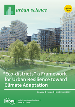
Cover Story (view full-size image): Within the debate on climate-proof urban regeneration, “eco-districts” are becoming possible integrated frameworks between urbanism and ecology. In this context, the state of the art on sustainable development and urban resilience points to the French context as an emblematic scope of study. In particular, the French EcoQuartiers are considered as best practices toward mitigation and adaptation strategies, providing an important contribution for a grid of references. Nevertheless, research opens a debate on the potentials and limits of these practices, related on the one hand to the quality, innovation, integration, and dissemination of the design solutions, and on the other hand to the economic and social costs that find a synthesis in the concept of “greentrification”. View this paper
  • Issues are regarded as officially published after their release is announced to the table of contents alert mailing list.
  • You may sign up for e-mail alerts to receive table of contents of newly released issues.
  • PDF is the official format for papers published in both, html and pdf forms. To view the papers in pdf format, click on the "PDF Full-text" link, and use the free Adobe Reader to open them.
Order results
Result details
Select all
Export citation of selected articles as:
23 pages, 1604 KiB  
Article
Effectiveness of Urban Climate Change Governance in Addis Ababa City, Ethiopia
by Tigezaw Lamesgin Addis, Belay Simane Birhanu and Tesfaye Zeleke Italemahu
Urban Sci. 2022, 6(3), 64; https://doi.org/10.3390/urbansci6030064 - 16 Sep 2022
Cited by 3 | Viewed by 2480
Abstract
Addis Ababa is one of the eleven cities in Africa that have been taking bold action in meeting the objectives of the Paris Agreement. At the present time, the city is working toward reducing greenhouse gas emissions and enabling the city to be [...] Read more.
Addis Ababa is one of the eleven cities in Africa that have been taking bold action in meeting the objectives of the Paris Agreement. At the present time, the city is working toward reducing greenhouse gas emissions and enabling the city to be resilient to the impacts of climate change. To make the city carbon neutral and resilient to climate change, the coordination of different sectors and actors is crucial. To this end, the planning and implementation of mitigation and adaptation measures needs effective climate change governance. Thus, this study was intended to explore the effectiveness of climate change governance in Addis Ababa City, Ethiopia. The study followed both quantitative and qualitative research approaches and relied on both primary and secondary data sources. A survey of 232 respondents, who were environment experts at different levels, was conducted using questionnaires. In addition, interviews and observations were conducted to gather relevant data. Secondary data were collected from different sources. The quantitative data were analysed using relative importance index (RII) analysis. The study found that existing environmental policies, strategies, regulations, proclamations, laws, and implementations in the city were facing major challenges in terms of weak accountability, the poor enforcement of regulation, and the failure to involve key actors, especially NGOs, communities, and private sectors; these failures were characterized by weak institutional setup and a lack of formal systems allowing actors (private sectors, communities, and NGOs) to interact to respond to climate change. Hence, climate change governance was ineffective in terms of accountability, participation, law enforcement, equity, institutions, the role of actors, and partnership. Thus, the Addis Ababa City Environmental Protection and Green Development Commission should give more emphasis to the coordination of other actors (NGOs, communities, private sectors, and research institutions) to respond to climate change in the city. In addition, the commission should provide training to the lower layers of experts and mobilise the community for climate change response, particularly in the undertaking of adaptation measures. Furthermore, Addis Ababa City administrators should give due attention to climate change response through an established strong accountability system to enforce regulation, rules, proclamations, laws, policies, and strategies in different sectors. Full article
(This article belongs to the Special Issue Urban Climate Change Management and Society)
Show Figures

Figure 1

16 pages, 3435 KiB  
Article
Urban Planning for Climate Change: A Toolkit of Actions for an Integrated Strategy of Adaptation to Heavy Rains, River Floods, and Sea Level Rise
by Carmela Mariano and Marsia Marino
Urban Sci. 2022, 6(3), 63; https://doi.org/10.3390/urbansci6030063 - 13 Sep 2022
Cited by 6 | Viewed by 3284
Abstract
Cities and urban systems are the places most responsible for climate change, but at the same time they are the places where its effects are felt the most. A state-of-the-art analysis showed that Ecological–Environmental, Settlement, and Infrastructure and Service Systems are the components [...] Read more.
Cities and urban systems are the places most responsible for climate change, but at the same time they are the places where its effects are felt the most. A state-of-the-art analysis showed that Ecological–Environmental, Settlement, and Infrastructure and Service Systems are the components of cities most exposed to risk phenomena. Therefore, it is important to identify site-specific actions aimed at enhancing ecosystem services and building hierarchical ecological networks (green and blue infrastructures), according to an Ecosystem-based Approach (EbA). In this regard, the contribution presents the results of a research work on the theme of multi-risks connected to climate change, referring to heavy rains and river flood phenomena and sea level rise and proposes a systematisation of international best practices in the field of the Ecosystem-based Approach (EbA). Each best practice analysed is traced back to the three urban resilience macro-strategies of “defence”, “adaptation”, and “relocation/de-anthropisation”, already conceptualised by the authors during their joint research activity. The aim is to outline a synthetic toolkit of site-specific design actions, exportable to other contexts, intended as a tool to support the innovation of urban planning tools at the local level. Full article
Show Figures

Figure 1

12 pages, 13276 KiB  
Technical Note
Rapid Damage Estimation of Texas Winter Storm Uri from Social Media Using Deep Neural Networks
by Yalong Pi, Xinyue Ye, Nick Duffield and on behalf of the Microsoft AI for Humanitarian Action Group
Urban Sci. 2022, 6(3), 62; https://doi.org/10.3390/urbansci6030062 - 13 Sep 2022
Cited by 3 | Viewed by 2354
Abstract
The winter storm Uri that occurred in February 2021 affected many regions in Canada, the United States, and Mexico. The State of Texas was severely impacted due to the failure in the electricity supply infrastructure compounded by its limited connectivity to other grid [...] Read more.
The winter storm Uri that occurred in February 2021 affected many regions in Canada, the United States, and Mexico. The State of Texas was severely impacted due to the failure in the electricity supply infrastructure compounded by its limited connectivity to other grid systems in the United States. The georeferenced estimation of the storm’s impact is crucial for response and recovery. However, such information was not available until several months afterward, mainly due to the time-consuming and costly assessment processes. The latency to provide timely information particularly impacted people in the economically disadvantaged communities, who lack resources to ameliorate the impact of the storm. This work explores the potential for disaster impact estimation based on the analysis of instant social media content, which can provide actionable information to assist first responders, volunteers, governments, and the general public. In our prototype, a deep neural network (DNN) uses geolocated social media content (texts, images, and videos) to provide monetary assessments of the damage at zip code level caused by Uri, achieving up to 70% accuracy. In addition, the performance analysis across geographical regions shows that the fully trained model is able to estimate the damage for economically disadvantaged regions, such as West Texas. Our methods have the potential to promote social equity by guiding the deployment or recovery resources to the regions where it is needed based on damage assessment. Full article
(This article belongs to the Special Issue Feature Papers in Urban Science)
Show Figures

Figure 1

16 pages, 2246 KiB  
Article
Examining Decomposition and Nitrogen Mineralization in Five Common Urban Habitat Types across Southern California to Inform Sustainable Landscaping
by George L. Vourlitis, Emma Lousie van der Veen, Sebastian Cangahuala, Garrett Jaeger, Colin Jensen, Cinzia Fissore, Eric M. Wood, Joel K. Abraham, Kevin S. Whittemore, Elijah Slaven, Dustin VanOverbeke, James Blauth, Elizabeth Braker, Nina Karnovsky and Wallace M. Meyer III
Urban Sci. 2022, 6(3), 61; https://doi.org/10.3390/urbansci6030061 - 13 Sep 2022
Cited by 2 | Viewed by 1970
Abstract
Urban landscaping conversions can alter decomposition processes and soil respiration, making it difficult to forecast regional CO2 emissions. Here we explore rates of initial mass loss and net nitrogen (N) mineralization in natural and four common urban land covers (waterwise, waterwise with [...] Read more.
Urban landscaping conversions can alter decomposition processes and soil respiration, making it difficult to forecast regional CO2 emissions. Here we explore rates of initial mass loss and net nitrogen (N) mineralization in natural and four common urban land covers (waterwise, waterwise with mulch, shrub, and lawn) from sites across seven colleges in southern California. We found that rates of decomposition and net N mineralization were faster for high-N leaf substrates, and natural habitats exhibited slower rates of decomposition and mineralization than managed urban landcovers, especially lawns and areas with added mulch. These results were consistent across college campuses, suggesting that our findings are robust and can predict decomposition rates across southern California. While mechanisms driving differences in decomposition rates among habitats in the cool-wet spring were difficult to identify, elevated decomposition in urban habitats highlights that conversion of natural areas to urban landscapes enhances greenhouse gas emissions. While perceived as sustainable, elevated decomposition rates in areas with added mulch mean that while these transformations may reduce water inputs, they increase soil carbon (C) flux. Mimicking natural landscapes by reducing water and nutrient (mulch) inputs and planting drought-tolerant native vegetation with recalcitrant litter can slow decomposition and reduce regional C emissions. Full article
Show Figures

Figure 1

16 pages, 3488 KiB  
Article
Understanding Sources and Composition of Black Carbon and PM2.5 in Urban Environments in East India
by Balram Ambade, Tapan Kumar Sankar, Lokesh K. Sahu and Umesh Chandra Dumka
Urban Sci. 2022, 6(3), 60; https://doi.org/10.3390/urbansci6030060 - 05 Sep 2022
Cited by 26 | Viewed by 3319
Abstract
Black carbon (BC) and PM2.5 chemical characterizations are crucial for insight into their impact on the health of the exposed population. PM2.5 sampling was carried out over selected residential sites of Jamshedpur (JSR) and Kharagpur (KGP), east India, during the winter [...] Read more.
Black carbon (BC) and PM2.5 chemical characterizations are crucial for insight into their impact on the health of the exposed population. PM2.5 sampling was carried out over selected residential sites of Jamshedpur (JSR) and Kharagpur (KGP), east India, during the winter season. Seven selected elements (SO42−, Cl, Na+, NO3, K+, Ca2+, and Mg2+) were analyzed using ion chromatography (IC). Black carbon (BC) sampling was also done at two different sites in JSR and KGP to understand its correlation. The PM2.5 ionic species mass concentration in JSR was in the order of SO42− > Cl > Na+ > NO3 > K+ > Ca2+ > Mg2+, whereas in KGP, it was SO42− > NO3 > Cl > Na+ > K+ > Ca2+ > Mg2+. The back-trajectory analysis showed that most of the air masses during the study period originated from the Indo Gangetic Plain (IGP). The Pearson relations of BC-PM2.5 indicate a better positive correlation (r = 0.66) at KGP compared to JSR (r = 0.42). As shown in the diagnostic ratio analysis, fossil fuel combustion and wood burning account for 51.51% and 36.36% of the total energy consumption in JSR city, respectively. In KGP city, the apportionment of origin sources were fossil fuel and wood burning at 43.75% and 34.37%, respectively. This study provides the first inventory of atmospheric particulate-bound chemical concentrations and BC profiles in middle-east India and informs policymakers and scientists for further studies. Full article
(This article belongs to the Special Issue Urban Climate Change Management and Society)
Show Figures

Figure 1

16 pages, 261 KiB  
Article
How Many Trees Are Planted in African Cities? Expectations of and Challenges to Planning Considering Current Tree Planting Projects
by Emmanuel S. H. Lobe Ekamby and Pierpaolo Mudu
Urban Sci. 2022, 6(3), 59; https://doi.org/10.3390/urbansci6030059 - 05 Sep 2022
Cited by 1 | Viewed by 2567
Abstract
Africa is a particularly vulnerable continent to the effects of climate and environmental changes. Several tree planting projects were launched as one of the plausible solutions to climate action. This paper reviews the recent tree planting projects in African cities, initiated between 2009 [...] Read more.
Africa is a particularly vulnerable continent to the effects of climate and environmental changes. Several tree planting projects were launched as one of the plausible solutions to climate action. This paper reviews the recent tree planting projects in African cities, initiated between 2009 to 2021, focusing on analyzing the expected benefits to the populations. Indeed, these projects have become a widespread instrument to promise planning solutions for many African countries given the expected improvements to mitigate air pollution, carbon sequestration, and the conditions of cities for the health and wellbeing of their citizens. The consequences of uncontrolled urbanization in Africa also stress the importance of better planning of green spaces. African cities should reconsider urban planning with a clear focus on the role of green infrastructures because of their extensive social benefits and supportive capacity for any significant sustainable development. While these projects seem to be a promising initiative and are expected to deliver beneficial ecosystem services to citizens, there are still some loopholes that this paper highlights. Full article
12 pages, 1678 KiB  
Article
Urban Expansion and Its Implication to Build Urban Resilience in Regio-Metropolitan Cities of the Amahara Region, Ethiopia
by Kassahun Gashu and Endalew Terefe Alene
Urban Sci. 2022, 6(3), 58; https://doi.org/10.3390/urbansci6030058 - 03 Sep 2022
Viewed by 2400
Abstract
There could be many empirical contexts which could be applied in urban resilience. The general objective of this research is to assess urban expansion and its implication on urban resilience in regio-metropolitan cities in the Amhara Region (Gondar and Bahir Dar). It used [...] Read more.
There could be many empirical contexts which could be applied in urban resilience. The general objective of this research is to assess urban expansion and its implication on urban resilience in regio-metropolitan cities in the Amhara Region (Gondar and Bahir Dar). It used mixed research approaches and cross-sectional design. Data were collected from primary and secondary sources. Primary data were collected from a survey questionnaire, key informant interview and FGDs while secondary data were gathered from both published and unpublished sources. A multi-stage sampling technique was used to determine sample size, and a proportional sampling method was used. Quantitative data were analyzed using descriptive statistics (mean, percentage, SD), while qualitative data were analyzed using thematic analysis. The results indicate that major factors that influence building urban resilience are lacking proper urban planning, basic infrastructure and good governance in both cities, and both cities are extremely far behind in implementing urban resilience principles. Hence, the study improves the community participation in development policy formulation and implementation for urban resilience. Full article
(This article belongs to the Topic Resilience of Interdependent Urban Systems)
Show Figures

Figure 1

16 pages, 1824 KiB  
Review
Barriers and Challenges to Waste Management Hindering the Circular Economy in Sub-Saharan Africa
by Justice Kofi Debrah, Godfred Kwesi Teye and Maria Alzira Pimenta Dinis
Urban Sci. 2022, 6(3), 57; https://doi.org/10.3390/urbansci6030057 - 01 Sep 2022
Cited by 20 | Viewed by 9635
Abstract
More and more, waste generated in most parts of the Western world has been recycled and transformed into new circularity products. However, managing waste within Sub-Saharan Africa (SSA), such as in Ghana, has become a challenge due to the continued practice of the [...] Read more.
More and more, waste generated in most parts of the Western world has been recycled and transformed into new circularity products. However, managing waste within Sub-Saharan Africa (SSA), such as in Ghana, has become a challenge due to the continued practice of the old traditional linear waste economy, that is, the taking, making and disposing methods of management, representing a threat to global environmental sustainability. Despite the need to revise current linear waste management (WM) in order to turn to the circular economy (CE) model, which consists of the concept of renew, remake and share, to advance sustainable development, a number of factors restrict the CE realization in practice, specifically in developing countries. An integrative methodology was used in this article to identify some of the challenges that hinder the achievement of CE in SSA countries. The results revealed the absence of educational programs and public awareness of waste management activities. The findings also highlight the lack of political will, funding and national policies on WM as some of the most significant issues. The study contributes to further encouraging policymakers and policy implementers, entrepreneurs and relevant interested groups to commit resources to sustainable WM services aiming to advancing CE in SSA countries. Full article
Show Figures

Figure 1

27 pages, 9888 KiB  
Article
Urban Regeneration and Green and Blue Infrastructure: The Case of the “Acilia–Madonnetta” Urban and Metropolitan Centrality in the Municipality of Rome
by Francesco Crupi
Urban Sci. 2022, 6(3), 56; https://doi.org/10.3390/urbansci6030056 - 31 Aug 2022
Cited by 5 | Viewed by 2807
Abstract
To contribute to the debate on climate-proof urban regeneration, the illustrated study seeks to understand how the provision of new multiscalar, multidimensional, and integrated planning tools based on sustainable and resilient strategies can guarantee high levels of urban, environmental, and energy efficiency and [...] Read more.
To contribute to the debate on climate-proof urban regeneration, the illustrated study seeks to understand how the provision of new multiscalar, multidimensional, and integrated planning tools based on sustainable and resilient strategies can guarantee high levels of urban, environmental, and energy efficiency and quality, as well as circularity of resources, counteracting the effects deriving from climate change. Starting from some regulatory and design references that integrate a new ecologically oriented city model into the planning of urban projects, the contribution identifies in the construction of green and blue infrastructures (GI) new design metaphors capable of improving biodiversity; favoring ecological and energy transition; restoring the quality of the air, water, and soil environmental matrices with natural solutions; and making cities truly inclusive, sustainable, and resilient. The methodology adopted for the design of the “Acilia–Madonnetta” Urban and Metropolitan Centrality in the Municipality of Rome simulates a planning process for part of the X Municipality by applying an iterative and interscalar logic, an articulation of levels and phases with the aim of prefiguring the construction of a GI characterized by new ecological-environmental and functional endowments strictly related to the promotion of an efficient, smart, and green city. The contribution highlights the potential and limits of the proposed experimentation, relating both to the quality and innovation of design solutions and possible evolutionary lines and to the lack of clear institutional governance that is limiting the implementation of projects. Full article
Show Figures

Figure 1

20 pages, 1022 KiB  
Article
A Study on the Promotional Effect and Mechanism of National e-Commerce Demonstration City Construction on Green Innovation Capacity of Cities
by Jie Li, Shengjun Yuan and Jun Wu
Urban Sci. 2022, 6(3), 55; https://doi.org/10.3390/urbansci6030055 - 30 Aug 2022
Cited by 3 | Viewed by 1575
Abstract
Green innovation precisely reflects China’s new development concept and is the general trend for urban development in the future. In addition, e-commerce might become an important breakthrough platform to promote urban green innovation. In order to explore the impact of the construction of [...] Read more.
Green innovation precisely reflects China’s new development concept and is the general trend for urban development in the future. In addition, e-commerce might become an important breakthrough platform to promote urban green innovation. In order to explore the impact of the construction of national e-commerce demonstration cities on urban green innovation, this paper aimed to theoretically analyze the potential relationship between the two and the transmission mechanism. At the same time, we have examined the panel data from 297 prefecture level cities in China from 2005 to 2018 to explore the implementation effect of the pilot policies by using difference-in-differences and carried out a series of robustness tests. The results showed that: (i) The pilot policy of e-commerce demonstration cities exhibited a significant promotion effect on the green innovation capacity of the different cities, and in general, the promotion effect of the pilot policy is dynamically sustainable. (ii) Analysis of the further influence mechanism showed that the pilot policy could effectively promote the development of urban green innovation capacity by enhancing the level of urban informatization, thereby attracting the concentration of scientific and technological talents. This in turn can facilitate urban innovation and the entrepreneurship environment, among which the boosting effect of optimizing the urban innovation and entrepreneurship environment was the greatest. (iii) In terms of heterogeneity, the pilot policies showed significant positive effects on all the regions to which the cities belong, while the boosting effects were more significant for cities with large populations, non-central cities, and the general science and education cities. The findings of this study not only enrich the research results in the field of urban green innovation, but also have clear policy implications, which can provide useful guidance and reference value for the work of relevant departments. Full article
Show Figures

Figure 1

11 pages, 5691 KiB  
Technical Note
Parametric Analysis of Rainfall-Induced Loess Soil Slope Due to the Rainwater Infiltration
by Yang Liu, Gang Tian, Shijun Wang, Alfrendo Satyanaga and Qian Zhai
Urban Sci. 2022, 6(3), 54; https://doi.org/10.3390/urbansci6030054 - 24 Aug 2022
Cited by 2 | Viewed by 1610
Abstract
Hydraulic properties (such as soil–water characteristic curves (SWCC) and hydraulic conductivity function (HCF)) play an important role in evaluating the stability of unsaturated soil slopes. Loess soils are widely distributed in Gansu Province in China, and most of them are in unsaturated conditions [...] Read more.
Hydraulic properties (such as soil–water characteristic curves (SWCC) and hydraulic conductivity function (HCF)) play an important role in evaluating the stability of unsaturated soil slopes. Loess soils are widely distributed in Gansu Province in China, and most of them are in unsaturated conditions due to the deep groundwater table (G.W.T). In this study, twenty-eight sets of data published in the literature were analyzed to develop the upper and lower bounds of the SWCC for loess soil in Gansu. The variation of HCF for the loess soil was estimated from the upper and lower bounds curve developed in this study. Subsequently, numerical analyses incorporating scenarios considering different SWCCs, HCFs, and rainfall conditions were conducted for investigating the effects of those factors on the rainfall-induced slope stability. The results of analyses indicate that the infiltration plays an important role in the rainfall-induced slope stability. Higher permeable soil leads to a larger infiltration amount, which, in turn, results in a lower safety factor. In addition, the effect of the hydraulic property on the rainfall-induced slope stability decreases with the increase in slope angle. Full article
Show Figures

Figure 1

23 pages, 2939 KiB  
Review
Integrating Biophysical and Economic Assessment: Review of Nature-Based Adaptation to Urban Flood Extremes
by Carlotta Quagliolo, Peter Roebeling, Rita Mendonça, Alessandro Pezzoli and Elena Comino
Urban Sci. 2022, 6(3), 53; https://doi.org/10.3390/urbansci6030053 - 23 Aug 2022
Cited by 5 | Viewed by 2554
Abstract
Over the last decade, the potential of nature-based solutions (NBS) has been recognized to support climate change adaptation, by promoting sustainable urban planning. Nevertheless, a wider uptake of such solutions in urban areas faces different challenges and barriers. A comprehensive mapping of available [...] Read more.
Over the last decade, the potential of nature-based solutions (NBS) has been recognized to support climate change adaptation, by promoting sustainable urban planning. Nevertheless, a wider uptake of such solutions in urban areas faces different challenges and barriers. A comprehensive mapping of available NBS impact assessment methods could help to accelerate this process. There is, however, a lack of comprehensive systematization of economic analysis. This research aims to provide an overview of NBS impact evaluations by assessing how the scientific literature integrates such economic analysis into urban planning adaptation. A systematic review approach has been used to discuss the role of NBS in climate change adaptation. This review presents two main stages. Firstly, it identifies the biophysical–economic assessment of NBS adaptation measures to reduce urban flood extremes in coastal cities. Secondly, the NBS approaches were categorized based on the biophysical benefits (in terms of flood-risk reduction) related to each specific solution and the subsequent economic evaluation of such implementations. This research review revealed a low-level gap of integration between climate change issues and NBS analysis (i.e., it is commonly used as background condition). Most publications provide NBS biophysical impacts assessment, without combining these results with economic evaluation of the flood damages to finally achieve the avoided cost due to the implementation of such solutions. This work shows the growing interest on further research to develop spatially integrated environmental–economic assessment of NBS implementation, by highlighting the needs and opportunities of a trans-disciplinary approach to support policy-making in the framework of urban climate change adaptation. Full article
(This article belongs to the Special Issue Coastal Urban Dynamics under Climate Change)
Show Figures

Figure 1

17 pages, 1546 KiB  
Article
On Spatial Mechanisms of Social Equity: Exploring the Associations between Street Networks, Urban Compactness, and Social Equity
by Mahbub Rashid
Urban Sci. 2022, 6(3), 52; https://doi.org/10.3390/urbansci6030052 - 22 Aug 2022
Cited by 3 | Viewed by 1765
Abstract
In several publications between 1998 and 2003, Elizabeth Burton examined whether urban compactness promotes social equity. Based on an extensive literature review, Burton developed numerous urban compactness and social equity measures. Using a sample of 25 free-standing English cities of different sizes, her [...] Read more.
In several publications between 1998 and 2003, Elizabeth Burton examined whether urban compactness promotes social equity. Based on an extensive literature review, Burton developed numerous urban compactness and social equity measures. Using a sample of 25 free-standing English cities of different sizes, her studies found that urban compactness measures are often statistically correlated with social equity measures in these cities. Extending Burton’s studies, this study explores the correlations between the measures of street networks, urban compactness, and social equity in the same 25 cities that Burton studied. Correlational analyses revealed that street network measures are correlated differently with different urban compactness and social equity measures. Some street network measures are not statistically correlated with social equity and urban compactness measures. Some are statistically correlated with urban compactness measures, but not with social equity measures. Yet others are statistically correlated with social equity measures, but not with urban compactness. Still others are statistically correlated with both social equity and urban compactness measures. Therefore, it was concluded that spatial mechanisms may work differently for different aspects of social equity. The implications of these findings are discussed. Full article
Show Figures

Figure 1

13 pages, 4594 KiB  
Article
A Preliminary Study of Summer Thermo-Hygrometric Comfort under Different Environmental Conditions in a Mediterranean City
by Serena Falasca, Annalisa Di Bernardino, Virgilio Ciancio, Gabriele Curci and Ferdinando Salata
Urban Sci. 2022, 6(3), 51; https://doi.org/10.3390/urbansci6030051 - 21 Aug 2022
Cited by 1 | Viewed by 1745
Abstract
The thermo-hygrometric sensation of pedestrians in outdoor environments can be quantified by means of bioclimatic indices. In this work, the Mediterranean Outdoor Thermal Comfort Index (MOCI) is applied in the city of Rome (Italy) for the purpose of investigating the effect of local [...] Read more.
The thermo-hygrometric sensation of pedestrians in outdoor environments can be quantified by means of bioclimatic indices. In this work, the Mediterranean Outdoor Thermal Comfort Index (MOCI) is applied in the city of Rome (Italy) for the purpose of investigating the effect of local environmental conditions (urban, suburban, rural) on pedestrian thermal comfort. Hourly values of MOCI are calculated for the May–September period in the years 2015–2021 using weather quantities acquired by the four monitoring stations of the Regional Agency for Environmental Protection included in the metropolitan area of Rome. MOCI data are analyzed based on the comfort and (cold/hot) discomfort conditions during both daytime and nighttime. At the urban station, 26% of daily records exceed the comfort threshold revealing the effect of urban overheating, whereas only 0.1% of hot discomfort occurrences are recorded overnight. Here, greater nighttime thermal comfort is experienced than in non-urban locations suggesting that the nocturnal thermo-hygrometric conditions are satisfactory for inhabitants in downtown Rome, despite the urban heat island. It also suggests that other factors, such as orography and atmospheric circulation, influence outdoor thermal comfort. The development of this work will therefore include at least these two elements. Full article
Show Figures

Figure 1

16 pages, 2463 KiB  
Article
Industrial Waste Pretreatment Approach for 3D Printing of Sustainable Building Materials
by Qaisar Munir, Sanaz Afshariantorghabeh and Timo Kärki
Urban Sci. 2022, 6(3), 50; https://doi.org/10.3390/urbansci6030050 - 01 Aug 2022
Cited by 3 | Viewed by 2816
Abstract
The large volume of industrial by-products and wastes from the construction, timber and paper industries has become a serious challenge worldwide. Recycling these industrial wastes as functional materials in the construction industry is an efficient approach for sustainable development. This study presents a [...] Read more.
The large volume of industrial by-products and wastes from the construction, timber and paper industries has become a serious challenge worldwide. Recycling these industrial wastes as functional materials in the construction industry is an efficient approach for sustainable development. This study presents a pretreatment approach for recycling construction and demolition waste (CDW) and industrial side-streams (such as green liquor sludge, fiber waste, flotation sand and fly ash) in order to produce a geopolymer for the 3D printing of construction materials. A treatment approach was developed for screening the residues from CDW with a maximum size of 16 mm and for a combined line treatment for industrial side streams. The treatment processes utilized suitable and economical separation techniques for the recycling of waste materials. The crushing of the screened residues resulted in a homogeneous material size that facilitates the separation of mixed wastes and simplifies the classification of materials. The combined plant enabled the cost-effective treatment of various industrial wastes in a single process unit. The results show that the economic and environmental impact of the chosen techniques, in terms of their energy consumption, is highly dependent on the treatment line, separation technique and quantity of the individual waste that is processed. These recycled industrial wastes can be used as sustainable materials for the production of geopolymer concrete, contributing to the sustainability of the construction industry. Full article
Show Figures

Figure 1

28 pages, 2335 KiB  
Article
A Planning Framework for Urban Resilience toward Climate Adaptation and Mitigation: Potentials and Limits of “Eco-Districts”
by Irene Poli, Chiara Ravagnan and Laura Ricci
Urban Sci. 2022, 6(3), 49; https://doi.org/10.3390/urbansci6030049 - 22 Jul 2022
Cited by 4 | Viewed by 2843
Abstract
In order to contribute to the debate on climate-proof urban regeneration, the study illustrated in this paper pays attention to the references for eco-districts as possible integrated frameworks that include urbanism and ecology toward urban resilience linked to environmental, social and governance “commitments”. [...] Read more.
In order to contribute to the debate on climate-proof urban regeneration, the study illustrated in this paper pays attention to the references for eco-districts as possible integrated frameworks that include urbanism and ecology toward urban resilience linked to environmental, social and governance “commitments”. To this end, the research activity has given answer to a need for a contextualization of the urban phenomena and the state of the art on sustainable development and climate proof urban resilience, pointing out the French context as an emblematic scope of study through a literature review of European best practices of eco-district. In consistency with this research framework, the study has developed a case study analysis, focusing on the description and evaluation of four best practices of French EcoQuartiers. The methodology adopted has selected with an inductive method the mitigation and adaptation strategies developed in the implementation of the French emblematic eco-quartiers, combining the official sources of the projects with on-site visits and surveys in order to define an experimental proposal of a grid of methodological-operational references relating to eco-districts. Furthermore, the discussion points out the potentials and limits of the proposed framework, related on the one hand to the quality, innovation, integration, and dissemination of the design solutions, and on the other hand to the economic and social costs of the EcoQuartiers that find a synthesis in the concept of “greentrification”. Finally, the conclusion highlights the interest of the contribution of the French context in climate proof planning and points out research interest in the other national contexts toward a European framework for eco-districts. Full article
Show Figures

Figure 1

18 pages, 755 KiB  
Article
Relations of Public Transport Use and Car Ownership with Neighbourhood and City-Level Travel Purposes in Kerman, Iran
by Houshmand Masoumi, Chengete Chakamera, Liberty Mapamba, Noleen Pisa and Hamid Soltanzadeh
Urban Sci. 2022, 6(3), 48; https://doi.org/10.3390/urbansci6030048 - 13 Jul 2022
Cited by 4 | Viewed by 2602
Abstract
There are significant deviations in travel mode choice drivers between developed and developing countries. This study investigates the determinants of car ownership and public transit ridership in Iran. Using survey data from 800 respondents, the determinants of travel behaviour of Kerman residents were [...] Read more.
There are significant deviations in travel mode choice drivers between developed and developing countries. This study investigates the determinants of car ownership and public transit ridership in Iran. Using survey data from 800 respondents, the determinants of travel behaviour of Kerman residents were investigated, based on gender, age, household size, car ownership, frequency of public transport ridership, number of working days per week, number of shopping activities in the neighbourhood per week, number of entertainment activities in the neighbourhood per week, and number of shopping activities in the city. Two multivariate models were estimated using the OLS and WLS methods. Our findings suggested that owning a car tends to increase as age, household size, number of working days and number of shopping days in the city decreases. An increase in the number of entertainment days in the neighbourhood raised the probability of car ownership while shopping in the neighbourhood did not influence car ownership. Public transport use was negatively influenced by gender, increased age and number of working days, but positively influenced by shopping in the city. Our research results have significant implications for transport planning. Firstly, changes in household size may not be a good basis to inform planning as our findings show that in Kerman as household size increases, car ownership decreases, and it does not influence public transport. Secondly, when planning road network connectivity (land use) higher working days are expected to increase both car ownership and public transport use. Full article
Show Figures

Figure 1

21 pages, 3538 KiB  
Article
Nature-Positive Design and Development: A Case Study on Regenerating Black Cockatoo Habitat in Urban Developments in Perth, Australia
by Giles Thomson, Peter Newman, Dominique Hes, Jo Bennett, Mark Taylor and Ron Johnstone
Urban Sci. 2022, 6(3), 47; https://doi.org/10.3390/urbansci6030047 - 07 Jul 2022
Cited by 4 | Viewed by 15116
Abstract
The benefits of ecosystem services to cities are well documented; for example, water-sensitive urban design to mitigate stormwater flows and purify run-off, the cooling benefits provided by tree shade, and psychological benefits of urban greening. Cities tend to displace nature, and in urban [...] Read more.
The benefits of ecosystem services to cities are well documented; for example, water-sensitive urban design to mitigate stormwater flows and purify run-off, the cooling benefits provided by tree shade, and psychological benefits of urban greening. Cities tend to displace nature, and in urban environments where nature exists it tends to be as highly altered ecosystems. This paper sets out how it is possible to regenerate nature in cities. We outline the principles of how to do this through a study on a new regenerative urban development in Perth, Australia, where urban planning is intended to support the regeneration of a bioregional habitat within the city. The authors, drawn from sustainability, property development and ecological backgrounds, describe how urban regeneration can potentially facilitate the regeneration of endemic habitat within the city. This builds on the original ecosystem functionality to provide an urban ecosystem that enables biodiversity to regenerate. Perth lies on the Swan Coastal Plain, a biodiversity hotspot; it is home to 2.1 million people and numerous endemic species such as the endangered Black Cockatoo. Low reproduction rates and habitat loss through agricultural clearing, fire and urban expansion have greatly reduced the Black Cockatoo’s range and this continuing trend threatens extinction. However, the charismatic Black Cockatoos enjoy passionate support from Perth’s citizens. This paper describes a range of strategies whereby new urban development could potentially harness the popularity of the iconic Black Cockatoo to build momentum for urban habitat regeneration (for the cockatoos and other species) on the Swan Coastal Plain. The strategies, if systematically operationalised through urban planning, could allow city-scale ecological gain. The authors suggest a framework for nature-positive design and development that offers multiple benefits for human and non-human urban dwellers across scales, from individual gardens, to city/regional scale habitat corridors. Collectively, these strategies can increase the capacity of the city to support endemic species, simultaneously enhancing a bioregional “sense of place”, and numerous associated ecosystem services to increase urban resilience in the face of climate change. Full article
(This article belongs to the Special Issue Nature-Positive Design and Development)
Show Figures

Figure 1

20 pages, 3291 KiB  
Systematic Review
Assessment of Citizens’ Perception of the Built Environment throughout Digital Platforms: A Scoping Review
by Montserrat Delpino-Chamy and Yolanda Pérez Albert
Urban Sci. 2022, 6(3), 46; https://doi.org/10.3390/urbansci6030046 - 06 Jul 2022
Cited by 1 | Viewed by 2118
Abstract
(1) Background: To assess the quality of the built environment, it is necessary to study both the physical components and the inhabitants’ perceptions. However, since objective indicators are easily measurable, most studies have centered only on analyzing the physical dimensions of cities. Currently, [...] Read more.
(1) Background: To assess the quality of the built environment, it is necessary to study both the physical components and the inhabitants’ perceptions. However, since objective indicators are easily measurable, most studies have centered only on analyzing the physical dimensions of cities. Currently, the massification of information technology and the emergence of digital platforms are offering new participatory channels for studying citizens’ perceptions of the built environment. (2) Objective: considering the scarcity of the theoretical and methodological approaches supporting this new research, the main objective of this article is centered on contributing to the field by developing a scoping review of the publications assessing the perception of the built environment through digital platforms and concluding with a conceptual framework to support future research. (3) Methods: to do so, 98 articles were reviewed and 21 of them were selected and studied in detail after applying a selection criteria identifying papers that analyzed the urban environment (Criteria 1), used participatory processes (Criteria 2), were developed with the support of digital platforms (Criteria 3), and were centered on the study urban places, therefore excluding mobility (Criteria 4), which was done in order to identify the main theoretical and methodological approaches used for studying perception in the built environment. (4) Results: The research identified Audit Tools and Perception Tools to study citizens’ perceptions. Audit Tools are methodologically related to Systematic Social Observation (SSO). Perception Tools rely on transactional person–environment or Public Participation as the main theories, followed by Subjective Wellbeing (SWB), Physical Activity (PA), and Social Sustainability as fields where these studies are being applied. Participatory mapping is identified as a general methodology, considered the basic technical tool of Public Participation Geographic Information Systems (PPGIS). Place-based and Citizens Science are other methodologies supporting perception research. (5) Conclusions: Finally, the proposed framework for assessing the perception of the built environment supports the notion that, in order to study perception, both subjective and objective approaches are necessary. The subjective approach supports the study of the self-reported perceived environment while the objective approach is used to collect urban structure data so as to understand the socio-environmental context conditioning the experience. Full article
Show Figures

Figure 1

27 pages, 6859 KiB  
Review
A Study on Transformation of Housing Typology and Its Environmental and Social Effects on the Living Conditions of Residents in Planned Residential Neighborhoods of Kabul City
by Mohammad Ramin Amiryar and Junichiro Asano
Urban Sci. 2022, 6(3), 45; https://doi.org/10.3390/urbansci6030045 - 05 Jul 2022
Cited by 1 | Viewed by 6099
Abstract
This study examines the transformation in housing typology from low-rise to apartment buildings in the formal neighborhood of Kabul city. These formal neighborhoods were developed according to plans from 1978. The majority of these neighborhoods were designed with detached houses that had courtyards. [...] Read more.
This study examines the transformation in housing typology from low-rise to apartment buildings in the formal neighborhood of Kabul city. These formal neighborhoods were developed according to plans from 1978. The majority of these neighborhoods were designed with detached houses that had courtyards. Literature reviews, field visits, opinions of residents, and a planning organization provided data for this study. In this study, the transformation of housing in planned neighborhoods is analyzed in relation to their social and environmental impacts. Researchers determined how varying housing typologies affected residents’ health and quality of life in these planned neighborhoods. Initially, we assessed the physical characteristics of the study area and evaluated how much transformation volume is present in the study area. Second, we examined residents’ views of residential development and its impacts, as well as their daily lives. In order to identify the relationship between these two aspects, the study examined the characteristics of the area (variables) from the perspectives of privacy, natural light, shading, sound pollution, air pollution, and energy use. We used several criteria to evaluate the accuracy of the physical characteristics and the respondents’ opinions. Lastly, we provided some recommendations and solutions to improve the current situation. Full article
(This article belongs to the Topic Sustainable Built Environment)
Show Figures

Figure 1

17 pages, 3872 KiB  
Article
Impact of the COVID-19 Pandemic on Walkability in the Main Urban Area of Xi’an
by Kun Yuan, Hirokazu Abe, Noriko Otsuka, Kensuke Yasufuku and Akira Takahashi
Urban Sci. 2022, 6(3), 44; https://doi.org/10.3390/urbansci6030044 - 28 Jun 2022
Cited by 4 | Viewed by 2422
Abstract
The COVID-19 pandemic has greatly affected the mobility of individuals everywhere. This has been especially true in China, where many restrictions, including lockdowns, have been widely applied. This paper discusses the impact of the pandemic on walkability, an important factor in promoting urban [...] Read more.
The COVID-19 pandemic has greatly affected the mobility of individuals everywhere. This has been especially true in China, where many restrictions, including lockdowns, have been widely applied. This paper discusses the impact of the pandemic on walkability, an important factor in promoting urban neighborhoods, in the main urban area of Xi’an, China, one of China’s four great ancient capitals. Based on the street view data obtained before and after the pandemic, the paper quantitatively compares changes in specific components of selected streetscapes through a deep learning (DL) street view analysis. The aim is to identify the impact of the pandemic on walkability and determine the elements that influence increased walkability in Xi’an’s historical area, using a walkability evaluation model based on a regression analysis involving three factors (streetscape components, walkability check scores, and street connectivity of space syntax for every image). Although Xi’an’s urban structure did not change significantly, the pandemic has clearly impacted street vitality, especially in terms of reducing pedestrian flow and commercial value. Based on study results, the street environment has great room for improvement, especially in the city’s historical blocks, by reconsidering safety measures to pedestrians and the important role of atmospheric aspects on the streets. Full article
Show Figures

Figure 1

17 pages, 2483 KiB  
Article
An Exploratory Study of Crime: Examining Lived Experiences of Crime through Socioeconomic, Demographic, and Physical Characteristics
by Christopher Chimaobi Onyeneke and Aly H. Karam
Urban Sci. 2022, 6(3), 43; https://doi.org/10.3390/urbansci6030043 - 24 Jun 2022
Cited by 3 | Viewed by 10374
Abstract
Debates in urban social research indicate that one of the most significant problems facing cities of the global south is the dilemma of crime. This study explores the research question: what is the level of influence of economic deprivation and residential mobility weights [...] Read more.
Debates in urban social research indicate that one of the most significant problems facing cities of the global south is the dilemma of crime. This study explores the research question: what is the level of influence of economic deprivation and residential mobility weights on criminal activities within vulnerable neighborhoods in urban centres? This research focuses on the urban social structural theory of social disorganization, to investigate how socioeconomic, demographic, and physical characteristics affect criminal behaviour. The study adopted a qualitative research approach that is cross-sectional. With the use of volunteer self-selection sampling techniques, in-depth interviews were conducted with heads of households via a semi-structured interview guide. The data were analyzed using thematic analysis. The study found that sociological factors such as economic deprivation and socioeconomic inequality lead to the gradual integration of delinquency in cities. The findings of this research build on the existing theory of social disorganization. To ensure safety, residents’ economic status must be standardized by supporting the provision of more regulated informal sector opportunities and activities for active engagement in supervising and controlling youth behaviour. Full article
Show Figures

Figure 1

18 pages, 17184 KiB  
Article
Designing Urban Green Infrastructures Using Open-Source Data—An Example in Çiğli, Izmir (Turkey)
by Stefano Salata, Bensu Erdoğan and Bersu Ayruş
Urban Sci. 2022, 6(3), 42; https://doi.org/10.3390/urbansci6030042 - 23 Jun 2022
Cited by 1 | Viewed by 3252
Abstract
The city of Izmir (Turkey) has experienced one of the most rapid and fastest urbanization processes in the last thirty years; more than 33 thousand hectares of agricultural and seminatural land have been transformed into urban areas, leading to a drastic reduction of [...] Read more.
The city of Izmir (Turkey) has experienced one of the most rapid and fastest urbanization processes in the last thirty years; more than 33 thousand hectares of agricultural and seminatural land have been transformed into urban areas, leading to a drastic reduction of biodiversity and hard deployments of the ecosystem service supply. In this perspective, the potential definition of methodologies to design multifunctional green infrastructures is extremely important to challenge the effects of climate change. The aim of this study is to propose an easy and replicable methodology to design a Green Infrastructure at the neighbourhood level in one of the most important districts of Izmir: Çiğli. To this end, we combined historical land-use change analysis (based on Urban Atlas, Copernicus Land Monitoring Service) with environmental and ecosystem mapping in a Geographic Information System environment (ESRI ArcMap 10.8.1) while creating a composite layer based on unweighted overlays of Imperviousness, Tree Cover Density, and Habitat Quality. Results were used to design the Green Infrastructure of Çiğli and suggest context-based strategies for urban adaptation, including Nature-Based Solutions for core, edge, and urban links. Full article
Show Figures

Figure 1

Previous Issue
Next Issue
Back to TopTop