Next Issue
Volume 7, February
Previous Issue
Volume 6, December


J. Mar. Sci. Eng., Volume 7, Issue 1 (January 2019) – 19 articles

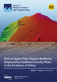
Cover Story (view full-size image): Upper-flow-regime bedforms and their role in the evolution of marine and lacustrine deltas are not well understood. Wave-like undulations on delta foresets are by far the most commonly reported bedforms in deltas and it will take time before many of these features get identified as upper-flow-regime bedforms. This review aims to (1) provide a summary of our knowledge to date on deltaic bedforms emplaced by sediment gravity flows, (2) illustrate that these features are most likely transitional upper-flow-regime bedforms, and (3) use field case studies of the Mazzarrà delta in Italy and glaciolacustrine deltas in northern Germany in order to examine their role in the evolution of fine-grained and coarse-grained deltas. View Paper here.
  • Issues are regarded as officially published after their release is announced to the table of contents alert mailing list.
  • You may sign up for e-mail alerts to receive table of contents of newly released issues.
  • PDF is the official format for papers published in both, html and pdf forms. To view the papers in pdf format, click on the "PDF Full-text" link, and use the free Adobe Reader to open them.
Order results
Result details
Section
Select all
Export citation of selected articles as:
17 pages, 646 KiB  
Review
Environmental Decision Support Systems for Monitoring Small Scale Oil Spills: Existing Solutions, Best Practices and Current Challenges
by Davide Moroni, Gabriele Pieri and Marco Tampucci
J. Mar. Sci. Eng. 2019, 7(1), 19; https://doi.org/10.3390/jmse7010019 - 21 Jan 2019
Cited by 30 | Viewed by 5334
Abstract
In recent years, large oil spills have received widespread media attention, while small and micro oil spills are usually only acknowledged by the authorities and local citizens who are directly or indirectly affected by these pollution events. However, small oil spills represent the [...] Read more.
In recent years, large oil spills have received widespread media attention, while small and micro oil spills are usually only acknowledged by the authorities and local citizens who are directly or indirectly affected by these pollution events. However, small oil spills represent the vast majority of oil pollution events. In this paper, multiple oil spill typologies are introduced, and existing frameworks and methods used as best practices for facing them are reviewed and discussed. Specific tools based on information and communication technologies are then presented, considering in particular those which can be used as integrated frameworks for the specific challenges of the environmental monitoring of smaller oil spills. Finally, a prototype case study actually designed and implemented for the management of existing monitoring resources is reported. This case study helps improve the discussion over the actual challenges of early detection and support to the responsible parties and stakeholders in charge of intervention and remediation operations. Full article
(This article belongs to the Special Issue Marine Oil Spills 2018)
Show Figures

Figure 1

10 pages, 1786 KiB  
Article
Development of an Outdoor Wave Basin to Conduct Long-Term Model Tests with Real Vegetation for Green Coastal Infrastructures
by Jochen Michalzik, Sven Liebisch and Torsten Schlurmann
J. Mar. Sci. Eng. 2019, 7(1), 18; https://doi.org/10.3390/jmse7010018 - 18 Jan 2019
Cited by 3 | Viewed by 3150
Abstract
The demand for physical model tests with real vegetation is increasing due to the current trend to elucidate the performance and durability of green coastal infrastructures to ensure and promote ecosystem services. To address this demand, a new outdoor wave basin (OWB) was [...] Read more.
The demand for physical model tests with real vegetation is increasing due to the current trend to elucidate the performance and durability of green coastal infrastructures to ensure and promote ecosystem services. To address this demand, a new outdoor wave basin (OWB) was built in August 2017 at the Ludwig-Franzius-Institute in Hannover, Germany. This paper reviews the general characteristics and the ongoing development of the new OWB. First insights into the long-term development of the ecosystem services of different grass revetments are discussed in terms of their ecological value and safety standards of sea dikes. Focus is placed on the resistance and ecological value of different grass mixtures that are typically applied on sea dikes situated along the North Sea. Further research concepts are briefly described to highlight how experiments in the new OWB may contribute to the current understanding and design recommendations of green coastal infrastructures. The operation of the OWB enables the performance of long-term experiments over seasonal growth stages of coastal vegetation using either fresh or seawater with wave load stresses and varying sea water levels. The first conducted experiments with different grass revetment combinations mimic typical storm surge conditions with a constant wave load (with a duration of up to 10 hours every second week) on a natural dike. Full article
(This article belongs to the Special Issue Selected Papers from Coastlab18 Conference)
Show Figures

Figure 1

17 pages, 10873 KiB  
Article
Experimental Validation of Smoothed Particle Hydrodynamics on Generation and Propagation of Water Waves
by Andi Trimulyono and Hirotada Hashimoto
J. Mar. Sci. Eng. 2019, 7(1), 17; https://doi.org/10.3390/jmse7010017 - 18 Jan 2019
Cited by 16 | Viewed by 4181
Abstract
This paper is aimed to validate smoothed particle hydrodynamics (SPH) on the generation and propagation of water waves. It is a classical problem in marine engineering but a still important problem because there is a strong demand to generate intended nonlinear water waves [...] Read more.
This paper is aimed to validate smoothed particle hydrodynamics (SPH) on the generation and propagation of water waves. It is a classical problem in marine engineering but a still important problem because there is a strong demand to generate intended nonlinear water waves and to predict complicated interactions between nonlinear water waves and fixed/floating bodies, which is indispensable for further ocean utilization and development. A dedicated experiment was conducted in a large wave basin of Kobe University equipped with a piston-type wavemaker, at three water depths using several amplitudes and periods of piston motion for the validation of SPH mainly on the long-distance propagation of water waves. An SPH-based two-dimensional numerical wave tank (NWT) is used for numerical simulation and is accelerated by a graphics processing units (GPU), assuming future applications to realistic engineering problems. In addition, comparison of large-deformation of shallow water waves, when passing over a fixed box-shape obstacle, is also investigated to discuss the applicability to wave-structure interaction problems. Finally, an SPH-based three-dimensional NWT is also validated by comparing with an experiment and two-dimensional simulation. Through these validation studies, detailed discussion on the accuracy of SPH simulation of water waves is made as well as providing a recommended set of SPH parameters. Full article
(This article belongs to the Special Issue Computational Fluid Dynamics for Ocean Surface Waves)
Show Figures

Figure 1

14 pages, 4724 KiB  
Data Descriptor
CADDY Underwater Stereo-Vision Dataset for Human–Robot Interaction (HRI) in the Context of Diver Activities
by Arturo Gomez Chavez, Andrea Ranieri, Davide Chiarella, Enrica Zereik, Anja Babić and Andreas Birk
J. Mar. Sci. Eng. 2019, 7(1), 16; https://doi.org/10.3390/jmse7010016 - 16 Jan 2019
Cited by 32 | Viewed by 7199
Abstract
In this article, we present a novel underwater dataset collected from several field trials within the EU FP7 project “Cognitive autonomous diving buddy (CADDY)”, where an Autonomous Underwater Vehicle (AUV) was used to interact with divers and monitor their activities. To our knowledge, [...] Read more.
In this article, we present a novel underwater dataset collected from several field trials within the EU FP7 project “Cognitive autonomous diving buddy (CADDY)”, where an Autonomous Underwater Vehicle (AUV) was used to interact with divers and monitor their activities. To our knowledge, this is one of the first efforts to collect a large public dataset in underwater environments with the purpose of studying and boosting object classification, segmentation and human pose estimation tasks. The first part of the dataset contains stereo camera recordings (≈10 K) of divers performing hand gestures to communicate with an AUV in different environmental conditions. The gestures can be used to test the robustness of visual detection and classification algorithms in underwater conditions, e.g., under color attenuation and light backscatter. The second part includes stereo footage (≈12.7 K) of divers free-swimming in front of the AUV, along with synchronized measurements from Inertial Measurement Units (IMU) located throughout the diver’s suit (DiverNet), which serve as ground-truth for human pose and tracking methods. In both cases, these rectified images allow the investigation of 3D representation and reasoning pipelines from low-texture targets commonly present in underwater scenarios. This work describes the recording platform, sensor calibration procedure plus the data format and the software utilities provided to use the dataset. Full article
(This article belongs to the Special Issue Underwater Imaging)
Show Figures

Figure 1

18 pages, 1856 KiB  
Review
Survey on Experimental and Numerical Approaches to Model Underwater Explosions
by Felipe Vannucchi de Camargo
J. Mar. Sci. Eng. 2019, 7(1), 15; https://doi.org/10.3390/jmse7010015 - 15 Jan 2019
Cited by 18 | Viewed by 4766
Abstract
The ability of predicting material failure is essential for adequate structural dimensioning in every mechanical design. For ships, and particularly for military vessels, the challenge of optimizing the toughness-to-weight ratio at the highest possible value is essential to provide agile structures that can [...] Read more.
The ability of predicting material failure is essential for adequate structural dimensioning in every mechanical design. For ships, and particularly for military vessels, the challenge of optimizing the toughness-to-weight ratio at the highest possible value is essential to provide agile structures that can safely withstand external forces. Exploring the case of underwater explosions, the present paper summarizes some of the fundamental mathematical relations for foreseeing the behavior of naval panels to such solicitation. A broad state-of-the-art survey links the mechanical stress-strain response of materials and the influence of local reinforcements in flexural and lateral-torsional buckling to the hydrodynamic relations that govern the propagation of pressure waves prevenient from blasts. Numerical simulation approaches used in computational modeling of underwater explosions are reviewed, focusing on Eulerian and Lagrangian fluid descriptions, Johnson-Cook and Gurson constitutive materials for naval panels, and the solving methods FEM (Finite Element Method), FVM (Finite Volume Method), BEM (Boundary Element Method), and SPH (Smooth Particle Hydrodynamics). The confrontation of experimental tests for evaluating different hull materials and constructions with formulae and virtual reproduction practices allow a wide perception of the subject from different yet interrelated points of view. Full article
(This article belongs to the Special Issue Engineering Mathematics in Ship Design)
Show Figures

Figure 1

15 pages, 4429 KiB  
Article
Applicability of Nonlinear Wavemaker Theory
by Mads Røge Eldrup and Thomas Lykke Andersen
J. Mar. Sci. Eng. 2019, 7(1), 14; https://doi.org/10.3390/jmse7010014 - 14 Jan 2019
Cited by 19 | Viewed by 4659
Abstract
Generation of high-quality waves is essential when making numerical or physically model tests. When using a wavemaker theory outside the validity area, spurious waves are generated. In order to investigate the validity of different wave generation methods, new model test results are presented [...] Read more.
Generation of high-quality waves is essential when making numerical or physically model tests. When using a wavemaker theory outside the validity area, spurious waves are generated. In order to investigate the validity of different wave generation methods, new model test results are presented where linear and nonlinear wave generation theories are tested on regular and irregular waves. A simple modification to the second-order wavemaker theory is presented, which significantly reduces the generation of spurious waves when used outside its range of applicability. For highly nonlinear regular waves, only the ad-hoc unified wave generation based on stream function wave theory was found acceptable. For irregular waves, similar conclusions are drawn, but the modified second-order wavemaker method is more relevant. This is because the ad-hoc unified generation method for irregular waves requires the wave kinematics to be calculated by a numerical model, which might be quite time-consuming. Finally, a table is presented with the range of applicability for each wavemaker method for regular and irregular waves. Full article
(This article belongs to the Special Issue Selected Papers from Coastlab18 Conference)
Show Figures

Figure 1

25 pages, 14992 KiB  
Article
Exploring Marine and Aeolian Controls on Coastal Foredune Growth Using a Coupled Numerical Model
by Nicholas Cohn, Bas M. Hoonhout, Evan B. Goldstein, Sierd De Vries, Laura J. Moore, Orencio Durán Vinent and Peter Ruggiero
J. Mar. Sci. Eng. 2019, 7(1), 13; https://doi.org/10.3390/jmse7010013 - 11 Jan 2019
Cited by 58 | Viewed by 8704
Abstract
Coastal landscape change represents aggregated sediment transport gradients from spatially and temporally variable marine and aeolian forces. Numerous tools exist that independently simulate subaqueous and subaerial coastal profile change in response to these physical forces on a range of time scales. In this [...] Read more.
Coastal landscape change represents aggregated sediment transport gradients from spatially and temporally variable marine and aeolian forces. Numerous tools exist that independently simulate subaqueous and subaerial coastal profile change in response to these physical forces on a range of time scales. In this capacity, coastal foredunes have been treated primarily as wind-driven features. However, there are several marine controls on coastal foredune growth, such as sediment supply and moisture effects on aeolian processes. To improve understanding of interactions across the land-sea interface, here the development of the new Windsurf-coupled numerical modeling framework is presented. Windsurf couples standalone subaqueous and subaerial coastal change models to simulate the co-evolution of the coastal zone in response to both marine and aeolian processes. Windsurf is applied to a progradational, dissipative coastal system in Washington, USA, demonstrating the ability of the model framework to simulate sediment exchanges between the nearshore, beach, and dune for a one-year period. Windsurf simulations generally reproduce observed cycles of seasonal beach progradation and retreat, as well as dune growth, with reasonable skill. Exploratory model simulations are used to further explore the implications of environmental forcing variability on annual-scale coastal profile evolution. The findings of this work support the hypothesis that there are both direct and indirect oceanographic and meteorological controls on coastal foredune progradation, with this new modeling tool providing a new means of exploring complex morphodynamic feedback mechanisms. Full article
(This article belongs to the Special Issue Coastal Dune Dynamics and Management)
Show Figures

Figure 1

15 pages, 1572 KiB  
Article
Bayesian Statistics of Wide-Band Radar Reflections for Oil Spill Detection on Rough Ocean Surface
by Bilal Hammoud, Fabien Ndagijimana, Ghaleb Faour, Hussam Ayad and Jalal Jomaah
J. Mar. Sci. Eng. 2019, 7(1), 12; https://doi.org/10.3390/jmse7010012 - 10 Jan 2019
Cited by 20 | Viewed by 3419
Abstract
In this paper, we present a probabilistic approach which uses nadir-looking wide-band radar to detect oil spills on rough ocean surface. The proposed approach combines a single-layer scattering model with Bayesian statistics to evaluate the probability of detection of oil slicks, within a [...] Read more.
In this paper, we present a probabilistic approach which uses nadir-looking wide-band radar to detect oil spills on rough ocean surface. The proposed approach combines a single-layer scattering model with Bayesian statistics to evaluate the probability of detection of oil slicks, within a plausible range of thicknesses, on seawater. The difference between several derived detection algorithms is defined in terms of the number of frequencies used (within C-to-X-band ranges), as well as of the number of radar observations. Performance analysis of all three types of detectors (single-, dual- and tri-frequency) is done under different surface-roughness scenarios. Results show that the probability of detecting an oil slick with a given thickness is sensitive to the radar frequency. Multi-frequency detectors prove their ability to overcome the performance of the single- and dual-frequency detectors. Higher probability of detection is obtained when using multiple observations. The roughness of the ocean surface leads to a loss in the reflectivity values, and therefore decreases the performance of the detectors. A possible way to make use of the drone systems in the contingency planning is also presented. Full article
(This article belongs to the Special Issue Marine Oil Spills 2018)
Show Figures

Figure 1

5 pages, 167 KiB  
Editorial
Acknowledgement to Reviewers of Journal of Marine Science and Engineering in 2018
by JMSE Editorial Office
J. Mar. Sci. Eng. 2019, 7(1), 11; https://doi.org/10.3390/jmse7010011 - 09 Jan 2019
Viewed by 2229
Abstract
Rigorous peer-review is the corner-stone of high-quality academic publishing [...] Full article
15 pages, 4745 KiB  
Article
Damage Characterization of Rock Slopes
by Ermano de Almeida, Marcel R. A. van Gent and Bas Hofland
J. Mar. Sci. Eng. 2019, 7(1), 10; https://doi.org/10.3390/jmse7010010 - 09 Jan 2019
Cited by 12 | Viewed by 2994
Abstract
In order to design reliable coastal structures, for present and future scenarios, universal and precise damage assessment methods are required. This study addresses this need, and presents improved damage characterization methods for coastal structures with rock armored slopes. The data used in this [...] Read more.
In order to design reliable coastal structures, for present and future scenarios, universal and precise damage assessment methods are required. This study addresses this need, and presents improved damage characterization methods for coastal structures with rock armored slopes. The data used in this study were obtained from a test campaign carried out at Deltares within the European Union (EU) Hydralab+ framework. During these tests, advanced measuring techniques (digital stereo photography) were used, which are able to survey the full extension of the structure and identify local variations of damage. The damage characterization method proposed here is based on three fundamental aspects: clear damage concepts, precise damage parameters, and high resolution measuring techniques. Regarding damage concepts, first, the importance of the characterization width is studied. For damage parameters obtained from the maximum erosion depth observed in a given width (E3D,m), the measured damage increases continuously with increased characterization width. However, for damage parameters obtained from width-averaged profiles (S and E2D), the measured damage reduces with increased characterization width. Second, a new definition of damage limits (damage initiation, intermediate damage, and failure) is presented and calibrated. Regarding the damage parameters, the parameter E3D,5, which describes the maximum erosion depth within the characterization width, is recommended as a robust damage parameter for conventional and non-conventional configurations based on four main characteristics: its low bias, its low random error, the ability to distinguish damage levels, and its validity and suitability for all types of structures (conventional and non-conventional). In addition, the results from this study show that the damage measured with the damage parameter E3D,5 presents an extreme value distribution. Full article
(This article belongs to the Special Issue Selected Papers from Coastlab18 Conference)
Show Figures

Figure 1

18 pages, 8415 KiB  
Article
A Mild-Slope System for Bragg Scattering of Water Waves by Sinusoidal Bathymetry in the Presence of Vertically Sheared Currents
by Kostas Belibassakis, Julien Touboul, Elodie Laffitte and Vincent Rey
J. Mar. Sci. Eng. 2019, 7(1), 9; https://doi.org/10.3390/jmse7010009 - 07 Jan 2019
Cited by 13 | Viewed by 3665
Abstract
Extended mild-slope models (MMSs) are examined for predicting the characteristics of normally incident waves propagating over sinusoidal bottom topography in the presence of opposing shearing currents. It is shown that MMSs are able to provide quite good predictions in the case of Bragg [...] Read more.
Extended mild-slope models (MMSs) are examined for predicting the characteristics of normally incident waves propagating over sinusoidal bottom topography in the presence of opposing shearing currents. It is shown that MMSs are able to provide quite good predictions in the case of Bragg scattering of waves over rippled bathymetry without a current, but fail to provide good predictions concerning the resonant frequency in the additional presence of a current. In order to resolve the above mismatch, a two-equation mild-slope system (CMS2) is derived from a variational principle based on the representation of the wave potential expressed as a superposition of the forward and backward components. The latter system is compared against experimentally measured data collected in a wave flume and is shown to provide more accurate predictions concerning both the resonant frequency and the amplitude of the reflection coefficient. Future work will be devoted to the examination of the derived model for a more general wave system over realistic seabed topography. Full article
(This article belongs to the Section Ocean Engineering)
Show Figures

Figure 1

15 pages, 6494 KiB  
Article
Impulse Wave Runup on Steep to Vertical Slopes
by Frederic M. Evers and Robert M. Boes
J. Mar. Sci. Eng. 2019, 7(1), 8; https://doi.org/10.3390/jmse7010008 - 07 Jan 2019
Cited by 19 | Viewed by 4815
Abstract
Impulse waves are generated by landslides or avalanches impacting oceans, lakes or reservoirs, for example. Non-breaking impulse wave runup on slope angles ranging from 10° to 90° (V/H: 1/5.7 to 1/0) is investigated. The prediction of runup heights induced by these waves is [...] Read more.
Impulse waves are generated by landslides or avalanches impacting oceans, lakes or reservoirs, for example. Non-breaking impulse wave runup on slope angles ranging from 10° to 90° (V/H: 1/5.7 to 1/0) is investigated. The prediction of runup heights induced by these waves is an important parameter for hazard assessment and mitigation. An experimental dataset containing 359 runup heights by impulse and solitary waves is compiled from several published sources. Existing equations, both empirical and analytical, are then applied to this dataset to assess their prediction quality on an extended parameter range. Based on this analysis, a new prediction equation is proposed. The main findings are: (1) solitary waves are a suitable proxy for modelling impulse wave runup; (2) commonly applied equations from the literature may underestimate the runup height of small wave amplitudes; (3) the proposed semi-empirical equations predict the overall dataset within ±20% scatter for relative wave crest amplitudes ε, i.e., the wave crest amplitude normalised with the stillwater depth, between 0.007 and 0.69. Full article
(This article belongs to the Special Issue Tsunami Science and Engineering II)
Show Figures

Figure 1

12 pages, 2258 KiB  
Article
Geometric Evaluation of Stiffened Steel Plates Subjected to Transverse Loading for Naval and Offshore Applications
by João Pedro T. P. De Queiroz, Marcelo L. Cunha, Ana Pavlovic, Luiz Alberto O. Rocha, Elizaldo D. Dos Santos, Grégori da S. Troina and Liércio A. Isoldi
J. Mar. Sci. Eng. 2019, 7(1), 7; https://doi.org/10.3390/jmse7010007 - 07 Jan 2019
Cited by 19 | Viewed by 3941
Abstract
This work searched for the optimal geometrical configuration of simply supported stiffened plates subjected to a transverse and uniformly distributed load. From a non-stiffened reference plate, different geometrical configurations of stiffened plates, with the same volume as the reference plate, were defined through [...] Read more.
This work searched for the optimal geometrical configuration of simply supported stiffened plates subjected to a transverse and uniformly distributed load. From a non-stiffened reference plate, different geometrical configurations of stiffened plates, with the same volume as the reference plate, were defined through the constructal design method. Thus, applying the exhaustive search technique and using the ANSYS software, the mechanical behaviors of all the suggested stiffened plates were compared to each other to find the geometrical configuration that provided the minimum deflection in the plate’s center when subjected to this loading. The optimum geometrical configuration of stiffeners is presented at the end of this work, allowing a reduction of 98.57% for the central deflection of the stiffened plate if compared to the reference plate. Furthermore, power equations were adjusted to describe the deflections for each combination of longitudinal and transverse stiffeners as a function of the ratio between the height and the thickness of the stiffeners. Finally, a unique equation for determining the central deflections of the studied stiffened plates based only on the number of longitudinal stiffeners without significantly losing accuracy has been proposed. Full article
(This article belongs to the Special Issue Engineering Mathematics in Ship Design)
Show Figures

Figure 1

15 pages, 5232 KiB  
Communication
Engineering Design Driven by Models and Measures: The Case of a Rigid Inflatable Boat
by Cristiano Fragassa
J. Mar. Sci. Eng. 2019, 7(1), 6; https://doi.org/10.3390/jmse7010006 - 05 Jan 2019
Cited by 5 | Viewed by 6539
Abstract
Rigid-hulled inflatable boats are extremely practical and popular nowadays, offering an effective conciliation among usability and costs. Their stable and seaworthy behavior is guaranteed by performing hydroplaning hulls coupled with unsinkable inflated tubes. At the same time, their design is often based on [...] Read more.
Rigid-hulled inflatable boats are extremely practical and popular nowadays, offering an effective conciliation among usability and costs. Their stable and seaworthy behavior is guaranteed by performing hydroplaning hulls coupled with unsinkable inflated tubes. At the same time, their design is often based on tradition and preconceptions. In this article, both numerical methods and experimental mechanics techniques are proposed as an essential way for supporting the designers in decisive tasks. Three different situations are detailed where a numerical or an experimental approach shows its benefit inside the engineering design process: firstly, permitting investigation of the behavior of materials driving the fiberglass selection; then measuring the levels of stress and strain in the hull during sailing; and finally, using information as a base for developing numerical models of the hull slamming in waves. Even if the discussion is focused on a rigid inflatable boat, a large part of these considerations is relevant beyond this particular case. Full article
Show Figures

Figure 1

29 pages, 12866 KiB  
Review
Role of Upper-Flow-Regime Bedforms Emplaced by Sediment Gravity Flows in the Evolution of Deltas
by Svetlana Kostic, Daniele Casalbore, Francesco Chiocci, Jörg Lang and Jutta Winsemann
J. Mar. Sci. Eng. 2019, 7(1), 5; https://doi.org/10.3390/jmse7010005 - 04 Jan 2019
Cited by 27 | Viewed by 5579
Abstract
Upper-flow-regime bedforms and their role in the evolution of marine and lacustrine deltas are not well understood. Wave-like undulations on delta foresets are by far the most commonly reported bedforms on deltas and it will take time before many of these features get [...] Read more.
Upper-flow-regime bedforms and their role in the evolution of marine and lacustrine deltas are not well understood. Wave-like undulations on delta foresets are by far the most commonly reported bedforms on deltas and it will take time before many of these features get identified as upper-flow-regime bedforms. This study aims at: (1) Providing a summary of our knowledge to date on deltaic bedforms emplaced by sediment gravity flows; (2) illustrating that these features are most likely transitional upper-flow-regime bedforms; and (3) using field case studies of two markedly different deltas in order to examine their role in the evolution of deltas. The study combines numerical analysis with digital elevation models, outcrop, borehole, and high-resolution seismic data. The Mazzarrà river delta in the Gulf of Patti, Italy, is selected to show that upper-flow-regime bedforms in gullies can be linked to the onset, growth, and evolution of marine deltas via processes of gully initiation, filling, and maintenance. Ice-marginal lacustrine deltas in Germany are selected as they illustrate the importance of unconfined upper-flow-regime bedforms in the onset and evolution of distinct delta morphologies under different lake-level trends. Full article
(This article belongs to the Special Issue Advances in Sediment Transport under Combined Waves and Currents)
Show Figures

Figure 1

11 pages, 3286 KiB  
Article
Numerical Study of Oil Spill in the Patos Lagoon Under Flood and Ebb Conditions
by Bruno Vasconcellos Lopes, Ana Pavlovic, Thaísa Beloti Trombetta, Phelype Haron Oleinik, Caroline Barbosa Monteiro, Ricardo Cardoso Guimarães, Douglas Vieira da Silva and Wiliam Correa Marques
J. Mar. Sci. Eng. 2019, 7(1), 4; https://doi.org/10.3390/jmse7010004 - 04 Jan 2019
Cited by 8 | Viewed by 3064
Abstract
Facing great obstacles to eradicate environmental hazards generated by oil spills, it is crucial to establish actions against such accidents. In this context, the focus of this study is to analyze oil spills at the harbor region of Rio Grande, Rio Grande do [...] Read more.
Facing great obstacles to eradicate environmental hazards generated by oil spills, it is crucial to establish actions against such accidents. In this context, the focus of this study is to analyze oil spills at the harbor region of Rio Grande, Rio Grande do Sul. The Easy Coupling Oil System (ECOS) model was used to model the oil spills under different environmental conditions simulated by the hydrodynamic model Telemac-3D, with the intention to identify the main forces controlling the movement of the oil slicks over a year of averaged hydrodynamic conditions from 2003 to 2015. The computational domain comprises the Patos Lagoon, the harbor area of Rio Grande and the Southern Brazilian Shelf. For the oil spill simulations, eight distinct events were defined considering both flood and ebb conditions in the estuarine region of the Patos Lagoon. The oil spill simulations showed that, in ebb conditions, the oil slick movement is mainly ruled by the currents, moving towards the outflow. After a few hours, the wind action makes the slick move towards the margins of the waterway. In flood conditions, on the other hand, the oil slick drifts to the interior of the estuary, following the dominant currents and the local winds. Full article
(This article belongs to the Section Ocean Engineering)
Show Figures

Figure 1

16 pages, 3682 KiB  
Article
Long-Term Monitoring of the Atlantic Jet through the Strait of Gibraltar with HF Radar Observations
by Pablo Lorente, Silvia Piedracoba, Marcos G. Sotillo and Enrique Álvarez-Fanjul
J. Mar. Sci. Eng. 2019, 7(1), 3; https://doi.org/10.3390/jmse7010003 - 02 Jan 2019
Cited by 14 | Viewed by 3361
Abstract
The present work focuses on the long-term coastal monitoring of the Atlantic surface inflow into the Mediterranean basin through the Strait of Gibraltar. Hourly current maps provided during 2016–2017 by a High Frequency radar (HFR) system were used to characterize the Atlantic Jet [...] Read more.
The present work focuses on the long-term coastal monitoring of the Atlantic surface inflow into the Mediterranean basin through the Strait of Gibraltar. Hourly current maps provided during 2016–2017 by a High Frequency radar (HFR) system were used to characterize the Atlantic Jet (AJ) since changes in its speed and direction modulate the upper-layer circulation of the Western Alboran Gyre (WAG). The AJ pattern was observed to follow a marked seasonal cycle. A stronger AJ flowed north-eastwards during autumn and winter, while a weaker AJ was directed more southwardly during the middle of the year, reaching a minimum of intensity during summertime. A strong relationship between AJ speeds and angles was evidenced: the AJ appeared to be frequently locked at an angle around 63°, measured clockwise from the North. The AJ speed usually fluctuated between 50 cm·s−1 and 170 cm·s−1, with occasional drops below 50 cm·s−1 which were coincident with abrupt modifications in AJ orientation. Peaks of current speed clearly reached values up to 250 cm·s−1, regardless of the season. A number of persistent full reversal episodes of the surface inflow were analyzed in terms of triggering synoptic conditions and the related wind-driven circulation patterns. High sea level pressures and intense (above 10 m·s−1), permanent and spatially-uniform easterlies prevailed over the study domain during the AJ collapse events analyzed. By contrast, tides seemed to play a secondary role by partially speeding up or slowing down the westward currents, depending on the phase of the tide. A detailed characterization of this unusual phenomenon in the Strait of Gibraltar is relevant from diverse aspects, encompassing search and rescue operations, the management of accidental marine pollution episodes or efficient ship routing. Full article
(This article belongs to the Special Issue Radar Technology for Coastal Areas and Open Sea Monitoring)
Show Figures

Figure 1

20 pages, 3503 KiB  
Review
Feedbacks between Biotic and Abiotic Processes Governing the Development of Foredune Blowouts: A Review
by Christian Schwarz, Joost Brinkkemper and Gerben Ruessink
J. Mar. Sci. Eng. 2019, 7(1), 2; https://doi.org/10.3390/jmse7010002 - 28 Dec 2018
Cited by 18 | Viewed by 5200
Abstract
This paper reviews the initiation, development, and closure of foredune blowouts with focus on biotic-abiotic interactions. There is a rich body of literature describing field measurements and model simulations in and around foredune blowouts. Despite this abundance of data there is no conceptual [...] Read more.
This paper reviews the initiation, development, and closure of foredune blowouts with focus on biotic-abiotic interactions. There is a rich body of literature describing field measurements and model simulations in and around foredune blowouts. Despite this abundance of data there is no conceptual framework available linking biotic and abiotic observations to pathways of blowout development (e.g., erosional blowout growth or vegetation induced blowout closure). This review identifies morphological and ecological processes facilitating the transition between blowout development stages and sets them in the context of existing conceptual frameworks describing biotic-abiotic systems. By doing so we are able to develop a new conceptual model linking blowout development to the dominance of its governing processes. More specifically we link blowout initiation to the dominance of abiotic (physical) processes, blowout development to the dominance of biotic-abiotic (bio-geomorphological) processes and blowout closure to the dominance of biotic (ecological) processes. Subsequently we identify further steps to test the proposed conceptual model against existing observations and show possibilities to include it in numerical models able to predict blowout development for various abiotic and biotic conditions. Full article
(This article belongs to the Special Issue Coastal Dune Dynamics and Management)
Show Figures

Figure 1

14 pages, 2675 KiB  
Article
An Operational Marine Oil Spill Forecasting Tool for the Management of Emergencies in the Italian Seas
by Alberto Ribotti, Fabio Antognarelli, Andrea Cucco, Marcello Francesco Falcieri, Leopoldo Fazioli, Christian Ferrarin, Antonio Olita, Gennaro Oliva, Andrea Pes, Giovanni Quattrocchi, Andrea Satta, Simone Simeone, Costanza Tedesco, Georg Umgiesser and Roberto Sorgente
J. Mar. Sci. Eng. 2019, 7(1), 1; https://doi.org/10.3390/jmse7010001 - 20 Dec 2018
Cited by 25 | Viewed by 4496
Abstract
Oil extraction platforms are potential sources of oil spills. For this reason, an oil spill forecasting system was set up to support the management of emergencies from the oil fields in the Italian seas. The system provides ready-to-use products to the relevant response [...] Read more.
Oil extraction platforms are potential sources of oil spills. For this reason, an oil spill forecasting system was set up to support the management of emergencies from the oil fields in the Italian seas. The system provides ready-to-use products to the relevant response agencies and optimizes the anti-pollution resources by assessing hazards and risks related to this issue. The forecasting system covers seven working oil platforms in the Sicily Channel and middle/low Adriatic Sea. It is composed of a numerical chain involving nested ocean models from regional to coastal spatial scales and an oil spill model. The system provides two online services, one automatic and a second dedicated to possible real emergencies or exercises on risk preparedness and responding. The automatic service produces daily short-term simulations of hypothetical oil spill dispersion, transport, and weathering processes from each extraction platform. Products, i.e., risk maps, animations, and a properly called bulletin, are available on a dedicated web-portal. The hazard estimations are computed by performing geo-statistical analysis on the daily forecasts database. The second service is activated in near-real-time producing oil spill simulations for the following 48 h. Full article
(This article belongs to the Special Issue Marine Oil Spills 2018)
Show Figures

Figure 1

Previous Issue
Next Issue
Back to TopTop