Next Issue
Volume 6, August
Previous Issue
Volume 6, June


Environments, Volume 6, Issue 7 (July 2019) – 11 articles

Cover Story (view full-size image): 
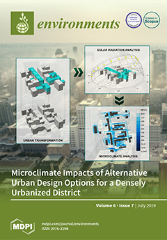
The present contribution investigates the potential of urban densification to mitigate heat island effects and to improve outdoor thermal conditions. The study focuses on an already densely urbanized district in Vienna, Austria. A set of urban microclimate simulations for pre- and post-densification scenarios, considering solar radiation potential of the investigated domain, were carried out and analyzed. For the simulations, the parametric modeling environment Rhinoceros 3D and a set of built-in algorithms in the Rhino’s plug-in Grasshopper was used. The results revealed a notable solar shielding effect of newly introduced vertical extensions of existing buildings. The number of sunlight hours available in urban street canyons decreased for up to 4 hours on average within newly formed deep urban street canyons. View this paper.
  • Issues are regarded as officially published after their release is announced to the table of contents alert mailing list.
  • You may sign up for e-mail alerts to receive table of contents of newly released issues.
  • PDF is the official format for papers published in both, html and pdf forms. To view the papers in pdf format, click on the "PDF Full-text" link, and use the free Adobe Reader to open them.
Order results
Result details
Select all
Export citation of selected articles as:
20 pages, 3977 KiB  
Article
An Open Source GIS-Based Application for the Assessment of Groundwater Vulnerability to Pollution
by Lia Duarte, Jorge Espinha Marques and Ana Cláudia Teodoro
Environments 2019, 6(7), 86; https://doi.org/10.3390/environments6070086 - 21 Jul 2019
Cited by 27 | Viewed by 7460
Abstract
Groundwater is a crucial natural resource for regular socio-economic function. Groundwater vulnerability to pollution can be assessed through Geographical Information System (GIS)-based qualitative methods. GIS-based tools, dedicated to the assessment of groundwater vulnerability, usually present several limitations, such as high cost, unavailable code, [...] Read more.
Groundwater is a crucial natural resource for regular socio-economic function. Groundwater vulnerability to pollution can be assessed through Geographical Information System (GIS)-based qualitative methods. GIS-based tools, dedicated to the assessment of groundwater vulnerability, usually present several limitations, such as high cost, unavailable code, and a lack of functionality concerning the flexible application of vulnerability indices and vulnerability map comparison. The objective of this work was to create a new GIS-based open source application for groundwater vulnerability assessment, GVTool, developed using QGIS software, with the capability of creating and comparing groundwater vulnerability maps considering four different methods: DRASTIC, GOD, SINTACS, and Susceptibility Index (SI). This application incorporates features from a previous tool, DRASTIC Model, and new functionalities were included, namely three additional vulnerability assessment methods, map comparative analysis, map statistics, and index interval reclassification and symbology definition. The GVTool functionalities and capabilities are illustrated through a groundwater vulnerability assessment in Serra da Estrela mountain (Central Portugal). GVTool is mostly useful in integrated assessments, helping to verify if the groundwater vulnerability maps are accurate and to decide which is the most suitable method or the combination of methods to express groundwater vulnerability to pollution in a specific area. Full article
(This article belongs to the Special Issue Groundwater Quality and Groundwater Vulnerability Assessment)
Show Figures

Figure 1

15 pages, 5251 KiB  
Article
Assessment of Remote Sensing Data to Model PM10 Estimation in Cities with a Low Number of Air Quality Stations: A Case of Study in Quito, Ecuador
by Cesar I. Alvarez-Mendoza, Ana Claudia Teodoro, Nelly Torres and Valeria Vivanco
Environments 2019, 6(7), 85; https://doi.org/10.3390/environments6070085 - 21 Jul 2019
Cited by 45 | Viewed by 8695
Abstract
The monitoring of air pollutant concentration within cities is crucial for environment management and public health policies in order to promote sustainable cities. In this study, we present an approach to estimate the concentration of particulate matter of less than 10 µm diameter [...] Read more.
The monitoring of air pollutant concentration within cities is crucial for environment management and public health policies in order to promote sustainable cities. In this study, we present an approach to estimate the concentration of particulate matter of less than 10 µm diameter (PM10) using an empirical land use regression (LUR) model and considering different remote sensing data as the input. The study area is Quito, the capital of Ecuador, and the data were collected between 2013 and 2017. The model predictors are the surface reflectance bands (visible and infrared) of Landsat-7 ETM+, Landsat-8 OLI/TIRS, and Aqua-Terra/MODIS sensors and some environmental indexes (normalized difference vegetation index—NDVI; normalized difference soil index—NDSI, soil-adjusted vegetation index—SAVI; normalized difference water index—NDWI; and land surface temperature (LST)). The dependent variable is PM10 ground measurements. Furthermore, this study also aims to compare three different sources of remote sensing data (Landsat-7 ETM+, Landsat-8 OLI, and Aqua-Terra/MODIS) to estimate the PM10 concentration, and three different predictive techniques (stepwise regression, partial least square regression, and artificial neuronal network (ANN)) to build the model. The models obtained are able to estimate PM10 in regions where air data acquisition is limited or even does not exist. The best model is the one built with an ANN, where the coefficient of determination (R2 = 0.68) is the highest and the root-mean-square error (RMSE = 6.22) is the lowest among all the models. Thus, the selected model allows the generation of PM10 concentration maps from public remote sensing data, constituting an alternative over other techniques to estimate pollutants, especially when few air quality ground stations are available. Full article
Show Figures

Figure 1

15 pages, 6272 KiB  
Article
Potential Impacts to Wetlands and Water Bodies Due to Mineral Exploration, Pebble Copper-Gold Prospect, Southwest Alaska
by Kendra Zamzow and David M. Chambers
Environments 2019, 6(7), 84; https://doi.org/10.3390/environments6070084 - 19 Jul 2019
Cited by 1 | Viewed by 5904
Abstract
There is little information in the literature about the impacts of mineral exploration drilling on natural waters. A copper-gold-molybdenum mining deposit in Alaska was heavily explored until 2012 and partially reclaimed; however, full reclamation of drill sites remained incomplete in 2016. Copper is [...] Read more.
There is little information in the literature about the impacts of mineral exploration drilling on natural waters. A copper-gold-molybdenum mining deposit in Alaska was heavily explored until 2012 and partially reclaimed; however, full reclamation of drill sites remained incomplete in 2016. Copper is sub-lethally toxic to salmon, a highly-valued resource in this area. Of 109 sites inspected, 9 sites had confirmed impacts due to un-reclaimed drill-holes or drill waste disposal practices. At seven sites artesian waters at the drill stem resulted in surface water or sediment elevated in aluminum, iron, copper, or zinc with neutral pH. Copper concentrations at artesian sites were <0.4, 0.7, 2, 7, 15, 76, and 215 µg/L; the latter four exceed water quality criteria. Drilling waste is known to have been disposed of in ponds and unlined sumps. At one of five ponds sampled, copper declined from 51 to 8 µg/L over nine years. At the one sump area with historical data, copper increased from 0.3 to 1.8 µg/L at a downgradient wetland spring over five years. This research identifies contaminant types and sources and can be used to guide future ecotoxicity studies and improve regulatory oversight. Full article
(This article belongs to the Special Issue Groundwater Quality and Groundwater Vulnerability Assessment)
Show Figures

Figure 1

14 pages, 4185 KiB  
Review
Walking in Each Other’s Footsteps: Do Animal Trail Makers Confer Resilience against Trampling Tourists?
by David B. Croft
Environments 2019, 6(7), 83; https://doi.org/10.3390/environments6070083 - 15 Jul 2019
Cited by 4 | Viewed by 6419
Abstract
Modern humans, and other hominins before them, have walked across the landscapes of most continents for many millennia. They shared these landscapes with other large animals, especially mammalian herbivores and their predators, whose footsteps defined trails through the vegetation. Most of the diversity [...] Read more.
Modern humans, and other hominins before them, have walked across the landscapes of most continents for many millennia. They shared these landscapes with other large animals, especially mammalian herbivores and their predators, whose footsteps defined trails through the vegetation. Most of the diversity in the wild species is now concentrated in protected areas and visited by large numbers of tourists who may walk amongst them. This review examines the literature about medium-large animal and tourist trampling impacts to uncover any marriage between animal ecology and nature-based tourism research. Methodology is comparable. Animal ecology has focused on the propagation of grazing and trampling effects from a point source (usually water). Tourism research has focused on trail structure (formal/informal, hardened, wide/narrow) and the propagation of effects (especially weeds) into the hinterland and along the trail. There is little research to substantiate an evolutionary view of trampling impacts. At least tourists venturing off formed trails may reduce impacts by following animal trails with caveats, such as risk of encounters with dangerous animals and disruption of animal behavior. This is an under-studied topic but a fertile ground for research, aided by modern tools like trail cameras and geographically enabled devices borne by tourists. Full article
(This article belongs to the Special Issue Environmental Impact of Nature-Based Tourism)
Show Figures

Figure 1

12 pages, 3599 KiB  
Article
Potential of Urban Densification to Mitigate the Effects of Heat Island in Vienna, Austria
by Milena Vuckovic, Wolfgang Loibl, Tanja Tötzer and Romana Stollnberger
Environments 2019, 6(7), 82; https://doi.org/10.3390/environments6070082 - 10 Jul 2019
Cited by 16 | Viewed by 7502
Abstract
Global increase of urban population has brought about a growing demand for more dwelling space, resulting in various negative impacts, such as accelerated urbanization, urban sprawl and higher carbon footprints. To cope with these growth dynamics, city authorities are urged to consider alternative [...] Read more.
Global increase of urban population has brought about a growing demand for more dwelling space, resulting in various negative impacts, such as accelerated urbanization, urban sprawl and higher carbon footprints. To cope with these growth dynamics, city authorities are urged to consider alternative planning strategies aiming at mitigating the negative implications of urbanization. In this context, the present contribution investigates the potential of urban densification to mitigate the heat island effects and to improve outdoor thermal conditions. Focusing on a quite densely urbanized district in Vienna, Austria, we carried out a set of simulations of urban microclimate for pre- and post-densification scenarios using the parametric modelling environment Rhinoceros 3D and a set of built-in algorithms in the Rhino’s plug-in Grasshopper. The study was conducted for a hot summer period. The results revealed a notable solar shielding effect of newly introduced vertical extensions of existing buildings, promoting temperature decrease and improved thermal conditions within more shaded urban canyons and courtyards. However, a slight warming effect was noted during the night-time due to the higher thermal storage and lower sky view factor. Full article
(This article belongs to the Special Issue Adaptation Measures for Urban Heat Island)
Show Figures

Figure 1

15 pages, 1558 KiB  
Article
Recreational Ecology: A Review of Research and Gap Analysis
by Daminda Sumanapala and Isabelle D. Wolf
Environments 2019, 6(7), 81; https://doi.org/10.3390/environments6070081 - 08 Jul 2019
Cited by 24 | Viewed by 8815
Abstract
Recreational ecology is an internationally evolving research field addressing the high demand for nature-based tourism and recreation, and its environmental impacts. This review aimed to analyze the research effort of recreational ecology studies published in four renowned journals in the field, the Journal [...] Read more.
Recreational ecology is an internationally evolving research field addressing the high demand for nature-based tourism and recreation, and its environmental impacts. This review aimed to analyze the research effort of recreational ecology studies published in four renowned journals in the field, the Journal of Sustainable Tourism, Tourism Management, the Journal of Environmental Management, and Environmental Management. Between 1976 and 2017, this review identified 145 papers focused on recreational ecology. The majority of research investigated the direct impacts of terrestrial activities in protected areas, in particular the impacts of walking and hiking on vegetation and trail conditions, and the impacts of wildlife viewing. A conceptual model was developed to describe the varied relationships between nature-based tourists and recreationists and the environment. Future research in recreational ecology should broaden its agenda to increase knowledge on indirect and long-term impacts; including on cryptic or less popular species; establish more specifically how the intensity of impacts depends on the amount of use other than in trampling studies; extend to other geographic areas such as developing countries, and nature-based spaces that are less protected and exposed to high visitation such as urban environments. Importantly, a much stronger focus needs to be on interdisciplinary approaches incorporating both environmental and social science techniques to determine ways of how visitor experiential needs can be reconciled with environmental conservation concerns in a rapidly increasing tourism and recreation economy. Full article
(This article belongs to the Special Issue Environmental Impact of Nature-Based Tourism)
Show Figures

Figure 1

10 pages, 3335 KiB  
Article
Cyclospora Cayetanensis Presence in the Environment—A Case Study in the Chicago Metropolitan Area
by Nora H. Onstad, Jonathan E. Beever, Matthew R. Miller, Michelle L. Green, William H. Witola and Paul C. Davidson
Environments 2019, 6(7), 80; https://doi.org/10.3390/environments6070080 - 06 Jul 2019
Cited by 7 | Viewed by 5080
Abstract
Cyclospora cayetanensis is an emerging foodborne protozoan pathogen. Similar to other gastrointestinal illnesses, cyclosporiasis causes prolonged diarrhea. Unlike Cryptosporidium, Cyclospora oocysts are not infective when they are shed by infected individuals. Oocysts mature in the environment for 7–10 days before sporulating. Little [...] Read more.
Cyclospora cayetanensis is an emerging foodborne protozoan pathogen. Similar to other gastrointestinal illnesses, cyclosporiasis causes prolonged diarrhea. Unlike Cryptosporidium, Cyclospora oocysts are not infective when they are shed by infected individuals. Oocysts mature in the environment for 7–10 days before sporulating. Little is known about how C. cayetanensis is transported in the environment and which factors inhibit or promote sporulation. Water and fresh produce, such as leafy greens and berries, are common sources of infection. Contact with soil has also been correlated with Cyclospora infection. In addition to acting as a vector to transport oocysts from the environment to the body, water and soil may be important reservoirs to not only allow C. cayetanensis to persist, but also transport the oocysts from one location to another. This study examined a snapshot of an urban area near Chicago where human waste sporadically enters the environment via combined sewer outfalls (CSO). A total of 61 samples were collected from three CSO discharge events. Most of the 21 positive samples were wildlife feces (n = 13), and a few were soil (n = 7). There was one positive water sample. PCR analysis of soil, water, and wildlife feces indicated the presence of C. cayetanensis in the environment, suggesting likely transport of oocysts by wildlife. Given the emerging threat of cyclosporiasis, additional studies are needed to confirm and expand this case study. Full article
Show Figures

Figure 1

17 pages, 7462 KiB  
Article
Dynamic Noise Mapping in the Suburban Area of Rome (Italy)
by Roberto Benocci, Patrizia Bellucci, Laura Peruzzi, Alessandro Bisceglie, Fabio Angelini, Chiara Confalonieri and Giovanni Zambon
Environments 2019, 6(7), 79; https://doi.org/10.3390/environments6070079 - 04 Jul 2019
Cited by 28 | Viewed by 6619
Abstract
A “real-time” noise mapping project, named DYNAMAP, has been developed in the framework of a Life+ 2013 program and cofunded by the European Commission. The project aims at giving a real picture of the noise generated by vehicular traffic. To this purpose, a [...] Read more.
A “real-time” noise mapping project, named DYNAMAP, has been developed in the framework of a Life+ 2013 program and cofunded by the European Commission. The project aims at giving a real picture of the noise generated by vehicular traffic. To this purpose, a dedicated platform has been developed to elaborate the information from distributed noise monitoring stations. The methodology has been implemented along the ring road encircling the city of Rome (Italy). A detailed description of the system is given together with a report on the testing campaign that allowed evaluation of the accuracy and reliability of the system. From the monitoring campaign satisfactory results have been achieved, showing an average overall prediction error of ~1.5 dB. Full article
(This article belongs to the Special Issue New Solutions Mitigating Environmental Noise Pollution)
Show Figures

Figure 1

14 pages, 5129 KiB  
Article
Documentation of Acidic Mining Exploration Drill Cuttings at the Pebble Copper–Gold Mineral Prospect, Southwest Alaska
by David M Chambers and Kendra Zamzow
Environments 2019, 6(7), 78; https://doi.org/10.3390/environments6070078 - 04 Jul 2019
Cited by 4 | Viewed by 5086
Abstract
During exploration drilling of the Pebble copper–gold–molybdenum (Cu–Au–Mo) deposit, drilling wastes were disposed of directly on the landscape or passed through unlined sumps prior to disposal. The ore and host rock are rich in sulfides, which weather to sulfuric acid with consequent metal [...] Read more.
During exploration drilling of the Pebble copper–gold–molybdenum (Cu–Au–Mo) deposit, drilling wastes were disposed of directly on the landscape or passed through unlined sumps prior to disposal. The ore and host rock are rich in sulfides, which weather to sulfuric acid with consequent metal leaching. Oxidized cuttings were visually evident, and confirmed with laboratory and field testing to have a pH of 2.7–4.3. At these sites, Cu and Mo exceeded or were at the high end of the natural background. With one exception, Cu was in the range of 545 mg/kg to 4865 mg/kg. Dead vegetation was observed at all sites with drill cuttings on the surface. Dead vegetation was also observed on sump soil covers, unrelated to drilling waste. Sites where vegetation had not re-established were from four to thirteen years old. The potential impact to surface and groundwater was not determined. Understanding the source and extent of damage from cuttings could lead to better site management. Full article
(This article belongs to the Special Issue Groundwater Quality and Groundwater Vulnerability Assessment)
Show Figures

Figure 1

8 pages, 423 KiB  
Article
Adventure Races in Brazil: Do Stakeholders Take Conservation into Consideration?
by Carolina Bartoletti, Teresa Cristina Magro-Lindenkamp and Gabriel Adrián Sarriés
Environments 2019, 6(7), 77; https://doi.org/10.3390/environments6070077 - 03 Jul 2019
Cited by 2 | Viewed by 4630
Abstract
This case study used exploratory and descriptive research to look into how stakeholders involved in the organization and practice of adventure races in Brazil perceive impacts related to this outdoor activity. Additionally, questions were posed about whether such impacts have been taken into [...] Read more.
This case study used exploratory and descriptive research to look into how stakeholders involved in the organization and practice of adventure races in Brazil perceive impacts related to this outdoor activity. Additionally, questions were posed about whether such impacts have been taken into consideration when planning these sporting events. Finally, the research aimed to understand why racers and adventure race organizers choose a certain time of year and venue to partake and organize a race: whether for more logistical purposes or also considering conservation. Online surveys were set up to target adventure race organizers, racers, and national park managers. Overall, there seems to be very little knowledge among racers and race organizers about social and environmental impacts associated with adventure races. This has led to the organization of events with very few or no specific concerns to the environment. Moreover, racers and adventure race organizers seem to perceive certain ecological issues—i.e., erosion—as challenges to the sport and not a problem to be addressed or avoided. National park managers were the group surveyed with more knowledge about the negative impacts adventure races might have on the environment. Full article
(This article belongs to the Special Issue Environmental Impact of Nature-Based Tourism)
Show Figures

Figure 1

18 pages, 297 KiB  
Article
Epidemiology of Mesothelioma
by Domenica Cavone, Antonio Caputi, Luigi De Maria, Enza Sabrina Silvana Cannone, Francesca Mansi, Francesco Birtolo, Maria Celeste Delfino and Luigi Vimercati
Environments 2019, 6(7), 76; https://doi.org/10.3390/environments6070076 - 01 Jul 2019
Cited by 17 | Viewed by 7263
Abstract
Since 1973 the International Agency for Research on Cancer has classified asbestos as a certain carcinogen, but today it is still used in several countries. To date, mesothelioma risk is certainly linked not only to occupational exposures but also to environmental exposures. The [...] Read more.
Since 1973 the International Agency for Research on Cancer has classified asbestos as a certain carcinogen, but today it is still used in several countries. To date, mesothelioma risk is certainly linked not only to occupational exposures but also to environmental exposures. The incidence and mortality are increasing worldwide, especially in developing countries where asbestos is still often used without adequate measures for worker safety. The epidemiological surveillance systems of related asbestos diseases are instruments of public health adopted internationally. The experience and the operating methodology of the Italian mesothelioma registry and the data produced from 1996 to 2015 highlight how in countries where the asbestos ban has been active for over 20 years the risk of asbestos remains present, especially in the construction sector as well as for the environmental exposures of the resident population near companies that used asbestos in their production cycle. Worldwide, it is necessary to introduce the ban on the extraction, processing, and marketing of asbestos as claimed by the international scientific community. Full article
Previous Issue
Next Issue
Back to TopTop