
Landscape, Memory, and Adverse Shocks: The 1968 Earthquake in Belìce Valley (Sicily, Italy): A Case Study


Abstract
:1. Introduction
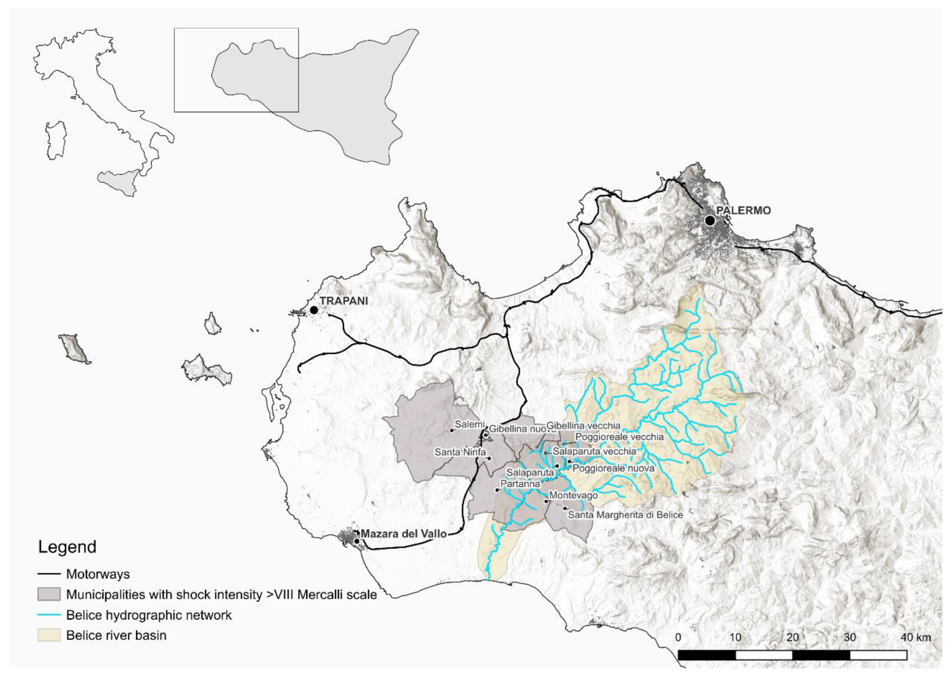
2. Study Area
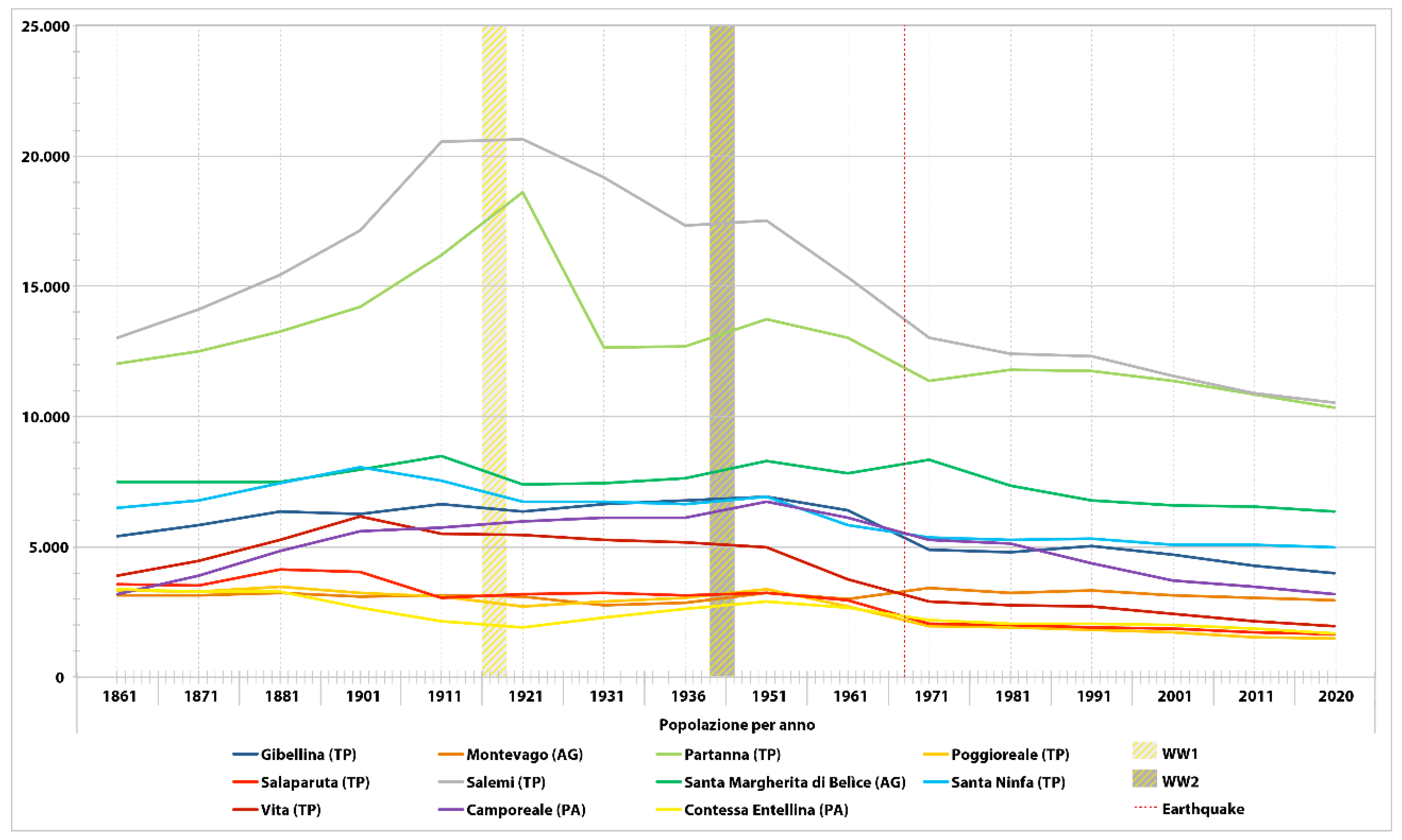
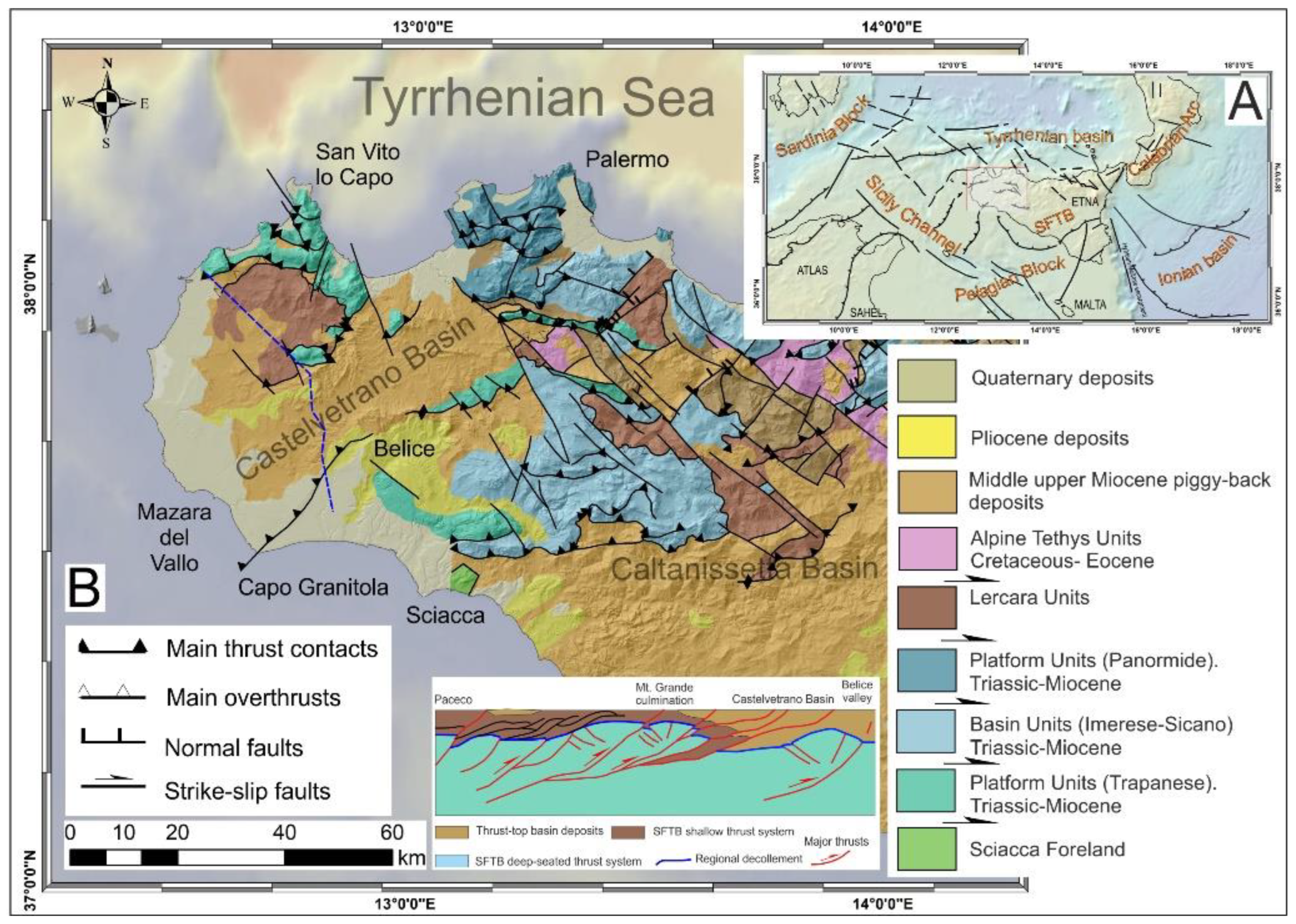
2.1. The Belìce Valley

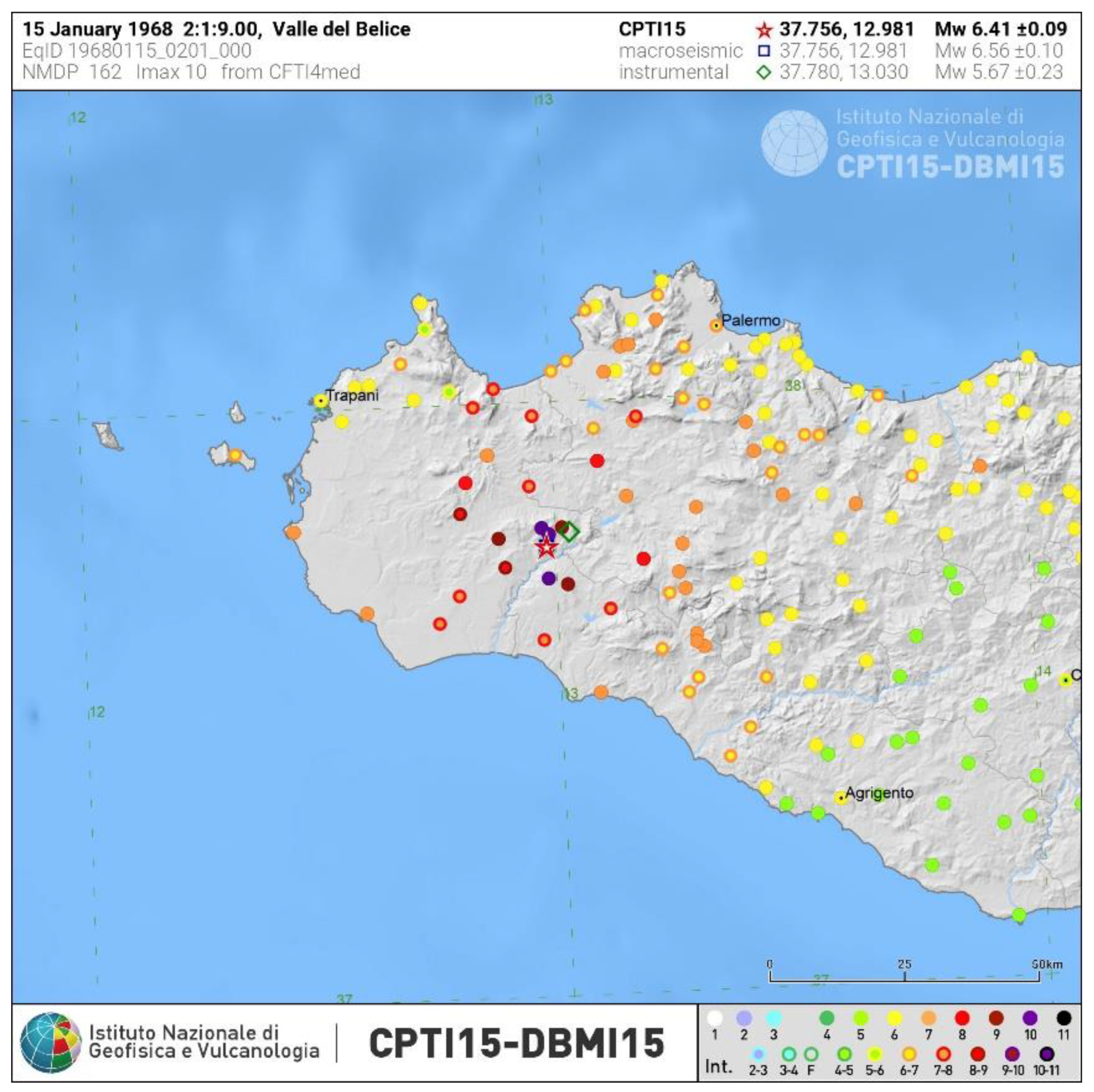
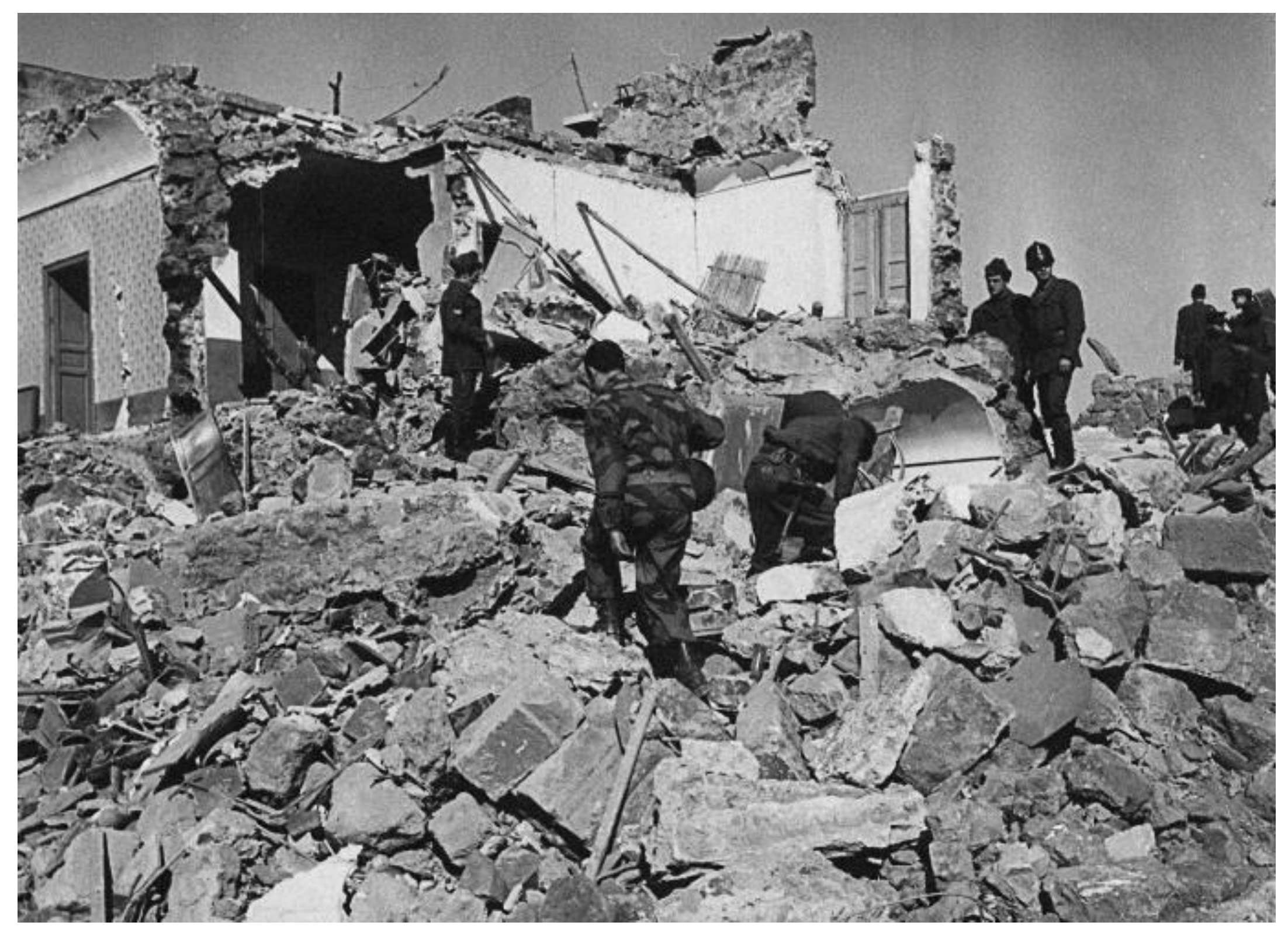
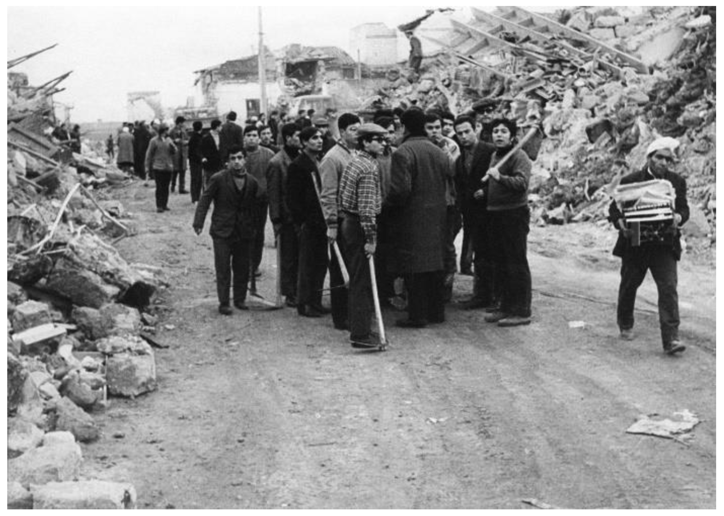
2.2. The 1968 Earthquake


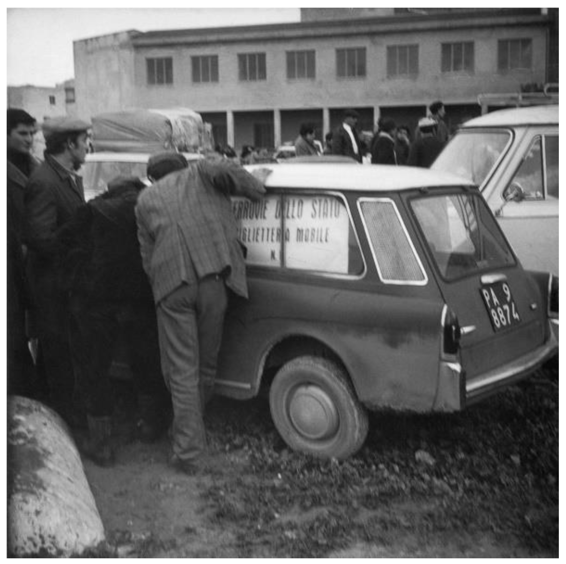
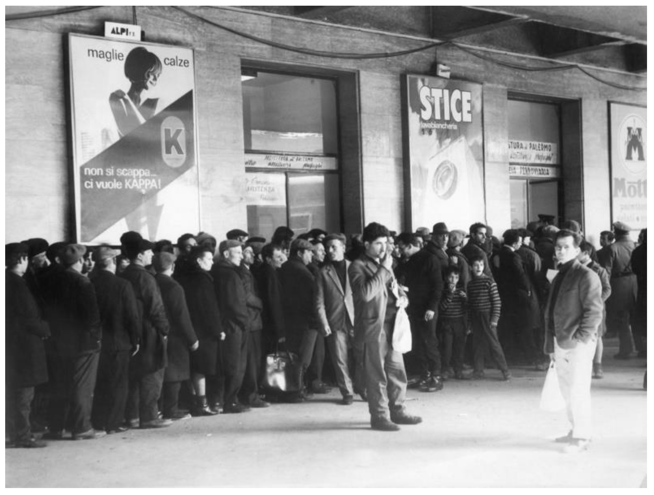
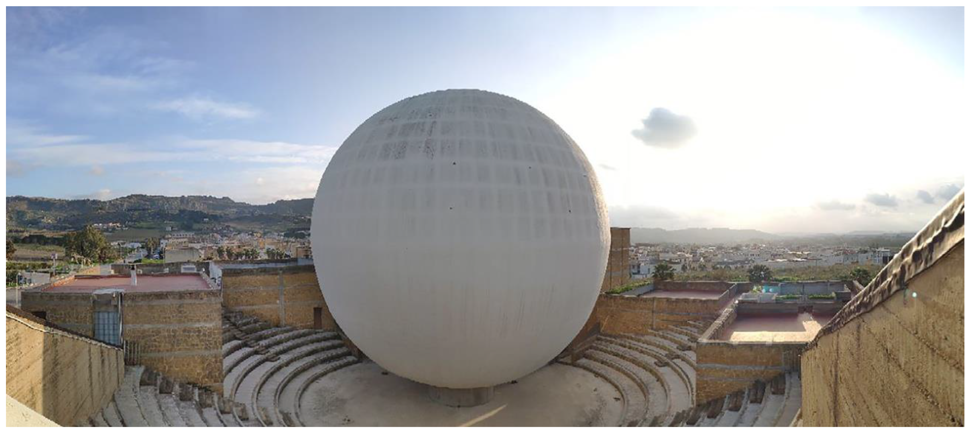
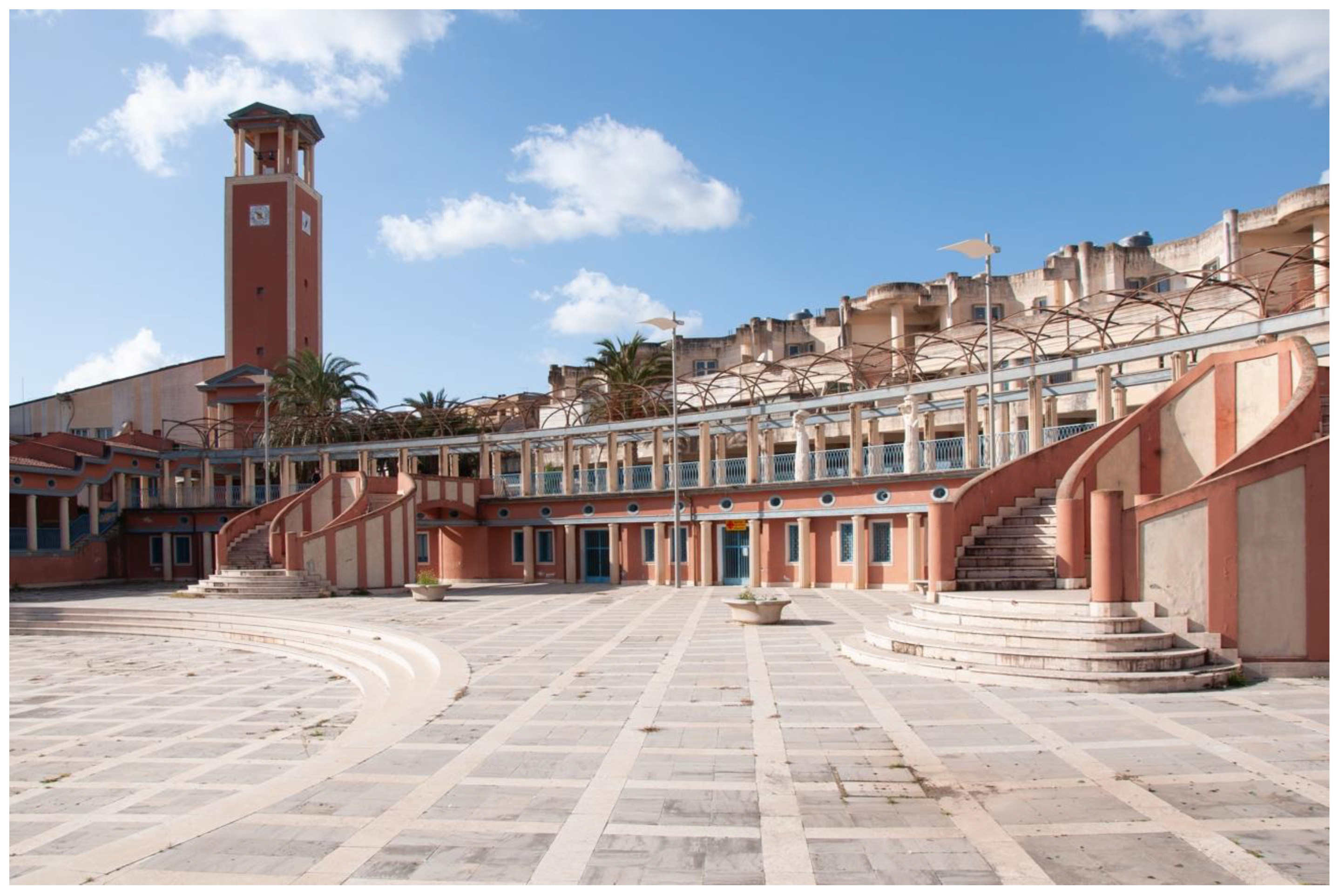
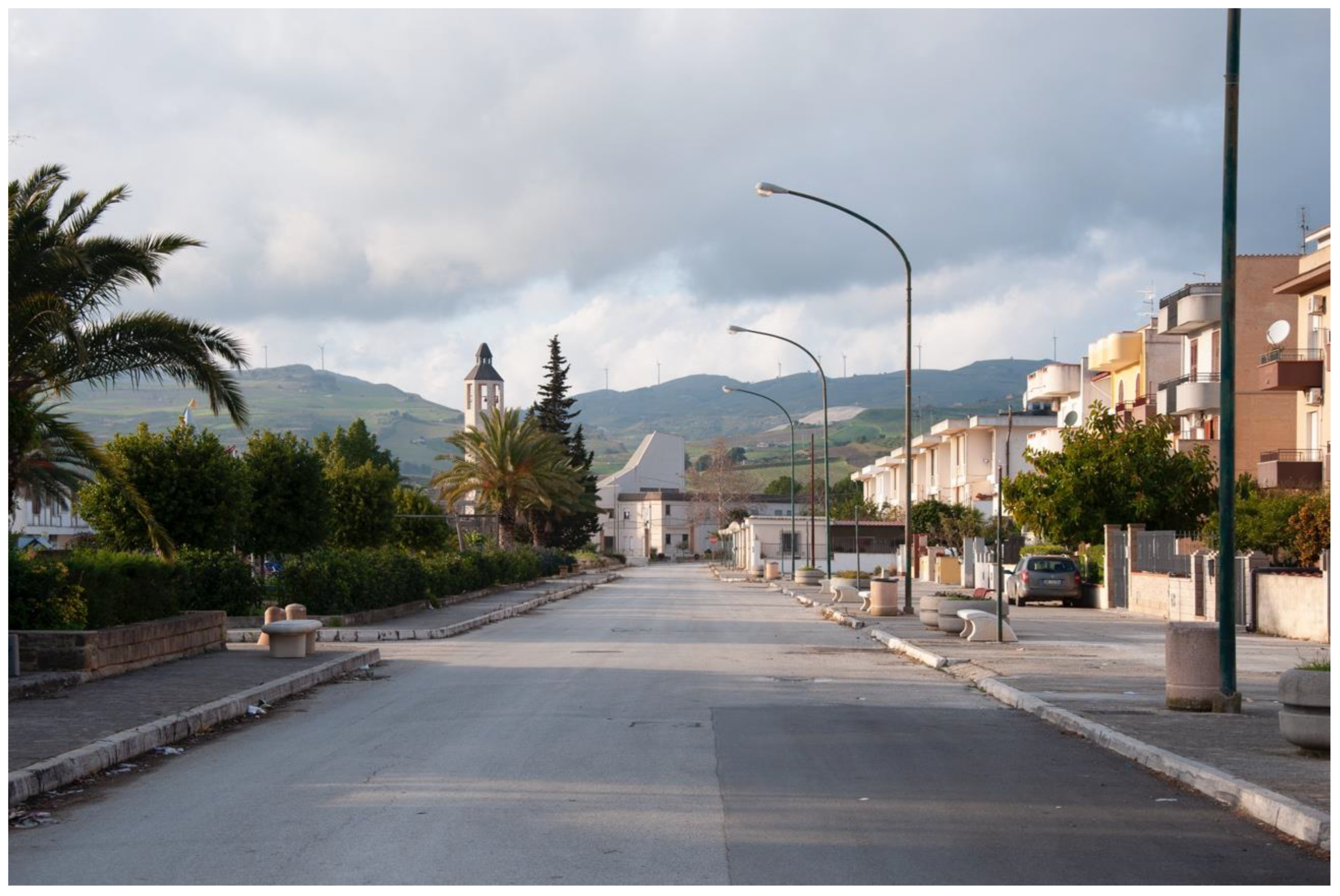
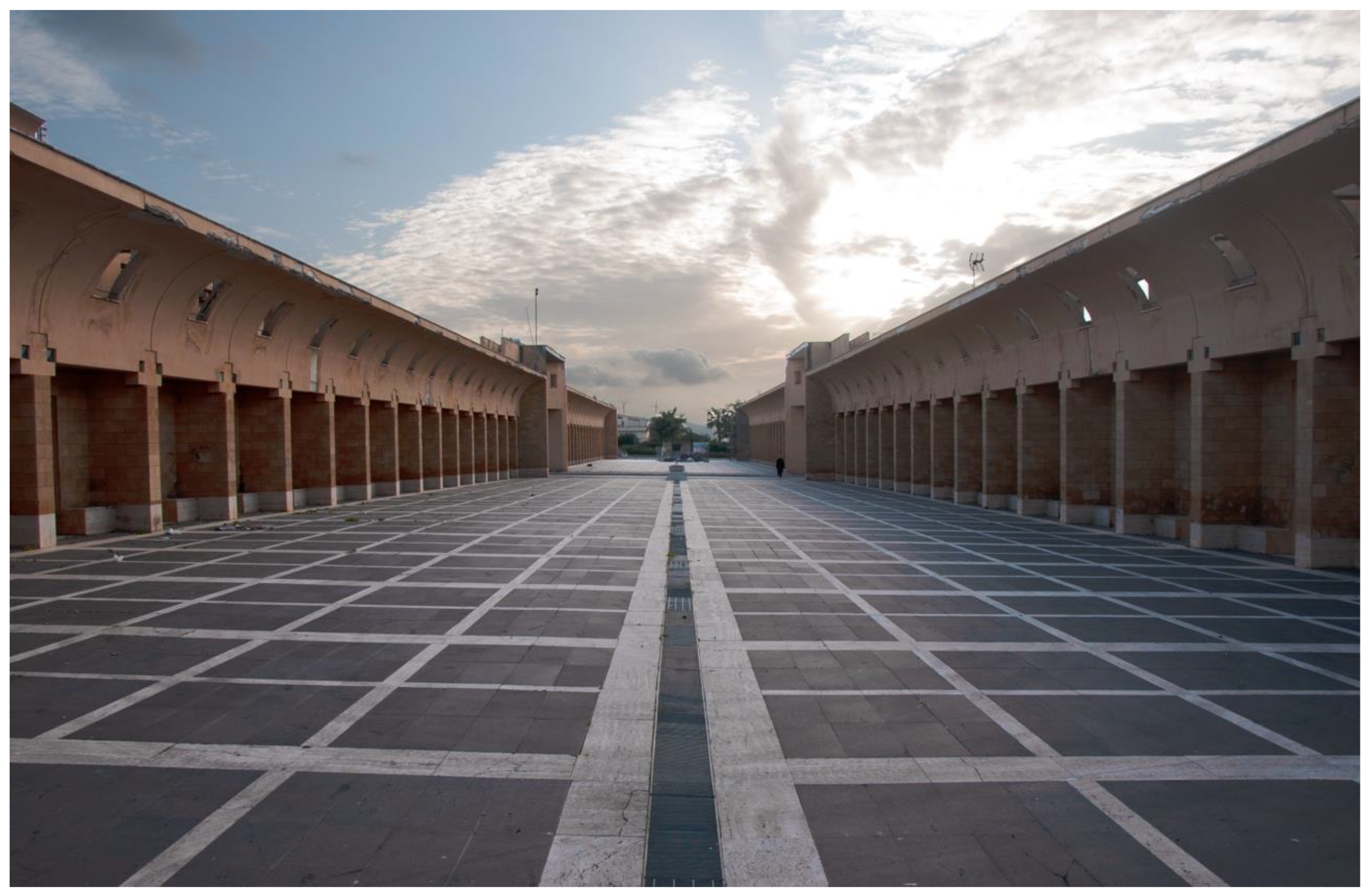
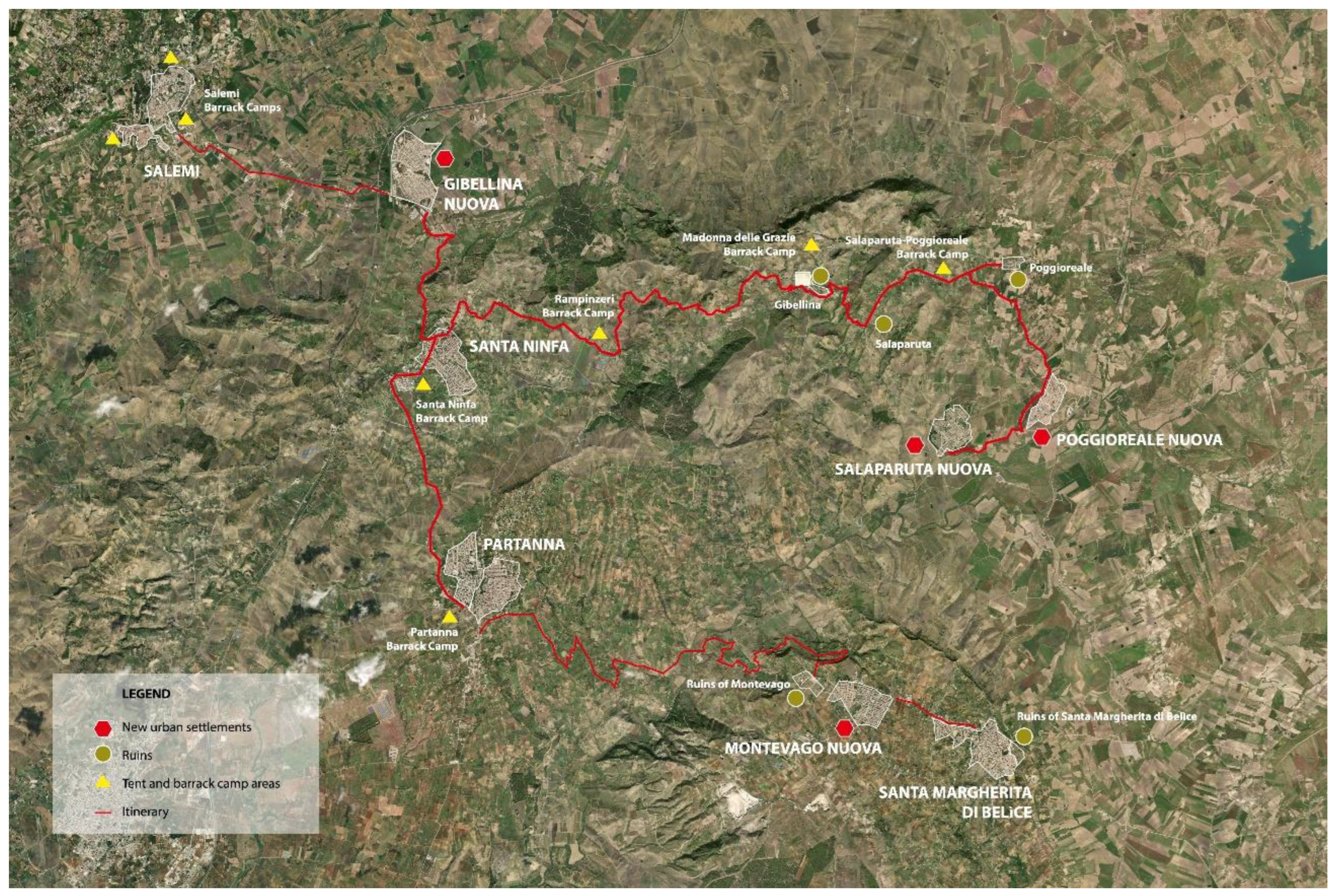
2.3. The Belice Valley after the Earthquake
3. Methodology
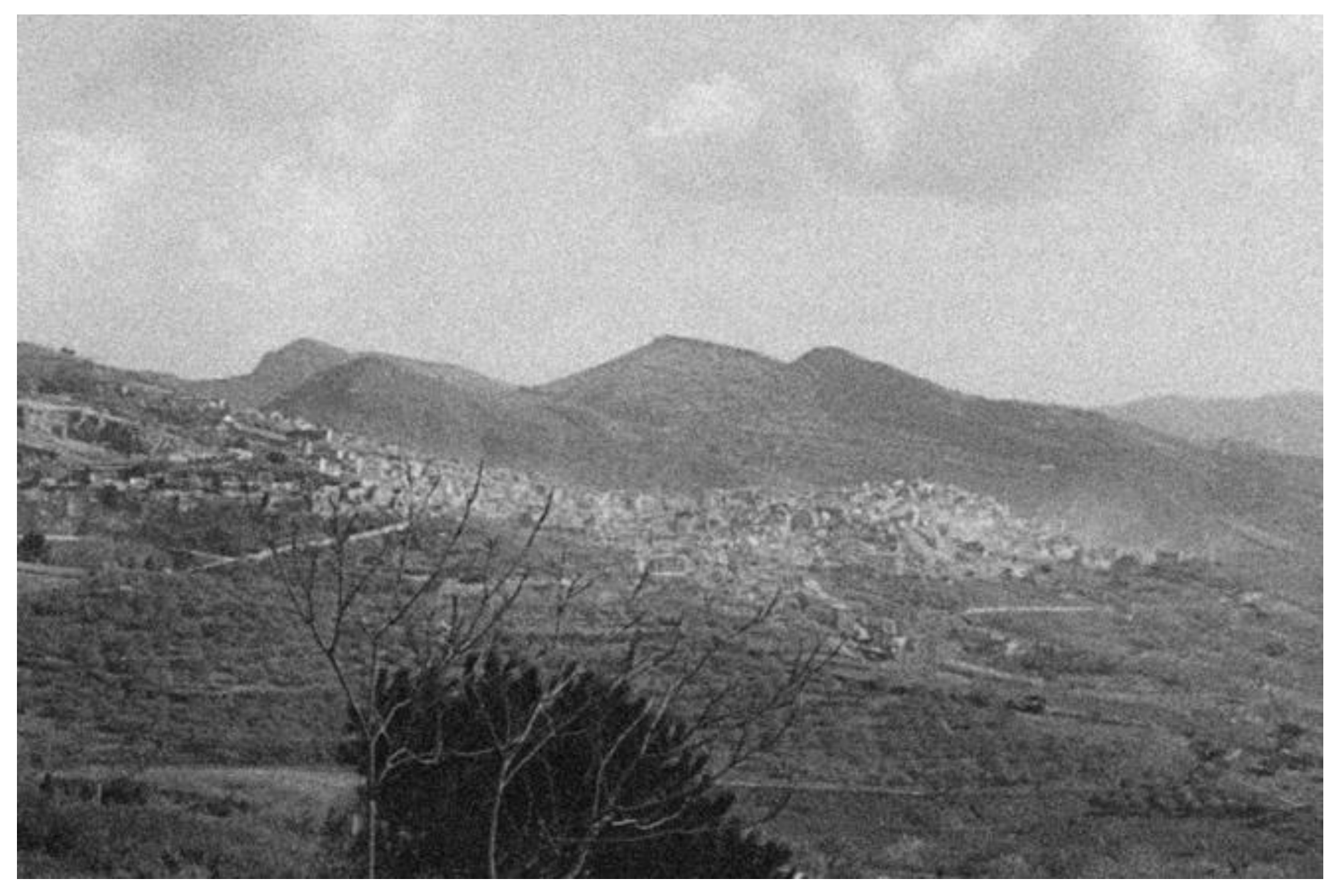
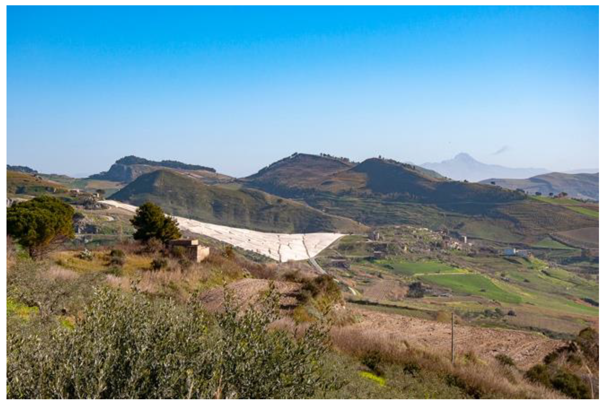
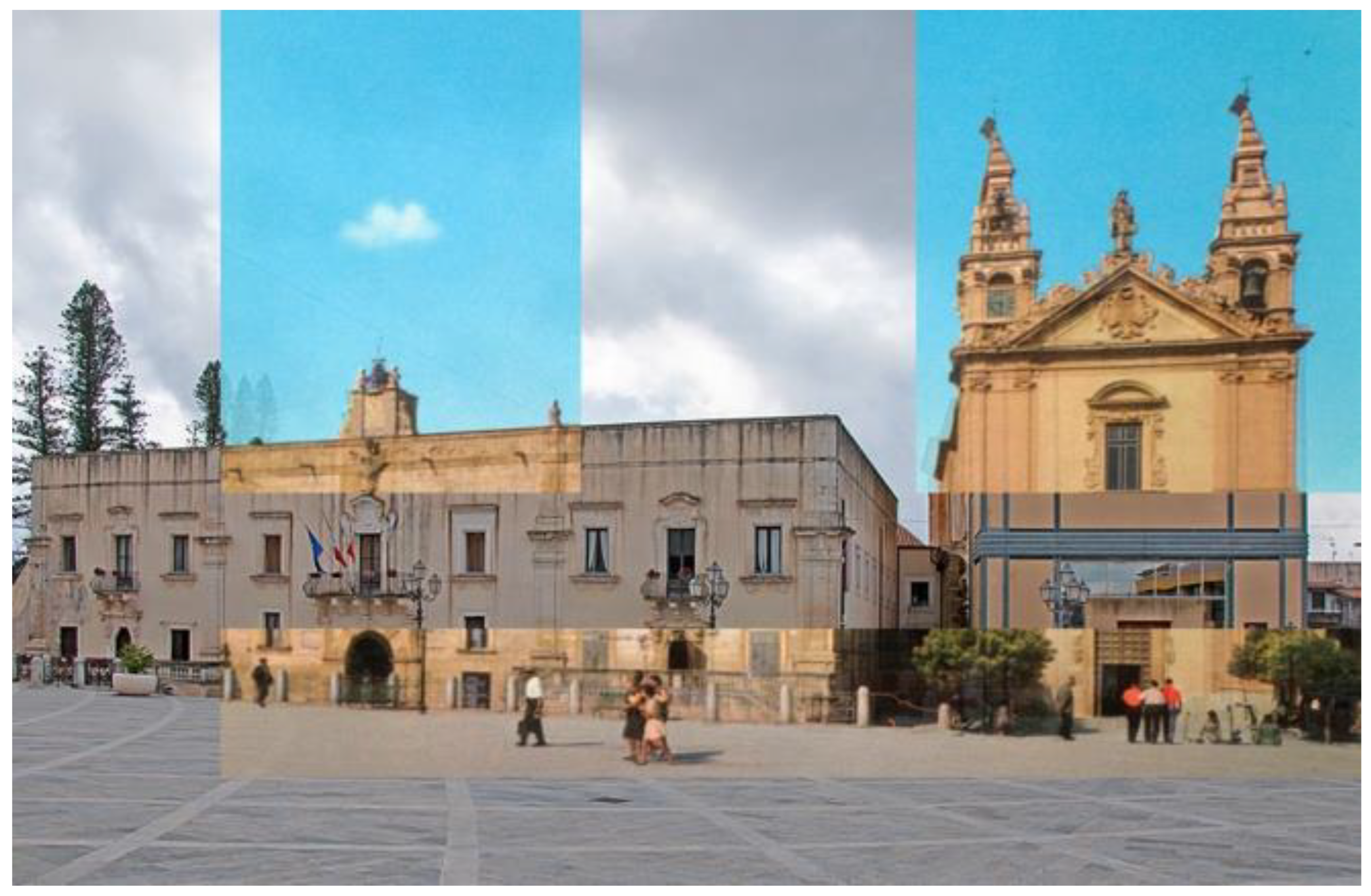
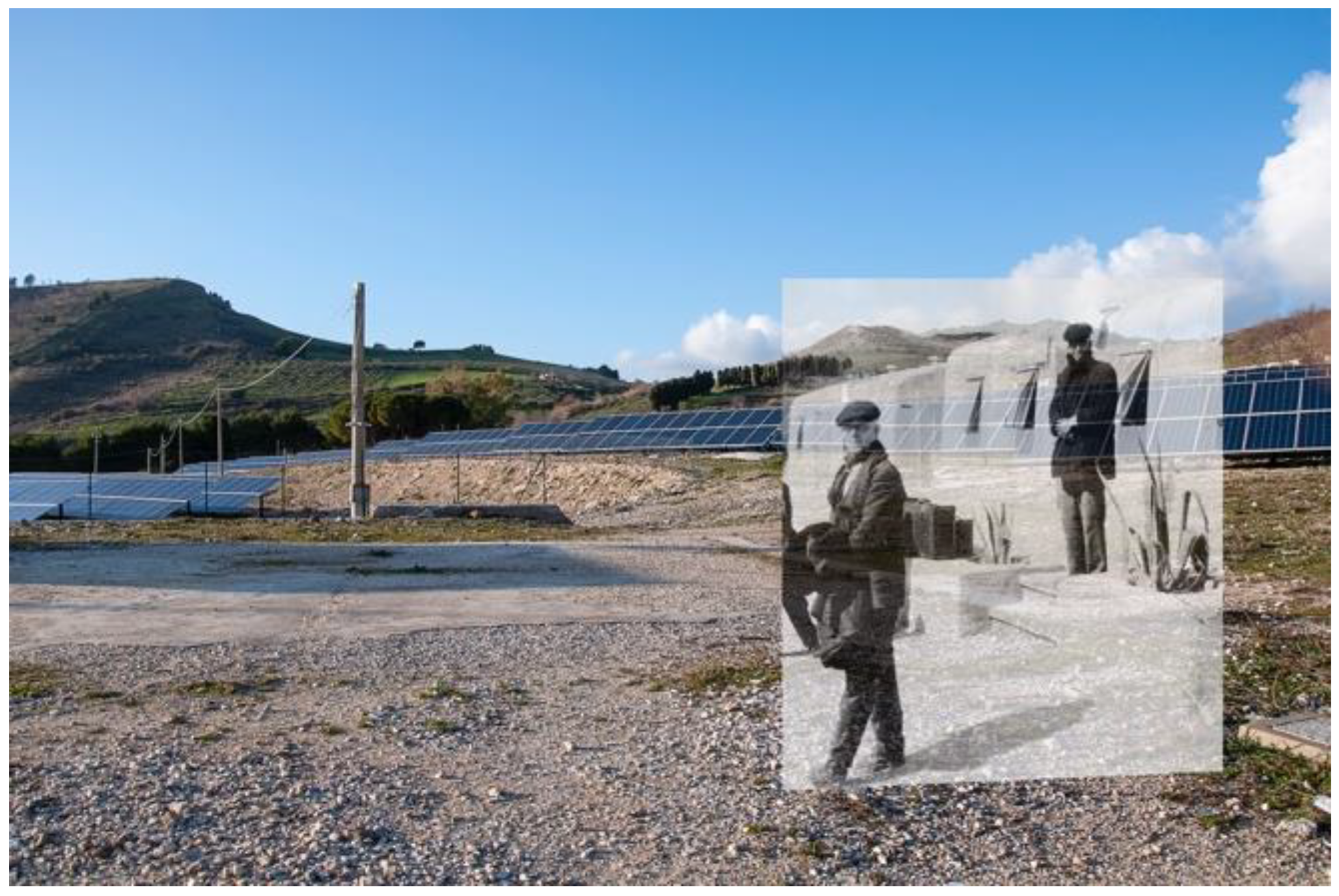
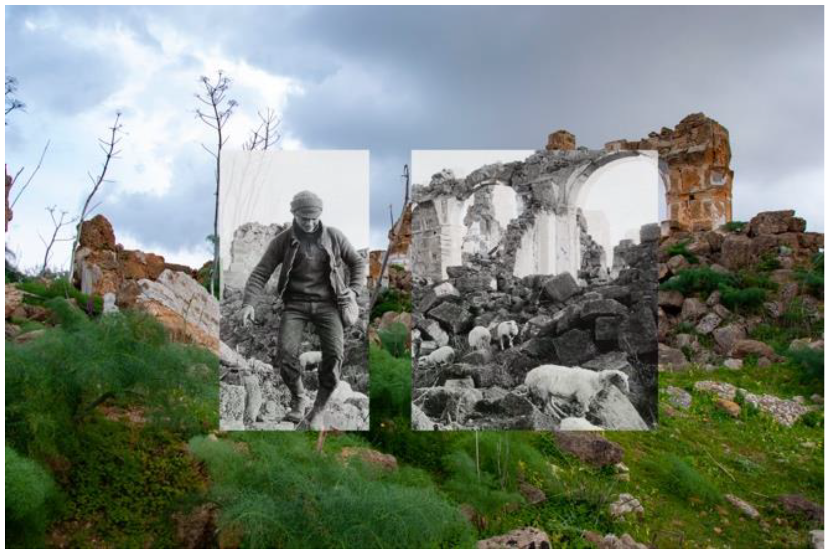
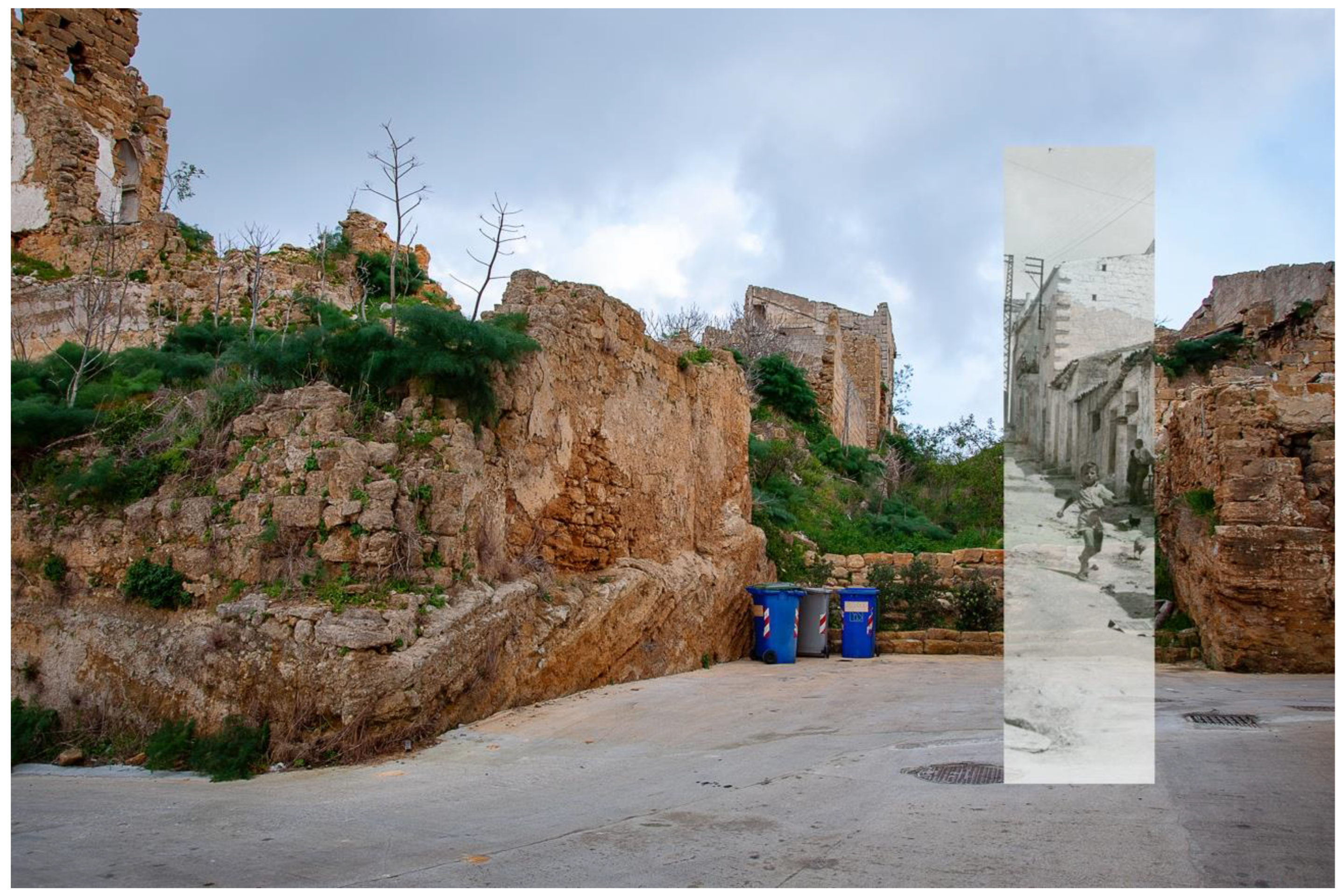
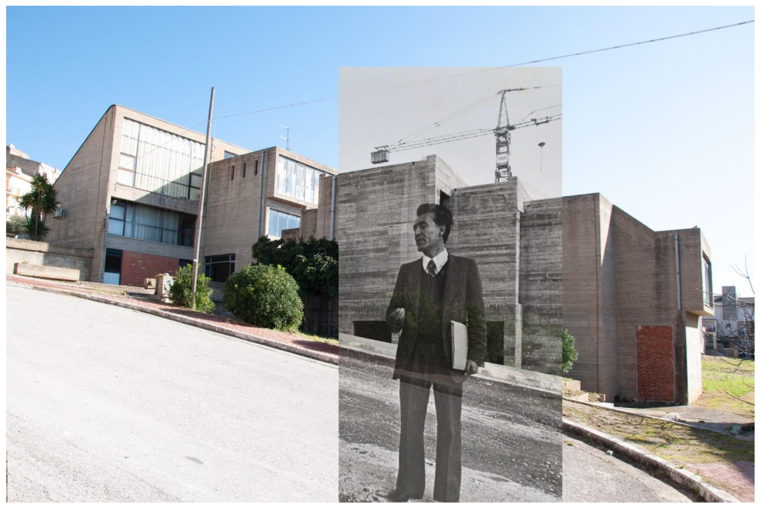
Re-Photography as a Territorial Documentation Technique
4. Results: The Application of the Re-Photographic Method in the Belìce Valley
5. Discussion: Digital Territories and Geographical Readings
6. Conclusions
Author Contributions
Funding
Institutional Review Board Statement
Informed Consent Statement
Data Availability Statement
Acknowledgments
Conflicts of Interest
| 1 | Bagli are buildings built around an open space, a kind of courtyard. |
| 2 | https://tumamoc.arizona.edu/active-research-projects (accessed on 6 July 2020). |
| 3 | http://www.markklettphotography.com/rephotographic-survey-project (accessed on 20 July 2020). |
| 4 | https://missionphotodatar.cget.gouv.fr/mission (accessed on 14 July 2020). |
| 5 | https://camilojosevergara.com/About-This-Project/1/ (accessed on 1 March 2022). |
| 6 | L’Ora was an important news and investigation newspaper, published in Palermo from 1900 to 1992. |
| 7 | Baraccopoli Rampinzeri, Baraccopoli Madonna delle Grazie, Baraccopoli di Salaparuta, Baraccopoli Santa Lucia, Baraccopoli Montevago, Baraccopoli Giammuzzello. |
| 8 | Gibellina Nuova (the new Gibellina) was rebuilt 10–15 km away, in the territory of the municipality of Salemi. |
| 9 | Munteán refers to the post-doctoral essay “The Origin of German Tragic Drama” (1928), in which Walter Benjamin recognizes an allegory of history in the shape of the ruins: «The allegorical physiognomy of the nature-history, which is put on stage in the Trauerspiel, is present in reality in the form of the ruin. In the ruin history has physically merged into the setting. And in this guise history does not assume the form of the process of an eternal life so much as that of irresistible decay. Allegory thereby declares itself to be beyond beauty. Allegories are, in the realm of thoughts, what ruins are in the realm of things». |
| 10 | http://www.markklettphotography.com/after-the-ruins/nmcvfola2oh4900n9txo8j622fxq5s (accessed on 15 July 2020). |
| 11 | See, for example, Shawn Clover’s projects based on the earthquakes in San Francisco (1906) and Loma Prieta (1989) (https://shawnclover.com/thenandnowmashups, accessed on 23 April 2022), or Igor Baloh Parin’s combinations of images of the Slovenian city of Breginj, before and after the 1976 Friuli earthquake (https://www.re.photos/en/profile/Parin/, accessed on 23 April 2022). |
| 12 | “The ecomuseum is a participatory practice of enhancing the tangible and intangible cultural heritage, elaborated and developed by the local community also through an entity organized in the perspective of sustainable development”, Carta di Catania, 2007. |
| 13 | The images shown here are part of a larger group of re-photographic elaborations. |
References
- Lowenthal, D. Geography, Experience, and Imagination: Towards a Geographical Epistemology. Ann. Assoc. Am. Geogr. 1961, 51, 241–260. [Google Scholar] [CrossRef]
- Lucchesi, F. Sviluppi teorici e tematiche di indagine negli studi di Geografia Umanistica: I paesaggi letterari e quelli cinematografici. ACME Ann. Fac. Lett. Filos. Dell’univ. Degli Studi Milano 2012, 65, 193–220. [Google Scholar]
- George, P. La Geografia nella Società Industriale; FrancoAngeli: Milano, Italy, 1976; ISBN 978-8-82042-225-7. [Google Scholar]
- WHC. Operational Guidelines for the Implementation of the World Heritage Convention; UNESCO World Heritage Centre: Paris, France, 2008. [Google Scholar]
- Sauer, C. The Morphology of Landscape. Geography 1925, 2, 315–350. [Google Scholar]
- Vallega, A. Geografia Culturale: Luoghi, Spazi, Simboli; UTET: Turin, Italy, 2003. [Google Scholar]
- Hellpach, W. Geopsiche: L’uomo, il Tempo, il Clima, il Suolo e il Paesaggio; Paoline: Rome, Italy, 1969. [Google Scholar]
- Luginbühl, Y. La Mise en Scène du Monde. Construction du Paysage Européen; CNRS Editions: Paris, France, 2012; ISBN 978-2-27107-501-7. [Google Scholar]
- Donadieu, P. Sciences du Paysage: Entre Théories et Pratiques; Lavoisier: Paris, France, 2012; ISBN 978-2-74301-405-6. [Google Scholar]
- Napoli, M.D.; Petino, G. Il prodotto attrae, il territorio accoglie. Analisi dell’offerta turistica di due areali produttivi IGP siciliani. In Annali del Turismo, 4th ed.; Edizioni Geoprogress: Novara, Italy, 2017; pp. 153–175. [Google Scholar]
- Turco, A. Configurazioni della Territorialità; FrancoAngeli: Milan, Italy, 2010. [Google Scholar]
- Dell’Agnese, E.; Tabusi, M. (Eds.) La Musica Come Geografia: Suoni, Luoghi, Territori; SGI: Rome, Italy, 2016; pp. 5–12. ISBN 978-8-88869-298-2. [Google Scholar]
- Dewey, J.F.; Helman, M.L.; Turco, E.; Hutton, D.H.W.; Knott, S.D. Kinematics of the Western Mediterranean. In Alpine Tectonics; Coward, M.P., Dietrich, D., Park, R.G., Eds.; Geological Society of London: London, UK, 1989; pp. 265–283. [Google Scholar]
- Ben-Avraham, Z.; Boccaletti, M.; Cello, G.; Grasso, M.; Lentini, F.; Torelli, L.; Tortorici, L. Principali domini strutturali originatisi dalla collisione neogenico-quaternaria nel Mediterraneo centrale. Mem. Soc. Geol. Ital. 1990, 45, 453–462. [Google Scholar]
- Catalano, R.; D’Argenio, B.; Torelli, L.; Argenio, B.; Torelli, L. A geological section from Sardinia Channel to Sicily Straits based on seismic and field data. In The Lithosphere in Italy: Advances in Earth Science Research; Boriani, A.B., Piccardo, M., Vai, G.B., Eds.; Italian National Commitee for the International Lithosphere Program: Rome, Italy, 1989; pp. 110–128. [Google Scholar]
- Catalano, R.; Franchino, A.; Merlini, S.; Sulli, A. Central western Sicily structural setting interpreted from seismic reflection profiles. Mem. Soc. Geol. Ital. 2000, 55, 5–16. [Google Scholar]
- Finetti, I.R.; Lentini, F.; Carbone, S.; Del Ben, A.; Di Stefano, A.; Forlin, E.; Guarnieri, P.; Pipan, M.; Prizzon, A. Geological outline of Sicily and Lithospheric Tectono-dynamics of its Tyrrhenian Margin from new CROP seismic data. In CROP PROJECT: Deep Seismic Exploration of the Central Mediterranean and Italy; Finetti, I.R., Ed.; Elsevier: Amsterdam, The Netherlands, 2005. [Google Scholar]
- Barreca, G.; Bruno, V.; Dardanelli, G.; Guglielmino, F.; Brutto, M.L.; Mattia, M.; Pipitone, C.; Rossi, M. An integrated geodetic and InSAR technique for the monitoring and detection of active faulting in southwestern Sicily. Ann. Geophys. 2020, 63, 1–11. [Google Scholar] [CrossRef] [Green Version]
- De Panfilis, M.D.; Marcelli, L. Il periodo sismico della Sicilia occidentale iniziato il 14 Gennaio 1968. Ann. Geophys. 1968, 21, 343–421. [Google Scholar] [CrossRef]
- Anderson, H.; Jackson, J. Active tectonics of the Adriatic Region. Geophys. J. Int. 1987, 91, 937–983. [Google Scholar] [CrossRef]
- Rovida, A.; Locati, M.; Camassi, R.; Lolli, B.; Gasperini, P. The Italian earthquake catalogue CPTI15. Bull. Earthq. Eng. 2020, 18, 2953–2984. [Google Scholar] [CrossRef]
- Rovida, A.; Locati, M.; Camassi, R.; Lolli, B.; Gasperini, P.; Antonucci, A. Catalogo Parametrico dei Terremoti Italiani (CPTI15), Versione 3.0; Istituto Nazionale di Geofisica e Vulcanologia (INGV): Rome, Italy, 2021. [Google Scholar] [CrossRef]
- Rovida, A.; Locati, M.; Camassi, R.; Lolli, B.; Gasperini, P.; Antonucci, A. Catalogo Parametrico dei Terremoti Italiani (CPTI15), Versione 4.0; Istituto Nazionale di Geofisica e Vulcanologia (INGV): Rome, Italy, 2022. [Google Scholar] [CrossRef]
- Bottari, A. Attività sismica e neotettonica della Valle del Belice. Ann. Geophys. 1973, 26, 55–84. [Google Scholar] [CrossRef]
- Michetti, A.M.; Brunamonte, F.; Serva, L. Paleoseismological Evidence in the Epicentral Area of the January 1968 Earthquakes, Belice, Southwestern Sicily. In Perspectives in Paleoseismology; Serva, L., Slemmons, D.B., Eds.; A.E.G.: Los Angeles, CA, USA, 1995; pp. 127–139. [Google Scholar]
- Bosi, C.; Cavallo, R.; Francaviglia, V. Aspetti geologici e geologico-tecnici del terremoto della Valle del Belice del 1968. Mem. Soc. Geol. Ital. 1973, 12, 81–130. [Google Scholar]
- Haas, J.E.; Ayre, R.S. The Western Sicily Earthquake of 1968; National Academy of Engineering Report; National Academy of Science: Washington, DC, USA, 1969; p. 70. [Google Scholar]
- Caldo, C. L’insediamento nella valle del Belice (Sicilia) in relazione al terremoto del 1968. Riv. Geogr. Ital. 1973, 3, 294–312. [Google Scholar]
- Aprile, M. Il Terremoto del Belice o del Fraintendimento. In La Furia di Poseidon. Messina 1908 e Dintorni; Campione, G., Ed.; Silvana Editoriale: Milan, Italy, 2009; pp. 221–234. [Google Scholar]
- Badami, A. Gibellina, la Città che Visse Due Volte. Terremoto e Ricostruzione nella Valle del Belice; FrancoAngeli: Milan, Italy, 2020; ISBN 8-89-179024-9. [Google Scholar]
- Abbate, G.; Fede, M.S.D. Le città della Valle del Belice in Sicilia a cinquant’anni dal terremoto. In La Città Altra. Storia e Immagine della Diversità Urbana: Luoghi e Paesaggi dei Privilegi e del Benessere, Dell’isolamento, del Disagio, della Multiculturalità; Capano, F., Pascariello, M.I., Visone, M., Eds.; Federico II University Press e CIRICE: Napoli, Italy, 2018; pp. 579–586. ISBN 978-8-89993-003-5. [Google Scholar]
- Rogers, G.F. Then and Now—A Photographic History of Vegetation Change in the Central Great Basin Desert; University of Utah Press: Salt Lake City, UT, USA, 1982; ISBN 978-0-87480-206-1. [Google Scholar]
- Rogers, G.F.; Malde, H.E.; Turner, R.M. Bibliography of Repeat Photography for Evaluating Landscape Change; University of Utah Press: Salt Lake City, UT, USA, 1984; ISBN 978-0-87480-239-9. [Google Scholar]
- McLuhan, M. The Gutenberg Galaxy: The Making of Typografic Man; University of Toronto Press: Toronto, ON, Canada, 1962. [Google Scholar]
- Finsterwalder, S. Die Photogrammetrie in den Italienischen Hochalpen; Verlag Der Deutsche Alpenvereins: Wien, Austria, 1890. [Google Scholar] [CrossRef]
- Bryan, K.; Rue, E.C.L. Persistence of Features in an Arid Landscape: The Navajo Twins, Utah. Geogr. Rev. 1927, 17, 251–257. [Google Scholar] [CrossRef]
- Clements, F.E. Research Methods in Ecology; The University Publishing Company: Lincoln, NE, USA, 1905. [Google Scholar]
- Shantz, H.L.; Marbut, C.F. The Vegetation and Soils of Africa; National Research Council and American Geographical Society: New York, NY, USA, 1923. [Google Scholar]
- Shantz, H.L.; Turner, B.L. Photographic Documentation of Vegetational Changes in Africa over a Third of a Century; University of Arizona: Tucson, AZ, USA, 1958. [Google Scholar]
- Webb, R.H.; Boyer, D.E.; Turner, R.M. (Eds.) Repeat Photography: Methods and Applications in the Natural Sciences; Island Press: Washington, DC, USA, 2010. [Google Scholar]
- Adams, R. The New West: Landscapes along the Colorado Front Range; Colorado Associated University Press: Louisville, KY, USA, 1974; ISBN 978-3-86930-900-2. [Google Scholar]
- Salvesen, B. (Ed.) New Topographics; Steidl: Göttingen, Germany, 2009; ISBN 978-3-86521-827-8. [Google Scholar]
- Campbell, N. The Cultures of the American New West; Routledge: London, UK, 2000. [Google Scholar]
- Sciascia, L. Quelli lì. L’Ora 1968, 68, 12. [Google Scholar]
- Messina, G. Old Gibellina: The map, the world, the Aleph. Cult. Geogr. 2019, 27, 317–323. [Google Scholar] [CrossRef]
- Recalcati, M. Le lacrime e l’opera. In Alberto Burri. Il Grande Cretto di Gibellina; Recalcati, M., Ed.; Magonza: Arezzo, Italy, 2018; ISBN 978-8-89875-668-1. [Google Scholar]
- Munteán, L. Rephotography and the Ruin of the Event. Transform. J. Media Cult. 2016, 28, 1–12. [Google Scholar]
- Klett, M.; Lundgren, M.; Fradkin, P.L.; Solnit, R.; Breuer, K. After the Ruins, 1906 and 2006: Rephotographing the San Francisco Earthquake and Fire; University of California Press: Oakland, CA, USA, 2006; ISBN 978-0-52024-556-3. [Google Scholar]
- Burton, C.; Mitchell, J.T.; Cutter, S. Evaluating post-Katrina recovery in Mississippi using repeat photography. Disasters 2011, 35, 488–509. [Google Scholar] [CrossRef] [PubMed]
- Puschmann, O.; Eiter, S.; Fjellstad, W.; Krogli, S.O. Preparing Future Flashbacks—Repeat Photography as a Method in Landscape Monitoring. Nibio-Pop 2018, 4, 1–6. [Google Scholar]
- De Varine, H.D. L’ecomuseo Singolare e Plurale; Utopie Concrete: Gemona del Friuli, Italy, 2021. [Google Scholar]
- Bonito Oliva, A. Paesaggio con Rovine; Edizione Fondazione Orestiadi: Gibellina, Italy, 1992. [Google Scholar]
- Frazzetto, G. La Mano e la Stella; Edizioni Orestiadi: Gibellina, Italy, 2007; ISBN 978-8-89509-802-9. [Google Scholar]


| Cities/Years | 1861 | 1911 | 1961 | 2011 | 2020 |
|---|---|---|---|---|---|
| Gibellina | 5419 | 6646 | 6410 | 4264 | 3836 |
| Montevago | 3122 | 3113 | 3008 | 3015 | 2734 |
| Partanna | 12,012 | 16,174 | 13,011 | 10,854 | 10021 |
| Poggioreale | 3338 | 3074 | 2698 | 1534 | 1394 |
| Salaparuta | 3555 | 3015 | 2943 | 1721 | 1596 |
| Salemi | 13,035 | 20,549 | 15,364 | 10,871 | 10,114 |
| Santa Margherita di Belìce | 7474 | 8494 | 7811 | 6544 | 6104 |
| Santa Ninfa | 6486 | 7522 | 5826 | 5095 | 4842 |
| Vita | 3911 | 5474 | 3748 | 2139 | 1819 |
| Camporeale | 3169 | 5749 | 6093 | 3448 | 3029 |
| Contessa Entellina | 3364 | 2117 | 2669 | 1865 | 1536 |
Publisher’s Note: MDPI stays neutral with regard to jurisdictional claims in published maps and institutional affiliations. |
© 2022 by the authors. Licensee MDPI, Basel, Switzerland. This article is an open access article distributed under the terms and conditions of the Creative Commons Attribution (CC BY) license (https://creativecommons.org/licenses/by/4.0/).
Share and Cite
Petino, G.; Napoli, M.D.; Mattia, M. Landscape, Memory, and Adverse Shocks: The 1968 Earthquake in Belìce Valley (Sicily, Italy): A Case Study. Land 2022, 11, 754. https://doi.org/10.3390/land11050754
Petino G, Napoli MD, Mattia M. Landscape, Memory, and Adverse Shocks: The 1968 Earthquake in Belìce Valley (Sicily, Italy): A Case Study. Land. 2022; 11(5):754. https://doi.org/10.3390/land11050754
Chicago/Turabian StylePetino, Gianni, Maria Donata Napoli, and Mario Mattia. 2022. "Landscape, Memory, and Adverse Shocks: The 1968 Earthquake in Belìce Valley (Sicily, Italy): A Case Study" Land 11, no. 5: 754. https://doi.org/10.3390/land11050754