Next Issue
Volume 14, April-2
Previous Issue
Volume 14, March-2


Water, Volume 14, Issue 7 (April-1 2022) – 184 articles

Cover Story (view full-size image): 
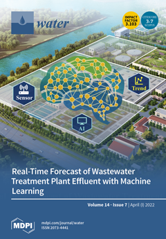
On-line sensors equipped in wastewater treatment plants (WWTPs) provide support for the future prediction of effluent water quality and associated proactive regulation actions. This paper developed an improved feedforward neural network (IFFNN) model that coupled on-line data. Hourly WWTP influent and treatment process data, as well as effluent data, were employed as model input variables. A demonstration in a real WWTP showed that the IFFNN enhanced prediction performance by over 50%, compared to a model without historical on-line effluent input. View this paper
  • Issues are regarded as officially published after their release is announced to the table of contents alert mailing list.
  • You may sign up for e-mail alerts to receive table of contents of newly released issues.
  • PDF is the official format for papers published in both, html and pdf forms. To view the papers in pdf format, click on the "PDF Full-text" link, and use the free Adobe Reader to open them.
Order results
Result details
Section
Select all
Export citation of selected articles as:
14 pages, 1826 KiB  
Article
Regional Assessment of Sub-Hourly Annual Rainfall Maxima
by Anna Pelosi, Giovanni Battista Chirico, Pierluigi Furcolo and Paolo Villani
Water 2022, 14(7), 1179; https://doi.org/10.3390/w14071179 - 06 Apr 2022
Cited by 5 | Viewed by 1833
Abstract
The assessment of rainfall extremes at sub-hourly scales is generally hindered by a lack of rainfall data at small timescale resolutions. This study proposes a methodology for assessing mean annual maximum rainfall at the sub-hourly scale by blending historical time series of annual [...] Read more.
The assessment of rainfall extremes at sub-hourly scales is generally hindered by a lack of rainfall data at small timescale resolutions. This study proposes a methodology for assessing mean annual maximum rainfall at the sub-hourly scale by blending historical time series of annual maxima recorded by mechanical stations (operating at hourly scales) up to the end of the past century with newer time series of annual maxima at higher time resolutions recorded by automatic stations installed over the past twenty years. A linear correlation was found at the regional scale between the shape parameter controlling the dependency of rainfall maxima with a duration longer than one hour and the shape parameter of the dependency of rainfall maxima with the durations shorter than one hour. Thanks to this correlation, data recorded at the mechanical stations could be exploited to assess sub-hourly mean annual maxima. The proposed hybrid procedure was verified and was found to provide estimates with an accuracy close to those obtained with the high-resolution data, i.e., our best estimates. Moreover, the proposed procedure outperforms what could be achieved by spatially interpolating the best estimates at those locations where only hourly data are available. Full article
(This article belongs to the Special Issue Extreme Rainfall and Floods in the Mediterranean Regions)
Show Figures

Figure 1

12 pages, 4471 KiB  
Article
Removal of Disinfection By-Products Precursor (Humic Acid) by Graphene-Silica Composites
by Siqi Chen, Shanze Shang, Qi Zhao, Shaojie Zhang and Wu Yang
Water 2022, 14(7), 1178; https://doi.org/10.3390/w14071178 - 06 Apr 2022
Cited by 1 | Viewed by 1588
Abstract
Graphene-silica (RGO-SiO2) was successfully synthesized by a simple hydrothermal method. The composites were used to study the adsorption properties of humic acid and disinfection by-product precursors in natural surface water. Compared with reduced graphene oxide (RGO), the specific surface area of [...] Read more.
Graphene-silica (RGO-SiO2) was successfully synthesized by a simple hydrothermal method. The composites were used to study the adsorption properties of humic acid and disinfection by-product precursors in natural surface water. Compared with reduced graphene oxide (RGO), the specific surface area of the composites doped with silica (SiO2) increased by 31.2% to 259.43 m2/g. RGO-SiO2 could achieve 66.91% adsorption of humic acid (HA), while the maximum adsorption of HA on RGO-SiO2 reached 925.91 mg/g. The adsorption and removal rates of HA by RGO-SiO2 were significantly higher than those of RGO. The whole adsorption process was in accordance with the quasi-secondary kinetic model, the Langmuir isothermal adsorption model. RGO-SiO2 has good adsorption performance for organic matter of different water qualities. RGO-SiO2 has a better removal ability for hydrophobic organics than hydrophilic and nitrogenous organics. The adsorbent was reusable, and the organic removal efficiency of RGO-SiO2 decreased insignificantly after four cycles. Full article
(This article belongs to the Section Wastewater Treatment and Reuse)
Show Figures

Figure 1

27 pages, 6720 KiB  
Article
Vulnerability of a Tunisian Coastal Aquifer to Seawater Intrusion: Insights from the GALDIT Model
by Adel Zghibi, Amira Merzougui, Abubakarr S. Mansaray, Ali Mirchi, Lahcen Zouhri, Anis Chekirbane, Mohamed Haythem Msaddek, Dhekra Souissi, Amina Mabrouk-El-Asmi and Abdelmadjid Boufekane
Water 2022, 14(7), 1177; https://doi.org/10.3390/w14071177 - 06 Apr 2022
Cited by 8 | Viewed by 3067
Abstract
The Korba region in northwestern Tunisia has a coastal aquifer that is impacted by intensive irrigation, urban expansion, and sensitivity to SWI. We assessed the vulnerability extent of Korba’s GW to SWI. We utilized a parametric model for GW vulnerability assessment, the GALDIT, [...] Read more.
The Korba region in northwestern Tunisia has a coastal aquifer that is impacted by intensive irrigation, urban expansion, and sensitivity to SWI. We assessed the vulnerability extent of Korba’s GW to SWI. We utilized a parametric model for GW vulnerability assessment, the GALDIT, which considers six parameters to determine SWI effects. The GALDIT map has four rating categories (≥7.5, 7.5–5, 5–2.5, and <2.5), representing very high, high, moderate, and low vulnerability, respectively. Most of the region was found to be highly vulnerable (44.2% of the surface area), followed by areas characterized by very high (20.3%) and moderate (19.3%) vulnerability. Only 16.2% was found to have low vulnerability. A parameter sensitivity analysis showed that distance from shore and depth of GW represent the determining factors for SWI with variation index values of 24.12 and 18.02%, respectively. Inland advancement of seawater is causing GW salinity to rise, as indicated by a strong Pearson correlation coefficient of 0.75 between SWI indices and the electrical conductivity. Suitable areas for artificial recharge were mainly distributed in the alluvial plains, with a total area of 32.85 km2. Inhibiting SWI requires about 11.31 MCM of artificial recharge in the two most suitable recharge zones in the region. Full article
(This article belongs to the Special Issue Methods and Tools for Assessment of Groundwater)
Show Figures

Figure 1

26 pages, 4825 KiB  
Article
Flood Exposure and Social Vulnerability Analysis in Rural Areas of Developing Countries: An Empirical Study of Charsadda District, Pakistan
by Abdur Rahim Hamidi, Li Jing, Muhammad Shahab, Kamran Azam, Muhammad Atiq Ur Rehman Tariq and Anne W. M. Ng
Water 2022, 14(7), 1176; https://doi.org/10.3390/w14071176 - 06 Apr 2022
Cited by 12 | Viewed by 4998
Abstract
In recent years, social vulnerability has gained much importance in academic studies. However, social indices are rarely combined and validated with exposure and resilience components. This study provides an integrated analysis of the flood exposure and social vulnerability of rural households in a [...] Read more.
In recent years, social vulnerability has gained much importance in academic studies. However, social indices are rarely combined and validated with exposure and resilience components. This study provides an integrated analysis of the flood exposure and social vulnerability of rural households in a case area of Charsadda District, Khyber Pakhtunkhwa, Pakistan. A conceptual framework was designed (based on the MOVE framework) as a guideline and key indicators were identified. For the exposure component, parameters such as elevation, flooded locations, and distance from the river were endorsed to understand flood mechanisms. For populating socioeconomic variables, questionnaire-based interviews were conducted with 210 households. The results were presented through ArcGIS-generated maps. The most significant indicators interplaying with high vulnerability were exposure-related indicators. The findings showed that the southern areas, including Agra, Daulat Pura, and Hisar Yasinzai were highly vulnerable due to having the highest number of flood locations, lowest elevations, and shortest distances from rivers, as well as larger household sizes, more elderly, children and women, illiteracy rates, and weak financial capacity. Understanding such dominant indicators and areas where high social vulnerability and high exposure converge can inform the authorities in mitigating both social and physical flood vulnerability. Full article
Show Figures

Figure 1

3 pages, 166 KiB  
Editorial
Energy and Water Cycles in the Third Pole
by Yaoming Ma, Lei Zhong and Zhongbo Su
Water 2022, 14(7), 1175; https://doi.org/10.3390/w14071175 - 06 Apr 2022
Cited by 1 | Viewed by 1680
Abstract
The energy and water cycles in the Third Pole have great impacts on the atmospheric circulation, Asian monsoon system and global climate change [...] Full article
(This article belongs to the Special Issue Energy and Water Cycles in the Third Pole)
15 pages, 1931 KiB  
Article
Impacts of Fishing Vessels on the Heavy Metal Contamination in Sediments: A Case Study of Qianzhen Fishing Port in Southern Taiwan
by Yee-Cheng Lim, Chih-Feng Chen, Mei-Ling Tsai, Chung-Hsin Wu, Yi-Li Lin, Ming-Huang Wang, Frank Paolo Jay B. Albarico, Chiu-Wen Chen and Cheng-Di Dong
Water 2022, 14(7), 1174; https://doi.org/10.3390/w14071174 - 06 Apr 2022
Cited by 26 | Viewed by 3481
Abstract
Routine maintenance of fishing vessels and wastewater discharges are primary sources of heavy metals in fishing ports. Sediment pollution assessment is necessary in fishing port management, including sediment dredging and disposal, sewage treatment facility construction, and pollution source control. In this study, sediment [...] Read more.
Routine maintenance of fishing vessels and wastewater discharges are primary sources of heavy metals in fishing ports. Sediment pollution assessment is necessary in fishing port management, including sediment dredging and disposal, sewage treatment facility construction, and pollution source control. In this study, sediment heavy metal contents in Qianzhen Fishing Port, the largest pelagic fishery port in Taiwan, were investigated to assess the contamination levels and related potential ecological risks using multiple sediment pollution indices. Normalization methods were applied to identify the potential sources of heavy metals in fishing port sediments. Results showed that Cu, Zn, Pb, and Cr contents in the sediments of the inner fishing port (averages of 276, 742, 113, and 221 mg/kg, respectively) were 3–5 times greater compared to those along the port entrance and outside, indicating the strong impacts of anthropogenic pollution (EFCu: 5.6–12.5; EFZn: 2.8–4.3; EFPb: 2.4–5.4; EFCr: 1.1–3.2). Copper pollution was more severe, with high maxima contamination factor (CFCu: 15.1–24.8), probably contributed by copper-based antifouling paints used in fishing vessels. The sediments in the inner fishing port are categorized as having considerable ecological risk and toxicity (mERMq: 0.61–0.91; ΣTU: 7.5–11.7) that can potentially cause adverse effects on benthic organisms. Qianzhen Fishing Port sediments can be characterized as high Cu/Fe and Pb/Fe, moderate Zn/Fe, and high total grease content, indicating that the potential sources of heavy metals are primarily antifouling paints and oil spills from the fishing vessels. This study provides valuable data for pollution control, remediation, and environmental management of fishing ports. Full article
(This article belongs to the Special Issue The Relationship between Ships and Marine Environment)
Show Figures

Figure 1

15 pages, 1764 KiB  
Article
Modeling Groundwater Nitrate Contamination Using Artificial Neural Networks
by Christina Stylianoudaki, Ioannis Trichakis and George P. Karatzas
Water 2022, 14(7), 1173; https://doi.org/10.3390/w14071173 - 06 Apr 2022
Cited by 8 | Viewed by 2627
Abstract
The scope of the present study is the estimation of the concentration of nitrates (NO3) in groundwater using artificial neural networks (ANNs) based on easily measurable in situ data. For the purpose of the current study, two feedforward [...] Read more.
The scope of the present study is the estimation of the concentration of nitrates (NO3) in groundwater using artificial neural networks (ANNs) based on easily measurable in situ data. For the purpose of the current study, two feedforward neural networks were developed to determine whether including land use variables would improve the model results. In the first network, easily measurable field data were used, i.e., pH, electrical conductivity, water temperature, air temperature, and aquifer level. This model achieved a fairly good simulation based on the root mean squared error (RMSE in mg/L) and the Nash–Sutcliffe Model Efficiency (NSE) indicators (RMSE = 26.18, NSE = 0.54). In the second model, the percentages of different land uses in a radius of 1000 m from each well was included in an attempt to obtain a better description of nitrate transport in the aquifer system. When these variables were used, the performance of the model increased significantly (RMSE = 15.95, NSE = 0.70). For the development of the models, data from chemical and physical analyses of groundwater samples from wells located in the Kopaidian Plain and the wider area of the Asopos River Basin, both in Greece, were used. The simulation that the models achieved indicates that they are a potentially useful tools for the estimation of groundwater contamination by nitrates and may therefore constitute a basis for the development of groundwater management plans. Full article
Show Figures

Figure 1

19 pages, 3371 KiB  
Article
Feasibility Study of Water Reclamation Projects in Industrial Parks Incorporating Environmental Benefits: A Case Study in Chonburi, Thailand
by Weeraya Intaraburt, Jatuwat Sangsanont, Tawan Limpiyakorn, Piyatida Ruangrassamee, Pongsak Suttinon and Benjaporn Boonchayaanant Suwannasilp
Water 2022, 14(7), 1172; https://doi.org/10.3390/w14071172 - 06 Apr 2022
Cited by 5 | Viewed by 3006
Abstract
Financial feasibility is usually a concern in water reclamation projects. Aside from internal benefits, water reclamation in industrial parks delivers health and environmental benefits not normally considered in cost–benefit analyses (CBA). This study investigated the influence of environmental benefits on the feasibility of [...] Read more.
Financial feasibility is usually a concern in water reclamation projects. Aside from internal benefits, water reclamation in industrial parks delivers health and environmental benefits not normally considered in cost–benefit analyses (CBA). This study investigated the influence of environmental benefits on the feasibility of water reclamation projects with flow rate scenarios in accordance with industrial parks in Chonburi, Thailand. CBAs of water reclamation plants for industrial water supply, consisting of ultrafiltration (UF) and reverse osmosis (RO), with flow rates of 5200, 10,000, 15,000, and 25,000 m3/day and discount rates of 3%, 5%, 7%, 9% and 11% were conducted. Considering only the direct costs and benefits, none of the projects were financially feasible. However, when the environmental benefits were included, the projects became profitable in all cases except those with a flow rate of 5200 m3/day and discount rates of 5%, 7%, 9%, and 11% and those with flow rates of 10,000 and 25,000 m3/day and an 11% discount rate. Further, CBAs of water reclamation projects in industrial parks for irrigation were conducted with post-treatment processes consisting of sand filtration and chlorine disinfection for flow rates of 240, 480, 2400, 3600, and 4800 m3/day. The projects are profitable, regardless of environmental benefits. Full article
Show Figures

Figure 1

32 pages, 1063 KiB  
Review
Gas Hydrate-Based Heavy Metal Ion Removal from Industrial Wastewater: A Review
by Sirisha Nallakukkala, Adeel ur Rehman, Dzulkarnain B. Zaini and Bhajan Lal
Water 2022, 14(7), 1171; https://doi.org/10.3390/w14071171 - 06 Apr 2022
Cited by 19 | Viewed by 3982
Abstract
Innovating methods for treating industrial wastewater containing heavy metals frequently incorporate toxicity-reduction technologies to keep up with regulatory requirements. This article reviews the latest advances, benefits, opportunities and drawbacks of several heavy metal removal treatment systems for industrial wastewater in detail. The conventional [...] Read more.
Innovating methods for treating industrial wastewater containing heavy metals frequently incorporate toxicity-reduction technologies to keep up with regulatory requirements. This article reviews the latest advances, benefits, opportunities and drawbacks of several heavy metal removal treatment systems for industrial wastewater in detail. The conventional physicochemical techniques used in heavy metal removal processes with their advantages and limitations are evaluated. A particular focus is given to innovative gas hydrate-based separation of heavy metals from industrial effluent with their comparison, advantages and limitations in the direction of commercialization as well as prospective remedies. Clathrate hydrate-based removal is a potential technology for the treatment of metal-contaminated wastewater. In this work, a complete assessment of the literature is addressed based on removal efficiency, enrichment factor and water recovery, utilizing the gas hydrate approach. It is shown that gas hydrate-based treatment technology may be the way of the future for water management purposes, as the industrial treated water may be utilized for process industries, watering, irrigation and be safe to drink. Full article
(This article belongs to the Topic Sustainable Environmental Technologies)
Show Figures

Figure 1

13 pages, 4603 KiB  
Article
Automated Monitoring of a High-Speed Flocculation Flat-Bottomed Sludge Blanket Clarifier Pond during Drought and Flood Conditions
by Chun-I Wu, Shang-Lein Lo and Hsu-Chen Chung
Water 2022, 14(7), 1170; https://doi.org/10.3390/w14071170 - 06 Apr 2022
Viewed by 1590
Abstract
The occasional rains that occur during dry seasons often stir up the bottom sediment of reservoirs, which leads to high turbidity and electrical conductivity in raw waters received by water utility companies. A newly developed real-time precision multi-layer sensor (RPMS) system was used [...] Read more.
The occasional rains that occur during dry seasons often stir up the bottom sediment of reservoirs, which leads to high turbidity and electrical conductivity in raw waters received by water utility companies. A newly developed real-time precision multi-layer sensor (RPMS) system was used to monitor a high-speed flocculation flat-bottomed sludge blanket clarifier (HFSBC) pond in real time to solve the water quality problems caused by drought and flood conditions. The RPMS is capable of monitoring the thickness of a sludge blanket; if the coagulation and sedimentation processes of the HFSBC are not working well, the sludge blanket will be thin and have a low sludge concentration. Conversely, if the HFSBC is working properly, the sludge blanket will have a thick and highly concentrated layer of sludge. Any heavy metals that are not removed by water treatment processes will enter the water supply network, which will result in poor water quality for end users. Against the backdrop of intensifying climate change, the enhancement of automated monitoring systems and adaptation processes will be an important part of efforts to minimize and resolve acute changes in water quality. Full article
(This article belongs to the Section Hydrology)
Show Figures

Figure 1

18 pages, 5708 KiB  
Article
Rainfall-Induced or Lake-Water-Level-Controlled Landslide? An Example from the Steep Slopes of Lake Balaton, Hungary
by Fruzsina Kápolnainé Nagy-Göde and Ákos Török
Water 2022, 14(7), 1169; https://doi.org/10.3390/w14071169 - 06 Apr 2022
Cited by 3 | Viewed by 2546
Abstract
The present paper provides a case study and an overview of the stability of high banks bordering the eastern basin of the largest central European lake, Lake Balaton, in Hungary. External factors such as rain, lake-water level, or pore water pressure are considered [...] Read more.
The present paper provides a case study and an overview of the stability of high banks bordering the eastern basin of the largest central European lake, Lake Balaton, in Hungary. External factors such as rain, lake-water level, or pore water pressure are considered in the stability analysis. The slope stability was assessed using two software with different approximations and calculation methods. The results of the models using Plaxis and Rocscience Slide2 are compared. One of the major identified failure scenarios is the deep-seating rotational landslides that are triggered by rain and elevated groundwater table. The modeled slip surfaces are in good agreement with the inclinometer monitoring data of the site; meanwhile, the top of the slope failures is not influenced by water level. Full article
(This article belongs to the Special Issue Landslides Induced by Surface and Groundwater)
Show Figures

Figure 1

16 pages, 3982 KiB  
Article
Local Scour around Tandem Double Piers under an Ice Cover
by Liansheng Sang, Jun Wang, Tiejie Cheng, Zhixing Hou and Jueyi Sui
Water 2022, 14(7), 1168; https://doi.org/10.3390/w14071168 - 06 Apr 2022
Cited by 7 | Viewed by 1541
Abstract
Compared to the scour around a single pier, the local scour process around tandem double piers is much more complicated. Based on laboratory experiments in a flume, we conducted the scour process around tandem double piers under an ice-covered flow condition. The results [...] Read more.
Compared to the scour around a single pier, the local scour process around tandem double piers is much more complicated. Based on laboratory experiments in a flume, we conducted the scour process around tandem double piers under an ice-covered flow condition. The results showed that when the pier spacing ratio L/D = 2 (where L = the pier spacing distance, and D = the pier diameter), the rear pier (the downstream one) will intensify the horseshoe vortex process behind the front pier, and the scour depth around the front pier will increase by about 10%. As the pier spacing ratio L/D increases, the scour depth around the front pier will gradually decrease. When the pier spacing ratio L/D = 5, sediment scoured around the front pier begins to deposit between these two piers. To initiate a deposition dune between piers, the pier spacing distance under an ice-covered condition is about 20% more than that under an open flow condition. The results also showed that the existence of the rear pier will lead to an increase in the length of the scour hole but a decrease in the depth of the scour hole around the front pier. The local scour around the front pier interacts with the local scour of the rear pier. The maximum scour depth of the scour hole around the rear pier increases first, then decreases and increases again afterward. When the pier spacing ratio L/D = 9, the scour depth around the rear pier is the least. With an increase in the pier spacing ratio, the influence of the local scour around the front pier on the local scour around the rear pier gradually decreases. When the pier spacing ratio L/D is more than 17, the scour around the front pier has hardly any influence on that around the rear pier. The scour depth around the rear pier is about 90% of that around the front pier. Full article
(This article belongs to the Special Issue Fluvial Hydraulics Affected by River Ice and Hydraulic Structures)
Show Figures

Figure 1

29 pages, 4605 KiB  
Article
Investigation of Gender-Differentiated Impacts of Water Poverty on Different Livelihood Groups in Peri-Urban Areas around Dhaka, Bangladesh
by Lamiya Sharmeen Jaren, Rabeya Sultana Leya and M. Shahjahan Mondal
Water 2022, 14(7), 1167; https://doi.org/10.3390/w14071167 - 06 Apr 2022
Viewed by 4051
Abstract
The concept of water poverty integrates water stress, access to safe water and sanitation, socioeconomic capacity, water uses and environmental aspects. This study presents a new concept to demonstrate gender-differentiated impacts of water poverty for different livelihood groups in a peri-urban setting. The [...] Read more.
The concept of water poverty integrates water stress, access to safe water and sanitation, socioeconomic capacity, water uses and environmental aspects. This study presents a new concept to demonstrate gender-differentiated impacts of water poverty for different livelihood groups in a peri-urban setting. The objective is to identify how gender and livelihood groups are affected by dynamic water poverty. A few peri-urban areas around Dhaka city were selected as the study area, and male and female industrial workers, small-scale male and female farmers, and economically inactive women were the target groups. Data were collected through a questionnaire survey of 220 respondents and using a number of participatory appraisal tools, such as focus group discussions, and semi-structured and key-informant interviews. Water poverty was assessed by its five components: resource, access, capacity, use and environment. Peri-urban water poverty is found not only to be limited to scarcity, or physical availability, of water resources, but also to encompass political, social, economic and institutional dimensions. The study found that inadequate availability and quality of water, restricted access and use, poor socioeconomic capacity and fragile environment affected every livelihood group, but these factors eventually led to extreme impoverishment for adolescent girls, and physically challenged and elderly women. Suggestions are provided as to how gender issues of water can be balanced at different levels to make water management decisions gender-sensitive. Full article
(This article belongs to the Special Issue Advance in Water Management and Water Policy Research)
Show Figures

Figure 1

13 pages, 2592 KiB  
Article
Automatic Water Control System and Environment Sensors in a Greenhouse
by Yousif Yakoub Hilal, Montaser Khairie Khessro, Jos van Dam and Karrar Mahdi
Water 2022, 14(7), 1166; https://doi.org/10.3390/w14071166 - 06 Apr 2022
Cited by 5 | Viewed by 3979
Abstract
Iraqi greenhouses require an active microcontroller system to ensure a suitable microclimate for crop production. At the same time, reliable and timely Water Consumption Rate (WCR) forecasts provide an essential means to reduce the amount of water loss and maintain the environmental conditions [...] Read more.
Iraqi greenhouses require an active microcontroller system to ensure a suitable microclimate for crop production. At the same time, reliable and timely Water Consumption Rate (WCR) forecasts provide an essential means to reduce the amount of water loss and maintain the environmental conditions inside the greenhouses. The Arduino micro-controller system is tested to determine its effectiveness in controlling the WCR, Temperature (T), Relative Humidity (RH), and Irrigation Time (IT) levels and improving plant growth rates. The Arduino micro-controller system measurements are compared with the traditional methods to determine the quality of the work of the new control system. The development of mathematical models relies on T, RH, and IT indicators. Based on the results, the new system proves to reliably identify the amount of WCR, IT, T, and RH necessary for plant growth. A t-test for the values from the Arduino microcontroller system and traditional devices for both conditions show no significant difference. This means that there is solid evidence that the WCR, IT, T, and RH levels for these two groups are no different. In addition, the linear, two-factor interaction (2FI), and quadratic models display acceptable performance very well since multiple coefficients of determination (R2) reached 0.962, 0.969, and 0.977% with IT, T, and RH as the predictor variables. This implies that 96.9% of the variability in the WCR is explained by the model. Therefore, it is possible to predict weekly WCR 14 weeks in advance with reasonable accuracy. Full article
(This article belongs to the Special Issue Water Management for Climate Smart Agriculture)
Show Figures

Figure 1

25 pages, 6784 KiB  
Article
An Integrated Approach for Deciphering Hydrogeochemical Processes during Seawater Intrusion in Coastal Aquifers
by Hend S. Abu Salem, Khaled S. Gemail, Natalia Junakova, Amin Ibrahim and Ahmed M. Nosair
Water 2022, 14(7), 1165; https://doi.org/10.3390/w14071165 - 06 Apr 2022
Cited by 15 | Viewed by 3420
Abstract
For managing the freshwater in the worldwide coastal aquifers, it is imperative to understand the hydrogeochemical processes and flow patterns in the mixing freshwater/saltwater zone. The Egyptian Nile Delta aquifer is a typical example. The management of seawater intrusion (SWI) requires detailed investigations [...] Read more.
For managing the freshwater in the worldwide coastal aquifers, it is imperative to understand the hydrogeochemical processes and flow patterns in the mixing freshwater/saltwater zone. The Egyptian Nile Delta aquifer is a typical example. The management of seawater intrusion (SWI) requires detailed investigations of the intrusion wedge and the dynamic processes in the mixing zone. Thus, a multidisciplinary approach was applied based on holistic hydrogeochemical, statistical analysis, and DC resistivity measurements to investigate the lateral and vertical changes in groundwater characteristics undergoing salinization stressor. The results of cross plots and ionic deviations of major ions, hydrochemical facies evolution diagram (HFE-D), and seawater mixing index (SMI) were integrated with the resistivity results to show the status of the SWI where the intrusion phase predominates in ~2/3 of the study are (~70 km radius) and the compositional thresholds of Na, Mg, Cl, and SO4 are 600, 145, 1200, and 600 mg/L, respectively, indicating that the wells with higher concentrations than these thresholds are affected by SWI. Moreover, the results demonstrate the efficiency of combining hydrogeochemical facies from heatmap and resistivity investigations to provide a large-scale characterization of natural and anthropogenic activities controlling aquifer salinization to support decision-makers for the long-term management of coastal groundwater. Full article
(This article belongs to the Special Issue Assessment and Management of Hydrological Risks Due to Climate Change)
Show Figures

Figure 1

17 pages, 5862 KiB  
Article
Investigation of Groundwater Logging for Possible Changes in Recharge Boundaries and Conditions in the City of Aswan, Egypt
by Hickmat Hossen, A. S. Nour-Eldeen, Abdelazim Negm, Ali M. Hamdan, Mohamed Elsahabi, Martina Zelenakova and Ismail Abd-Elaty
Water 2022, 14(7), 1164; https://doi.org/10.3390/w14071164 - 05 Apr 2022
Cited by 5 | Viewed by 2440
Abstract
Groundwater is of great importance in our daily life, and its importance is due to its multiple uses, whether in agriculture, industry or other uses. Increasing the Groundwater Levels (GWL) in any area is a great benefit for its importance and multiplicity of [...] Read more.
Groundwater is of great importance in our daily life, and its importance is due to its multiple uses, whether in agriculture, industry or other uses. Increasing the Groundwater Levels (GWL) in any area is a great benefit for its importance and multiplicity of uses, but in the city of Aswan, it is different, as the increase in the GWL causes severe damage to buildings and leads to poor quality of agricultural land and the destruction of infrastructure due to the lack of good management. The main objective of this study is to develop a conceptual model of the groundwater system to gain better understanding of water dynamics in the study area and to investigate different management scenarios of the use of groundwater. The model was developed using MODFLOW code to achieve the objective of the study, where the necessary field data were collected to feed the model from the study area, such as Surface Water Levels (SWL) in the Aswan Dam lake and the Nile River, GWL in the Aswan Aquifer and the different characteristics of the layers constituting the aquifer, such as porosity and recharge for different periods to ensure obtaining the most accurate and best results from the model. The model was calibrated with mean residual and absolute mean residual which reached −0.08 and 0.629 m, respectively, with a Root Mean Square Error (RMSE) of 0.737m and a normalized RMSE of 4.319%. Two future scenarios have been developed to arrive at a future vision of GWL in the Aswan aquifer. The first scenario investigated GWL in the study area by changing the values of recharge to the aquifer resulting from an increase in the drinking water and sewage networks’ leakage values, which were predicted in the future for years 2025, 2030, 2035 and 2040. The GWL in the study area are increasing as a result of the increase in the amount of leakage in the years 2025, 2030, 2035 and 2040 compared to the GWL in the study area for the year 2020 by 0.29%, 1.31%, 2.01% and 3.16%, respectively. The second scenario investigated GWL by changing the water levels in El hebs (the lake between the High Dam and the Aswan Dam) as follows (108 m, 110 m, 112 m, 114 m, 116 m and 118 m), where the groundwater levels were calculated in the Aswan Aquifer corresponding to each level. The percentage of increase in groundwater levels corresponding to the levels 108 m, 110 m, 112 m, 114 m, 116 m and 118 m compared to the groundwater levels at the level of 106 m was found as follows: 0.92%, 2%, 2.87%, 4.05%, 4.91% and 5.67%, respectively. The simulation results are intended to support integrated groundwater modeling for the components of the hydrological water budget in the city of Aswan. Furthermore, the model provides us with a better understanding of long-term scenarios for the waterlogging in the city. The results are useful for managing the water logging problems and planning the future infrastructure in the city of Aswan. Full article
(This article belongs to the Special Issue Assessment and Management of Hydrological Risks Due to Climate Change)
Show Figures

Figure 1

14 pages, 972 KiB  
Article
Thermodynamic Study of Phosphate Adsorption and Removal from Water Using Iron Oxyhydroxides
by Kyriaki Kalaitzidou, Anastasios Zouboulis and Manassis Mitrakas
Water 2022, 14(7), 1163; https://doi.org/10.3390/w14071163 - 05 Apr 2022
Cited by 7 | Viewed by 2161
Abstract
Iron oxyhydroxides (FeOOHs) appear to be the optimal group of materials among inorganic adsorbents for the removal of phosphates from water, providing significant adsorption capacities. This research work presents a thermodynamic study of phosphate adsorption by examining five different FeOOHs sorbent nanomaterials. The [...] Read more.
Iron oxyhydroxides (FeOOHs) appear to be the optimal group of materials among inorganic adsorbents for the removal of phosphates from water, providing significant adsorption capacities. This research work presents a thermodynamic study of phosphate adsorption by examining five different FeOOHs sorbent nanomaterials. The otablebtained results indicated that the adsorption process in these cases was spontaneous. When the experiments were performed using distilled water, akageneite (GEH), schwertmannite, and tetravalent manganese feroxyhyte (AquAsZero), displaying ΔH° values of 31.2, 34.7, and 7.3 kJ/mole, respectively, presented an endothermic adsorption process, whereas for goethite (Bayoxide) and lepidocrocite, with ΔH° values of −11.4 and −7.7 kJ/mole, respectively, the adsorption process proved to be exothermic. However, when an artificial (according to NSF) water matrix was used, GEH, schwertmannite, lepidocrocite, and AquAsZero presented ΔH° values of 13.2, 3.3, 7.7, and 3.3 kJ/mole, respectively, indicative of an endothermic process, while only for Bayoxide, with ΔH° of −17 kJ/mole, the adsorption remained exothermic. The adsorption enthalpy values generally decreased with the NSF water matrix, probably due to the competition for the same adsorption sites by other co-existing anions as well to the possible formation of soluble phosphate complexes with calcium; however, an overall positive effect on the uptake of phosphates was observed. Full article
(This article belongs to the Special Issue Application of Nanomaterials in Water Treatment)
Show Figures

Figure 1

20 pages, 40369 KiB  
Article
Hydroclimatic Conditions, Wildfire, and Species Assemblages Influence Co-Occurrence of Bull Trout and Tailed Frogs in Northern Rocky Mountain Streams
by David S. Pilliod, Robert S. Arkle, Russell F. Thurow and Daniel J. Isaak
Water 2022, 14(7), 1162; https://doi.org/10.3390/w14071162 - 05 Apr 2022
Cited by 2 | Viewed by 2153
Abstract
Although bull trout (Salvelinus confluentus) and tailed frogs (Ascaphus montanus) have co-existed in forested Pacific Northwest streams for millennia, these iconic cold-water specialists are experiencing rapid environmental change caused by a warming climate and enhanced wildfire activity. Our goal [...] Read more.
Although bull trout (Salvelinus confluentus) and tailed frogs (Ascaphus montanus) have co-existed in forested Pacific Northwest streams for millennia, these iconic cold-water specialists are experiencing rapid environmental change caused by a warming climate and enhanced wildfire activity. Our goal was to inform future conservation by examining the habitat associations of each species and conditions that facilitate co-occupancy. We repurposed data from previous studies in the northern Rocky Mountains to assess the efficacy of bull trout electrofishing surveys for determining the occurrence of tailed frogs and the predictive capacity of habitat covariates derived from in-stream measurements and geospatial sources to model distributions of both species. Electrofishing reliably detected frog presence (89.2% rate). Both species were strongly associated with stream temperature and flow regime characteristics, and less responsive to riparian canopy cover, slope, and other salmonids. Tailed frogs were also sensitive to wildfire, with occupancy probability peaking around 80 years after a fire. Co-occupancy was most probable in locations with low-to-moderate frequencies of high winter flow events, few other salmonids, a low base-flow index, and intermediate years since fire. The distributions of these species appear to be sensitive to environmental conditions that are changing this century in forests of the northern Rocky Mountains. The amplification of climate-driven effects after wildfire may prove to be particularly problematic in the future. Habitat differences between these two species, considered to be headwater specialists, suggest that conservation measures designed for one may not fully protect the other. Additional studies involving future climate and wildfire scenarios are needed to assess broader conservation strategies and the potential to identify refuge streams where both species are likely to persist, or complementary streams where each could exist separately into the future. Full article
(This article belongs to the Special Issue Aquatic Biodiversity and Forests)
Show Figures

Figure 1

15 pages, 956 KiB  
Article
Metagenomic Characterization of Microbial Pollutants and Antibiotic- and Metal-Resistance Genes in Sediments from the Canals of Venice
by James F. Curran, Luca Zaggia and Grazia Marina Quero
Water 2022, 14(7), 1161; https://doi.org/10.3390/w14071161 - 04 Apr 2022
Cited by 7 | Viewed by 3480
Abstract
The spread of fecal pollutants and antibiotic resistance in the aquatic environment represents a major public health concern and is predicted to increase in light of climate change consequences and the increasing human population pressure on the lagoon and coastal areas. The city [...] Read more.
The spread of fecal pollutants and antibiotic resistance in the aquatic environment represents a major public health concern and is predicted to increase in light of climate change consequences and the increasing human population pressure on the lagoon and coastal areas. The city of Venice (Italy) is affected by diverse microbial pollution sources, including domestic wastewaters that, due to the lack of modern sewage treatment infrastructure in the historical city center, are released into canals. The outflowing jets of its tidal inlets thus represent a source of contamination for the nearby beaches on the barrier island separating the lagoon from the sea. Metagenomic analyses of DNA extracted from sediment samples from six sites in the canals of the city’s historic center were undertaken to characterize the microbial community composition, the presence of fecal microbes as well as other non-enteric pathogens, and the content of genes related to antibiotic (AB) and heavy metal (HM) resistance, and virulence. The six sites hosted similar prokaryotic communities, although variations in community composition likely related to oxygen availability were observed. All sites displayed relatively high levels of fecal contamination, including the presence of Fecal Indicator Bacteria, sewage- and alternative feces-associated bacteria. Relatively high levels of other potential pathogens were also found. About 1 in 500 genes identified at these sites are related to AB and HM resistance; conversely, genes related to virulence were rare. Our data suggest the existence of widespread sediment microbial pollution in the canals of Venice, coupled with the prevalence of ARGs to antibiotics frequently used in humans as well as of HMRGs to toxic metals that still persists in the lagoon. All of this evidence raises concerns about the consequences on the water quality of the lagoon and adjacent marine areas and the potential risks for humans, deserving further studies. Full article
Show Figures

Figure 1

15 pages, 4061 KiB  
Article
Robust Magnetic γ-Fe2O3/Al–ZnO Adsorbent for Chlorpyriphos Removal in Water
by Miryam Boulares, Baha Chamam, Amal Mejri, Mohamed Ali Wahab, Amani Haddouk, Lassaad El Mir, Ahmed Hichem Hamzaoui, Amjad Kallel, Chedly Tizaoui and Ismail Trabelsi
Water 2022, 14(7), 1160; https://doi.org/10.3390/w14071160 - 04 Apr 2022
Cited by 3 | Viewed by 2072
Abstract
In this research, the removal of the pesticide chlorpyriphos (CPE) from water by adsorption using a novel adsorbent made of γ-Fe2O3/Al-ZnO nanocomposite was studied. The adsorbent was characterized using Fourier-transformed infrared spectroscopy (FTIR), Scanning electron microscopy (SEM), Brunauer-Emmett-Teller (BET) [...] Read more.
In this research, the removal of the pesticide chlorpyriphos (CPE) from water by adsorption using a novel adsorbent made of γ-Fe2O3/Al-ZnO nanocomposite was studied. The adsorbent was characterized using Fourier-transformed infrared spectroscopy (FTIR), Scanning electron microscopy (SEM), Brunauer-Emmett-Teller (BET) surface area, and vibrating sample magnetometry (VSM). The main parameters affecting the adsorption process, including the initial pH (2–12), the concentration of pesticide (10–70 ppm), the %Fe2O3 of the adsorbent, and the adsorption time (≤60 min), were studied. The results demonstrated that the adsorption of CPE depended on the pH, with a maximum removal of 92.3% achieved at around neutral pH. The adsorption isotherm was modelled and the results showed that the Freundlich model fitted the experimental data better than the Langmuir and Temkin models. The kinetics of adsorption were also studied and modelled using the pseudo-first-order and pseudo-second-order models, with the former being found more suitable. Energy dispersive X-ray (EDX) analysis confirmed the adsorption of CPE on γ-Fe2O3/Al-ZnO, while FTIR analysis suggested that the hydroxyl, N-pyridine, and chloro functional groups governed the adsorption mechanism. Furthermore, VSM analysis revealed that the magnetization saturation of γ-Fe2O3/Al-ZnO nanocomposite, after CPE adsorption, was slightly lower than that of fresh γ-Fe2O3/Al-ZnO but remained adequate for the efficient separation of the adsorbent simply using a magnet. This study demonstrates that binary γ-Fe2O3/Al-ZnO magnetic nanocomposites are effective for the removal of chlorpyriphos and could be highly promising materials for the removal of emerging pollutants in wastewater. Full article
(This article belongs to the Section Wastewater Treatment and Reuse)
Show Figures

Figure 1

19 pages, 3662 KiB  
Article
Inundation Analysis of Coastal Urban Area under Climate Change Scenarios
by Heechan Han, Deokhwan Kim and Hung Soo Kim
Water 2022, 14(7), 1159; https://doi.org/10.3390/w14071159 - 04 Apr 2022
Cited by 4 | Viewed by 2690
Abstract
The inundation of urban areas has frequently occurred as a result of the localized heavy precipitation and flash floods in both South Korea and globally. Metropolitan areas with higher property value and population density than rural areas need practical strategies to reduce flood [...] Read more.
The inundation of urban areas has frequently occurred as a result of the localized heavy precipitation and flash floods in both South Korea and globally. Metropolitan areas with higher property value and population density than rural areas need practical strategies to reduce flood damage. Therefore, this study aims to perform an inundation analysis of coastal urban areas under a climate change scenario. Changwon city is one of the typical coastal metropolitan regions in South Korea. Severe flooding has occurred in this area caused by a combination of precipitation and sea-level rise enhanced by the typhoon, Sanba, in September 2012. At that time, daily precipitation was 65.5 mm, which is lower than the capable amount of rainfall of the drainage system. However, the river stage combined with the tidal wave caused by a typhoon and heavy precipitation exceeded the flood warning level. This study performed the flood inundation analysis for a part of Changwon city using the SWMM model, a two-dimensional urban flood analysis model. Furthermore, we considered the climate change scenarios to predict the potential flood damage that may occur in the future. As a result, as the future target period increases, both the flooding area and the inundation depth increase compared to the results of the inundation simulation according to the current precipitation and sea-level conditions. The inundation area increased by 2.6–16.2% compared to the current state, and the flooded depths would be higher than 1 m or more. We suggest a structural method to reduce inundation damages to consider extreme precipitation and tidal wave effects. Full article
(This article belongs to the Special Issue The Impacts of Climate Change on Hydrologic Extremes)
Show Figures

Figure 1

22 pages, 422 KiB  
Review
Remote Sensing, Geophysics, and Modeling to Support Precision Agriculture—Part 1: Soil Applications
by Arya Pradipta, Pantelis Soupios, Nektarios Kourgialas, Maria Doula, Zoi Dokou, Mohammad Makkawi, Mohammed Alfarhan, Bassam Tawabini, Panagiotis Kirmizakis and Mohamed Yassin
Water 2022, 14(7), 1158; https://doi.org/10.3390/w14071158 - 04 Apr 2022
Cited by 9 | Viewed by 3466
Abstract
Sustainable agriculture management typically requires detailed characterization of physical, chemical, and biological aspects of soil properties. These properties are essential for agriculture and should be determined before any decision for crop type selection and cultivation practices. Moreover, the implementation of soil characterization at [...] Read more.
Sustainable agriculture management typically requires detailed characterization of physical, chemical, and biological aspects of soil properties. These properties are essential for agriculture and should be determined before any decision for crop type selection and cultivation practices. Moreover, the implementation of soil characterization at the beginning could avoid unsustainable soil management that might lead to gradual soil degradation. This is the only way to develop appropriate agricultural practices that will ensure the necessary soil treatment in an accurate and targeted way. Remote sensing and geophysical surveys have great opportunities to characterize agronomic soil attributes non-invasively and efficiently from point to field scale. Remote sensing can provide information about the soil surface (or even a few centimeters below), while near-surface geophysics can characterize the subsoil. Results from the methods mentioned above can be used as an input model for soil and/or soil/water interaction modeling. The soil modeling can offer a better explanation of complex physicochemical processes in the vadose zone. Considering their potential to support sustainable agriculture in the future, this paper aims to explore different methods and approaches, such as the applications of remote sensing, geophysics, and modeling in soil studies. Full article
25 pages, 649 KiB  
Review
Remote Sensing, Geophysics, and Modeling to Support Precision Agriculture—Part 2: Irrigation Management
by Arya Pradipta, Pantelis Soupios, Nektarios Kourgialas, Maria Doula, Zoi Dokou, Mohammad Makkawi, Mohammed Alfarhan, Bassam Tawabini, Panagiotis Kirmizakis and Mohamed Yassin
Water 2022, 14(7), 1157; https://doi.org/10.3390/w14071157 - 04 Apr 2022
Cited by 11 | Viewed by 3918
Abstract
Food and water security are considered the most critical issues globally due to the projected population growth placing pressure on agricultural systems. Because agricultural activity is known to be the largest consumer of freshwater, the unsustainable irrigation water use required by crops to [...] Read more.
Food and water security are considered the most critical issues globally due to the projected population growth placing pressure on agricultural systems. Because agricultural activity is known to be the largest consumer of freshwater, the unsustainable irrigation water use required by crops to grow might lead to rapid freshwater depletion. Precision agriculture has emerged as a feasible concept to maintain farm productivity while facing future problems such as climate change, freshwater depletion, and environmental degradation. Agriculture is regarded as a complex system due to the variability of soil, crops, topography, and climate, and its interconnection with water availability and scarcity. Therefore, understanding these variables’ spatial and temporal behavior is essential in order to support precision agriculture by implementing optimum irrigation water use. Nowadays, numerous cost- and time-effective methods have been highlighted and implemented in order to optimize on-farm productivity without threatening the quantity and quality of the environmental resources. Remote sensing can provide lateral distribution information for areas of interest from the regional scale to the farm scale, while geophysics can investigate non-invasively the sub-surface soil (vertically and laterally), mapping large spatial and temporal domains. Likewise, agro-hydrological modelling can overcome the insufficient on-farm physicochemical dataset which is spatially and temporally required for precision agriculture in the context of irrigation water scheduling. Full article
Show Figures

Figure 1

18 pages, 3075 KiB  
Article
Integrating Sponge City Requirements into the Management of Urban Development Land: An Improved Methodology for Sponge City Implementation
by Dongdong Yang, Xin Zhao and Bruce C. Anderson
Water 2022, 14(7), 1156; https://doi.org/10.3390/w14071156 - 04 Apr 2022
Cited by 3 | Viewed by 2800
Abstract
Sponge city planning aims to manage urban development land to prevent flooding and to support the achievement of water resource protection objectives. In this study, from the perspective of rainfall management demand and ability, we present an improved planning method, including two calculation [...] Read more.
Sponge city planning aims to manage urban development land to prevent flooding and to support the achievement of water resource protection objectives. In this study, from the perspective of rainfall management demand and ability, we present an improved planning method, including two calculation models, aimed at determining the VCRAR (volume capture ratio of annual rainfall) and then integrating VCRAR requirements into the management of urban development land more accurately and objectively, while simultaneously considering the rainfall condition and urban planning attributes to support the implementation of sponge city planning. Compared to the current method, the VCRAR calculation model greatly improves the accuracy of the VCRAR for various space scales, and the conversion model solves the fundamental problem that urban land indicators corresponding to the VCRAR are difficult to calculate objectively and accurately. Moreover, this methodology can achieve a reasonable tradeoff between the development of individual districts and the environmental protection of the whole urban watershed, which allows a poetic vision to be turned into executable planning and design. The results of the application of this methodology in a case study in Jizhou, China, show that the improved method can make land utilization, development period and natural conditions more integrated and scientifically involved in the indicator calculation. The results also quantitatively show that the capacity of volume capture inside the site for one district increases as its green space ratio increases, and it decreases with an increase in the transformation difficulty for stormwater management facilities, when restricted by the investment and available space. Full article
Show Figures

Figure 1

12 pages, 2364 KiB  
Article
Effects of Temperature on the Timeliness of eDNA/eRNA: A Case Study of Fenneropenaeus chinensis
by Tangyi Qian, Xiujuan Shan, Weiji Wang and Xianshi Jin
Water 2022, 14(7), 1155; https://doi.org/10.3390/w14071155 - 03 Apr 2022
Cited by 15 | Viewed by 3079
Abstract
Environmental DNA (eDNA) technology has been successfully applied to detect organisms in various aquatic ecosystems. However, eDNA has been proven to exist for a long time in environmental samples. The timeliness of eDNA detection results largely depends on the rate of molecular degradation. [...] Read more.
Environmental DNA (eDNA) technology has been successfully applied to detect organisms in various aquatic ecosystems. However, eDNA has been proven to exist for a long time in environmental samples. The timeliness of eDNA detection results largely depends on the rate of molecular degradation. Environmental RNA (eRNA) is considered an excellent complementary tool because most researchers believe that RNA degrades faster than DNA in vitro, while, to the best of our knowledge, the number of published articles related to eRNA is very limited. To address an important knowledge gap, this study focused on the response mechanism of eRNA degradation to water temperature change as compared with eDNA. Changes in the concentration of eDNA and eRNA of the mitochondrial cytochrome c oxidase subunit 1 (COI) gene from Fenneropenaeuschinensis were detected at four temperatures (10, 15, 20 and 25 °C). The results showed that the degradation rate of eDNA increased with an increase in temperature. The degradation rate constants ranged from 0.011 to 0.486 h−1 and the degradation time ranged from 8 to 383 h for eDNA. The degradation rate of eRNA changed slightly with an increase in temperature. The degradation rate constants ranged from 0.190 to 0.379 h−1 and the degradation time ranged from 11 to 22 h for eRNA. eRNA showed better stability under temperature change and maintained a faster degradation rate at low temperatures. These results provide answers to the questions of whether eRNA and eDNA degradation rates are fast or slow. Furthermore, this study may suggest the potential superiority of eRNA over eDNA and promote further study of eRNA in future research. Full article
(This article belongs to the Topic Advances in Environmental Biotechnology (AEB))
Show Figures

Graphical abstract

14 pages, 4494 KiB  
Article
An Operational Model for Remote Estimating Absorption of Optical Activity Constituents
by Zhifeng Yu, Shoujing Yin, Xiaohong Yuan, Yaming Zhou, Nan Wang, Bin Meng and Bin Zhou
Water 2022, 14(7), 1154; https://doi.org/10.3390/w14071154 - 03 Apr 2022
Viewed by 1853
Abstract
The need for an accurate model that can derive the absorption coefficient of optical activity constituents from both marine water and coastal water remains necessary. This study aimed to develop an algorithm for determining the absorption coefficients for both phytoplankton and non-phytoplankton pigments [...] Read more.
The need for an accurate model that can derive the absorption coefficient of optical activity constituents from both marine water and coastal water remains necessary. This study aimed to develop an algorithm for determining the absorption coefficients for both phytoplankton and non-phytoplankton pigments [aph(λ) and adg(λ), respectively]. This algorithm included two portions: (1) the total absorption coefficients at the blue and green bands were computed using a neural network technology-based, quasi-analytical algorithm; and (2) the relationship between the adg(λ) coefficient and the coefficient of total absorption was analyzed. This algorithm was evaluated with both in-situ observations and remote-sensed satellite data. The results showed that the algorithm could produce acceptable results in the retrievals of adg(λ) and aph(λ) in both turbid and clear waters. The results also indicated that the proposed algorithm was effective for distinguishing between adg(λ) and aph(λ) from the total coefficients of absorption, even though more independent assessments using in-situ and remote-sensed data are required to further improve the approach. Full article
Show Figures

Figure 1

19 pages, 1330 KiB  
Review
Benefits, Inconveniences, and Facilities of the Application of Rain Gardens in Urban Spaces from the Perspective of Climate Change—A Review
by Joanna Bąk and Matthias Barjenbruch
Water 2022, 14(7), 1153; https://doi.org/10.3390/w14071153 - 03 Apr 2022
Cited by 11 | Viewed by 7378
Abstract
The need to support existing sewage systems is obvious due to the noticeable consequences of climate change, such as extreme rainfall, which is causing more urban flooding. It is believed that these phenomena will intensify in the long-term, and that sewage systems will [...] Read more.
The need to support existing sewage systems is obvious due to the noticeable consequences of climate change, such as extreme rainfall, which is causing more urban flooding. It is believed that these phenomena will intensify in the long-term, and that sewage systems will be overloaded with stormwater. Consequently, cities will need more opportunities to protect themselves from flooding. Moreover, longer periods of drought will increase the temperatures in towns. The use of blue and green infrastructure is being used to adapt to climate change and to limit its effects in cities. However, it is important not to apply these solutions indiscriminately. They have obvious advantages, but are also limited in their uses. Facilities are also being developed for the design and construction of green infrastructure. This article presents the benefits of using rain gardens in urban spaces and in relation to other forms of blue–green infrastructure; it also explored the problems that may occur while using them. More important facilitations in the implementation of rain gardens into urban fabrics are discussed, particularly in the context of the existing inconveniences. A holistic approach to the issue was applied addressing technical, economic, environmental, and social aspects. Full article
Show Figures

Graphical abstract

19 pages, 18963 KiB  
Review
Wetlands in China: Evolution, Carbon Sequestrations and Services, Threats, and Preservation/Restoration
by Siyuan Ye, Lixin Pei, Lei He, Liujuan Xie, Guangming Zhao, Hongming Yuan, Xigui Ding, Shaofeng Pei, Shixiong Yang, Xue Li and Edward A. Laws
Water 2022, 14(7), 1152; https://doi.org/10.3390/w14071152 - 03 Apr 2022
Cited by 9 | Viewed by 5460
Abstract
China has a wetland area of 53.42 million hectares, the fourth largest in the world; it includes all types of wetlands defined by the Ramsar Convention and has a carbon sink capacity of more than 1.71 million metric tons per year. Inland wetlands [...] Read more.
China has a wetland area of 53.42 million hectares, the fourth largest in the world; it includes all types of wetlands defined by the Ramsar Convention and has a carbon sink capacity of more than 1.71 million metric tons per year. Inland wetlands in China are mainly distributed in 10 major catchments, among which the Yellow River, the Yangtze River, the rivers in the northwest, and the rivers in the northeast each have more than 8 million hectares of wetlands. There are 4220 species of plants and 4015 species of animals in China’s wetland ecosystem. The wetland resources that have been developed and utilized include edible products, reeds for paper making, peat for fertilizer, fuel for power generation, and chemical, pharmaceutical, ceramic, and building materials. However, wetland areas in China have shrunk by about 54% since 1980. In recent years, China’s central government has set great store by Chinese wetlands, and although 49.03% of wetland area is now officially protected, many issues have confounded the implementation of that protection. It is imperative that knowledge gained from scientific research be used to formulate a sound wetland protection and management plan that takes into consideration social, economic, and ecological issues in a way that facilitates the sustainable use of wetland resources and informs decision-makers of the paths that must be followed to achieve that goal. Full article
(This article belongs to the Special Issue Section Wastewater Treatment and Reuse: Feature Papers)
Show Figures

Figure 1

25 pages, 4544 KiB  
Article
The Ecological Compensation Mechanism in a Cross-Regional Water Diversion Project Using Evolutionary Game Theory: The Case of the Hanjiang River Basin, China
by Kai Zhu, Yuan Zhang, Min Wang and Hai Liu
Water 2022, 14(7), 1151; https://doi.org/10.3390/w14071151 - 03 Apr 2022
Cited by 20 | Viewed by 3677
Abstract
As a vital method to resolve conflicts between water use in upstream and downstream areas and solve the problem of transboundary water pollution, watershed ecological compensation is widely used worldwide. It is necessary to analyze the influencing factors of watershed ecological compensation from [...] Read more.
As a vital method to resolve conflicts between water use in upstream and downstream areas and solve the problem of transboundary water pollution, watershed ecological compensation is widely used worldwide. It is necessary to analyze the influencing factors of watershed ecological compensation from the perspective of how different governments interact with each other. However, the previous literature has paid less attention to the special situation of cross-regional water diversion projects, the changing processes of governmental behavior, and the interventions by the central government. Therefore, when taking the upstream and downstream governments and the central government in the basin of a cross-regional water diversion project as research objects, it is important to study their behavior and influencing factors to improve the ecological compensation system in the basin. This paper first analyzes the interactions among upstream, downstream, and central governments in the basin, based on evolutionary game theory. Second, the evolutionary game models before and after the interventions by the central government were developed separately, and the effects of different contexts on the dynamic evolutionary process were analyzed. Finally, taking the Hanjiang River Basin as an example, which is where the water source area of China’s South-to-North Water Diversion Middle Project is located, the opportunity cost of protecting the water environment in the upstream areas of this basin was estimated by establishing an econometric regression model using data on water quality and gross domestic product. The results show that (1) the initial probabilities of governments affect their final behaviors; (2) even without the supervision of the central government, it is still possible for upstream and downstream governments to reach the desired state spontaneously; (3) the supervision of the central government can promote upstream and downstream governments to reach a stable state faster; and (4) the current level of compensation from the central government is significantly lower than the opportunity cost of protecting the water environment for upstream governments in the Hanjiang River Basin. This paper can provide helpful insights for improving the ecological compensation system in the basin, which helps promote cooperation in water environment protection. Full article
Show Figures

Figure 1

13 pages, 2281 KiB  
Article
Feasibility Analysis of Energy Recovery Using PATs in Water Distribution Networks
by Ethan Pillay, Muthukrishnavellaisamy Kumarasamy, Joy Adu, Saravana Prakash Thirumuruganandham, Ayesha Paruk and Maranka Naidoo
Water 2022, 14(7), 1150; https://doi.org/10.3390/w14071150 - 02 Apr 2022
Cited by 4 | Viewed by 3053
Abstract
Power generation is becoming an increasing problem in South Africa. South Africa produces approximately 90% of its electricity from coal-fired power stations and only 5% from hydroelectric power stations and pumped storage. Durban has a very steep topography, which results in high pressure [...] Read more.
Power generation is becoming an increasing problem in South Africa. South Africa produces approximately 90% of its electricity from coal-fired power stations and only 5% from hydroelectric power stations and pumped storage. Durban has a very steep topography, which results in high pressure in certain parts of the water distribution network (WDN). Leakage is costly and contributes to a large extent to non-revenue water (NRW) in the network. Pressure reducing valves (PRVs) are used in WDNs to control the pressure in the pipework to reduce leakage. This excess pressure can be used to generate electricity by a pump acting as a turbine (PAT). The electricity generated is a function of the flow rate and the pressure reduction through the PAT. The hydraulic modelling software EPANET 2.2 is used for the analysis of the Cornubia Integrated Human Settlement Development Phase 2A WDN in Durban. EPANET is used to determine the strategic placement of PATs in the WDN and their setting and configuration to extract the most energy and reduce pressure in the system. A configuration of five PATs of different sizes extracts a total power output of 166.31 kW and reduces leakage in the WDN by 45.59 kL per month, which is an 18.16% reduction in leakage. Full article
(This article belongs to the Section Water-Energy Nexus)
Show Figures

Figure 1

Previous Issue
Next Issue
Back to TopTop