1. Introduction
Earth system modelling is currently playing increasing role in weather forecasting and understanding climate change, however, the operation, deployment and development of numerical Earth system models (ESMs) are extremely demanding in terms of computational resources and human effort. Merging synergies has become a natural process by which national meteorological services (NMSs) assess and contribute to the development of such systems. The Portuguese Institute for the Sea and Atmosphere, I.P. (IPMA), is no exception in this context, since it is a partner in several European initiatives which aim to model the different components of the Earth system. For instance, IPMA is a full member of the European Network for Meteorology (EUMETNET) and maintains close operation and research connections with the European Organisation for the Exploitation of Meteorological Satellites (EUMETSAT), the European Space Agency (ESA), the European Centre for Medium-Range Weather Forecasts (ECMWF), of which Portugal is a full member, among others.
Numerical weather prediction (NWP) is one of the components of ESM and IPMA is a partner (with local operation responsibilities) in the high-resolution limited area model (LAM) development performed by the Consortium for Convective-Scale Modelling Research and Development (ACCORD,
http://www.umr-cnrm.fr/accord/, accessed on 22 August 2022). Envisaging the establishment of synergies in NWP at the national level, IPMA initiated a cycle of biannual workshops in collaboration with the Portuguese Research and Development (R&D) centres. The cycle was named “Numerical Weather Prediction in Portugal’’. The kick-off of this cycle was held in November 2018 at IPMA’s headquarters (
https://www.ipma.pt/pt/publicacoes/meteorologia/index.jsp?page=NWP-workshop-2018.xml, accessed on 22 August 2022) and was dedicated to the presentation of the main national NWP groups and of groups whose activities directly or indirectly impact NWP. More recently, in November 2021, a second edition of the workshop was dedicated to the surface–atmosphere interaction and took place at the University of Évora (
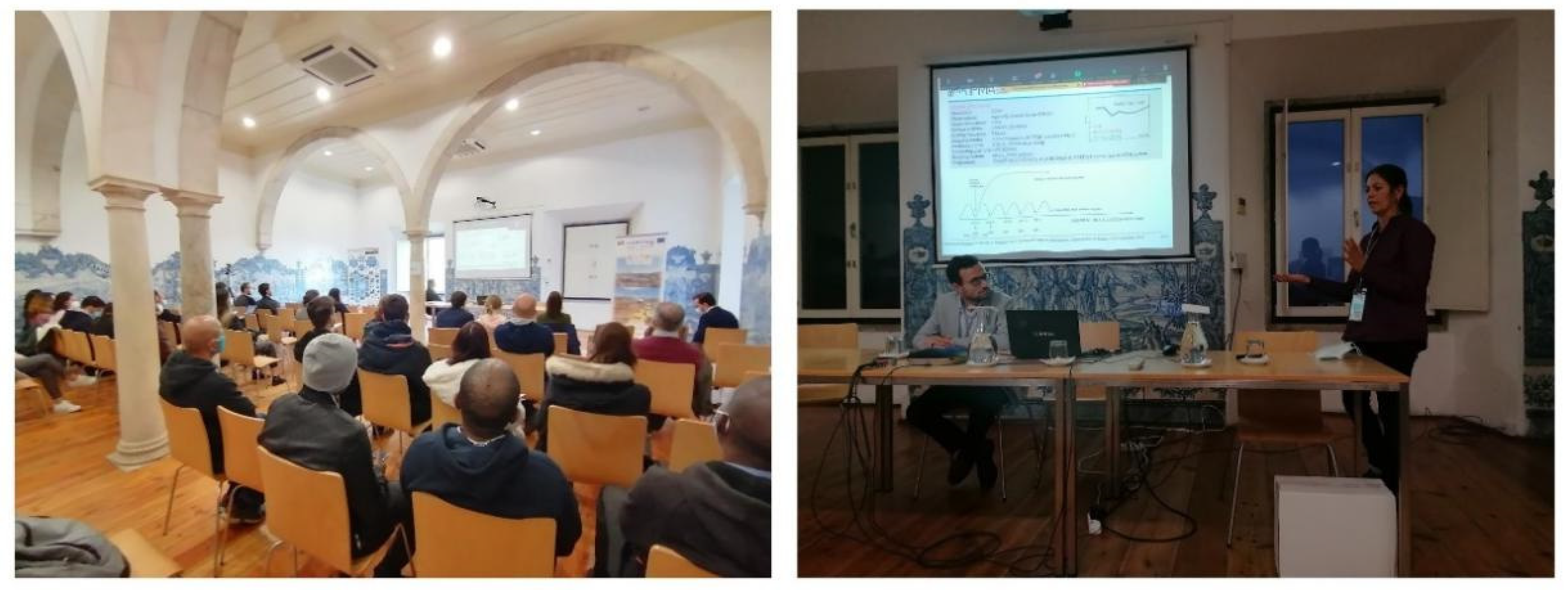
Figure 1). The main objective was to bring together Portuguese teams working on topics related to numerical weather and climate forecasting, seeking to identify the current challenges and possible collaborations regarding the improvement of the representation of the different surfaces and their interactions with the atmosphere. This article aimed to provide the synopsis of ongoing Portuguese science gathered during this workshop as well as highlight the main contributions and conclusions from the workshop.
Surface modelling—which includes processes over land, ocean, inland water, urban areas, ice and snow, together with surface–atmosphere interactions—has been widely recognised as crucial for accurate numerical weather predictions, especially in the lower levels of the atmosphere. Although initially aimed at describing, in a consistent way, the water and energy cycles—at space and time scales which are longer than those of atmospheric motion—it has recently been recognised as having an increased scope for supporting decision making and policies on land-use and water-use management [
1].
The 2021 workshop had a hybrid and bilingual format and included a total of twenty-four communications and eight posters. Four sounding scientists from forefront European organisations and consortia for Earth observation (EO) and modelling were invited to provide key notes on the latest developments and plans in their fields of expertise, namely Clément Albergel (ESA Climate Office); Tânia Casal (ESA-ESTEC); Gianpaolo Balsamo (ECMWF); and Patrick Samuelsson (ACCORD Surface Area Leader). The workshop encompassed five sessions in the following scientific areas: land modelling; surface–atmosphere interaction and modelling; surface observation applications; physiographic effects and wildfire behaviour; and urban effects and air quality. These main aspects will be tackled in the following sections and this article is structured as follows: the Introduction, consisting of the present section; a section per scientific area, from
Section 2,
Section 3,
Section 4,
Section 5 and
Section 6, respectively; the conclusion, which includes some recommendations, in
Section 7; and a list of the abbreviations and acronyms to facilitate reading the article, in the annex. The workshop material is available through the website
https://www.ipma.pt/pt/publicacoes/meteorologia/index.jsp?page=NWP-workshop-2021.xml (accessed on 22 August 2022).
2. Surface–Atmosphere Interaction and Modelling
The physical exchange mechanisms behind surface–atmosphere interactions constitute one of the topics which is receiving more attention among Portuguese researchers at present. These mechanisms differ depending on the surface characteristics, and are directly related to the processes occurring in each physical environment beneath the surface (land, ocean, lake, etc.).
Land–atmosphere energy and water exchanges, for instance, are fundamentally linked to soil moisture. The distribution of the planets’ biomes hinges on the surface–atmosphere coupling since soil moisture and temperature feedbacks have a strong influence on plant transpiration and photosynthesis. Land use/land cover (LUC) changes modify local land surface properties that control the land–atmosphere mass and energy (and momentum) exchanges. The impact of these changes depends on the scale and the nature of land cover modifications and is very difficult to quantify. At present, large inconsistencies in the LUC impacts are observed between numerical models, highlighting the need for adopting a common LUC across the current large variety of models. The Flagship Pilot Study LUCAS (Land Use and Climate Across Scales,
https://ms.hereon.de/cordex_fps_lucas/, [
2], accessed on 22 August 2022) provides a coordinated effort to study LUC using an ensemble of regional climate models (RCMs). Recently, three experiments over the Coordinated Regional Climate Downscaling Experiment for the European domain (EURO-CORDEX,
https://www.euro-cordex.net/, accessed on 22 August 2022) were set up in order to assess the uncertainty in the atmosphere simulation due to different land covers. As a common effort, all experiments used ECMWF Reanalysis Interim (ERA-Interim,
https://www.ecmwf.int/en/forecasts/datasets/reanalysis-datasets/era-interim, [
3], accessed on 22 August 2022) fields. The experiments were run during the period 1985/1986–2015, and considered distinct land covers: the current vegetation (CORINE Land Cover (CLC)
https://land.copernicus.eu/pan-european/corine-land-cover, [
4], accessed on 22 August 2022); grass; and forest. The link between extreme temperatures and soil moisture or evapotranspiration was also analysed, and for this purpose, a new coupling metric for short time scales was proposed—the latent heat flux–temperature coupling magnitude (LETCM, [
5]). As expected, the results reveal that the number, amplitude and spatial distribution of compound extreme heat and drought are highly model-dependent (the impact of afforestation or deforestation is not consistent across the experiment models). Moreover, the employed metrics allowed the detection of events that are extreme for the energy and water cycles (see the presentation by Rita Cardoso).
The surface climate response of an atmospheric NWP model to different schemes of runoff and groundwater was also presented. Experiments were set up to understand how the representation of land surface processes impacts the simulated atmosphere properties, however, in this case, the land cover was maintained and the difference between experiments were laid on the land surface model. The numerical system consisted of the atmospheric Weather Research and Forecasting model (WRF,
https://ncar.ucar.edu/what-we-offer/models/weather-research-and-forecasting-model-wrf, accessed on 22 August 2022) coupled with the ECMWF Reanalysis 5th Generation Description (ERA5,
http://climate.copernicus.eu/products/climate-reanalysis, [
6], accessed on 22 August 2022) and the experiments were conducted during the period 2004–2006 so that the winter and summer seasons for the EURO-CORDEX region could be analysed. The weather parameters of precipitation, 2-metre maximum temperature, and 2-metre minimum temperatures were targeted, as well as the balances of land water and land energy. Generally speaking, it was found that all WRF runs showed an overestimation in precipitation. For the land energy balance, differences between WRF runs were found to be higher in summer than in winter; for the water balance, further analyses should be pursued (see the presentation by Daniela Lima).
EURO-CORDEX is the European branch of the Coordinated Regional Climate Downscaling Experiment initiative (CORDEX,
https://cordex.org/, accessed on 22 August 2022), which aims to produce ensemble climate simulations based on multiple dynamical and empirical-statistical downscaling models imposed by multiple global climate models from the World Climate Research Programme (WCRP) Coupled Model Intercomparison Project—Phase 5 (CMIP5,
https://www.wcrp-climate.org/wgcm-cmip/wgcm-cmip5, accessed on 22 August 2022). This is an example of an initiative which provides the framework for many research branches in an optimised way. For instance, the distribution added value (DAV, [
7,
8]) metric was recently considered to assess the gains or losses of the precipitation, maximum and minimum temperature, taken from the high-resolution (0.11°) EURO-CORDEX Hindcast (1989–2008) and Historical (1971–2005) simulations against their respective lower-resolution counterparts, respectively, ERA-Interim reanalysis and CMIP5 global circulation models (GCMs). To this end, a new observational gridded dataset of 0.1° resolution, covering the entire Iberian Peninsula (Iberia01, [
9]), was used as a reference. The Iberia01 constitutes an unprecedented opportunity in assessing the performance of EURO-CORDEX runs, since both datasets have similar resolutions. The performance of DAV in this experiment showed that most Hindcast models reveal gains (over their lower-resolution counterparts) above 15% for precipitation, while for the extremes, values above 20% were reached. As for the historical models, although most pairs display gains, some do reveal losses, sometimes around −5% or stronger. However, the spatialisation of the DAV is clear in revealing a spread out significant added value for precipitation throughout the domain, particularly on the extremes. On the other hand, the gains for maximum temperature are more relevant in comparison to minimum temperature. For more local scales, areas near the coast always reveal significant added value compared to the interior, which in turn displays detrimental effects of approximately −30%. As for temperature extremes, a similar range is observed. Finally, in an effort to assess the differences between the coast and the interior, as well as the effect of orography, the DAVs metric is also computed at different height levels (see the presentation by João Careto).
A realistic representation of extreme precipitation events is crucial to correctly model the surface water balance and risk assessment of these events to important socio-economic sectors, such as agriculture, forestry, infrastructures and energy production. In mainland Portugal, nearly 58% of hail events reported at weather stations are associated with T2 m <10 °C, and are thus probably related to small hail events that are typically linked to much weaker and less organised convective cells than severe hail, which is also in agreement with previous studies (see the presentation by João Santos). A better understanding of these hailfall events, including their dynamic driving mechanisms, is of utmost relevance to improve numerical weather forecasting and enhance its usefulness as key decision support tools over a wide range of activities.
The ESA—Climate Change Initiative (ESA-CCI,
https://www.esa.int/Applications/Observing_the_Earth/Space_for_our_climate/ESA_s_Climate_Change_Initiative, accessed on 22 August 2022) is another European initiative which provides the framework for the study of many components from the Earth system. It aims to monitor and track climate changes, through a suite of satellite (long) data records of key components of the climate system, known as essential climate variables (ECVs) (
https://climate.esa.int/en/, accessed on 22 August 2022) that track changes across the world’s oceans, atmosphere and land. In fact, satellites observing Earth provide a clear picture of changes across the entire planet. They provide regular, accurate measurements, including of areas that are difficult to reach such as the polar regions. At present, the Climate Change Initiative (CCI) encompasses 23 ECVs that can be split into three main groups, namely ocean (sea surface temperature, sea ice, sea level, sea state, ocean colour and sea surface salinity); terrestrial (fire, lakes glaciers, snow, Greenland ice sheet, land cover, permafrost, soil moisture, land surface temperature, biomass, high resolution and cover and Antarctica ice sheet); and atmospheric (aerosol, cloud, greenhouse gases, ozone and water vapour), several research projects and an open data portal (
https://climate.esa.int/en/odp/#/dashboard, accessed on 22 August 2022). ECVs provide the primary evidence to study climate drivers, interactions and feedback, as well as reservoirs, tipping points and fluxes of energy, water and carbon. The statuses of many current ESA-CCI projects, as well as their achievements, have been reviewed. Additional research projects are being prepared that use multiple ECVs to address complex science questions, including closing the global and regional carbon and sea-level budgets (see the invited presentation by Clément Albergel).
An improved understanding of the present and future marine climatology is necessary as support for numerous activities such as fisheries and tourism along the Atlantic coast and for the operation of offshore structures, the optimisation of ship routes and the evaluation of offshore wave energy resources. Ocean–atmosphere interactions generally refer to the exchange of energy (under the form of exchange of heat, moisture and momentum) and mass (freshwater and gases, the latter may be quite significant, due to the extent of the ocean). The ocean–atmosphere interaction on the observed climate variability, either in the form of fluxes or compensatory dynamical circulations (see [
10] for a short description) is of major importance. The Atlantic coast of Iberia is a target region for many studies as it is rich in surface interaction phenomena (see for instance [
11]). Examples of known interaction phenomena over the Iberian margin are: summer coastal upwelling, which involves a wind-driven flourishment of dense, cooler and usually nutrient-rich water from deep water; and the winter Iberian Poleward Current (IPC), associated with the northward advance of a warm, salty flow of water throughout the upper 400 m layer.
A high-resolution simulation of the Iberian margin is being developed using the Regional Ocean Modeling System (ROMS,
https://www.myroms.org/, accessed on 22 August 2022), spanning the period of 2002–2008 at a resolution of approximately 1.8 km and 60 vertical levels. The numerical system encompasses a two-way coupling of two nested configurations of ROMS, with open boundary conditions. The interannual variability (monthly averages) is provided, respectively, by the two reanalyses of the European Mercator-Ocean Global Ocean Reanalysis and Simulation (GLORYS) project (
https://www.mercator-ocean.eu/en/ocean-science/glorys/, accessed on 22 August 2022), GLORYS2V4 and GLORYS12V1 [
12], which are carried out in the framework the European Copernicus Marine Environment Monitoring Service (CMEMS). The atmospheric forcing stems from the ERA5 atmospheric reanalysis and monthly averages of river discharges of the main Iberian rivers are obtained from simulations with the hydrodynamic model CaMa-Flood (
http://hydro.iis.u-tokyo.ac.jp/~yamadai/cama-flood/, accessed on 22 August 2022) driven by runoff generated by the land surface model Carbon-Hydrology Tiled Scheme for Surface Exchanges over Land (CHTESSEL). A comparison of the model results (sea surface temperature (SST), air temperature, salinity and wind), with satellite and buoy data, have shown that many features based on model state variables are already properly simulated by the numerical system, but some discrepancies have to be investigated (see the presentation by Ana Machado). The sea surface temperature (SST) is one of the diagnostics of the proper representation of the exchange processes in the ocean–atmosphere interface. For instance, SST was one of three identified factors that influence the occurrence of hybrid subtropical cyclones at the northeast latitudes of the Atlantic Ocean, together with the wind shear between the top and bottom troposphere and the lapse rate in the lower half part of the troposphere. An analysis based on Hurricanes Database (HURDAT,
https://www.aoml.noaa.gov/hrd/hurdat/Data_Storm.html, accessed on 22 August 2022) and on ERA5 analysis was performed, leading to the conclusion that the northeast Atlantic region is currently prone to form and maintain hybrid systems, some of which are generated from non-tropical perturbations, and to keep for longer duration tropical characteristic systems, before being transformed into extra-tropical systems (see the presentation by Tiago Oliveira).
Large-scale global wave information was produced using the WAVEWATCH III™ [
13] wave model forced with wind and ice-cover data from the Representative Concentration Pathways (RCP) 8.5 [
14] EC-Earth system integration for two 30-year time slices. EC-Earth (e.g., [
15]) is a seamless Earth system model based on the operational seasonal forecast system of ECMWF that can be used for climate studies and WAVEWATCH III™ (WW3,
https://polar.ncep.noaa.gov/waves/wavewatch/wavewatch.shtml, accessed on 22 August 2022) is a third-generation wave model developed at NOAA/NCEP. The first slice from this experiment covers the period 1980–2009 and represents the present climate (used for validation), while the second covers the period 2070–2099, representing the climate at the end of the 21st century. Simulations were compared to ERA5 analysis and descriptive empirical statistics (mean and 95th percentile, the latter for extreme events) of wind (magnitude and direction) and wave parameters (significant wave, height of total sea, mean wave period, peak period, mean wave direction and energy), for the North Atlantic region, were performed to evaluate how the wave climate is expected to change at the end of the 21st century. The results analysis leads to the observation that a few discrepancies remain between ERA 5 and WW3 simulations as well as to some clues on future wave climate, particularly on a generalised decrease in the mean wave energy, except in some regions, but an increase in energy extremes, most probably associated with an expected higher frequency of extreme weather events (see the detailed conclusions at the presentation by Mariana Bernardino).
Lake–atmosphere interactions are also characterised by the exchanges of energy (momentum, heat) and mass (see for instance [
16]) and therefore affect the patterns of the atmospheric circulation and the regional climate. A such, an effort has been made in recent years to understand these interactions and improve the coupling of lake models with weather prediction and climate models.
In order to assess the impact on the largest artificial lake in Europe—the Alqueva Lake—one typical meteorological year (TMY) of Meso-NH simulations was performed over a region with 1.25 km of horizontal resolution, using the operational analysis from IFS/ECMWF as initial and lateral boundary conditions. This artificial time period is meant to represent the typical meteorological conditions in the region and the model results are used to assess the changes in the local climate. Therefore, two sets of experiments were used with and without the initialisation and activation of the FLake model (
http://www.flake.igb-berlin.de/, accessed on 22 August 2022). The results show a decrease in air temperature during daytime (10–9 °C) and night time increase (up to 10 °C) due to the presence of the Alqueva Lake [
17]. In the nearest towns, the daily maximum temperature decreases and daily minimum temperature increases, which refers to milder weather conditions. Alqueva mainly showed a suppression in fog formation in the nearby area as well as the presence of lake/land breeze (see the presentation by Maksim Iakunin).
3. Land Modelling
Advances in land modelling are currently being pursued through projects combining the expertise of international state-of-the-art numerical modelling groups and their focus relies on very specific and complex approaches, which demand a large a priori investment. Within those projects, the developments are decentralised with benefit to all partners, which usually requires a straight connection to a particular modelling community. Being a challenging topic, it collected just a few communications in this workshop, at the national level.
Examples of community surface numerical modelling systems (or platforms) in Europe include the ECMWF Land Surface Modelling System (ECLand; [
18]), the externalised surface model Surface Externalisée (SURFEX;
http://www.umr-cnrm.fr/surfex/, accessed on 22 August 2022) developed by Météo-France with the collaboration of the scientific community; and the Terrestrial Systems Modelling Platform (TSMP,
https://www.terrsysmp.org, accessed on 22 August 2022).
ECLand is a scalable modular land-surface modelling system whose code governance is led by ECMWF to assure a distributed source code architecture (with github repository and git-tools version management), which summarises the ongoing modelling efforts to support the next generation of NWP forecasting and the climate/environment reanalysis of Copernicus (
https://www.copernicus.eu/en, accessed on 22 August 2022) and DestinE (
https://digital-strategy.ec.europa.eu/en/policies/destination-earth, accessed on 22 August 2022). DestinE—is an initiative of the European Commission’s Digital Europe programme which aims to monitor the impact of severe weather and climate change, biodiversity and deforestation over the different planet regions and support the management of risks of environmental extremes, complementing existing national and European efforts such as those provided by the national meteorological services and the Copernicus Services. It will support the European Commission’s Digital Strategy and the green deal priority actions on climate change. The complex Earth system software and hardware environment needed for the next generation of very-high-resolution prediction models is being built by ECMWF in coordination with EUMETSAT and ESA. The land-surface developments of the ECMWF are based on CHTESSEL and form an integral part of the integrated forecasting system (IFS), supporting a wide range of global weather, climate and environmental applications. The recently developed modular extensions are (see the invited presentation by Gianpaolo Balsamo): (i) vegetation; (ii) snow; (iii) soil; (iv) open water/lake; (v) river/inundation; and (vi) urban areas. Coupled modelling and data assimilation activities over land encompass: coupled land–atmosphere modelling and the assimilation at ECMWF for operational NWP and future generations of reanalyses (NWP, Copernicus Services, and high-resolution Destination Earth); consistent observation monitoring across the components is ongoing to support land data assimilation systems (LDASs). The next steps will include a more uniform ECMWF land DA system and enhanced exploitation of land observations. Challenges of the Earth system approach for NWP are: the observations’ availability, sustainability (e.g., snow, ocean); the coupling through the observation operator (e.g., for snow surfaces); and opportunities to enhance the exploitation of satellite data. Perspectives of further developments are: model refactoring and calibration to improve the hydrological performance; improving the water cycle, with particular attention to evaporation processes, transition seasons, and hydrological forecast skill; better exploitation of very-high-resolution (e.g., SENTINEL 1-2-3) observational datasets, in particular skin temperature over land; among other developments.
Generally speaking and as indicated by [
18], the developments in surface modelling platforms are evaluated separately with long-range, atmosphere-forced surface offline simulations and coupled land–atmosphere–ocean experiments. At present, local efforts are focused on a study to understand the actual limitations in the representation of land cover and vegetation seasonality in the ECMWF model and to deploy current EOs to improve the realism of land cover (from the ESA-CCI) and leaf area index (LAI, from the Copernicus Global Land Service). Additionally, clumping parametrisation is being tested to introduce some seasonality to the low vegetation coverage. To estimate the model errors, the land surface temperature (LST) from the Land Surface Analysis Satellite Application Facility (LSA-SAF) is used as a reference (see the presentation by Emanuel Dutra). The improvement in the representation of these slowly varying surface components may lead to an increase in the actual model predictability.
SURFEX is a platform of surface schemes that aim to simulate the processes over four layers of surface physical means (land, sea, urban, lake) called tiles, and to provide the surface fluxes of heat, moisture and carbon. The land tile can be further subdivided into a number of patches representing different vegetation types. It is being used for research and operations by the twenty-six ACCORD countries, either under offline or online mode. The processes described in SURFEX are: (i) snow (a D95 bulk 1-layer snow; 12-layer explicit snow; and Crocus multi-layer); (ii) soil and vegetation (3-layer scheme of interactions—soil–biosphere–atmosphere (ISBA) force restore; 14-layer diffusion soil; explicit canopy on the multi-energy balance (MEB); vegetation growth and photosynthesis (A-gs) prognostic vegetation); (iii) lake and rivers (FLake model; proxy based on deep soil); (iv) orography (orographic drag; orography radiation); (v) urban (town energy balance (TEB); a rocky surface); (vi) surface layer (Monin–Obukhov; multi-layer prognostic; roughness sublayer); (vii) sea (SST from the boundary with a few flux options; GELATO [
19] and SICE [
20] models; and the ocean–atmospheric–sea–ice–soil coupler (OASIS) coupler to 3D ocean models and wave models). In contrast to atmospheric processes, land processes require input from databases representing the characteristics of the surface; therefore, SURFEX recognises different databases for topography, land cover (ECOCLIMAP, [
21,
22]), soil texture and lake depth, at different horizontal resolutions. Operationally, SURFEX databases are based on ECOCLIMAP, first (1 km) and second (ESA-CCI land cover 300 m) generations. SURFEX includes all three generations of physics or combinations thereof to know: the first generation which considers an aerodynamic pathway in the lower atmosphere; the second generation, with the explicit canopy; and the third generation, which includes carbon cycling. SURFEX can be forced by, e.g., observations from a micrometeorological tower, by lowest model data from AROME, or from surface analysis products such as ERA5-Land. SURFEX can also be used on an LDAS, either by a simple optimal interpolation (OI) process (using the SODA scheme, for instance), which is in use for operation and allows the assimilation of in situ 2-metre temperature and relative humidity observations (see
Section 4); or through more sophisticated analysis algorithms such as the extended Kalman filter (EKF) and ensemble Kalman filter (EnKF) to assimilate satellite products and radiances to assimilate, e.g., LAI, surface temperature and soil moisture (or radiances which depend on these), which are under development (see the invited presentation by Patrick Samuelsson).
The Meso-NH research model is a state-of-the-art non-hydrostatic mesoscale atmospheric model developed by the Laboratoire d’Aérologie and by the Centre National De Recherches Météorologiques (CNRM)/Météo-France which deals with scales ranging from large (synoptic) to small (large eddy) scales [
23]. It has a complete set of physical parameterisations, which are particularly advanced for the representation of clouds and precipitation, being vectorised, parallelised, operating in 1D, 2D or 3D designed to handle real situations as well as academic cases, and is coupled with a chemistry module and a lightning module, and a forest fire propagation model (FOREFIRE). The Meso-NH research model also has observation operators that directly compare the model output with satellite observations, radar, lidar and GPS. This atmospheric model has an online coupling to the SURFEX platform of surface models for the representation of surface–atmosphere interactions [
24], and this surface modelling platform is shared with the operational AROME model (running at IPMA). In addition to sharing the surface modelling platform, Meso-NH also shares some of its physical parameterisations with AROME, providing an optimal framework for testing the future improvements of IPMA’s operational numerical system. Additionally, the Meso-NH radiative scheme (EcRAD) is shared with IFS/ECMWF. Meso-NH is the numerical basis tool for several developments and research which are being performed at Évora University; as such, the developments and achievements were mentioned during Rui Salgado presentation. Namely, the lake modelling [
25,
26], a long project on the impact of freshwater reservoirs (Alqueva) on weather and climate, in the Iberian thermal low and summer circulations in the south of Portugal, boundary layer characterisation, fog development (e.g., [
27]), urban heat island, coastal dynamics and erosion, orographic and high precipitation events [
28,
29], aerosol (dust) transport (e.g., [
30]), atmospheric electricity and fire weather [
31].
A recent study on Meso-NH performance of solar radiation simulations has taken place, for instance, leading to the development of an artificial neural network (ANN), an artificial intelligence (AI) methodology, in order to improve its solar radiation output fields [
32]. An accurate solar resource assessment is essential for applications related to the solar resource and, ultimately, for the planning and design of photovoltaic energy systems. This study lead to the conclusion that the Meso-NH model seems to overestimate solar radiation probably due to poor cloud simulation and the use of monthly mean aerosol climatologies and that global horizontal irradiation (GHI) is better simulated by the Meso-NH model than direct normal irradiation (DNI), and therefore the ANN corrective algorithm not only improves the simulations of solar radiation for the station of Évora-Verney but also for the surrounding region (see the presentation by Sara Pereira).
The Terrestrial Systems Modelling Platform (TSMP) features the Consortium for Small-Scale Modelling (COSMO) atmospheric model, the community land model (CLM), and the hydrologic model ParFlow [
33], and is linked through the ocean–atmosphere–sea–ice–soil coupler interfaces with the Model Coupling Toolkit (OASIS3-MCT) coupler which is another example of a community surface modelling system. The system primarily used for research on the water cycle, considers a physically based representation of the transport processes of mass, energy and momentum across scales down to sub-km resolutions and the explicit feedback between compartments. Coupled with the ECMWF forecast model, it is now under operational mode at Deutscher Wetterdienst (DWD, German weather forecasting service) over a pan-European region at a 12.5 km horizontal resolution and over a small geographical area over Germany at hectometric scales (see the presentation by Maksim Iakunin).
4. Surface Observations Applications
The availability of accurate observations (in situ and remote, either passive or active) in the lower troposphere at the target spatial density and frequency is crucial to improving surface models and knowledge of the surface–atmosphere interactions. Observations can be directly assimilated to prevent model forecast drift (due to system biases and/or nonlinear processes), provide diagnostics to guide model development, contribute to the assessment of the model forecasts’ quality and are also a primary ingredient for performing a reanalysis (RE).
Satellite observations provide support for decision makers (e.g., the Intergovernmental Panel on Climate Change (IPCC), the Joint Research Centre (JRC), etc.), and are useful for operational monitoring. At present, a large number of new satellite sensors and products are being planned or have been released which allow the performance of better diagnostics on surface model biases. According to its goals, satellite missions are attributed to different organisms: EUMETSAT (meteorology), Copernicus and ESA. The European Space Research and Technology Centre from the European Space Agency (ESA-ESTEC) is one example of a centre responsible for the satellite launching missions of ESA (see the invited presentation by Tânia Casal). ESA’s programmes are designed to study the Earth and its immediate space environment, our solar system and the universe. Hence, to date, ESA has maintained fifteen satellite missions in operation and thirty-nine under development. Satellite platforms provide Earth observations from space and are required to explore their possibilities, prove concepts, develop interpretations, develop calibrations, simulate data products and validate results; however, field campaigns usually involve different means such as ground-, tower-, airborne-, helicopter-, shipborne-, and drones-based observation platforms. Examples of campaigns are CryoVEx, targeting the sea and land ice coverage of Greenland; the SMOSice over the Norwegian archipelago, associated with Soil Moisture and Ocean Salinity (SMOS) satellite mission; AfriSCAT, associated with the BIOMASS satellite mission; and finally, the Antarctic24 Campaign, associated with the PolarGAP 2015/2016 satellite mission(s). An important piece of information, however, is that most ESA campaign data are available through the gateway
https://earth.esa.int/eogateway/ (accessed on 22 August 2022).
The combination of satellite observations with other in situ or remotely sensed observations or with NWP products provides new means for diagnostics of the surface and atmospheric conditions. For instance, the Frequent Rainfall Observations on GridS (FROGS) is composed of gridded daily-precipitation products on a common 1° × 1° grid to facilitate intercomparison and assessment exercises. The database includes satellite, ground-based and reanalysis products. However, one of the WCRP Grand Challenges is to evaluate whether existing observations are enough to underpin the assessment of weather and climate extremes (
https://www.wcrp-climate.org/gc-extreme-events, accessed on 22 August 2022) and recently, the results obtained when examining extreme weather associated with atmospheric rivers (ARs) for two different globe regions (California, USA, and Portugal) have shown that the precipitation products based on satellite data, individually or combined with other products, perform worse in terms of capturing daily precipitation totals over land (see the presentation by Alexandre Ramos). There is an overall underestimation of precipitation by the different products. For the ARs making landfall over Portugal, the multi-product ensembles reveal mean absolute percentage errors between −25% and −60%. For the western USA case, the range is from −60% to −100%.
The Satellite Application Facility on Land Surface Analysis (LSA-SAF), which is part of the ground segment of EUMETSAT and is based at IPMA, provides a portfolio of satellite-derived land surface products at variables related to the surface energy balance and vegetation state. Space agencies divide their ground segment work by member states and IPMA is responsible for what concerns the application development based on the remote sensing of the land surface, either as an LSA-SAF leader (production; distribution; product developer) or as a product developer of Copernicus Global Land Service (CGLS,
https://land.copernicus.eu/global/, accessed on 22 August 2022), of ESA-CCI (
https://climate.esa.int/en/projects/land-surface-temperature/, accessed on 22 August 2022) and Copernicus Atmosphere Monitoring Service (CAMS;
https://atmosphere.copernicus.eu/, accessed on 22 August 2022).
Several products are available from the LSA-SAF (
https://landsaf.ipma.pt/en/, accessed on 22 August 2022), in particular, those concerning the LST (see the presentation by João Martins). Land surface temperature is the radiative skin temperature of the land surface which corresponds to the thermal emission from the top thin layer of a few micrometres on the surface (up to 50 μm). Satellite sensors can measure this “skin” temperature by measuring the infrared radiance emitted by the surface. LSA-SAF LST products can be enumerated as LSA-SAF LST (clear-sky) retrieval, which is generated on an operational basis with 15 min frequency from 2004 onwards; LST from the advanced very high-resolution radiometer (AVHRR) on MetOp (polar orbiter—global, twice daily); LST from Spinning Enhanced Visible Infra-Red Imager (SEVIRI) on the Indian Ocean Data Coverage (IODC) mission; all-sky LST from SEVIRI on Meteosat Second Generation (MSG); and a new layer on the nominal near-real-time (NRT) LST product correcting for directional effects. At the same time, the number of applications for the LSA-SAF products is increasing, in order to monitor climate extremes; drought; post-wildfire vegetation recovery; urban heat islands; the land cover and land usage; etc.
Land surface temperature (LST) is acknowledged as an essential climate variable, namely because of its relevance for the description and understanding of surface processes. The temperature of the interface between the soil and the atmosphere is a crucial element of the surface energy balance (determining radiation loss, for instance). As such, satellite-derived LST is being increasingly used in various applications related to the assessment of land surface conditions and surface schemes in numerical weather prediction models, in the estimation of evapotranspiration and in the monitoring of plant water stress or drought extent. The Landsat Program is a series of EO satellite missions jointly managed by the National Aeronautics and Space Administration (NASA) and the U.S. Geological Survey (USGS). The Landsat series of satellites have the potential to provide LST estimates at a high spatial resolution that are particularly appropriate for local and small-scale studies. A methodology for deriving LST from the Landsat series of satellites (i.e., Landsat 4, 5, 7 and 8) was developed and is fully implemented in Google Earth Engine (GEE, [
34]). A code repository with all the GEE scripts necessary to compute LSTs from Landsat data is available (
https://code.earthengine.google.com/?accept_repo=users/sofiaermida/landsat_smw_lst, accessed on 22 August 2022) and its repository allows users to perform any data analysis within GEE without the need to store data locally. The LST is computed using the Statistical Mono-Window (SMW) algorithm developed by the Climate Monitoring Satellite Application Facility (CM-SAF). In addition to Landsat data, the LST production code makes use of two other datasets available within GEE: atmospheric data from reanalyses of NCEP and the National Center for Atmospheric Research (NCAR) and surface emissivity from the Advanced Spaceborne Thermal Emission and Reflection Radiometer Global Emissivity Database (ASTER GED) developed by NASA Jet Propulsion Laboratory (JPL) (see the presentation by Sofia Ermida). This kind of cloud tools allows for cross-cutting studies, since many other datasets are available through GEE, including satellite and reanalysis data, thus avoiding the inconvenience of huge data transfers and the need for a big computational infrastructure to process them.
Conventional observations are also important. In fact, the World Meteorological Organization (WMO) Statement of Guidance (SoG) for High-Resolution Numerical Weather Prediction [
35] and, more recently, the short-range NWP SoG issued for the EUMETNET Composite Observation System (EUCOS) region (
http://www.eumetnet.eu/wp-content/uploads/2020/08/EMN_StatementofGuidance_EUCOSregion_ShortRangeNWP.pdf, accessed on 22 August 2022), recommended that the planning of future conventional networks should focus on the boundary layer where the NWP vertical resolution is the highest and the surface conditions have a high impact. In particular, the density and frequency of observations available from the Mediterranean Sea should be expanded. One of the widely known NWP applications of the observations is data assimilation (DA). DA systems aim to combine modelling and observation techniques to provide more realistic products (diagnostic and prognostic). Reanalysis uses DA methodologies to provide the best possible picture of past weather and climate that current science and technology can produce, which has a wide range of applications. These techniques are currently in use by several international programmes such as NASA, ECMWF and ESA.
As suggested by an example of an operational surface DA system, based on the Application of Research to Operations at Mesoscale (AROME) model [
36], conventional observations of surface Iberian networks still have the potential to improve local high-resolution forecasts and OI appears as a cheap method of achieving this. The surface DA scheme of AROME developed for operational use follows the ideas of [
37] to refresh the soil and deep soil temperature and moisture, taking advantage of the dense near-surface in situ observations of 2-metre temperature and relative humidity which are regionally shared in NRT. This uses the optimal interpolation algorithm and the ISBA scheme from SURFEX to produce realistic heat and moisture surface fluxes required for the initialisation of the lower atmospheric conditions of AROME. This DA cycling is being used operationally to produce the background fields for an hourly surface analysis over the Iberian Peninsula of screen-level parameters (2-metre temperature, 2-metre relative humidity and 10-metre wind) (see the presentation by Maria Monteiro).
Reanalysis can produce a complete and consistent time series of surface and atmospheric conditions, which can be global or regional. For instance, ECMWF used this capacity to produce ERA5-Land [
38], a global reanalysis with relatively high resolution (~9 km) with data every hour, available since 1981, and the Copernicus Climate Change Service set up the Copernicus European Regional Reanalysis (CERRA), which provides a 5.5 km horizontal resolution surface reanalysis (1961–2019) for Europe. The NASA Global Modeling and Assimilation Office (GMAO) reanalysis MERRA-2 (1979–2016) is another example of a global reanalysis system which used the three-dimensional variational DA method to provide simulated pictures of atmospheric states. The MERRA-2 is the first long-term global reanalysis to assimilate the space-based observations of aerosols and represent their interactions with other physical processes in the climate system (
https://gmao.gsfc.nasa.gov/reanalysis/, accessed on 22 August 2022).
Reanalysis streams are independent and continuous production segments of an RE system of past decades that run in parallel to save time. The use of parallel streams to compute past decades of reanalyses projects is a standard practice followed by all major NWP centres that produce reanalyses and a recent study over the reanalysis streams overlap of the same system of this system (see the presentation by David Carvalho) provided a set of conclusions between the DA systems and the observations: parallel reanalysis streams show significant differences in their overlapping periods if carefully looked at (standard deviations and not just the means); the differences primarily arise due to different initial conditions, the signature of which is still present after one year of DA cycling. This gives an indication that the divergence tendency caused by atmospheric chaos is strong and not sufficiently contained by the DA cycling. Additionally, the overlapping stream convergence is highly dependent on the number and quality of the assimilated observations: the more/better observations, the higher the DA constraint and consequent streams convergence. Other relevant conclusions are that year-long spin-up periods are generally not necessary since the maximum convergence is usually obtained in shorter periods (2–3 months), except for some land variables. Finally, the overlapping stream differences are tied to the NWP-DA internal mechanisms and are not random or noisy.
5. Physiographic Effects and Wildfire Behaviour
As we will see in this section, many atmospheric phenomena are triggered or conditioned by the surface conditions (land, ocean, inland water, urban areas, ice and snow), particularly in the planetary boundary layer (PBL) where the interaction between these distinct physical means occurs.
Over the sea, for instance, a wind drop-off (an abrupt weakening of the wind speed) in coastal upwelling regions can be shaped by the combination of coastal orography, coastline orientation and the direct interaction of the sea surface temperature (SST) with the atmosphere (wind). High-resolution simulations over the Canary and Madeira Archipelagos of a two-way coupled ocean–atmosphere system, with the ROMS and the WRF models, together with satellite data, revealed the mechanism which drives the wind drop-off (see the presentation by José Alves). In regions where orography values are high, the percentage of wind drop-off increases; furthermore, the presence of an intense SST front can affect the coastal wind vertical structure. In this way, it was possible to see that, near these Atlantic islands, the atmospheric flow is essentially controlled by orography, which gives origin to the frequently observed intense jets (tip-jets) near its flanks, which contrast with the weak winds usually observed on the island’s wakes, and the progressive prevalence of the SST–wind coupling effect with an increasing distance from the coast.
The application of atmospheric models in the study of extreme weather phenomena and the importance of surface–atmosphere interactions was presented. The important role played by atmospheric circulation transporting large amounts of dust from the Sahara Desert to Portugal in February 2017 was evidenced by simulations including dust emission and transport. On the other hand, the spatial distribution of simulated CG lightning using the Meso-NH electrical scheme (CELLS) with a good agreement with the lightning strokes obtained from the national lightning detection network showed a possible application of the Meso-NH electrical scheme, namely the study of forest fire ignition by lightning strokes (see the presentation by Rui Salgado).
Orographic effects over the north-easterly atmospheric flow towards Madeira island under the stationary Azores Anticyclone were found to be a common feature during three analysed wildfire events (summer seasons of 2010, 2012 and 2016), making the southern part of the island prone to wildfire events, due to the intensification weather patterns related to high daytime (and sometimes overnight) temperatures, low humidity, and strong wind gusts that favour fire growth [
39] (see the presentation by Flavio Couto). A similar mesoscale non-hydrostatic (Meso-NH,
http://mesonh.aero.obs-mip.fr/mesonh51, accessed on 22 August 2022) model experiment setup over Portugal Mainland, was used to analyse the weather conditions during the occurrence of a wildfire in Vila de Rei, in 2019. The strong surface winds during the afternoon were the main factor behind the extensive burned area in a few hours (see the presentation by Carolina da Purificação). The conclusions obtained by the two last studies were achieved by performing atmospheric flow simulations with the atmospheric Meso-NH model such that the interactions between the fires and the atmosphere were not taken into account in the experiments. In the first case, the model was integrated over an Atlantic geographical location covering the Madeira archipelago, whereas in the second case, the domain covered the Portugal mainland.
6. Urban Effects and Air Quality
Very localised phenomena with significant impacts on human lives are driven by lower atmosphere and surface conditions. Temperature stress and air quality are two factors which affect the comfort of daily human lives and therefore these topics receive much attention from scientists. Different tools such as numerical models (e.g., of urban canopy or air quality), analysis of long observational time series, or the application of statistical methods in artificial intelligence, usually constrained by meteorological simulations, are used to highlight, reproduce and investigate different aspects of urban effects and air quality.
The urban heat islands (UHIs) effect occurs when an urban area is warmer than its surroundings due to human activity. Usually, it is computed as the difference in temperature of the rural surrounding region relative to the urban core region and different methods can be applied to the identification of the UHI.
A study performed over three big cities, Paris, Madrid and Milan, evaluated the time variability of UHI as well as how the rural land cover affects the heat island intensity using LST as a diagnostic parameter. The analysis over a long LST time series (2004–2020) confirmed the independent diurnal and seasonal variabilities of UHI from city to city due to their different climates (e.g., due to local water availability and solar radiation incidence). Additionally, within each city, it was possible to verify the UHI variability depending on the type of rural land cover considered, which changes when a long time series is analysed due to the evolution of the local land cover. These results stress the importance of the availability of an adequate observational temporal resolution, due to the observed diurnal cycle of UHI. Future land use and land cover changes may affect the UHI intensity by changing the surface temperature in rural areas (see the presentation by Alexandra Hurduc).
The 2003 Lisbon heatwave (HW) was the case study used to assess the performance of two urban canopy models (UCMs) under the WRF framework, the single-layer urban canopy model (SLUCM) and building effect parameterisation (BEP). Two UHI identification methods based on 2-metre temperature were also used: the so-called classical method, which accounts for geographical and urban canopy effects and the so-called local method, accounts which only for urban canopy effects. Two main differences were found in the UHI intensity and spatial distribution between the identification methods: a reduction by half in the UHI intensity during night time (local method); and a dipole spatial pattern in both daytime and night time (classic method). These results highlight the importance of using the local method in UHI modelling studies to fully isolate urban canopy and regional geographic contributions to the UHI intensity and spatial distribution identification. Moreover, the surface temperature seems better simulated when coupling WRF with the UCMs, particularly when using the SLUCM (see the presentation by Rui Silva).
Although the use of artificial intelligence in Earth and Climate sciences is still at its initial steps, many studies have already proven the convenience of exploiting these techniques to supersede or complement process-driven numerical models. Examples of the use of AI in Earth scientific problems are pattern recognition in geospatial observations, climate data clustering, automated remote-sensing data analysis, and time series prediction (a review of Earth AI is available in [
40]). According to [
41], the key methodological advantage of using machine learning (ML), a subgroup of AI methods, in comparison to covariance-based spatial statistics in Earth science analysis, lies in the possibility of mapping nonlinear processes.
As a consequence of the rapid development of hardware and software and the availability of new large dimensions and types of datasets (such as satellite-based and crowdsource), AI is growing in importance in many aspects of meteorology, especially for improving the skill and efficiency of numerical weather forecasting. In addition to the example on the improvement of radiance values estimates already provided in
Section 3 of this article, another example was illustrated with the use of ML. In fact, efforts are also being developed to provide the Lisbon municipality with an ML tool that may help in the monitoring, management and mitigation of uncomfortable environmental conditions for citizens, such as heatwaves. The tool, which should be easily maintained and does not require high operational expertise (unlike process-driven models), aims to: (i) adjust the summer near-surface air temperature forecasts from IPMA’s operational AROME model to observational data coming from NETATMO Public Weather Stations (PWS) (see
https://weathermap.netatmo.com/, accessed on 22 August 2022) (i.e., reducing its mean absolute error (MAE)); and (ii) downscale the spatial level of detail, from a 2.5 × 2.5 km pixel size (AROME) up to a 250 × 250 m grid (ML grid). In this study, such a machine learning empirical approach is developed, providing a straightforward tool for the local authorities to (i) identify the short-term critical areas of the Greater Lisbon area; (ii) prioritise public health measures, especially during HW events; and (iii) test the efficiency of land use/land cover (LUC)-related acclimatisation measures. Three alternative ML algorithms were tested, and their results compared—a linear mixed-effects model (LMM), a random forest (RF) and a neural network approach (NN). Results from both ML models are shown to accurately predict T2m at the local scale, with a mean absolute error (MAE) reduced from the original 2.0 °C (AROME forecasts versus in situ observations) up to 0.5 °C (RF model) (see the presentation by Ana Oliveira).
Aiming to deliver timely information on forecast pollution levels to the population, in areas of significant public exposure, the deployment of an air quality forecasting system is taking place these days. This consists of the offline coupling of two process-driven models, the multi-scale chemistry-transport model CHIMERE with the atmospheric forcing of the WRF model, fed with chemical boundary conditions and primary pollutant emissions. CHIMERE (
https://www.lmd.polytechnique.fr/chimere/, accessed on 22 August 2022) is an open-source multi-scale chemistry-transport model designed to produce (i) accurate analysis of pollution episodes; (ii) daily forecasts of ozone, aerosols and other pollutants; (iii) long-term simulations (entire seasons or years) for emission control scenarios. The system daily forecasts of an air quality index and on the concentrations for specific pollutants (such as those of particulate matter (PM10, dust), PM2.5, nitrogen dioxide (NO
2), ozone (O
3), sulphur dioxide (SO
2)) is available from the site
http://previsao-qar.web.ua.pt (accessed on 22 August 2022). It was possible to verify that the concentrations of these particulate matter and pollutants vary according to the location, the season (for instance, long lasting PM10 episodes are associated with very cold and dry periods during winter), associated with regional atmospheric phenomena (for instance, sea-breeze circulation promotes the transport of polluted air masses from the coast to inland), along the diurnal cycle, etc. (see the presentation by Carla Gama).
7. Conclusions
With the aim of building synergies at the national level, the second edition of the workshop on numerical weather prediction in Portugal was promoted by IPMA in cooperation with several Portuguese universities. The event was hosted by the University of Évora, during the period 11–12 of November 2021. It was dedicated to surface–atmosphere interactions and allowed the exchange of experiences between experts, students and newcomers.
The 2021 workshop on numerical weather prediction in Portugal provided a refreshed inventory of ongoing research and development topics in Portugal, on surface–atmosphere interactions modelling and its applications. Additionally, it allowed us to revisit some of the concepts associated with this area of the atmospheric sciences as well as to elaborate on a list of means and tools for its study which is provided in this summary. The identification of gaps in certain research topics became evident, which will hopefully motivate new projects broadly involving the Portuguese national NWP community. In particular, projects should comply with the Sustainable Development Goals (SDG) from the United Nations (UN), such as “Climate Action”, “Affordable and Clean Energy”, “Zero Hunger”, “Good Health and Well-Being”, “Life on Land” and “Life Below Water”, especially given the vulnerability of the overall Mediterranean region to climate change. More and better validated modelling data are crucial for understanding the expected changes and providing guidance to the decision-making of stakeholders in order to mitigate the impacts of land use/land cover change, higher chances of droughts, heatwaves, extreme events and forest fires, etc. in human activities and well-being.
In Portugal, many R&D efforts in numerical modelling are devoted to surface–atmosphere interactions and most of the work is associated with International/European initiatives such as EURO-CORDEX, CMIP5/6, ESA-CCI, which provide the framework for many studies aiming to understand the surface–atmosphere exchange mechanisms and review current modelling methodologies. Observational databases (mapped or not), such as Landsat, Iberia01, EMODNET and HURDAT; other satellite (derived) products such as those available from the LSA-SAF, etc.; and reanalysis products from ERA5 (atmosphere, land and ocean), ERA-Interim (atmosphere, land and ocean), CERRA (atmosphere, land), MERRA-2 (atmosphere, land and ocean), GLORYS (ocean) projects are essential to guide the surface model development. Reference community land modelling systems provide a platform for new developments and applications: ECLand (ECMWF), SURFEX (Météo-France) and TSMP (COSMO) and its intercomparison is essential to assess the uncertainty of estimating surface–atmosphere fluxes and to highlight meaningful differences in the state variables used in the parameterisation schemes. In local research work, many types of numerical process-driven models, which are components of an ESM, are at play: EC-Earth, as an Earth (global) system model; AROME, Meso-NH and WRF, as examples of regional atmospheric models; and ROMS, as an ocean model. Further schemes of surface modelling platforms providing tools for developments and studies have been mentioned: CHTESSEL (land), FLake (lake) and CaMa-Flood (drivers discharge model). Downstream of a numerical system, impact models have also been referred to: ParFow (hydrologic) and CHIMERE (air pollutants-transport). Surface data assimilation is another topic which receives local teams’ attention, and a few schemes are being deployed and studied, or available for this purpose: optimal interpolation for the assimilation of conventional data, and more sophisticated extended Kalman filters or ensemble Kalman filters for the assimilation of satellite data. From this local emerging science, new metrics such as LETCM, DAV and new software such as GEE have been recent achievements from the Portuguese teams. Machine learning techniques are currently under study, by combining observational data with the numerical process-driven models to add value to the models outputs in a post-processing step.
The surface–atmospheric interactions can be categorised into: (i) land–atmosphere; (ii) ocean–atmosphere; (iii) inland waters–atmosphere; (iv) urban–atmosphere; (v) ice–atmosphere; and (vi) snow–atmosphere, taking into account the physical means underneath Earth’s surface. The determination of surface–atmosphere fluxes is a form of diagnosis of the coupled processes and surface temperature (ST) can have an important role here. Several illustrations of land–atmosphere interactions and their impacts have been tackled during the workshop, the orography and SST–wind coupling and the wind channelling under wildfires context are such examples, however, the need to find the adequate representation of the land use/land cover in numerical models was also discussed. Ocean–atmosphere interaction examples (and their applications) have been widely illustrated by the Portuguese teams, obviously due to the close geographical location of Portuguese territories to marine environments, such as the upwelling along the Atlantic coast of Iberia, the Iberian Poleward Current, the wave energy on a future climate scenario, and the feed of tropical cyclones in the northeast Atlantic regions. The study of lake–atmosphere interaction is also important in Portugal due to the existence of the largest artificial lake in Europe, Alqueva, and its impact was therefore illustrated during the meeting. Finally, the urban–atmosphere interaction was another feature of the surface–atmosphere system that was analysed during the meeting and is the object of several ongoing research projects in the context of climate change.
Model developments and improvements are many times motivated by the emergence of new observational capabilities, many of which come from pivotal satellite missions. For instance, the Aeolus mission, operated by ESA, is the first spaceborne Doppler wind Lidar (DWL) and provides global horizontal line-of-sight wind observations since it has been operational, and represents a statistically significant improvement in short-range forecasts, especially in the upper-level winds [
42]. The Copernicus Sentinel missions have enabled many improvements of this kind, including higher resolution and better-quality surface physiographic fields. EUMETSAT is also launching its third-generation satellites (the first platforms will be launched by the end of 2022), the MTG and EPS-SG missions, both of which provide observations with unprecedented temporal, spatial and spectral resolutions, including geostationary infrared sounding capability and lightning detection, better fire radiative power products, better cloud microphysics, among many others. Other satellite agencies and national weather services such as NASA, NOAA, the China Meteorological Agency (CMA) or the Japan Meteorological Agency (JMA) are making similar efforts and providing observations that complement those obtained by European agencies. These new observations will challenge the modelling community, not only by providing better physical constraints, but also due to the huge volumes of data for assimilation.
Leading to an integrated modelling and data sharing over Europe, the DestinE initiative puts in place the suggestion of a new approach to climate model development by [
43], based on the verification that “global storm and ocean-eddy resolving [O(1 km)] models make it possible to directly simulate deep convection, ocean mesoscale eddies, and important land–atmosphere interactions”, dismissing the representation of essential processes by semi-empirical parameterisations. In sequence, within the framework of DestinE, and the coordination of ECMWF, the ACCORD consortium will manage and develop the Destination Earth On-Demand Extremes (DEODE) Digital Twin to provide an on-demand numerical tool suitable for limited area Earth system simulations at hecto-metric scales. IPMA will be a partner of the DEODE project, raising the opportunity for participation in new numerical science development, methodologies and techniques, in different areas of NWP basic systems, online ocean/lake–atmosphere coupling (or other Earth system components), new physics applications and validation, high-spatial and temporal observations resolution data assimilation and impact models (e.g., energy, hydrological, smoke dispersion). The overseen changes at the European level, which concern severe weather conditions prediction and mitigation management, will certainly have an impact on the local operations of IPMA at many levels. In order to keep track of the scientific and technological advances driven by the international community, it is recommended that a national strategy of development is established, which, at the IPMA level, implies a continuous internal and external adaptation. Together, university research groups and IPMA can collaborate by testing and developing numerical schemes that improve the prediction of weather-related phenomena that are of particular relevance in Portugal, namely: fire meteorology and the spread of forest fires; forecast of solar resources; heat waves and their impact on health; meteorological drought and water resources; impact of land use changes, the transport and diffusion of desert dust in the atmosphere; and weather conditions for Mediterranean cultures. To address all these issues, the development of national assimilation systems is of crucial importance.
At IPMA, the adoption of internal overview annual meetings (as recently proposed by Emanuel Dutra) can lead to optimised coordination of efforts, while external actions could pass by maintaining regular public actions and workshops, such as the “Numerical Weather Prediction in Portugal” (ideally bloomed by a shared research topic), or by publicising an annual list of possible and strategic join topics and opportunities supported by the sharing of data and tools.


 ,
, 
