
Reinterpreting Spatial Planning Cultures to Define Local Adaptation Cultures: A Methodology from the Central Veneto Region Case


Abstract
:1. Introduction
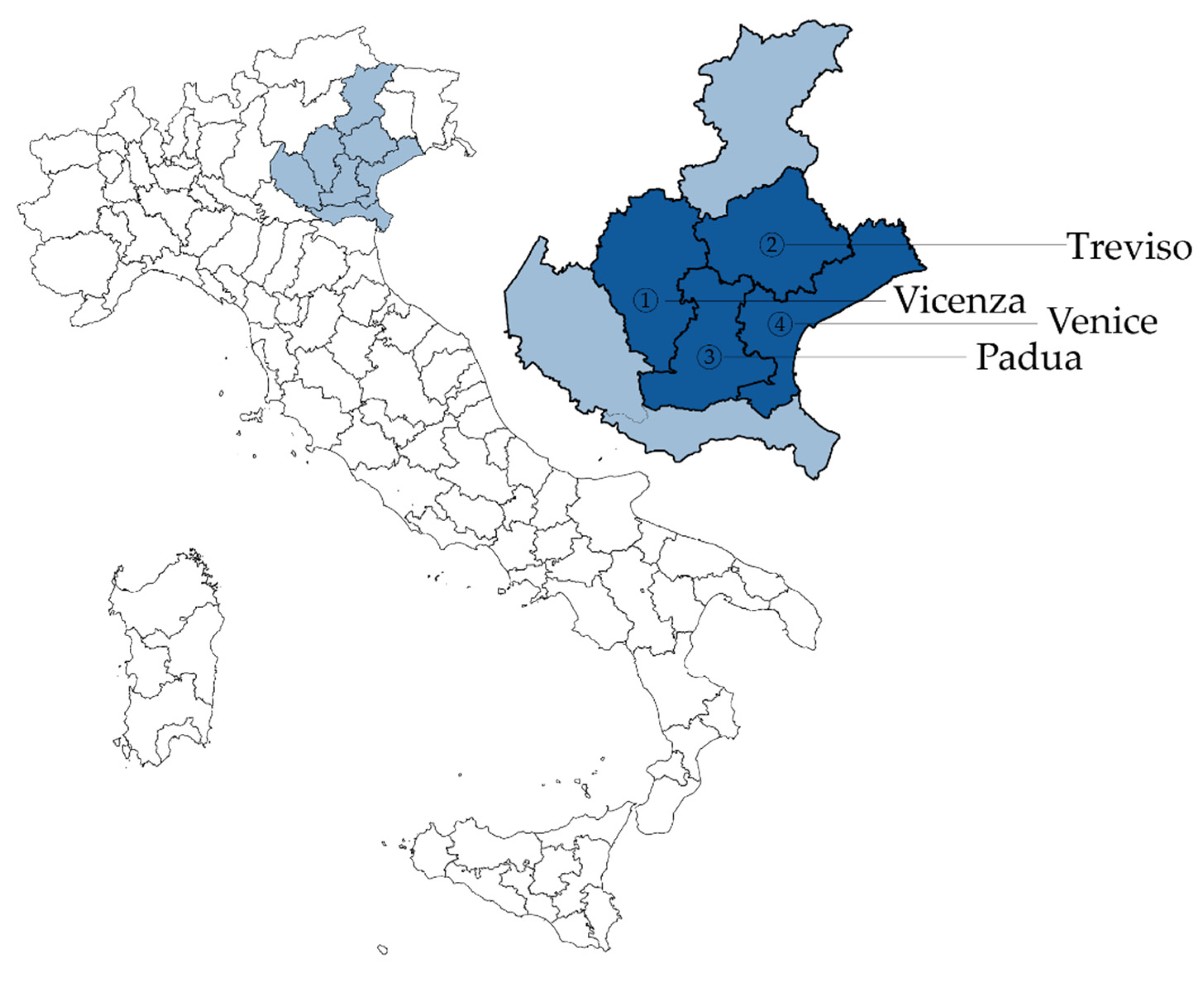
1.1. Pilot Area: Central Veneto Area
1.2. From Unconscious Adaptation to Mainstreaming Evidence-Informed Spatial Thinking about Climate Change
2. Materials and Methods
- -
- Capacity building and preparation of municipal technicians: through specific meetings, training courses, and close and constant contact, the necessary knowledge on the subject of climate change has been ensured for municipal technicians and political personnel. The preparation, adoption, and implementation of climate transition processes is a profound innovation whose success depends largely on the ability of governments and local communities to take on board the objectives and indications that they develop and promote. Therefore, the purpose of the proposed capacity-building activities is the consolidation, expansion, and dissemination of technical expertise [38].
- -
- Self-completion of the questionnaire by the municipalities and collective validation: the analysis asked the participants to fill out an online questionnaire in which they described the adaptation measures included in the plans, recognised according to some categories. Some categories asked participants to select an item from a list, others to produce a short text. The questionnaire, prepared on Google Forms and available for compilation in .xls format, was sent to municipal managers for compilation, supported remotely by scientific partners.
- -
- Analysis and assessment with the classification of the answers: the scientific partners proceeded to analyse the results and to settle possible problems and inconsistencies.
- -
- The intervention strategies [39] of the measure type:
- ○
- By “coping”, we mean intervention strategies in response to an emergency, aimed at managing the event and later recovering/rebuilding the previous state.
- ○
- By “incremental”, we describe adaptive measures to contain a phenomenon, developed to maintain or recover an existing level of safety. They are usually quick to implement. They are effective for short or medium return times, less so for extraordinary events or severe climate change effects.
- ○
- By “transformative”, we mean systemic land transformation interventions. Considering that there are no natural disasters, but only effects on the built environment of natural events, and that vulnerability depends on the choice of places, transformative interventions change the land morphology to adapt the landscape to future events. These interventions are much more expensive in the immediate future, but they allow to lower the economic and social costs of intervention and recovery, strongly reducing the potential victims.
- -
- The expected effects:
- ○
- Impact reduction: Dedicated impact-reduction measures allow the reinforcement of fragile elements of the territory. Impact-reduction measures are, for example, the downsizing of drainage channels or the creation of shading.
- ○
- Dispersion of the phenomenon. The dispersion of the phenomenon exclusively or promiscuously describes a spatial intervention capable of letting an event occur without a severe effect on the continuity of urban life.
- ○
- Self-protection of citizens: The measures of self-protection of the citizenship are designed to deliver guidance to the inhabitants, or users, of areas at risk and incentives to protect themselves and their material goods.
- ○
- Rapid intervention and information: This class of measures allows for the development of rapid intervention models capable of reducing human and economic or social losses during an event.
- ○
- Monitoring and mapping: Monitoring and mapping measures gather all the processes of forecasting the evolution and effects of potentially dangerous events.
- -
- Types of intervention:
- ○
- Physical: We define physical as those adaptation measures that act directly on the urban structure at any scale. They can act, for example, on individual buildings, riverbanks, trees, road surfaces, etc.
- ○
- Organisational: Those measures that, not interacting with the built environment, propose modes of governance or intervention that can promote adaptation. Examples could be the recognition of those responsible for the emergency plan’s function, the establishment of a permanent working table on environmental issues, or an agreement to exchange data with a weather-monitoring agency.
- ○
- Economic: Economic measures are those adaptation proposals based on taxation or local detaxation of behaviours more-or-less useful to reduce the impact of climate change.
- -
- Return Times: The return time (RT) of a climate event describes the average time in which it tends to recur. It is directly related to the phenomenon’s intensity to the extent that the greater the severity of the event, the less likely it is to occur frequently in a regular regime. This is modified by climate change in a worsening direction, but we have no firm data on the relationship between climate change and worsening effects.
- ○
- Ordinary: A measure useful for managing not-particularly intense events, occurring every year or every few years.
- ○
- RT 5–10 years: A measure able to cope with not-ordinary events but still frequent.
- ○
- RT 30–50 years: Measures designed for extraordinary events, suitable for preparing a territory for the effects of climate change even in the medium term.
- ○
- RT 100–300 years: Measures able to cope with extreme events, capable of securing the territory even for the most severe scenarios of worsening effects imposed by climate change.
3. Results
3.1. Hazard
3.2. Type of Measure
3.3. Expected Effect
3.4. Type of Intervention
3.5. Return Time
4. Discussion
- -
- The municipality of Venice began drafting a Climate Adaptation Plan;
- -
- The municipality of Padua has adopted a Sustainable Energy and Climate Action Plan (SECAP);
- -
- The municipality of Treviso has adopted a Sustainable Energy and Climate Action Plan (SECAP);
- -
- The municipality of Vicenza has adopted a Sustainable Energy and Climate Action Plan (SECAP).
5. Conclusions
Author Contributions
Funding
Institutional Review Board Statement
Informed Consent Statement
Conflicts of Interest
Appendix A

| City | Value | Area | Hazard | Measure | Type of Measure | Expected Effect | Time of Realisation | Stairs | Type | ReturnTimes |
|---|---|---|---|---|---|---|---|---|---|---|
| Vicenza | Mand. | Municipal | Flood. | Creation of conditions for the use of nonpolluting means of transport for sustainable mobility | Trans. | Impact red. | Planned | Municipal | Phys. | Ord. |
| Mand. | Municipal | Flood. | Urban greenery | Trans. | Impact red. | Planned | Municipal | Phys. | Ord. | |
| Mand. | Municipal | Flood. | planting of species suitable for bank consolidation (art. 12 NTA) | Increm. | Impact red. | Underway | Municipal | Phys. | RT 5–10 years | |
| Mand. | Municipal | Flood. | Areas subject to Flood. or periodic waterlogging (art. 15 NTA) | Increm. | Impact red. | Completed | Municipal | Org. | Ord. | |
| Mand. | Municipal | Flood. | Rural territory (art. 32 NTA) | Increm. | Impact red. | Completed | Municipal | Org. | RT 100–300 years | |
| Mand. | Municipal | Flood. | Hydraulic compatibility (art. 66 NTA) | Increm. | Impact red. | Completed | Municipal | Org. | Ord. | |
| Mand. | Municipal | UHI | Urban greenery | Trans. | Impact red. | Planned | Municipal | Phys. | Ord. | |
| Mand. | Municipal | UHI | Valuable tree species (art. 11 NTA) | Increm. | Impact red. | Planned | Municipal | Phys. | Ord. | |
| Mand. | Municipal | UHI | Maximum quantitative limit of SAU transformable (art. 19 NTA) | Increm. | Impact red. | Completed | Municipal | Org. | Ord. | |
| Mand. | Municipal | Flood. | Invariants of a geological nature (art. 11 NTA) | Increm. | Impact red. | Completed | Municipal | Org. | Ord. | |
| Mand. | Municipal | Flood. | Compatibility and hydraulic protection (art. 16 NTA) | Increm. | Impact red. | Completed | Municipal | Org. | Ord. | |
| Mand. | Municipal | UHI | Redevelopment and reconversion actions (art. 25 NTA) | Increm. | Impact red. | Completed | Municipal | Org. | Ord. | |
| Mand. | Municipal | UHI | Areas suitable for the improvement of urban and territorial quality (art. 25) | Increm. | Impact red. | Completed | Municipal | Org. | Ord. | |
| Mand. | Municipal | UHI | Preferential development lines and Phys. limits to new building (art. 30 NTA) | Increm. | Impact red. | Underway | Municipal | Org. | Ord. | |
| Mand. | Municipal | UHI | Areas relevant to the ecological and territorial network (art. 34 NTA) | Trans. | Impact red. | Planned | Municipal | Org. | Ord. | |
| Mand. | Municipal | UHI | SEA monitoring (art. 65 NTA) | Increm. | Mon. and mapp. | Completed | Municipal | Org. | Ord. | |
| Mand. | Municipal | Flood. | Hydrogeological balance (art.11 and 13 NTA) creation of a buffer zone in resurgence areas | Increm. | Disper. of the phen. | Completed | Municipal | Org. | RT 5–10 years | |
| Mand. | Municipal | Flood. | Areas subject to Flood. or periodic waterlogging (art. 15 NTA) | Increm. | Impact red. | Completed | Municipal | Org. | Ord. | |
| Mand. | Municipal | UHI | Wooded or reforested areas (art. 13 NTA) | Increm. | Impact red. | Planned | Municipal | Org. | Ord. | |
| Mand. | Municipal | Flood. | Invariants of geological, landscape, and environmental nature (art. 11 NTA) | Increm. | Impact red. | Underway | Municipal | Org. | Ord. | |
| Mand. | Municipal | Flood. | Redevelopment and reconversion actions (art. 25 NTA) | Increm. | Impact red. | Completed | Municipal | Org. | Ord. | |
| Mand. | Municipal | Flood. | Areas subject to Flood. or periodic waterlogging (art. 15 NTA) | Increm. | Impact red. | Completed | Municipal | Org. | RT 5–10 years | |
| Mand. | Municipal | Flood. | Geological, hydrogeological, and hydraulic balance—wooded areas intended for reforestation (art. 13 NTA) | Increm. | Impact red. | Underway | Municipal | Org. | Ord. | |
| Mand. | Municipal | Flood. | Areas subject to Flood. or periodic waterlogging (art. 15 NTA) | Increm. | Impact red. | Completed | Municipal | Org. | RT 5–10 years | |
| Mand. | Municipal | Flood. | Geological compatibility of land for building purposes (art. 14 NTA) | Increm. | Impact red. | Completed | Municipal | Org. | Ord. | |
| Mand. | Municipal | Flood. | Areas subject to Flood. or periodic waterlogging (art. 15 NTA) | Increm. | Impact red. | Completed | Municipal | Org. | Ord. | |
| Treviso | Mand. | Municipal | Flood. | Resurgences | Cop. | Impact red. | Underway | Municipal | Phys. | Ord. |
| Mand. | Municipal | Flood. | Geological compatibility—Unsuitable soils | Increm. | Citizens self-prot. | Planned | Municipal | Phys. | Ord. | |
| Mand. | Municipal | Flood. | Main hydrography | Cop. | Impact red. | Underway | Municipal | Phys. | Ord. | |
| Mand. | Municipal | Flood. | Overflowing or waterlogged areas | Cop. | Citizens self-prot. | Planned | Municipal | Phys. | Ord. | |
| Mand. | Municipal | Flood. | Historical Centres | Cop. | Citizens self-prot. | Planned | Municipal | Phys. | Ord. | |
| Mand. | Municipal | Flood. | Resurgence areas | Increm. | Impact red. | Underway | Municipal | Phys. | Ord. | |
| Mand. | Municipal | Flood. | Geological compatibility—Suitable soils. For the purposes of safeguarding the environmental heritage, the safety of the territory, and the relative infrastructural works, the P.A.T. distinguishes soils within the territory of Treviso according to the following classes of geological compatibility: - compatibility class I: suitable soils; compatibility class II: conditionally suitable soils; - compatibility class III: unsuitable soils | Trans. | Citizens self-prot. | Completed | Municipal | Phys. | Ord. | |
| Mand. | Municipal | Flood. | Protection zones (L.R. n° 11/04—art. 41) | Increm. | Citizens self-prot. | Underway | Intermunicipal | Phys. | RT 5–10 years | |
| Mand. | Municipal | Flood. | Geological compatibility—Soils suitable under certain conditions. In order to safeguard the environmental heritage, the safety of the territory, and the related infrastructural works, the P.A.T. distinguishes the soils within the territory of Treviso according to the following classes of geological compatibility: - compatibility class I: suitable soils; -compatibility class II: conditionally suitable soils; - compatibility class III: unsuitable soils | Increm. | Citizens self-prot. | Planned | Municipal | Phys. | Ord. | |
| Mand. | Municipal | Flood. | Utilised Agricultural Area (UAA) | Trans. | Impact red. | Completed | Municipal | Org. | RT 30–50 years | |
| Mand. | Municipal | Flood. | River landscape routes | Increm. | Citizens self-prot. | Planned | Municipal | Phys. | RT 5–10 years | |
| Mand. | Municipal | Flood. | Strategic Actions | Trans. | Impact red. | Underway | Municipal | Phys. | RT 5–10 years | |
| Mand. | Municipal | Flood. | Sile Natural Park area | Increm. | Citizens self-prot. | Underway | Municipal | Phys. | Ord. | |
| Mand. | Municipal | Flood. | Consolidated urban areas | Trans. | Impact red. | Completed | Municipal | Phys. | RT 5–10 years | |
| Mand. | Municipal | Flood. | Area for the establishment of the Storga Park | Increm. | Impact red. | Underway | Municipal | Org. | RT 5–10 years | |
| Mand. | Municipal | Flood. | Areas of diffuse construction | Trans. | Impact red. | Completed | Municipal | Phys. | RT 5–10 years | |
| Mand. | Municipal | Flood. | Core areas | Increm. | Citizens self-prot. | Underway | Municipal | Phys. | RT 5–10 years | |
| Mand. | Municipal | Flood. | Buffer zones and core completion areas | Increm. | Impact red. | Underway | Municipal | Phys. | RT 5–10 years | |
| Padua | Mand. | Municipal | Flood. | Areas suitable for conditions easily subject to water stagnation and/or overflowing and/or hydraulic risk: geognostic investigations, suitable morphological remodelling, hydraulic protection systems, waterproofing works | Increm. | Impact red. | Completed | Municipal | Phys. | RT 5–10 years |
| Mand. | Municipal | Flood. | Suitable areas with very low permeability: facilitation of water drainage, prohibition of soil spraying | Increm. | Impact red. | Completed | Municipal | Phys. | RT 5–10 years | |
| Mand. | Municipal | Flood. | Suitable areas subject to conditions characterised by water stagnation and/or overflowing and/or hydraulic risk and by soil with very low permeability: suitable morphological remodelling, hydraulic protection systems, waterproofing works, facilitation of water draining, prohibition of soil spraying, geognostic investigations | Increm. | Impact red. | Completed | Municipal | Phys. | RT 5–10 years | |
| Mand. | Municipal | Flood. | Ineligible areas: no new buildings, possibility to build public infrastructures, maintenance, and renovation of existing buildings for geological and hydraulic impact red. | Increm. | Impact red. | Completed | Municipal | Phys. | RT 5–10 years | |
| Mand. | Municipal | Flood. | General rules and prescriptions for maintenance and protection in areas subject to hydrogeological instability (areas subject to Flood. or water stagnation)—principle of hydraulic stabilisation | Increm. | Disper. of the phen. | Completed | Municipality | Phys. | RT 30–50 years | |
| Mand. | Municipal | Flood. | General rules and prescriptions for maintenance and protection in areas subject to hydrogeological instability (areas subject to overflowing or stagnant water)—discharge control structure | Increm. | Disper. of the phen. | Completed | Municipal | Phys. | RT 30–50 years | |
| Mand. | Municipal | UHI | General rules and prescriptions for maintenance and safeguard in areas subject to hydrogeological instability (areas subject to Flood. or water stagnation)—permeability index and draining parking spaces | Increm. | Impact red. | Planned | Municipal | Phys. | RT 30–50 years | |
| Mand. | Municipal | Flood. | General rules and prescriptions for maintenance and safeguarding in areas subject to hydrogeological instability (areas subject to Flood. or waterlogging)—precautions to avoid spillage onto the ground | Increm. | Impact red. | Completed | Municipal | Phys. | RT 5–10 years | |
| Mand. | Municipal | Flood. | General rules and prescriptions for maintenance and safeguard in areas subject to hydrogeological instability (areas subject to Flood. or water stagnation)—maintenance of ditches, road drainage ways | Cop. | Impact red. | Completed | Municipal | Phys. | Ord. | |
| Mand. | Municipal | Flood. | General rules and prescriptions for maintenance and protection in areas subject to hydrogeological instability (areas subject to Flood. or water stagnation)—compensatory measures for hydraulic mitigation in intervention plans, urban implementation plans, and recovery plans | Increm. | Mon. and mapp. | Planned | Municipal | Org. | RT 30–50 years | |
| Mand. | Municipal | Flood. | General rules and prescriptions for maintenance and protection in areas subject to hydrogeological instability (areas subject to Flood. or water stagnation) -construction indications in areas of moderate hazard | Increm. | Impact red. | Completed | Municipal | Phys. | RT 30–50 years | |
| Mand. | Municipal | Flood. | General rules and prescriptions for maintenance and safeguard in areas subject to hydrogeological instability (areas subject to Flood. or water stagnation)—coherence between instruments for solving hydraulic criticalities | Increm. | Impact red. | Planned | Municipal | Org. | RT 30–50 years | |
| Mand. | Municipal | Flood. | General rules and prescriptions for maintenance and safeguarding in areas subject to hydrogeological instability (areas subject to Flood. or water stagnation)—definition of the volume of reservoir in the I.P. | Increm. | Disper. of the phen. | Planned | Municipal | Phys. | RT 30–50 years | |
| Mand. | Municipal | Flood. | General rules and prescriptions for maintenance and safeguarding in areas subject to hydrogeological instability (areas subject to Flood. or water stagnation)—oil skimmer systems, first rain treatment | Increm. | Impact red. | Completed | Municipal | Phys. | RT 30–50 years | |
| Mand. | Municipal | Flood. | General rules and prescriptions for maintenance and protection in areas subject to hydrogeological instability (areas subject to overflowing or stagnant water)—drafting of water plan | Trans. | Citizens self-prot. | Planned | Municipal | Org. | RT 100–300 years | |
| Mand. | Municipal | Flood. | Hydraulic mitigation—guidelines contained in the hydraulic compatibility assessment—basic hydraulic stabilisation | Increm. | Impact red. | Completed | Municipal | Phys. | RT 30–50 years | |
| Mand. | Municipal | Flood. | Hydraulic mitigation—guidelines contained in the hydraulic compatibility assessment—deductive hydraulic stabilisation | Increm. | Impact red. | Completed | Municipal | Phys. | RT 30–50 years | |
| Mand. | Municipal | Flood. | Hydraulic mitigation—guidelines contained in the hydraulic compatibility assessment—correct design of sewerage works | Increm. | Disper. of the phen. | Completed | Municipal | Phys. | RT 30–50 years | |
| Mand. | Municipal | Flood. | Hydraulic mitigation—addresses contained in the hydraulic compatibility assessment—public and/or private parking spaces | Increm. | Disper. of the phen. | Completed | Municipal | Phys. | RT 30–50 years | |
| Mand. | Municipal | Flood. | Hydraulic mitigation—guidelines contained in the hydraulic compatibility assessment—safeguarding floodways | Trans. | Disper. of the phen. | Completed | Municipal | Phys. | RT 30–50 years | |
| Mand. | Municipal | Flood. | Hydraulic mitigation—guidelines contained in the hydraulic compatibility assessment—local management of rainfall Flood. | Increm. | Impact red. | Completed | Municipal | Phys. | RT 30–50 years | |
| Mand. | Municipal | Flood. | Hydraulic mitigation—guidelines contained in the hydraulic compatibility assessment—disconnection of green areas from drainage networks | Increm. | Disper. of the phen. | Completed | Municipal | Phys. | RT 30–50 years | |
| Mand. | Municipal | Flood. | Hydraulic mitigation—guidelines contained in the hydraulic compatibility assessment—to safeguard naturally occurring reservoir volumes on the territory | Trans. | Disper. of the phen. | Completed | Municipal | Phys. | RT 30–50 years | |
| Mand. | Municipal | Flood. | Hydraulic mitigation—guidelines contained in the hydraulic compatibility assessment—compliance with existing or planned hydraulic mitigation works | Increm. | Impact red. | Completed | Municipal | Phys. | RT 30–50 years | |
| Mand. | Municipal | Flood. | Hydraulic mitigation—guidelines contained in the hydraulic compatibility assessment—correct distribution of green areas in the u.p.a. | Increm. | Disper. of the phen. | Completed | Municipal | Phys. | RT 30–50 years | |
| Mand. | Municipal | Flood. | Hydraulic mitigation—guidelines contained in the hydraulic compatibility assessmentUnderground volumes and morphology of accesses to underground volumes. | Increm. | Impact red. | Completed | Municipal | Phys. | RT 30–50 years | |
| Mand. | Municipal | Flood. | Hydraulic mitigation—guidelines contained in the hydraulic compatibility assessment—admissibility of interventions on floodways | Increm. | Impact red. | Completed | Municipal | Phys. | RT 30–50 years | |
| Mand. | Municipal | Flood. | Hydraulic mitigation—guidelines contained in the hydraulic compatibility assessment—comply with and enforce existing sector legislation | Increm. | Impact red. | Completed | Municipal | Phys. | RT 30–50 years | |
| Mand. | Municipal | Flood. | Hydraulic mitigation—guidelines contained in the hydraulic compatibility assessment—consider rainfall Flood. as an asset to be safeguarded | Trans. | Impact red. | Planned | Municipal | Phys. | RT 30–50 years | |
| Mand. | Municipal | UHI | Hydraulic mitigation—guidelines contained in the hydraulic compatibility assessment—garden covers | Trans. | Disper. of the phen. | Planned | Municipal | Phys. | RT 30–50 years | |
| Mand. | Municipal | Flood. | Hydraulic mitigation—guidelines contained in the hydraulic compatibility assessment—need for an opinion on hydraulic mitigation works even for interventions not subject to the u.p.a. but with significant “characteristics” | Increm. | Impact red. | Planned | Municipal | Org. | RT 30–50 years | |
| Mand. | Municipal | Flood. | Hydraulic mitigation—addresses contained in the hydraulic compatibility assessment—complete definition of rain-Flood. paths | Increm. | Impact red. | Planned | Municipal | Org. | RT 30–50 years | |
| Mand. | Municipal | Flood. | Hydraulic mitigation—guidelines contained in the hydraulic compatibility assessment—qualitative treatment of rainwater Flood. | Increm. | Impact red. | Completed | Municipal | Phys. | RT 5–10 years | |
| Mand. | Municipal | Flood. | Hydraulic mitigation—guidelines contained in hydraulic compatibility assessment—improper use of floodways | Cop. | Impact red. | Completed | Municipal | Phys. | RT 5–10 years | |
| Mand. | Municipal | Flood. | Hydraulic mitigation—guidelines contained in the hydraulic compatibility assessment—minimum limit of peak flow rate | Increm. | Impact red. | Completed | Municipal | Phys. | RT 30–50 years | |
| Mand. | Municipal | Flood. | Hydraulic mitigation—guidelines contained in the hydraulic compatibility assessment—hydraulic detention | Increm. | Impact red. | Completed | Municipal | Phys. | RT 30–50 years | |
| Mand. | Municipal | Flood. | Hydraulic mitigation—guidelines contained in the hydraulic compatibility assessment—additional reservoir volumes | Increm. | Impact red. | Completed | Ta Municipal | Phys. | RT 30–50 years | |
| Mand. | Municipal | Flood. | Environmental risk areas: supramunicipal project for hydraulic protection and identification of “strategic buildings and emergency areas for civil protection” | Cop. | Citizens self-prot. | Planned | Intermunicipal | Org. | RT 30–50 years | |
| Mand. | Municipal | Flood. | Major-accident hazard zones: sealing and prohibition of ground leakage | Increm. | Impact red. | Completed | Municipal | Phys. | RT 30–50 years | |
| Mand. | Municipal | Flood. | Major-accident hazard zones: low-impact crops, ban on ground dispersion | Increm. | Impact red. | Completed | Municipal | Phys. | RT 30–50 years | |
| Mand. | Municipal | Flood. | Areas between the main embankments and the floodway of rivers and river islands: transformations exclusively aimed at improving hydraulic safety are allowed | Trans. | Impact red. | Completed | Municipal | Phys. | RT 30–50 years | |
| Mand. | Municipal | Flood. | Protection of water resources, crop conversion, treatment of livestock manure | Increm. | Impact red. | Planned | Municipal | Org. | RT 30–50 years | |
| Mand. | Municipal | UHI | Variations in the margins of the urbanised fabric of the “consolidated city”: compliance with the objectives of limiting soil consumption, verification of environmental balance, compliance with the conditions of sustainability of the VAS (Strategic Environmental Assessment), and hydraulic safety of the hydraulic compatibility assessment | Increm. | Impact red. | Planned | Municipal | Org. | RT 5–10 years | |
| Mand. | Municipal | UHI | Transfer of areas of the “planned city” as part of the implementation of integrated and environmental equalisation zones: establishment of parks and nature reserves of municipal interest | Increm. | Impact red. | Planned | Municipal | Phys. | RT 30–50 years | |
| Mand. | Municipal | UHI | Site conversion or redevelopment through building credit | Trans. | Impact red. | Planned | Municipal | Cheap | RT 30–50 years | |
| Mand. | Municipal | UHI | Fundamental requirements for settlement development in the “City to be transformed”: contiguity with the urbanised fabric, respect for environmental values, and protection of viable farms not in conflict with important strategic public interests | Increm. | Impact red. | Planned | Municipal | Phys. | RT 30–50 years | |
| Mand. | Municipal | UHI | Agricultural area: sustainable strategic objectives in the management of building interventions | Trans. | Impact red. | Planned | Municipal | Cheap | RT 30–50 years | |
| Mand. | Municipal | UHI | Agricultural zone: other indications | Trans. | Impact red. | Planned | Municipal | Eco. | RT 30–50 years | |
| Mand. | Municipal | UHI | Areas of diffuse construction: morphological and perceptual reorganisation | Increm. | Impact red. | Planned | Municipal | Phys. | RT 30–50 years | |
| Mand. | Municipal | Flood. | Specific objectives of the qualification of the productive commercial management system | Increm. | Impact red. | Planned | Municipal | Phys. | RT 5–10 years | |
| Mand. | Municipal | UHI | CO2 compensation | Increm. | Impact red. | Planned | Municipal | Cheap | RT 30–50 years | |
| Mand. | Municipal | UHI | Quantification of ‘environmental carrying capacity’ at the ‘One-Stop Shop’ | Trans. | Impact red. | Planned | Municipal | Org. | RT 30–50 years | |
| Mand. | Municipal | Flood. | Environmental aspects of the “public convenience” of interventions to be subject to public–private agreements in the context of urban equalisation | Increm. | Disper. of the phen. | Planned | Municipal | Phys. | RT 30–50 years | |
| Mand. | Municipal | UHI | Building credit: environmental aspects | Trans. | Impact red. | Planned | Municipal | Cheap | RT 100–300 years | |
| Mand. | Municipal | Flood. | Building credit: water aspects | Trans. | Impact red. | Planned | Municipal | Cheap | RT 30–50 years | |
| Mand. | Municipal | UHI | Historical–environmental routes of municipal and supramunicipal interest | Increm. | Impact red. | Planned | Intermunicipal | Phys. | RT 30–50 years | |
| Mand. | Municipal | Flood. | Establishment of river agricultural parks | Trans. | Impact red. | Planned | Municipal | Phys. | RT 30–50 years | |
| Mand. | Municipal | UHI | Establishment of river agricultural parks | Trans. | Impact red. | Planned | Municipal | Phys. | RT 100–300 years | |
| Mand. | Municipal | UHI | Metropolitan and Municipal Ecological Network: subsidies for maintenance and/or creation of hedges, buffer strips, woods | Trans. | Impact red. | Planned | Municipal | Cheap | RT 100–300 years | |
| Mand. | Municipal | UHI | Metropolitan and Municipal Ecological Network: actions to be pursued to maintain nature or provision of compensatory measures | Trans. | Impact red. | Planned | Municipal | Phys. | RT 100–300 years | |
| Mand. | Municipal | UHI | Interventions in the core area “Grave and wetlands of the Middle Brenta” | Trans. | Impact red. | Planned | Municipal | Phys. | RT 30–50 years | |
| Mand. | Municipal | UHI | Areas of naturalistic connection: interventions on the tree and shrub heritage, water quality control | Trans. | Impact red. | Planned | Municipal | Phys. | RT 100–300 years | |
| Mand. | Municipal | Flood. | Interventions in key ecological corridors | Trans. | Impact red. | Planned | Municipal | Phys. | RT 100–300 years | |
| Mand. | Municipal | UHI | Interventions in secondary ecological corridors | Increm. | Impact red. | Planned | Municipal | Phys. | RT 30–50 years | |
| Mand. | Municipal | UHI | Interventions in “High Nature Islands” as local support nodes for wildlife transfers | Increm. | Impact red. | Planned | Municipal | Phys. | RT 30–50 years | |
| Mand. | Municipal | UHI | Infrastructure barriers and related mitigation works: general indications | Increm. | Impact red. | Planned | Municipal | Phys. | RT 30–50 years | |
| Mand. | Municipal | UHI | Infrastructure barriers and related mitigation works: specific indications for infrastructure barriers (areas) | Increm. | Impact red. | Planned | Municipal | Phys. | RT 30–50 years | |
| Mand. | Municipal | UHI | Infrastructure barriers and related mitigation works: specific indications for infrastructure barriers (points) | Increm. | Impact red. | Planned | Municipal | Phys. | RT 30–50 years | |
| Mand. | Municipal | UHI | Construction of roofs and terraces green walls | Trans. | Impact red. | Planned | Municipal | Phys. | RT 100–300 years | |
| Mand. | Municipal | Flood. | Stormwater recovery | Trans. | Impact red. | Planned | Municipal | Phys. | RT 100–300 years | |
| Mand. | Municipal | Flood. | Mitigation measures defined in the SEA on Flood. | Trans. | Impact red. | Planned | Municipal | Phys. | RT 100–300 years | |
| Mand. | Municipal | UHI | Mitigation measures defined in SEA on green theme with effect on islands of UHI | Trans. | Impact red. | Planned | Municipal | Phys. | RT 100–300 years | |
| Mand. | Municipal | UHI | Criteria for verifying and monitoring the Plan’s sustainability forecasts in relation to the Strategic Environmental Assessment on the green/island theme of UHI | Cop. | Mon. and mapp. | Planned | Municipal | Org. | Ord. | |
| Mand. | Municipal | Flood. | Criteria for verifying and monitoring the Plan’s sustainability forecasts in relation to the Strategic Environmental Assessment on the green/island theme of UHI | Cop. | Mon. and mapp. | Planned | Municipal | Org. | Ord. | |
| Venice | Mand. | Municipal | Flood. | Creation of areas for controlled Flood. and park landscaping | Increm. | Disper. of the phen. | Planned | Project | Phys. | RT 5–10 years |
| Mand. | Municipal | Flood. | Construction of the new rainwater basin in the former Lusore riverbed (int. B.3) | Increm. | Disper. of the phen. | Planned | Project | Phys. | RT 5–10 years | |
| Mand. | Municipal | Flood. | Guarantee the airport site from possible Flood., bringing the whole area to a level of hydraulic safety suitable for the intended uses | Trans. | Impact red. | Planned | Project | Phys. | RT 5–10 years | |
| Mand. | Municipal | Flood. | Reducing the consumption of drinking water and energy through initiatives aimed at reusing raw water, rainwater, or purified water, including water from outside the airport, for compatible purposes, in order to obtain economic and environmental benefits | Increm. | Impact red. | Planned | Project | Phys. | Ord. | |
| Mand. | Municipal | UHI | Redevelopment of natural components | Increm. | Impact red. | Underway | Project | Phys. | Ord. | |
| Mand. | Municipal | UHI | Promoting maintenance of open areas | Increm. | Citizens self-prot. | Underway | Municipal | Cheap | Ord. | |
| Mand. | Municipal | UHI | Reorganisation of urban green areas | Trans. | Citizens self-prot. | Underway | Municipal | Phys. | Ord. | |
| Mand. | Municipal | UHI | Improving urban quality | Increm. | Impact red. | Underway | Municipal | Org. | Ord. | |
| Mand. | Municipal | UHI | Redevelopment and/or conversion areas | Increm. | Impact red. | Underway | Municipal | Phys. | Ord. | |
| Mand. | Municipal | UHI | Urban equalisation for areas worthy of environmental protection | Increm. | Disper. of the phen. | Underway | Municipal | Cheap | Ord. | |
| Mand. | Municipal | UHI | Spot upgrading | Increm. | Disper. of the phen. | Underway | Municipal | Eco. | Ord. | |
| Mand. | Municipal | UHI | Energy efficiency | Increm. | Impact red. | Underway | Municipal | Phys. | Ord. | |
| Mand. | Municipal | Flood. | Protection of the agricultural heritage | Increm. | Impact red. | Underway | Municipal | Cheap | Ord. | |
| Mand. | Municipal | UHI | Prevention of risks related to UHI waves | Increm. | Impact red. | Completed | Municipal | Org. | Ord. | |
| Mand. | Municipal | Flood. | Risk prevention and mitigation | Increm. | Impact red. | Completed | Municipal | Org. | RT 5–10 years | |
| Mand. | Municipal | Flood. | Prevention of risks related to intense weather events | Increm. | Impact red. | Completed | Municipal | Org. | RT 5–10 years | |
| Mand. | Municipal | UHI | Lifting systems and new water pumps | Increm. | Impact red. | Planned | Municipal | Phys. | RT 5–10 years | |
| Mand. | Municipal | Flood. | Construction of reservoirs/lamination basins, controlled Flood. areas | Increm. | Impact red. | Planned | Municipal | Phys. | RT 5–10 years | |
| Mand. | Municipal | Flood. | Construction of new pipeline | Increm. | Impact red. | Planned | Municipal | Phys. | Ord. | |
| Mand. | Municipal | Flood. | Construction of a new inlet/ditch | Trans. | Impact red. | Planned | Municipal | Phys. | RT 5–10 years | |
| Mand. | Municipal | Flood. | Renaturalisation, green belts and urban parks | Trans. | Impact red. | Planned | Municipal | Phys. | RT 5–10 years | |
| Mand. | Municipal | Flood. | Land management guidelines (reduction of run-off volume by dispersion, infiltration basins, detention basins, permeable pavement) | Trans. | Mon. and mapp. | Planned | Project | Phys. | Ord. | |
| Mand. | Municipal | Flood. | Decreasing environmental fragility | Increm. | Impact red. | Underway | Municipal | Phys. | Ord. | |
| Mand. | Municipal | Flood. | Restoration of wetlands | Increm. | Disper. of the phen. | Underway | Municipal | Phys. | RT 5–10 years | |
| Mand. | Municipal | Flood. | Hydraulic improvement | Trans. | Disper. of the phen. | Underway | Project | Phys. | RT 5–10 years | |
| Mand. | Municipal | Flood. | Response to rainfall events in new works | Trans. | Disper. of the phen. | Underway | Project | Phys. | RT 30–50 years | |
| Mand. | Municipal | Flood. | Water drainage | Increm. | Disper. of the phen. | Underway | Project | Phys. | RT 5–10 years | |
| Mand. | Area/neighbourhood | Flood. | dune and backdune reconnection areas | Trans. | Impact red. | Planned | Neighbourhood | Org. | RT 100–300 years | |
| Mand. | Regional | Flood. | The PAI is the sectoral reference document. It plans and defines mitigation and adaptation strategies, analysing the risk, vulnerability, and danger of the territory and designing response measures | Increm. | Impact red. | Underway | Intermunicipal | Org. | Ord. | |
| Mand. | Provincial | Flood. | Adaptation strategies: assessment and analysis of all incident scenarios on the territory based on potential risks and subdivision of the provincial territory into homogeneous territorial areas; response to events: management of emergency situations, rescue | Increm. | Citizens self-prot. | Underway | Municipal | Org. | RT 100–300 years | |
| Mand. | Regional | Flood. | The plan is part of the strategic planning that the European Directive 2000/60 requires to be drawn up and updated every six years involving the different institutional, third sector, or individual stakeholders in order to protect and enhance the water resource in all its aspects | Increm. | Mon. and mapp. | Underway | Intermunicipal | Org. | Ord. | |
| Mand. | Provincial | Flood. | Hydraulic risk reduction | Trans. | Mon. and mapp. | Underway | Intermunicipal | Org. | Ord. | |
| Mand. | Provincial | UHI | The PAT/PATI also through agreements for the co-ordination of planning with the province and the municipalities concerned, define the forecasts: integrating, also through equalisation and compensation procedures, parts of the territory already equipped for tourism with others intended for: the integration of tourist services, including innovative ones (theme parks, basins for pleasure boating, arrangement of inland canals) with measures to adapt to climate change (reallocation of reclaimed and underused areas, formation of coastal and lagoon buffer zones) | Trans. | Impact red. | Underway | Intermunicipal | Org. | Ord. | |
| Mand. | Provincial | UHI | The norm recalls the need to consider climate phenomena as a factor that affects the provincial territory, determining adaptation needs in coherence with international and superordinate guidelines. It indicates the need to apply the precautionary principle in the evaluation of alternatives and mitigation and compensation criteria for impacts | Trans. | Impact red. | Underway | Municipal | Org. | Ord. | |
| Mand. | Provincial | UHI | The PAT/PATI forecasts can also be defined through co-ordination agreements in order to co-ordinate and integrate the local scale forecasts with the provincial ones, to favour the restructuring of the accessibility system of the coastal resorts, to integrate, also through equalisation and compensation procedures, parts of the territory already equipped for tourism with others destined to make the territory safe or to enhance and strengthen the environmental and cultural heritage, integrating tourist services, including innovative ones (theme parks, basins for recreational boating, arrangement of inland canals) with measures to adapt to climate change (such as, for example, refilling reclaimed and underused areas, creating buffer strips along the coastline and in lagoons), and, lastly, limiting as far as possible the number of settlements for new tourist accommodation | Trans. | Impact red. | Underway | Municipal | Org. | Ord. | |
| Mand. | Provincial | Flood. | It invests in environmental aspects involved in climate change adaptation processes, such as: climate-changing emissions; hydraulic planning; land consumption for urban or infrastructural uses; and rural land uses and production | Trans. | Impact red. | Underway | Intermunicipal | Org. | Ord. | |
| Mand. | Provincial | Flood. | The province encourages and promotes the participation of the municipalities in the strategic programmes and promotes: the adoption of locational solutions for accommodation facilities and installations that are safer in hydraulic terms and have a lower environmental impact, in line with the strategy of adaptation to climate change, in backwardness with respect to the coastline | Trans. | Impact red. | Underway | Intermunicipal | Org. | Ord. | |
| Mand. | Provincial | Flood. | As a general rule, landscaping should use native or naturalised plants, as the latter not only integrate better with the landscape but also adapt better to rainfall patterns | Increm. | Impact red. | Underway | Project | Phys. | Ord. | |
| Mand. | Provincial | Flood. | The PAT/PATI will have to define specific indicators to verify the planned reduction of coastal erosion and fragility of the areas following the implementation of the plan measures, including the permanence of the convenience to socially support the overall maintenance costs of hydraulic drainage and, with reference to the indications of the PTCP, will have to identify the areas considered suitable to be reconnected or used as expansion tanks of the Flood. courses | Trans. | Mon. and mapp. | Underway | Municipal | Org. | Ord. | |
| Mand. | Municipal | UHI | Promoting environmental friendliness | Increm. | Citizens self-prot. | Underway | Municipal | Eco. | Ord. | |
| Mand. | Municipal | Flood. | Phys. protection and integrity of the territory | Trans. | Disper. of the phen. | Underway | Municipal | Phys. | Ord. | |
| Mand. | Municipal | Flood. | Bissuola junction: construction of a 15,000 m3 volume first rainwater basin to serve the Carpenedo sewage basin and a 10 m3/s water-scooping system to discharge second rainwater into the Marzenego river | Increm. | Disper. of the phen. | Planned | Project | Phys. | RT 5–10 years | |
| Mand. | Municipal | Flood. | Extraordinary mainteaning and securing of the Acque Basse collector sewer | Cop. | Impact red. | Planned | Project | Phys. | Ord. | |
| Mand. | Municipal | Flood. | Construction of a rainwater basin to serve the Via Torino reservoir with a capacity of 10,000 m3 with an adjoining 7.5 m3/s water drainage system | Increm. | Disper. of the phen. | Planned | Project | Phys. | RT 5–10 years | |
| Mand. | Provincial | UHI | Preservation and enhancement of the ecological network | Increm. | Impact red. | Underway | Intermunicipal | Phys. | Ord. | |
| Mand. | Provincial | UHI | Reclamation | Increm. | Disper. of the phen. | Underway | Intermunicipal | Phys. | RT 30–50 years | |
| Mand. | Regional | Flood. | It identifies tools for the protection and conservation of water resources. As a risk reduction strategy, it is concerned with contributing to the mitigation of the effects of floods and droughts | Increm. | Impact red. | Underway | Intermunicipal | Org. | RT 30–50 years | |
| Mand. | Regional | UHI | Regional ecological network | Increm. | Impact red. | Underway | Intermunicipal | Phys. | Ord. | |
| Mand. | Regional | UHI | Ecological corridors | Increm. | Impact red. | Underway | Intermunicipal | Phys. | Ord. | |
| Mand. | Regional | UHI | Containing and combating the effects of climate change | Increm. | Impact red. | Underway | Intermunicipal | Phys. | RT 30–50 years | |
| Mand. | Regional | Flood. | Hydraulic risk | Increm. | Impact red. | Underway | Intermunicipal | Phys. | Ord. | |
| Mand. | Regional | Flood. | City Network | Increm. | Impact red. | Planned | Intermunicipal | Org. | Ord. | |
| Mand. | Regional | Flood. | Reorganisation of the settlement system and design criteria | Increm. | Impact red. | Planned | Intermunicipal | Org. | Ord. | |
| Mand. | Regional | Flood. | Reorganisation of the settlement system and design criteria | Increm. | Impact red. | Planned | Intermunicipal | Org. | Ord. | |
| Mand. | Regional | Flood. | Risk from sea storms and coastal protection | Trans. | Disper. of the phen. | Underway | Intermunicipal | Phys. | Ord. | |
| Mand. | Municipal | UHI | Containment of energy consumption and environmental protection of new interventions | Increm. | Citizens self-prot. | Underway | Municipal | Phys. | RT 5–10 years | |
| Mand. | Municipal | UHI | Building Regeneration | Increm. | Impact red. | Underway | Municipal | Phys. | Ord. | |
| Mand. | Municipal | UHI | Renewable sources in new buildings | Increm. | Impact red. | Underway | Municipal | Phys. | Ord. | |
| Mand. | Municipal | UHI | Energy efficiency | Increm. | Impact red. | Underway | Municipal | Cheap | Ord. | |
| Mand. | Municipal | Flood. | Soil and subsoil moisture | Increm. | Citizens self-prot. | Underway | Municipal | Phys. | Ord. | |
| Mand. | Municipal | Flood. | Rainwater conveyance in roofs | Increm. | Disper. of the phen. | Underway | Municipal | Phys. | RT 5–10 years | |
| Mand. | Municipal | Flood. | Internal water networks | Increm. | Disper. of the phen. | Underway | Municipal | Phys. | RT 5–10 years | |
| Vol. | Provincial | Flood. | The projects must be aimed at recovering the quality of urban life through the rediscovery of Flood.: this is a change that touches on urban, environmental, and economic aspects.The rediscovery of the relationship between man—Flood., land—and sea must take place through the recovery of the relationship between the city and the sea, between the city and the rivers, redesigning a new urban idea, having the merit and the ability to transform compromised and disused areas into sources of life and resources of various kinds (tourist, commercial, productive, services...). The reappropriation of these spaces will also take place by mending the relationship between the urban structure and the “sea/river” front | Trans. | Impact red. | Underway | Project | Phys. | Ord. | |
| Vol. | Municipal | UHI | Energy efficiency interventions in public buildings for public use in the Municipality of Venice | Increm. | Impact red. | Planned | Municipal | Phys. | Ord. | |
| Vol. | Municipal | UHI | Energy efficiency and renewables at IUAV sites | Increm. | Impact red. | Completed | Municipal | Phys. | Ord. | |
| Vol. | Municipal | UHI | Widespread energy efficiency upgrading of the municipal residential building stock | Increm. | Impact red. | Planned | Municipal | Phys. | Ord. | |
| Vol. | Municipal | UHI | Energy efficiency measures in sports facilities in the Municipality of Venice | Increm. | Impact red. | Planned | Municipal | Phys. | Ord. | |
| Vol. | Municipal | UHI | Reducing energy demand | Increm. | Citizens self-prot. | Underway | Municipal | Phys. | Ord. | |
| Vol. | Municipal | UHI | Energy saving in commercial and tertiary buildings | Increm. | Citizens self-prot. | Underway | Municipal | Phys. | Ord. | |
| Vol. | Municipal | Flood. | Environmental education in schools | Cop. | Citizens self-prot. | Completed | Municipal | Org. | Ord. | |
| Vol. | Municipal | Flood. | Protection and restoration of special areas | Cop. | Disper. of the phen. | Underway | Intermunicipal | Phys. | Ord. | |
| Vol. | Municipal | Flood. | Urban and periurban agriculture for the preservation of agricultural areas | Increm. | Impact red. | Underway | Municipal | Phys. | Ord. | |
| Vol. | Municipal | Flood. | Recovery and enhancement of environments | Increm. | Impact red. | Underway | Municipal | Phys. | Ord. | |
| Vol. | Municipal | Flood. | Urban agriculture | Increm. | Impact red. | Underway | Municipal | Phys. | Ord. | |
| Vol. | Large area | Flood. | Work to reduce the hydraulic risk west of the centre of Mestre by extending the drainage network and creating a new basin with alternating mechanical flow. | Increm. | Disper. of the phen. | Planned | Project | Phys. | Ord. | |
| Vol. | Large area | Flood. | Construction of accumulation basins and phyto-purification systems with surface and subsurface flow within the Bosco di Mestre areas in the municipality of Venice | Increm. | Disper. of the phen. | Planned | Project | Phys. | RT 5–10 years | |
| Vol. | Large area | Flood. | Construction of reservoirs and phyto-purification on the River Dese downstream of the A57 “Tangenziale di Mestre” motorway | Increm. | Disper. of the phen. | Planned | Project | Phys. | RT 5–10 years | |
| Vol. | Municipal | Flood. | Emergency communication | Increm. | Speed of interv. and info. | Planned | Intermunicipal | Org. | Ord. | |
| Vol. | Provincial | Flood. | Design of a warning system for the protection of cultural heritage from hydrogeological and hydraulic risks | Increm. | Speed of interv. and info. | Planned | Project | Org. | RT 5–10 years | |
| Vol. | Provincial | Flood. | Recognition of the list of buildings of interest in areas subject to Flood., river Flood. and high tides | Increm. | Speed of interv. and info. | Planned | Project | Org. | RT 5–10 years | |
| Vol. | Provincial | Flood. | Definition of internal emergency plans for each site | Increm. | Speed of interv. and info. | Planned | Project | Org. | RT 5–10 years | |
| Vol. | Provincial | Flood. | Preparation and/or implementation of “cataloguing/vulnerability sheets” also emulating those of the Municipality of Venice | Increm. | Speed of interv. and info. | Planned | Project | Org. | RT 5–10 years | |
| Vol. | Provincial | Flood. | Information linkage of operational structures | Increm. | Speed of interv. and info. | Planned | Project | Org. | RT 5–10 years | |
| Vol. | Provincial | Flood. | Training courses for Vol. groups and targeted exercises | Increm. | Speed of interv. and info. | Planned | Project | Org. | RT 5–10 years | |
| Vol. | Municipal | Flood. | Reducing hydraulic risk by increasing landscape quality | Trans. | Citizens self-prot. | Underway | Municipal | Phys. | RT 30–50 years | |
| Vol. | Municipal | Flood. | Stability of water bodies | Increm. | Disper. of the phen. | Underway | Municipal | Phys. | RT 30–50 years | |
| Vol. | Municipal | Flood. | Maintenance of water bodies | Cop. | Disper. of the phen. | Underway | Municipal | Phys. | RT 30–50 years | |
| Vol. | Municipal | Flood. | Safety of water bodies | Increm. | Disper. of the phen. | Underway | Municipal | Phys. | RT 30–50 years | |
| Vol. | Municipal | Flood. | Water stress defence | Increm. | Disper. of the phen. | Underway | Municipal | Phys. | RT 5–10 years | |
| Vol. | Municipal | UHI | Increasing the green heritage | Increm. | Impact red. | Underway | Municipal | Phys | Ord. | |
| Vol. | Municipal | UHI | Choice of oriented plant species | Increm. | Impact red. | Underway | Municipal | Org. | Ord. | |
| Vol. | Municipal | UHI | Good practices for the choice of greenery | Increm. | Citizens self-prot. | Underway | Municipal | Org. | Ord. |
References
- Bertin, M.; Negretto, V.; Patassini, D.; Musco, F. L’adattamento inconsapevole. Un punto di partenza per L’integrazione della pianificazione territoriale in relazione al rischio, la sicurezza dei territori fragili. In Proceedings of the Conferenza Nazionale SIU, Matera-Bari, Italy, 5–7 July 2019; p. 614. [Google Scholar]
- Istat. Available online: http://www.dati.istat.it/ (accessed on 5 January 2022).
- Cultura Veneto. Available online: https://www.culturaveneto.it/it/patrimonio-mondiale-in-veneto (accessed on 5 January 2022).
- Messina, P. Città o area metropolitana?: Il caso del Veneto nel contesto europeo. Econ. E Soc. Reg. 2013, 1, 46–63. [Google Scholar]
- ARPAV. Rapporto sullo Stato dell’Ambiente del Veneto—Anno 2020; ARPAV: Venice, Italy, 2020; ISBN 978-88-7504-170-0. [Google Scholar]
- Euro-Mediterranean Center on Climate Change, Scenari Climatici per l’Italia. Available online: https://www.cmcc.it/it/scenari-climatici-per-litalia (accessed on 5 January 2022).
- Monai, M.; Barbi, A.; Racca, R.; Rech, F.; Cagnati, A.; Savio, F.; Carta, M. A Proposito di …Cambiamenti Climatici; ARPAV: Venice, Italy, 2017. [Google Scholar]
- IPCC. Summary for policymakers. In Climate Change 2021: The Physical Science Basis; Cambridge University Press: Cambridge, UK, 2021. [Google Scholar]
- Ferro, D.; Fregolent, L.; Magni, F.; Maragno, D.; Martinucci, D.; Musco, F. Strumenti e politiche di adattamento per UHI nell’area centrale veneta. In Il Clima Cambia le Città; European Union: Brussels, Belgium, 2013. [Google Scholar]
- Munafò, M. (Ed.) Consumo di Suolo, Dinamiche Territoriali e Servizi Ecosistemici; Edizione 2021; SNPA: Rome, Italy, 2021. [Google Scholar]
- Tempesta, T. Crescita Urbana nel Veneto e Degrado del Territorio. Available online: https://www.legambientepadova.it/wp-content/uploads/2020/06/urbanizzazione_veneto_Tempesta.pdf (accessed on 30 March 2022).
- LIFE Veneto Adapt. Central Veneto Climate Change Vulnerability—State of the Art Report; Progetto LIFE16 VENETO ADAPT LIFE16 CCA/IT/000090; Veneto Adapt: Padua, Italy, 2018. [Google Scholar]
- Veneto Adapt. Progetto LIFE16 VENETO ADAPT LIFE16 CCA/IT/000090, Action A.2 Adaptation: State of the Art Assessment. A.2.1 Comparative Analysis of the Existing Adaptation Measures A.2.2 Central Veneto Climate Change Vulnerability—State of the Art Report. Available online: https://www.venetoadapt.it/wp-content/uploads/2020/03/Del%20A2%20-%20VenetoADAPT%20Adaptation%20State%20of%20the%20art%20assessment.pdf (accessed on 5 March 2022).
- Fussel, H. Adaptation planning for climate change: Concepts, assessment approaches, and key lessons. Sustain. Sci. 2007, 2, 265–275. [Google Scholar] [CrossRef]
- Magni, F.; Litt, G.; Carraretto, G. Metropolitan Cities supporting local adaptation processes. The case of the Metropolitan City of Venice. TeMA J. Land Use Mobil. Environ. 2021, 14, 125–144. [Google Scholar] [CrossRef]
- Allmendiger, P. Towards a Post-Positivist Typology of Planning Theory. Plan. Theory 2002, 1, 77–99. [Google Scholar] [CrossRef] [Green Version]
- Grasso, M.; Tàbara, J.D. Towards a Moral Compass to Guide Sustainability Transformations in a High-End Climate Change World. Sustainability 2019, 11, 2971. [Google Scholar] [CrossRef] [Green Version]
- Medd, W.; Marvin, S. From the Politics of Urgency to the Governance of Preparedness: A Research Agenda on Urban Vulnerability. J. Contingencies Crisis Manag. 2005, 2, 44–49. [Google Scholar] [CrossRef]
- Forino, G.; von Meding, J.; Brewer, G.J. A Conceptual Governance Framework for Climate Change Adaptation and Disaster Risk Reduction Integration. Int. J. Disaster Risk Sci. 2015, 6, 372–384. [Google Scholar] [CrossRef] [Green Version]
- O’Neill, B.C.; Kriegler, E.; Riahi, K.; Ebi, K.; Hallegatte, S.; Carter, T.R.; Mathur, R.; van Vuuren, D.A. New scenario framework for climate change research: The concept of shared socioeconomic pathways. Clim. Chang. 2014, 122, 387–400. [Google Scholar] [CrossRef] [Green Version]
- Birkmann, J.; von Teichmann, K. Integrating disaster risk reduction and climate change adaptation: Key challenges—Scales, knowledge, and norms. Sustain. Sci. 2010, 5, 171–184. [Google Scholar] [CrossRef]
- Schwab, J.C. (Ed.) Hazard Mitigation: Integrating Best Practices into Planning; APA Planning Advisory Service: Chicago, IL, USA, 2010. [Google Scholar]
- Mercer, J. Disaster Risk reduction or climate change adaption: Are we reinventig the whell? J. Int. Dev. 2010, 22, 247–264. [Google Scholar] [CrossRef]
- Gallopin, G.C. Linkages between vulnerability, resilience, and adaptive capacity. Glob. Environ. Chang. 2006, 16, 293–303. [Google Scholar] [CrossRef]
- Musco, F. Policy design for sustainable integrated planning: From local agenda 21 to climate protection. In Local Governments and Climate Change; van Staden, M., Musco, F., Eds.; Springer: New York, NY, USA, 2011. [Google Scholar]
- Ahrens, J.; Rudolph, P.M. The Importance of Governance in Risk Reduction and Disaster Management. J. Contingencies Crisis Manag. 2006, 4, 207–220. [Google Scholar] [CrossRef]
- Lewis, D.; Mioch, J. Urban Vulnerability and Good Governance. J. Contingencies Crisis Manag. 2005, 13, 2. [Google Scholar] [CrossRef]
- Taàbara, J.D.; Cots, F.; Pedde, S.; Hoölscher, K.; Kok, K.; Capela Lourenço, T.; Frantzeskaki, N.; Etherington, J. Exploring institutional transformations to address High-End Climate Change in Iberia. Sustainability 2018, 10, 16. [Google Scholar] [CrossRef] [Green Version]
- Butina Watson, G. Designing resilient cities and neighborhoods. In Urban Disaster Resilience. New Dimensions from International Practice in the Built Environment; Kayden, J., Leis, J., Eds.; Routledge: New York, NY, USA, 2017. [Google Scholar]
- Magni, F.; Musco, F.; Litt, G.; Carraretto, G. The Mainstreaming of NBS in the SECAP of San Donà di Piave: The LIFE Master Adapt Methodology. Sustainability 2020, 12, 10080. [Google Scholar] [CrossRef]
- Bockel, L.; Smit, B. How to Mainstream Climate Change Adaptation and Mitigation into Agriculture Policies? FAO: Rome, Italy, 2009. [Google Scholar]
- Hoölscher, K.; Frantzeskaki, N.; Loorbach, D. Steering transformations under climate change: Capacities for transformative climate governance and the case of Rotterdam, the Netherlands. Reg. Environ. Chang. 2019, 19, 791–805. [Google Scholar] [CrossRef] [Green Version]
- LIFE Veneto Adapt. Available online: http://www.venetoadapt.it (accessed on 5 January 2022).
- Comune di Venezia, Piano Clima Città di Venezia. Available online: www.comune.venezia.it/it/content/piano-clima-citt-venezia (accessed on 10 March 2022).
- Menoni, S. Emergency planning. In Encyclopedia of Natural Hazards; Bobrowsky, P.T., Ed.; Springer: Berlin, Germany, 2013. [Google Scholar]
- Lindell, M. Emergency management. In Encyclopedia of Natural Hazards; Bobrowsky, P.T., Ed.; Springer: Berlin, Germany, 2013. [Google Scholar]
- Bertin, M.; Magnabosco, G.; Maragno, D.; Negretto, V.; Dall’Omo, C.F.; Musco, F.; Fabian, L.; Veneto Adapt. Un’esperienza di Convergenza Tra Adattamento al Cambiamento Climatico e Riduzione del Rischio. Urban. Inf. 2018. Available online: https://air.iuav.it/retrieve/handle/11578/305598/136218/VenetoAdapt%20-%20Un%27esperienza%20di%20convergenza%20tra%20adattamento%20al%20cambiamento%20climatico%20e%20riduzione%20del%20rischio.pdf (accessed on 5 January 2022).
- Litt, G.; Ferraioli, E.; Magni, F.; Lucertini, G.; Musco, F. Inter-Municipal Methodology for Climate Transition Strategies: The First Case in Italy. Sustainability 2022, 14, 2529. [Google Scholar] [CrossRef]
- Arras, F.; Baruzzi, V.F.; Carraretto, G.; Santos, T.F.; Giordano, F.; Lapi, M.; Litt, G.; Luise, D.; Magni, F.; Marras, S.; et al. DELIVERABLE AZIONE C3—Linee Guida per il Mainstreaming nei Gruppi di Comuni”—LIFE15 CCA/IT/000061 MASTER ADAPT—“MainSTreaming Experiences at Regional and Local Level for Adaptation to Climate Change; European Commission: Brussels, Belgium, 2020. [Google Scholar]
- Harrison, P.A.; Jaöger, J.; Frantzeskaki, N.; Berry, P. Understanding high-end climate change: From impacts to co-creating integrated and transformative solutions. Reg. Environ. Chang. 2019, 19, 621–627. [Google Scholar] [CrossRef] [Green Version]
- Gramberger, M.; Zellmer, K.; Kok, K.; Metzger, M. Stakeholder integrated research (STIR): A new approach tested in climate change adaptation research. Clim. Chang. 2014, 128, 201–214. [Google Scholar] [CrossRef]
- Kasemir, B.; Schibli, D.; Stoll, S.; Jaeger, C.C. Involving the public in climate and energy decisions. Environ. Sci. Policy Sustain. Dev. 2000, 42, 32–42. [Google Scholar] [CrossRef]
- IPCC. IPCC Special Report on Global Warming of 1.5 °C. Available online: http://www.ipcc.ch/report/sr15/ (accessed on 23 May 2019).
- Harrison, P.A.; Dunford, R.W.; Holman, I.P.; Cojocaru, G.; Madsen, M.S.; Chen, P.Y.; Sandars, D. Differences between low-end and high-end climate change impacts in Europe across multiple sectors. Reg. Environ. Chang. 2018, 19, 695–709. [Google Scholar] [CrossRef] [Green Version]
- Van Vuuren, D.P.; Carter, T.R. Climate and socio-economic scenarios for climate change research and assessment: Reconciling the new with the old. Clim. Chang. 2014, 122, 415–429. [Google Scholar] [CrossRef] [Green Version]
- Holman, I.P.; Harrison, P.A.; Metzger, M.J. Cross-sectoral impacts of climate and socio-economic change in Scotland: Implications for adaptation policy. Reg. Environ. Chang. 2014, 16, 97–109. [Google Scholar] [CrossRef]
- LIFE Veneto Adapt. The Veneto ADAPT Strategy Paper. Available online: http://www.venetoadapt.it/wp-content/uploads/2020/03/DEL%20A1%20-%20The%20Veneto%20ADAPT%20Strategy%20Paper.pdf (accessed on 5 January 2022).


| Category | Response Options |
|---|---|
| Plan Name | Title |
| Value of the Plan | Voluntary/Mandatory |
| Area | Neighbourhood/Municipal/Wide Area/Provincial/Regional Scale |
| Hazard Type | Flooding/Urban Heat Island/Waterway and High Water/Wind |
| Project | Name |
| Measure | Title |
| Type of Measure | Coping/Incremental/Transformative |
| Expected Effect | Impact reduction/Dispersion of the phenomenon/Citizens self-protection/Speed of intervention and information/Monitoring and mapping |
| Time of realisation | Planned/Underway/Completed |
| Scale of intervention | Project/District/Municipal/Intermunicipal |
| Type of intervention | Physical/Organizational/Economic |
| Return Times (RT) | Ordinary/RT 5–10 years/RT 30–50 years/RT 100–300 years |
Publisher’s Note: MDPI stays neutral with regard to jurisdictional claims in published maps and institutional affiliations. |
© 2022 by the authors. Licensee MDPI, Basel, Switzerland. This article is an open access article distributed under the terms and conditions of the Creative Commons Attribution (CC BY) license (https://creativecommons.org/licenses/by/4.0/).
Share and Cite
Litt, G.; Bertin, M.; Negretto, V.; Musco, F. Reinterpreting Spatial Planning Cultures to Define Local Adaptation Cultures: A Methodology from the Central Veneto Region Case. Sustainability 2022, 14, 7344. https://doi.org/10.3390/su14127344
Litt G, Bertin M, Negretto V, Musco F. Reinterpreting Spatial Planning Cultures to Define Local Adaptation Cultures: A Methodology from the Central Veneto Region Case. Sustainability. 2022; 14(12):7344. https://doi.org/10.3390/su14127344
Chicago/Turabian StyleLitt, Giovanni, Mattia Bertin, Vittore Negretto, and Francesco Musco. 2022. "Reinterpreting Spatial Planning Cultures to Define Local Adaptation Cultures: A Methodology from the Central Veneto Region Case" Sustainability 14, no. 12: 7344. https://doi.org/10.3390/su14127344