Next Issue
Volume 4, March
Previous Issue
Volume 3, September


Drones, Volume 3, Issue 4 (December 2019) – 10 articles

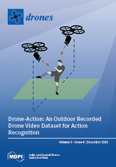
Cover Story (view full-size image): Limited research has been done on human–drone interactions and associated applications. Although some commercial drones can recognize gestures, the capabilities rely on high-quality videos captured at low altitudes and are limited to a small number of simple gestures. Going beyond gestures, enabling a drone to recognize general human actions is far more challenging. Recognizing the importance of datasets for action recognition research in the aerial domain, we present, in this study, a new full high-definition (FHD) video dataset with rich human detail that was recorded on a drone in a controlled manner.View this paper.
  • Issues are regarded as officially published after their release is announced to the table of contents alert mailing list.
  • You may sign up for e-mail alerts to receive table of contents of newly released issues.
  • PDF is the official format for papers published in both, html and pdf forms. To view the papers in pdf format, click on the "PDF Full-text" link, and use the free Adobe Reader to open them.
Order results
Result details
Section
Select all
Export citation of selected articles as:
11 pages, 11805 KiB  
Article
Small Unmanned Aircraft Systems (SUAS) and Manned Traffic near John Wayne Airport (KSNA) Spot Check of the SUAS Facility Map: Towards a New Paradigm for Drone Safety Near Airports
by Peter J. Burke
Drones 2019, 3(4), 84; https://doi.org/10.3390/drones3040084 - 08 Dec 2019
Cited by 8 | Viewed by 3557
Abstract
Using data from an Automatic Dependent Surveillance-Broadcast (ADSB) aggregator, a custom data-mining program was developed to identify all manned aircraft below 500′ AGL within 5 miles of the KSNA airport on six specific days in 2018–2019. The data (a spot check) show that [...] Read more.
Using data from an Automatic Dependent Surveillance-Broadcast (ADSB) aggregator, a custom data-mining program was developed to identify all manned aircraft below 500′ AGL within 5 miles of the KSNA airport on six specific days in 2018–2019. The data (a spot check) show that several of the zero-foot grids are well outside of the traffic pattern, with no manned aircraft below 500′ AGL for at least a mile. Detailed maps showing all the traffic on those days are overlaid on the KSNA UAS facility map for comparison. This data-driven safety analysis is outlined as a new paradigm for drone safety near airports, which can be applied worldwide. Full article
Show Figures

Figure 1

21 pages, 7291 KiB  
Article
Effect of Application Height and Ground Speed on Spray Pattern and Droplet Spectra from Remotely Piloted Aerial Application Systems
by Daniel E. Martin, Wayne E. Woldt and Mohamed A. Latheef
Drones 2019, 3(4), 83; https://doi.org/10.3390/drones3040083 - 04 Dec 2019
Cited by 29 | Viewed by 5472
Abstract
The objectives of this study were to characterize the effects of operational factors on spray application parameters for remotely piloted aerial application systems (RPAAS). The effects of application height and ground speed on spray pattern uniformity and droplet spectra characteristics were investigated for [...] Read more.
The objectives of this study were to characterize the effects of operational factors on spray application parameters for remotely piloted aerial application systems (RPAAS). The effects of application height and ground speed on spray pattern uniformity and droplet spectra characteristics were investigated for two RPAAS (DJI model MG-1 and HSE V6A) delivery vehicles equipped with original equipment manufacturer (OEM) nozzles. A spray mixture of tap water and fluorescent dye was applied at three different application heights in conjunction with four different ground speeds over the center line of a cotton string, suspended 1 m above ground. Fluorometric assessment of spray deposits on cotton strings and spray droplets captured on water-sensitive paper samplers described spray pattern and droplet spectra, respectively. Effective swath was determined based on the widest spray swath with a coefficient of variation (CV) ≤ 25%. Regardless of ground speed, application heights of 2 and 3 m yielded the largest effective swath for the MG-1. Neither application height nor ground speed significantly influenced effective swath for the V6A. These test results may provide guidance to remote aerial applicators as to the best application height and ground speed to use for their RPAAS for efficacious application of pest control products. Full article
Show Figures

Figure 1

16 pages, 1801 KiB  
Article
Drone-Action: An Outdoor Recorded Drone Video Dataset for Action Recognition
by Asanka G. Perera, Yee Wei Law and Javaan Chahl
Drones 2019, 3(4), 82; https://doi.org/10.3390/drones3040082 - 28 Nov 2019
Cited by 46 | Viewed by 11142
Abstract
Aerial human action recognition is an emerging topic in drone applications. Commercial drone platforms capable of detecting basic human actions such as hand gestures have been developed. However, a limited number of aerial video datasets are available to support increased research into aerial [...] Read more.
Aerial human action recognition is an emerging topic in drone applications. Commercial drone platforms capable of detecting basic human actions such as hand gestures have been developed. However, a limited number of aerial video datasets are available to support increased research into aerial human action analysis. Most of the datasets are confined to indoor scenes or object tracking and many outdoor datasets do not have sufficient human body details to apply state-of-the-art machine learning techniques. To fill this gap and enable research in wider application areas, we present an action recognition dataset recorded in an outdoor setting. A free flying drone was used to record 13 dynamic human actions. The dataset contains 240 high-definition video clips consisting of 66,919 frames. All of the videos were recorded from low-altitude and at low speed to capture the maximum human pose details with relatively high resolution. This dataset should be useful to many research areas, including action recognition, surveillance, situational awareness, and gait analysis. To test the dataset, we evaluated the dataset with a pose-based convolutional neural network (P-CNN) and high-level pose feature (HLPF) descriptors. The overall baseline action recognition accuracy calculated using P-CNN was 75.92%. Full article
Show Figures

Figure 1

20 pages, 5375 KiB  
Article
Multi-Sensor UAV Tracking of Individual Seedlings and Seedling Communities at Millimetre Accuracy
by Todd M. Buters, David Belton and Adam T. Cross
Drones 2019, 3(4), 81; https://doi.org/10.3390/drones3040081 - 30 Oct 2019
Cited by 16 | Viewed by 5108
Abstract
The increasing spatial and temporal scales of ecological recovery projects demand more rapid and accurate methods of predicting restoration trajectory. Unmanned aerial vehicles (UAVs) offer greatly improved rapidity and efficiency compared to traditional biodiversity monitoring surveys and are increasingly employed in the monitoring [...] Read more.
The increasing spatial and temporal scales of ecological recovery projects demand more rapid and accurate methods of predicting restoration trajectory. Unmanned aerial vehicles (UAVs) offer greatly improved rapidity and efficiency compared to traditional biodiversity monitoring surveys and are increasingly employed in the monitoring of ecological restoration. However, the applicability of UAV-based remote sensing in the identification of small features of interest from captured imagery (e.g., small individual plants, <100 cm2) remains untested and the potential of UAVs to track the performance of individual plants or the development of seedlings remains unexplored. This study utilised low-altitude UAV imagery from multi-sensor flights (Red-Green-Blue and multispectral sensors) and an automated object-based image analysis software to detect target seedlings from among a matrix of non-target grasses in order to track the performance of individual target seedlings and the seedling community over a 14-week period. Object-based Image Analysis (OBIA) classification effectively and accurately discriminated among target and non-target seedling objects and these groups exhibited distinct spectral signatures (six different visible-spectrum and multispectral indices) that responded differently over a 24-day drying period. OBIA classification from captured imagery also allowed for the accurate tracking of individual target seedling objects through time, clearly illustrating the capacity of UAV-based monitoring to undertake plant performance monitoring of individual plants at very fine spatial scales. Full article
(This article belongs to the Special Issue Ecological Applications of Drone-Based Remote Sensing)
Show Figures

Figure 1

23 pages, 7094 KiB  
Article
Estimating the Threshold of Detection on Tree Crown Defoliation Using Vegetation Indices from UAS Multispectral Imagery
by Kaori Otsu, Magda Pla, Andrea Duane, Adrián Cardil and Lluís Brotons
Drones 2019, 3(4), 80; https://doi.org/10.3390/drones3040080 - 29 Oct 2019
Cited by 24 | Viewed by 4790
Abstract
Periodical outbreaks of Thaumetopoea pityocampa feeding on pine needles may pose a threat to Mediterranean coniferous forests by causing severe tree defoliation, growth reduction, and eventually mortality. To cost–effectively monitor the temporal and spatial damages in pine–oak mixed stands using unmanned aerial systems [...] Read more.
Periodical outbreaks of Thaumetopoea pityocampa feeding on pine needles may pose a threat to Mediterranean coniferous forests by causing severe tree defoliation, growth reduction, and eventually mortality. To cost–effectively monitor the temporal and spatial damages in pine–oak mixed stands using unmanned aerial systems (UASs) for multispectral imagery, we aimed at developing a simple thresholding classification tool for forest practitioners as an alternative method to complex classifiers such as Random Forest. The UAS flights were performed during winter 2017–2018 over four study areas in Catalonia, northeastern Spain. To detect defoliation and further distinguish pine species, we conducted nested histogram thresholding analyses with four UAS-derived vegetation indices (VIs) and evaluated classification accuracy. The normalized difference vegetation index (NDVI) and NDVI red edge performed the best for detecting defoliation with an overall accuracy of 95% in the total study area. For discriminating pine species, accuracy results of 93–96% were only achievable with green NDVI in the partial study area, where the Random Forest classification combined for defoliation and tree species resulted in 91–93%. Finally, we achieved to estimate the average thresholds of VIs for detecting defoliation over the total area, which may be applicable across similar Mediterranean pine stands for monitoring regional forest health on a large scale. Full article
(This article belongs to the Special Issue Unmanned Aerial Vehicles in Geomatics)
Show Figures

Graphical abstract

19 pages, 8175 KiB  
Article
Accuracy Assessment of 3D Photogrammetric Models from an Unmanned Aerial Vehicle
by Salvatore Barba, Maurizio Barbarella, Alessandro Di Benedetto, Margherita Fiani, Lucas Gujski and Marco Limongiello
Drones 2019, 3(4), 79; https://doi.org/10.3390/drones3040079 - 15 Oct 2019
Cited by 55 | Viewed by 8421
Abstract
The unmanned aerial vehicle (UAV) photogrammetric survey of an archaeological site has proved itself to be particularly efficient. In order to obtain highly accurate and reliable results, it is necessary to design carefully the flight plan and the geo-referencing, while also evaluating the [...] Read more.
The unmanned aerial vehicle (UAV) photogrammetric survey of an archaeological site has proved itself to be particularly efficient. In order to obtain highly accurate and reliable results, it is necessary to design carefully the flight plan and the geo-referencing, while also evaluating the indicators of the accuracy rate. Using as a test case a UAV photogrammetric survey conducted on the archaeological site of the Roman Amphitheatre of Avella (Italy), in this paper, we propose a pipeline to assess the accuracy of the results according to some quality indicators. The flight configuration and the georeferencing chosen is then be checked via the residuals on the ground control points (GCPs), evenly distributed on the edges and over the entire area. With the aim of appraising the accuracy of the final model, we will suggest a method for the outlier detection, taking into account the statistical distribution (both global and of portion of the study object) of the reprojection errors. A filter to reduce the noise within the model will then be implemented through the detection of the angle formed by homologous rays, in order to reach a compromise between the number of the usable points and the reduction of the noise linked to the definition of the 3D model. Full article
Show Figures

Figure 1

14 pages, 11402 KiB  
Technical Note
Requirements and Limitations of Thermal Drones for Effective Search and Rescue in Marine and Coastal Areas
by Claire Burke, Paul R. McWhirter, Josh Veitch-Michaelis, Owen McAree, Harry A.G. Pointon, Serge Wich and Steve Longmore
Drones 2019, 3(4), 78; https://doi.org/10.3390/drones3040078 - 14 Oct 2019
Cited by 34 | Viewed by 10976
Abstract
Search and rescue (SAR) is a vital line of defense against unnecessary loss of life. However,
in a potentially hazardous environment, it is important to balance the risks associated with SAR
action. Drones have the potential to help with the efficiency, success rate [...] Read more.
Search and rescue (SAR) is a vital line of defense against unnecessary loss of life. However,
in a potentially hazardous environment, it is important to balance the risks associated with SAR
action. Drones have the potential to help with the efficiency, success rate and safety of SAR operations
as they can cover large or hard to access areas quickly. The addition of thermal cameras to the drones
provides the potential for automated and reliable detection of people in need of rescue. We performed
a pilot study with a thermal-equipped drone for SAR applications in Morecambe Bay. In a variety
of realistic SAR scenarios, we found that we could detect humans who would be in need of rescue,
both by the naked eye and by a simple automated method. We explore the current advantages and
limitations of thermal drone systems, and outline the future path to a useful system for deployment
in real-life SAR. Full article
Show Figures

Figure 1

47 pages, 5561 KiB  
Article
Computationally Efficient Force and Moment Models for Propellers in UAV Forward Flight Applications
by Rajan Gill and Raffaello D’Andrea
Drones 2019, 3(4), 77; https://doi.org/10.3390/drones3040077 - 08 Oct 2019
Cited by 13 | Viewed by 10223
Abstract
Two low-order, parametric models are developed for the forces and moments that a rotating propeller undergoes in forward flight. The models are derived using a first-principles-based approach, and are computationally efficient in the sense of being represented by explicit expressions. The parameters for [...] Read more.
Two low-order, parametric models are developed for the forces and moments that a rotating propeller undergoes in forward flight. The models are derived using a first-principles-based approach, and are computationally efficient in the sense of being represented by explicit expressions. The parameters for the models can be identified either using supervised learning/grey-box fitting from labelled data, or can be predicted using only the static load coefficients (i.e., the hover thrust and torque coefficients). The second model is a multinomial model that is derived by means of a Taylor series expansion of the first model, and can be viewed as a lower-order lumped parameter model. The models and parameter generation methods are experimentally tested against 19 propellers tested in a wind tunnel under oblique flow conditions, for which the data is made available. The models are tested against 181 additional propellers from existing datasets. Full article
Show Figures

Figure 1

24 pages, 1195 KiB  
Review
The Global Emergence of Community Drones (2012–2017)
by Nicolás Vargas-Ramírez and Jaime Paneque-Gálvez
Drones 2019, 3(4), 76; https://doi.org/10.3390/drones3040076 - 06 Oct 2019
Cited by 35 | Viewed by 9116
Abstract
The use of drones with or by communities—what we call community drones—has emerged globally over the last decade to serve diverse purposes. Despite a growing academic interest in community drones, most experiences have been documented as gray literature and there are still no [...] Read more.
The use of drones with or by communities—what we call community drones—has emerged globally over the last decade to serve diverse purposes. Despite a growing academic interest in community drones, most experiences have been documented as gray literature and there are still no publications that review and systematize their use worldwide. Here, we present an overview of the first experiences using community drones—what we refer to as their global emergence (2012–2017). We reviewed gray and academic literature in English and Spanish for the period 2012–2017. We then analyzed the experiences according to their location, date, purpose, type of drone(s) used, agent(s) that carried them out, and methodology used for community participation; “good” and “bad” practices were also included when information was available. We reviewed 39 experiences and found that (1) they mostly occurred in Latin America from 2014; (2) commercial and multirotor drones were the most frequently employed; (3) the main purposes were community training to acquire territorial information for improved defense and/or informed decision-making; (4) most initiatives were driven by external agents and communities’ allies; (5) the most usual forms of community participation were participatory mapping and training workshops, yet local knowledge was either neglected or little valued to complement drone information; and (6) there were no appropriate practices established for community drone usage. Our study improves the little knowledge we have regarding the global emergence of community drones, its geographic trends, and the existing opportunities and challenges to meet the needs and expectations from community drones. In addition, we provide guidelines for appropriate practices that will be useful for communities and social agents interested in the acquisition, training, and use of drones. We conclude by suggesting new avenues to develop theoretical and methodological approaches in relation to the new field of community drones. Full article
Show Figures

Graphical abstract

15 pages, 1740 KiB  
Article
A Comparative Analysis of the Legislation Evolution for Drone Use in OECD Countries
by Nikolaos Tsiamis, Loukia Efthymiou and Konstantinos P. Tsagarakis
Drones 2019, 3(4), 75; https://doi.org/10.3390/drones3040075 - 01 Oct 2019
Cited by 32 | Viewed by 9467
Abstract
Drones have been employed for multiple uses, such as for military, surveillance, recreational, scientific, and research purposes. Their presence inside civil areas has necessitated the need to regulate their use. Towards this direction, many countries worldwide have issued national legislations, which vary on [...] Read more.
Drones have been employed for multiple uses, such as for military, surveillance, recreational, scientific, and research purposes. Their presence inside civil areas has necessitated the need to regulate their use. Towards this direction, many countries worldwide have issued national legislations, which vary on vehicle categorization according to the size, weight, flight altitude, purpose of use, and restrictions. In this study, we pursued the first comparative analysis of the Organization for Economic Co-operation and Development (OECD) countries’ national legislations, in order to explore the similarities and differences in drone use and recommend improvements and homogenization. Some of the examined countries issued legislation during recent years of drone application, while others amended their existing legislative framework in order to catch up with drone technology evolution. Although from the 35 OECD countries 22 belong to the European Union, we observed much diversity among national legal frameworks. The intensive use of drones has led to severe ethical dilemmas that policy makers will need to address in the near future. We conclude with a proposal regarding the basic legislation for different uses according to the criteria that have been developed so far, followed by limitations and restrictions. Full article
Show Figures

Figure 1

Previous Issue
Next Issue
Back to TopTop