Next Issue
Volume 5, March
Previous Issue
Volume 4, September


Urban Sci., Volume 4, Issue 4 (December 2020) – 36 articles

Cover Story (view full-size image): 
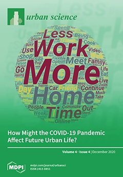
The COVID-19 pandemic has affected many behaviors, including working from home, dining, commuting, and air travel. An important question is whether these behavioral changes will persist once the threat of the pandemic is over. This U.S. survey gives an early look at future behaviors by asking respondents how they behaved pre-pandemic, how they behave now, and how they expect to behave in the future. Respondents reported expecting to work from home more often, fly less often, and dine out less often. These changes will have significant impacts on the transportation system as well as the restaurant and airline industries. View this paper
  • Issues are regarded as officially published after their release is announced to the table of contents alert mailing list.
  • You may sign up for e-mail alerts to receive table of contents of newly released issues.
  • PDF is the official format for papers published in both, html and pdf forms. To view the papers in pdf format, click on the "PDF Full-text" link, and use the free Adobe Reader to open them.
Order results
Result details
Select all
Export citation of selected articles as:
3 pages, 154 KiB  
Editorial
Urban Place Names: Introduction
by Sergei Basik
Urban Sci. 2020, 4(4), 80; https://doi.org/10.3390/urbansci4040080 - 21 Dec 2020
Cited by 11 | Viewed by 2586
Abstract
Urban place names are multidimensional phenomena [...] Full article
(This article belongs to the Special Issue Urban Place Names: Political, Economic, and Cultural Dimensions)
10 pages, 722 KiB  
Article
The Impact of Forest Usage and Accessibility on the Perceptions of its Users and Surrounding Residents
by Gloria C. Blaise, Jeffrey A. Brown, Rebecca C. Jordan and Amanda E. Sorensen
Urban Sci. 2020, 4(4), 79; https://doi.org/10.3390/urbansci4040079 - 21 Dec 2020
Viewed by 2674
Abstract
Forests provide valuable ecosystem services to individuals that live near them and visit them. However, many forests, especially in highly developed areas, are specifically managed for resource conservation purposes. A common practice for conservation is restricting access to people to ensure minimal human-driven [...] Read more.
Forests provide valuable ecosystem services to individuals that live near them and visit them. However, many forests, especially in highly developed areas, are specifically managed for resource conservation purposes. A common practice for conservation is restricting access to people to ensure minimal human-driven harm. While the restriction of human access to a forest increases its biological ecosystem services, it limits its cultural services and may reduce the public’s perceived value of the forest. To investigate how access influences the perceived value of a forest, two forests in the state of New Jersey, USA, were compared. The forests, the Rutgers Ecological Preserve (RUEP) and Hutcheson Memorial Forest (HMF), represent accessible and inaccessible forests respectively. The study reported here evaluated the effects of visitation and accessibility on public perception of both sites. Residents near the RUEP and HMF, and visitors of both sites, were surveyed (n = 48). The results of the surveys demonstrated that the frequency of visitation and community location can have noticeable influences on a number of variables, including one’s belief that forests provide important services and the thought that protected areas take away from an individual’s freedom to use the area. A more positive view of the forests was present in those who visited the public forest most often. Full article
Show Figures

Figure 1

11 pages, 1037 KiB  
Article
Mitigation of Urban Heat Island Effects through “Green Infrastructure”: Integrated Design of Constructed Wetlands and Neighborhood Development
by Victor Ruiz-Aviles, Anthony Brazel, Jonathan M. Davis and David Pijawka
Urban Sci. 2020, 4(4), 78; https://doi.org/10.3390/urbansci4040078 - 21 Dec 2020
Cited by 2 | Viewed by 3758
Abstract
Extreme heat threatens desert city residents throughout the hot summer months and inhibits outdoor recreation and activity. Ecosystem services provide various benefits for urban environments. For desert cities, few are more critical than microclimate regulation and water treatment and conservation. This study evaluates [...] Read more.
Extreme heat threatens desert city residents throughout the hot summer months and inhibits outdoor recreation and activity. Ecosystem services provide various benefits for urban environments. For desert cities, few are more critical than microclimate regulation and water treatment and conservation. This study evaluates the degree to which artificial wetlands support cooler microclimates and reduce the local urban heat island effect. The authors use (a) remotely sensed temperature data for Avondale, Arizona, to measure temperature differences between neighborhoods with and without water features and (b) resident surveys to evaluate perceptions of potential cooling effects. Results show substantial differences in the daytime surface temperatures for the wetland neighborhood compared to those without water features. More than a third of residents perceived a cooling effect throughout the year. The authors conclude that artificial wetlands within a desert city increase human comfort by reducing surface and air temperature and should be considered an urban heat island mitigation strategy. Full article
Show Figures

Figure 1

24 pages, 4068 KiB  
Article
Finite Element Method for the Estimation of Insertion Loss of Noise Barriers: Comparison with Various Formulae (2D)
by Nikolaos M. Papadakis and Georgios E. Stavroulakis
Urban Sci. 2020, 4(4), 77; https://doi.org/10.3390/urbansci4040077 - 21 Dec 2020
Cited by 10 | Viewed by 2950
Abstract
Noise barriers are a critical part of noise mitigation in urban and rural areas. In this study, a comparison of the insertion loss calculations of noise barriers via the Finite Element Method (FEM) and various formulae (Kurze–Anderson, ISO 9613-2/Tatge, Menounou) is presented in [...] Read more.
Noise barriers are a critical part of noise mitigation in urban and rural areas. In this study, a comparison of the insertion loss calculations of noise barriers via the Finite Element Method (FEM) and various formulae (Kurze–Anderson, ISO 9613-2/Tatge, Menounou) is presented in the case of two-dimensional acoustic radiation problems. Some of the cases explored include: receiver in the illuminated zone, in the shadow zone, in the shadow border, source in medium, long, short distance from the barrier, source and receiver near barrier, and source above the barrier. Comparisons of the results indicate that FEM results comply well (less than 1 dB in each case) with Menounou’s formula which in turn complies with the analytic solution (MacDonald Solution). In certain cases, the differences between FEM and Menounou’s formula compared to Kurze–Anderson and ISO 9613-2/Tatge formulae are substantial (source and receiver near the barrier (10 dB) and source near the barrier and receiver in the shadow border (5 dB)). Similar differences are also confirmed by the analytic solution. The findings suggest that FEM can be applied effectively for the precise estimation of the insertion loss of noise barriers. Especially in cases where ISO 9613-2 formula shows large deviations from the analytic solution (e.g., near barrier), possible applications may arise in cases such as balconies, facades, etc. Furthermore, the study supports the idea that FEM could possibly be effectively utilized in real life applications for microscale urban acoustic modeling as a viable alternative to expensive noise prediction software. Full article
(This article belongs to the Collection Urban Acoustic Environments)
Show Figures

Figure 1

20 pages, 1283 KiB  
Review
Resilient Urbanization: A Systematic Review on Urban Discourse in Pakistan
by Latif Abdul and Tao-fang Yu
Urban Sci. 2020, 4(4), 76; https://doi.org/10.3390/urbansci4040076 - 14 Dec 2020
Cited by 21 | Viewed by 6477
Abstract
Urbanization is a common phenomenon in the modern world. It has come with new challenges, especially for developing countries. Such countries, therefore, have to stay ahead in their preparedness efforts to meet these urban issues halfway. Unfortunately, urban residents in Pakistan are living [...] Read more.
Urbanization is a common phenomenon in the modern world. It has come with new challenges, especially for developing countries. Such countries, therefore, have to stay ahead in their preparedness efforts to meet these urban issues halfway. Unfortunately, urban residents in Pakistan are living in serious social, physical, and economic hardships. Despite being economic engines, cities in Pakistan suffer from stresses like climate change, haphazard and unregulated expansion, housing shortage, and a lack of basic civic amenities. While using systematic review methodology, we collected published and grey data from national and international sources. Literature shows that successive governments in Pakistan gave ample space to urban development in most of the policy documents. However, urban resilience and community engagement were given scant attention. This major gap, both in policy and practice, needs to be bridged to promote resilient and sustainable urbanization in Pakistan. Full article
(This article belongs to the Special Issue Healthy City Science: Citizens, Experts and Urban Governance)
Show Figures

Figure 1

9 pages, 1840 KiB  
Commentary
Towards Creating a Global Urban Toponymy—A Comment
by Liora Bigon
Urban Sci. 2020, 4(4), 75; https://doi.org/10.3390/urbansci4040075 - 12 Dec 2020
Cited by 12 | Viewed by 2984
Abstract
This commentary points to the problems inherent in critical place names studies in terms of classic research topics, methodologies and geographies. It expounds the limits of the official “index”, that is, the variety of traditional urban inscriptions on which critical toponymy scholars rely [...] Read more.
This commentary points to the problems inherent in critical place names studies in terms of classic research topics, methodologies and geographies. It expounds the limits of the official “index”, that is, the variety of traditional urban inscriptions on which critical toponymy scholars rely in interpreting modern urban spatialities—e.g., lists of street names, official street signage, gazetteers, archival materials, etc. The argument is that in Southern urban contexts, where informality in planning can reach up to about 80 percent of the city, researching official naming and signage renders a distorted image of the city and its namescape production. A comment is thus made on the need to embrace more innovative and almost ethnographic research methodologies for understanding place referencing, place attachment and everyday navigational channels in Southern cities. These will generate a more substantial contribution towards the creation of global urban toponymy and a further de-colonization of Eurocentric presumptions regarding governmentality, urban management, and the accompanying role of street naming systems. Full article
(This article belongs to the Special Issue Urban Place Names: Political, Economic, and Cultural Dimensions)
Show Figures

Figure 1

17 pages, 10615 KiB  
Article
Street Name Data as a Reflection of Migration and Settlement History
by Sarah J. Berkemer and Peter F. Stadler
Urban Sci. 2020, 4(4), 74; https://doi.org/10.3390/urbansci4040074 - 11 Dec 2020
Cited by 2 | Viewed by 2809
Abstract
Street names (odonyms) play an important role not only as descriptors of geographic locations but also due to their sociological and political connotations and commemorative character. Here we analyse street names in Europe and North America extracted from OpenStreetMap, asking in particular to [...] Read more.
Street names (odonyms) play an important role not only as descriptors of geographic locations but also due to their sociological and political connotations and commemorative character. Here we analyse street names in Europe and North America extracted from OpenStreetMap, asking in particular to what extent odonyms reflect early European settlements in the New World, i.e., the immigration of German, Austrian and Scandinavian minorities. We observe that old street names of European origin can predominantly be found in rural areas. North American street names indeed recapitulate local and regional settlement histories. The aim of this study is to demonstrate that easily accessible data sets from freely available map data such as street names convey usable information concerning migration patterns and the history of settlements in the case of European immigrants in North America as well as colonial history. We provide a freely available pipeline to analyse this kind of data. Full article
Show Figures

Figure 1

34 pages, 9060 KiB  
Article
Exploring and Illustrating the (Inter-)Disciplinarity of Waste and Zero Waste Management
by Jonathon Hannon
Urban Sci. 2020, 4(4), 73; https://doi.org/10.3390/urbansci4040073 - 08 Dec 2020
Cited by 5 | Viewed by 3196
Abstract
The aim of this research was to explore the composition, contribution and arrangement of scientific disciplines, across the spectrum from, traditional waste management, to alternative, contemporary approaches, such as the zero waste and circular economy movements. The purpose of this research is to [...] Read more.
The aim of this research was to explore the composition, contribution and arrangement of scientific disciplines, across the spectrum from, traditional waste management, to alternative, contemporary approaches, such as the zero waste and circular economy movements. The purpose of this research is to better address the challenge of waste by enhancing the understanding and future employment of interdisciplinary theory and practice. The first outcome of the review strategy employed in this research was to, illustrate a generic rubric of scientific disciplines and to highlight and discuss key disciplines most obviously connected to waste management. This graphic illustration was then overlain with the findings from systematically reviewing a diverse range of indicators and sources of insight and information on the disciplines and interdisciplinarity evident across the spectrum from waste to zero waste management approaches. The resulting final graphic illustrates the intense disciplinarity and hence, the significant interdisciplinary requirement of (zero) waste management. An observation emerging from this research is that, successfully managing the globalised complexity of waste issues and in this, addressing the challenges of climate change and sustainable development, requires cultivating synergy between multiple scientific and practical disciplines. The scope of this challenge increases with the adoption of more holistic, aspirational, countercultural approaches, such as zero waste. It is argued that, enhancing interdisciplinary training and collaboration in research, education and industry/community practice, will improve performance across the spectrum of worldviews, from waste to zero waste. Full article
Show Figures

Figure 1

23 pages, 33256 KiB  
Article
A Hybrid Method for Citizen Science Monitoring of Recreational Trampling in Urban Remnants: A Case Study from Perth, Western Australia
by Greg D. Simpson, Jackie Parker, Erin Gibbens and Philip G. Ladd
Urban Sci. 2020, 4(4), 72; https://doi.org/10.3390/urbansci4040072 - 08 Dec 2020
Cited by 4 | Viewed by 2437
Abstract
Vegetation trampling that arises from off-trail excursions by people walking for recreation can negatively impact the structure of understory plants in natural spaces that are an essential element of urban green infrastructure in a modern city. In addition to reducing the esthetic quality [...] Read more.
Vegetation trampling that arises from off-trail excursions by people walking for recreation can negatively impact the structure of understory plants in natural spaces that are an essential element of urban green infrastructure in a modern city. In addition to reducing the esthetic quality and environmental values of urban remnant and replanted native vegetation, such trampling reduces the habitat that supports wildlife populations within the urban fabric. This case study draws upon several disparate methods for measuring vegetation structure and trampling impacts to produce a hybrid method that community-based citizen scientists (and land managers and other researchers) could use to simply, rapidly, and reproducibly monitor how trampling associated with urban recreation trails impacts the structure of understory vegetation. Applying the novel hybrid method provided evidence that trampling had reduced the vegetation structure adjacent to a recreational walking trail in an urban woodland remnant in Perth, Western Australia. The hybrid method also detected ecological variability at the local ecosystem-scale at a second similar woodland remnant in Perth. The hybrid sampling method utilized in this case study provides an effective, efficient, and reproducible data collection method that can be applied to recreation ecology research into aspects of trampling associated with trail infrastructure. Full article
Show Figures

Figure 1

15 pages, 230 KiB  
Article
The Urban-Rural Telecommunications Divide Endures: A Historical Perspective from Landline Telephony
by Jean-Michel Guldmann
Urban Sci. 2020, 4(4), 71; https://doi.org/10.3390/urbansci4040071 - 08 Dec 2020
Cited by 2 | Viewed by 1916
Abstract
The popular press and academic literature show that the urban-rural divide persists with regard to recent telecommunications technologies, such as broadband and wireless service. As was the case for landline telephony, this lack of deployment in rural areas is rooted in cost differentials [...] Read more.
The popular press and academic literature show that the urban-rural divide persists with regard to recent telecommunications technologies, such as broadband and wireless service. As was the case for landline telephony, this lack of deployment in rural areas is rooted in cost differentials and lack of agglomeration economies. This paper provides historical insights on this divide, using 1990 data on voice communications in a region located in the northeastern United States, and investigates (1) whether there are differences in telecommunications usage between urban and rural firms, (2) whether advanced telecommunications technologies provide an economic advantage to rural firms, and (3) what are the factors encouraging and inhibiting the provision of these technologies in rural areas. Exchange-level data on telephone usage by eleven economic sectors are first linked, through regression analysis, to data characterizing the exchange employment, rural character, availability of advanced technology, and geography. Rural activities turn out to use telecommunications less than urban ones in the absence of advanced technologies, but the latter tend to significantly increase usage. Next, a logit model is estimated to link the deployment of one advanced technology—digital switching—to market and geographical variables. The results tend to support the idea that an advanced telecommunications infrastructure in rural areas may be important to attract activities that make heavy use of telecommunications, but also that its provision is inhibited by the traditional rural barriers of distance and low population density. Full article
20 pages, 6526 KiB  
Article
Shopping Centres, Cycling Accessibility and Planning—The Case of Nova Lund in Sweden
by Till Koglin and Lucas Glasare
Urban Sci. 2020, 4(4), 70; https://doi.org/10.3390/urbansci4040070 - 04 Dec 2020
Cited by 3 | Viewed by 2331
Abstract
This paper evaluates the history and cycling accessibility of Nova, a shopping centre established in Lund, Sweden, in 2002. The current situation was also analysed through observation and a literature review. Moreover, the study conducted a closer analysis of the history and role [...] Read more.
This paper evaluates the history and cycling accessibility of Nova, a shopping centre established in Lund, Sweden, in 2002. The current situation was also analysed through observation and a literature review. Moreover, the study conducted a closer analysis of the history and role of the municipality based on further literature study and interviews with officials. The conclusion of the analysis indicates poor and unsafe bikeways caused by conflicts of interest between politicians, officials, landowners and the general public. It also depicts a situation in which the municipality’s master plan has been ignored, and, in contrast to the local goals, cycling accessibility at Nova has seen no significant improvement since the shopping centre was first established. The reasons for this, arguably, are a relatively low budget for bikeway improvements in the municipality, as well as a situation in which decision-makers have stopped approaching the subject, as a result of the long and often boisterous conflicts it has created in the past. Lastly, it must be noted that it is easy to regard the whole process of Nova, from its establishment to the current situation, as being symptomatic of the power structures between drivers and cyclists that still affect decision-makers at all levels. Full article
Show Figures

Figure 1

32 pages, 4042 KiB  
Article
Urban Form, Socio-Demographics, Attitude and Activity Spaces: Using Household-Based Travel Diary Approach to Understand Travel and Activity Space Behaviors
by Naila Sharmeen and Douglas Houston
Urban Sci. 2020, 4(4), 69; https://doi.org/10.3390/urbansci4040069 - 02 Dec 2020
Cited by 7 | Viewed by 2933
Abstract
Very few studies have addressed the gap in literature by examining the travel and activity patterns of travelers in developing countries to inform future land use and socio-economic planning. The major purpose of this paper is to determine the factors related with travel [...] Read more.
Very few studies have addressed the gap in literature by examining the travel and activity patterns of travelers in developing countries to inform future land use and socio-economic planning. The major purpose of this paper is to determine the factors related with travel and activity space patterns of residents in Dhaka, Bangladesh. Based on lessons learned from a pilot study, a full study was undertaken using artificial neural network and regression. A network analyst-based shortest path network with road network buffer activity space calculation measure was used in geographic information system. Exploratory and confirmatory factor analyses were used to identify attitudinal factor dimensions. Calculated individual activity spaces were found to range from 0.08 to 10.13 square miles. Trip characteristics were found to be significant predictors of individual activity space. In case of household activity space, D variables (density, design, and destination accessibility) and household characteristics were found as the most significant. Perceived neighborhood amenities, car attachment, monetary concerns, transit preferences, perceived daily travel area and environmental concern were found to shape people’s perception. Weekend activity spaces were more compact than those for weekdays. Individual day-to-day variability was less during weekdays than on the weekend. Female and high-income respondents had smaller activity spaces. Full article
Show Figures

Figure 1

12 pages, 2913 KiB  
Article
The Relationship between Land Cover and Sociodemographic Factors
by Daniel L. Mendoza
Urban Sci. 2020, 4(4), 68; https://doi.org/10.3390/urbansci4040068 - 02 Dec 2020
Cited by 5 | Viewed by 3080
Abstract
Multiple social and environmental justice concerns are linked to the urban form such as the distribution of socioeconomic class populations, healthcare spending, air pollution exposure, and human mobility. Because of this, the implications of the relationships between built urban form, sociodemographic factors, and [...] Read more.
Multiple social and environmental justice concerns are linked to the urban form such as the distribution of socioeconomic class populations, healthcare spending, air pollution exposure, and human mobility. Because of this, the implications of the relationships between built urban form, sociodemographic factors, and air quality warrant analysis at a high spatial resolution. This study used 1m resolved LiDAR data to characterize land use in Salt Lake County, Utah, and associate it with sociodemographic and air quality data at the census block group and zip code levels. We found that increasing tree cover was associated with higher per capita income and lower minority populations while increasing built cover was linked to lower per capita income and higher minority populations. Air quality showed less strong correlations, however, decreased non-irrigated cover, increased built cover, and higher amounts of households living under poverty were related to higher long-term PM2.5 exposure. Due to regional air pollution concerns, several policy efforts have been undertaken to improve air quality and reduce negative health outcomes in Utah which are being informed by regulatory and research-grade air quality sensors. Full article
Show Figures

Figure 1

21 pages, 268 KiB  
Article
City as a Growth Platform: Responses of the Cities of Helsinki Metropolitan Area to Global Digital Economy
by Ari-Veikko Anttiroiko, Markus Laine and Henrik Lönnqvist
Urban Sci. 2020, 4(4), 67; https://doi.org/10.3390/urbansci4040067 - 30 Nov 2020
Cited by 10 | Viewed by 3597
Abstract
The aim of this article is to shed light on how ongoing structural change towards the global digital economy condition urban economic development. Discussion starts with a brief reference to the growth machine thesis and its emphasis on the interests of local land [...] Read more.
The aim of this article is to shed light on how ongoing structural change towards the global digital economy condition urban economic development. Discussion starts with a brief reference to the growth machine thesis and its emphasis on the interests of local land and real estate owners. This theory serves as a contrasting point for the second element of our framework, the platform economy, which brings digital platforms and the transnational capitalist class into the picture. The transition from the urban growth machines of the industrial age to the digital growth platforms of the information age imply a radical change in the context of urban economic development. On this basis, we discuss cities’ need to adjust their growth strategies to the conditions of the emerging platform economy. Our illustrative case is the capital region of Finland. We interviewed officials and experts who hold key positions in the design of economic development policy in the three largest cities of this area. The empirical results show that the platform economy is rather vaguely conceptualized, and its challenges are ambiguously addressed. Cities have, however, started to adopt platform and ecosystem thinking in their strategies and established urban innovation platforms, talent and start-up attraction programs, and open data initiatives that reflect the gradual adoption of platform logic in urban economic development. Full article
14 pages, 4699 KiB  
Article
USRT: A Solar Radiative Transfer Model Dedicated to Estimating Urban 3D Surface Reflectance
by Deyong Hu, Manqing Liu, Yufei Di, Chen Yu and Yichen Wang
Urban Sci. 2020, 4(4), 66; https://doi.org/10.3390/urbansci4040066 - 27 Nov 2020
Cited by 4 | Viewed by 1941
Abstract
Urban 3D surface reflectance is a critical parameter for the modeling of surface biophysical processes. It is of great significance to enhance the accuracy of reflectance in urban areas. Based on the urban solar radiative transfer (USRT) model, this study presents a methodology [...] Read more.
Urban 3D surface reflectance is a critical parameter for the modeling of surface biophysical processes. It is of great significance to enhance the accuracy of reflectance in urban areas. Based on the urban solar radiative transfer (USRT) model, this study presents a methodology for estimating urban reflectance using the sky view factor (SVF) derived from airborne LiDAR data. Then, the USRT model was used to retrieve urban 3D surface reflectance from Landsat 8 data over the typical area of Beijing. The reflectance from USRT model was compared with the estimated value obtained from the model without considering the impact of morphological characteristics of the urban underlying surface (flat model). The results showed that the urban sample reflectance estimated by the USRT model was close to the sample reflectance of the suburban underlying surface which was less affected by morphological characteristics. The research summaries are as follows: (1) The definite physical meaning is presented in the USRT model, and can be applied to estimate the physical parameters of the urban underlying surface. (2) The reflectance from the USRT model is slightly larger than the reflectance derived from the flat model, which indicates that the accuracy of urban 3D surface reflectance is improved by the USRT model. (3) The effects of the SVF and building reflectance are different. The SVF presents a strong sensitivity to the estimation of the urban 3D surface reflectance, and the variations of building reflectance setting have little impact on urban reflectance, which is characterized by low sensitivity. Generally, the methodology of estimating urban reflectance proposed in this study can better clarify the impact mechanism of urban geometry on the radiative transfer processes and further promote the application and development of urban quantitative remote sensing. Full article
Show Figures

Figure 1

24 pages, 4981 KiB  
Article
Eco-Cultural Design Assessment Framework and Tool for Sustainable Housing Schemes
by Yahya Qtaishat, Kemi Adeyeye and Stephen Emmitt
Urban Sci. 2020, 4(4), 65; https://doi.org/10.3390/urbansci4040065 - 24 Nov 2020
Cited by 5 | Viewed by 4127
Abstract
Assessment tools such as BREEAM and LEED are widely used to assess physical indicators of building performance from the micro- to the mesoscale. However, the built environment represents both intangible and tangible sets of indicators that should be understood within its context. Therefore, [...] Read more.
Assessment tools such as BREEAM and LEED are widely used to assess physical indicators of building performance from the micro- to the mesoscale. However, the built environment represents both intangible and tangible sets of indicators that should be understood within its context. Therefore, this project proposes a prototype Eco-cultural design assessment framework and tool to enhance the process of sustainable housing development that meets the residents’ socio-cultural needs whilst avoiding unwanted environmental impacts. A qualitative research design approach was adopted. The tool was developed using data derived from interviews with 81 participants from two comparative case studies of vernacular and contemporary housing in Jordan. Results showed that indicators related to wellbeing and local culture were the most discussed by participants and were associated with sustainable architecture. The tool was designed to encapsulate these findings and evaluated for its completeness and usability by 38 architects from Jordan. Results indicate that participants had positive feedback, and they deemed the tool content useful and practical for integrating Eco-cultural design indicators within architectural practice in Jordan. The research outputs are novel and significant in that they translated qualitative socio-cultural indicators into tangible design guidelines that can be effectively incorporated into existing sustainable building assessment frameworks. Full article
Show Figures

Figure 1

10 pages, 2507 KiB  
Article
Colonialism and Toponyms in Singapore
by Samantha JingYi Yom and Francesco Cavallaro
Urban Sci. 2020, 4(4), 64; https://doi.org/10.3390/urbansci4040064 - 19 Nov 2020
Cited by 2 | Viewed by 4328
Abstract
Place names do not simply refer to physical locations. They are linguistic symbols full of connotative meaning, carrying a range of cognitive, social, historical, cultural, and ideological significance. Naming (or renaming) has been a key aspect of the colonisation process, through which the [...] Read more.
Place names do not simply refer to physical locations. They are linguistic symbols full of connotative meaning, carrying a range of cognitive, social, historical, cultural, and ideological significance. Naming (or renaming) has been a key aspect of the colonisation process, through which the colonisers have used language to assert their power over the colonised. Singapore has a very rich history, which includes pre-colonial, colonial, and post-colonial periods. This paper examines selected toponymic changes in Singapore that occurred against the backdrop of colonialism. Given Singapore’s colonial past, as well as its multilingual and multicultural context, the paper aims to provide a thorough and insightful documentation of selected toponymic changes, while uncovering the underlying reasons that motivated them. Four place names (as they are currently known) are investigated in this paper: Jalan Besar, Havelock Road, Middle Road, and the Padang. An analysis of historical data revealed that toponymic changes associated with these places during colonial rule mostly reflected the asymmetrical power relationship between the colonisers and the colonised. The paper also highlights the historical processes in which naming deviated from such expectations. Full article
Show Figures

Figure 1

8 pages, 2082 KiB  
Communication
A Note on Variation of the Acoustic Environment in a Quiet Residential Area in Kobe (Japan): Seasonal Changes in Noise Levels Including COVID-Related Variation
by Kimihiro Sakagami
Urban Sci. 2020, 4(4), 63; https://doi.org/10.3390/urbansci4040063 - 16 Nov 2020
Cited by 4 | Viewed by 2328
Abstract
This communication compares the previously reported results of the acoustic environment, mainly noise levels at a fixed point, in a quiet residential area in Kobe, Japan, under the declaration of the COVID-19 state of emergency in May 2020 with the results of two [...] Read more.
This communication compares the previously reported results of the acoustic environment, mainly noise levels at a fixed point, in a quiet residential area in Kobe, Japan, under the declaration of the COVID-19 state of emergency in May 2020 with the results of two follow-up studies in the same area: subsequent follow-up noise measurements in June and July–August 2020, and the present results of measurements in September–October 2020. The results of the comparison among the above three measurements suggest that noise levels were lower during September-October 2020 than during the declaration of the state of emergency in May 2020. In the period from May to October 2020, the noise level was significantly higher in July and August of the same year due to the sound of cicadas, which are common in this area. This suggests that it is difficult to set the target values of the acoustic environment planning by referring to the low noise level at lockdown or similar measures in areas with large seasonal variations in acoustic environment. Although many case studies are necessary to obtain appropriate target values, one case study is presented in this communication to illustrate an example and discuss its difficulty. Full article
Show Figures

Figure 1

9 pages, 906 KiB  
Article
Health Benefit Assessment of Running in Urban Areas against the Background of Particulate Matter 2.5 Concentration: The Munich Olympic Park
by Linda Zeindl and Joerg Koenigstorfer
Urban Sci. 2020, 4(4), 62; https://doi.org/10.3390/urbansci4040062 - 12 Nov 2020
Viewed by 2392
Abstract
Air pollution while exercising is a health threat to urban residents. The study’s purpose is to conduct a health benefit assessment for running against the background of the Particulate Matter (PM) 2.5 concentration, taking the Munich Olympic Park as a case. The health [...] Read more.
Air pollution while exercising is a health threat to urban residents. The study’s purpose is to conduct a health benefit assessment for running against the background of the Particulate Matter (PM) 2.5 concentration, taking the Munich Olympic Park as a case. The health benefit assessment was done under the assumption that people exercise at different PM2.5 concentrations and with varying duration and intensity. PM2.5 concentrations in and around the Olympic Park area were measured on 25 rain-free days from July until November 2019, using DC1700 (Dylos). The results show that, for the example of a 60-min run at a moderate intensity (60% VO2max), the PM2.5 concentration at which running no longer leads to additional health benefits amounts to 55 μg/m3 (tipping point). Harms outweigh health benefits at 95 μg/m3 (break-even point). The average PM2.5 concentration during the runs to and inside the Olympic Park was above the tipping point on one day, but did not reach the break-even point on any of the days. The average concentration across all days did not reach the tipping or break-even points for any running duration. The Munich Olympic Park provides a potentially health-enhancing space to residents from the perspective of PM2.5-related air pollution. Full article
Show Figures

Figure 1

20 pages, 1485 KiB  
Article
Predicting the Likelihood of Using Car-Sharing in the Greater Cairo Metropolitan Area
by Abdelrahman Samaha and Hamid Mostofi
Urban Sci. 2020, 4(4), 61; https://doi.org/10.3390/urbansci4040061 - 11 Nov 2020
Cited by 6 | Viewed by 3940
Abstract
This research investigates the influencing variables that affect the likelihood of choosing car-sharing if it launches in the Greater Cairo Metropolitan Area, Egypt. It adopts a binary logistic regression model to analyze the findings of an online stated preference survey. The results include [...] Read more.
This research investigates the influencing variables that affect the likelihood of choosing car-sharing if it launches in the Greater Cairo Metropolitan Area, Egypt. It adopts a binary logistic regression model to analyze the findings of an online stated preference survey. The results include 419 valid responses with different choice scenarios, which are based on the revealed preference of each respondent. The generated model shows statistical significance for age, car ownership, cost, and buffer time of the current mode of transport, travel time, and leisure trips. In addition, car-sharing experience, public transit, ride-hailing, walking, and biking also have significant effects. The highest-impact attributes are the car-sharing cost and access time, as the combination of setting the fare to 2 EGP per minute and limiting the access time of the shared vehicle to nearly 5 min achieved a likelihood of choosing car-sharing in nearly 77% of the responses. Full article
Show Figures

Figure 1

18 pages, 4353 KiB  
Article
Sharing Is Caring, but Is the Shore Cared for? The Sharing Paradox of the French Coast
by Stephan J. Hauser and Catherine Roche
Urban Sci. 2020, 4(4), 60; https://doi.org/10.3390/urbansci4040060 - 10 Nov 2020
Cited by 2 | Viewed by 2497
Abstract
Coastlines have long attracted industrial activities, services, housing, and tourism. At select geographic locations, harbors host port facilities and provide local economic growth opportunities. As such, these areas also concentrate populations around the world. In the north of France, where the unemployment rate [...] Read more.
Coastlines have long attracted industrial activities, services, housing, and tourism. At select geographic locations, harbors host port facilities and provide local economic growth opportunities. As such, these areas also concentrate populations around the world. In the north of France, where the unemployment rate is high, port industries are still massive providers of work. However, in the last decades, the port development has become a major threat to the architectural heritage, the historical scenery, and the unique biodiversity of these areas, both at sea and on land. The impact of urban redevelopment has been clearly visible since 1950. At this point, this paper raises the following question: How is it possible, in this context, to efficiently limit this urban sprawl through legal frameworks to protect land, sea, and their in-between environment, in spite of the economic interests? The urbanization of the northern coastline of France has gradually expanded since 1950 until a fundamental act appeared in 1986, the Shoreline Act “Loi Littoral”. This act allows us to analyze the last thirty years of urbanization and its binding force towards the protection of the environment; and yet, we also understand that it has a limited role. It does not forbid all kinds of construction, but just new buildings coming out of nowhere, though expansion in urbanized areas is allowed. After decades of existence, this framework has been integrated by both politicians and citizens, and its results have been judged. If the law is now seen as a guardian of the shore, inhabitants and environmental organizations have often criticized its dimness, which favors interpretation. This paper analyzes the soft limitations that have affected the ongoing space consumption since the 1950s using aerial pictures provided by the IGN (Institut National de l’Information Géographique et Forestière), as well as if the rules were efficient enough in their protection. Full article
Show Figures

Figure 1

15 pages, 1181 KiB  
Review
Towards Psychosocial Well-Being in Historic Urban Landscapes: The Contribution of Cultural Memory
by Fatmaelzahraa Hussein, John Stephens and Reena Tiwari
Urban Sci. 2020, 4(4), 59; https://doi.org/10.3390/urbansci4040059 - 09 Nov 2020
Cited by 5 | Viewed by 3755
Abstract
A crucial element in the human search for well-being is achieving a sense of identity within, and belonging to, the landscape in which we live. Landscape should be understood as not only the visible environment but the affective values we attach to it [...] Read more.
A crucial element in the human search for well-being is achieving a sense of identity within, and belonging to, the landscape in which we live. Landscape should be understood as not only the visible environment but the affective values we attach to it and how we shape it in our mind’s eye. These inner reflections of our landscapes constitute one of our richest archives, in particular, in terms of creating and passing down to future generations our cultural memories. The current paper is a review of literature on the concepts of urban heritage conservation, and, in particular, the development of the historic urban landscape (HUL) approach, with reference to the role and contribution of cultural memory and its presence in the urban landscape. We also investigate how the notions of place attachment and identity interrelate with cultural memory to elucidate how such interrelations can contribute to human psychosocial well-being and quality of life (QOL). This review points to the neglected role of cultural memory in the maintenance of psychosocial well-being in HULs, a topic which requires further research to deepen our understanding about its importance in urban environments. Full article
(This article belongs to the Special Issue Nature & Culture for Cities and Territories)
Show Figures

Figure 1

19 pages, 1521 KiB  
Article
Are Knowledge-Intensive Services an Urban Growth Factor in the Global Periphery? (Un)Fulfilled Possibilities in the Large Metropolitan Areas of Mexico
by Boris Graizbord and Luis Enrique Santiago
Urban Sci. 2020, 4(4), 58; https://doi.org/10.3390/urbansci4040058 - 04 Nov 2020
Cited by 3 | Viewed by 2219
Abstract
In this paper, we analyze the labor productivity of “knowledge-intensive services” (KIS) located in the four larger metropolitan areas in Mexico. We discuss the accepted explanation to why big cities concentrate the best and most qualified jobs and activities that generate innovative and [...] Read more.
In this paper, we analyze the labor productivity of “knowledge-intensive services” (KIS) located in the four larger metropolitan areas in Mexico. We discuss the accepted explanation to why big cities concentrate the best and most qualified jobs and activities that generate innovative and technological change and therefore labor productivity. In Mexico this is the case for some knowledge-intensive sectors, but some paradoxes emerge when services are disaggregated by analytical, synthetic, and symbolic categories. We use disaggregated economic census data for 2004 and 2014 to find changes in labor productivity in those KIS sectors compared to the metropolitan service economy. In fact, we can identify different spatial logic according to the type of knowledge that KIS produce. Results show unexpected paradoxes in terms of type of KIS category viz a viz their location and growth performance in the four larger metropolitan areas. Full article
Show Figures

Figure 1

19 pages, 5693 KiB  
Communication
Factors Affecting Electric Vehicle Uptake: Insights from a Descriptive Analysis in Australia
by Bethany Foley, Kenan Degirmenci and Tan Yigitcanlar
Urban Sci. 2020, 4(4), 57; https://doi.org/10.3390/urbansci4040057 - 04 Nov 2020
Cited by 23 | Viewed by 10476
Abstract
Transport activities are among the major contributors of greenhouse gas emissions and the resulting global climate crisis. Despite some efforts in shifting from internal combustion engines to electric motors, the global market share of electric vehicles (EVs) is very low—about 1%. This figure [...] Read more.
Transport activities are among the major contributors of greenhouse gas emissions and the resulting global climate crisis. Despite some efforts in shifting from internal combustion engines to electric motors, the global market share of electric vehicles (EVs) is very low—about 1%. This figure even goes as low as 0.4% for some developed countries—e.g., Australia. There is a growing, but still limited, number of studies investigating the key factors affecting the uptake of EVs. Additionally, there is no regional analysis in late-moving countries, which would provide knowledge for a better understanding why some countries are falling behind in the EV market. This paper focuses on Australia as a late mover in the EV market and generates insights into a regional analysis of key factors affecting the uptake of EVs. The unit of analysis for this study is determined as the states and territories of Australia. The methodologic approach of the study includes a descriptive analysis of publicly accessible fast and slow charging stations in Australia, the distribution of renewable energy, as well as electric vehicle sales in Australia, along with further factors relating to differences in income and education and subsidies for EVs from the government. The findings of the study reveal that (a) EV uptake conditions is an emerging research topic; (b) renewable energy, EV subsidies, charging stations, income, and education do generally favor EV sales in Australia; (c) the Australian Capital Territory has the highest readiness level among all the Australian states and territories; and (d) future research should be conducted on a local government level to capture the local readiness levels accurately. The study findings inform policymakers, car manufacturers, the energy sector, and scholars on the critical success factors for the uptake of EVs in Australia. Full article
Show Figures

Figure 1

22 pages, 2070 KiB  
Article
How Might the COVID-19 Pandemic Affect 21st Century Urban Design, Planning, and Development?
by Bradley Bereitschaft and Daniel Scheller
Urban Sci. 2020, 4(4), 56; https://doi.org/10.3390/urbansci4040056 - 04 Nov 2020
Cited by 106 | Viewed by 19204
Abstract
As the COVID-19 pandemic continues to transform lives and ways of living across the globe, it is becoming increasingly clear that adaptations involving both physical and institutional infrastructure are warranted. Cities are at the forefront of these adaptive changes as dense urban environments [...] Read more.
As the COVID-19 pandemic continues to transform lives and ways of living across the globe, it is becoming increasingly clear that adaptations involving both physical and institutional infrastructure are warranted. Cities are at the forefront of these adaptive changes as dense urban environments are particularly vulnerable to the spread of contagious airborne diseases such as the novel coronavirus. This paper considers how COVID-19 might influence where and how people live, work, recreate, and move about the city, and how these changing patterns might in turn shape future development trajectories. We also discuss how cities are currently responding to the public health threat posed by COVID-19, and how they might use planning and design strategies to improve resilience in the face of future pandemics. Full article
Show Figures

Figure 1

29 pages, 1094 KiB  
Article
Policies for Autonomy: How American Cities Envision Regulating Automated Vehicles
by Yonah Freemark, Anne Hudson and Jinhua Zhao
Urban Sci. 2020, 4(4), 55; https://doi.org/10.3390/urbansci4040055 - 31 Oct 2020
Cited by 7 | Viewed by 3260
Abstract
Local governments play an important role in structuring urban transportation through street design, zoning, and shared jurisdiction over ride-hailing, transit, and road pricing. While cities can harness these powers to steer planning outcomes, there is little research about what local officials think about [...] Read more.
Local governments play an important role in structuring urban transportation through street design, zoning, and shared jurisdiction over ride-hailing, transit, and road pricing. While cities can harness these powers to steer planning outcomes, there is little research about what local officials think about regulatory changes related to autonomous vehicles (AV). We compile key AV-related policies recommended by scholars but rarely implemented, and conduct a survey of municipal officials throughout the United States, exploring their personal support and perceptions of bureaucratic capacity, legal limits, and political backing for each policy. This paper finds broad personal support for regulations related to right-of-way, equity, and land use, such as for increasing pedestrian space, expanding access for low-income people, and reducing sprawl. However, officials emphasized uncertain bureaucratic and legal capacity for city intervention outside of these areas, reaffirming limited local power in the federal system. Only a minority expected political support for any policy. Greater population size and more liberal resident political ideologies are strongly associated with personal and political support for many policies. Local population growth is correlated with greater capacity to undertake policies. This work contributes to the growing literature on transportation governance in the context of technological uncertainty. Full article
Show Figures

Figure 1

19 pages, 5181 KiB  
Article
Surface Urban Heat Island in Middle City: Spatial and Temporal Characteristics
by Elis Alves, Max Anjos and Emerson Galvani
Urban Sci. 2020, 4(4), 54; https://doi.org/10.3390/urbansci4040054 - 31 Oct 2020
Cited by 10 | Viewed by 3265
Abstract
Currently, cities have aroused the interest of researchers due the local climate change caused by the surface urban heat island (SUHI) effect. The impact of anthropogenic land use and cover changes has led to more frequent intense SUHI, with direct consequences on urban [...] Read more.
Currently, cities have aroused the interest of researchers due the local climate change caused by the surface urban heat island (SUHI) effect. The impact of anthropogenic land use and cover changes has led to more frequent intense SUHI, with direct consequences on urban quality of life. Therefore, this research aims at analyzing the influences of natural and anthropogenic variables on the seasonality and spatial SUHI intensity in a Brazilian city, using remote sensing data and analysis of several physical parameters. Results show that the city of São Carlos has an SUHI mosaic and surface urban freshness island (SUFI). On average, 86% of the urban area presented a SUHI, whilst most SUFIs are located near watercourses, parks, slopes and valley bottoms, revealing the effects of green areas and relief on creation of microclimates. The SUHI showed significant seasonal variability. Full article
Show Figures

Figure 1

16 pages, 1110 KiB  
Article
Message Sent, Now What? A Critical Analysis of the Heat Action Plan in Ahmedabad, India
by Maryam Nastar
Urban Sci. 2020, 4(4), 53; https://doi.org/10.3390/urbansci4040053 - 31 Oct 2020
Cited by 9 | Viewed by 4781
Abstract
To protect public health, heat-related policies are increasingly being adopted by city authorities to address the unequal impact of heatwaves. Ahmedabad’s Heat Action Plan (HAP) is an acclaimed and successful policy response in India and beyond. While the pilot evaluation of the initiative [...] Read more.
To protect public health, heat-related policies are increasingly being adopted by city authorities to address the unequal impact of heatwaves. Ahmedabad’s Heat Action Plan (HAP) is an acclaimed and successful policy response in India and beyond. While the pilot evaluation of the initiative suggests that almost a thousand deaths were avoided annually after its implementation, it is not yet clear whose lives were saved, and to what extent this statistic was due to the HAP, rather than other factors. By reviewing the published and grey literature centering on the HAP target groups, outreach strategies, and impacts on urban services, this paper points out major knowledge gaps concerning the potentials and impacts of the HAP, which may lead to the systematical exclusion of vulnerable and disadvantaged groups from the intended benefits. In this paper, it is argued that the effectiveness and inclusiveness of the HAP predominantly depend on its integration into urban development projects, which is a challenging task given the existing horizontal and vertical fragmentation in the planning of city projects. Moreover, urban plans and policies, including the HAP, are shown to be overly focused on technology, and as a consequence, they do not realize their limited scope in addressing the associated issues, which are fundamentally social, deep, and structural, such as spatial inequality in Indian cities. Full article
Show Figures

Figure 1

20 pages, 986 KiB  
Article
Aiding Users in Green IS Adoption with Persuasive Systems Design
by Nataliya Shevchuk and Harri Oinas-Kukkonen
Urban Sci. 2020, 4(4), 52; https://doi.org/10.3390/urbansci4040052 - 27 Oct 2020
Cited by 3 | Viewed by 2354
Abstract
Green information systems (IS) is a research domain that contributes to finding solutions for fostering environmental behavior in individuals, organizations, and communities. So far, researching Green IS for individual users has been less abundant and requires more insight. Users’ engagement with technologies start [...] Read more.
Green information systems (IS) is a research domain that contributes to finding solutions for fostering environmental behavior in individuals, organizations, and communities. So far, researching Green IS for individual users has been less abundant and requires more insight. Users’ engagement with technologies start from adoption. Green IS challenges users to modify their lifestyles in order to achieve sustainable behavior patterns. This article is focused on persuasive Green IS, which have in-built features to convince users to modify their lifestyles and to improve technology adoption intention. In the theoretical background, main concepts, especially sustainable behavior, Green IS, IS adoption, persuasive systems, and persuasive systems design (PSD) model are presented. In this article, we analyzed three studies that focused on individual sustainable behavior change with persuasive Green IS. Overviews of these studies are presented and the studies were analyzed as a whole. The reviewed studies suggest that the PSD model has a high potential for becoming a tool for Green IS enhancement. The key themes identified from the studies bring value to both academics and practitioners, as well as suggest directions for researching the individual behavior change with persuasive Green IS in the future. Full article
Show Figures

Figure 1

17 pages, 1019 KiB  
Article
Entrepreneurialism through Self-Management in Afghan Guest Towns in Iran
by Jussi S. Jauhiainen and Davood Eyvazlu
Urban Sci. 2020, 4(4), 51; https://doi.org/10.3390/urbansci4040051 - 22 Oct 2020
Cited by 2 | Viewed by 2352
Abstract
This article studies the self-management of guest towns (GTs) in Iran and the development of Afghan refugees’ employment and entrepreneurship in these settlements. No earlier research exists on refugee entrepreneurialism in GTs in Iran. The research is based on surveys (546 refugee respondents), [...] Read more.
This article studies the self-management of guest towns (GTs) in Iran and the development of Afghan refugees’ employment and entrepreneurship in these settlements. No earlier research exists on refugee entrepreneurialism in GTs in Iran. The research is based on surveys (546 refugee respondents), interviews (35 refugees) and observations in four GTs in Iran, and interviews (12) with key public authorities related to Afghan refugees in Iran. Of the nearly one million Afghan refugees in Iran, approximately 30,000 reside in 20 GTs, each having up to a few thousand inhabitants. Following a decrease in international support for Afghan refugees and national privatisation policies, the Iranian government decided in 2003 that GTs needed to be self-managed to be financially self-sustainable by their Afghan refugee inhabitants. The motivation and necessity generated by GT self-management led to the increase, diversification, and profit orientation in Afghan refugees’ economic activities in the GTs. The GT refugee councils facilitated internal entrepreneurship fostered externally by state policies, such as the GTs’ obligation to become economically self-sustainable and the provision of tax exemptions and other incentives to GTs. A larger number of Afghan refugees (including women) obtained employment, various entrepreneurial trajectories emerged, and several businesses connected the GTs to the external economy. Full article
Show Figures

Figure 1

Previous Issue
Next Issue
Back to TopTop