1. Introduction—Ideology: Agricultural Productivity, Equality, and Community
The Zionist rural settlement in Israel is significantly different from long-term evolutionary agricultural settlements elsewhere. It is highly planned, in terms of the establishment of the villages, their countrywide deployment, and their meticulous design. Moreover, it is highly ideological: they are imbued with cooperative and mainly nationalist values. According to Zionism, Jewish rural settlements are central in embodying and promoting a number of national values. Firstly, cultivating the land has been used to forge an immediate relationship between the Jewish migrant and the mythical Biblical Land of Israel. Secondly, a farming operation around the rural residential area enables parts of the land to be physically held by tilling. Thirdly, farmwork has been used as a means to create a working class, and particularly an agrarian one, which had been lacking in the range of occupations of European Jews at the turn of the 20th century—at that time, most Jews were employed in small-scale commerce and crafts, with a few pursuing academic careers, and almost none occupied in physical labor, let alone on the land.
Notably, Jewish society has historically lacked a normal occupational hierarchy founded on physical labor, let alone agricultural labor. Another value Zionism sought to attain while creating the new Jewish society in the Land of Israel was equality. Accordingly, Zionist rural settlements were supposed to maintain equality in resources and marketing [
1]. The rural settlement patterns developed by the Zionists to promote these ideals were twofold: the kibbutz and the moshav. Both were developed in the early 20th century by the settlement agencies of pre-statehood Jewish society. This article focuses on the moshav: a type of agricultural settlement based on family farms [
2].
The entire process of establishing and running a moshav was one of translating ideology into practice. With regard to land, it was determined that the moshav’s land belonged to the Jewish nation and was only leased to the individual settlement. Regarding management, it was run by a “cooperative association”. The latter was responsible for marketing the agricultural produce, for the equal division of the land and the means of production, and for establishing and operating public institutions at the center of the moshav, whose financing was equally divided among moshav members. Although the family was the basic unit of agricultural labor and it had to avoid salaried employees, and although the rights to the land lease were inheritable and the family plot could not be subdivided, the collective bore the main socioeconomic responsibility. It had to help the individual family unable to maintain its farm by providing labor or funding. Apart from farmers, the moshav was also home to several public servants—a doctor, a nurse, a teacher, etc. [
3,
4].
Ideological values and practices were also articulated in the planning of the first moshavim. Thus, the public buildings and the homes of the public servants were built at the center of the moshav, surrounded by the farmers’ residential units in the periphery, from which elongated and equal-sized family plots stretched further outward (see
Figure 1). In order to create a productive and autarchic society, intimate enough to produce a community, and with an appropriate entrance threshold to social and community services, the number of families was limited to 80–100, with an equal number of farms [
5]. In peripheral moshavim, a larger number of plots was allowed, but in most, not all of them were actually cultivated [
6]. The number of inhabitants was limited to 350 [
4].
1.1. Ideology in Practice: The Agricultural Cooperative
The moshav is managed differently from other villages in the developed world. Although the farm is based on the family, as elsewhere, all the lands are state-owned, leased and managed by the agricultural cooperative. Unlike other cooperatives, in Israel, the agricultural cooperative is dedicated to the specific moshav, and its members are the moshav’s farmers, who decide on its ongoing management together [
5].
There are multiple advantages to the centralized management of the lands. With regard to the state and its authority, the cooperative jointly handles oppositions to the appropriation of lands for the purpose of construction projects in high-demand areas, or to the declaring of farmlands as nature reserves. With regard to the farmers themselves, the cooperative sees to the leasing of the plots and to their cultivation. Moreover, as an economic body, the cooperative can ensure high-quality public services. Regarding the community, the mutual acquaintance among its members and their joint democratic management heighten the sense of solidarity and communality [
5].
1.2. The Agricultural Crisis and Its Consequences
The global economic crisis, since the late 1970s to mid-1980s, has affected the agricultural sector as well: the importance of this sector in terms of GDP dropped, as did the number of employees, promoting greater efficiency, which meant exploiting economies of size and expertise [
7] by mechanization, reducing the number of farmhands and farm units, prioritizing larger farms, and focusing on a small number of crops [
8].
In Europe, villagers no longer employed in agriculture commuted to nearby cities for employment, and plots previously used for agriculture began being used for other activities, such as leisure, tourism, commerce, industry, and small businesses [
9]. Thus, agriculture also became a provider of leisure and environmental services to the urban population, rather than of just farm products [
7]. It was found that proximity to urban employment centers encourages commuting, whereas the distance from them, combined with environmental advantages, encourages rural tourism industries, serving urban populations attracted to the village for its difference [
9,
10].
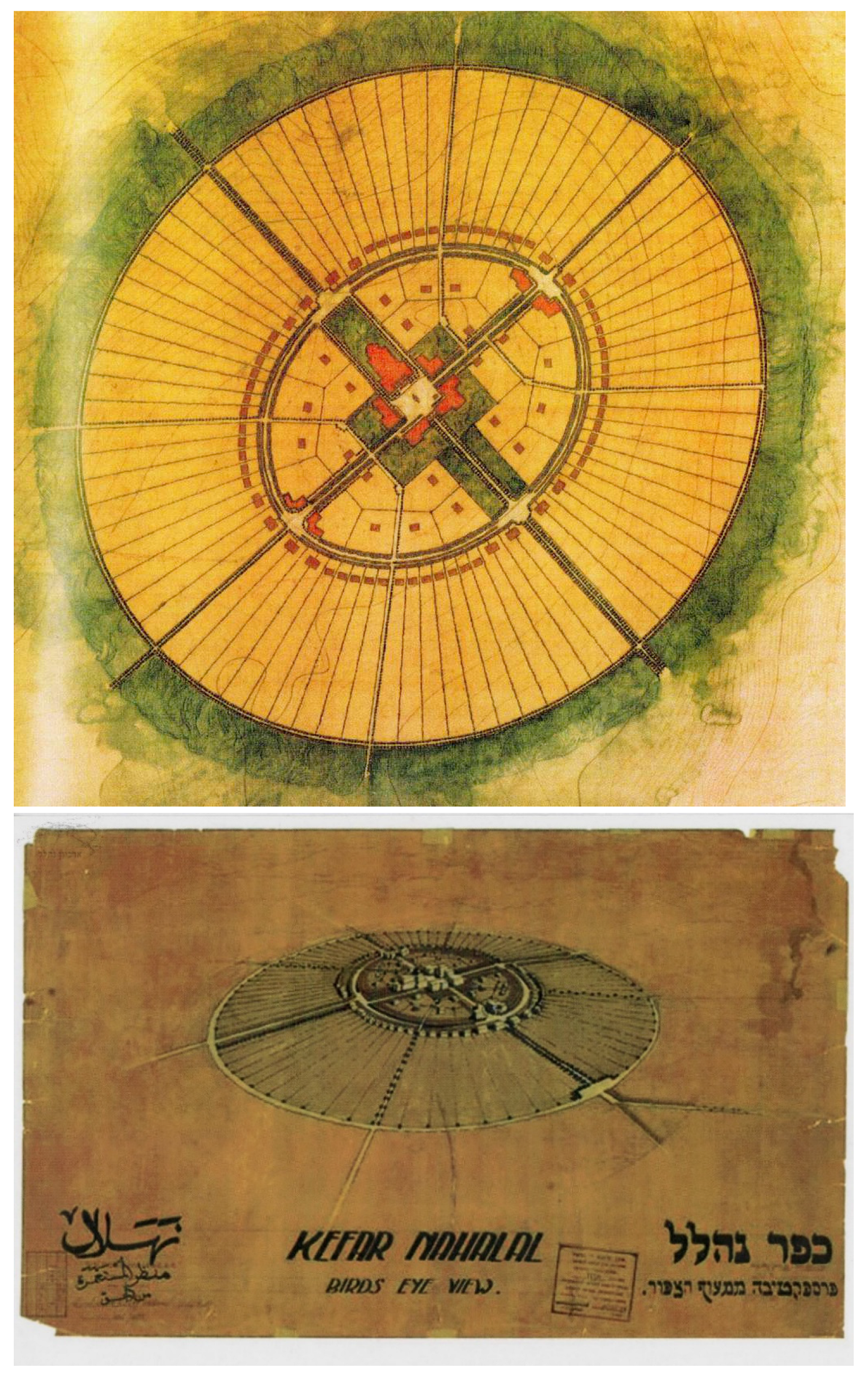
Figure 1.
The Nahalal plan and diagram, planned by Richard Kaufmann (1921). The public area included around 50 acres, of which half (25 acres) were designated for public servants’ residences [
9]. The size of the public area was derived from the width of the farmers’ housing units, and out of consideration for agricultural machinery, rather than for functional needs [
4]. Source: Nahalal Archive.
Since the 1970s, Europe has seen migration from the city to the village by people wishing to improve their residential conditions, particularly households of educated professionals from the upper-middle class with children. This phenomenon characterized the edges of the metropolis: mothers and fathers living in the village kept working in the city and consuming most of their services there [
9]. Those moving to more remote rural areas were retirees who wanted to realize the dream of living in the countryside [
11].
Parallel processes also occurred in Israel, which has been in an agricultural crisis since 1985. Non-agricultural occupations began entering the moshav, as did non-farmer inhabitants. Although the ideological character of the moshavim, and the fact that the land was owned by the state, served to delay those changes [
12], they were essentially the same [
13]. Today, only one-third of farmers are actually employed in agriculture [
5], due to the aforementioned trend, as well as efficiency and expertise considerations. Thanks to the cooperative, the plots of many farmers are leased to the active farmers in order to ensure economies of size and technology [
5,
9]. Some farmers work only part time in agriculture, while others have given up on it completely. Some of them work within the moshav, while others commute elsewhere [
14].
In both the western world and in Israel, it was found that the closer the rural settlement to a metropolitan center, the more the businesses within it tend not to be related to agriculture or to landscape values. Conversely, the more peripheral and remote the settlement, the more its businesses are related to agriculture and landscape values [
11]. Moreover, in the latter case, agriculture becomes acutely important due to limited economic diversity [
5].
In Israel as well, urbanites have moved to the moshavim in search of a suburban quality of life, particularly at the edges of the metropolitan centers [
15]. Accordingly, as the population grew, so did the perception of the rural space in the eyes of the Israeli planners: from a preoccupation with clinging to the land for agricultural purposes and ideological reasons to a broader emphasis on protecting open spaces that represent a cultural (and ideological) heritage, as well as environmentalist values [
16]. Still, despite all the changes and the creeping of urbanity into rural space, agriculture has not disappeared, and remains an important and salient element of the economy and physical landscape of the moshav [
9].
Most recently, COVID-19 shed light on the decisive role of the rural space in health, community, and mental resilience. Rural areas are considered safe havens, characterized by better daily living conditions thanks to their distance from the city. The lower density of the moshavim ensures both social distancing and safer, freer access to nature and leisure. Studies have shown how rural areas can deal with emergencies of this kind, suggesting that this turning point can inform a rethinking of the flexible development of rural (as opposed to urban) space. The countryside is no longer a bread basket alone, and the characteristics of its communities should be reevaluated as a basis for rural regeneration that has strategic planning and design elements [
17,
18].
2. Objectives and Method
Israel is facing a particularly rapid population growth (currently 9.6 million, and estimated to reach 12.8 million by 2040) [
19], resulting in the densification of the existing cities, which is encouraged by the government through nationwide urban regeneration plans. However, the absence of a parallel plan for densification and regeneration of the rural areas is keenly felt, despite the fact that it could preserve their agricultural character, support centralized development, reduce commuting, increase internal consumption within the moshavs, and contribute to general sustainability. The purpose of this study is to propose principles for such a regeneration plan, with particular focus on the qualitative and quantitative values involved in regenerating the moshav’s physical, functional, and community centers.
Studies found that today, there is demand for service infrastructure and facilities in both the Israeli moshavs and the rural areas of other developed countries, particularly near the big cities [
20]. It was found that business enterprises in rural spaces of central location, with central qualities, promote the opening of secondary businesses, and, in fact, create an impact that exceeds them [
21]. It was also found that centralized development in a rural space prevents the trickling of other economic uses into the agricultural environment, reduces commuting and the damage to the agricultural landscape, and contributes to sustainability [
22].
Based on the above, it is obvious that the regeneration of the village, and the village center in particular, are absolutely necessary. However, what are the possible functional, architectural, and spatial principles for that regeneration? In particular, how can the rural character, heritage, and ideological principles of the rural settlement be preserved in terms of its visibility and performance in its public space [
14]?
To address that question, below we propose two types of values:
Qualitative values, inspired by the moshav’s ideology, as presented above: egalitarianism, the importance of agriculture, and communalism;
Physical and spatial values that must be preserved to ensure a future effective performance of rural space.
The qualitative–quantitative values have a great effect on the way people feel and behave in the existing space, and the densified and regenerated future space. These are divided into two considerations: (1) values that can be directly quantified, such as the number of housing units, distances between the buildings, population density, and the size of open spaces [
23,
24,
25,
26,
27]; and (2) values for which an additional stage of evaluation will be required, including visibility and landscape viewing, walkability, safety, sense of security in space, accessibility, and connectivity. These are the considerations presented by Shach-Pinsly and Ganor [
28].
The aim of this article is to outline tools for the future regeneration of rural areas, mainly focusing on qualitative and quantitative values of rural renewal. The lack of professional literature on rural regeneration has led us to use existing analysis and physical tools for urban renewal and apply them on rural regeneration, focusing on a unique ideological type of rural development area: the moshav. The rural area of the moshav has four physical/geometrical model types; however, in this article, we discuss the two basic types of the moshav physical model: The concentric and linear models.
2.1. Analysis of Quality and Performance Values: Quantitative Evaluation of the Moshav
The quality and performance values addressed are as follows:
Number of housing units: in the moshav, the number of housing units is statutorily limited, derived from the size of the plots, and not diversified.
Distances between the buildings: The planning and design of the layout of buildings on the ground has a great influence on multiple qualitative and performance values. For example, wide distances positively influence the amount of the landscape that can be seen, but reduce walkability and the sense of security [
29]. Conversely, proximity between buildings provides greater compactness, walkability, and increased sense of security, accessibility, and connectivity.
Density: Densifying the moshav by adding housing units offers multiple advantages, including reducing the entrance threshold for various uses, and increased potential for good walkability, accessibility, and connectivity.
Walkability is one of the parameters of a sustainable environment: it makes for an improved environmental experience, offers social possibilities [
24,
30], and contributes to physical activities [
31,
32]. Quantitatively, it was found that multiple intersections improved walkability [
33,
34], as did better access to public transportation [
35].
Accessibility and connectivity are among the important parameters in environmental performance, serving as indicators for the quality of a place and its urban network [
35,
36]. Good accessibility and connectivity are ensured by a higher number of intersections, which encourage walkability, improve free choice of paths, and enable shortcuts [
34,
37].
Sense of security increases with the number of people in the built environment, as it increases social supervision [
24], or “eyes on the street”, as Jane Jacobs (1961) put it [
38]. Studies have shown that the level of maintenance of a public space also increases the sense of security [
39], and that spaces that are attractive for staying and walking increase the potential level of human use and, in turn, the sense of personal security [
27,
40]. Several tools and methods have been developed recently to evaluate the sense of security in urban areas. One is “crime prevention through environmental design” (CPTED) [
41], a tool for preventing crimes that offers guidelines for planning to reduce crime and the fear of crime, and to improve quality of life. Another tool measures security in a public space by evaluating urban elements, including the degree of mixed uses and the proximity of intersections, buildings, and lighting, and enables the development of raster maps pointing to areas of low or high security [
27]. The conclusion from all these studies is that, in order to improve spatial security, structural changes are required in the urban environment.
Safety is a function of the quality of the sidewalks and streets: the width of the walking lane, the width of the sidewalk, the condition of the sidewalk, etc. [
35,
40]. The safety of a public space is extremely important [
24,
27]. As mentioned, a high level of safety also affects the sense of security.
Visibility and landscape: it was found that the ability to view a landscape improves health and quality of life [
42,
43,
44]. In recent years, various tools have been developed for evaluating the view to the landscape from several aspects, including how much of the landscape can be seen through windows [
25], the quality of the view that can be seen [
45,
46], and the degree of shading in open areas [
47].
The remainder of this article is organized as follows. First, two archetypal moshav models are presented: concentric and linear. This is followed by a discussion of two specific moshavs planned according to these models (Nahalal and HaYogev, respectively). The physical solutions used in moshavs in general to meet changes in their agriculture and human composition are reviewed next, with particular focus on changes in the two specific moshavs. Finally, the discussion will focus on the nature of rural regeneration suggested for the moshavs.
2.2. The Moshav’s Physical Structure
Archetypal Models: The Concentric and Linear Models
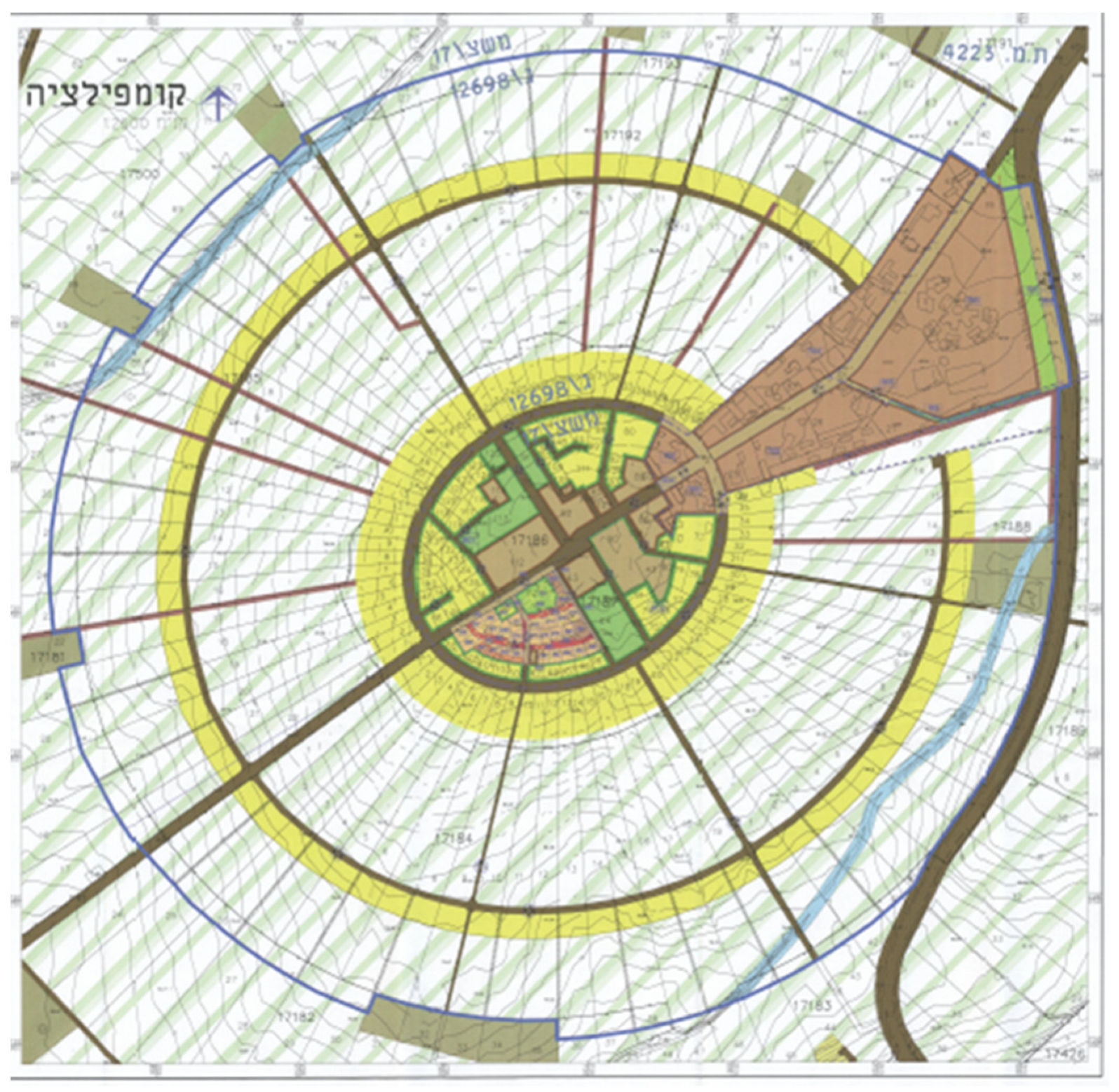
The ideological values and practices reviewed above were expressed in the planning and design of the early, pre-statehood moshavs. Not coincidentally, the planning and design of the very first moshav, Nahalal (est. 1921), was a perfect physical embodiment of those values. In the
concentric model, an area was dedicated in the center for the public buildings and the public servants’ housing units. In the periphery, the farmers’ houses were built on equally-sized circular sectors. The agricultural plot extended outwards from the housing unit (
Figure 1).
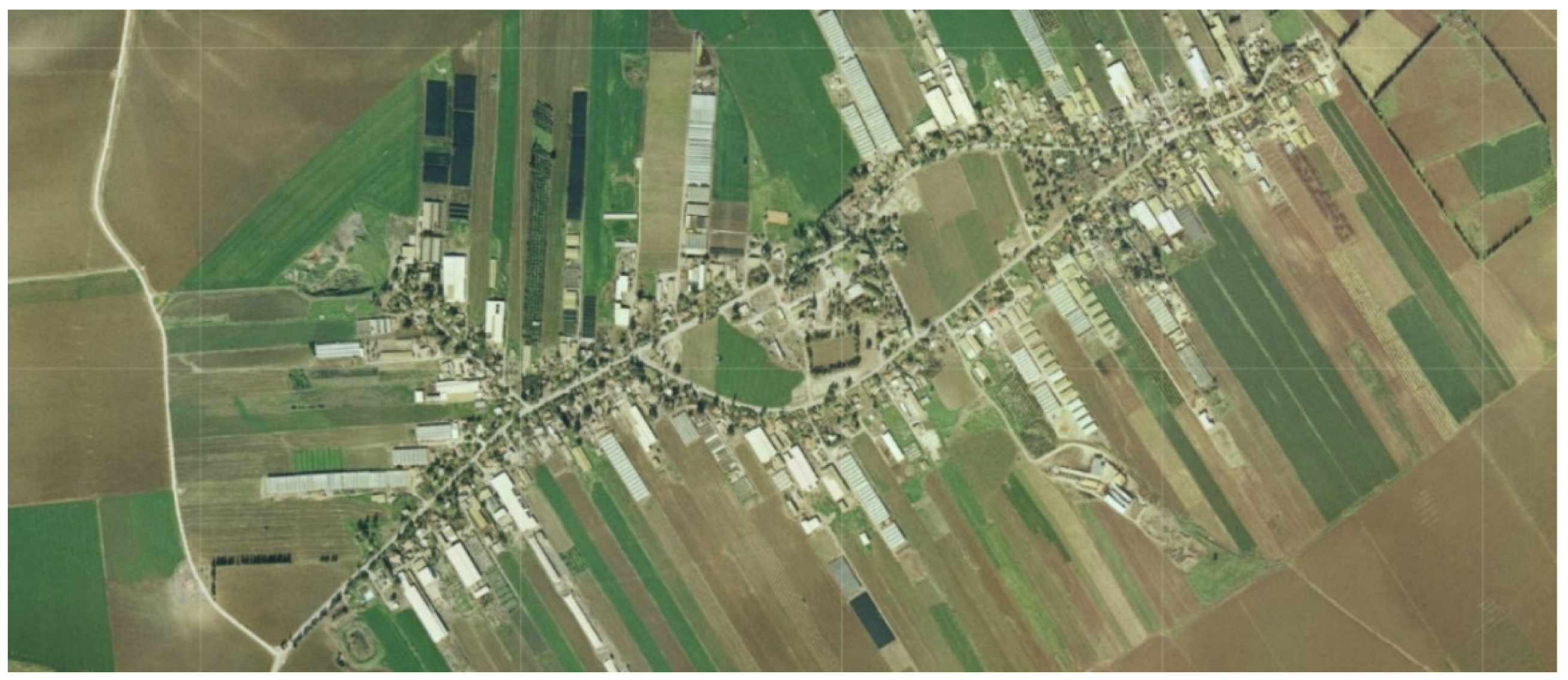
In the
linear model, the distances between the farmers’ houses are 50 m (the short side of the rectangular plot), creating an elongated moshav. As in the concentric model, plots are assigned to public services and servants at the center. Sometimes, the distance between the center and the houses was greater than one kilometer [
4,
48]. An example is HaYogev, a moshav founded in 1949 (
Figure 2). The size of each plot ranges between 7 acres in the central area and over 25 acres in the peripheral areas. Each plot includes an area designated for housing (“Plot A”, 0.62 acres), and a land area for cultivation (“Plot B”). The public area at the center includes preschools, community centers, and a synagogue, secretariat, grocery store, clinic, and park. It also includes several home farms for the nurse, doctor, and teacher (1.24 acres). The size of the central area varies, ranging between five and fifty acres, as in Nahalal (Planner of the local council).
The European origins of the planners and settlers are clearly indicated by the structure of the concentric moshavs, reminiscent of the European concentric villages [
49], and the round village model (
Rundling) developed in the late Middle Ages by liberated vassals in Eastern Europe, who moved from the feudal estates to frontier areas [
50]. The concentric moshav model was also influenced by Ebenezer Howard’s (1985 (1898)) Garden City [
51] that was highly popular in those years, and also called upon for restricting the number of inhabitants. Conversely, the linear model imitated the “street village” (
Strassendorf) that developed evolutionarily [
49], as well as linear villages in the Dutch polders [
50]. Furthermore, the models are perfectly aligned with the Zionist ideology.
2.3. The Recent Development of the Moshavs, Their Management over the Years, and the Problems They Pose
As the moshav was established on land owned by the national institutes, and subsequently by the state, and was based on a family farm, it was initially decided that each settler was entitled to hold only one plot, and could not split it, not even among inheritors [
5]. This ideology found it difficult to meet needs arising with time, such as the growing population in Israel, the need to find houses for non-inheritor children, or the need to provide an array of services for the inhabitants (an average of two-thirds) who were not farmers.
The changes in the moshav’s structure were hesitant and piecemeal. Since the 1990s, “extension neighborhoods” were added at the periphery of many moshavs, for non-farmer inhabitants [
5]. The original aim was to take care of children who did not inherit the farm [
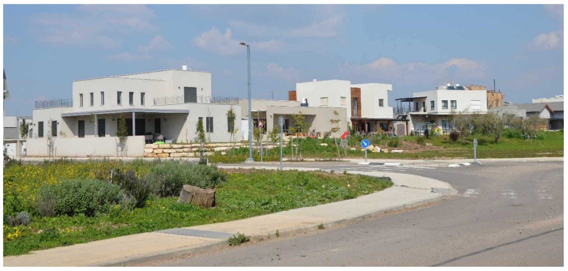
9]. However, people from outside the moshavs, eager to join their rural and communal environment, quickly occupied those neighborhoods, transformed the moshav’s human composition, and raised the housing prices (Planner of the local council) (
Figure 3). This change was supported by the state’s planning authorities: due to the need to cope with the dramatic population increase in Israel and densify the built areas to maintain wide open areas, the National Outline Plan, NOP 35/1, included a “densification table” for all settlements in Israel, admitting 500 inhabitants to each moshav—most of them, obviously, not farmers [
5]. The housing densification proposed within the moshav’s plots was limited: Amendment 1(b) of NOP 35 (June 2016) enabled the construction of three units, in three separate buildings, in Plot A (Planning Administration, 2023).
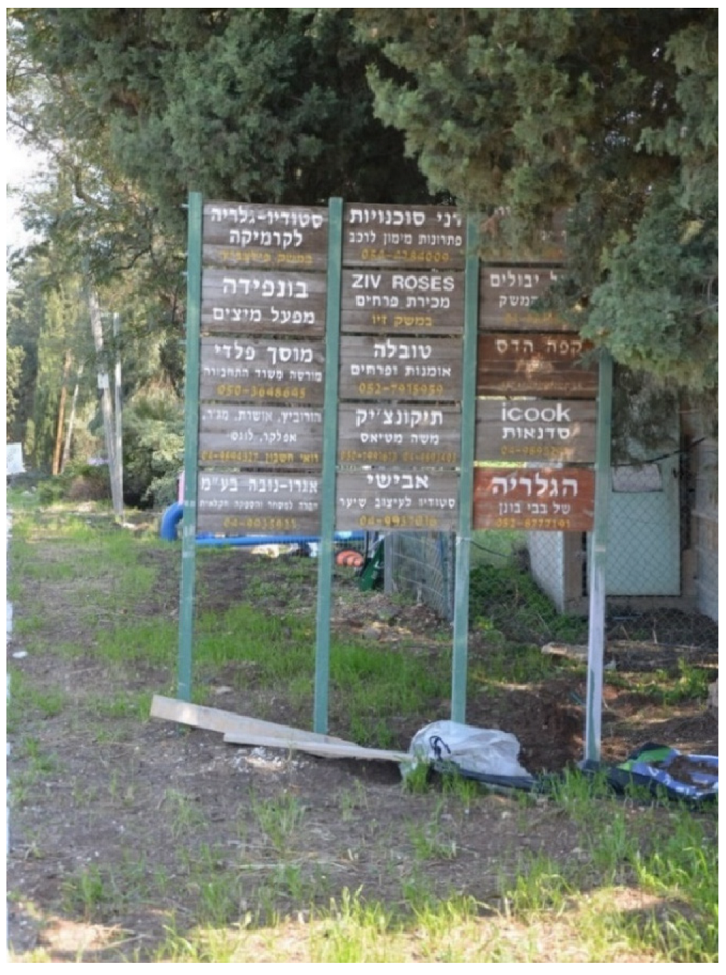
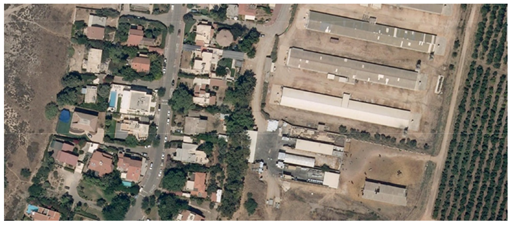
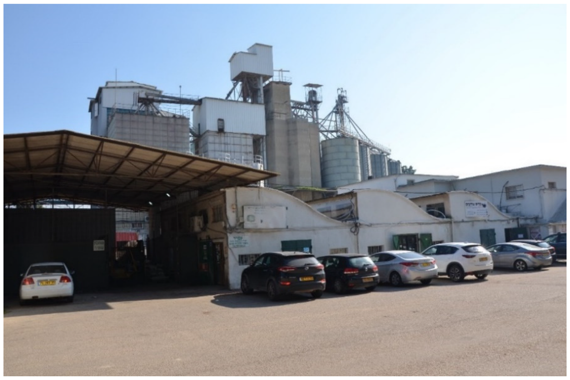
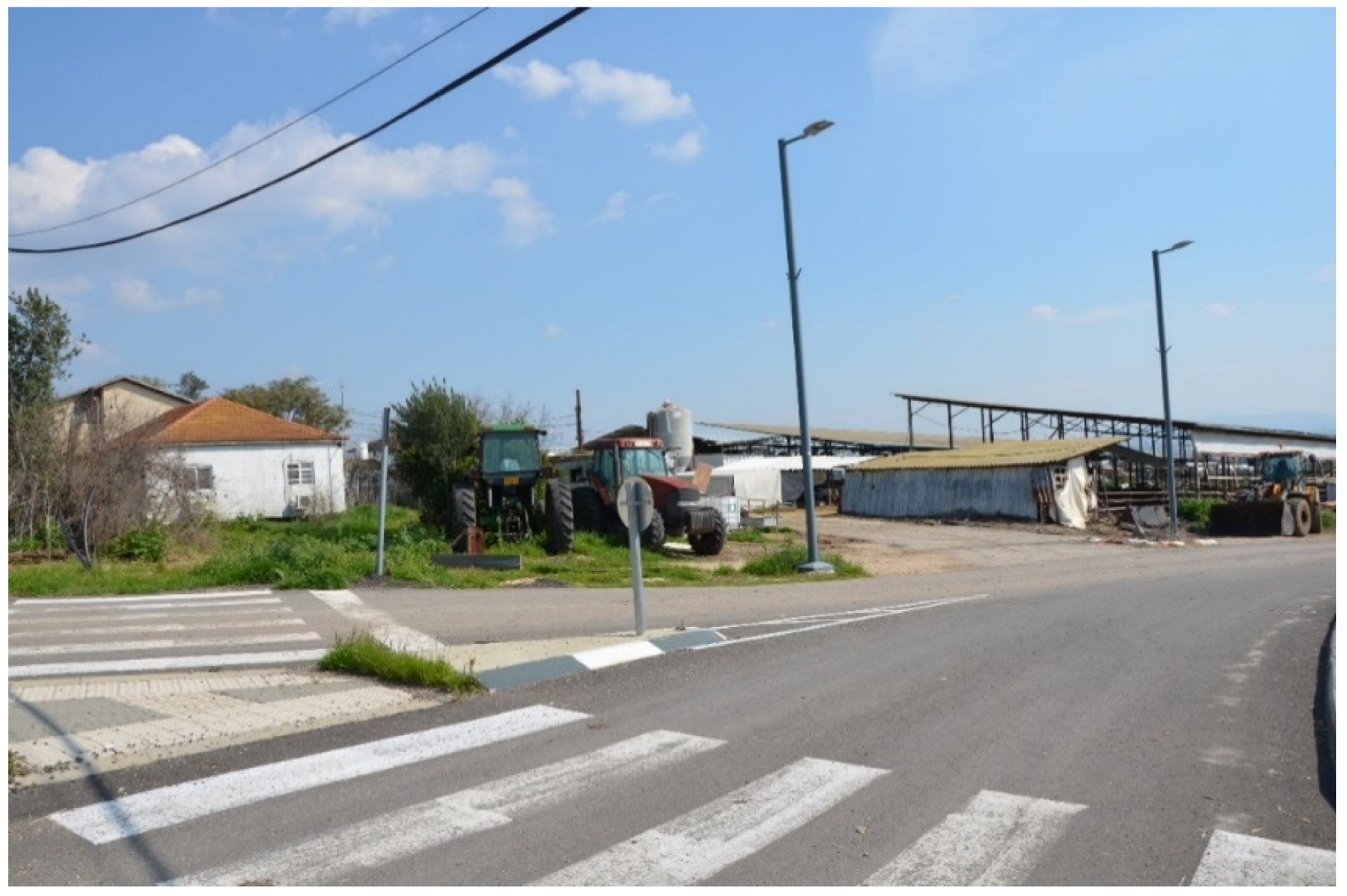
At the same time, unpredictable changes occurred: the agricultural crisis led to the development of small businesses in the moshav. A study conducted in 2014 found that the area of most businesses does not exceed 50 square meters, and that 75% of them employed no more than two salaried workers [
5]. Their splitting across the various plots did not enable sharing central services (such as office services), so they were not too economic, and often also illegal: many have been active without a planning permit or license for many years [
5], thus arguably tarnishing the moshav’s agricultural image [
52] (
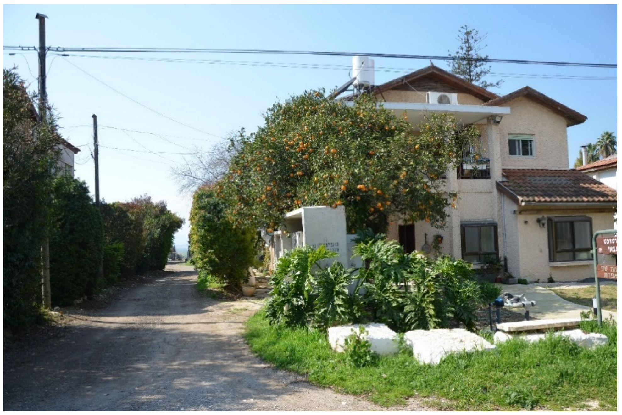
Figure 4). In some cases, rich individuals bought entire plots and built huge and alienated palaces, completely antithetical to the original ideology of the moshav (
Figure 5).
In terms of management, the agricultural cooperative no longer represents all of the moshav inhabitants. Accordingly, local committees have been elected to manage the affairs of everyone. In 2017, it was decided that if the public areas owned by the cooperative are demanded by the local committee or regional council, representative of all the inhabitants, the cooperative had to comply [
5].
3. Results: Planning Solutions and Their Evaluation
The concentric Nahalal and the linear HaYogev sought planning solutions to deal with the changes mentioned above. From the outset, it was realized that the concentric model was flawed in including a public area that was too large and, consequently, too empty (
Figure 6). The linear model was flawed in lacking social cohesion due to the large distances between the houses, resulting in excessive distance between most of the houses and the moshav’s center [
4,
48] (
Figure 7). Both models made future growth difficult: the concentric model was too closed, and the linear model was overextended.
The rural regeneration in Nahalal took place in two main areas: (1) at the center of the moshav, within the central circle, and (2) at the perimeter, with the addition of plots with housing units (
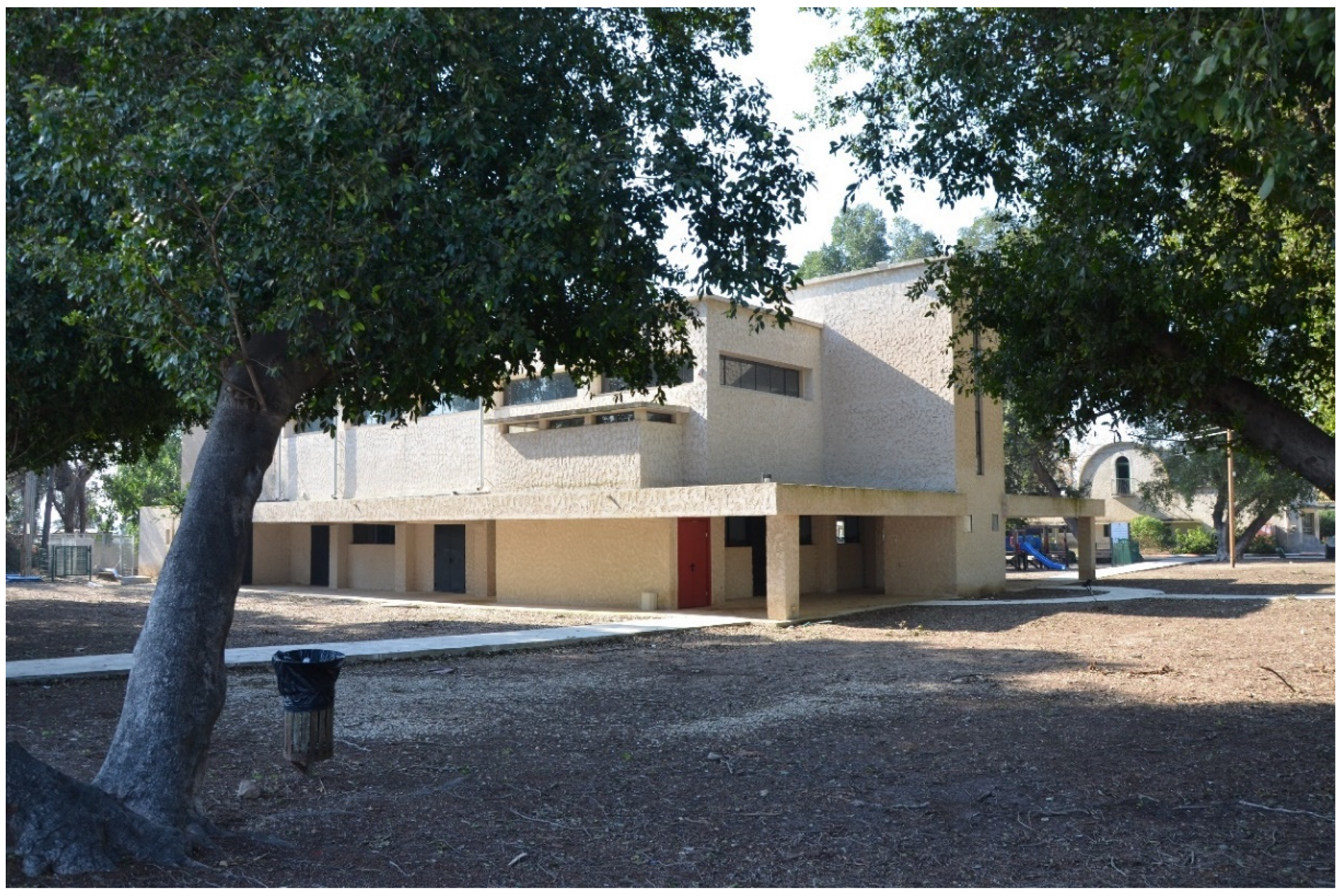
Figure 8). The renewal of the round center, 800 m in diameter and crossed by two main and intersecting roads, is based on a combination of preservation and new construction, and the introduction of diverse uses. Most of the old public buildings have been preserved, including the community center (
Figure 9), industrial buildings, the school, and the first post office, as well as paths overlooking the landscape and green spaces. The new construction includes the addition of 25 housing units at the center for youngsters who have not inherited farms, at an area of about a quarter of the central circle (
Figure 10).
A very recent initiative seeks to convert industrial buildings into a commercial center for the sale of industrial produce and the development of future agricultural technology, as well as for “soft” uses such as a medical center, a hotel, and a project for developing professional and academic occupations (
Figure 11). An interview with the Moshav Secretary, suggests that such “soft” uses have the greatest potential in terms of feasibility, implementation, and preservation of the moshav’s rural character. These are planned around the intersection of the main north–south and east–west roads at the moshav’s center.
When examining the spatial quality obtained following the rural regeneration at the center of Nahalal, it appears that it is precisely its concentric configuration (criticized as too closed) and the ideal walking distances (800 m from the houses of all farmers to the very heart of the center) that enable reducing parking spaces and increasing walkability and access, the latter also improving the sense of security [
29]. The wide lanes (the main roads and the peripheral road are 20 m wide) enable long sightlines to the open landscape from the driving/walking lanes to the entire moshav, as well as along the borders of the moshav’s estates (
Figure 12). Finally, adding housing units at the center increases density, which, together with the mix of soft uses, creates a potential for optimal performance.
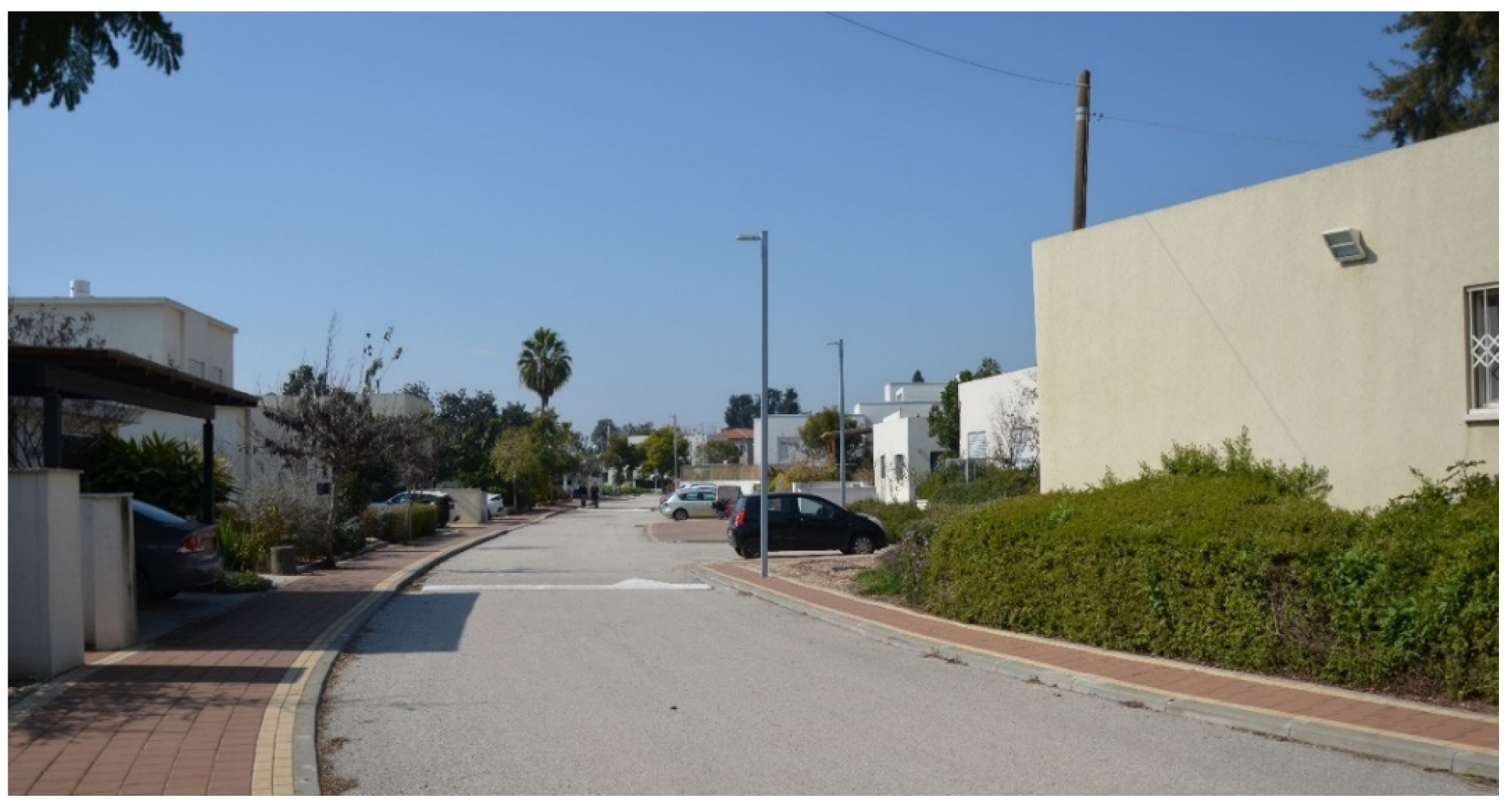
Additional rural regeneration occurs at the outer perimeter, where 75 new farm plots have been added to the original 75. The size of the original plots is 3.2 acres; the size of the new plots is 2.5. The new construction at the perimeter is designated for inheritors, and the boundaries of the new plots are an extension of their parents’ old plots. Between the plots are lanes that connect the perimeter to the center, affording open views to the outer landscape as well as to the moshav center (
Figure 12 and
Figure 13). The distances to the center of Nahalal remain walkable and accessibility is maintained, since the distance of the new plots from the edge of the moshav center is only 300 m. Maintaining the boundaries of radial continuous estates also improves the connectivity and accessibility of new residents to the center of the moshav. This distance also maintains the residents’ privacy [
25].
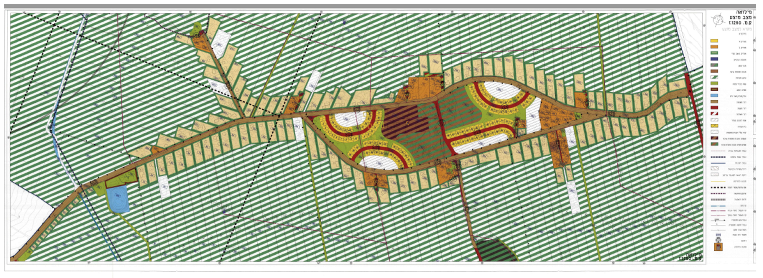
The rural regeneration in HaYogev also took place in two main areas: (1) the center, where housing units were added, and (2) the outlying areas, where a limited number of plots with housing units were added between the existing plots.
In this linear moshav, all plots lie on both sides of a long road. At the center of the moshav, the road splits in two, trapping within it a wide-open space, about a kilometer long and 200 m wide. This space houses the moshav’s public buildings and communal areas: the secretariat, administration, grocery store, several commercial centers, and extended green spaces. The moshav has no school of its own, and the use mixture is limited.
In order to create a functional and effective center, the plan is to densify it by adding 488 housing units without any added commercial spaces, offices, or mixed uses (Plan C/17676) (
Figure 14). This will increase HaYogev’s overall density, particularly at its center. However, in the absence of additional units, viability would be highly limited. It may be that in the remaining open areas, diverse and “soft” rural functions could be developed, as planned in Nahalal. Later on, it was decided to add a limited number of plots between the existing ones, as infills, in areas previously allocated for plots, but not yet realized as such [
6].
When examining the spatial quality achieved after the rural regeneration at HaYogev, the conclusions are different from those pertaining to the rural regeneration in Nahalal. Due to its linear typology, HaYogev has low walkability. Although it has a center, whose renewal strengthens the moshav, that center is accessible by foot only from the nearest plots and new housing units. The regeneration has not created reasonable walking distances and has failed to promote the accessibility and connectivity from the moshav plots to the center, and between them.
Nevertheless, the additional housing units at the center are dispersed in four compounds, so that they subdivide the oversized open area and create smaller open spaces, at different parts of the center. These offer the potential for developing functional and performed open spaces in the future [
53]. This dispersal also reduces walking distances, contributing to walkability at the center, and to the connectivity and accessibility of various locations within it [
54]. With regard to vistas, despite the fact that the moshav is located within agricultural areas, no sightlines are planned to afford open views. Currently, openness to the view relates to nearby rather than to distant landscape views (
Figure 15).
To conclude, large and bourgeois-looking family housing units were built at the centers of the two moshavs to renew them, conveying values that are neither egalitarian nor agricultural. Nahalal benefitted from its concentric structure, reasonable walking distances, and addition of multiple diverse uses at the center. HaYogev’s linear structure was a major drawback, as was the construction of housing units without additional uses. However, the inner center of the moshav saw the beginning of a densification process. Additional solutions should have been examined for the moshav’s regeneration, such as developing transportation within the moshav, adding housing units along the main road, and, of course, adding uses.
4. Discussion, Conclusions, and Recommendations
As a result of the processes reviewed above, the agricultural, egalitarian and productive character of the moshavs is at risk. Those located near Israel’s metropolitan centers are gradually turning into wealthy suburbs, or rural settlements without agriculture, whose inhabitants commute to the nearby city. In Israel’s socio-geographic periphery, the inhabitants of the moshavs may lack services. Obviously, the performance of the moshav as a whole needs to be reexamined, particularly in terms of the services it provides. Physically, its residential plots need to be densified, particularly at the communal center, whose limited functions are no longer consistent with the changing needs and occupations of the inhabitants. The recommendations below are derived from the qualitative values that characterize the moshav and the qualitative and performance values it lacks, or that need to be preserved.
4.1. The Structure of the Moshav
Densification by adding housing units: As suggested above, the number of housing units that can be built in each moshav is limited. It is determined top-down by national plans, and cannot be changed other than by statutory intervention. These limitations on the moshav’s ability to grow and densify prevent its inhabitants from benefiting from the introduction of additional services, whose entrance threshold is too high [
6].
Densification has obvious advantages, as it meets the need to preserve open spaces and lower the entrance threshold for various uses. Densification may also lead to improved connectivity and accessibility between the various areas of the moshav, and better walkability, by bringing the residential areas closer to the center [
55]. Accordingly, we recommend densifying the moshav by increasing the number of family housing units per plot (in the residential area of 0.62 acres, or Plot A). Note that this is a moderate degree of densification, that will have limited effect on the moshav’s visibility and community, and on its ecosystem [
56]. We also find that the efficiency of the family farm is not inferior to that of the institutional farm [
5], so there is an advantage in having more members of the same family live on the same plot, resulting in a more efficient farm. Finally, densification must be carried out in keeping with the moshav’s visible qualities: a rural settlement, where vegetation can be seen between the buildings, and sometimes also the farm buildings and fields. Therefore, open areas must be maintained between the buildings, in order to ensure long, open, and green vistas.
Housing diversification: Since the housing units’ area is derived from the plot area (Plot A), the housing units in the moshav are currently large. The few small housing units are attached to houses and are not separate apartments. This has limited the availability of small housing units that are affordable or suitable for couples that separate, who currently have no housing solution and are often forced to leave the moshav [
6]. We, therefore, recommend constructing diverse housing units in the moshavim, including small units for sale as well as rent.
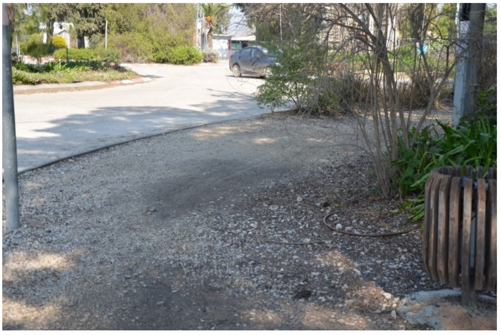
Walkability: Most of the moshavs are located in level areas, contributing to their walkability. However, due to the structure of the plots, the distances between the houses are wide, including the distance from most of the houses to the center. Low walkability means a high motorization rate and lower sustainability. Moreover, the lack of human presence in public spaces reduces the sense of personal security. We therefore recommend the promotion of planning that encourages walkability using such proven parameters such as densifying the road network to ensure higher accessibility and connectivity, and greater availability of public transportation. Increasing the number of housing units within the moshav will reduce the spaces between the buildings, densify the road network, and promote the development of public transportation, as well as contribute to pedestrians’ sense of security.
Security and safety are major aspects in any future development. Studies that have examined the sense of security in the moshav space [
27] suggest that it should be improved by morphological changes in the built environment and by ensuring a high level of maintenance. The safety of public space in the moshavs is far from optimal: often, sidewalks are missing (
Figure 16), and those that exist are not well maintained. Public spaces in general suffer from a low quality of maintenance. In addition, to improve the sense of security, conditions must be created to increase the number of people in the public space, encouraging them to spend time in that space, and improve walkability. In order to do so, higher budgets must be invested in the maintenance of public space, and in changing its morphological characteristics.
4.2. The Renewed Rural Center
The center of the moshav is the heart of the community. Therefore, its renewal will affect the entire moshav.
Diverse uses. Mixed uses have an important role to play in ensuring high performance, as well as achieving optimal use mixture [
35]. This, in turn, contributes to walkability and personal security. Diversity is defined by the amount and type of mixed uses in public space [
57]. In turn, mixed uses at the moshav center affect the surrounding space, improve walkability to the center, and therefore also improve personal and general walkability.
In addition to existing functions, the moshav center can and should include housing units for non-farmers and institutes of diverse functions, as planned in 1921 in the first model of the moshav by Richard Kaufmann [
58], so long as they serve primarily the local residents. With regard to housing, this should be extended to inheritors who are not farmers, as well as to provide rentals to diverse populations, and apartments of various sizes, including small apartments, protected housing for the elderly, etc.
Regarding other functions, the small businesses currently dispersed throughout the moshav can obtain statutory approval and enjoy economies of size if located at the center of the moshav. This way, the moshav would be able to provide centralized office and reception services, allowing the plots to contain housing units alone. The recommendation is to build spaces that can be subdivided flexibly and contain diverse uses, after the model of WeWork, as well as “soft” uses that meet immediate needs.
With regard to occupational specialization, it was found that academics would easily leave the moshav if not satisfied with its services [
59]. Overall, as the farmers become more educated, their desire to realize their skill becomes stronger [
7,
60]. Although commuting makes it easier to find appropriate employment outside the rural settlement, it is still important to provide options for skilled workers at the center of the moshav. Importantly, today, when the digital communication network erases distances, particularly after COVID-19, the entire space should be seen as a source of employment and services, and not only within the moshav itself. Thus, one moshav can offer regional services or specialized jobs that will serve other rural settlements, and even the inhabitants of the nearby city [
61].
Ideologically speaking, introducing functions, such as office spaces, that are closed to moshav inhabitants would be wrong, as much as it may be profitable in terms of municipal taxes. Conversely, functions the inhabitants can enjoy are welcome, including tourist hosting areas and attendant functions that can also serve the locals, such as a restaurant, café, pool, conference hall, etc. This would remain true even if these functions serve the inhabitants for only part of the day, as in time sharing.
In terms of value preservation, egalitarianism is one of the major values of the moshav, so all of its inhabitants must benefit from its regeneration, and the renewal of its center in particular. The fact that the center is under the responsibility of the moshav’s administrative authority (the agricultural cooperative or local committee) will facilitate any internal or external business venture for the renewal of the center.
Another key value is communalism. Despite the changes in the agricultural sector, the transition from an enlisted ideological society into an individualist society, and the transition from a socialist into a neoliberal economy, it is found that moshav members still feel a very strong commitment to this value [
62]. Moreover, studies in other developed countries found that the yearning for rural communalism remains strong, despite the fact that European villages were not founded with communalism in mind. It was found that migrants to rural settlements seek community values, above and beyond natural values [
63]. Thus, the new functions in the moshav must support community cohesion and appeal to a very broad normative common denominator.
4.3. The Morphological Characteristics of the Renewed Center
Dense construction: according to the original moshav model, which served as the prototype of the concentric moshavs, the design principles of the central area are different from those of the periphery, where the farmers live. Kaufmann planned the center as relatively dense, and even formal, that is, with a central square, significant public buildings around it, relatively high-rise construction, and boulevards connecting the moshav’s periphery and center (
Figure 1). Thus, relatively dense construction at the center is not foreign to the moshav spirit, but in designing it, the following features must be maintained. Moreover, it must be connected to the rest of the moshav by extending the traffic routes deep into the agricultural areas, maintaining the vistas as much as possible, and retaining mature vegetation [
64]. It is preferable that the height of the buildings not surpass the height of the trees, to highlight the moshav’s rural character.
Unique architectural properties derived from the moshav spirit: in the US, it was found that longtime villagers were more wary of introducing new functions [
64]. In Israel, it was found that the older the generation, the greater its loyalty to agriculture [
7], and its actual preservation: the older generation associated agriculture with the ideological values of the early rural Zionist settlement [
62]. Conversely, a Belgian study found that using agricultural buildings for non-agricultural purposes (including commercial ones), was not opposed by the villagers [
65]. In Israel as well, most moshav inhabitants did not view non-agricultural activities as problematic. Still, accepting non-agricultural functions depends on their visibility and scale: the higher the visibility, the greater the opposition [
12]. The conclusion is that, in order to reduce the opposition to the introduction of new functions in the rural center, the following guidelines must be met.
Reusing legacy buildings: a survey conducted in 2000 found that most built legacy assets were located at the moshav centers, that they were highly visible in the space, and that the locals sought to preserve them. The older inhabitants viewed them as part of a living memory, and the younger, as part of an existing and desirable image [
14]. The conclusion is that integrating legacy buildings into the regeneration process would be the optimal solution.
Maintaining the scale via small-fragment construction, combining indoors and outdoors: it is preferable to renew the rural center based on several buildings, suited to the rural fabric, rather than to plan one large building. This enables integrating preserved buildings, and building in stages, adding suitable uses (the “soft” uses referred to above), drawing conclusions, and implementing them on the go. It is also important to weave the built space together with the green space, and preferably with several open spaces that are different in their character and in the functions facing them [
66].
Using rural images: for those who do not work in agriculture, rural life represents landscape, as well as educational and community values [
62]. These are partly similar to the perceptions of rural space in other developed countries, which focus on peace and quiet, and a harmonious community that ensures a high quality of life [
67]. Therefore, the regeneration planners must be aware of the multiple connotations of rural living and decide on the proper design weights of each connotation in each specific site.
To conclude, rural regeneration is a highly complex issue, since it involves a variety of considerations that are irrelevant to the urban space. These include a different ownership structure (in Israel, these are state lands), top-down decisions by the Israel Lands Authority (the agency that manages state lands), and by the Planning Administration (in charge of approving land planning and of related policymaking on behalf of the state), as well as historical decisions, such as the prohibition of plot subdivisions and inheritance by more than one inheritor. They also include biased bottom-up decisions, such as the management of land by the agricultural cooperatives in each moshav. Accordingly, regenerating rural space while preserving moshav values must be informed by extensive ideological, economic, functional, social, and community knowledge, requiring sustainable thinking that preserves existing values while redirecting and using them to plan the future.
This article does not present an “ideal case model” for rural regeneration. The innovation of this article is the presentation of two approaches to rural regeneration that are based on previous physical/geometrical models of moshav development. These physical/geometrical models were developed based on a community ideology that was prevalent during the early days of moshav settlements (see
Section 2.1). Moreover, we demonstrate how these predecessors’ physical/geometrical models of moshavs can be integrated into new approaches and trends for urban and rural development, which incorporate walkability, visibility, security, etc., in a new and current way.


