Next Issue
Volume 9, October
Previous Issue
Volume 9, August


Water, Volume 9, Issue 9 (September 2017) – 97 articles

Cover Story (view full-size image): 
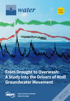
Groundwater resources of low-lying atoll islands are threatened due to changes in rainfall, wave climate, and sea level. This study explores how these forcings affect the limited groundwater resources on Roi-Namur, of the Marshall Islands. As part of a 16-month study, a rarely recorded overwash event occurred and the aquifer’s response was measured. While the small-scale overwash event returned to pre-overwash conditions within 30 days, the collected data also suggests that degradations in freshwater resources are likely to increase in severity in the future due to sea-level rise. View this paper
  • Issues are regarded as officially published after their release is announced to the table of contents alert mailing list.
  • You may sign up for e-mail alerts to receive table of contents of newly released issues.
  • PDF is the official format for papers published in both, html and pdf forms. To view the papers in pdf format, click on the "PDF Full-text" link, and use the free Adobe Reader to open them.
Order results
Result details
Section
Select all
Export citation of selected articles as:
3506 KiB  
Article
Spatial Distribution, Adsorption/Release Characteristics, and Environment Influence of Phosphorus on Sediment in Reservoir
by Tianxiang Wang, Jianwei Liu, Shiguo Xu, Guoshuai Qin, Ya Sun and Fuqiang Wang
Water 2017, 9(9), 724; https://doi.org/10.3390/w9090724 - 20 Sep 2017
Cited by 12 | Viewed by 3632
Abstract
Sediment gradually accumulates at the bottom of reservoirs after decades of running. To explore the influences of sediments on the water quality of reservoirs, the spatial distribution, adsorption/release characteristics, and environment influence of sediment pollutants should be analyzed. In this paper, the spatial [...] Read more.
Sediment gradually accumulates at the bottom of reservoirs after decades of running. To explore the influences of sediments on the water quality of reservoirs, the spatial distribution, adsorption/release characteristics, and environment influence of sediment pollutants should be analyzed. In this paper, the spatial distributions of phosphorus (P) and P fractions in the Biliuhe reservoir (river valley reservoirs) sediments were investigated. The adsorption and release characteristics of sediments P were studied in the experiment, while its environmental influence was analyzed too. The results indicate that the concentration of P in sediments was higher at the dam and the Zhongling site, while lower at other entrances of the reservoir and the smallest in the water-level fluctuating zone. Total Phosphorus (TP) varied from 355.46 to 764.57 mg/kg. Inorganic Phosphorus (IP) was the main form of TP in sediments, making up a proportion of 56–75%, while the correlation coefficient of P bound to Al, Fe, and Mn oxides was 0.922. Hydroxide (Fe/Al-P) was the main form of IP, which accounted for 46–83% with a correlation coefficient of 0.888. The maximum adsorption capacity calculated by Langmuir model was between 714.29 and 3333.33 mg/kg. The adsorption efficiency obtained by the Freundlich model was within the range of 0.40–1.42, which indicated that P adsorption was more difficult in the water-level fluctuating zone. The critical adsorption and release concentration range was 0.1–0.2 mg/L for the majority of the sampling points. The amount of P released in 24 h (the initial concentration of TP in the overlying water was 0 mg/L) accounted for 1.15–4.16% of TP in sediments, which was higher than the average concentration in the reservoir. It is concluded that the sediment is the potential pollution source. The relationship between the change of environmental factors and the release of sediment contaminants should be considered in the future. Full article
Show Figures

Figure 1

4622 KiB  
Article
Investigating Hydrochemical Groundwater Processes in an Inland Agricultural Area with Limited Data: A Clustering Approach
by Xin Wu, Yi Zheng, Juan Zhang, Bin Wu, Sai Wang, Yong Tian, Jinguo Li and Xue Meng
Water 2017, 9(9), 723; https://doi.org/10.3390/w9090723 - 20 Sep 2017
Cited by 15 | Viewed by 4613
Abstract
Groundwater chemistry data are normally scarce in remote inland areas. Effective statistical approaches are highly desired to extract important information about hydrochemical processes from the limited data. This study applied a clustering approach based on the Gaussian Mixture Model (GMM) to a hydrochemical [...] Read more.
Groundwater chemistry data are normally scarce in remote inland areas. Effective statistical approaches are highly desired to extract important information about hydrochemical processes from the limited data. This study applied a clustering approach based on the Gaussian Mixture Model (GMM) to a hydrochemical dataset of groundwater collected in the middle Heihe River Basin (HRB) of northwestern China. Independent hydrological data were introduced to examine whether the clustering results led to an appropriate interpretation on the hydrochemical processes. The main findings include the following. First, in the middle HRB, although groundwater chemistry reflects primarily a natural salinization process, there are evidence for significant anthropogenic influence such as irrigation and fertilization. Second, the regional hydrological cycle, particularly surface water-groundwater interaction, has a profound and spatially variable impact on groundwater chemistry. Third, the interaction between the regional agricultural development and the groundwater quality is complicated. Overall, this study demonstrates that the GMM clustering can effectively analyze hydrochemical datasets and that these clustering results can provide insights into hydrochemical processes, even with a limited number of observations. The clustering approach introduced in this study represents a cost-effective way to investigate groundwater chemistry in remote inland areas where groundwater monitoring is difficult and costly. Full article
(This article belongs to the Special Issue Sustainable Water Management within Inland River Watershed)
Show Figures

Figure 1

3866 KiB  
Article
Threshold of Slope Instability Induced by Rainfall and Lateral Flow
by Hung-En Chen, Tung-Lin Tsai and Jinn-Chuang Yang
Water 2017, 9(9), 722; https://doi.org/10.3390/w9090722 - 20 Sep 2017
Cited by 8 | Viewed by 5054
Abstract
In this study, a two-dimensional numerical landslide model was developed to investigate the effects of the amount of rainfall and lateral flow on induced slope failures. The Richard’s equation was used to evaluate pore water pressure distribution in response to moisture content variations [...] Read more.
In this study, a two-dimensional numerical landslide model was developed to investigate the effects of the amount of rainfall and lateral flow on induced slope failures. The Richard’s equation was used to evaluate pore water pressure distribution in response to moisture content variations induced by rainfall and infiltration in soil mass. The slope stability was then assessed using the limit equilibrium method of slices, and the moment equilibrium was considered. Several hypothetical cases involving various rainfall amounts and durations were simulated using the proposed model to investigate the possible tendency toward slope instability caused by rainfall time-series processes. After the rainfall conditions were analyzed, rainfall patterns were categorized as uniform, intermediate, advanced, and delayed types. Furthermore, the lateral flows running through the upstream and downstream boundaries of a slope were analyzed to investigate the lateral effects on the hillslope. The results indicated that the lateral flow may increase or reduce the groundwater table and, thus, accelerate or reduce the occurrence of slope failure. In addition, several rainfall threshold curves that accounted for the rainfall amounts, durations, and patterns were developed and appeared more realistic and to approximate real conditions more accurately than those created using one-dimensional landslide modeling do. Full article
Show Figures

Figure 1

3792 KiB  
Article
Adsorption Capacity of a Volcanic Rock—Used in ConstructedWetlands—For Carbamazepine Removal, and Its Modification with Biofilm Growth
by Allan Tejeda, Arturo Barrera and Florentina Zurita
Water 2017, 9(9), 721; https://doi.org/10.3390/w9090721 - 20 Sep 2017
Cited by 12 | Viewed by 4879
Abstract
In this study, the aim was to evaluate the adsorption capacity of a volcanic rock commonly used in Mexico as filter medium in constructed wetlands (locally named tezontle) for carbamazepine (CBZ) adsorption, as well as to analyze the change in its capacity [...] Read more.
In this study, the aim was to evaluate the adsorption capacity of a volcanic rock commonly used in Mexico as filter medium in constructed wetlands (locally named tezontle) for carbamazepine (CBZ) adsorption, as well as to analyze the change in its capacity with biofilm growth. Adsorption essays were carried out under batch conditions by evaluating two particle sizes of tezontle, two values of the solution pH, and two temperatures; from these essays, optimal conditions for carbamazepine adsorption were obtained. The optimal conditions (pH 8, 25 °C and 0.85–2.0 mm particle-size) were used to evaluate the adsorption capacity of tezontle with biofilm, which was promoted through tezontle exposition to wastewater in glass columns, for six months. The maximum adsorption capacity of clean tezontle was 3.48 µg/g; while for the tezontle with biofilm, the minimum value was 1.75 µg/g (after the second week) and the maximum, was 3.3 µg/g (after six months) with a clear tendency of increasing over time. The adsorption kinetic was fitted to a pseudo-second model for both tezontle without biofilm and with biofilm, thus indicating a chemisorption process. On clean tezontle, both acid active sites (AAS) and basic active sites (BAS) were found in 0.087 and 0.147 meq/g, respectively. The increase in the adsorption capacity of tezontle with biofilm, along the time was correlated with a higher concentration of BAS, presumably from a greater development of biofilm. The presence of biofilm onto tezontle surface was confirmed through FTIR and FE-SEM. These results confirm the essential role of filter media for pharmaceutical removal in constructed wetlands (CWs). Full article
(This article belongs to the Special Issue Recent Advances in Water Management: Saving, Treatment and Reuse)
Show Figures

Figure 1

4621 KiB  
Article
Flow Hydrodynamics across Open Channel Flows with Riparian Zones: Implications for Riverbank Stability
by Da Liu, Manousos Valyrakis and Richard Williams
Water 2017, 9(9), 720; https://doi.org/10.3390/w9090720 - 20 Sep 2017
Cited by 35 | Viewed by 6568 | Correction
Abstract
Riverbank vegetation is of high importance both for preserving the form (morphology) and function (ecology) of natural river systems. Revegetation of riverbanks is commonly used as a means of stream rehabilitation and management of bank instability and erosion. In this experimental study, the [...] Read more.
Riverbank vegetation is of high importance both for preserving the form (morphology) and function (ecology) of natural river systems. Revegetation of riverbanks is commonly used as a means of stream rehabilitation and management of bank instability and erosion. In this experimental study, the effect of different riverbank vegetation densities on flow hydrodynamics across the channel, including the riparian zone, are reported and discussed. The configuration of vegetation elements follows either linear or staggered arrangements as vegetation density is progressively increased, within a representative range of vegetation densities found in nature. Hydrodynamic measurements including mean streamwise velocity and turbulent intensity flow profiles are recorded via acoustic Doppler velocimetry (ADV)—both at the main channel and within the riverbank. These results show that for the main channel and the toe of riverbank, turbulence intensity for the low densities (λ ≈ 0 to 0.12 m−1) can increase up to 40% compared the case of high densities (λ = 0.94 to 1.9 m−1). Further analysis of these data allowed the estimation of bed-shear stresses, demonstrating 84% and 23% increase at the main channel and near the toe region, for increasing densities (λ = 0 to 1.9 m−1). Quantifying these hydrodynamic effects is important for assessing the contribution of physically representative ranges of riparian vegetation densities on hydrogeomorphologic feedback. Full article
Show Figures

Graphical abstract

1418 KiB  
Article
A Multi-Dimensional Equilibrium Allocation Model of Water Resources Based on a Groundwater Multiple Loop Iteration Technique
by Ting Wang, Guohua Fang, Xinmin Xie, Yu Liu and Zhenzhen Ma
Water 2017, 9(9), 718; https://doi.org/10.3390/w9090718 - 19 Sep 2017
Cited by 7 | Viewed by 4523
Abstract
In this paper, a multi-dimensional equilibrium allocation model of water resources was developed based on the groundwater multiple loop iteration technique. The proposed model is an integrated framework of three modules respectively corresponding to the input layer, operation layer, and feedback layer in [...] Read more.
In this paper, a multi-dimensional equilibrium allocation model of water resources was developed based on the groundwater multiple loop iteration technique. The proposed model is an integrated framework of three modules respectively corresponding to the input layer, operation layer, and feedback layer in the allocation process. Firstly, a prediction model integrating the genetic algorithm-back propagation (GA-BP) model, the general regression neural network (GRNN) model, and the support vector machine (SVM) model was built to predict the future reservoir runoff, and the results were entered into the database of an optimal allocation model. Furthermore, taking exploitable groundwater as the feedback factor, the water resource optimal allocation model was continuously optimized. Also, the groundwater multiple loop iteration technique was applied to the feedback process. The proposed model was successfully applied to a typical region in Jinan, Eastern China. The uncertainties of future reservoir runoff and exploitable groundwater were taken into account. The results revealed that groundwater represented 36.6% of water supply in the base year, indicating that it is the main water source in Jinan. However, the amount of groundwater mining was decreased after considering the exploitable groundwater. The developed framework provides a comprehensive approach towards optimal future allocation of water resources, especially for the regions with overexploited groundwater. Full article
Show Figures

Figure 1

3133 KiB  
Article
Water Policy Reforms in South Korea: A Historical Review and Ongoing Challenges for Sustainable Water Governance and Management
by Ik-Chang Choi, Hio-Jung Shin, Trung Thanh Nguyen and John Tenhunen
Water 2017, 9(9), 717; https://doi.org/10.3390/w9090717 - 18 Sep 2017
Cited by 58 | Viewed by 19869
Abstract
This study aims to provide an opinion on the state-of-the-art of changes and reforms of water policies in South Korea, as well as the challenges along with their implications for sustainable water governance and management. In parallel with change in water resource characteristics [...] Read more.
This study aims to provide an opinion on the state-of-the-art of changes and reforms of water policies in South Korea, as well as the challenges along with their implications for sustainable water governance and management. In parallel with change in water resource characteristics generated by physical, environmental and socio-economic challenges such as: (1) uncertainties about climate change (flooding and drought) including seasonal and regional variation in precipitation; (2) significant increase in water use caused by rapid urbanization and population growth in industrialized urban areas; (3) inadequate water pricing mechanism which covers only around 80% of the production cost and makes it harder to maintain water systems; and (4) recursive water quality degradation and conflicts over water rights between regions resulting from non-point source pollution in highland versus lowland areas, Korean water policies have been developed through diverse reforms over 100 years. Nevertheless, new challenges for sustainable water management are continuously emerging. To meet those challenges we provide two ideas: (i) provider-gets-principle (payment for ecosystem services) of cost-benefit sharing among stakeholders who benefit from water use; and (ii) water pricing applying full-cost pricing-principle internalizing environmental externalities caused by the intensive water use. Funds secured from the application of those methods would facilitate: (1) support for upstream (rural) low income householders suffering from economic restrictions; (2) improvement in water facilities; and (3) efficient water use and demand management in South Korea’s water sectors. We expect that this paper can examine the lessons relevant to challenges that South Korea faces and offer some implications on the formulation of new integration and further reforms of the institutions, laws and organizations responsible for managing water resources in South Korea. Full article
(This article belongs to the Special Issue Sustainable Water Management within Inland River Watershed)
Show Figures

Figure 1

8204 KiB  
Article
Bedload and Suspended Load Transport in the 140-km Reach Downstream of the Mississippi River Avulsion to the Atchafalaya River
by Sanjeev Joshi and Y. Jun Xu
Water 2017, 9(9), 716; https://doi.org/10.3390/w9090716 - 18 Sep 2017
Cited by 30 | Viewed by 8768
Abstract
The Mississippi River Delta has been continuously losing land since the 1930s due to several factors, chief of which is the reduced sediment supply. A few recent studies have estimated individual components of short-term sediment transport, i.e., bedload and suspended load, separately for [...] Read more.
The Mississippi River Delta has been continuously losing land since the 1930s due to several factors, chief of which is the reduced sediment supply. A few recent studies have estimated individual components of short-term sediment transport, i.e., bedload and suspended load, separately for some locations along the Lowermost Mississippi River (LmMR, commonly considered as the last 500-km reach of the Mississippi River before entering the Gulf of Mexico). However, the combined effects of both components on the long-term sediment supply along the river reach are still unclear. One of the major obstacles here hindering our understanding is that it is difficult and impractical to accurately measure bedloads in large alluvial rivers, such as the Mississippi. In this study, we estimated bedloads of three medium grain sizes (D50 = 0.125, 0.25 and 0.5 mm) for three locations along the uppermost 140-km reach of the LmMR: Tarbert Landing (TBL) at river kilometer (rk) 493, St Francisville (St F) at rk 419, and Baton Rouge (BTR) at rk 367.5 during 2004–2015. We also estimated suspended loads at St F during 1978–2015 and at BTR during 2004–2015 in order to discern the interactive relationship between bedloads and suspended loads. We found gradually increasing bedloads for all the three medium grain sizes from TBL (83, 41.5 and 20.75 million tons (MT), respectively) to BTR (96, 48 and 24 MT). We also found that suspended loads at TBL (reported previously) were significantly higher than those at St F and BTR during corresponding overlapping periods. Bedloads increased almost linearly with suspended loads, river discharge and river stage at the upstream locations (TBL and St F); however, such a relationship was not evident downstream at BTR. The total sediment load (bedload + suspended sediment load) was substantially higher at TBL (931 MT), while lower and nearly equal at other two downstream locations (550 MT at St F and 544 MT at BTR) during 2004–2010 (the matching period of availability of both loads). These findings indicate that the uppermost 20–25 km LmMR reach (covering TBL) has potentially entrapped substantial suspended load over the last three to four decades, while bedload transport prevails in the lower reach (covering St F and BTR). We suggest that future sediment management in the river should seek engineering solutions for moving trapped coarse sediments downstream towards the coast for the Mississippi River Delta restoration Full article
(This article belongs to the Special Issue Recent Progress in Research on River Deltas)
Show Figures

Figure 1

7936 KiB  
Article
Enabling Efficient and Sustainable Transitions of Water Distribution Systems under Network Structure Uncertainty
by Jonatan Zischg, Michael Mair, Wolfgang Rauch and Robert Sitzenfrei
Water 2017, 9(9), 715; https://doi.org/10.3390/w9090715 - 18 Sep 2017
Cited by 14 | Viewed by 5225
Abstract
This paper focuses on the performance of water distribution systems (WDSs) during long-term city transitions. A transition describes the pathway from an initial to a final planning stage including the structural and functional changes on the infrastructure over time. A methodology is presented [...] Read more.
This paper focuses on the performance of water distribution systems (WDSs) during long-term city transitions. A transition describes the pathway from an initial to a final planning stage including the structural and functional changes on the infrastructure over time. A methodology is presented where consecutive WDSs under changing conditions are automatically created, simulated and then analyzed at specific points in time during a transition process of several decades. Consequential WDS analyses include (a) uncertain network structure, (b) temporal and spatial demand variation and (c) network displacement. With the proposed approach, it is possible to identify robust WDS structures and critical points in time for which sufficient hydraulic and water quality requirements cannot be ensured to the customers. The approach is applied to a case study, where a WDS transition of epic dimensions is currently taking place due to a city relocation. The resulting necessity of its WDS transition is modelled with automatically created planning options for consecutive years of the transition process. For the investigated case study, we tested a traditional “doing-all-at-the-end” approach, where necessary pipe upgrades are performed at the last stages of the transition process. Results show that the sole design of the desired final-stage WDS is insufficient. Owing to the drastic network deconstruction and the stepwise “loss of capacity”, critical pipes must be redesigned at earlier stages to maintain acceptable service levels for most of the investigated future scenarios. Full article
Show Figures

Graphical abstract

3046 KiB  
Article
Use of Cotton as a Carbon Source for Denitrification in Biofilters for Groundwater Remediation
by Amir Aloni and Asher Brenner
Water 2017, 9(9), 714; https://doi.org/10.3390/w9090714 - 18 Sep 2017
Cited by 23 | Viewed by 5486
Abstract
This study is part of a comprehensive research aimed at the development and application of the “Water Sensitive Cities” idea in Israel. This is a sustainable concept, incorporating among others the harvesting, treatment, and reuse of storm-water. The use of engineered biofiltration systems [...] Read more.
This study is part of a comprehensive research aimed at the development and application of the “Water Sensitive Cities” idea in Israel. This is a sustainable concept, incorporating among others the harvesting, treatment, and reuse of storm-water. The use of engineered biofiltration systems for the harvesting and treatment of storm-water in Israel is complicated due to the prolonged dry climate period, spanning 7–8 months of the year. Therefore, the tactic suggested is to use a hybrid biofiltration system for both storm-water harvesting/polishing during winter, and for remediation of nitrate-contaminated groundwater during summer. This paper focuses on the summer design (denitrification) configuration. In preliminary experiments, it was found that crude cotton could serve as an effective carbon source for denitrification. Further results are reported herein regarding the design and operation of biofilter columns applied for the treatment of synthetic mixtures simulating nitrate-contaminated groundwater. The columns were composed of crude cotton wool and polyethylene beads, which prevented the effect of cotton compression. This application was shown to enable controlled removal of nitrate to low levels, while emitting very low concentrations of total organic carbon (TOC) and nitrite. It was also concluded that a biofilter requires judicious design and operation, since complete removal of nitrogen oxides might lead to the formation of undesired compounds such as sulfides due to the development of anaerobic conditions. Full article
(This article belongs to the Special Issue Development of Alternative Water Sources in the Urban Sector)
Show Figures

Figure 1

3746 KiB  
Article
Changes in Phytoplankton and Water Quality during Sustainable Restoration of an Urban Lake Used for Recreation and Water Supply
by Anna Kozak, Ryszard Gołdyn, Renata Dondajewska, Katarzyna Kowalczewska-Madura and Tomasz Holona
Water 2017, 9(9), 713; https://doi.org/10.3390/w9090713 - 18 Sep 2017
Cited by 22 | Viewed by 5129
Abstract
Groundwater intake near Lake Głębokie, situated in the city of Szczecin in Northwestern Poland, resulted in a distinct decrease in the lake water level. Water intake from a river and a neighboring urban area led to eutrophication and a strong cyanobacterial water bloom. [...] Read more.
Groundwater intake near Lake Głębokie, situated in the city of Szczecin in Northwestern Poland, resulted in a distinct decrease in the lake water level. Water intake from a river and a neighboring urban area led to eutrophication and a strong cyanobacterial water bloom. Both the water intake and recreation were threatened due to the possible influence of cyanobacterial toxins. The lake was subjected to three sustainable restoration methods: aeration of sediment-water; iron addition to precipitate P, and; biomanipulation. The goal of our study was to determine the changes in the taxonomic composition of phytoplankton and chemical water variables during restoration measures. A comparison of the data obtained during this research with the pre-restoration data showed that, as a result of the treatments orthophosphates decreased, rarely exceeding 0.06 mg P·L−1, and cyanobacterial water blooms disappeared. Cyanobacteria were found in the lake but they were not abundant. Chrysophytes and diatoms were the most abundant in springtime of each year. Green algae, desmids and chrysophytes were particularly abundant in summer, while cryptophytes predominated in autumn. Algae from all these groups do not pose a threat to either recreation or water intake. The deep chlorophyll maximum occurring in summer at a depth of 5 m as a result of restoration confirms the lower trophic status of the lake, alluding to mesotrophic conditions. Full article
Show Figures

Figure 1

5110 KiB  
Article
Incorporating Rainfall-Runoff Events into Nitrate-Nitrogen and Phosphorus Load Assessments for Small Tile-Drained Catchments
by Petr Fučík, Antonín Zajíček, Markéta Kaplická, Renata Duffková, Jana Peterková, Jana Maxová and Šárka Takáčová
Water 2017, 9(9), 712; https://doi.org/10.3390/w9090712 - 16 Sep 2017
Cited by 19 | Viewed by 4226
Abstract
Rainfall-runoff events significantly influence water runoff and the loss of pollutants from tile-drained agricultural land. We monitored ten small (4 to 38 ha) tile-drained catchments in Czechia for three to five years (2012 to 2016). The discharge was measured continuously; a regular 14-day [...] Read more.
Rainfall-runoff events significantly influence water runoff and the loss of pollutants from tile-drained agricultural land. We monitored ten small (4 to 38 ha) tile-drained catchments in Czechia for three to five years (2012 to 2016). The discharge was measured continuously; a regular 14-day scheme of water quality monitoring was accompanied with event sampling provided by automatic samplers in 20 to 120 min intervals. A new semi-automated algorithm was developed for the identification of runoff events (RE) based on discharge and water temperature changes. We then quantified the share of RE on the total runoff and the N and P losses, and we compared six methods for nutrient load estimation on an annual and monthly basis. The results showed considerable differences among the monitored sites, seasons, and applied methods. The share of RE on N loads was on average 5% to 30% of the total annual load, whereas for P (dissolved and total), the share of RE was on average 10% to 80% on the total annual load. The most precise method for nutrient load estimation included the RE. The methods based on point monitoring of the discharge and water quality underestimated the loads of N by 10% to 20% and of P by 30% to 80%. The acquired findings are crucial for the improvement of nutrient load assessment in tile-drained catchments, as well as for the design of various mitigation measures on tile-drained agricultural land. Full article
Show Figures

Figure 1

2440 KiB  
Article
Variability of Stable Isotope in Lake Water and Its Hydrological Processes Identification in Mt. Yulong Region
by Xiaoyi Shi, Tao Pu, Yuanqing He, Cuishan Qi, Guotao Zhang and Dunsheng Xia
Water 2017, 9(9), 711; https://doi.org/10.3390/w9090711 - 16 Sep 2017
Cited by 10 | Viewed by 5377
Abstract
Lakes are regarded as important nodes in water resources, playing pivotal roles in the regional hydrological cycle. However, the systematic study on lake water balance is scarce in Mt. Yulong region. Here, we study the stable isotope compositions of precipitation, inflowing rivers and [...] Read more.
Lakes are regarded as important nodes in water resources, playing pivotal roles in the regional hydrological cycle. However, the systematic study on lake water balance is scarce in Mt. Yulong region. Here, we study the stable isotope compositions of precipitation, inflowing rivers and lake water to exploit the characteristics of hydrological supply and lake water balance. The results showed that there was a typical spatial distribution of surface isotope in August and April. Relatively high δ18O values with low d-excess were found on the east and west shores of the lake in August and in the middle part of the lake in April. The lowest δ18O with highest d-excess were found in the north and south shores in August and April, respectively. Meanwhile, slight isotopic stratification indicated that the lake water was vertically mixed-well. Subsequently, the evaporation-to-inflow ratios (E/Is) during the two periods were further derived based on the isotope mass balance model. Approximately 51% in August and 12% in April of the water flowing into Lashi Lake underwent evaporation. This study provides a reference for the long-term monitoring and modeling the hydrology processes of the basin, and is important for the regional water resource. Full article
(This article belongs to the Special Issue Isotopes in Hydrology and Hydrogeology)
Show Figures

Figure 1

940 KiB  
Article
Ranking of Storm Water Harvesting Sites Using Heuristic and Non-Heuristic Weighing Approaches
by Shray Pathak, Chandra Shekhar Prasad Ojha, Chris Zevenbergen and Rahul Dev Garg
Water 2017, 9(9), 710; https://doi.org/10.3390/w9090710 - 16 Sep 2017
Cited by 15 | Viewed by 5337
Abstract
Conservation of water is essential as climate change coupled with land use changes influence the distribution of water availability. Stormwater harvesting (SWH) is a widely used conservation measure, which reduces pressure on fresh water resources. However, determining the availability of stormwater and identifying [...] Read more.
Conservation of water is essential as climate change coupled with land use changes influence the distribution of water availability. Stormwater harvesting (SWH) is a widely used conservation measure, which reduces pressure on fresh water resources. However, determining the availability of stormwater and identifying the suitable sites for SWH require consideration of various socio-economic and technical factors. Earlier studies use demand, ratio of runoff to demand and weighted demand distance, as the screening criteria. In this study, a Geographic Information System (GIS) based screening methodology is adopted for identifying potential suitable SWH sites in urban areas as a first pass, and then a detailed study is done by applying suitability criteria. Initially, potential hotspots are identified by a concept of accumulated catchments and later the sites are screened and ranked using various screening parameters namely demand, ratio of runoff to demand and weighted demand distance. During this process, the opinion of experts for finalizing the suitable SWH sites brings subjectivity in the methodology. To obviate this, heuristic (Saaty Analytic hierarchy process (AHP)) and non-heuristic approaches (Entropy weight, and Principal Component Analysis (PCA) weighing techniques) are adapted for allotting weights to the parameters and applied in the ranking of SWH sites in Melbourne, Australia and Dehradun, India. It is observed that heuristic approach is not effective for the study area as it was affected by the subjectivity in the expert opinion. Results obtained by non-heuristic approach come out to be in a good agreement with the sites finalized for SWH by the water planners of the study area. Hence, the proposed ranking methodology has the potential for application in decision making of suitable storm water harvesting sites. Full article
(This article belongs to the Special Issue Sponge Cities: Emerging Approaches, Challenges and Opportunities)
Show Figures

Figure 1

3667 KiB  
Article
Assessing the Uncertainty of Multiple Input Datasets in the Prediction of Water Resource Components
by Bahareh Kamali, Karim C. Abbaspour and Hong Yang
Water 2017, 9(9), 709; https://doi.org/10.3390/w9090709 - 16 Sep 2017
Cited by 22 | Viewed by 5236
Abstract
A large number of local and global databases for soil, land use, crops, and climate are now available from different sources, which often differ, even when addressing the same spatial and temporal resolutions. As the correct database is unknown, their impact on estimating [...] Read more.
A large number of local and global databases for soil, land use, crops, and climate are now available from different sources, which often differ, even when addressing the same spatial and temporal resolutions. As the correct database is unknown, their impact on estimating water resource components (WRC) has mostly been ignored. Here, we study the uncertainty stemming from the use of multiple databases and their impacts on WRC estimates such as blue water and soil water for the Karkheh River Basin (KRB) in Iran. Four climate databases and two land use maps were used to build multiple configurations of the KRB model using the soil and water assessment tool (SWAT), which were similarly calibrated against monthly river discharges. We classified the configurations based on their calibration performances and estimated WRC for each one. The results showed significant differences in WRC estimates, even in models of the same class i.e., with similar performance after calibration. We concluded that a non-negligible level of uncertainty stems from the availability of different sources of input data. As the use of any one database among several produces questionable outputs, it is prudent for modelers to pay more attention to the selection of input data. Full article
Show Figures

Figure 1

3849 KiB  
Article
Pseudomonas aeruginosa Psl Exopolysaccharide Interacts with the Antimicrobial Peptide LG21
by Joyce Seow Fong Chin, Sheetal Sinha, Anjaiah Nalaparaju, Joey Kuok Hoong Yam, Zhiqiang Qin, Luyan Ma, Zhao-Xun Liang, Lanyuan Lu, Surajit Bhattacharjya and Liang Yang
Water 2017, 9(9), 681; https://doi.org/10.3390/w9090681 - 16 Sep 2017
Cited by 4 | Viewed by 5695
Abstract
Biofilm formation by opportunistic pathogens serves as one of the major causes of chronic and persistent infections. Bacterial cells in the biofilms are embedded in their self-generated protective extracellular polymeric substances (EPS), which include exopolysaccharides, large adhesin proteins and extracellular DNA. In this [...] Read more.
Biofilm formation by opportunistic pathogens serves as one of the major causes of chronic and persistent infections. Bacterial cells in the biofilms are embedded in their self-generated protective extracellular polymeric substances (EPS), which include exopolysaccharides, large adhesin proteins and extracellular DNA. In this study, we identified an antimicrobial peptide (AMP) LG21 that is able to interact specifically with the Psl exopolysaccharide of Pseudomonas aeruginosa, thus it can be used as a diagnostic tool for P. aeruginosa biofilms. Molecular dynamics simulation analysis showed that residues numbered from 15 to 21 (WKRKRFG) in LG21 are involved in interacting with Psl. Our study indicates that host immune systems might detect and interact with microbial biofilms through AMPs. Engineering biofilm EPS-targeting AMPs might provide novel strategies for biofilm detection and treatment. Full article
(This article belongs to the Special Issue Antimicrobial Resistance in Environmental Waters)
Show Figures

Figure 1

11905 KiB  
Article
A Novel Calendar-Based Method for Visualizing Water Quality Change: The Case of the Yangtze River 2006–2015
by Lina Huang, Mengyin Zhong, Qiyao Gan and Yanfang Liu
Water 2017, 9(9), 708; https://doi.org/10.3390/w9090708 - 15 Sep 2017
Cited by 6 | Viewed by 3949
Abstract
Mapping water quality change is helpful in the study of the water environment of a region. Using visual methods, interpretation of water condition and pollution issues can be intuitive and easy to understand. In this paper, we present a map to represent the [...] Read more.
Mapping water quality change is helpful in the study of the water environment of a region. Using visual methods, interpretation of water condition and pollution issues can be intuitive and easy to understand. In this paper, we present a map to represent the spatial and temporal variation of water quality change in the Yangtze River during the period from 2006 to 2015. The calendar view was developed to explore the water quality condition and water pollutants for sections of the Yangtze River. A “W” construction was proposed to arrange the weekly water quality data in a continuous logic, and qualitative colors were designed to identify the change in major pollutants throughout the period. This map provides a promising visual analytical approach to investigate the water quality status and reveal the spatial and temporal patterns of water quality change in the Yangtze River. Full article
Show Figures

Figure 1

2639 KiB  
Article
Exploring the Spatial-Seasonal Dynamics of Water Quality, Submerged Aquatic Plants and Their Influencing Factors in Different Areas of a Lake
by Kun Li, Ling Wang, Zhaohua Li, Yujing Xie, Xiangrong Wang and Qing Fang
Water 2017, 9(9), 707; https://doi.org/10.3390/w9090707 - 15 Sep 2017
Cited by 20 | Viewed by 5001
Abstract
The degradation of water quality in lakes and its negative effects on freshwater ecosystems have become a serious problem worldwide. Exploring the dynamics in the associated factors is essential for water pollution management and control. GIS interpolation, principal component analysis (PCA) and multivariate [...] Read more.
The degradation of water quality in lakes and its negative effects on freshwater ecosystems have become a serious problem worldwide. Exploring the dynamics in the associated factors is essential for water pollution management and control. GIS interpolation, principal component analysis (PCA) and multivariate statistical techniques were used to identify the main pollution sources in different areas of Honghu Lake. The results indicate that the spatial distribution of the concentrations of total nitrogen (TN), total phosphate (TP), ammonia nitrogen (NH4+–N), and permanganate index (CODMn) have similar characteristics and that their values gradually increased from south to north during the three seasons in Honghu Lake. The major influencing factors of water quality varied across the different areas and seasons. The relatively high concentrations of TN and TP, which might limit the growth of submerged aquatic plants, were mainly caused by anthropogenic factors. Our work suggests that spatial analyses combined with PCA are useful for investigating the factors that influence water quality and submerged aquatic plant biomass in different areas of a lake. These findings provide sound information for the future water quality management of the lake or even the entire lake basin. Full article
(This article belongs to the Special Issue Water Quality Monitoring and Modeling in Lakes)
Show Figures

Graphical abstract

12756 KiB  
Article
Local- and Plot-Scale Measurements of Soil Moisture: Time and Spatially Resolved Field Techniques in Plain, Hill and Mountain Sites
by Giulia Raffelli, Maurizio Previati, Davide Canone, Davide Gisolo, Ivan Bevilacqua, Giorgio Capello, Marcella Biddoccu, Eugenio Cavallo, Rita Deiana, Giorgio Cassiani and Stefano Ferraris
Water 2017, 9(9), 706; https://doi.org/10.3390/w9090706 - 15 Sep 2017
Cited by 25 | Viewed by 6562
Abstract
Soil moisture measurement is essential to validate hydrological models and satellite data. In this work we provide an overview of different local and plot scale soil moisture measurement techniques applied in three different conditions in terms of altitude, land use, and soil type, [...] Read more.
Soil moisture measurement is essential to validate hydrological models and satellite data. In this work we provide an overview of different local and plot scale soil moisture measurement techniques applied in three different conditions in terms of altitude, land use, and soil type, namely a plain, a mountain meadow and a hilly vineyard. The main goal is to provide a synoptic view of techniques supported by practical case studies to show that in such different conditions it is possible to estimate a time and spatially resolved soil moisture by the same combination of instruments: contact-based methods (i.e., Time Domain Reflectometry—TDR, and two low frequency probes) for the time resolved, and hydro-geophysical minimally-invasive methods (i.e., Electromagnetic Induction—EMI, Ground Penetrating Radar—GPR, and the Electrical Resistivity Tomography—ERT) for the spatially resolved. Both long-term soil moisture measurements and spatially resolved measurement campaigns are discussed. Technical and operational measures are detailed to allow critical factors to be identified. Full article
(This article belongs to the Special Issue Advances in Hydro-Meteorological Monitoring)
Show Figures

Figure 1

3685 KiB  
Article
Flood Inundation Modelling of Flash Floods in Steep River Basins and Catchments
by Davor Kvočka, Reza Ahmadian and Roger A. Falconer
Water 2017, 9(9), 705; https://doi.org/10.3390/w9090705 - 15 Sep 2017
Cited by 16 | Viewed by 6310
Abstract
The potential flood inundation extent can be estimated with flood inundation models, which can differ in the level of physical and numerical modelling complexity included in the solution procedure. In recent years, several studies have highlighted the benefits of shock-capturing flood inundation models, [...] Read more.
The potential flood inundation extent can be estimated with flood inundation models, which can differ in the level of physical and numerical modelling complexity included in the solution procedure. In recent years, several studies have highlighted the benefits of shock-capturing flood inundation models, particularly when modelling a high Froude number or supercritical flows, or in areas prone to the occurrence of rapidly varying flood events, such as flash floods. Nonetheless, decision makers are often reluctant to implement more complex modelling tools into practical flood inundation modelling studies, unless evidence is provided to establish when such refined modelling tools should be used. The main objective of this study was to determine a general threshold value of the bottom slope that could be used by decision makers as an orientation guide to ascertain when to use a specific type of flood inundation model. The results obtained suggest that in torrential river basins or catchments (i.e., river basins and catchments with a bed slope generally greater than 1%), the flood inundation modelling should be conducted by using a flood inundation model that include shock-capturing algorithms in the model solution procedure. Full article
Show Figures

Figure 1

1459 KiB  
Article
Optimization of a Water Quality Monitoring Network Using a Spatially Referenced Water Quality Model and a Genetic Algorithm
by Deepti Puri, Kyna Borel, Cherish Vance and Raghupathy Karthikeyan
Water 2017, 9(9), 704; https://doi.org/10.3390/w9090704 - 15 Sep 2017
Cited by 20 | Viewed by 4284
Abstract
The monitoring network for a river system is designed to provide information about water quantity and quality. The development of Watershed Protection Plans and Total Maximum Daily Loads require systematic monitoring of waterbodies. In this study, optimum water quality monitoring networks were selected [...] Read more.
The monitoring network for a river system is designed to provide information about water quantity and quality. The development of Watershed Protection Plans and Total Maximum Daily Loads require systematic monitoring of waterbodies. In this study, optimum water quality monitoring networks were selected to assess E. coli loads in the Guadalupe River and San Antonio River basins. A Genetic Algorithm (GA) was applied to select monitoring stations using the mean annual E. coli flux from the Spatially Referenced Regression Model on Watershed Attributes (SPARROW). The objectives of the GA were to minimize the number of monitoring stations, include large values of the mean annual E. coli flux, and minimize uncertainty of the flux estimations. Constraints related to the monitoring of critical locations were included in a multi-objective optimization problem. The SPARROW model was applied to the optimized GA solution sets, which were compared using the objective values and statistical indices. The best GA-generated alternative set adequately represented the San Antonio River basin, in good agreement with a previous study conducted using only SPARROW. The application of the GA ensured the inclusion of the monitoring stations with large values of E. coli flux, which reflected high-risk areas within the watershed. Full article
Show Figures

Figure 1

9690 KiB  
Article
A New Approach to Quantify Shallow Water Hydrologic Exchanges in a Large Regulated River Reach
by Tian Zhou, Maoyi Huang, Jie Bao, Zhangshuan Hou, Evan Arntzen, Robert Mackley, Alex Crump, Amy E. Goldman, Xuehang Song, Yi Xu and John Zachara
Water 2017, 9(9), 703; https://doi.org/10.3390/w9090703 - 15 Sep 2017
Cited by 11 | Viewed by 5219
Abstract
Hydrologic exchange is a crucial component of the water cycle. The strength of the exchange directly affects the biogeochemical and ecological processes that occur in the hyporheic zone and aquifer from micro to reach scales. Hydrologic exchange fluxes (HEFs) can be quantified using [...] Read more.
Hydrologic exchange is a crucial component of the water cycle. The strength of the exchange directly affects the biogeochemical and ecological processes that occur in the hyporheic zone and aquifer from micro to reach scales. Hydrologic exchange fluxes (HEFs) can be quantified using many field measurement approaches, however, in a relatively large river (scale > 103 m), these approaches are limited by site accessibility, the difficulty of performing representative sampling, and the complexity of geomorphologic features and subsurface properties. In rivers regulated by hydroelectric dams, quantifying HEF rates becomes more challenging because of frequent hydropeaking events, featuring hourly to daily variations in flow and river stages created by dam operations. In this study, we developed and validated a new approach based on field measurements to estimate shallow water HEF rates across the river bed along the shoreline of the Columbia River, USA. Vertical thermal profiles measured by self-recording thermistors were combined with time series of hydraulic gradients derived from river stages and inland water levels to estimate the HEF rates. The results suggest that the HEF rates had high spatial and temporal heterogeneities over the riverbed, with predicted flux rates varied from +1 × 10⁻⁶ m s−1 to −1.5 × 10⁻⁶ m s−1 under different flow conditions. Full article
Show Figures

Figure 1

27738 KiB  
Article
Factors Affecting Tufa Degradation in Jiuzhaigou National Nature Reserve, Sichuan, China
by Lixia Liu
Water 2017, 9(9), 702; https://doi.org/10.3390/w9090702 - 14 Sep 2017
Cited by 26 | Viewed by 5651
Abstract
Water and tufa samples were collected from Arrow Bamboo Lake, the stream from Panda Lake to Five-Color Lake, Pearl Shoal and Shuzheng Lakes in Jiuzhaigou National Nature Reserve, China, between October 2013 and September 2014, to investigate tufa growth rate and water environment [...] Read more.
Water and tufa samples were collected from Arrow Bamboo Lake, the stream from Panda Lake to Five-Color Lake, Pearl Shoal and Shuzheng Lakes in Jiuzhaigou National Nature Reserve, China, between October 2013 and September 2014, to investigate tufa growth rate and water environment (water temperature, pH, electric conductivity, major ions and nutrients), and analyzed to explore the main causes of tufa degradation. The mean annual rate of tufa growth was low and varied within lakes, with the maximum deposit thickness of 332 μm/y. The calcite saturation index ranged from 0.65 to 0.83. Scanning electron microscope images showed that the tufa deposits had non-isopachous structures, and diatoms were the dominant microorganisms that participated in tufa deposition. Porous and crystalline structures of deposits were linked with a high tufa growth and small amounts of diatoms. Conversely, tufa deposits with amorphous and loose structures showed a low crystal growth rate and a high number of diatoms. A one-way analysis of variance and a least significant difference test were applied to identify site differences in water chemistry. Linear correlations indicated that nitrate, phosphate and sulfate inhibit tufa growth (p < 0.05). Increased nitrogen and phosphorus concentrations that originate mainly from atmospheric pollution and tourist activities at scenic attractions could trigger excessive diatom growth, which inhibits tufa precipitation. A series of measures should be implemented (e.g., the visitor number and vehicles should be regulated and controlled) to minimize tufa degradation in the Jiuzhaigou National Nature Reserve. Full article
Show Figures

Figure 1

2025 KiB  
Article
The Current Status and Future of Central Asia’s Fish and Fisheries: Confronting a Wicked Problem
by Norman A. Graham, Steven G. Pueppke and Talgat Uderbayev
Water 2017, 9(9), 701; https://doi.org/10.3390/w9090701 - 14 Sep 2017
Cited by 24 | Viewed by 7771
Abstract
Central Asia’s arid lowland ecosystems are dependent on water that originates in nearby mountains and is carried by rivers to terminal lakes and freshwater seas with no outlets to the ocean. Fish traditionally thrived in these waterways, but they have become increasingly jeopardized [...] Read more.
Central Asia’s arid lowland ecosystems are dependent on water that originates in nearby mountains and is carried by rivers to terminal lakes and freshwater seas with no outlets to the ocean. Fish traditionally thrived in these waterways, but they have become increasingly jeopardized by water impoundment and diversion for energy and crop production. Fish capture in the five new Central Asian republics consequently entered a period of long decline, a trend that was accelerated by removal of the centralized controls imposed by the former Soviet Union. Production levels have recovered during the past decade, but only in some countries. A similar trend is evident with aquaculture, which reached its lowest production levels in 2003–2008 but now is partially recovering. In both cases, progress is most evident in water-deficient Uzbekistan. Fish capture in Kazakhstan’s Ili River ecosystem, including Kapchagay Reservoir and Lake Balkhash, is now dropping precipitously. Effects on the lake’s fisheries have been magnified by the disproportionate rates of disappearance of valuable carp and pike-perch. The interrelationships between water, energy, and food underlie these threats to Central Asia’s fish and define a classic “wicked problem” that must be addressed regionally with explicit attention given to fish as important components of the ecosystem. Recent developments, although not all positive, give reason for cautious optimism that the region’s fisheries and aquaculture industries can be stabilized. Full article
(This article belongs to the Special Issue The Future of Water Management in Central Asia)
Show Figures

Figure 1

1001 KiB  
Article
Effects on Infiltration and Evaporation When Adding Rapeseed-Oil Residue or Wheat Straw to a Loam Soil
by Xuguang Xing, Yibo Li and Xiaoyi Ma
Water 2017, 9(9), 700; https://doi.org/10.3390/w9090700 - 14 Sep 2017
Cited by 23 | Viewed by 4341
Abstract
The application of additives (e.g., wheat straw (WS) or rapeseed-oil residue (RR)) to soils is a common agronomic practice, used for improving soil water retention. Through a laboratory investigation, this study examined the effects of RR and WS on infiltration, evaporation, water distribution, [...] Read more.
The application of additives (e.g., wheat straw (WS) or rapeseed-oil residue (RR)) to soils is a common agronomic practice, used for improving soil water retention. Through a laboratory investigation, this study examined the effects of RR and WS on infiltration, evaporation, water distribution, and water retention. The results indicated that the migration rate of the wetting front, as well as the accumulative infiltration and evaporation, decreased with the amount of applied additives. RR was more effective than WS for infiltration and evaporation suppression. Furthermore, in the Kostiakov model, the value of a decreased with an increasing amount of additive, becoming smaller than the corresponding control treatment (CK) value; by contrast, the value of n decreased with increasing amount of applied additive, remaining larger than the CK value. In the Rose model, the values of A for the soils mixed with additives were smaller than those of the CK, and decreased with increasing amount of additive. Moreover, compared with the CK, the maximum water content for the RR-applied soils increased by 17.84% after infiltration and by 47.66% after evaporation. In addition, the water retention coefficients (calculated as the soil moisture after evaporation divided by that after infiltration) for soils mixed with RR were the highest, indicating that RR is more effective than WS for improving the water retention of the soil layer. Full article
(This article belongs to the Special Issue Water and Solute Transport in Vadose Zone)
Show Figures

Figure 1

2588 KiB  
Article
Virtual Water Flows at the County Level in the Heihe River Basin, China
by Yali Zhang, Qing Zhou and Feng Wu
Water 2017, 9(9), 687; https://doi.org/10.3390/w9090687 - 14 Sep 2017
Cited by 8 | Viewed by 4505
Abstract
Water scarcity in arid regions can be addressed by using the virtual water concept in water resources management. This research used a compiled county-level input–output table to analyze virtual water flows for the Heihe River Basin in 2012 by applying a multi-regional input–output [...] Read more.
Water scarcity in arid regions can be addressed by using the virtual water concept in water resources management. This research used a compiled county-level input–output table to analyze virtual water flows for the Heihe River Basin in 2012 by applying a multi-regional input–output (MRIO) model. The results showed that the Heihe River Basin is a net virtual water exporter at a scale of 1.05 billion m3, which accounts for one third of the total amount of the basin’s water resources. The midstream area of the basin imports 96.31% of virtual water (2.04 billion m3) and exports 88.84% of virtual water (0.94 billion m3). In contrast, the upstream and downstream parts have limited virtual water flows. The agricultural sector largely consumes water in each county; maize or wheat production accounts for approximately 50% of the total water consumption. For most sectors, the virtual water content from surface water is greater than that from groundwater. The ratio of virtual surface water to virtual groundwater ranges from 1.20 to 2.91. The results for the water stress index indicated that most counties experienced water stress due to maize production. Greater attention needs to be paid to the adaptation and assessment of virtual water strategies in arid regions. Full article
(This article belongs to the Special Issue Sustainable Water Management within Inland River Watershed)
Show Figures

Figure 1

3566 KiB  
Article
Modelling Extreme Wave Overtopping at Aberystwyth Promenade
by Daniel A. Thompson, Harshinie Karunarathna and Dominic E. Reeve
Water 2017, 9(9), 663; https://doi.org/10.3390/w9090663 - 14 Sep 2017
Cited by 16 | Viewed by 6511
Abstract
The work presents a methodology to assess the coastal impacts during a storm event which caused significant damage along the promenade at Aberystwyth, Wales on the 3 January 2014. Overtopping was analysed in detail for a section of promenade by downscaling offshore wave [...] Read more.
The work presents a methodology to assess the coastal impacts during a storm event which caused significant damage along the promenade at Aberystwyth, Wales on the 3 January 2014. Overtopping was analysed in detail for a section of promenade by downscaling offshore wave conditions to force a surf zone hydrodynamic model, NEWRANS. Overtopping discharges are computed and were in qualitative agreement with published discharges for the level of damage observed along the promenade. Peak storm conditions were observed to arrive just before and during high tide at Aberystwyth, which in addition to a storm surge and wave-setup, contributed to the damage observed. A high frequency of overtopping occurs during peak high tide, with overtopping also occurring in the hour leading up to and following high tide. Finally, comparisons to design methods for the estimation of overtopping discharge were made. Current empirical formulae underestimated the peak overtopping event at high tide. The methodology applied is generic and applicable to any location. Full article
Show Figures

Figure 1

4477 KiB  
Article
Applications of Mobile Augmented Reality to Water Resources Management
by Domenica Mirauda, Ugo Erra, Roberto Agatiello and Marco Cerverizzo
Water 2017, 9(9), 699; https://doi.org/10.3390/w9090699 - 13 Sep 2017
Cited by 21 | Viewed by 7981
Abstract
The present paper proposes a mobile prototype platform, based on Augmented Reality and multimedia smart-phone technology, which operates on a combination of real environment and computer-generated data in order to increase the human perception of a scene in real time. By enhancing visible [...] Read more.
The present paper proposes a mobile prototype platform, based on Augmented Reality and multimedia smart-phone technology, which operates on a combination of real environment and computer-generated data in order to increase the human perception of a scene in real time. By enhancing visible details and displaying invisible or inexistent objects, this platform could improve water monitoring activities as well as the understanding of physical processes by technical and non-technical mobile workforces. At the same time, such a tool might support decision-makers in choosing strategies and actions aimed at forecasting, preventing, and mitigating environmental risks. A preliminary validation of the prototype performance was carried out in the field of water management, specifically for sample basin of Southern Italy. During the testing phase, this innovative application showed its ability to speed up field surveys, easily move around in unknown or remote places, and allow the employment of less-specialised users. These results could help reduce the time and costs of water monitoring activities, which would be perceived as essential by local administrators, contributing thus to the safeguard and the correct use of water resources. Full article
Show Figures

Figure 1

231 KiB  
Article
Incorporating the Vadose Zone into the Budyko Framework
by Garrison Sposito
Water 2017, 9(9), 698; https://doi.org/10.3390/w9090698 - 13 Sep 2017
Cited by 8 | Viewed by 3256
Abstract
The Budyko framework provides a quantitative description of long-term average annual evapotranspiration at catchment scales in terms of macro-climatic variables. This framework, however, makes no reference to the vadose zone because it neglects changes in ubsurface storage in the catchment water balance. Recent [...] Read more.
The Budyko framework provides a quantitative description of long-term average annual evapotranspiration at catchment scales in terms of macro-climatic variables. This framework, however, makes no reference to the vadose zone because it neglects changes in ubsurface storage in the catchment water balance. Recent studies have shown clearly that vadose-zone water storage cannot be neglected at sub-catchment or sub-annual space and time scales, resulting in numerous model attempts to extend the original Budyko framework to incorporate the full water balance equation. Here we apply the approach taken in a companion paper on the original Budyko framework to show that it can be generalized rigorously to include changes in vadose-zone water storage in a manner that is both parsimonious in hypotheses and broad in scope. Full article
(This article belongs to the Special Issue Water and Solute Transport in Vadose Zone)
11978 KiB  
Article
Combined Coagulation and Ultrafiltration Process to Counteract Increasing NOM in Brown Surface Water
by Alexander Keucken, Gerald Heinicke, Kenneth M. Persson and Stephan J. Köhler
Water 2017, 9(9), 697; https://doi.org/10.3390/w9090697 - 13 Sep 2017
Cited by 29 | Viewed by 8431
Abstract
Membrane hybrid processes—coagulation coupled with ultrafiltration (UF)—have become a common method to comply with the legal, chemical, and microbiological requirements for drinking water. The main advantages of integrating coagulation with membrane filtration are the enhanced removal of natural organic matter (NOM) and reduced [...] Read more.
Membrane hybrid processes—coagulation coupled with ultrafiltration (UF)—have become a common method to comply with the legal, chemical, and microbiological requirements for drinking water. The main advantages of integrating coagulation with membrane filtration are the enhanced removal of natural organic matter (NOM) and reduced membrane fouling. With in-line coagulation, coagulants are patched into the feed stream directly prior to the membrane process, without removing the coagulated solids. Compared with conventional coagulation/sedimentation, in-line coagulation/membrane reduces the treatment time and footprint. Coagulant dosing could be challenging in raw water of varying quality; however, with relatively stable specific ultraviolet absorbance (SUVA), dosing can be controlled. Recent studies indicate that UV absorbance correlates well with humic substances (HS), the major fraction to be removed during coagulation. This paper describes and evaluates a 30-month UF pilot trial on the surface water of Lake Neden (Sweden), providing drinking water to 60,000 residents. In this study, automatic coagulant dosing based on online measurement was successfully applied. Online sensor data were used to identify the current optimal aluminium coagulation conditions (0.5–0.7 mg L−1) and the potential boundaries (0.9–1.2 mg L−1) for efficient future (2040) NOM removal. The potential increase in NOM could affect the Al dose and drinking water quality significantly within 20 years, should the current trends in dissolved organic carbon (DOC) prevail. UV absorbance, the freshness index, and liquid chromatography-organic carbon detection (LC-OCD) measurements were used to optimise the process. Careful cross-calibration of raw and filtered samples is recommended when using online sensor data for process optimisation, even in low-turbidity water (formazin nephelometric unit (FNU) < 5). Full article
Show Figures

Figure 1

Previous Issue
Next Issue
Back to TopTop