Article

Application of 3D Laser Scanning Technology Using Laser Radar System to Error Analysis in the Curtain Wall Construction

1
Guangdong Provincial Key Laboratory of Durability for Marine Civil Engineering, College of Civil and Transportation Engineering, Shenzhen University, Shenzhen 518060, China
2
Metadigital Technology Co., Ltd., Shenzhen 518063, China
*
Author to whom correspondence should be addressed.
Remote Sens. 2023, 15(1), 64; https://doi.org/10.3390/rs15010064
Submission received: 23 November 2022 / Revised: 17 December 2022 / Accepted: 20 December 2022 / Published: 23 December 2022
(This article belongs to the Special Issue Radar Techniques for Structures Characterization and Monitoring)

Abstract

:
With the fast growth and rapid development of the construction industry, building design is not satisfied with only safety, accessibility, and habitability. People are requiring more multifunctional layouts and beautifully designed buildings. Thus, special and unique-shaped buildings with various curved curtain walls have emerged more than ever in recent years. As for these curtain walls, it is difficult to perform the size measurement for panel design and calibration, as well as the on-site material cutting and assembly accurately and efficiently. The occurrence and continuous progress of 3D laser scanning technology combined with building information modeling (BIM) technology have been paid attention to and applied for curtain wall engineering to overcome this problem, particularly the construction-related progress, such as developed design and on-site installation. The 3D laser scanning technology can achieve fast and high-precision measurement by creating a “point cloud” dataset of the target building and its components, based on which an accurate as-built 3D BIM model of the scanned items can be established. By comparing and calibrating with the as-planned curtain wall design, engineers can update the real-time information (locations, shape, dimensions, etc.) for the following developed design and assembly production of the curtain wall. Compared to the conventional approach using manual locating and measurement, the progress of the curtain wall design and installation can be achieved in a more accurate and efficient manner by employing 3D laser scanning technology. Based on these considerations, in this present study, the basic concept, workflow, a case study with practical strategies of the application of 3D laser scanning technology in the curtain wall design and installation field, including the scanning operation, point cloud data acquisition and processing, 3D BIM model reconstruction, and relevant BIM model practice have been elaborated and discussed. Also, the 3D model that represents the actual construction condition established based on the point cloud data was used to compare with the originally designed BIM model. It was found discrepancies existed in the dimensions and positions between the as-built and as-designed BIM models, which can thus be used to revise the manufacture design and improve the installation plan of curtain walls. Furthermore, the difference, benefits, great significance of replacing conventional methods with 3D laser scanning technology, and instructions, limitations, recommendations for practical application, along with challenges and future directions open to research in the curtain wall construction field, were also presented in this work. Therefore, this work provides technical support to the application of 3D laser scanning technology and its combination with the BIM platform in the curtain wall construction.

1. Introduction

In construction engineering and management, it is required to conduct on-site structural dimension measurement for various purposes, such as project progress management, construction quality assessment, non-structural component (door, window, curtain wall, etc.) developed design, blanking, assembly, installation, and so on. In the traditional method, the data collection and measurement are usually performed by manual approach and be used to calibrate the measurement information and control the construction progress by comparing with the initial 2D design drawings. This can meet the accuracy and efficiency requirements for most building constructions in the past. However, with the rapid urban renewal and development of the construction industry, people are not satisfied with only safety, accessibility, and habitability for building design and construction, begin to require more multifunctional layouts and beautifully designed buildings. Thus, an increasing occurrence and expectation of buildings with complex designs of various special and unique-shaped curtain walls (tall, aerodynamic, or curvilinear, etc.)have been emerging more than ever before in recent years. As for the construction-related processes, particularly the developed design and on-site installation of these specially-designed curtain walls, several disadvantages and inconveniences have been noticed by employing the conventional manual approach, such as those listed below:
(i)
it is not only cumbersome but also time-consuming for dimension and location information collection and measurement;
(ii)
the measurement highly relies on the knowledge, and experience of engineers, which is less objective and effective, might bring inaccuracy, discrepancy, and errors to the measuring and locating results according to different implementers, thus potentially generate improperly developed design and manufacture, furthermore lead to even more serious circumstance such as material waste, installation rework, and construction process delay;
(iii)
it as well easily causes measure discrepancies due to temperature change, pulling force, or failure to keep as level in the process of tape measuring;
(iv)
it is difficult to synchronize and update data in a real-time manner.
Under such circumstances, there is a need to seek a more convenient, efficient, accurate, time and human resource-saving locating and measuring approach for the field of curtain wall design and installation.Following the expectation to increase the performance and efficiency of data collection and measurement in curtain wall design and installation, the 3D laser scanning technology began to be noticed and paid more attention to in recent years. 3D laser scanning is defined as a technology for rapidly capturing shapes of objects, such as components of buildings, entire buildings, and landscapes, by a 3D scanner to create a “point cloud” of geometric samples on the surface of the subject [1,2,3]. On the one hand, the curved surface and special-shaped curtain wall engineering are complex in shape, so that it is difficult to perform the size measurement for panel design and calibration, as well as the material cutting and assembly for accurate and efficient on-site installation. In the traditional approach, prefabricated element installation, quality assessment, construction progress control, and other construction-related tasks are mainly dependent on manual dimension measurement and visual inspection based on 2D drawings. Engineers are usually using checklists or 2D drawings to achieve these tasks, which heavily rely on the implementer’s subjective judgment using observational skills and experience with a high probability [4]. Compared to the conventional manual approach, 3D laser scanning is a newly-developed three-dimensional scanning technology that realizes all-around and fully automatic measurement through laser emission and reflection reception. It breaks through the traditional single-point measurement method and has a wide range of advantages for the developed design and installation of the curtain wall construction. It can collect various information, such as spatial information, including locations expressed by 3D coordinates of the scanned surface, dimensions (length, width, height, etc.) of components, as well as their relative positions and connections to one another in the entire building, color information that be able to help reconstruct texture/composition for model visualization in a high-precision, high-resolution and fast manner. Based on this information, it is possible to create 2D drawings or 3D models of the scanned object for lots of measurement purposes. On the other hand, as building information modeling (BIM) technology occurred and developed rapidly in recent years, the good performance and potential collaboration with the 3D laser scanning technology is increasingly recognized as an effective representation of the real-time as-built construction status rather than the traditional approach due to its greater accuracy, better integrity, multi-dimensional visualization, and robustness to design changes. BIM is a comprehensive platform including various data such as design details, construction phases, budget/cost, and management information, etc. throughout the design, construction, and maintenance of the entire building lifecycle. A lot of tasks in building engineering can be performed by introducing huge information obtained using 3D laser scanning technology on the BIM platform. Thus, there is another important need and significant progress to monitor the work progress and control the quality of the building construction for developed design or material order by combining the 3D laser scanning technology and BIM platform. For example, a 3D BIM model can be established using the “point cloud” dataset captured by the 3D laser scanning technology, based on which the construction progress can be monitored and recorded by tracking the changes in the as-built model compared with the as-designed model. Or, the ordering dimension of curtain wall panels in the process of manufacturecan be calibrated and re-designed based on the discrepancies between the original design and the actual construction status by comparing the as-built and as-designed models. Besides, the on-site material cutting, panel assembly, or curtain wall installation can be as well assisted by accurate locating using spatial information obtained from the 3D laser scanning process. Based on the above considerations, it is expected to provide promising solutions by creating a 3D model on a computer and utilizing the data collected by 3D laser scanning and various information accumulated in the BIM platform throughout the building lifecycle, for overcoming technical difficulties and increasing accuracy and efficiency in the curtain wall design and installation field. Kim et al. [5] conducted a research project to discuss the application of laser scanning and BIM as quality inspection techniques for full-scale precast concrete elements. In their proposal, the as-built model constructed from the point cloud data to the corresponding as-designed BIM model can be utilized for precise dimension estimations of the actual precast structural elements. Another research relating to the use of 3D laser scanning to acquire landslide data and to compute earthwork volume was performed by Du and Teng [6]. They pointed out that 3D laser scanning can just sample the earth’s surface in some fixed pattern but was not able to capture object features in exact global orientation. To solve this problem, they introduced the GPS and presented a case study to explore the potential and benefits of combining 3D laser scanning and GPS in the field of landslide earthwork volume estimation. Arayici [7] indicated that 3D laser scanning technology can provide high-density point data with high accuracy of the 3D information concerned with buildings and other related objects in the built environment. Also, he displayed two case studies demonstrating the use of the 3D laser scanning technology to produce accurate 2D plans and elevations by slicing through different planes from the database obtained from scanning. Tang et al. [8] presented the requirements for quality assessment of the acquired data using 3D laser scanning and as-is BIM data of civil engineers and further demonstrated that the required quality assessment result can be derived by analyzing the patterns in the deviations between these two datasets. Bosche [9] proposed a new approach for automated recognition of project 3D Computer-Aided Design (CAD) model objects in large laser scans, by which automatically controlling the compliance of the project concerning corresponding dimensional tolerances could be achieved. Barsanti et al. [10] tested and evaluated the application of 3D laser scanning technology in the ancient building survey field. As well, they also compared and evaluated the advantages and disadvantages of the 3D model established based on the point could from 3D laser scanning with that from the photogrammetric technique for archaeological applications and needs. Thus, the techniques of BIM and 3D laser scanning can potentially help achieve visualization of the project during its life cycle phases, and enable stakeholders to change/adjust the project before spending much time and money on unwanted/inaccurate details timely and efficiently. A variety of research to explore and discuss the use of 3D laser scanning technology for different applications in the construction field for a wide range of purposes have been conducted, such as construction management/progress control [11,12,13], construction quality assessment [14], damage detection/monitoring [15], prefabricated element assembly [16], and so on. However, Alomari et al. [17] pointed out that 3D laser scanning has not been noticed enough among construction management personnel on a wide range of projects compared to BIM. This could be because not enough experts can provide technical support and 3D laser scanning always needs high cost. Furthermore, they as well indicated a lack of additional information about the current practice related to BIM and 3D laser scanning technologies along with evidence of the current barriers to further diffusion of the technologies throughout the construction industry. It can be also known that even though 3D laser scanning technology has been applied for and demonstrated to be effective in the construction field, the applications are mainly focused on progress control and construction management of infrastructural structures. Therefore, there is still a huge potential to explore the application of 3D laser scanning technology and its combination with the BIM platform for building structures, particularly in the curtain wall construction field of developed design and on-site installation which is primarily concerned by authors in this work.
In view of the above-mentioned issues, this paper mainly focuses on the application in the curtain wall construction field rather than progress control and quality assessment that have been discussed in some other research. The general concept and main techniques for the application of 3D laser scanning technology combining the BIM platform in the curtain wall construction field have been clearly elaborated and proposed. Besides, the detailed workflow, actual performance, and advantages have been discussed by presenting a real-life curtain wall construction project. This work as well points out the differences/progress of using the 3D laser scanning technology compared to conventional methods, and the specific problems 3D laser scanning can address in the curtain wall construction field. Based on this experimental practice, it is considered possible to expect a systematic practical workflow of applying the 3D laser scanning technology in the curtain wall construction tasks. This project can thus be considered as a response to the increasingly urgent need for providing evidence and supporting a wide range of applications of the 3D laser scanning technology combined with BIM in building construction tasks. The reminder of this paper is organized as follows: Section 2 first provides critical methodologies and practical concepts of applying the 3D laser scanning technology combined with the BIM platform in the area of curtain wall design and installation. In addition, a field case study, including the scanning operation, point cloud data acquisition and processing, 3D BIM model reconstruction, data fitting and comparing, and on-site construction setting out using the BIM model is provided in Section 3. Moreover, a conceptual comparison with the conventional method, instructions, limitations, and recommendations for practical applications, along with challenges and future directions open to research are given in Section 4, followed by the key conclusions obtained from this work (Section 5).

2. Methodology

2.1. 3D Laser Scanning Technology

3D laser scanning combined with BIM technology has been gradually developed and promoted in the building construction industry for collecting spatial information and performing measurement tasks in lots of countries, such as the United States, the United Kingdom, Singapore, Australia, and other countries in the recent decades [18]. It can scan from multiple directions inside and outside the target buildings by adjusting the scanner laser beam and recording 3D points with information not only including the X, Y, Z coordinates but also color, illumination, and so on. The large collection of spatial points termed a “point cloud” is a set of spatial data representing the real shape of the scanned target for further 2D drawing or 3D model creation. In the models established based on the “point cloud”, locations and relative spatial relationships between different objectives, as well as the characteristics depiction of structural features can be easily obtained and displayed from the distance between spatial points. In addition, the “point cloud” can be post-processed for establishing a comprehensive data platform for increasing productivity, efficiency, and accuracy of a variety of fieldwork on building construction.
As shown in Figure 1, 3D laser scanning works based on Light Detection and Ranging (LiDAR) technology by placing a 3D laser scanner on the construction site. The scanner is always placed at multiple points around the target building for performing multiple scans from different directions. A laser scan beam rotates around its vertical and horizontal axis and reflects pulses using sensors to record the position based on reflection time from the laser to the surface of the scanned object and then back to the laser. Depending on this procedure, the point data collection with locations and distance measurement is performed automatically, so as to further establish a complete, continuous, and panoramic “point cloud” for partial or entire spatial information of the building. The 3D laser scanning uses a built-in spherical coordinate system inside the laser scanner along with the laser ranging method to achieve measurement goals as illustrated in Figure 2. It generally has two mutually perpendicular axes, around which the laser-ranging beam rotates and measures. The intersection of the rotation axes is the origin of the internal coordinate system, the horizontal rotation axis of the ground is the Y-axis while the X-axis is perpendicular to the Y-axis in the horizontal plane, and the Z-axis is perpendicular to the horizontal scanning plane to form a right-hand right angle. For example, considering an individual spatial point P as shown in Figure 2, the distance between point P and the built-in coordinate origin point O can be easily captured by one scan. Then, the location of point P in the built-in laser scanner coordinate system that expressed by ( X p 1 , Y p 1 , Z p 1 ) can thus be obtained according to Equation (1), based on which the absolute location of point P in the geodetic coordinate system expressed by ( X p , Y p , Z p ) is able to be accordingly calculated by a coordinate transformation.
{ X p 1 = S × cos α × cos β Y p 1 = S × cos α × sin β Z p 1 = S × sin α
After one scan and measurement are completed, the scanner is moved to different locations for performing repeated multiple scans from different directions about the same object. To ensure complete information of the scanned target can be captured for complex shapes, overlap scanning is always performed. Based on these processes, a huge amount of point data including comprehensive information of the scanned surfacecan thus be collected and recorded in the scanner. Consequently, a complete “point cloud” dataset including all these points has been rapidly and accurately established for further 3D model reconstruction and various applications.

2.2. BIM Technology

After the point cloud has been obtained by the 3D laser scanning, further data processing and application can be performed, such as 2D drawing creation, or 3D model reconstruction. One of the most valuable applications is size measurement and construction quality control associated with BIM technology. BIM technology is a comprehensive building database that includes building information supported by various tools and technologies. It can provide collaborative opportunities for all processes of the lifecycle of a building from design, construction management, quality control and assurance, to maintenance based on a 3D interactive model applying over information models, regularly updating and synchronizing [5,11,19,20,21,22,23,24,25]. As for the building construction field, it can help information exchange through differentphases for various purposes and thus be considered an advanced digital solution for data documentation and project management.
Considering the combination with 3D laser scanning that is concerned in this work, the obtained point cloud using the 3D laser scanning technology can be processed and consequently imported into the BIM platform, based on which a 3D as-built model representing any stage of the current construction condition can thus be reconstructed. Once the as-designed and as-built models are both completed in BIM, engineers can recognize the discrepancy and tolerance of any building components by geometric alignment and comparison. For instance, whether the scanned objects are constructed at their as-designed positions or not, or whether the assigned precast components such as curtain wall keels and panels can be smoothly installed or not can be detected conveniently. Furthermore, the comparison results can be as well exported in various formats, such as reports, and visualization models which might be more convenient for checking. Based on these results, detailed recommendations and revisions are possibly provided for the developed design and installation of precast components. Furthermore, through the 3D laser scanning and model reconstruction using BIM technology, dimension and flatness checking, evaluation of the prefabricated component installation, construction progress control, etc. can be as well achieved [26,27]. In the contrast, the processes of these tasks abovementioned were usually done manually with scales, rulers, or altimeters in the traditional approach, which leads to not only time and human resource-consuming but also prone to bring errors and discrepancies. Thus, it can be indicated that a more efficient and accurate construction process can be expected due to the collaboration of 3D laser scanning and BIM technologies [28,29,30,31,32].

2.3. Applications in Curtain Wall Design and Installation

This study mainly focuses on the application of 3D laser scanning technology in the curtain wall design and installation field. Due to the irregularity and complexity of special-shaped curtain walls with curved surfaces, it is requiring high precision position and dimension information for developed design and on-site installation of curtain wall keel and panel components. Nevertheless, it is rather difficult to perform an accurate locating for the curtain wall connection points, dimension measuring for the supporting steel keels, and panel assembly and installation for the special-shaped curtain walls using the conventional manual approach. To overcome this problem, the 3D laser scanning technology is considered a suitable substitution for the traditional method for performing the data collection in an efficient and accurate manner, as well as supporting further installation and construction. It can capture and record the real-time condition of on-site construction including but not limited to locations of the completed structural construction surface (the foundation of the curtain wall keels), the completed construction surface of curtain wall keels (the foundation of the curtain wall panels), and systematically restore them with high precision in a 3D BIM model. In this model, the detailed size of each component in the curtain wall can be conveniently examined, which can be handed over to the curtain wall panel manufacturer to calibrate and revise the originally designed dimension of each panel, furthermore, the on-site assembly and installation can be as well instructed and assisted in a visualization way. Thus, it can be known that the application of 3D laser scanning technology in curtain wall construction can greatly improve work efficiency, reduce the impact of engineering construction errors on design, and avoid unnecessary material waste. The detailed procedures based on the 3D laser scanning technology along with the BIM concept are given as follows and shown in Figure 3.
  • Firstly, due to the completed structural construction surface being the foundation layer for the curtain wall system, the structural construction dimensions need to be rechecked and confirmed for the following developed design and installation of the curtain wall keels. Thus, the first phase of 3D laser scanning is mainly for data collection and size measurement of the completed structural construction surface, based on which a 3D BIM model representing the as-built condition of the structural construction as the foundation for the curtain wall keel can be established. Further, a comparison between the as-built and as-designed BIM models can be performed to detect the deviation in the locations and dimensions for the following production and installation work of curtain wall keels.
  • Next, which is mainly aimed at a review and detection of deviation using 3D laser scanning after the curtain wall keels have been installed. By comparing the as-built andas-designed BIM models of the curtain wall keels that are foundations for curtain wall panels, it can be easily detected and obtained the discrepancies in the original-designed positions and dimensions of the curtain wall panels. Therefore, calibrated and confirmed information for the developed design and revisions on the original design of the curtain wall panels that might be manufactured by glasses or other materials can be accordingly obtained and consequently updated for curtain wall panel manufacture.
  • Thirdly, after the complex 3D BIM model including both the completed structural construction surface and curtain wall keel surface established, the on-site curtain wall panel installation can thus be processed. The location and measurement information of the curtain wall system included in the final calibrated BIM model can help engineers determine the accurate anchor and connection points of the curtain wall panels and further guide the following installation progress accurately and efficiently.
Generally, the first stage of 3D laser scanning and 3D BIM modeling of the structural completion layer is mainly to form an as-built BIM model for the foundation of the curtain wall system where the curtain wall keels are installed. The second stage of 3D laser scanning for the curtain wall keels is to further ensure the accuracy of the keel installation to meet the precise location and production of curtain wall panels. Only if the curtain wall panels are manufactured with accurate dimensions, an efficient and successful installation can be achieved. Therefore, the 3D laser scanning technology mainly plays the role of measuring and positioning in the entire process of the curtain wall design and installation.

3. Field Application in Curtain Wall Design and Installation

This section describes the detailed workflow of the application of 3D laser scanning technology in curtain wall design and installation by presenting a field case from a real-life construction project to demonstrate its effectiveness and feasibility.

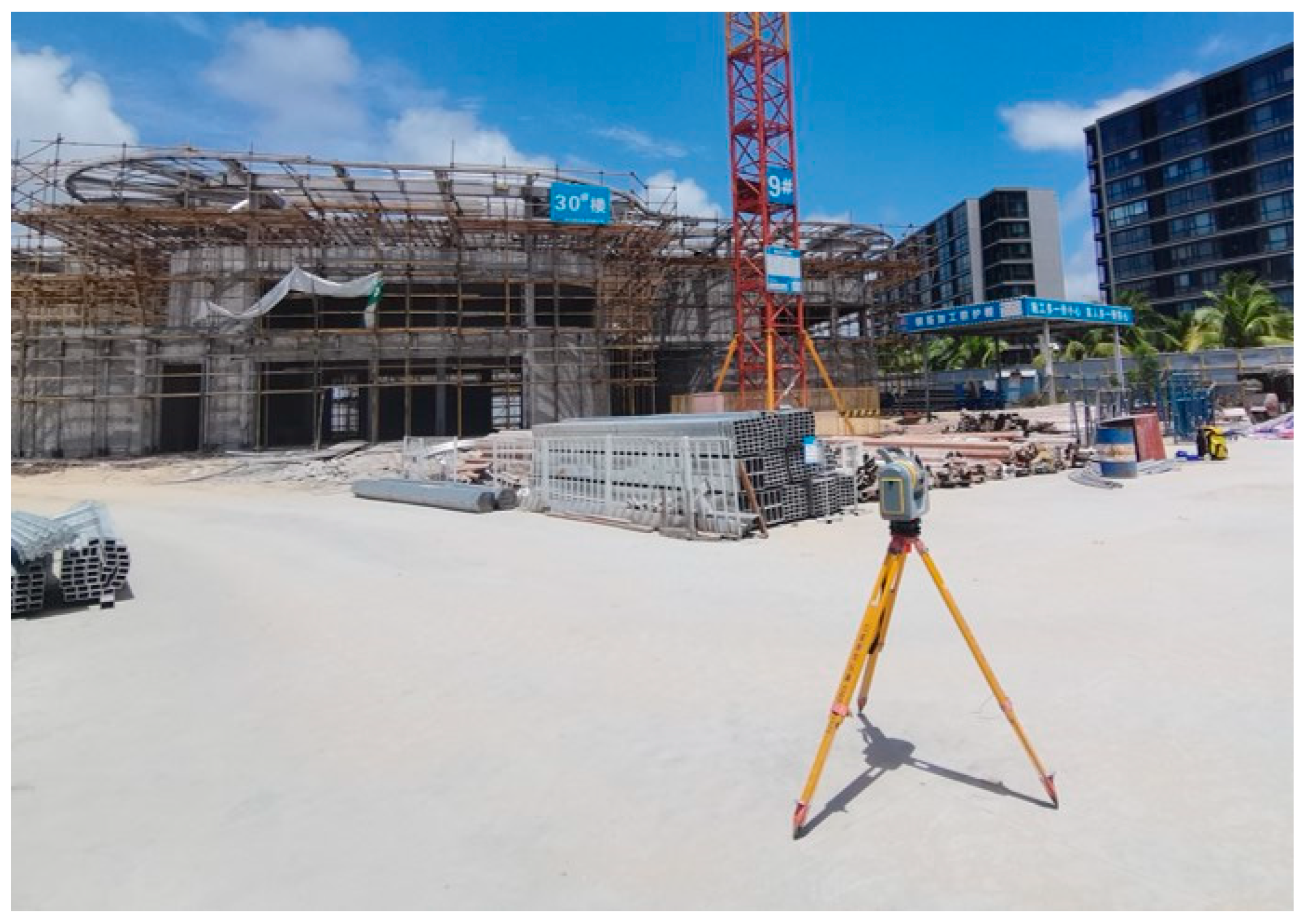
3.1. Field Project Description

A kindergarten construction project located in Blue Harbor, Xincun Town, Lingshui Li Autonomous County, Hainan Province, China, was selected in this work to present the application of 3D laser scanning technology in the curtain wall design and installation. It was designed and constructed in two-story steel structural form covering a gross floor area of 1537.19 square meters with a total height of 9.4 m. The overall view of the project is presented in Figure 4. The 3D laser scanning work was conducted when the project was at the end of structural construction, but prior to the building facade decoration. The 3D laser scanning aimed to collect a “point cloud” dataset to calibrate the location and measurement information of both curtain wall keel and panels, so as to update a developed design and revise the curtain wall panel material order and production, accordingly. Thus, by presenting the detailed procedures, experience, and findings obtained from this field case, the practical solution of applying 3D laser scanning technology integrated with the BIM concept was indeed demonstrated to improve the accuracy and efficiency of the curtain wall design and installation progress. More details are given below.

3.2. Scanning Operation

A 3D laser scanner is the most critical device in the application of 3D laser scanning technology to capture spatial locations and size measurements of the scanned target surface. Three types of 3D laser scanners, including terrestrial laser scanning, mobile laser scanner, and airborne laser scanner have been widely utilized [31,32]. In this present field case, considering the requirements for the efficiency and accuracy of data collection for the two-story building, the terrestrial laser scanner placed on a tripod was employed to perform the scan task. As the 3D laser scanner can only scan and record the light and its reflection in their sight line, multiple scans and overlaps of captured point data are required to create a complete representation of the target building.
Considering that the scaffolders were not demolished due to building façade decoration needs when the scanning task began, the overall scanning was designed into two main phases, the outer surface scanning, and the inside detailed scanning. Thus, lasering scans were operated from the outer surface using the Trimble SX10 laser scanner with a maximum scanning range of 600 m as shown in Figure 5a while Trimble X7 with a maximum scanning range of 80 m as shown in Figure 5b was employed for interior space detailed scanning. As for the outer surface scanning, the Trimble SX10 was applied due to its large scanning range making it more suitable for scanning large-scale targets or performing scanning in a large open space. In contrast, the inside space scanning for detailed information on small-size components was performed using the Trimble X7 with a small range and simplified adoption. The Trimble X7 scanner could be placed close enough to the completed surface of each target structural component to perform the scanning inside the building. It provided scanning speeds of up to 26,600 and 500,000 points per second for Trimble SX10 and X7, respectively.
The entire process began with the 3D laser scanner set up from the outside surface of the building to the inside space of the building. With a comprehensive evaluation of factors that influence the scanning strategy, such as environmental effects (illumination, weather, etc.), the movement of construction personnel, and so on, the number of necessary scans, scanning distance to the scanned target, and scanner positions for each scan had been carefully considered first of all. Thus, a total of 15 scans were determined for the outer surface while more than 50 scans were acquired for the inside space to provide complete coverage of the entire building. After 2 days of continuous scanning, the quantity and quality of the data gathered by the scanners ensure the feasibility of further data analysis and model reconstruction without additional field rework. Based on these considerations, a scanning route beginning from the façade of the target building to the inner space given in the floor plan as shown in Figure 6 was designed. In this scanning route, (i) the scanner was placed at a certain point representing the start point (Point A in Figure 6) in front of the to-be-scanned building for the entire scanning task, (ii) moved the scanner clockwise against the building (Point A-B-C-D-E-F-G-H-I-J-K-L-M-N-O in Figure 6) for performing all designed scans of the outer surface, (iii) moved the scanner to the inside space and placed on the beginning point of the interior scanning (Point A′ in Figure 6), and consequently, (iv) moved the scanner clockwise inside the building following the route of A′-B′-C′-D′-E′ in Figure 6 (totally more than 50 scans performed as given by the yellow triangles as shown in Figure 7). Following this pre-designed scanning plan, the scanner was appropriately arranged at several locations from multiple directions to gather a huge amount of spatial data including locations and measurements for establishing a “point cloud” for the following developed design and on-site installation of the curtain wall system.

3.3. Data Acquisition and Processing

Before the scanning, a control network should be established first by scanning and adjusting multiple target boards with black and white colors as shown in Figure 8a to mark the entire ground according to the coordinate system and the scanning plan. The deployment of the control network mainly considered the visibility between each adjacent control point to ensure the entire target building could be covered, and point cloud splicing which is an important role in subsequent processing. Further, based on the deployed control network, scanning sites could thus be set up accurately. The scanning sites should be determined not only for deploying scanners to ensure the required objects of the building can be completely scanned but also can conveniently perform point data registration and coordinate transformation by connecting with the control network. It needs to note that once the points in the control network have been determined, they cannot be removed or changed through the entire progress of the scanning because the structural construction axes and the scanner axes have been adjusted and determined by measuring and recording the relative distance and spatial relationship against the control points to calibrate the on-site existing axes. If the points in the control network change, the determined axes have to be adjusted accordingly, which leads to the previous measurement and locating results being invalid. Based on these considerations, the locations of the control network were marked by multiple metal spikes fixed on the ground as shown in Figure 8b. Depending on the control network with accurate coordinate positions (geographical coordinates and plane coordinates) or elevations, the coordinates or elevations of the pre-planned scanning sites can be conveniently obtained and calculated for data registration and so on. By placing scanners on these scanning sites and performing scans, massive point cloud data were successfully captured from multiple viewing angles and positions in a faster and more exact manner. Next, a successful alignment and composition of point data slices from each scan can be achieved based on the fixed control network and the spatial locations of scanning sites. Through this data acquisition and processing, a complete point cloud dataset was thus formed.
On the basis of the control network, 3D laser scanning of the visible finished layer for both the outer surface and interior space of the entire building on each scanning site was consequently performed. It should be noted that the intersections of adjacent items and components, regions that have numerous hidden corners, or fixed obstacles of the interior space on the finishing surface of the structural construction need to be particularly paid attention to. The unprocessed point cloud obtained from the entire scanning work is presented in Figure 9. It can be seen that not only the target building itself but also the scaffolds, pipe system, adjacent buildings, surrounding environment, ground landscape, etc. were captured and recorded. The existence of these additional data in the raw point cloud dataset not related to the target building provided nothing meaningful information but might inversely lead to time-consuming data processing. Thus, it is necessary to adjust the raw point cloud dataset into a more suitable pattern for the following procedures.
With the point cloud collected and lots of noise data existing, the obtained dataset should be processed by splicing the target object and eliminating noise data for the next modeling step. Due to the complexity and disordering of the entire point cloud, it was difficult to apply filters to efficiently and accurately locate and select “right” points (belong to the scanned target and would be remained) and eliminate “wrong” points (noise data that not belong to the target and should be removed). The noise data usually includes two resources: the unrelated noise of the scanned target itself due to some disturbance of external incoherent objects or obstacles on the LiDAR lightening route in the process of scanning, and noise caused by objects on the surface of the scanned target with high reflection intensity (glass, metals, etc.). Thus, in this project, we processed the point cloud dataset manually with specialized software, Trimble RealWorks. Trimble RealWorks is a set of point cloud processing and analysis software that integrates the functions of point cloud splicing, dimension measuring, orthophoto image production, data registration and 3D model reconstruction, and finally producing powerful comprehensive results [33]. With data has been input into this software, the gathered point cloud can be processed manually by splicing into different clusters, removing noise data, compositing site points, determining coordinates, and so on.Based on these processes, the originally gathered point cloud shown in Figure 9 was matched and merged for a processed point cloud only composed of sufficient and necessary spatial point information for the further 3D BIM model reconstruction exporting as displayed in Figure 10. Thus, it can be considered that after data collection in a few days and data processing in just a few minutes for one component or a few hours for part of the entire building, the spatial information of the target object for curtain wall construction can be accurately recorded by 3D laser scanning and displayed in a visualization manner, which is unmatched by the traditional manual data collection approaches.

3.4. BIM Model Reconstruction from Point Cloud

The processed point cloud was consequently imported into BIM modeling software for setting up each scanned component of the target building. Based on the reconstruction and assembling of component models, a complete 3D BIM model representing the as-built condition of the completed structural surface was established in the Sketchup software by aligning the transformed objects as shown in Figure 11.
Based on the 3D BIM model, accurate information including dimensions of the completed structural surface and requirements for the curtain wall keels and panels for guiding the curtain wall material manufacture and production with precise length, width, height, and other parameters related to the actual shape could be conveniently obtained. Besides, the location information for the following setting out and on-site installation was as well included in the BIM model. All of the above mentioned information can support and help engineers simplify the work process, save the construction period, improve the accuracy of the curtain wall installation so that potentially avoid material rework and schedule delays due to incorrect production dimension, installation errors, etc., further lay a solid foundation for the refined processing of the curtain wall in the factory. In addition, the finished decorative surface that can be implemented on-site was determined, as well the parameterized modeling in the BIM software for further applications could thus be carried out.

3.5. Data Fitting and Comparing of the BIM Model

Proceeding to the next step, the construction drawings or BIM models representing the as-designed condition were imported and overlapped with the reconstructed BIM model that represents the as-built foundation for curtain wall installation. A point cloud data fitting analysis and a comparison of the as-built and as-designed 3D BIM models were performed in this step. In detail, the as-designed 3D BIM model was handed over directly from the designer while the optimized as-built 3D BIM model was reconstructed from the dense point cloud dataset that has been displayed in the previous step. Consequently, these two models were used for a comparative analysis in the 3D space, based on which the comparative analysis results can be displayed in a visualization way. It can help designers optimize the developed design, as well as provide dimension/location information to engineers and ensure the on-site construction quality and accuracy for the curtain wall assemblies, furthermore, potentially shorten the entire design and construction period and effectively avoids the waste of materials. An overall view of the comparison is given in Figure 12 while several detailed comparisons are displayed in Figure 13. Elements with different colors represent the relative discrepancies between the as-built and as-designed BIM models (plane elements represent the as-designed BIM models while red/yellow/green colors represent the as-built BIM models established by the point cloud). It can be seen that in Figure 13a, the point clusters of the curtain wall keels obtained from the scanning that represents the actual construction condition displayed in red color are protruding out of the structural surface of the originally designed construction plan in the BIM model that is displayed in gray color on the roof floor; in Figure 13b, besides the curtain wall keels breaking through the roof surface similar to that have been found in Figure 13a, the point clusters representing the 2nd-floor structural completed surfacein blue color also shows discrepancies out of the as-designed floor in the BIM model; in Figure 13c, one column besides the stairs that scanned and represented in point clusters in red color can be found located in a shift position different from the originally designed column that represented in gray color in the BIM model; in Figure 13d, columns and beams in the actural construction condition that are displayed in red and yellow colors are also shows shift compared to the originally designed positions in gray color of the BIM model. Based on the comparison result, the difference between the as-built and as-designed curtain wall installation foundation and design dimension information was able to be detected and clearly visible in the 3D BIM models. It can be known that it was not appropriate to produce and manufacture the curtain wall panels following the as-designed dimensions, which possibly lead to on-site material rework or a failure of installing the curtain wall panels in the originally planned locations. Thus, engineers were able to conveniently detect not only where the original design needed to be revised, but as well the detailed dimension information for the manufacture and production of the curtain wall system. Based on this, a report including the calibrated dimensions of the curtain wall materials for a developed design and revisions of the installation positions that affect the curtain wall keel and panel construction progress was handed over to the curtain wall material manufacturer. Compared to the conventional approach, chances of convenience in the curtain wall construction are potentially enhanced, such as solving the difficulty in measuring and comparing some special-shaped curtain wall keels or panels; increasing the low efficiency, avoiding the waste of manpower, incomplete information, and even some conditions that measurements and comparison cannot be performed by human hands. Besides, problems caused by “human errors” might be effectively avoided through the non-contact information collection based on the digital dataset. And, the comparison results obtained from this process can not only accurately reflect the spatial position along with color information of the as-built and as-designed models but also display the discrepancy between these two models in a visualization manner, which make the comparative results easier to be detected and handed over to any related personnel, including curtain wall designers, construction engineers, and material manufacturers, etc.
This section indicated that the discrepancies existing between the design drawings and the current construction condition for the curtain wall keels and panels by performing the BIM model reconstruction and comparison can be visually detected, which can effectively reduce the production and installation rework, and further avoid a possible construction delay and human-generated errors.

3.6. Construction Setting out Using BIM

Due to the 3D BIM model being determined previously, the control network and the coordinates of both foundation and completed surfaces for curtain wall design and installation were obtained. Based on this completed layer, a developed design of the curtain wall material was performed according to the actual construction size with lower material loss, which potentially leads to a prefabricated construction of the curtain wall keel, and reduces the possible safety hazards on site. After the curtain wall panels have been manufactured in high accordance with the actual dimensions and to-be-installed positions, the finishing BIM model could accurately control and guide the on-site curtain wall installation, thus reduce the installation difficulty of panel components with complex shapes. An automatic total station was consequently employed and carried out for the on-site construction setting out with the coordinate calibration done by the BIM stakeout robot. In addition, 3D laser scanning can be as well performed once more for quality control purposes after the curtain wall system has been installed. The quality control process is out of the scope of this work, so details are not presented. While it can be noted that the concept and workflow are similar to the that of the design and installation procedures.

4. Discussion

The application in a field case of 3D laser scanning technology in the curtain wall design and installation was reported previously by presenting a real-life project. It indeed demonstrates the effectiveness and feasibility of the approach based on the 3D laser scanning technology with the BIM concept, and shows the advancements and continual development contribute to increasing the efficiency and accuracy of the curtain wall system developed design and on-site installation, particularly compared to the conventional manual approach. However, it is still considered to be in the early stages of practical applications. Vast potential and opportunities for further research and discussions continually remain. Therefore, discussions regarding a conceptual comparison with the conventional approach, key strengths of the methodology, instructions, limitations/weaknesses, recommendations for practical application, and challenges along with potential future directions at the current stage are presented in this section.

4.1. Conceptual Comparison with the Conventional Method

The 3D laser scanning technology provides the possibility of adopting a non-contact high-speed laser locating and measurement with high efficiency and accuracy for the purpose of the curtain wall system construction. The on-site point cloud data including locations and distances of the foundation and finishing for curtain wall keels and panels are collected firstly by the 3D laser scanners. And, the gathered raw data are processed and converted into a “point cloud” with high handleability by post-processing. The point cloud can thus be output in a variety of different formats to meet the needs of the curtain wall system developed design and on-site installation. The 3D laser scanning technology overcomes the limitations of the traditional measurement approach and changes the manual measurement method, which solves the shortcomings of low accuracy and efficiency of manual measurement, particularly the inability to measure building façade elements and special-shaped curtain walls. Furthermore, it potentially supports a real-time and efficient way of data storage for subsequent data processing. More comparisons between the 3D laser scanning approach and the conventional manual approach are listed in Table 1.
Besides, it is difficult to collect complete basic data information such as civil works, curtain wall connection points, and supporting skeletons using traditional measurement methods. Furthermore, inconsistencies in size and errors in locations can be easily caused by solely relying on manual measurements with 2D drawings to place and assembly curtain wall material, which potentially results in material waste and construction delays. In contrast, based on the improvements of using the 3D laser scanning approach, high precision locating and measuring for each curtain wall component, especially for highly difficult curved surfaces or special-shaped curtain walls can be achieved. Also, 3D laser scanning is capable of capturing practically detailed features of the object being scanned, avoiding the likelihood of item omission that might occur by human work. Generally, the application of 3D laser scanning technology provides opportunities to greatly improve work efficiency, reduce the impact of engineering construction errors on design, and avoid unnecessary material loss rather than the conventional manual approach.

4.2. Instructions, Limitations, and Recommendations

Based on this field case presented in Section 3, pieces of instructions, limitations, and recommendations for further practical application of the 3D laser scanning technology in the curtain wall design and installation are given below:
(1)
The field case showed the potential and demonstrated the effectiveness of the application of 3D laser scanning, and is encouraging the value of the integration of 3D laser scanning and the BIM approach in the curtain wall construction field. A comprehensive workflow summarized based on this case is given in Figure 14. It should be noted that the quality control after the curtain wall system has been installed which is not mainly concerned in this paper is as well presented in this workflow in order to provide a complete concept.
(2)
The initial cost of the 3D laser scanning device (scanner and relevant accessories) is always higher than that of the conventional manual approach, which leads to a negative impact on a wide application of this technology. And, the operation of the 3D laser scanner and the following post-data processing need sufficient knowledge and training for engineers on site, while the method of operation is still unknown and less understood to engineers due to the lack of knowledge. In addition, even though this technology has been researched and applied in various industries, due to the lack of adopting professional training and imposing targeted measures for wide application in the curtain wall design and installation field, the promotion of this approach still needs more attention and attempt.
(3)
As previously described, the scanners can only collect and record point data of the object’s surface in their lighting and reflecting line, even though an overall coverage and a complete model of the entire building might be achieved by arranging multiple scans from different scanning sites, details of some locations, items that are hidden into the conjunctions might be still unable to obtain. Particularly for complex buildings, it might bring information missing or potential errors.
(4)
With performed in this field case, it is highly recommended a pre-observation of the outer surface and an information preparation including technical documents, built construction plans, structural design details, and other related documents for the 3D laser scanning planning. Based on a good understanding of the scanned target and requirements of the scanning purposes, an effective and applicable pre-designed scanning plan and operation path can be established, which potentially brings a positive impact and might be highly supportive for the following scanning task.
(5)
Another consideration for the practical application is the operation team organization. It can be seen that two main phases are required, data acquisition by 3D laser scanning, and BIM-based data processing and model reconstruction. Thus, at least two engineers are required for a well-organized group, one should be a well-trained operator who can perform the 3D laser scanning for collecting raw point cloud data, and another should be capable of conducting data processing and model reconstruction.
(6)
Currently, the post-processing on the “point cloud” was performed by manual work in this project. This can be considered because it is difficult to develop a promising automatic or semi-automatic data post-processing technique including point cloud splicing, noise selecting and removing with good accuracy and efficiency considering the huge amount, the complexity, and the disordering of the raw point dataset in this project. In the other words, the manual approach is still the most suitable way to process the raw point dataset and prepare it into the “point cloud” for the next steps.

4.3. Challenges and Future Directions

It can be seen that the approach based on 3D laser scanning along with BIM technology can provide a good potential for practical application, such as obtaining accurate pre-and post-construction models for updating the curtain wall design, material production, on-site installation, and adherence to design plans. However, there are still several challenges that need to be realized by researchers.
  • Sufficient studies have not been conducted to quantify the increase of work efficiency in time, cost, work safety, etc. by using 3D laser scanning technology compared to the traditional manual approach that has been applied widely used in the current practice.
  • The usage of 3D laser scanning technology is still in the early stages in the building construction field, and it is only considered applied in the construction phase, the possibility of its application in other phases, such as structural damage assessment, building management and maintenance, are expected and open to research.
  • The point cloud data processing, including splicing the point cloud dataset, removing noise data, etc. in this project was performed in a manual way, automatical or semi-automatical approaches without manual intervention have not been achieved yet. This can be considered due to the huge data amount and complexity of the entire point cloud dataset. The alignment and collaboration with other newly-developed technologies, such as computer science-based data analysis, machine learning, and so on, might have great potential to be considered of value for these tasks.
According to the above-mentioned challenges, potential future directions open to research are present herein.
  • Further studies to quantify the performance of applying the 3D laser scanning technology, such as how much cost-and time-efficient rather than the traditional approach are required. Also, parametric studies and discussions are expected for investigating the influencing factors on the performance of applying the 3D laser scanning technology. For example, both traditional and 3D laser scanning approaches can be conducted on specimens in an experimental test or actual construction projects first. Next, results that can represent and quantify the performance of both approaches can be compared and discussed to verify the comparability of laser scanning with currently specified construction measurement and quantity determination methodology.
  • To further increase work efficiency, automatic or semi-automatic based on newly-developed techniques are needed for the data post-processing on the collected huge amount of raw points to obtain the most suitable “point cloud” for next-step model reconstruction. For example, collaboration with computer science-based data analysis, machine learning, etc. might have great potential to be carefully considered and applied in the procedures of splicing the point cloud, data selection, and removing noise.
  • The potential of 3D laser scanning technology in a wider scope including structural damage assessment, building management, and maintenance is open for further investigation.
  • The 3D BIM model obtained from the point cloud data might be contributive to a cloud-based digital world in the short future. A larger range of applications, including scanners and other reality capture equipment, such as Virtual Reality (VR) devices, might be incorporated to improve the value of gathered point cloud data and the established BIM model.
  • Using 3D laser scanning technology, it is also possible to predict the structural performance and location of condensation that may occur on the curtain wall materials, such as the serious cold bridge phenomenon that may exist at the metal frame and glass joints of the curtain wall panels, and additionally, provide corresponding thermal performance parameter prediction.

5. Conclusions

The work presented in this paper demonstrated the effectiveness of the application of 3D laser scanning technology in the curtain wall design and installation field. The basic concept, detailed workflow, and actual performance have been given and summarized by presenting a real-life construction project. Generally, the application of 3D laser scanning technology in the curtain wall design and installation can be divided into two main phases: the first phase of scanning is mainly for the review of structural construction conditions, to detect the deviation and accuracy of the foundation for the curtain wall construction. The second stage of scanning is mainly aimed at the review of the curtain wall keel after installation, to evaluate the accuracy of the keel installation for the following curtain wall panel manufacture and installation, and consequently, the BIM model can be used to guide and control the on-site installation.
Besides, the difference between using the 3D laser scanning technology compared to conventional methods, and the benefits and the great significance in the practical application have been discussed in detail. Furthermore, instructions, limitations, and recommendations for practical application, along with challenges and future directions open to research, were also pointed out in this work.

Author Contributions

All authors conceived and designed the study. Conceptualization, methodology, and writing: J.W.; Revision and supervision: T.U.; investigation, resources, data curation: T.Y.; and field investigation: X.L. All authors have read and agreed to the published version of the manuscript.

Funding

This research received no external funding.

Data Availability Statement

Not applicable.

Acknowledgments

The authors acknowledge the kindness and support of all members of the Ueda laboratory of Guangdong Provincial Key Laboratory for Durability of Marine Civil Engineering at College of Civil and Transportation Engineering, Shenzhen University during the development of this work.

Conflicts of Interest

The authors declare no conflict of interest.

References

  1. Ma, D.L.; Cui, J.; Wang, S.Y. Application and Research of 3D Laser Scanning Technology in Steel Structure Installation and Deformation Monitoring. Appl. Mech. Mater. 2014, 580, 2838–2841. [Google Scholar]
  2. Edl, M.; Mizerák, M.; Trojan, J. 3D Laser Scanners: History and Applications. Int. Sci. J. About Simul. 2018, 4, 1–5. [Google Scholar] [CrossRef]
  3. Li, Y.; Liu, P.; Li, H.; Huang, F. A Comparison Method for 3D Laser Point Clouds in Displacement Change Detection for Arch Dams. ISPRS Int. J. Geo-Inf. 2021, 10, 184. [Google Scholar] [CrossRef]
  4. Bosché, F.; Ahmed, M.; Turkan, Y.; Haas, C.T.; Haas, R. The value of integrating Scan-to-BIM and Scan-vs-BIM techniques for construction monitoring using laser scanning and BIM: The case of cylindrical MEP components. Autom. Constr. 2015, 49, 201–213. [Google Scholar] [CrossRef]
  5. Kim, M.-K.; Wang, Q.; Park, J.-W.; Cheng, J.C.; Sohn, H.; Chang, C.-C. Automated dimensional quality assurance of full-scale precast concrete elements using laser scanning and BIM. Autom. Constr. 2016, 72, 102–114. [Google Scholar] [CrossRef]
  6. Du, J.-C.; Teng, H.-C. 3D laser scanning and GPS technology for landslide earthwork volume estimation. Autom. Constr. 2007, 16, 657–663. [Google Scholar] [CrossRef]
  7. Arayici, Y. An approach for real world data modelling with the 3D terrestrial laser scanner for built environment. Autom. Constr. 2007, 16, 816–829. [Google Scholar] [CrossRef] [Green Version]
  8. Tang, P.; Anil, E.B.; Akinci, B.; Huber, D. Efficient and effective quality assessment of as-is building information models and 3D laser-scanned data. In Proceedings of the International Workshop on Computing in Civil Engineering 2011, Miami, FL, USA, 19–22 June 2011; pp. 486–493. [Google Scholar]
  9. Bosché, F. Automated recognition of 3D CAD model objects in laser scans and calculation of as-built dimensions for dimensional compliance control in construction. Adv. Eng. Inform. 2010, 24, 107–118. [Google Scholar] [CrossRef]
  10. Barsanti, S.G.; Remondino, F.; Visintini, D. Photogrammetry and Laser Scanning for archaeological site 3D modeling–Some critical issues. In Proceedings of the 2nd Workshop on’The New Technologies for Aquileia, Aquileia, Italy, 25 June 2012; Volume 1, pp. 1–10. [Google Scholar]
  11. El-Omari, S.; Moselhi, O. Integrating 3D laser scanning and photogrammetry for progress measurement of construction work. Autom. Constr. 2008, 18, 1–9. [Google Scholar] [CrossRef]
  12. El Omari, S.; Moselhi, O. Integrating Automated Data Acquisition Technologies for Progress Reporting of Construction Projects. Autom. Constr. 2011, 20, 699–705. [Google Scholar] [CrossRef] [Green Version]
  13. Gikas, V. Three-Dimensional Laser Scanning for Geometry Documentation and Construction Management of Highway Tunnels during Excavation. Sensors 2012, 12, 11249–11270. [Google Scholar] [CrossRef] [PubMed]
  14. Rolfsen, C.N.; Lassen, A.K.; Han, D.; Hosamo, H.; Ying, C. The use of the BIM-model and scanning in quality assurance of bridge constructions. In ECPPM 2021–eWork and eBusiness in Architecture, Engineering and Construction; CRC Press: Boca Raton, FL, USA, 2021; pp. 357–360. [Google Scholar]
  15. Si, M.; Han, D.; Guo, J.; Yuan, Y.; Yang, Y.; Ying, C.; Bai, J.; Guo, T. Road Disease Analysis Method Based on 3D Laser Scanning Point Cloud. Sci. Technol. Eng. 2018, 19, 1671–1815. [Google Scholar]
  16. Yoon, S.; Wang, Q.; Sohn, H. Optimal placement of precast bridge deck slabs with respect to precast girders using 3D laser scanning. Autom. Constr. 2018, 86, 81–98. [Google Scholar] [CrossRef]
  17. Alomari, K.; Gambatese, J.; Olsen, M.J. Role of BIM and 3D laser scanning on job sites from the perspective of construction project management personnel. In Proceedings of the Construction Research Congress, San Juan, PR, USA, 31 May–2 June 2016; pp. 2532–2541. [Google Scholar]
  18. SMCHURDM; SBTAJCO. Shanghai BIM Technology Application & Development Reports (2021); Shanghai Housing and Urban-Rural Construction Administration Commission: Shanghai, China, 2021. [Google Scholar]
  19. Huber, D.; Akinci, B.; Tang, P.; Adan, A.; Okorn, B.; Xiong, X. Using laser scanners for modeling and analysis in architecture, engineering, and construction. In Proceedings of the 2010 44th Annual Conference on Information Sciences and Systems (CISS), Princeton, NJ, USA, 17–19 March 2010; pp. 1–6. [Google Scholar]
  20. Slattery, K.T.; Slattery, D.K.; Peterson, J.P. Road construction earthwork volume calculation using three-dimensional laser scanning. J. Surv. Eng. 2012, 138, 96–99. [Google Scholar] [CrossRef]
  21. Zhang, C.; Arditi, D. Automated progress control using laser scanning technology. Autom. Constr. 2013, 36, 108–116. [Google Scholar] [CrossRef]
  22. Shukor, S.A.; Wong, R.; Rushforth, E.; Basah, S.N.; Zakaria, A. 3D terrestrial laser scanner for managing existing building. J. Teknol. 2015, 76, 12. [Google Scholar]
  23. Liu, J.; Zhang, Q.; Wu, J.; Zhao, Y. Dimensional accuracy and structural performance assessment of spatial structure components using 3D laser scanning. Autom. Constr. 2018, 96, 324–336. [Google Scholar] [CrossRef]
  24. Binjin, C.; Shouyan, Y.; Xin, Y.; Qichen, J.; Xin, L. A Novel Construction Quality Control and Management Method Based on BIM and 3D Laser Scanning Technology. In Proceedings of the 2018 International Conference on 3D Immersion (IC3D), Brussels, Belgium, 5–6 December 2018; pp. 1–8. [Google Scholar]
  25. Rodrigues, F.; Teixeira, J.; Matos, R.; Rodrigues, H. Development of a web application for historical building management through BIM technology. Adv. Civ. Eng. 2019, 2019, 9872736. [Google Scholar] [CrossRef] [Green Version]
  26. Kim, M.K.; Cheng, J.C.; Sohn, H.; Chang, C.C. A framework for dimensional and surface quality assessment of precast concrete elements using BIM and 3D laser scanning. Autom. Constr. 2015, 49, 225–238. [Google Scholar] [CrossRef]
  27. Jrade, A.; Lessard, J. An integrated BIM system to track the time and cost of construction projects: A case study. J. Constr. Eng. 2015, 2015, 1–10. [Google Scholar] [CrossRef] [Green Version]
  28. Nguyen, T.A.; Nguyen, P.T.; Do, S.T. Application of BIM and 3D laser scanning for quantity management in construction projects. Adv. Civ. Eng. 2020, 2020. [Google Scholar] [CrossRef]
  29. Sanhudo, L.P.; Ramos, N.M.; Martins, J.P.; Almeida, R.M.; Barreira, E.; Simões, M.L.; Cardoso, V.E. A framework for in-situ geometric data acquisition using laser scanning for BIM modelling. J. Build. Eng. 2020, 28, 101073. [Google Scholar] [CrossRef]
  30. Pica, D.; Abanda, F.H. Emerging BIM-3d-laser scanning integration in construction practice. In Collaboration and Integration in Construction, Engineering, Management and Technology; Springer: Cham, Switzerland, 2021; pp. 345–350. [Google Scholar]
  31. Bassier, M.; Yousefzadeh, M.; Van Genechten, B. Evaluation of data acquisition techniques and workflows for Scan to BIM. In Geo Bussiness; Geo Bussiness: London, UK, 2015. [Google Scholar]
  32. Liu, J.; Xu, D.; Hyyppä, J.; Liang, Y. A Survey of Applications with Combined BIM and 3D Laser Scanning in the Life Cycle of Buildings. IEEE J. Sel. Top. Appl. Earth Obs. Remote Sens. 2021, 14, 5627–5637. [Google Scholar] [CrossRef]
  33. Elbshbeshi, A.; Gomaa, A.; Mohamed, A.; Othman, A.; Ghazala, H. Applying geomatics techniques for documenting heritage buildings in Aswan region, Egypt: A Case study of the Temple of Abu Simbel. Research 2022. [Google Scholar] [CrossRef]
Figure 1. An example of a 3D laser scanner used in the building construction industry.
Remotesensing 15 00064 g001
Figure 2. The built-in local coordinate system of the 3D laser scanner.
Remotesensing 15 00064 g002
Figure 3. The overview of the 3D laser scanning technology workflow in curtain wall design and installation.
Remotesensing 15 00064 g003
Figure 4. The overall view of the kindergarten project.
Remotesensing 15 00064 g004
Figure 5. The 3D laser scanners used in this project: (a) Trimble SX10 for outside scanning; (b) Trimble X7 for inside scanning.
Remotesensing 15 00064 g005
Figure 6. The scanning route.
Remotesensing 15 00064 g006
Figure 7. The scanning points inside the building.
Remotesensing 15 00064 g007
Figure 8. (a) An example of the target board; (b) A metal spike fixed on the ground.
Remotesensing 15 00064 g008
Figure 9. The gathered unprocessed point cloud by 3D laser scanning.
Remotesensing 15 00064 g009
Figure 10. The processed point cloud: (a) side view; (b) vertical view.
Remotesensing 15 00064 g010
Figure 11. The reconstructed 3D BIM model from the processed point cloud: (a) side view; (b) vertical view.
Remotesensing 15 00064 g011
Figure 12. The overall view of the comparison of the as-built and as-designed 3D BIM model.
Remotesensing 15 00064 g012
Figure 13. The detailed view of the comparison of the as-built and as-designed 3D BIM model (point cloud dataset): (a) and (b) curtain wall keels; (c) and (d) structural columns.
Remotesensing 15 00064 g013
Figure 14. The workflow design of the application of 3D laser scanning for the curtain wall design and installation task.
Remotesensing 15 00064 g014
Table 1. Comparison of 3D laser scanning approach versus conventional manual approach.
Comparison Item3D Laser Scanning ApproachConventional Manual Approach
Tools3D Laser ScannerTape measure, scale, laser rangefinder, drawings, total station
Measurement methodCompletely non-contact, long-distance measurement, not affected by the environmental conditions (illumination, etc.)Contact, close distance measurement, affected by the environment conditions (illumination, etc.)
Field drawing workUnnecessary, automatic data collectionNecessary
Measuring efficiencyHigh efficiency, complete single-station panoramic scan within 1 minLow efficiency, can only measure point-to-point distance, and labor-intensive
Degree of securityNon-contact measurement to ensure personnel safetyDegree of security
Result formPoint cloud data can be imported into REVIT\Autocad\3DMAX\Navisworks\ArchiCAD and other BIM software; easily obtain a series of evaluation distance, slope distance, vertical distance, clearance, diameter, angle, azimuth, slope, inclination angle, and coordinates Data; BIM model is accurately modified and reviewed according to point cloud data.Label data on drawings based on measured point-to-point distances
Modeling methodEfficient reverse modeling based on point cloudDraw CAD drawings based on on-site manuscripts, and then perform 3D modeling based on CAD drawings
AccuracyAll-round acquisition of on-site conditions, which can be accurately reflected through 3D point cloud data. According to the point cloud data, the size data of artificially unmeasurable positions can be obtained, with high accuracy. Millimeter-level accuracy avoids wasting capital and materials due to reworkOnly based on the experience of the on-site review personnel measure the data that is considered to be reviewed, might occur interference affected by human factors, the measurement data is partial, subjective, and prone to produce human errors
Skills requirementThe 3D scanner operation, the collection method of the point cloud, and the data processing approach are easy to learnA measurement team composed of experienced workers is needed
ApplicabilitySuitable for all difficult curtain wall projects, especially projects with complex structures, high precision requirements, large space, and difficult manual measurement.Simple structure, small area, and low precision-required structures
Visualization3D visualization2D Plane visualization
Disclaimer/Publisher’s Note: The statements, opinions and data contained in all publications are solely those of the individual author(s) and contributor(s) and not of MDPI and/or the editor(s). MDPI and/or the editor(s) disclaim responsibility for any injury to people or property resulting from any ideas, methods, instructions or products referred to in the content.

