
A Machine Learning Algorithm for Himawari-8

 ,
,  ,
,
Abstract
:
1. Introduction
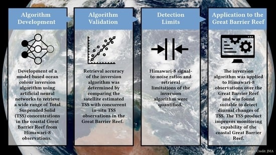
2. Methods
2.1. The Forward Model
2.2. The Inverse Model
- The input neurons receive the input vector , containing simulated reflectances and the ancillary data described above, and propagates it to the hidden layer neurons .
- In the hidden layer, the artificial neurons sum up the weighted input signals and pass these through a non-linear transfer function and subsequently forward their outputs to the output layer neurons .
- The cost function (i.e., mean squared errors, MSE—Equation (1)) between the simulated target outputs and the ANN computed outputs is calculated for the entire training dataset (N = 100,000), and the internal weights of the network are adjusted.
- The training of the ANN is repeated until the cost function between output and target value is minimised.
2.3. The Himawari-8 Ocean Colour Processing
2.4. Great Barrier Reef in Situ Data
2.5. Validation Protocol
2.6. Assessment of Limitations
3. Results
3.1. Algorithm Validation
3.2. Himawari-8 Total Suspended Solids for the Great Barrier Reef
3.3. Detection Limits
4. Discussion
4.1. Algorithm Development and Validation
4.2. Himawari-8 Total Suspended Solids for the Great Barrier Reef
4.3. Limitations
5. Conclusions and Future Perspectives
Supplementary Materials
Author Contributions
Funding
Data Availability Statement
Acknowledgments
Conflicts of Interest
References
- Schroeder, T.; Devlin, M.J.; Brando, V.E.; Dekker, A.G.; Brodie, J.E.; Clementson, L.A.; McKinna, L. Inter-annual variability of wet season freshwater plume extent into the Great Barrier Reef lagoon based on satellite coastal ocean colour observations. Mar. Pollut. Bull. 2012, 65, 210–223. [Google Scholar] [CrossRef]
- Devlin, M.; Petus, C.; da Silva, E.T.; Tracey, D.; Wolff, N.; Waterhouse, J.; Brodie, J. Water Quality and River Plume Monitoring in the Great Barrier Reef: An Overview of Methods Based on Ocean Colour Satellite Data. Remote Sens. 2015, 7, 12909–12941. [Google Scholar] [CrossRef]
- Blondeau-Patissier, D.; Brando, V.E.; Lønborg, C.; Leahy, S.M.; Dekker, A.G. Phenology of Trichodesmium spp. blooms in the Great Barrier Reef lagoon, Australia, from the ESA-MERIS 10-year mission. PLoS ONE 2018, 13, e0208010. [Google Scholar] [CrossRef] [PubMed]
- Petus, C.; Waterhouse, J.; Lewis, S.; Vacher, M.; Tracey, D.; Devlin, M. A flood of information: Using Sentinel-3 water colour products to assure continuity in the monitoring of water quality trends in the Great Barrier Reef (Australia). J. Environ. Manag. 2019, 248, 109255. [Google Scholar] [CrossRef]
- Brodie, J.; Schroeder, T.; Rohde, K.; Faithful, J.; Masters, B.; Dekker, A.; Brando, V.; Maughan, M. Dispersal of suspended sediments and nutrients in the Great Barrier Reef lagoon during river-discharge events: Conclusions from satellite remote sensing and concurrent flood-plume sampling. Mar. Freshw. Res. 2010, 61, 651–664. [Google Scholar] [CrossRef]
- Sirjacobs, D.; Alvera-Azcárate, A.; Barth, A.; Lacroix, G.; Park, Y.; Nechad, B.; Ruddick, K.; Beckers, J.-M. Cloud filling of ocean colour and sea surface temperature remote sensing products over the Southern North Sea by the Data Interpolating Empirical Orthogonal Functions methodology. J. Sea Res. 2011, 65, 114–130. [Google Scholar] [CrossRef]
- Ruddick, K.; Neukermans, G.; Vanhellemont, Q.; Jolivet, D. Challenges and opportunities for geostationary ocean colour remote sensing of regional seas: A review of recent results. Remote Sens. Environ. 2014, 146, 63–76. [Google Scholar] [CrossRef]
- Ruddick, K.; Vanhellemont, Q.; Yan, J.; Neukermans, G.; Wei, G.; Shang, S. Variability of suspended particulate matter in the Bohai Sea from the geostationary Ocean Color Imager (GOCI). Ocean. Sci. J. 2012, 47, 331–345. [Google Scholar] [CrossRef]
- IOCCG. Ocean-Colour Observations from a Geostationary Orbit; Reports of the International Ocean-Colour Coordinating Group (IOCCG) Report Number 12; Antoine, D., Ed.; IOCCG: Dartmouth, NS, Canada, 2012; Available online: http://ioccg.org/wp-content/uploads/2015/10/ioccg-report-12.pdf (accessed on 18 April 2016).
- Gruber, R.; Waterhouse, J.; Logan, M.; Petus, C.; Howley, C.; Lewis, S.; Tracey, D.; Langlois, L.; Tonin, H.; Skuza, M.; et al. Marine Monitoring Program: Annual Report for Inshore water Quality Monitoring 2018–2019; Report for the Great Barrier Reef Marine Park Authority 2208–4096; Great Barrier Reef Marine Park Authority: Townsville, Australia, 2020. Available online: https://elibrary.gbrmpa.gov.au/jspui/handle/11017/3665 (accessed on 14 May 2022).
- Waterhouse, J.; Schaffelke, B.; Bartley, R.; Eberhard, R.; Brodie, J.; Thorburn, P.; Rolfe, J.; Ronan, M.; Taylor, B.; Star, M.; et al. Scientific Consensus Statement Summary: Land Use Impacts on Great Barrier Reef Water Quality and Ecosystem Condition; State of Queensland: Townsville, Australia, 2017. Available online: https://www.reefplan.qld.gov.au/science-and-research/the-scientific-consensus-statement (accessed on 25 November 2017).
- Feng, J.; Chen, H.; Zhang, H.; Li, Z.; Yu, Y.; Zhang, Y.; Bilal, M.; Qiu, Z. Turbidity estimation from GOCI satellite data in the turbid estuaries of China’s coast. Remote Sens. 2020, 12, 3770. [Google Scholar] [CrossRef]
- Lou, X.; Hu, C. Diurnal changes of a harmful algal bloom in the East China Sea: Observations from GOCI. Remote Sens. Environ. 2014, 140, 562–572. [Google Scholar] [CrossRef]
- Groom, S.; Sathyendranath, S.; Ban, Y.; Bernard, S.; Brewin, R.; Brotas, V.; Brockmann, C.; Chauhan, P.; Choi, J.-K.; Chuprin, A.; et al. Satellite Ocean Colour: Current Status and Future Perspective. Front. Mar. Sci. 2019, 6, 485. [Google Scholar] [CrossRef]
- Park, J.-E.; Park, K.-A.; Kang, C.-K.; Park, Y.-J. Short-Term Response of Chlorophyll-a Concentration to Change in Sea Surface Wind Field over Mesoscale Eddy. Estuaries Coasts 2019, 43, 646–660. [Google Scholar] [CrossRef]
- Lavigne, H.; Ruddick, K. The potential use of geostationary MTG/FCI to retrieve chlorophyll-a concentration at high temporal resolution for the open oceans. Int. J. Remote Sens. 2018, 39, 2399–2420. [Google Scholar] [CrossRef]
- Dorji, P.; Fearns, P. Atmospheric correction of geostationary Himawari-8 satellite data for Total Suspended Sediment mapping: A case study in the Coastal Waters of Western Australia. ISPRS J. Photogramm. Remote Sens. 2018, 144, 81–93. [Google Scholar] [CrossRef]
- Miller, S.D.; Schmit, T.L.; Seaman, C.J.; Lindsey, D.T.; Gunshor, M.M.; Kohrs, R.A.; Sumida, Y.; Hillger, D. A Sight for Sore Eyes: The Return of True Color to Geostationary Satellites. Bull. Am. Meteorol. Soc. 2016, 97, 1803–1816. [Google Scholar] [CrossRef]
- Doxaran, D.; Lamquin, N.; Park, Y.-J.; Mazeran, C.; Ryu, J.-H.; Wang, M.; Poteau, A. Retrieval of the seawater reflectance for suspended solids monitoring in the East China Sea using MODIS, MERIS and GOCI satellite data. Remote Sens. Environ. 2014, 146, 36–48. [Google Scholar] [CrossRef]
- Doxaran, D.; Cherukuru, R.C.N.; Lavender, S.J. Use of reflectance band ratios to estimate suspended and dissolved matter concentrations in estuarine waters. Int. J. Remote Sens. 2005, 26, 1763–1769. [Google Scholar] [CrossRef]
- Kwiatkowska, E.J.; Ruddick, K.; Ramon, D.; Vanhellemont, Q.; Brockmann, C.; Lebreton, C.; Bonekamp, H.G. Ocean colour products from geostationary platforms, opportunities with Meteosat Second and Third Generation. Ocean. Sci. Discuss. 2015, 12, 3143–3167. [Google Scholar] [CrossRef]
- Murakami, H. Ocean color estimation by Himawari-8/AHI. In Proceedings of the Remote Sensing of the Oceans and Inland Waters: Techniques, Applications, and Challenges, New Delhi, India, 7 May 2016. [Google Scholar] [CrossRef]
- Chen, X.; Shang, S.; Lee, Z.; Qi, L.; Yan, J.; Li, Y. High-frequency observation of floating algae from AHI on Himawari-8. Remote Sens. Environ. 2019, 227, 151–161. [Google Scholar] [CrossRef]
- Hafeez, S.; Wong, M.S.; Abbas, S.; Jiang, G. Assessing the Potential of Geostationary Himawari-8 for Mapping Surface Total Suspended Solids and Its Diurnal Changes. Remote Sens. 2021, 13, 336. [Google Scholar] [CrossRef]
- Japan Meteorological Agency. Event Log: Himawari-8 Performance Test Results; Meteorological Satellite Center: Kiyose, Japan, 2015; Available online: https://www.data.jma.go.jp/mscweb/en/himawari89/space_segment/fig/AHI8_performance_test_en.pdf (accessed on 20 September 2021).
- IOCCG. Remote Sensing of Ocean Colour in Coastal and Other Optically-Complex Waters; Reports of the International Ocean-Colour Coordinating Group (IOCCG) Report Number 3; Sathyendrath, S., Ed.; IOCCG: Dartmouth, NS, Canada, 2000; Available online: http://ioccg.org/wp-content/uploads/2015/10/ioccg-report-03.pdf (accessed on 20 September 2015).
- Schroeder, T.; Schaale, M.; Lovell, J.; Blondeau-Patissier, D. An ensemble neural network atmospheric correction for Sentinel-3 OLCI over coastal waters providing inherent model uncertainty estimation and sensor noise propagation. Remote Sens. Environ. 2022, 270, 112848. [Google Scholar] [CrossRef]
- Fan, Y.; Li, W.; Chen, N.; Ahn, J.-H.; Park, Y.-J.; Kratzer, S.; Schroeder, T.; Ishizaka, J.; Chang, R.; Stamnes, K. OC-SMART: A machine learning based data analysis platform for satellite ocean color sensors. Remote Sens. Environ. 2021, 253, 112236. [Google Scholar] [CrossRef]
- Brockmann, C.; Doerffer, R.; Peters, M.; Stelzer, K.; Embacher, S.; Ruescas, A. Evolution of the C2RCC neural network for Sentinel 2 and 3 for the retrieval of ocean colour products in normal and extreme optically complex waters. In Proceedings of the European Space Agency, Prague, Czech Republic, 9–13 May 2016. [Google Scholar]
- Schroeder, T.; Fischer, J.; Schaale, M.; Fell, F. Artificial-neural-network-based atmospheric correction algorithm: Application to MERIS data. In Proceedings of the SPIE 4892, Ocean Remote Sensing and Applications, Hangzhou, China, 8 May 2003; pp. 124–132. [Google Scholar] [CrossRef]
- Jamet, C.; Thira, S.; Moulin, C.; Crepon, M. Use of a Neurovariational Inversion for Retrieving Oceanic and Atmospheric Constituents from Ocean Color Imagery: A Feasibility Study. J. Atmos. Ocean. Technol. 2005, 22, 460–475. [Google Scholar] [CrossRef]
- Brajard, J.; Jamet, C.; Moulin, C.; Thiria, S. Use of a neuro-variational inversion for retrieving oceanic and atmospheric constituents from satellite ocean colour sensor: Application to absorbing aerosols. Neural Netw. Off. J. Int. Neural Netw. Soc. 2006, 19, 178–185. [Google Scholar] [CrossRef]
- Doerffer, R. Algorithm Theoretical Basis Document (ATBD) MERIS Regional Coastal and Lake Case 2 Water Project Atmospheric Correction ATBD; Water Version 1; GKSS Research Center: Geesthacht, Germany, 2008; pp. 1–42. [Google Scholar]
- Pahlevan, N.; Smith, B.; Schalles, J.; Binding, C.; Cao, Z.; Ma, R.; Alikas, K.; Kangro, K.; Gurlin, D.; Hà, N.; et al. Seamless retrievals of chlorophyll-a from Sentinel-2 (MSI) and Sentinel-3 (OLCI) in inland and coastal waters: A machine-learning approach. Remote Sens. Environ. 2020, 240, 111604. [Google Scholar] [CrossRef]
- Gross, L.; Thiria, S.; Frouin, R.; Mitchell, B.G. Artificial neural networks for modeling the transfer function between marine reflectance and phytoplankton pigment concentration. J. Geophys. Res. Ocean. 2000, 105, 3483–3495. [Google Scholar] [CrossRef]
- Schroeder, T.; Behnert, I.; Schaale, M.; Fischer, J.; Doerffer, R. Atmospheric correction algorithm for MERIS above case-2 waters. Int. J. Remote Sens. 2007, 28, 1469–1486. [Google Scholar] [CrossRef]
- Schroeder, T.; Schaale, M.; Fischer, J. Retrieval of atmospheric and oceanic properties from MERIS measurements: A new Case-2 water processor for BEAM. Int. J. Remote Sens. 2007, 28, 5627–5632. [Google Scholar] [CrossRef]
- Schroeder, T. Fernerkundung von Wasserinhaltsstoffen in Küstengewässern mit MERIS unter Anwendung expliziter und impliziter Atmosphärenkorrekturverfahren (Remote Sensing of Coastal Waters with MERIS on Basis of Explicit and Implicit Atmospheric Correction Algorithms). Ph.D. Thesis, Freie Universität, Berlin, German, 2005. [Google Scholar] [CrossRef]
- Patricio-Valerio, L. Exploring Himawari-8 Observations for the Advanced Coastal Monitoring of the Great Barrier Reef. Ph.D. Thesis, James Cook University, Townsville, Australia, 2021. [Google Scholar] [CrossRef]
- Fell, F.; Fischer, J. Numerical simulation of the light field in the atmosphere-ocean system using the matrix-operator method. J. Quant. Spectrosc. Radiat. Transf. 2001, 69, 351–388. [Google Scholar] [CrossRef]
- Fischer, J.; Grassl, H. Radiative transfer in an atmosphere–ocean system: An azimuthally dependent matrix-operator approach. Appl. Opt. 1984, 23, 1032–1039. [Google Scholar] [CrossRef]
- Santer, R.; Zagolski, F.; Dilligeard, E. Radiative Transfer Code Comparison for MERIS Vicarious Calibration. In Proceedings of the ENVISAT Validation Workshop, ESRIN, Frascati, Italy, 9–13 December 2002. [Google Scholar]
- Committee on Extension to the Standard Atmosphere. U.S. Standard Atmosphere; NASA: Washington, DC, USA, 1976. [Google Scholar]
- Holben, B.N.; Eck, T.F.; Slutsker, I.; Tanré, D.; Buis, J.P.; Setzer, A.; Vermote, E.; Reagan, J.A.; Kaufman, Y.J.; Nakajima, T.; et al. AERONET—A Federated Instrument Network and Data Archive for Aerosol Characterization. Remote Sens. Environ. 1998, 66, 1–16. [Google Scholar] [CrossRef]
- AERONET. Aerosol Robotic Network. Available online: https://aeronet.gsfc.nasa.gov/cgi-bin/data_display_aod_v3?site=Lucinda&nachal=2&level=3&place_code=10 (accessed on 3 October 2017).
- Ångström, A. The parameters of atmospheric turbidity. Tellus 1964, 16, 64–75. [Google Scholar] [CrossRef]
- Rothman, L.S.; Barbe, A.; Chris Benner, D.; Brown, L.R.; Camy-Peyret, C.; Carleer, M.R.; Chance, K.; Clerbaux, C.; Dana, V.; Devi, V.M.; et al. The HITRAN molecular spectroscopic database: Edition of 2000 including updates through 2001. J. Quant. Spectrosc. Radiat. Transf. 2003, 82, 5–44. [Google Scholar] [CrossRef]
- Bennartz, R.; Fischer, J. A modified k-distribution approach applied to narrow band water vapour and oxygen absorption estimates in the near infrared. J. Quant. Spectrosc. Radiat. Transf. 2000, 66, 539–553. [Google Scholar] [CrossRef]
- Zhang, T.; Fell, F.; Liu, Z.S.; Preusker, R.; Fischer, J.; He, M.X. Evaluating the performance of artificial neural network techniques for pigment retrieval from ocean color in Case I waters. J. Geophys. Res. Ocean. 2003, 108, 3286. [Google Scholar] [CrossRef]
- Pope, R.M.; Fry, E.S. Absorption spectrum (380–700 nm) of pure water. II. Integrating cavity measurements. Appl. Opt. 1997, 36, 8710–8723. [Google Scholar] [CrossRef]
- Hale, G.M.; Querry, M.R. Optical constants of water in the 200-nm to 200-μm wavelength region. Appl. Opt. 1973, 12, 555–563. [Google Scholar] [CrossRef]
- Bricaud, A.; Morel, A.; Babin, M.; Allali, K.; Claustre, H. Variations of light absorption by suspended particles with chlorophyllaconcentration in oceanic (case 1) waters: Analysis and implications for bio-optical models. J. Geophys. Res. Ocean. 1998, 103, 31033–31044. [Google Scholar] [CrossRef]
- Babin, M.; Stramski, D.; Ferrari, G.M.; Claustre, H.; Bricaud, A.; Obolensky, G.; Hoepffner, N. Variations in the light absorption coefficients of phytoplankton, nonalgal particles, and dissolved organic matter in coastal waters around Europe. J. Geophys. Res. Ocean. 2003, 108, 3211. [Google Scholar] [CrossRef]
- Morel, A. Optical properties of pure water and pure seawater. In Optical Aspects of Oceanography; Nielsen, J.S., Ed.; Academic Press: Cambridge, MA, USA, 1974; pp. 1–24. [Google Scholar]
- Babin, M.; Morel, A.; Fournier-Sicre, V.; Fell, F.; Stramski, D. Light scattering properties of marine particles in coastal and open ocean waters as related to the particle mass concentration. Limnol. Oceanogr. 2003, 48, 843–859. [Google Scholar] [CrossRef]
- Zhang, T.; Fell, F.; Fischer, J. Modelling the backscattering ratio of marine particles in Case-2 waters. In Proceedings of the Ocean Optics XVI, Santa Fe, MN, USA, 18–22 November 2002. [Google Scholar]
- Minsky, M.; Papert, S.A. Perceptrons: An Introduction to Computational Geometry; MIT Press: Cambridge, MA, USA, 1969. [Google Scholar]
- Malthouse, E.C. Limitations of nonlinear PCA as performed with generic neural networks. IEEE Trans. Neural Netw. 1998, 9, 165–173. [Google Scholar] [CrossRef] [PubMed]
- Liu, D.C.; Nocedal, J. On the limited memory BFGS method for large scale optimization. Math. Program. 1989, 45, 503–528. [Google Scholar] [CrossRef]
- Japan Meteorological Agency. Event Log: Update of Calibration Information Used to Correct Himawari-8 AHI Sensitivity Trend; Meteorological Satellite Center: Kiyose, Japan, 2019; Available online: https://www.data.jma.go.jp/mscweb/en/oper/eventlog/Update_of_Calibration_Information_2019.pdf (accessed on 20 September 2021).
- Kurucz, R. The solar spectrum: Atlases and line identifications. In Proceedings of the Laboratory and Astronomical High Resolution Spectra, Brussels, Belgium, 29 August–2 September 1995; p. 17. [Google Scholar]
- Meteorological Satellite Center. GSICS Himawari-8 Visible and Near-Infrared Vicarious Calibration Guide. Available online: https://www.data.jma.go.jp/mscweb/data/monitoring/gsics/vis/techinfo_visvical.html (accessed on 10 May 2022).
- Japan Meteorological Agency. Event Log: Improvement of Himawari-8 Observation Data Quality; Event log Meteorological Satellite Center: Kiyose, Japan, 2017; Available online: https://www.data.jma.go.jp/mscweb/en/oper/eventlog/Improvement_of_Himawari-8_data_quality.pdf (accessed on 20 September 2021).
- Qin, Y.; Steven, A.D.L.; Schroeder, T.; McVicar, T.R.; Huang, J.; Cope, M.; Zhou, S. Cloud Cover in the Australian Region: Development and Validation of a Cloud Masking, Classification and Optical Depth Retrieval Algorithm for the Advanced Himawari Imager. Front. Environ. Sci. 2019, 7, 20. [Google Scholar] [CrossRef]
- Great Barrier Reef Marine Park Authority. Great Barrier Reef (GBR) Features (Reef boundaries, QLD Mainland, Islands, Cays, Rocks and Dry Reefs) (GBRMPA) (Version 1.4) [Dataset] 2164DB88-FD79-449E-920F-61C37ADE634B. 1998. Available online: http://www.gbrmpa.gov.au/geoportal/catalog/search/resource/details.page?uuid=%7B41AB3629-B41B-4746-9B75-3822667E5AF3%7D (accessed on 14 May 2022).
- Emecen, E.; Kara, G.; Erdogmus, F.; Gardashov, R. The determination of sunglint locations on the ocean surface by observation from geostationary satellites. TAO Terr. Atmos. Ocean. Sci. 2006, 17, 253. [Google Scholar] [CrossRef]
- National Oceanic and Atmospheric Administration. Total Ozone Analysis using SBUV/2 and TOVS (TOAST). Available online: https://www.ospo.noaa.gov/Products/atmosphere/toast/index.html (accessed on 1 December 2020).
- Kistler, R.; Kalnay, E.; Collins, W.; Saha, S.; White, G.; Woollen, J.; Chelliah, M.; Ebisuzaki, W.; Kanamitsu, M.; Kousky, V. The NCEP–NCAR 50-year reanalysis: Monthly means CD-ROM and documentation. Bull. Am. Meteorol. Soc. 2001, 82, 247–268. [Google Scholar] [CrossRef]
- Kanamitsu, M.; Ebisuzaki, W.; Woollen, J.; Yang, S.-K.; Hnilo, J.J.; Fiorino, M.; Potter, G.L. NCEP–DOE AMIP-II Reanalysis (R-2). Bull. Am. Meteorol. Soc. 2002, 83, 1631–1644. [Google Scholar] [CrossRef]
- Kalnay, E.; Kanamitsu, M.; Kistler, R.; Collins, W.; Deaven, D.; Gandin, L.; Iredell, M.; Saha, S.; White, G.; Woollen, J. The NCEP/NCAR 40-year reanalysis project. Bull. Am. Meteorol. Soc. 1996, 77, 437–472. [Google Scholar] [CrossRef]
- National Oceanic and Atmospheric Administration. NCEP Reanalysis 2 Meteorological Data. Available online: https://psl.noaa.gov/data/gridded/data.ncep.reanalysis2.html (accessed on 1 December 2020).
- Integrated Marine Observing System. IMOS Ocean Colour Bio Optical Database of Australian Waters (SRS-OC-BODBAW). 2011. Available online: https://researchdata.edu.au/imos-srs-ocean-australian-waters (accessed on 20 February 2017).
- Great Barrier Reef Marine Park Authority. Marine Monitoring Program Quality Assurance and quality Control Manual 2017–2018; Great Barrier Reef Marine Park Authority: Townsville, Australia, 2019. Available online: http://elibrary.gbrmpa.gov.au/jspui/handle/11017/3487 (accessed on 15 May 2018).
- Soja-Woźniak, M.; Baird, M.; Schroeder, T.; Qin, Y.; Clementson, L.; Baker, B.; Boadle, D.; Brando, V.; Steven, A.D.L. Particulate Backscattering Ratio as an Indicator of Changing Particle Composition in Coastal Waters: Observations From Great Barrier Reef Waters. J. Geophys. Res. Ocean. 2019, 124, 5485–5502. [Google Scholar] [CrossRef]
- Bulgarelli, B.; Zibordi, G. On the detectability of adjacency effects in ocean color remote sensing of mid-latitude coastal environments by SeaWiFS, MODIS-A, MERIS, OLCI, OLI and MSI. Remote Sens. Environ. 2018, 209, 423–438. [Google Scholar] [CrossRef]
- Schroeder, T.; Lovell, J.; King, E.; Clementson, L.; Scott, R. IMOS Ocean Colour Validation Report 2017-18, Report to the Integrated Marine Observing System (IMOS); CSIRO Oceans and Atmosphere: Brisbane, Australia, 2018; p. 22. [Google Scholar]
- King, E.; Schroeder, T.; Brando, V.; Suber, K. A Pre-operational System for Satellite Monitoring of Great Barrier Reef Marine Water Quality. In Wealth from Oceans Flagship Report; CSIRO Wealth from Oceans Flagship: Hobart, Australia, 2014. [Google Scholar] [CrossRef]
- Japan Meteorological Agency. Event Log: Quality Improvement of Himawari-8 Observation Data; Meteorological Satellite Center: Kiyose, Japan, 2016; Available online: https://www.data.jma.go.jp/mscweb/en/oper/eventlog/20161117_Quality_improvement_of_Himawari-8_observation_data.pdf (accessed on 20 September 2021).
- Japan Aerospace Exploration Agency. JAXA Himawari Monitor P-Tree System. Available online: https://www.eorc.jaxa.jp/ptree/index.html (accessed on 14 May 2022).
- Hu, C.; Feng, L.; Lee, Z.; Davis, C.O.; Mannino, A.; McClain, C.R.; Franz, B.A. Dynamic range and sensitivity requirements of satellite ocean color sensors: Learning from the past. Appl. Opt. 2012, 51, 6045–6062. [Google Scholar] [CrossRef]
- Tang, W.; Llort, J.; Weis, J.; Perron, M.M.G.; Basart, S.; Li, Z.; Sathyendranath, S.; Jackson, T.; Sanz Rodriguez, E.; Proemse, B.C.; et al. Widespread phytoplankton blooms triggered by 2019–2020 Australian wildfires. Nature 2021, 597, 370–375. [Google Scholar] [CrossRef] [PubMed]
- Great Barrier Reef Marine Park Authority. Water Quality Guidelines for the Great Barrier Reef Marine Park; 1921682299; Great Barrier Reef Marine Park Authority: Townsville, Australia, 2010. Available online: https://elibrary.gbrmpa.gov.au/jspui/handle/11017/432 (accessed on 20 August 2019).
- Brodie, J.; Grech, A.; Pressey, B.; Day, J.; Dale, A.; Morrison, T.; Wenger, A. The future of the Great Barrier Reef: The water quality imperative. In Coasts and Estuaries; Wolanski, E., Day, J.W., Elliott, M., Ramachandran, R., Eds.; Elsevier: Amsterdam, The Netherlands, 2019; pp. 477–499. [Google Scholar] [CrossRef]
- Hieronymi, M.; Müller, D.; Doerffer, R. The OLCI Neural Network Swarm (ONNS): A Bio-Geo-Optical Algorithm for Open Ocean and Coastal Waters. Front. Mar. Sci. 2017, 4, 140. [Google Scholar] [CrossRef]
- Donlon, C. Sentinel-3 Mission Requirements Traceability Document (MRTD); European Space Agency (ESA)—ESTEC: Noordwijk, The Netherlands, 2011; p. 234. Available online: https://sentinels.copernicus.eu/documents/247904/1848151/Sentinel-3-Mission-Requirements-Traceability (accessed on 11 October 2018).
- Doerffer, R. Protocols for the Validation of MERIS Water Products; ESA Publication PO-TN-MEL-GS-0043 GKSS; Forschungszentrum: Geesthacht, Germany, 2002; pp. 1–42. [Google Scholar]
- Queensland Government. Water Monitoring Information Portal (WMIP). Available online: https://water-monitoring.information.qld.gov.au/ (accessed on 30 March 2021).
- Wolanski, E.; Spagnol, S. Sticky Waters in the Great Barrier Reef. Estuar. Coast. Shelf Sci. 2000, 50, 27–32. [Google Scholar] [CrossRef]
- Pickard, G.L.; Donguy, J.-R.; Hénin, C.; Rougerie, F. A Review of the Physical Oceanography of the Great Barrier Reef and Western Coral Sea; Australian Government Publishing Service: Canberra, Australia, 1977. [Google Scholar]
- Feng, D.; Hodges, B.R.; Socolofsky, S.A.; Thyng, K.M. Tidal eddies at a narrow channel inlet in operational oil spill models. Mar. Pollut. Bull. 2019, 140, 374–387. [Google Scholar] [CrossRef] [PubMed]
- De’ath, G.A.; Fabricius, K.K. Water Quality of the Great Barrier Reef: Distributions, Effects on Reef Biota and Trigger Values for the Protection of Ecosystem Health; Great Barrier Reef Marine Park Authority Commonwealth of Australia and Australian Institute of Marine Science: Townsville, Australia, 2008; p. 104. [Google Scholar]
- Thomson, R.E.; Wolanski, E.J. Tidal period upwelling within Raine island entrance great barrier reef. J. Mar. Res. 1984, 42, 787–808. [Google Scholar] [CrossRef]
- Wolanski, E.; Drew, E.; Abel, K.M.; O’Brien, J. Tidal jets, nutrient upwelling and their influence on the productivity of the alga Halimeda in the Ribbon Reefs, Great Barrier Reef. Estuar. Coast. Shelf Sci. 1988, 26, 169–201. [Google Scholar] [CrossRef]
- Marmorino, G.O.; Smith, G.B.; Miller, W.D. Turbulence characteristics inferred from time-lagged satellite imagery of surface algae in a shallow tidal sea. Cont. Shelf Res. 2017, 148, 178–184. [Google Scholar] [CrossRef]
- Delandmeter, P.; Lambrechts, J.; Marmorino, G.O.; Legat, V.; Wolanski, E.; Remacle, J.-F.; Chen, W.; Deleersnijder, E. Submesoscale tidal eddies in the wake of coral islands and reefs: Satellite data and numerical modelling. Ocean. Dyn. 2017, 67, 897–913. [Google Scholar] [CrossRef]
- Li, G.; He, Y.; Liu, G.; Zhang, Y.; Hu, C.; Perrie, W. Multi-Sensor Observations of Submesoscale Eddies in Coastal Regions. Remote Sens. 2020, 12, 711. [Google Scholar] [CrossRef]
- IOCCG. Mission Requirements for Future Ocean-Colour Sensors; Reports of the International Ocean-Colour Coordinating Group (IOCCG) Report Number 13; McClain, C., Meister, G., Eds.; IOCCG: Dartmouth, NS, Canada, 2012; Available online: http://ioccg.org/wp-content/uploads/2015/10/ioccg-report-13.pdf (accessed on 30 September 2017).
- Neukermans, G.; Ruddick, K.; Bernard, E.; Ramon, D.; Nechad, B.; Deschamps, P.-Y. Mapping total suspended matter from geostationary satellites: A feasibility study with SEVIRI in the Southern North Sea. Opt. Express 2009, 17, 14029–14052. [Google Scholar] [CrossRef]
- Neukermans, G.; Ruddick, K.; Loisel, H.; Roose, P. Optimization and quality control of suspended particulate matter concentration measurement using turbidity measurements. Limnol. Oceanogr. Methods 2012, 10, 1011–1023. [Google Scholar] [CrossRef]
- Röttgers, R.; Heymann, K.; Krasemann, H. Suspended matter concentrations in coastal waters: Methodological improvements to quantify individual measurement uncertainty. Estuar. Coast. Shelf Sci. 2014, 151, 148–155. [Google Scholar] [CrossRef]
- Tilstone, G.; Moore, G.; Sørensen, K.; Doerffer, R.; Røttgers, R.; Ruddick, K.; Pasterkamp, R.; Jørgensen, P. Regional validation of MERIS chlorophyll products in North Sea coastal waters. In Proceedings of the Working meeting on MERIS and AATSR Calibration and Geophysical Validation (ENVISAT MAVT-2003), Frascati, Italy, 20–24 October 2002. [Google Scholar]
- Stavn, R.H.; Rick, H.J.; Falster, A.V. Correcting the errors from variable sea salt retention and water of hydration in loss on ignition analysis: Implications for studies of estuarine and coastal waters. Estuar. Coast. Shelf Sci. 2009, 81, 575–582. [Google Scholar] [CrossRef]
- Okuyama, A.; Takahashi, M.; Date, K.; Hosaka, K.; Murata, H.; Tabata, T.; Yoshino, R. Validation of Himawari-8/AHI radiometric calibration based on two years of in-orbit data. J. Meteorol. Soc. Japan. Ser. II 2018, 96, 91–109. [Google Scholar] [CrossRef]
- Japan Meteorological Agency. Event log: Impacts of Spacecraft Events and Calibration on Himawari-8 Images: Striping; Meteorological Satellite Center: Kiyose, Japan, 2020; Available online: http://www.data.jma.go.jp/mscweb/en/oper/image_info.html#005 (accessed on 20 September 2021).
- Moses, W.J.; Bowles, J.H.; Lucke, R.L.; Corson, M.R. Impact of signal-to-noise ratio in a hyperspectral sensor on the accuracy of biophysical parameter estimation in case II waters. Opt. Express 2012, 20, 4309–4330. [Google Scholar] [CrossRef]
- Alvarez-Romero, J.G.; Devlin, M.; Teixeira da Silva, E.; Petus, C.; Ban, N.C.; Pressey, R.L.; Kool, J.; Roberts, J.J.; Cerdeira-Estrada, S.; Wenger, A.S.; et al. A Novel Approach to Model Exposure of Coastal Marine Ecosystems to Riverine Flood Plumes Based on Remote Sensing Techniques. J. Environ. Manag. 2013, 119, 194–207. [Google Scholar] [CrossRef]
- Petus, C.; Devlin, M.; Thompson, A.; McKenzie, L.; Teixeira da Silva, E.; Collier, C.; Tracey, D.; Martin, K. Estimating the Exposure of Coral Reefs and Seagrass Meadows to Land-Sourced Contaminants in River Flood Plumes of the Great Barrier Reef: Validating a Simple Satellite Risk Framework with Environmental Data. Remote Sens. 2016, 8, 210. [Google Scholar] [CrossRef]
- Devlin, M.; Schroeder, T.; McKinna, L.; Brodie, J.; Brando, V.; Dekker, A. Monitoring and Mapping of Flood Plumes in the Great Barrier Reef Based on In Situ and Remote Sensing Observations. In Advances in Environmental Remote Sensing to Monitor Global Changes; Chang, N.-B., Ed.; Environmental Remote Sensing and Systems Analysis; CRC Press: Boca Raton, FL, USA, 2012; pp. 147–191. [Google Scholar] [CrossRef]
- Steven, A.D.; Baird, M.E.; Brinkman, R.; Car, N.J.; Cox, S.J.; Herzfeld, M.; Hodge, J.; Jones, E.; King, E.; Margvelashvili, N.; et al. eReefs: An operational information system for managing the Great Barrier Reef. J. Oper. Oceanogr. 2019, 12, S12–S28. [Google Scholar] [CrossRef]


| Band # (Name) | Band Centre (Width) | Spatial Resolution | SNR @100% Albedo |
|---|---|---|---|
| #1 (blue) | 470.64 (45.37) nm | 1 km | 585 (641.5) |
| #2 (green) | 510.00 (37.41) nm | 1 km | 645 (601.9) |
| #3 (red) | 639.15 (90.02) nm | 0.5 km | 459 (519.3) |
| #4 (NIR) | 856.69 (42.40) nm | 1 km | 420 (309.3) |
| Band | %Noise | ||||
|---|---|---|---|---|---|
| 470 | 59.5 | 0.26 | 0.44 | 223 | 100 |
| 510 | 38.3 | 0.29 | 0.76 | 130 | 74 |
| 640 | 13.8 | 0.41 | 3.02 | 33 | 28 |
| 865 | 3.4 | 0.18 | 5.26 | 19 | 8 |
Publisher’s Note: MDPI stays neutral with regard to jurisdictional claims in published maps and institutional affiliations. |
© 2022 by the authors. Licensee MDPI, Basel, Switzerland. This article is an open access article distributed under the terms and conditions of the Creative Commons Attribution (CC BY) license (https://creativecommons.org/licenses/by/4.0/).
Share and Cite
Patricio-Valerio, L.; Schroeder, T.; Devlin, M.J.; Qin, Y.; Smithers, S.
A Machine Learning Algorithm for Himawari-8
Patricio-Valerio L, Schroeder T, Devlin MJ, Qin Y, Smithers S.
A Machine Learning Algorithm for Himawari-8
Patricio-Valerio, Larissa, Thomas Schroeder, Michelle J. Devlin, Yi Qin, and Scott Smithers.
2022. "A Machine Learning Algorithm for Himawari-8