Imaging Floods and Glacier Geohazards with Remote Sensing


1
Italian Space Agency, Via del Politecnico snc, 00133 Rome, Italy
2
Center for Advanced Measurements in Extreme Environments and Department of Geological Sciences, University of Texas at San Antonio, San Antonio, TX 78249, USA
*
Author to whom correspondence should be addressed.
Remote Sens. 2020, 12(23), 3874; https://doi.org/10.3390/rs12233874
Submission received: 23 November 2020
/
Accepted: 24 November 2020
/
Published: 26 November 2020
(This article belongs to the Special Issue Imaging Floods and Glacier Geohazards with Remote Sensing)
Geohazards associated with the dynamics of the liquid and solid water of the Earth’s hydrosphere, such as floods and glacial processes, may pose significant risks to populations, activities and properties. Adverse weather, tsunamis, storm surges, sea level rise or even changes in land use (e.g., infrastructure projects and resource exploitation) may cause coastal, fluvial and surface-water inundations. Heavy snowmelt, ice jams and dam failure can lead to catastrophic flooding. Rock, snow and ice avalanches impacting glacial lakes can trigger outburst floods. Sea ice and icebergs may disrupt ship circulation along sea lanes worldwide.
Understanding how these geohazards occur, their severity, causes and types and the damage they cause helps to design and improve forecasting methods and risk mitigation approaches. By providing a spectrum of imaging capabilities, resolutions, temporal and spatial coverage, remote sensing plays a pivotal role in achieving these objectives.
Developed within the “Remote Sensing in Geology, Geomorphology and Hydrology” section of the journal Remote Sensing as part of a growing series of thematic volumes (e.g., [1,2,3,4,5]), the Special Issue “Imaging Floods and Glacier Geohazards with Remote Sensing” [6] was launched in mid-2018 with the aim to gather research articles and reviews on the use of satellite, aerial and ground-based remote sensing to image floods and glacier geohazards. One of the key goals was to collect research studies on novel technologies (e.g., new sensors and platforms), data (e.g., multi-spectral, radar, laser scanning, GPS and gravity) and analysis methods (e.g., change detection, offset tracking, structure from motion, 3D modeling, radar interferometry, automated classification, machine learning, spectral indices and probabilistic approaches), as well as case studies distributed globally and discussions of current trends and future perspectives in this research field.
The Special Issue project was collaboratively led by an international team of three Guest Editors: Dr Francesca Cigna from the Italian Space Agency in Italy, Prof Hongjie Xie from the University of Texas at San Antonio in the USA and Prof Karem Chokmani from the National Institute of Scientific Research in Canada. The three Guest Editors handled a total of 19 manuscripts over the 21 months when the call for papers was disseminated and the system was open for submissions, namely from May 2018 until the end of February 2020 [6]. The average time from submission to acceptance was 63 days, while the time from acceptance to online publication was 4 days. The first paper was published on 24 March 2019, and the last on 8 May 2020.
In total, 66 authors contributed to the submitted manuscripts, and a team of 35 anonymous international experts in the field of flood and glacier remote sensing was involved in the peer-review process to help the Guest Editors ensure a rigorous assessment of the submissions during the course of the Special Issue project. On average, 2–3 reviewers provided feedback on each manuscript, and some reviewers were involved in the assessment of more than one submission.
In the following paragraphs, this editorial paper provides an overview of the research articles composing the Special Issue (Table 1), via a summary of the remote sensing data and methods used and the initial scientific impact achieved in the first few months after publication of the last paper.
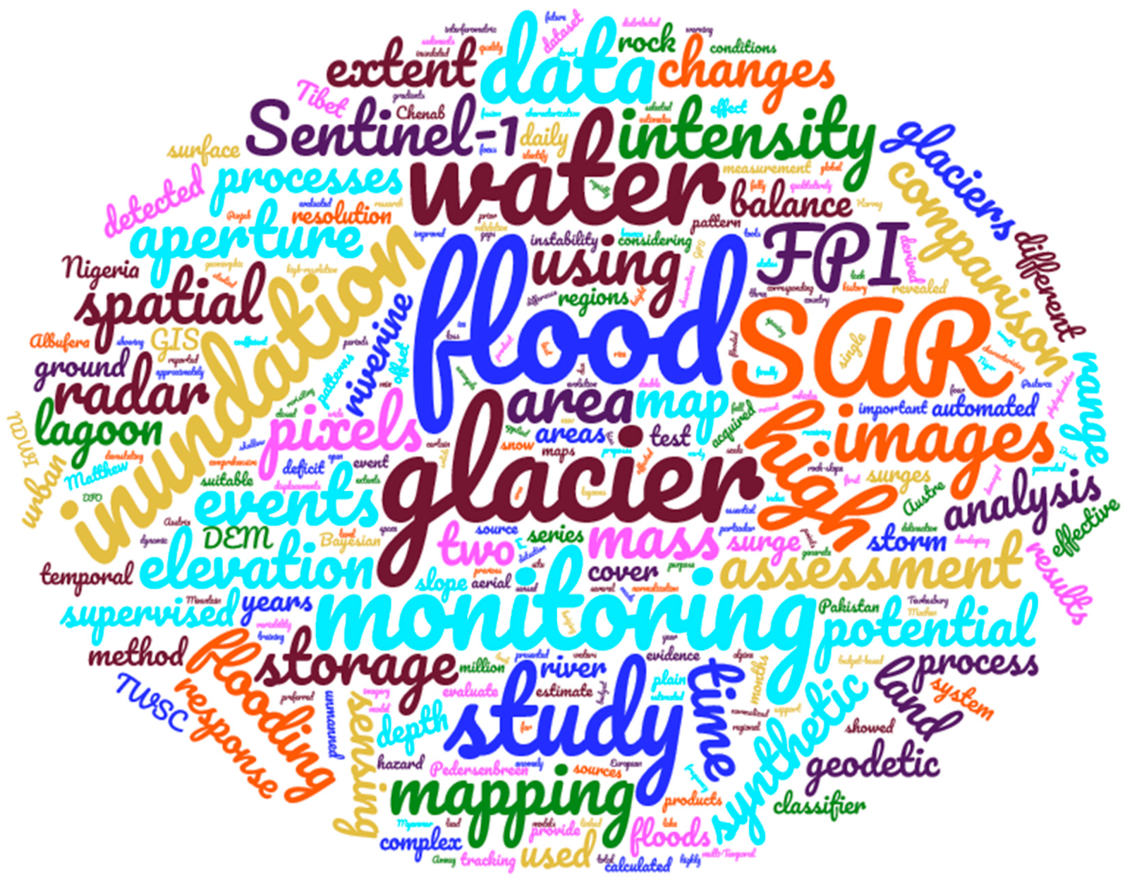
The published Special Issue comprises 11 research articles. The pictorial word cloud in Figure 1 combines the thematic keywords used in their main metadata (namely, their titles, abstracts and keywords), while Table 1 summarizes the remote sensing data and methods used, and the areas of interest investigated in each article.
The cloud shows that among the most frequently used keywords, there are not only terms relating to the geophysical processes involved (e.g., surge, mass, deficit and storm) or the approaches employed for flood and glacier imaging (e.g., supervised classification and comparison) but also specific data types (e.g., digital elevation models), sensors and missions (e.g., Sentinel-1). The latter data, in particular, were exploited in more than one article (see Table 1) and reflect a higher-level trend that can be observed in the recent specialist literature in this field which increasingly exploits satellite Synthetic Aperture Radar (SAR) imagery. A significantly high number of articles also focused on image classifiers, probabilistic approaches and elevation and change detection methods.
Multi-sensor and multi-platform approaches were also quite common across the papers on specific events or sites, and so were studies focused on algorithm development and testing. Most contributions focused on flood events, hazard and risk, while only four on glacier monitoring.
MDPI’s article metrics powered by TrendMD were exploited with the aim to gather a flavor of the visibility of the Special Issue across the journal readership in the first 6 months after the publication of the last paper. TrendMD uses technologies such as Google Analytics by Google Inc. to track the use of and interaction with webpages made by visitors (e.g., abstract and full-paper views and downloads). The metrics for the 11 articles of the Special Issue show that since the publication of the first article at the end of March 2019, the Special Issue received more than 15,500 views in total over the 20-month-long time span between March 2019 and November 2020. This reflected an average number of 100 views/month for each paper. A positive exception is represented by the boosted performance of the article by Uddin et al. 2019 [10], which attracted over 4400 views since its publication in July 2019 and as of mid-November 2020, i.e., approximately 260 views/month.
The overall 64 citations in the indexed literature received as of mid-November 2020 also provide an indication of the good scientific impact that the Special Issue is building across the scientific community in the first few months after publication. A portion of these citations were made by articles published in MDPI open-access journals, including Remote Sensing, Sustainability, Water, Hydrology and Applied Sciences, while many others were received from articles in scientific journals of other publishers, focused on the fields of hydrology, remote sensing and environmental and Earth sciences. Looking at the scale of single articles, while generally, most of the papers of the Special Issue received 1 to 6 citations so far, two apparent positive outliers are the research articles by Benoudjit and Guida 2019 [8] and Uddin et al. 2019 [10], with outstanding achievements of 16 and 30 citations already attracted, respectively.
Overall, the body of literature collected in the Special Issue provides a good representation of the current state of the art and trends in this topical research field, showcasing remote sensing tools currently used for imaging, characterizing and modeling floods and glacier processes. A wide range of platforms, data sources, processing and analysis methods and models have been presented and discussed, with several cases studies distributed globally. The Special Issue, thus, contributes, together with other thematic volumes published in Remote Sensing, to the technical and scientific discussion on the use of remote sensing data in geology, geomorphology and hydrology.
Author Contributions
Conceptualization, F.C. and H.X.; formal analysis, F.C.; data curation, F.C.; visualization, F.C. and H.X.; writing—original draft preparation, F.C.; writing—review and editing, H.X. All authors have read and agreed to the published version of the manuscript.
Funding
This research received no external funding.
Acknowledgments
This Special Issue was developed following on from the invitation sent to Francesca Cigna by Kevin Zhang, Managing Editor at MDPI. The Guest Editors would like to acknowledge the authors who contributed to this Special Issue with their papers and express their gratitude to the anonymous reviewers for providing their feedback on the submitted manuscripts and helping the authors to enhance the scientific quality of their papers. Karem Chokmani from the National Institute of Scientific Research (Quebec City, QC, Canada) is sincerely acknowledged for his work and commitment in handling manuscripts submitted to the Special Issue. The Remote Sensing Editorial Office and the team of Assistant Editors are greatly acknowledged for their support and assistance to setup, kick-off, manage and publish this Special Issue.
Conflicts of Interest
The authors declare no conflict of interest.
References
- Alcântara, E.; Park, E. Editorial for the Special Issue “Remote Sensing of Large Rivers”. Remote Sens. 2020, 12, 1244. [Google Scholar] [CrossRef] [Green Version]
- Topouzelis, K.; Papakonstantinou, A.; Singha, S.; Li, X.M.; Poursanidis, D. Editorial on Special Issue “Applications of Remote Sensing in Coastal Areas”. Remote Sens. 2020, 12, 974. [Google Scholar] [CrossRef] [Green Version]
- Domeneghetti, A.; Schumann, G.J.-P.; Tarpanelli, A. Preface: Remote Sensing for Flood Mapping and Monitoring of Flood Dynamics. Remote Sens. 2019, 11, 943. [Google Scholar] [CrossRef] [Green Version]
- Rodríguez-Fernández, N.; Al Bitar, A.; Colliander, A.; Zhao, T. Soil moisture remote sensing across scales. Remote Sens. 2019, 11, 190. [Google Scholar] [CrossRef] [Green Version]
- Cigna, F.; Tapete, D.; Lu, Z. Remote sensing of volcanic processes and risk. Remote Sens. 2020, 12, 2567. [Google Scholar] [CrossRef]
- Cigna, F.; Xie, H.; Chokmani, K. MDPI Remote Sensing: Special Issue “Imaging Floods and Glacier Geohazards with Remote Sensing”. Available online: https://www.mdpi.com/journal/remotesensing/special_issues/floods_glacier_geohazards (accessed on 12 November 2020).
- Paul, F. Repeat Glacier Collapses and Surges in the Amney Machen Mountain Range, Tibet, Possibly Triggered by a Developing Rock-Slope Instability. Remote Sens. 2019, 11, 708. [Google Scholar] [CrossRef] [Green Version]
- Benoudjit, A.; Guida, R. A novel fully automated mapping of the flood extent on sar images using a supervised classifier. Remote Sens. 2019, 11, 779. [Google Scholar] [CrossRef] [Green Version]
- Amitrano, D.; Guida, R.; Di Martino, G.; Iodice, A. Glacier monitoring using frequency domain offset tracking applied to sentinel-1 images: A product performance comparison. Remote Sens. 2019, 11, 1322. [Google Scholar] [CrossRef] [Green Version]
- Uddin, K.; Matin, M.A.; Meyer, F.J. Operational flood mapping using multi-temporal Sentinel-1 SAR images: A case study from Bangladesh. Remote Sens. 2019, 11, 1581. [Google Scholar] [CrossRef] [Green Version]
- Lin, Y.N.; Yun, S.H.; Bhardwaj, A.; Hill, E.M. Urban flood detection with Sentinel-1Multi-Temporal Synthetic Aperture Radar (SAR) observations in a Bayesian framework: A case study for Hurricane Matthew. Remote Sens. 2019, 11, 1778. [Google Scholar] [CrossRef]
- Idowu, D.; Zhou, W. Performance evaluation of a potential component of an early flood warning system-a case study of the 2012 flood, lower Niger River Basin, Nigeria. Remote Sens. 2019, 11, 1970. [Google Scholar] [CrossRef] [Green Version]
- Ai, S.; Ding, X.; Tolle, F.; Wang, Z.; Zhao, X. Latest geodetic changes of Austre Lovénbreen and Pedersenbreen, Svalbard. Remote Sens. 2019, 11, 2890. [Google Scholar] [CrossRef] [Green Version]
- Sebastiá-Frasquet, M.T.; Aguilar-Maldonado, J.A.; Santamaría-Del-ángel, E.; Estornell, J. Sentinel 2 analysis of turbidity patterns in a coastal lagoon. Remote Sens. 2019, 11, 2926. [Google Scholar] [CrossRef] [Green Version]
- Sajjad, A.; Lu, J.; Chen, X.; Chisenga, C.; Saleem, N.; Hassan, H. Operational monitoring and damage assessment of riverine flood-2014 in the lower chenab plain, Punjab, Pakistan, using remote sensing and gis techniques. Remote Sens. 2020, 12, 714. [Google Scholar] [CrossRef] [Green Version]
- Avian, M.; Bauer, C.; Schlögl, M.; Widhalm, B.; Gutjahr, K.H.; Paster, M.; Hauer, C.; Frießenbichler, M.; Neureiter, A.; Weyss, G.; et al. The status of earth observation techniques in monitoring high mountain environments at the example of pasterze glacier, austria: Data, methods, accuracies, processes, and scales. Remote Sens. 2020, 12, 1251. [Google Scholar] [CrossRef] [Green Version]
- Liang, J.; Liu, D. Estimating daily inundation probability using remote sensing, riverine flood, and storm surge models: A case of hurricane harvey. Remote Sens. 2020, 12, 1495. [Google Scholar] [CrossRef]
Figure 1.
Thematic keywords of the 11 research papers composing the Special Issue “Imaging Floods and Glacier Geohazards with Remote Sensing” [6] of Remote Sensing (created with wordclouds.com).
Figure 1.
Thematic keywords of the 11 research papers composing the Special Issue “Imaging Floods and Glacier Geohazards with Remote Sensing” [6] of Remote Sensing (created with wordclouds.com).


Table 1.
Remote sensing data, methods and areas of interest discussed in the 11 research papers composing the Special Issue (sorted in ascending order, according to the publication date). Notation: BSI, Bare Soil Index; DEM, Digital Elevation Model; DInSAR, Differential Interferometric SAR; GEE, Google Earth Engine; GEOBIA, GEographic Object-Based Image Analysis; GPS, Global Positioning System; GRACE, Gravity Recovery and Climate Experiment; LWM, Land and Water Mask; NDMI, Normalized Difference Moisture Index; NDVI, Normalized Difference Vegetation Index; NDWI, Normalized Difference Water Index; NPCRI, Normalized Pigment Chlorophyll Ratio Index; RTK, Real-Time Kinematic; SAR, Synthetic Aperture Radar; SfM, Structure from Motion; SRTM, Shuttle Radar Topography Mission; SWIR, Short Wave InfraRed; UAV, Unmanned Aerial Vehicle.
| Article | Remote Sensing Data and Methods | Event and/or Area of Interest |
|---|---|---|
| Paul 2019 [7] | Corona KH4-A/B declassified, Landsat-5/7/8, Sentinel-2, QuickBird and WorldView; SRTM and High Mountain Asia DEMs; red/SWIR band ratios, contrast-enhancement, DEM differencing | 2004, 2007 and 2016 glacier collapses and surges at Amney Machen mountain range (China) |
| Benoudjit and Guida 2019 [8] | TerraSAR-X and Sentinel-1 SAR; Landsat-5 and Sentinel-2; iterative optimization through stochastic gradient descent, NDWI, supervised classifier, automated flood extent mapping | 2007 flood in Tewkesbury (UK) and 2015 flood in Mawlamyine (Myanmar) |
| Amitrano et al. 2019 [9] | Sentinel-1 SAR; frequency-domain offset tracking | 2017 monitoring of Petermann, Nioghalvfjerdsfjorden and Jackobshavn Isbræ (Greenland) and Thwaites (Antarctica) glaciers |
| Uddin et al. 2019 [10] | Sentinel-1 SAR; Landsat-8; SRTM; DEM; land use/land cover mapping in GEE; NDVI, NDWI, NDMI, BSI and NPCRI indices; LWM, GEOBIA, supervised image classification, machine learning | 2017 floods in whole country of Bangladesh |
| Lin et al. 2019 [11] | Sentinel-1 SAR; King Air 350ER aerial photos; SPOT-6, WorldView and QuickBird; distribution normalization, Bayesian probability, probabilistic thresholding, classification | 2016 flood in Lumberton, North Carolina (USA) |
| Idowu and Zhou 2019 [12] | GRACE; terrestrial water storage anomaly; precipitation data; flood potential index | 2012 flood in Lower Niger River Basin (Nigeria) |
| Ai et al. 2019 [13] | GPS RTK; ArcticDEM, UAV photogrammetric DEMs; elevation changes estimation, interpolation methods, DEM generation | 2013–2015 mass changes at Austre Lovénbreen and Pedersenbreen glaciers (Svalbard) |
| Sebastiá-Frasquet et al. 2019 [14] | Sentinel-2; precipitation and wind data; Secchi disk depth, suspended particulated matter; chlorophyll a concentration, turbidity mapping | 2017–2018 turbidity of Albufera de Valencia lagoon (Spain) |
| Sajjad et al. 2020 [15] | Landsat-8; GPS data; Google Earth; supervised classification, land use/cover change detection, modified NDWI | 2014 flood in Lower Chenab plain (Pakistan) |
| Avian et al. 2020 [16] | Terrestrial laser scanning; Sentinel-1 SAR; Sentinel-2; UAV photos; automatic cameras; DInSAR; SfM | 2001–2019 monitoring of Pasterze glacier (Austria) |
| Liang and Liu 2020 [17] | Sentinel-1 SAR; Planet and DMCii imagery; riverine flood depth, storm surge water height, land cover; National Map 3D Elevation Program DEM; NDWI, data fusion, daily inundation probability, weight of evidence | 2017 inundations in Harris, Texas (USA) |
Publisher’s Note: MDPI stays neutral with regard to jurisdictional claims in published maps and institutional affiliations. |
© 2020 by the authors. Licensee MDPI, Basel, Switzerland. This article is an open access article distributed under the terms and conditions of the Creative Commons Attribution (CC BY) license (http://creativecommons.org/licenses/by/4.0/).
Share and Cite
MDPI and ACS Style
Cigna, F.; Xie, H. Imaging Floods and Glacier Geohazards with Remote Sensing. Remote Sens. 2020, 12, 3874. https://doi.org/10.3390/rs12233874
AMA Style
Cigna F, Xie H. Imaging Floods and Glacier Geohazards with Remote Sensing. Remote Sensing. 2020; 12(23):3874. https://doi.org/10.3390/rs12233874
Chicago/Turabian StyleCigna, Francesca, and Hongjie Xie. 2020. "Imaging Floods and Glacier Geohazards with Remote Sensing" Remote Sensing 12, no. 23: 3874. https://doi.org/10.3390/rs12233874
Note that from the first issue of 2016, this journal uses article numbers instead of page numbers. See further details here.